Andy Martin was on a real kick to climb as many peaks in Mexico as possible. He was thinking up climbs in places I had never heard of, but that’s not so surprising, really – he knows the Sonoran topographic maps better than just about anybody. Me, I was just along for the ride. Don’t get me wrong, I enjoy those Mexican peaks as much as the next guy, and I’m always happy I go along. This time, he was suggesting a climb of the Sierra San Antonio. The idea was that we would park in the U.S. and walk across the border into Mexico in an uninhabited area to get our peak. Sounded good to me. Based on discussions we had had with the U.S. Border Patrol, we knew that the official stance was as follows: if you crossed on foot into Mexico, let’s say to go climbing, and when returning to cross back into the U.S. you were apprehended by the Border Patrol, they could deny you entry and make you go to an official border crossing like anyone else entering the U.S. legally from Mexico. That could be problematic, as your vehicle could be on the other side of the border – how the heck would you get yourself to a proper entry point, which could be fifty miles away? That said, in actual practice (this had happened to both of us in the past), as long as you were carrying proper identification to show to them, they would let you back in to the country with a bit of a warning to smarten up and do it the official way next time.
So, very early on a mid-January morning, I picked him up at our usual meeting place on the east side of town. It was pitch black, not only then but all the way to the town of Patagonia, where we left the paved highway and drove a series of lesser and lesser dirt roads. Finally, we were in four-wheel-drive, low range, in my Toyota truck as we negotiated the final rough track. In a deep hollow, completely hidden from view, we parked near the abandoned Line Boy mine, a mere 900 feet from the Mexican border. Andy had picked one of the coldest nights in quite a while for this venture – it was in the low teens when we set out, wearing several layers of clothing against the cold.
It was 7:20 a.m. when we left the truck. By the time we had traveled the short distance to the border, we had climbed about 200 vertical feet. A simple barbed-wire fence marked the international boundary, and it was short work to cross over it. There’s not much Andy and I don’t know about getting under, over or through a fence of any type. On the Mexican side, the area was laced with small dirt roads, and the ground was fairly level for a short while. Then, what to our wondering eyes should appear but a major, well-graded dirt road, not shown on any map! It could only be a back-country short-cut between the little town of Santa Cruz to the east and the large city of Nogales to the west.
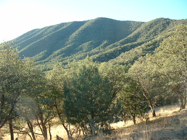
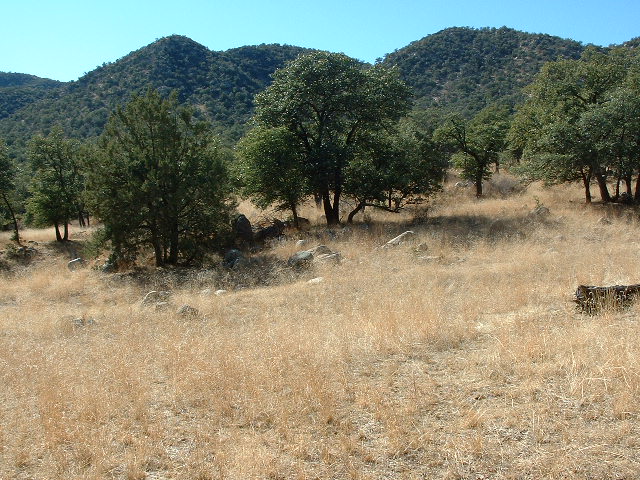
A spur of this road headed south for a while, and we gladly followed it through a beautiful oak forest. It was easy going, basically a grassland with widely-spaced trees. Here is a photo of the Sierra San Antonio, looking south – it is about 8:00 in the morning. It was taken about one mile south of the border into Mexico, at an elevation of 5,450 feet. The summit is about 1,800 feet higher, but is not quite visible.
We did a gentle ascending traverse on the east side of the range for about two kilometers. Then, probably because we had different opinions as to the best route to take, we split up, headed west, and ascended to the main north-south spine of the range by different ridges. I reached this crest at about 6,250 feet elevation, and Andy hit it a few hundred feet higher – his route turned out to be the better of the two. He graciously allowed me to catch up with him, and didn’t even rub it in that I had “chosen poorly”, like the evil Nazi in the third Indiana Jones movie.
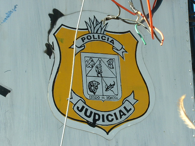
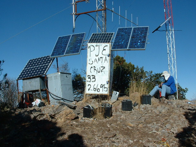
Together, we followed a pretty decent trail southeast along the main ridge, until, three hours after leaving the truck, we arrived at the summit, the high point of the Sierra San Antonio which we felt was about 7,250 feet in elevation. Like most significant Mexican peaks, it was festooned with antennas. One of them had this emblem displayed on its base.
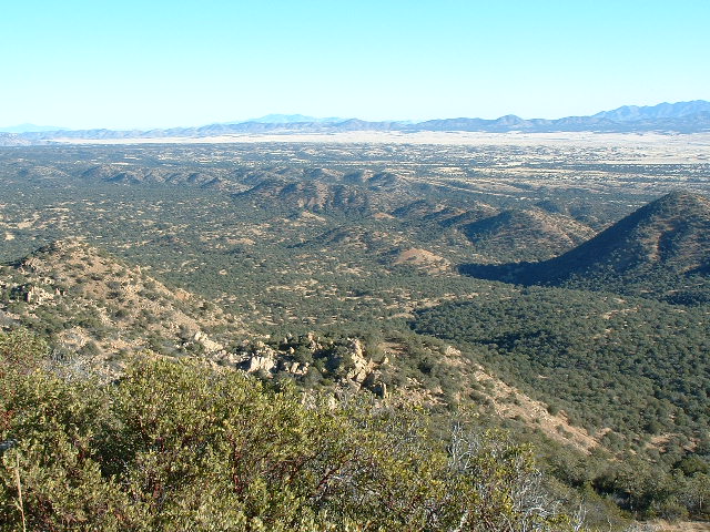
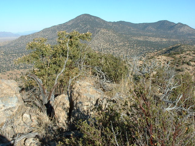
Others had rude, spray-painted comments alluding to the moral character of the police. It was an interesting place, and we spent a good while on the summit, sitting in the sunshine and warming up. We had great views back towards the U.S., such as these.
My Verizon cell phone didn’t work worth a flip up there – I call it my POS phone (my piece of shit phone), but Andy’s T-Mobile service worked just fine, and we called our wives to let them know we had made the summit okay. Just in case we were never seen again and our bodies were never found!
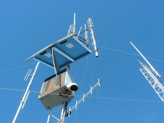
There were quite a few solar panels, as well as car batteries, on top of the peak. Some of the radio equipment looked pretty sophisticated, such as this.
It was hard to know if any of this stuff was actually working or not. We have stood on top of mountains in Mexico that had old dilapidated towers and you could tell that it was simply abandoned junk. However, this equipment looked more modern and in better shape.
After a while, we left and walked down the ridge trail as far as we could follow it, but finally had to leave it and drop down to the pleasant oak forest below. It was an idyllic place, with large open areas of tall grass surrounded by oak groves.
When we neared the main dirt road described earlier, we could hear vehicles passing. Staying out of sight, we waited until just the right moment to cross it – there is no way we wanted to be seen by anyone. First of all, we were in the country illegally, having snuck across the border, and the last thing we wanted was to be picked up by any police. Man, would we have some ‘splainin to do!! Cooling our heels in a Mexican jail would be our worst nightmare. In addition, there was a good chance that some of those driving on that road would have been involved in illegal activities such as running drugs or people into the U.S., due to its proximity to the border.
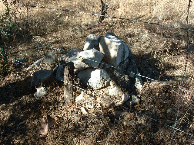
Before long, we picked our moment and hurried across the road where we were soon swallowed up by the waiting forest. A short walk took us to the border fence. Once there, we thought it would be fun to look for Border Monument #113, since we were practically right on top of the thing. We were able to zero in on what should have been its exact location, which was a rather unusual one. Most of the monuments sit out in plain view, on ridgelines or in open areas in valley bottoms. This one had been placed in an oak forest, where visibility was limited to a hundred yards, tops. Finally, we found all that was left of it – some old concrete at its base, holding a few rocks together.
On the Mexican side of the fence, you could drive right up to it. Usually, these monuments bear a nice brass plaque, but there was none here. What a souvenir that would make – not that we would ever entertain such an idea! But it would appear that somebody had already acted on that thought.
From the border fence, it was a short walk back to the truck. The round trip had taken about 6 1/2 hours. A really nice area, highly recommended for those who want a bit of adventure.
Please visit our Facebook page at https://www.facebook.com/pages/Desert-Mountaineer/192730747542690

