
What kind of a climbing trip was this? Exploding bombs, getting circled by helicopters, freezing our asses off, jet aircraft buzzing us, drinking water filled with disgusting creatures, drug smugglers, and then – the accident. All we’d wanted to do was go into the desert and climb some out-of-the-way peaks and have a good time.
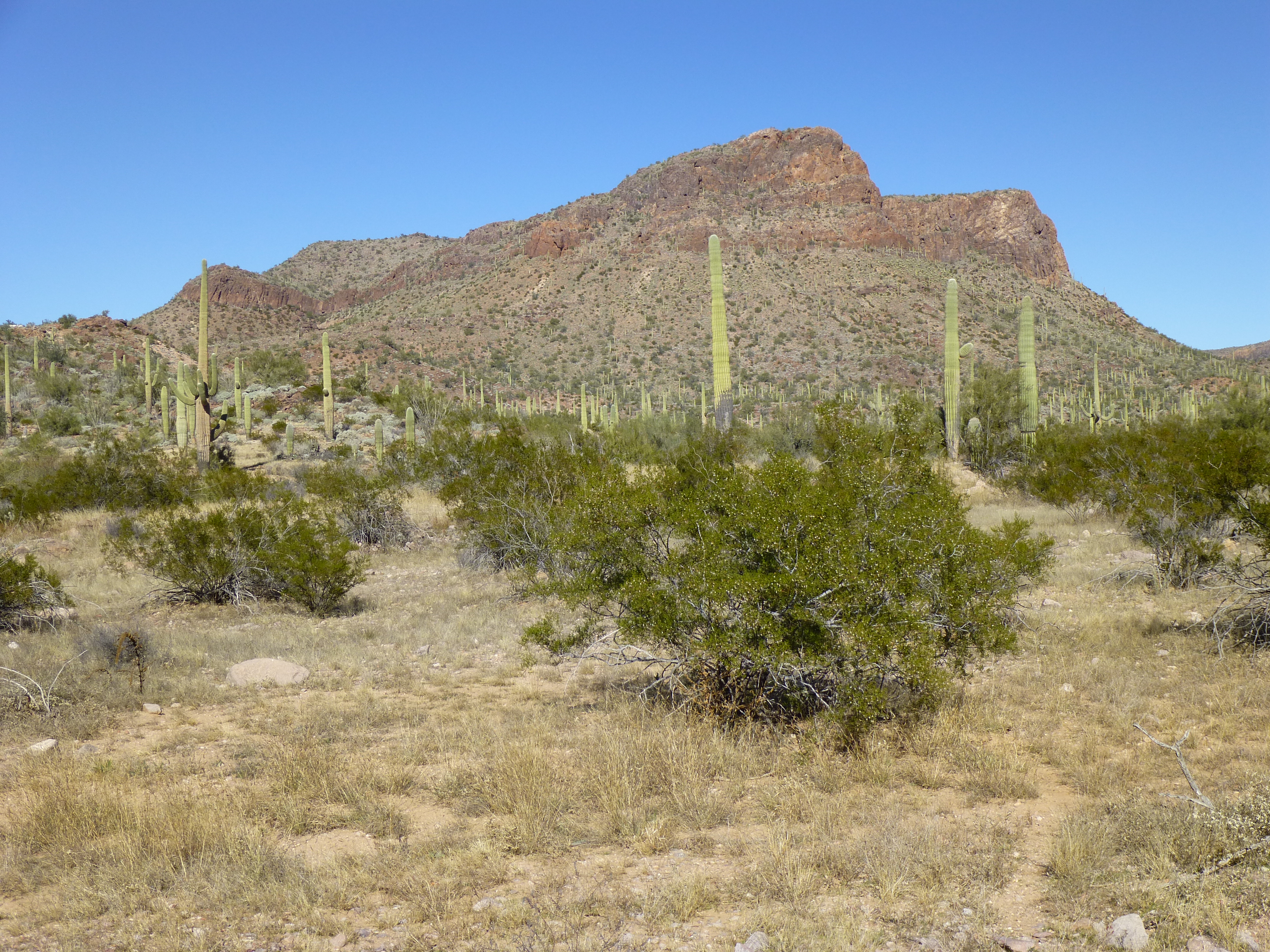
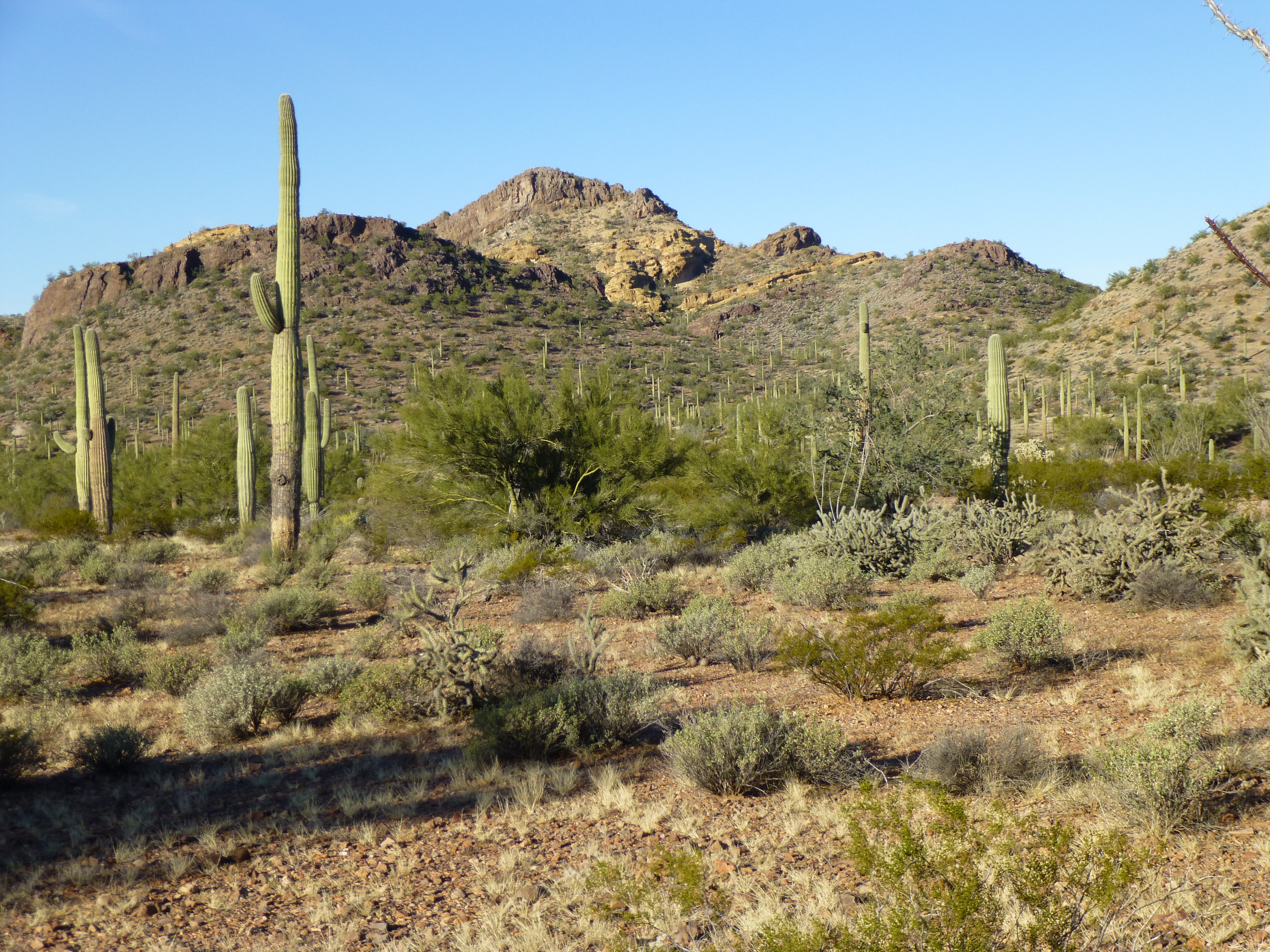
There’s a mountain range less than 70 air miles from my Tucson home called the Sand Tank Mountains, and it’s one of the most beautiful ranges in which I’ve ever climbed. It has high, rocky peaks, as well as low, gentle ones, and everything in between. A goodly number of them are on a U.S. Air Force bombing range, some areas of which are, truth be told, more restricted than others. It seemed like climbing a group of these peaks would be a good project, especially if we chose ones that hadn’t been visited before.
Paul drove out from Dallas with some fine new camping gear, we got organized, then on a fine Boxing Day we hopped in his Tundra and drove for four hours on ever-worsening roads. By the time we stopped, we were in a wash. Paul had asked me to drive the last, worst parts of the road for him, but I almost got stuck a few times in the deep sand. Using satellite photos, I had researched a potential parking spot in a cluster of trees, and it turned out to be a pretty good one. You couldn’t see the truck unless you were quite close to it.
If it sounds like we were a little paranoid about somebody finding the truck, you’re right. The area was a known conduit for smugglers, and we could see footprints and tire tracks nearby. We had a plan. In addition to locking a club on to the steering wheel, Paul pulled a major fuse from under the hood and completely disabled the truck. In case somebody let the air out of the tires, we had brought an air compressor which could plug in to the cigarette lighter. Leaving a gallon water jug by the truck, we taped a sign in the window which said, in Spanish “We are hunters, nearby. The water is for you. God be with you.” The thinking was that they’d think that if we were hunters, we’d have guns and they wouldn’t want to mess with us.
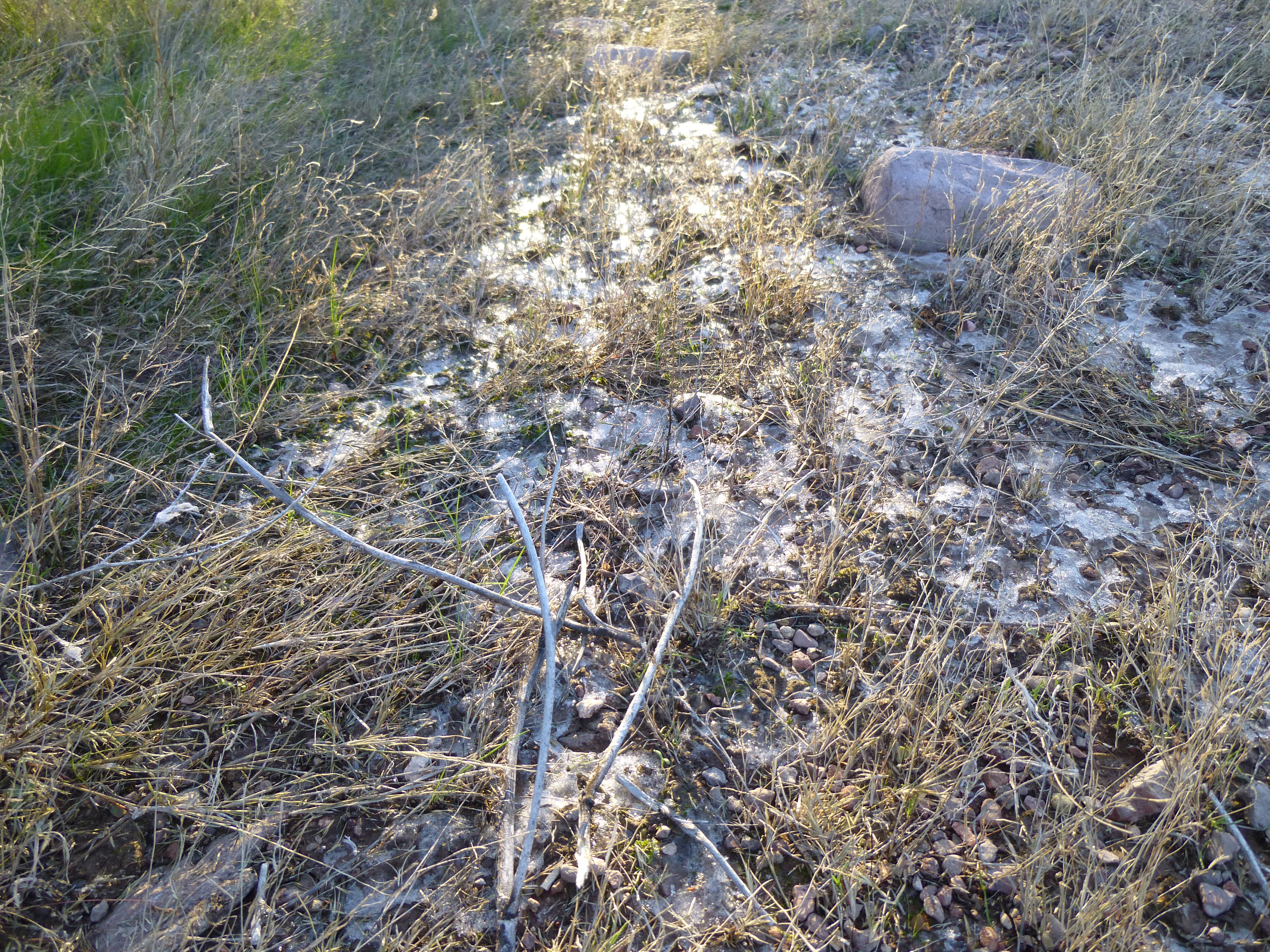
Then, we buried several things in the sand of the wash: all the tools for changing a tire; a gallon of water; the air compressor; a change of clothes, and a shovel.
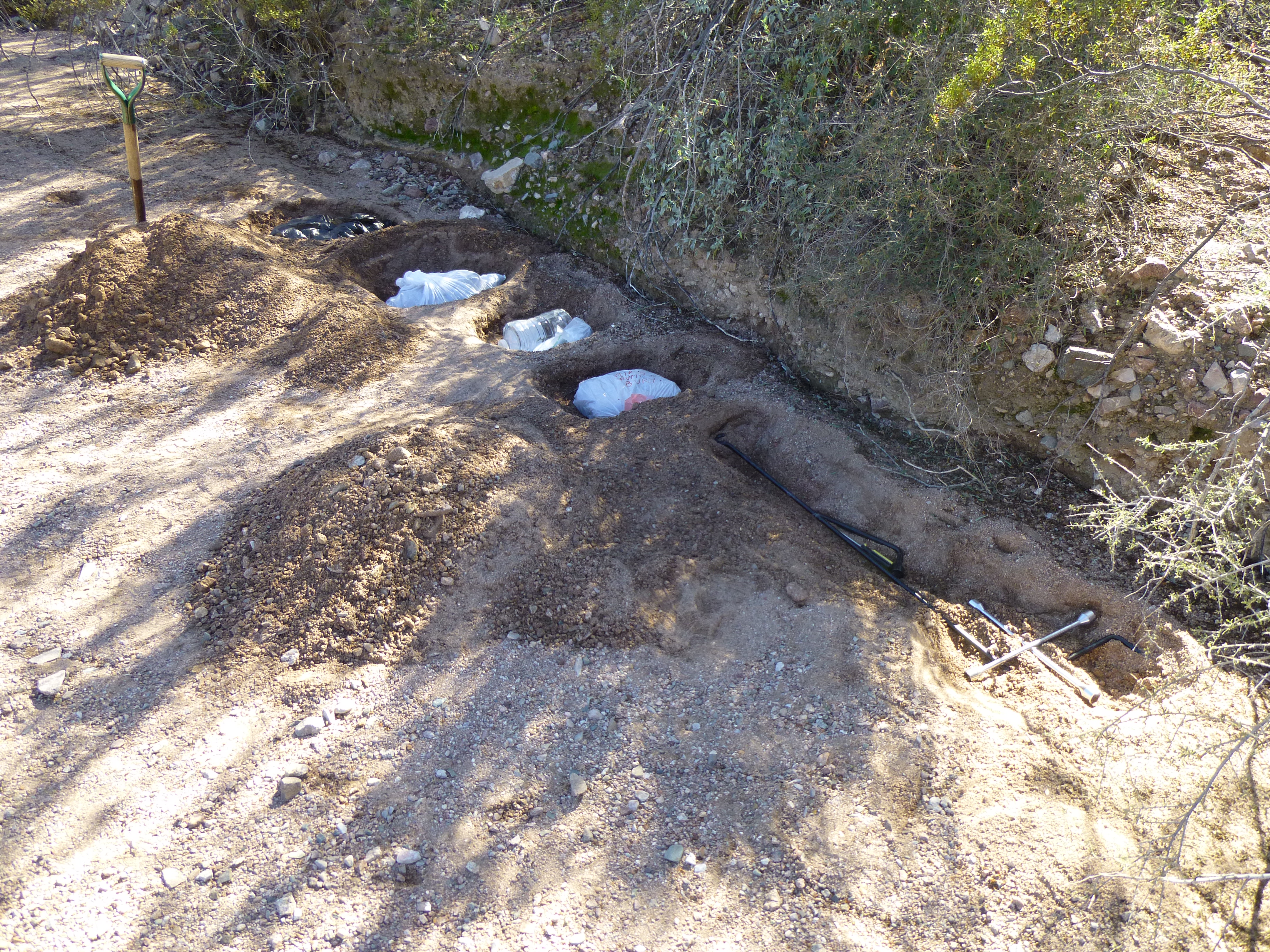
The burial ground
There wasn’t anything at all left in the cab of the truck, to minimize the chance of anyone seeing something they wanted and breaking in. Our packs were already organized, so by 1:30 PM we set out on foot. Paul was carrying about 60 pounds, and I, maybe 50. The reason our packs were that light was because, even though we were planning to be out for six days, we were only carrying six quarts of water each. The ace up our sleeve was that we were hoping to find a water supply later on where we could re-supply.
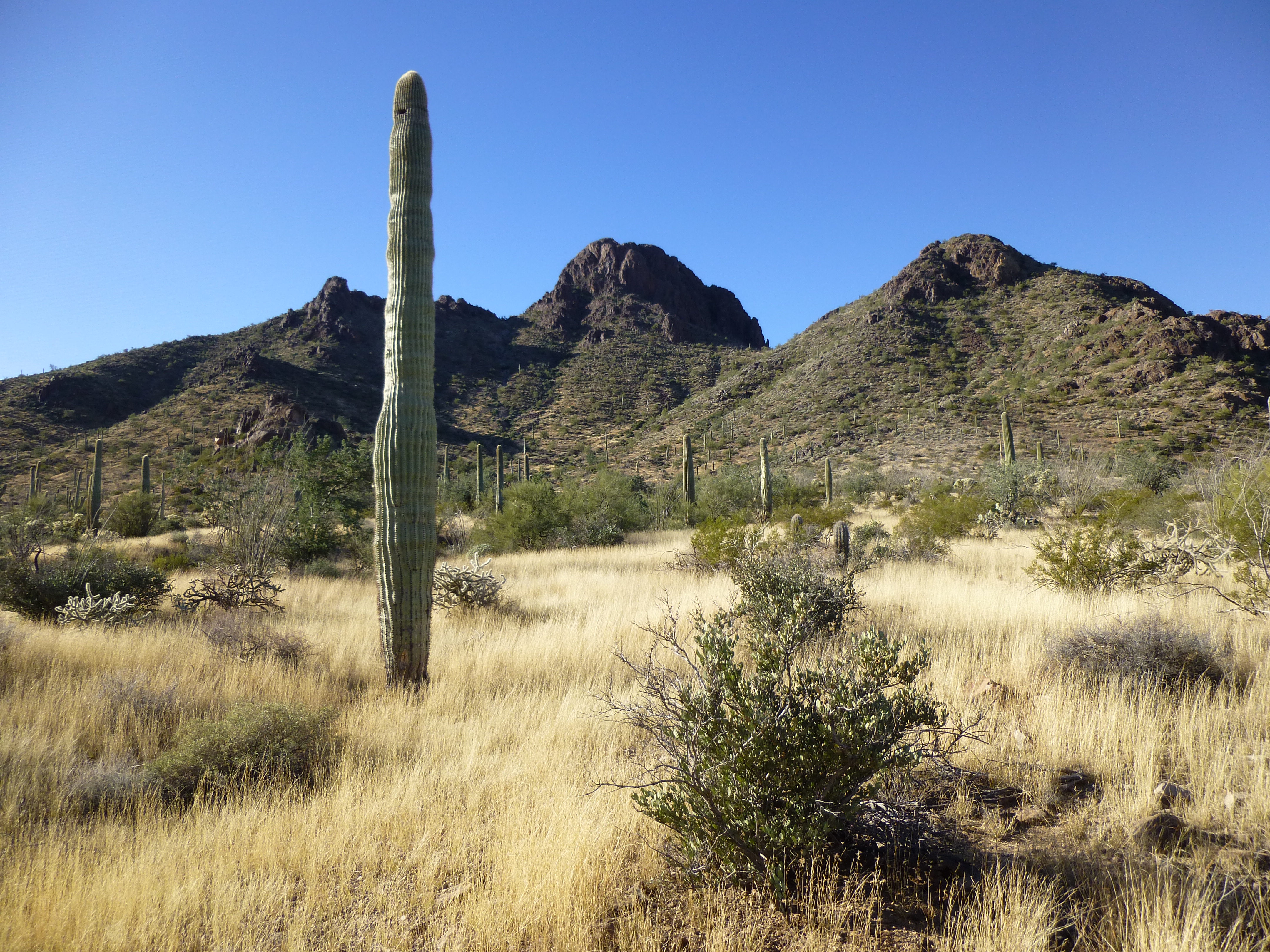
After 15 minutes of walking in the wide, sandy wash we headed south through the desert. This was all new territory, an area of low hills and shallow washes.
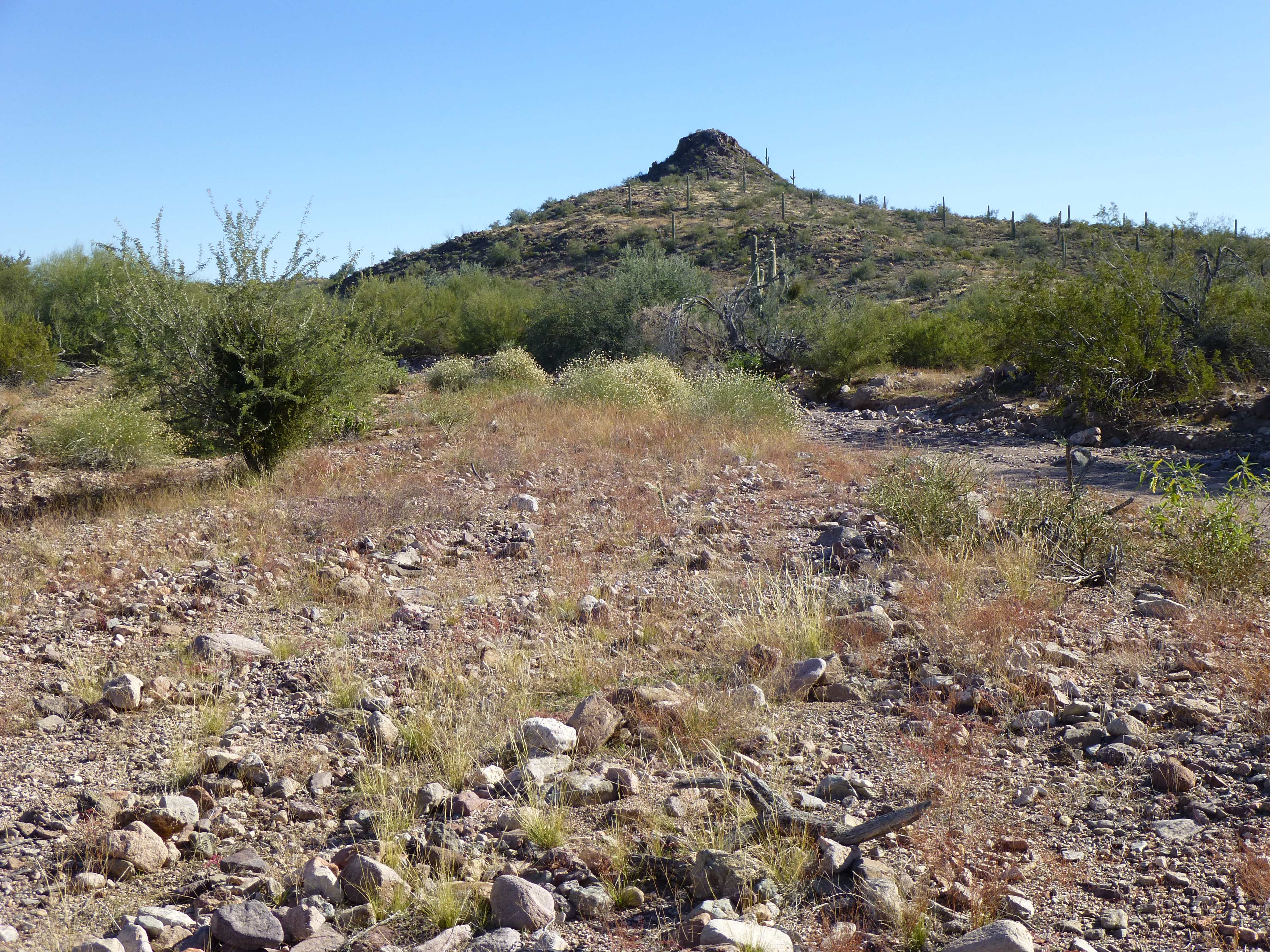
Gentle country
Paul found a tiny skull – we don’t know for sure what it was – maybe a baby bighorn sheep? Or a Sonoran pronghorn antelope, but I didn’t know if they were ever this far east.
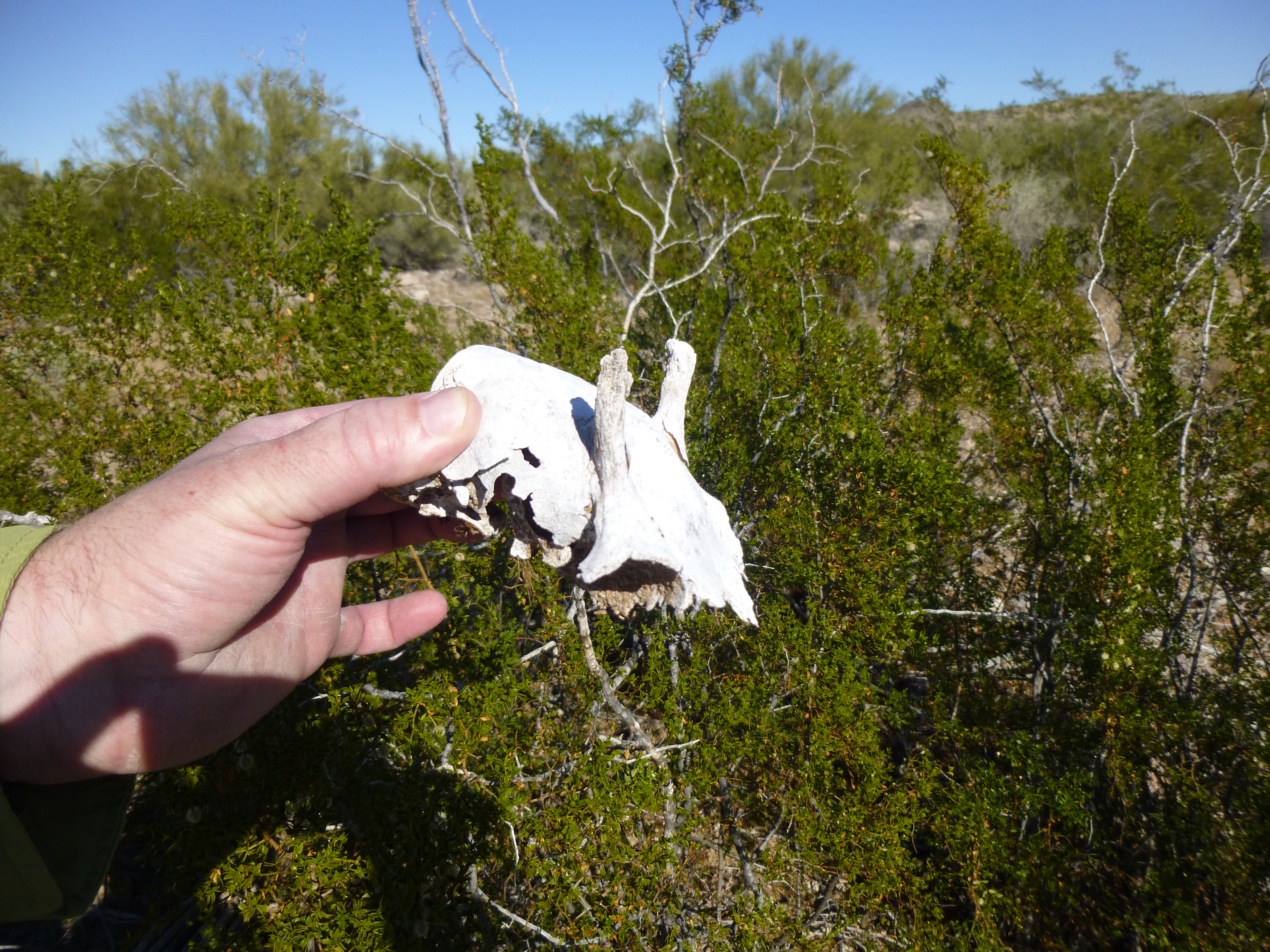
The mysterious skull
The ground was littered with empty 50-caliber shell casings, most of them from World War II, as well as all manner of shrapnel. The military certainly had been using the area for a long time. By about 4:30, we’d gone as far as we cared to, about 4.6 miles for the day and made camp beside a wash at 2,080′ elevation.
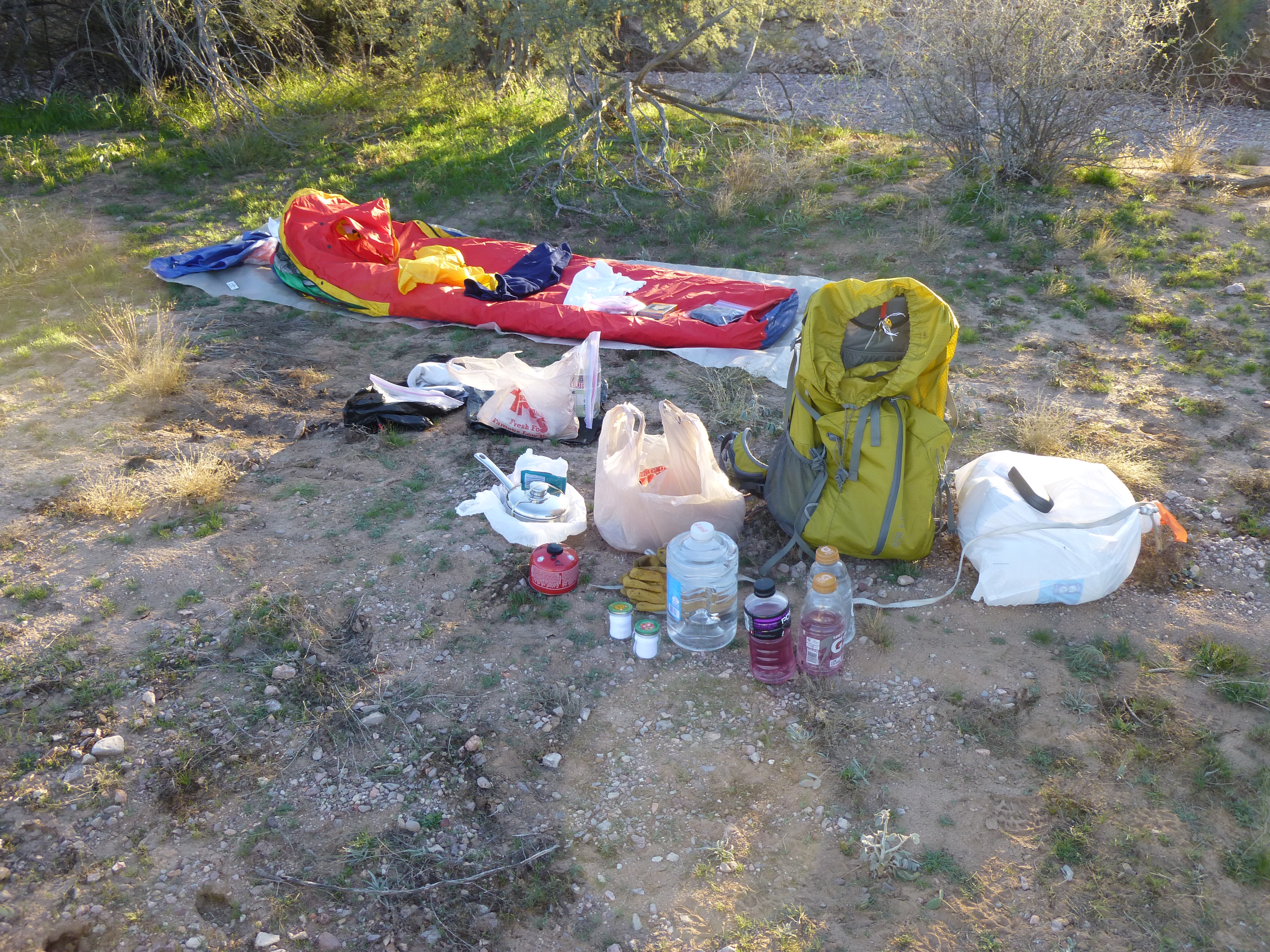
My gear all spread out
As soon as the sun set, the temperature started to drop quickly. After heating some food, we didn’t even make a campfire but went to bed by about 6:00 o’clock. Frost was already forming on our sleeping bags. Getting up to pee in the night was a miserable experience – it was so cold, it took a while to stop shivering once back in the bag. That was one long night. When we finally got up the next morning, around 7:30 AM, the thermometer read +17 degrees F. Dang, no wonder it’d felt so cold!
We ate a few energy bars as we packed up our gear, having decided to only take the time to heat food for supper. Even so, it was almost 9:00 o’clock by the time we walked out of there. One hour to the east, we found what we were looking for. The Arizona Game and Fish Department had installed a water catchment for wildlife. A pipe gathered rainwater as it flowed down a rocky draw, funneling it into an underground 10,000-gallon tank, which in turn fed an above-ground trough from which animals could drink.
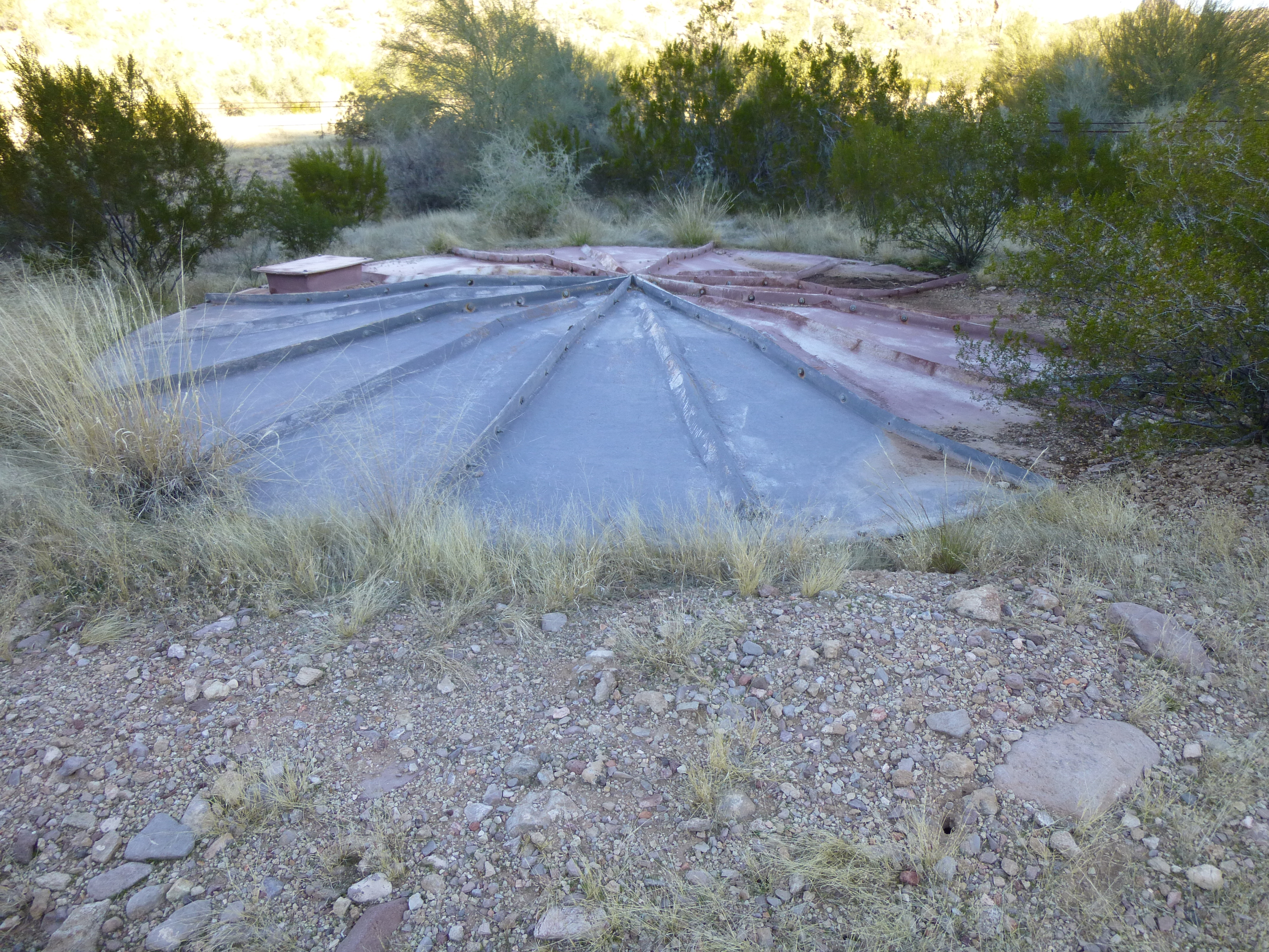
The underground 10,000-gallon tank
The topo map showed this, but in the wrong place. For some reason, it was a thousand feet away from the map location. No worries, we’d found it, that’s all that mattered. Now it was time to get to work. We assembled the water purifier and started. It was one of the hand-crank units – slow, tedious, but it did the job. We took turns, and had filtered 4 gallons in 2 hours. Here’s Paul hard at work.
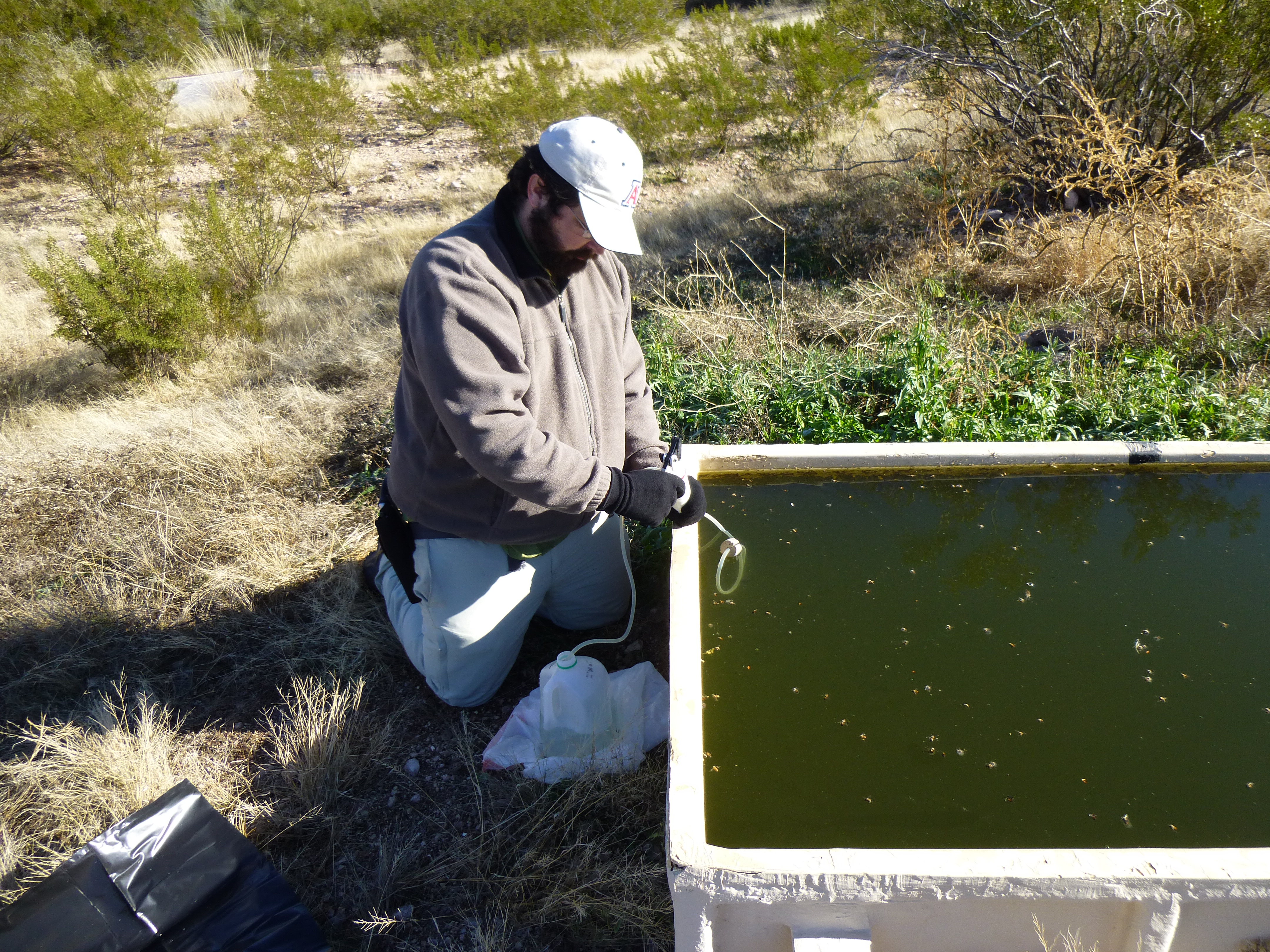
Paul pumping water through the filter.
During one of Paul’s stints at the filter, he noticed something moving about a foot below the surface. It was over two inches long, black and had long legs. My curiosity got the better of me, so I got a stick and coaxed it up to the surface. It was a huge insect, covered in what looked like a white fungus. Disgusting! It turned out to be a giant water bug. The top of the water was covered with hundreds of dead bees, and all manner of things were swimming around in the trough. No matter – the water going into our bottles tasted fresh and clean.
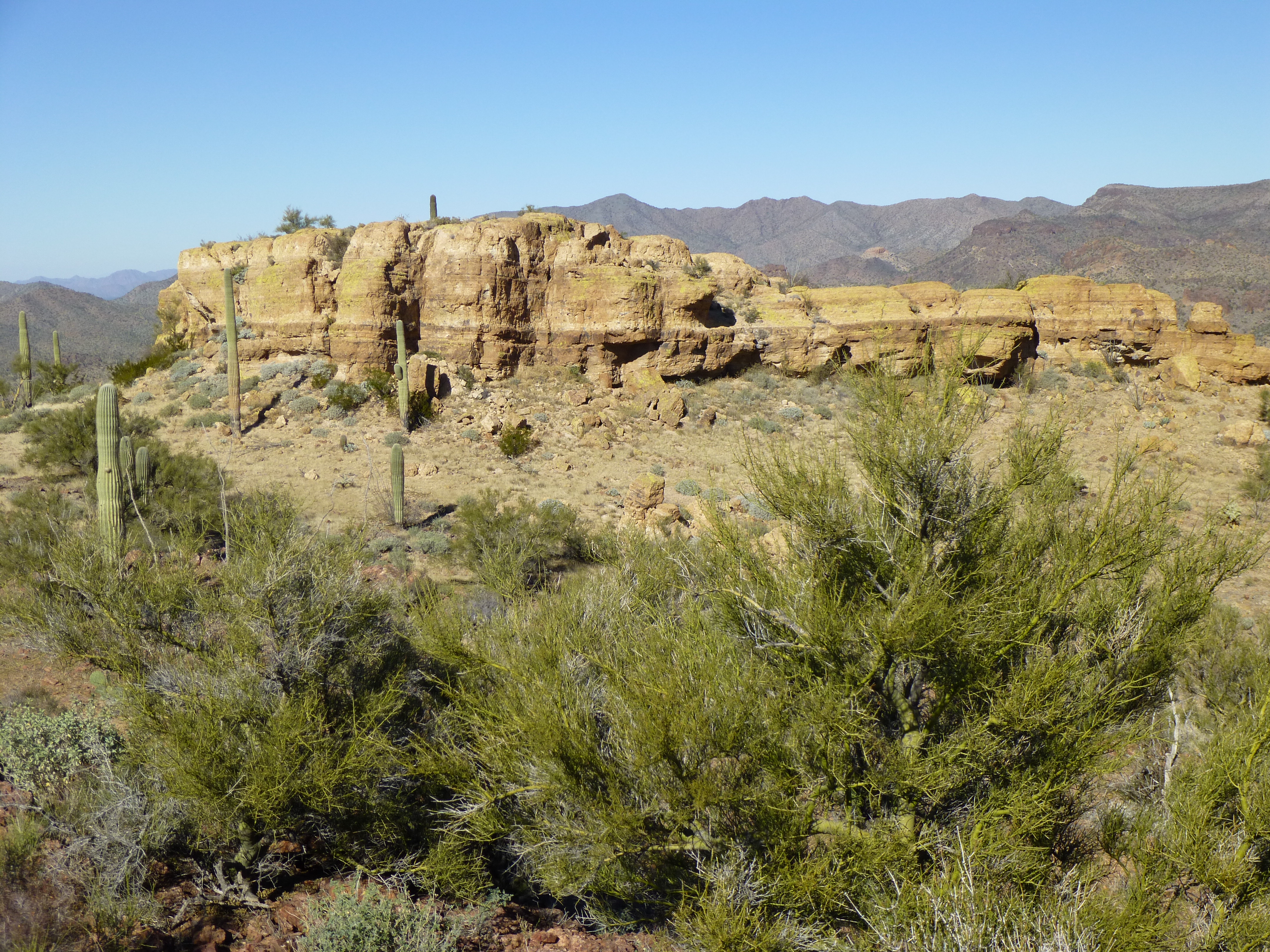
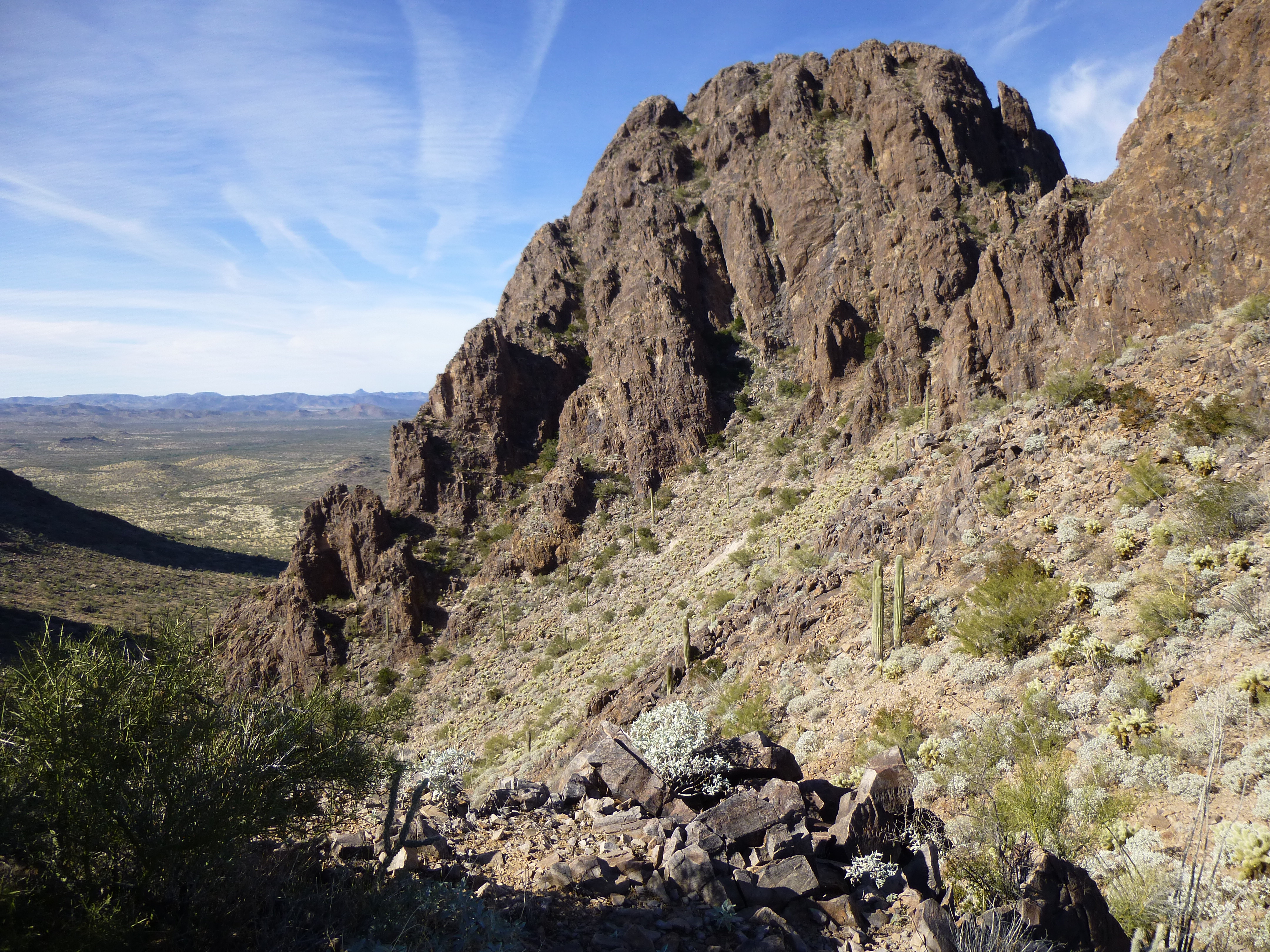
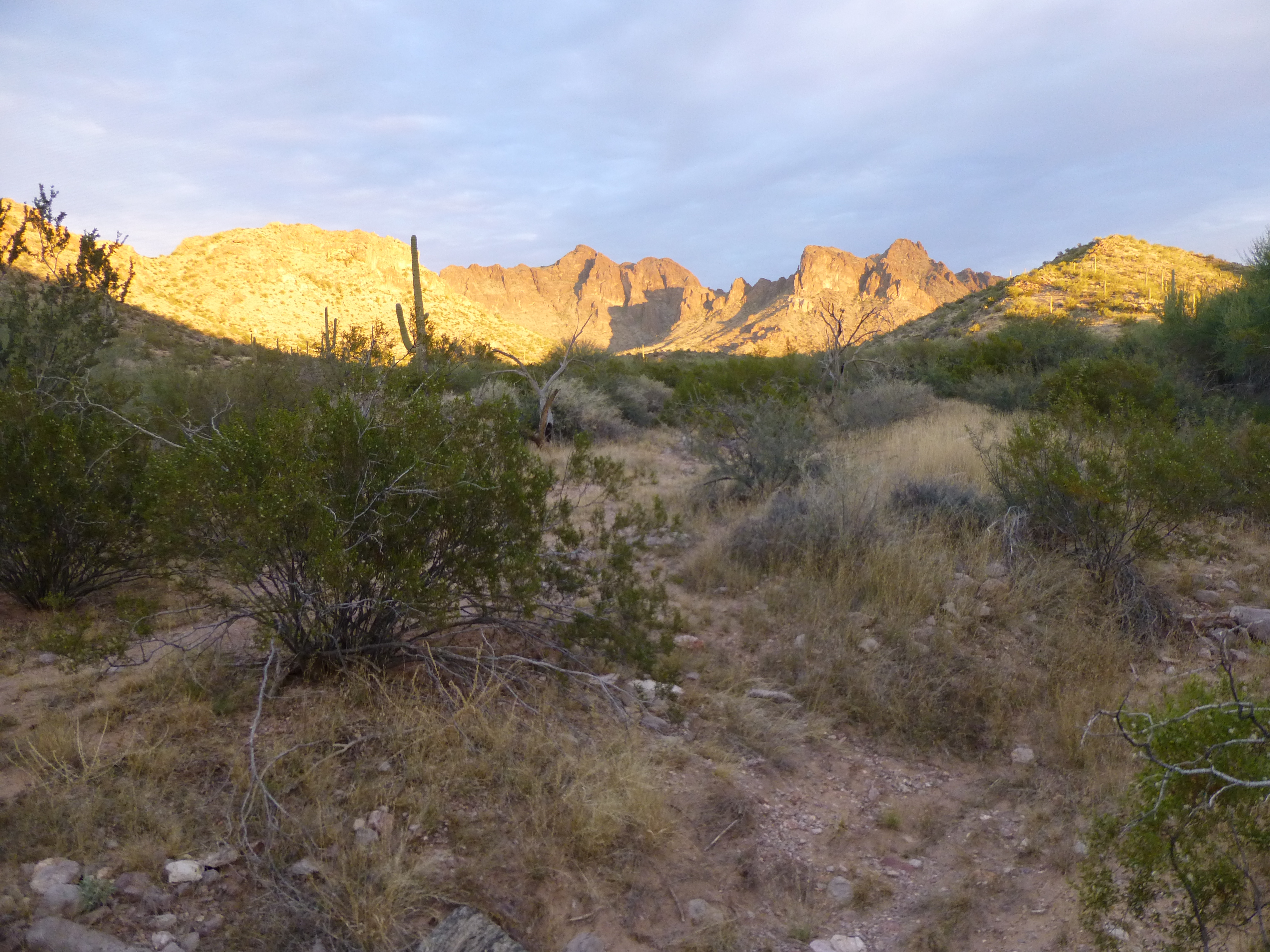
By the time we walked away, our loads were a lot heavier with all that water. Fortunately, it was less than an hour to our next camp site, and it felt good to drop those packs. We noticed that there was a lot of ice on the ground at mid-day – it still hadn’t warmed up enough to melt it. Stashing our gear under some trees and covering it with branches, we set out with day packs – it was time to do what we had come here to do – climb! The view from camp was sensational – the high country of the Sand Tank Mountains drops in a steep wall on its western side, and it was hard to not be distracted by it.
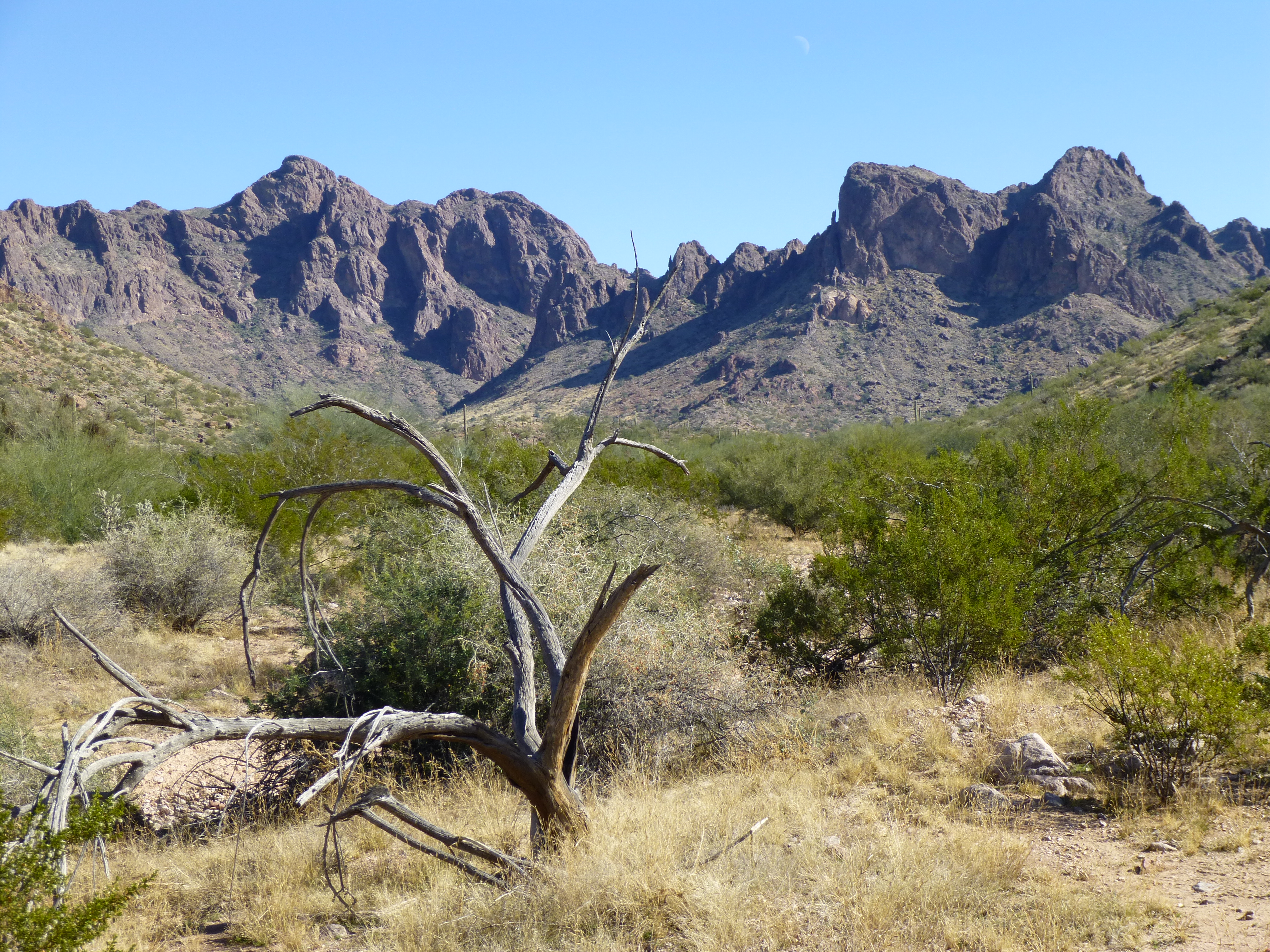
The west side of the Sand Tank Mountains, dropping 1,500 vertical feet to the desert floor
Less than a mile from camp, we came upon a road not on any map, a road used by smugglers on quads to transport loads of drugs. Check it out – it looks so clean and distinct, like it was put in by professionals. This road didn’t exist a few years ago.
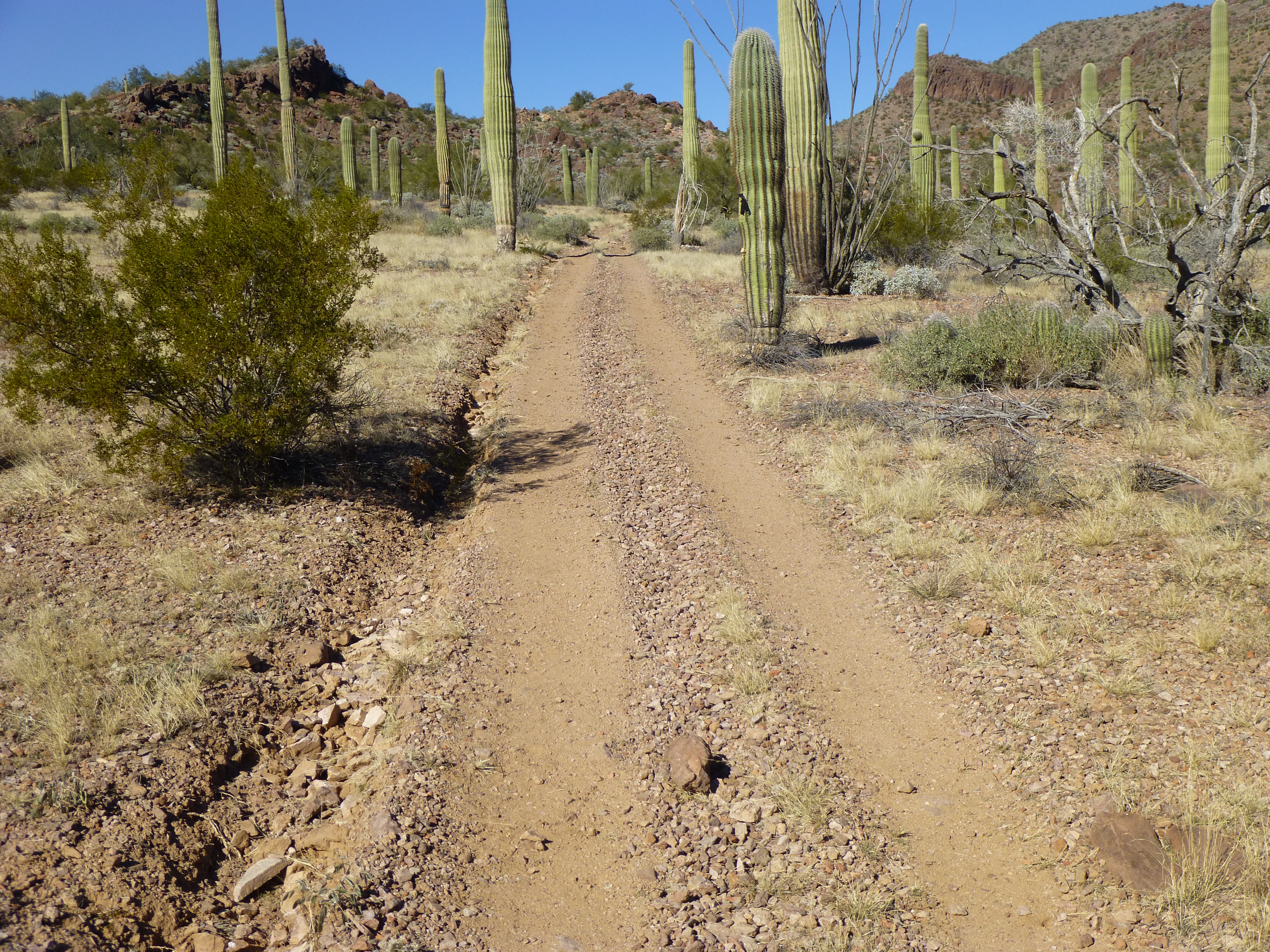
Quad road used by smugglers
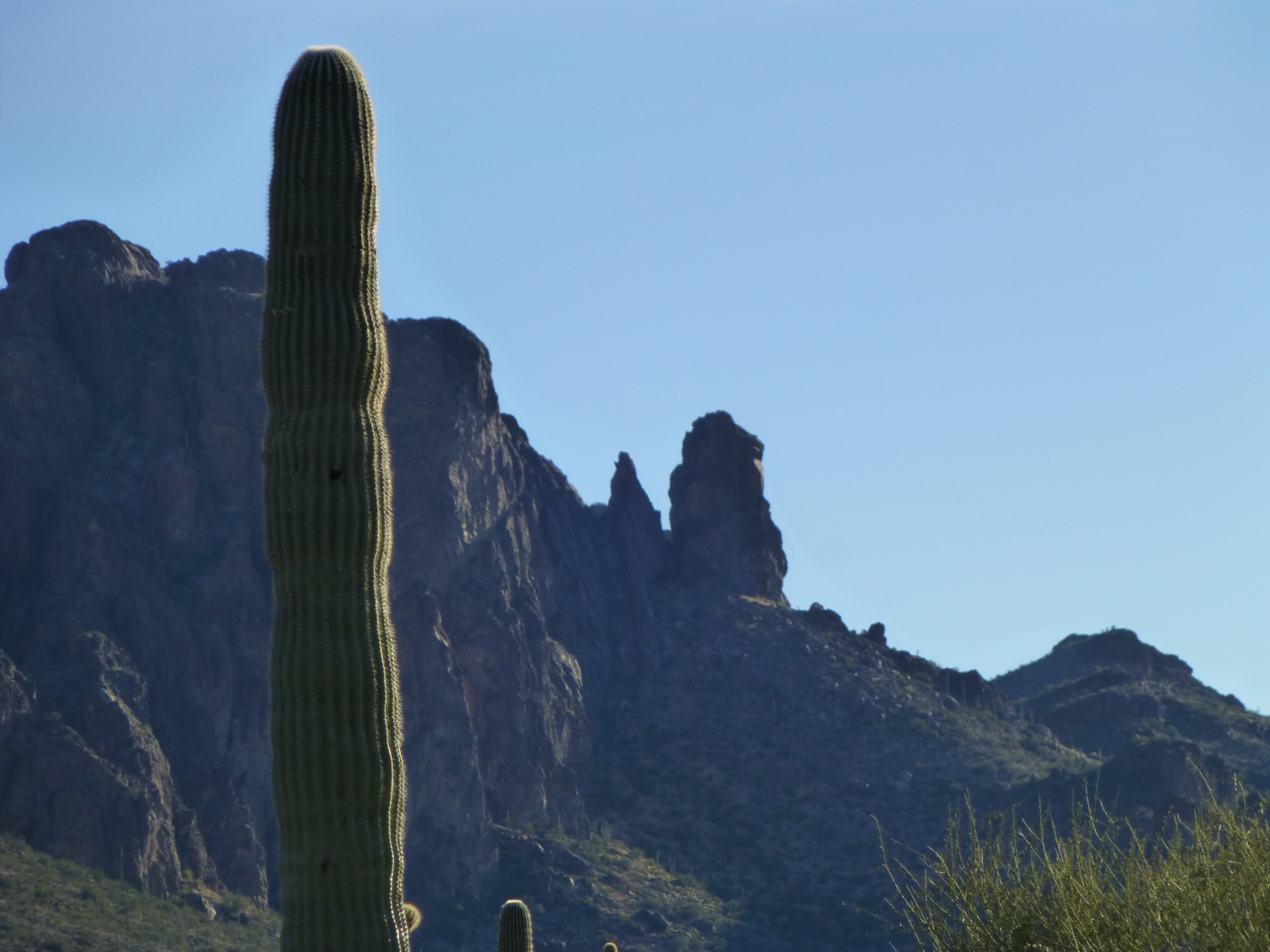
From it, we caught this glimpse of our first objective, also the highest of the trip.
Looking north to Peak 3220. The high point is hidden from view.
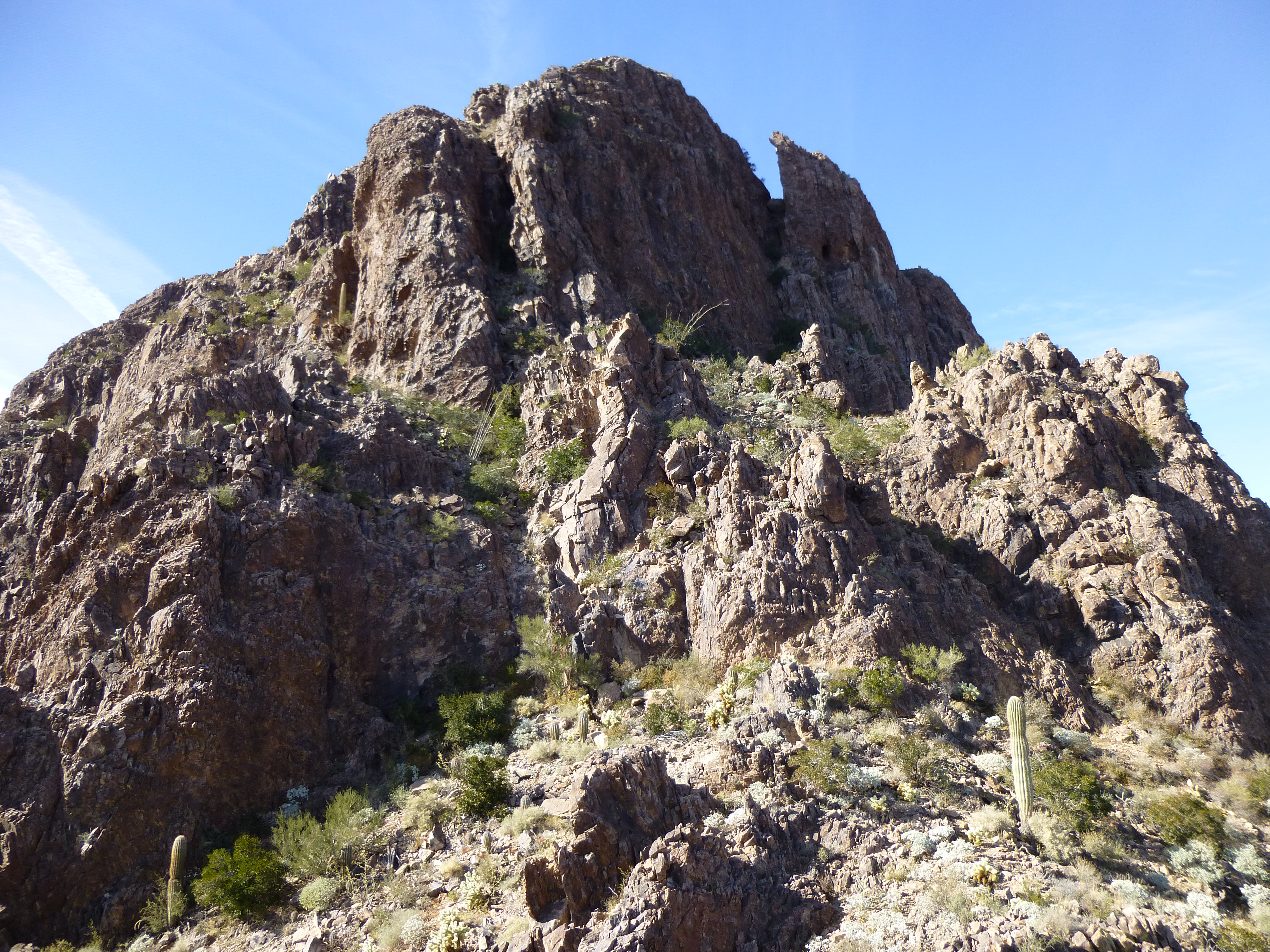
It was a climb of 800 feet to the top of Peak 3220. Paul decided to sit this one out, so waited at a saddle on the southwest side. I hustled up and soon arrived at the distinctive rock capping the summit, which can be seen from miles around.
The yellowish rock capping the summit of Peak 3220
I almost forgot to leave a register, the views were so distracting.
Sand Tank Mountains
On top by 2:00 PM, I soon left and made my way back down to Paul. He and I then headed a short distance west and climbed the easy slope of Peak 2975, arriving on top just after three o’clock. This one felt especially good to Paul, it being his first summit in several years. It didn’t hurt that it was a first ascent, either, the first of his career. Here’s a shot of Paul on the summit. This view is looking east. The dark bump to the right of him is the nearby east summit, which seems equal in height. I climbed both, but we put the register on the western of the pair.
Paul on Peak 2975
Down we went, back to the saddle and down the quad road. Something caught our eye, a bright-red 5-gallon gas can. We punctured it so the smugglers couldn’t use it again- ditto for another we found a quarter of a mile away to the south. It seemed the smugglers had these along the road so they could refuel. The second one was full, so we emptied it before destroying it.
By the time we arrived back at camp, it was 4:30 PM. Much to our surprise, the ice we saw on the ground at noon was still there – it had not thawed all day, even in the sun.
Ice that had not thawed all day
After heating some food, we decided to build a campfire. That way, we could cut down on the 13 hours spent in our sleeping bags at night. The warmth of the fire felt good, but there was no place to sit down and get off our feet – those heavy-duty boots exact a toll – so by about 7:30 we called it a day. Even though we’d only bagged two peaks today, it was a start – that was why we were out here, after all.
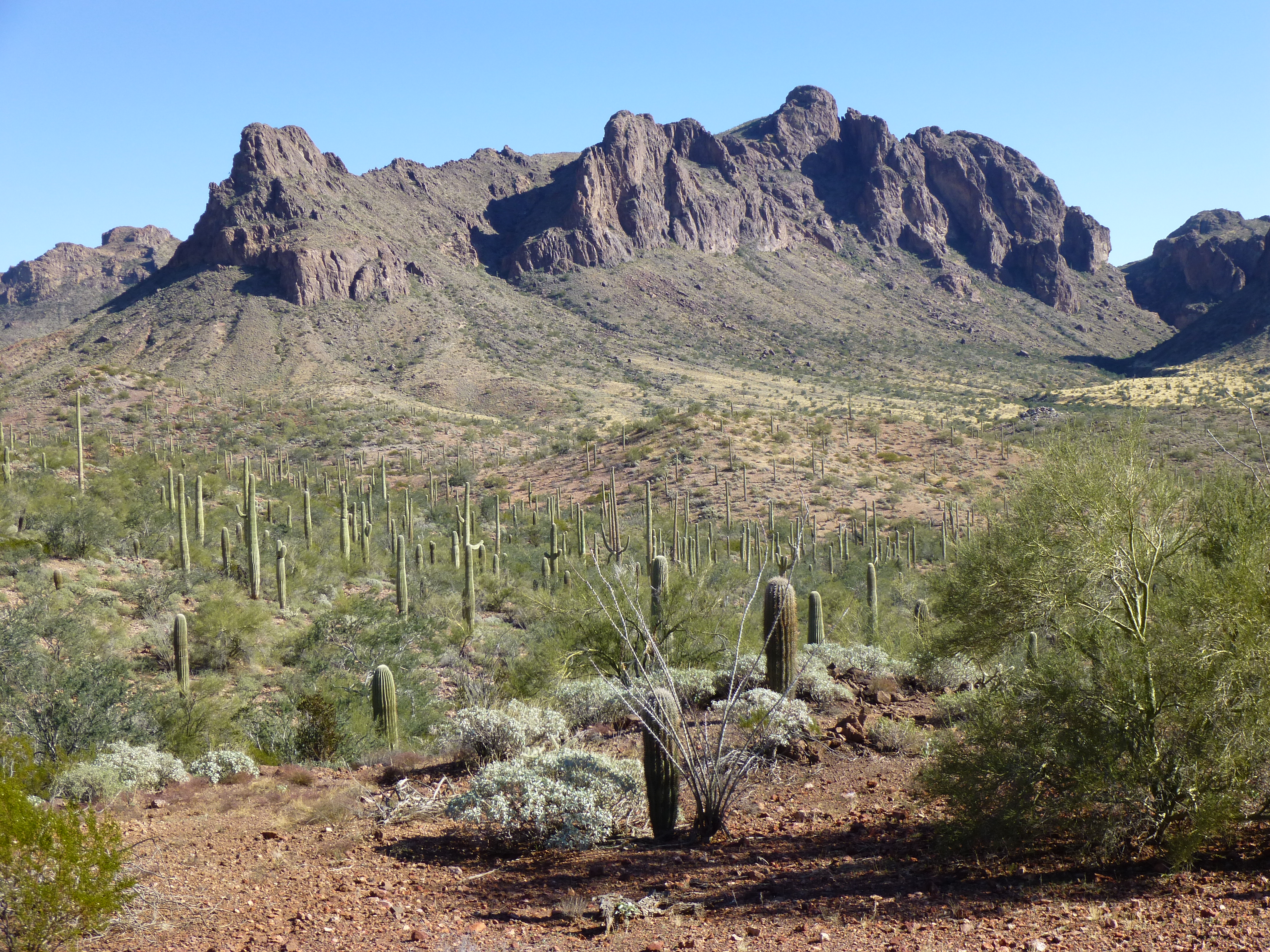
The next morning, day 3 of our trip, dawned clear and a balmy 28 degrees, much warmer than yesterday’s temperature. We hid all of our gear under trees and set out at 8:35 with light day packs. This was to be a sort of bonus day, in which we’d head farther south to explore two peaks which had held my attention for the last few years. Leaving camp, we crossed over a low ridge, then dropped down into a wide, low expanse of desert. It was a nice stroll, mostly flat with a few gullies. A few miles to the east, the high country of the Sand Tanks offered plenty of intrigue, like the huge pillar, hundreds of feet tall, seen in this telephoto shot.
Sand Tanks pillar
We made a bee-line for this striking peak, seen here from the northwest in this telephoto shot.
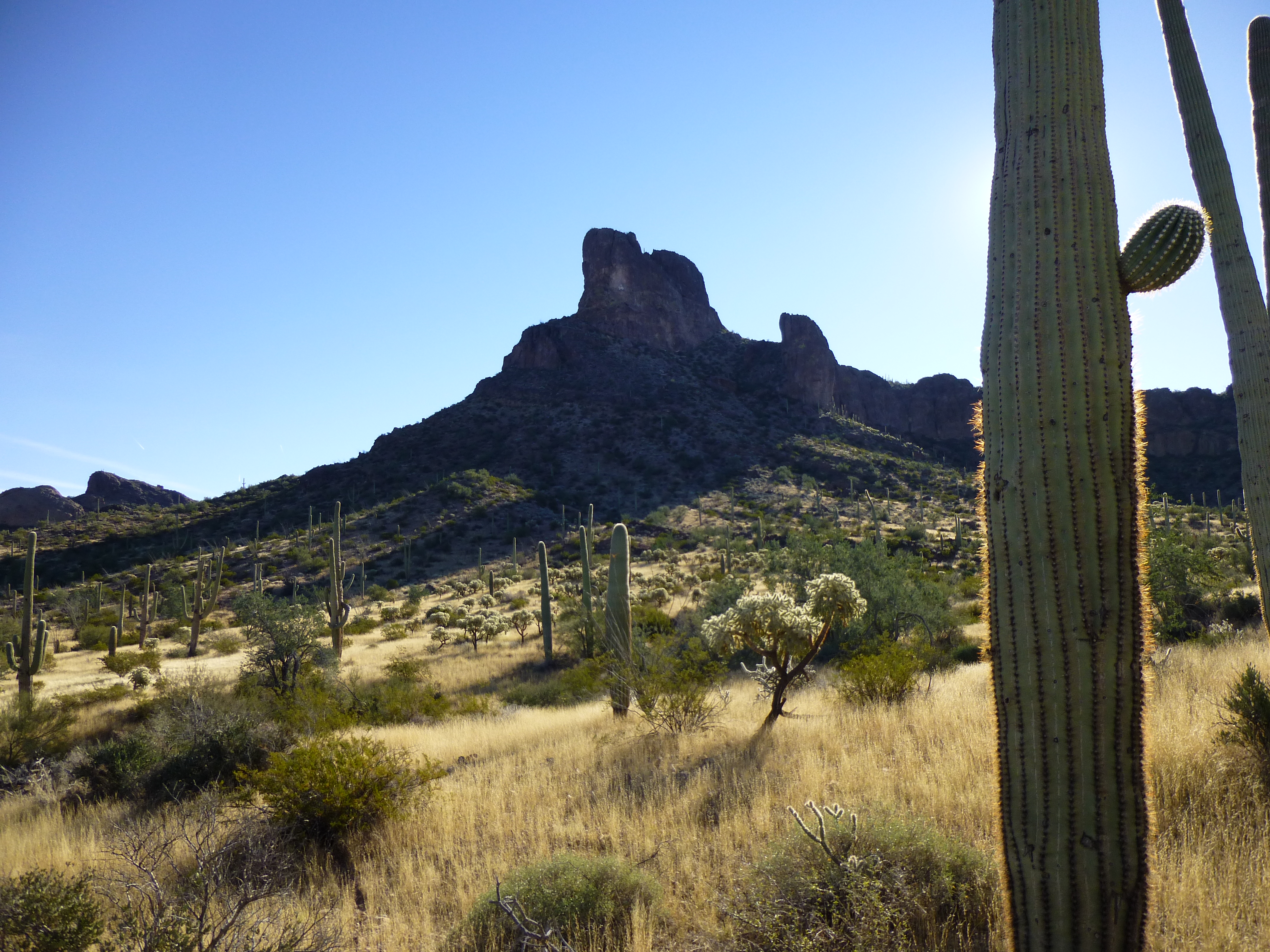
Peak 3220
It was an 800-foot climb from the desert floor. Paul decided to sit this one out, so I climbed up to the wide gap to the right of the highest point seen in the photo. The final 400 feet went without incident – I got on to a ridge, not visible in the photo, and had an easy walk up and to the northwest. One bit of exposed Class 3 just below the summit put me on the top of Peak 3220. No sign of any previous visit, so I left a cairn and register. From this summit, I got the million-dollar view I was hoping for.
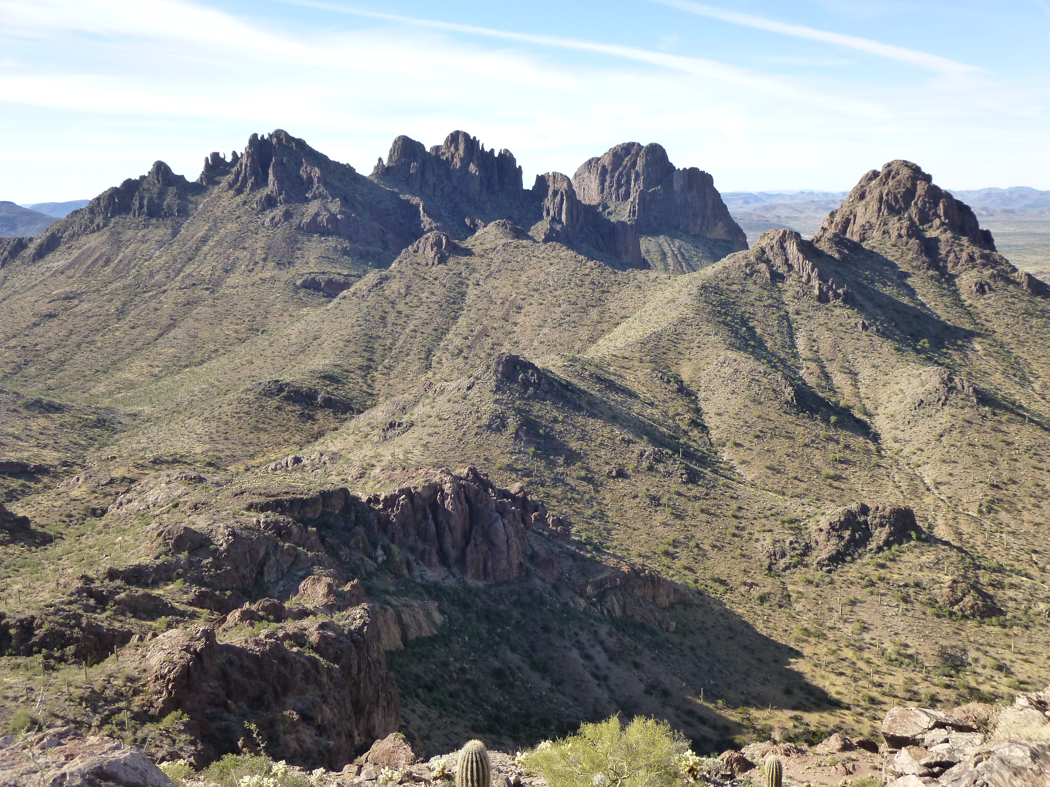
On the far right is Peak 3300; all the steep bits to the left of it comprise Dragon’s Tooth
No matter how many times I see Dragon’s Tooth, it never disappoints. I called Paul on the radio and told him I was starting down, and less than half an hour later I was back with him. He knew I wanted to go and try another nearby summit, and said he was fine with it, that he’d wait there while I went to check it out. It was the one in the center of the next photo.
Looking southwest to Peak 3300
This one had me a bit worried. I’d never seen any easy way up it, at least not from afar. You never know about these things until you’ve got boots on the ground and are actually on the thing. You can study topo maps and satellite photos until you’re blue in the face, and speculate all you want, but until you’ve got your nose up against the rock, it’s all wishful thinking.
Setting out hopefully, I climbed up and over one ridge to arrive on another. There I was, less than 800 feet away from the east face of Peak 3300. My first reaction was one of disappointment. It looked mighty steep, all nasty cliffs and such. After looking at it for a while, I picked out two possible gullies that might lead high up on the thing – they are the ones deep in shadow on the lower left part of the face in the next photo. Nothing for it but to give them a try. I crossed the cholla minefield and got to the bottom of the upper gully. After bushwhacking my way up it for a while, I came to a blank cliff that stopped me cold – damn! Okay, let’s try the lower one – same thing, stopped by a featureless bit of cliff that I couldn’t climb and wouldn’t even try. I had time for one more thing. Scrambling up the steep, loose slope, I made it to the wide notch seen in the upper right of the photo. That was easy enough, and put me within 300 feet of the summit.
The east face of Peak 3300
At the notch, I studied what lay in front of me.
The upper part of Peak 3300, as seen from the notch to the east.
The above photo doesn’t show all of the 300 feet to the summit, part of it is hidden up above. Several of the brushy ramps looked like they ended at cliffs. There were also some deep cracks, and I didn’t explore any of them. It was around one o’clock when I radioed Paul and told him I was running out of time and options. It’s entirely possible that there could be a scrambling route up there among the cliffs and gullies, but the way to the summit could also be more than that. It seemed like the prudent thing to do was to call it a day on Peak 3300 and rejoin Paul, so I headed down the northeast slope to the valley below and was back with him by 1:35 PM. Here’s another view of Peak 3220 (the morning peak). which I couldn’t resist showing you.
Looking east to Peak 3220
Setting out together, we had an enjoyable time walking a few miles west across the desert towards our next peak. Early in the morning, we’d had this view of it.
Looking west to Peak 2700
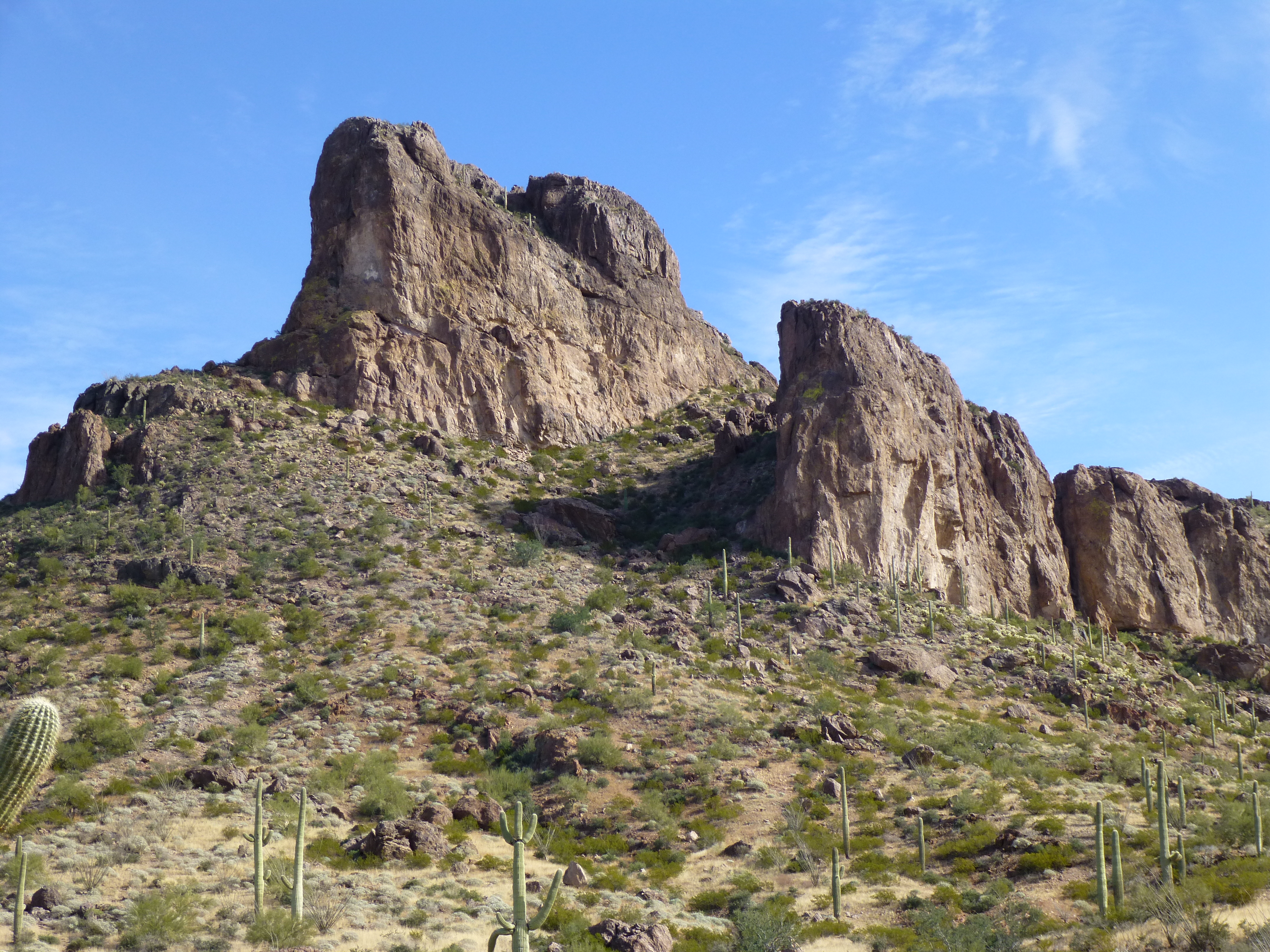
The afternoon was warm and we covered the distance quickly. Some high clouds had moved in, but we weren’t worried about rain – the long-term forecast had promised good weather for all of our trip. On the way to the peak, we crossed the smugglers’ quad road at yet another point, spotting another of their gas cans. The climb itself went easily, and we stood on the top of Peak 2700 at 3:00 PM. Another virgin summit, with no sign of any human having been there before us. We left the requisite cairn and register. From the base of the mountain, here’s a look back to the two peaks that had taken up most of the earlier part of the day.
Peak 3220 on the left, and Peak 3300 on the right
This was the last item on our agenda for the day, so we headed down the north side of the peak, then up a short valley, over a pass and right down to our camp. Our gear was still hidden where we had left it. After laying out our sleeping bags for the night, we cooked some food and watched the sun go down.
Sunset on the west side of the Sand Tanks
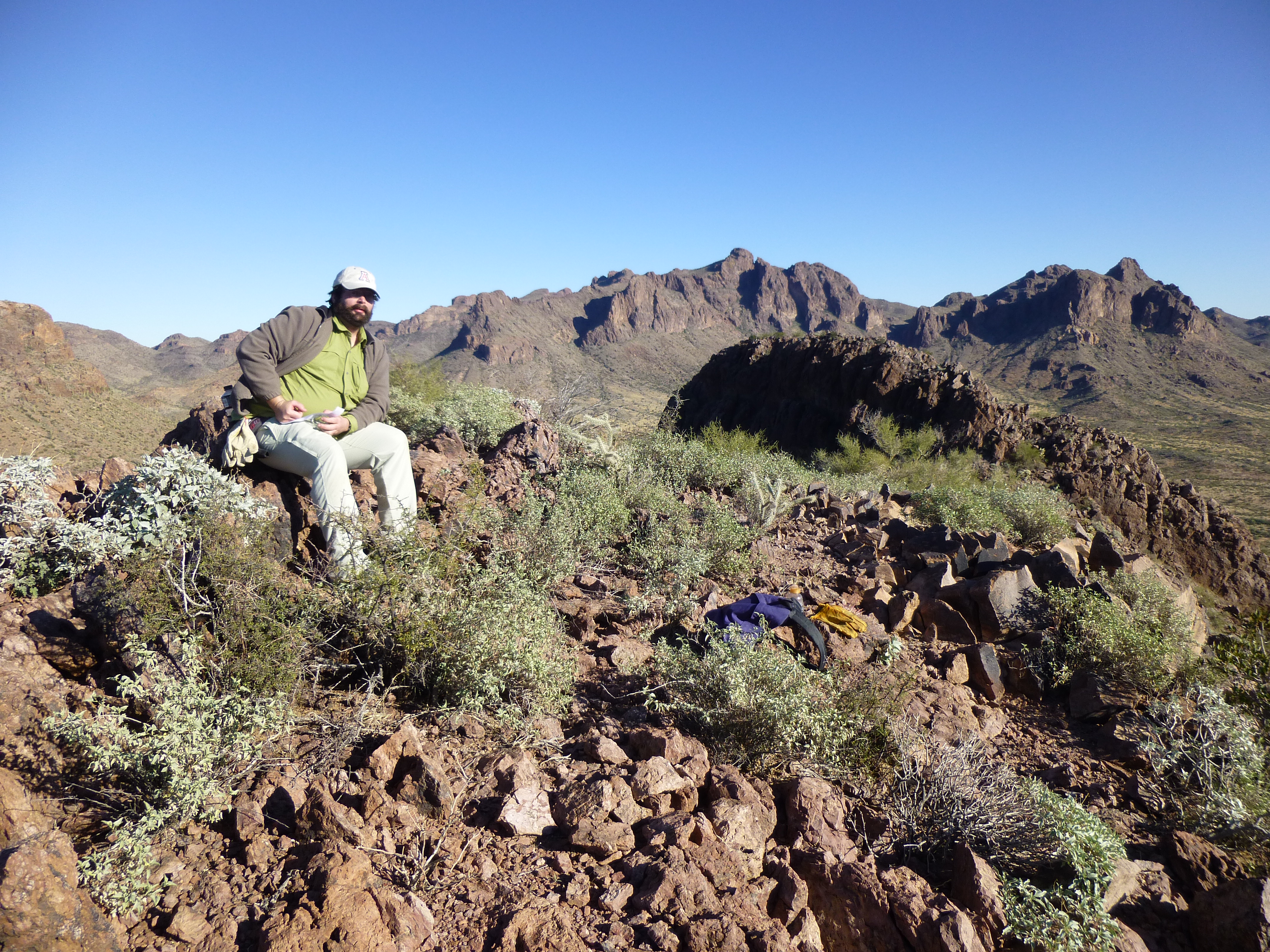
Since we had arrived back at camp nice and early today, at 4:00 PM, we had plenty of time to relax. I found a spot in the nearby wash where we could build a fire and sit down and take a load off, so we gathered a lot of firewood. Many do not realize that the Sonoran desert is the world’s most heavily vegetated – there’s dead wood everywhere, so you can build a fire whenever and wherever it pleases you. Once it was dark, we had a nice warm fire going, sitting beside it and minding our own business. It’s so quiet out in the desert, so utterly quiet, that whenever any new sound comes along, you notice it right away. And that’s exactly what happened next………………………………
Please stay tuned for the continuation of this story.