
Here’s the conclusion of the story we started last week.
Both of us noticed it at the same time. “Listen – what’s that?” “I think it’s a helicopter.” As we listened, it sounded like it was coming closer. “I wonder if they’ll see our fire.” “Too late, I think they already have.” Thundering out of the night, from the east, it came, and in no time was upon us. It zeroed right in, circled us maybe a hundred feet off the ground, then turned on a powerful floodlight. It shone on our sleeping bags and other gear, hovering at times and trying to peer under trees and bushes, undoubtedly to see if there were others besides Paul and me. By then, we had stood up and walked away from the fire, hands in plain view, out into an open area where they could see us clearly – open, but not enough that they could land. They then started checking out nearby hillsides, shining their floodlight in ever-widening circles, looking for others. It’s highly likely they had heat-seeking infrared technology on board, so after a few minutes of flying they realized that we were the only ones out there. Next, they came back, hovering directly overhead and shining their powerful light on us. We didn’t know what else to do, so we gave them a wave. Next, we thought we heard a different sound – they must have had a loudspeaker, because we heard a voice. There was so much noise from the chopper blades as it hovered over us that we couldn’t make out what they were saying. Three separate times they tried telling us something, but we couldn’t understand a word – we didn’t even know if they were speaking Spanish or English. That was about the last thing that happened before they up and left. Just like that, as quickly as it all started, they pointed that chopper west and flew off into the night.
The entire incident, from start to finish, lasted about five minutes. That may not seem like much, but it’s a long time to have a helicopter hovering over your head on a cold, dark night with the rotor wash blasting down on you. The whole affair was exciting, yet kind of traumatic. Paul thought he saw Border Patrol colors of white and green on the machine, but we couldn’t say that with absolute certainty. As soon as they left, the questions started flying. If they weren’t Border Patrol, who were they? It didn’t seem like the Air Force would be flying around there at night, but even if they were, I can’t imagine they’d much care about two guys in the desert. I’m sure they’d have thought we were a couple of indocumentados. We’ve also seen Game and Fish flying around the area in a chopper, but they wouldn’t be out there at night. My money’s on the Border Patrol, but we may never know for sure who our nocturnal visitors were. We both lay awake for quite a while, though, thinking about what had happened.
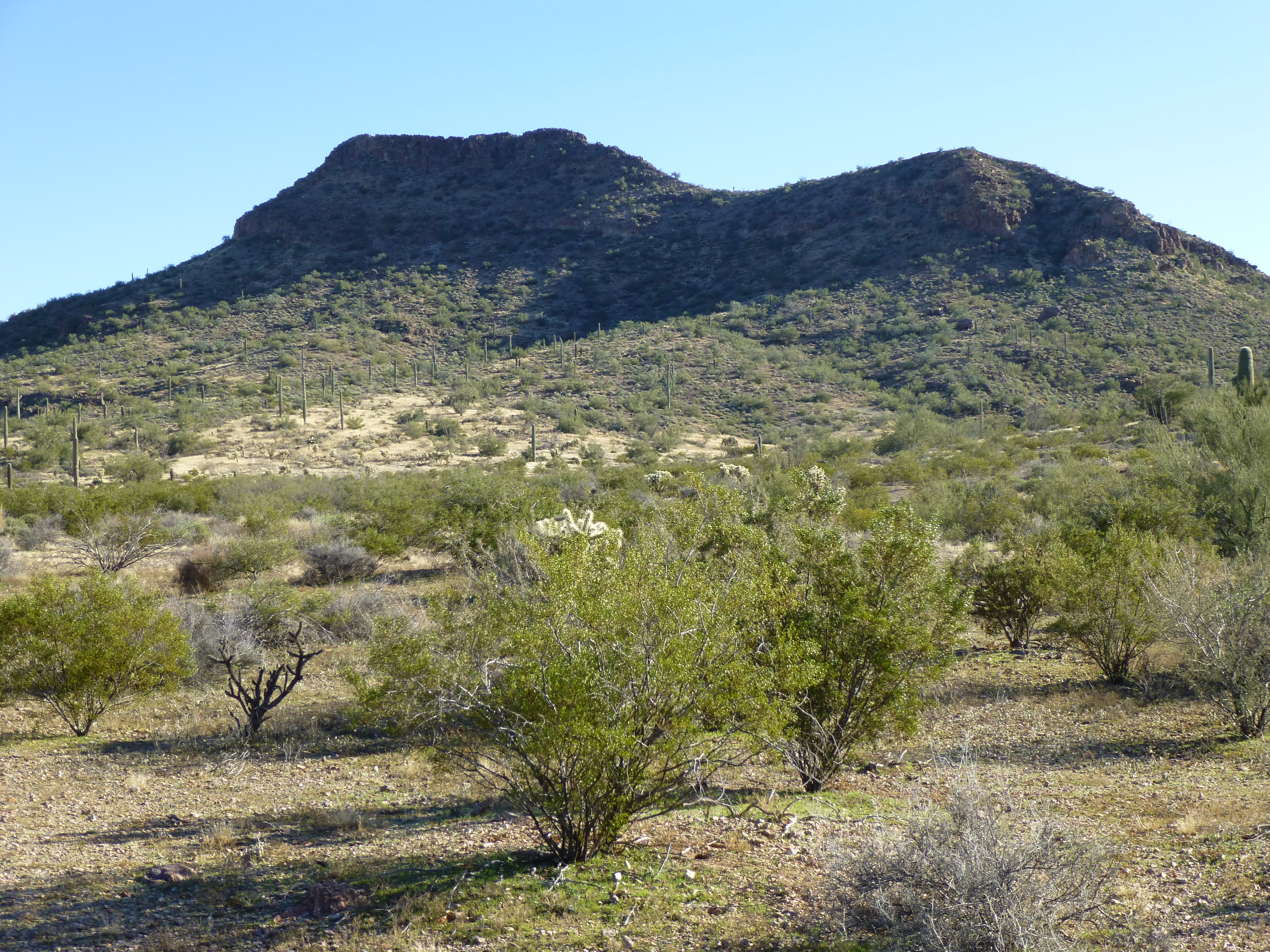
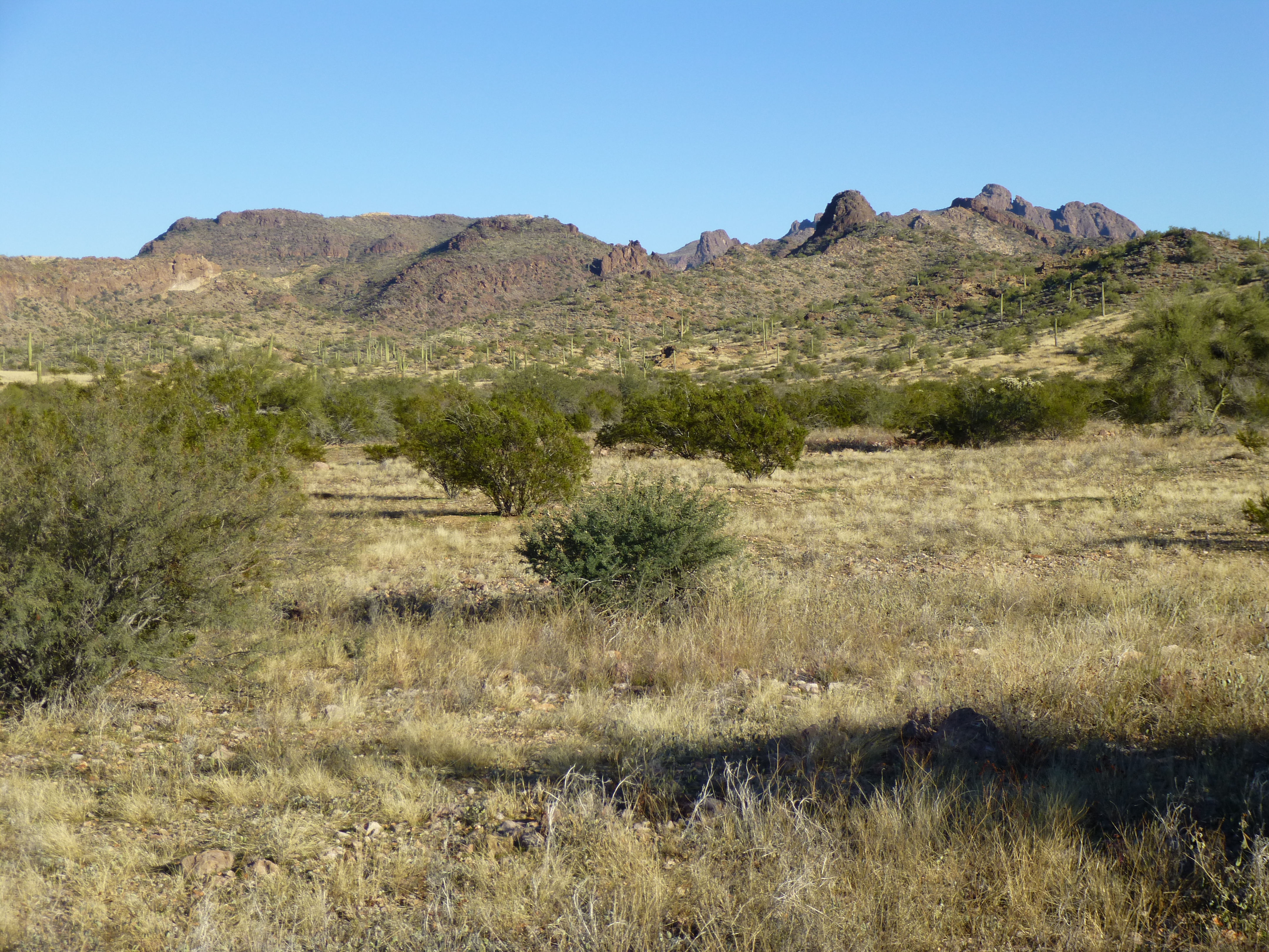
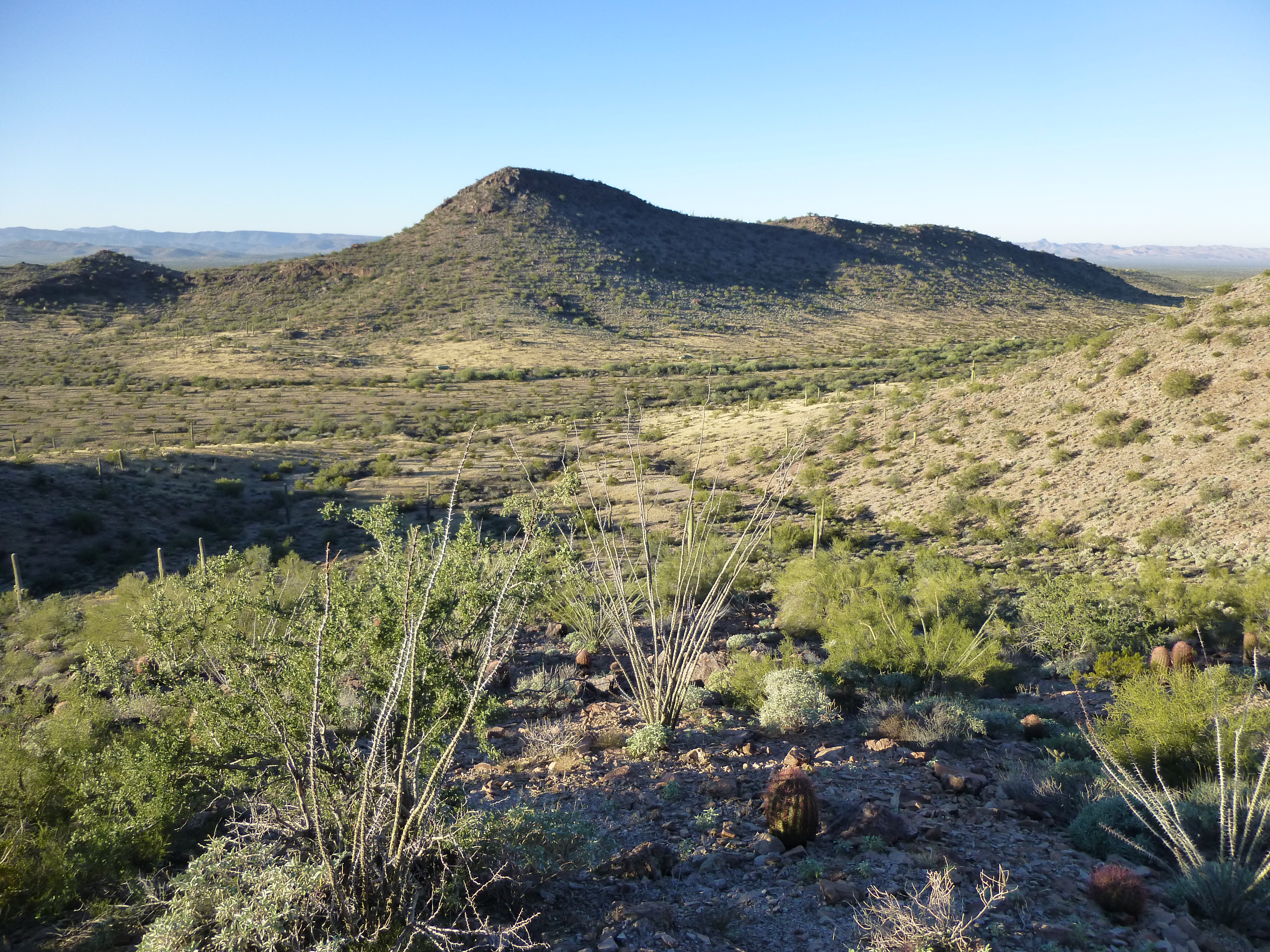
The next morning brought us 29 degrees and little frost – the most comfortable night yet. It was Day 4 of our trip, and time to move camp. After packing up, we made an easy march of half a mile to the west, then hid our packs once again. It was quick work to reach the top of Peak 2740 to the south.
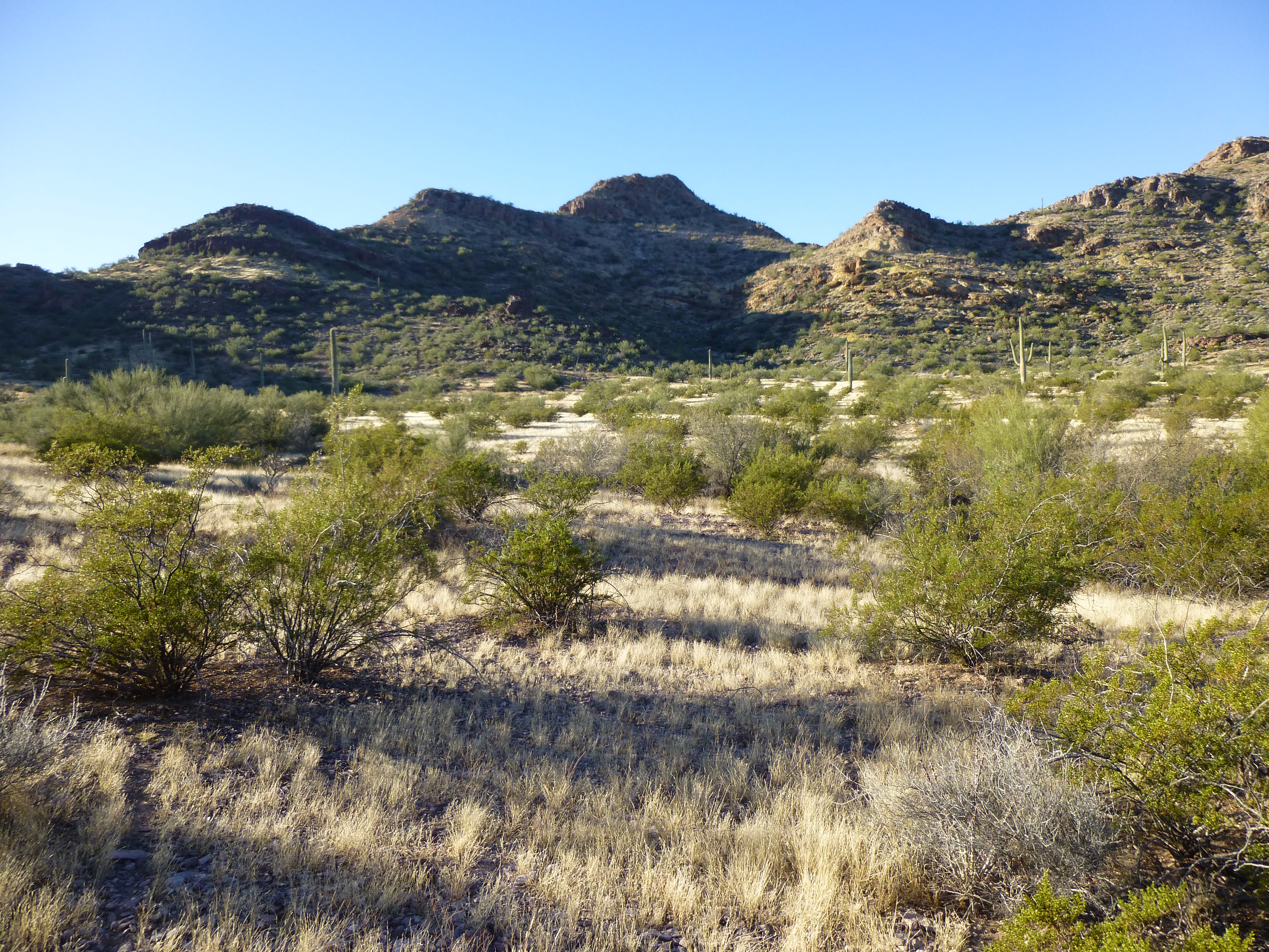
Looking south to Peak 2740
It was just before 10:00 AM. No sooner had we reached the summit than we heard loud booming sounds – ten miles to the west, A-10s were dropping bombs. We could see the orange flash of the explosions and the smoke rising into the air, but the sound didn’t reach us until almost a minute later. Here is a long telephoto shot of the action.
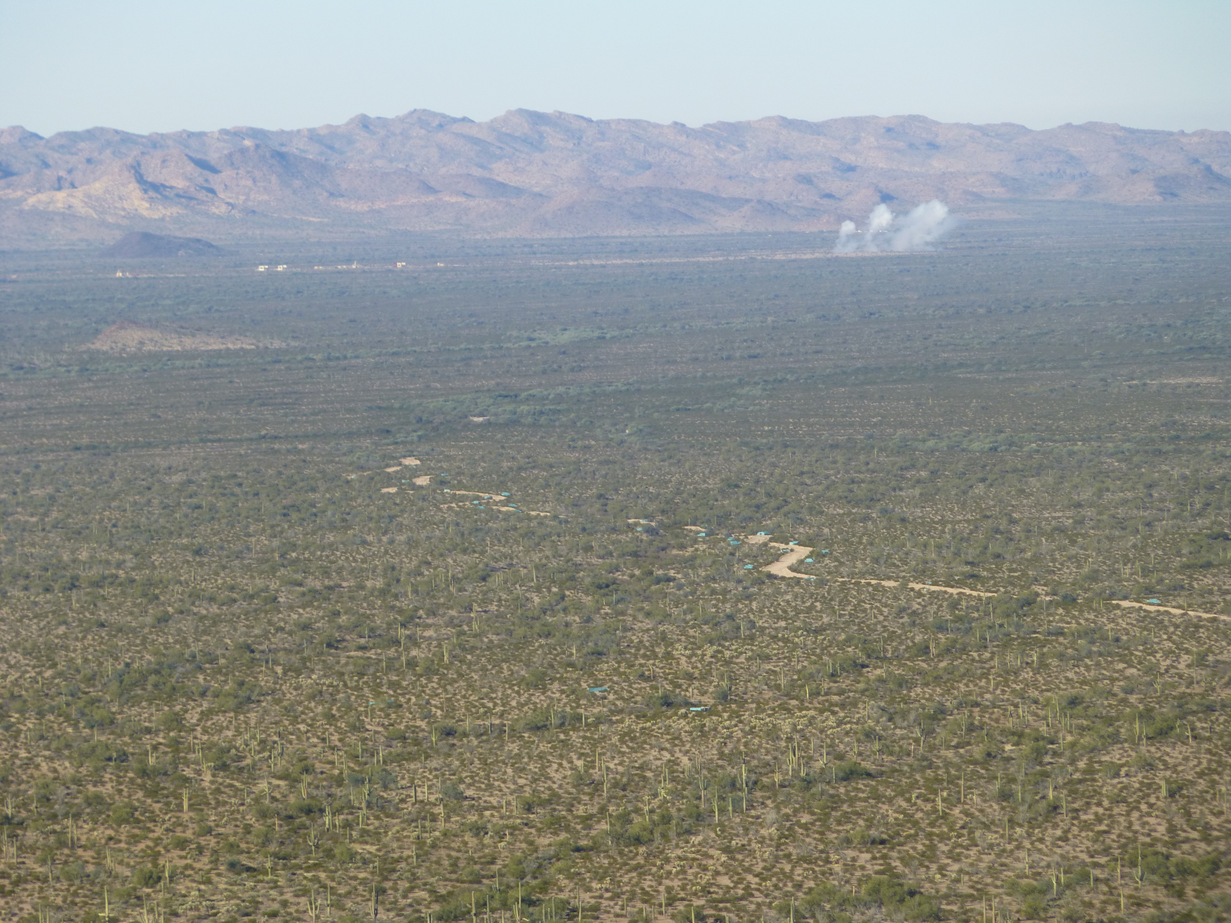
A long telephoto shot of bombs exploding ten miles to the west
Paul loved seeing the A-10s swooping low and dropping their bombs, as did I, even though I’d seen this several times before on other trips. The A-10s, affectionately known as Tank-Killers, play an important role in keeping us safe, and are a common sight as they train in the remote desert areas of Arizona. Peak 2740 showed no sign of any previous visit, so we built a cairn and left a register. It’s north side had some fun rock scrambling on the way down to where we’d stashed our packs.
Today, we were going to move into another valley to do some more climbing, but first we needed to get more water. Heading west a short distance, we hid our packs once again. Then, laden with little more than empty water jugs, we walked to the water tank. We spent an hour and a half to filter 2 1/2 gallons. The first time we’d been there, two days earlier, we’d been a bit nervous – we knew that smugglers must use the tank as a water source, so had been looking over our shoulders while filtering the water. Today, things felt more relaxed. And honest, Paul didn’t filter all the water – I took my turn as well.
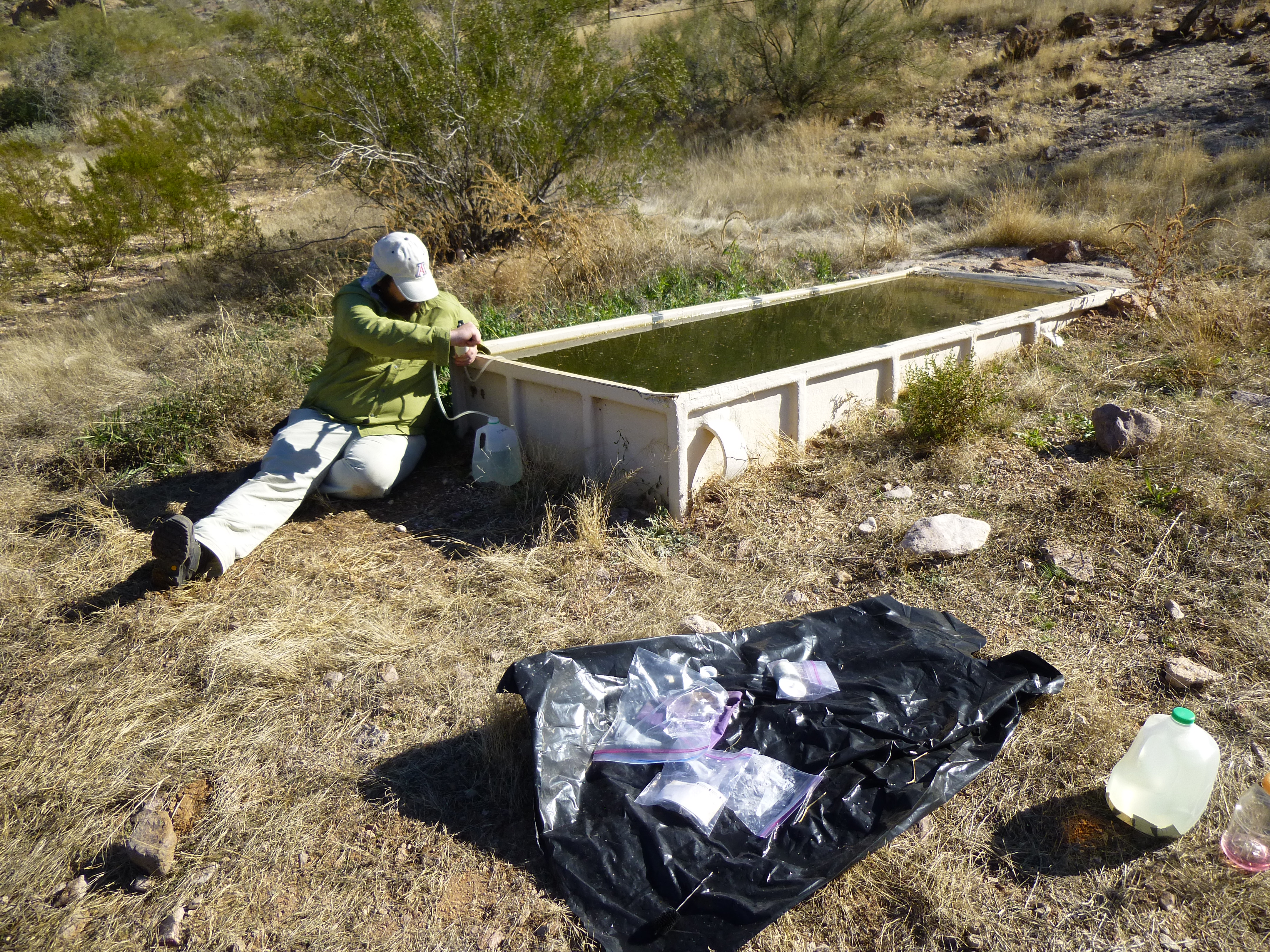
Paul filtering water
Truth be told, a contributing factor to our peaceful, easy feeling was the fact that Paul had brought along a revolver, a Smith and Wesson .357 Magnum, and it was always handy on his right hip. He’d decided to bring it, given the fact that our climbing was going to be done in an area frequented by Bad Guys. Also, we were now so used to being in the area that it was beginning to feel like home.
It was one in the afternoon when we made it back to the packs. Even with the extra water, our loads felt pretty good, quite manageable. Heading north, we climbed a gentle gradient and soon arrived at a low pass, once again dropping our packs. We were perfectly situated to climb Peak 2660 – it was a short walk up its eastern slope. Carrying next to nothing, we started up. Climbing through a small cliff band, we continued up easier ground, then came to another cliff. There were easy ways up it, and at the top, we saw we were little more than a hundred vertical feet from the summit. Then it happened.
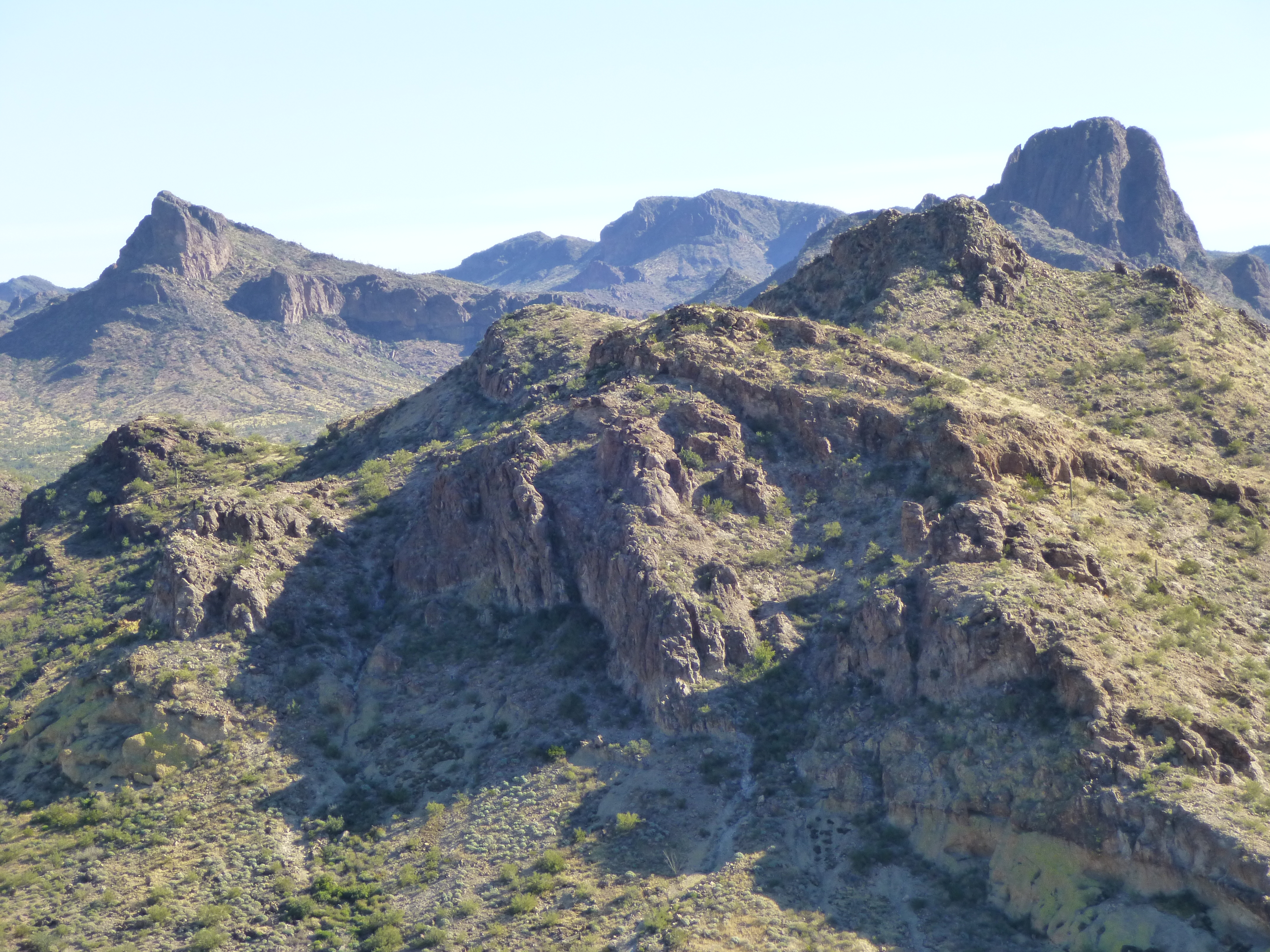
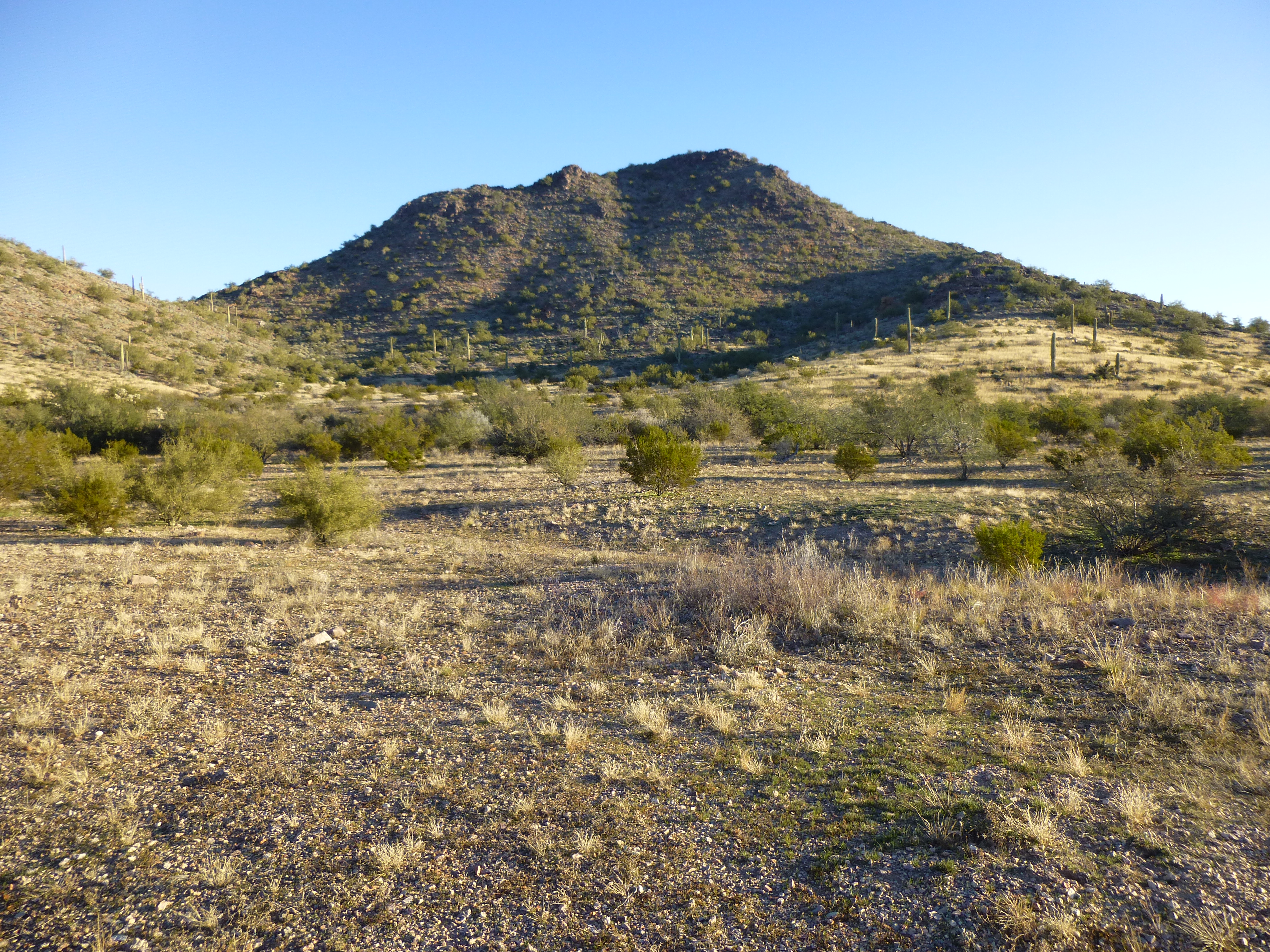
I was out in front, maybe 30 feet upslope from Paul, when I heard a commotion behind me. I turned quickly, only to see Paul rolling down the slope. He had yelled out “My knee, my knee!”, which is what caught my attention. I only saw him roll a few feet, then he slammed into a Palo Verde tree which arrested his fall. Thank God for that, as immediately beyond the tree trunk was the cliff we had just climbed. If the tree hadn’t stopped him, the fall over the cliff would likely have been fatal. Look at the next picture – Peak 2660 is on the right. The cliff Paul almost went over is the dark band on the right slope half-way up.
Looking northwest to Peak 2660 from one kilometer away
It only took a moment to run back down to Paul – I took his hand and helped him up – he was lying on his back, and I helped pull him up to a sitting position. His arm and back were lacerated where he had hit the tree – Palo Verdes are covered in long, sharp thorns – and there was blood on the rocks where he had been lying.
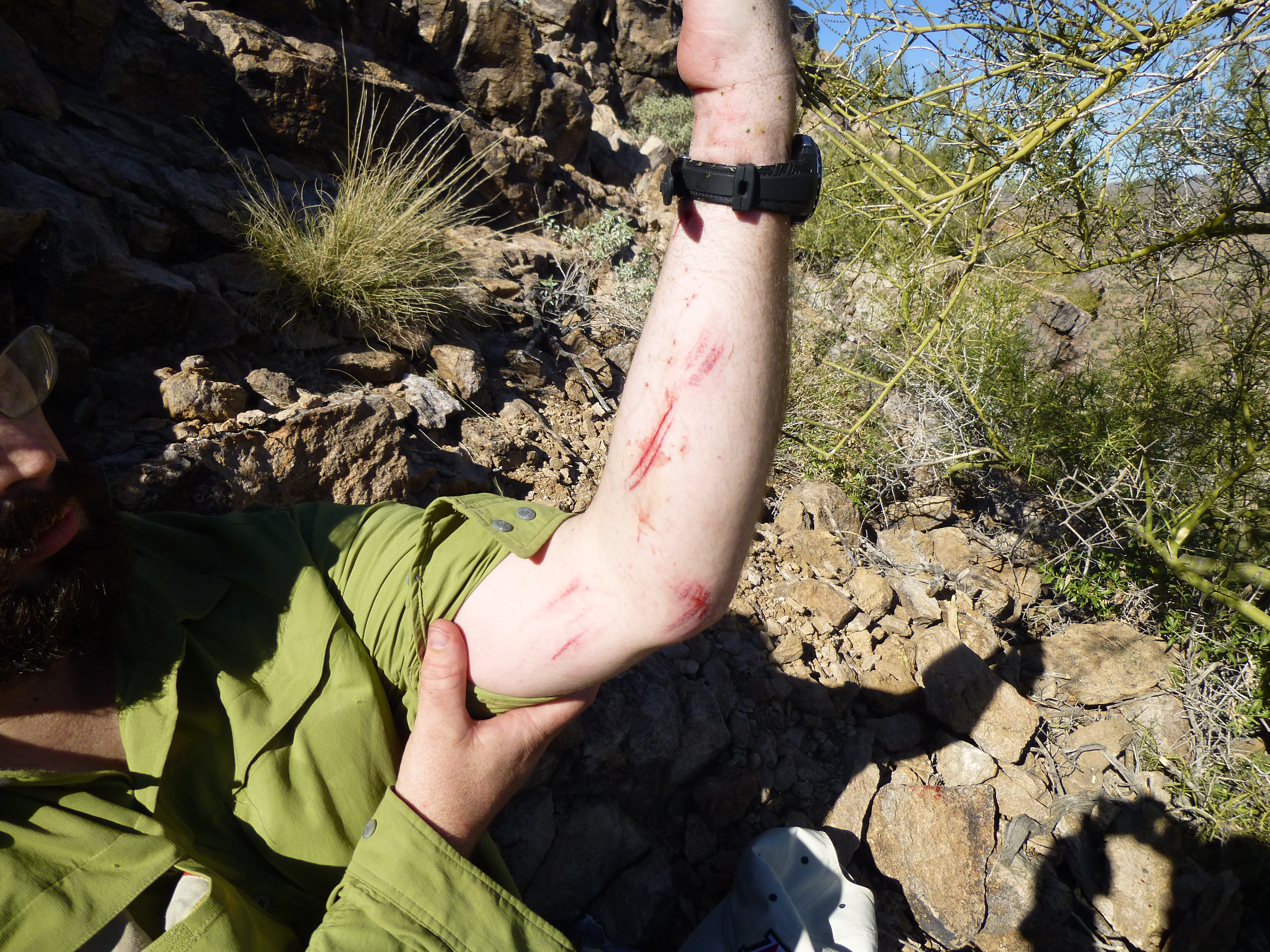
Paul’s lacerated arm – his back was much worse
Once he was sitting in a safe, comfortable spot, he told me that he had been scrambling up the slope on all fours when, all of a sudden, his right leg had hyper-extended, then crumpled under him. He said he’d never felt such pain in all his life. As we sat and talked, he noticed his knee was swelling and bruising. Miraculously, he had a knee brace in his day pack. He’d carried it for years in case of a day like this, of course hoping he’d never use it. Gingerly, he put it on, then stood up and tried his full weight on his leg – it held. I asked him if he felt he could walk, and he said he thought so. He wondered if there was a way down off the mountain without having to downclimb the cliff – perhaps we could outflank it? He said he’d sit and wait while I checked around, and that if I wanted to go to the nearby summit as part of doing that, that was fine too.
I scrambled up to the summit of Peak 2660, a few short minutes away, and scanned the slopes of the mountain as I filled out a register.
Looking southeast from Peak 2660, to yesterday’s climbing
There wasn’t really any other good way down that didn’t involve a lot of extra distance, and I told Paul this when I went back down to his position. Studying the cliff below us, I saw a way down through it that looked pretty decent, zig-zagging along a few ledges. Paul said he thought he’d be able to manage it, so we started down with my guiding his every step. It didn’t take too long, actually, and once below the cliff, it was just a matter of walking carefully to avoid slipping on the loose surface. Before we knew it, we were back at the saddle with our packs. We got Paul’s big pack on, and he felt he could manage with the weight if he walked carefully. It was now about 2:40 PM.
As we stood there checking the lay of the land below, we heard what sounded like a jet aircraft. A few moments later, an A-10 “warthog” came roaring past, only a few hundred yards from our position. Seconds later, another one came by – I was barely able to snap this poor photo, it was moving so quickly. It was closer than it looks – this is a wide-angle shot. They say that the two coolest jobs in the world are rock star and fighter pilot, and at that moment we had to agree.
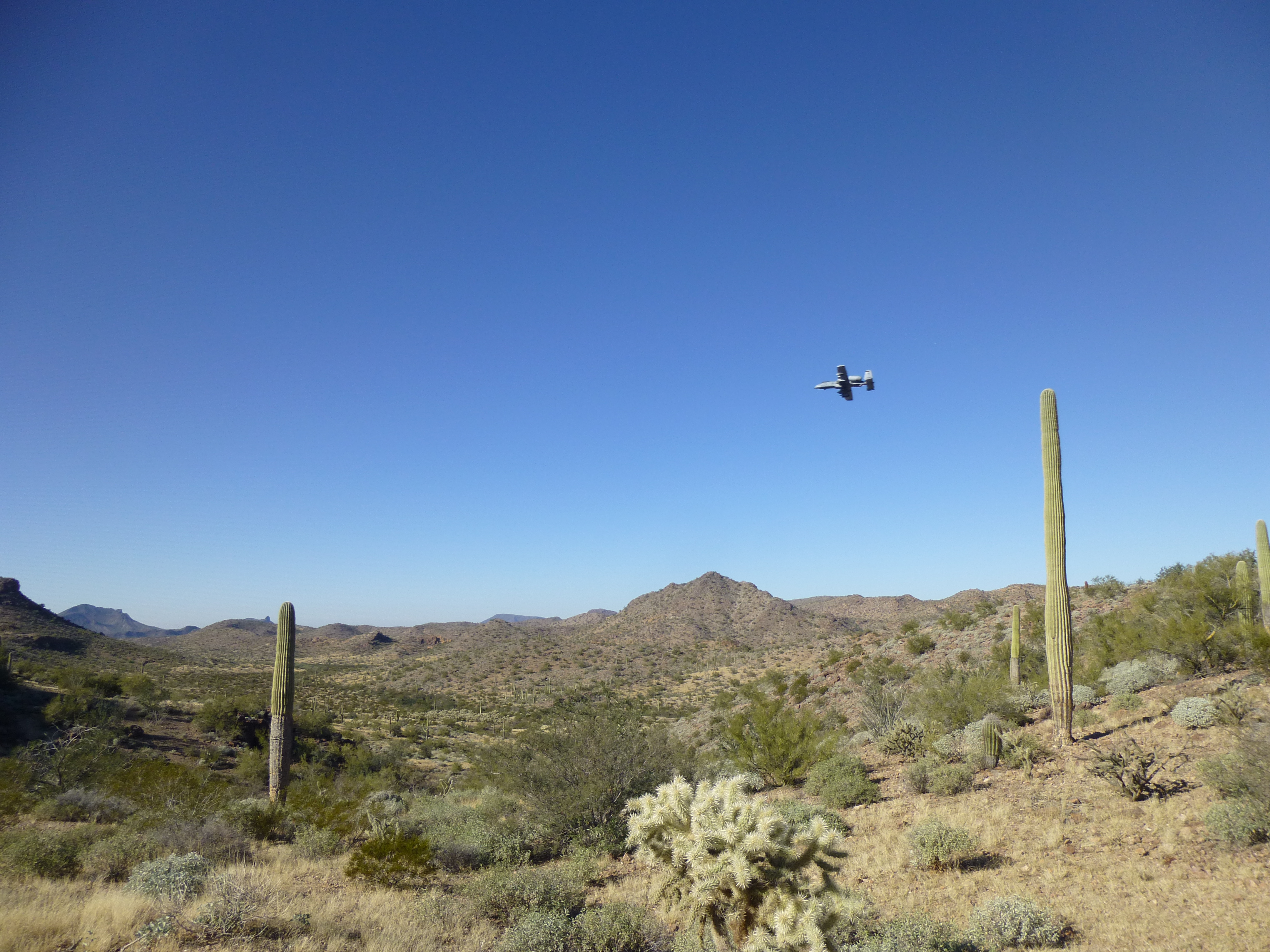
The A-10
I went first and found the gentlest path possible and he followed. It was only a drop of 150 feet or so to the north to the valley bottom, and once there it was pretty level going. Fortunately, Paul’s leg was holding up pretty well, so much so that we covered a full mile in about an hour. He soldiered through the pain until we dropped our packs at the perfect campsite.
Looking back to Peak 2660. Paul’s cliff is the abrupt drop half-way down on the left side
It was a nice, flat area where you could have camped an army, and the best part was that it was only 3:30. We spread our gear out to dry (there had been some frost last night that had made it a bit damp), and gathered wood for a fire.
Our camping spot for the fourth night
Paul was feeling a bit better, and we were standing in the sunshine discussing how his accident could have turned out so much worse. I carry an emergency rescue locator device in my pack whenever I climb, and wouldn’t have hesitated to use it if we’d had no other choice, but let’s just say it would have been a bit embarrassing to have called for help in that part of Arizona, if you get my drift. Anyway, there we were, enjoying the warm sunshine, when we hear a distant droning. Yep, it was a helicopter – déjà vu all over again. It was coming from the west, out on the main part of the bombing range. Was it going to be the same one we saw last night, come looking for us again?
Within moments, it came into view, and it was moving fast, right towards us. It was broad daylight, and there was no time or place to hide. It didn’t even slow down, but roared right over our heads, not a hundred feet off the deck, and kept on going. What the hell? It soon reached the head of our valley, flew right over the spot where Paul hurt his leg, and kept on going. We could see it pass over the spot where the other chopper had circled us the night before; then it kept on going to the southeast and was lost to view. The pilot must have seen us – our bright red and blue gear was spread out on the ground and in the bright sunlight. plainly visible. We were amazed that he didn’t at least circle us, or land. Hmmm – he must have been texting while flying.
It all happened so quickly, I didn’t even get a photo – I was too shocked by the whole thing. While we still had daylight, we cooked some food and got organized for another night in the desert. And once again, the main talk around the campfire was helicopters. We stayed up quite a while, feeding the fire in the wash to keep warm. This was to be our last night out here, so we were enjoying every minute. Paul knew his climbing was finished for the trip – he just wanted to be sure he could walk all the way out on the morrow.
Another clear, chilly night, with another 29-degree morning. I crawled out of my sleeping bag fully clothed, put on my boots and day pack and walked away – it was 7:15 AM. Talk about a good place to camp – there was a peak on each side, with no travel time involved. The first one I chose was to the west, Peak 2500. The ground around the peak was covered in shrapnel, all kinds of it. This had been a well-used air-to-ground shooting and bombing area, so I guess that wasn’t too much of a shock. It didn’t take long to scramble to the summit, where, once again, there was no sign of a previous visit. Just before the sun rose, I looked to the west and saw this rosy glow on the horizon. Here’s a link to this phenomenon.
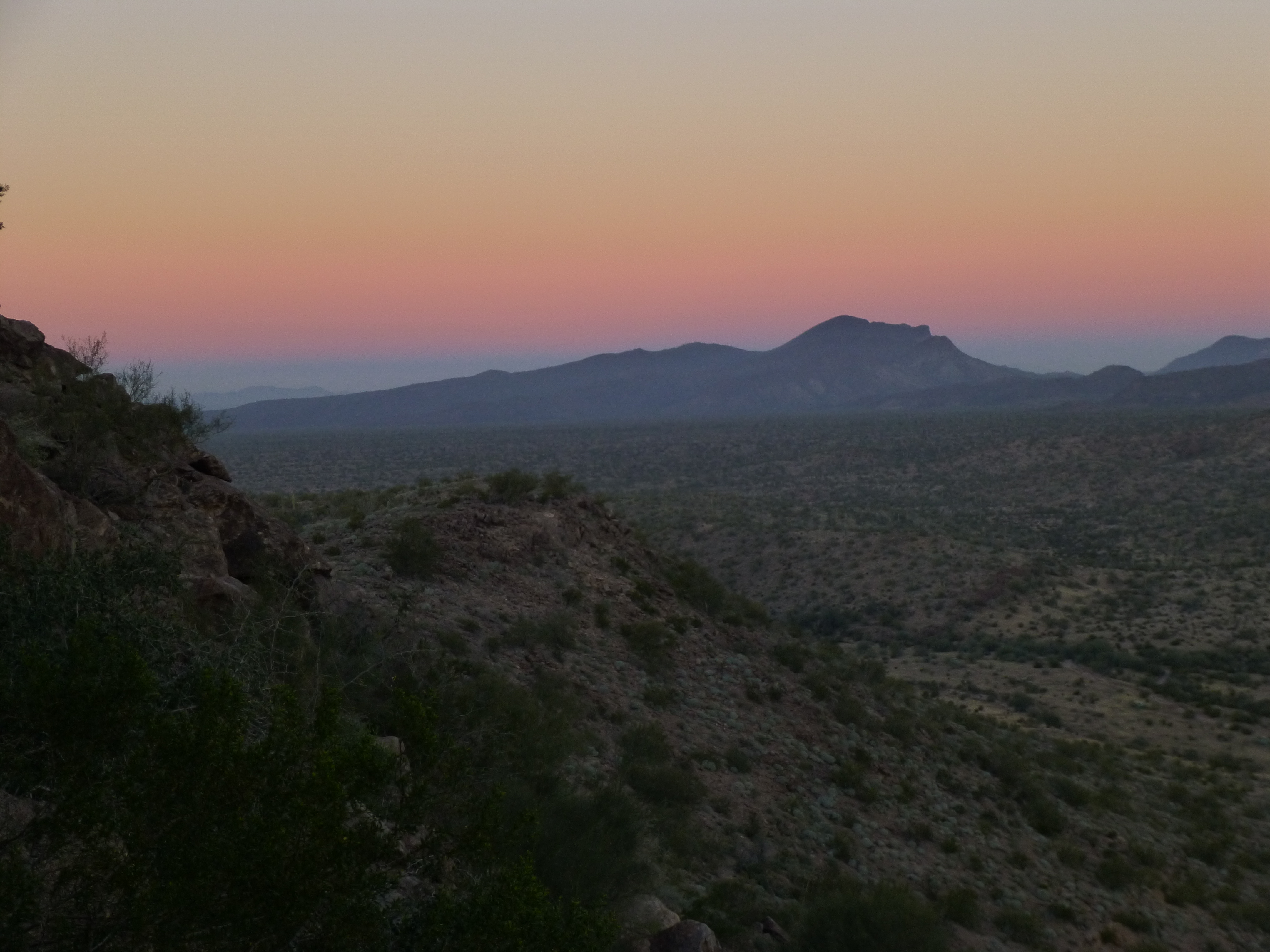
Looking west, just before sunrise, to the Belt of Venus
The sunrise was so peaceful, with no hint of a breeze – I loved every moment, not wanting to leave, because I knew this was our last day out.
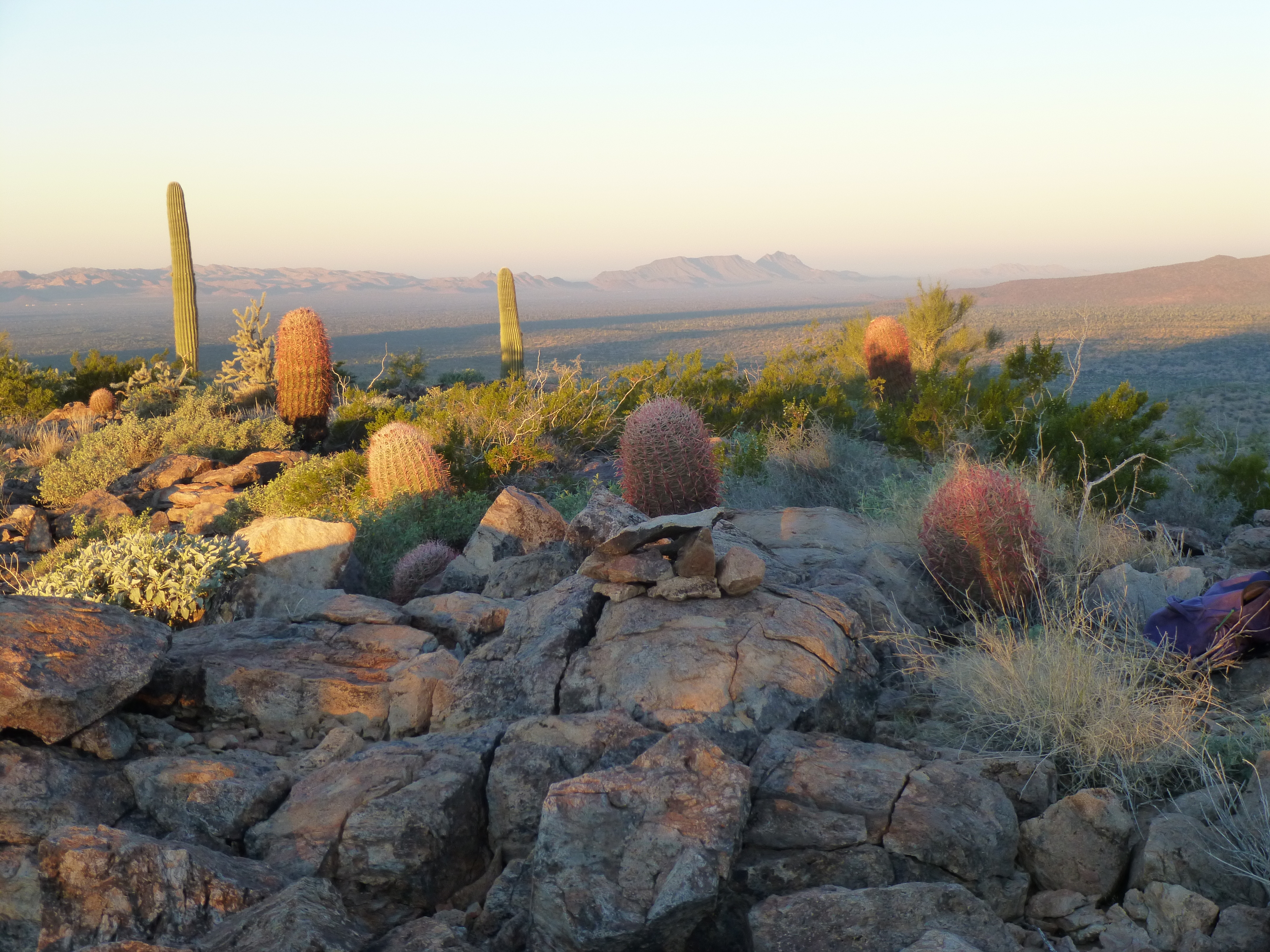
Sunrise on Peak 2500
I could look down and see both of our sleeping bags below, with Paul still asleep in his. It seemed important that he get as much extra rest as possible, to ready himself for the march out. Reluctantly, I left a register and started down. Near the bottom, I saw this large metal object, with what looked like a crater nearby. Hmmm, didn’t know what it was, and wasn’t gonna touch it.
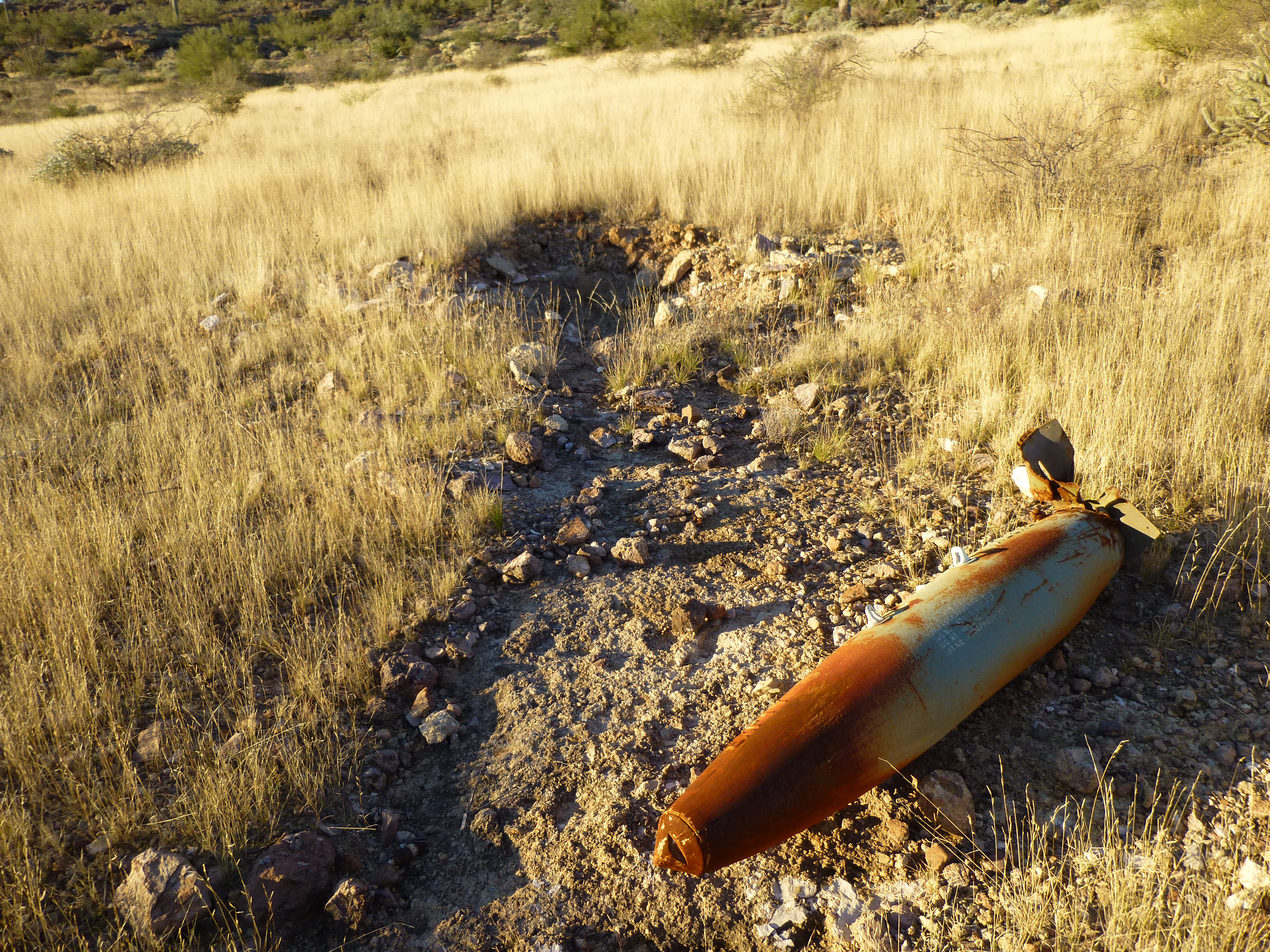
The whatever. It was about six feet long.
Here’s a look back to the east side of Peak 2500.
The east side of Peak 2500, as seen from Peak 2588 across the valley
I walked through camp, said a quick hello to Paul, and kept on going east right up Peak 2588. It too was right beside camp, and took a mere 26 minutes to stroll up to the top.
The west side of Peak 2588
Paul called me on the radio, but I’ll bet we could have shouted back and forth and carried on a conversation over the 1,700-foot gap just as easily. I left the final register of the trip, a small baby-food jar – when you’re going into an area where you may need to leave a lot of registers, they need to be small and light to keep the weight down.
A Sand Tanks register
Back at camp, Paul and I got our gear packed up for the last time and headed out around ten o’clock. We had camped right at the end of an old road, one that the military had put in long ago. It looked like it hadn’t been driven for a long time, but it was still easy to walk.
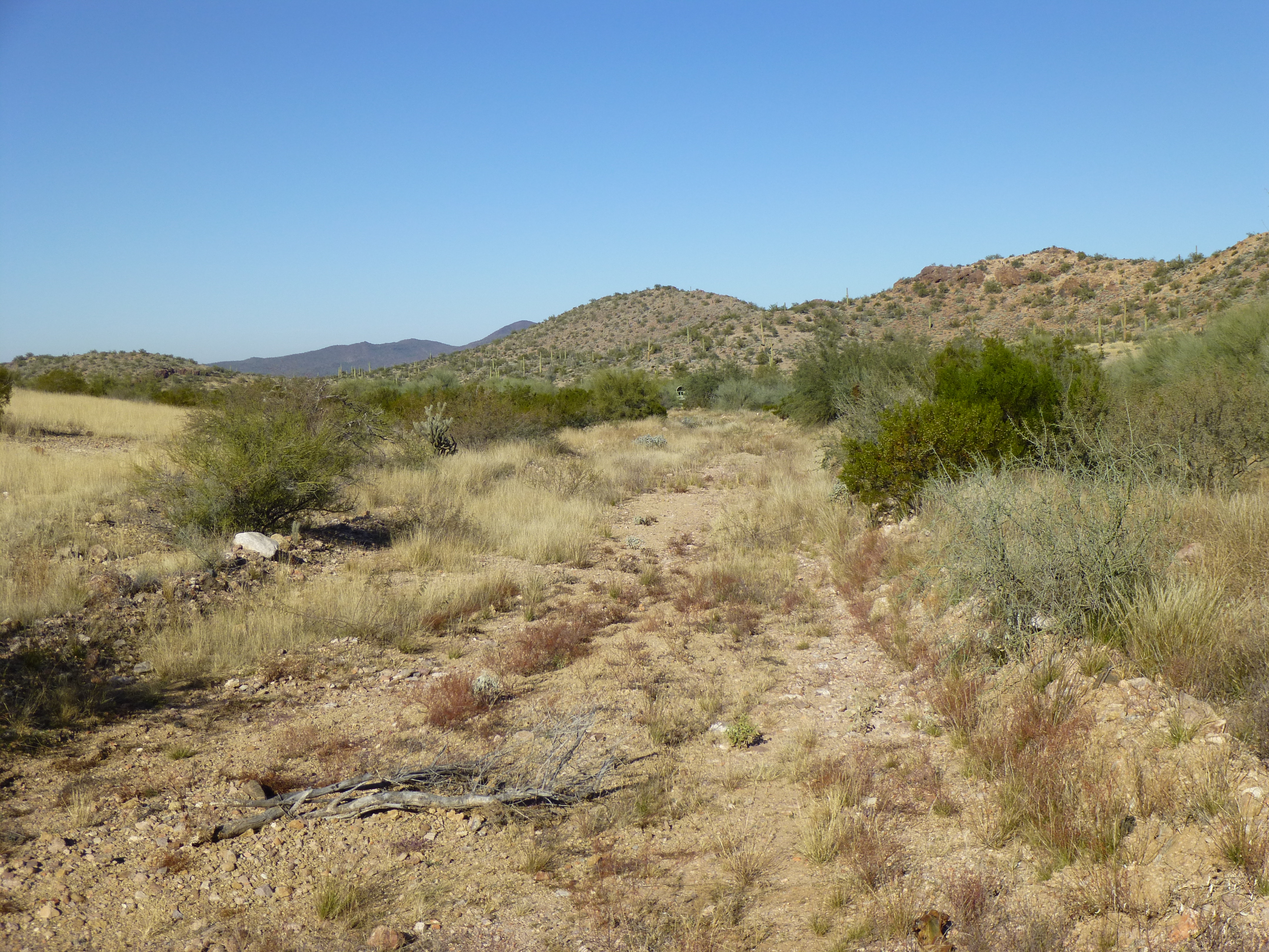
The old road
Along both sides of this road sat a long line of vehicles, stretching for more than a mile and a half. As you can see in the photos, they were all painted blue (to increase their visibility, I suppose) and shot full of countless holes. A-10s probably accounted for the large holes, while men on the ground with rifles and handguns could have made the smaller ones.
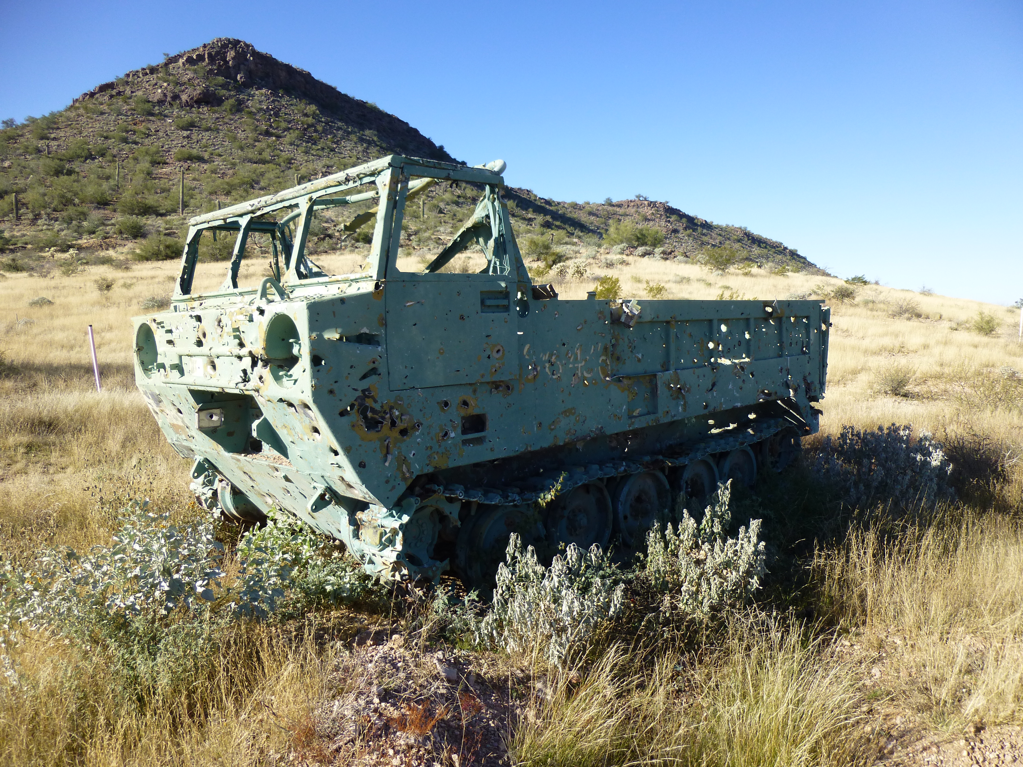
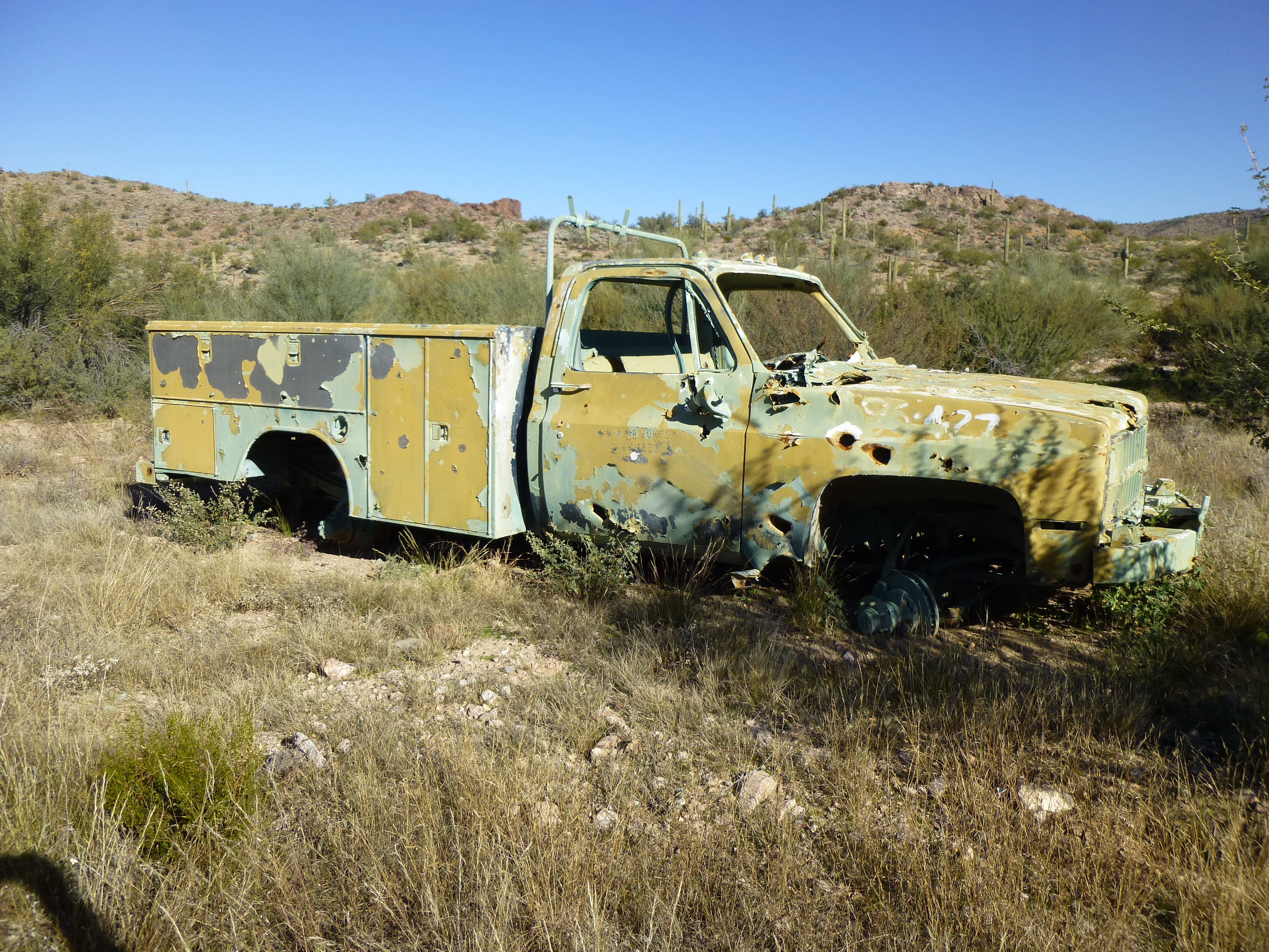
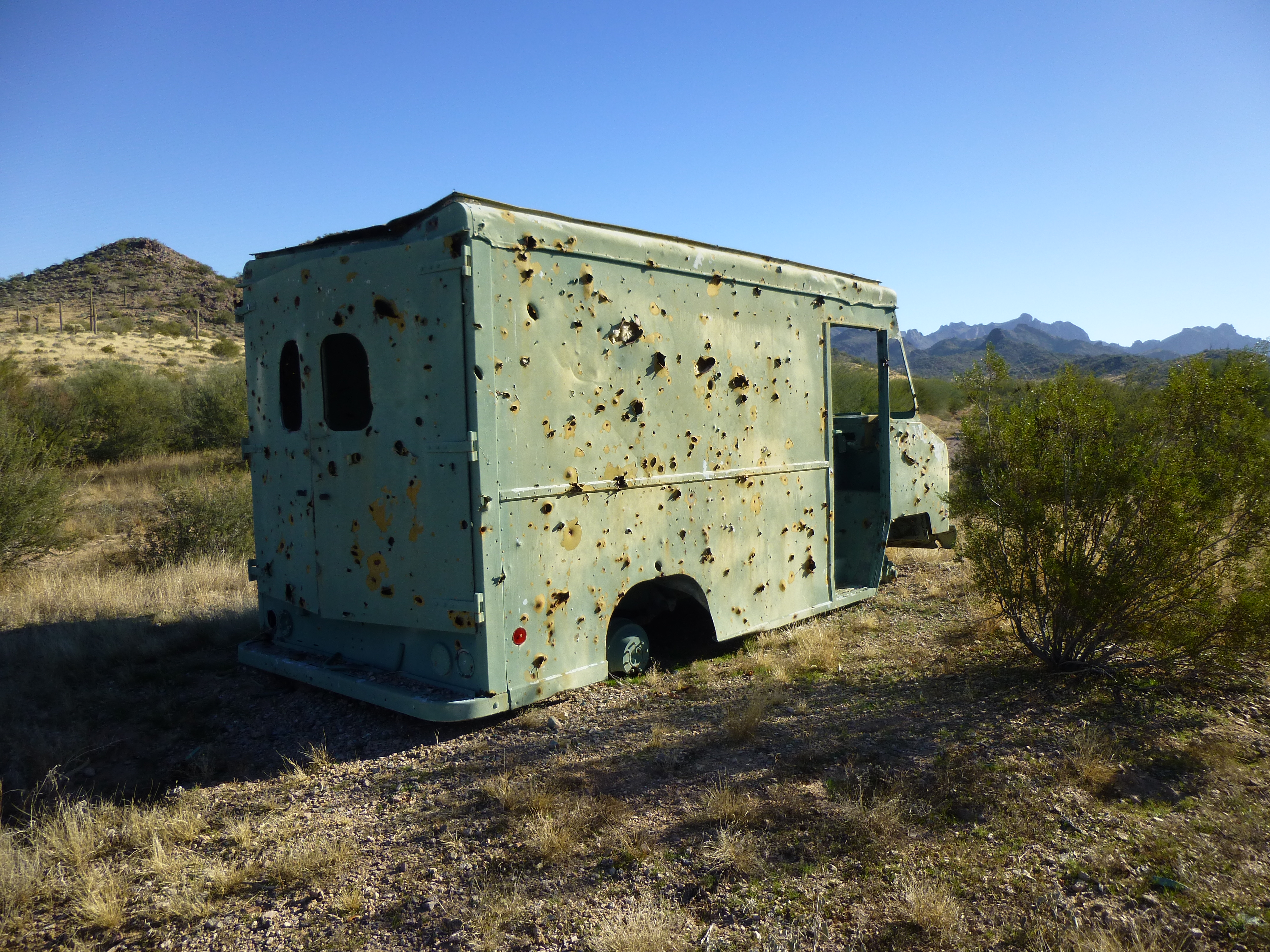
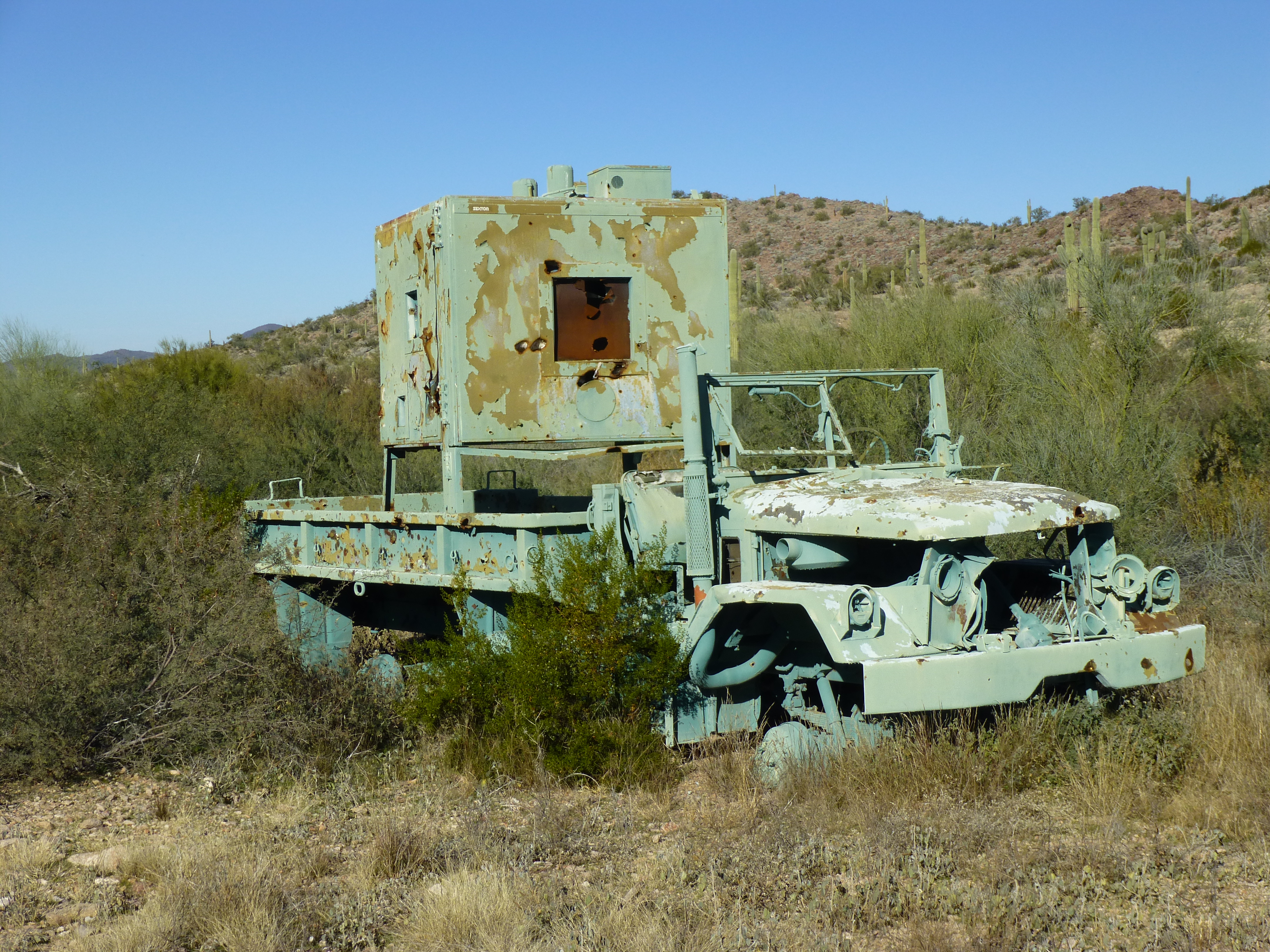
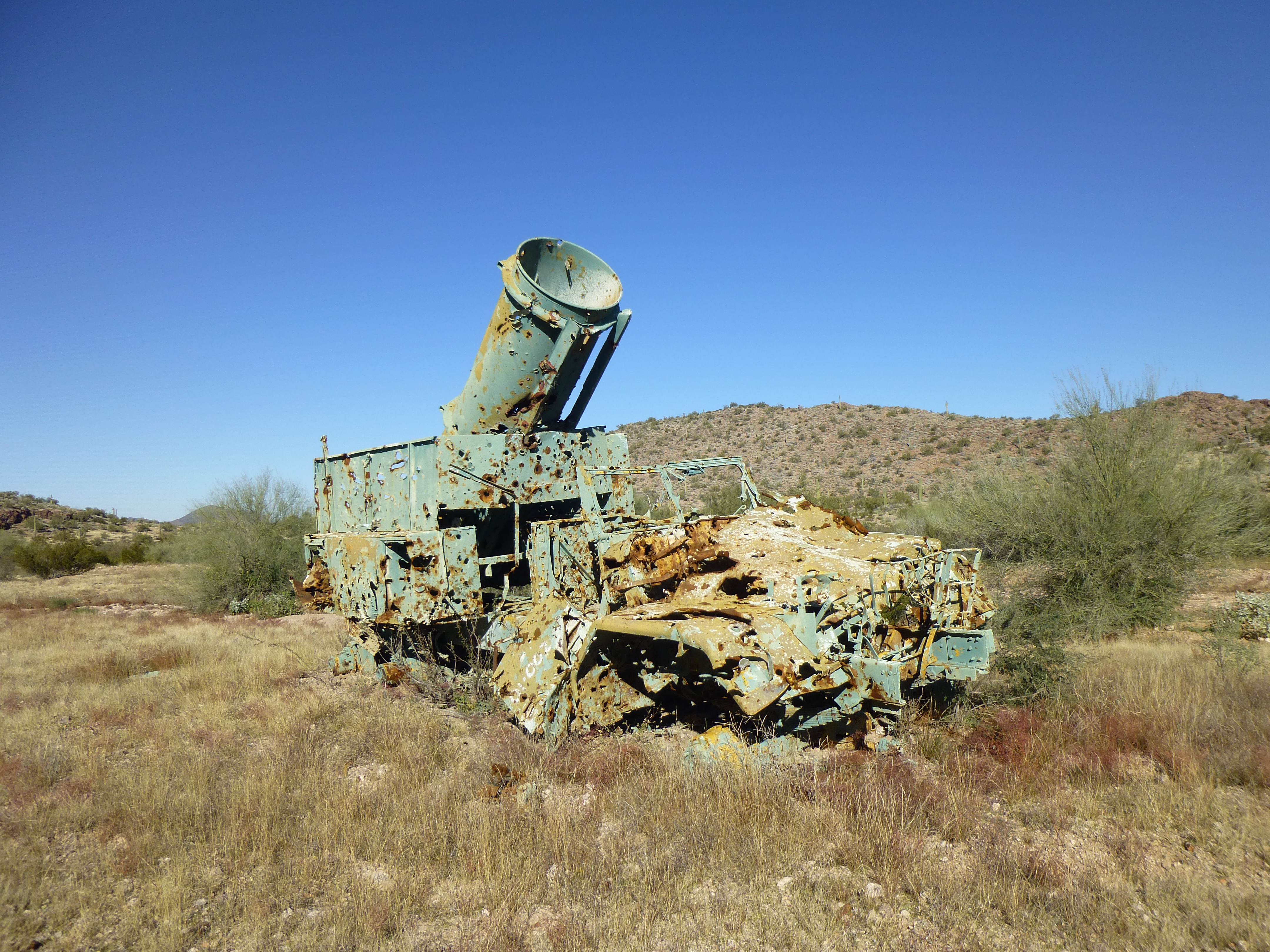
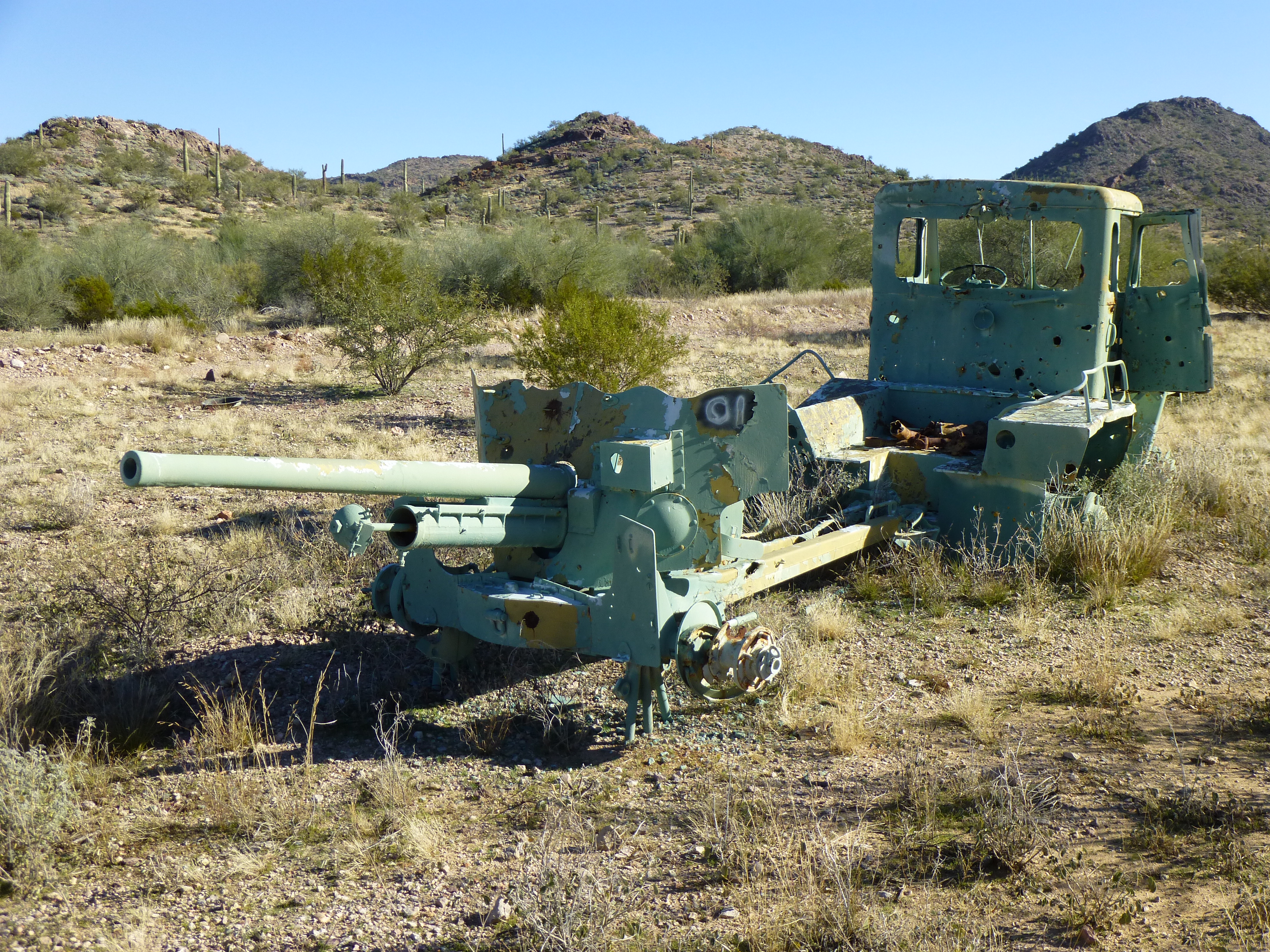
Pretty interesting stuff, huh? There was quite a variety of vehicles here, but I had in another location once seen even stranger – a bus, a grader, an 18-wheeler. In any case, it was a fascinating walk. Where the vehicles ended, it was time to leave the road and head north cross-country through the desert we had traveled to get into the area.
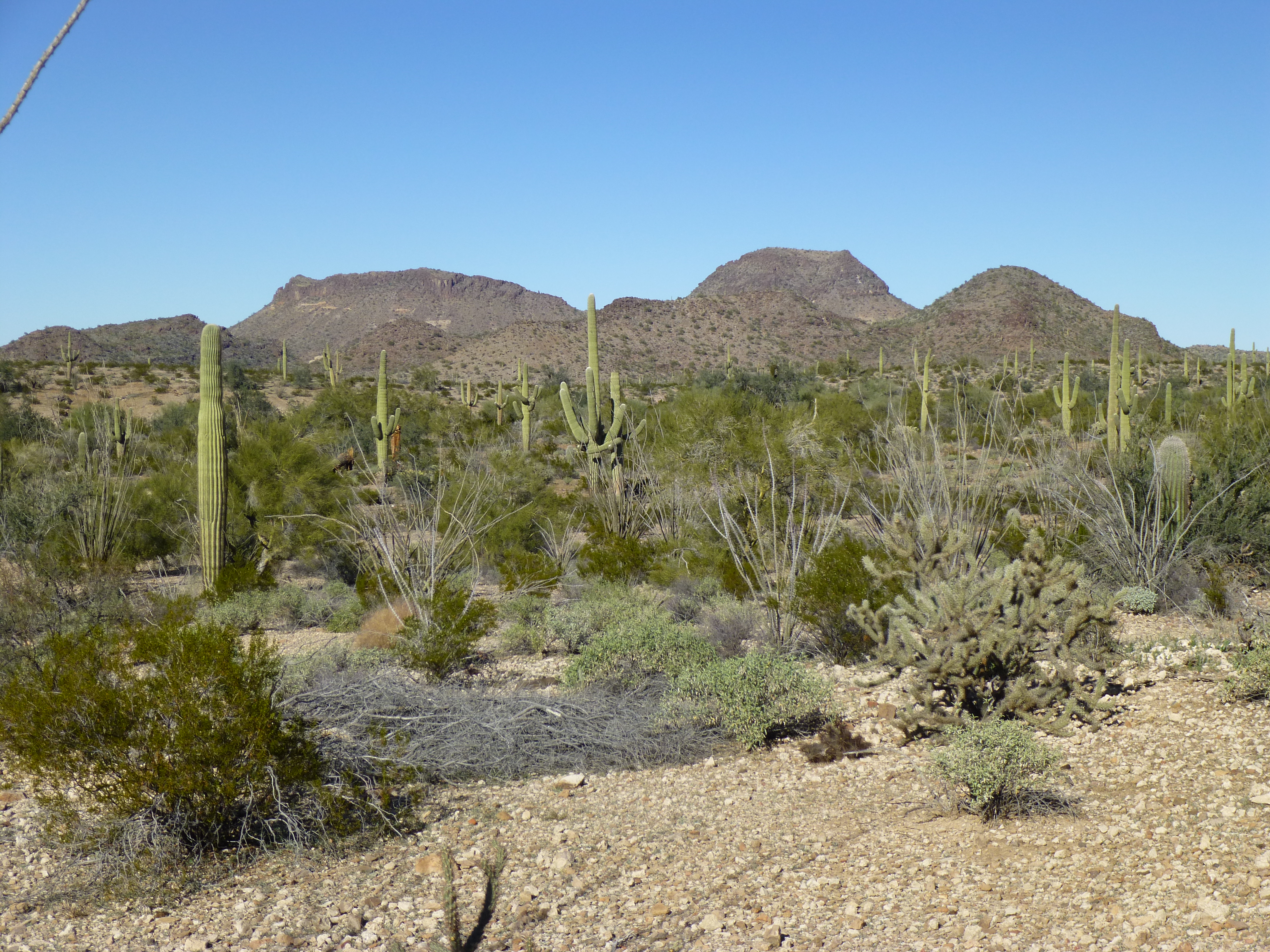
We walked slowly, trying to avoid any steep bits, rather sticking to gentler ground to make it easier on Paul’s leg. Familiar landmarks, like Peak 2849, came into view.
Almost back, Peak 2849 straight ahead.
Two hours twenty minutes later, we zeroed in on the truck. A big concern for the last five days had been this – would smugglers have found the truck and tampered with it? As we rounded a corner, we caught a glimpse of it from 200 yards away. By the time we reached it, it was obvious all was well. The jug of water we had left was untouched, no windows were broken, everything seemed as we had left it. Hallelujah!
More than anything, I wanted to get out of my boots. While Paul replaced the fuse and got the truck running, I went over to where we had buried our stuff. The shovel came up first, then everything else, none of it the worse for wear. It sure felt good to put on clean clothes. By the time we were ready to drive away, it was almost 2:00 PM. It felt good to be off our feet as we rode along, talking about the details of the trip.
We’d gone perhaps five miles when we noticed something in the rear-view mirror. Three quads were behind us and coming up fast. Bad Guys? Nope, they looked like law enforcement. I pulled over and the one in the lead pulled up beside us. The other two held back. The officer was in a mood to talk, and so were we. These fellows were with the Maricopa County Sheriff’s Department, driving the back roads looking for drug smugglers. He was quite friendly, interested in where we’d been and what we’d seen, and also impressed that Paul’s truck was only a two-wheel-drive. He knew of the smugglers’ quad road we’d seen, telling us they’d driven south on it several times. He told us that smugglers were totally responsible for the road, it was of their making and no-one else’s. When we told him of the mysterious chopper circling us in the night, he was unsure of who it might have been. He told us something else though – because it was the Christmas holiday season, few if any smugglers would be in the area. They actually take a break too! He also said it takes them about 12 days on foot to make the journey from Mexico up to that part of the Sand Tanks, so within another week or so, they’d probably start coming through again. That would explain why we never saw another human out there, which suited us just fine. He genuinely wanted to keep in touch, so we exchanged contact information. We must have talked for almost half an hour, but finally he said they’d better move on, pulling out ahead of us since they were faster.
An hour later, we were all the way back out to the freeway. There, in a clearing, we saw parked three pickups with trailers – those fellows must have been sidetracked, chasing down Bad Guys and weren’t back yet. Thanks to the MCSO for helping keep us safe out there!
Although it was clear blue sky when we hit pavement, little did we know it was about to change. That night, a serious winter storm hit the area in which we’d climbed, dropping plenty of rain with freezing temperatures. It’s good we got out when we did, or we’d have been out there, cold and miserable, like a couple of drowned rats. Our timing was perfect, with clear skies every day and no precipitation. A bit cold, yes, but that didn’t hurt us.
A few stats on the trip:
Peaks climbed – 8 (plus one attempted) Miles covered on foot – 32.7 Vertical feet climbed – 7,030
The distance covered was so little due to the tight packing of all the peaks, a perfect set-up, really. Thankfully, Paul’s fall turned out as well as it did – a tiny bit different and it would have been a game-changer. Climbing mountains is risky business – there are a hundred opportunities every day to get into trouble, or worse. It’s been interesting to see how much feedback, all of it positive, the first installment of this story has generated in the week since it was published. Hopefully you enjoyed this second part just as much.
Please visit our Facebook page at: https://www.facebook.com/pages/Desert-Mountaineer/192730747542690