
During my early years in Arizona, I was very busy with a big, complicated mountaineering project. For almost four years, I spent every spare minute wandering the state, seeking out the highest point of each of the mountain ranges and climbing them all. (Remember, “Not all those who wander are lost” – J.R.R. Tolkien). By November of 1987, my attention had turned to Organ Pipe Cactus National Monument. This 517-square-mile tract of unspoiled desert had been set aside to protect its namesake cactus, and six ranges within its boundaries beckoned. I spent a few enjoyable days picking off the more accessible ones, such as the Ajo Range, the Diablo Mountains, the Puerto Blanco Mountains and the Sonoyta Mountains, then hit a bit of a roadblock.
Early one morning, November 14, 1987 in fact, I was in the visitor center nosing around. I asked about access to the far southeast corner of the monument, knowing full well that there was none by road. The employee with whom I spoke said she’d try to get someone who knew more, and, a few minutes later, out waltzes a woman who introduces herself as the Superintendent. I told her I wanted to go climbing in the Sierra de Santa Rosa. “Sierra de what?”, she asked. I saw that they had on the wall a large map of the monument, which divided it up into several different zones. I showed her where I wanted to go. She seemed suspicious. “Why on earth would you want to go way over there?” “Well, like I said, there’s a mountain there I’d like to climb. All I want to do is stand on the summit and leave a register.” She told me in no uncertain terms that that wasn’t allowed, that only a few peaks in the park had registers and they were approved, that people couldn’t wander around leaving things on top of their mountains because this was protected federal land. Okay, I said, I wouldn’t leave a register, but I still needed to go and climb it.
She asked how long I planned to be there and I told her that, depending on how close I could drive, probably overnight. “Well, you need a permit to camp overnight in back country like that” she informed me. “Okay, I’ll get a permit” I replied. “Well, we’ve never given anyone a permit to camp in that area, ever.” “Lady, is that a problem – can I get a permit or not?” “Well, I guess you can – it’s free, just fill our this form. And oh, by the way, you can’t drive any farther than Blankenship Well”.
Hearing that news was a real bombshell – Blankenship Well was far short of where I was hoping to drive. I knew a crude road of sorts followed the border east for many miles, and, if allowed to drive it, my goal would be more within reach.
Paperwork done and permit in hand, I left the building. Standing out in the parking lot by my truck wondering what I should do next, I realized I was going to have to come up with some sort of a Plan B. Moments later, a man approached me. “I couldn’t help but overhear everything that went on in there” he said. “I think I may be able to help you out”. He introduced himself and said he was a volunteer who worked a few days a week at Organ Pipe. One of his jobs was to check the border fence, to keep it repaired so that cattle couldn’t stray over the border from Mexico. He offered to have me accompany him, saying that I could leave my truck in the visitor center parking lot where he’d check on it from time to time.
What a lucky break – I couldn’t believe my good fortune! I gathered up all my gear, everything I’d need to camp out for two days, and discretely transferred it into his official Organ Pipe vehicle. Within minutes, we left the visitor center and headed out to the highway, then down towards the border at Lukeville. A mile shy of same, we turned east along the aptly-named “Camino de Dos Republicas” and five-plus miles later we were at Blankenship Well. No public traffic was allowed beyond this point, but we weren’t public. We carried on, following the border fence on a rough dirt track. He explained that smugglers from south of the line would sometimes cut the barbed-wire fence and drive on through. Sometimes, cattle would knock down the fence and wander on to the U.S. side. The last of the American ranchers had been forced to remove their cattle by the 1970s .
He told me to let him know where I wanted off. We traveled a total of about six miles from Blankenship Well before I asked him to stop. By then, it was around noon. Since I didn’t have to carry anything to this point, I’d brought everything but the kitchen sink – tent, sleeping bag, lawn chair, lots to eat and drink. We made a deal that he’d pick me up twenty-four hours later, at noon. I thanked him and watched him drive back west – he’d come all this way on my account.
There I was, all by my lonesome, miles from nowhere, with an abundance of time on my hands. Tomorrow morning, early and cool, would be better than now to do the climb. Might as well relax. I set up my tent so that it was hidden by some bushes, not fifty feet from Mexico, then plunked myself down in my lawn chair in the shade.
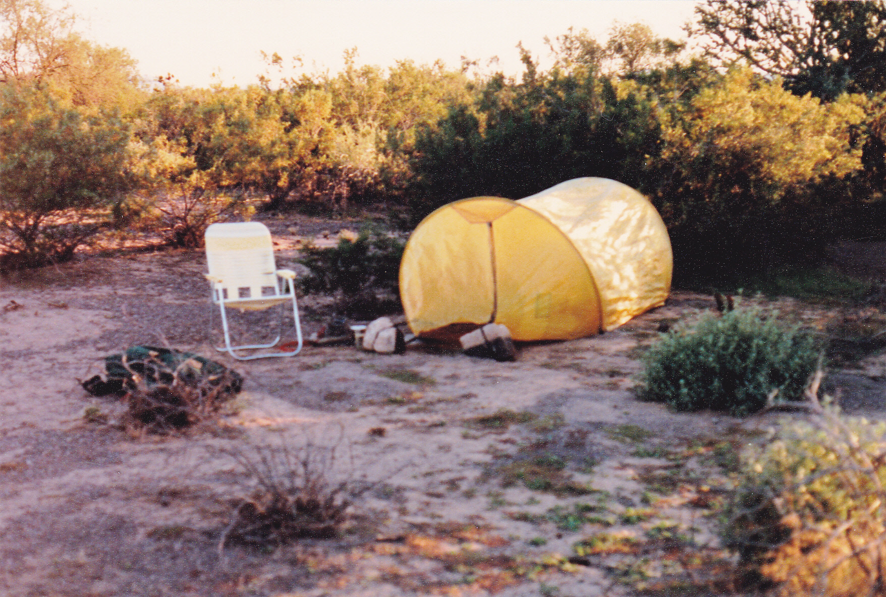
My campsite near Border Monument 162
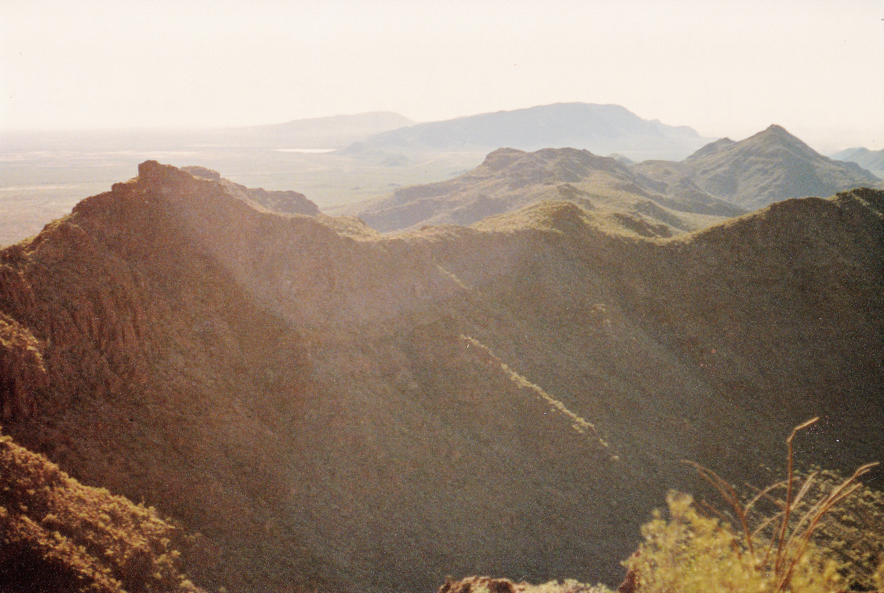
The rest of the afternoon was spent reading, dozing and eating. At one point, a lone coyote came by and started talking to me. He didn’t want me to get a good look at him, so for over an hour he played a game of “now you see me, now you don’t” behind some bushes. He may have never seen a human before, and likely not a tent, so he was very curious. This was the life of Riley, just hanging out and relaxing – sitting in my chair and facing northeast with a front-row view of my mountain.
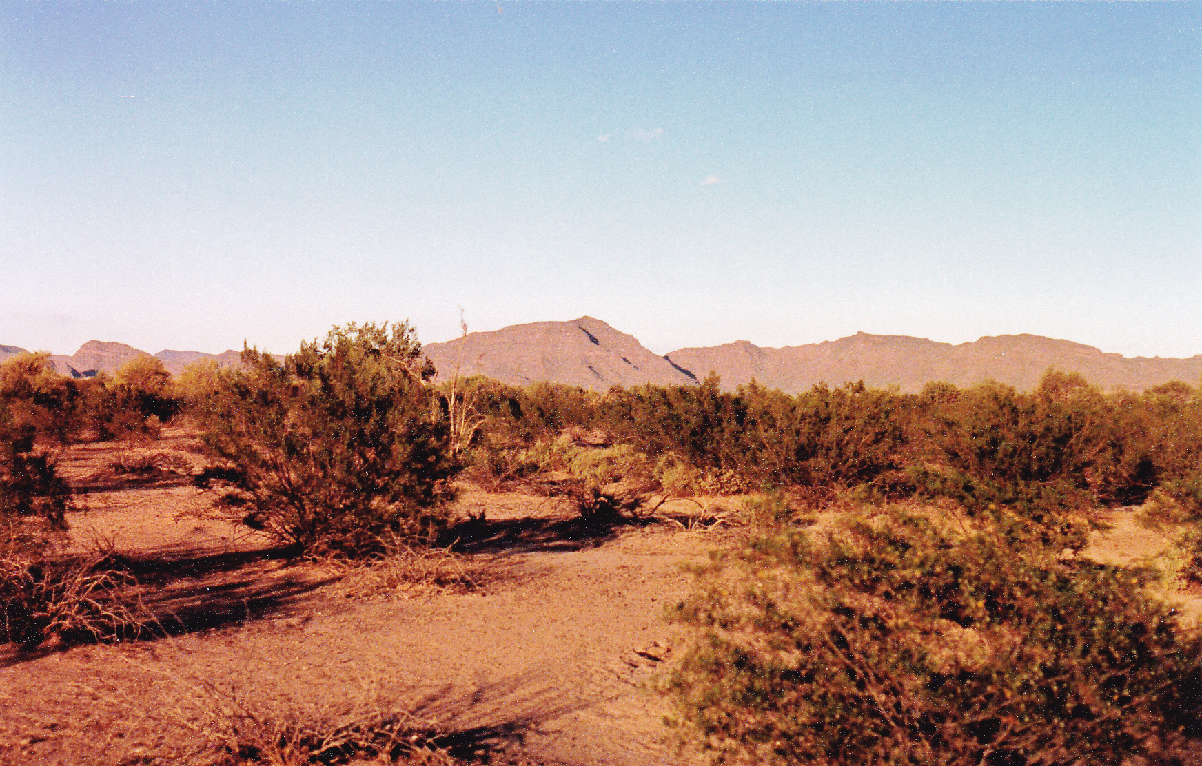
Looking from camp northeast to Peak 2921
Darkness came early, so after eating some supper, I crawled into my bag and spent a long, restful night. The next morning, I was up and ready to move by first light. As always, it was a picture-perfect winter’s day in the desert, clear and cool. To reach my peak, all I had to do was walk across even ground, ever-so-slightly uphill.
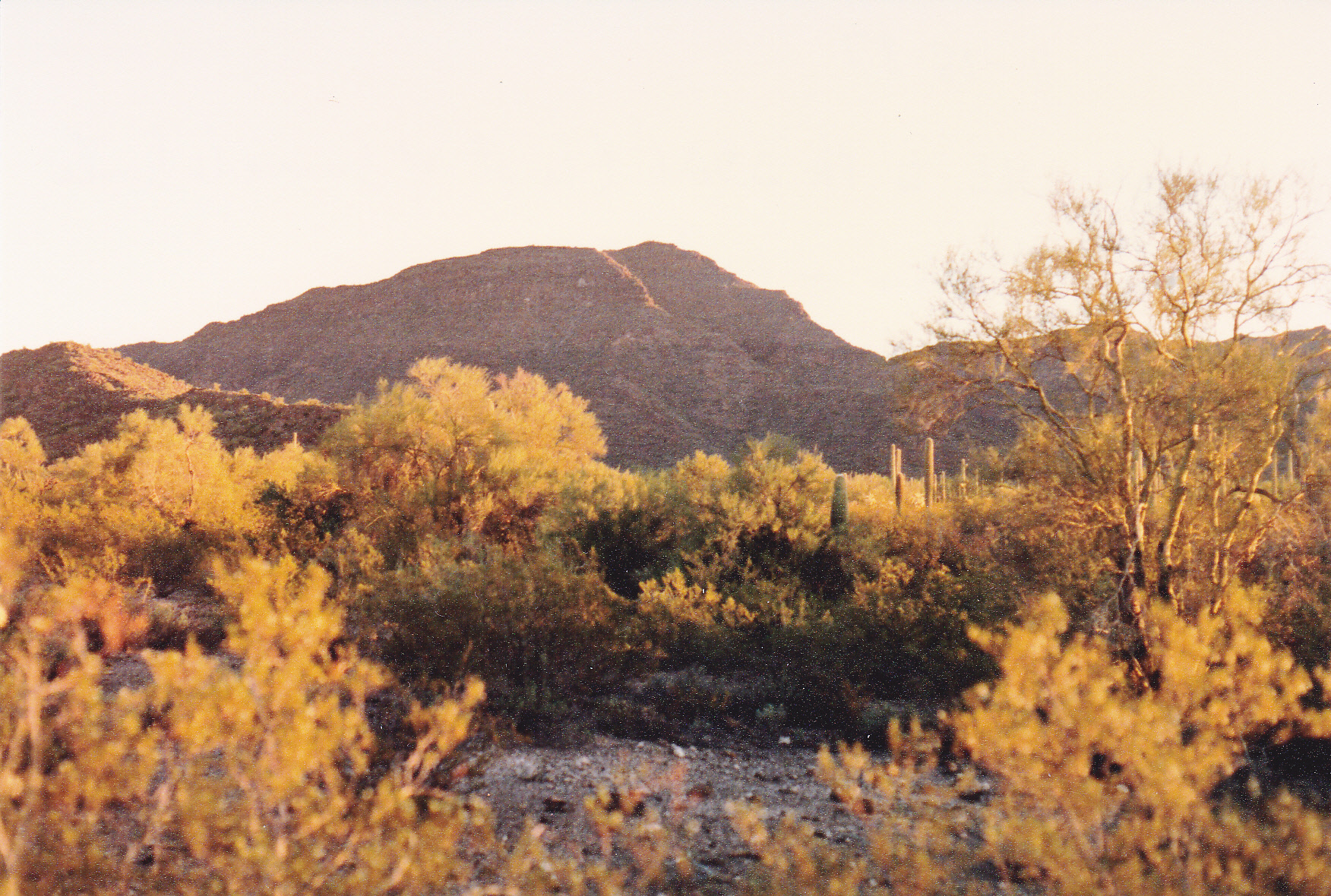
Sunrise, one mile from my goal
It only took two hours and there I was, at the foot of Peak 2921, the high point of the Sierra de Santa Rosa, and, a short while later, on its summit. It appeared untrodden, so I built a cairn and left a register – oops!
For a change, I sat and soaked up the view – what a great spot! To the north stretched the Ajo Range for another 18 miles and 35 peaks.
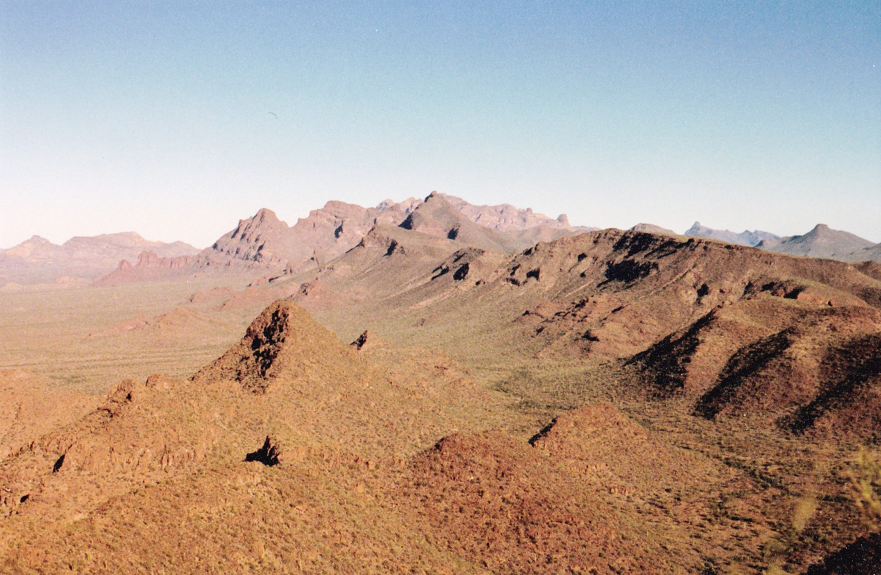
Northwest along the Ajo Range
My own little range, the Sierra de Santa Rosa, ran down to and across the border into Mexico.
Southeast along the Sierra de Santa Rosa
To the southwest and west, I looked across the very flat Sonoyta Valley. Cerro Cubabi was writ large on the horizon in Sonora, a mere 17 miles distant. Meanwhile, there I sat on my peak, twelve hundred feet above the desert floor, feeling a bit like a pioneer and loving it.
All good things must end, as did this, and I made my way back down to the lowlands and started a leisurely walk back out, arriving at la frontera with much time to spare. At daybreak, I had packed up all my gear and hidden it well, so all I had to do was wait for my ride. You could have set your watch by his arrival – 12 noon, spot on. During the drive back out, I told him excitedly about my time in there, and he said he was glad to have helped make it possible. In retrospect, I guess I was in the right place at the right time – that ride in was meant to be. No doubt I had it easier than the dozen others who’ve been to the range high point since my visit. I’m not sure how they approached it, but certainly their climbs involved more effort than mine. When I climbed this peak 27 years ago, Organ Pipe was a more tranquil place than it is now. A lot has changed in the interim. Also, I never thought I’d have any reason to go back to this small, obscure range, but never say never. As Paul Harvey would say, “And now, for the rest of the story.”
Stay tuned for the continuation of this story.
Please visit our Facebook page at: https://www.facebook.com/pages/Desert-Mountaineer/192730747542690