
Please be sure to read the first two parts of this story before you read this continuation.
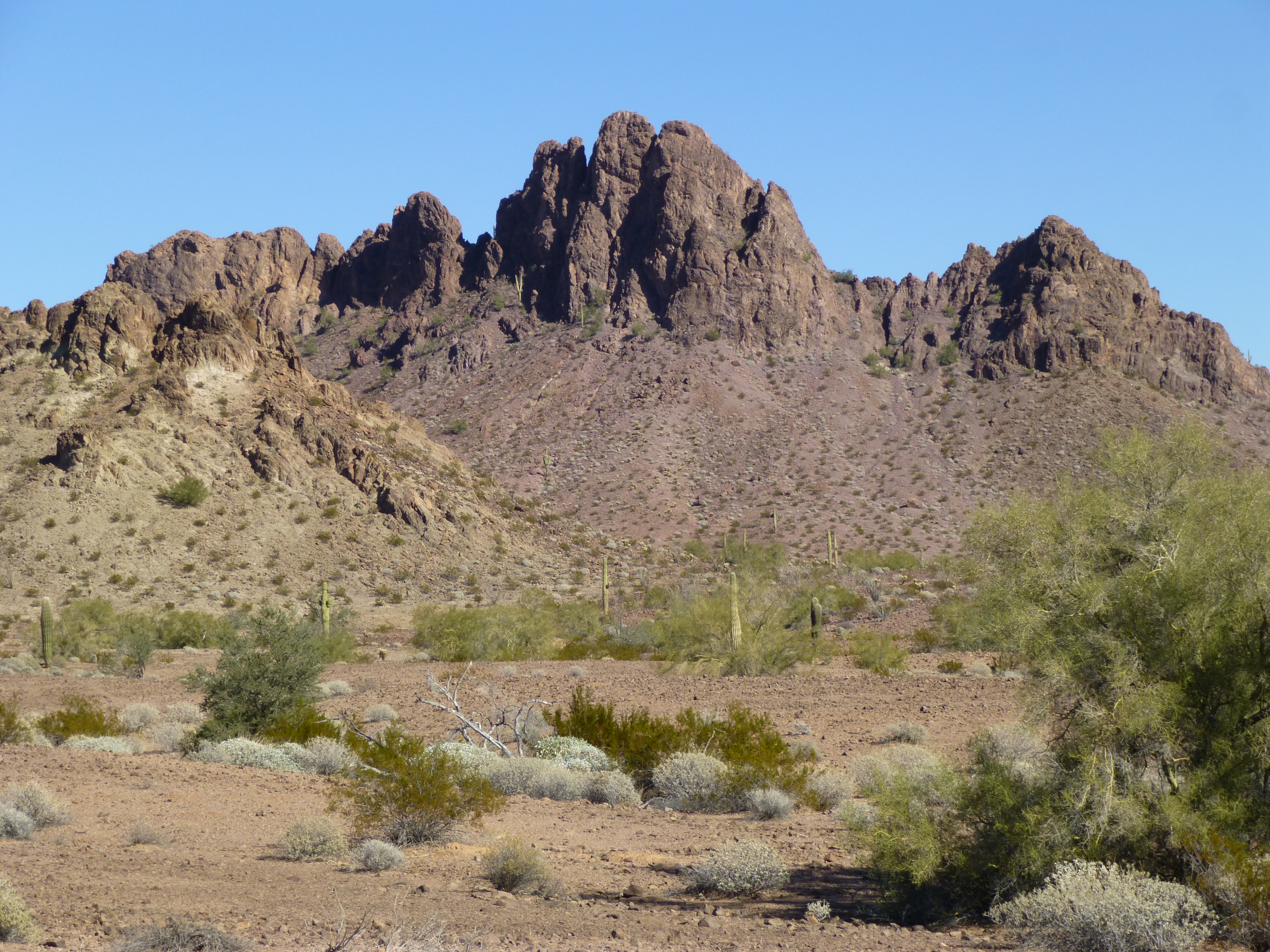
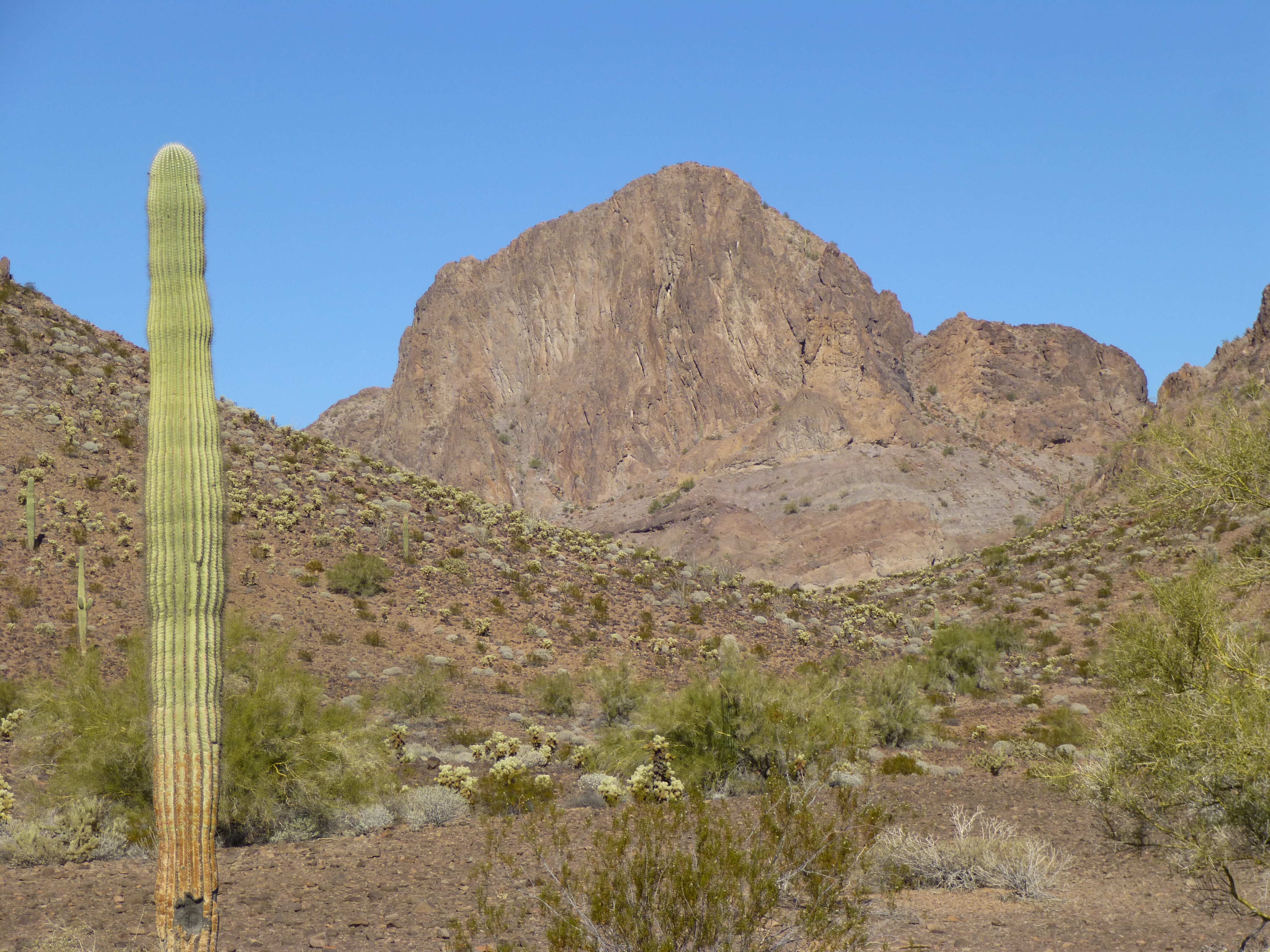
Our day had been a long one, and it felt good to cook a hot meal and settle in for the night. In the interests of saving some time, I decided not to set up my tent for a change – after all, the forecast had promised nothing but clear skies for our entire trip. The sky was full of stars when we crawled into our sleeping bags, but when I got up to pee after midnight, I saw the sky had clouded over completely. Fingers crossed, nothing untoward would happen, right? At around 2:00 AM, the rain falling on my face as I lay sleeping woke me up. We both covered our bags with tarps, but it was too late, they were already wet. It didn’t last long, and we were up by 5:30 once again in the cold, still night. Porridge eaten, camp packed up and hidden, we waited until first light to set out. Our later start today was based on the fact that our 3 mountains were all close in to camp. Dawn showed something interesting – fog on the desert, a rare sight.
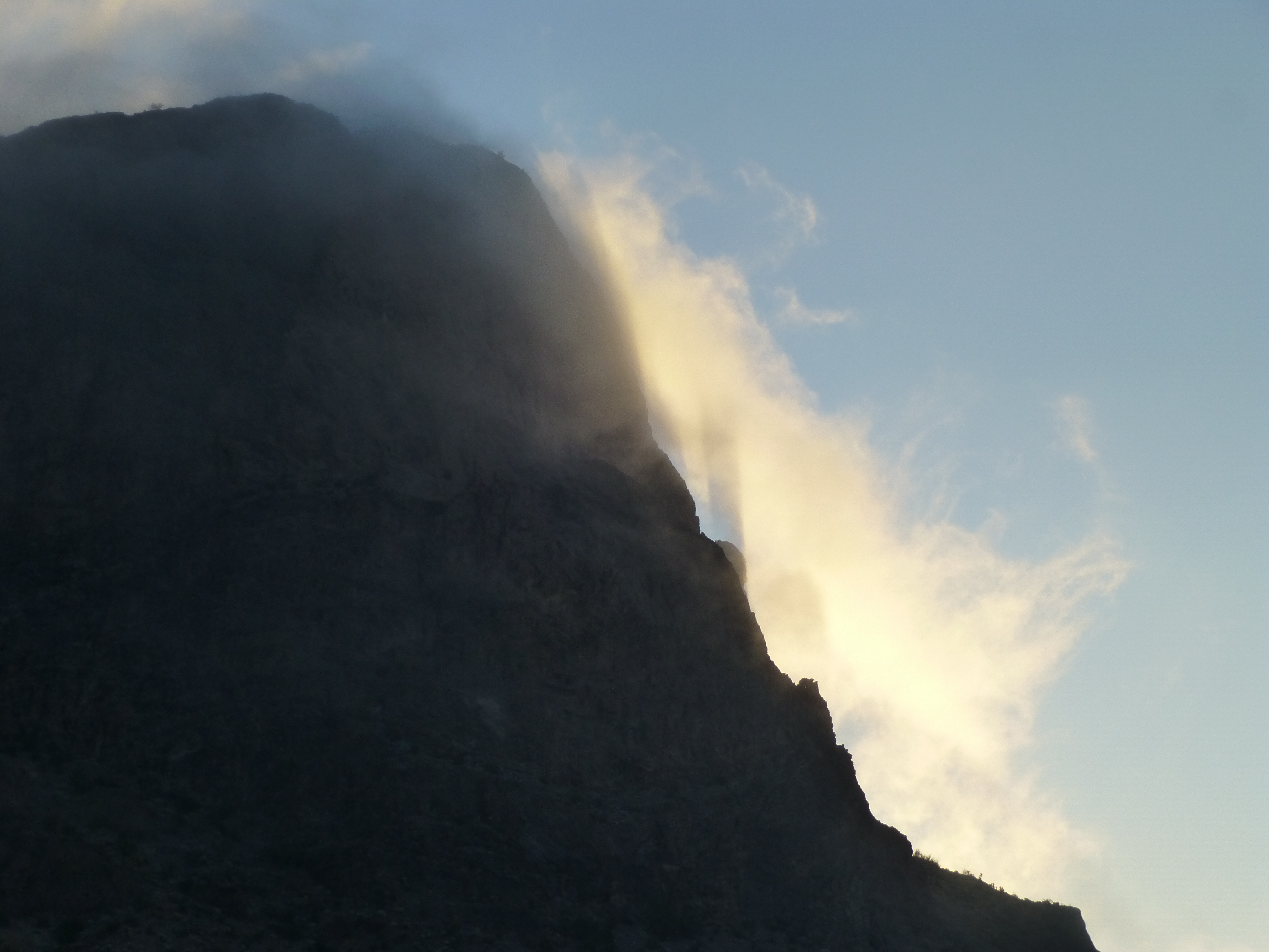
Fog above camp
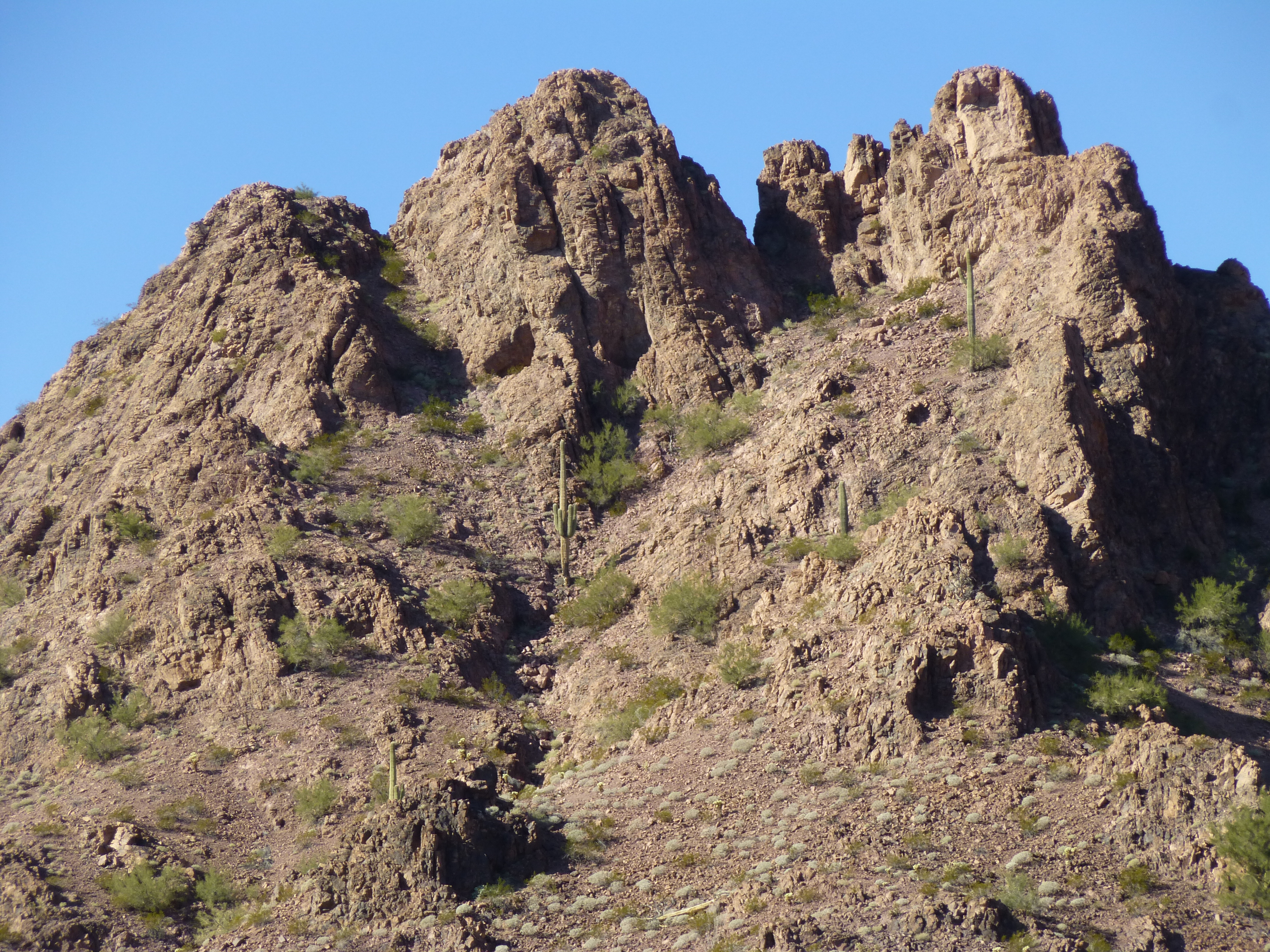
Remember how, last evening as we walked the final miles back to camp, we became concerned that two of today’s peaks would prove troublesome? Well, the first of them was well under a mile from camp, so we knew we’d start finding out what’s what in a big hurry. After heading south across the grain for a while, we then swung east over a low saddle. This put us directly to the north of our peak, and no obvious (sane) route revealed itself. Mark suggested heading farther, more to the northeast side, and once we did, it looked like we might have a chance. The uppermost part was still a question mark.
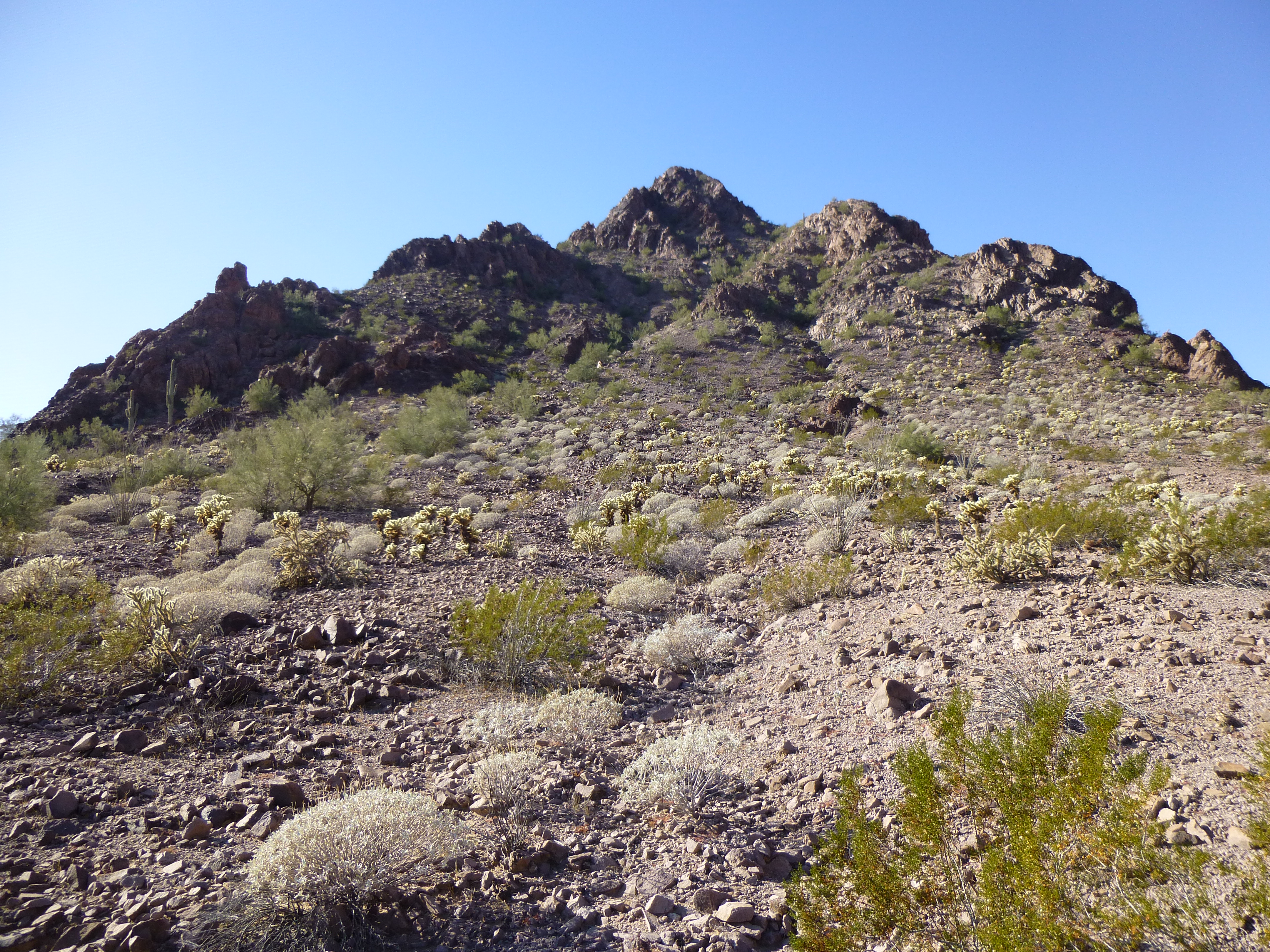
The northeast side of Peak 1422
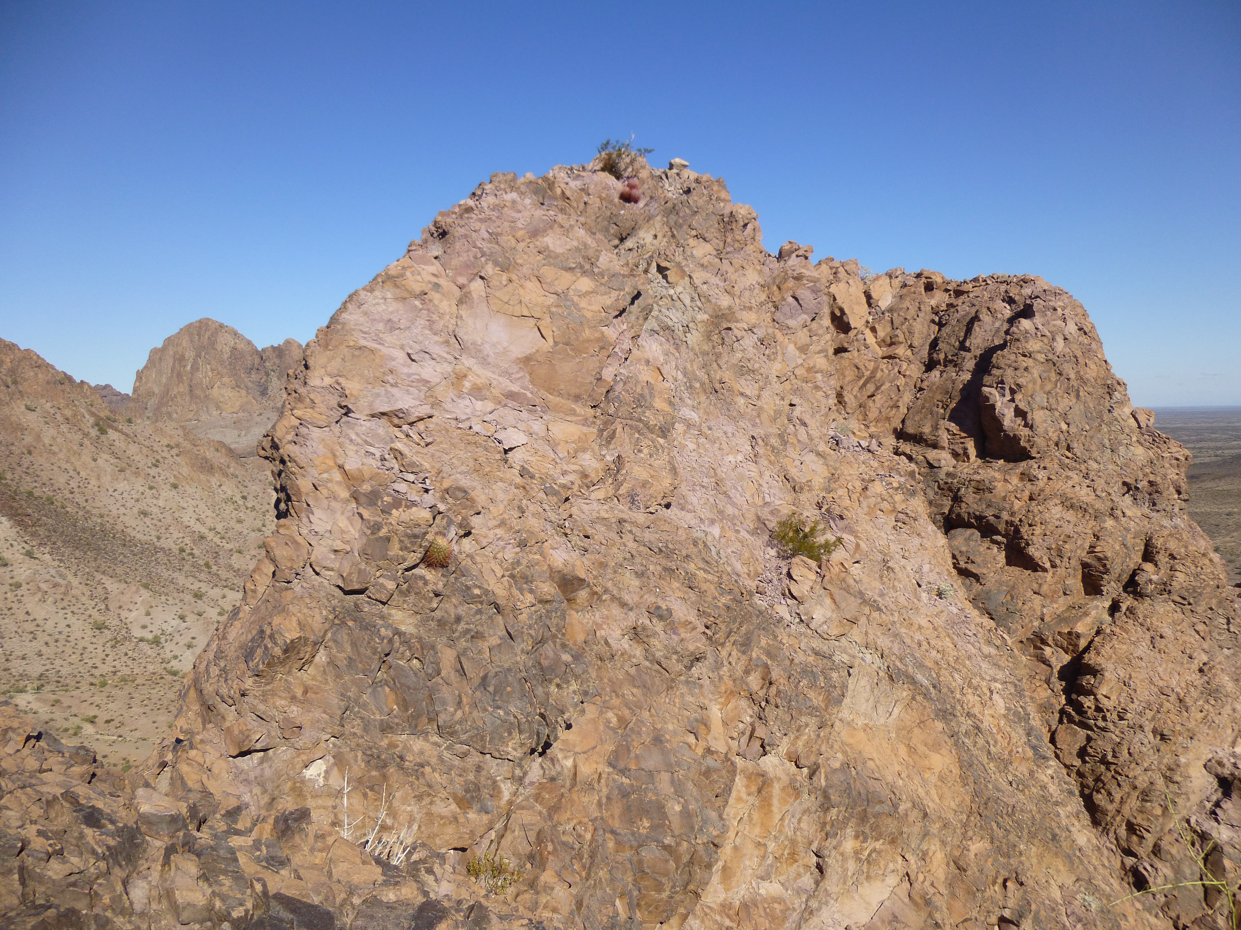
It didn’t look too bad as far as we could see, so up we went. A steep, loose gully provided a route which took us all the way up to the north ridge, and bit by bit, we continued to climb. Finally, less than a hundred feet from the top, we were forced to abandon the ridge itself, as it became impossible. It looked like there might be a way, below the crest, but in a perfect world, it wouldn’t have been our first choice. The crux came soon enough – a spot where the bit of a ledge we were on almost vanished. A small bush was in the way, with a hellacious screamer of a drop-off below it. In this next photo, you can see the bush with the green leaves on the left side, but sadly, the photo doesn’t show the heart-pounding situation we found ourselves in.
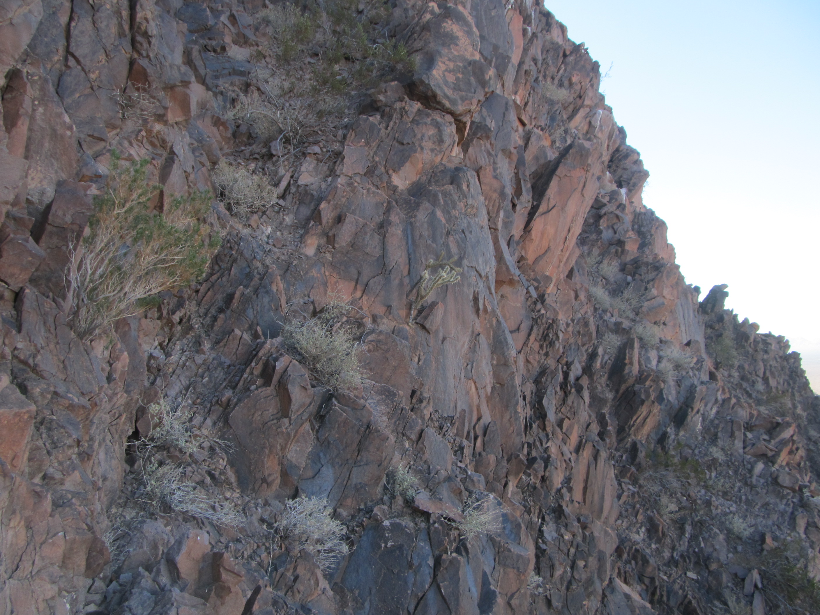
Our crux on Peak 1422
I squeezed past, plenty scared with no protection, and was never so glad to move on to safer ground. Mark, a few steps behind me, tried to pass the same point – he was wearing a larger day pack, and it proved a problem. It made the moves too dangerous, so he decided to set it down in a safe spot and move up to me without it. Hmmm, a Class 4 bush. That done, we breathed a sigh of relief and moved together the rest of the way to the top. Peak 1422 – you had let your defenses down just long enough for us to gain your summit.
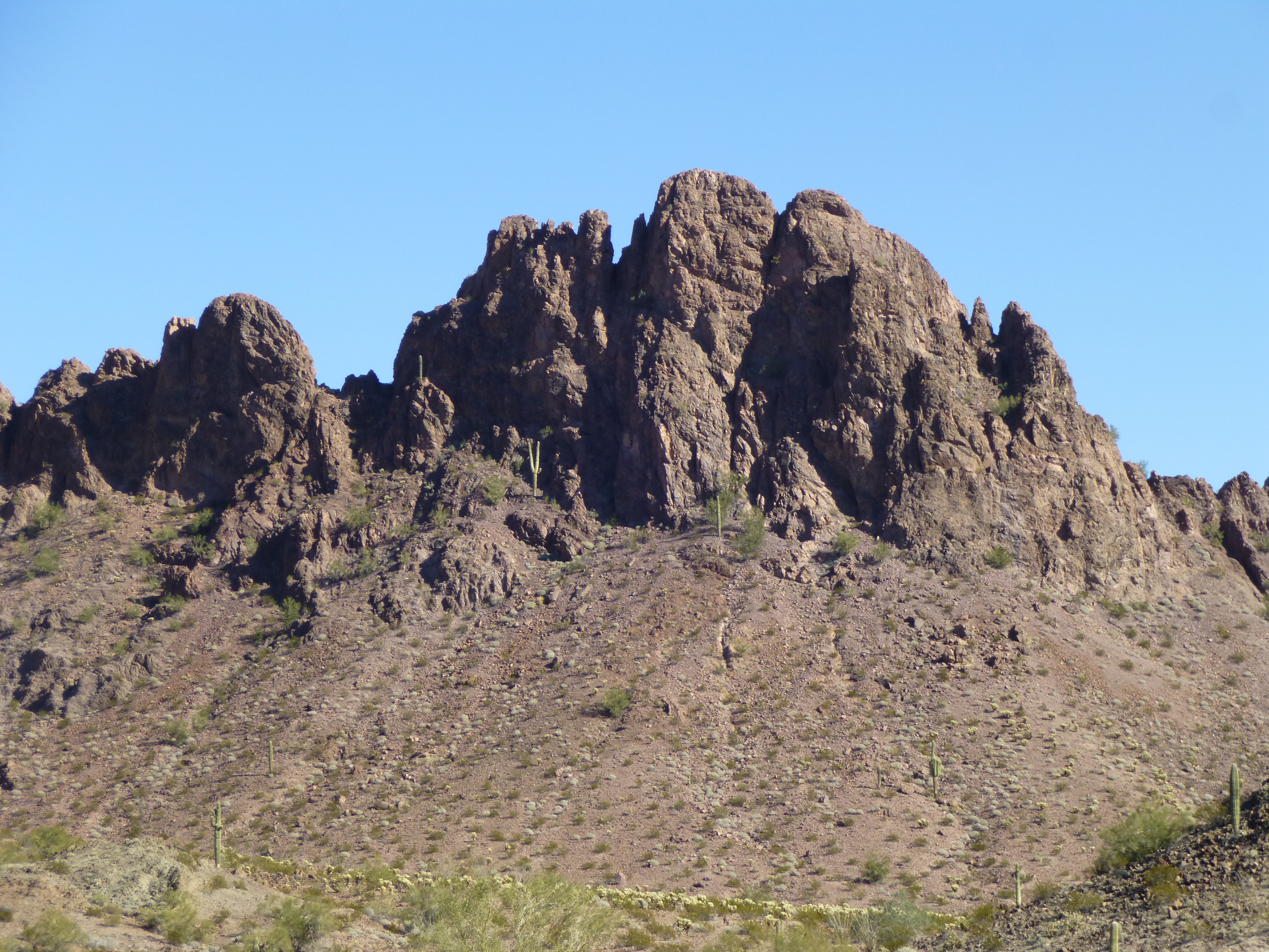
Jeez, we had done it. After we calmed down a bit, we got on with the usual tasks – photos, snack, register. I told Mark that I definitely did not want to go back down the same way – it seemed too dangerous. He said he’d go if I would, but I refused. We looked around and found a different way off the summit that looked doable – also steep, not altogether certain, but at least it was a start. It was nothing worse than Class 3. We had to drop about 200 vertical feet to get to a spot where we could cross over into our original ascent gully. I waited there while Mark climbed all the way back up to retrieve his pack; he was back down within 20 minutes. We then descended steep ground the last several hundred feet to the desert floor – it was hard to believe, but we had done it, in spite of our worst fears. Our dream of climbing all of the peaks was still alive. Here’s a look back up to the top of 1422 as seen from the southeast.
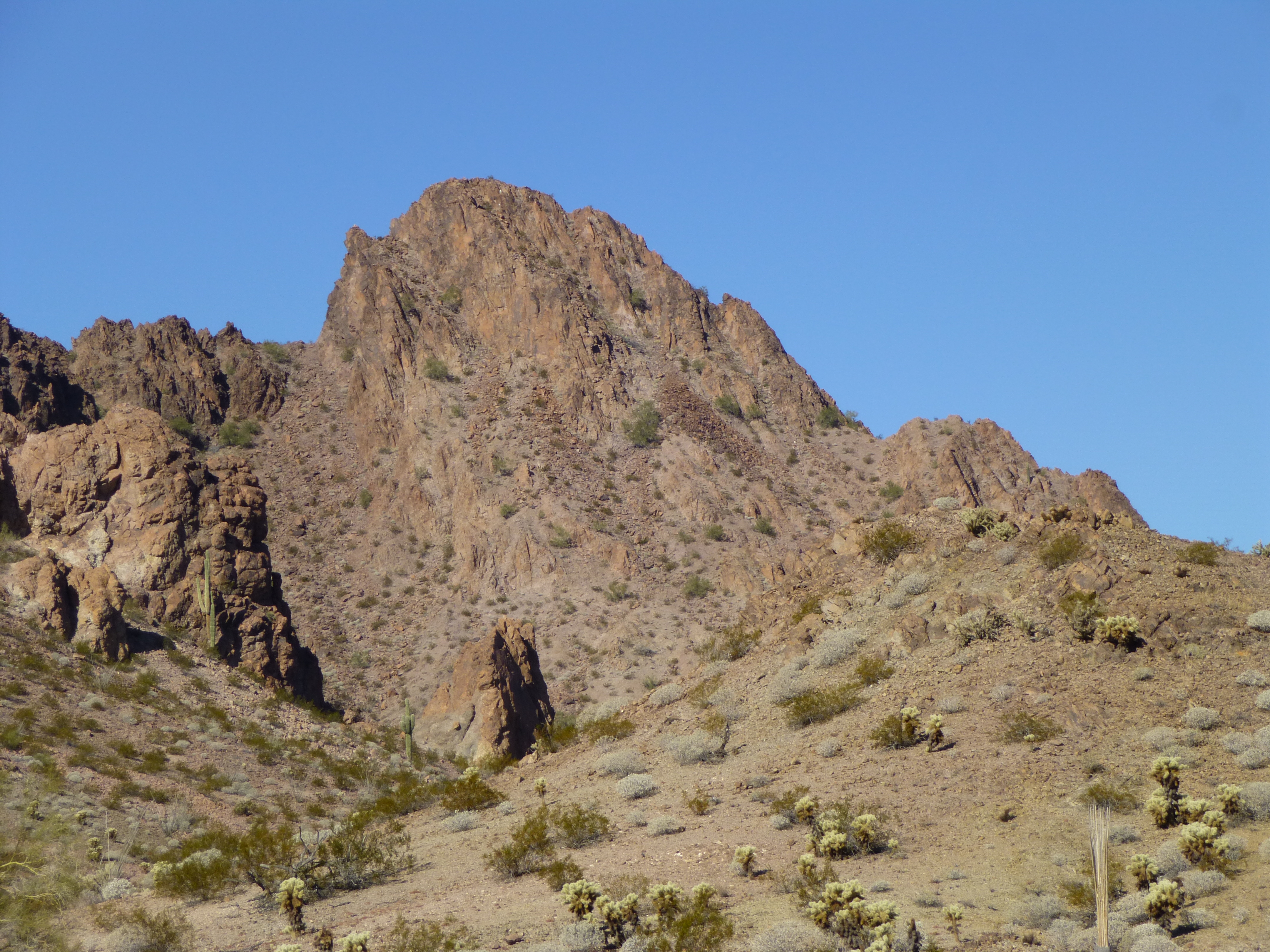
The southeast side of Peak 1422
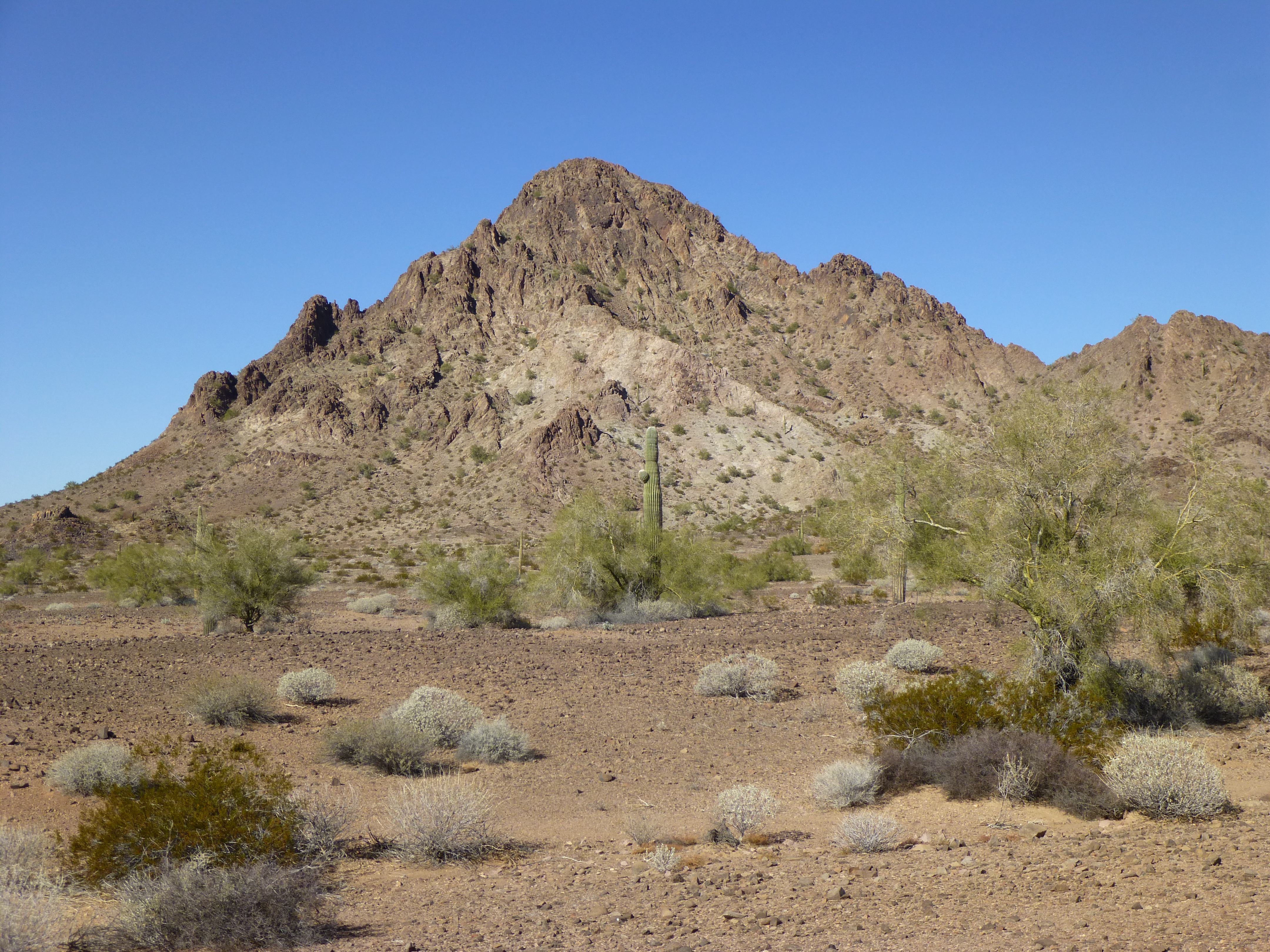
Remember how I said today’s three peaks were close together? It was a short walk to the base of the next one, Peak 1250. Our best view of it up until now had been the previous evening, coming back to camp on the long day of four peaks. Here’s the view we had had, and you can see why we’d become concerned.
Peak 1250 from the west
So now here we were, on the opposite (east) side of the peak. As we stood at the bottom, both of us felt there might be a chance, but we’d have to get up close to the top to see if it would go. From down below, we couldn’t tell for sure which was the highest point – it had to be one of two possible candidates. One of them appeared to be totally out of our league; the other was ………?
Looking up to the top of Peak 1250
Mark and I had clearly seen more than once already on this trip that it was dangerous to assume anything until we had our noses right up to the rock. It was short work to climb up an obvious gully towards a notch that we hoped would lead us to the top. Perhaps 50 feet below the notch, on the right-hand side, a steep, narrow gully only 2-3 feet wide led up to a spot that had to be very close to the top. I thought it could work, at least as far as we could see. However, we were so close to the notch by then that we continued up to it to see if we had any other options. What we saw was this wall in front of us, which had to be climbed in order to continue towards the top.
The wall defending the summit
There couldn’t have been more than 30 or so feet left to climb, but the screamer exposure off to the left had me scared, quite frankly. It’s one thing to be roped up and protected with gear, but a totally different matter if free solo climbing where a fall meant certain death. Actually, it’s not the fall that kills you, it’s the landing – but I digress. I suggested to Mark that we go back down to the steep gully and look at it as another option. He agreed and we did, but he quickly put the kibosh on that as a route – he said it looked even more difficult. So back up we went to the notch. Mark agreed to give the wall a try, and I agreed to follow if it went okay. He made short work of it – I was inspired by how easily he climbed up the steepest part, then disappeared along the last bit to the top. He had found a series of good holds on pretty decent rock. I shouted up to him to please not say anything about whether or not this was in fact the highest pinnacle, because if it weren’t, I didn’t want to be distracted by disappointment as I did the trickiest bit. Once up, I walked over to his position and could see right away that we were on the true summit of Peak 1250. A huge flood of relief poured over me, a very emotional moment actually, as I realized that the worst of our difficulties had been overcome and that it seemed fairly certain that we would be able to fulfill our dream of climbing all 13 of the Aguilas’ peaks.
Filling out this register felt especially good. Once done, Mark led the way back down to the notch, and I followed carefully, very carefully – the exposure was taking its toll on me. Once safely back down at the notch, we breathed a collective sigh of relief, then made our way back down to the desert floor on the east of the peak. There, we took a well-deserved break, ate some lunch and discussed our good fortune. Wow, two Class 4 peaks in a row.
There was one more peak we wanted to do today to keep on the schedule we had set for ourselves. We swung around to the south side of 1250, then made our way west for a short way and finally north into another valley. We were now west of 1250 and had this good view of it. We had lucked out this time – well, some luck, some skill, I guess. The summit is the middle bump, the one that looks higher. We had climbed up to the notch to the right of it, then up and to the left to reach the summit.
Peak 1250 from the west
I wanted to include one more picture for you here. An impressive face towered above our camp, a mere 1,200 feet away from where we slept each night. It was Point 1658, an outlier of Peak 1750 – it’s huge face rose a sheer 600 feet, and it was always amazing, whether wreathed in fog or aglow in the setting sun.
The west face of Point 1658
We were planning to climb three peaks today, right? All along, we had figured the third one would be a walk-up. As we got closer, it still looked okay, no real problems. Here’s what we saw.
The southeast side of Peak 1356
We made our way towards the notch half-way up the right skyline. Things got steeper, and there was a lot of loose ground to slow us down. Once we reached the notch, we were forced to cross over into a very steep, narrow gully on the other side. Mark led the way up a hundred, two hundred feet of steep scrambling, to finally reach a north ridge on the peak. Then the real fun began. Mark did this beautiful lead up a narrow, sinuous Class 3 ridge, where you had to pay attention every second of the way. The exposure was breath-taking. At times, we were forced off the rib, which became knife-edged in places. Mark pushed the route, though, and up we went, until he shouted back to me that we had made it. That was a relief – there were spots along that rib that had me worried. Here is a video that Mark shot on the summit.
Once we arrived, I immediately started looking down on all sides to see if there were a better (easier) way down. My suggestion to Mark was that perhaps we could try the basin on the north side, but he rightly said that it looked too steep to be do-able, and that we should down-climb the rib we had come up. Wow, all 3 of our peaks today had offered exciting challenges. As we sat on the summit of Peak 1356, we realized we could see every one of the 13 summits in the Aguila Mountains – a very cool vantage point. Here are my favorite views from the summit. In this first one, Peak 1422 (the first one we did today) is on the left, touching the skyline; Peak 1250 (the second one of the day) is the dark, craggy one to the right and lower down. The last one we did on the “Day of 4”, Peak 1214 (yesterday) is behind 1250 out in the distance.
A view east from Peak 1356.
Here’s another favorite view from the summit, looking southeast. This is a telephoto shot. Closer in, on the right, is Peak 1145, with a flurry of hills to its north. Farther out, at eleven o’clock from 1145, is the small, dark Peak 1013; finally, to its eleven o’clock is Red Point. Those were peaks 1, 2 and 3 of our “Day of 4” yesterday.
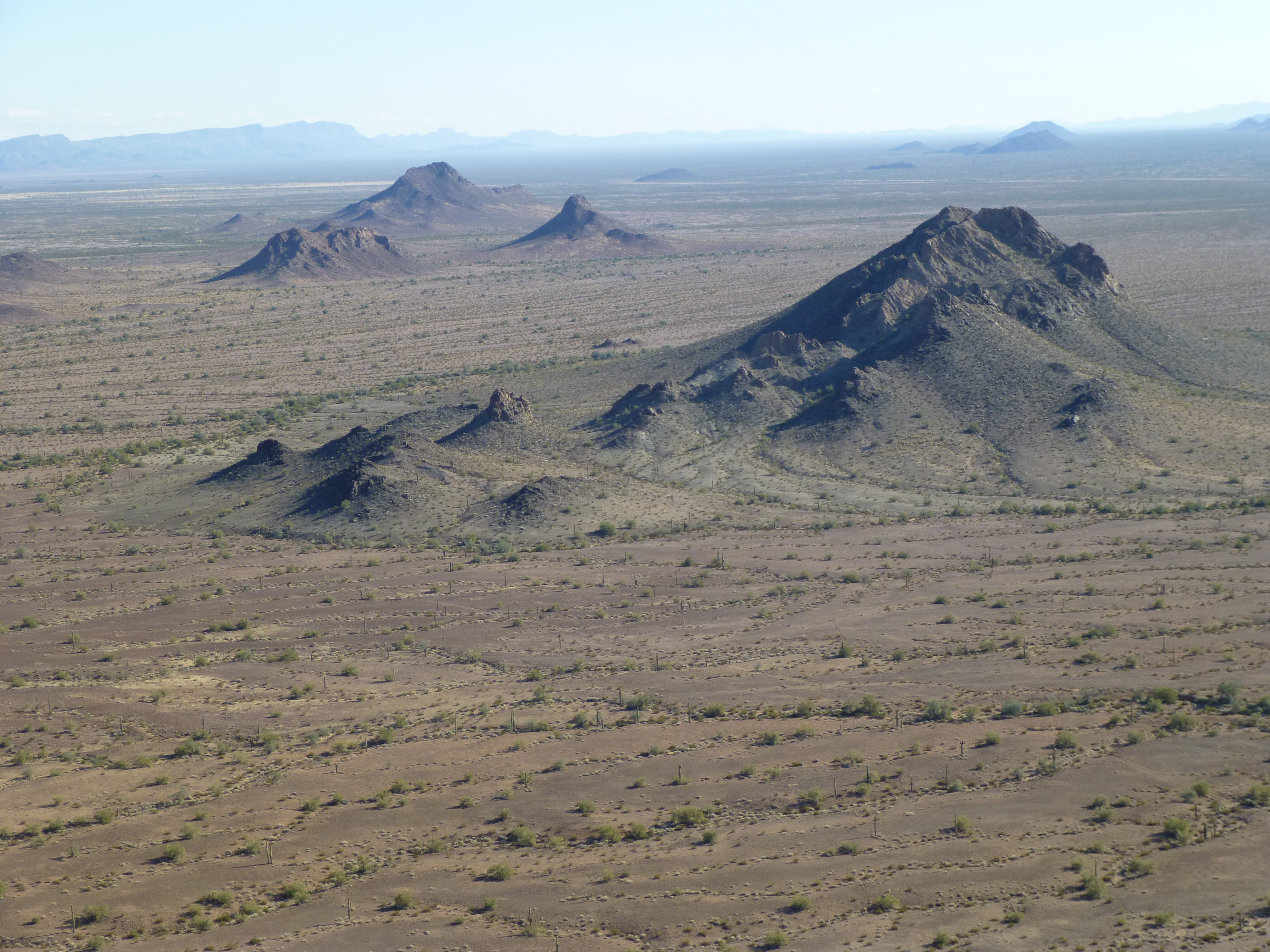
Looking southeast from Peak 1356
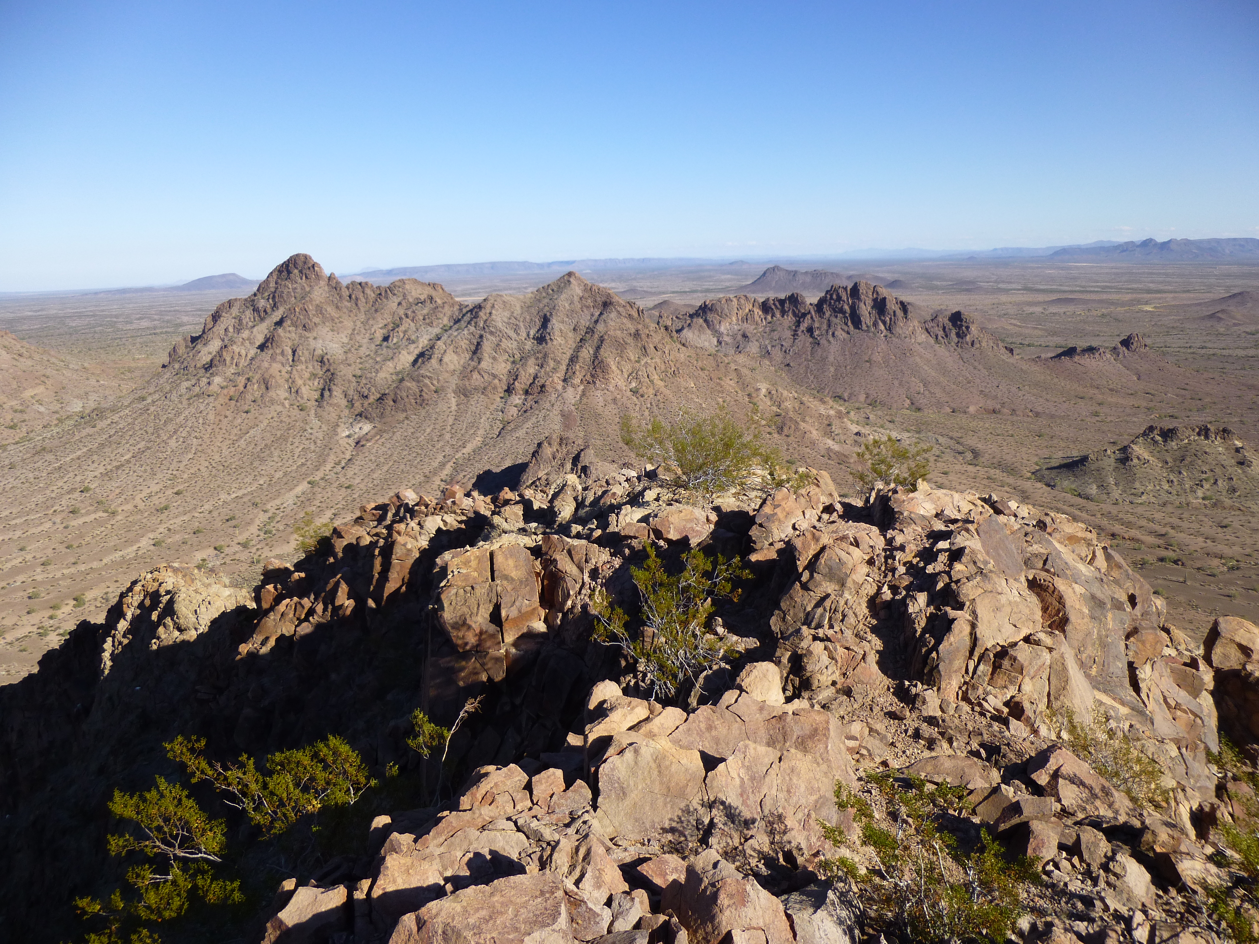
Of course, a cairn was built and a register left. Mark tried his cell phone, but like everywhere else in the range, he had no service. Reluctantly, we packed up and down-climbed the rib, reaching a saddle on the north ridge at around 1,200 feet. From there, it was simple to drop down to the northwest to reach the desert floor, and then an easy walk back to camp by 4:00 PM. The whole day’s climbing had taken only 8 hours, our shortest yet. It was nice to get back in time to dry out our sleeping bags and get camp chores done in the daylight.
I want to give you a better of view of Thompson Tank, the desert water supply we were using. Here’s a better view of the drinker. See all the bees drinking at the water’s edge?
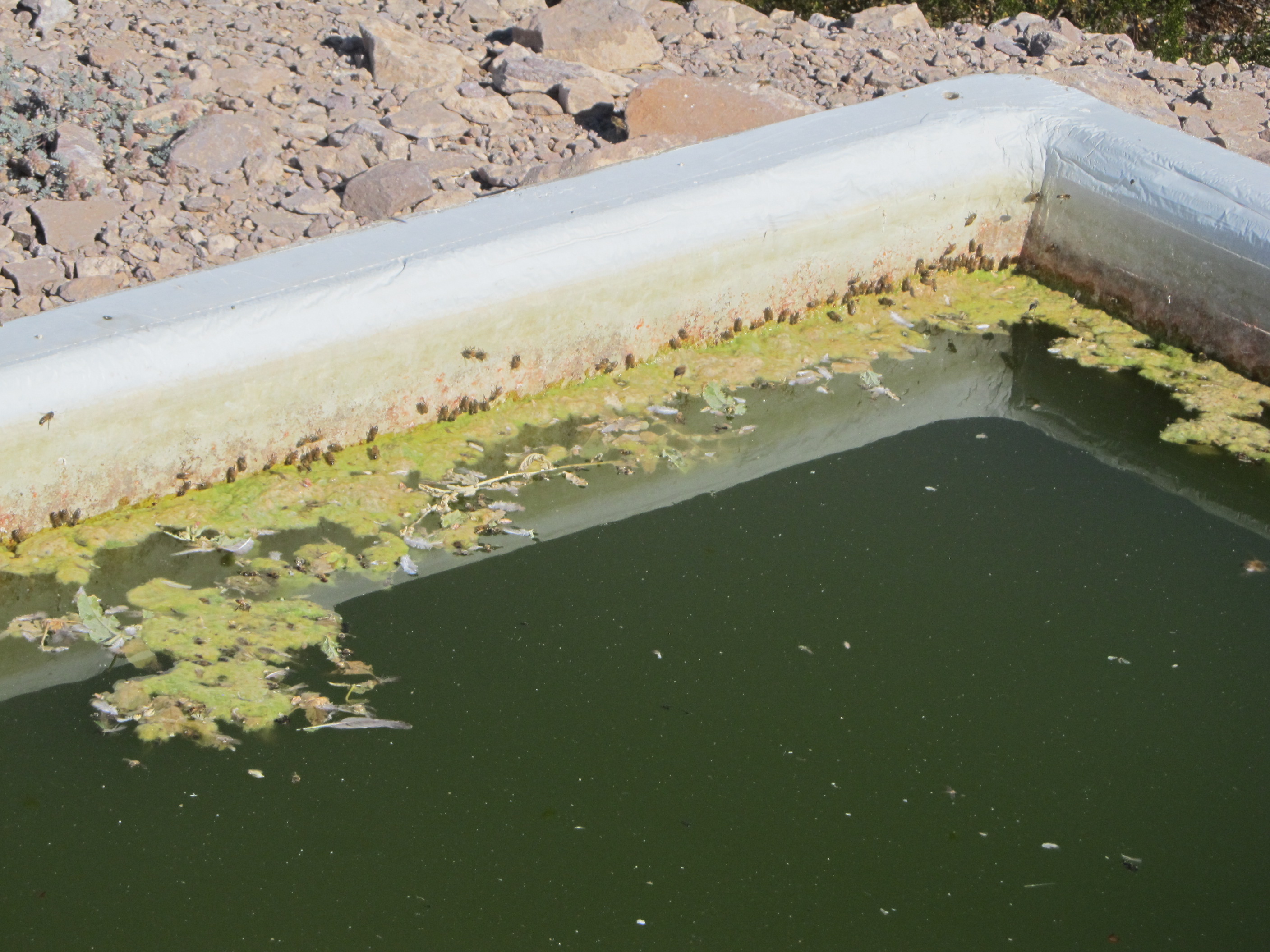
Slime on the water
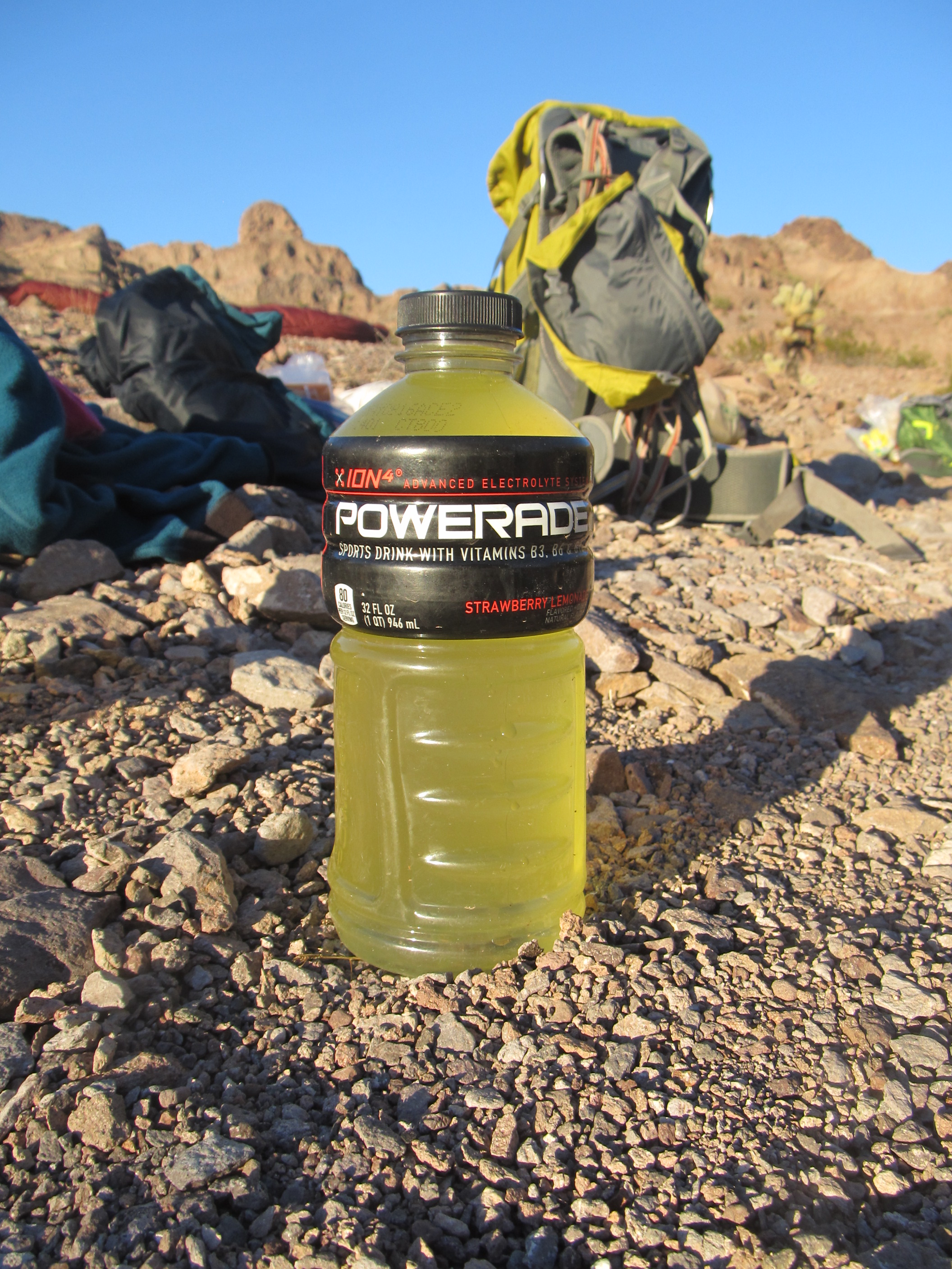
Once we had strained the biggest chunks out of the water, here’s what it looked like. That’s not lemonade in the bottle, folks, that’s the natural color of the water. We’d now been drinking it for 3 days with no ill effects – hopefully there were no nasty things growing in our gut!
Our water
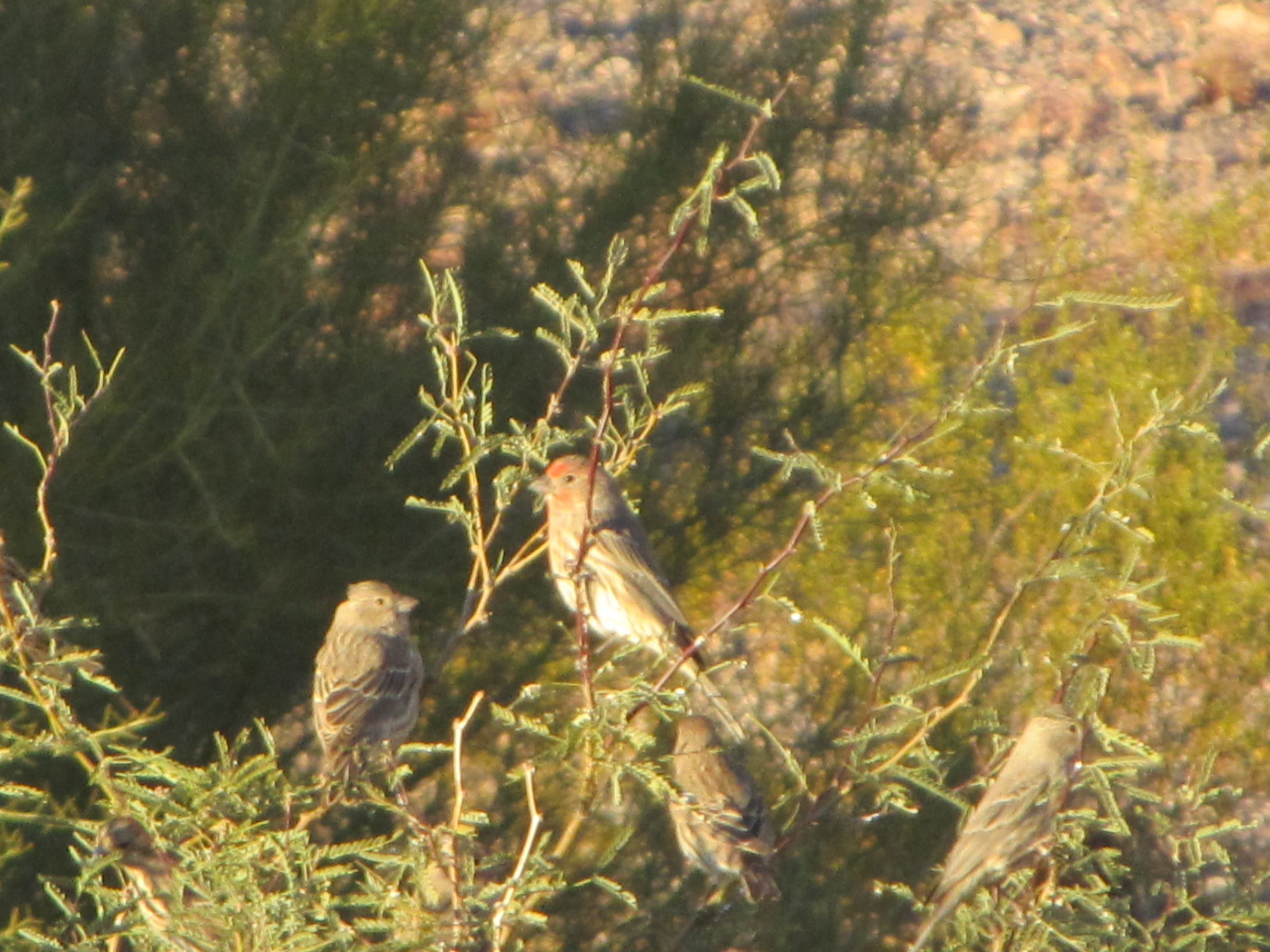
Late in the day, birds would come to drink – they waited patiently for us to finish and give them their turn. Doves walked up to within 2 feet of us, seemingly unafraid – it’s likely we were the only humans they’d ever seen.
Our bird friends waiting for a drink.
Around sunset, bats would also come to drink – they wouldn’t land, but would fly down and just skim the water, barely touching the surface. One morning, we went up to fill our bottles for the day and saw a lot of fresh bighorn sheep poop right beside the drinker – they had visited in the night, and we wished we had seen them. Everywhere we climbed in the range there was sheep sign, but we never saw any of them.
So ended Day 4 of our trip, and it was another chilly night.