
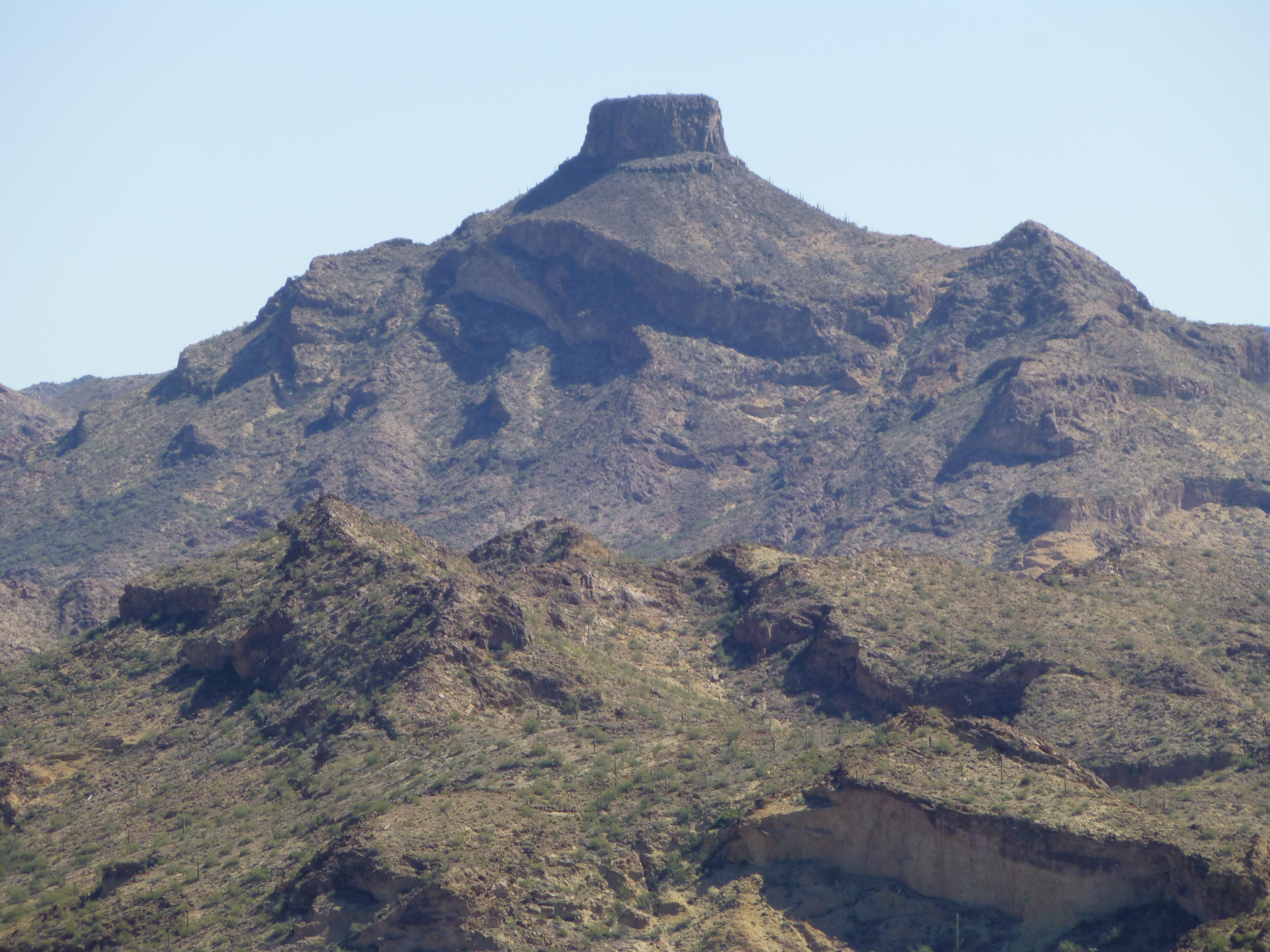
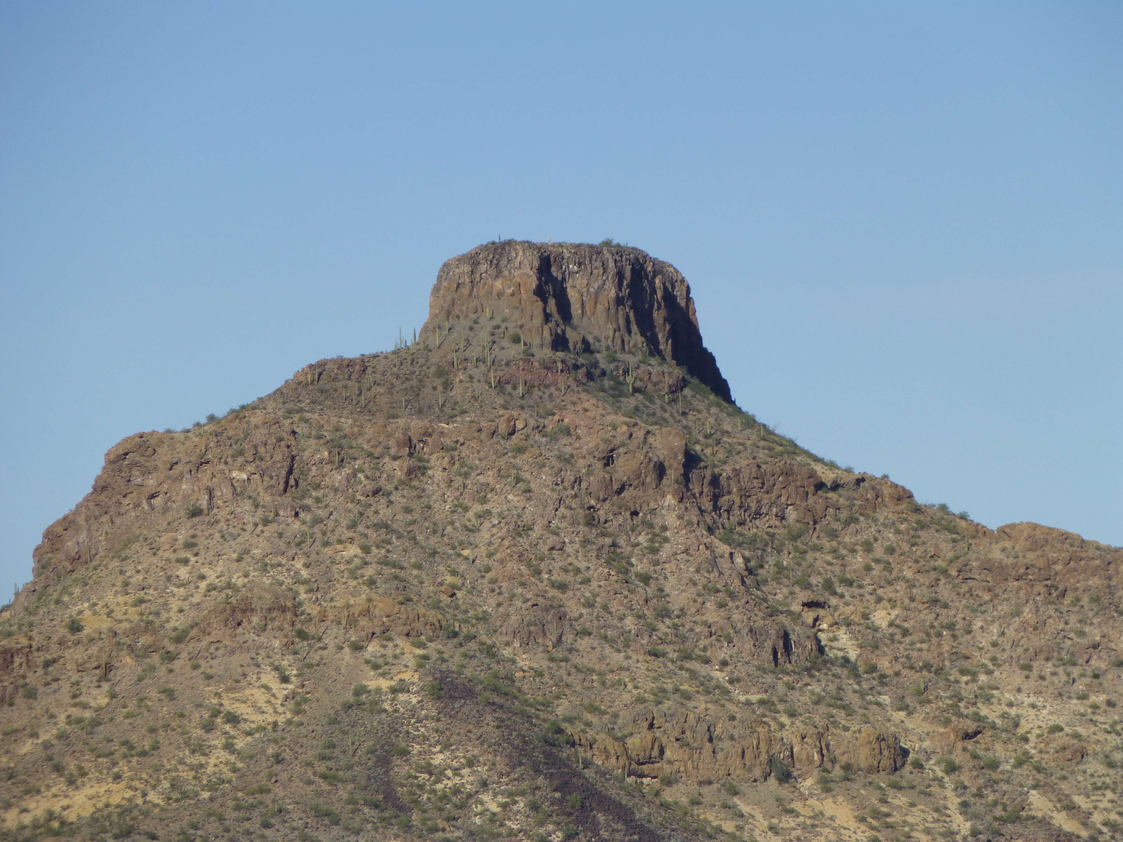
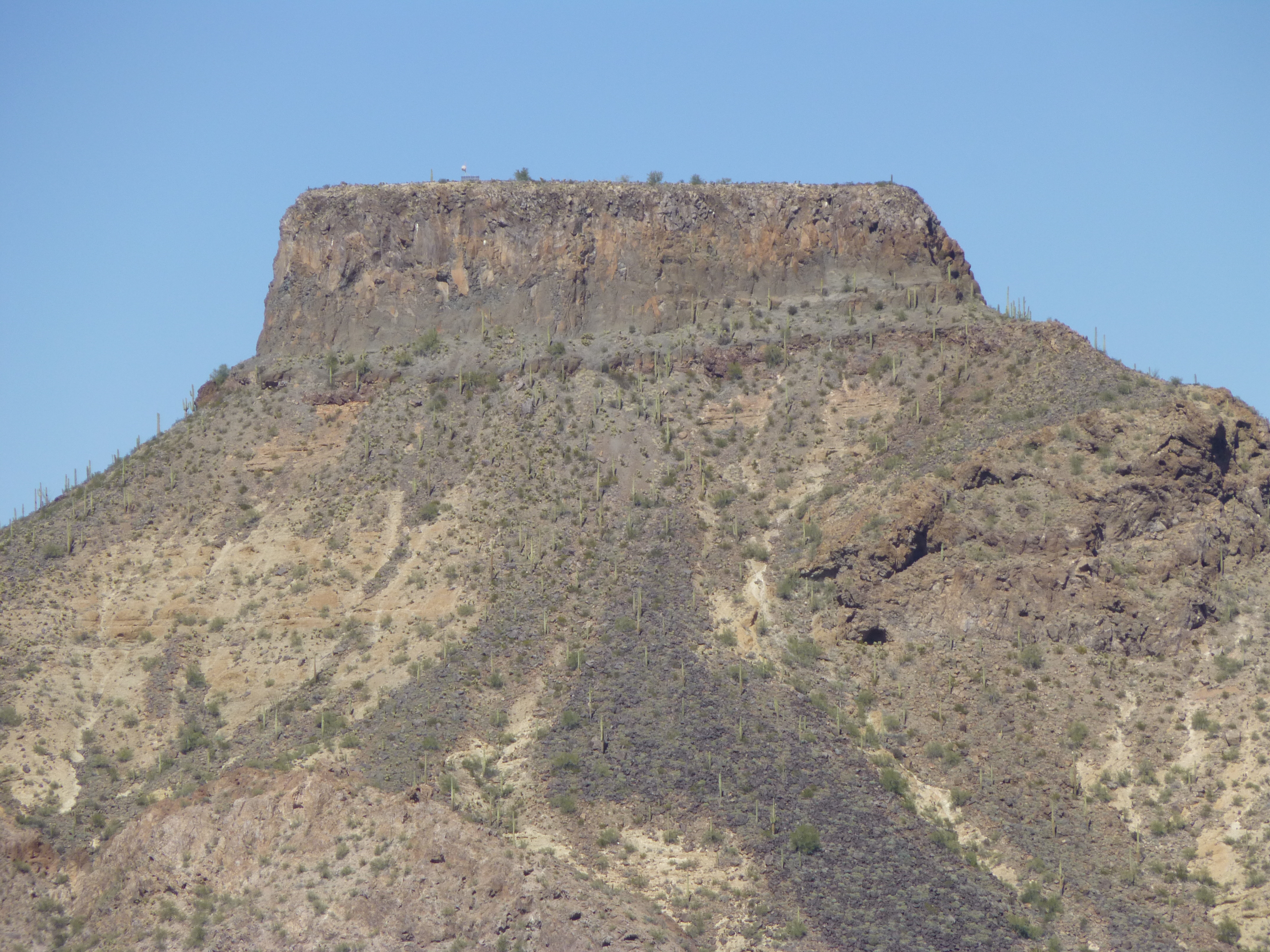
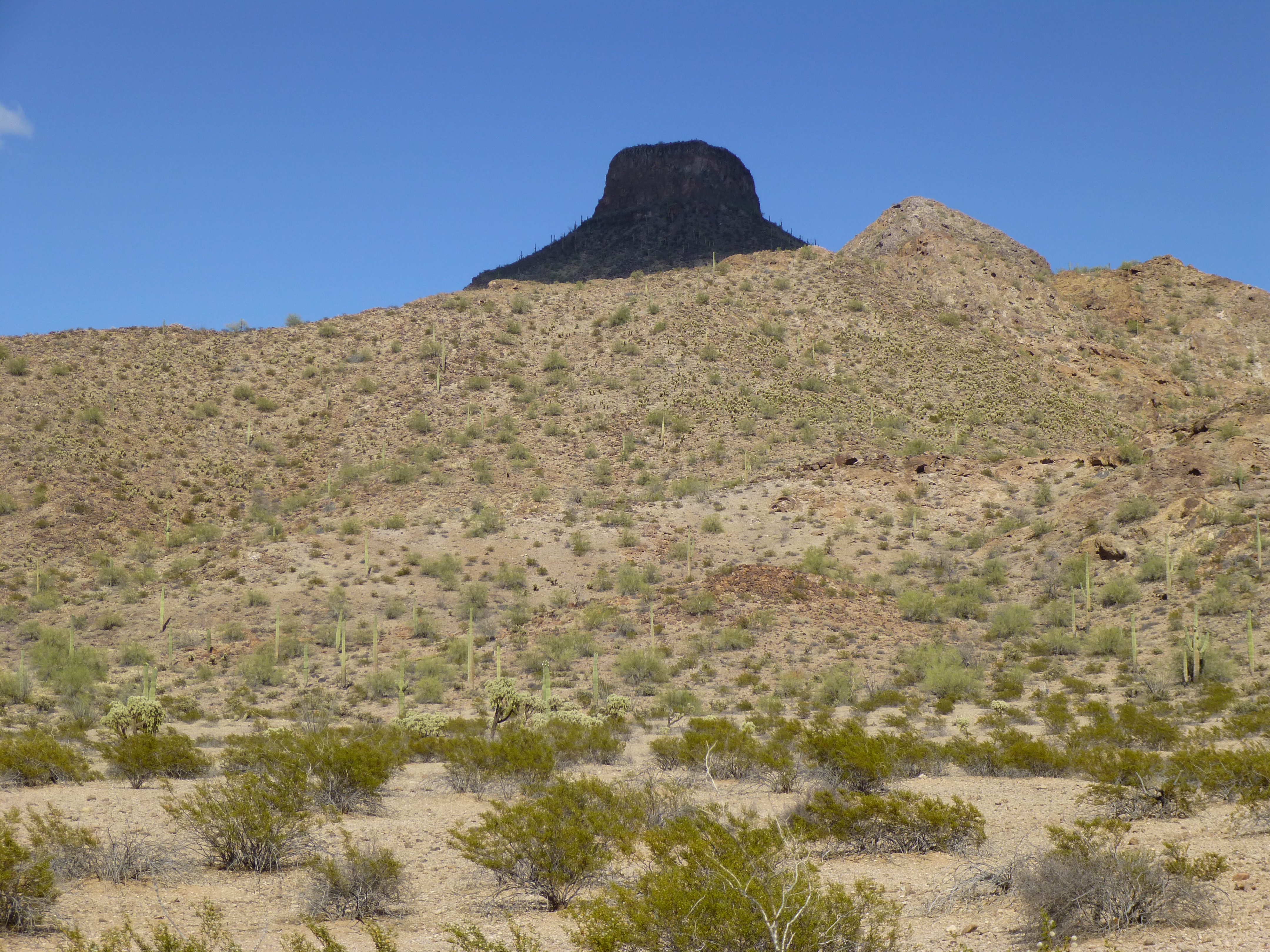
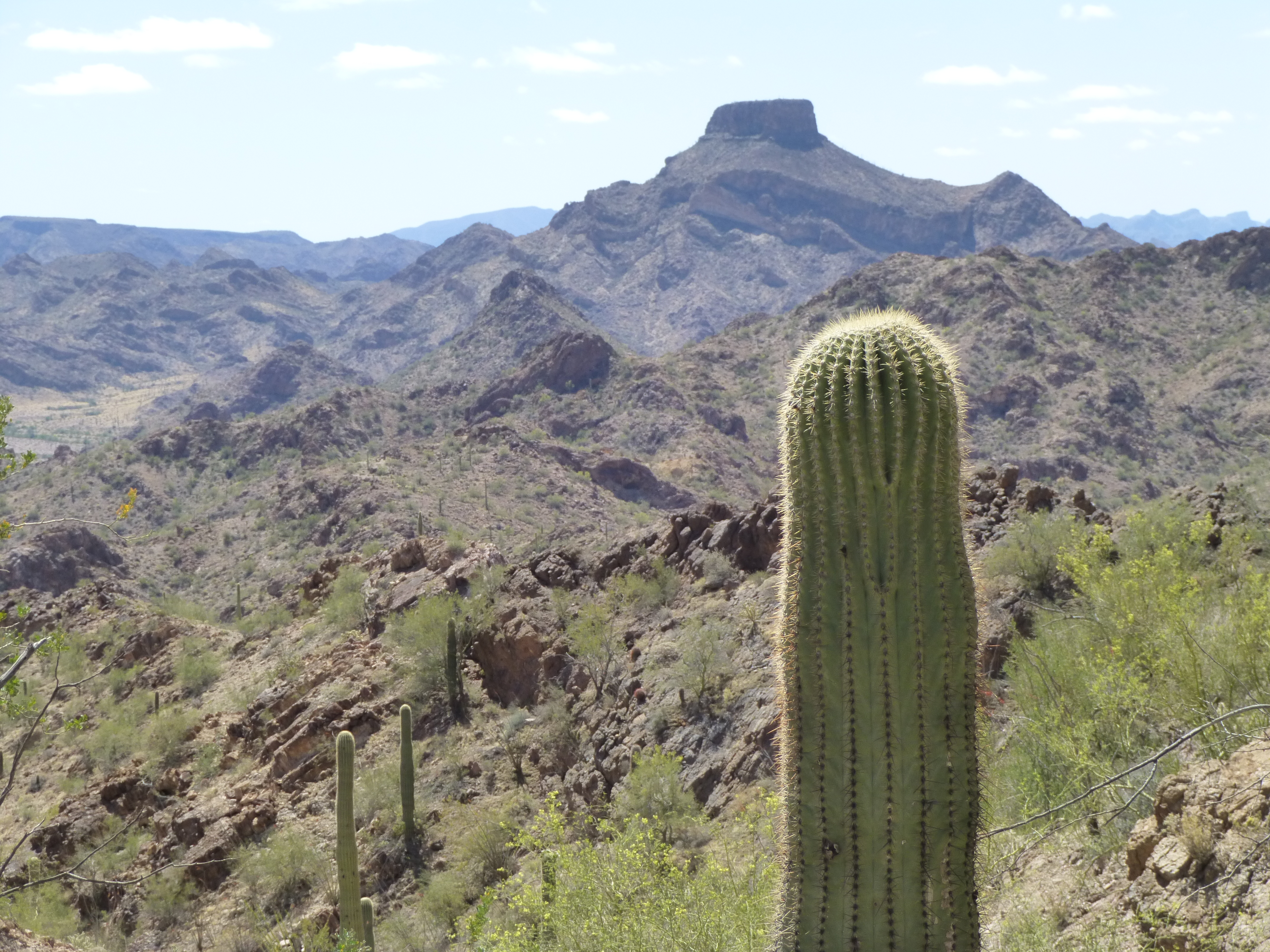
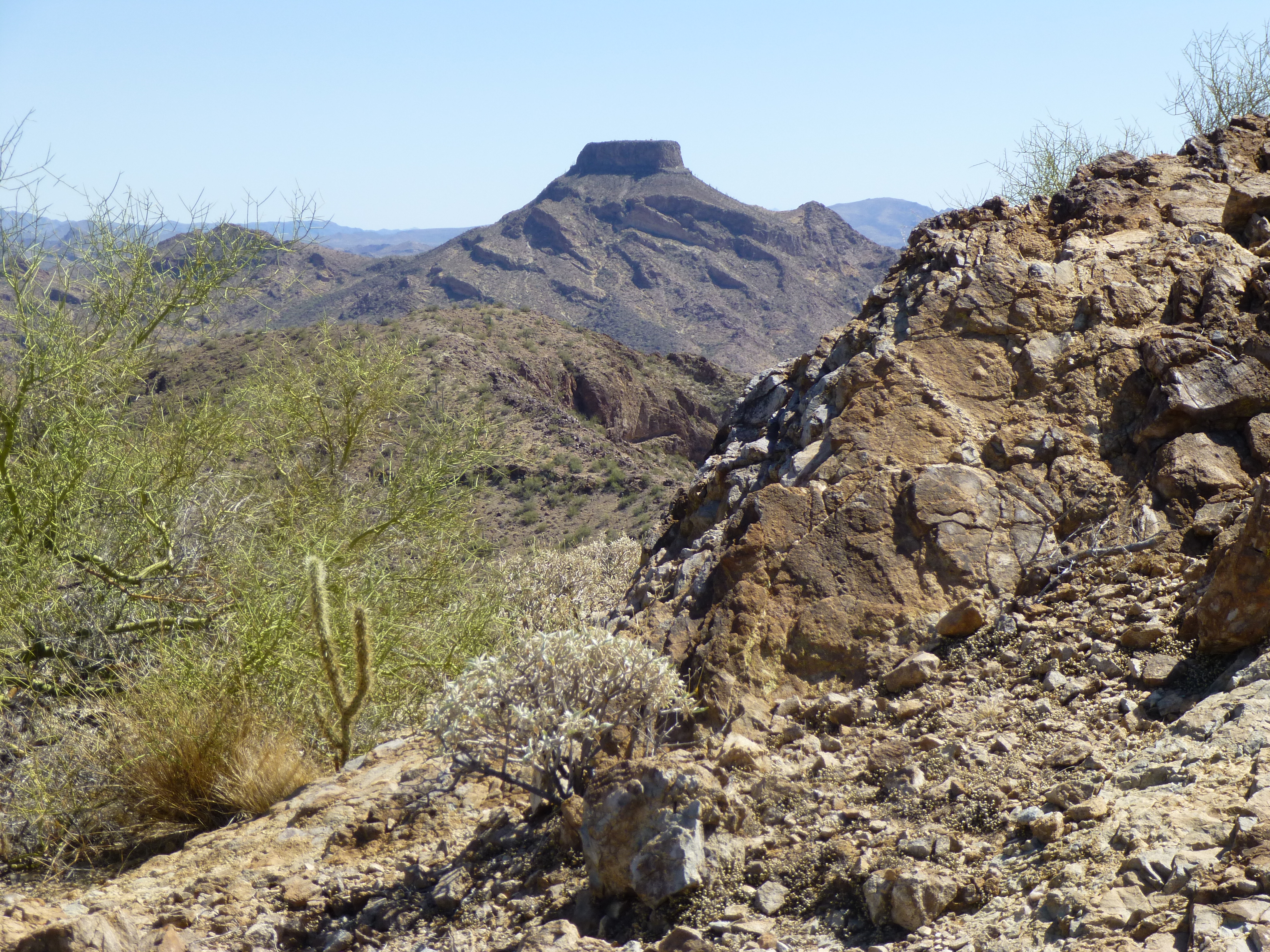
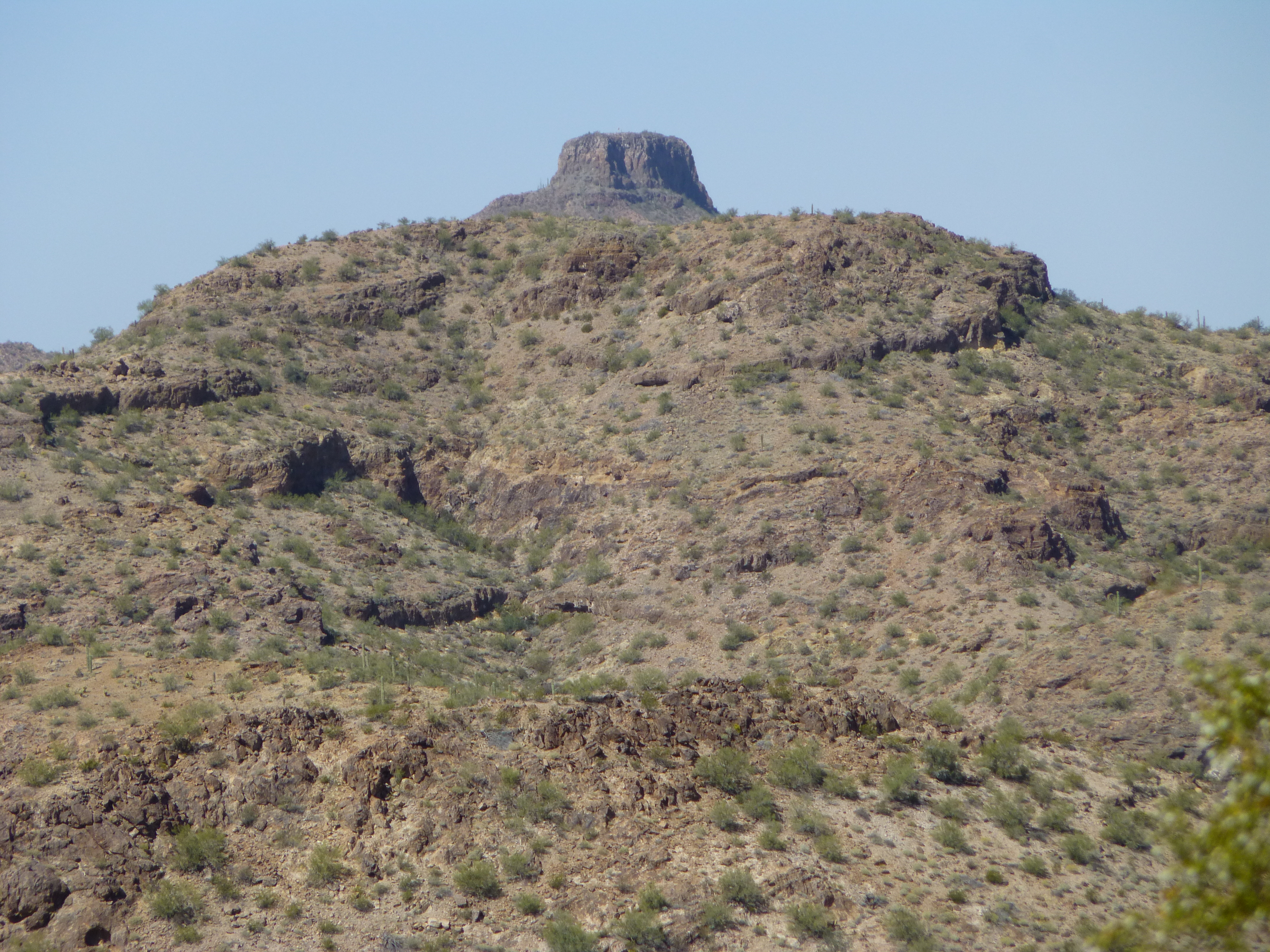
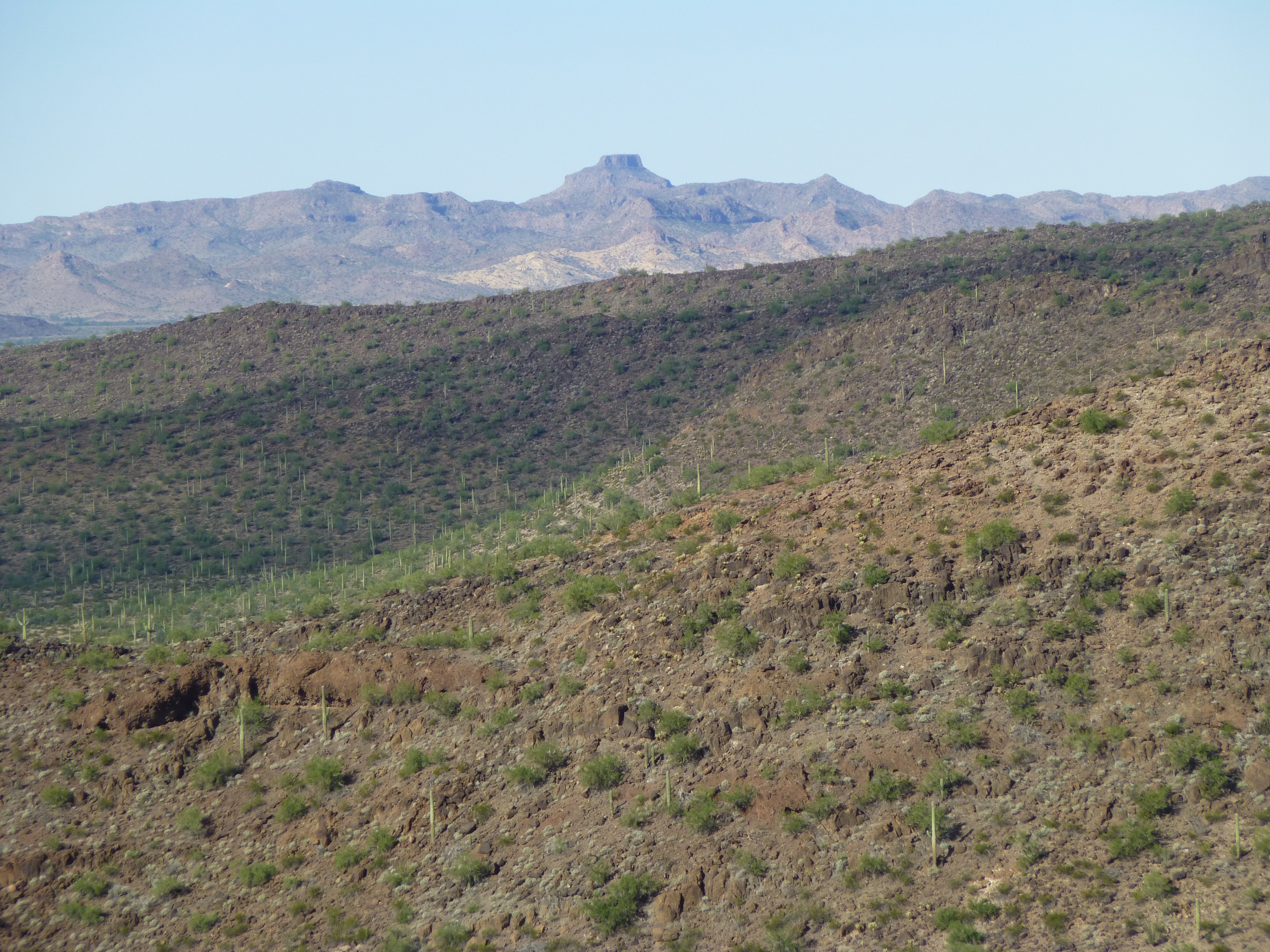
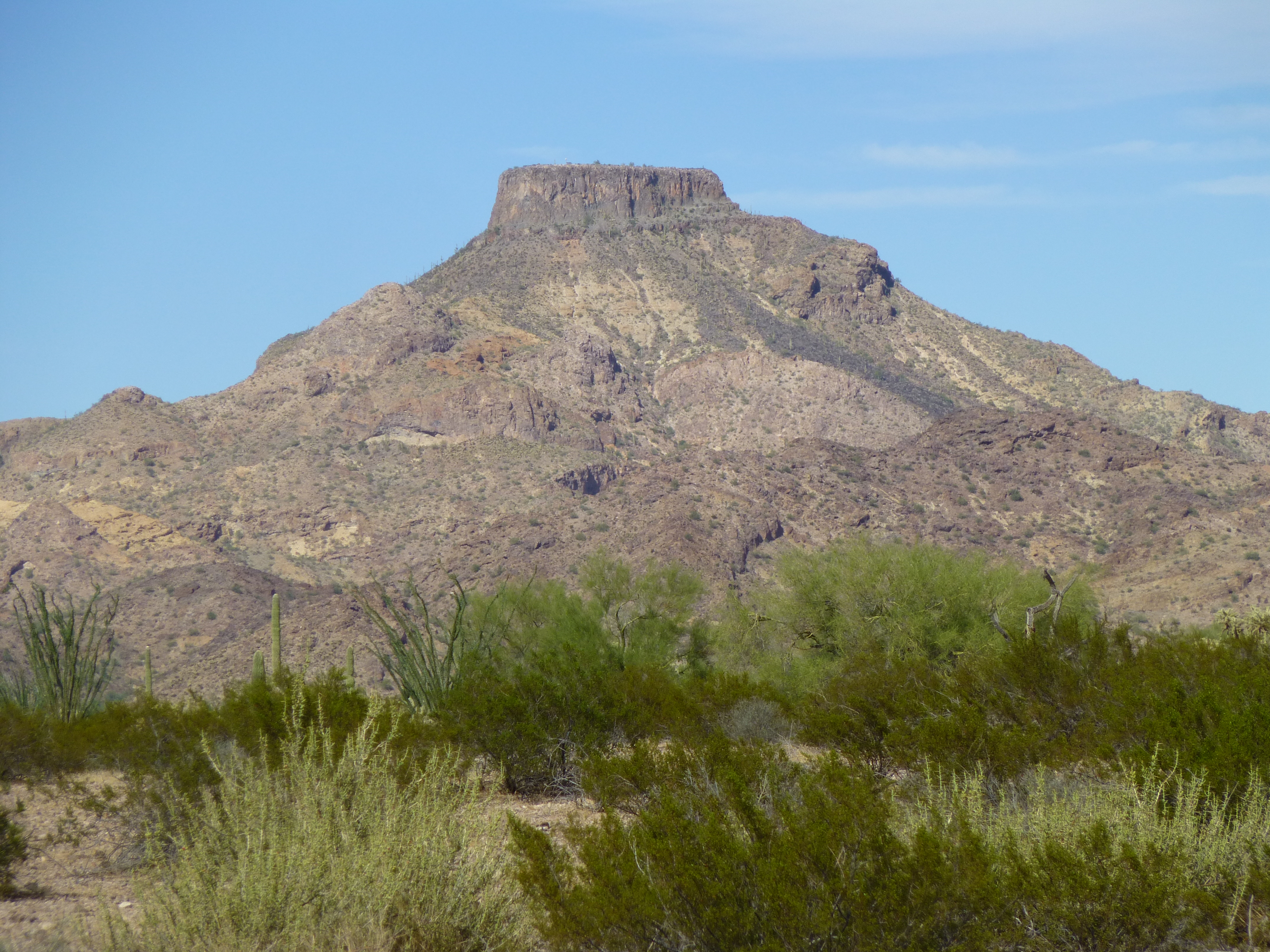
Hat Mountain – you can see it from a long way off. It’s not the highest mountain in its range, the Sauceda Mountains. In fact, at 2,854 feet, it’s skyward reach falls short of 13 of its fellows among the 105 in the range. But the look – it’s so distinct. As Andy describes it, it’s a landmark – so different, it’s shape is recognizable from any angle. Any visitor to the area not familiar with it would remark “Wow, what’s that peak?” upon seeing it for the first time. So, before I launch into this story, I thought I’d present to you a photo essay of Hat Mountain, a variety of views from near and far.
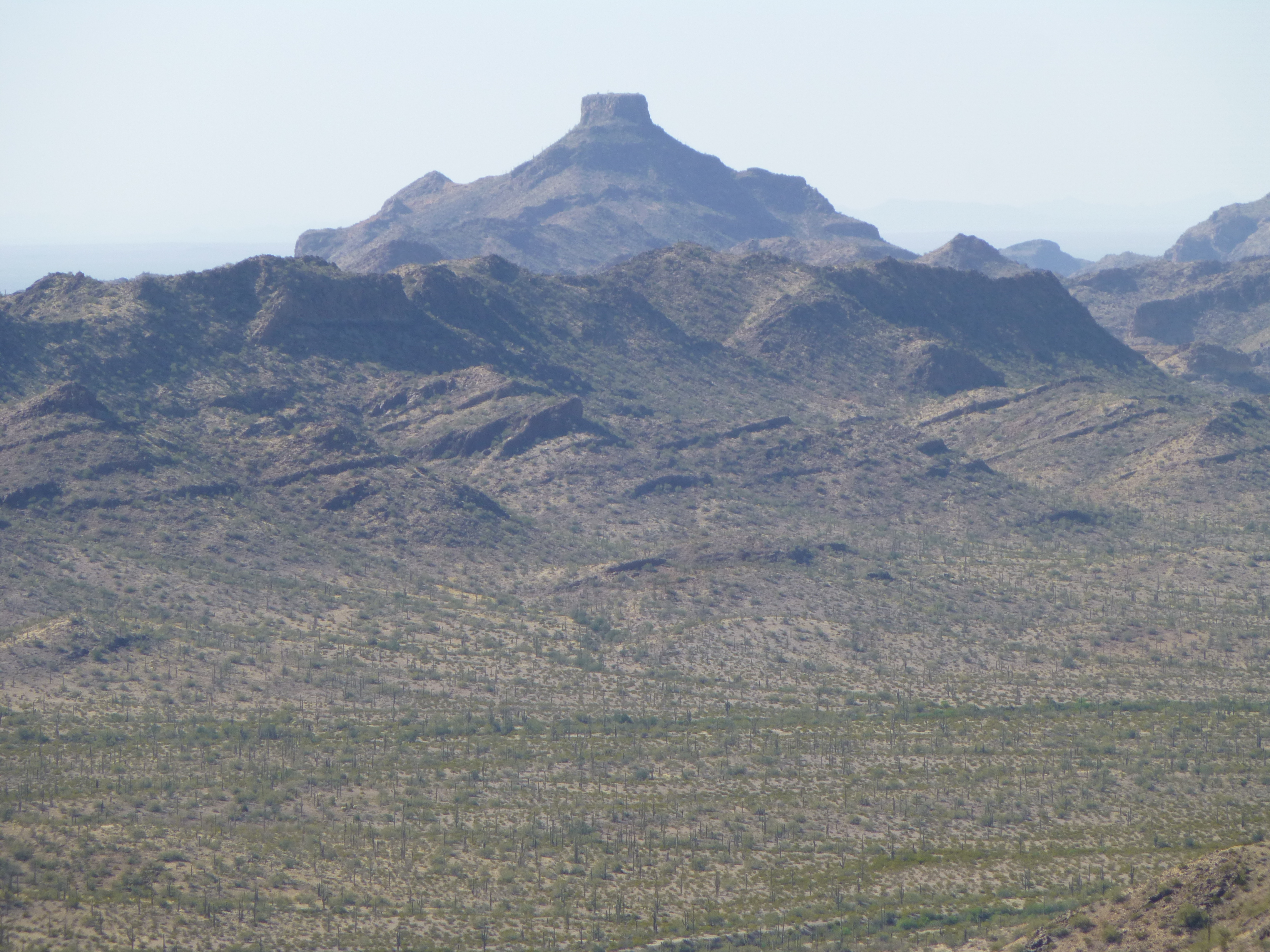

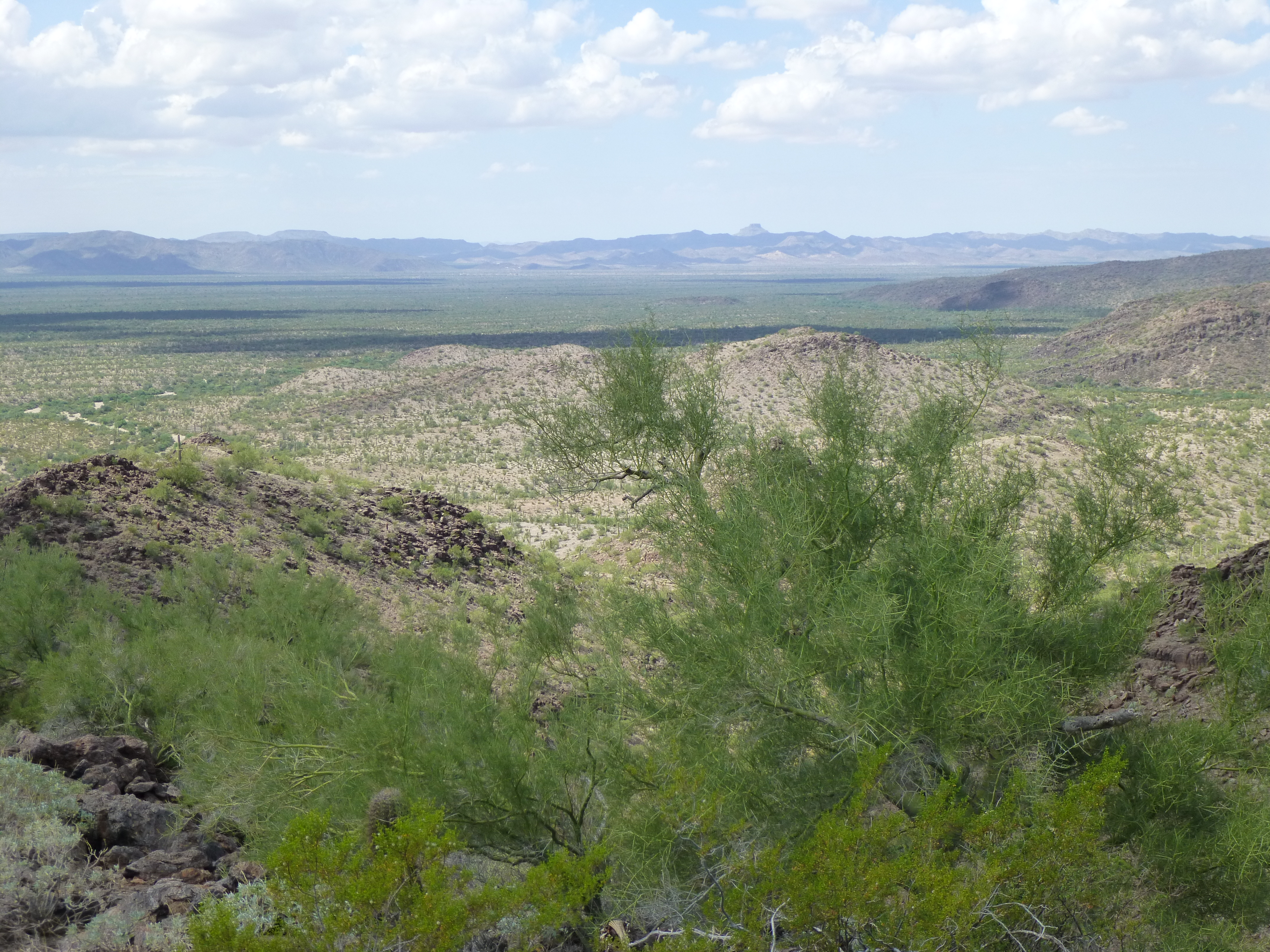
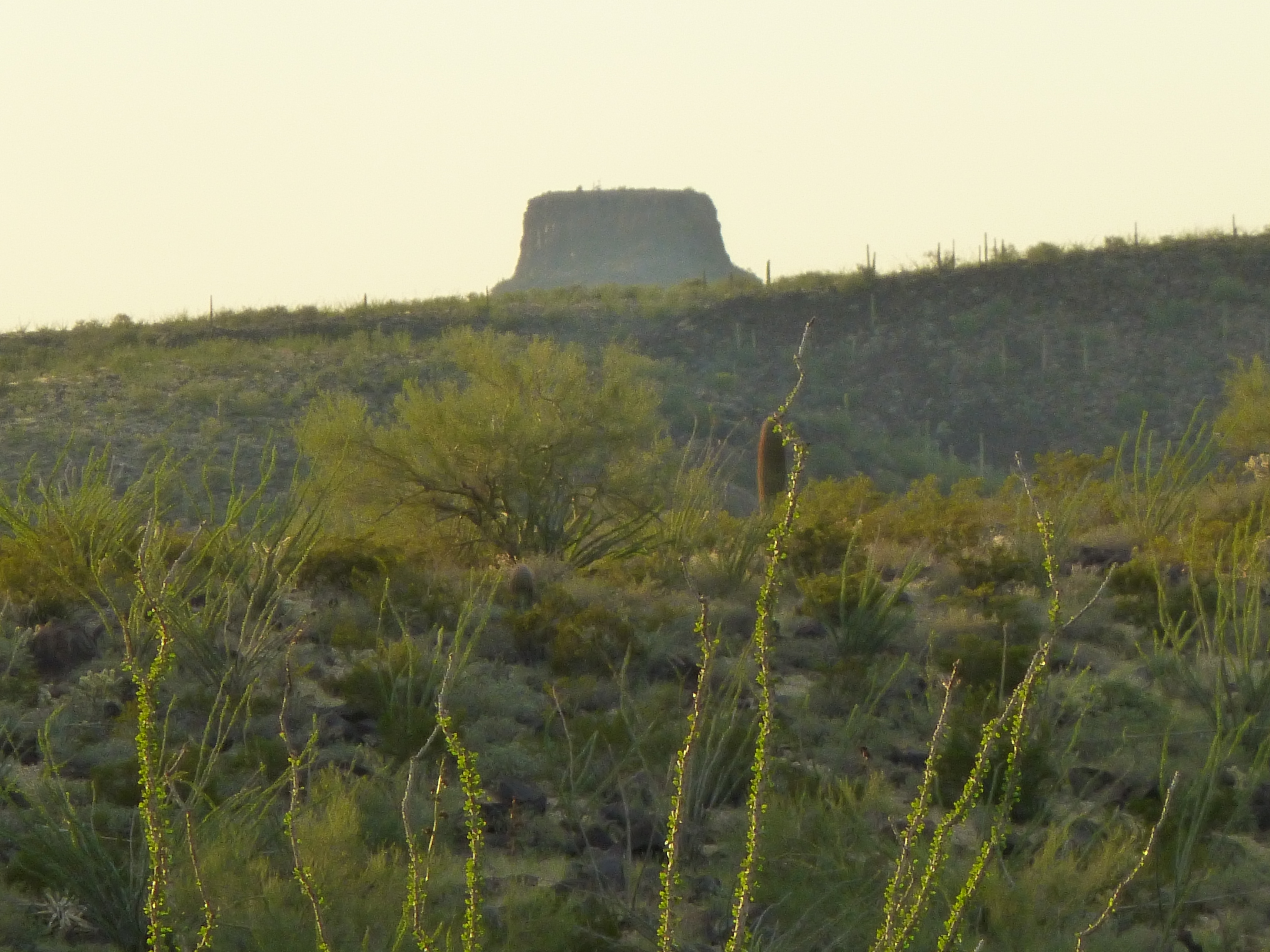
I was curious – from how far away could you see it under ideal conditions? You need an unhindered line of sight to see a peak from far away. I did a little playing around on one of my map programs and was surprised to learn the following facts. If you stand on the summit of Castle Dome Peak (3,788′), 87 air miles away, you can see Hat. The same for Signal Peak (4,877′), 92 miles away. Those two peaks are out west, near the California border. If you’re up north, you can stand on top of Seal Mountain (5,116′), northeast of Wickenburg, and see it, and that’s from a distance of 105 air miles. But the longest line of sight I could find was from Mt. Lemmon (9,157′) in Tucson’s back yard, and that was a whopping 115 air miles. That’s impressive, given the low elevation of Hat.
I had first seen Hat about 30 years ago, passing by on the highway to the west as a tourist. As the years passed, I saw it again from a distance once in a while when climbing in other ranges. Then, about 2 years ago, I started climbing all manner of peaks in the Saucedas, on all sides of Hat. Every time I’d head out there, I’d see it from another angle and it would always intrigue me. I would have tried it on my own, but what little I knew about it told me that it was a roped climb, so I avoided going it alone. Well, came a time when I’d climbed everything else in the range, so my attention focused hard on Hat. I was always looking over my shoulder at it, the elephant in the room. It was time to enlist some help.
Late last year, before Christmas, I contacted Andy Bates. He’s a busy man, but promised me he’d fit me into his schedule. Months passed, and I got the call – we’d head out on Saturday, August 6th, 2016. The great thing about living in the desert is that you can plan a climb for any date in the future and chances are the weather will cooperate beautifully. As the big day neared, we two became four – John and Tamika would round out our team.
The forecast called for a high of 111 degrees F. but that was a week out. As the big day approached, they dropped that to 108, then 107 – we were in luck, it’d be a great day. Nevertheless, we weren’t so entirely stupid as to get a late start – we didn’t want to push our luck, so it was agreed that we’d meet at the town of Gila Bend, Arizona, about 30 road miles from our peak. There we all were, in the parking lot of Mickey D’s, by 3:00 AM. I left my car there and rode with Andy, our friends following close behind, and by 3:30 we left the highway and unlocked the gate barring the way into the Air Force bombing range. Once through, we motored on in the dark – another 8 miles on dirt roads, with a little help from the good old GPS, and there we were, parked right where we needed to be. We stepped out of the vehicles – it was darker than a pocket. By the time we readied our packs and set out by headlamp, it was 4:25 AM.
The bulk of the mountain loomed up above us to the north. It was a moonless night, and we could only tell Hat was there by the part of the sky that had no stars. The summit was a bit less than a mile away, and thirteen hundred above us. Andy had climbed the peak before and led the way. We crossed some fairly level ground with a couple of small gullies, then started uphill. Most of the weight we carried was water. Andy’s 70M rope was in a separate bag which we took turns carrying. The mountainside steepened, the footing loose and we had to pay attention. Part-way up, those out in front spotted a striped skunk – its eyes reflected back at them in their headlamps before it sidehilled across the slope and disappeared from sight.
Soon after that, I heard shouting from above – when I asked what all the commotion was about, someone said there was a snake. Turns out I was almost level with it, and I managed to take this picture. It was a Black-tailed Rattlesnake, about 4 feet long, and he was shaking his rattle a lot, warning us to stay away. These snakes are active at night during the hot summer months, and are capable of delivering large amounts of potent venom. We gave it a wide berth, then continued on up.
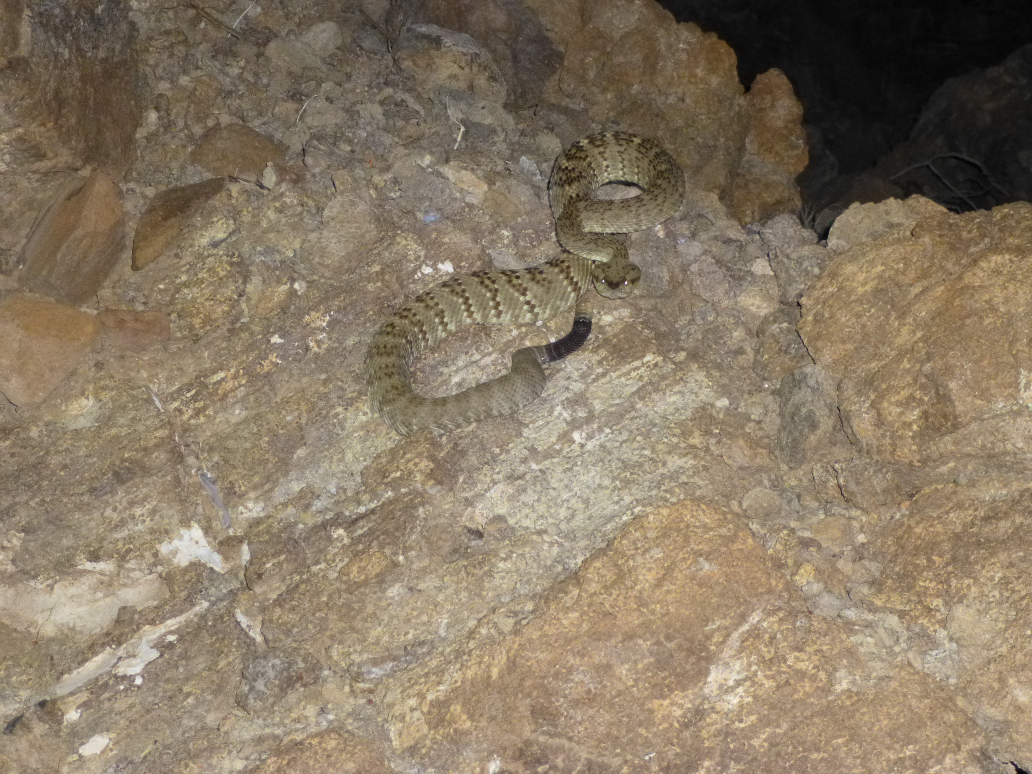
Our snake
Things steepened even more. We reached a point where we had to cross over to the right on a steep, loose slope for a hundred feet or so, and that put us at the base of the rock climbing. There we stood at the foot of a prominent rib of rock that formed the southeast corner of the mountain, of the top hundred feet of the whole peak. That’s all that stood between us and the summit. It was now broad daylight, and the sun stood poised on the world’s rim.
Andy was on familiar ground, and had a smile on his face. He knew what the climb would entail, and had brought only a few slings and no rack of any kind – it would be enough. Instead of going straight up the nose of the thing, he walked 50 feet farther to the east, to a better start for the roped climb, and tied in – John belayed him, and I took pictures. Here’s how it began.
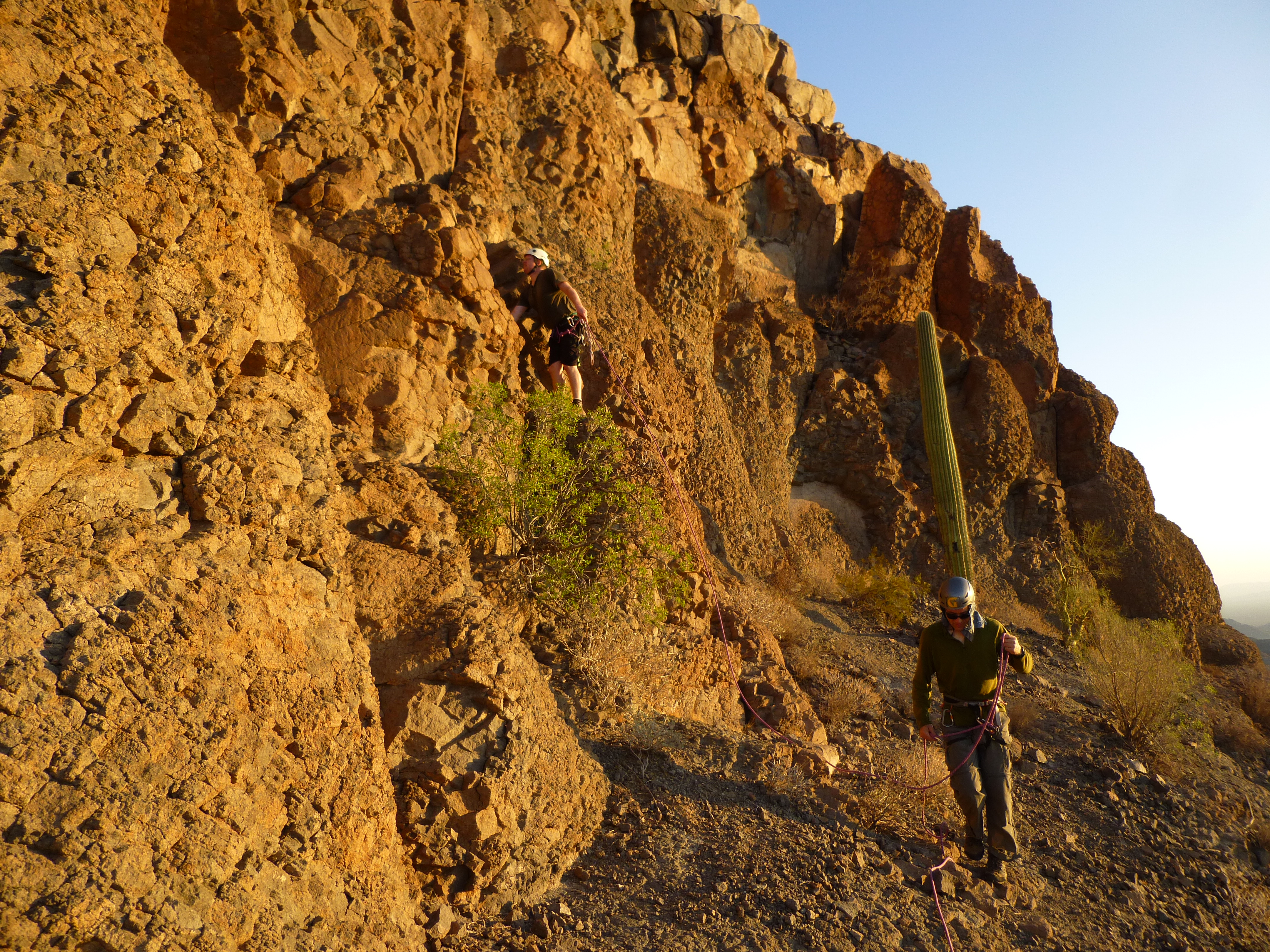
John doing a standing belay
Andy angled up a steep, broken ramp of sorts on Class 3 ground. He made quick work of that part. Perhaps 40 feet off the deck, he made his way past a small, dead saguaro and turned a corner to reach the west side of the rock rib. In this next photo, he is flipping the rope over the saguaro before disappearing from sight.
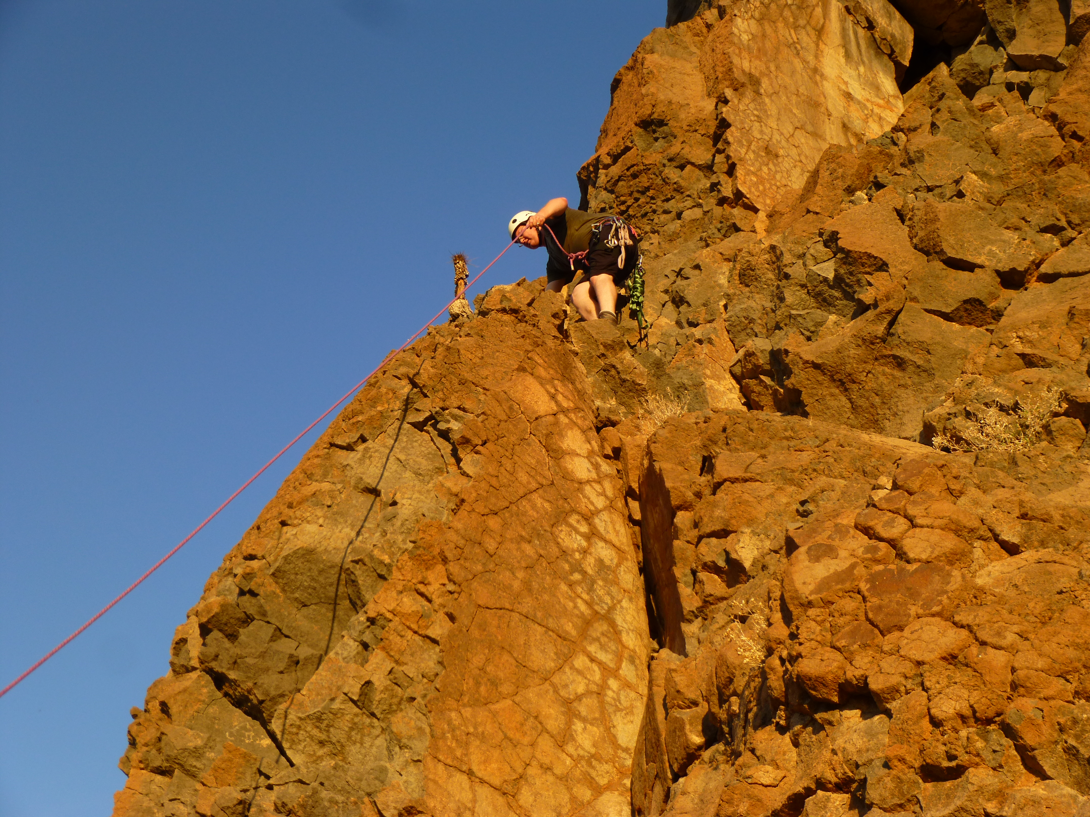
Turning the corner
A short while passed. Andy made it to the top of the cliff and set up a belay anchor, a sling around a boulder – later, he added a rappel ring for the descent. He then shouted down to us that he was all set and to climb when ready. I went next.
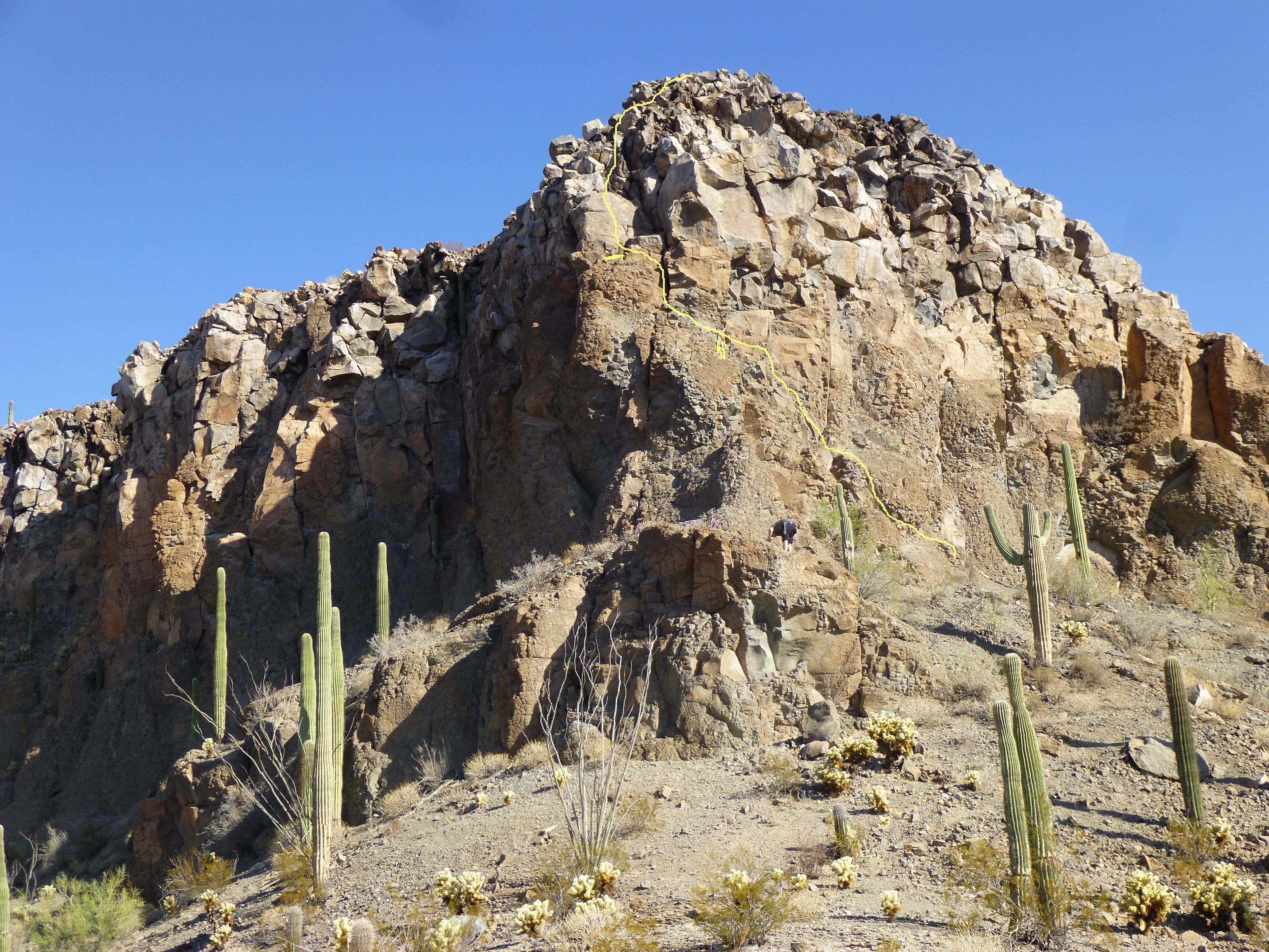
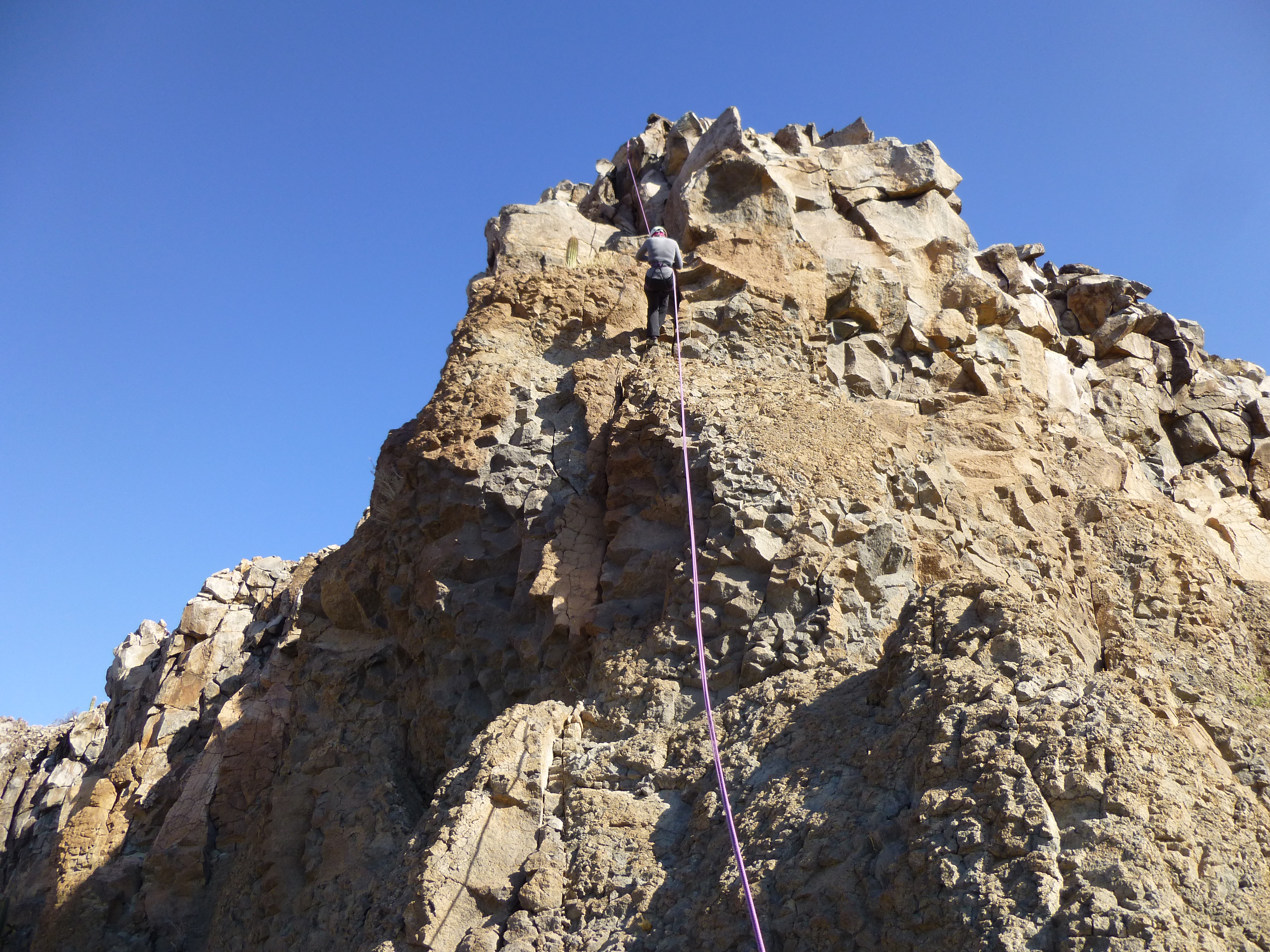
The first part was pretty easy, but when I reached the dead saguaro I fished the rope back over to the east side of it, then continued up. It became a lot more exposed and the holds were smaller, maybe Class 4, but still good going. In short order, I reached another saguaro, this one alive and well. Next came the slab. I’m going to show you a photo now that may illustrate all of this. You can zoom way in on the photo. See the yellow line. The climbing route starts on the center right portion of the photo, then angles up to the left. Part of the way up, I’ve drawn a yellow vertical line which marks the location of the dead saguaro. Farther up and more to the left is a horizontal line that shows where the live saguaro and the base of the slab are.
I started up the 8-foot slab, but got stumped right away. I had to try 3 or 4 times, and finally was able to get up it. There were a couple of very thin holds which I was able to use, and found myself at one point spread-eagled, spider-like on it. Once above the slab, things became easier. It was at this point where Andy found a wired stopper, left by some previous party. It was sitting under a loose rock. He found a solid crack for it a little higher up and added a sling and a couple of carabiners to act as the only protection placed on the route. The next part, easily seen in the photo, was like climbing up a pile of boulders. Some of these looked pretty unstable, so I moved cautiously, but once above them I walked over to where Andy was sitting and belaying me. The entire climb had taken perhaps 10 minutes. Tamika came next and made short work of it. John was the last up, but Tamika’s time was the best of all of us. We left the rope there and walked together the hundred yards to the summit. It was 7:00 AM.
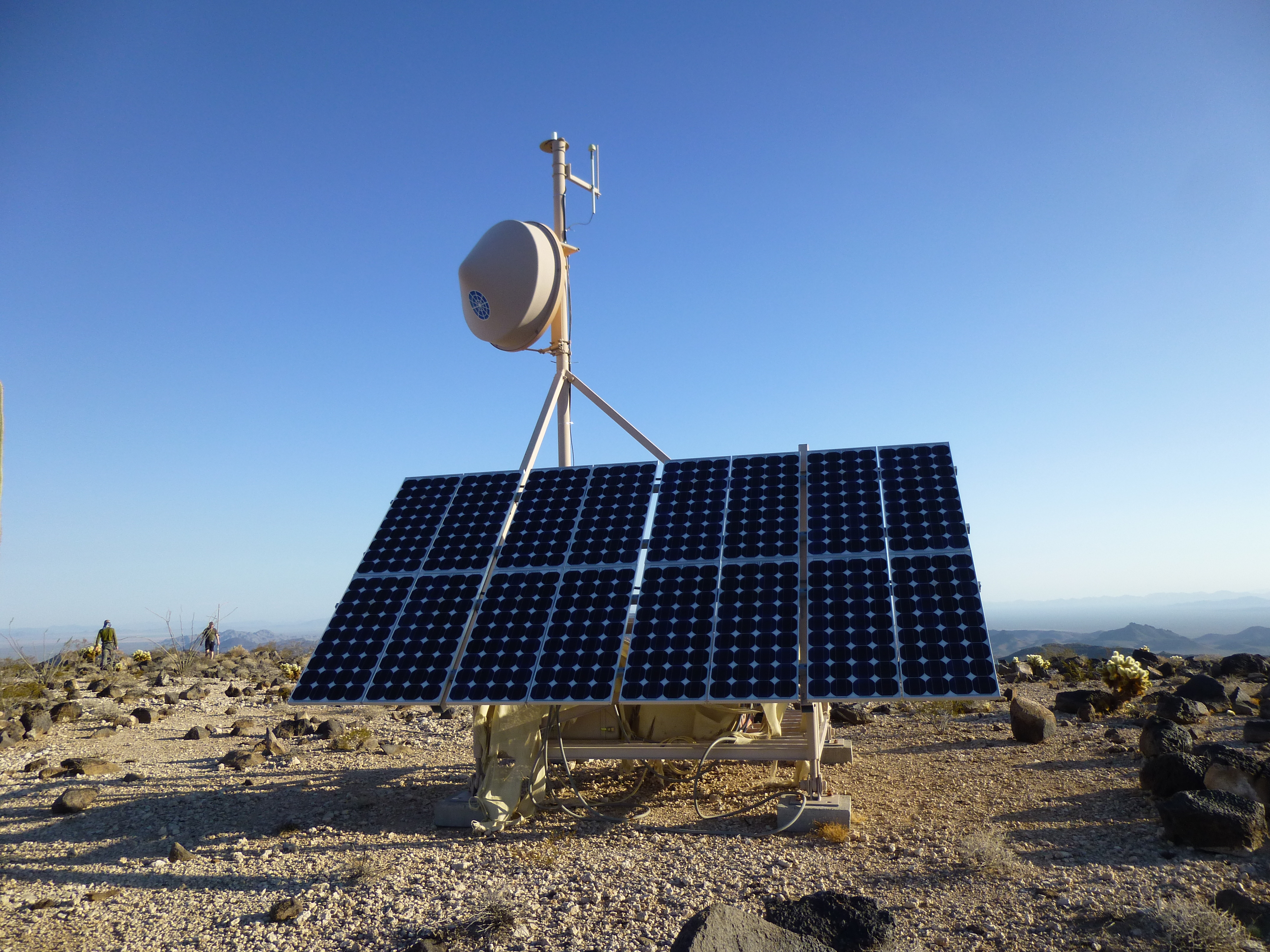
This was one very interesting spot. The most obvious thing there was some communications equipment.
We found the benchmark, and with it was the register left on February 19, 2001 by Andy and the party he led.
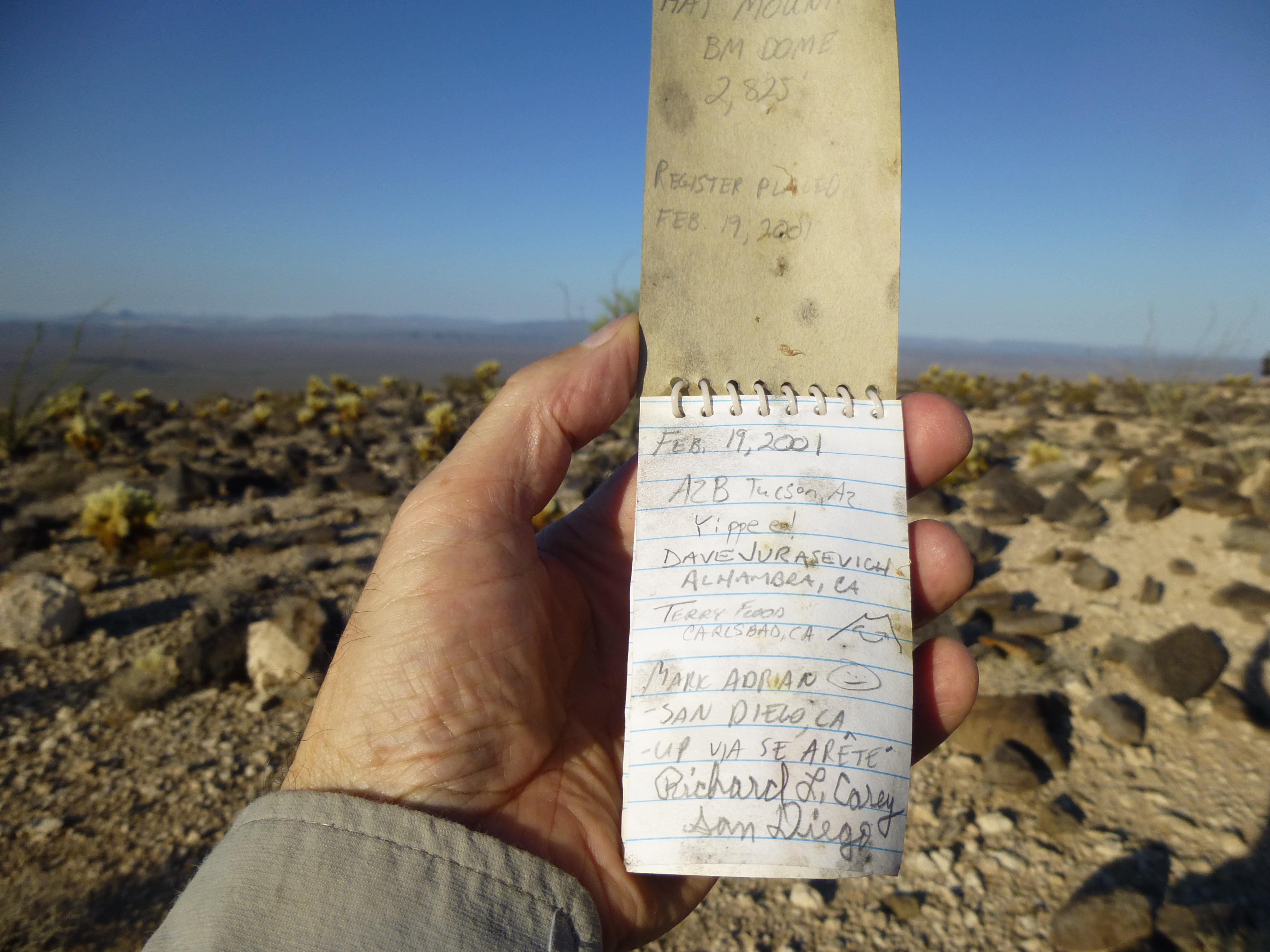
The summit register
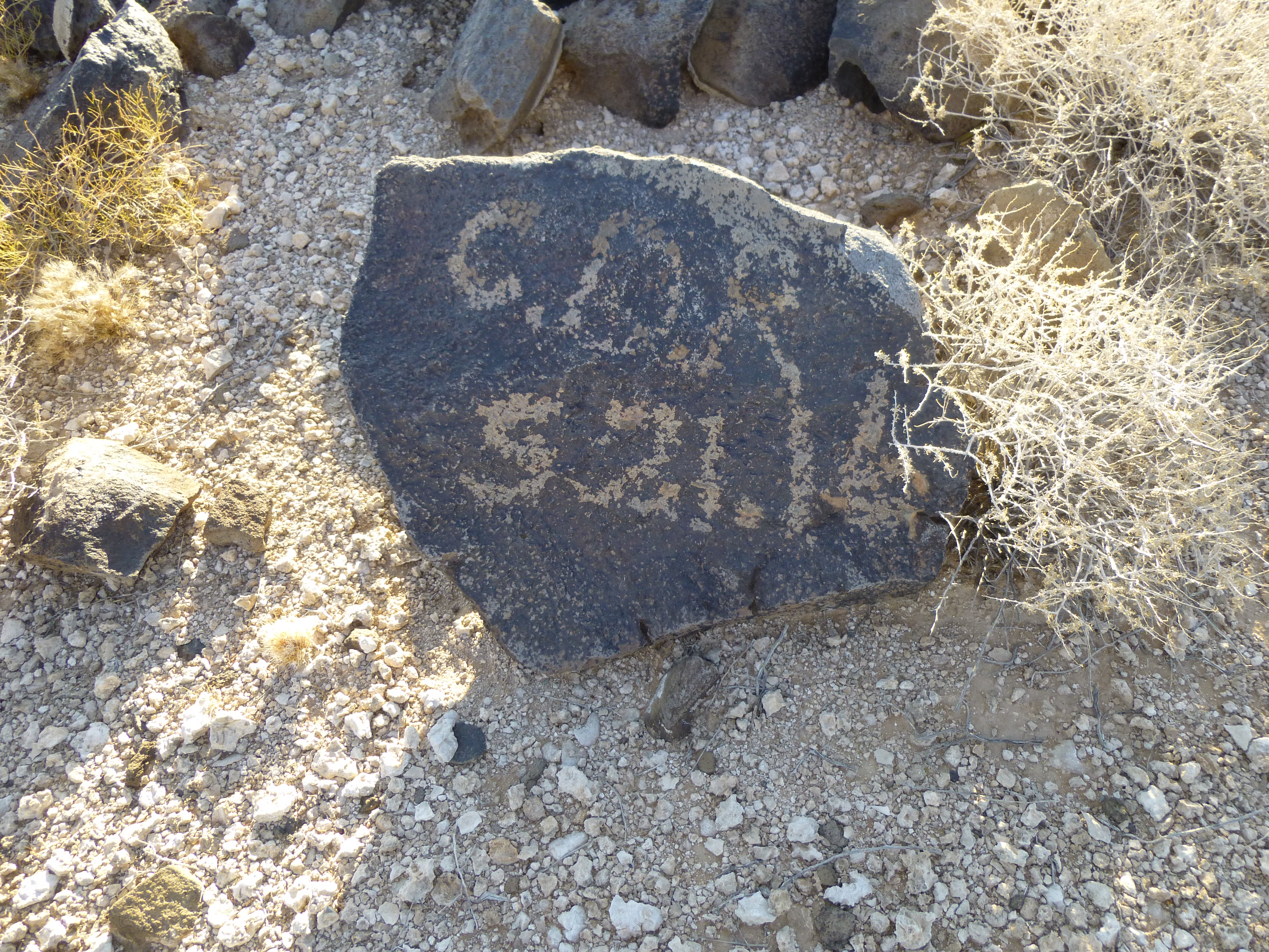
Ten different parties had signed in since they’d left the register, so that’s an average of somebody every 1.6 years. Perhaps even more remarkable than the register were those who had “signed in” before any modern climbers had left their mark. On some of the rocks near the highest point on the flat summit, people had scratched off the desert varnish to create their own signatures. Here’s the best one – I don’t know who CDR was but he or she had been here on May 21, 1916, just over a century ago. There was another from 1930.
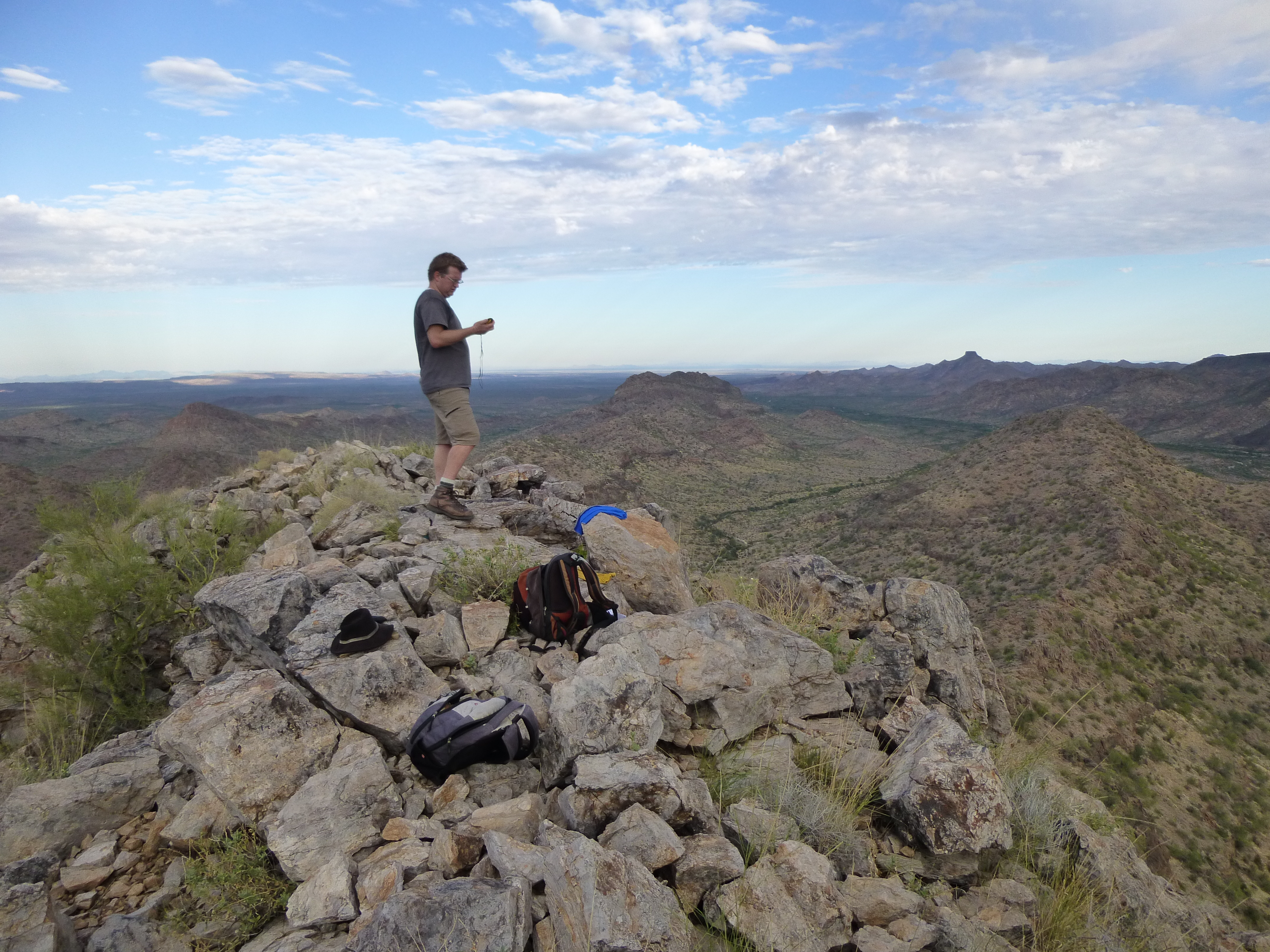
Here’s a shot of the gang studying the register entries.
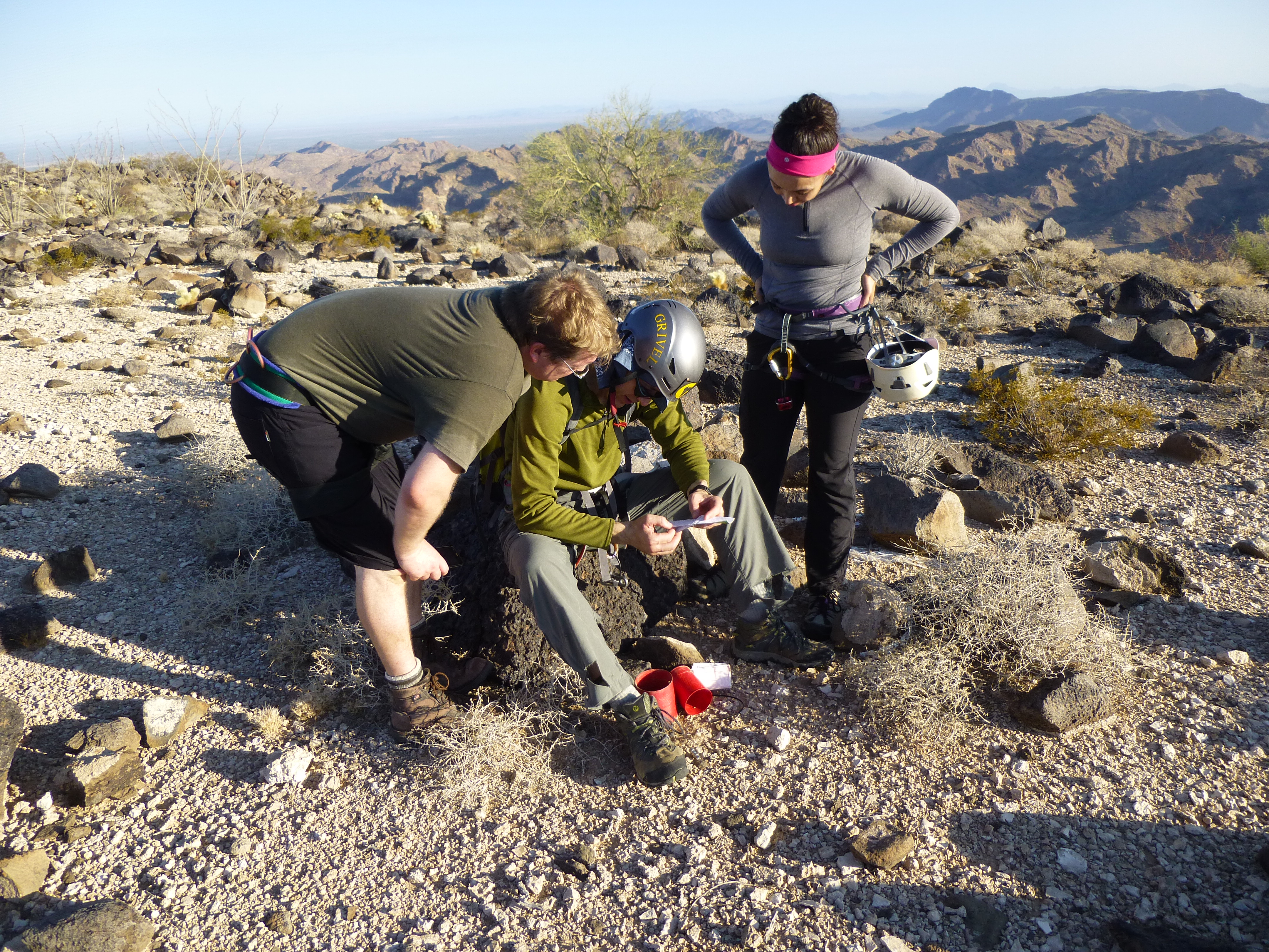
And here’s one with a better view of the team.
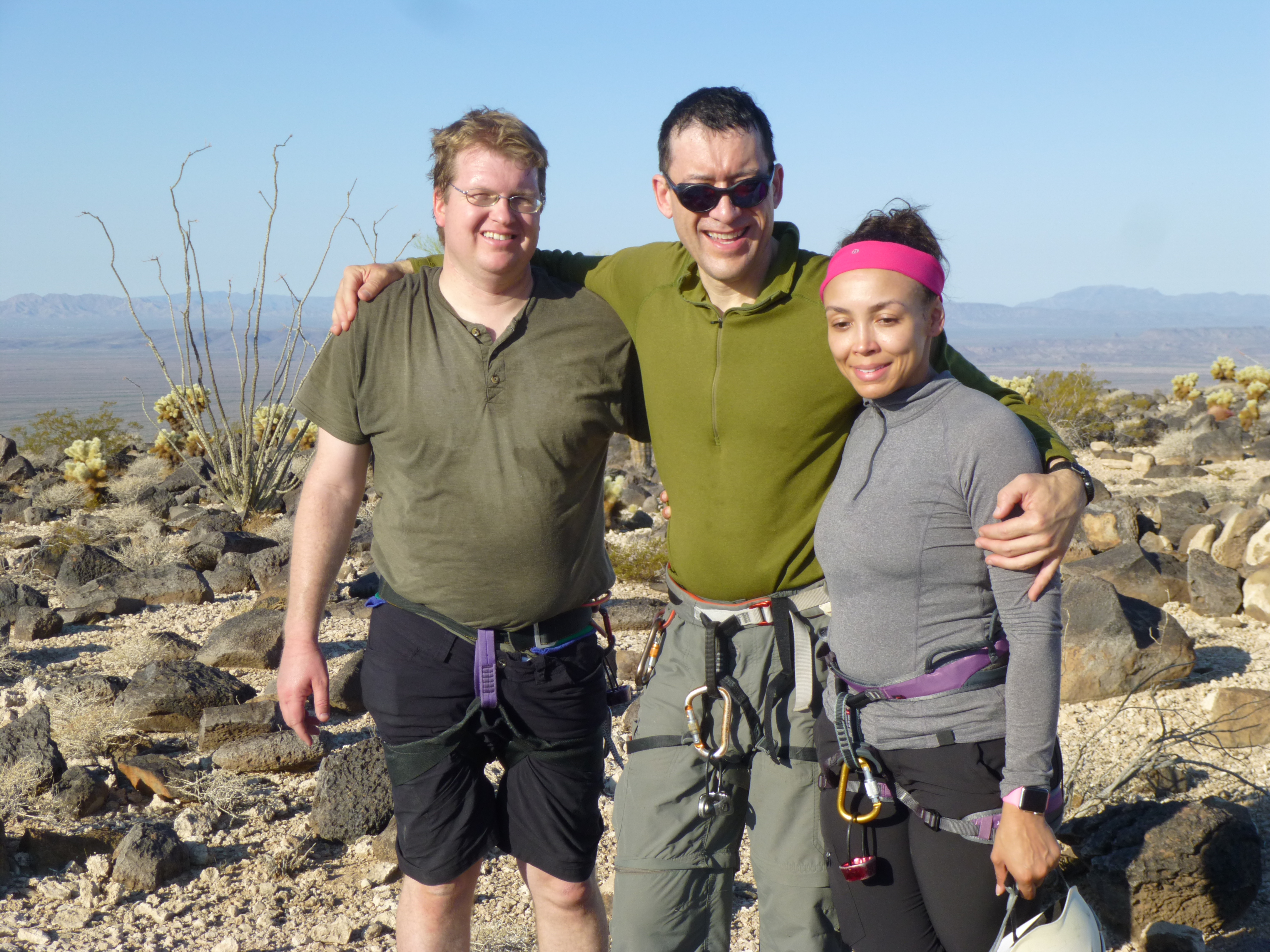
Andy on the left, John, Tamika
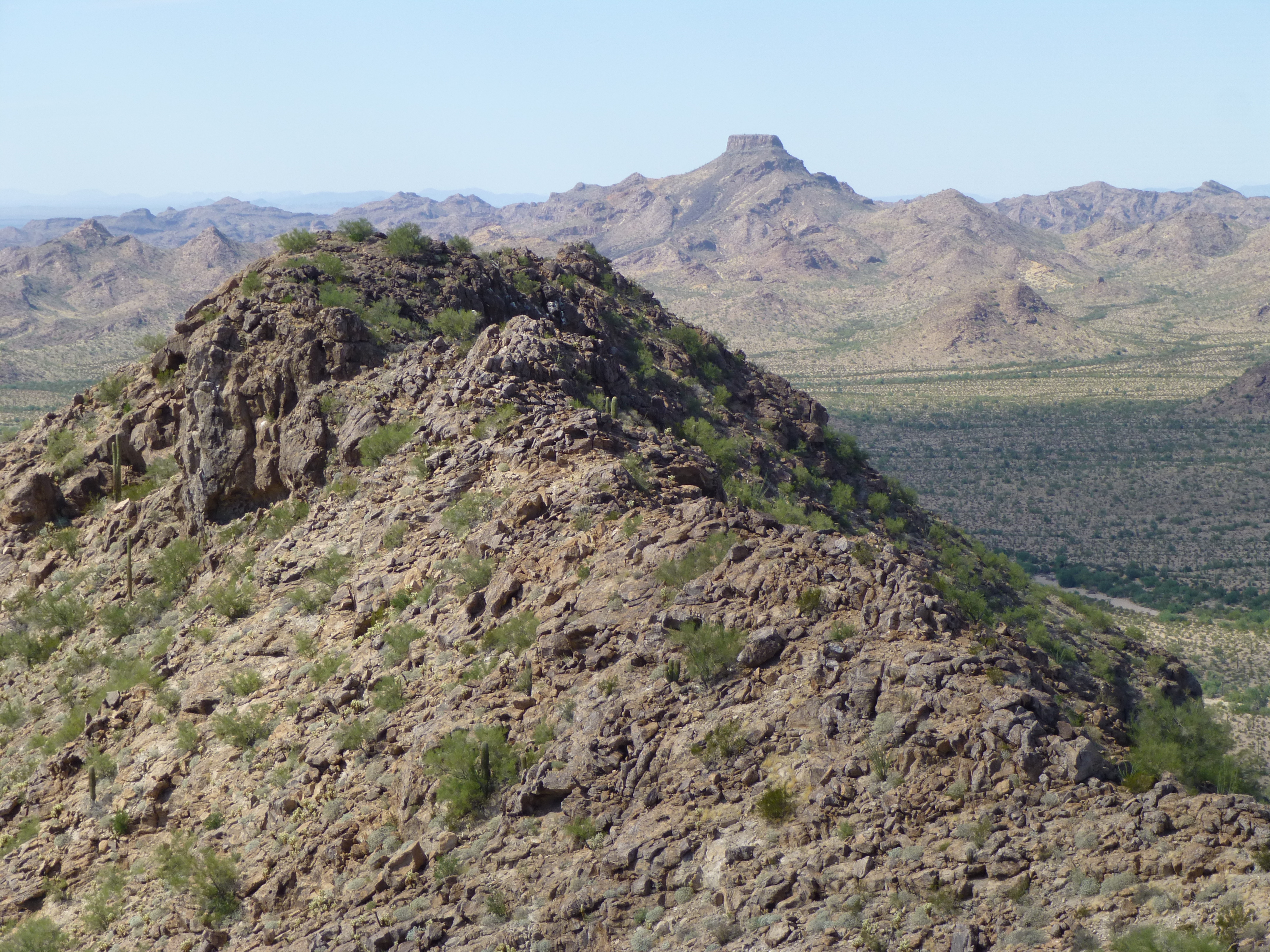
Well, the day was warming up, so we bid a fond adieu to Hat Mountain, elevation 2,854 feet, and headed back over to the top of the route. Andy wanted to rappel off the east side, a much bigger drop, but he felt the rock could be less loose there, posing less danger. We (mostly I) talked him out of it, and in no time we had the rappel set up. Here’s a view from the edge, looking towards the town of Ajo, 19 air miles to the SSW.
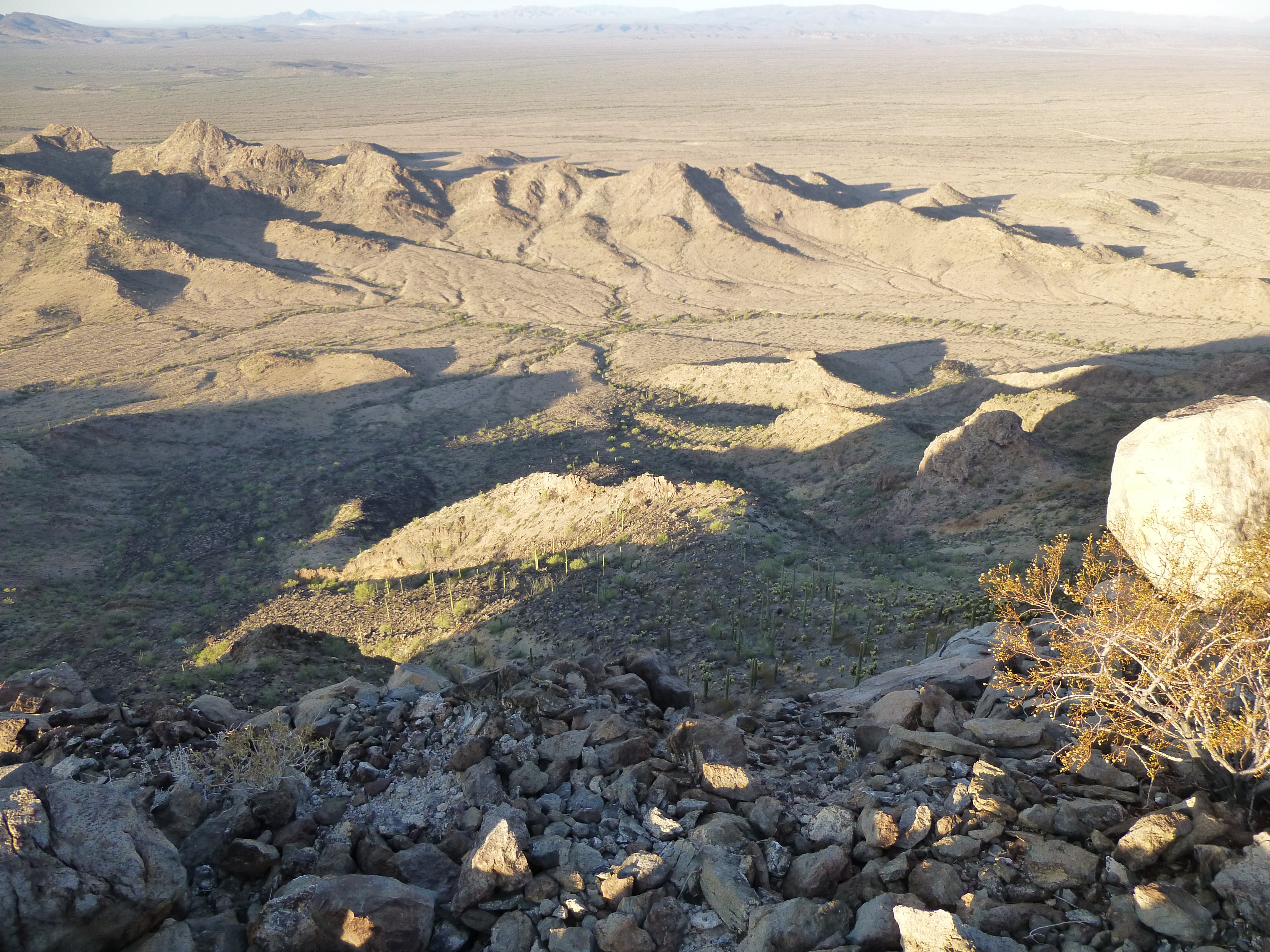
A look towards Ajo
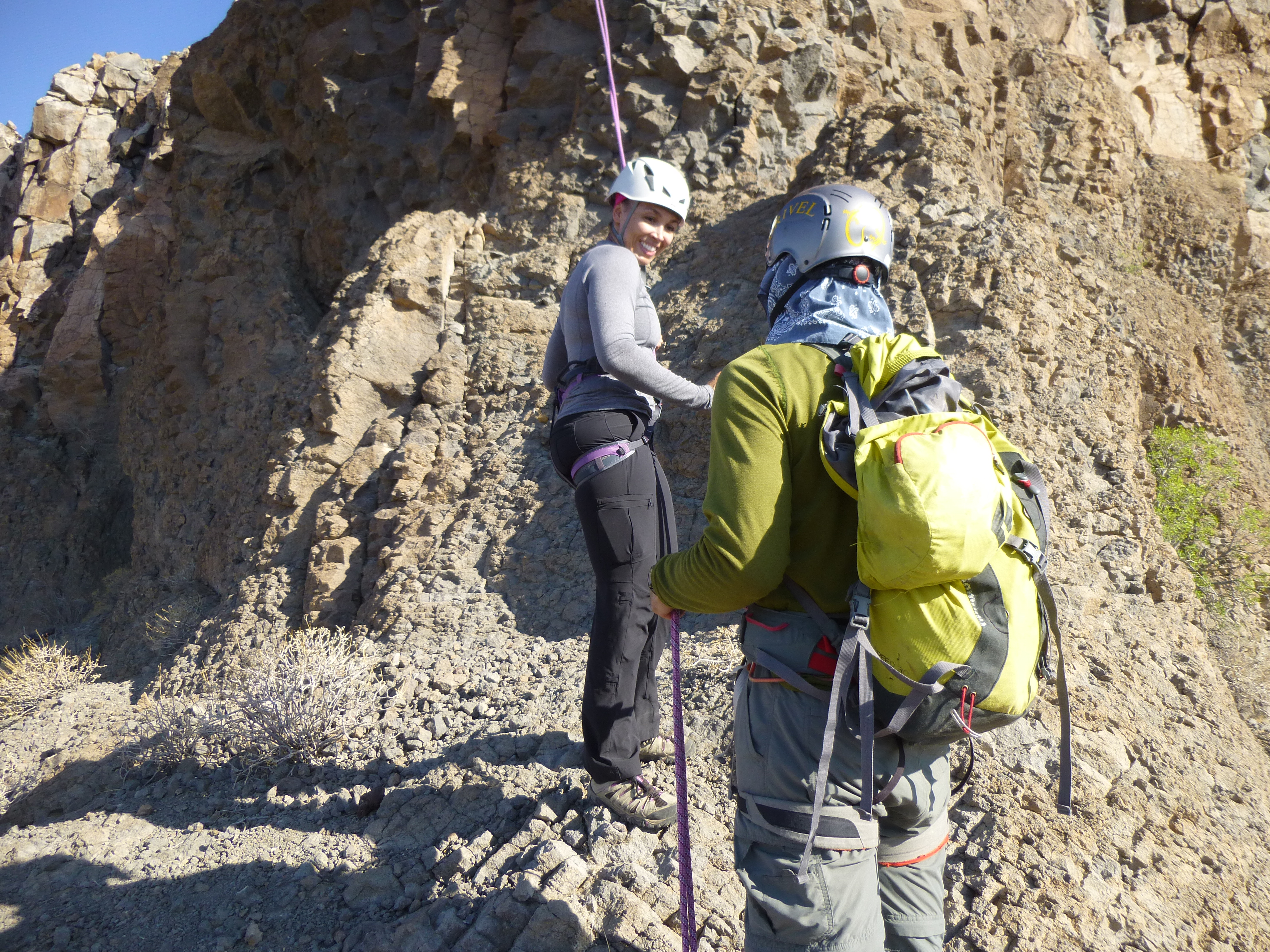
I was the first one to rappel down – there were two places where I had to spend some time hanging in the rope while I fished it out of a crack. Otherwise, it went without incident. John was second. Next came Tamika – this was her first rappel ever, and she handled it like a pro, like she’d been doing it all her life.
Tamika rappeling
You can tell by her expression that she felt it was a good experience.
Once we were all down, I checked the temperature – it was 92 degrees in the shade. Not too bad yet, but warming up. There was one more thing to check. Just below the roped climb was another bench mark, one appropriately called Hat Brim.
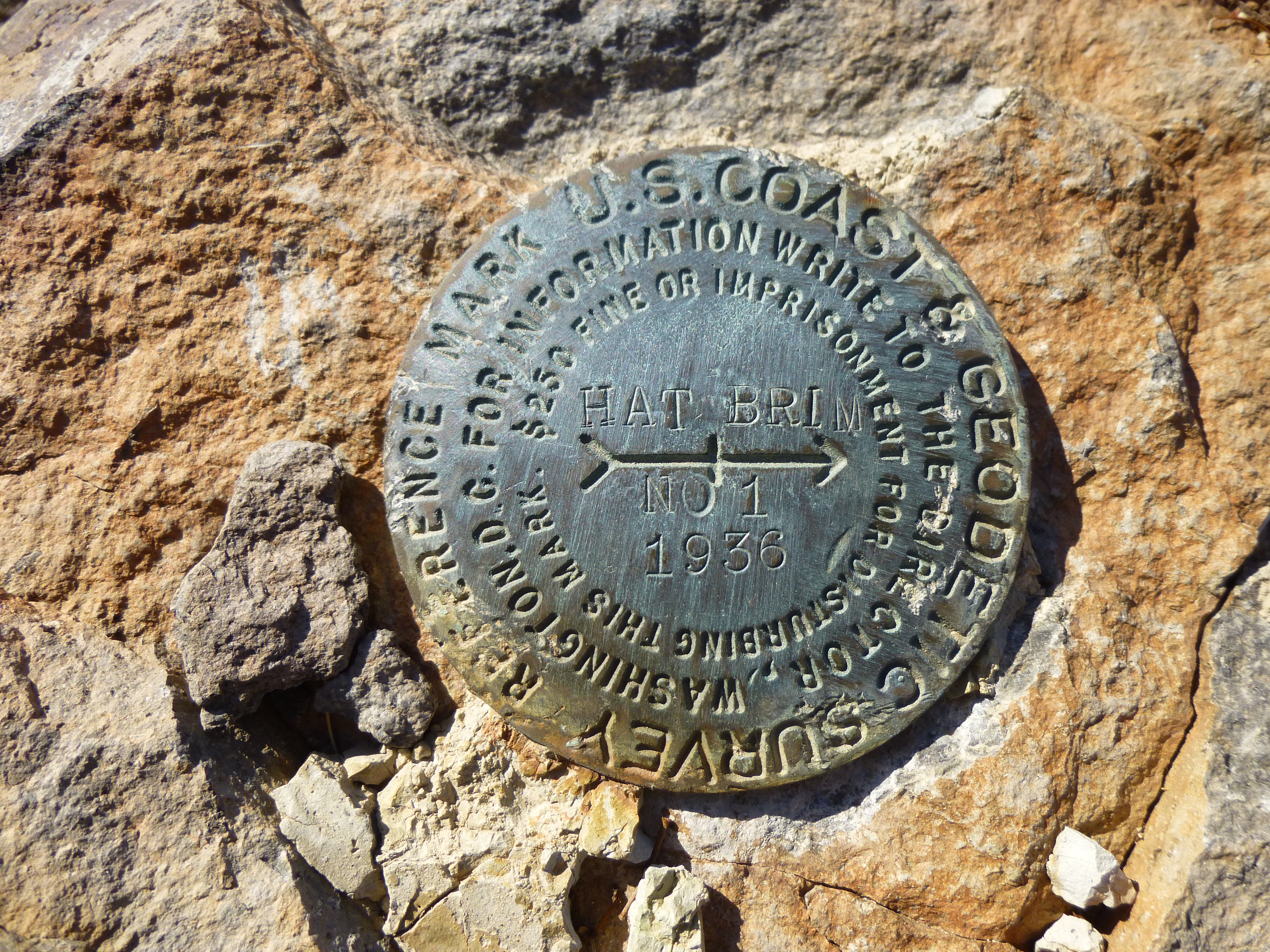
Hat Brim bench mark
Someone had left this little guy there, keeping watch over climbers up above.
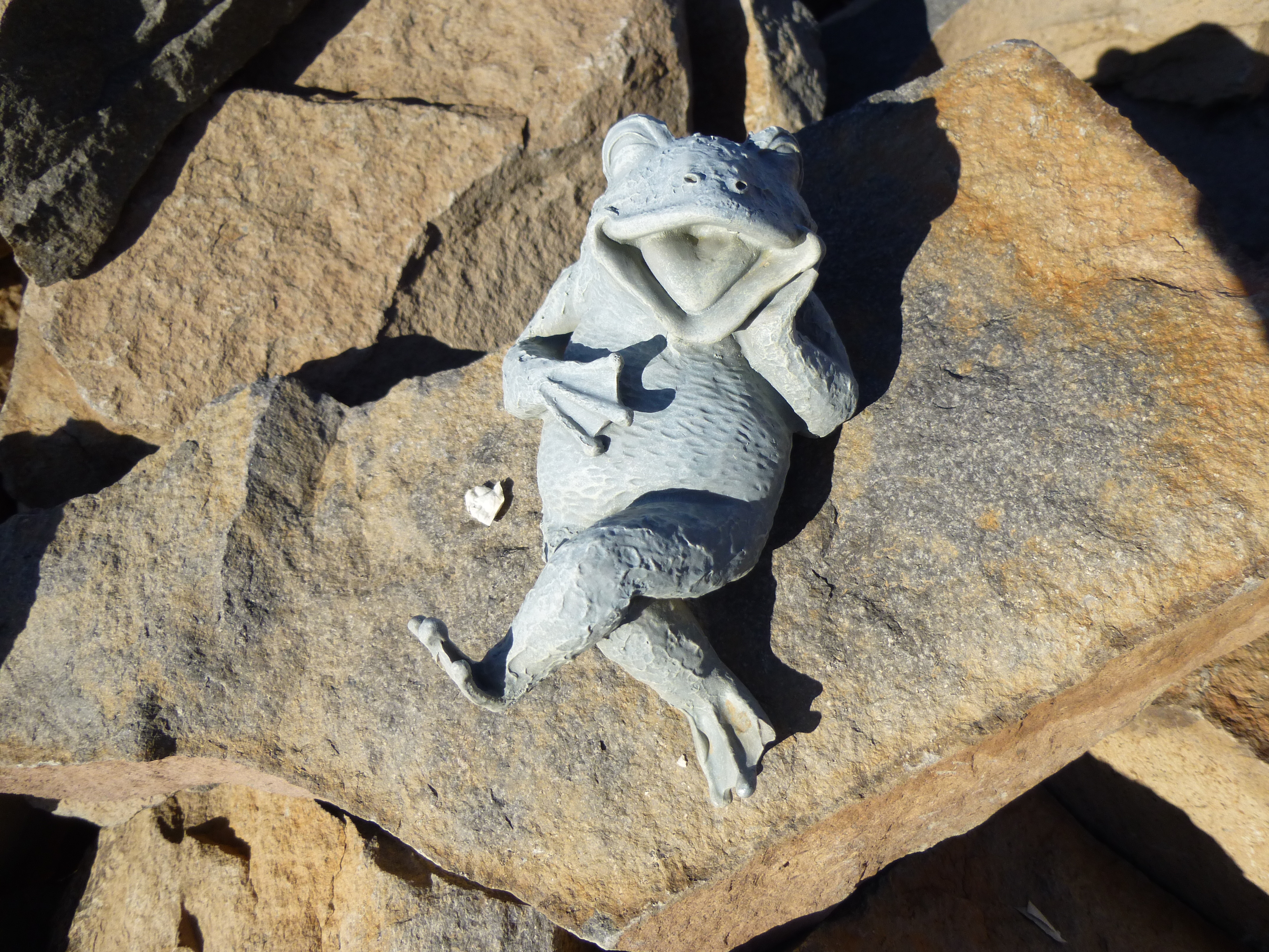
The watcher
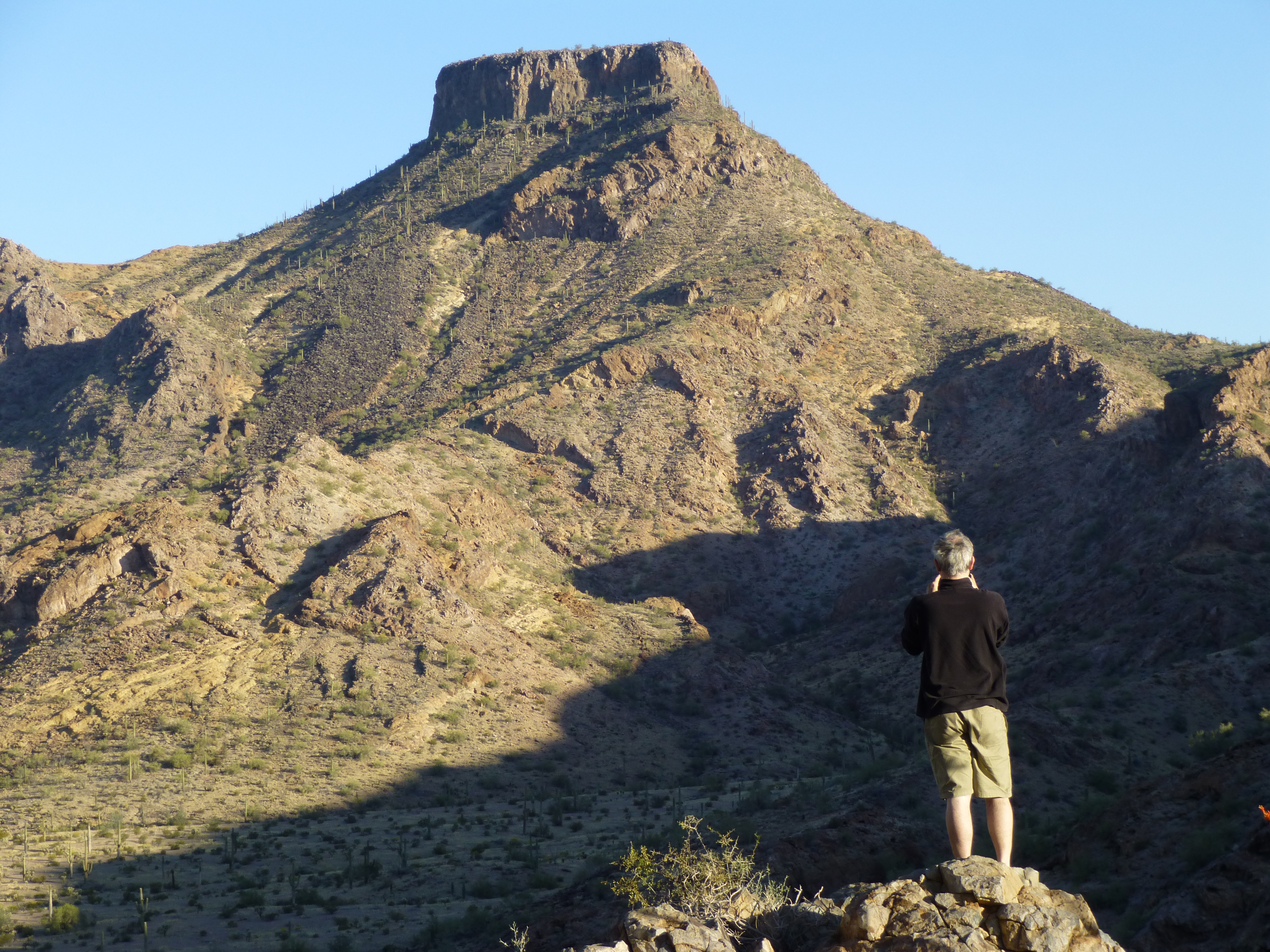
We started down the steep, loose mountainside together, but John and Tamika soon pulled out ahead. Andy and I stopped a couple of times to take a break in shady spots and have a drink. The heat really kills your appetite, and today was no exception – I didn’t eat a thing during the entire climb. It was around ten o’clock by the time we were back at the vehicles. Here’s one last shot looking back at the mountain.
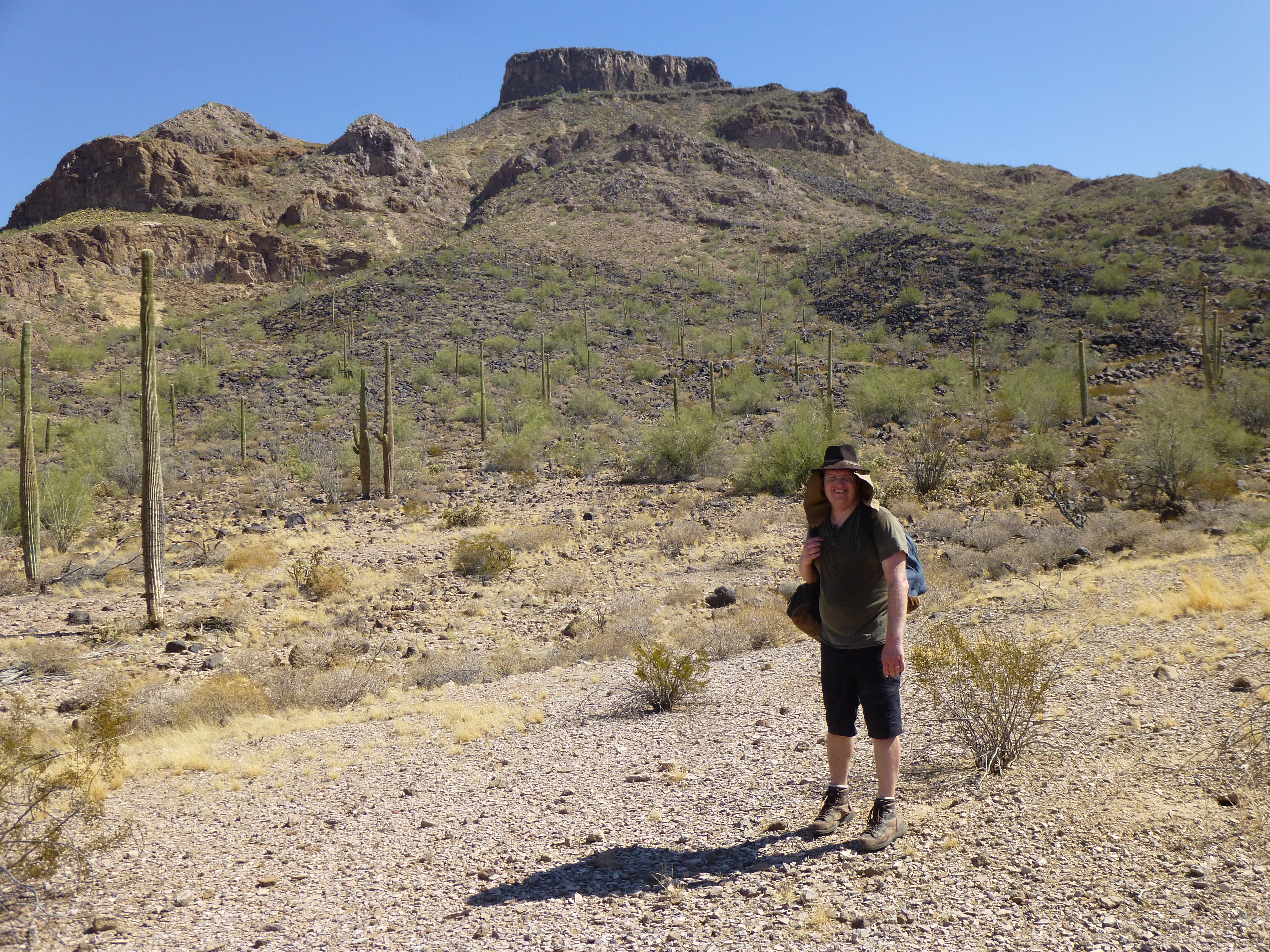
Andy and Hat Mountain
By the time we reached the highway, it was 97 degrees. Once back at Gila Bend and motoring home on the freeway, it was over 100 before noon. It was a good thing we had an early start.