
As the hot weather crept in in 2005, I made two trips into the Ajo Range in southern Arizona and focused on peaks near Barajita Well – there were five summits which were most easily accessed from there. A road branches off the road into Barajita Well, and goes south and west for 1.8 miles to Tonoka Well. There were three peaks which could be most easily accessed from a road that continued south from Tonoka Well, and I badly wanted to climb them.
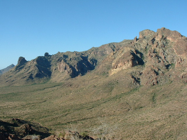
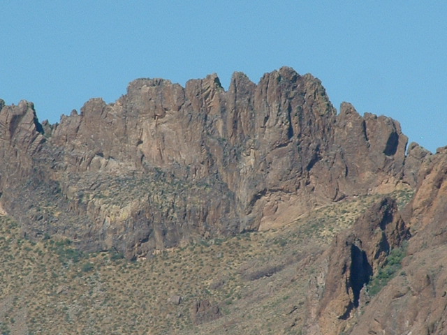
So, on the 4th of July, I arose at 2:30 AM and drove to Tonoka Well. I parked about a half-mile south of the well, and by 6:00 AM I headed out on foot to climb Peak 3380. However, I headed too far southwest, so that by the time I gained the ridge I had about a half-mile scamper to the northwest to finally gain the summit. The main spine of the Ajo Range rises up in all its glory to the west and is seen to advantage from the ridge I was on. In this next photo, we are looking south along the range, which rises in one big sweep over 2,000 vertical feet to the crest. Look closely at the extreme left edge of the photo – see the pyramidal peak in the background? That’s Diaz Peak, just over 6 miles distant.
The east side of the Ajo Range
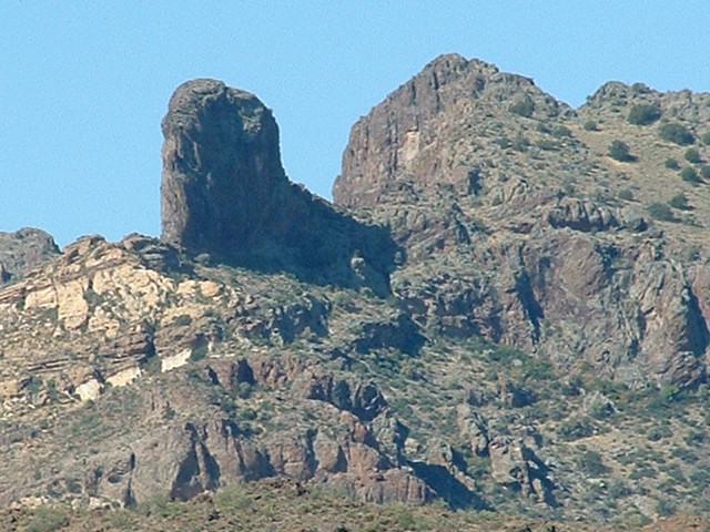
The range is full of un-named towers like these, just waiting to be tackled.
In the Ajo Range
I dodged a hive of wild bees en route and before I knew it I was on top, at about 7:20 AM. I built a cairn and left a summit register, then descended due east to regain my truck. Here’s a look back up to the summit.
The east side of Peak 3380
I drove to the low saddle to the west of Peak 2942 and parked. Here’s the view I had of it from my truck.
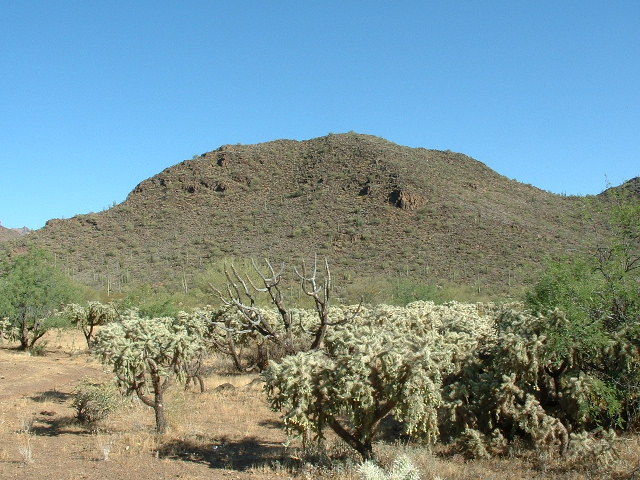
Peak 2942
I headed straight for the top and enjoyed some small cliffs en route. The views were just as amazing from this one. Here’s a thousand-foot wall for your viewing enjoyment.
The Ajo Range
If you look very carefully in the exact center of the next photo, you can see a little white dot. That is what my truck looked like from atop Peak 2942. It is 550 vertical feet below and about 1375 feet away in a straight line. It’s nice to be able to see your vehicle so close by when you are on a summit, but usually it is much farther away and barely visible, if in fact it can be seen at all.
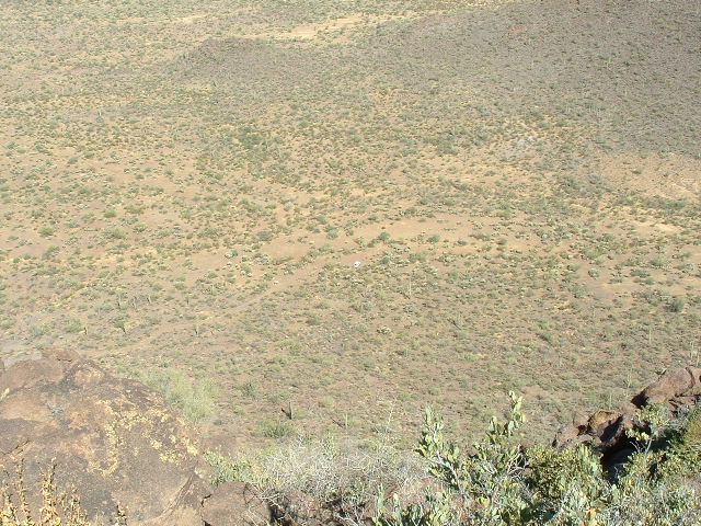
Looking down at my truck.
After I had left my register, I started to descend the northwest side. I hadn’t gone more than a hundred feet when I heard a commotion behind a nearby bush. It was a javelina I had probably awoken. It slowly walked away, snuffling loudly as it went. Then I saw another and another, and by the time their little parade had passed from view I had counted ten. They were all quite large, with the exception of one baby. They seemed to be issuing from a shallow cave. They weren’t interested in me and were probably just miffed that I had awoken them from their slumbers. They can grow to weigh 60 pounds. Here in the Sonoran desert, their main food consists of prickly pear cactus and agaves. They can live 10 years in the wild and up to 24 years in captivity. The Spanish name “javelina” is derived from the word for javelin, referring to their sharp tusks.
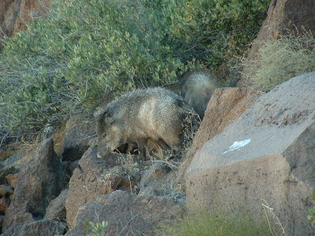
Adult javelina
It was a real treat to see them, and I watched until they disappeared from sight. I carefully bypassed another beehive as I continued down and soon I was back at the truck.
It was getting hot by now. I headed northwest across the desert and quickly climbed Peak 2780. As usual, there was no sign of any previous visit, so I left a register. I don’t mean to belabor this business about registers, but serious climbers in this part of the world consider registers to be an important part of the climbing record. A recent example that hit home for me was when I was surfing the internet and came upon some chatter from a group of climbers in British Columbia, Canada. They were discussing access and climbing details of some remote peaks which I had climbed in B.C. in the1970s, and whether or not their ascents were seconds or thirds, because old registers indicated that I had been the first one there. So registers actually form the basis of the historical record of climbing activity on a peak. Their importance should not be underestimated.
I descended Peak 2780 and arrived back at the truck. They had predicted 109 degrees in the area for the day so I was glad to be done. That completed the eight “Barajita-Tonoka” peaks, but the remaining climbs in the Gu Vo district would involve some interesting access.
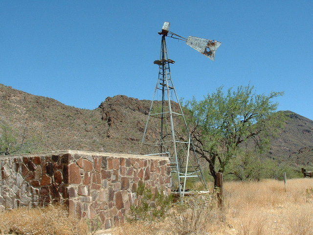
Tonoka Well – someone spent a lot of time building that beautiful rock tank. The windmill is derelict and the tank sits empty.
The drive home went without incident.
One final note about how deadly this summer heat is in the desert – an article in the Arizona Daily Star on Wednesday, July 6, 2005 stated that a total of nine more bodies of undocumented entrants were found in the last few days in this area. A total of 135 have died so far this fiscal year in this sector, the deadliest year on record. It’s one hell of a price to pay for trying to make a new start, isn’t it? Sometimes, when I’m sitting on top of a peak in the summer months, I realize that, somewhere out there within my field of view, someone is dying.