
A couple of days before I started in, a Border Patrol agent I met out in the desert told me that the place was over-run with Bad Guys, that the Mexican drug cartels constantly ran loads of drugs right through the area in which I was planning to climb. He shook his head in disbelief, then asked me if I would be carrying a weapon – I didn’t have the courage to tell him no. Now here I was, far from any help and six hours out from my vehicle. But I’m getting ahead of myself, so let me start at the beginning.
South-central Arizona, the Sonoran Desert, more specifically the Ajo Range – rugged as hell, much of it remote, full of places where they wouldn’t find a body in a million years. Yep, that was where I was heading, to climb an obscure un-named peak that nobody but me cared about. I had studied the maps, which may sometimes tell you very little; I had pored over satellite photos, but looking straight down at something from space can omit much detail. Some of the other valleys I had visited in the range were choked with brush, but maybe this one wouldn’t be so bad, maybe? It’s been said that the greatest attribute in a mountaineer is a short memory, and I have to admit that I left my memory at home when I decided to try this peak.
Sleeping in the back of my truck was comfortable enough, but I still had a restless night. When my alarm went off at 4:30 AM, I was already wide-awake. By the time I’d eaten something, then loaded my camping gear back into the truck, locked it and set out on foot, it was 5:20 and still as dark as the inside of an undertaker’s hat. My headlamp brightly lit my path, and that first mile was level and easy. I was heading up Alamo Canyon, which forked into 3 different branches. That first mile brought me to the entrance to the North Fork, which I ignored, and kept on going. The day grew bigger and bigger, so that by the time I reached the spot where the Middle Fork entered the canyon, I had turned it off and stowed it away in my pack. Here, I hid a quart, knowing that I’d appreciate it later in the day when I was on my way back out.
Travel up to this point was going pretty well – a gentle gradient up the wash, with little in the way of brush. The sun’s rays were just hitting the 4,000-foot ridge above me.
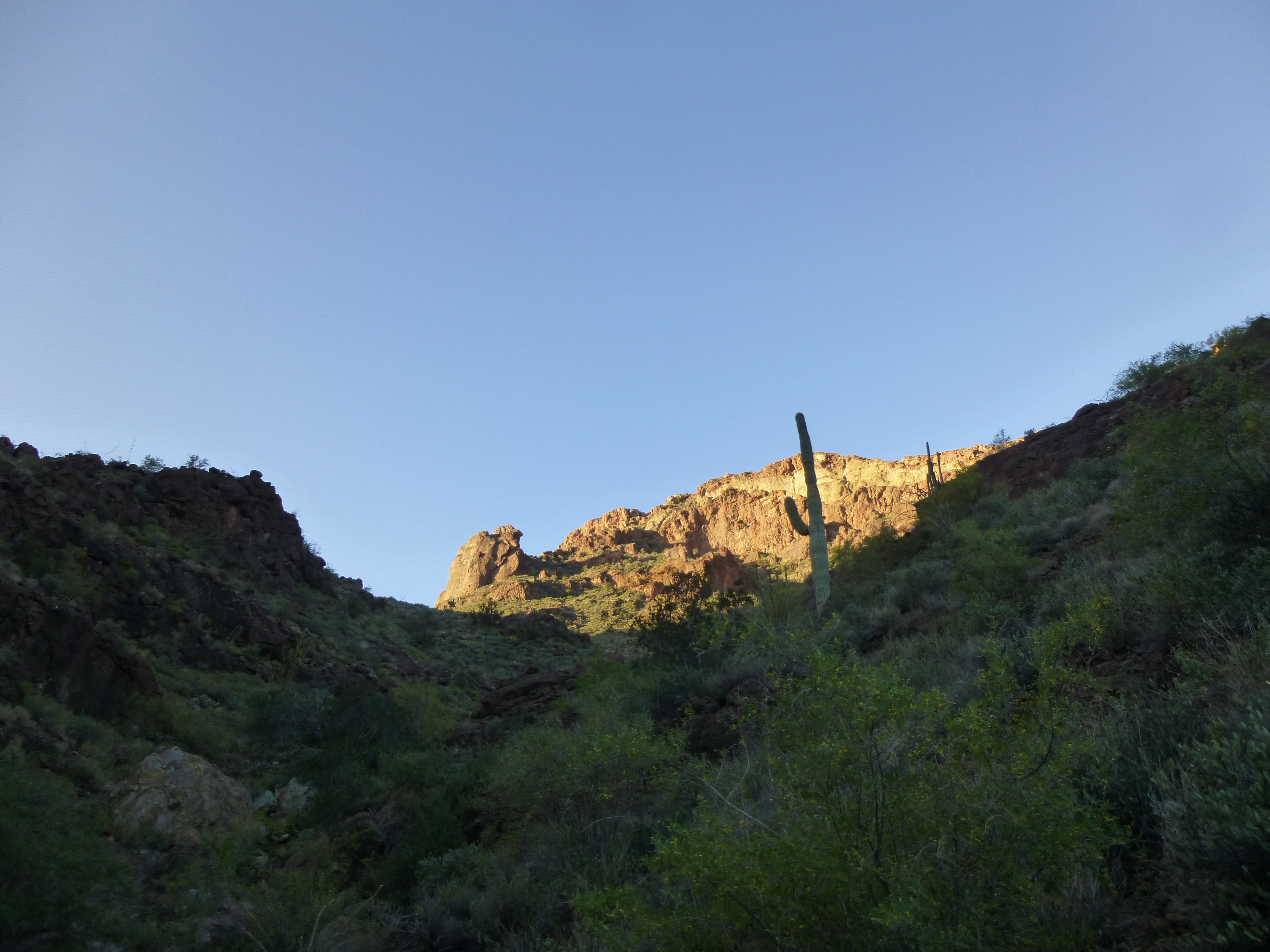
Finally, the sun!
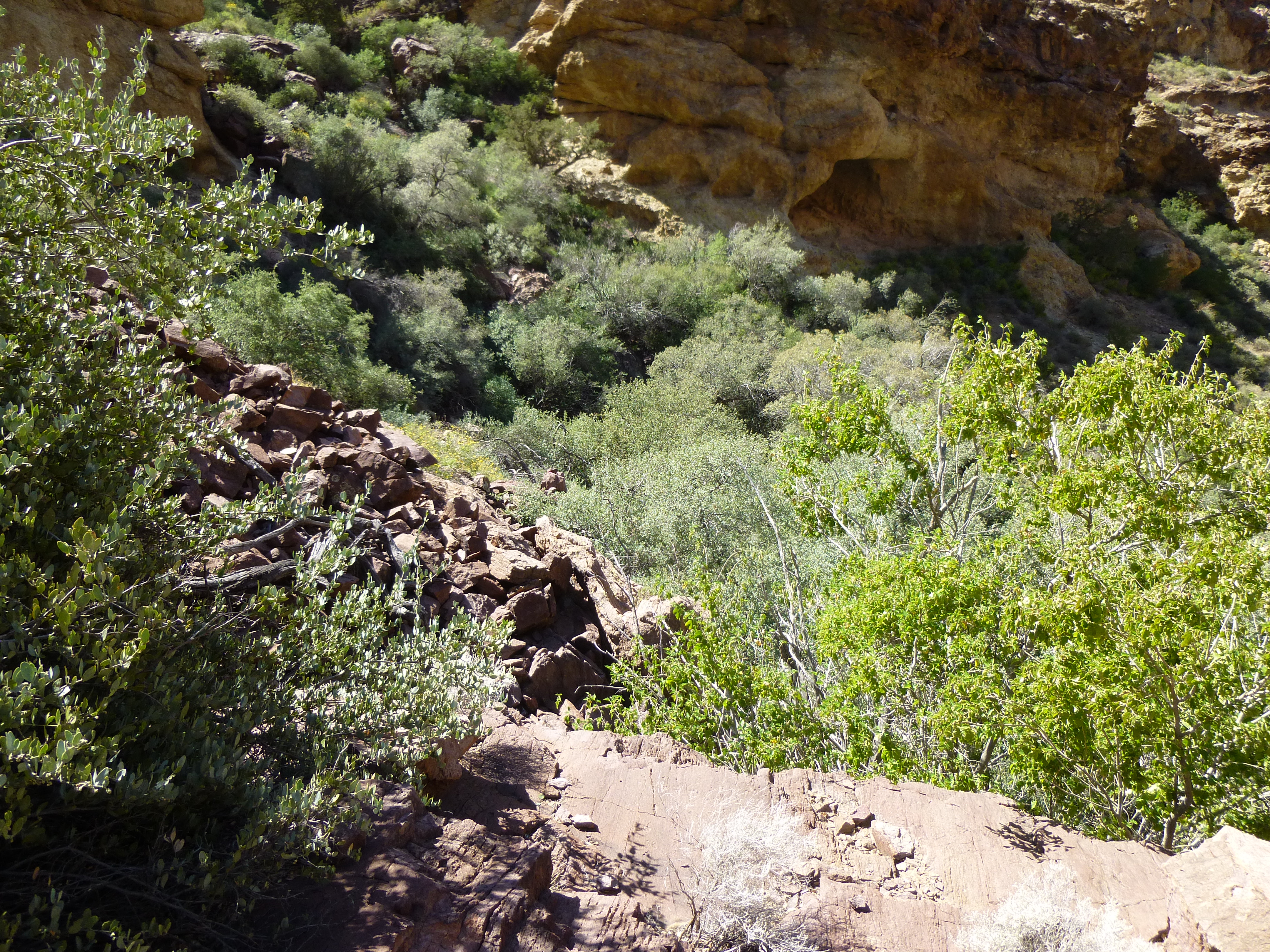
Little did I know that my luck was about to change, and how! Half a mile past the Middle Fork, I came to a spot where tall cliffs tightly constricted the canyon. It was all the same to me if I tried to bypass this on the left or right, so I chose the right (west) side. It was brushy to start, but a series of slabs tempted me upwards. I soon found this lying out in the open.
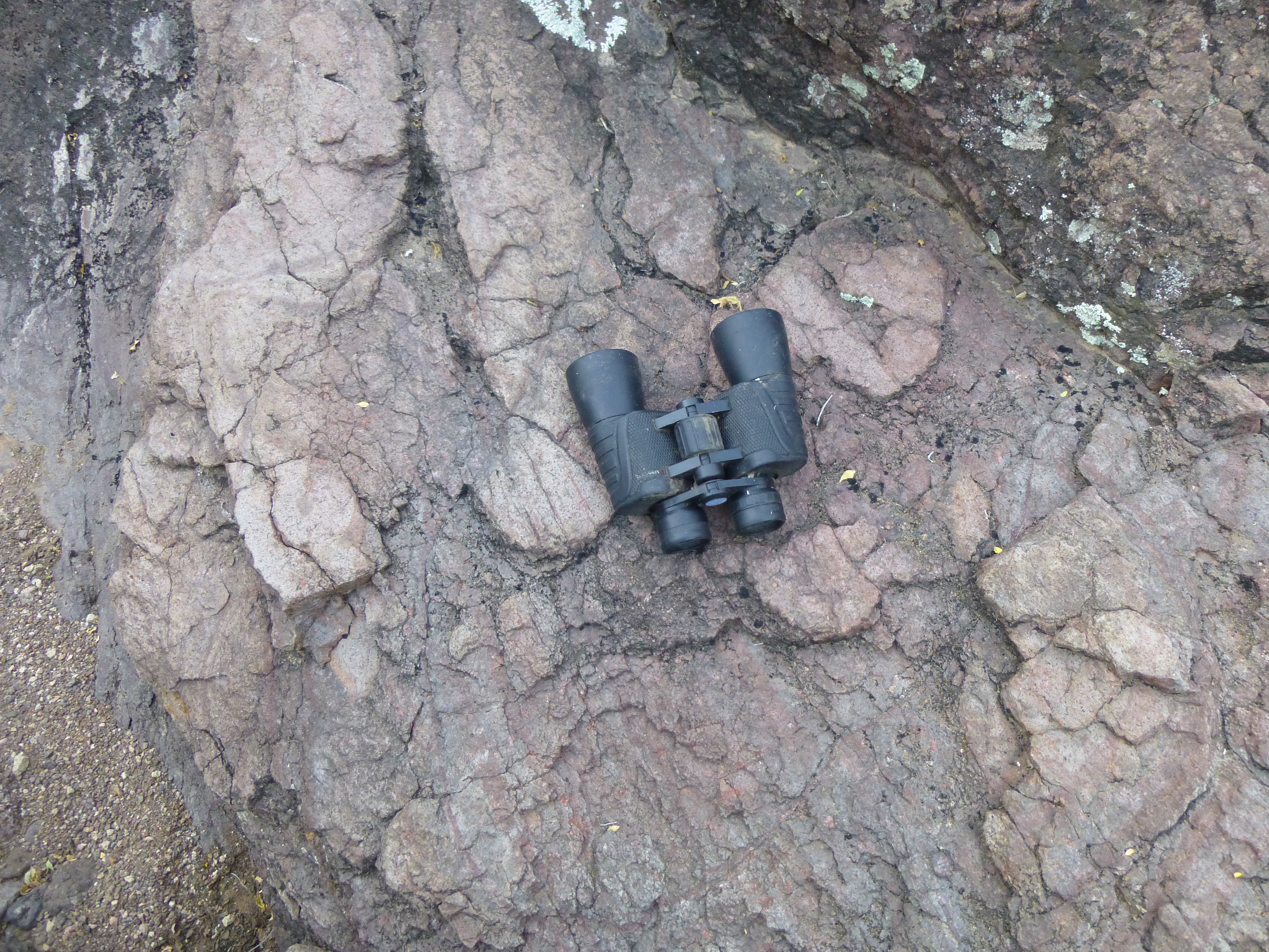
I didn’t bother to take them, as I’d found plenty of others over the years – cartel smugglers had left them there. Looking steeply back down, I spotted this natural catchment in the rock, still filled with water, a godsend here in the desert.
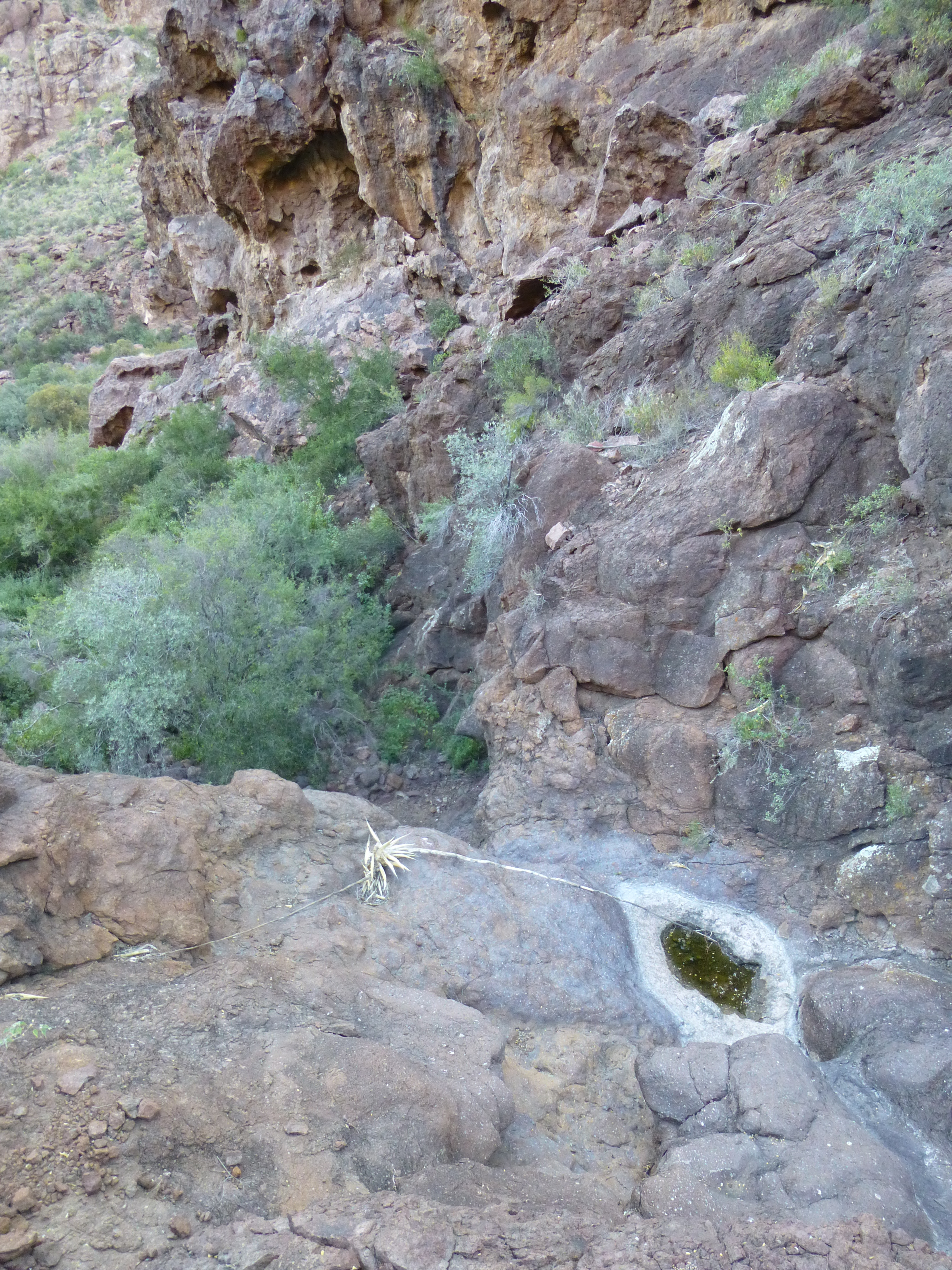
Water
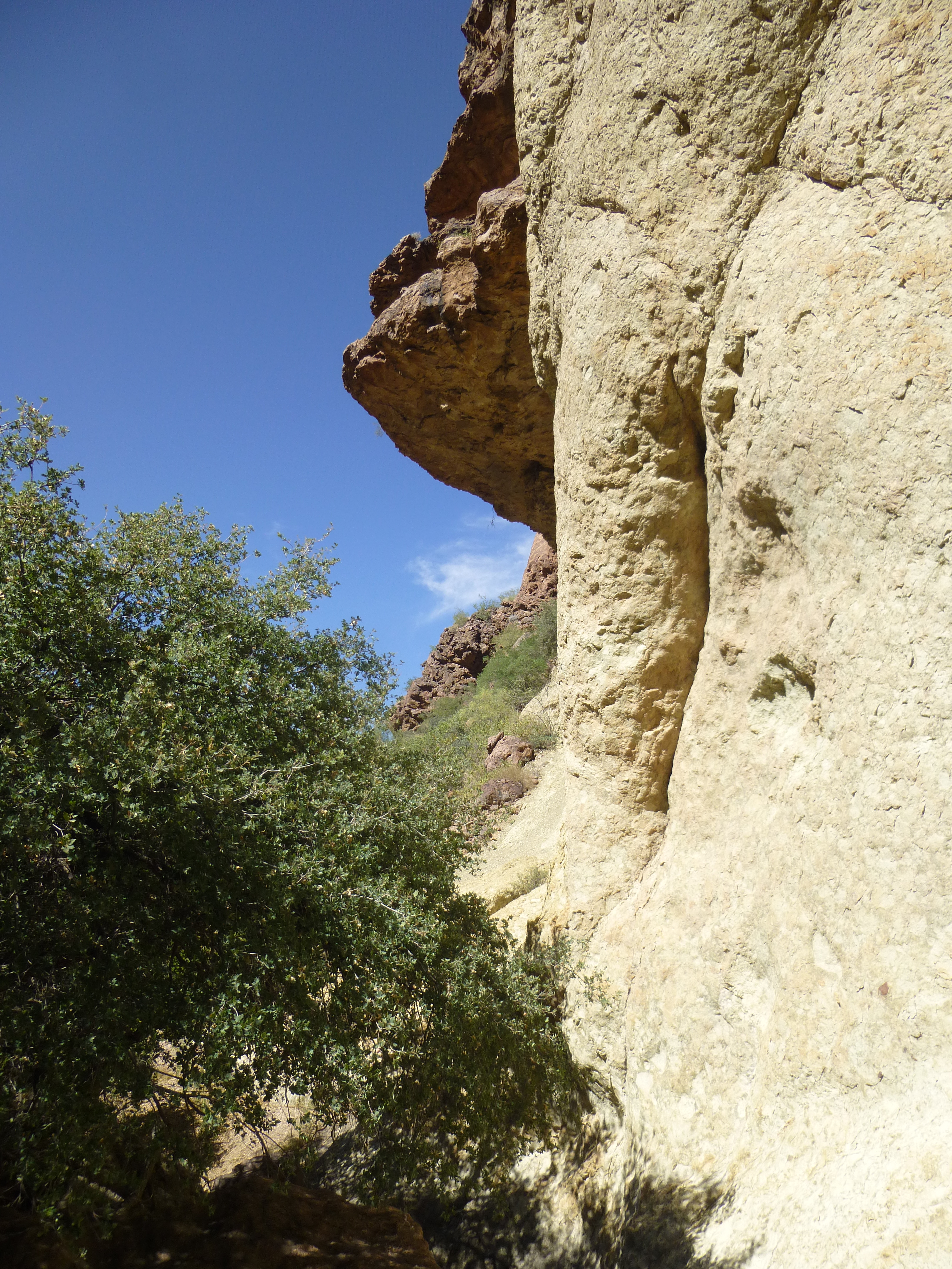
Before I knew it, I had climbed 250 feet above the canyon floor, where I walked into the sunshine for the first time. Little did I know, but this would be my last really open view for a long time.
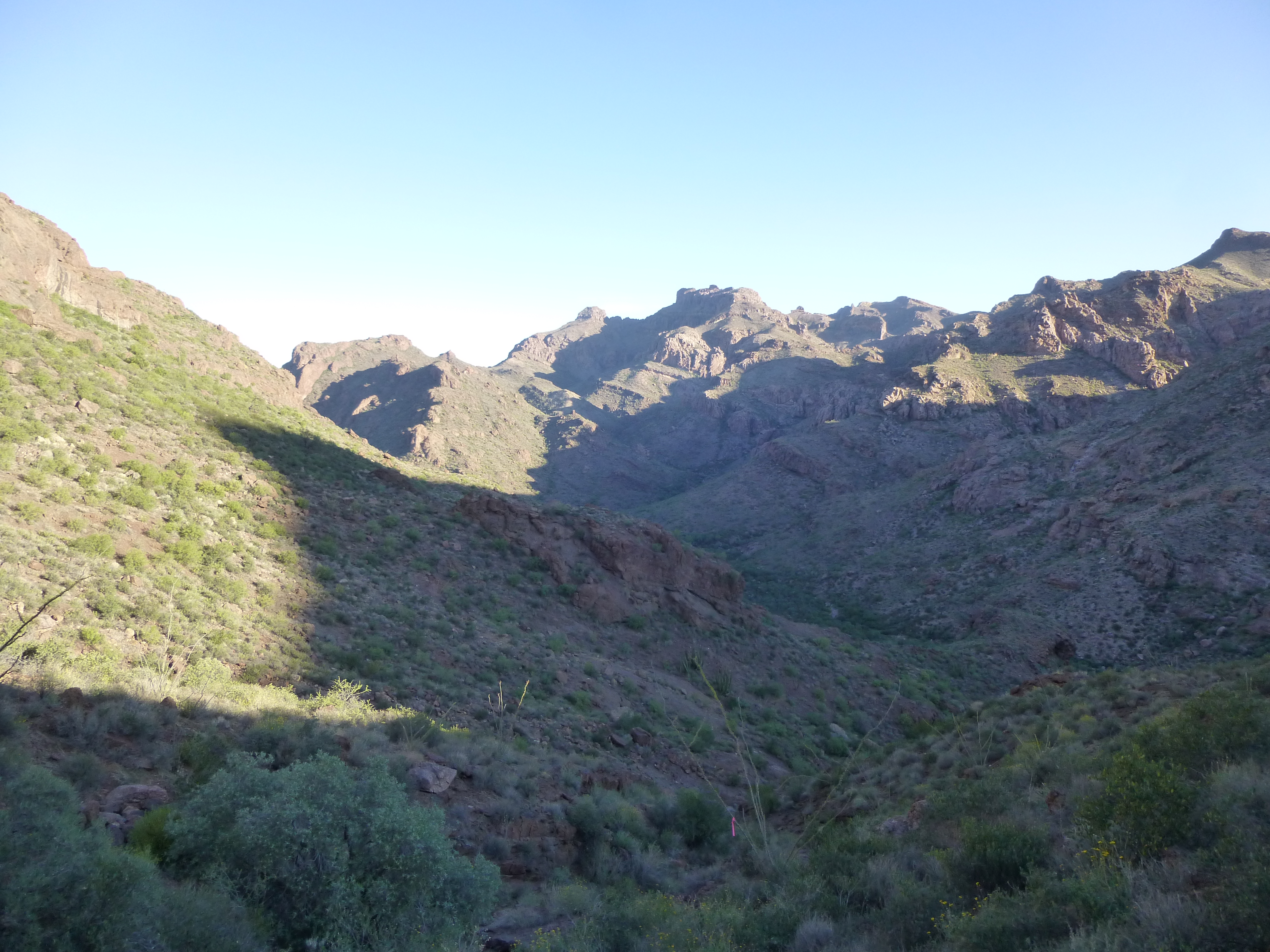
Looking north.
I was on a ridge and looking down steeply into the main canyon, so I thrashed my way down through the brush to join it once again. Well, at least I had bypassed the huge cliffs, but it seemed like an awful lot of work to pass a hundred feet of cliffs – a 250-foot climb to gain less than a hundred feet. Maybe there’d be a better option on the way back later on.
As I continued on up the canyon, things soon changed. The brush closed in around me, and it became a real struggle to push my way through it. There would be short stretches of good going, but the brush was never far away and always waiting to torment me as I pondered how to get through the next bit.
Gonna getch ya!
If the brush weren’t bad enough, there was endless boulder-hopping. At times, the walls would close in, forcing me to go around through the relentless bush or climb steeply up to bypass such places. I had to climb up 75 feet to get around this one.
Thou shalt not pass!
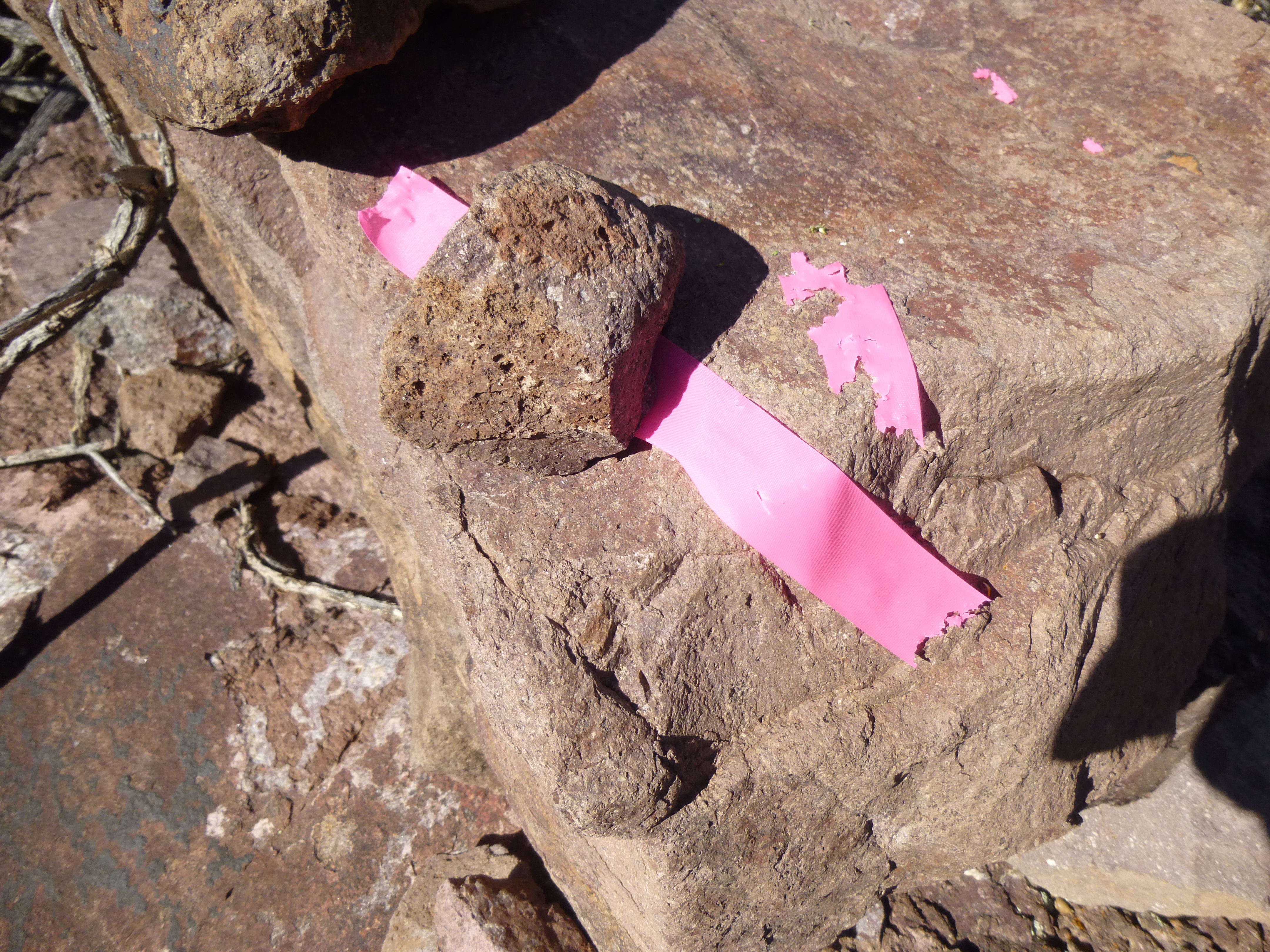
In some places, the brush was so thick I had to use flagging to mark my way, the better to retrace my steps later. Forward movement became incredibly slow. There was one horizontal stretch of 3,900 feet that took me 1 hour and 5 minutes to accomplish – that works out to 60 feet per minute, or less than 7/10 of a mile per hour. You could almost crawl that fast (actually, I was crawling for several stretches). That soul-destroying brush was really starting to get to me.
The wall of brush
To make matters worse, I started seeing more and more signs of drug smugglers – things like big pieces of cardboard, which they use to wrap bundles of drugs.
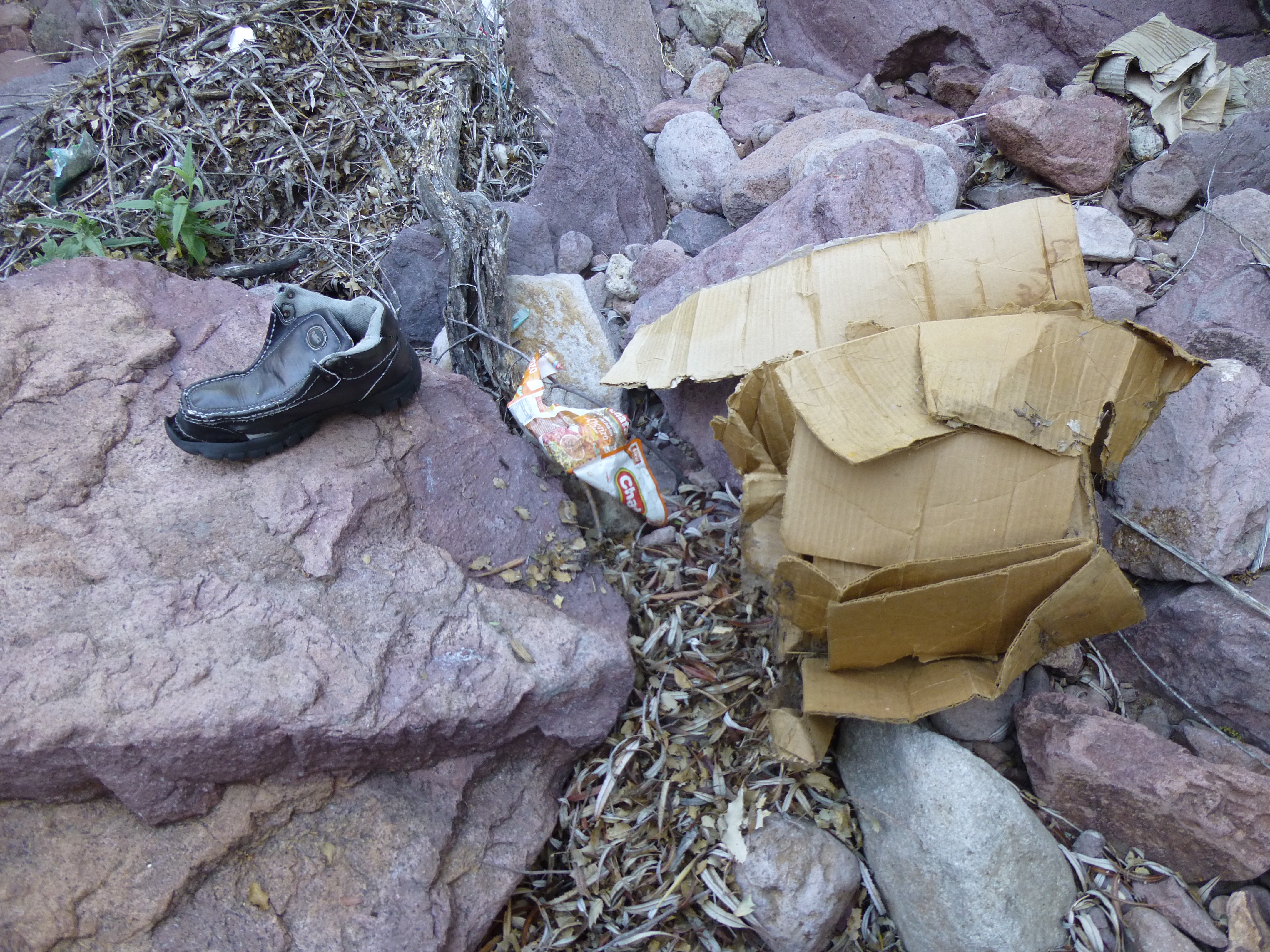
Cartel stuff
And large burlap bags, also used to transport the drugs.
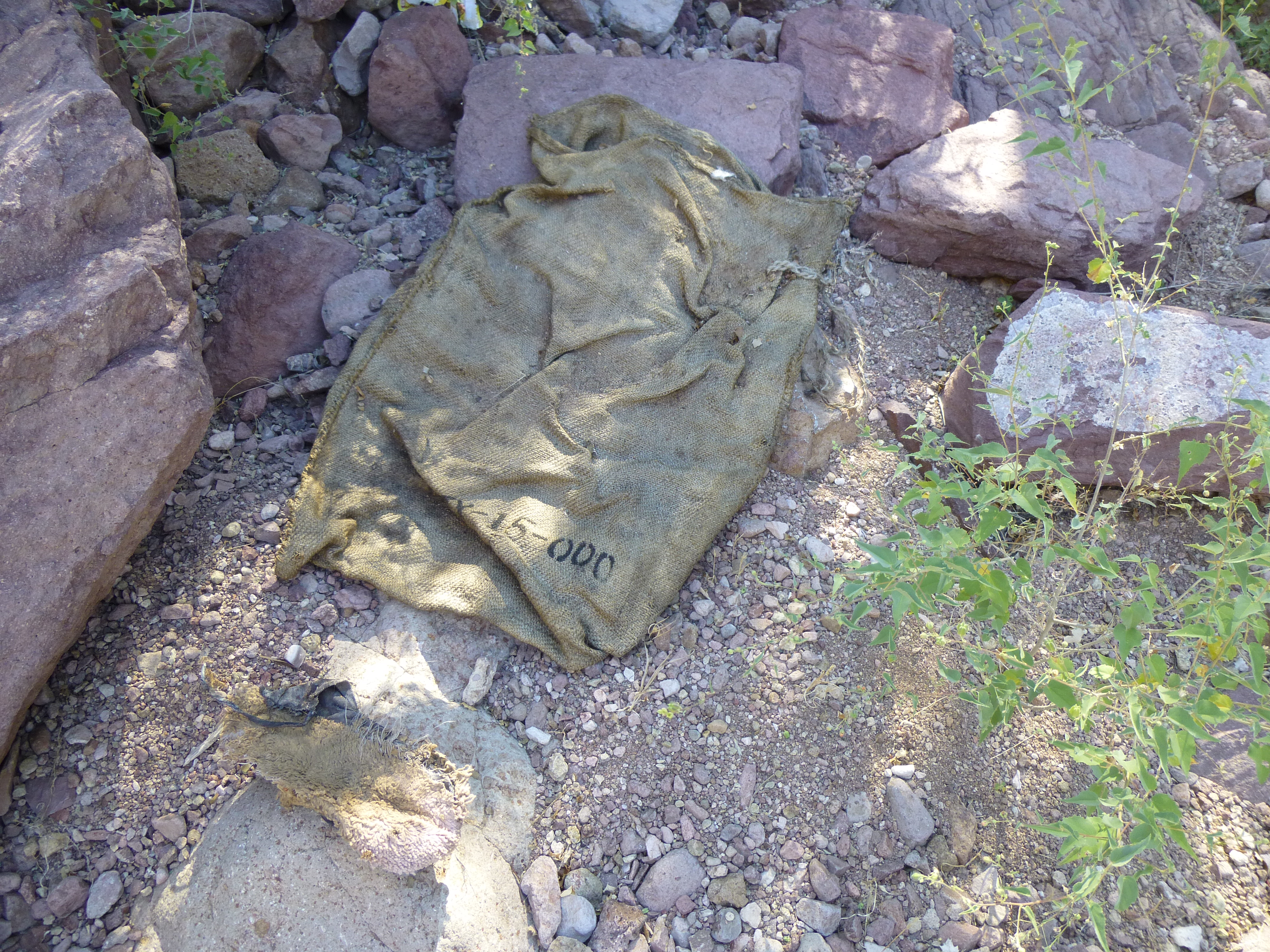
More cartel stuff
Aside from the rare open spot, what I now found myself in was the type of climbing that I had only previously experienced in nightmares. There were several moments, as I caught my breath after a particularly-bad thrash, when I seriously questioned what the hell I was doing out here.
It had taken me 3 full hours to move 1.4 miles up this South Fork, for an average speed of less than 1/2 mile per hour. Finally, I reached a spot where things opened up and my heart leaped – was I now going to be able to make some real progress? I was entering a deep canyon, with NO brush – here’s a look back out the way I’d come into it.
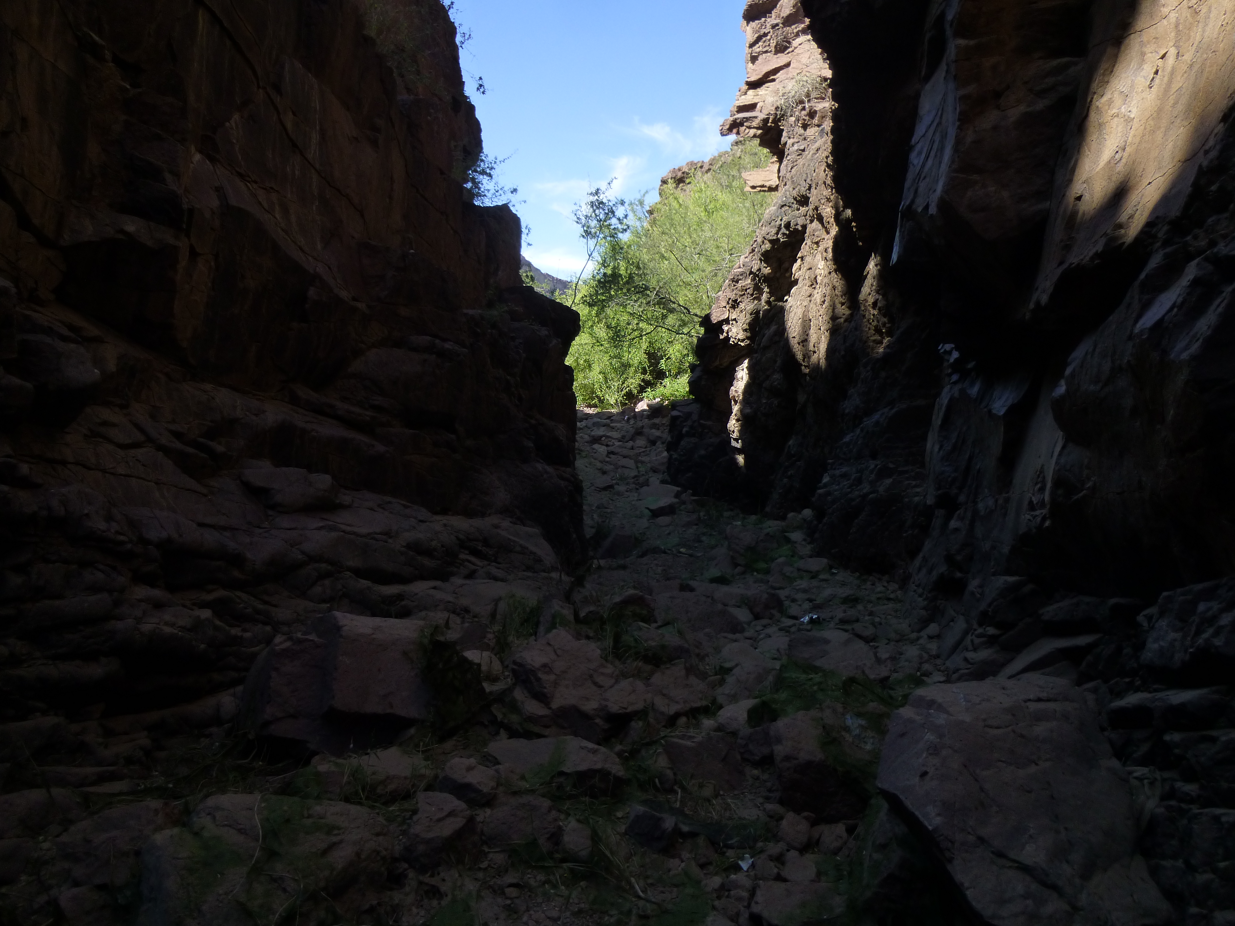
The mouth of the deep canyon
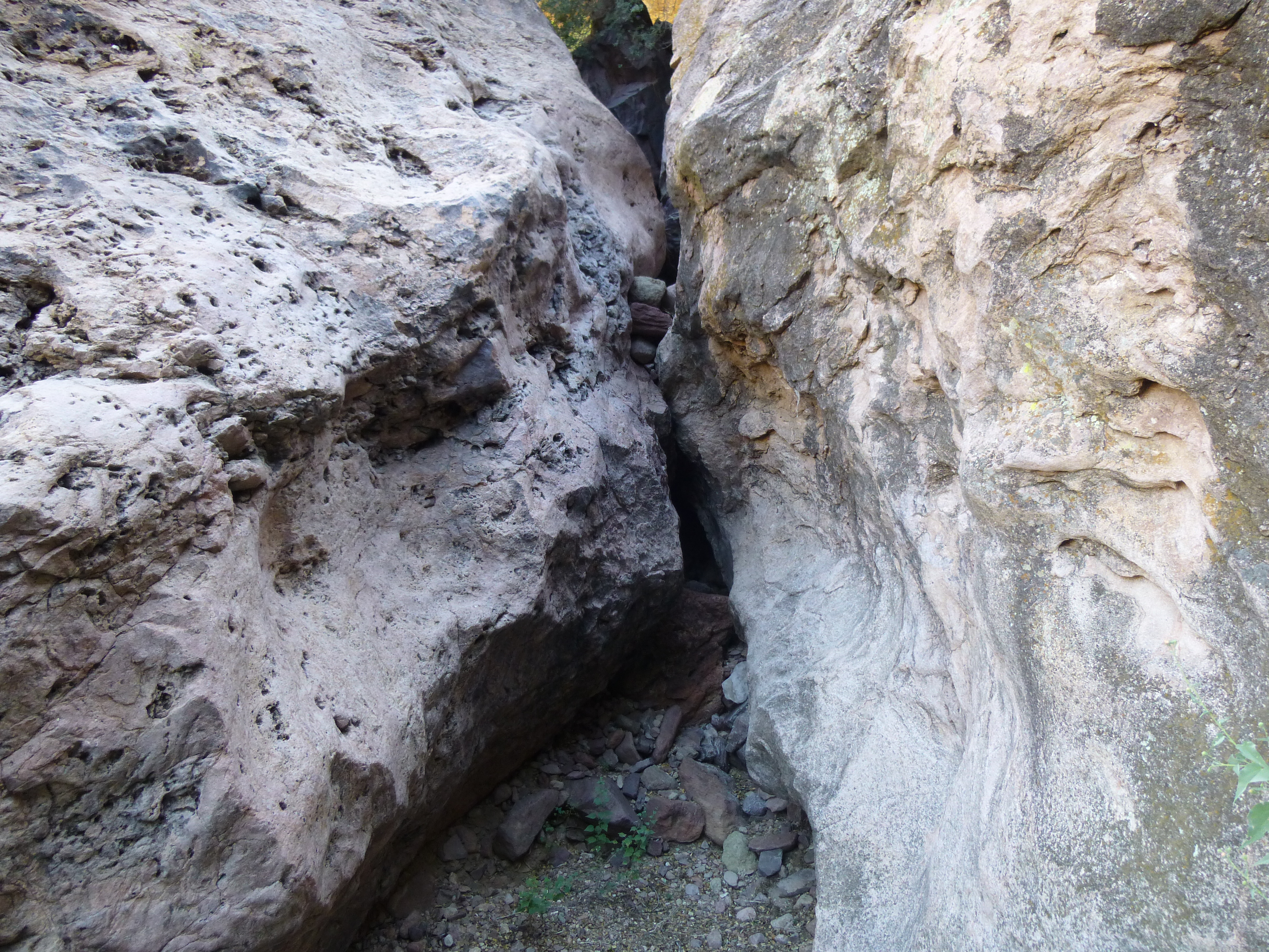
This was exciting! Hopefully, it’d allow me to keep going – I’d see in a minute. As I wound my way through, my heart was pounding – what was around the next corner? Goddamit – stopped dead in my tracks!! A huge pool, about 50 feet long, filled the entire bottom of the gorge.
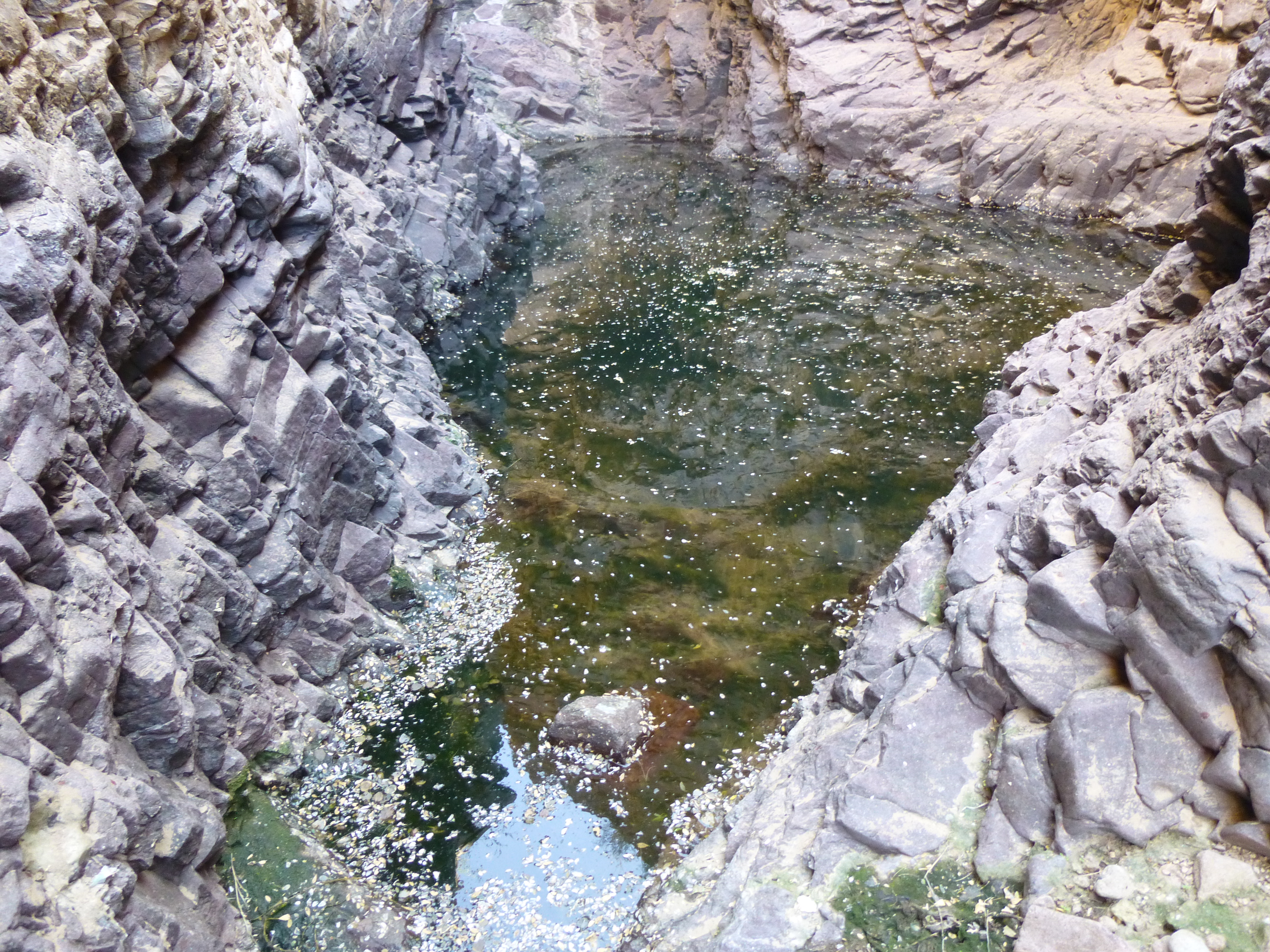
The pool
There’s nothing wrong with the picture – all those white things you see on the water are countless dead bugs. The rock along the sides of the pool are near-vertical and in many places smooth, and I knew I wouldn’t be able to pass the pool by trying to climb past it. The thought of wading it was soon dismissed – I threw several rocks in and could tell it was way over my head. My day pack weighed almost 20 pounds. If I were to try to swim the length of the pool, I’d have to take my boots off, put them into the pack, and swim with the whole affair over my head so as not to ruin my GPS, camera, headlamp, etc… That seemed a fool’s errand. Besides, I didn’t know what was around the corner beyond the pool – it could be another dead-end. Shit!! And the last thing I wanted was to drown in a pool so remote that nobody would ever find my remains.
Somehow I’d have to bypass the deep canyon by climbing up out of it and around. Backtracking a hundred yards, I found a steep gully which led up and out – it was nothing worse than Class 3. I soon found myself 200 feet above the canyon floor and on its south side.
If I had done my homework a little better, I would have realized at this point exactly what I should do next, but I hadn’t prepared well enough. I vaguely remembered from the satellite photos that I had studied, from the comfort of my sofa back home, that a distinct trail passed through this area and headed over towards my peak, but now I couldn’t remember the fine details. And like an idiot, I didn’t make enough notations on my map to help me out.
As I scrambled out of the gully, almost immediately I came face-to-face with a good trail, well-used and distinct. To the left, it appeared to go back down to the main canyon; to the right, it wound its way uphill in the other direction.
The trail shows in the bottom center of the photo and angles up and away to the right.
So now I made my second big mistake of the day – for some reason, I headed uphill and away from the canyon, assuming that it’d somehow follow a high path that would eventually lead around towards my peak. Oh, how wrong I was! I followed it up for a while, then took a fainter trail which offered hope of heading back the way I knew I’d have to go. I climbed 700 vertical feet above the canyon before topping out on an open ridge, where I had this view of Peak 3940, the first time I’d seen it all day. It still looked pretty far away, with a bunch of uncertain terrain to cover in order to get there.
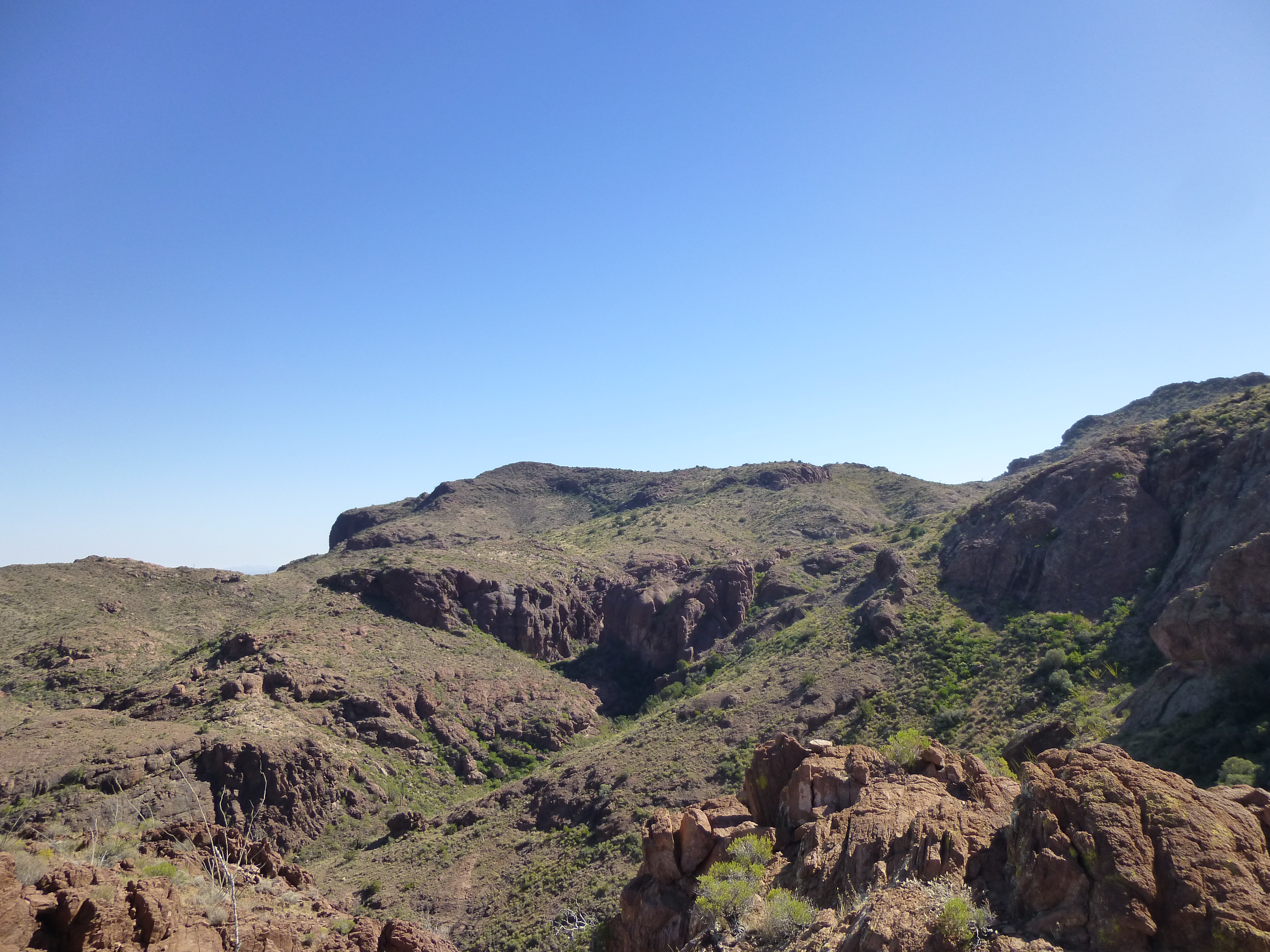
Peak 3940 on the skyline, just to the left of center
Ever the optimist, I braced myself for the next stage. I contoured down into the next valley, crossed over a gentle ridge, then found myself staring down into the bowels of the good old South Fork of Alamo Canyon once again. The terrain forced me lower, and a steep loose hillside covered in (of course, what else?) nasty brush was my reward before I dropped all the way down to the main canyon again.
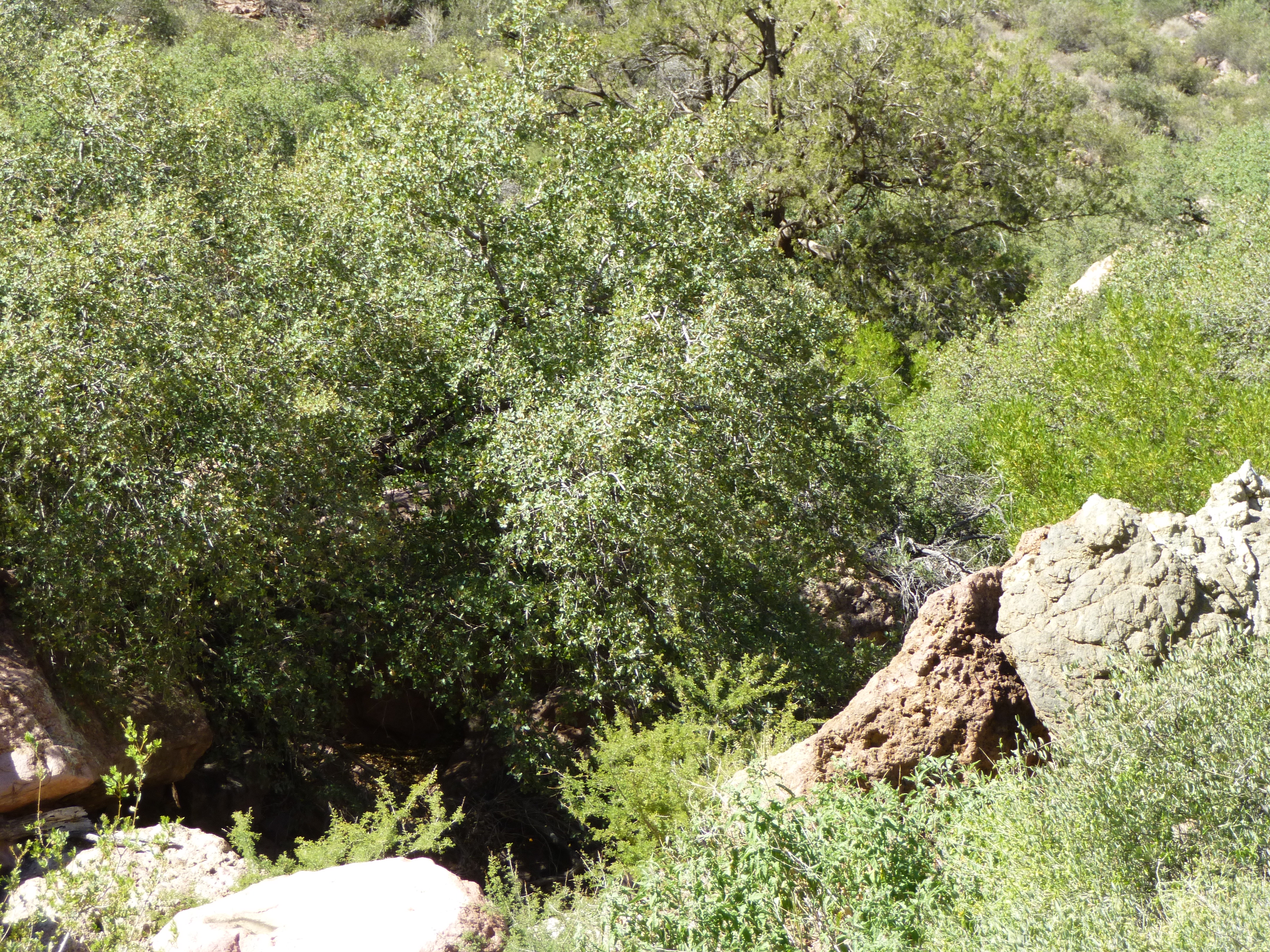
It was like entering the Garden of Good and Evil. There was trash everywhere, a lot of it, really a lot. This was a spot where many Bad Guys spent a lot of time as they carried their loads of drugs north to waiting American users. I walked felt-footed into the midst of it, oh-so-carefully, as I had no idea who might be there waiting. It was my lucky day – the place was deserted. In the canyon bottom were several nice pools, the perfect place to refresh yourself as you evaded law enforcement.
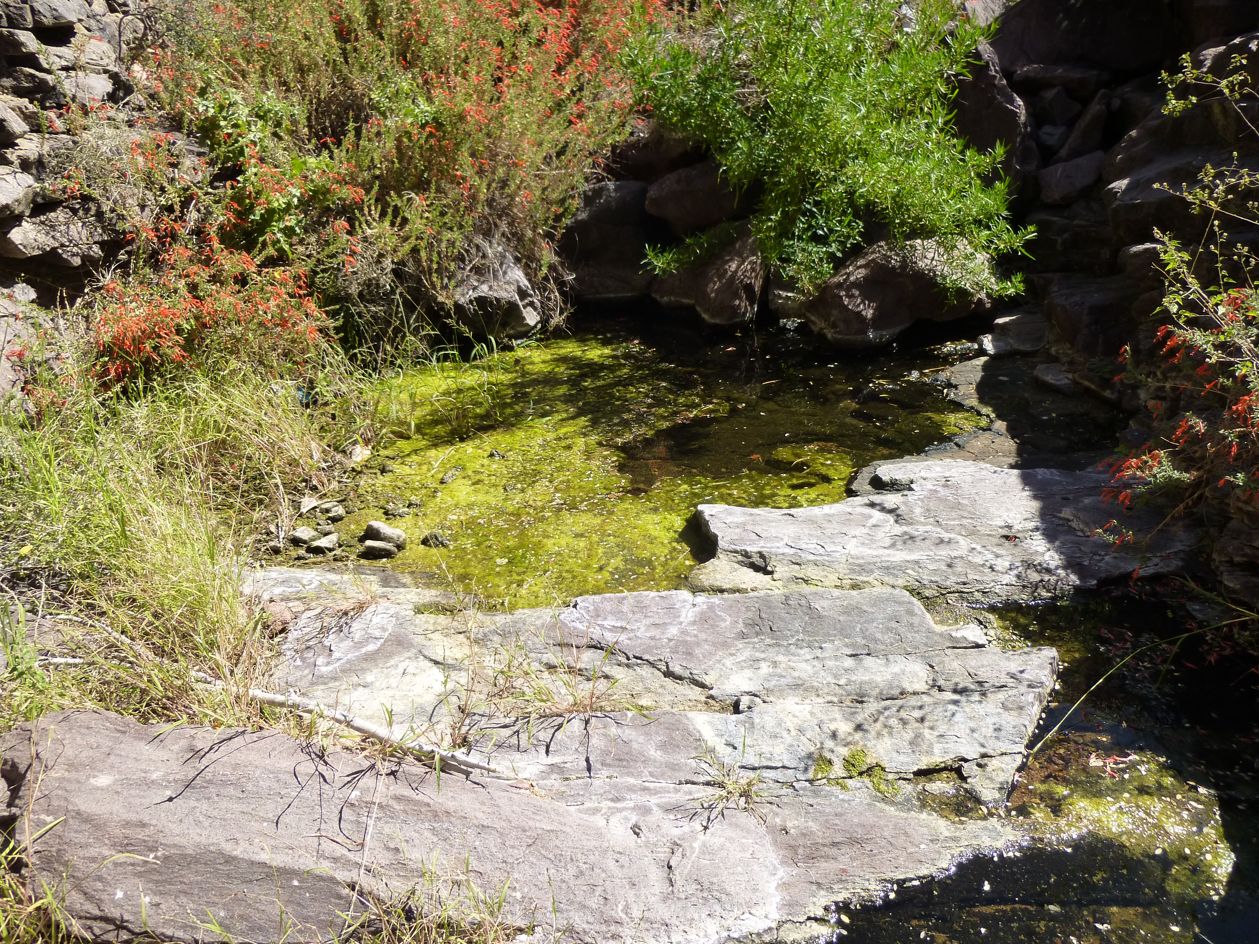
Pools in the upper canyon – the light green is algae on the water.
Remember the big pool I’d met earlier in the day, the one that had scared me? My GPS showed me that I was only 80-or-so feet above it, and very close by horizontally. I walked over to the edge of these upper pools and tried to peer down the gorge, but couldn’t see far – it looked like there was a lot of vertical real-estate below in the gloom.
I then realized that I’d spent well over 2 hours getting here, to a spot just above the big pool – I’d come in a big circle. After looking around a bit, I discovered a well-used trail climbing north out of the canyon from right near the pools, heading in the direction of my peak. I started up it, but decided that since I’d now been 6 1/2 hours out from my truck, discretion was the better part of valor. It was a hard decision to make, but the practical one under the circumstances. I went back down, crossed the canyon bottom through all the trash, then had a hunch what I’d find next. Yep, right about where I thought it would be, a trail heading uphill from the garden spot. I followed it, and 5 minutes later I was at the place I’d first met it hours earlier!!! What a dope – if I’d only gone left instead of right, I’d have saved myself hours of effort and would easily have gotten my peak. So there I was, looking back down the brushy Class 3 gully that led me back to the floor of Alamo Canyon.
It’s 200 feet down to the bottom
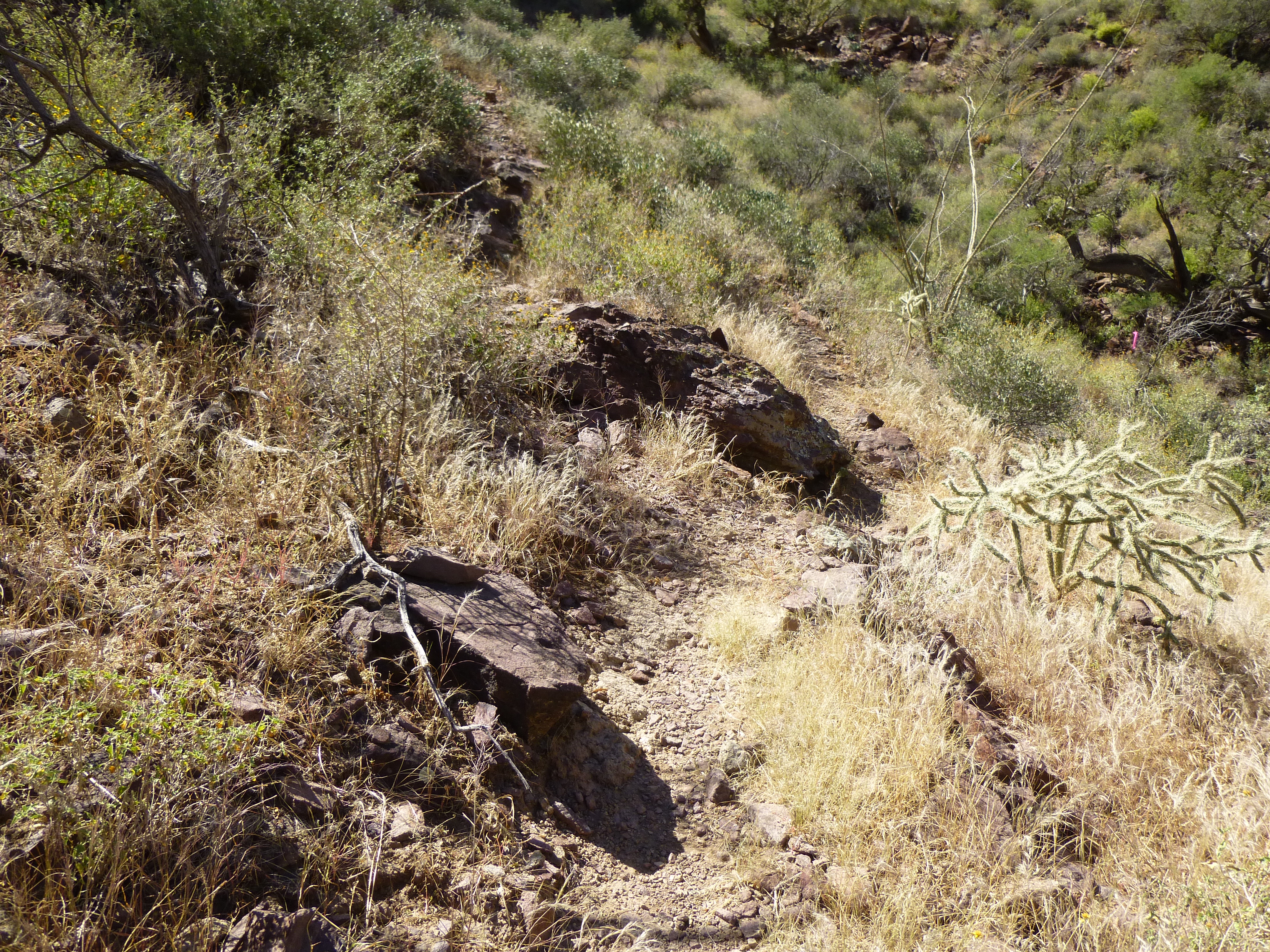
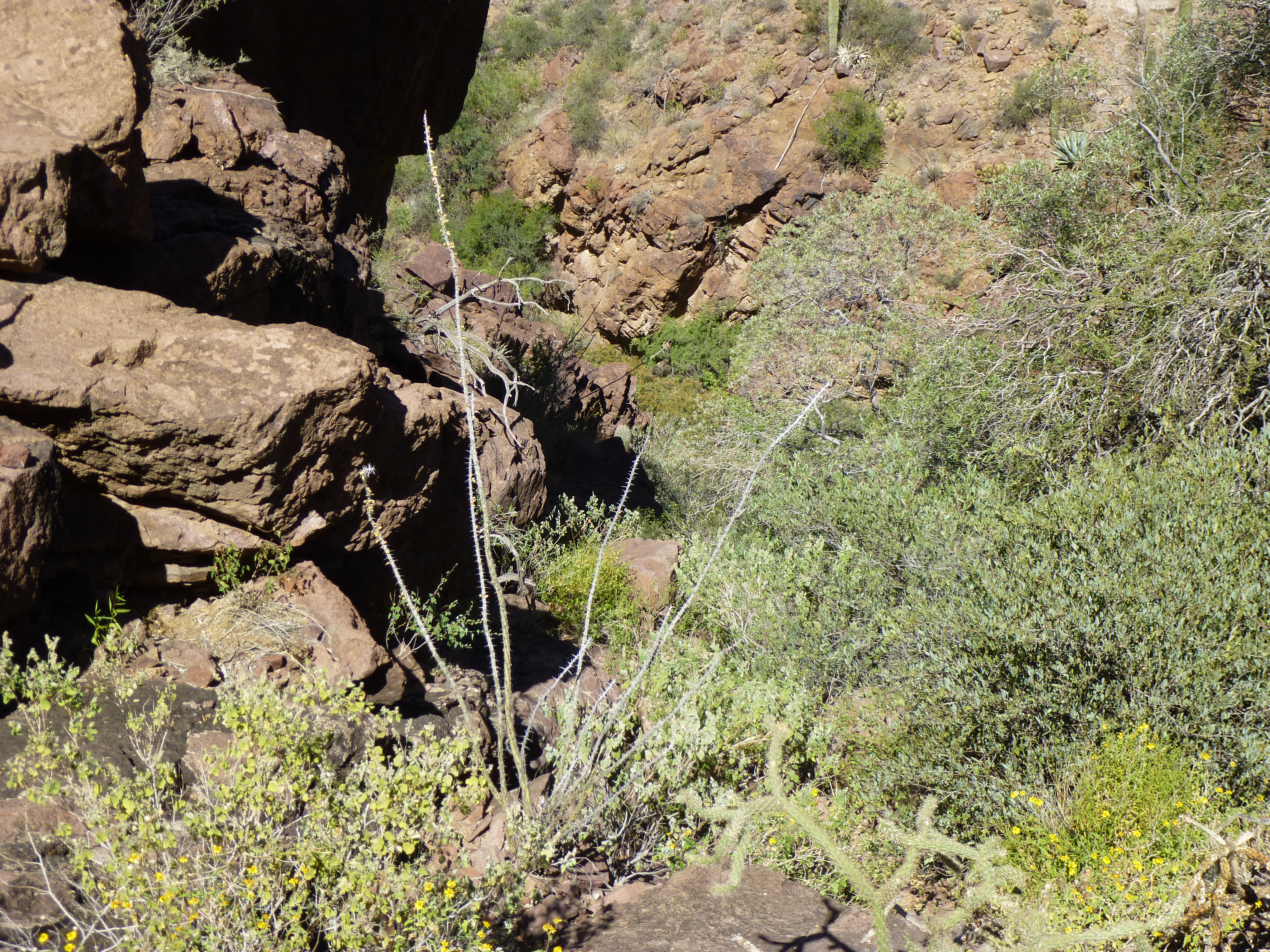
Once back down in Alamo Canyon proper, I just steeled myself to the fact that there was a long slog ahead of me. I won’t bore you with all the miserable details, but will show you a few of the highlights. There were several spots where a big drop had to be negotiated, like this one, by thrashing down through the brush to the side of the cliff.
One of the drops
There were impressive overhangs in several places as well.
An overhang
Remember how I said that some of the bushwhacking was so severe that I had to flag my way through it? I had left a piece out on a rock, and when I passed it again on the way down, here’s what I saw. I’ve long held a theory that animals are sometimes attracted to it – perhaps the color, or just the novelty of it – and will chew at it.
I had picked up some of the empty food packages to show you, so you can see what the well-fed smuggler is eating these days.
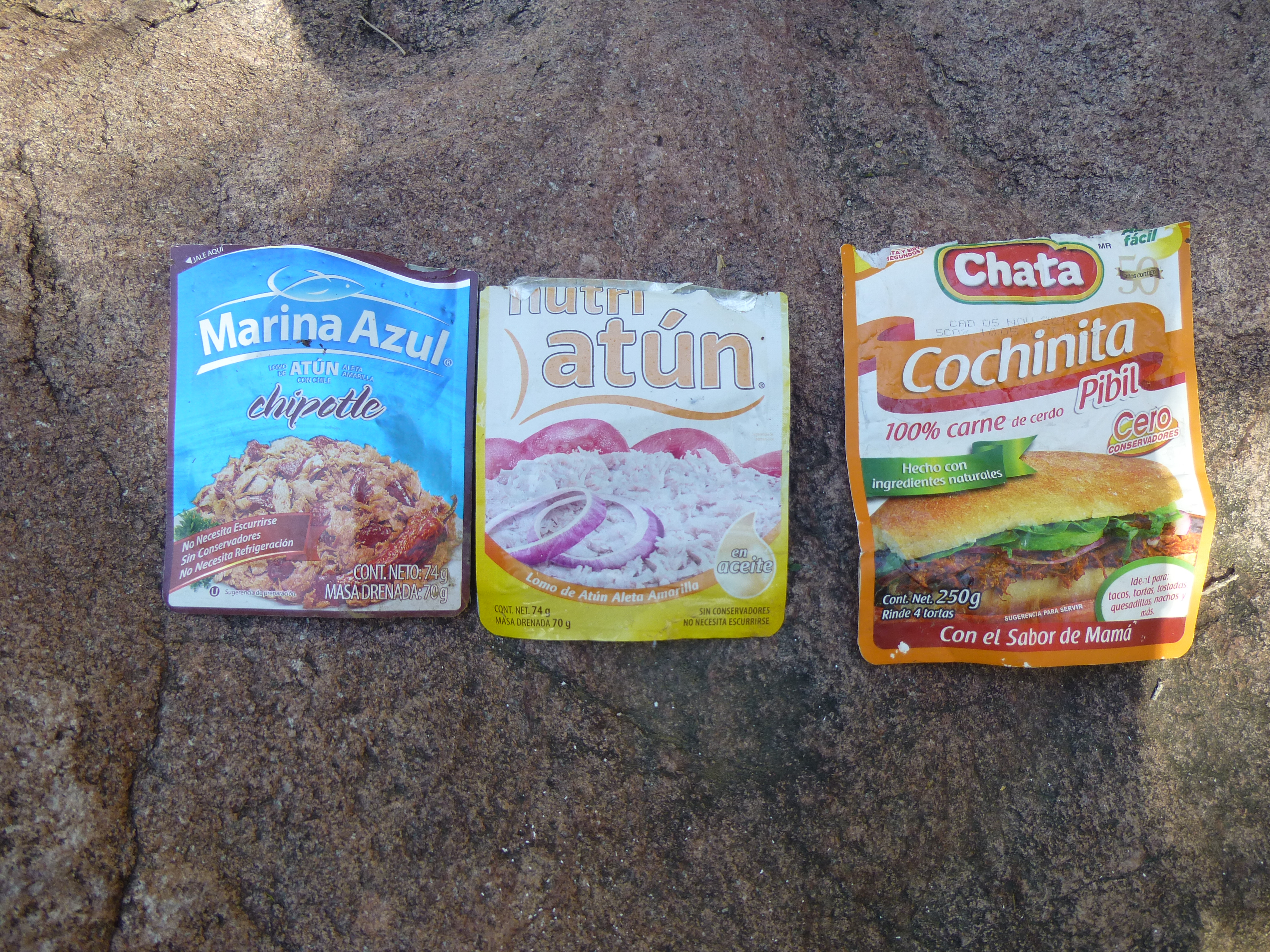
A few of dozens of different ones I saw that day.
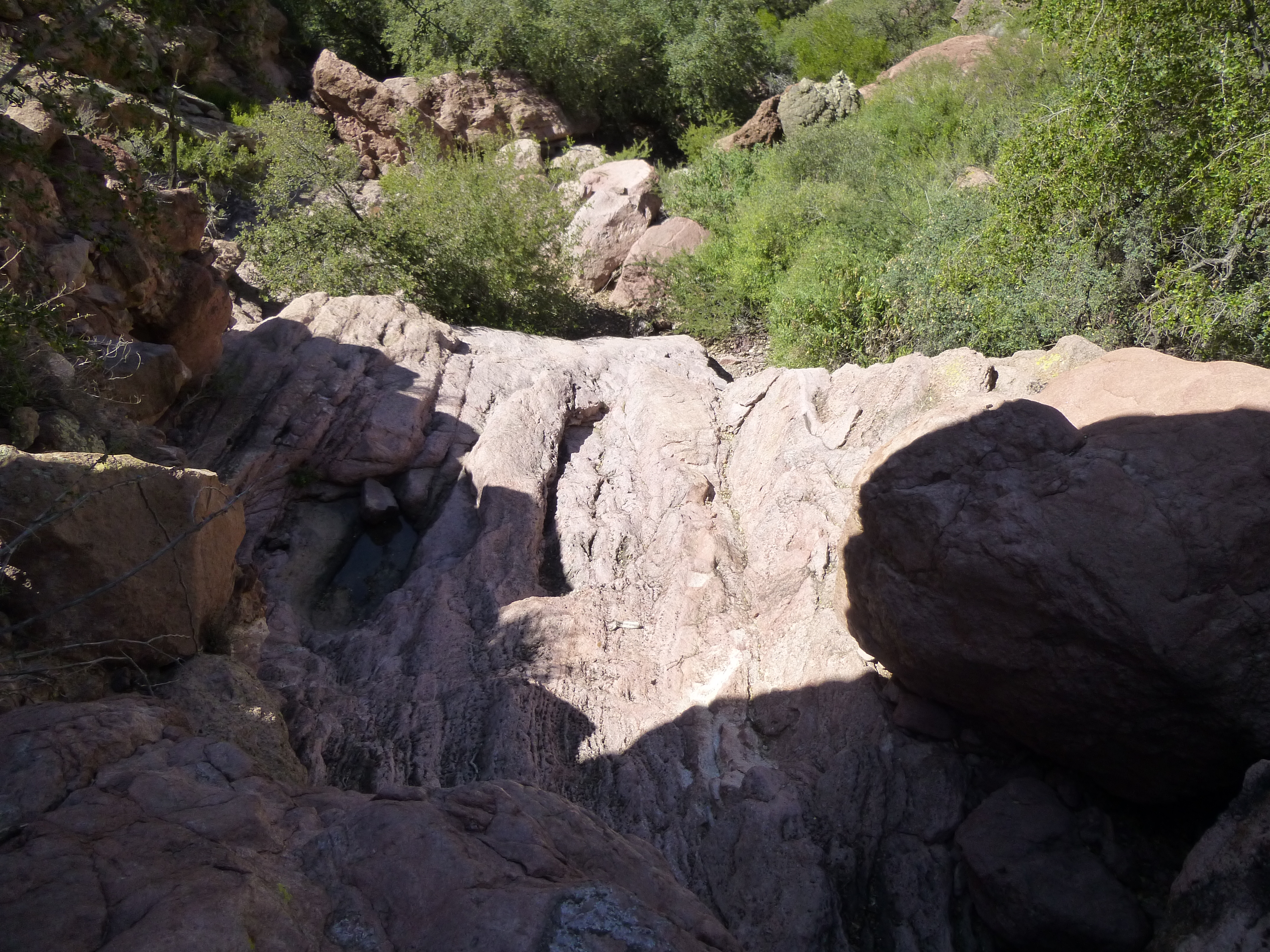
There were plenty of pools in the rock, some of which can hold water for a long time. You can see the evaporation rings here.
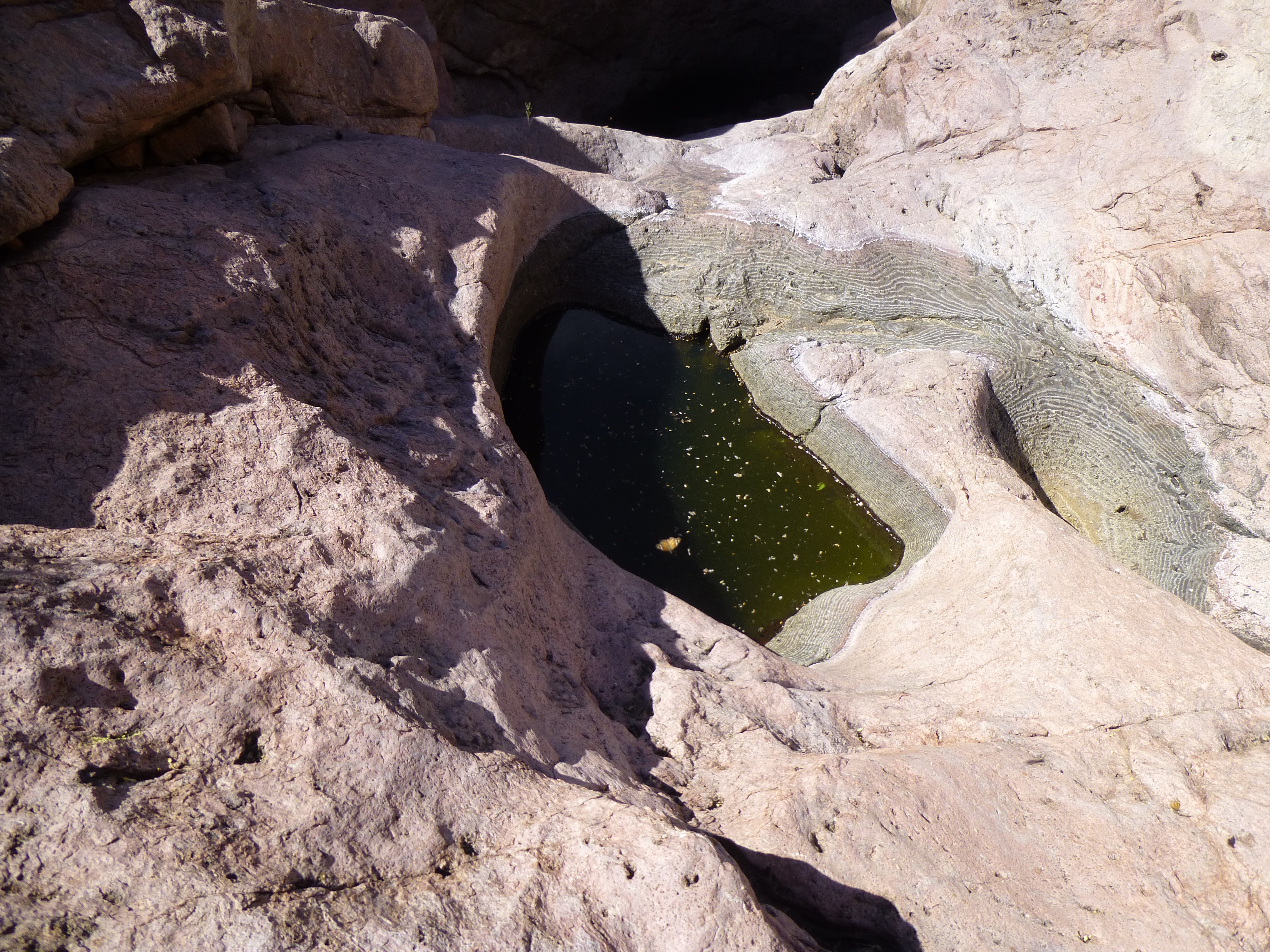
More pools
Early in the day, I had bypassed some cliffs by a 250-foot climb out of the canyon, but hoped that I’d find an easier way around. Well, I stayed on the opposite side on the way down, and it worked like a charm with little elevation wasted. Not far below that, I retrieved my last quart I’d hidden on the way in – ah, nectar of the gods! I was ready for it.
By the time I reached my truck, I’d been out on foot for 10 hours. It was 95 degrees F. in the shade and I was all done in – I guess I’d have to classify this one as a death march. It’s been said that if a day like this doesn’t kill you, it damages you. I looked like I’d been attacked by a bunch of thugs in a back alley, or should I say a bunch of cartel members in a remote canyon. Chalk it up to experience, right? I’m already planning another trip in to get my peak, but you can bet it’ll be by a different route.