
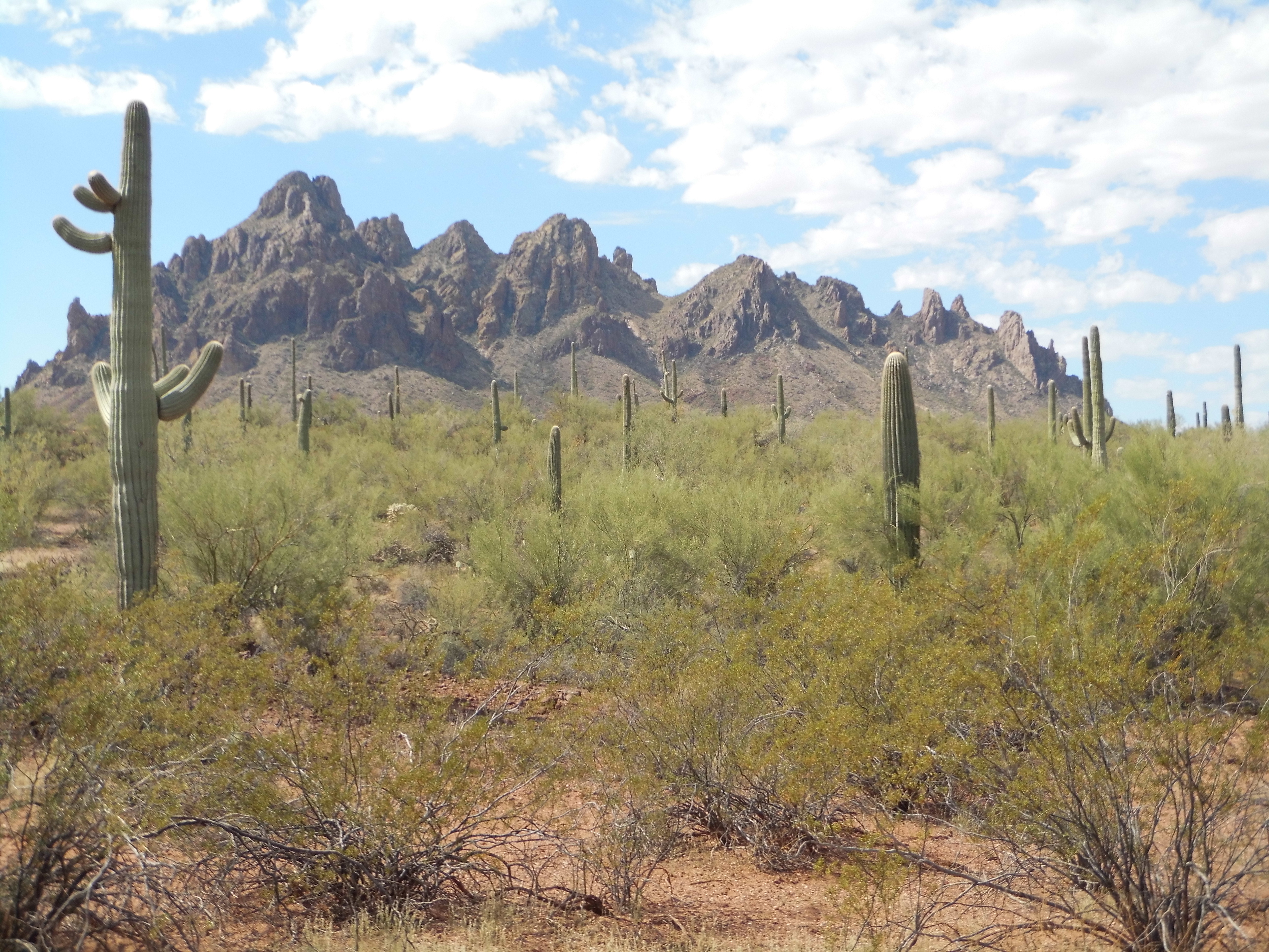
Fourteen years had passed since I had moved to Tucson, Arizona. In that time, a lot of miles and a lot of mountains had passed beneath my boots, and it was all good. But when you live in a state like Arizona with so many peaks (we have 7,479 of them – in fact, only Alaska, with 59,817 and California, with 11,322 have more) it’s easy to overlook some of them. That was the case with a lovely group of hills not far from my home – their nearest peak was a scant 20 miles away, and it took me until the year 2001 to espy them from a neighboring range. They were called the Samaniego Hills. Now usually here in Arizona when we call a group of peaks “hills”, rather than “mountains” or “range” or “sierra”, they tend to be lower or fewer or less significant in some way, but that didn’t seem to be the case with these.
Not only were they close to home, but there seemed to be some interesting historical facts that had occurred in the area surrounding them. The first thing I wanted to learn was how the name itself came about. Samaniego is a Spanish-language surname, and in all of the maps covering the entire state of Arizona, it only occurs in the Tucson area. I dug a little deeper. Samaniego Avenue in Tucson is named after him, as is Samaniego Peak in the Sierrita Mountains and Samaniego Ridge in the Santa Catalina Mountains, both of which are within shouting distance of Tucson. And, of course, the Samaniego Hills.
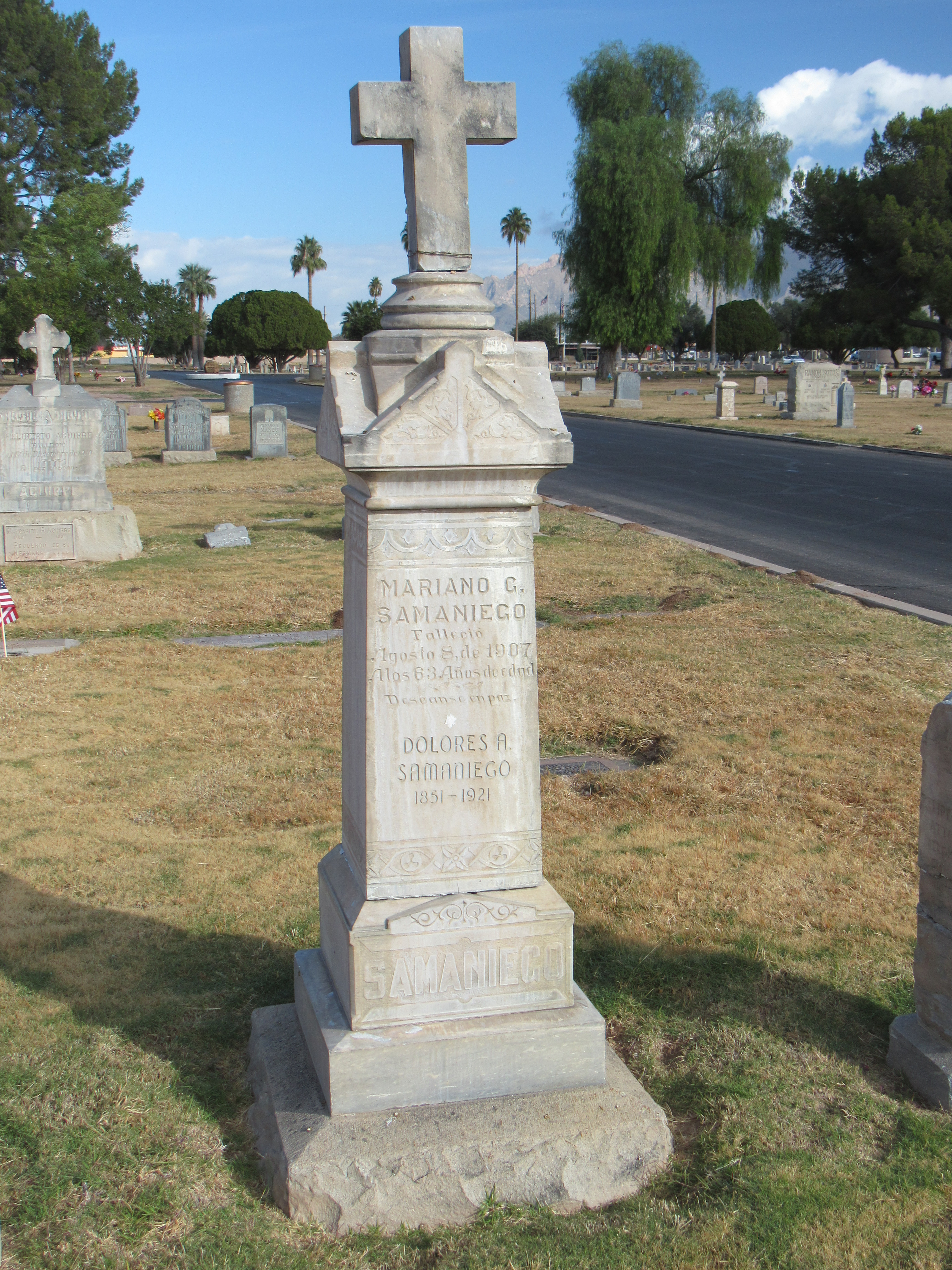
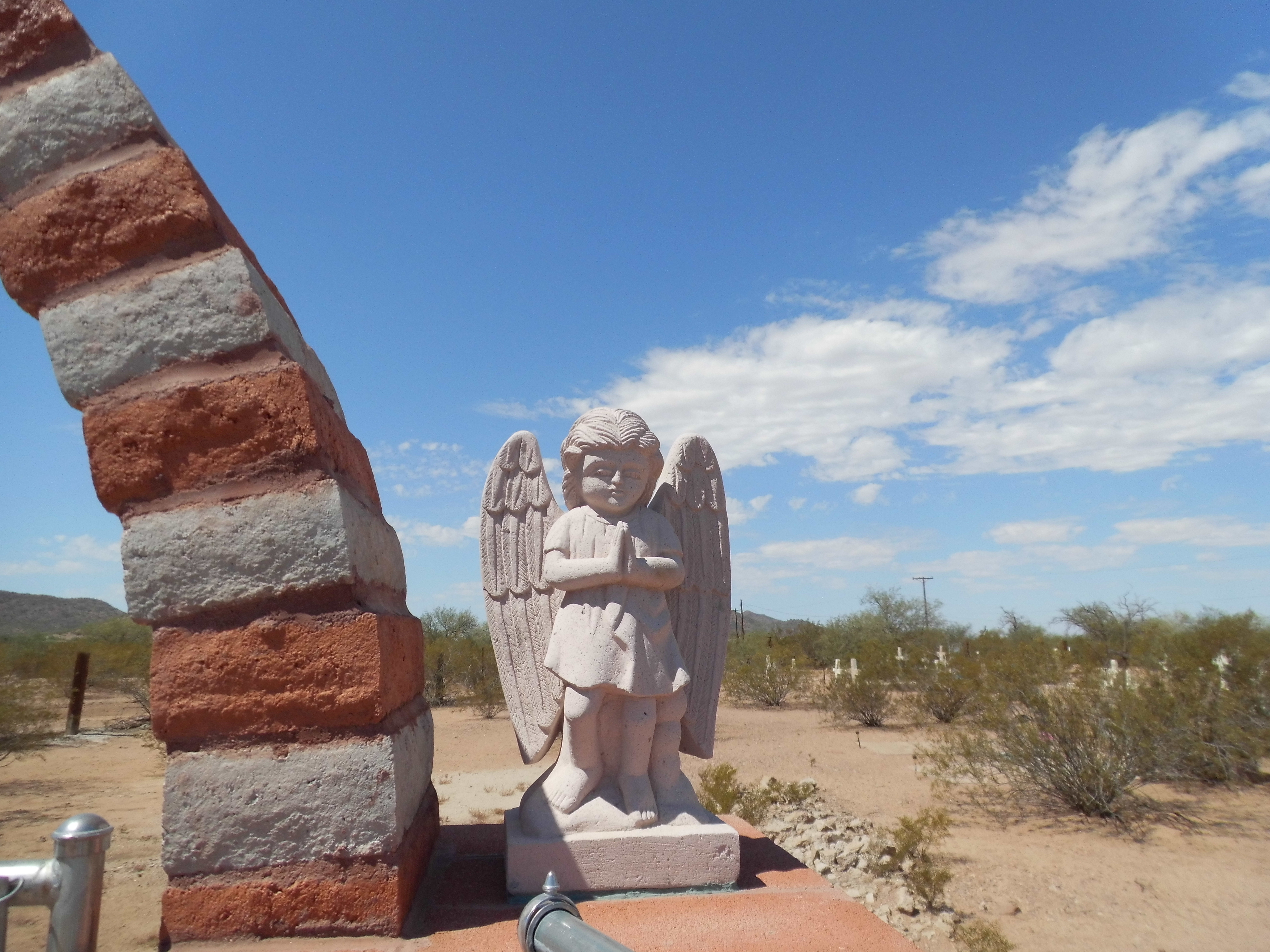
Who am I talking about? It’s Mariano Guadalupe Samaniego, and this guy was really something. Born in Sonora, Mexico in 1844, by degrees he ended up in Tucson in 1869. There wasn’t much that this man didn’t do. He worked as an interpreter for the Confederate Army; he freighted supplies to army forts in Arizona; he raised cattle; he acquired a lot of land north of Tucson, including that which eventually would become the site of the world-famous Biosphere 2. His legacy grew – he went on to serve as a councilman in the city of Tucson, became the Pima County assessor, then the chairman of the Pima County Board of Supervisors. Not stopping there, he became a representative in the Arizona Territorial Assembly, served on the University of Arizona’s first Board of Regents and even served two terms as president of the Arizona Historical Society. Quite the legacy! At the height of his career, he was one of the most powerful men in Tucson. He passed on in 1907, at the young age of 65. To me personally, there’s no more enduring legacy than to have geographical features named after you – that’s forever! I had a hunch he was buried in Tucson, so after a lot of work I was able to track down the location of his grave. Here it is.
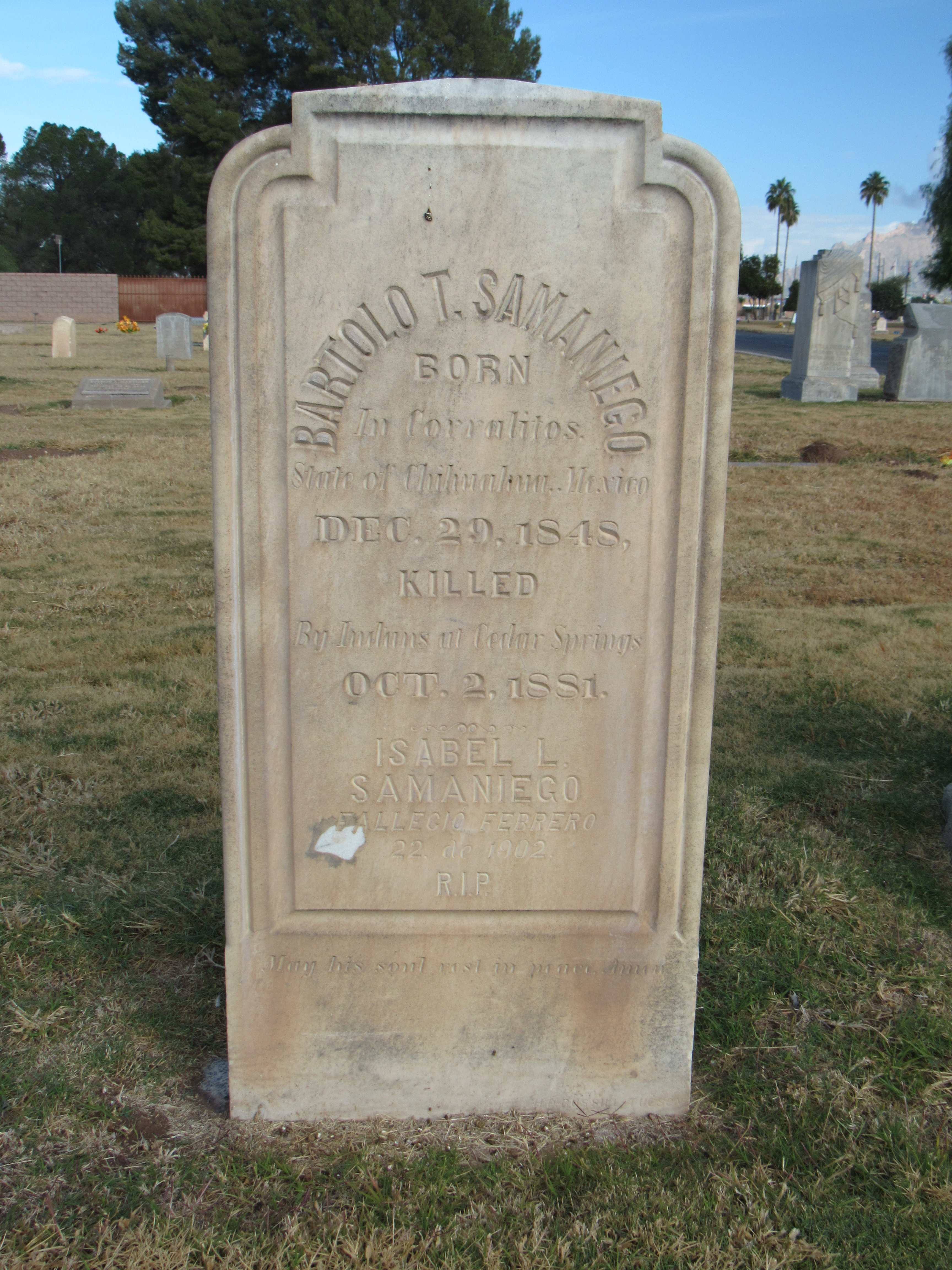
I also found the grave of another Samaniego, with the most fascinating headstone. I’m not sure if he was a relative of Mariano.
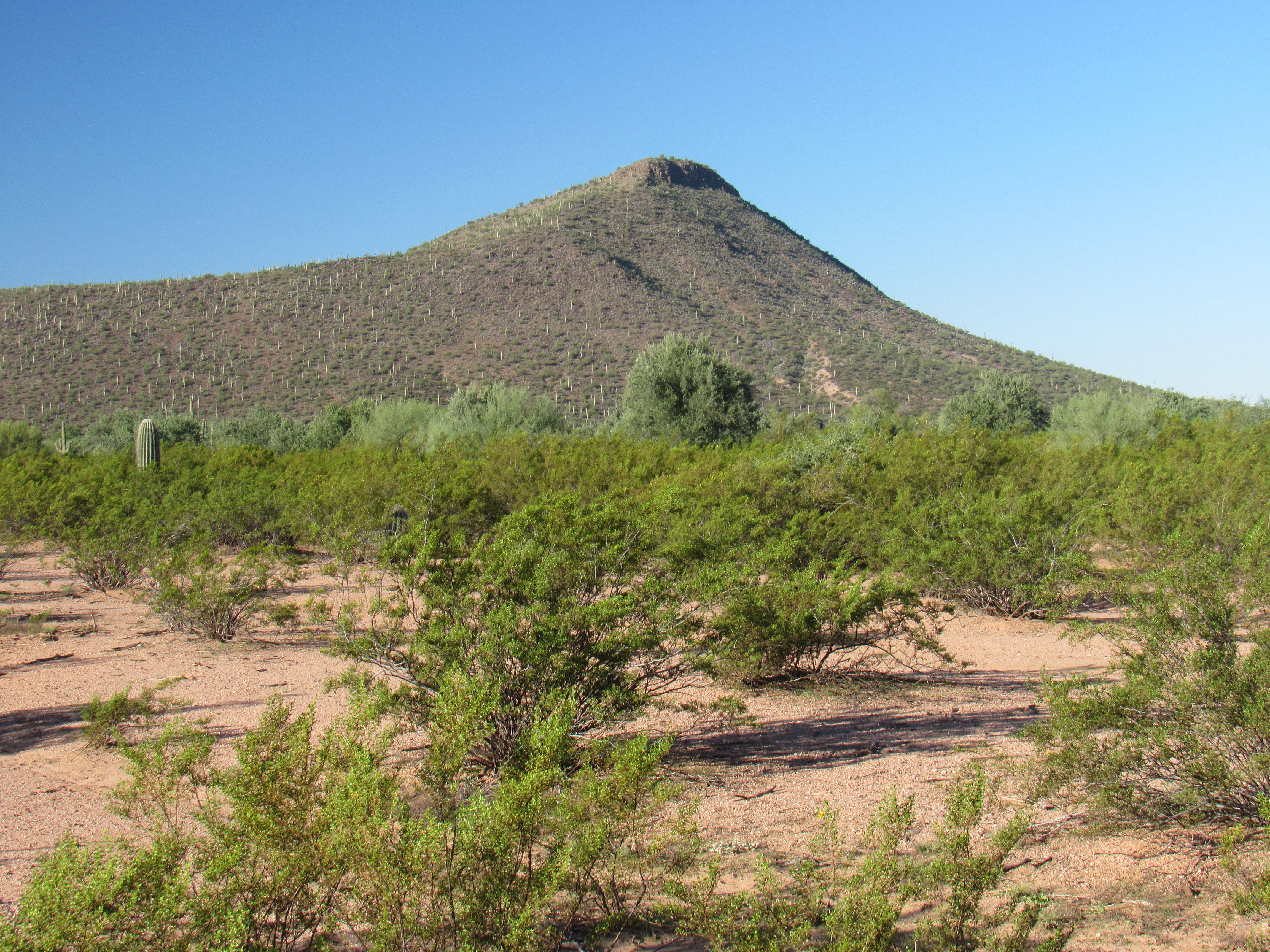
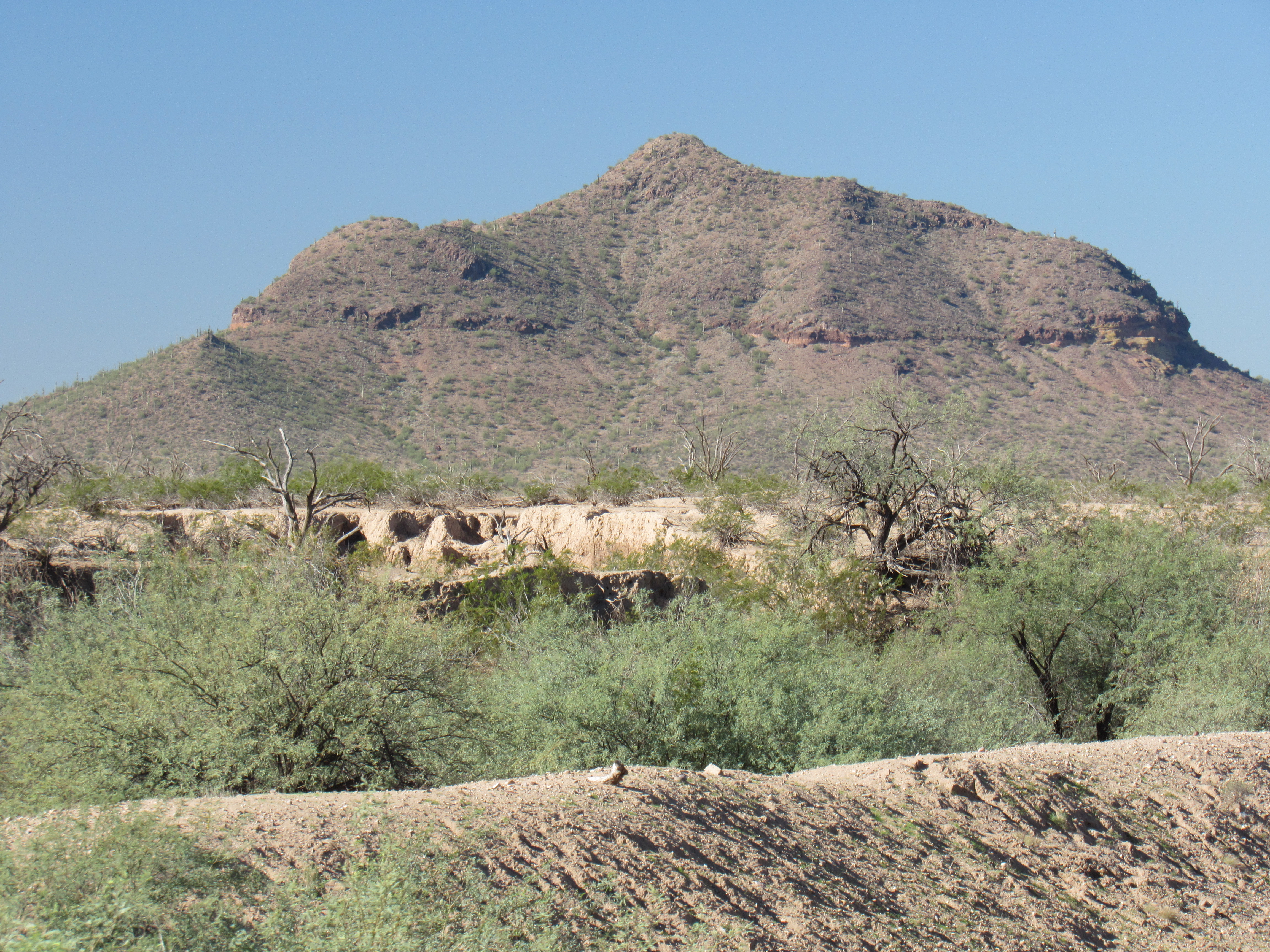
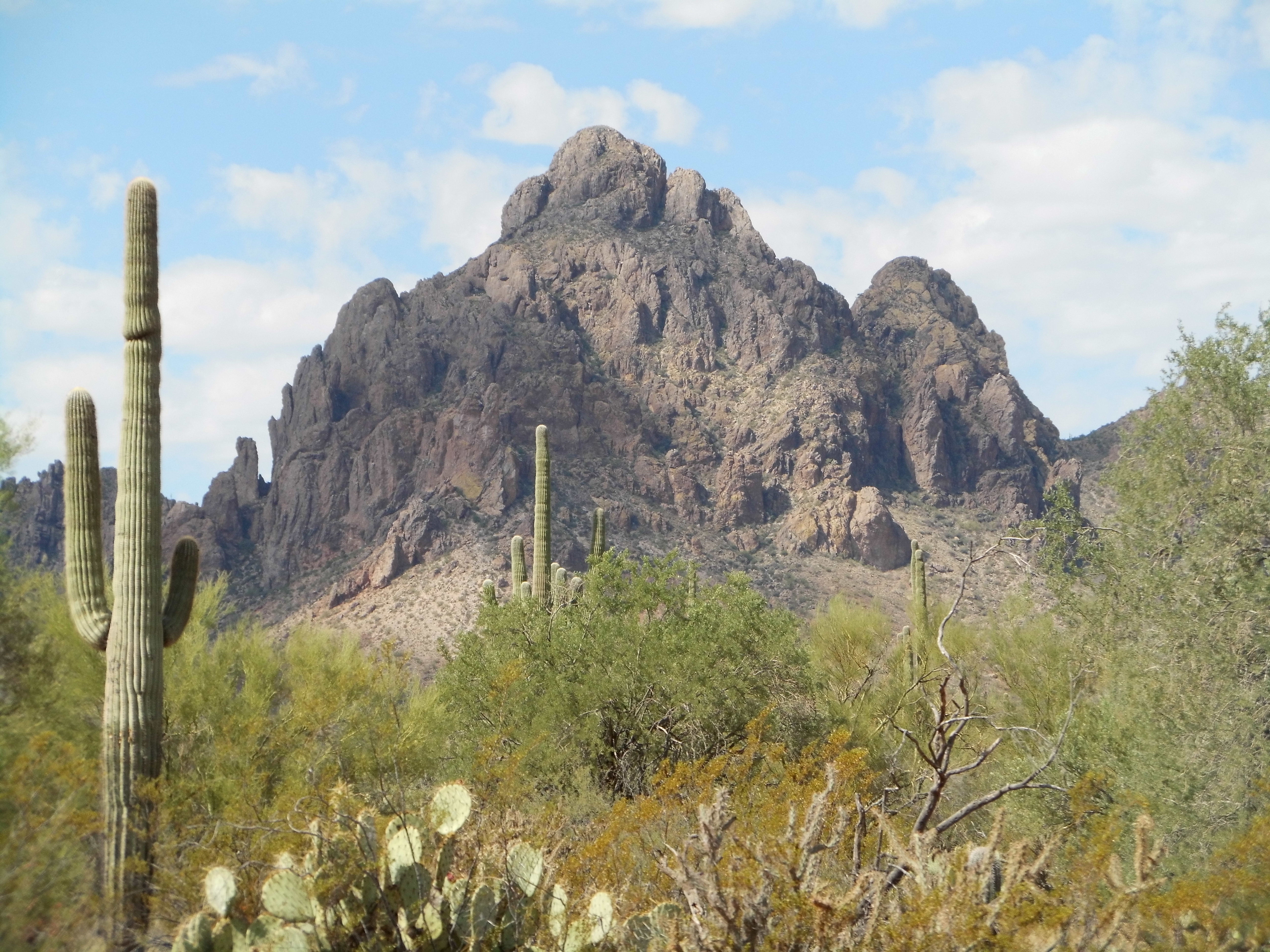
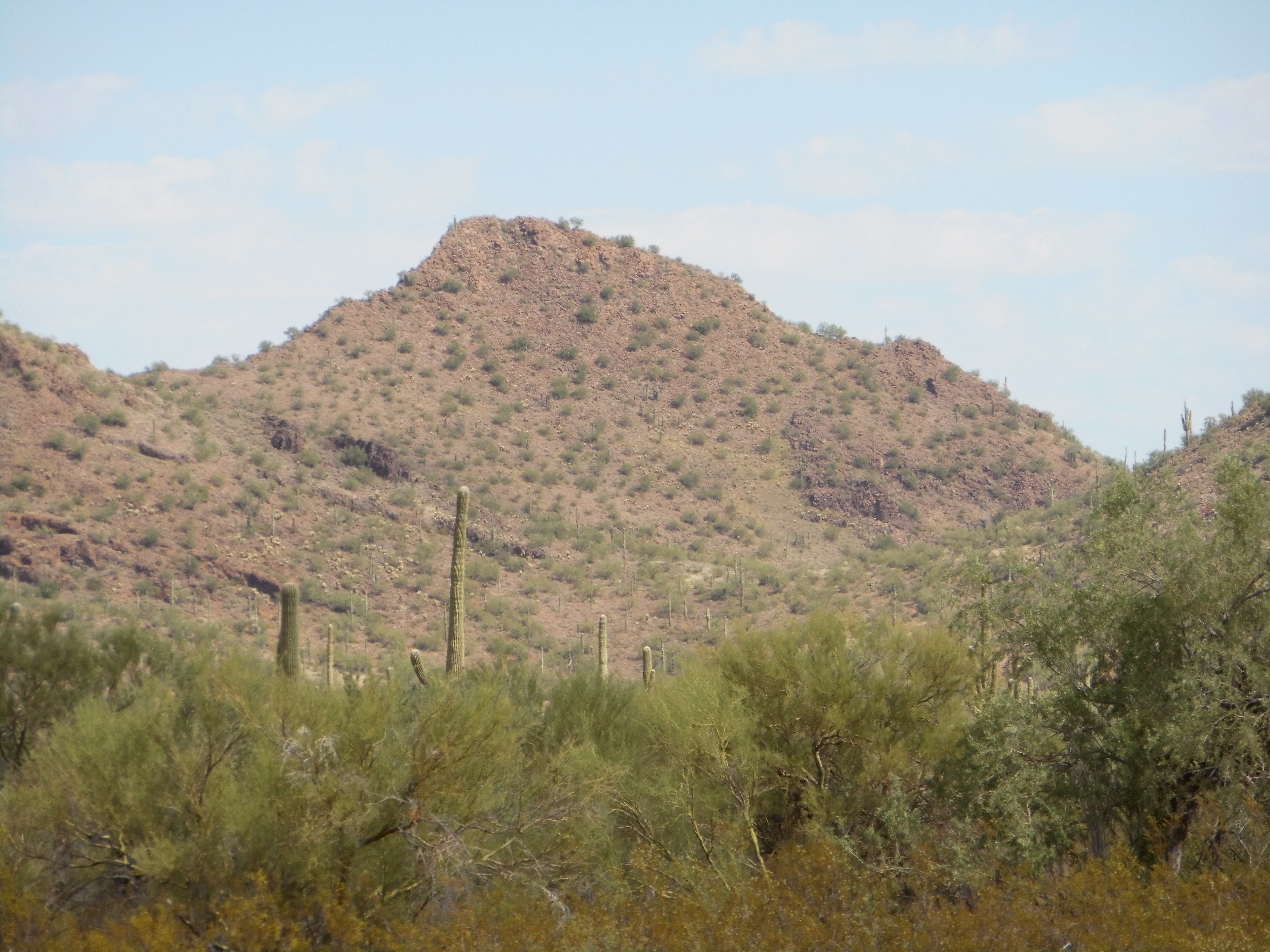
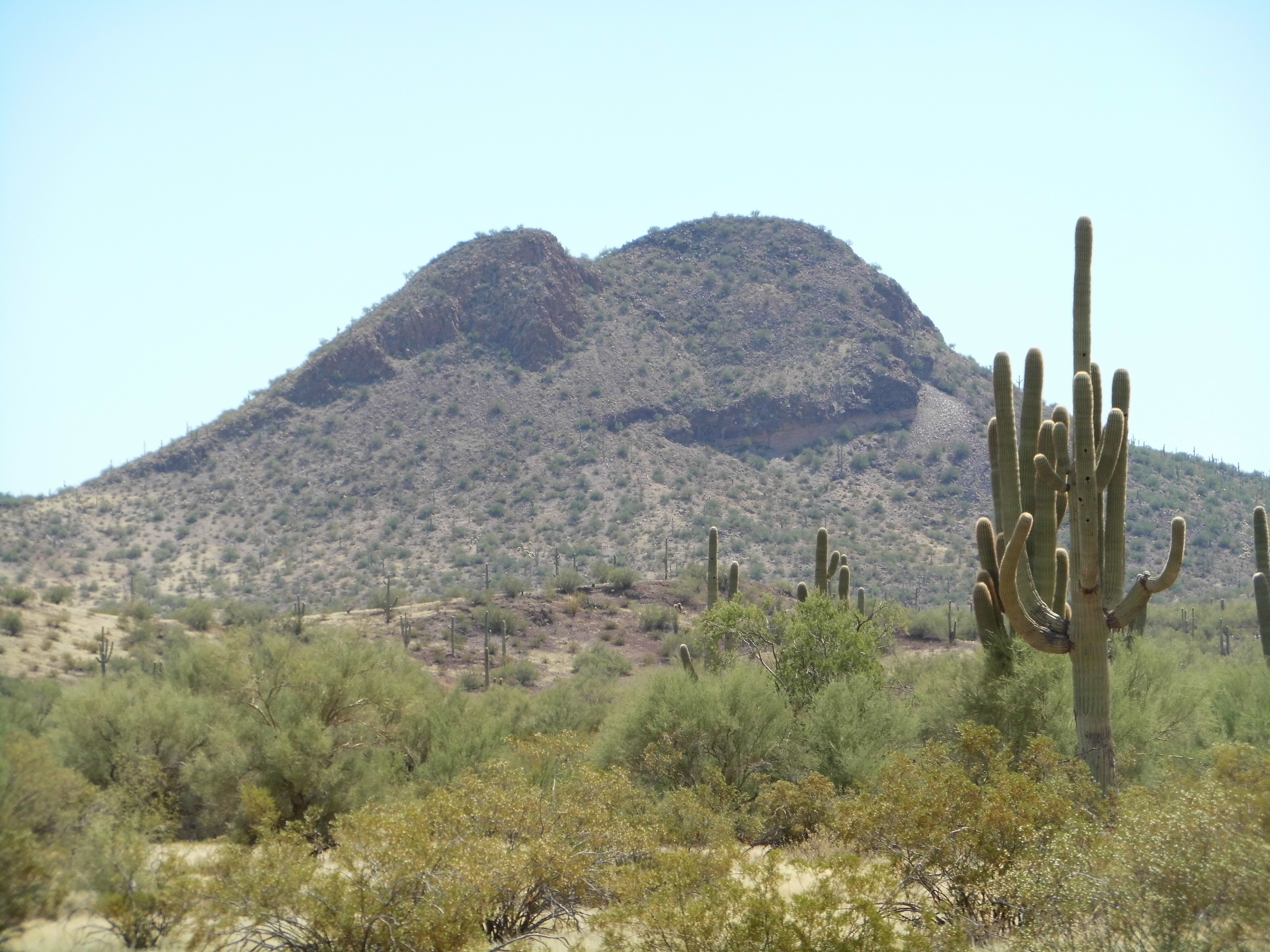
So now let’s fast-forward almost a century, to the day in 2001 when the Desert Mountaineer first set foot in the Samaniego Hills. It was one hot day in May when I made my way out there, to the most imposing peak in the group, something called Cerro Prieto. It’s not the highest point in this little range (it’s surpassed by a mere 2 feet by another peak), but it certainly comes across as the biggest, sitting alone on the edge of the group and rising up 600 feet from the desert below. As the name implies, it is dark in appearance.
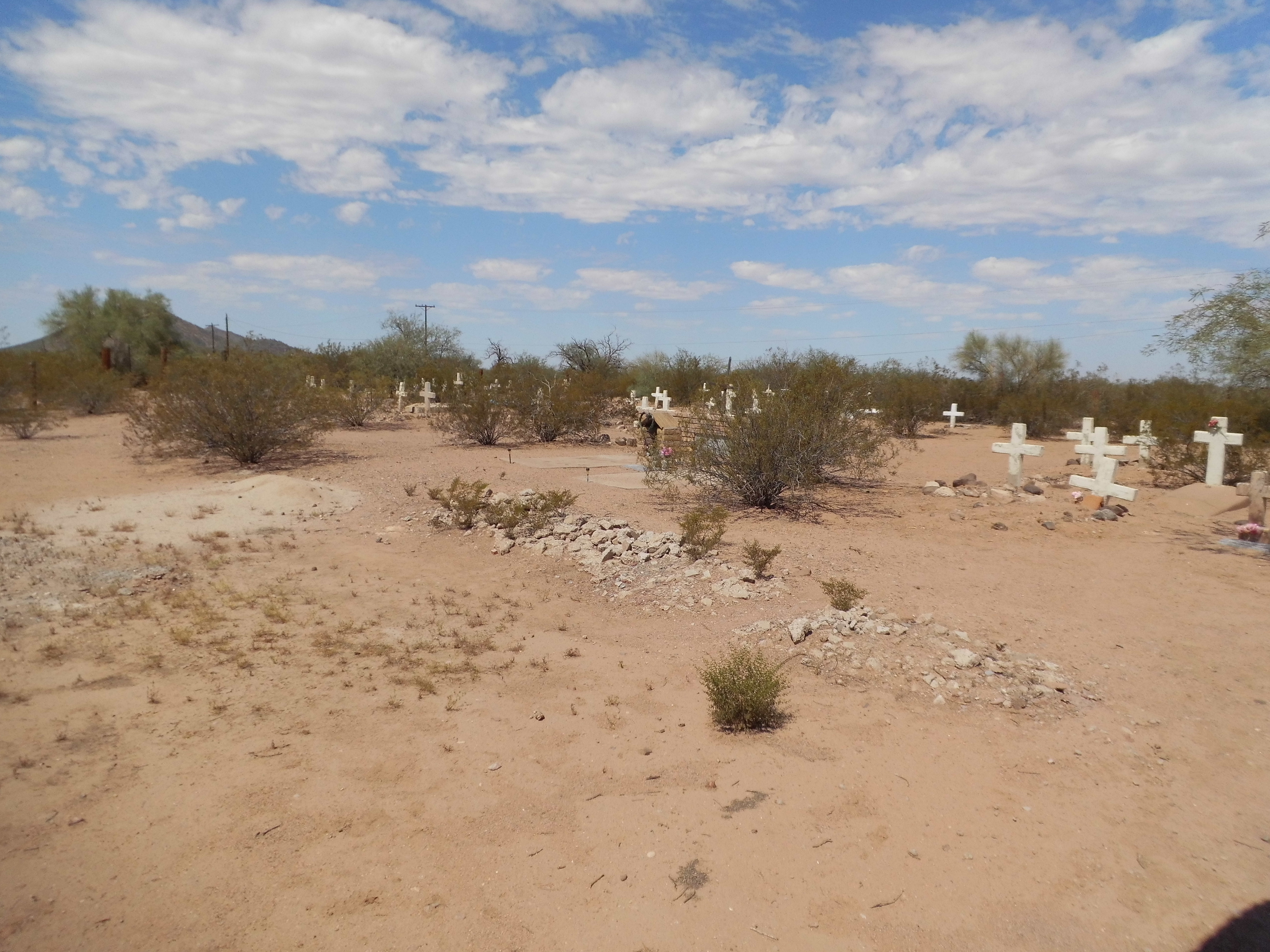
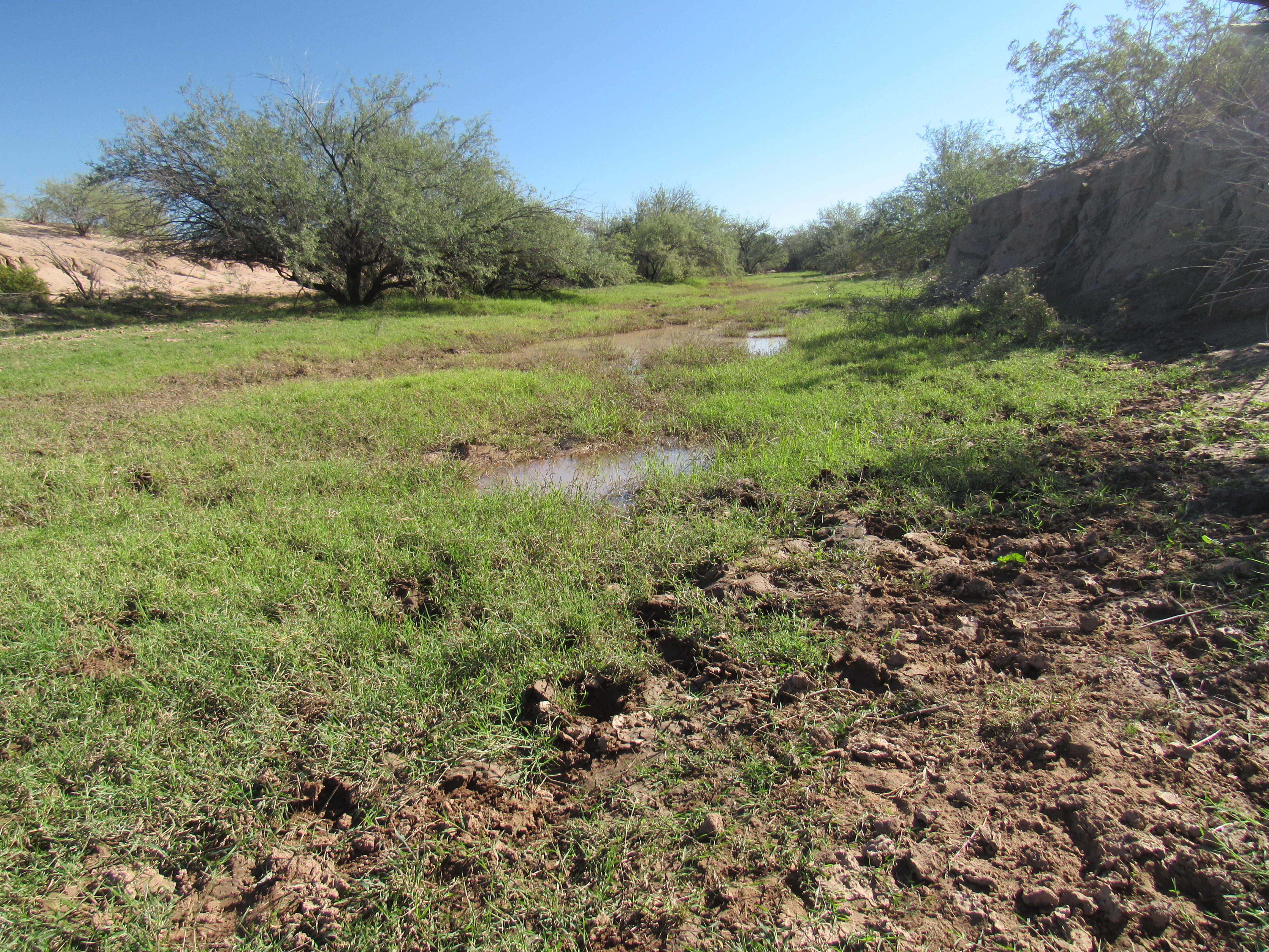
At the time, it seemed like the nicest prize, so once I’d climbed it I lost interest in the others (did I mention there were 14 other peaks in those Samaniego Hills?) A quick study of the map showed that, only 2 miles to the east, the Santa Cruz River ran through the area. Well, “ran” might seem like a bit of an exaggeration when you see it.
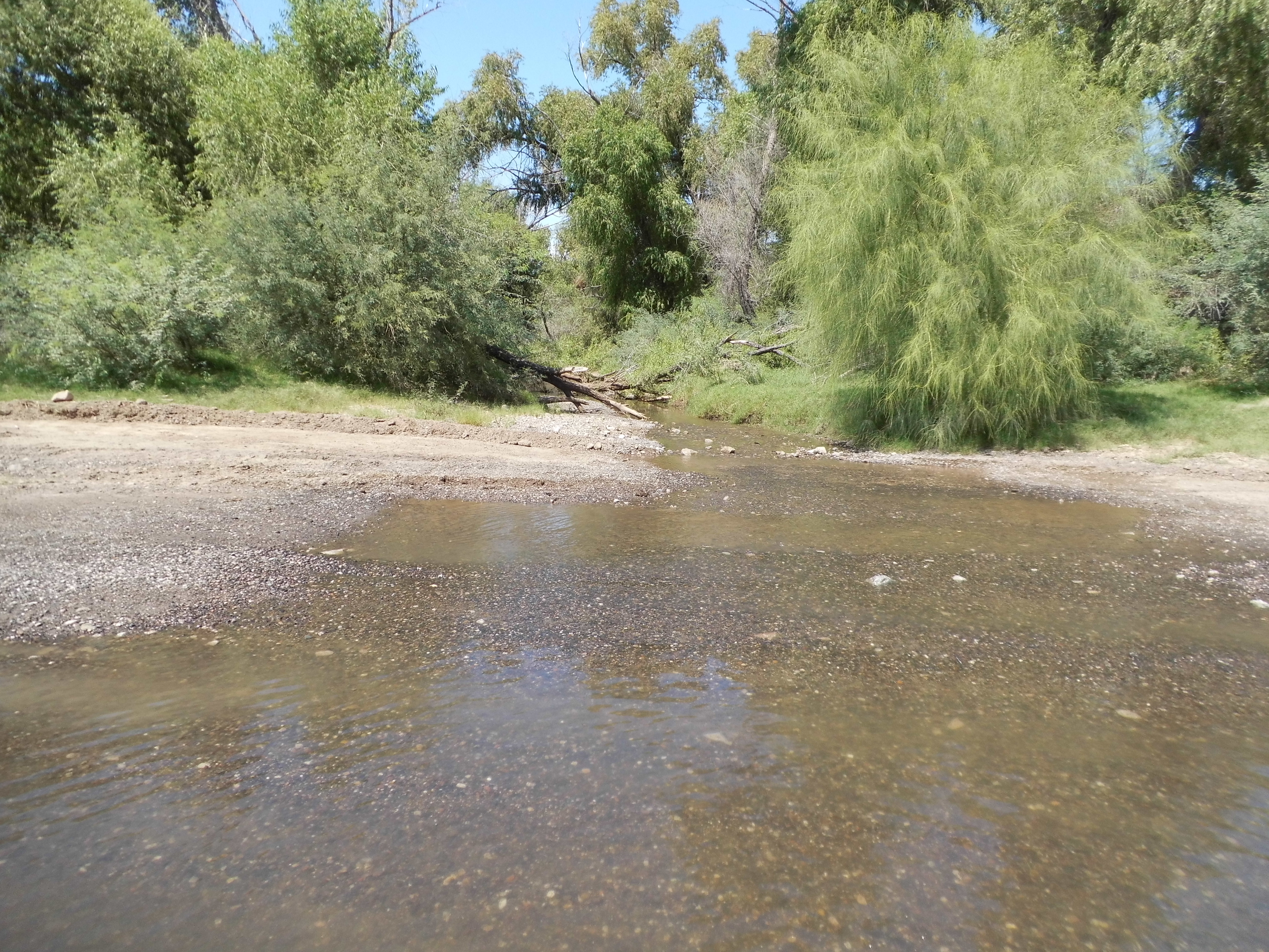
The river, or what’s left of it.
Tucsonans know the river well, as its path runs right through the city. It is normally bone-dry, and the water you see in the above photo wouldn’t even be there were it not for the effluent from the sewage-treatment plant 32 miles upstream. The water seen above soon disappears into the parched earth a few miles downstream and the river is no more, except in rare times of intense rainfall.
A scant 7 months later, a young Andy Bates would contact me and suggest that we get together for a day of climbing. It was a fine January morning when we drove out to the very solitary Desert Peak, a quick climb on the plain east of Interstate 10. That done, we made a beeline for the Samaniego Hills 15 miles to the southwest. We knew it was gonna be a good day.
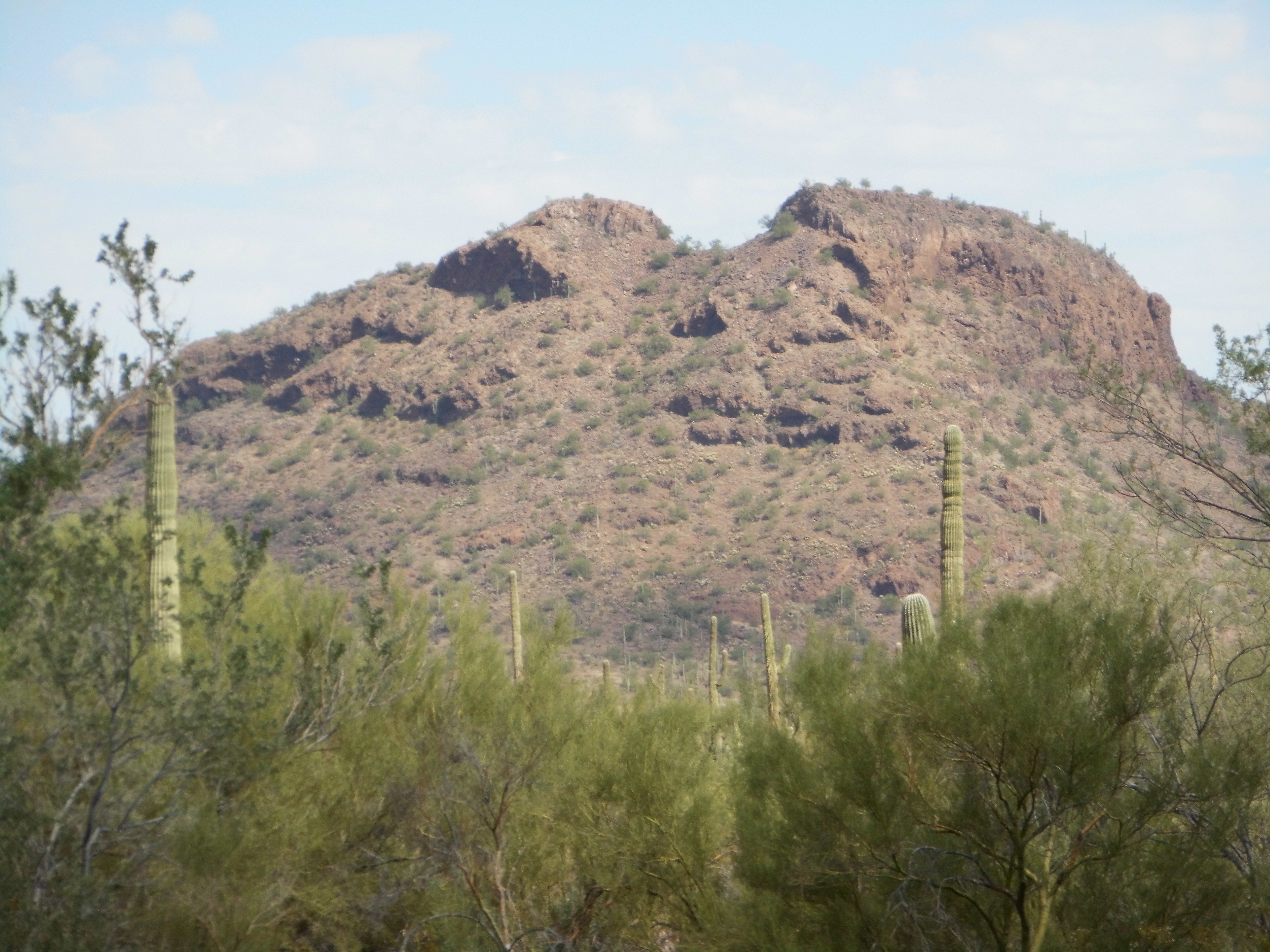
Our first goal was a climb of something called Rotten Benchmark, which turned out to have the highest prominence of anything in the range. It’s a curious name, isn’t it? Those early surveyors could drop any name they wished on to a peak when they left one of their benchmarks upon it, but some of them do make you wonder what was going through their heads at the time.
Rotten Benchmark
Sitting just to the east of Rotten, a mere mile and a half away, was our next one. Peak 2428 was what we called it, and it too was a quick climb. This range is surrounded by all manner of good dirt roads, so access to all of its peaks is excellent.
Peak 2428
One more was quite handy on the north side of the main road, a Peak 2329 – it was the natural next target, so there we went – another easy climb.
Peak 2329
These 3 peaks that we’d just climbed sat just to the north of the Sasco Road, so-named for the smelter and town that used to sit here. Here is a link that provides plenty of interesting history on the place. We poked around for a while among the old foundations, then moved on.
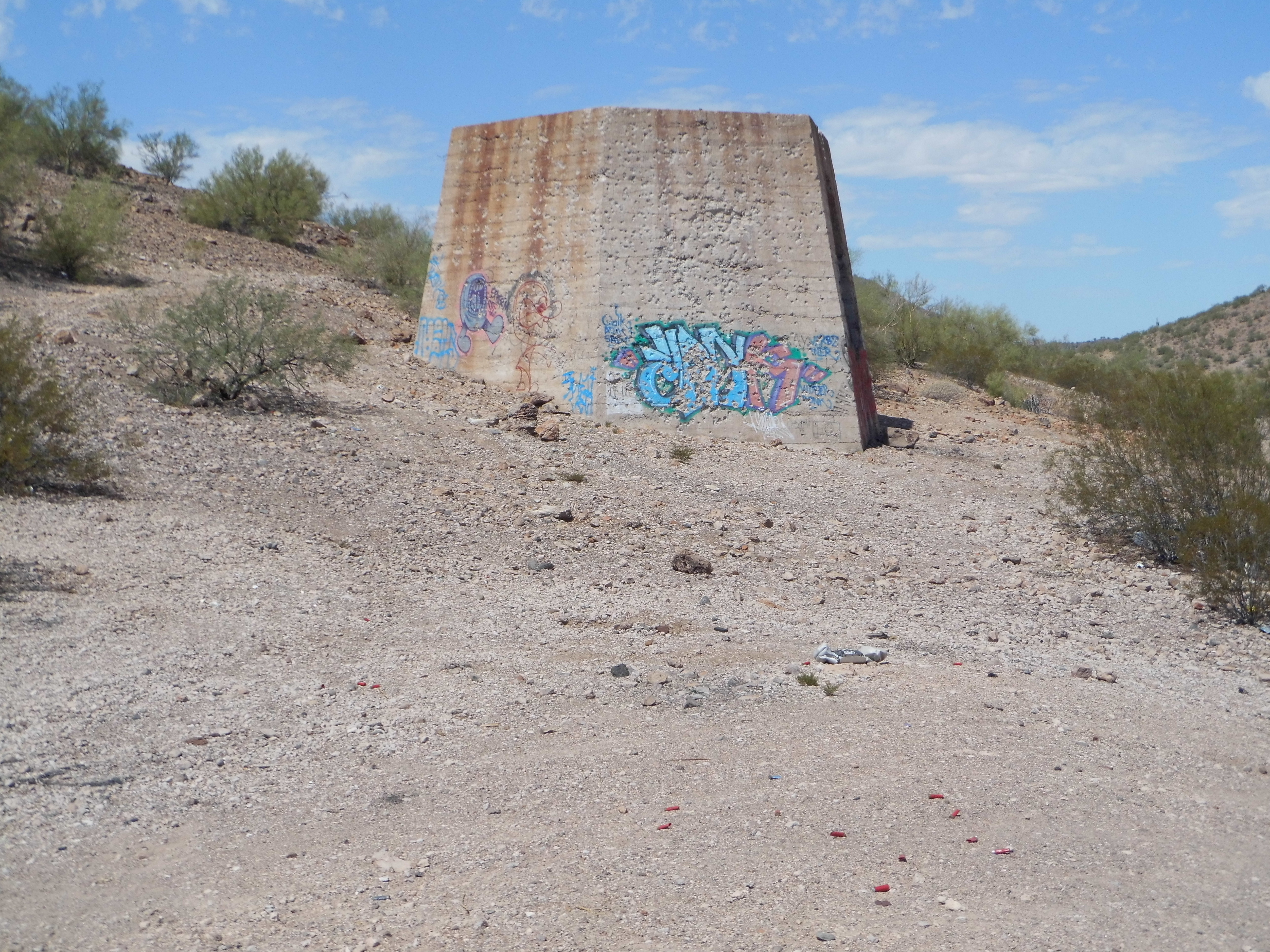
Part of the old smelter
Andy and I wanted to finish with a flourish. We knew that the true high point was unclimbed by either of us, so away we went. Peak 2690 sat on the western side of the Samaniego Hills, and it too fell to us in short order. It had been a good day.
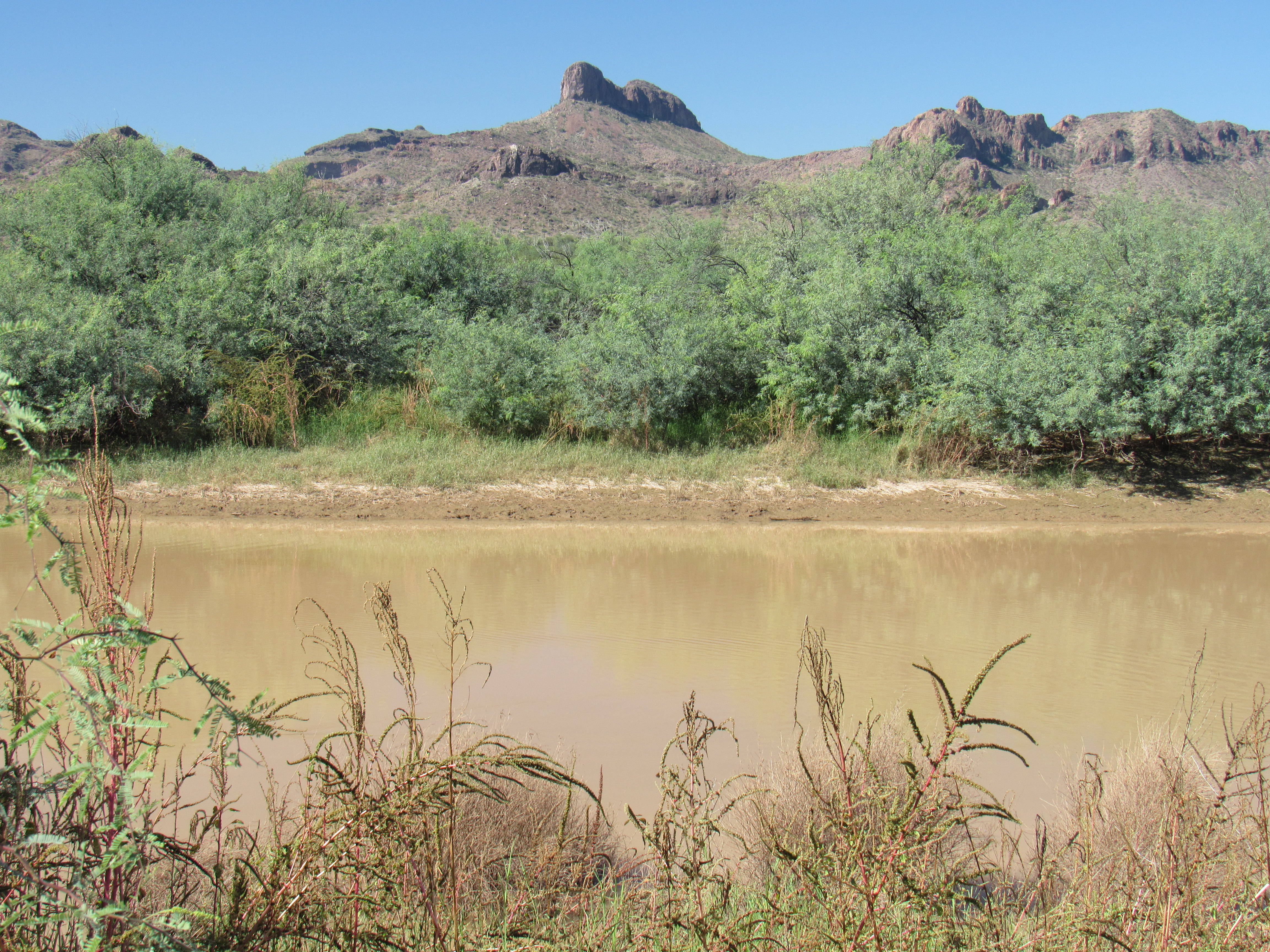
If you visit these hills, it’s hard to ignore the elephant in the room, the striking summit to the southwest known as Ragged Top in the nearby Silverbell Mountains.
The east side of Ragged Top
Its west ridge is especially dramatic.
The west ridge
A while passed, seven years in fact, before I once again turned my attention to the Samaniego Hills. I had often thought back on them, recalling the good times spent there, and one hot April day in 2009 marked my return. Even though I arrived there early, it was already hot – there were 4 peaks I wanted to climb, but I knew it would be a trying day. These were on the south side of the range in a tight cluster less than a mile and a half across, so at least getting from one to another should be easy enough.
Peak 2461 was where I started, close in to its south side. When a climb is well under a mile round-trip, and under 500 feet, it doesn’t take long.
Peak 2461
A short drive brought me to the next one – Peak 2585 was a bit higher but just as easy a climb, also by its south side.
Peak 2585
It was a short drive around on a decent road to a valley between the last two I wished to visit. Parking just west of Peak 2614 resulted in another quick ascent. Mark Nichols, one of Arizona’s most notable peakbaggers, had swept through this group a full 14 years earlier, and I found his registers on them all.
Peak 2614
By the time I did the last one, to the west across the valley, it was mighty toasty. I didn’t linger on top of Peak 2670, quickly signing in and heading straight back to my truck below.
Peak 2670
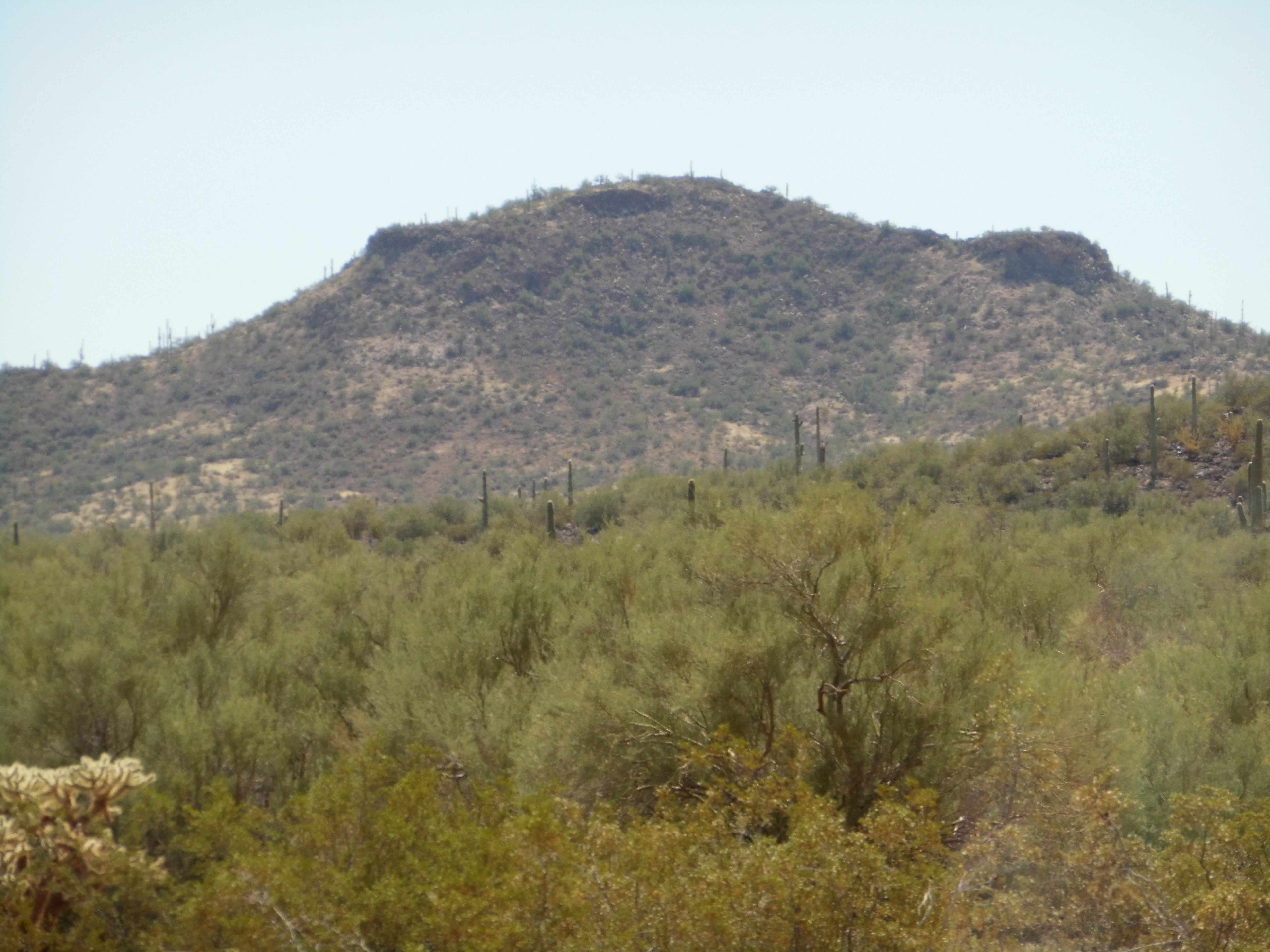
Thus ended my third visit to the Samaniego Hills. As hot a day as this had been, I guess I wasn’t scared off badly enough, because two weeks later I was back. My records show that I was only after one summit that day, a Peak 2576 just south of the Sasco Road. From its west side, this one was a bit higher climb but still took under 2 hours round-trip.
Peak 2576
It appears that I still hadn’t had my fill of heat, as I was back in mid-May. At this time of year, you could be pushing your luck in what could easily be 100-plus-degree temperatures. Oh well, nothing ventured nothing gained, right? There were 2 that needed climbing today, sitting together a mile south of the Sasco Road. I parked and set out in a hurry, first ascending Peak 2416.
Peak 2416
I didn’t dawdle, setting off down the north slope and heading straight up the next one, Peak 2533. A couple of others had been on this one too, and I signed in, then quickly headed back down to my truck. I had parked by a Game and Fish guzzler, and by the time I returned just under 2 hours had passed.
Peak 2533
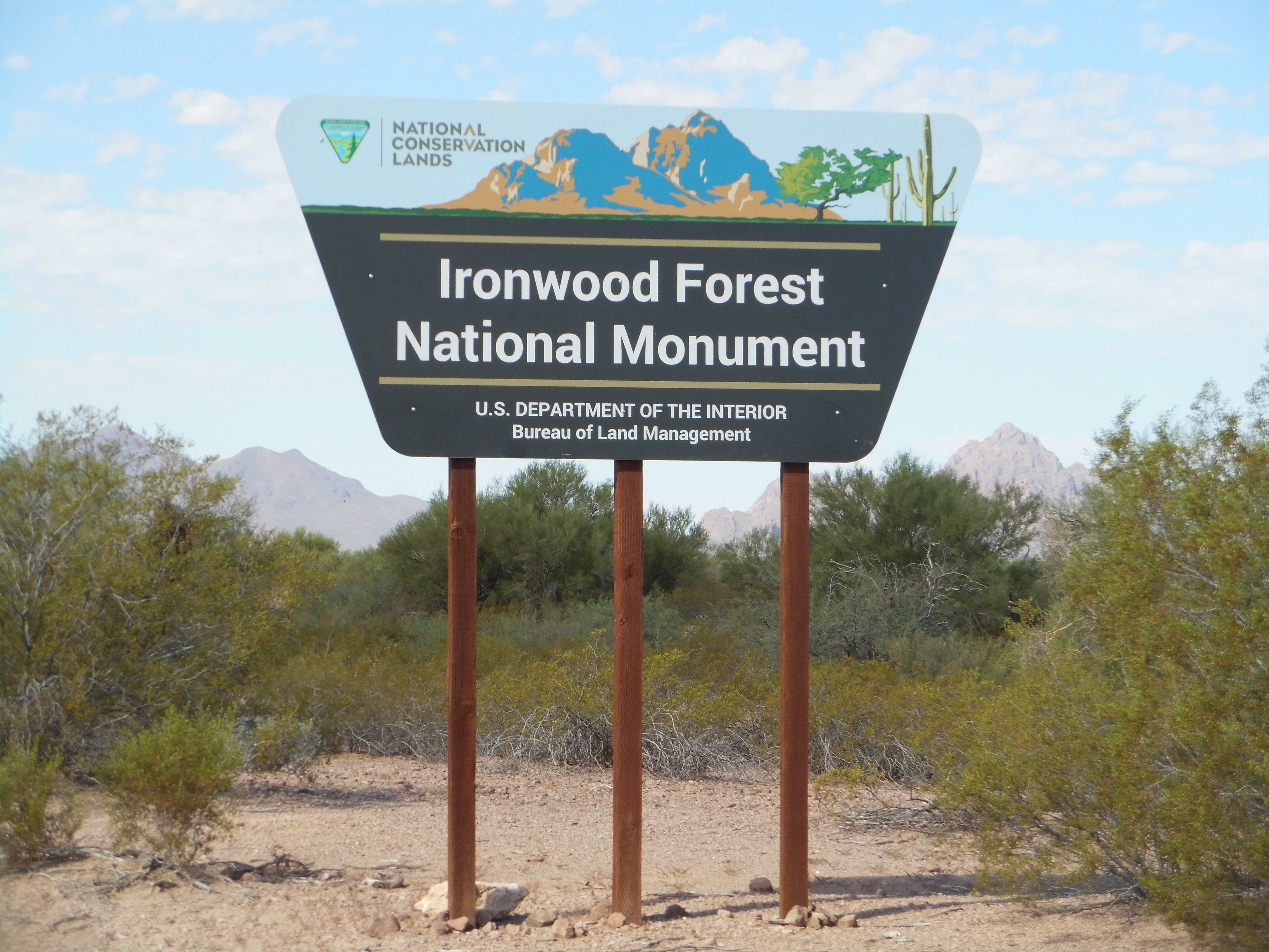
Back in the year 2000, the Ironwood Forest National Monument was created. It encompasses all of the peaks in the Samaniego Hills with the exception of the 3 sitting north of Sasco Road. There are those who decry these types of protection, but personally I think it has helped these hills from being overrun and abused. I love the scene on the sign – it shows Ragged Top on the right and Wolcott Peak on the left.
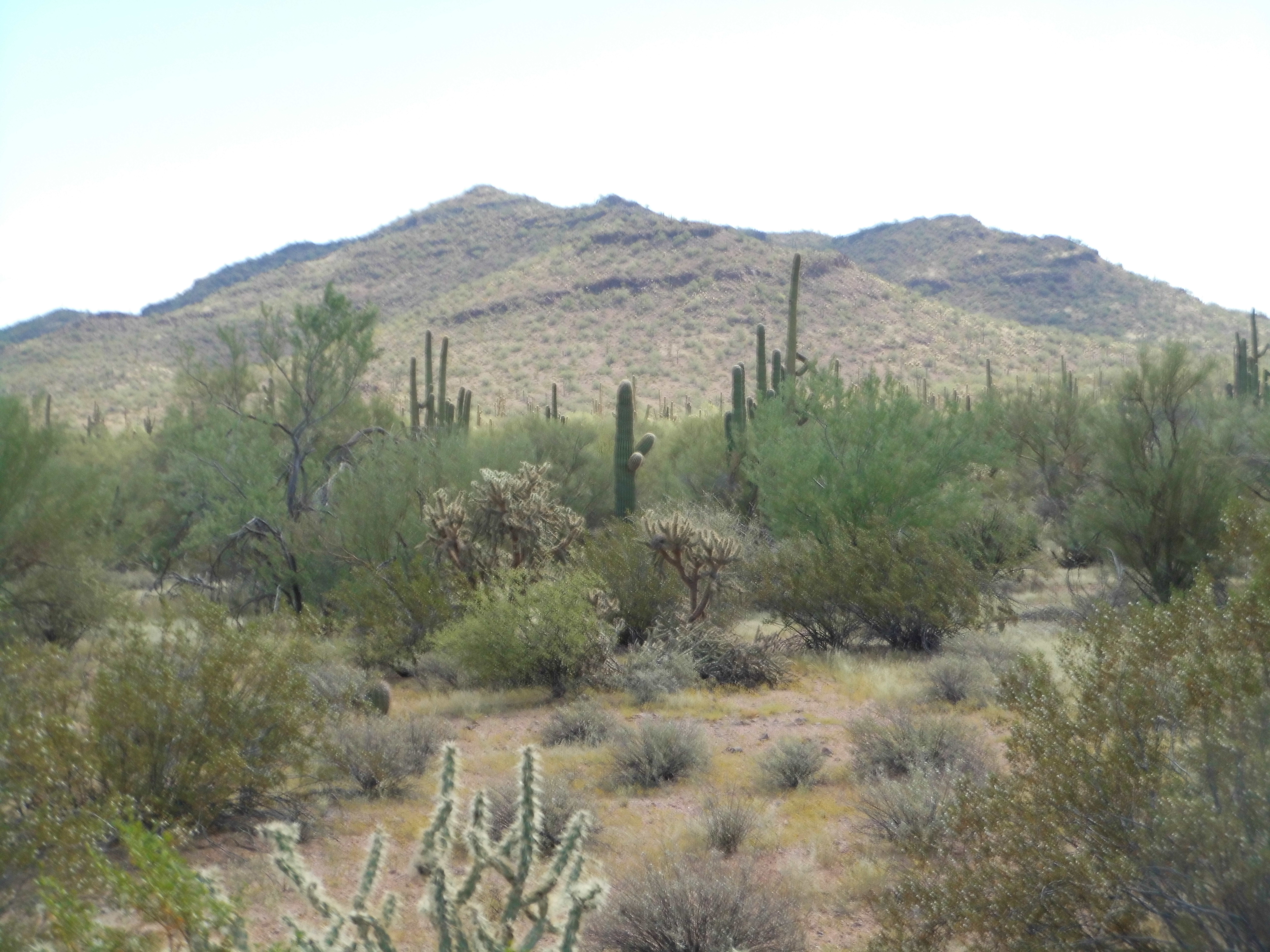
In November, when things had cooled down nicely, I came back. Have you ever tried burned bread? I thought I would – a mountain sat on the northeastern edge of the range with the curious name of Pan Quemado (English translation – “burned bread”). Oddly, there are only 2 places in the entire state where this name occurs. Both are peaks, and the other lies a mere 12 miles to the south in the Waterman Mountains. Makes me wonder if the same person named them both. In any case, it was a quick ascent via the north side – on the top, I found a register left almost 20 years earlier by Bob Martin. Just to the east sat a low ridge, barely a hundred feet high, which wore a benchmark with the odd name of “Fig” – it seemed to have been forgotten by everyone else, so I left a register on its summit.
Pan Quemado
Fig Benchmark
It was a full 2 years before I was back. You might think I had them all by then, but nope – there was one more straggler, hard by the Sasco Road on the west edge of things. It was a quick 40 minutes round-trip to get it done, Peak 2410. It’s been 7 years since I was there, and only 3 others have visited that summit since. That’s not a lot of peakbagging being done in the Samaniego Hills – a bit surprising, considering the range is quite visible from the Interstate only 6 miles to the east.
Earlier, I mentioned that there was some interesting history surrounding these peaks. I’ve already mentioned how the name came about; then there’s the Sasco smelter and ghost town, and the Silverbell Mine which has been in operation since 1873. A ranch bounds the north side of the hills, and it’s been there for over a hundred years. The La Osa Ranch covers more than 18,000 acres, and the Sasco Cemetery sits along its edge, and it too has been there for a century.
Sasco Cemetery
But I’ve saved one more tidbit for the very last, and this is fascinating stuff.
William Cornell Greene moved in 1872 from New York to southern Arizona, lured by the promise of riches in the mining industry. He settled on ranch land in the San Pedro Valley, and raised cattle and crops with his family. Finally, in 1896, his efforts paid off when he leased 4 mines in the Cananea, Sonora, Mexico area – one of them was the famous Cobra Grande mine. He then formed the Cananea Copper Company, the Cananea Cattle Company and the Greene Cattle Company. By the turn of the century, he was worth fifty million dollars US and had accumulated vast holdings. To put his wealth into perspective, allowing for inflation, that would be a billion and a half dollars in today’s dollars. He owned a rich copper empire, a lumber business and had accumulated a million acres of land in the US and Mexico. A decade later, he had quit his mining and lumber interests and focused on cattle ranching. The Greene Cattle Company grew rapidly in size, and he shipped cattle all over the United States.
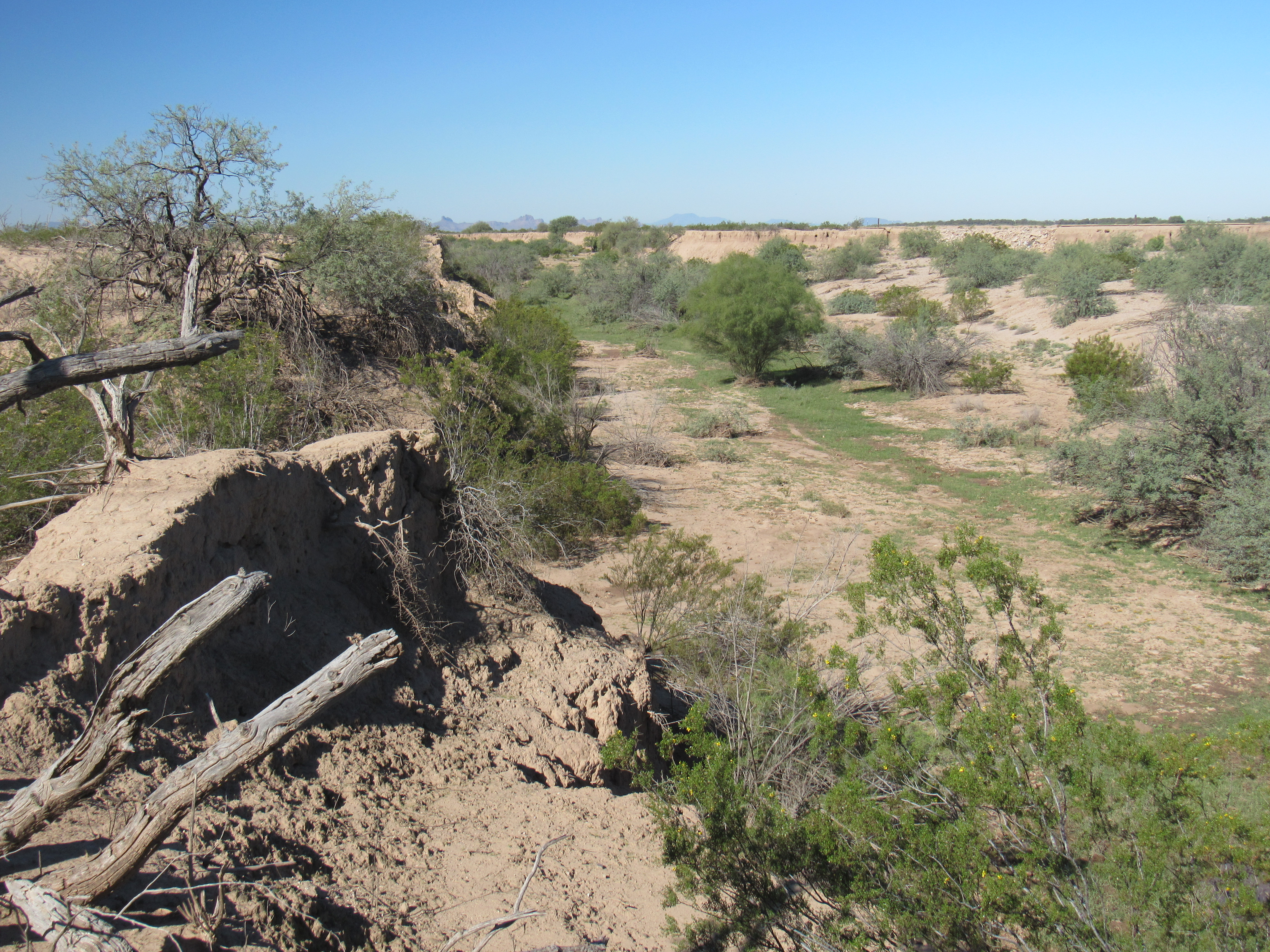
In 1909, Greene had focused his attention on the area of the Samaniego Hills. I don’t know many details about this next move of his, but 2 short miles northeast of Peak 2428 he created something called the Greene Canal. It ran west from the channel of the Santa Cruz River, in effect diverting its flow. Where this channel begins, the elevation is 1,759 feet above sea level. The canal ran for 16 miles to the WNW, in the process dropping to an elevation of 1,581 feet. That’s a loss of only 11 feet per mile, but it’s enough to allow water to flow in a canal without any mechanical assistance. Keep in mind the fact that not much water ever flowed in the Santa Cruz in this locale, even back in 1909. It would appear that the canal was meant to capture water during times of flood. It was one thing to have it flow down the canal, but what then? Our Mr. Greene had a plan for that too. At the lower end of the canal, he constructed a dam, with a length of 3,450 feet – this was meant to impound the water from the canal. However, there was one slight problem. In what must be one of the goofiest engineering blunders of all time, and in spite of being told that the earth-work was on the wrong side of the dam, giving animals the opportunity to weaken the dam, the irrigation plans continued and the dam did eventually wash out. Some better engineering and less haste never would have allowed the problem to occur in the first place. The dam never fulfilled its intended purpose of collecting water for farming and ranching. The influence of Greene’s Canal and its subsequently becoming an arroyo have caused flood flows since 1915 to take more westerly paths via Greene Canal.
Before the construction of Greene Canal in 1910, the Santa Cruz River downstream from Marana was a broad, flat alluvial plain with intermittent channels. Now the transition from defined channel to alluvial plain occurs near Chuichu, Arizona. Prior to and during the floods of 1914-1915, flood flows followed routes down the North Branch of the Santa Cruz Wash and McClellan Wash through the Casa Grande area. The influence of Greene Canal and its subsequent development as an arroyo have caused flood flows since 1915 to take more westerly paths via Greene Canal. I’d like to share with you some photos of all of this.
So effective was Green Canal in diverting the flow (albeit rare) of the Santa Cruz that today, over a century later, all that remains of the channel of the Santa Cruz River is this gentle depression. This picture was taken right beside the canal, where the river continues in its historical channel to the northwest.
The Santa Cruz River!!
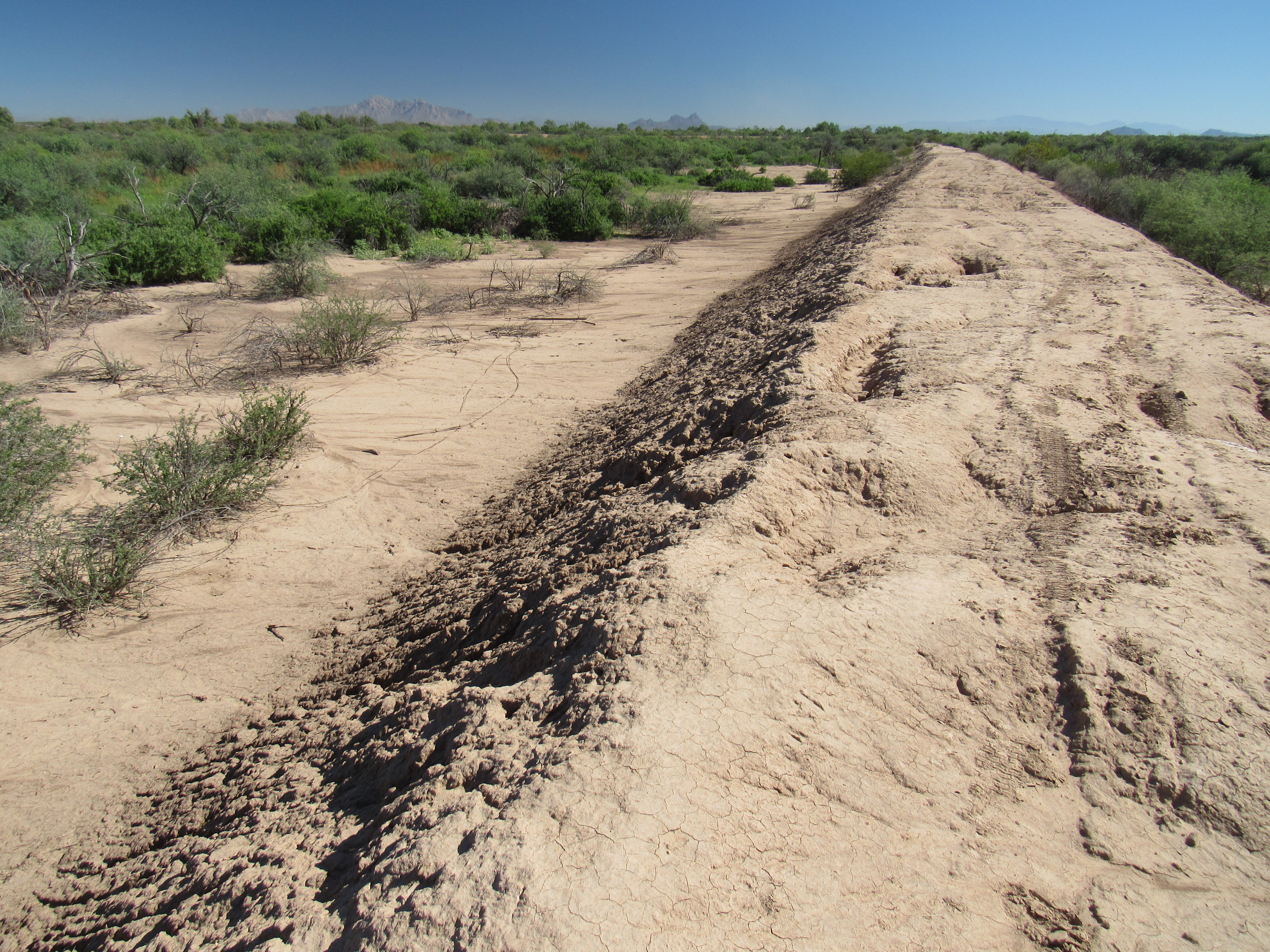
By contrast, right behind my back where I stood to take the above photo, this was the scene. It shows a wide, eroded channel.
Greene Canal
I walked down into the channel and explored a bit. Recent rains had left residual puddles, and things had greened up nicely in places.
Down in the canal.
A hundred years’ of erosion had taken their toll, however, and in places the edges were deeply incised.
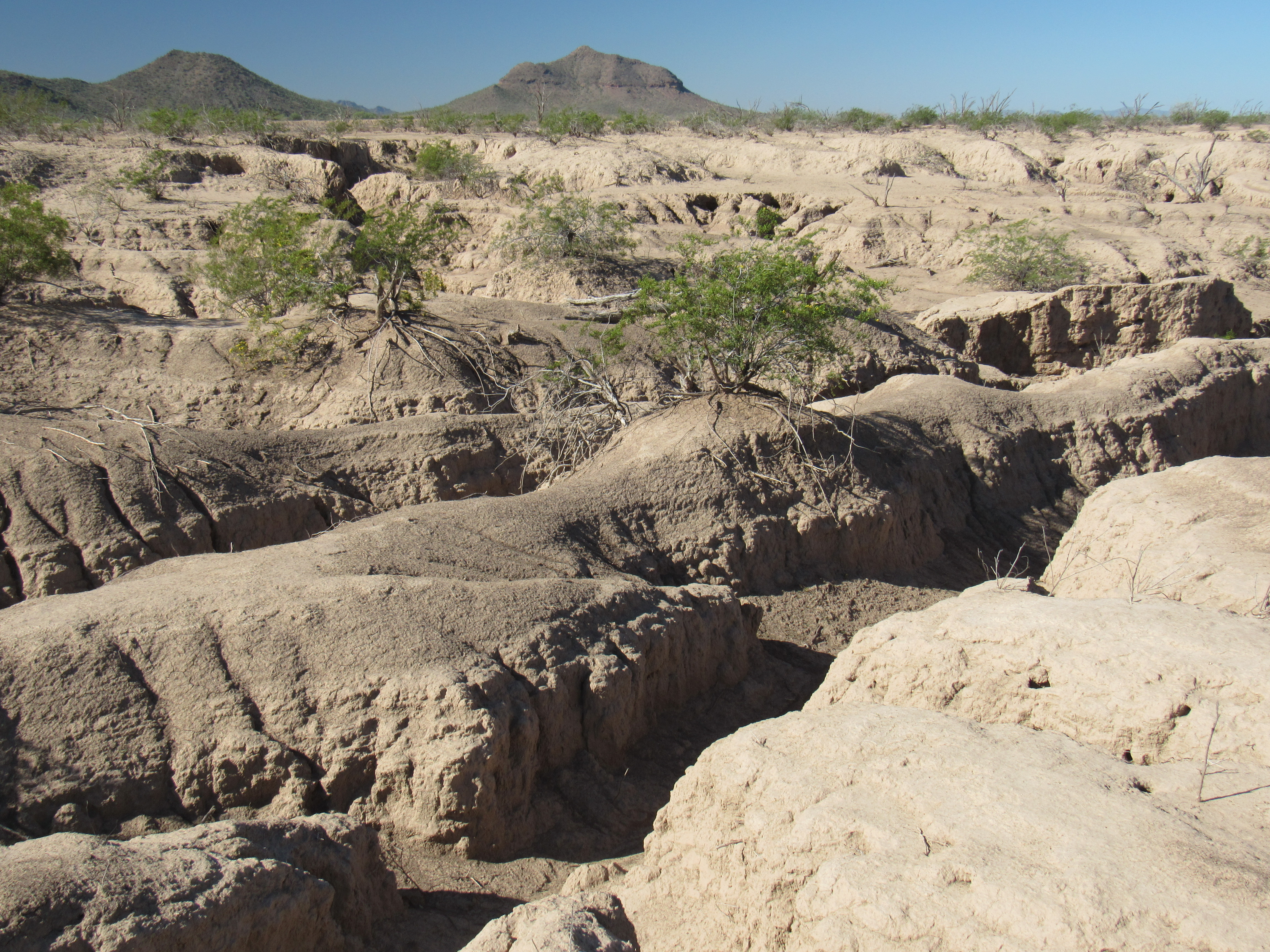
Erosion
I have no idea how wide they made the canal when it was first dug, but in places it runs as straight as an arrow, and is at least 100 feet wide at its narrowest nowadays. Its edges are steep walls over much of its length.
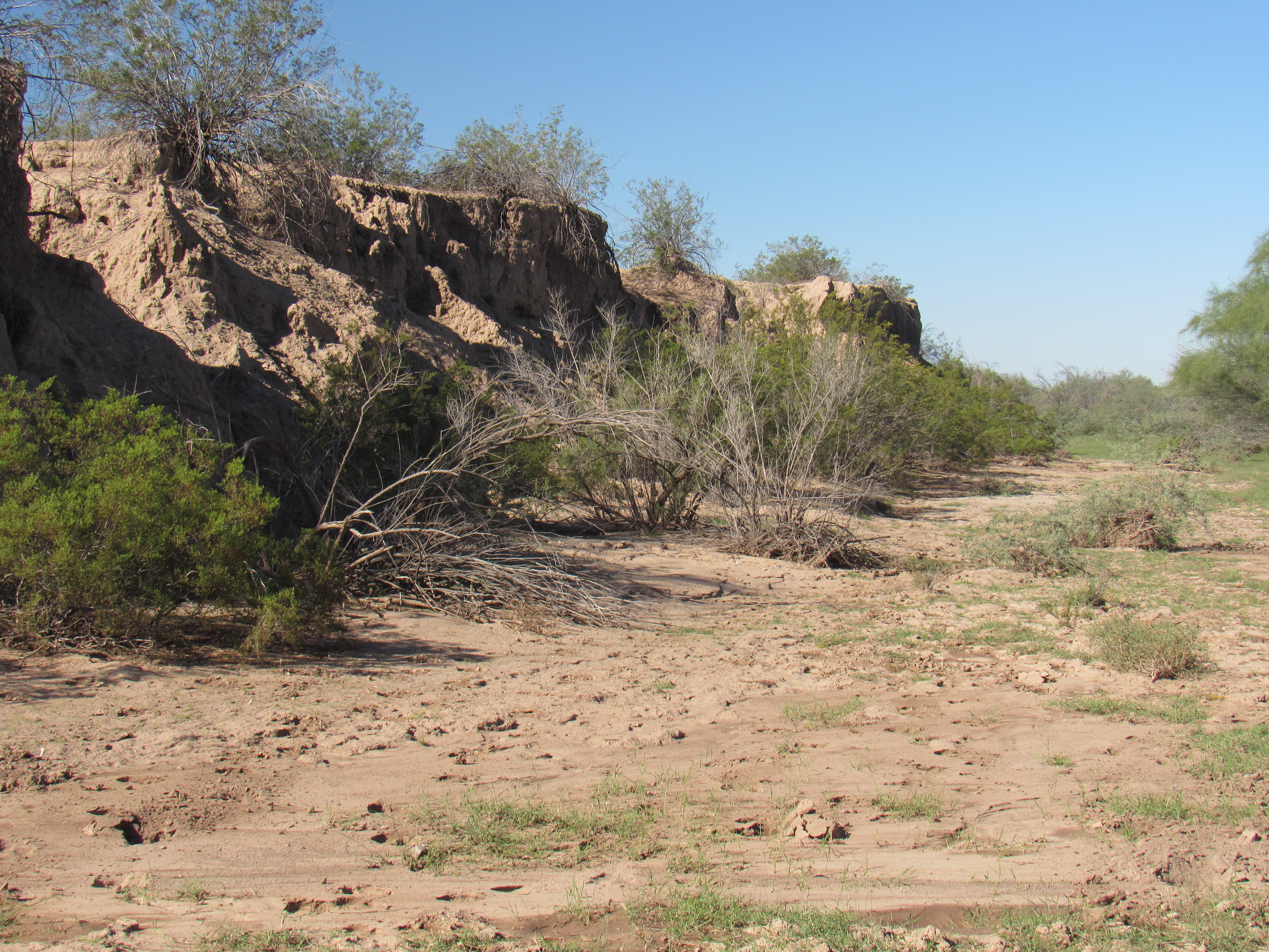
Nearby sits England Farm, where they grow alfalfa to sell to local ranchers. They had given me permission to cross their land to take my pictures, and I came across a spot where one of their concrete irrigation canals had toppled into the abyss, victim to the relentless erosion. Land that had once been productive had simply vanished.
The ex-canal
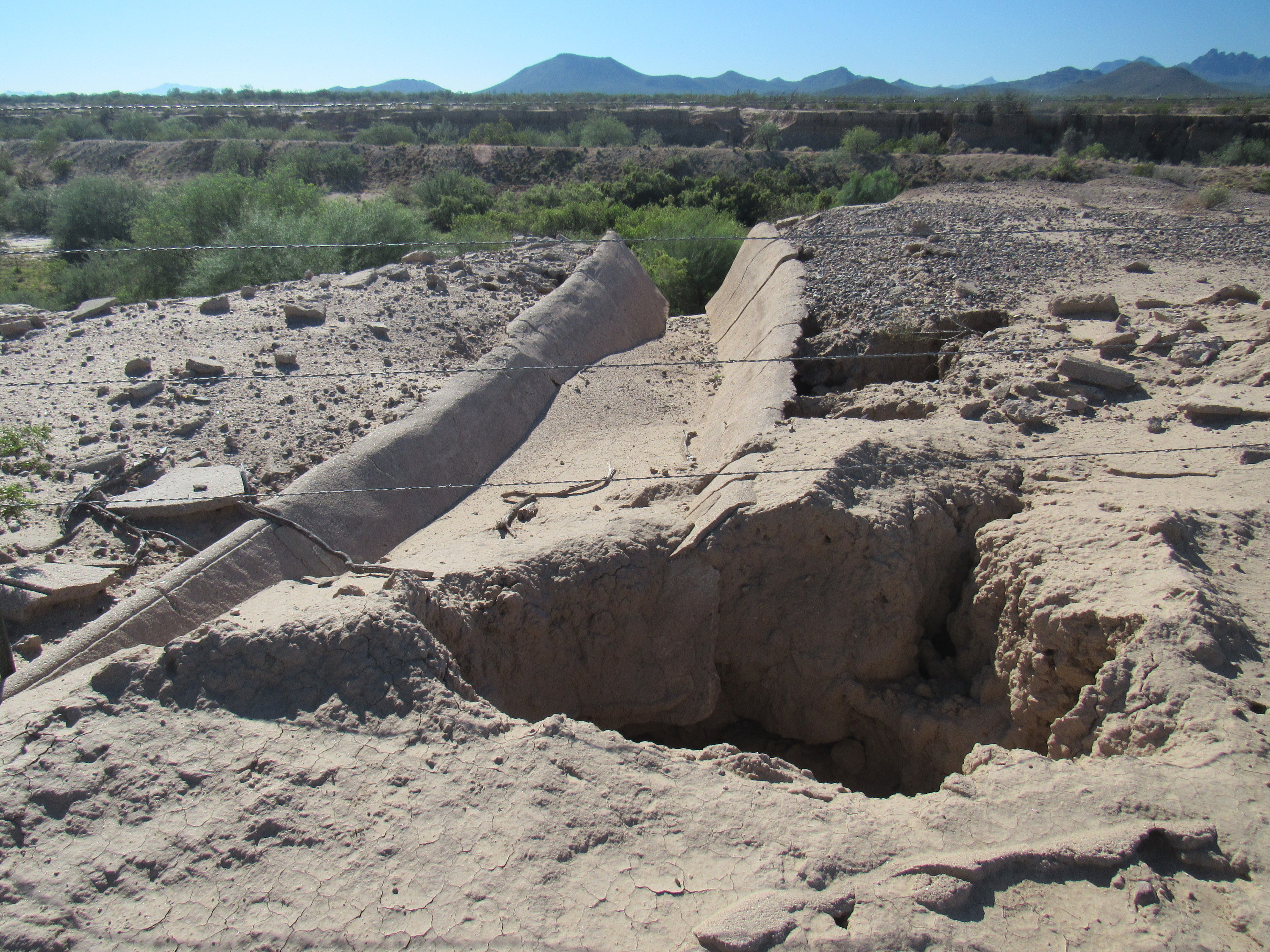
So we now know that the flow of the Santa Cruz River has been forever altered. In times of flood, its waters now go through what’s left of Greene Canal, over to what’s left of the dam, and then flow down what is nowadays known as Greene Wash, a name that didn’t exist before the ill-fated dam was built. It’s worth following the new course of the Santa Cruz River, the path it has taken during the last century, but first I traveled 16 miles to the west, to the site of Greene’s ill-fated dam. Near the dam, a modern bridge along paved Sunland Gin Road spans Greene Wash. Earthen berms 625 feet apart create a wide, gentle channel for the canal. See the green area on the right side? That’s the lowest part of the canal, where water can still flow.

I made my way through the desert to the Greene Reservoir Dam. There it stood, over a century old. It was 3,400 feet long, and stood 10 feet at best above the surrounding desert.
Greene Reservoir Dam
The dam was intended to impound all the water flowing down the watercourse which would be later named Greene Wash. As we already know, the wash won the battle with the dam – these days, a breech fully 300 feet wide exists where the waters of the wash (rare as they may be) flow freely downstream. I happened to be there after recent rains had actually left water running in the channel of the wash.
Greene Wash
Oh yes, almost forgot – as I walked along the top of the dam, some slight movement caught my eye. I knelt down for a closer look, and here’s what I saw.
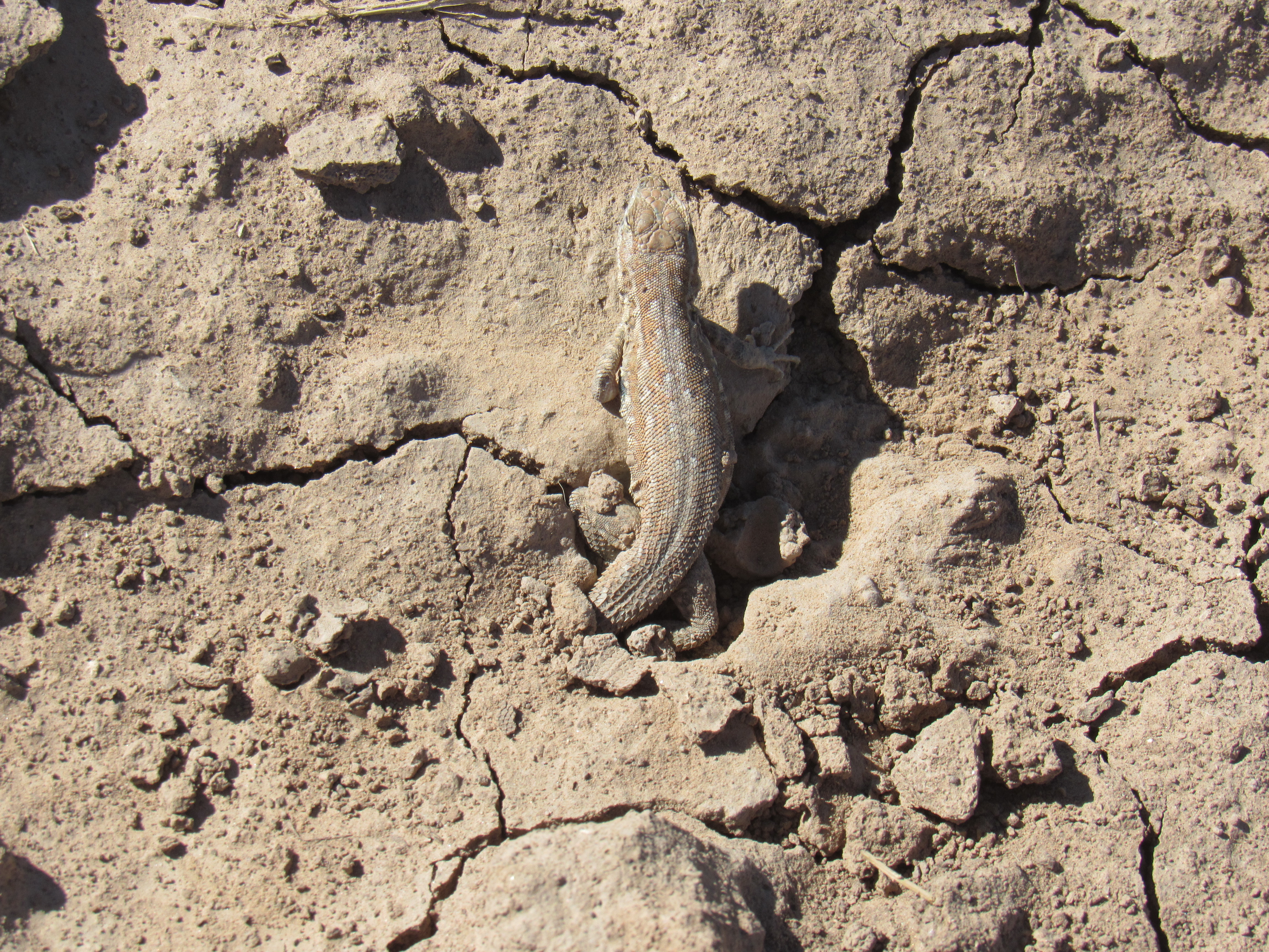
The captive lizard
It was a tiny lizard, not above 2 inches in length. His tail and hind legs were encased in hardened mud and he couldn’t get free. My heart goes out to innocent creatures like this, so I knew I had to help him. I dug out the mud around him and he tried to scamper away, but still couldn’t – there was still a chunk of mud around each of his feet. I picked him up bodily and squeezed the mud gently until it broke away, then set him down and away he went.
From the dam, let’s head north down Greene Wash. We travel down the east side of the Sawtooth Mountains, then angle to the northwest across the Shopishk Valley and enter the Tohono O’odham Indian Reservation at a point 11 miles from the dam. Then, within 2 miles of entering the res, our wash spreads out into a fan a mile wide. Of course, it would take a biblical event to put enough water into this alluvial fan to see water running through its many channels, but it does happen at rare intervals.
Paved Indian Highway 15 and a levee serve to corral the wash back down into a narrow channel to take it past the town of Chuichu at the 14-mile mark. Once past, things fan out again. Farmers have built no less than 16 earthen check dams to trap runoff from the many channels to water their crops (some of those dams are as much as 2,000 feet long). Once our wash has regrouped, at the 19-mile mark it is allowed by means of a siphon to pass through the Santa Rosa Canal. This lengthy canal carries irrigation water west from the Central Arizona Project Canal to irrigate the thirsty fields of Pinal County. Three miles later, our poor Greene Wash has lost its freedom, its ability to freely roam the desert. Levees have been built on each side of it, effectively channelizing it. Sadly, it continues like a captive, and at 23 miles it passes beneath Interstate 8. Here’s a view of the wash as it approaches the Interstate. See the tan-colored levee on each side? This picture was taken after a heavy rain, so it just goes to show that the normally bone-dry wash does flow sometimes.
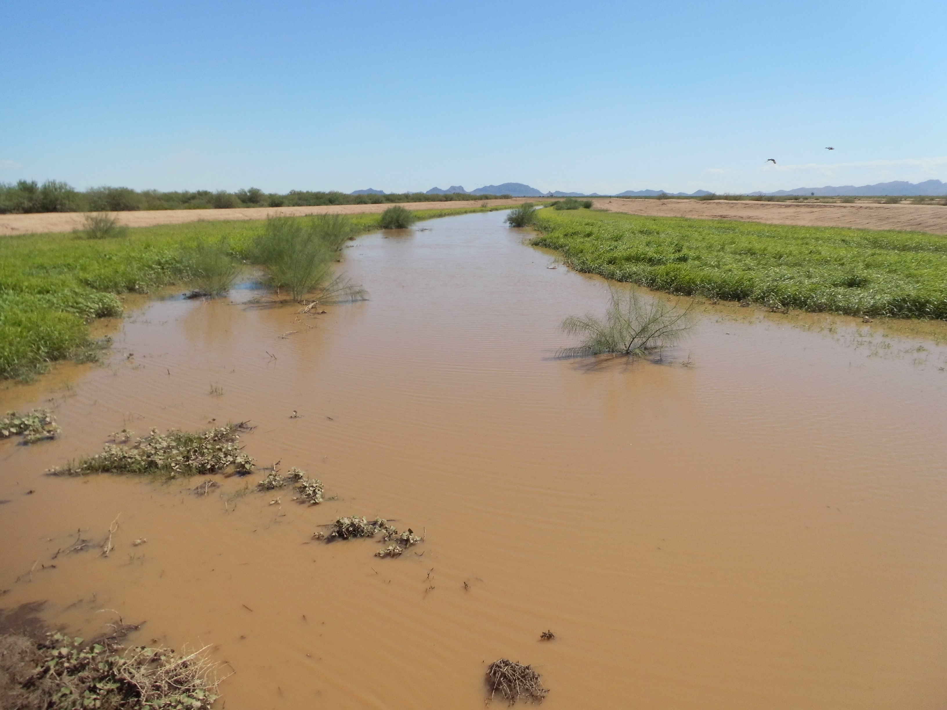
Greene Wash
In the area between the eastbound and westbound lanes of the freeway, enough moisture seems to collect and stay to support this mini-jungle.
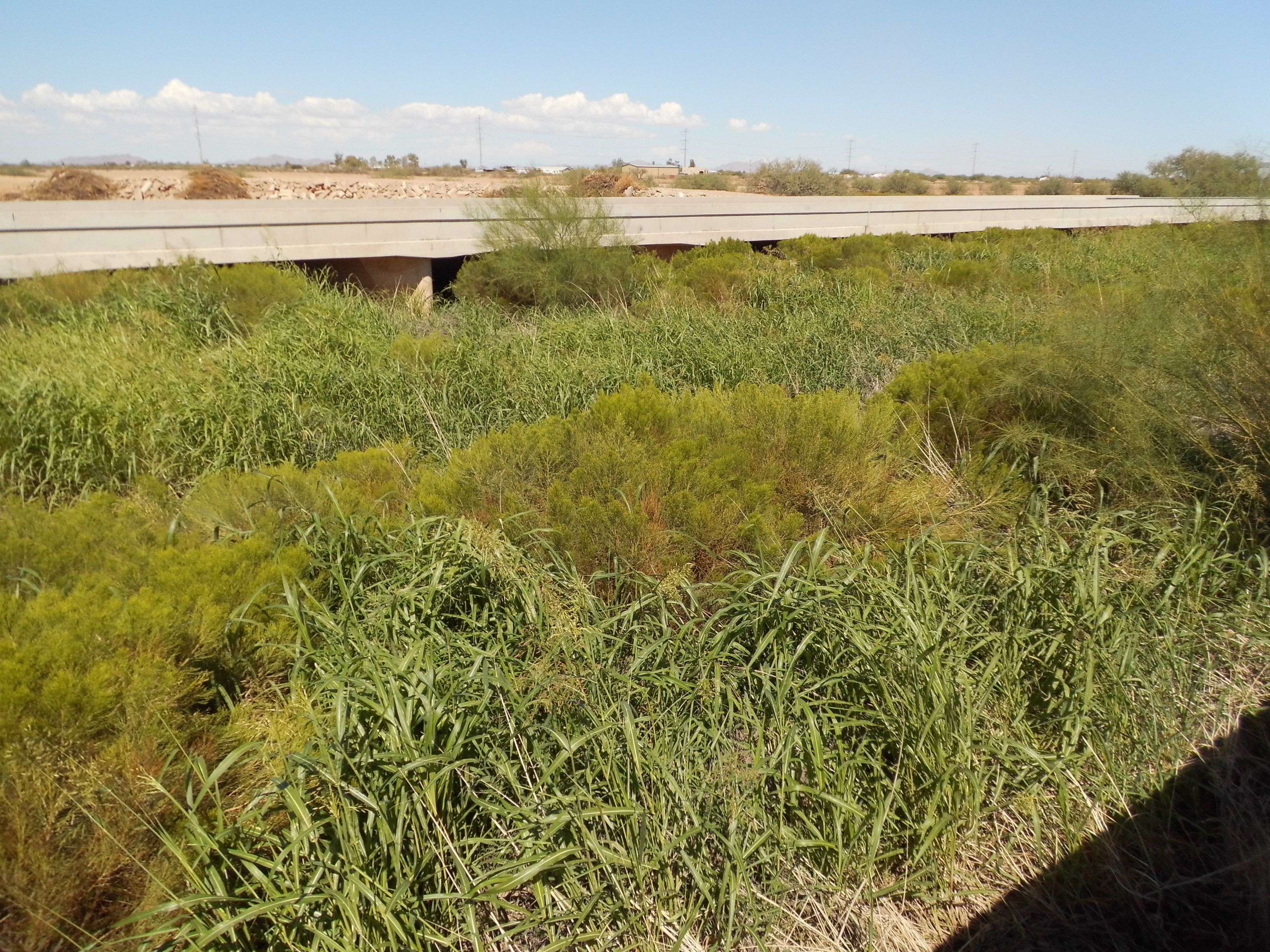
Moving north and west, it becomes bounded by irrigated fields and lives out the rest of its life in a channel surrounded by crops. At the 32-mile mark, it dies an un-natural death by being absorbed by the Santa Rosa Wash and is heard from no more. I’ve gone on at such length about Greene Wash only because before Bill built his canal and dam, effectively changing the route of the Santa Cruz River forever, this wash was of little consequence.
Thanks for coming along for the ride – I hope you enjoyed it.