
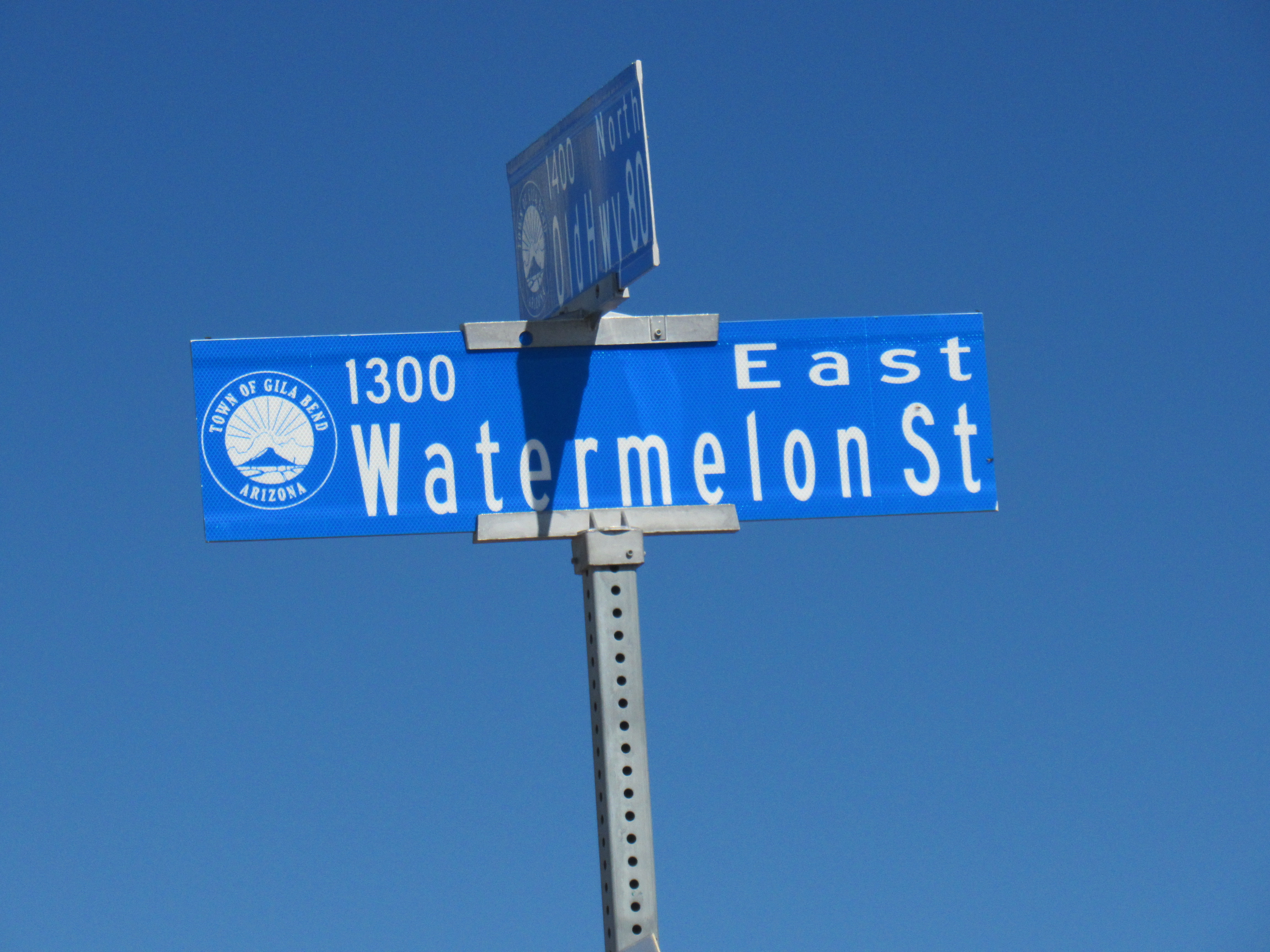
What an odd name! It’s about 11 miles long, running west to east. Paved over much of that distance, it seems like an important road. Agricultural fields straddle it on both sides but, because it sits in one of our hottest desert areas, everything needs to be irrigated – you can’t grow much on 7 inches of rainfall a year. It’s western 5 miles sit fallow these days. Were it not for the nearby Gila River’s underground water which farmers tap with deep wells, there’d be no agriculture here at all. So back to the name – did they once grow watermelons in these fields? Did somebody just decide to give the road its quirky name because they thought it’d be cute? Was it named after someone called Watermelon? All I know is that I’ve never seen a watermelon in those parts. And just to prove that I’m not making this up, here’s a picture of a sign at its eastern edge. Some local officials decided to upgrade it to Watermelon Street, but trust me, the name is Road and not Street.
Oh yes, there is one notable thing along the road which is not agricultural in nature. The huge Gila River Generating Station sits just north of the road at its eastern end. This plant burns natural gas to produce a whopping 2,200 MW of electricity.
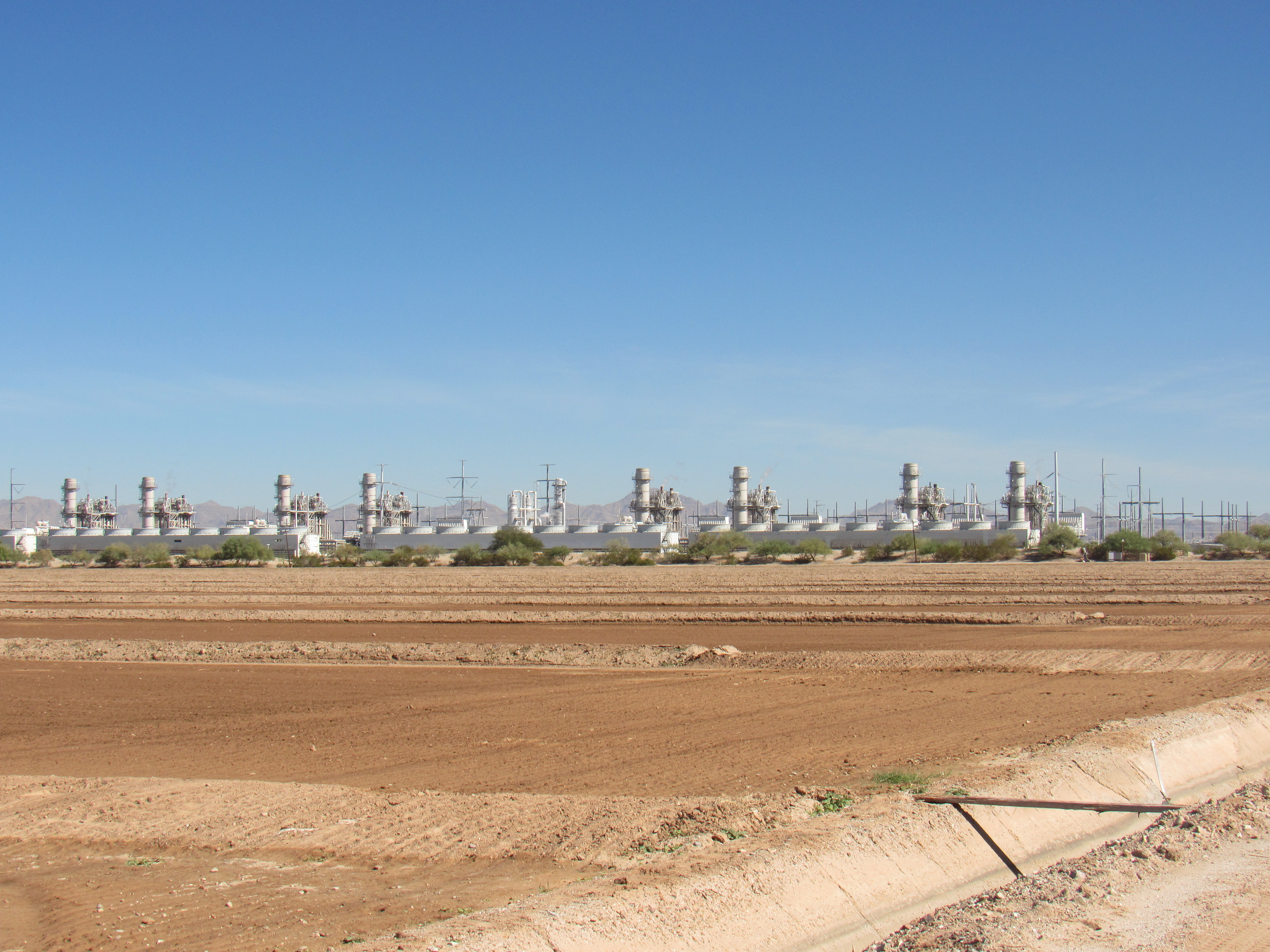
Gila River Generating Station
My first run-in with Watermelon Road was back in 2002. My wife and I drove along it, then north on dirt roads, crossing the dry channel of the Gila River to pass by Point of Rocks, then doing a leisurely climb of Petro Benchmark. It was a fine spring day, and I somehow knew it wouldn’t be my last visit to the area. A couple of years later, I was working on a big project – climbing all of the 401 peaks on the Tohono O’odham Indian Reservation – and I had spotted a loner just inside the boundary of the San Lucy District. I drove out to try it, but couldn’t drive as close to it as I’d hoped. Feeling lazy, I decided to come back another day, but while in the area, I stopped below something called the Fortaleza Indian Ruins. There, I saw a large sign stating that the ruins were a sacred place in the T.O. culture, and please don’t go up to them. I respected that and moved on.
Finally, in the first days of the New Year in 2006, I went back in again. That peak had been bugging me, as I knew I’d need it to complete my project. From where I had to park, it was a bit of a walk over hill and dale, but the day was perfect and I made it to the top of Peak 1116, the lowest of all the 401 on the reservation. If you click on the link, you can see my photo of this gentle summit.
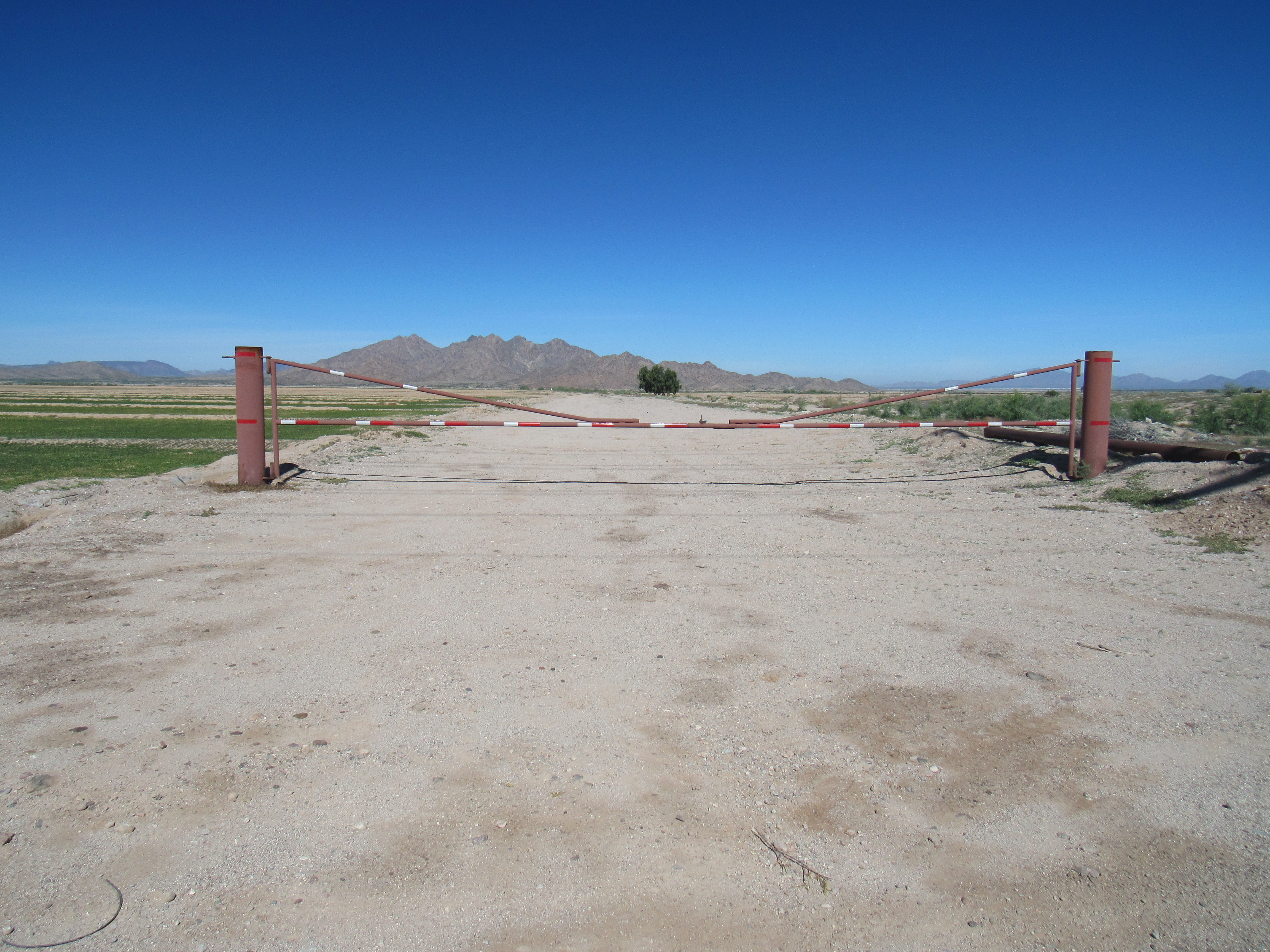
More years passed. Being the dyed-in-the-wool peakbagger that I am, I just couldn’t leave well-enough alone. A couple of peaks in the area had caught my eye, so back in I’d have to go. It’s interesting how you can scope something out on maps and satellite photos, only to find when you get out in the field that things aren’t what you expected. Like this massive steel gate blocking my path.
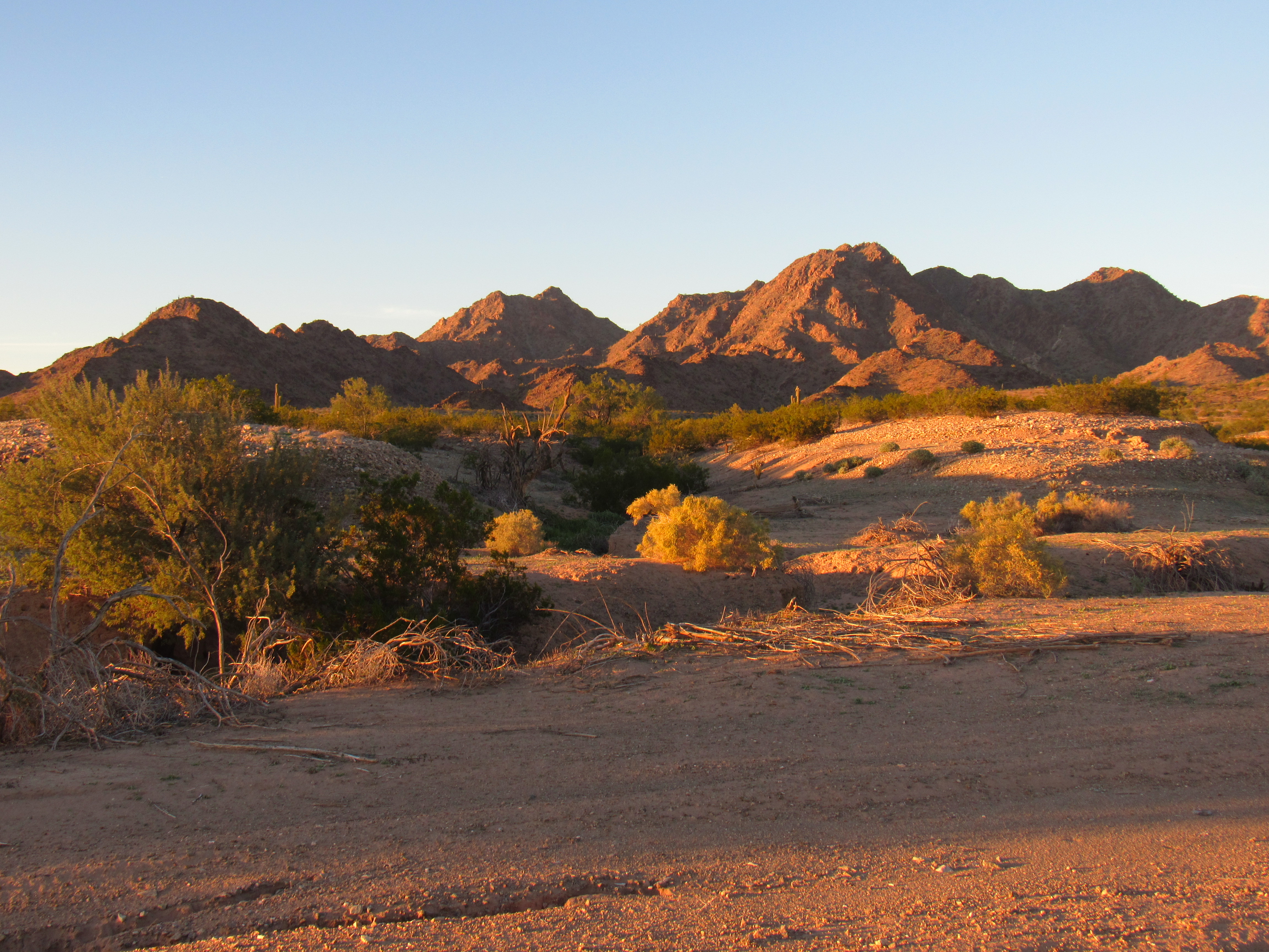
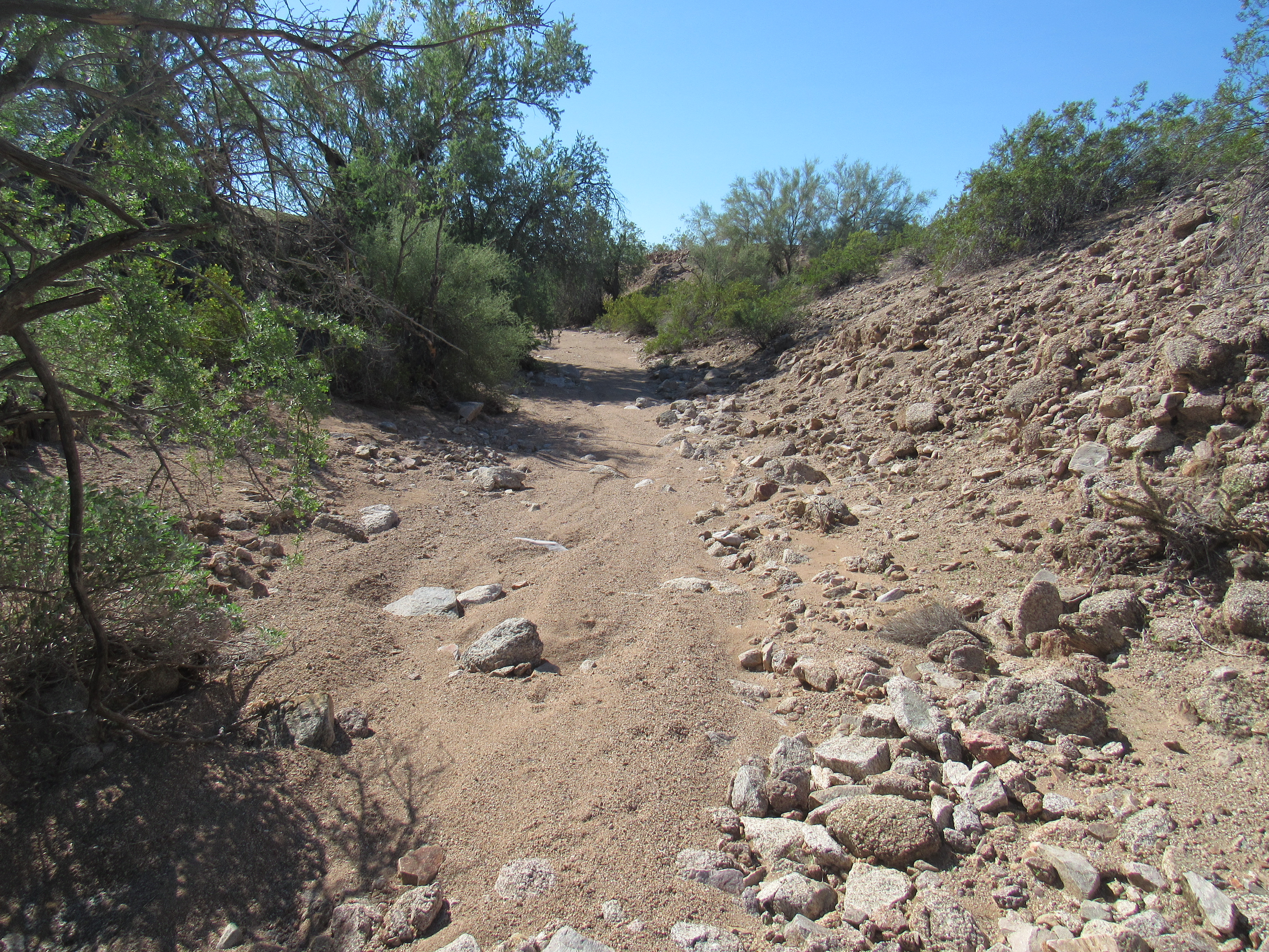
Fortunately there was a broad, sandy wash a few feet away, heading in the direction I needed to go. It was riddled with the tracks of others who had also chosen to bypass the gate, so away I went. A couple of miles later, the road went to hell in a handbasket. Where once you could drive, the way was blocked by a yawning chasm ten feet deep. I got out and surveyed the damage – hmmm, maybe there was some way to deal with this yet. I found a spot where I could drive down into the rift (a sharp turn almost did me in), then along in it for a hundred yards, through a rough, scary spot and then I shot out the other side. It was late afternoon by the time I reached my goal, a level spot in which to park for the night. However, while I still had some daylight there was something I wanted to find – petroglyphs. The map said they were there, but how hidden would they be?
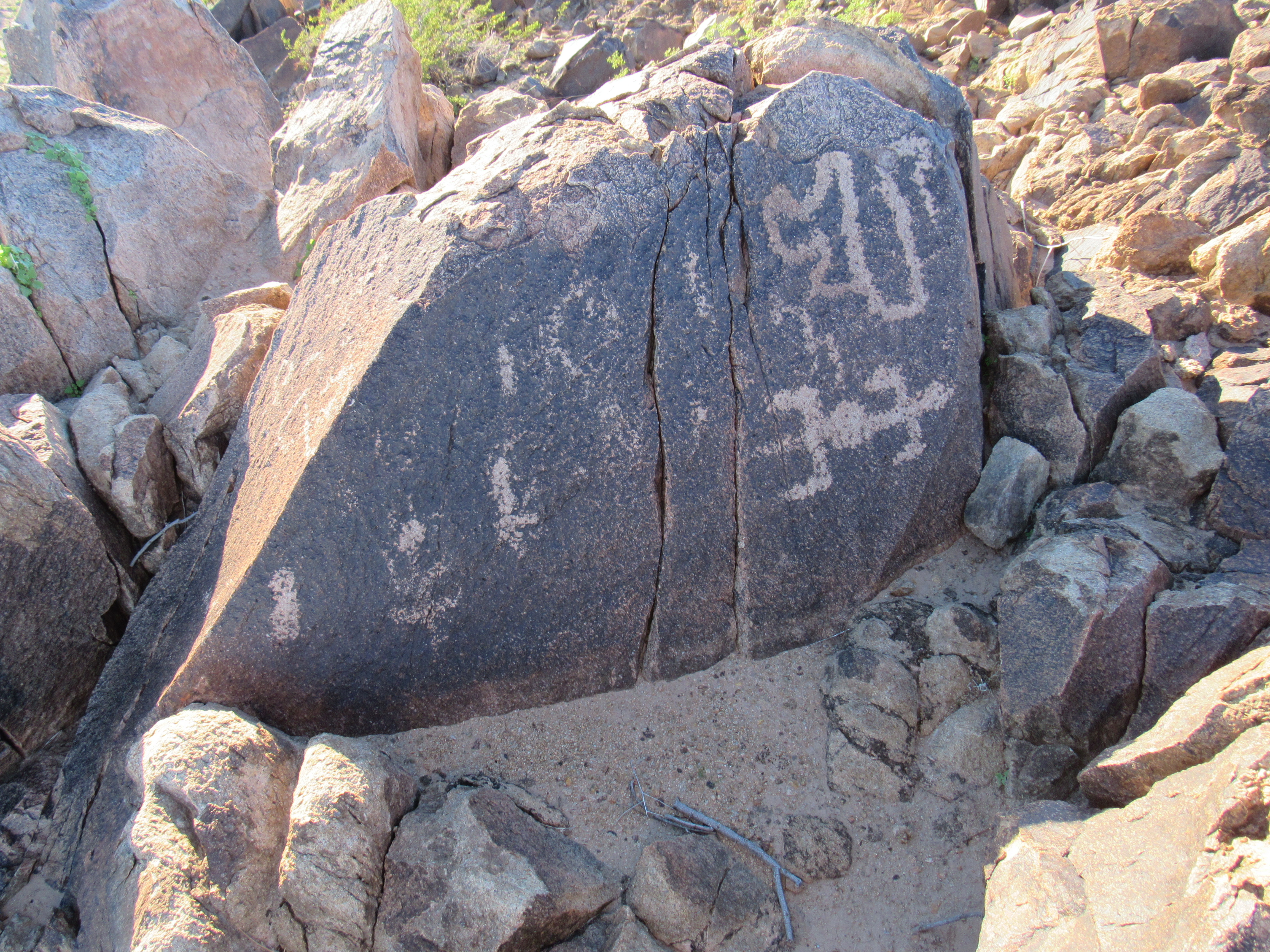
It was my lucky day, I found them with little looking. They sat on the nose of a ridge, overlooking the valley – here’s the spot. As I walked over to the right side of the ridge as seen below, I could spot some of them right away.
The ridge
These glyphs were made by the Hohokam people, between 1200 AD and 1450 AD, and it was exciting to be seeing them up close. Here are several photos that I took that day.
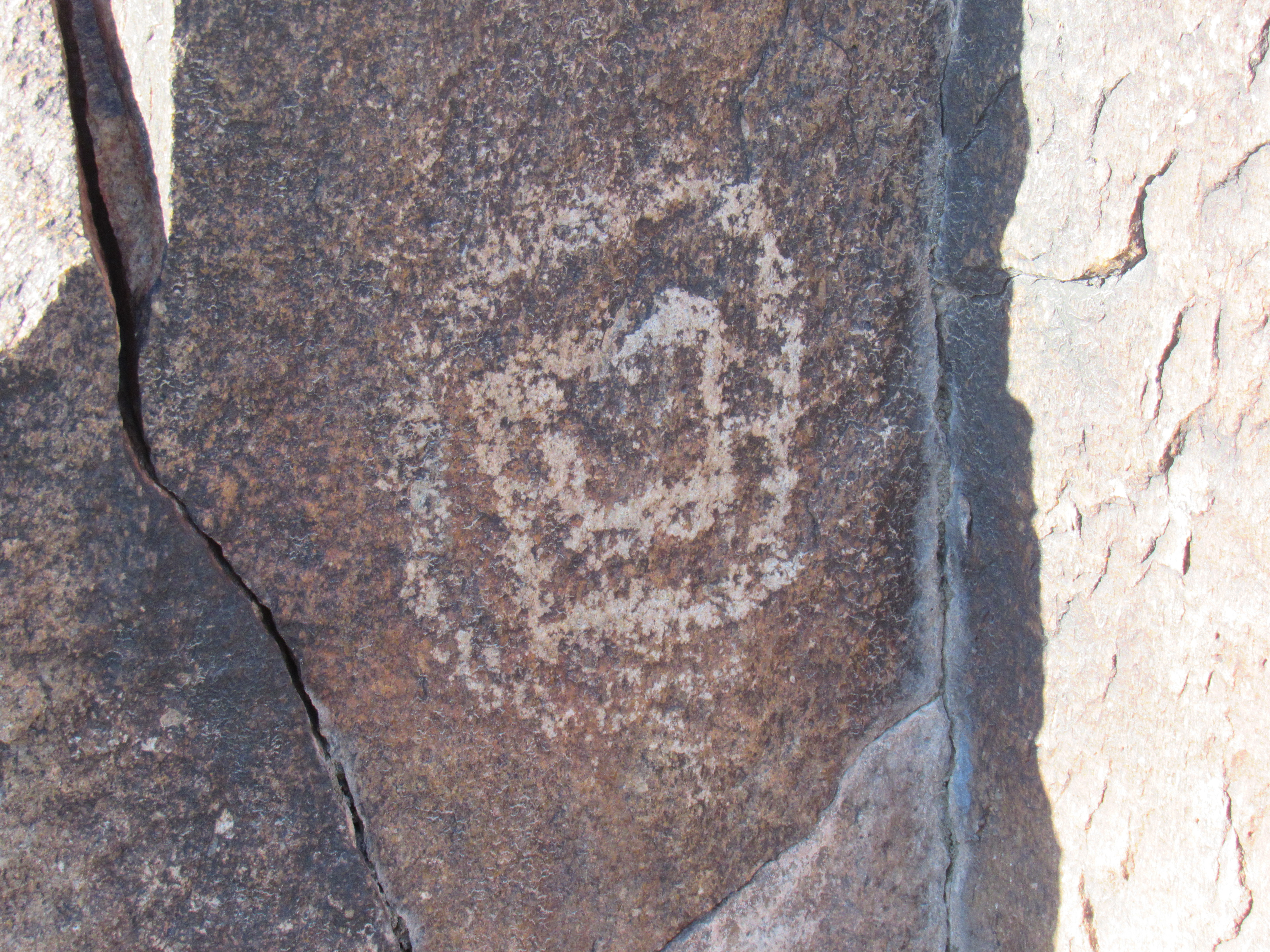
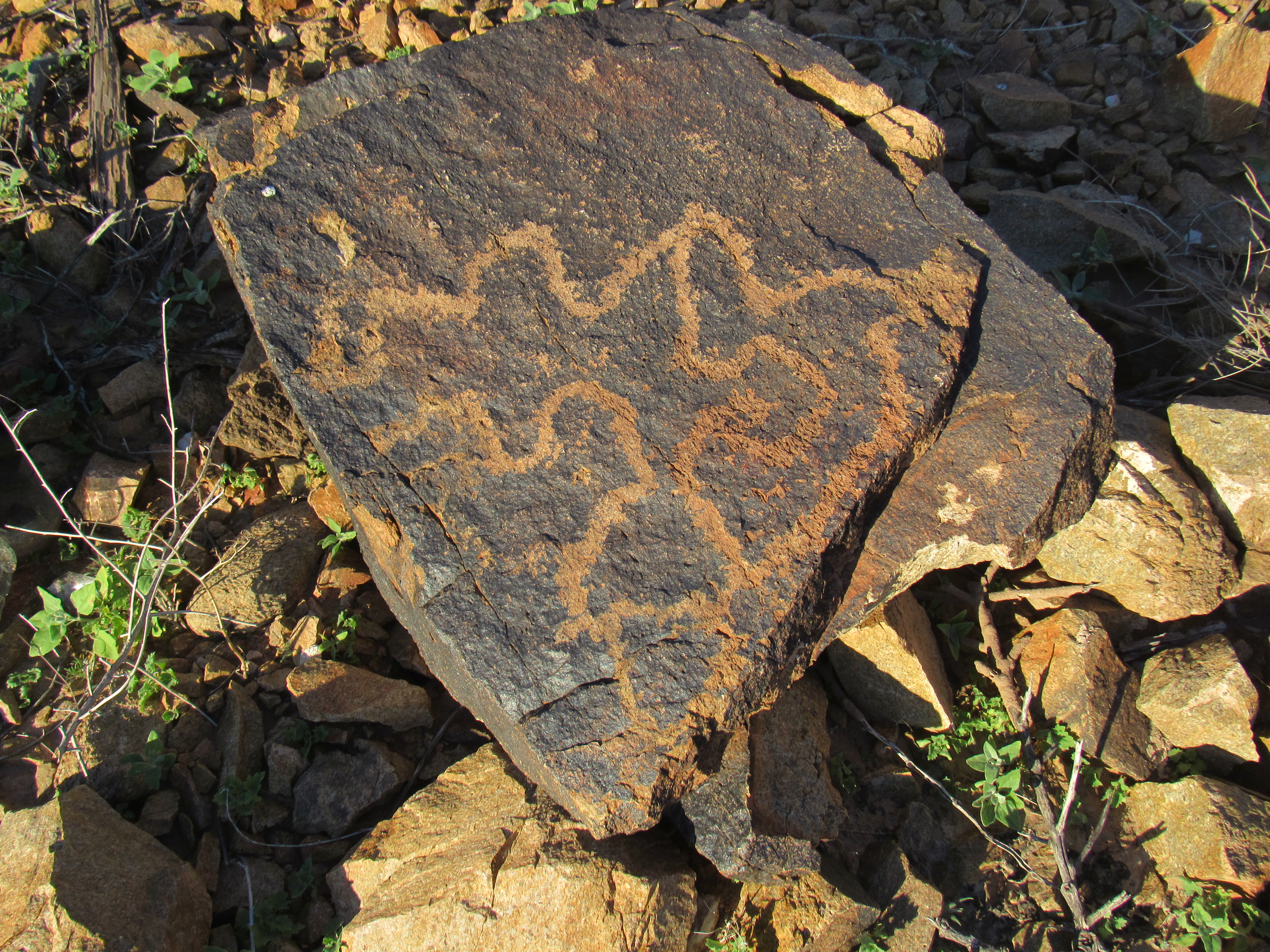
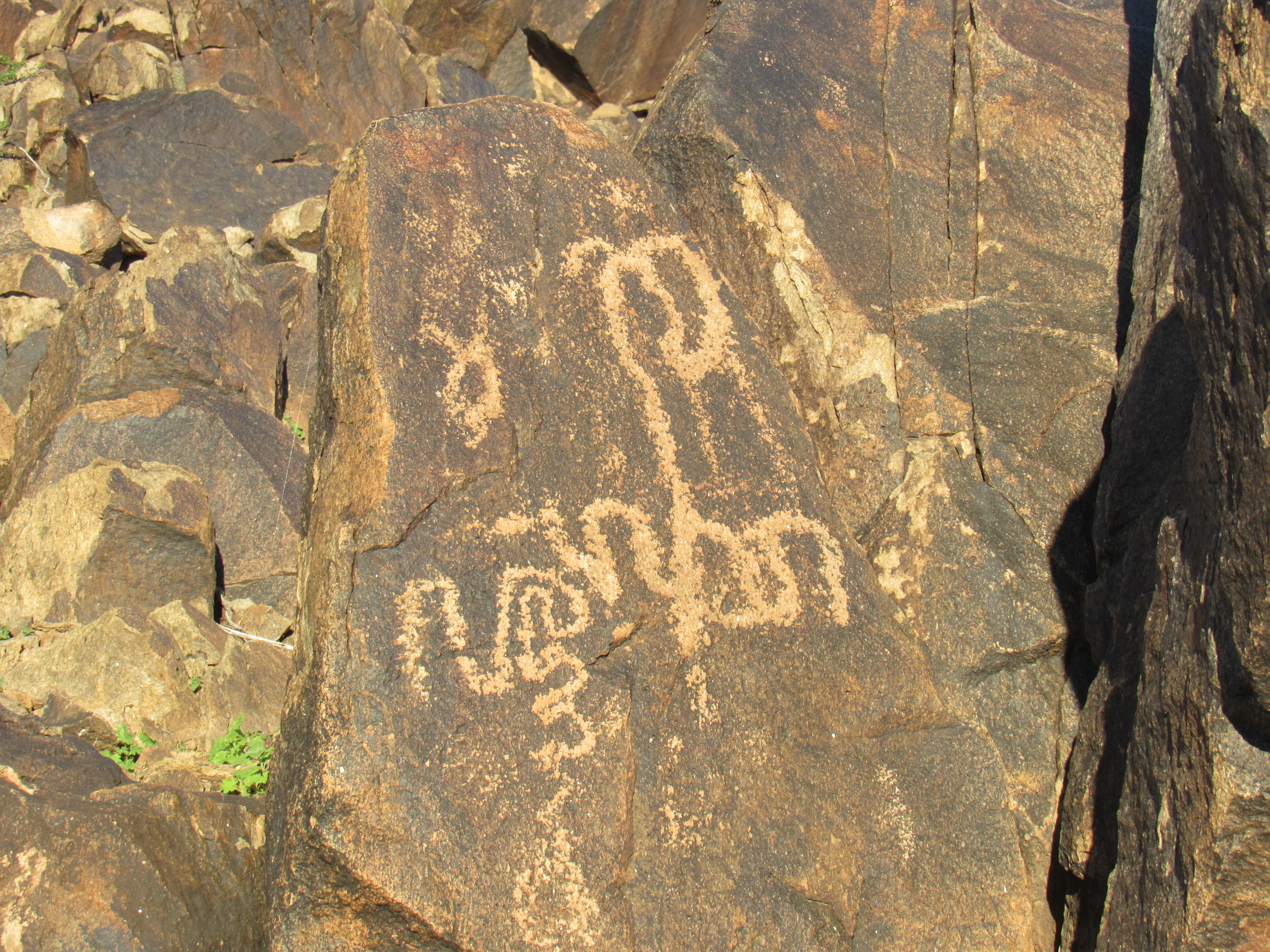
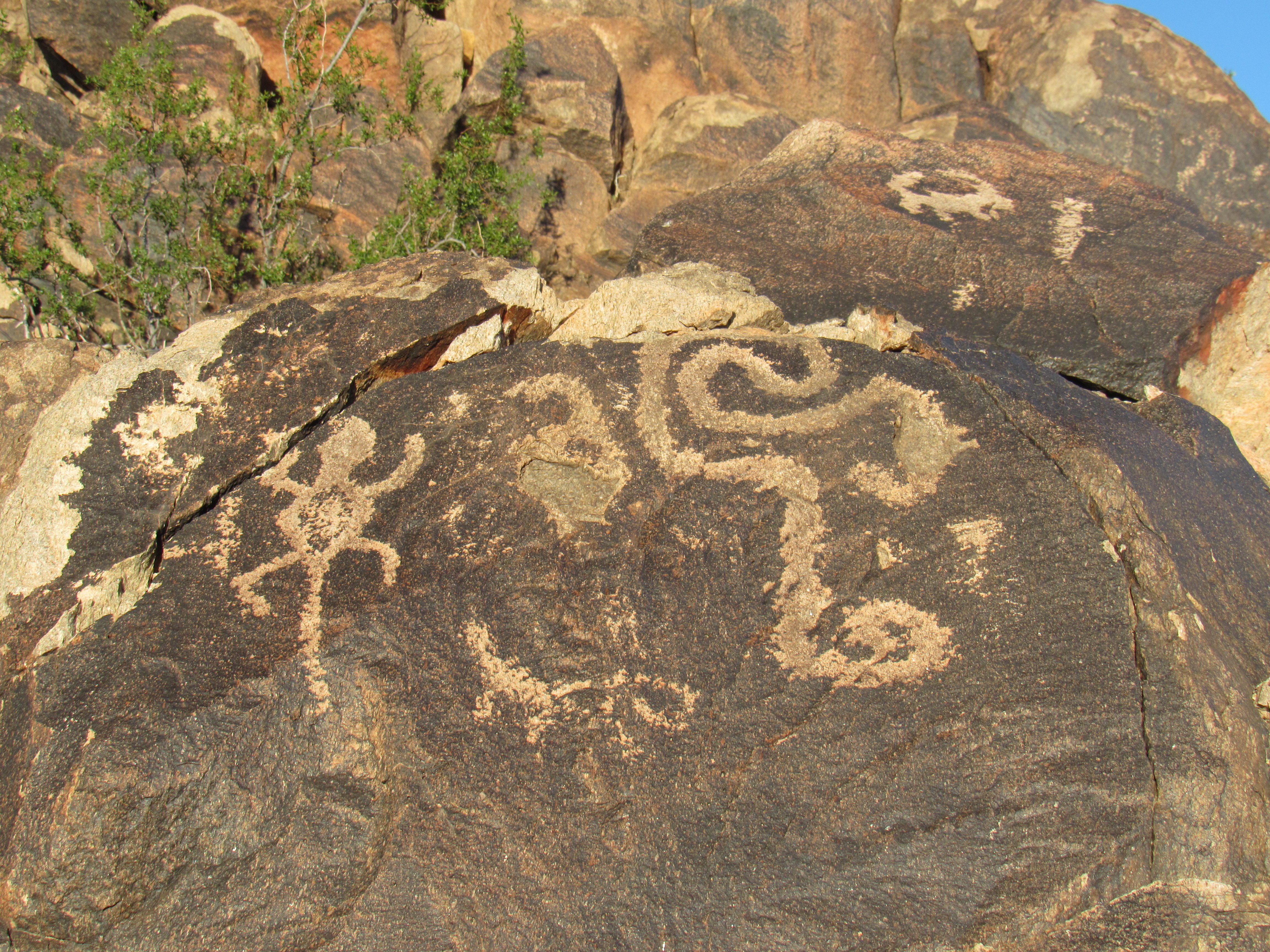
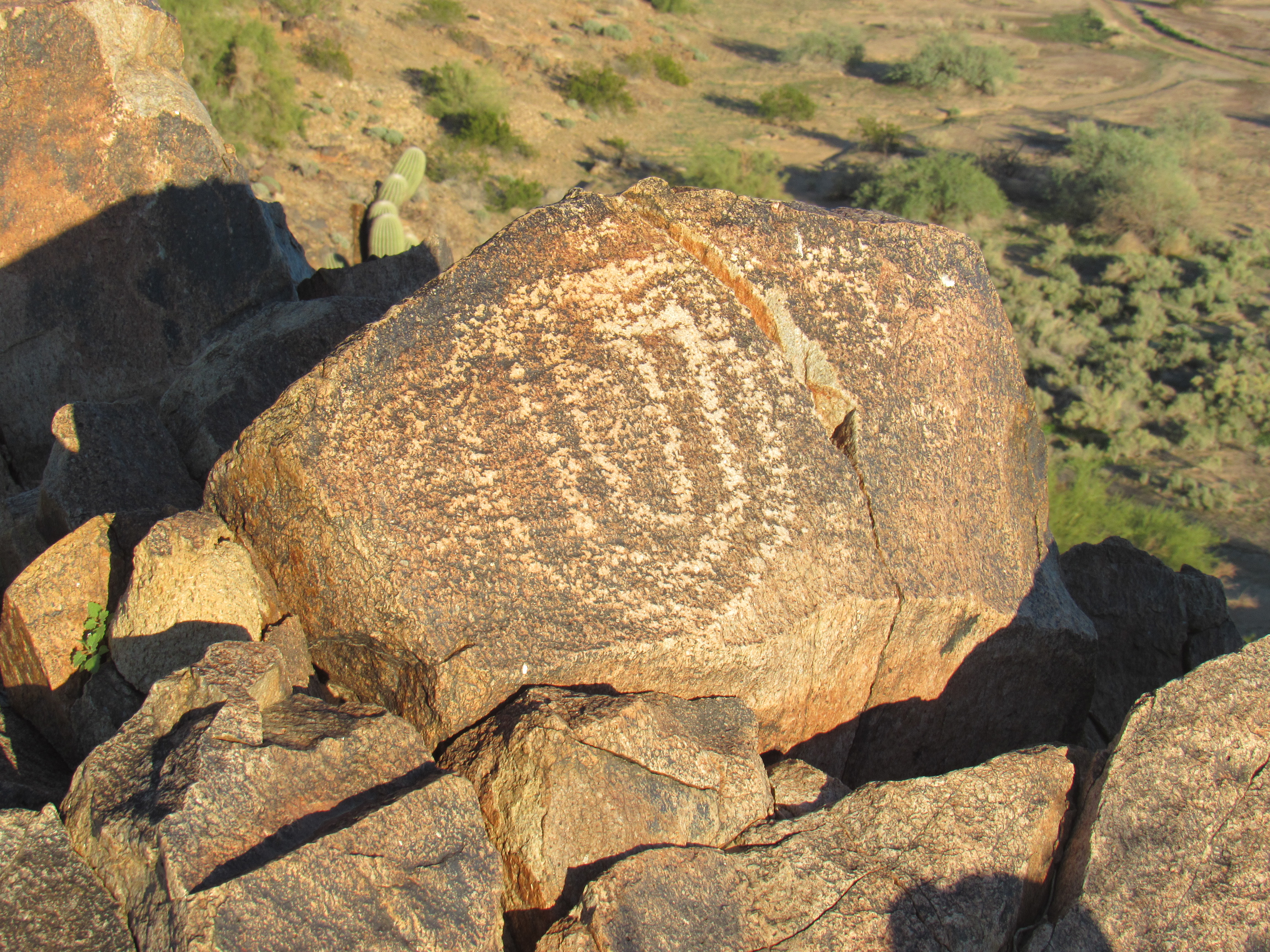
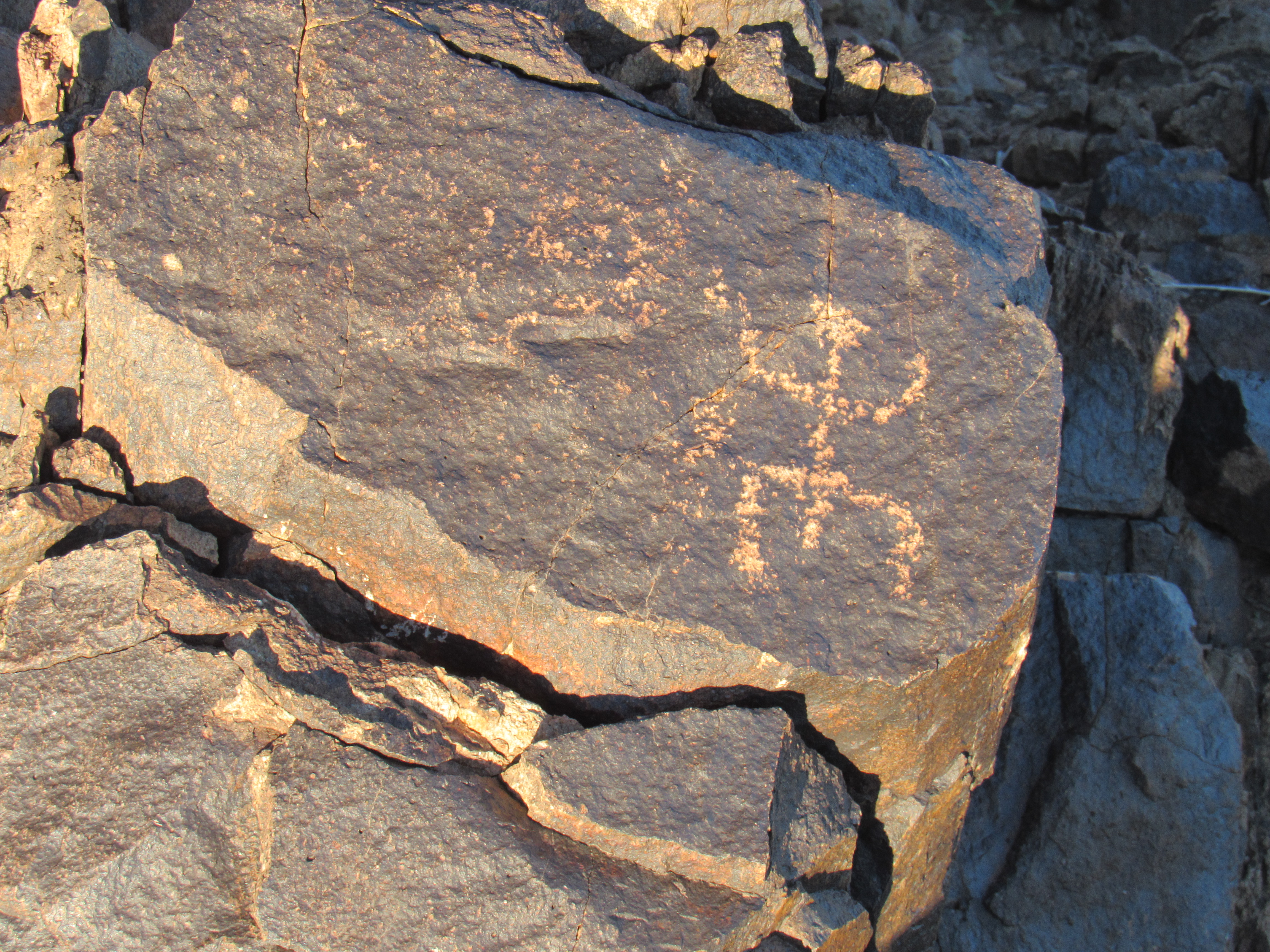
As I touched them, it was as if I were hearing their faint voices – I am deeply awed by this ancient land. I finished my exploration as the shadows lengthened.
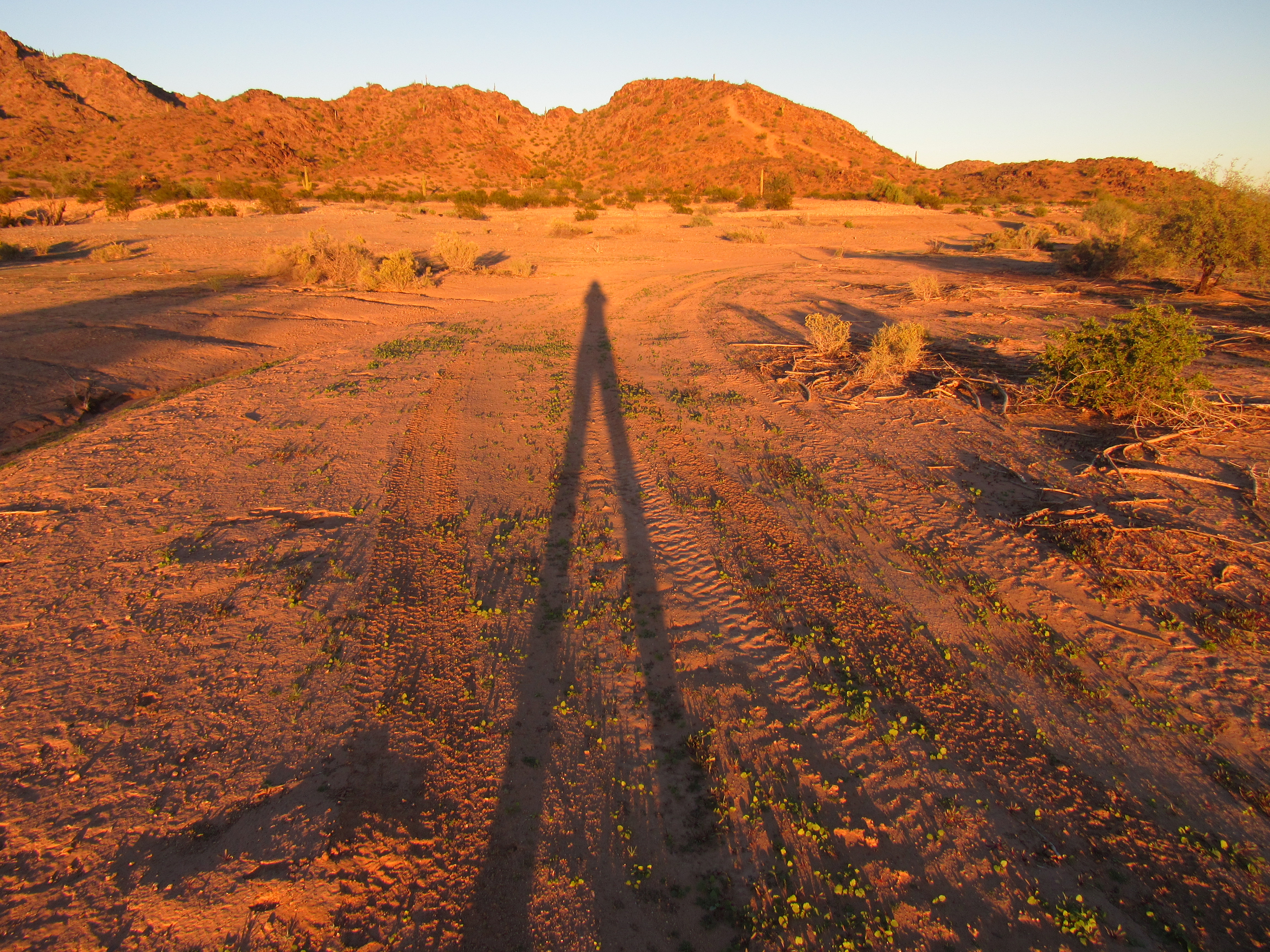
This tantalizing look at tomorrow’s peaks had me excited.
As darkness fell, the mosquitoes were making me crazy – recent flooding in this normally-parched land had brought them out in droves. Fortunately, the chill air of bedtime made them all disappear.
A chilly 41 degrees greeted me at first light when I set out the next morning. The wash in which I traveled was deep in shadow all the way to the base of my first climb of the day. A steep scramble put me on top of Peak 1370 an hour fifteen after setting out. I had managed the entire climb in the shade, so early was my start. There was no sign of a previous visit, so I left a register. Here’s a picture of the peak taken later in the day.
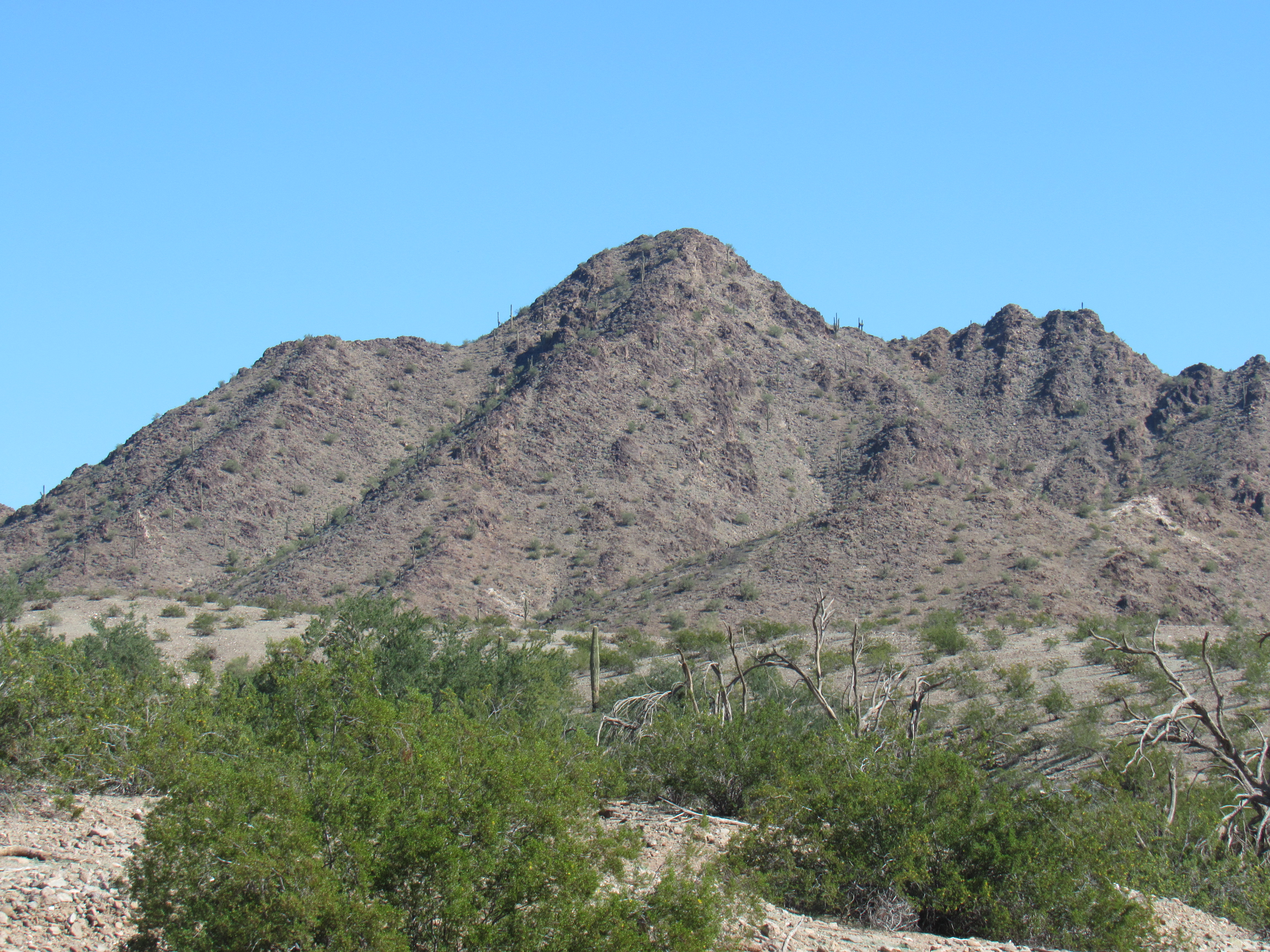
Peak 1370
And here’s the undisturbed summit as I found it.
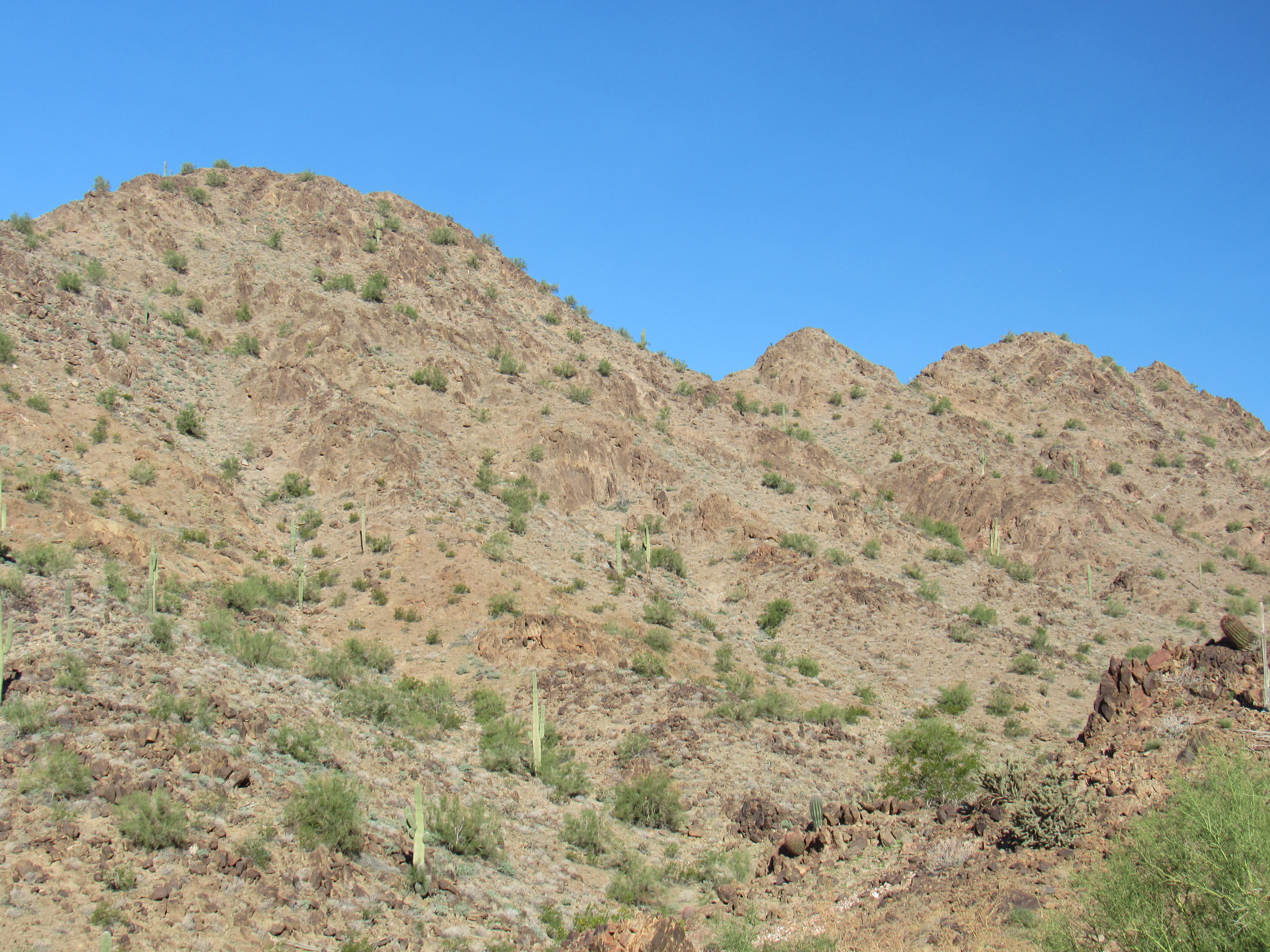
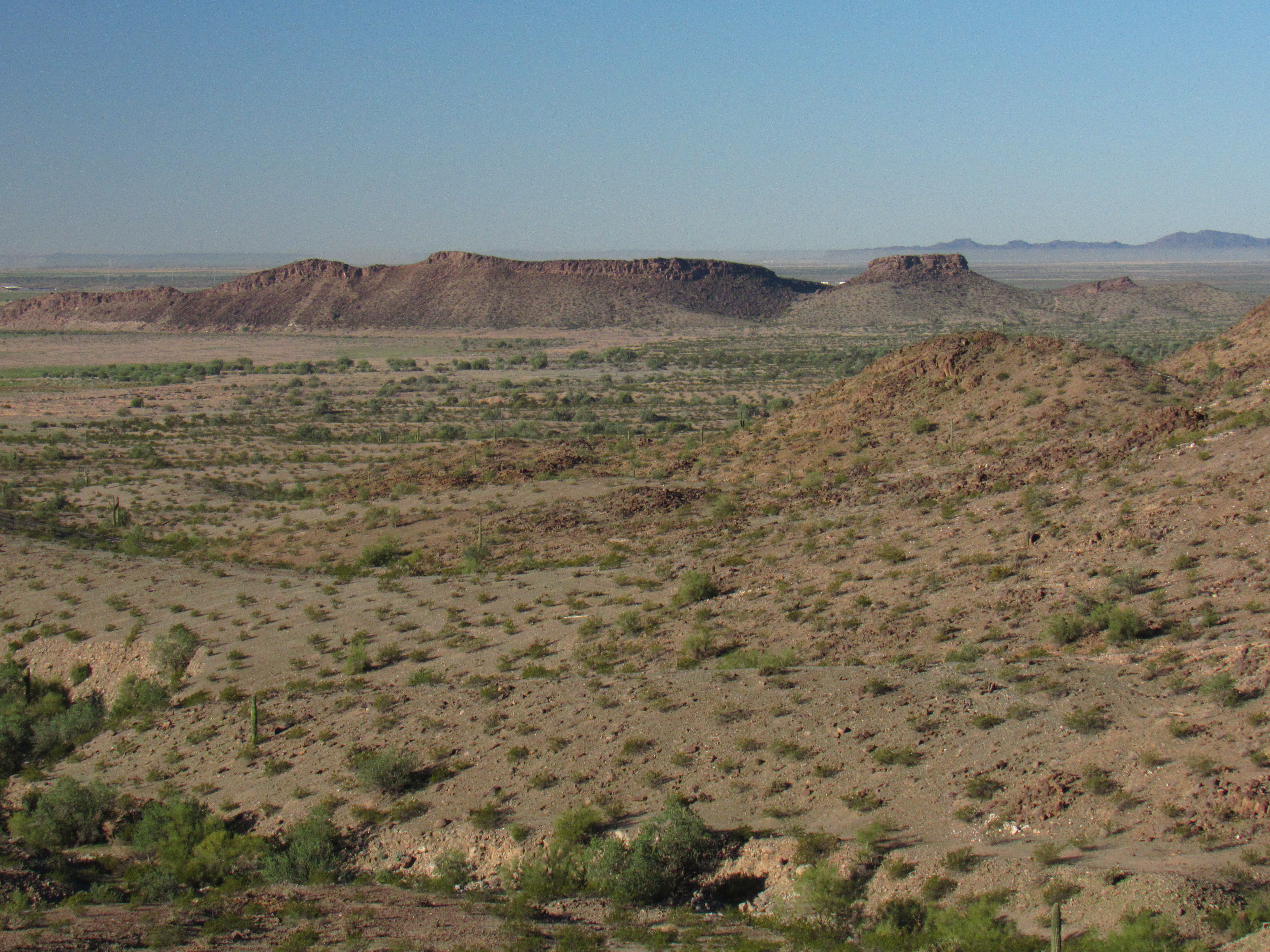
I had one more to visit, so I headed back down to the wash at the base, then went cross-country over hill and dale to finally reach a spot near Peak 1220. Here was my first good look at it. Of the 4 bumps you can see, it’s the second from the right.
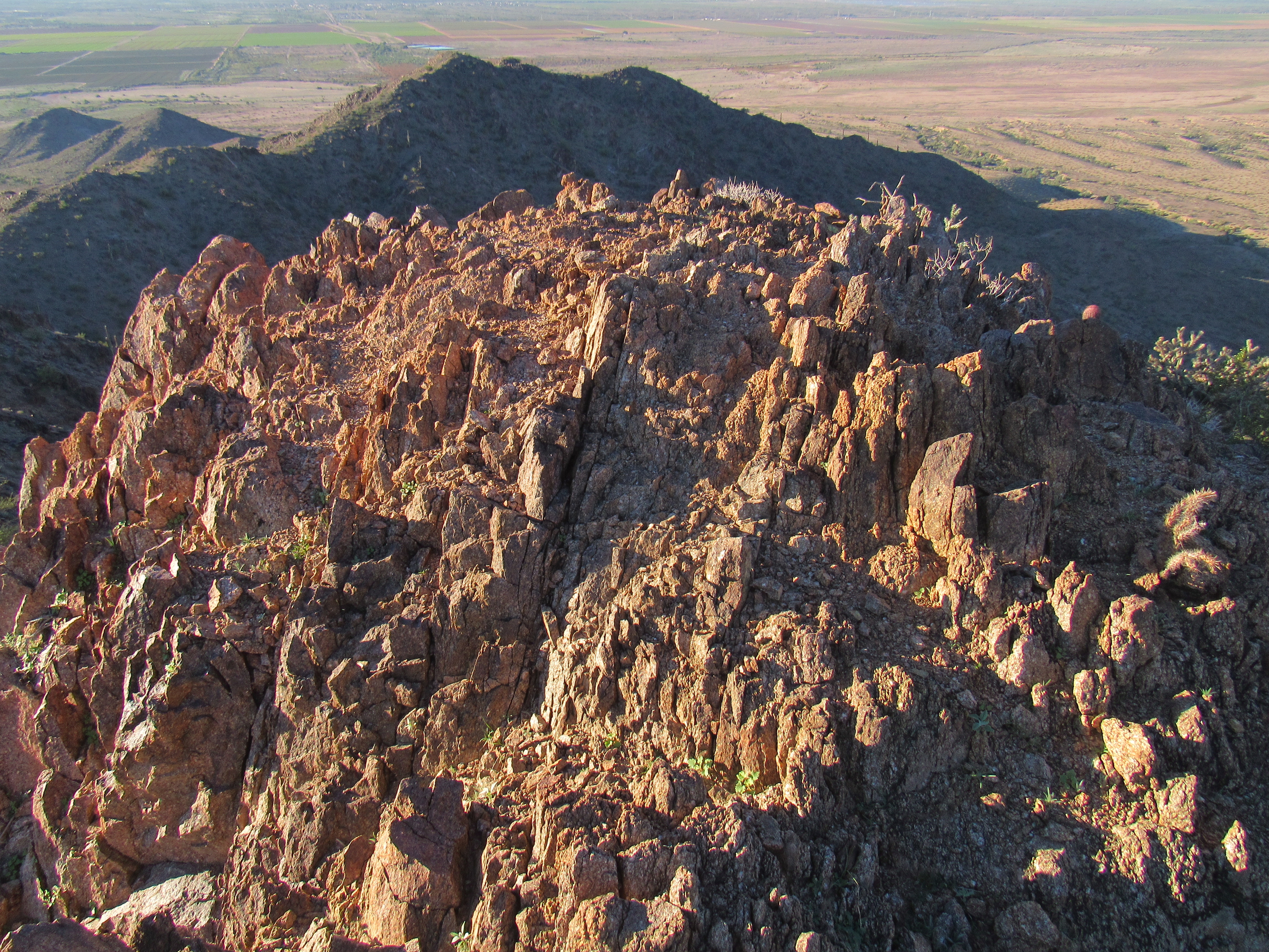
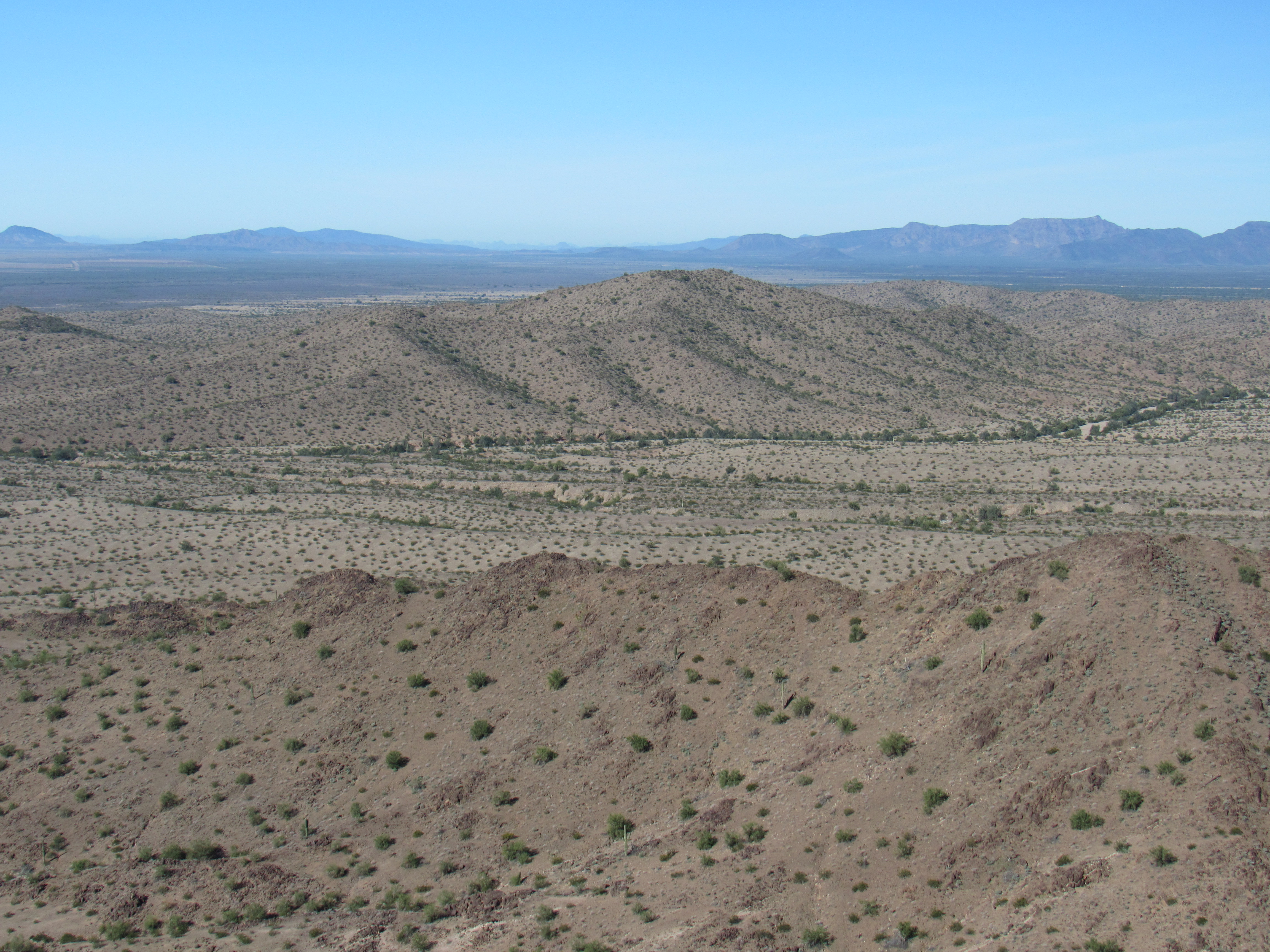
The day was warming up, so it felt good to reach the top and take a break. I had now been out for 3 hours. Once again, no sign of any previous visit, and the views! See for yourself. Here are some of the highlights. Remember Petro Benchmark from earlier? The long dark ridge is Petro, while the flat-topped mesa on the right is the site of the Fortaleza Indian Ruins.
Petro
Only a mile to the northwest sat my old friend, Peak 1116, from a dozen years earlier.
Peak 1116
Directly to the north, Peak 2056 towered above me.
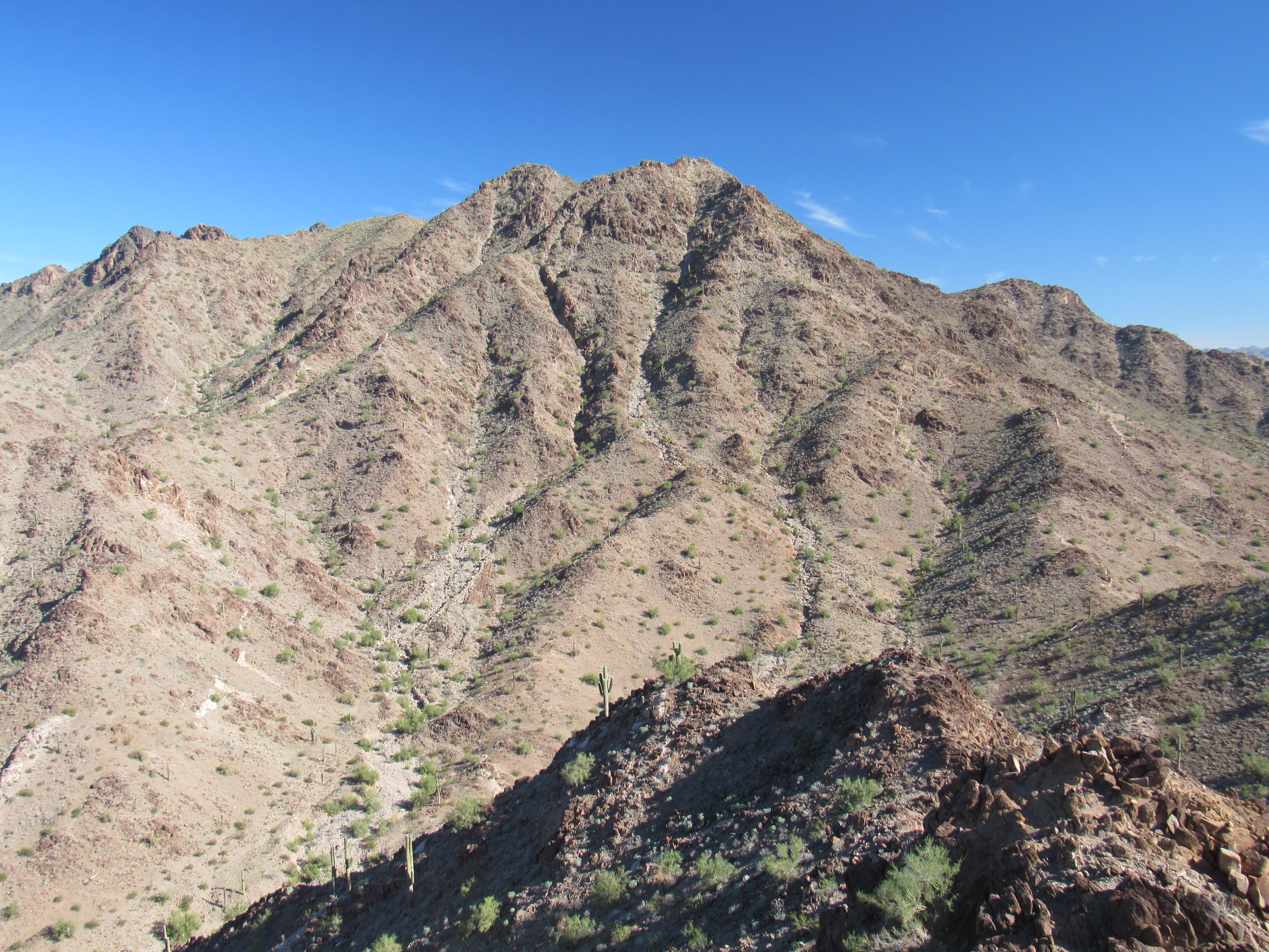
Peak 2056
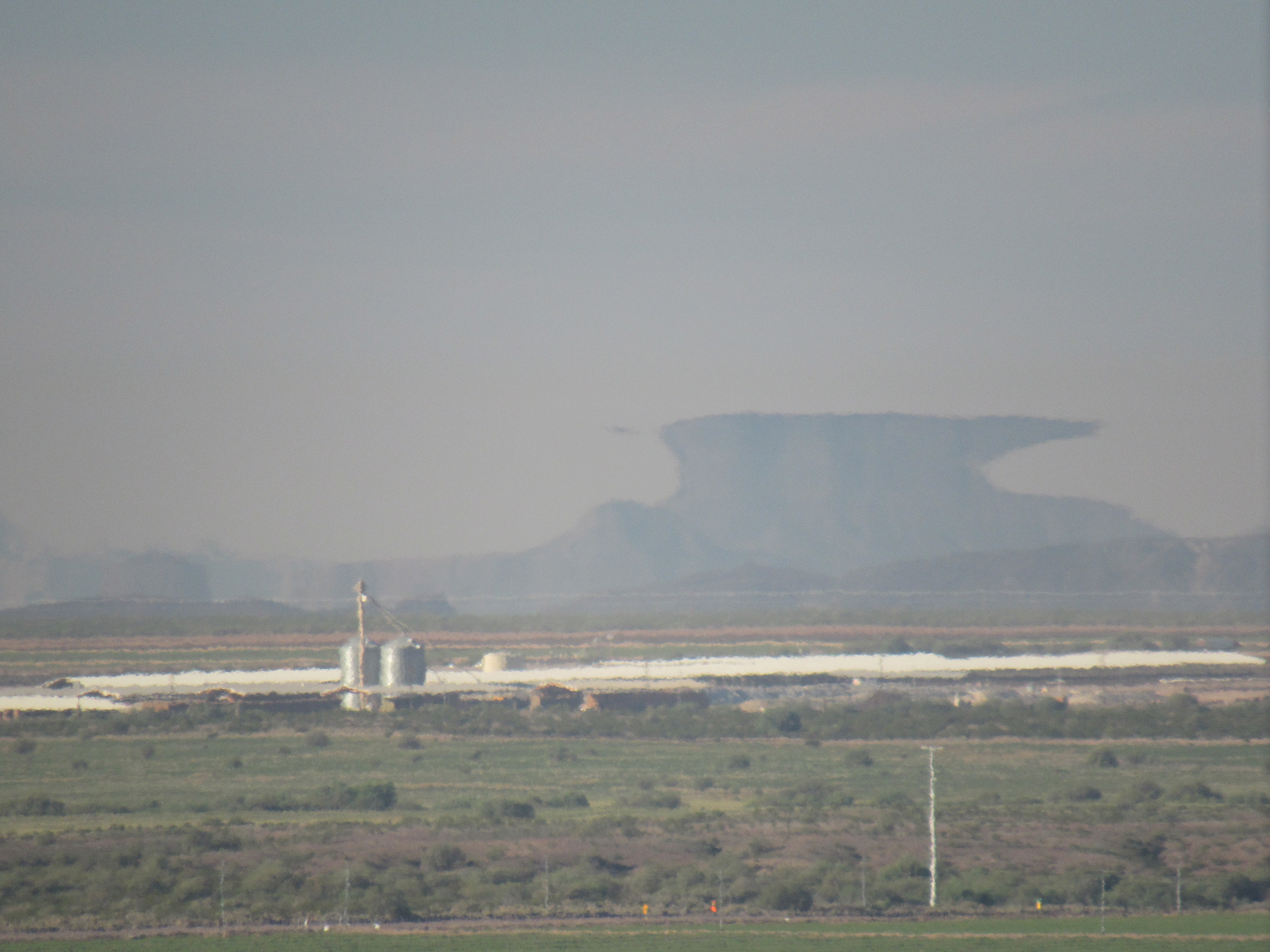
But something curious floated on the distant horizon. Mirages can be seen in the desert under the right conditions, and today was one of those days. Fully 31 miles to the southwest sits a group of peaks in the Crater Range – they are gentle and rather ordinary to look at, but not today. Here, they tower skyward, unlike their true selves.
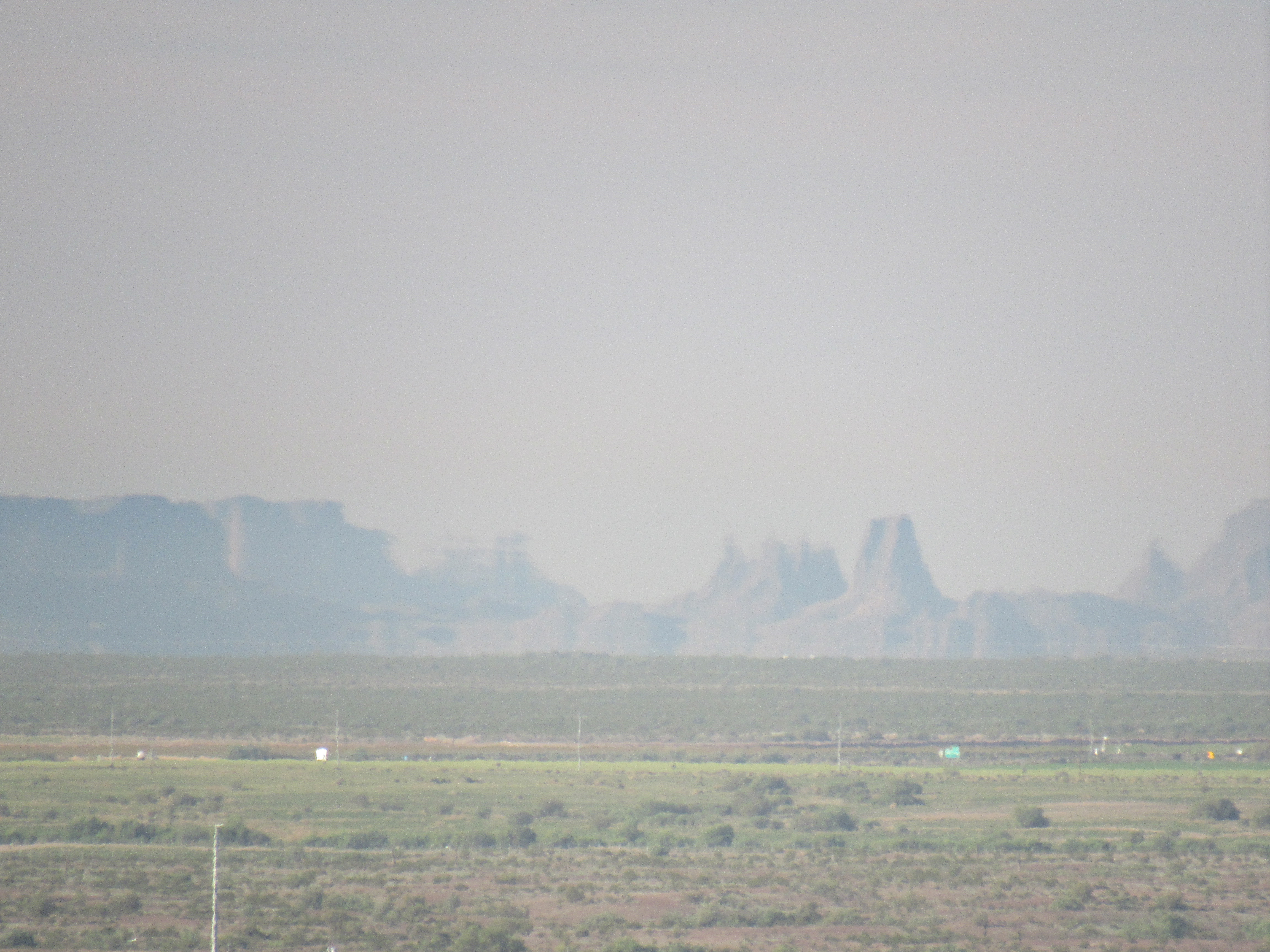
Specters of the Crater Range.
Here’s another view, a truly surreal image.
Well, all good things must end, and so did my time atop Peak 1220. I packed up and headed back down to the waiting wash on its east side. All I now needed to do was walk down it and enjoy the day.
It was a pleasant couple of miles on as fine a day as one could wish for, and almost 5 hours after setting out, I was back at the old Toyota. The desert never disappoints, and this trip had proven that once again. Thanks for coming along and keeping me company.