
Please be sure you read the previous chapter of this story entitled “The Heart of Darkness – Part One” before starting this one.
Day 3
Okay, I’ve already admitted in Part One of this story that we were stealth climbing. As you well know if you’ve been reading my stories over the years, stealth climbing is that which is done in places where no climbing is allowed, where essentially you are trespassing. You could stealth on private property, or on land that is closed to the public, but the boldest of all stealths are done on military lands. Hard-core stealthers aren’t particular – Air Force, Navy, Army, Marines, they’re all fair game and many of us peakbaggers have done it. No secrets there, it’s been going on for years.
So here we were, two nights and two days already spent in no-man’s land. Now a major event was about to happen. We needed to go deeper into the forbidden area to start picking off the next peaks. The first 6 we had done were just a warm-up for what was to come. There was a significant problem, though, and it was called “water”. As in much desert climbing, there may be no naturally-occurring water where you want to go. All life needs water, even climbers, and one important fact about water is that it is heavy, and carrying a lot of it really sucks.
Here’s what we had to do, on this, our Day 3 of the trip – move a lot of water to our next camp. When we arrived at our Camp One, we had brought a lot of water with us (since we could drive in to that camp, there was no effort involved and we could bring all we wanted). We prepared day packs for climbing, 7 or 8 pounds, and each put 4 1/2 gallons of water into our big packs. So, water + big pack + day packs gave us a load of 50 pounds. We’ve carried way more than that at other times, but I can tell you that 50 pounds on your back is no fun. I weigh 155, so I was carrying 1/3 of my body weight. Walking with that much weight on a level surface like a road is bad enough, but to walk in terrain which is slightly uphill, and is littered with rocks, vegetation and sand is so much worse. We had each trained by carrying heavy loads back home, but carrying those same loads in the uneven terrain of the desert is a horse of a different color.
We also had to move all of our gear, but we decided to not move any of it today in addition to the 50 pounds we already were carrying. Instead, we’d move the water first and our gear on a later trip. Another thing we wanted to do was to stop along the way and take breaks to take the strain off of our bodies. Instead of taking off those heavy packs, then struggling to put them back on again, we knew the easiest way to take breaks would be to sit down on a big rock or ledge or embankment. We would back up to such a place and sit down, taking the load off our legs yet still sitting there with our packs on. That made it a lot easier to get up again, although even then the one who got up first might have to help the other to his feet.
Our move today would cover new ground, ground that no climbers had previously trod. We were excited, having planned for this for 2 years. My pack was loaded with durable gallon water jugs; Luke’s, with 5-liter bladders. The day’s agenda was as follows: move the water to Camp Two, leave it there, climb one peak nearby, then walk with empty packs back to Camp One where we’d spend one last night. We put things in order, then walked away from camp at around 7:30 AM.
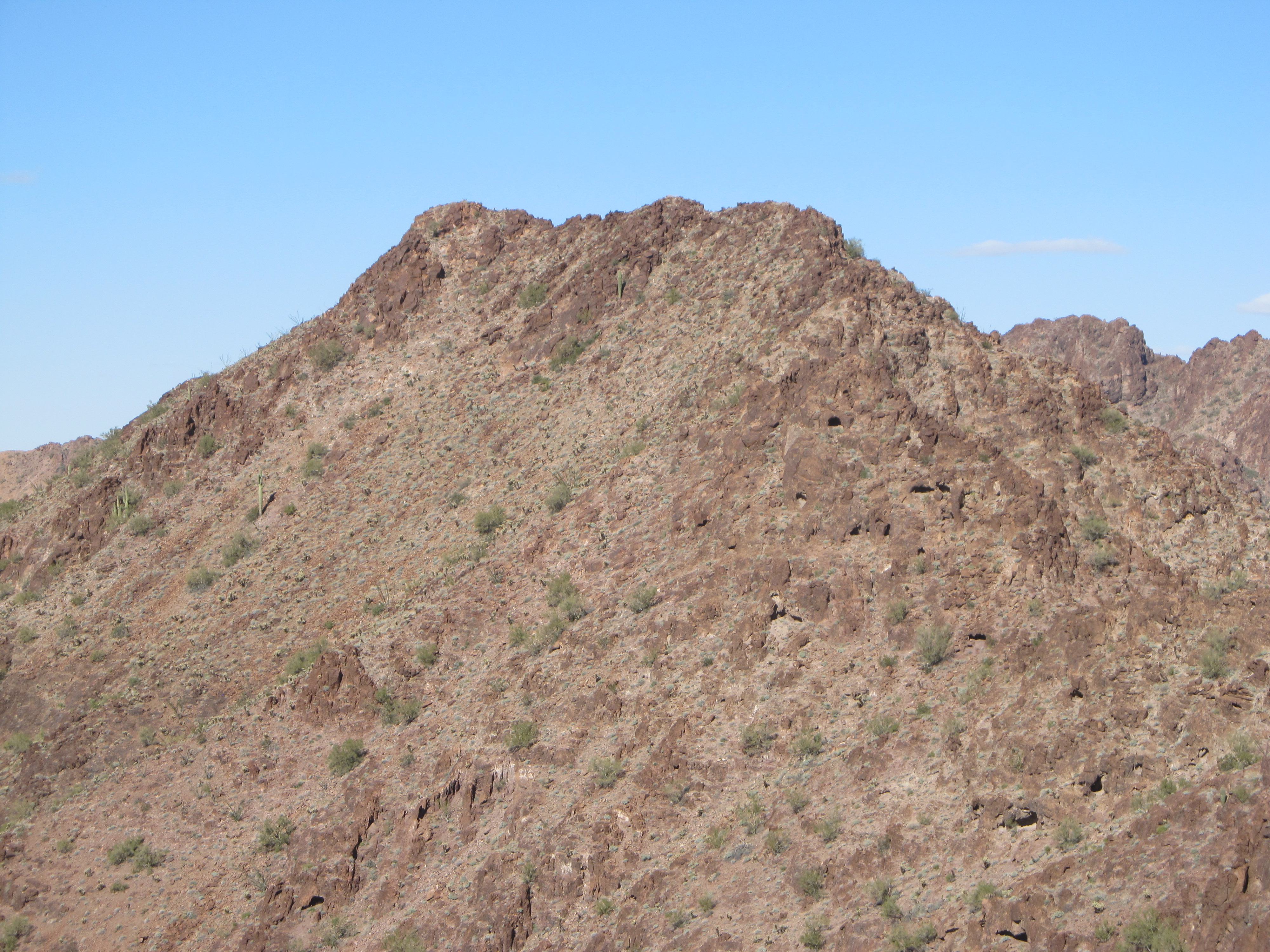
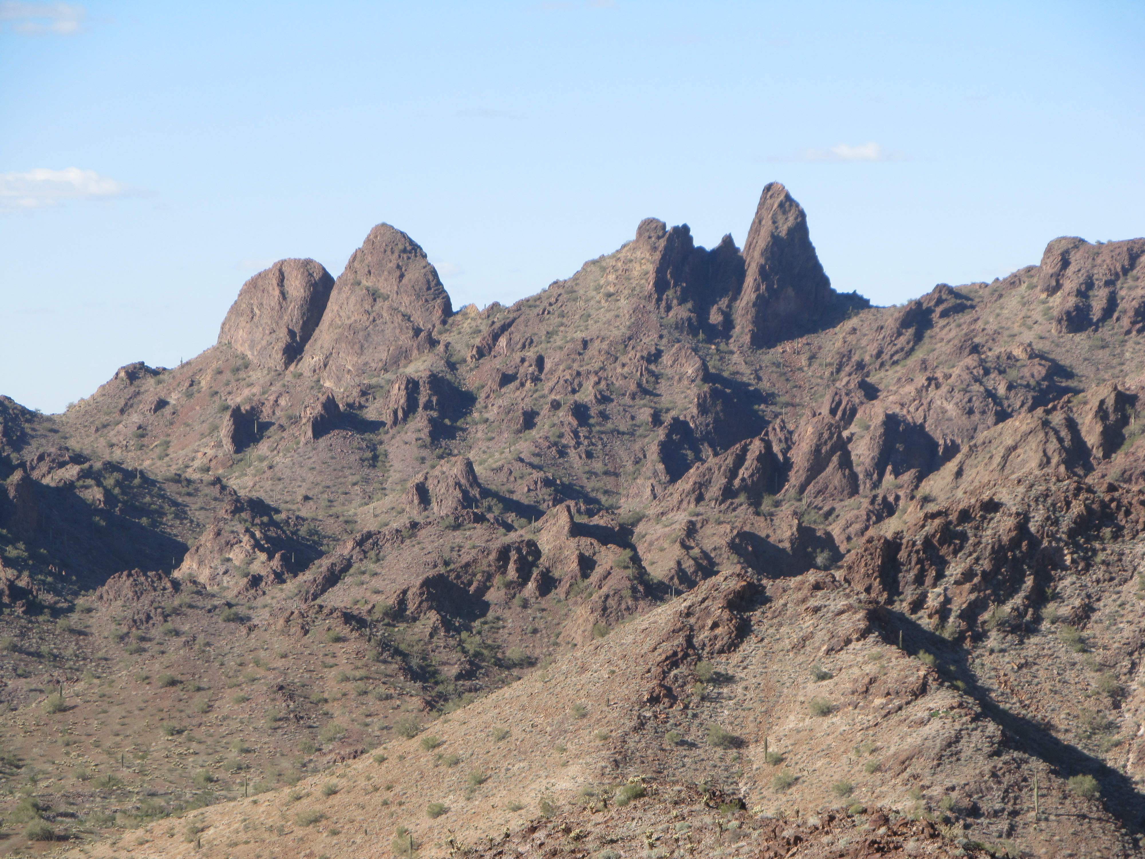
It was a perfect blue-sky desert morning as we set out, and the packs were as oppressively-heavy as we had expected. The start of the route we’d take would follow a wash upstream. It seemed straightforward enough, at least from the satellite photos we’d studied, but almost immediately we had a rude awakening. Instead of being a wide, sandy channel it was a maze of smaller, twisting ones. You’d walk for a bit up what looked like a promising lead, then it would vanish and you’d end up climbing up one embankment and down another in an effort to find another channel of the wash which you could follow. This clambering up and down was the hardest part while wearing the heavy packs. If we didn’t stay in a sandy channel, we’d have to push our way through vegetation, and that was not a good option. Much sooner than we’d expected, we found ourselves looking for a spot to rest. We were pretty fussy about such a spot, and would reject several marginal ones before finally deciding on a good one. On the way, we passed a peak which we’d both climbed many years before – certainly couldn’t complain about the scenery.
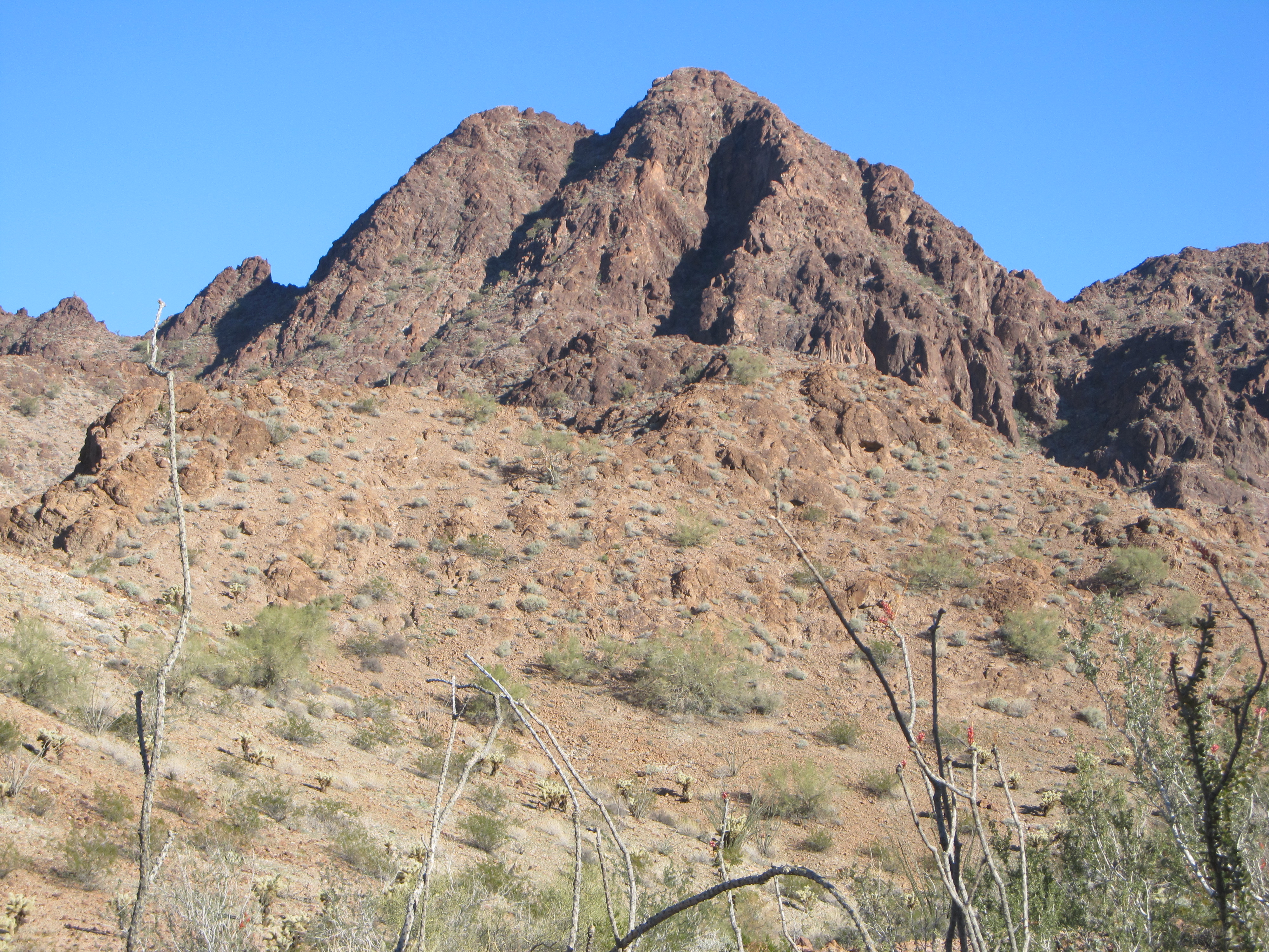
Desert beauty
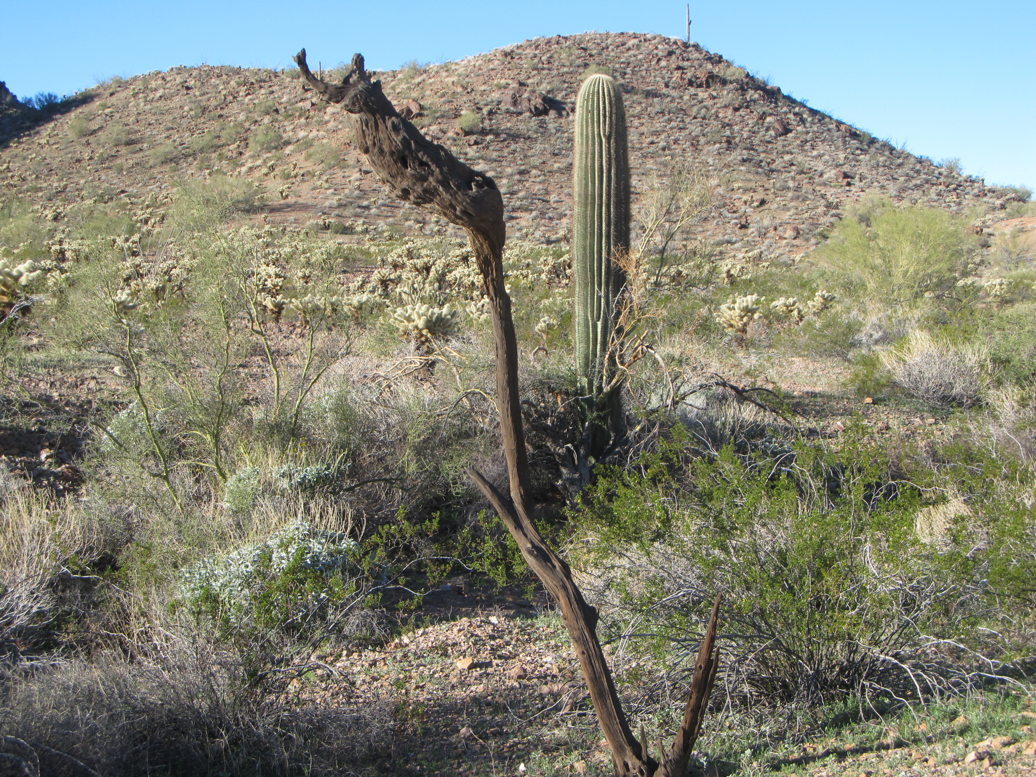
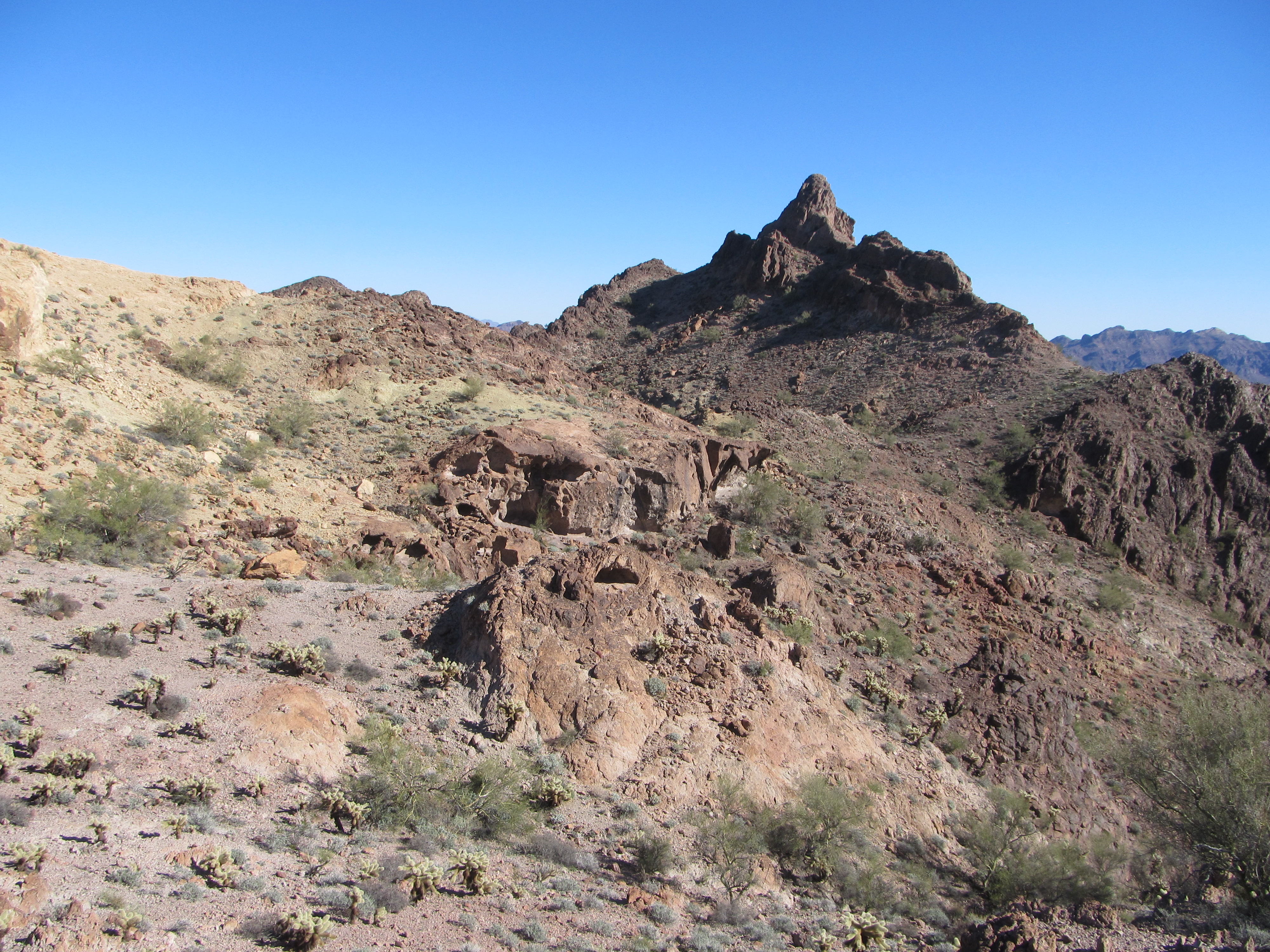
After a brief rest, we’d set out once again. Depending on the terrain, we might be able to go for 15 or 20 minutes before needing to rest again. We knew that the valley up which we were heading would end at a pass, but as we neared it, it looked more challenging than we’d expected it to be. We ended up being channeled into a small canyon, forcing us to do more gymnastics with those heavy loads than we cared to do. As we neared the pass, we could see a hill ahead, topped with a tall saguaro cactus. The little canyon was down the hill to the right of the picture. The odd-looking dark thing in the foreground is what’s left of an ironwood tree.
Finally, we crested the pass and a whole new vista opened up. Now, we looked down into a different drainage, so major it even had a name of its own (which I cannot reveal to you here, as I know you’ll understand). This was an exciting moment, as this new valley was our gateway to 11 more of the peaks we intended to climb.
The terrain changed. This new valley was wide, and more level. We found ourselves following a path, no doubt created by animals. It led us down into a wash, sandy and flat-bottomed, which we happily used to make good progress. Finally, hours after starting out, we arrived at the area we’d chosen for our Camp Two. To remain hidden from prying eyes, we went a hundred yards up a narrow side wash. It felt so good to escape from those huge packs, and once unburdened we unloaded all of the water and stashed it, well-hidden. This camp-site seemed narrow and claustrophobic, but it certainly filled the bill of being secluded.
We had no sooner hidden the water than we put on our large packs and headed back the way we’d come, but only for a short distance. This time we hid our big packs, then put on our day packs, ready for a climb. We set out up an entirely different valley, up a dramatic wash that wound its way towards our peak. The only problem was that we couldn’t quite tell which of the many bumps at the head of the valley was the one we wanted.
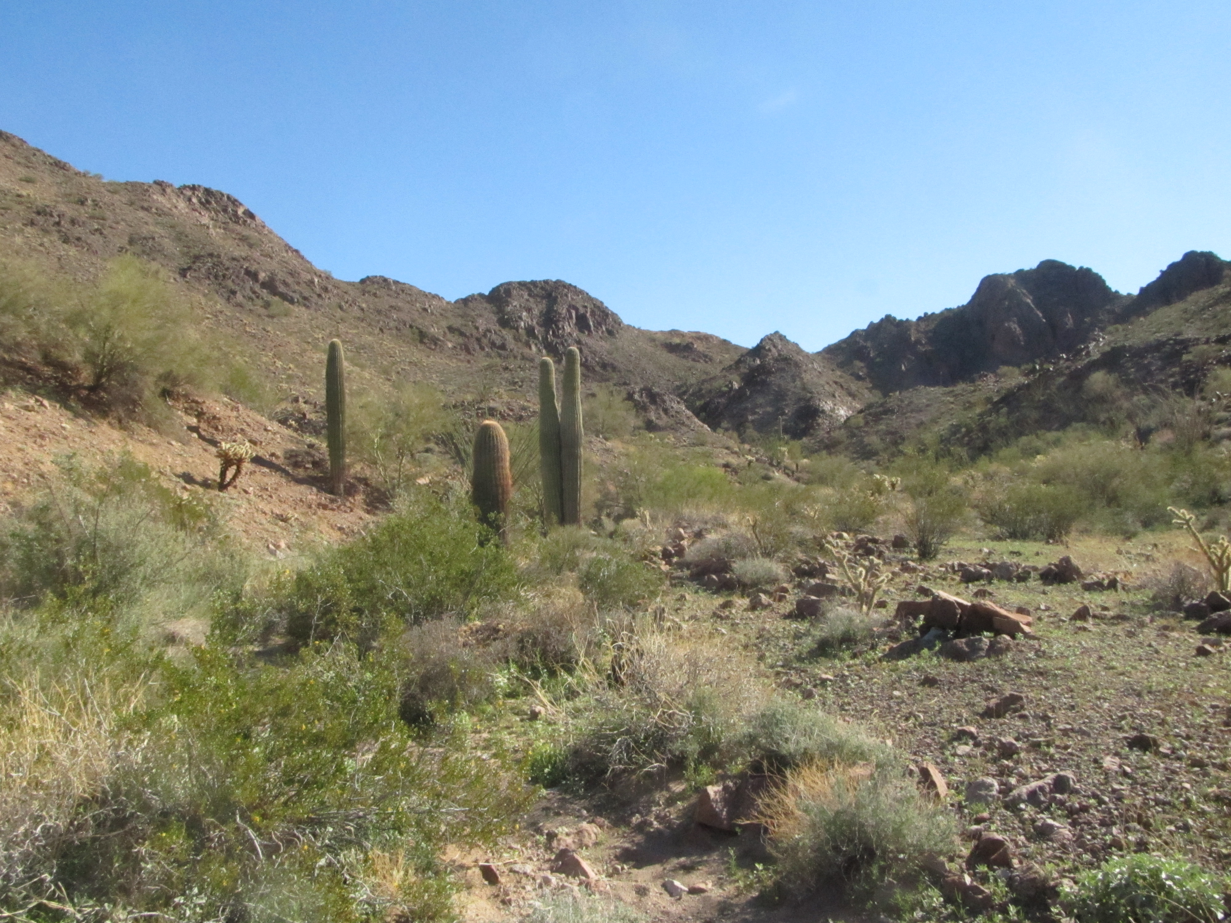
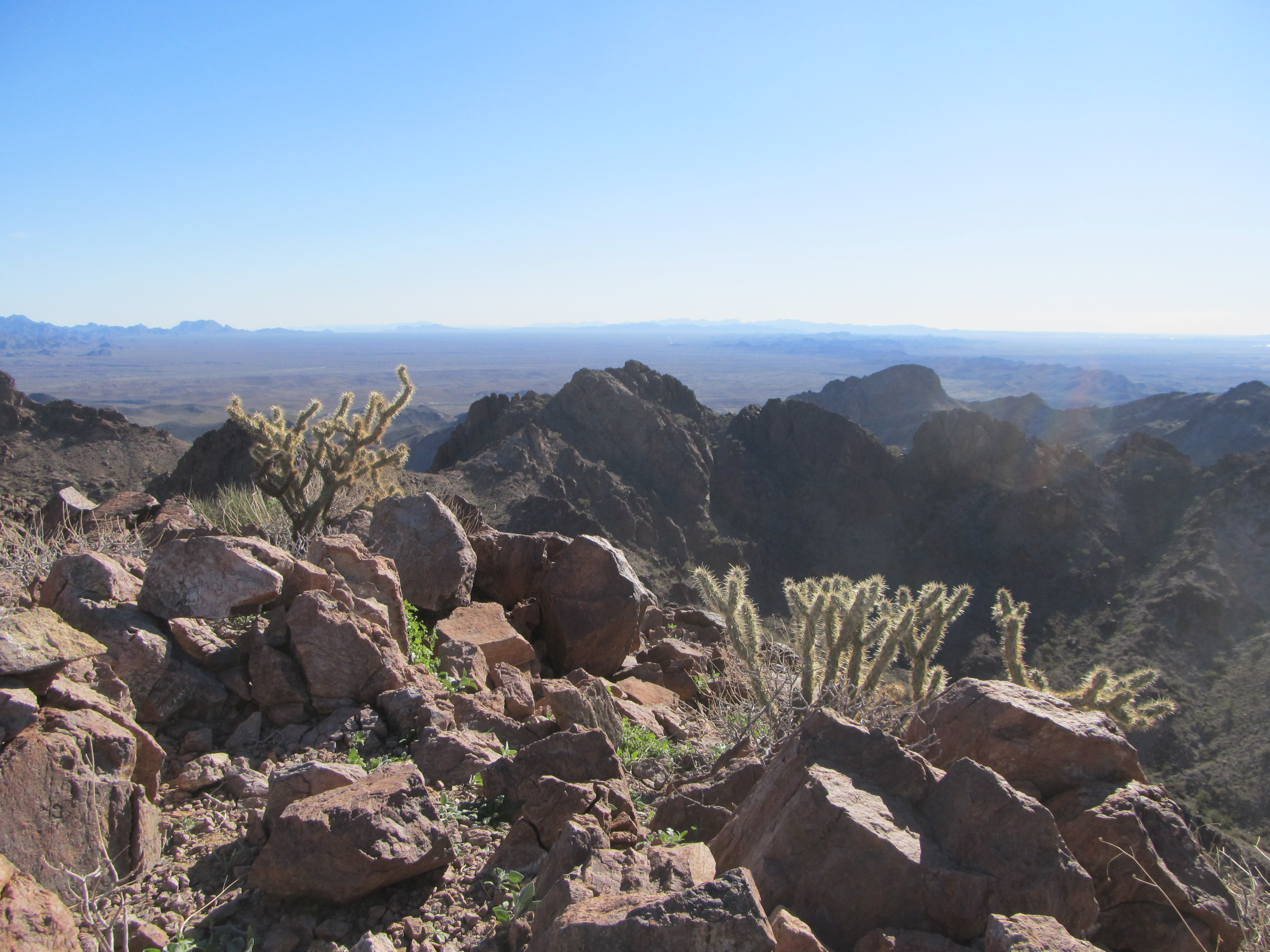
The new valley
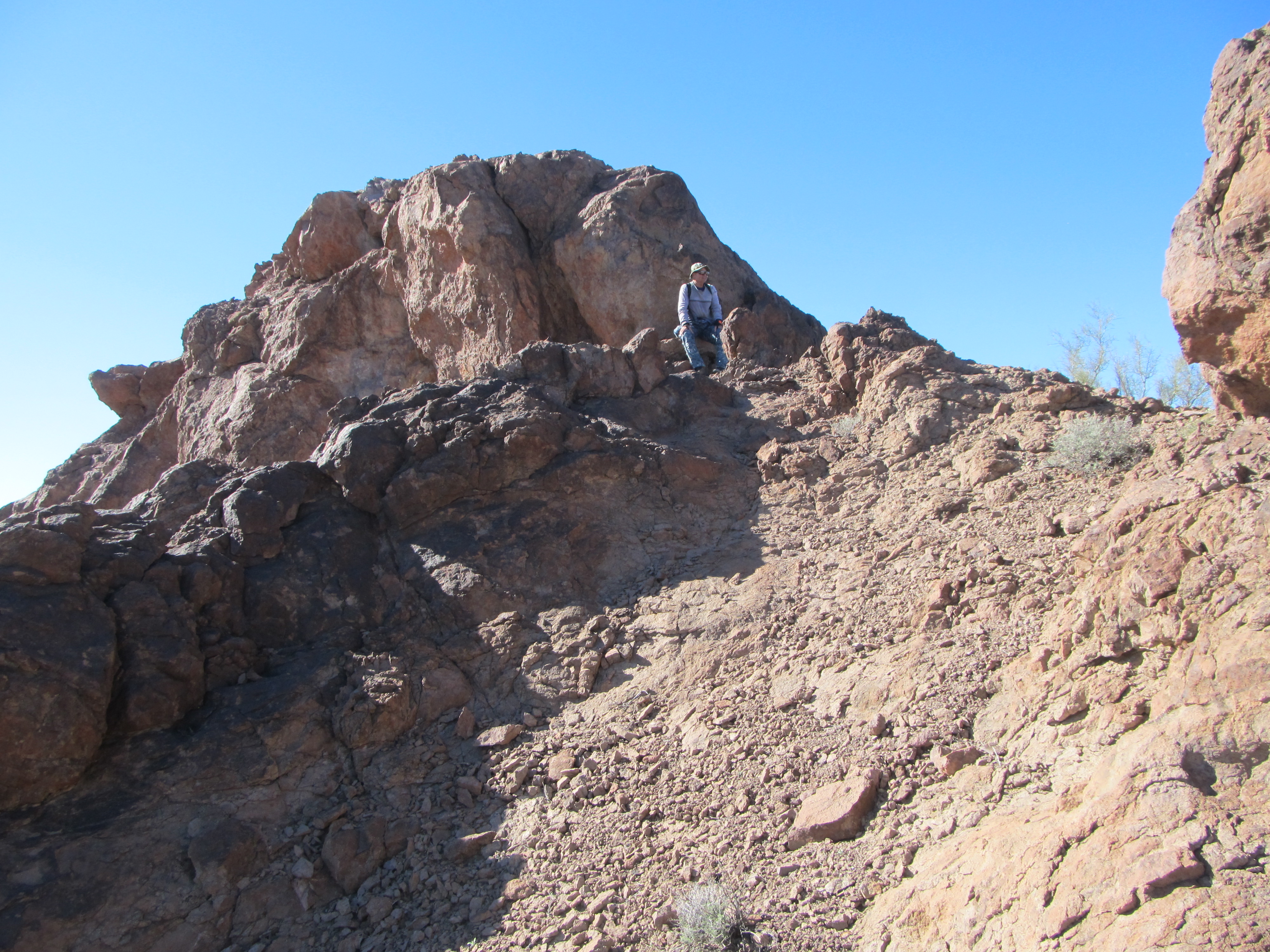
Once we reached the head of the wash, we climbed steeply up on to a ridge. Our map showed us the general direction of our peak from there, but everything we could see looked way out of our league. Oh well, all we could do was try to keep climbing and see if we could figure it out. We continued to make upward progress, but we were running out of mountain. It had to be right ahead of us, but what we saw was a steep-sided dome that would give anyone pause. Our instruments said that that was it, the summit, right in front of us. Sometimes in the mountains, when you don’t have any feature to help you judge scale, a feature such as a cliff might appear very large, but when you get right up to it, it could turn out to be much smaller. Such was the case here – once we got right up to it, we saw that the only real climbing we had to do was about 20 feet, but ah, what a 20 feet it was. The rock was decent enough, but the exposure was fatal – one slip and …… Oh-so-carefully we each soloed up it and stood on top. Damn, that was scary! Here’s a photo of Luke – the actual rock-climbing was 50 feet behind him on that crag.
The peak named incorrectly on the map
As we sat and completed a register, we were looking around and reconciling what we were seeing in person with what was shown on the map. Something was amiss. The spot elevation upon which we sat showed on the map as having the same closed contour as two others farther to the north – in other words, those two other points should appear to be more or less the same height as we were. But they weren’t, not even close – they towered above us. Even from a distance of half a mile, there was no mistaking it – we were in the wrong place! All that effort to have climbed an insignificant bump with no real value.
The REAL high point half a mile away
We cautiously down-climbed the Class 4 rock to a nearby safe spot and took our bearings. There was no question about it, all we could do, and must do, was to make our way over to the true high point – that’s what we do. Before we started down, we couldn’t help but admire this nearby spire, something that wasn’t on our agenda, fortunately.
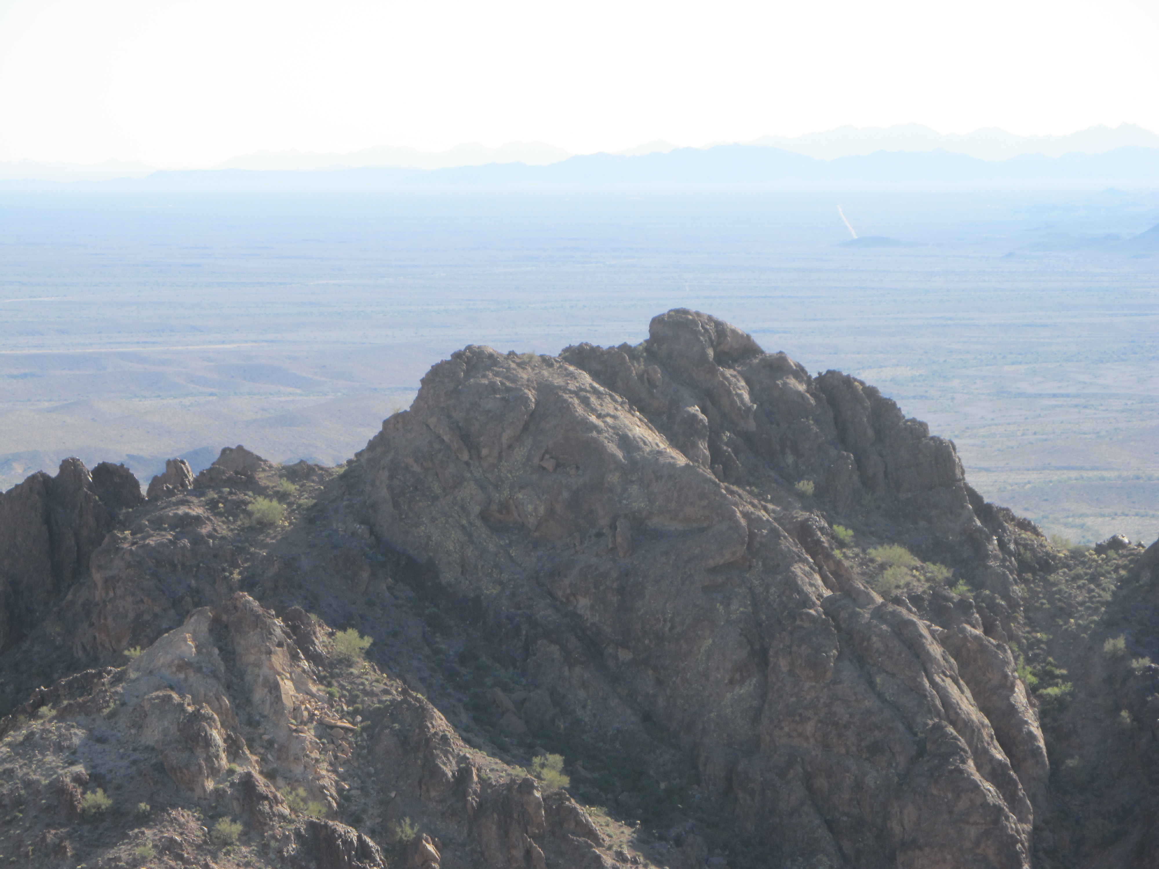
 We lost quite a bit of elevation as we moved north, avoiding cliffs and traversing the loose slope. When we finally reached a decent-looking part of the mountain, we started up the steep mountainside. Luke was moving strongly while I lagged behind – it seemed a herculean effort for me to finally gain the summit ridge. The wind had been picking up all day, but now it was positively dangerous. The highest point was beyond a series of knife-edges and never seemed any closer, but finally, at 2:00 PM, we arrived. We had left our register on the lower false summit so had none for here, but instead built an obvious cairn for future visitors – sure, like they’re ever going to arrive! Now here’s a look back on to the lower, false summit we had so daringly climbed. It’s the dark bump exactly in the middle of the photo – see how much lower it is?
The lower “summit”
Here’s a telephoto shot of the false summit we’d climbed. See the highest bump just to the right of center? We climbed up its steep left side.
The false summit
Our own instrument readings showed this point to be about 100 feet higher than the other, lower point. A later study of a series of topographic maps published to cover this area confirmed our results – the 1954 version of the map showed that the newer, supposedly-better map had left out a full 100 feet of contours! This is far from the first time we’ve seen verifiable map errors in the field, but rarely this big an error. Making this correction in the field cost us a bunch of time, but at least we had the satisfaction of getting to the top of this mysterious, unknown summit.
It was now 2:15 PM and time to leave. We had to drop down several hundred feet to escape the worst of the wind, and when we did, we were rewarded with this great view across another valley to the north.
No country for old men
By the time we reached our big packs, the afternoon was wearing on. We didn’t dawdle, and made quick time all the way back to Camp One. This would be our last night spent there. As a precaution against anything unforeseen later on, we would leave water, food and fuel hidden there for our likely return at the end of our trip – our final night could possibly be spent there. The day had gone well, but by carrying only water to Camp Two and no gear, and only climbing the one peak for the day, we felt we were dropping a bit behind in our schedule. No worries – as long as we kept making progress and were healthy and staying safe and hidden, we’d make it up later on.
Please stay tuned for the next installment of this story, to be entitled “The Heart of Darkness – Part Three”.