
Here we were, the three of us out for some adventure in the middle of a frozen wilderness in the depths of winter. I can’t remember whose idea it was to come here in the first place, but I do know that Brian and I had tried it once before.
In the summer of 1977, just after my 30th birthday, my friend and climbing partner Brian Rundle and I decided to do some climbs in Garibaldi Park. We left Vancouver at a decent hour, drove up to the Black Tusk parking lot, and stormed up the trail with overnight packs. We got all the way in to Gentian Pass where we set up a soggy bivouac – if memory serves me right, we set up a tarp as a lean-to. It snowed a lot overnight, but we gamely continued up Castle Towers in the morning, only to be stopped high on the peak by thick clouds and heavy falling snow. We had to turn back before the summit. It wasn’t just because of the weather and the poor visibility, but also because while we were climbing that west ridge, we came to a vertical drop, a gash in the ridge, a problem we weren’t able to surmount. After descending to Gentian Pass, we packed up our sodden camp and headed out, deciding to climb Gentian Peak on the way back down to the parking lot. Once back at the vehicle, we drove north all the way up to the trail-head for Wedge Mountain. From there, we backpacked up the climber’s trail, a steep climb of 4,000 vertical feet to the hut at Wedgemount Lake and got there before dark. It had been one hell of a long day, but we were young and fit and ready to climb anything that stood still long enough for us to get at it.
Early the next morning, we climbed 3,200 vertical feet to the summit of Wedge on its northeast side via the Weart Glacier. Wedge is the highest peak in Garibaldi Provincial Park, with a prominence of 7,379 feet. The weather was great, and once we descended to the Wedge-Weart col, we thought “what the heck, why don’t we climb Mount Weart while we’re here”. After all, from the col it was only another 1,500 vertical feet. So we did. It may have been a bit much, in retrospect, because by the time we got back to the hut, it was dark. We were so exhausted we were giddy and could barely see straight. We descended the 4,000′ to our vehicle the next morning, and so ended that encounter with Wedge.
This brings up an interesting question: what is the definition of a winter climb, and why is that even important? Since Earth’s calendar is divided into 4 seasons of approximately equal length, winter being one of them, there is a 3-month period which we call winter. In the northern hemisphere, that is roughly December 21st to March 21st; in the southern hemisphere, that is from about June 21st to September 21st. Some climbers feel that for a climb to qualify as a winter climb, it must occur during those time periods by the calendar. However, it is possible that even during those intervals the weather might be anything but wintery – it could be warmer, with no snow.. To some, however it’s a winter climb if done then, regardless of the weather at the time. In desert regions where it never snows, there’s not much of a claim to be made for having done a winter climb. The more challenging climb could well be the one done in the summer heat where the risk is greater. I live in the desert, and if you claim to have done a “summer climb”, you’re not going to really impress anyone, other than giving them the impression that you could be a little crazy. Outside of the desert regions, though, let’s say in temperate climes, winter climbs are usually considered to be more challenging, and therefore more of a feather in your cap.
The story I’m about to tell you meets anyone’s requirements for a true winter climb – not only did it take place during calendar winter, but the conditions were about as wintery as you could ever wish for. Here’s what I mean by that – cold, snowy, crappy and unsettled weather, everything frozen solid, the threat of avalanches, long nights and short days.
There were 3 of us actors in this chilly little pageant – Ross Lillie, Brian Rundle and myself, the ol’ Desert Mountaineer. The date was March 11th and the year was 1978. There was so much snow that we had to park well down the road below the trail-head, making for a longer trip with our heavily-laden packs, proving that we were really determined. It took us seven hours of plodding through the snow to reach our first day’s goal, the Sphinx Hut which sits on the shore of Garibaldi Lake and is seldom visited except in the winter months when it is frozen over. That was the case for us – 3 miles we walked through the snow over the lake to reach the shelter.
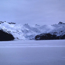
Looking east across Garibaldi Lake to the Sphinx Glacier
Our goal was to spend a few days in the area, climbing what we could, but we felt the real prize would be Castle Towers. It was already a grudge peak of sorts for me and Brian, and the fact that it was high and remote made it a real draw for us – it didn’t hurt either that the climb itself was challenging.
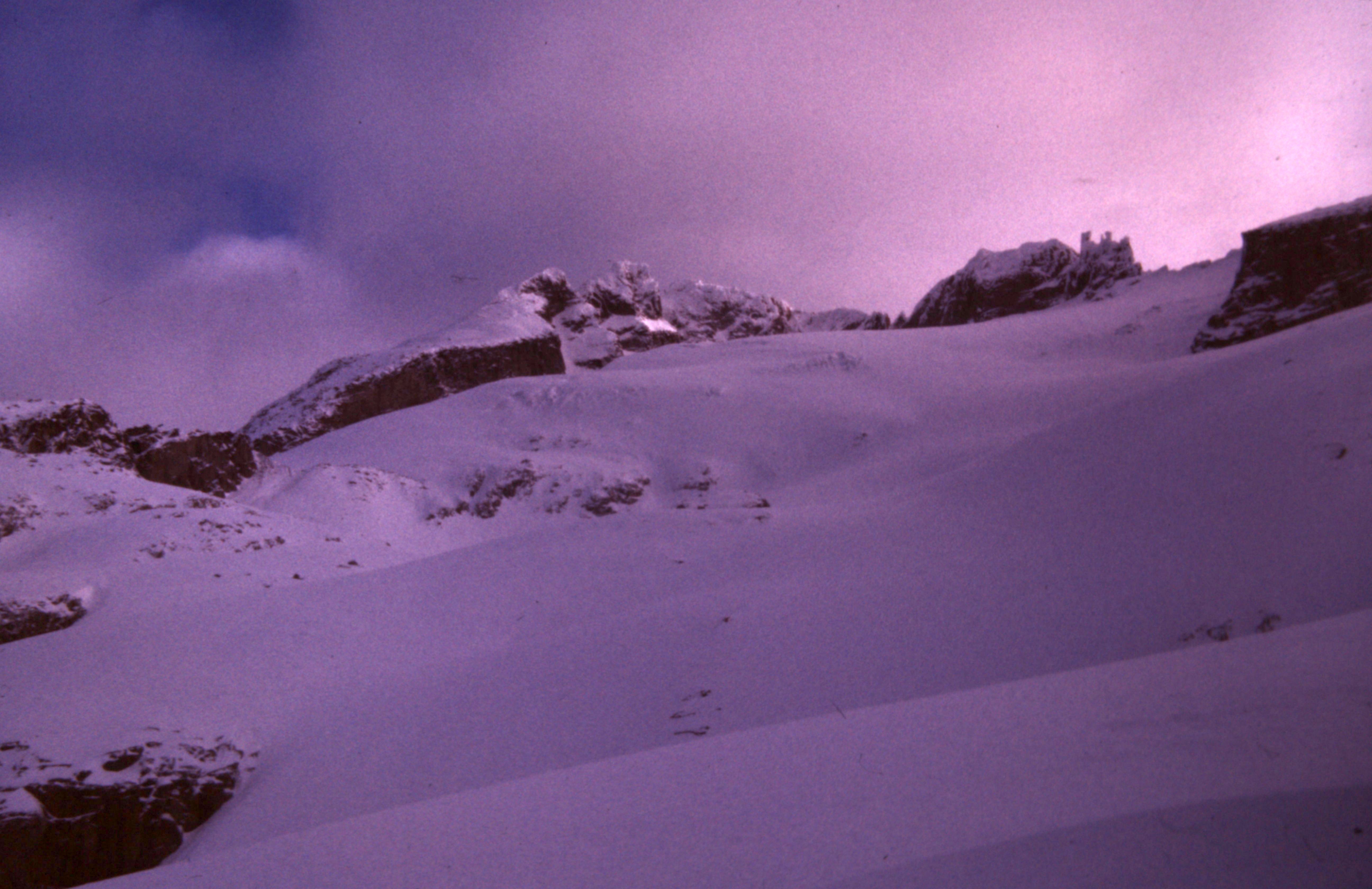
The morning of March 12th, the weather was fair as we started east up the Sphinx Glacier at 6:00 AM. There was a lot of fresh snow, deep in places. Here’s a look steeply up to Castle Towers, on the south side (our route).
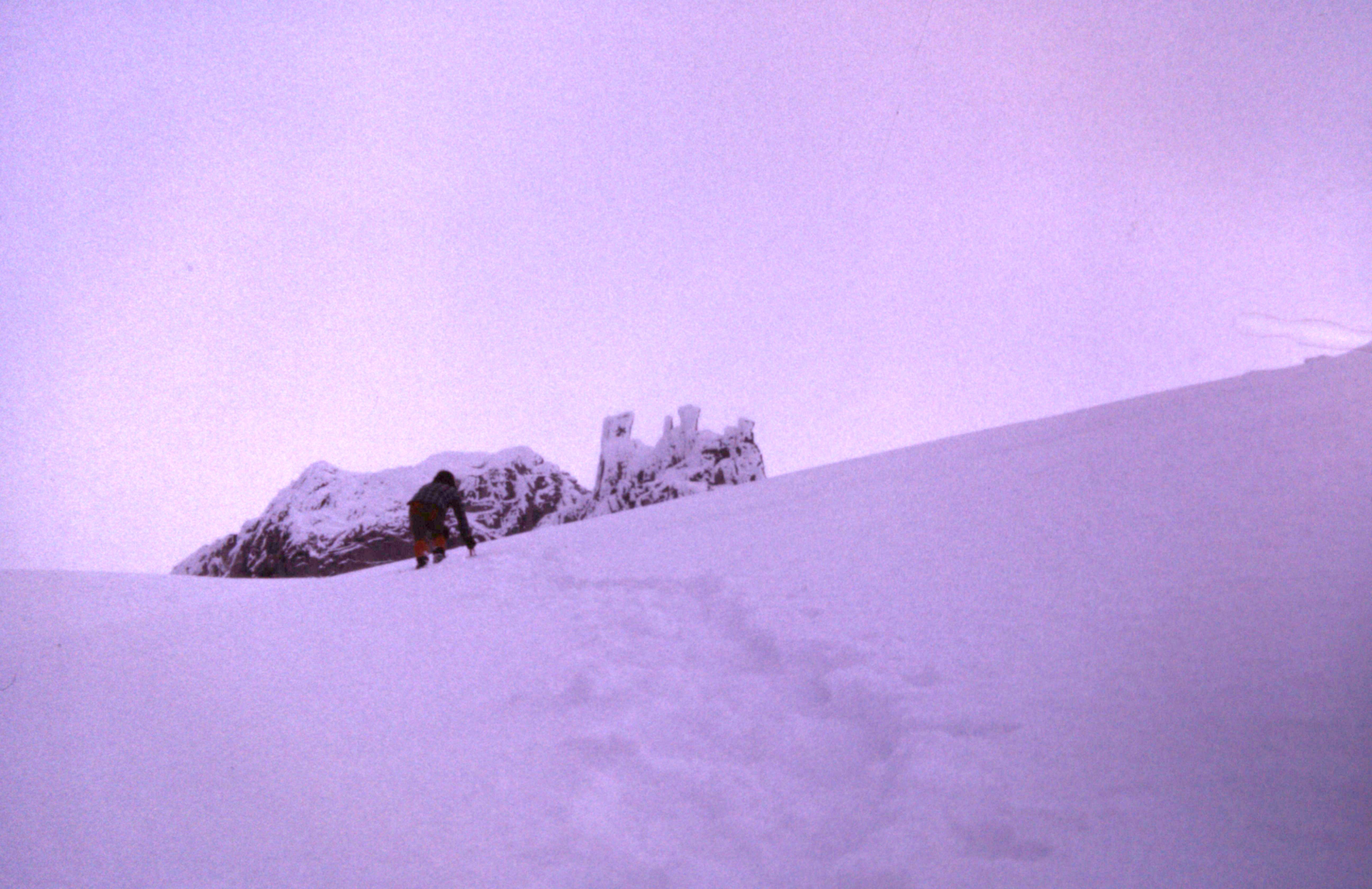
As time passed, the terrain steepened and clouds rolled in, really messing with visibility. Here’s a picture of Brian approaching a feature known as Phyllis’ Engine, as we got closer to Castle Towers. See how the rock spires look like an old-fashioned train engine?
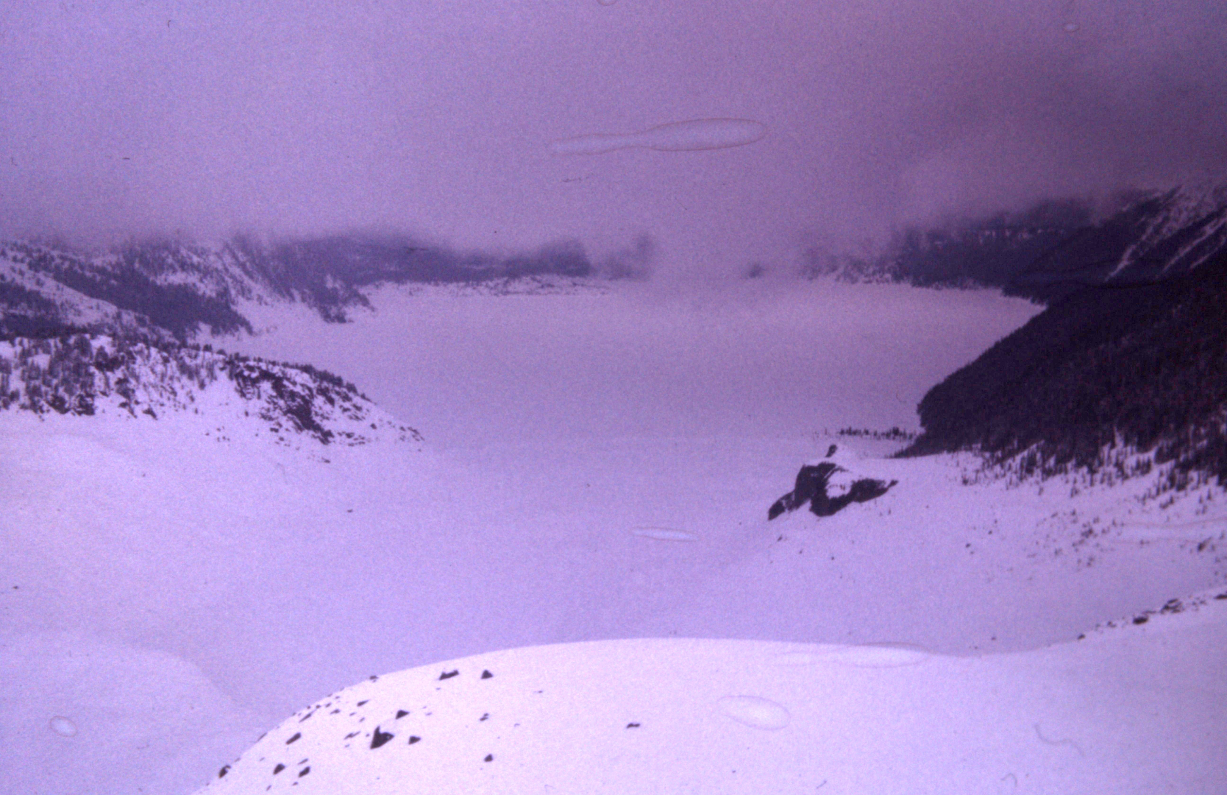
Here’s a look back down to Garibaldi Lake from up high before we got socked in.
It started to snow heavily, and at times we couldn’t see squat. As we got closer to the peak, we made our way up to a steep gully which we climbed in deteriorating conditions. The gully took us up to a gap in the west ridge, which we then followed to the summit area. It was here that Ross decided to call it quits. He had recently broken a bone in his left hand, and this affected his ability to hold his ice axe. His hand didn’t have a cast, but he was wearing an elastic bandage which didn’t give him a lot of confidence. He was only about 50 feet shy of the summit when he stopped. He promised that he’d wait there for us, and Brian and I continued up, making our way through spindrift.
Just below the summit, we ran smack into a vertical rock wall which was covered in ice. There was no way we could climb it, so we had to come up with a Plan B to surmount the final bit. There weren’t many options – in fact, there was only one and I didn’t much like it, but if we wanted the summit we had to do it. I moved to the left of the wall and out on to the 60-degree snow of the northwest face. Thankfully, for the most part the swirling clouds prevented us from seeing the thousand-foot drop to the glacier below, but there were moments when it would clear and the exposure was breath-taking, making my heart race. As I climbed, it became near-vertical, and I finished by chopping my way through a cornice to get on easier ground. Brian quickly followed, and soon afterwards things cleared a bit, enough that we could see that we were in fact on the summit. It was 11:00 AM and we stood on top of Castle Towers Mountain, elevation 8,778 feet.
Now all we had to do was to get back down to where Ross was waiting. Both of us knew one thing for certain – we were not going to down-climb that bit through the cornice and on to that face. The thought was terrifying. We made our way back down the ridge as far as we could go, very gingerly, then came to a spot I still remember to this day. It was right at the bit where we had climbed up through the cornice. Twelve or thirteen vertical feet below was a level spot, about one yard square. It was like a target, itself deep in snow, but from above it looked awfully small. It took us a while to get up the nerve, but we did. One at a time we jumped, straight down – it was a heart-pounding moment, but we did it. Problem solved, but with no room for error. The soft, deep snow cushioned the jump.
It was all over but the shouting. We descended the gully to where Ross was waiting, but he wasn’t there! Brian and I were both shocked – what had happened? He said he wouldn’t move from that spot until we returned. We continued down through the storm and soon found him lower down. He had become so cold while waiting for us that he had to descend to get to a less-exposed spot. I remember we told him how concerned we were when he wasn’t at the agreed-upon spot, and to please not do that again. Here’s a photo of me and Brian after the climb – just look at that big, shit-eating grin on his 20-year-old face, and me with ice in my beard.
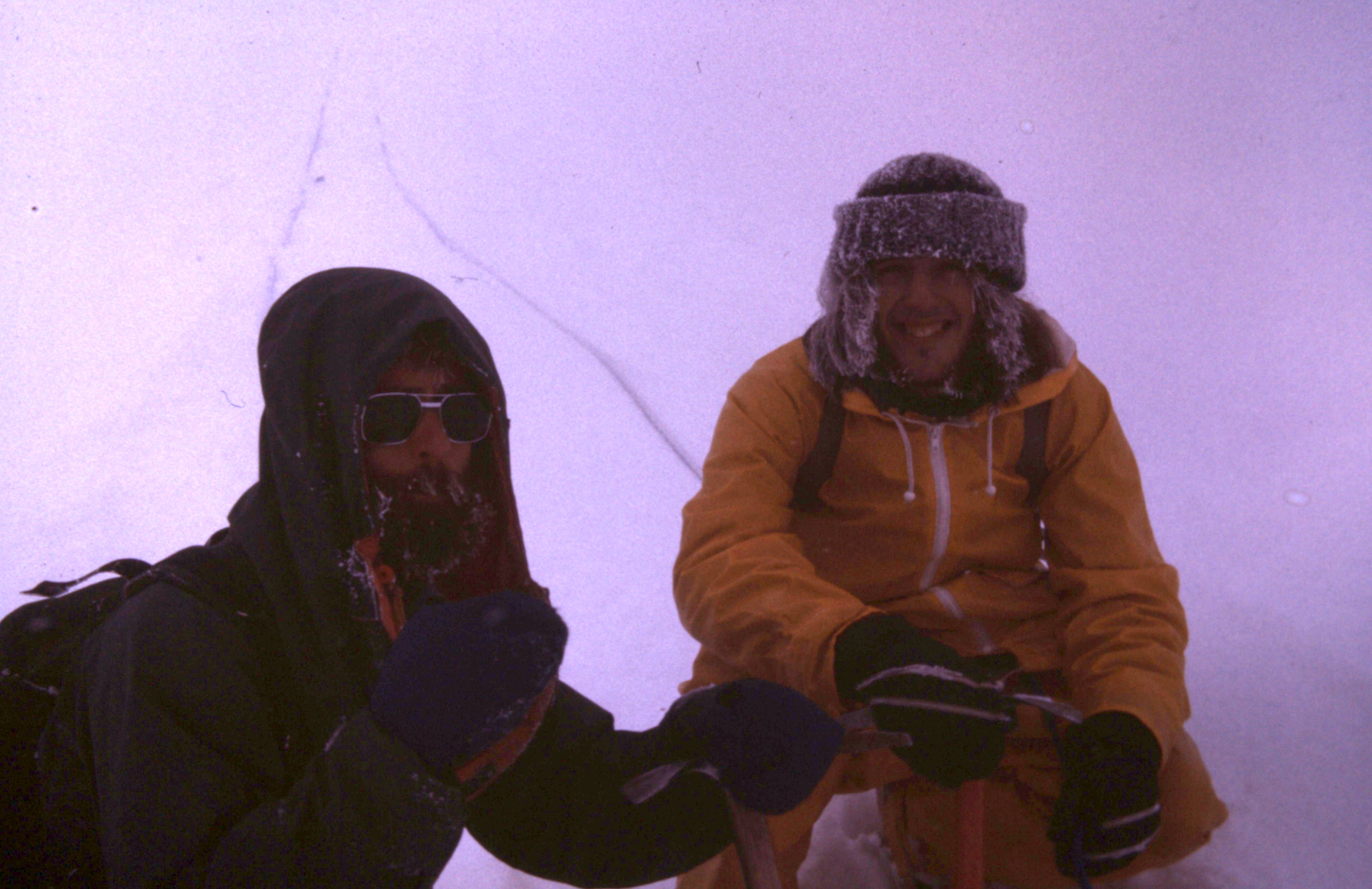
Brian on the right, after the climb.
On our way back to the hut, we thought we’d try to climb Mr. Carr (8,500′), but we couldn’t find it in the whiteout conditions. We gave up and returned to the hut where we cooked up some hot food and warmed up in our down sleeping bags. The next day, we headed out to try a few more. The day started off with good weather, but once again clouds closed in and a mere 100 feet from the top of Guard Mountain (7,170′) we had to turn back due to ice-encrusted rock.
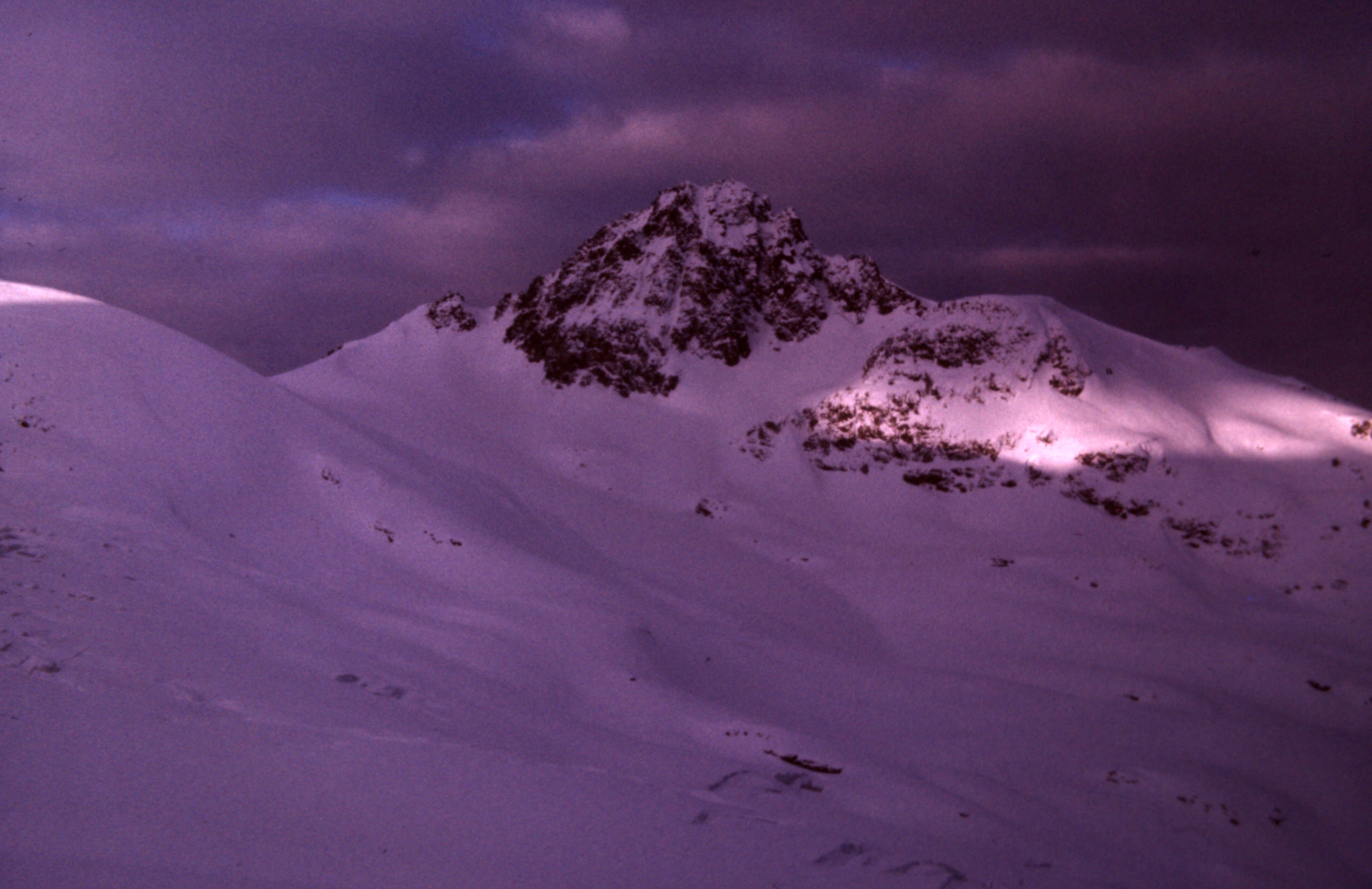
Guard Mountain
Brian wasn’t feeling well, so he returned to the hut while Ross and I climbed Deception Peak (7,320′) by its easy northeast slopes. Here’s another photo taken in cloudy conditions.
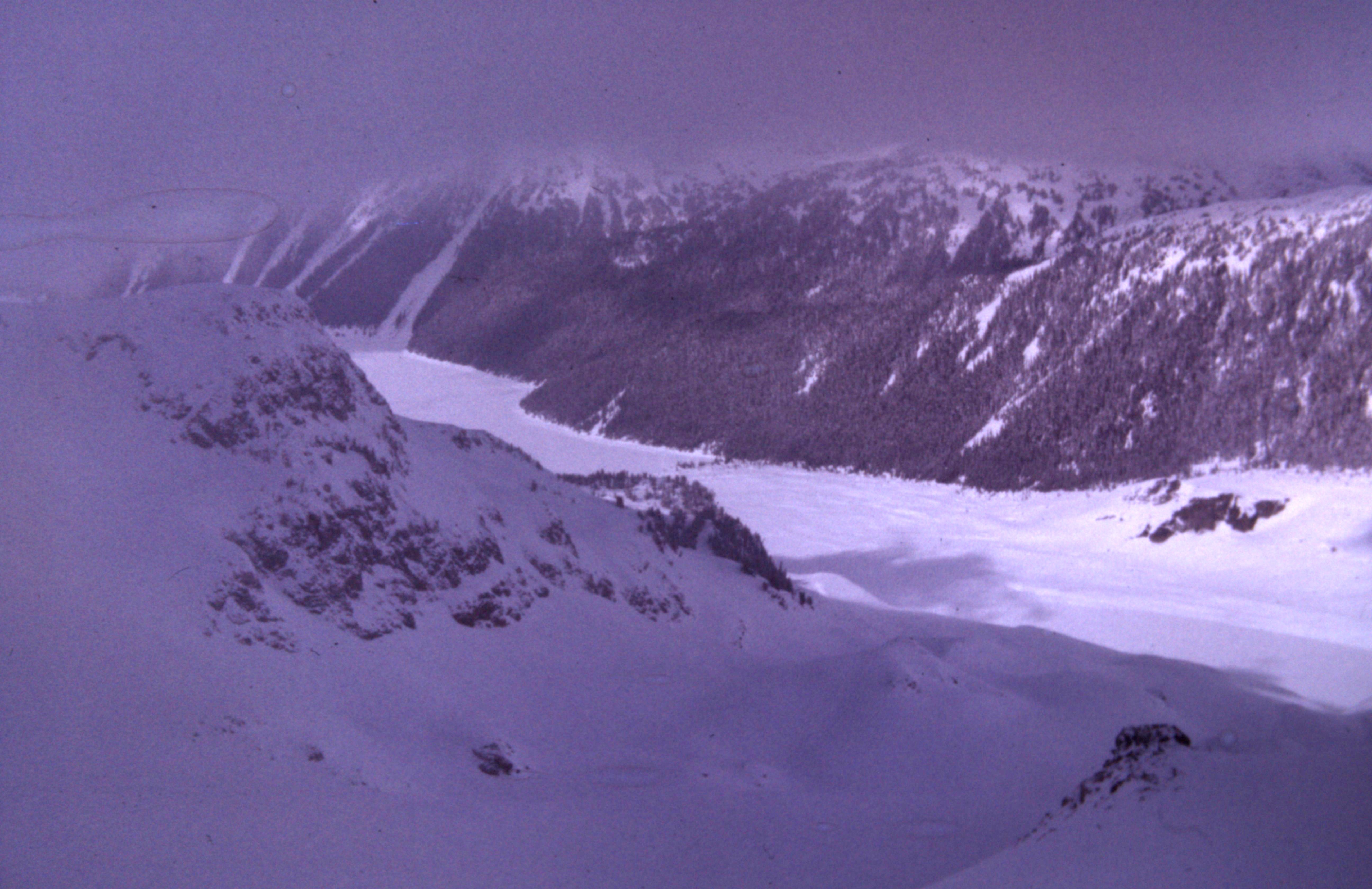
One more, a shot of Garibaldi Lake taken from our climb of Deception Peak during a break in the cloud cover.
Our time there in Garibaldi ended and we returned to the city. In all, we had covered 20 snowy miles on foot and climbed 10,100 vertical feet. Our big success was the winter climb of Castle Towers, to be sure, and we were mighty proud of it. Now here’s the epilogue.
Years later, Brian contacted me and told me about a new guidebook that had been published covering southwestern British Columbia. It was flush with all kinds of details that had never been included in the original guidebook of the area. It reported that the first known winter ascent of Castle Towers Mountain had occurred in 1979, but we knew better. The 3 of us are still alive and kicking, and still carry our little secret.
Thanks to both Ross and Brian for supplying details of this climb that I had long forgotten. And a big thanks to Ross for the use of his photos, the only ones that survive the climb.