
In the summer of 2019, I headed up to Canada for my 55th high-school reunion. I had graduated from a school in Mission, British Columbia back in 1964, and our class was pretty fanatical about our get-togethers every 5 years. This one was no exception, well-attended after all those years, and after 3 days of festivities it was time to move on. I did want to show you this photo, though, as from our town you can see Mount Baker across the border in Washington state in the USA. The inhabitants of Mission almost feel it is their peak, it’s so visible from there.
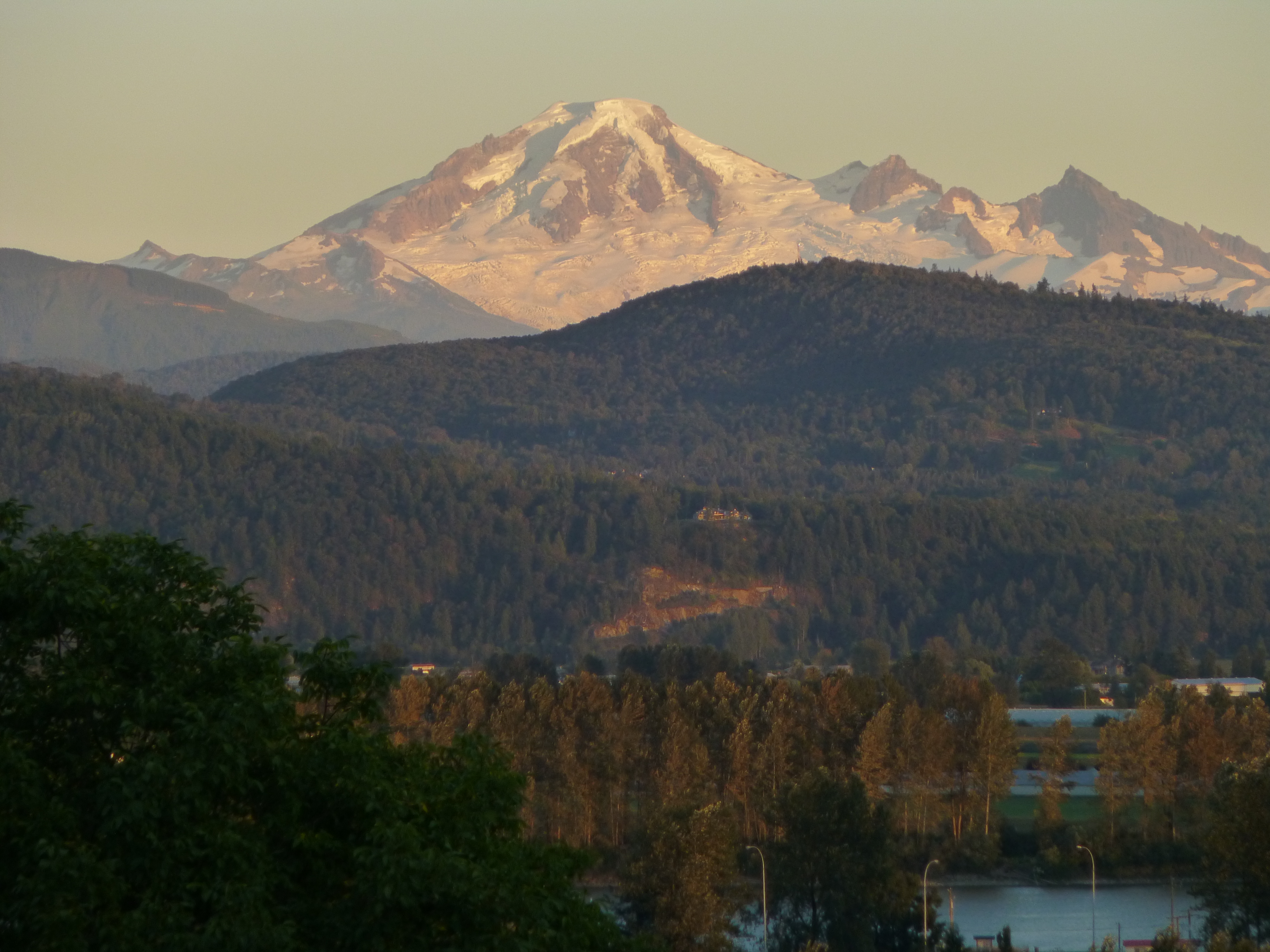
Mount Baker, elevation 10,781 feet
After the reunion, I headed up to the town of Hope, BC to visit friends. A claim to fame of this town is that most of the movie “Rambo, First Blood” was filmed there. All the shots that took place in the movie town were filmed in Hope, but there were a lot of scenes filmed in the forest (shot near the town) and in a deep canyon. The canyon shots were filmed near this spot, along the Coquihalla River.
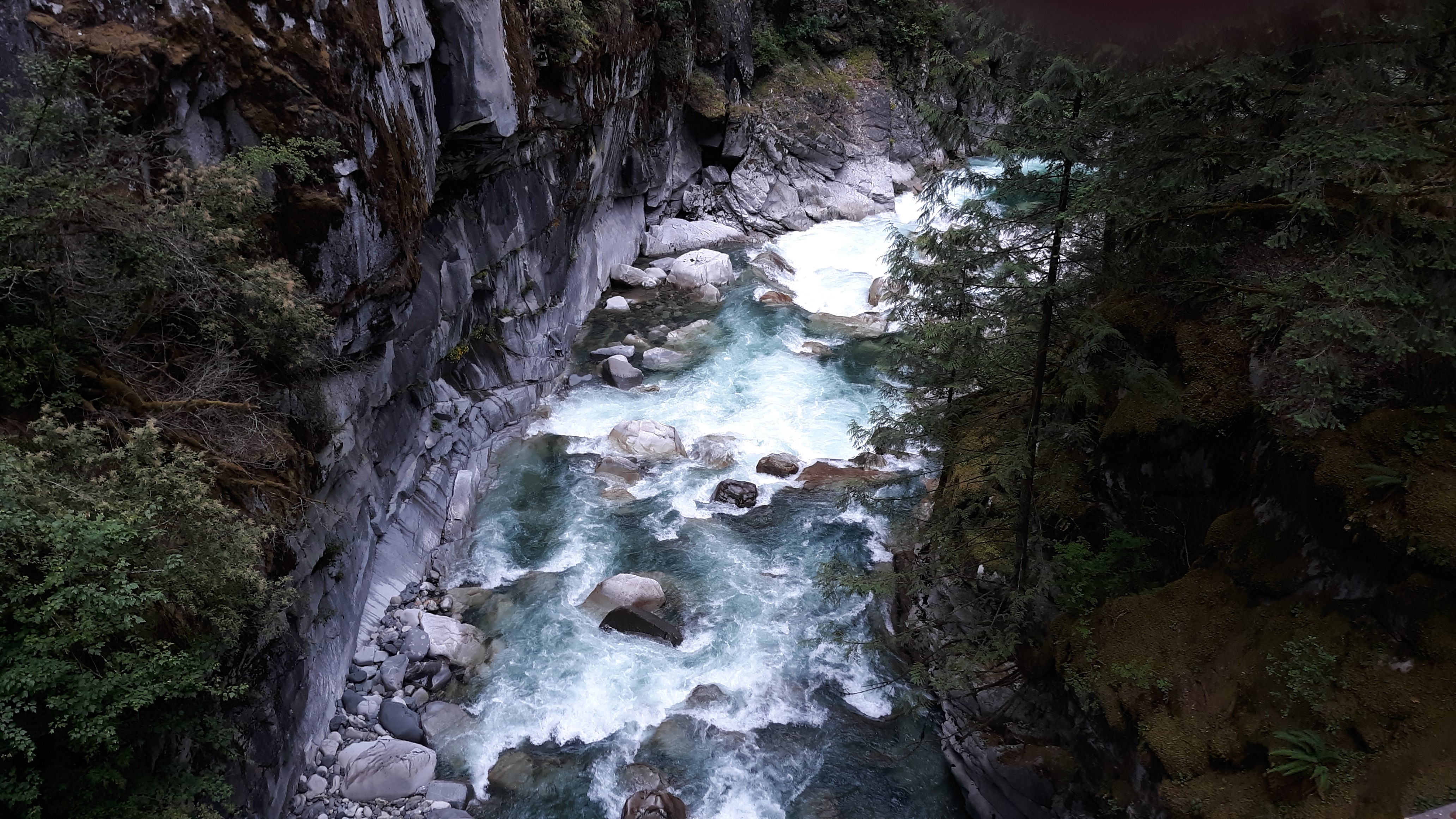
In the canyon of the Coquihalla River
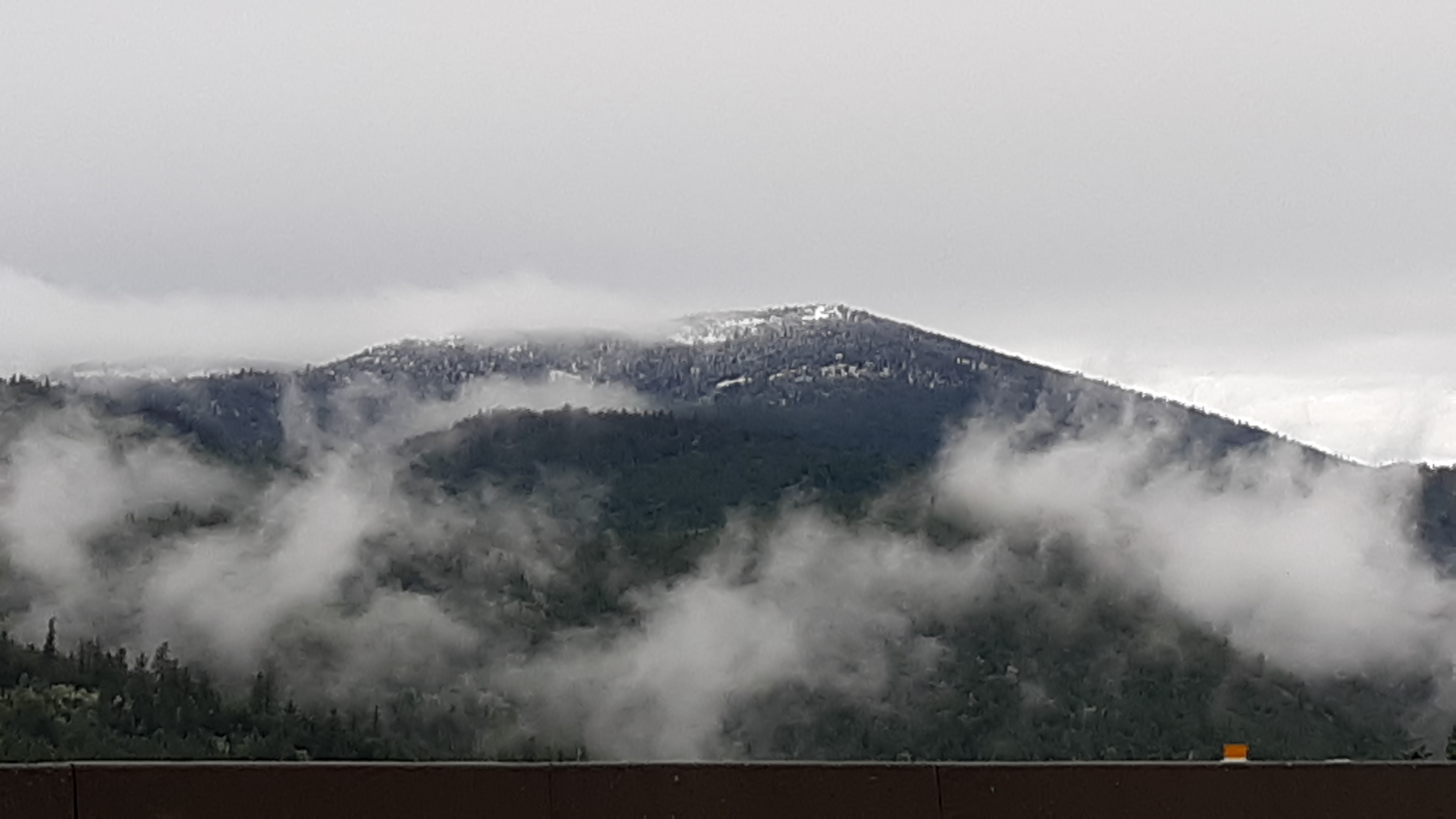
The town is surrounded by rugged peaks like Hope Mountain, which rises 6,000 vertical feet above it.
Hope Mountain
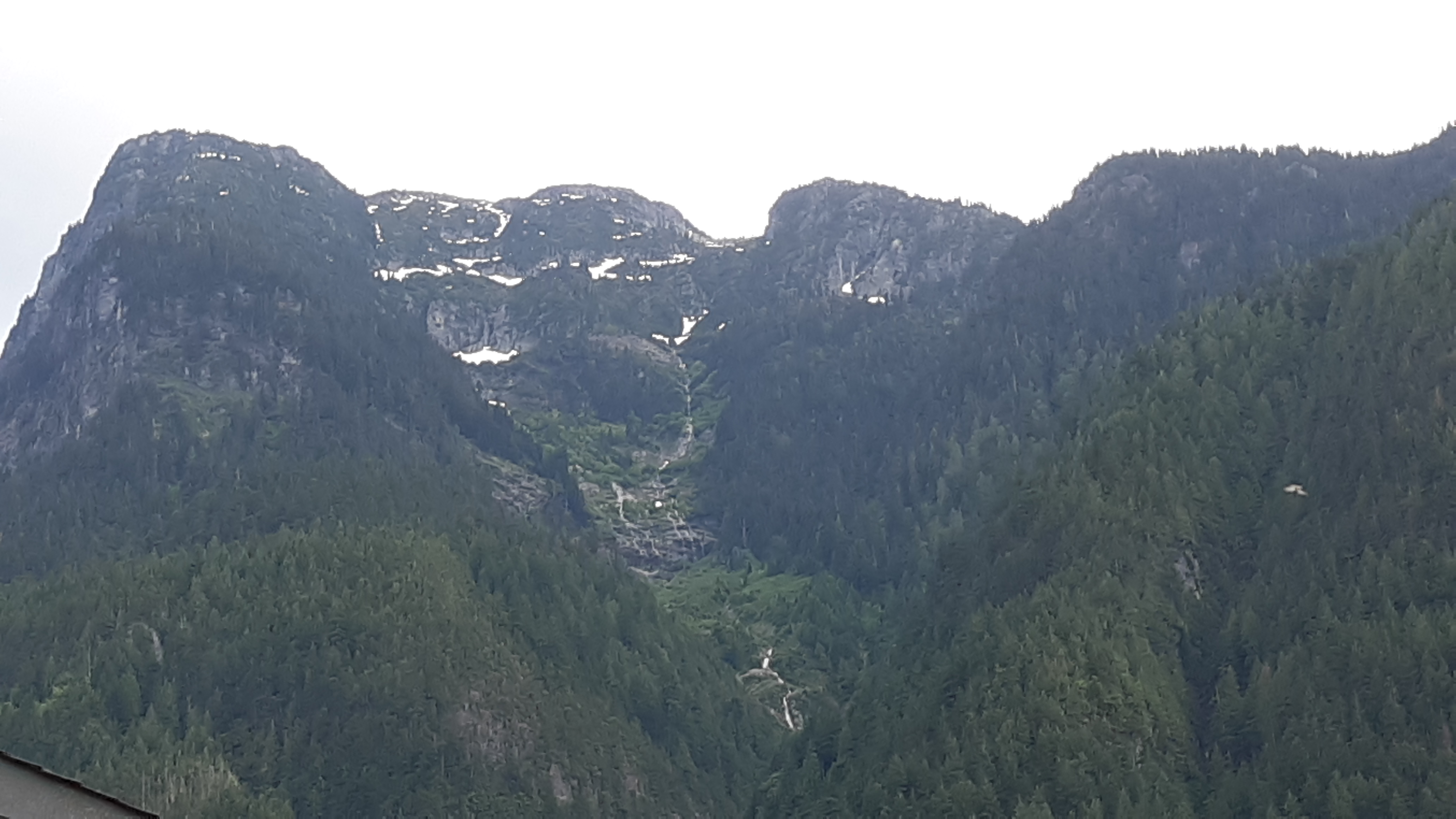
After a couple of days in Hope, it was time to move on to the city of Kamloops, BC. To cover those 203 KM, I would drive the Coquihalla Highway, which is featured on the Discovery Channel’s show Highway Thru Hell, so-named for its notorious weather and driving conditions. Although it barely exceeds 4,000 feet above sea level at its highest point, it can be a real challenge to drive in the winter. It was June 19th when I set out, rain falling hard as I climbed north towards the high country. The rental car I was driving showed the outside air temperature, which kept dropping as I made my way towards the pass. It was 52 degrees F when I left Hope, but it decreased steadily as I climbed – down into the 40s, and, to my amazement, even into the 30s. When it reached 37, I was shocked to see the steady rain turn into wet snow. It didn’t accumulate on the road, but through breaks in the clouds I could see the mountains around me covered in fresh snow.
Fresh snow along the Coquihalla
If it could do this in the summer, God only knows how bad the winter would be! Anyway, the rain let up and I made it to Kamloops just fine.
In addition to visiting with many cousins there, I was excited to do a climb of Mount Tod. A check of the weather on Thursday (it was raining in the city) showed a temperature of 30 degrees F at the top of the chair lift at Sun Peaks ski resort near Tod. Hmmm, what could we expect when we went for the climb the next day?
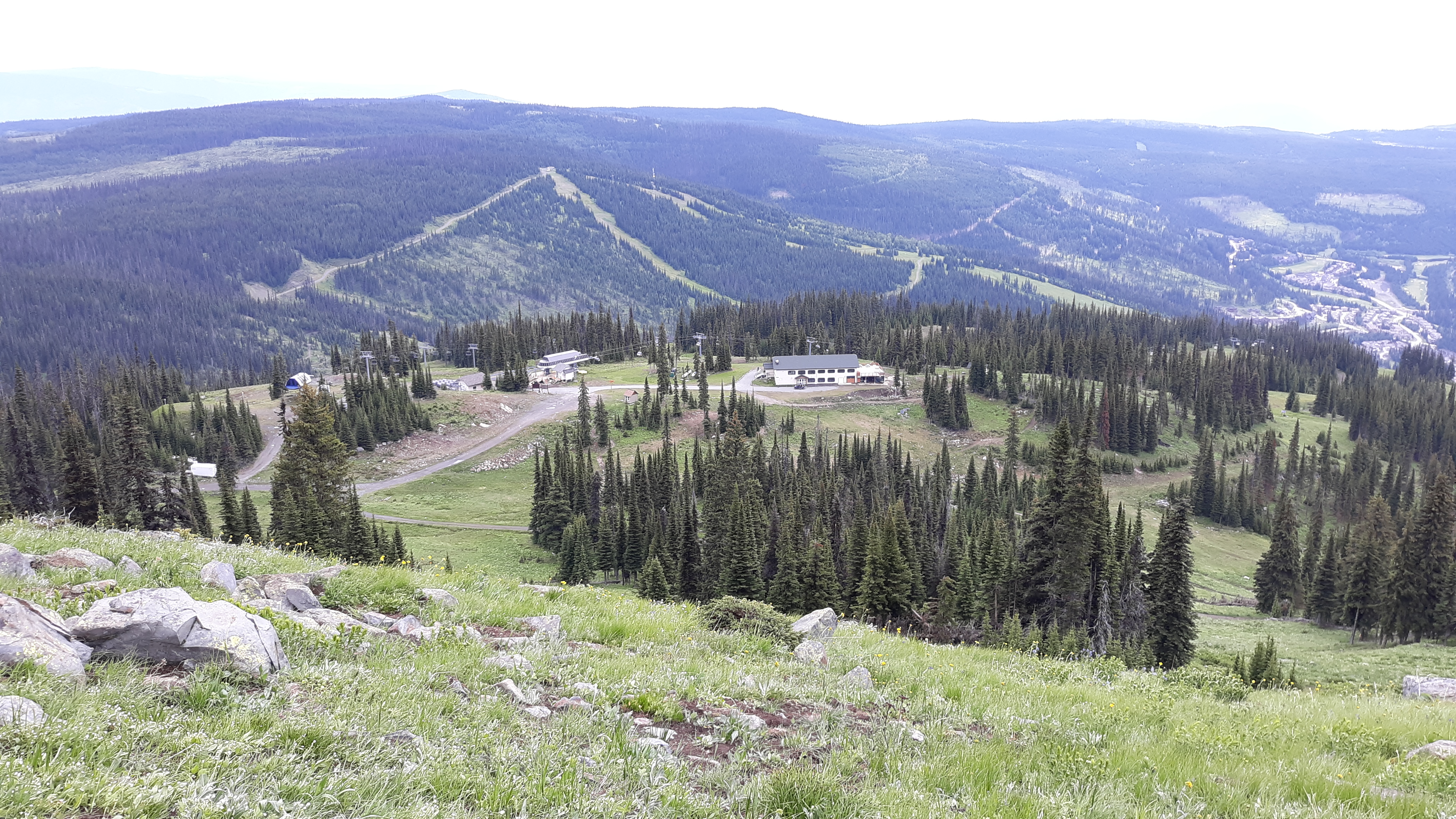
It was Friday, June 21st when Joan, Val and I drove up to the ski village at 4,117 feet elevation. This ski resort is Canada’s second-largest, exceeded in size only by Whistler. Even in summer, it was abuzz with activity. The first thing we noticed was the dozens of mountain-bikers. The lift had special racks to hold the bikes while their owners rode to the top.
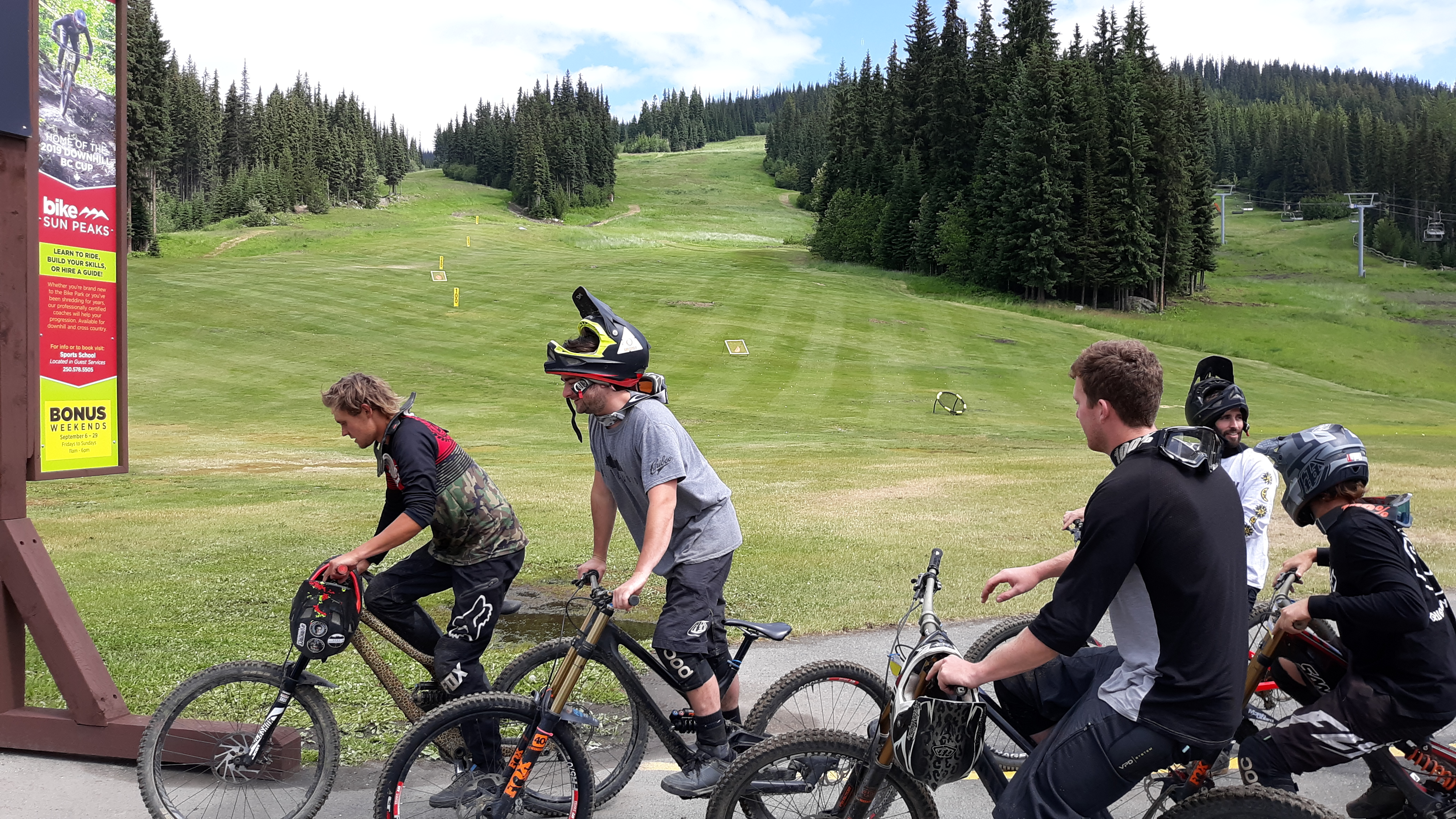
Cyclists heading towards the chairlift
The only chairlift operating during the summer months was this one, the Sunburst Express.
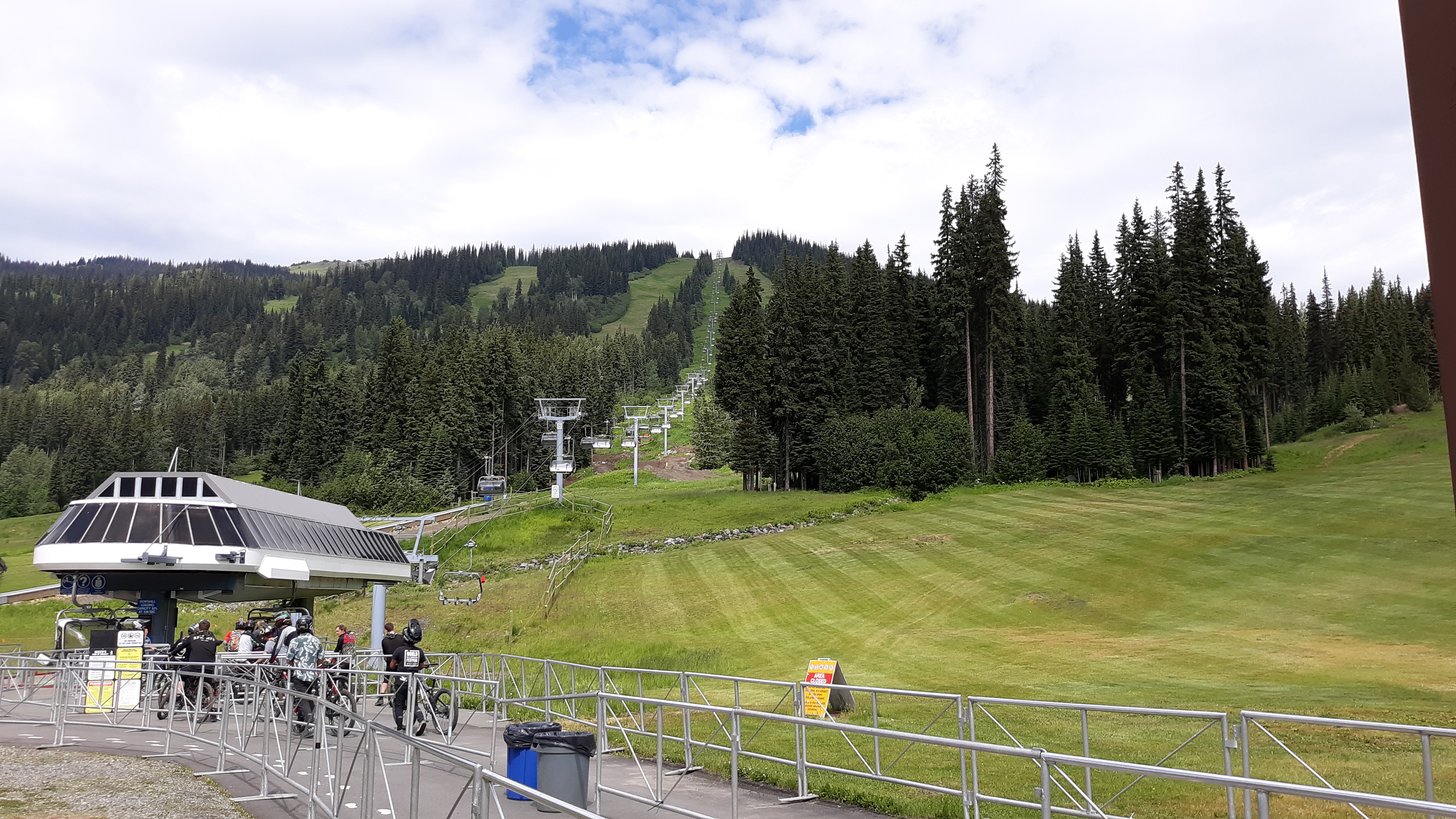
The Sunburst Express
Each chair seated 3-4 passengers comfortably and safely. As we climbed, there was a biking trail below us, as seen in this next photo.
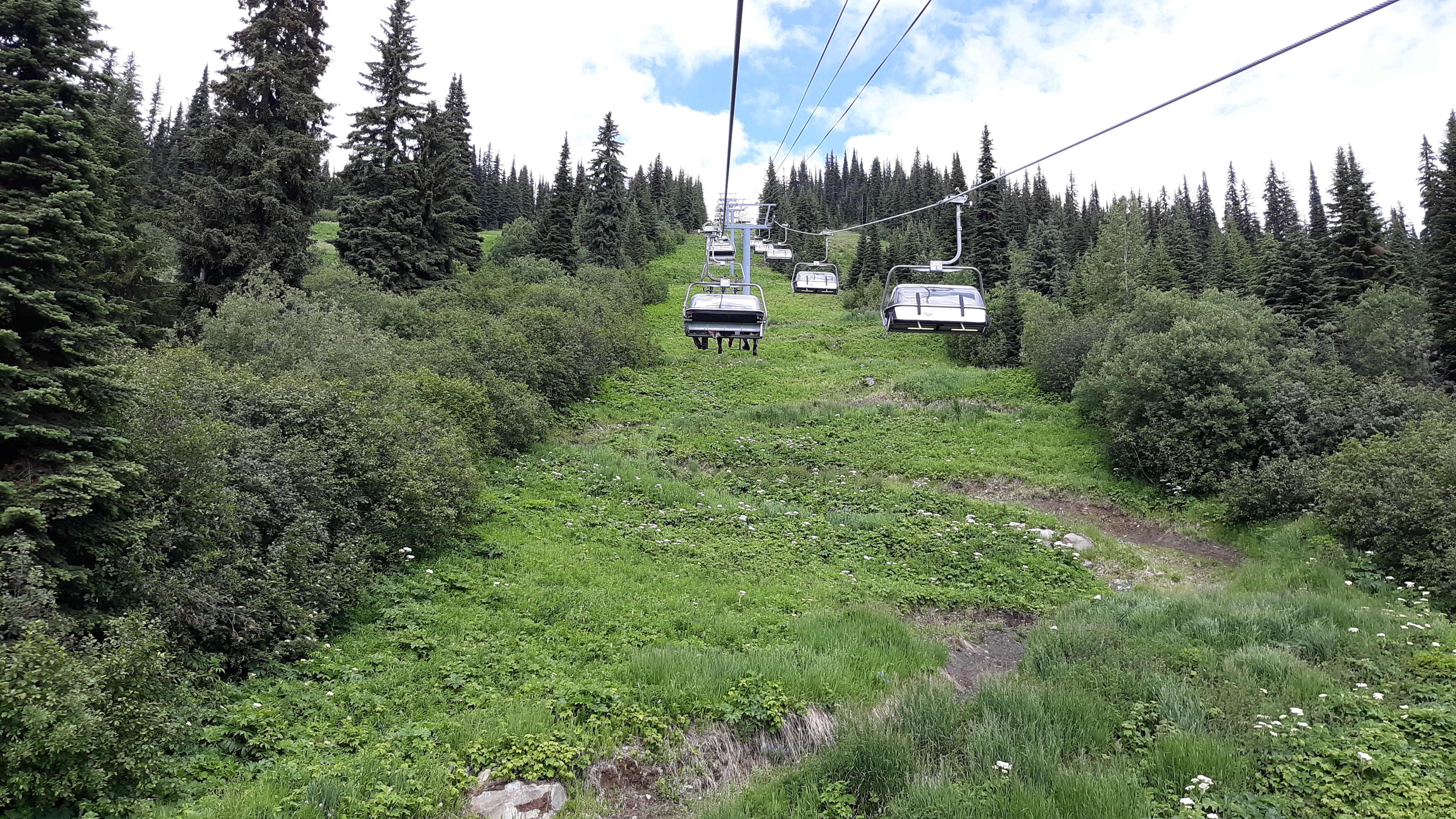
The bike path under the chairlift
This particular chairlift took us to an elevation of 6,069 feet which was terrific, having saved us a climb of 1,952 feet – the fee to ride was worth every penny.
What next? We familiarized ourselves with the series of trails we’d need to follow to the peak. Nearby sat an interesting signpost, which I couldn’t resist.
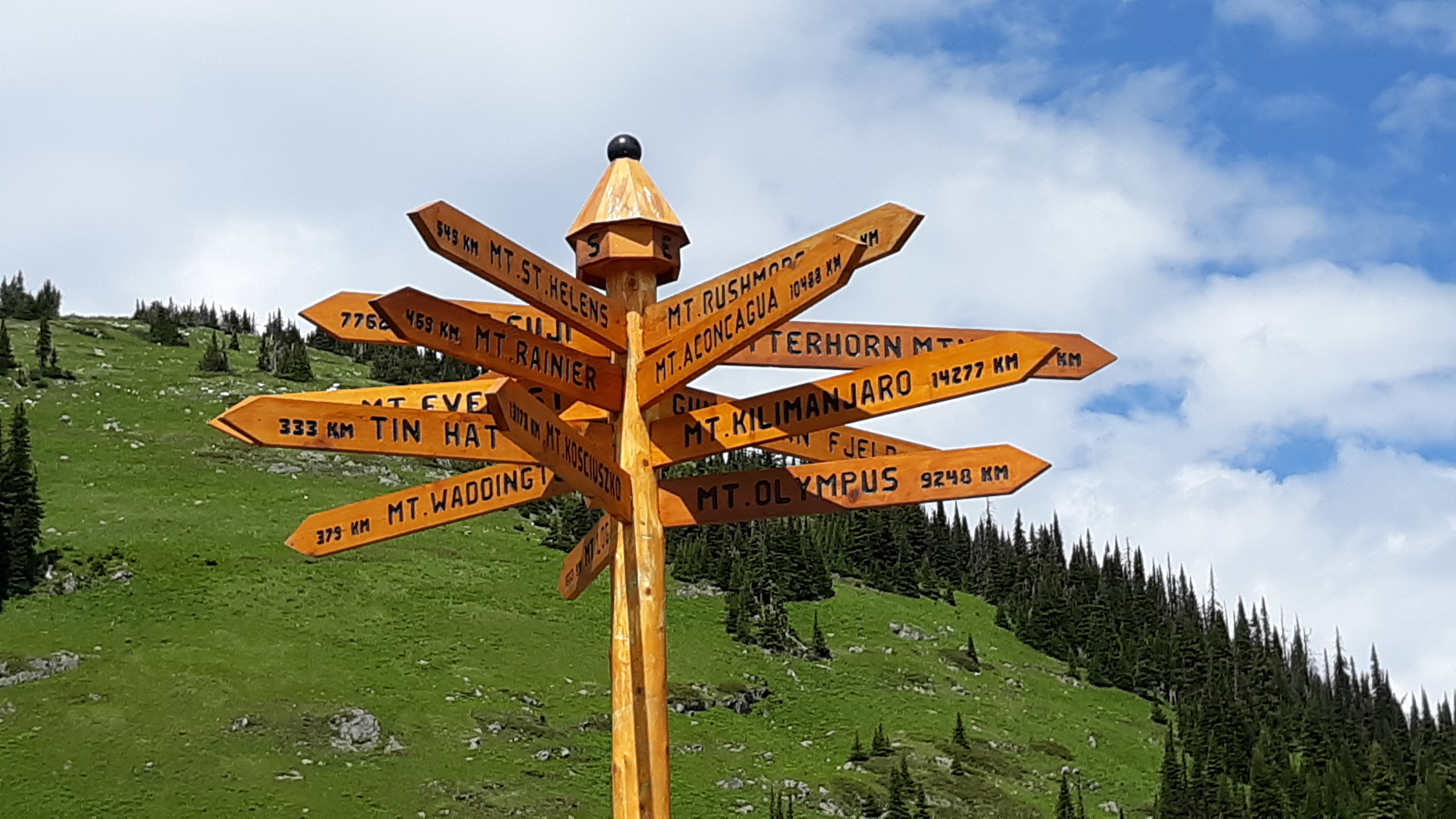
The signpost
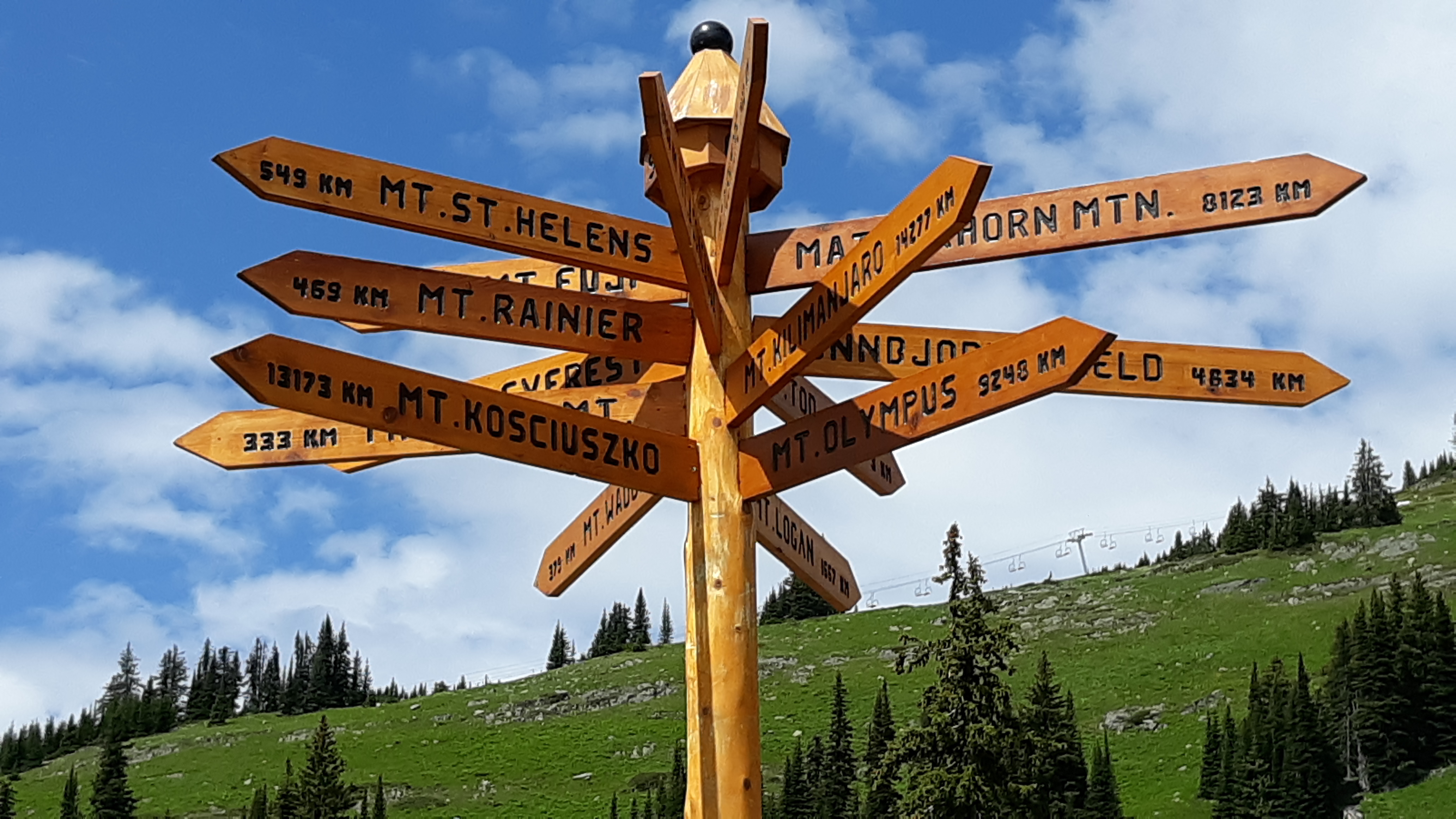
Another view
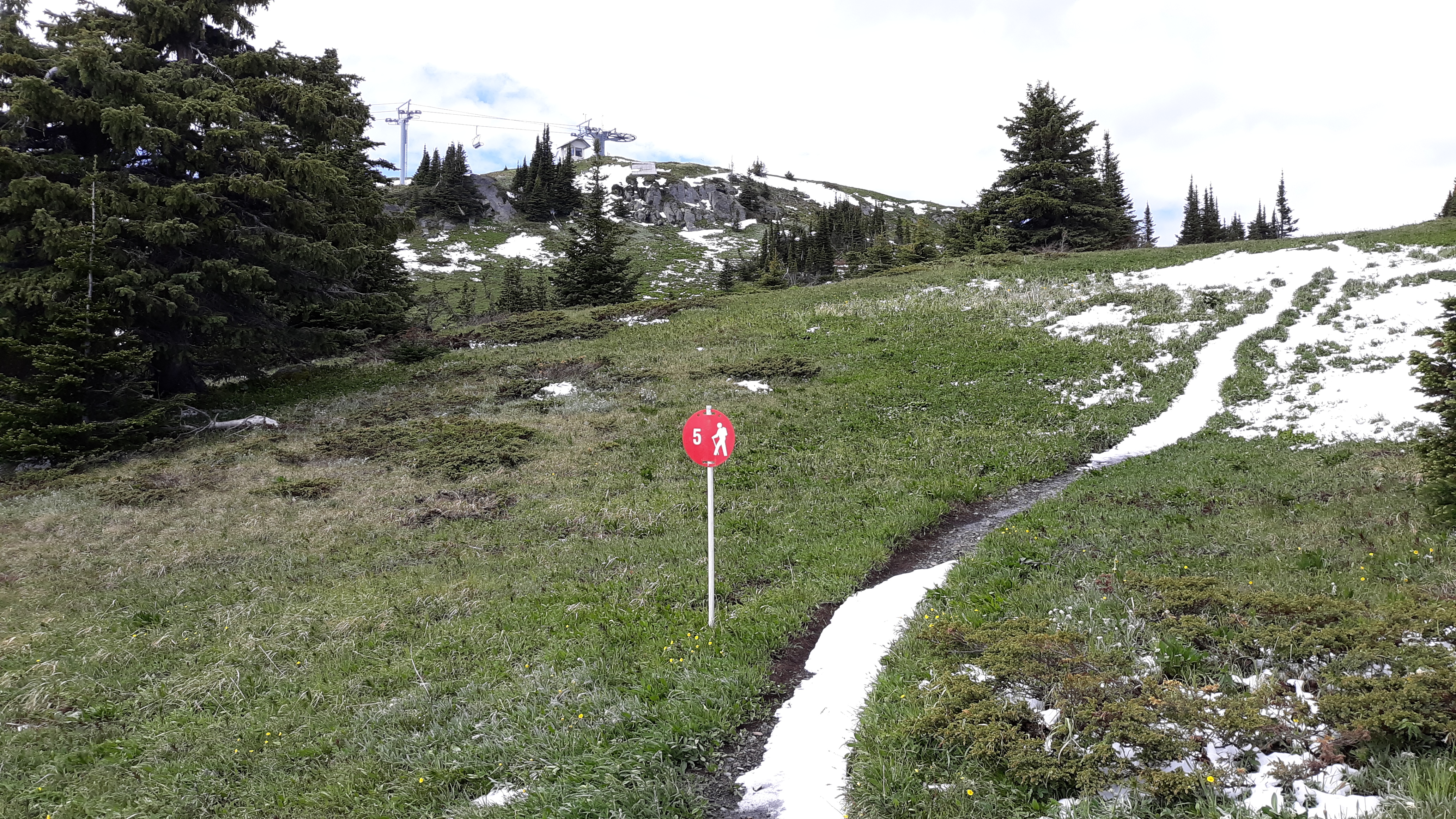
We started out on trail #2, then on to trail #5. These took us almost 2 KM and climbed up a steep, open slope. Here is a look back down to the top of the chairlift.
A look back down to the top of the Sunshine Express
By the time we’d reached the end of trail #5, we were near a spot called “Top of the World”. Another chairlift ended there, at 6,824 feet, but was not running during the summer months.
Top of the World
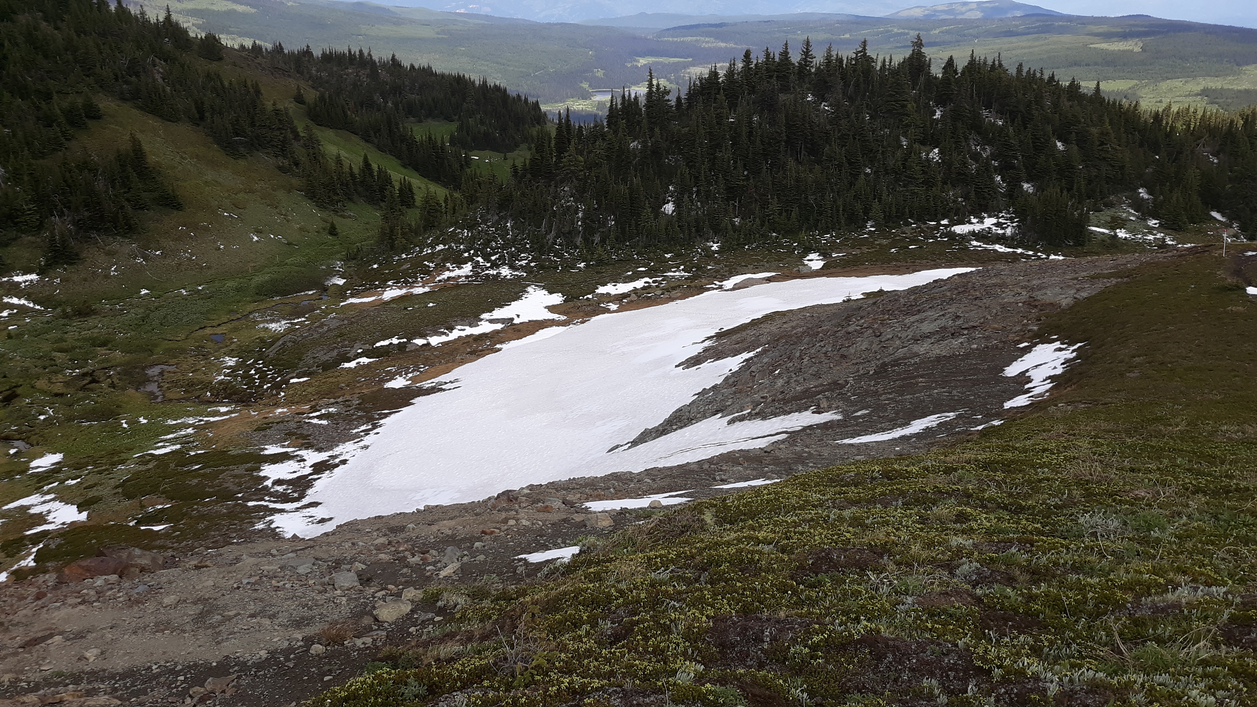
There was plenty of snow lying about, and it was quite slushy. I was wearing lightweight desert boots which weren’t waterproof, so my feet got plenty wet and stayed that way all day. The farther we went, the more snow we found.
More snow
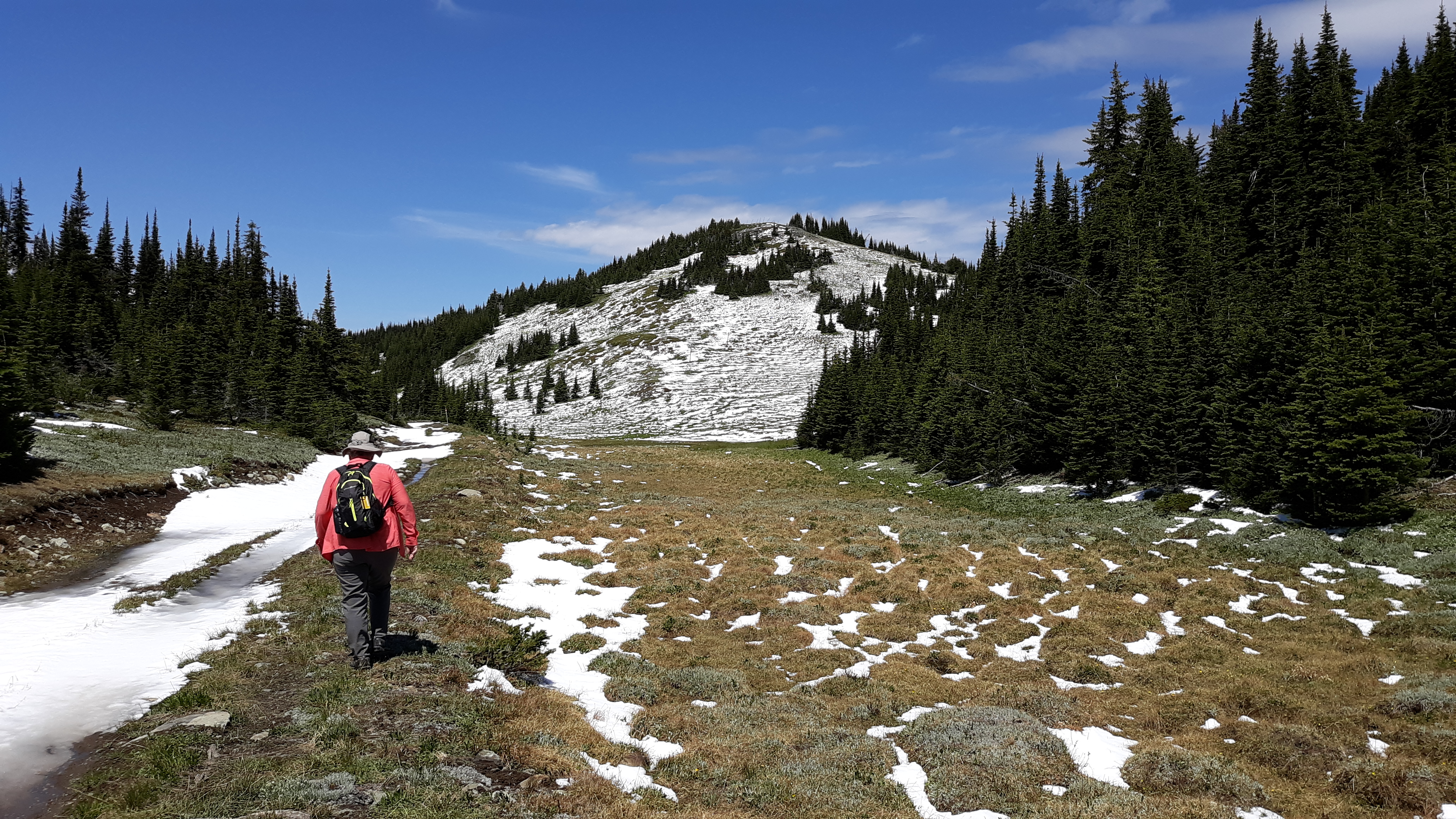
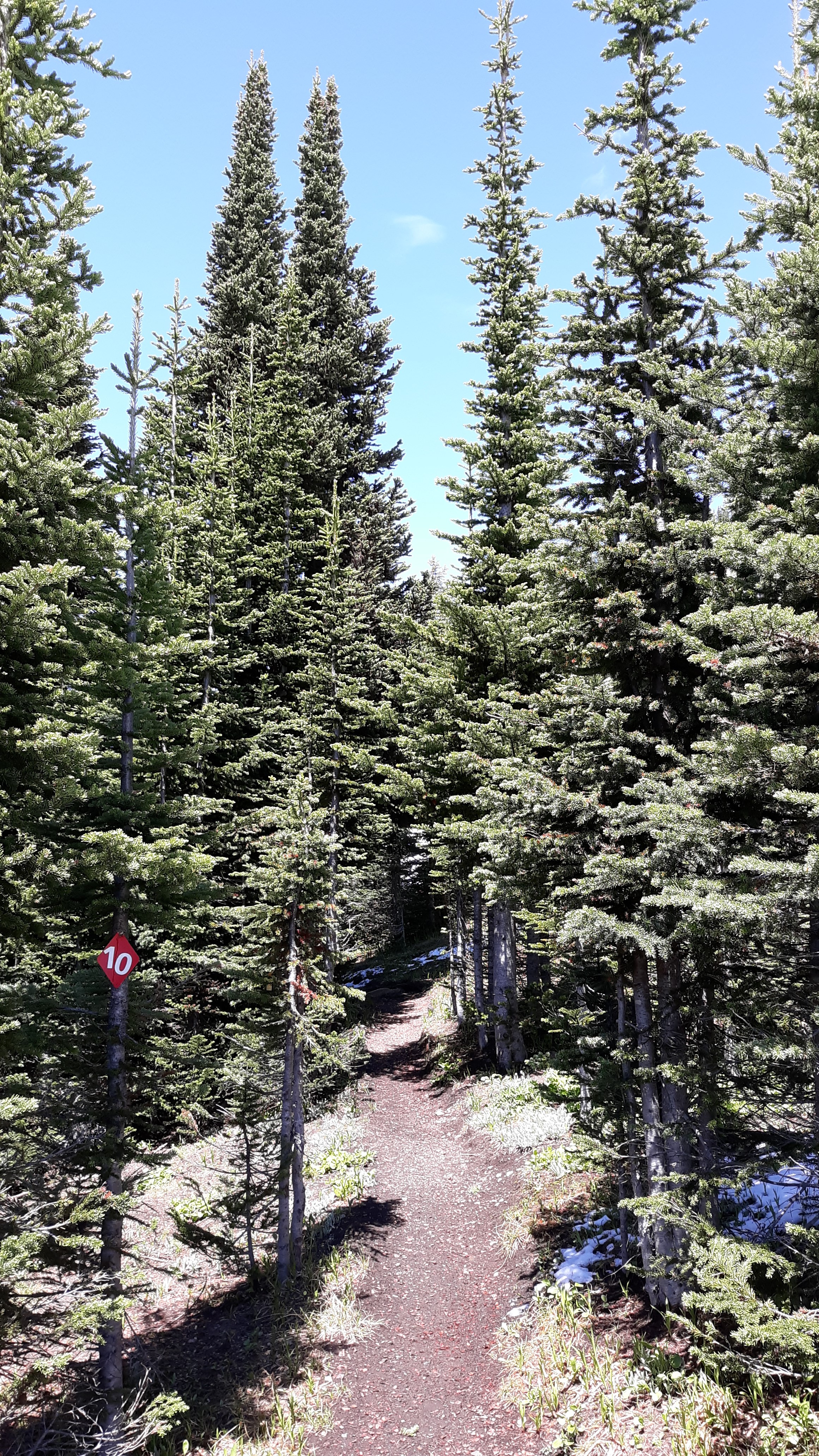
We were now on trail #10, the longest one we’d travel. It took us another 1.5 KM towards the peak, but unfortunately lost a lot of elevation in so doing. Here is the first good look we had at Mount Tod from #10. Along this stretch, we walked through snow as much as 12 inches deep.
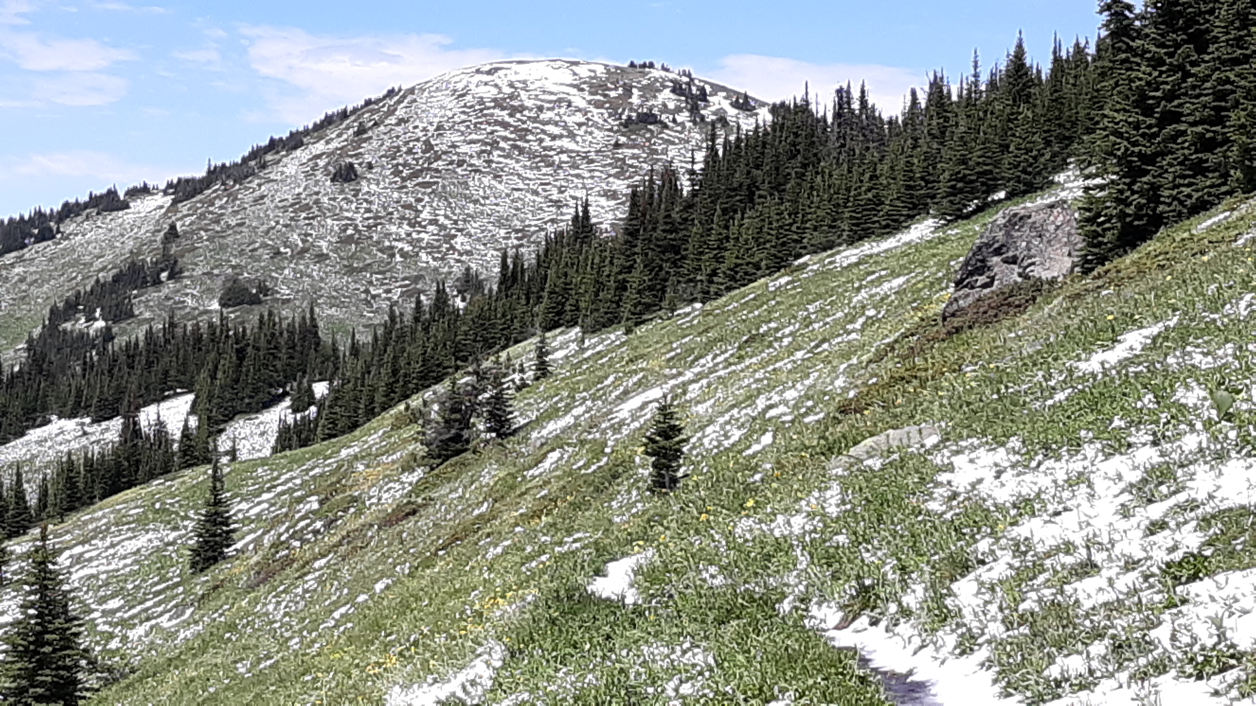
Looking northwest
Our path connected to trail #7, a fairly level stretch which was plenty wet.
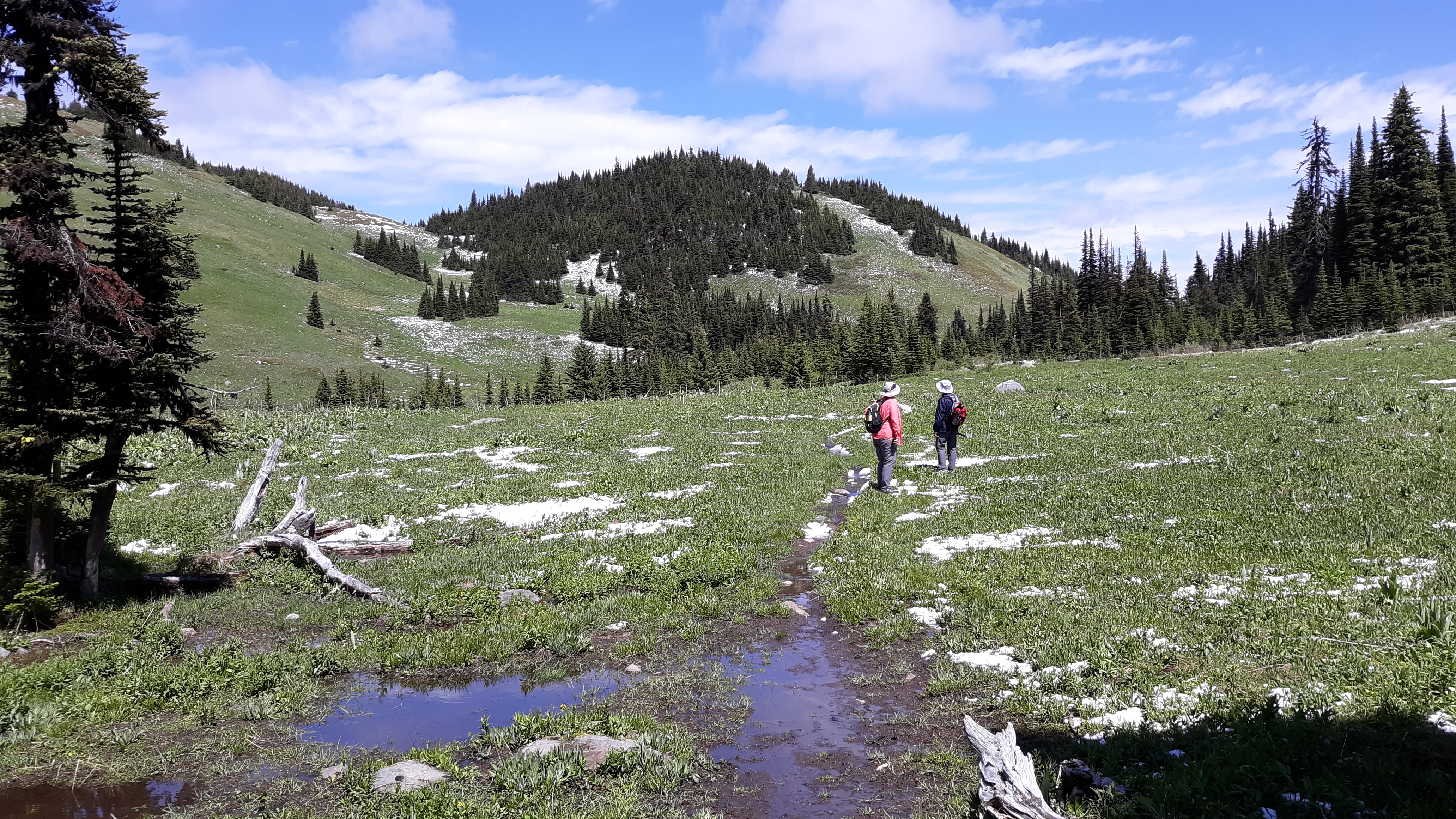
Along trail #7
#7 took us another 0.9 KM, passing this small tarn along the way.
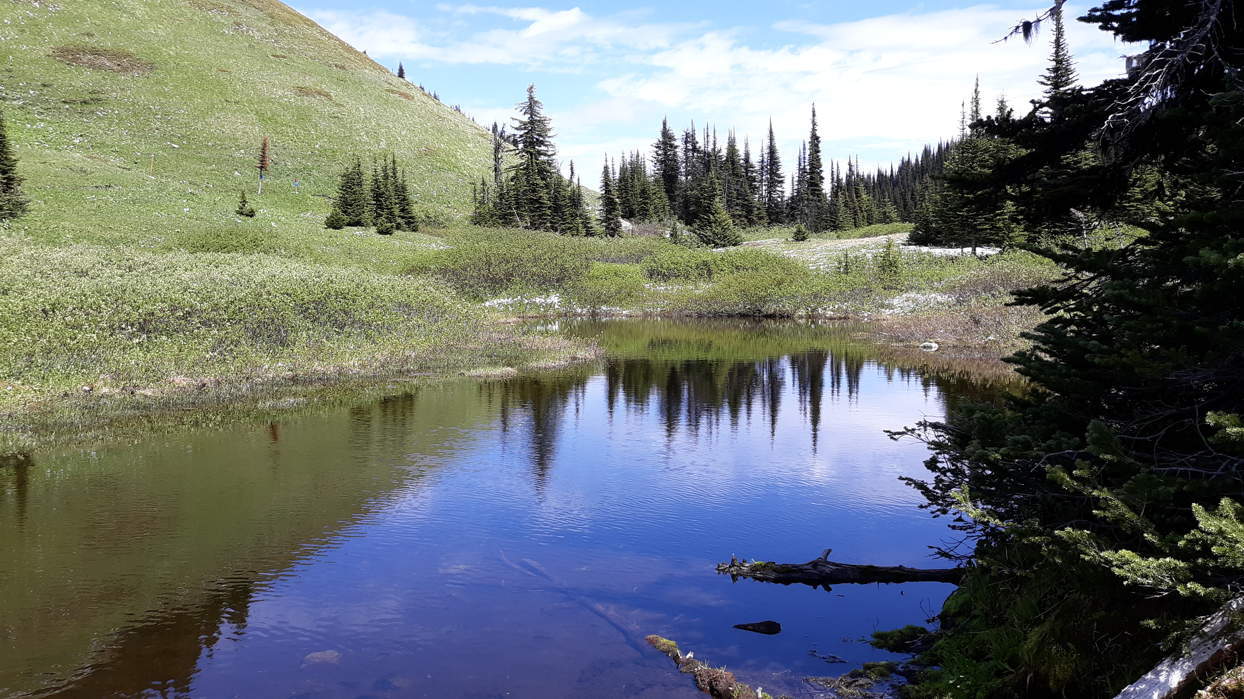
Peaceful
Now for one final push, along trail #11. This climbed steeply, re-gaining all the ground we’d lost along trail #10, and 1.4 KM later, we stood atop Mount Tod, at 7,060 feet. Here are Val (on the left) and Joan gracing the summit.
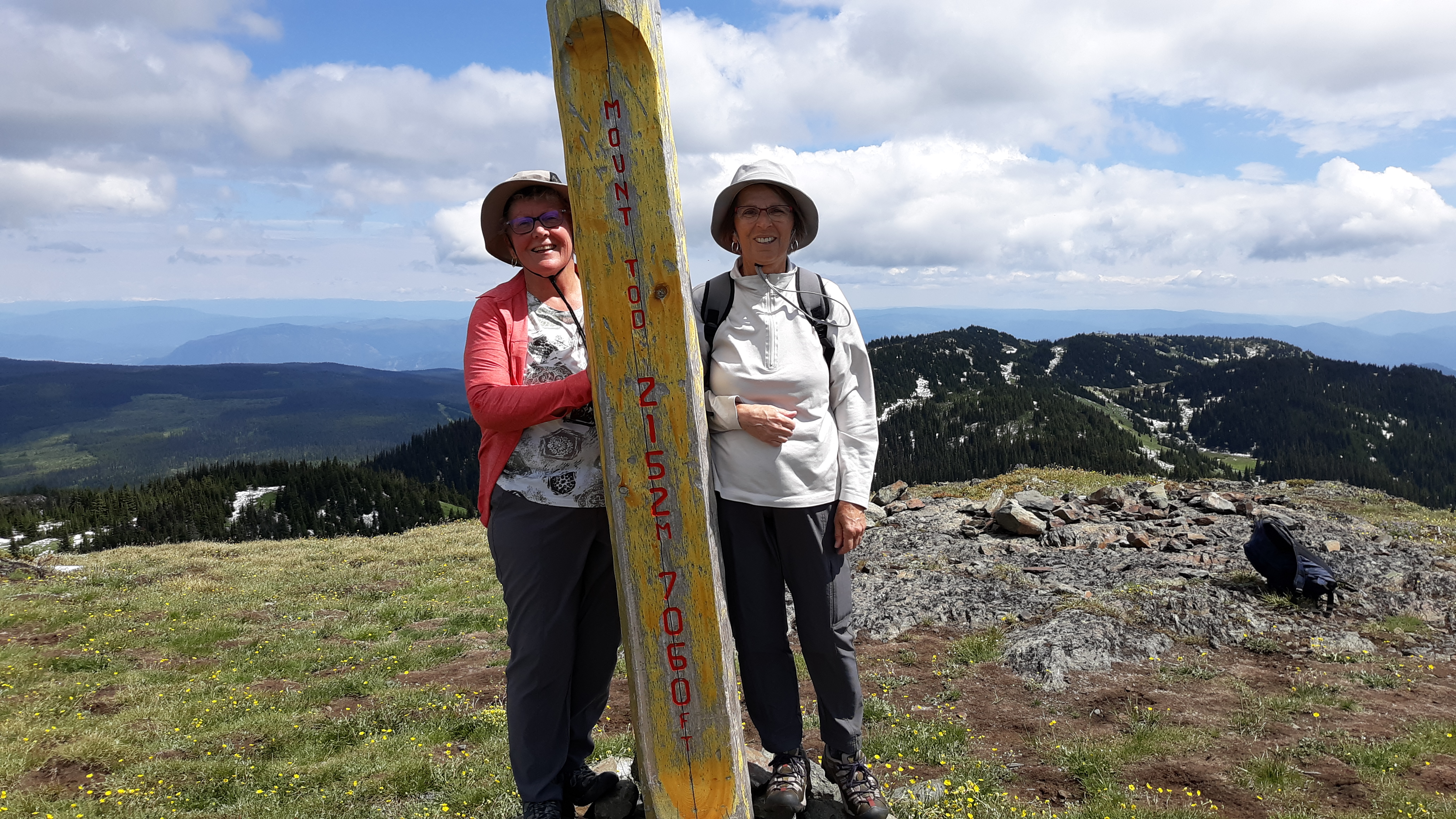
On the summit
We had taken a leisurely 3 hours to reach the top. It was windy and cool on the treeless summit. Here are a couple of views we had while there. This first one is a telephoto shot looking east to the Monashee Mountains, about 65 air miles distant.
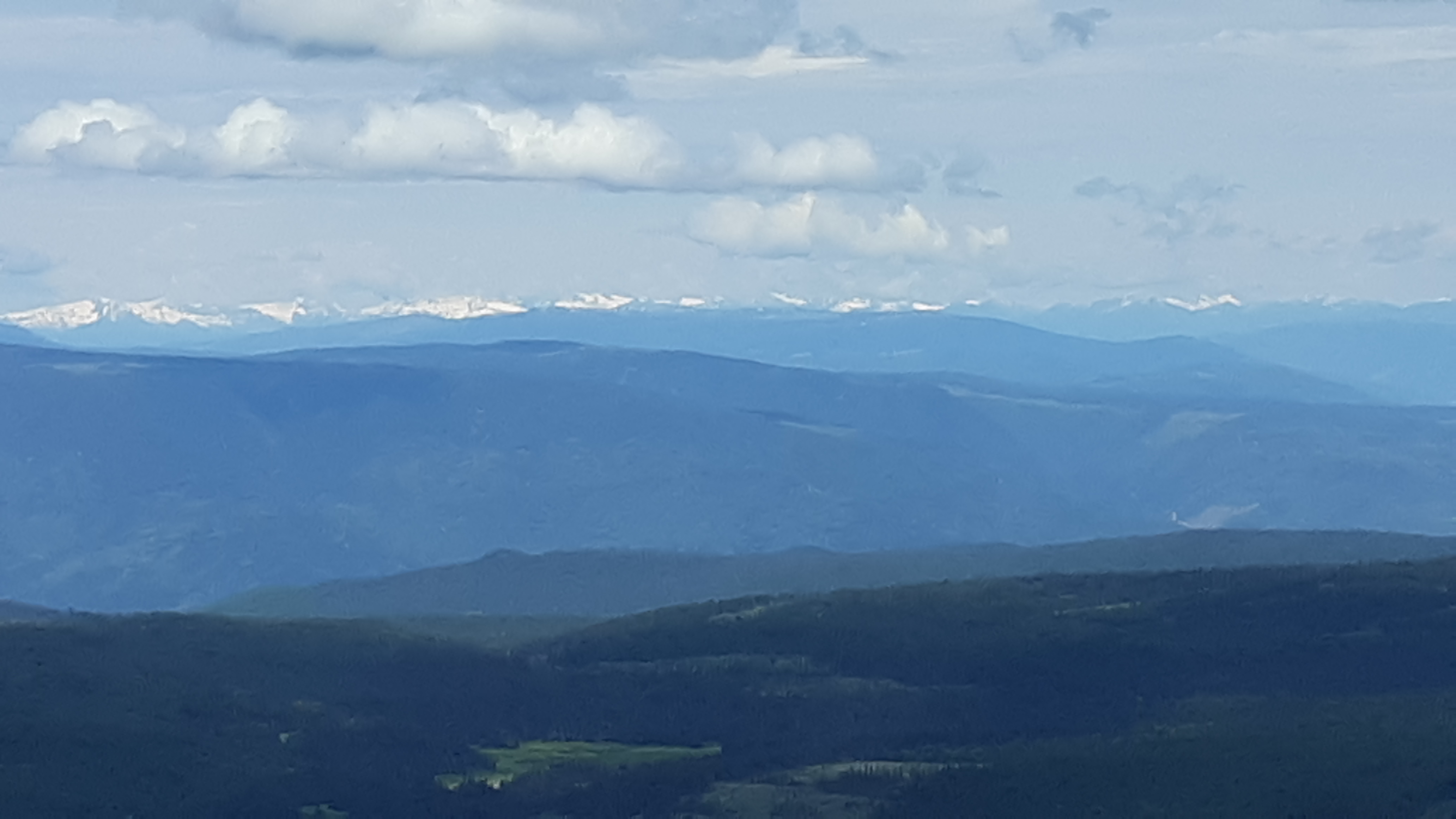
The Monashee Mountains
In this next photo, we look north. Nearby sits the bump some call North Tod, a bit lower, and in the distance, over to the right with its head in the clouds sits dark Dunn Peak (8,648′), a full 1,588 feet higher – it is about 40 air miles away.
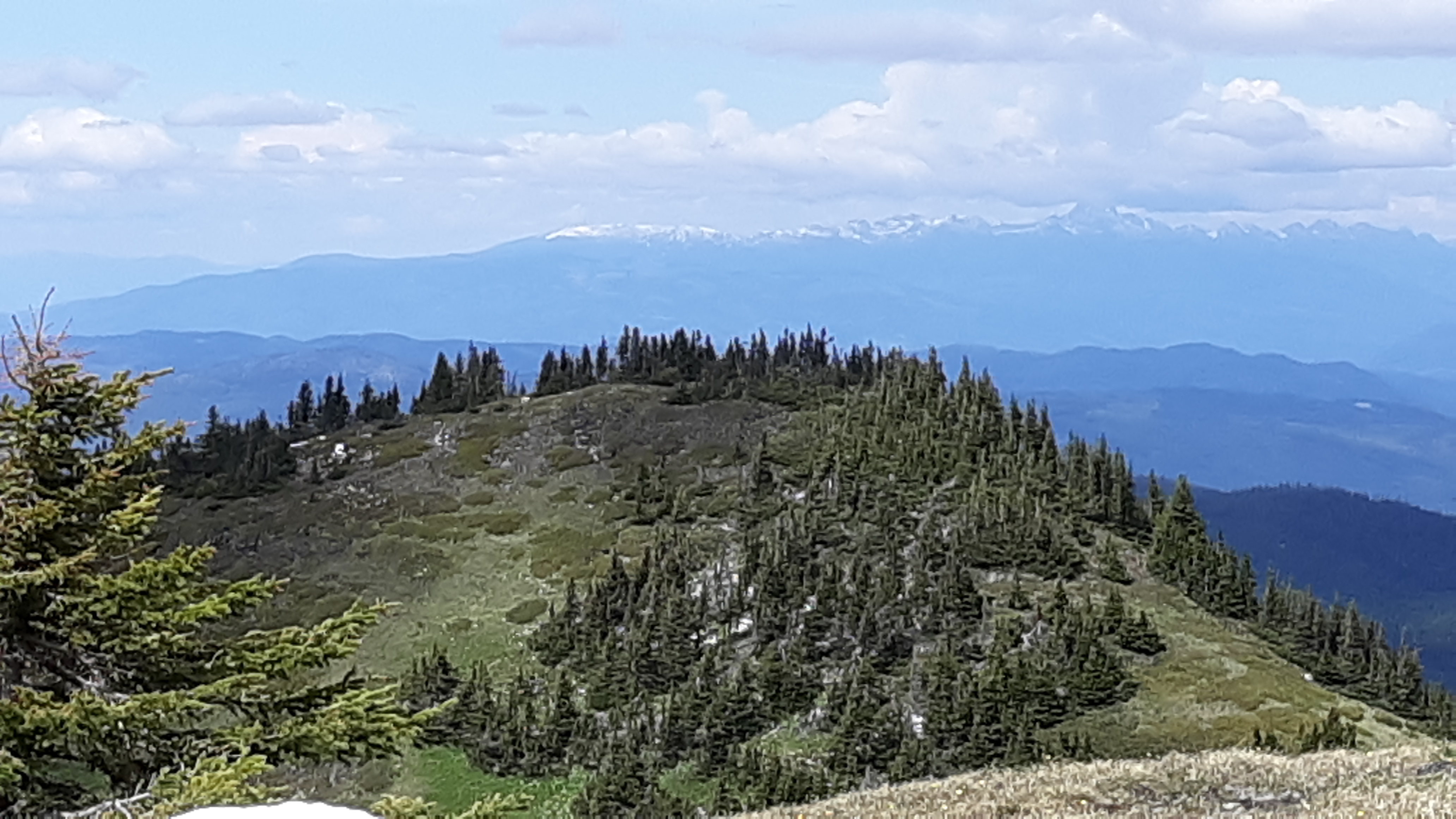
Dunn Peak
So why had I focused so much energy getting to this rather benign, albeit pleasant, summit? I knew, long before I ever laid eyes on the thing, that it was an ultra-prominence peak. In the world of peakbagging, that’s significant. Here’s the definition we use for an “ultra”: you must drop at least 1,500 meters, or 5,000 feet, vertically down to the highest saddle between it and the next-highest peak. BC alone has 101 ultras, almost twice as many as all of the lower 48 states combined. Mount Tod has been referred to as Canada’s easiest ultra-prominence peak to climb. That was just fine by me, I simply wanted to add it to my list. And speaking of lists – the best research I could do showed that Rob Woodall has climbed 22 of BC’s ultras, more than anyone. That’s 22 out of 101. Access is a huge problem in BC. You’d need a fortune and a lifetime to be able to get at and climb all of BC’s ultras. My pathetic total now stands at 5 of the 101.
We spent half an hour on top, ate some lunch, then headed back down. There were some good-sized snow patches nearby – this one stretched way around the corner to the right.
Snow
The day was warming up quickly, a breeze was blowing and the snow was melting. By the time we’d dropped 500 feet, a trail through a bit of forest was completely clear.
The path
In about 2 hours, we made it all the way back to the top of the chairlift. On the ride down, we had an excellent view of the Sun Peaks village, home to 800 permanent residents and many more in the ski season. Also visible are the many runs on Mt. Morrisey, across the valley to the south.
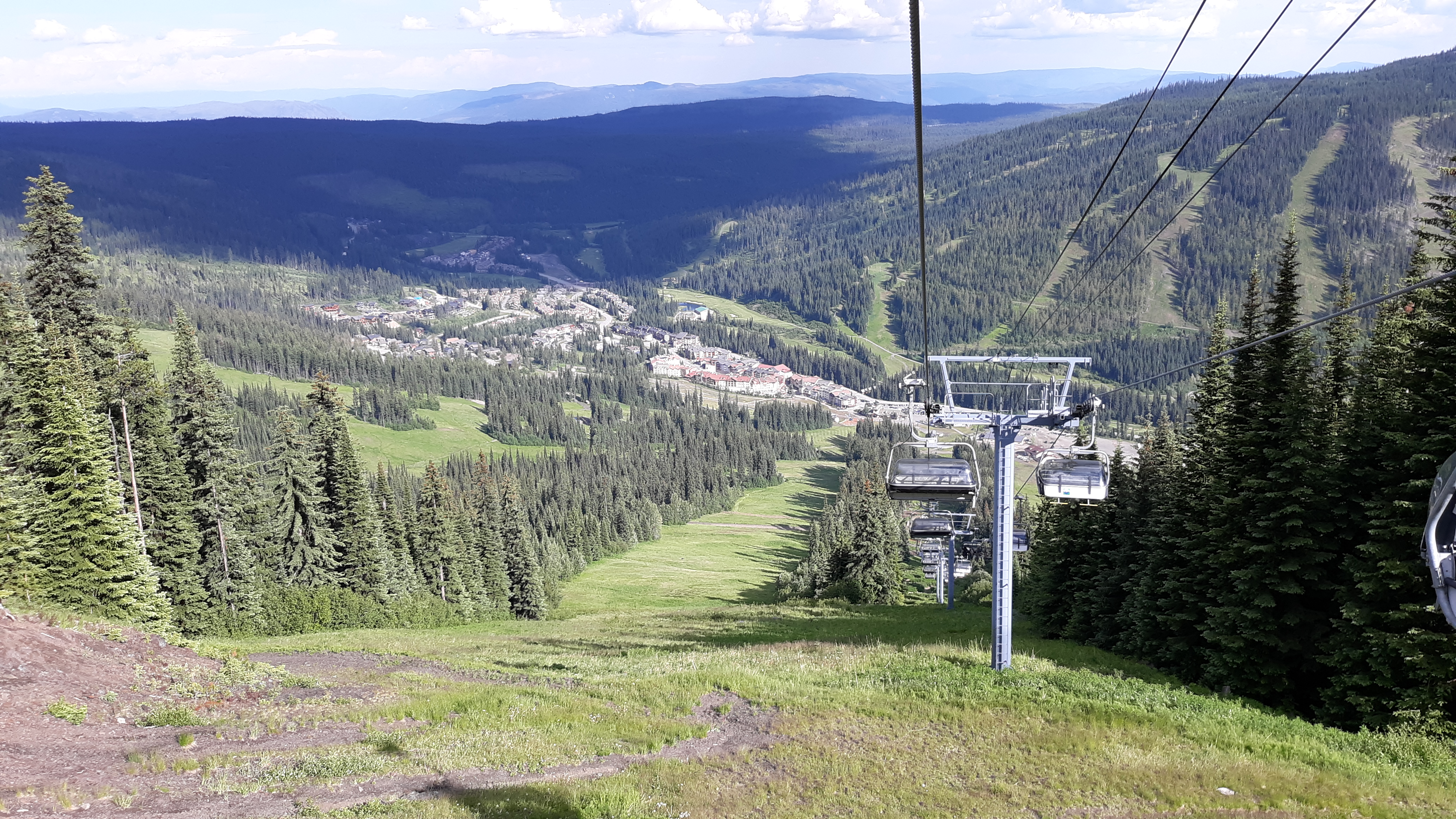
Mt. Morrisey
Our climb was over – the chairlift had made our day pretty easy. A round-trip of 7.1 miles, with 1,615 feet of climbing counting all of the downhill stretches, is what it took to do Mount Tod. It was a great day – the weather cooperated and the companionship was perfect.