
Folks who don’t live near the border don’t much think about it, I guess. Most Washington politicians are certainly clueless about what really happens along our frontier. I’m not talking about the border shared between the USA and Canada, but rather the one that separates the USA from its neighbor to the south, old Mexico. Now I’m not professing to be much of an expert on the southern frontier, but I’ve had some small experience with it in my own way, at least in a mountaineering sense, and that’s what I’d like to share with you here – more specifically, the stretch that separates Arizona from Mexico. I’d like to take you on a tour of those mostly empty miles, starting on the western end of things.
The far western edge of Arizona’s border with Mexico is an odd spot, geographically speaking. Everybody knows that the US state of California sits to the west of Arizona, on the other side of the Colorado River. But where our journey begins, let’s call it Mile 0.0, California is not to be found. Mexico is both south and west of that point. This can be best illustrated by a map, to which I’ve provided a link here. When you open the map, use the +/- buttons on the top left to zoom in, and when you do you’ll find yourself on the far western edge of Arizona, sitting right on the Colorado River. Across the river is the Mexican state of Baja California Norte. To find California, you’d have to paddle upstream, to the north, for 27 miles before you’d reach a curious point where Arizona, California and Mexico all meet. Okay, enough of that. Let’s go back to the spot where the map opened for you and start our real journey. There’s something important I need to tell you right away, though, as we start our journey along the border. We will not be traveling due east, as many might think – in fact, our heading will be 108 degrees, somewhat south of east. That’s just the way those gummint folks set things up when the Gadsden Purchase happened way back in 1854.
At Mile 0.0, Baja California is to the west and the Mexican state of Sonora is to the south. We need only travel to Mile 1.9 to reach the city of San Luis, Arizona which boasts a population of 25,000. Sitting right across the line is the much larger community of San Luis Río Colorado in Sonora, with a whopping 200,000 inhabitants. This discrepancy in population is something we see repeated along the US-Mexico border several times in our travels. We have now entered the Yuma Desert, unpopulated land on the Arizona side, but we need to travel all the way to Mile 7.5 to reach the outskirts of San Luis RC. By the way, what we call the Yuma Desert is known as the Desierto de Altar south of the border.
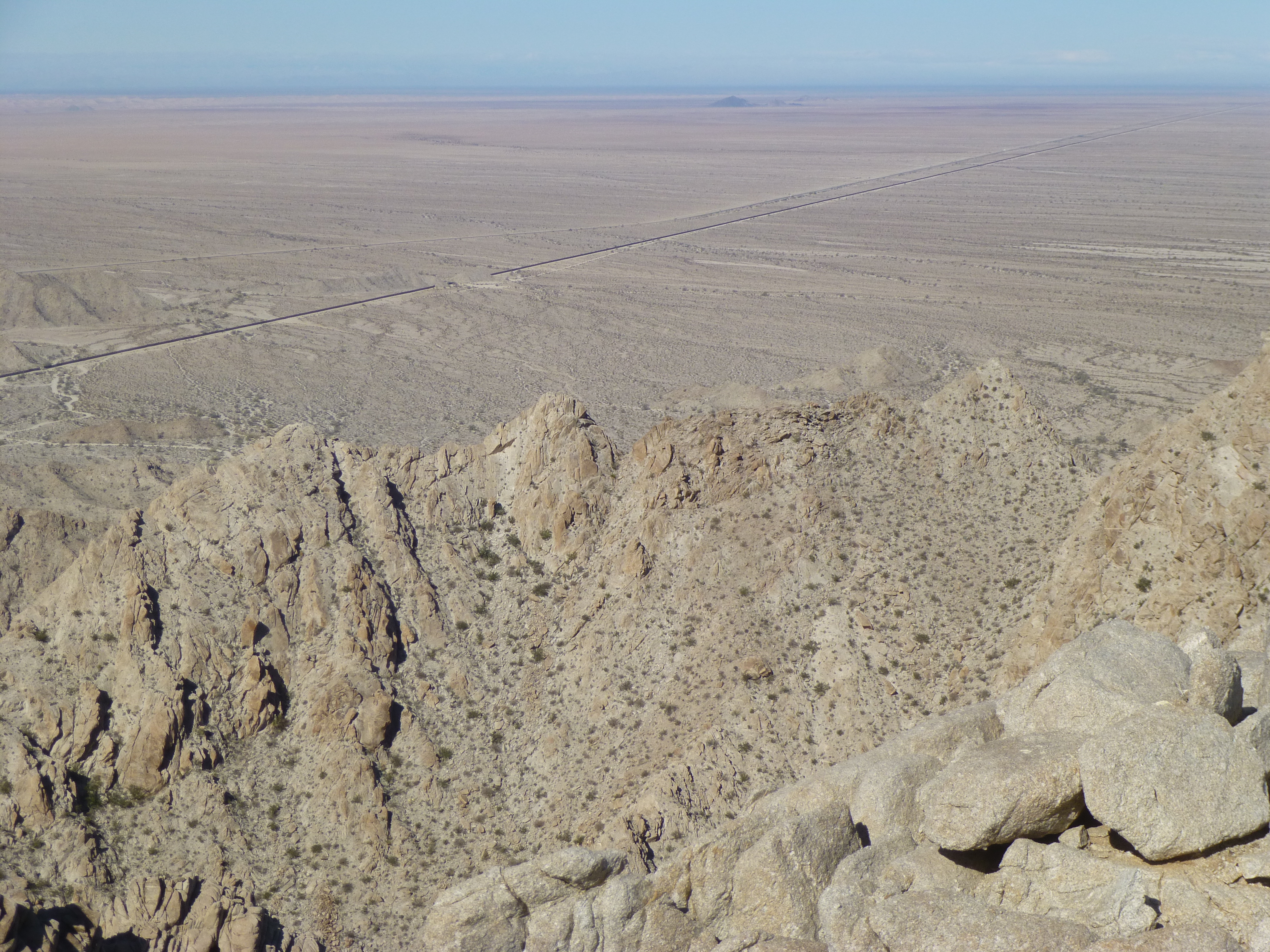
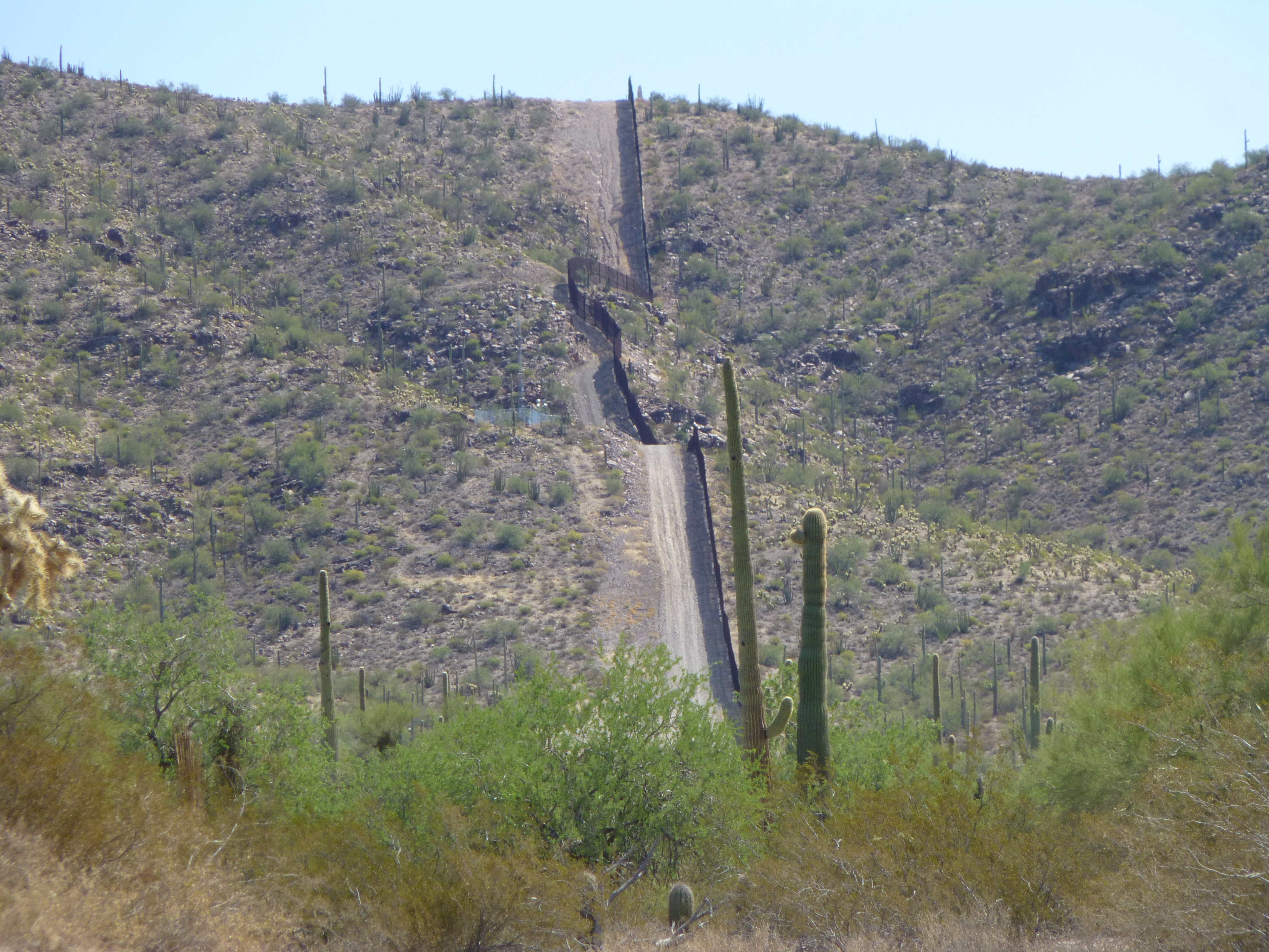
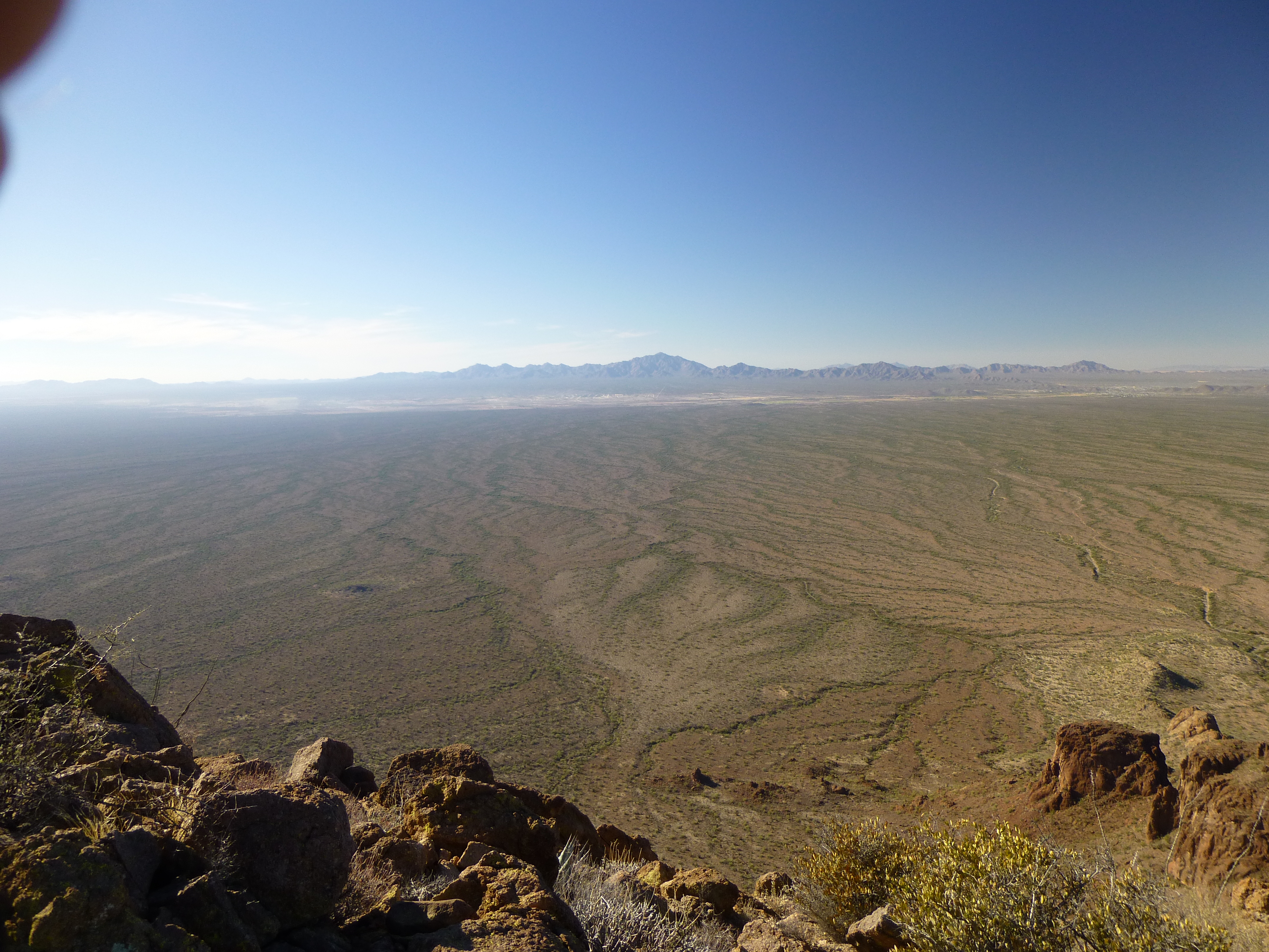
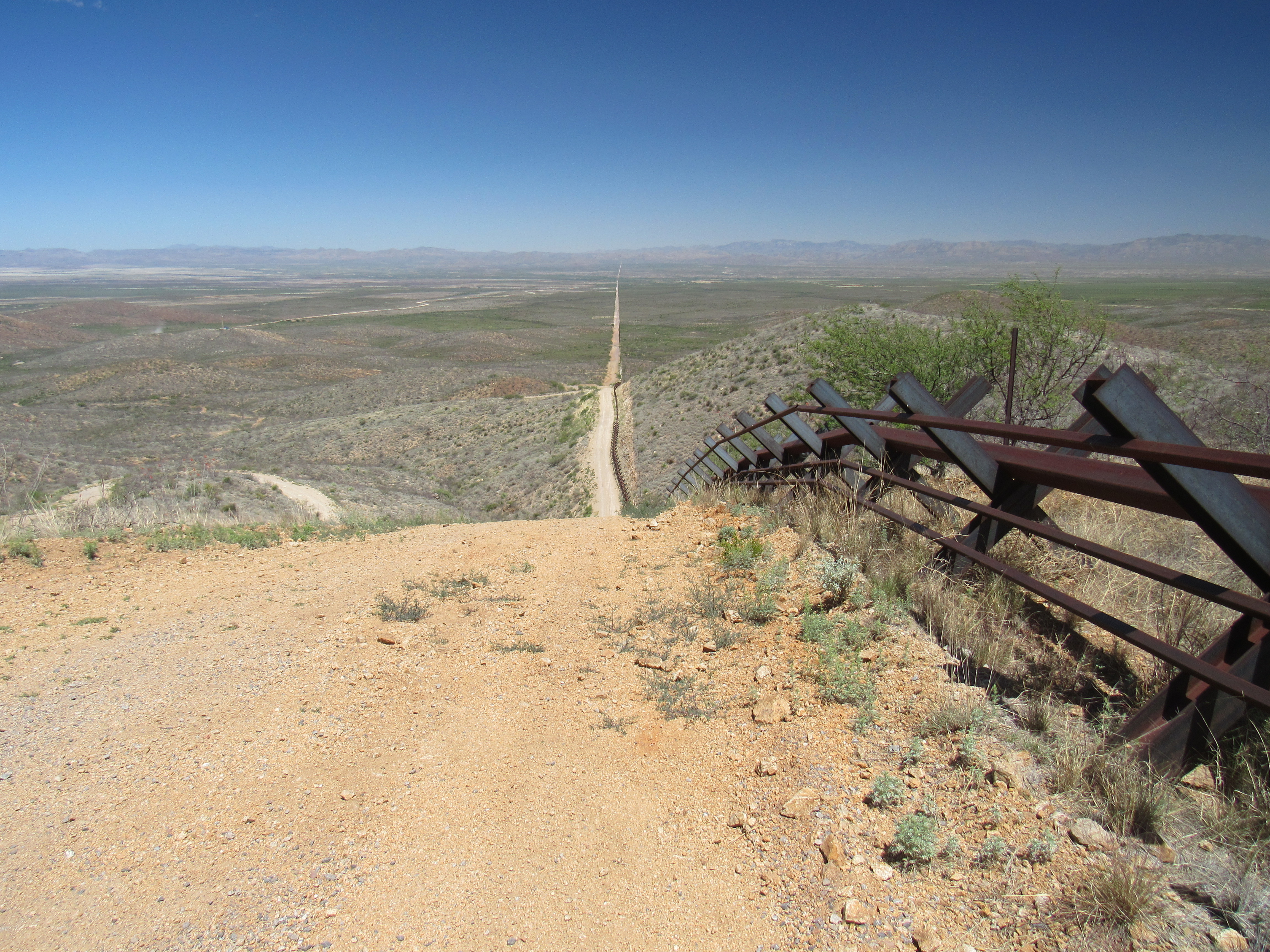
As we continue east, we leave BLM land and enter the Barry M. Goldwater Air force Range at Mile 15.5. Nothing looks any different there, it’s still flat, open desert, quite featureless. We need to go all the way to Mile 37.7 before we see anything new. Less than 2 miles to the north sit the Butler Mountains. Unlike the olden days, the military has now declared the entire range off limits to the public. Before we continue, I want to show you a view looking west over this stretch of desert. The black line is a barrier which has been built to prevent vehicles from illegally driving across the border.
At Mile 45.0 we enter the Tinajas Altas Mountains, an extremely rugged range which crosses the border into Mexico. Up to this point, a strong steel vehicle barrier has been in place to stop Bad Guys from simply driving across unchecked into the US. By Mile 49.2, we have left that range behind and find ourselves at an old dirt road which used to cross the border. This is now blocked by another stretch of vehicle barrier which spans the short gap between 2 mountain ranges. A short distance later, we enter another group of mountains, the Sierra de la Lechuguilla. This is another steep, crumbling range of loose rock which also crosses the border into Mexico, and once we’ve passed out of it to the east we find ourselves in the Cabeza Prieta National Wildlife Refuge at Mile 52.7, where we also enter the Lechuguilla Desert.
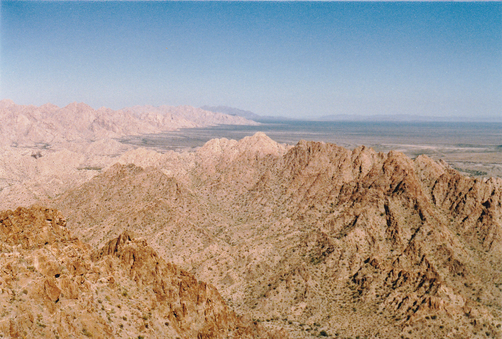
Looking north across the border into the US
We now cross this stretch of flat desert, and at Mile 57.4 we start the climb into the Tule Mountains. This extensive range is another of those that straddles the border, and it runs for a long way, until Mile 72.8 to be exact. Once done with it, we find ourselves in yet another desert, namely the Tule. Another open stretch brings us to a most interesting place, the Pinta Sands. We only spend a single mile in these orange-pink dunes before moving into the Pinacate Lava Flow.
There’s a big volcano in northern Sonora called Cerro Pinacate. In just a few miles, 25 to be exact, the land rises from sea level to the summit at 3,904 feet. It’s only 18 miles from the same summit to our Mile 72.8 along the border. At that point, a rugged expanse of rough lava rock begins, and it takes us all the way to Mile 81.9, passing a couple of 200-foot peaks along the way. This is a fascinating place to simply wander, unhurried, among the outcrop and the unusual vegetation, interspersed with the colorful sand. The lava has flowed northeast those many miles from the peak, crossed the border, and settled as a huge lobe in the Tule Desert. If we go a bit farther and leave the lava flow, we cross another stretch of the Pinta Sands and find ourselves back in the Tule Desert. We are now at Mile 84.1, and have loved every mile of the journey.
During the next 4 miles, we pass two playas. The dictionary defines a playa as an area of flat, dried-up land, especially a desert basin from which water evaporates quickly. That perfectly describes them. Getting past the playas takes us up to Mile 89.2, where we pass a small peak which is part of the O’Neill Hills. Leaving the hills behind, we leave Yuma county and enter Pima County at Mile 92.0. Around the border itself, the land is flat and empty, but to the north we can see the Agua Dulce Mountains – they stretch across our northern horizon for many miles to come.
By the time we reach Mile 107.6, we leave behind our old friend the Cabeza Prieta National Wildlife Refuge and enter Organ Pipe Cactus National Monument. In addition, we pass beyond the Agua Dulce Mountains and start to see the Quitobaquito Hills to the north. They will stay with us until we reach Mile 112.2, where these hills come right down to the border itself. There, we find the only water we’ve seen ever since our journey began, a lovely oasis in the harsh desert, a spot called Quitibaquito Pond. Imagine coming upon this in the harshest of deserts, a sight for sore eyes.
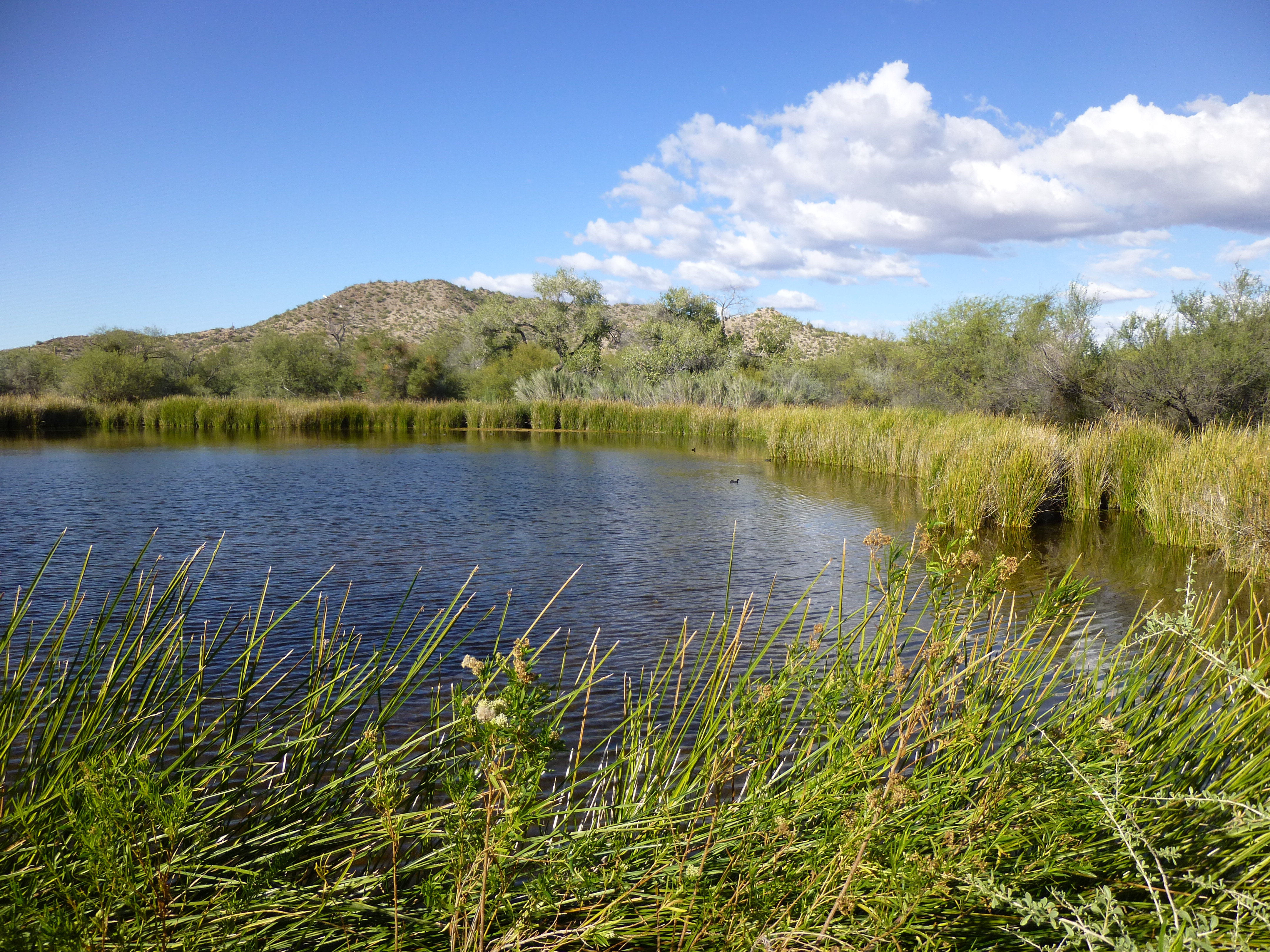
Quitobaquito Pond
Something else happens here, something rare. A road, used by the public and known as Puerto Blanco Drive, follows the border for several miles. It heads east across La Abra Plain to reach the southern tip of the Sonoyta Mountains at Peak 1883. As the photo in the link will show, the border actually goes right over the top of the mountain. Here’s another view of the border fence going up the steep mountainside, this time up the west side.
From here, we can see the settlement of Lukeville, population 35, which serves as a border crossing. Right across the border from it can be found the city of Sonoita, Sonora, with 13,000 inhabitants, another one of those situations where a lot more folks live on the Mexican side. It sits at Mile 124.2 and is the only humanity we’ve encountered since leaving San Luis, way back near California. Don’t get comfortable hanging around this one-horse town, though, because we’re leaving right away – we have a lot of ground yet to cover.
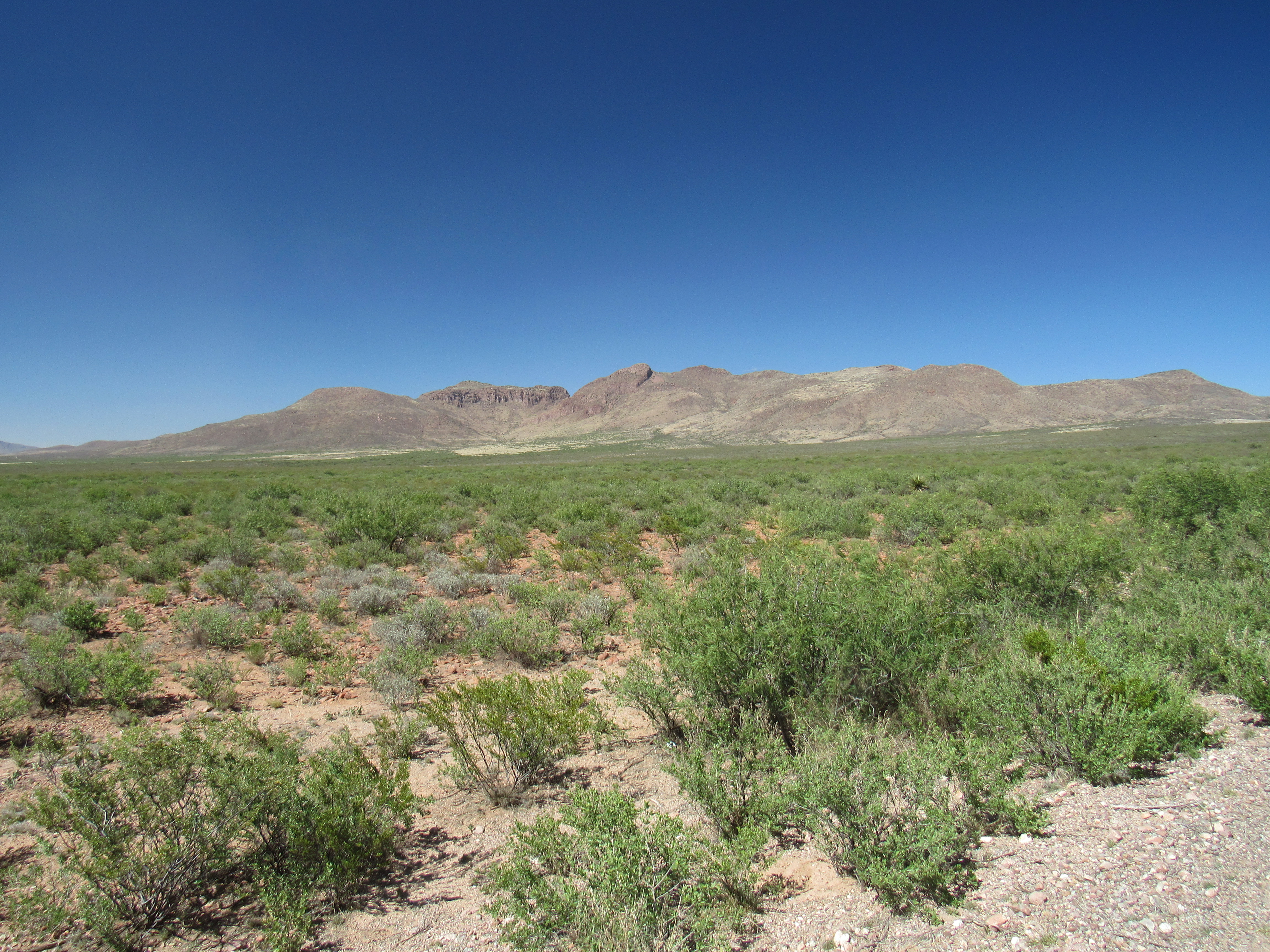
As we continue east, we pass through a large flat area called Sonoyta Valley, which fills up the extreme southeast corner of Organ Pipe. I mean it when I say flat – here’s a photo looking across it.
Sonoyta Valley. looking southwest across it
By the time we’ve traveled to Mile 137.2, we have crossed the valley and reached the Sierra de Santa Rosa, a subset of the much larger Ajo Range. At this point, we leave Organ Pipe and enter the Tohono O’odham Indian Reservation, about which I have already written a great deal on this website. Here, I’ll just continue with my focus on what we find along the border. When we reach Mile 140.4, we see the houses of a village, Al Jeg, a bit to the north. The name means “Little Opening” in their language, and with 250 people it ranks as the 12th-largest community on the T.O. nation. It sits tucked between 2 mountain ranges in a quiet corner of their land.
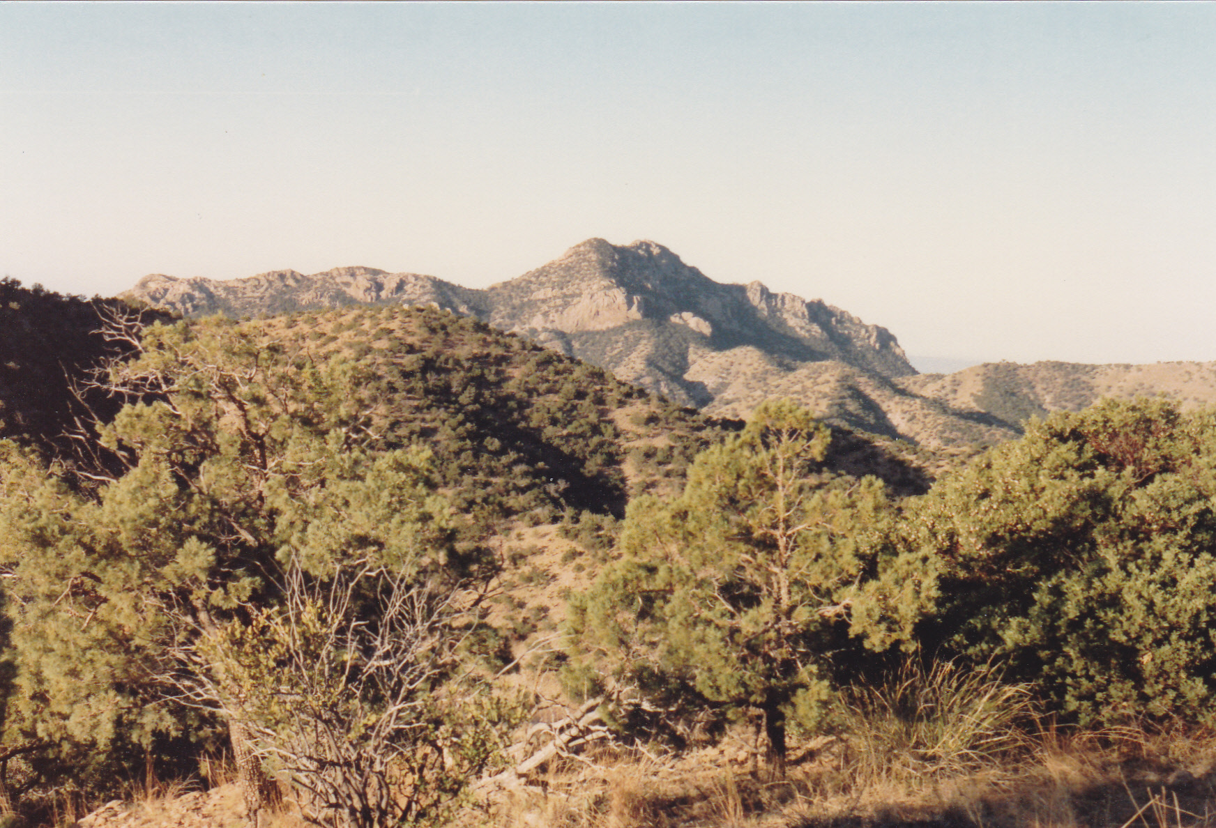
Because the reservation is so sparsely populated, Bad Guys from Mexico feel that they can smuggle drugs and people across it into the USA and avoid detection. The poor O’odham don’t stand a chance against this illicit tide, so the US Border Patrol keeps a heavy presence throughout their land. We don’t go very far from Al Jeg until we run into another mountain range, the Sierra de la Nariz. Mile 141.6 puts us on top of the range where it crosses the border, and Mile145.7 sees us back on the desert floor. We now find ourselves on a huge flat area with a name I love, “The Great Plain”. This stretches for many miles out in wide-open spaces, until we run into the La Lesna Mountains at Mile 160.7. This is one of the prettiest ranges you’ll find anywhere, a joy to visit, but it is way out there and far from anything. It is a lawless area, well-known to the authorities, and every time I’ve been there I’ve witnessed crimes being committed. Risky business. Here’s a picture of Peak 2650, atop which sits Border Monument 153. This is the steepest of all the 276 monuments demarcating the US-Mexico border, the hardest to reach, atop a Class 5.7 technical climb. The border passes right over the top.
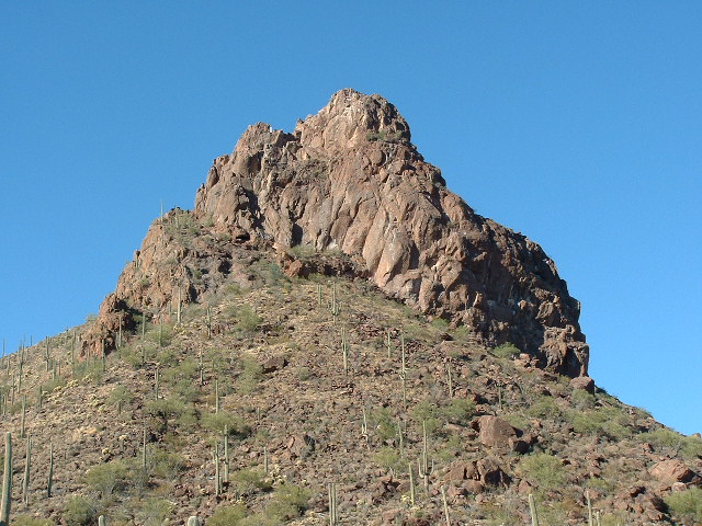
Peak 2650, the east side
The monument is at Mile 162.3, and if we jump off the precipitous drop on the east side, we’re back on the desert floor. This is the Tecolote Valley, flat and expansive – it takes many miles to cross it. At Mile 175.0, we see Wolfley Hill a quarter-mile to the north, then carry on all the way to Mile 183.0, climbing up over the southern shoulder of Horse Peak. Here, at Border Monument 146, we have climbed to our highest point so far on our journey, 3,550 feet. Just downhill to the east is a notorious spot where, a mere 500 feet south of the line at a little ranchito called La Sierrita, 7 men were found shot with a high-powered rifle and beheaded – mayhem of the drug trade.
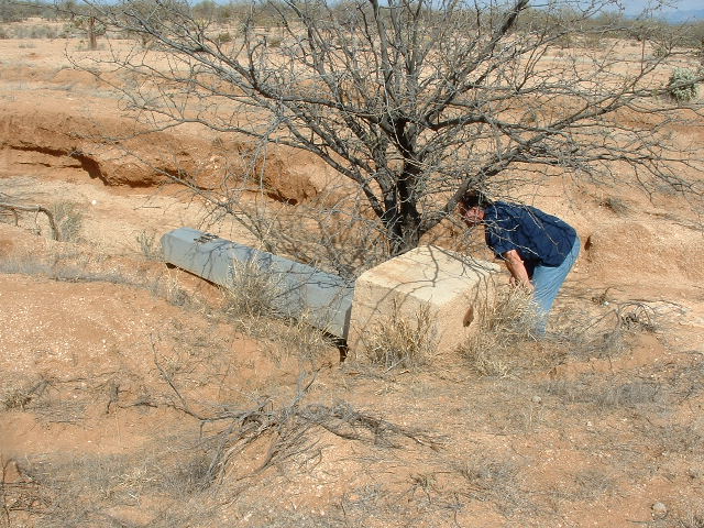
Here’s a photo of Border Monument 145, about 4 miles east and downhill from Horse Peak. As you can see, erosion has completely undermined the massive concrete block which supported the monument. When this picture was taken, in early 2004, there was only a barbed-wire fence to mark the border (it can be seen in the background).
It’s downhill all the way to The Gate, at Mile 189.8. An old road is here, a place traditionally used by the O’odham people to cross the border and visit with their kin in Sonora, and vice versa. Nearby, around Mile 192.0, we find the tiny community of Newfield, population 20. If we go a bit farther, say to Mile 196.9, we kiss the southern tip of the Baboquivari Mountains, and at Mile 200.5 we find ourselves in the depths of Smuggler’s Canyon in the heart of the Pozo Verde Mountains. Just a few miles more and we’ve left the mountains behind, at least for the moment, and are sitting at another of Arizona’s 6 legal border crossings with Mexico. This one is known as Sasabe, and it is found at Mile 204.1. There’s not much on the Arizona side, maybe 50 people, but on the Mexican side we find the much larger town of El Sasabe, with a population of 2,500. This is a depressing place, its sole reason for existence seeming to be to support Bad Guys and their clients who are trying to sneak into the US. It’s a staging ground for illegal border-crossing and the movement of drugs to the north. The place gives me the creeps, so let’s move on.
As we continue east, we’ve barely left town when we enter the Buenos Aires National Wildlife Refuge at Mile 204.5, and we stay in this protected area until Mile 210.0. Now we cross into a section of the Coronado National Forest and find ourselves in the San Luis Mountains – this is ranching country, and cattle abound. It’s a scenic area – here’s the view from Cerro del Fresnal, right on the border at Mile 212.0. This is our new border highpoint, at 4,500 feet.
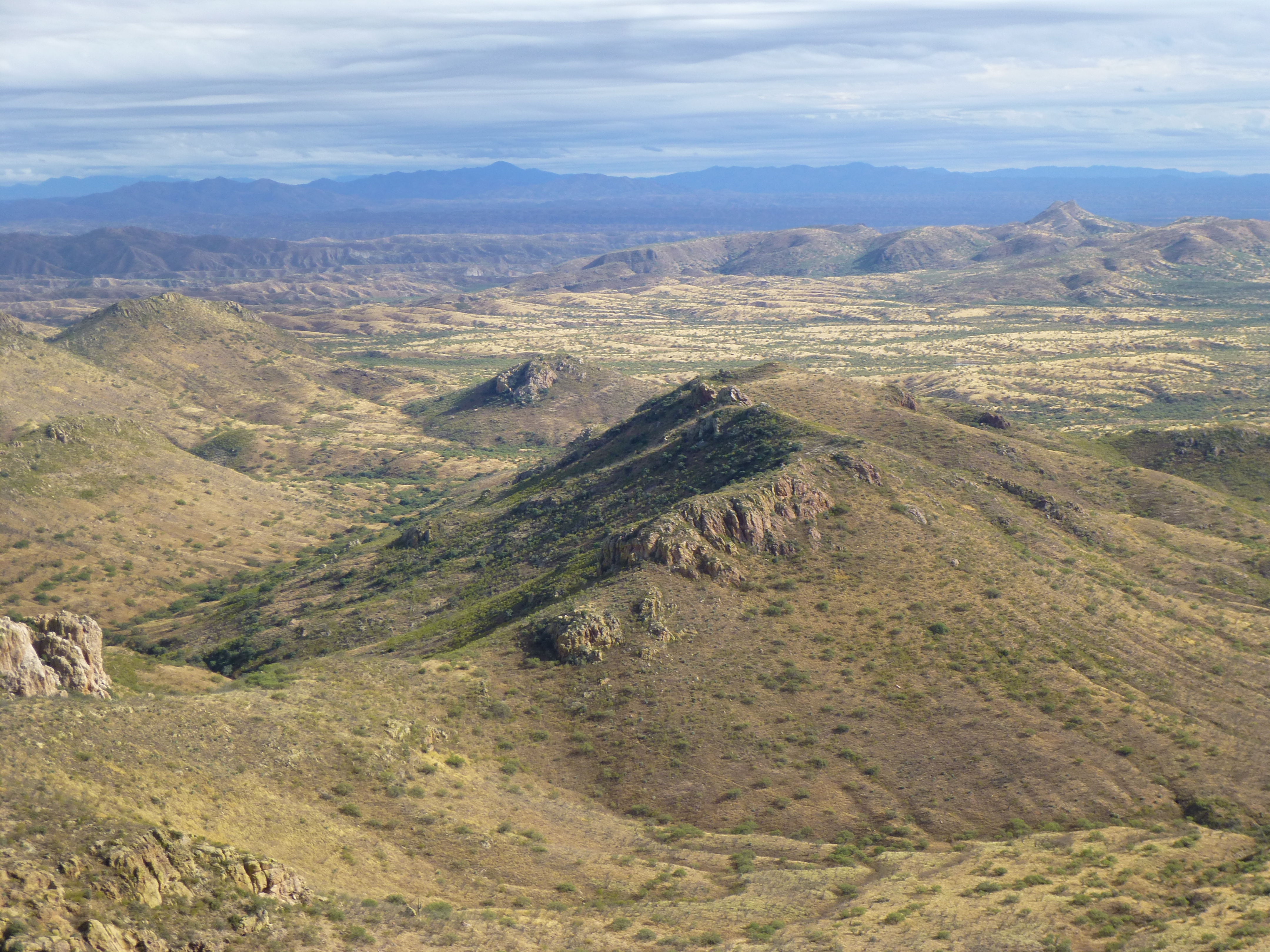
Looking east
A short distance farther east, we enter Santa Cruz County – we have now reached Mile 215.3. Still in the Coronado National Forest, we pass through a series of deep north-south valleys alternating with ridges – this is wild, rugged country. Bad Guys abound. Near Border Monument 130, atop one ridge we reach a new high, 4,950 feet, at Mile 227.7, and are entering the Pajarito Mountains. Here’s a view of the highest point of that range, just across the border into Mexico – this photo was taken from Border Monument 128.
If we travel only 6 miles more, we are at Mile 233.7, and at Border Monument 127. But this isn’t your ordinary BM – something happens here that only happens once along the entire length of Arizona’s southern border. The border changes direction!!
Now, instead of heading on a bearing of 108 degrees, our border heads due east on a bearing of 090 degrees. Before long, we leave the higher mountains and, at Mile 239.5, we leave the national forest. A short distance later, we enter the outskirts of the city of Nogales. This is another of those border communities where the majority of the inhabitants live on the Mexican side. Nogales, Arizona has a population of 20,000 while Nogales, Sonora has 215,000. At the heart of the city, we stand at Mile 241.6. This is a bustling city which has depended on tourism for decades, but drug cartel violence in recent years has put a damper on that.
As we continue east and leave the city behind, we pass through rolling hills, and at Mile 250.2 we enter another section of Coronado National Forest. We continue climbing into the Patagonia Mountains until we reach a new high point – 5,800 feet at Border Monument 114. These mountains have a rich history of mining activity going back more than a century. Once again, we drop down to lower country, the San Rafael Valley, leaving the national forest behind at Mile 258.6. Soon after, at Mile 260.5, we come upon a curious spot known as Lochiel. This place has a fascinating history, some of which can be learned at this website. We find ourselves in a wide expanse of grassland, part of which is now encompassed by San Rafael State Park. The Santa Cruz River forms within 10 miles of here, and flows south across the border at Mile 262.0 into Mexico. After describing a loop, it swings back north and crosses into Arizona at Nogales, then heads north to fade into the desert beyond Tucson.
Moving on, at Mile 265.6 we find ourselves back into another section of Coronado National Forest. A few miles beyond that, we enter Cochise County at Mile 271.6. Aside from that political boundary, everything else still looks the same – mesas, canyons, ranches. Now we’re in the Huachuca Mountains, a range which rises to 9,466 feet in Miller Peak to the north. The national forest ends on a ridge at 5,911 feet, our highest point yet, where the Coronado National Memorial begins at Mile 282.1. As we continue east, we drop steeply until we leave the memorial at Mile 285.6. This is ranching country, and we’ll stay in it for a long while.
At Mile 290.0 we cross the San Pedro River, a small stream, really (it flows from Mexico north into Arizona), then carry on eastwards. It’s not long before we come to our 5th legal border crossing at Naco, Arizona. Here, at Mile 302.0, we find an area that has been much-changed for the worse by smuggling into the US. It’s another cross-border town, where once again most of the people live on the Mexican side. Naco, Arizona has 1,000 people, whereas the Mexican side has 6,000. If you travel a few more miles to the east, you can see the historic city of Bisbee to the north, and by Mile 310.5 the Mule Mountains have come right down to the border.
Next, we’ll cross a long stretch of the very flat Sulphur Springs Valley to finally arrive at our last border community. At Mile 324.9, we roll into Douglas, Arizona, population 17,000. And just like all of our other towns on the border, there sits a much larger community on the other side. Agua Prieta, Sonora boasts a population of 80,000. Moving on, we leave the valley behind and find ourselves climbing into the Perilla Mountains, whose spine we cross at Mile 334.5. We soon drop down again to the San Bernardino Valley and find ourselves back in ranch lands.
Looking east to the Perilla Mountains
Here’s a view looking east from Border Monument 80 to the distant mountains on the New Mexico border.
We’re on the home stretch now. As we continue east, we climb back into mountainous country and stay there through a continuous array of hills. Once we reach Guadalupe Canyon, we’ve reached our last border range, the Guadalupe Mountains. At Mile 355.3, we cross from Arizona into New Mexico and we’re done!
Over a span of 30+ years, I’ve had the good fortune to visit many of those border miles, and in so doing have had many adventures, nearly all connected to climbing in one way or another. Some of those days were terrifying, others were puzzling, but most were exciting and enjoyable. Sadly, these days much of our border has been overrun by Bad Guys smuggling drugs and people into the USA, and that has dramatically changed how climbers deal with mountains along the frontier. Things will probably get worse before they get better.