
Please be sure to read the previous 2 installments of the story before starting this one.
Where we left off, Dave and I had just completed a climb of the Kupk Hills, our favorite one of the entire trip. From the summit, I had phoned the mechanic about my wounded truck and had been informed that they’d need 2 more days to have it ready. There wasn’t much choice but to keep on climbing, and that’d be fine, as we had 2 more still to do.
The next group of hills we wanted to visit was the Gu Vo Hills, located in the famous (or should I say infamous) Gu Vo District. Let’s deal with the name – it is more properly Ge Wo’o, which means “Big Pond” in the O’odham language. About 2 years before this story occurred, Dave and other climber friends were visiting this area to climb some mountain range high points. They were being guided by an O’odham man who lived on the reservation and in his company the entire time. As they entered the Gu Vo district in a convoy of several vehicles, they saw a sign which informed everyone in no uncertain terms that outsiders were not welcome. This was driven home to them a day later when they were apprehended by the Tohono O’odham Police as they finished a climb on the Mexican border. The police told them all, including their guide, to get their sorry asses out of the Gu Vo District immediately and to never return, or risk being cited or arrested. The surprising thing about this confrontation was that their guide was a native O’odham who lived on the reservation and who had every right to travel freely anywhere on O’odham land. This would be the equivalent of someone who lived in Oregon and was told by police in California that they were not allowed to visit there, and to go back home and never return.
Granted, the Gu Vo District is in an awkward location. It sits in the extreme southwestern corner of the reservation, far from anywhere, and right along the Mexican border. Indocumentados strive day and night to sneak across the border, moving drugs and immigrants into the US. It has the smallest population of any of the districts, coming in at a whopping 739 residents. 438 of them live in the village of Gu Vo, the district headquarters; another 265 live in Ali Chuk, down by Menager’s Dam and the Mexican border; the remaining 46 live in Pia Oik. The population of all of these communities continues to decline. The area of the Gu Vo District is about 400 square miles, meaning that there are just under 2 people per square mile – that translates as mostly empty land.
The name Gu Vo is used for several features on the map. Obviously, the district itself; the main village; Gu Vo Pass, which lies just to the NW of the village; and Gu vo Wash. The wash begins high on the eastern slope of Mount Ajo, almost 3,000 vertical feet above the village, and flows east for 23 miles until it dies a natural death when swallowed by San Simon Wash.
A year or two before we made this trip, Dave had proposed that we climb the high point of the Gu Vo Hills by a novel and surreptitious route. He suggested that we park along the shoulder of Ajo Mountain Drive in Organ Pipe National Monument, then head east across the grain, crossing numerous drainages, then following an un-named wash upstream for miles to reach Sweetwater Pass. Wait, we’re not done yet. Next, we’d head east and cross Siovi Shuatak Pass, then follow Siovi Shuatak Wash for several miles downstream, finally arriving at the abandoned site of Sweetwater. This was a journey of 10 miles, one-way. We still kid Dave about this scheme today. After he suggested his plan to us, it was met with remarks like “Sweet Mother of Jesus, are you out of your mind?!”
Understandably, we were a little paranoid about any time spent in the district, so what was our solution to the problem? We drove straight down into the heart of the district and parked at the site of Sweetwater – done! Here’s the view we had of the high point of the Gu Vo Hills, one mile to the southeast.
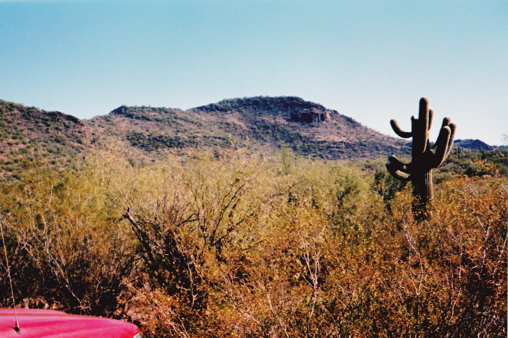
Easy -peasy
It was mid-afternoon by the time we set out, making a bee-line for the peak. Across the flats, then up an easy rocky slope to the summit ridge. The high point, Peak 2750, was at the south end. From the top, we had an excellent view of the village of Pia Oik about a mile to the southeast, but it’s what we saw next that really caught our attention.
Littering the area where we stood was a lot of trash, totally out of place. Food wrappers, plastic jugs, empty cans, even a pair of binoculars. This was obviously a lookout point used by Bad Guys to help ferry drugs and people into the country. Even as we stood there discussing this mess, something quite outrageous happened. Picture this: straight down the steep mountainside to the east, 700 vertical feet below us, ran the paved Indian Route 1 heading north over Pia Oik Pass and up to Gu Vo village. While we were looking down on to the road, a blue sedan heading north pulled over to the shoulder. The moment it stopped, three people who had been hiding in the brush down in the wash beside the road ran out and hopped in the car, which then sped off. The entire pick-up was so well-orchestrated, it only took seconds from start to finish.
We stood there, quite stunned by what had just transpired. Had it been for real? We certainly had something to talk about as we prepared a register and built a cairn, although it’s unlikely it would have stayed there for long with the illegal activity taking place. Then we happened to look back to where Dave’s truck was parked, and saw a white pickup truck pull up beside it, then somebody nosing around. Was it police, or a tribal member? Seeing that made us a bit paranoid. The truck didn’t stay there for long, but it gave us pause. Here’s a picture of us on the summit, not looking much like we’re in a partying mood.
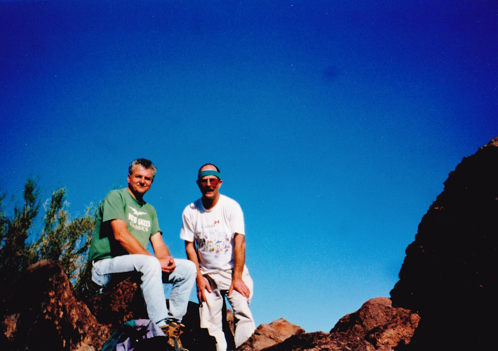
On Peak 2750
It only took half an hour to make it back to the truck, after the climb of 750 feet. You can bet that our climb was the topic of much conversation for the rest of the day. Once at the truck, we drove north through the Barajita Valley, through the village of Gu Vo and almost all the way back to Highway 86. Our next goal, and the last of the 11 we would climb, was a peak in the Gunsight Hills.
Allow me to tell you some things about the Gunsights. It is a fascinating group of hills. At one end, hard by Arizona Highway 85 which runs south through Ajo down to the Mexican border, we find the far western edge of the Gunsights. Lewis Benchmark rises 240 feet above the pavement, looks right down on it in fact, and its slope tumbles right down to the very edge of the highway. The hills continue east a few miles, where we see Gunsight Benchmark rising above the site of what once was the Surprise Mine. In fact, the benchmark is surrounded by lots of old mining activity. A mile north of the old mine is the village of Schuchulik, which some folks simply call Gunsight. Now the proper name of this place in the O’odham language is S-chuchuligk, which means “Many Chickens”, which has to be one of my favorite names on the reservation – it is home to 90 souls. The hills hop and skip farther east across a wide belt of land, much of it low but with here and there a peak. It is here, out in the middle of the Gunsights, where we find the high point (we’ll come back to it soon). Continuing east, we cross over Indian Route 1 and find another large chunk of the hills. This area includes Ninemile Peak and 3 others, where the hills finally fade out in the vicinity of Little Chief Mine. From west to east, the Gunsight Hills therefore extend a full 16.5 miles and include a wide range of topography. The name appears on several features in this area, namely: Gunsight Hills; Gunsight Benchmark; Gunsight Valley; Gunsight Cemetery; Gunsight Wash; Gunsight Pass and, finally, Gunsight (the long-abandoned mining community by Surprise Mine).
Our final goal today sat to the east of Indian Route 5. We found the dirt track we needed and drove east along it for 1.6 miles to where it ended by an old ruined stone wall. It was getting late, so we camped here for the night.
Day 5 – January 23, 2001
Early the next morning, we set out for our final summit. Heading mostly east, we crossed a saddle just south of Point 2391 – from there, we caught our first glimpse of Peak 2790 to the southeast, and in another mile had reached its base. It was an easy climb up the last 300 feet on the northwest side. On top, there was no trace of any previous visit, so we left a cairn and register. It was bittersweet – our last peak, but we’d made our way to all 11 and climbed them all with no mishap. Returning the same way, this one required 3 miles round-trip, about 2 hours and 750 feet of gain. Here’s a view of the peak, as seen from another one a mile to the east – it’s the dark one on the right.
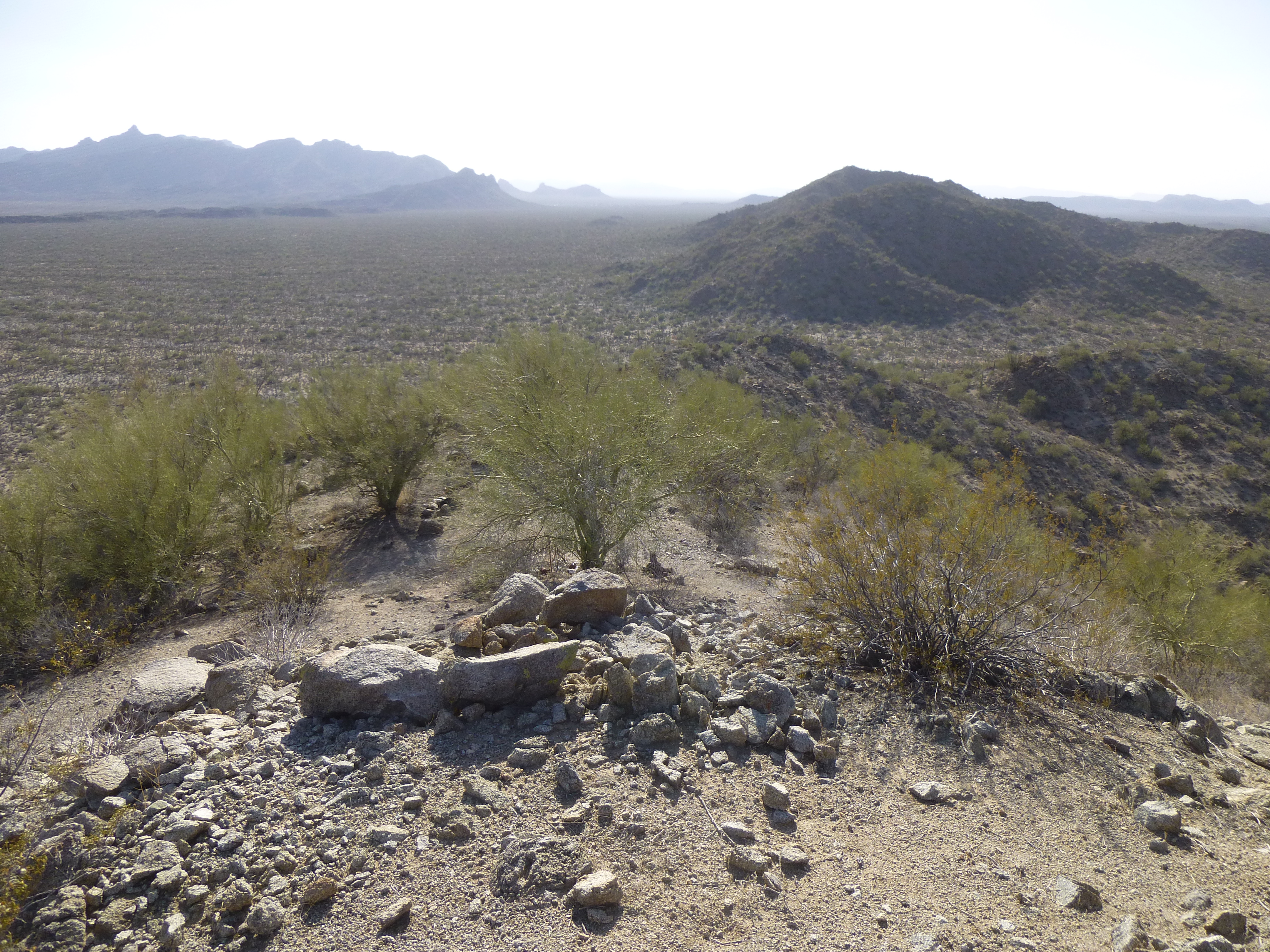
Looking west to Peak 2790
And one final mug-shot, taken on the summit.
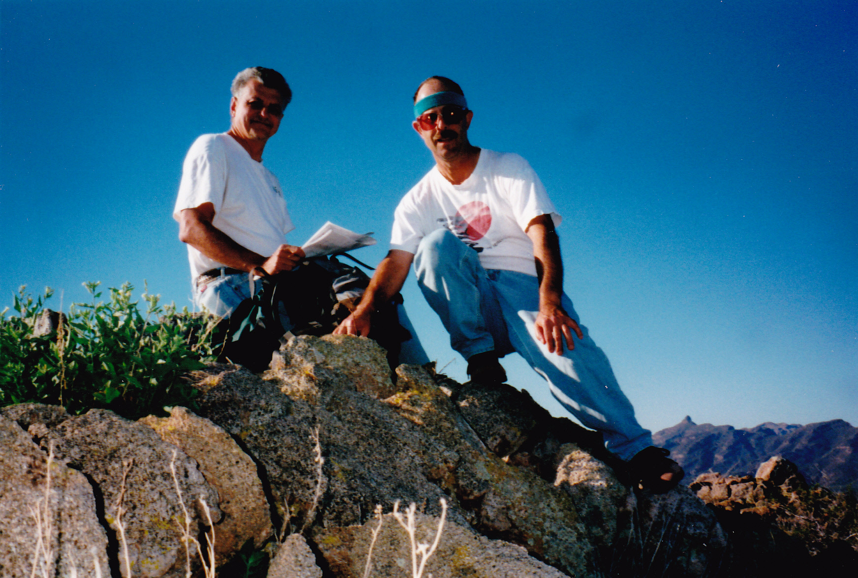
On Peak 2790
Here’s a bit of trivia for you. See the skyline in the lower right of the photo? That pointed summit is Peak 4088, only 5 miles to the southwest – an exposed and exhilarating climb we would pioneer 3 weeks later.
That’s it, we were done. We drove into Ajo and retrieved my truck – It turned out that the alternator they had installed was a piece of crap which failed utterly a year later. To celebrate our trip, we ate a Mexican meal at Don Juan’s restaurant, then said our goodbyes. Dave returned to Los Angeles and I to Tucson.
It seems appropriate to summarize our climbs of the 11 hills groups on the reservation. I’d like to share with you a few statistics of each one, namely the size of each set of hills and also how many peaks are in each group, as well as anything else that seems relevant.
Black Hills (west) – 2.0 miles x 4.4 miles, with 4 peaks. Nice peaks, nice area.
Black Hills (east) – 1.2 miles x 2.5 miles. No peaks at all, really. The high point doesn’t have enough relief to count as a real peak. There is a named hill, but it is even shorter.
Copperosity Hills – 2.3 miles x 4.5 miles. 8 peaks in all. Very remote, with beautiful peaks. Highly recommended.
Gu Vo Hills – 2.3 miles x 14.4 miles. A total of 7 peaks. Exciting, deep in the heart of No-Man’s Land.
Gunsight Hills – 3.5 miles x 16.5 miles. 9 peaks in all. Easy access.
Ko Vaya Hills – 3.3 miles x 3.8 miles. 3 peaks. Compact group, easy access, not isolated.
Kupk Hills – 2.5 x 6.7 miles. 4 peaks, including the best climb of them all. Also includes the only 1K prominence in all of the hills groups.
Sil Nakya Hills – 2.7 miles x 9.3 miles. 3 peaks, easy access, near settlement.
Topowa Hills – 0.9 miles x 1.7 miles. The smallest group, only 1 peak, near a town.
Vaca Hills – 3.9 miles x 4.3 miles. 4 peaks, quiet, pretty area.
Vaiva Hills – 5.7 miles x 6.2 miles. The most peaks, with 12. Good access.
I wanted to mention that Dave has prepared excellent trip reports for each set of hills, so contact me if you want any of them.
There is one small matter I’d like to discuss before signing off. It came to our attention that a name had been dropped on another group of peaks, using the term “hills” to describe them. The name seems to have arisen with the Arizona State Department of Transportation on June 27, 1984 and was used on county highway maps. The USGS does refer to the DOT use of the name, but the simple fact is that even though the USGS published an updated map of the area in November of 2014, the name Noipa Kam Hills does not appear on it. Our take on this is that until such time as the name appears on a USGS topo map, it isn’t official and doesn’t really exist. The USGS had a full 30 years to put it on their updated map, but chose not to do so.