
My home of Tucson, Arizona is situated in the Sonoran Desert, but you don’t have to travel very far east before you find yourself no longer in it and in the Chihuahuan Desert instead. If you find yourself in a place where saguaro cacti don’t grow, then you’re not in the Sonoran Desert. That was the case when one October morning, Dennis and I drove to the area of Tombstone to try a few peaks.
It was just after sunrise when we neared our destination, about 7 miles east of town, where the landscape was a checkerboard of private and state trust land. The area map showed several roads leaving paved Davis Road, all heading in the direction of our peaks. We pulled up to our first choice of gates, got out of the truck and walked up to have a good look. It was the work of only a few moments to see that the massive chain holding the gate closed was held on by a daisy-chain of the strongest locks that money could buy. The gate clearly displayed a “No Trespassing – Private Property” sign that couldn’t be ignored. Okay, let’s find another gate, something a little more user-friendly. A mile down the road, there was another, but it too was locked as tightly as could be.
We hadn’t given up yet. In all our driving around, there was a third one we had passed, so over to it we went. Crap – same thing! No way we were getting through any of them. A big part of the problem was that we didn’t know the area, so had no knowledge of any alternative routes to the peaks. Before giving up completely, there was one last option still open to us. A final gate stood between us and our peaks, and it had better work or we were sunk.
This gate was interesting – it bore no signs warning us away, nothing at all saying we could not enter. The one small sign it did carry simply asked us to close the gate after we had passed through. It too was closed with a chain, but as wimpy a one as you could ever use. One of the links had been replaced by a piece of wire, which was easily un-done, and Bob’s your uncle, we were through. That done, we found ourselves near some large white pipes which seemed to be part of a natural gas line, but nothing else. Further study of the map showed that one of the locked gates that stopped us earlier was about 2,000 feet to the east, and it appeared to connect directly to a road that would take us to our peaks.
All we had to do now was get over to it – easier said than done. There was some fairly open ground along the fence-line, which we drove for several hundred feet. When that ended, we found ourselves staring at a sea of weeds, six feet tall and seemingly impenetrable. Dennis walked ahead to find the path of least resistance and I followed in the truck. It was like driving through a jungle, mowing down this strange growth as we went. This too ended, and we found ourselves in a more open area. Still heading east, we came to a simple gate – once through that, there we were on the road we sought.
Now we’re talking! It seemed like now it’d be a straightforward drive north through the desert along this road all the way to our peaks. I have an app on my phone which shows my position in real-time on a topographic map, and this can be a real help in confusing terrain. Dennis was navigating while I drove, but we were shocked to see that after only a couple of hundred feet along this perfectly good road, it abruptly ended at an expanse of open field. The desert had been plowed with some huge piece of machinery which had stripped off every piece of vegetation, leaving deep furrows across our path. Thank goodness for high clearance. Dennis kept us following a track where the road would be if it still existed, and after half a mile or so of bouncing up and down as we crossed the furrows, the cleared area ended and we found the original road once again. Finally!
A few miles of easy driving on tired dirt roads took us all the way to what was known as Mesquite Windmill, then half a mile beyond, to a spot where the road was washed out at 4,820 feet elevation. We readied our day packs and set out in a northwesterly direction at ten minutes of nine in the AM. In short order, we arrived at a large metal tank.

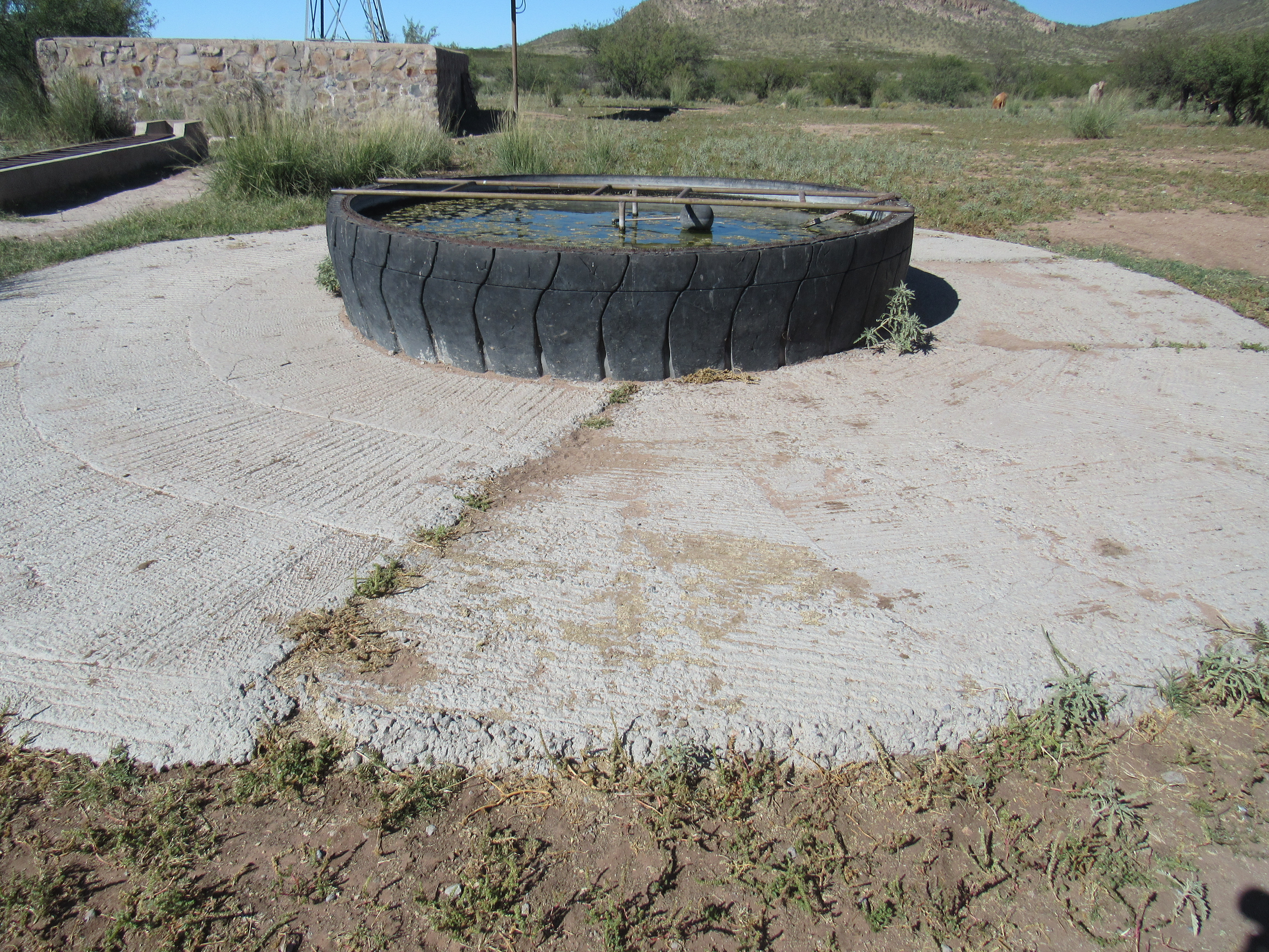
A good place for a drink
There was plenty of water there, but we were baffled as to how it got there – we couldn’t see any source, neither coming downhill from some kind of gravity feed nor anything else. The entire affair was set on a massive concrete base. See the water open to the sky part-way up from the base? That white thing on the water is a float, which keeps the water at just the right level for cattle to drink.
We carried on uphill towards our first summit. It was slow going, with a lot of loose rock underfoot and a lot of thorny bushes to push through, and a surprisingly steep southern slope to negotiate. Even though I was slowing us down, we still made it to the top of Peak 5206 in under 50 minutes.
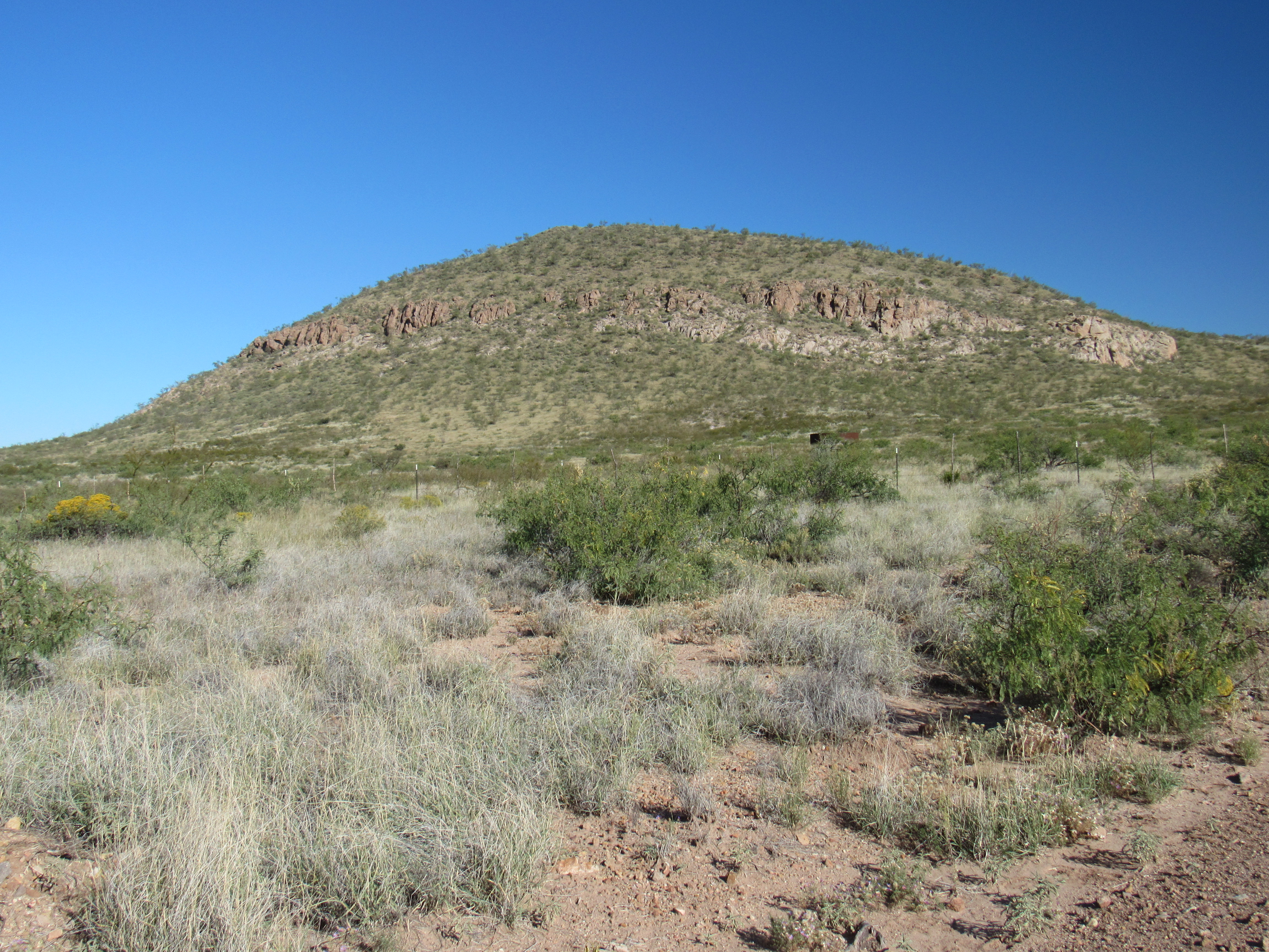
Looking to Peak 5206
There was no sign of any previous visit, so we built a cairn and left a register. Our plan for the day was to climb 3 peaks in one big loop – this was the first one done. From its summit, we looked across the valley to the east to our next one – it had a name, Stockton Hill, and it stood 400 feet higher.
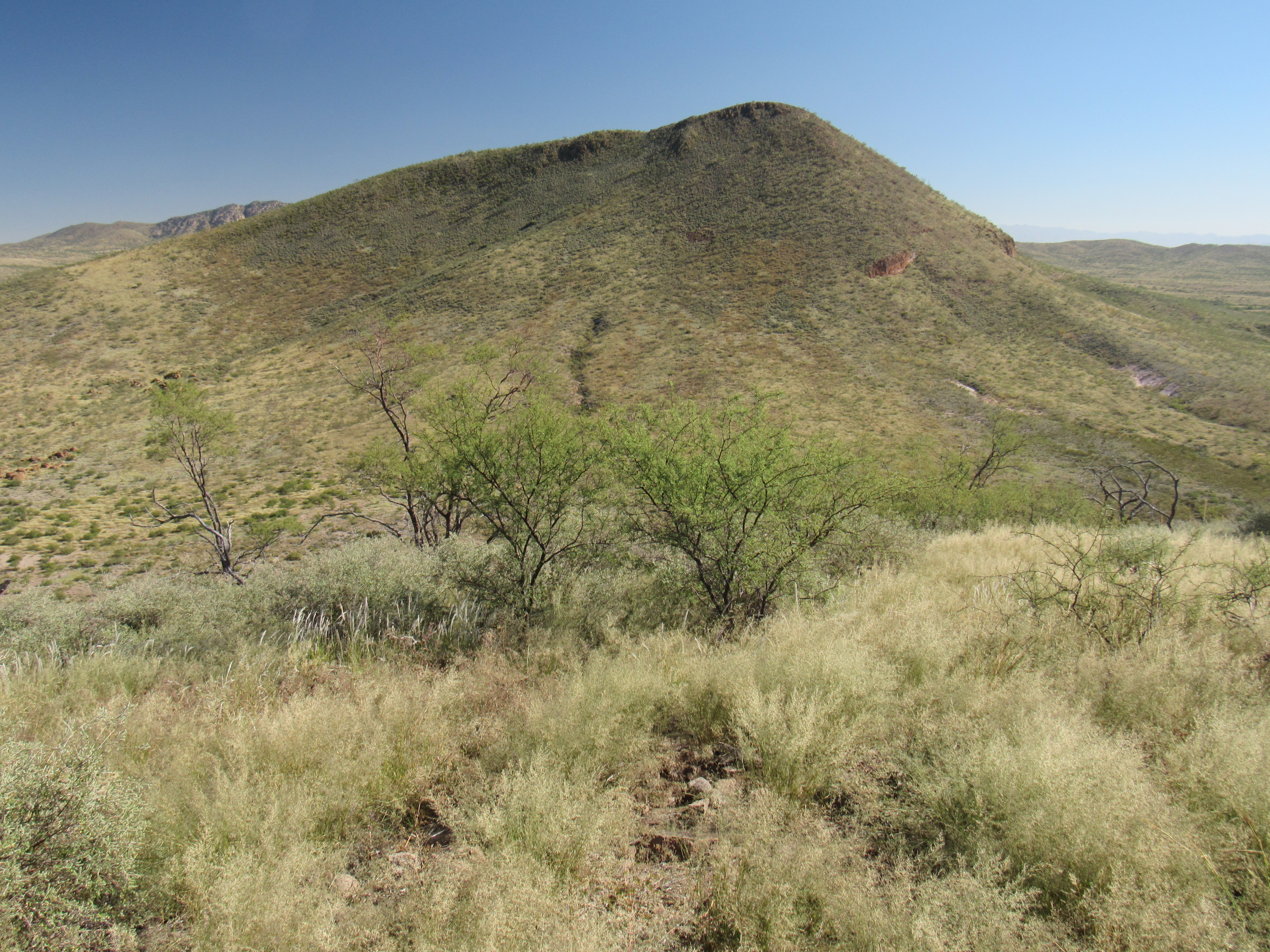
The west side of Stockton Hill
It was an easy descent to the saddle below. Once there, we started up the 700 vertical feet to the next summit (for those of you who do not climb, that’s like climbing the stairs to the top of a 70-story building). I was going so slowly, it was embarrassing – it took just over 2 hours from the first summit to the second. The entire mountainside was covered with loose rocks and made for slow, slippery going. Once on the summit ridge, we walked the last bit to the 4-foot cairn that had built by previous visitors.

Atop Stockton Hill
It was obvious that many had preceded us, so we poked around in the upper rocks until we found a glass jar register. It was filled with papers others had used to sign in, some of the entries going back 30 years. We signed in, then sat back and enjoyed some lunch. In the next photo, you can see our earlier peak in the upper left part of the photo.
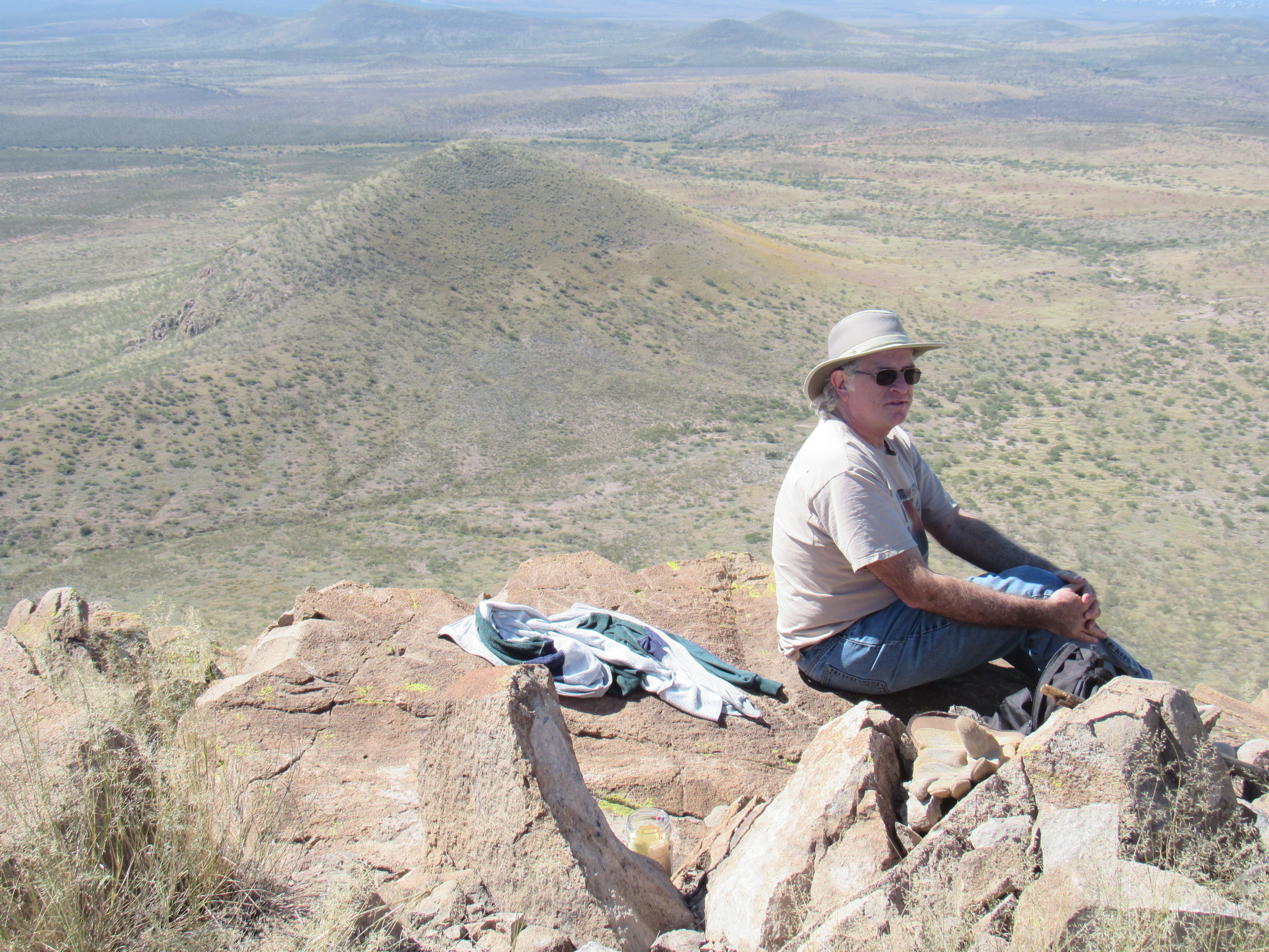
Talk about a scenic lunch spot! Dennis is sitting on the top edge of a cliff.
Ever since I’d seen the name “Stockton Hill” on the map, I’d wondered why that name had been chosen for this mountain. I mean, that’s normal right? I think we all wonder about the origin of place names. Fortunately, I have a wonderful book called “Arizona Place Names” by Will C. Barnes. It’s my go-to reference for anything Arizona, as it explains the origin of thousands of names. I was surprised to learn about Stockton Hill. It was named after old man Stockton, a well-known cattleman and character of the early days when Tombstone was booming, who settled in this region in the late 1870s.
Near the cairn sat a bench mark, which had been messed with to the point that much of the writing was illegible.
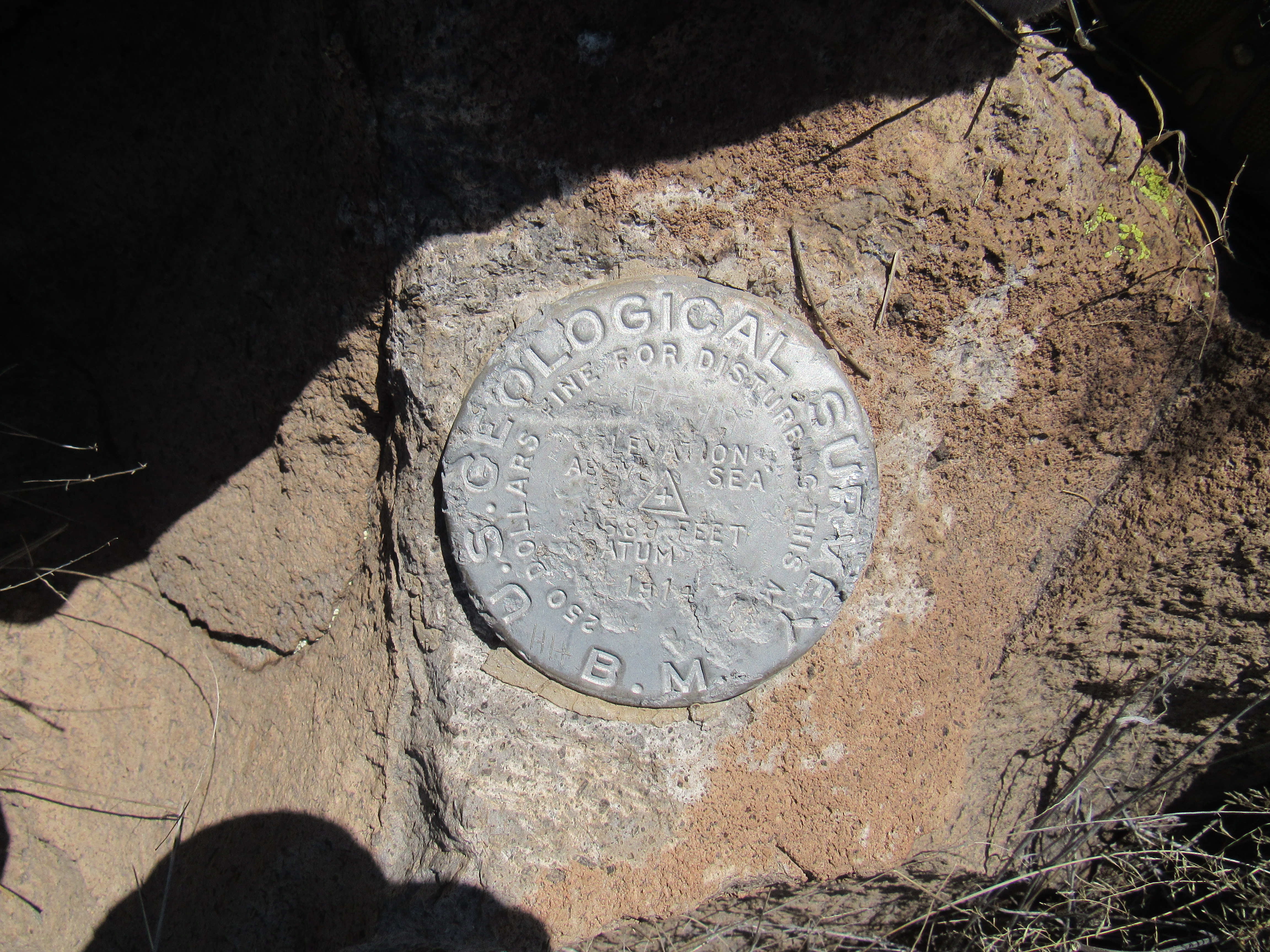
The benchmark
After a leisurely half-hour on the summit, we started down the south side. It was steeper than our ascent route, a full 45 degrees in places, so it bore careful stepping. The entire slope was like a mine-field of loose rocks, but after a while we made it down. I couldn’t help but take a picture of this agave that had recently bloomed – it stood a full 30 feet tall.
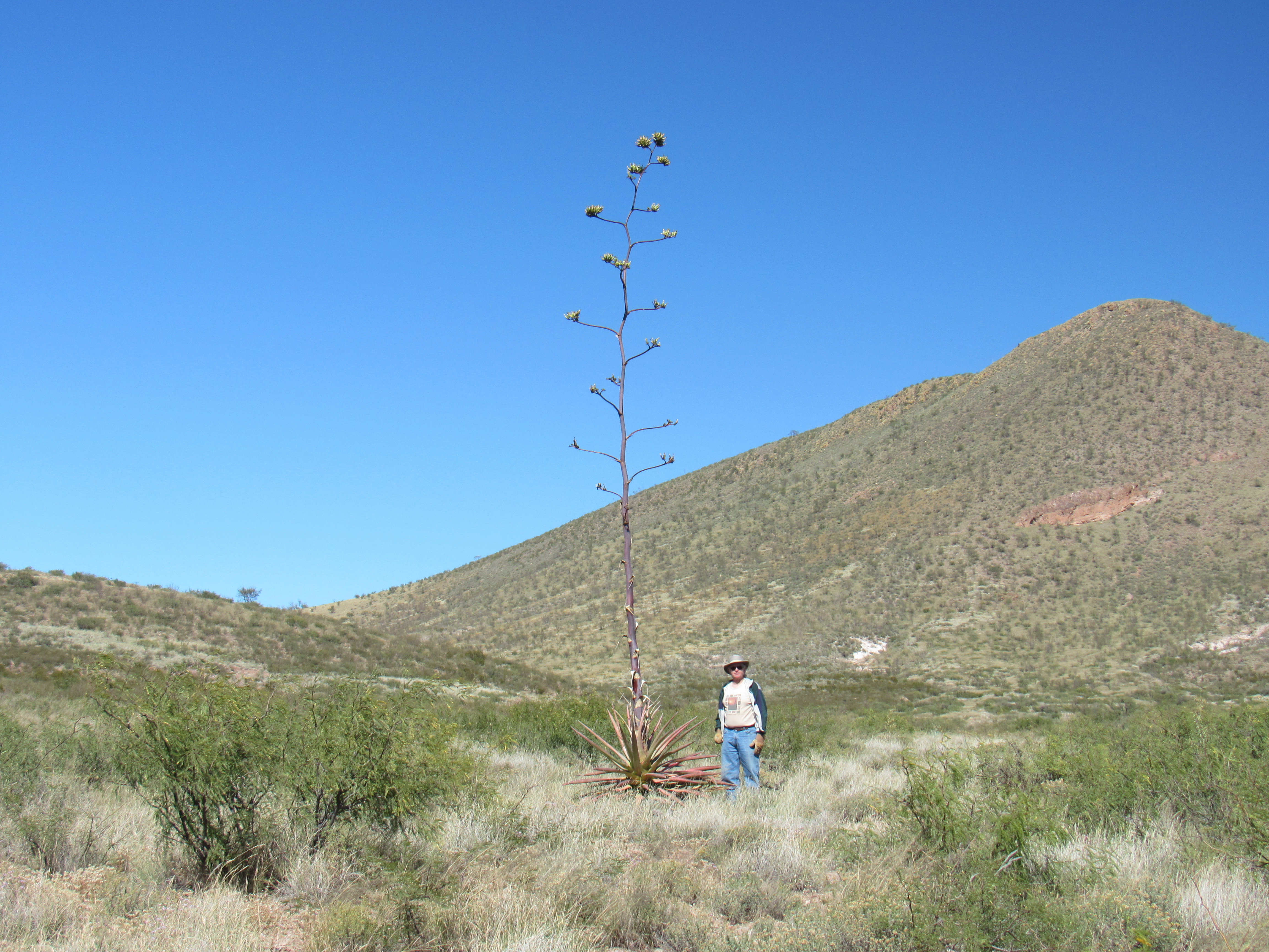
That’s some big agave!
Shortly after the agave, we arrived at the end of an old dirt road and found this strange apparatus on the ground.
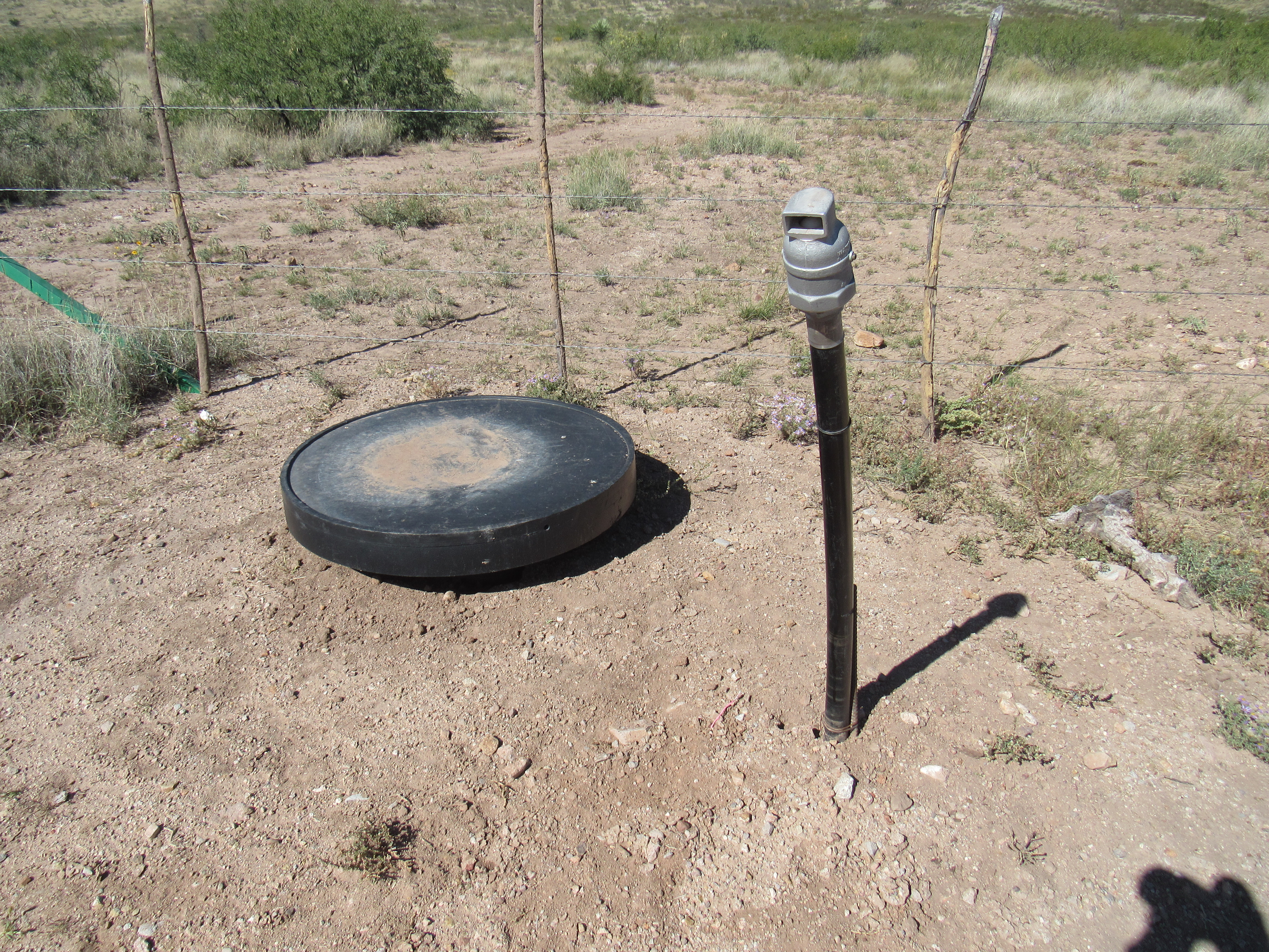
What the……..?
We lifted up the round thing and found ourselves looking down into a hole that was 3 or 4 feet deep. Sitting on the dirt at the bottom were a couple of valves that could be opened or closed, and we concluded that if both were opened, water could flow through a hidden pipe in the bottom of the hole and head uphill a horizontal distance of 700 feet and through a vertical gain of 25 feet to the big, rusty metal tank seen in the first photo of this piece. Okay, where did the water come from that passed through this hole? We were about to find out. Another 2,300 feet of walking took us back to where we were parked by Mesquite Windmill. Once there, look what we found – another one of the black things.
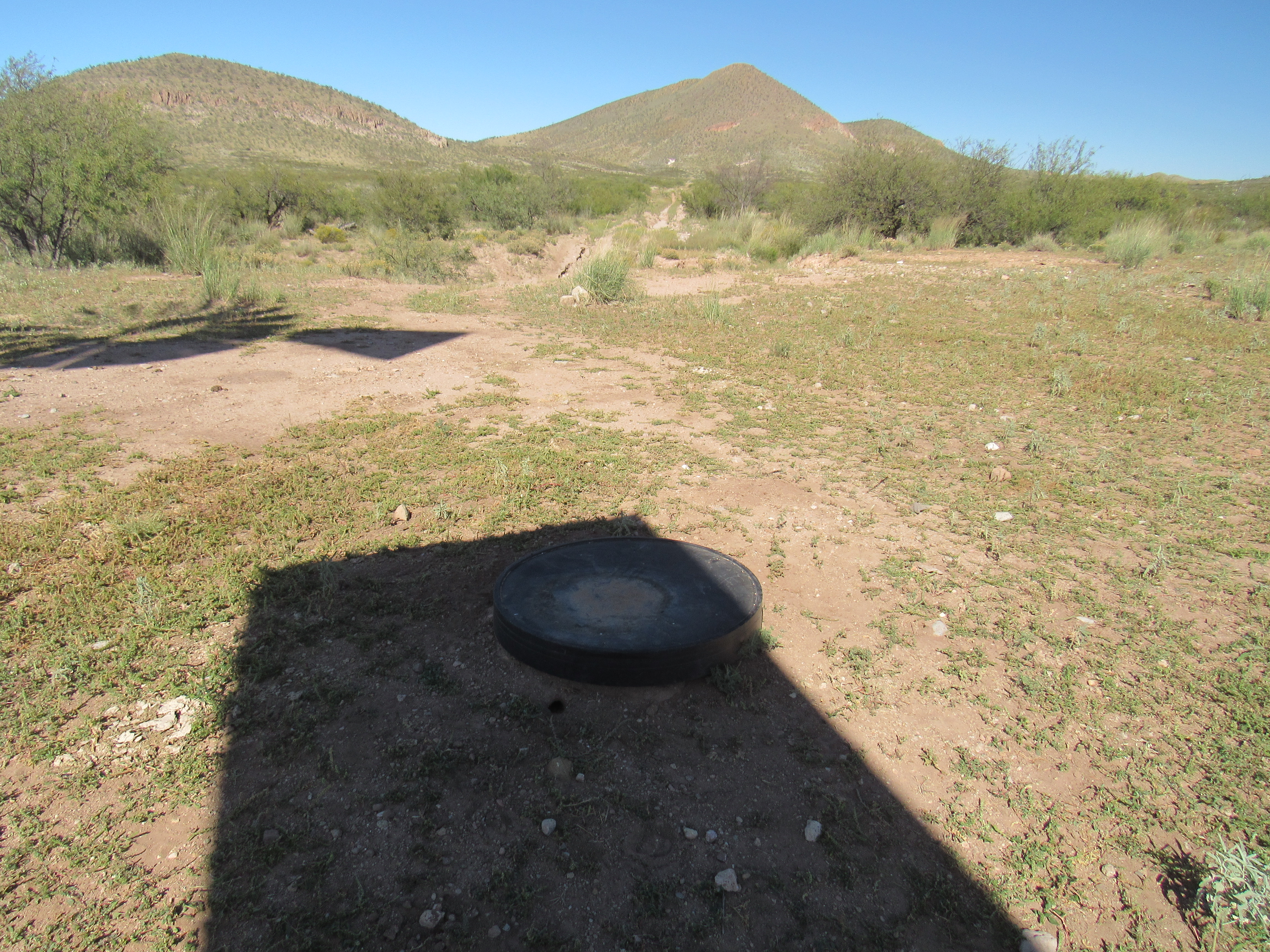
Another one
We found other things of interest a few feet away. The most obvious was this beautiful old Aermotor windmill. A quick glance showed that the long rod which connected the spinning blades at the top to the apparatus at the bottom which brought water to the surface was not there. Things were falling into place.
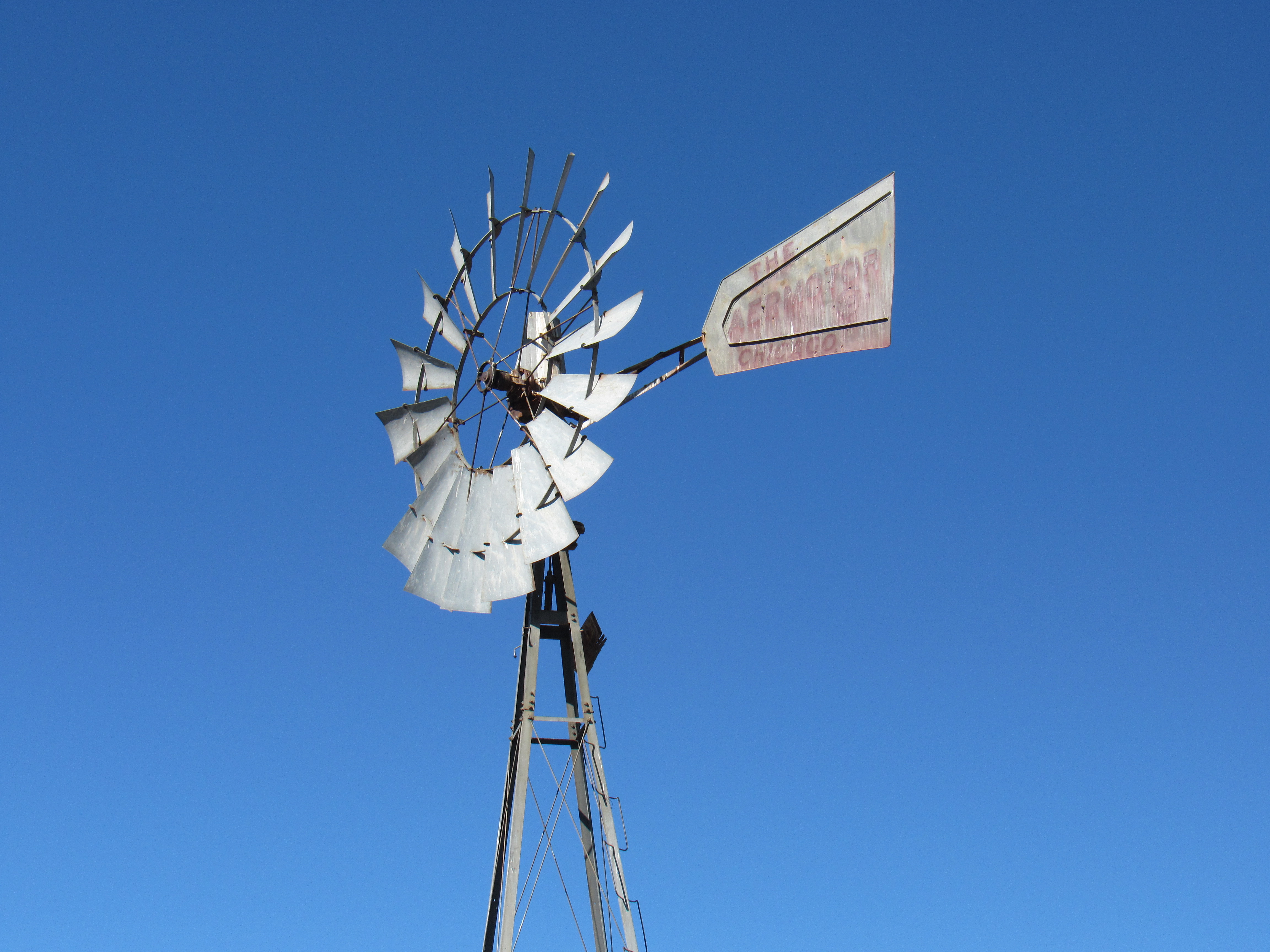
The fine old Aermotor windmill
So where was the water coming from? There was plenty of it around, like this.
Plenty of water for cattle, other animals and even human passers-by.
Our presence disturbed (but only briefly) these locals.
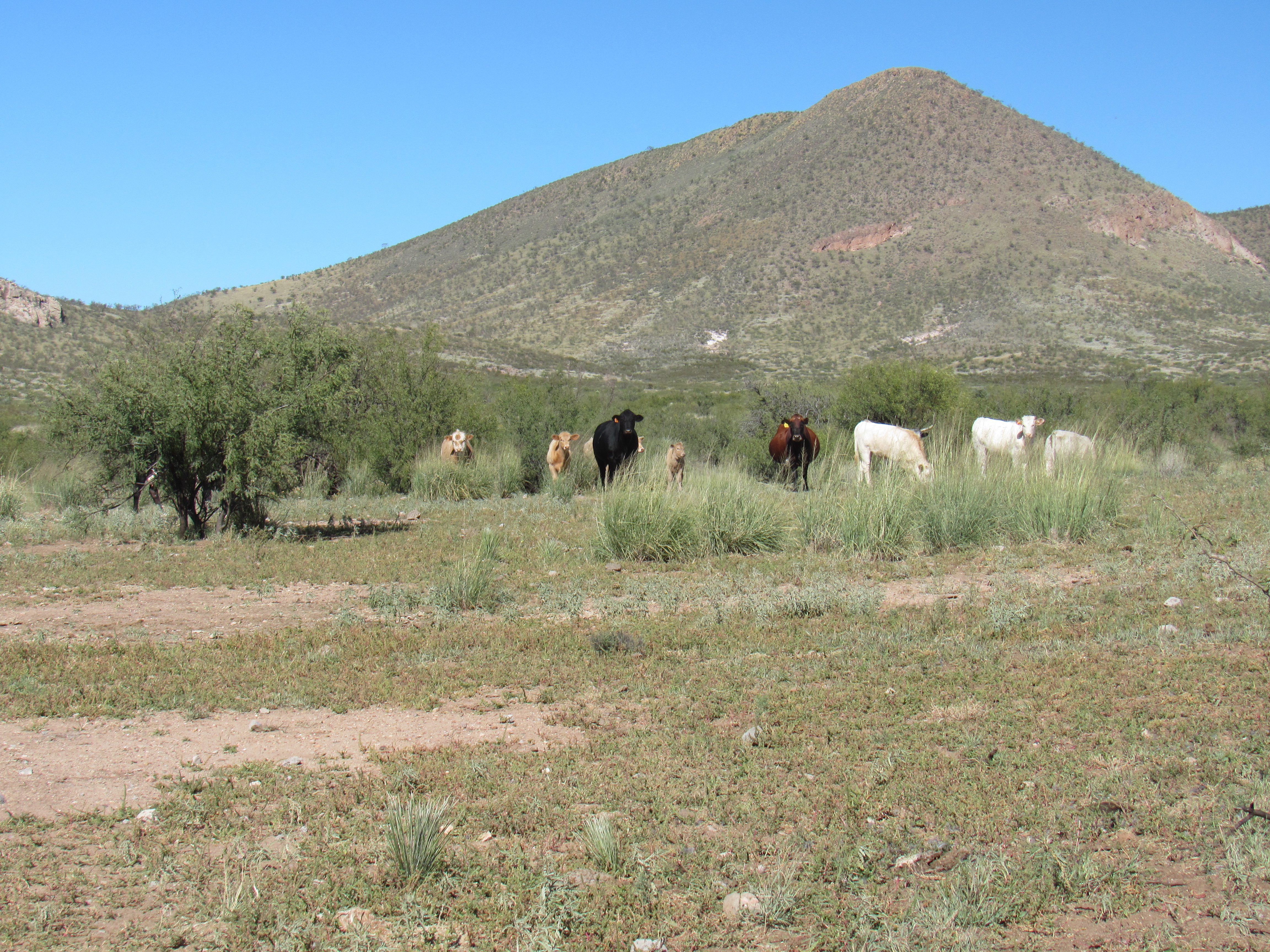
Moooo.
Finally, we figured it out once we saw these solar panels.
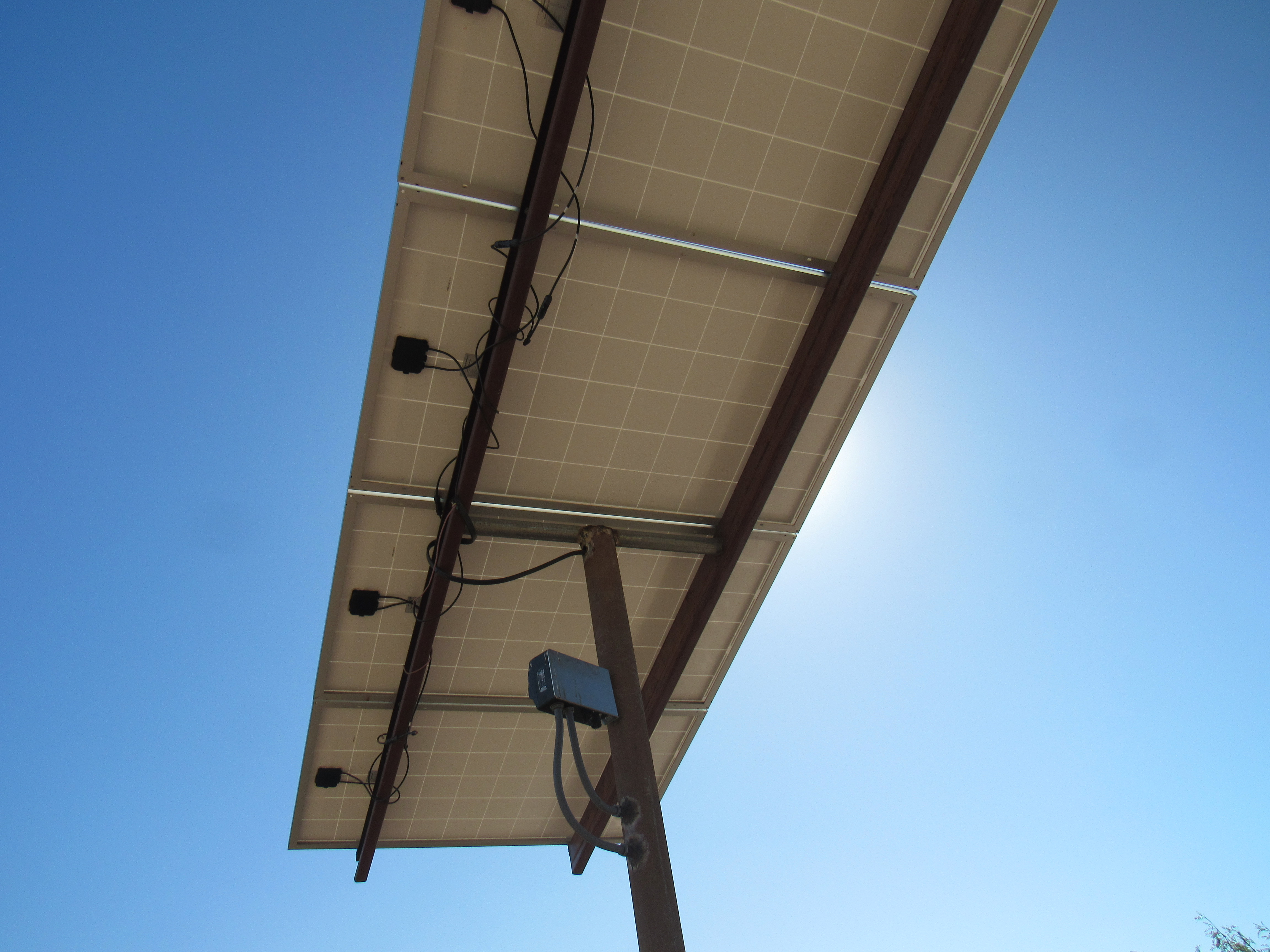
The missing link.
So here’s how we pieced it together. The solar panels provided the power for a pump hidden somewhere nearby, probably underground. The pump kept the large masonry tank filled (see 3 photos back), which in turn would gravity feed the round black tank (also see 3 photos back) to provide water for cattle to drink (see the float mechanism on top of the black tank). Remember the 2 round black covers sitting on the ground? By opening the valves down inside those holes, the electric motor could pump water uphill all the way to the large rusty metal tank a full 3,000 feet away.
After a while spent by the windmill, we headed back out along the several miles of dirt roads to finally arrive at the only useable gate, our ticket to pavement.
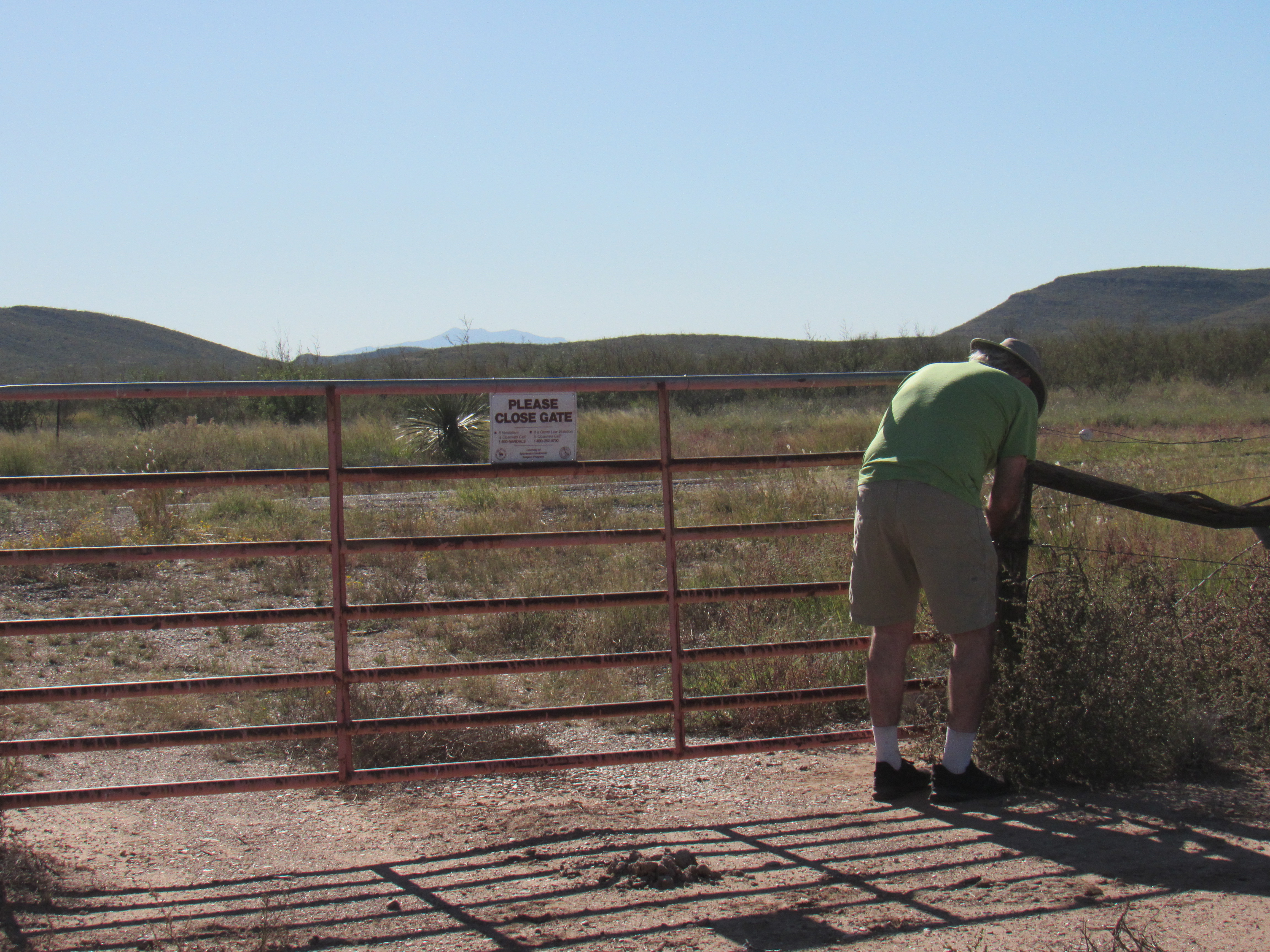
The one true gate.
So after a day of some surprises, everything had worked out in our favor in the end. The most important thing is that there had been no mishaps.