
So what did you climb on February 29th? Since it only comes around every 4 years, you might need to plan ahead to make sure you don’t miss it. One of my peakbagger friends told me to mark it on my calendar, and I was ready. Hey, you don’t know how many more February 29ths you have in your future, right, so you have to seize the moment.
In the world of peakbagging, some peaks have a road to the top – if you can drive it, that counts as a climb as long as you physically touch the highest point. That may sound pretty lame, but that’s the way it is. I had just come back from a tiring climbing trip, so I wanted something really easy. After a check of my map programs, I came up with one in a neighboring county that seemed to tick all of the boxes. I considered driving my car the 100 paved miles to the peak, but then I didn’t know if the dirt road to the summit required something with higher clearance. Safer to err on the side of caution, I decided, so I took the good old ’88 Toyota truck.
The day was fine, and before I knew it I was in Cochise County and motoring my way towards the peak. From a dozen miles away, I had picked it out from among a bunch of free-standing hills, and all appeared well. Here’s what I saw from the spot where I left the pavement, about a mile from the summit.
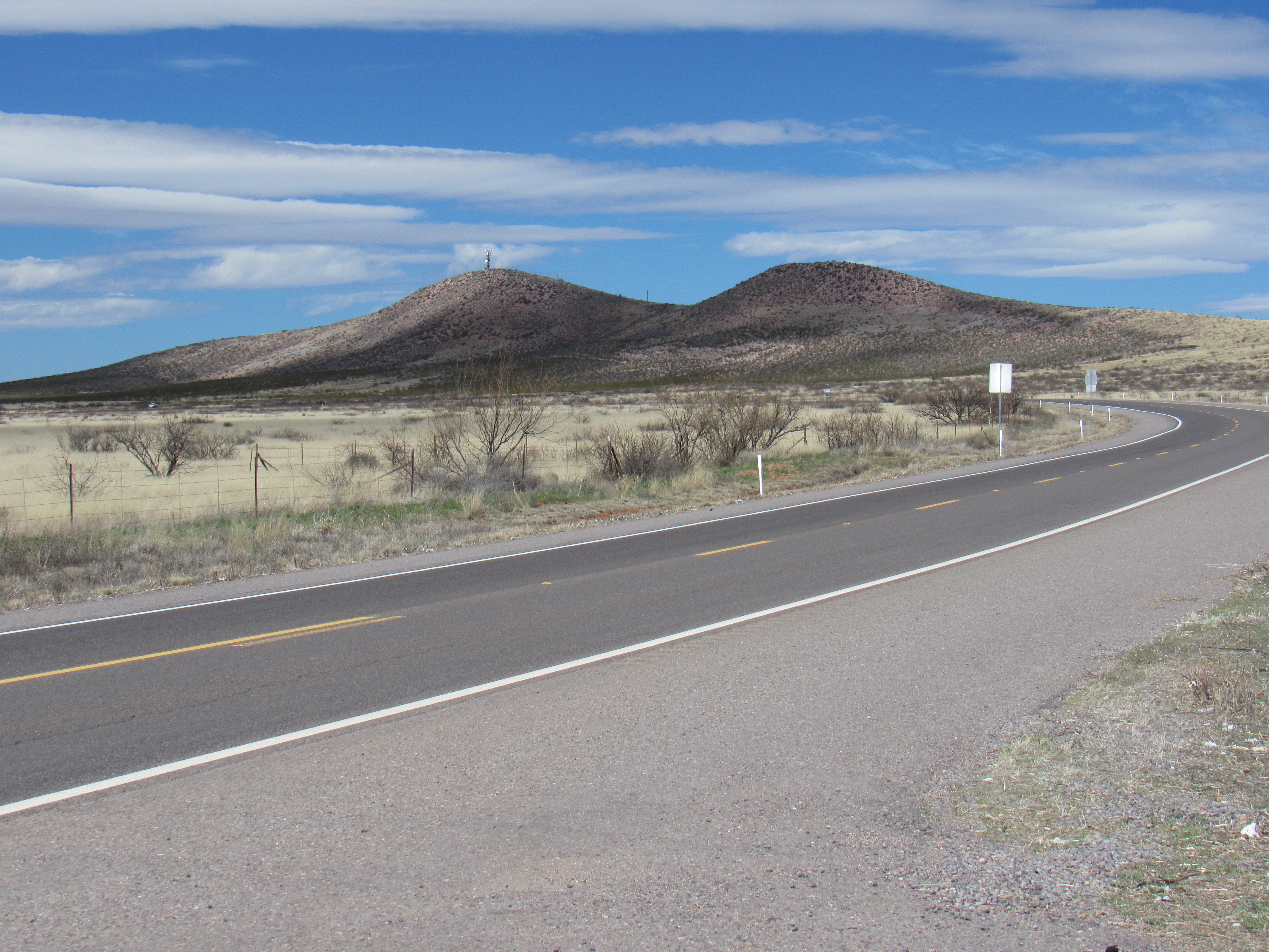
Turkey Creek Ridge to the northwest
There was a gate where I was to leave the pavement, but one like I’d never seen before.
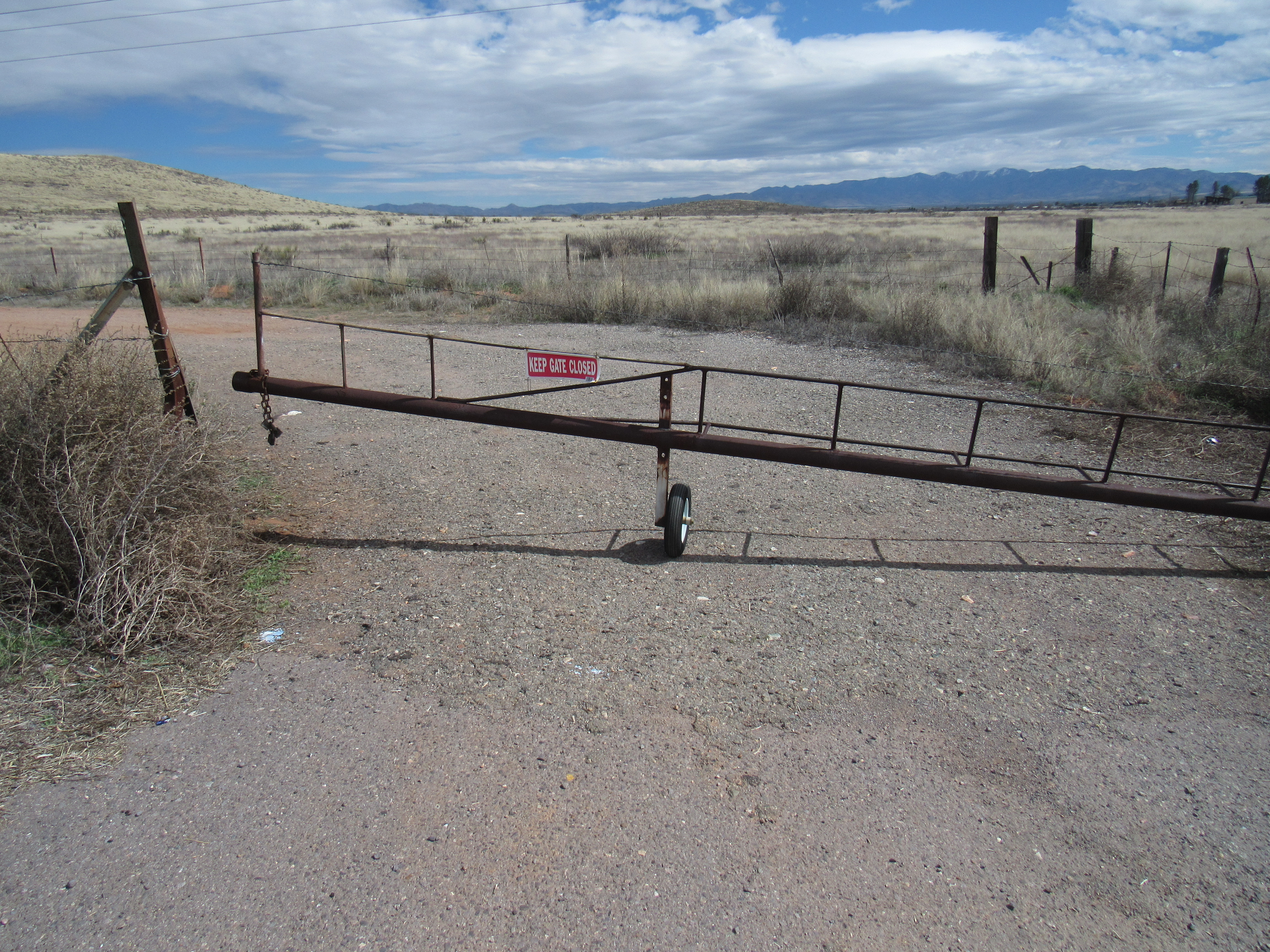
The rolling gate
It had one of those tires that doesn’t go flat. It took a lot of effort to roll the gate open far enough that I could drive through, but at least it wasn’t locked. This was at the start of West Well Ranch Road. The next 1.6 miles took me into open country, while climbing up 70 feet and over a low pass. Near an old abandoned ranch house, I turned from north to west and started up a lesser dirt road. A series of old wooden telephone poles carried power up to the mountaintop where sat a telecommunication tower.
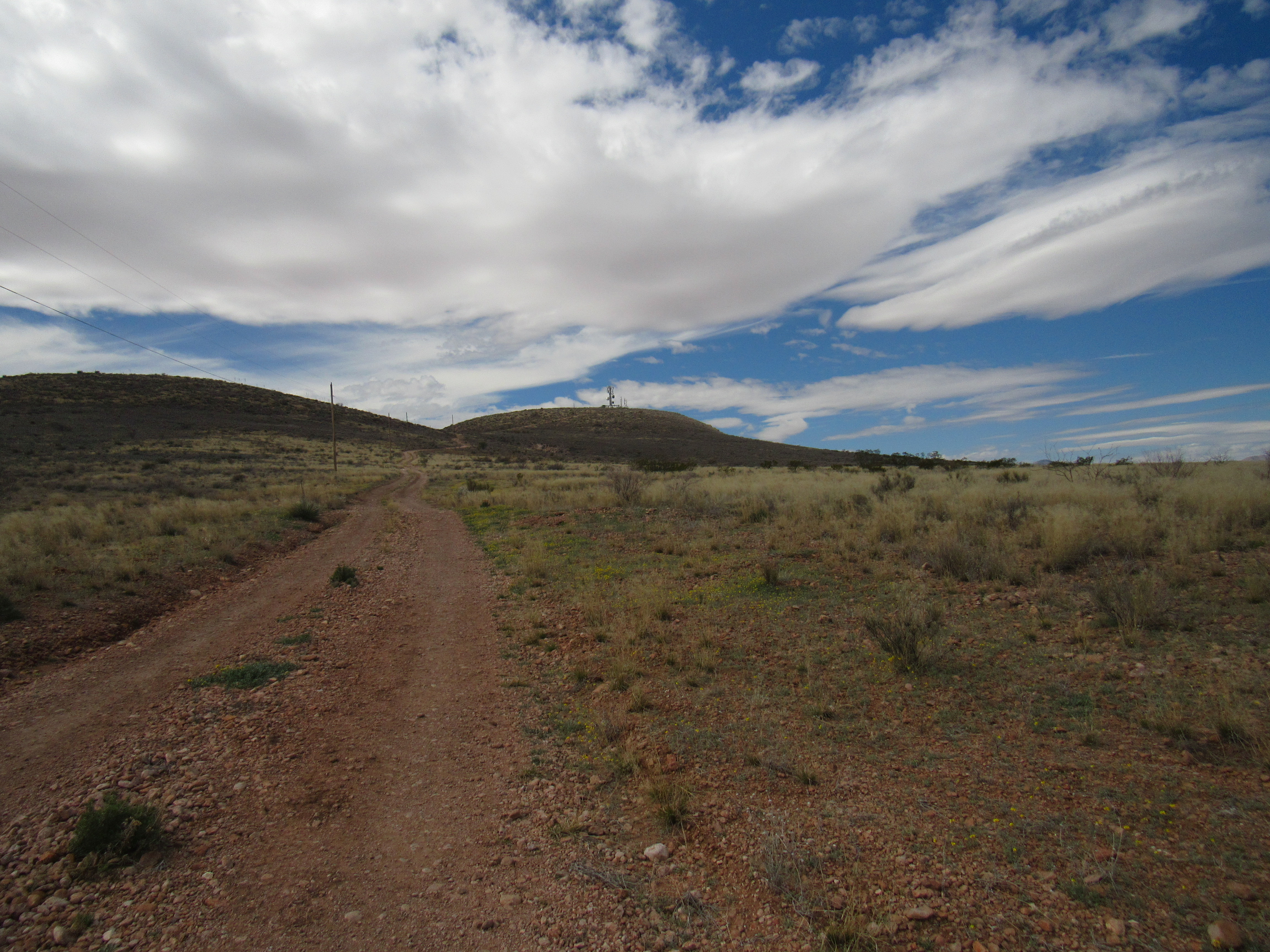
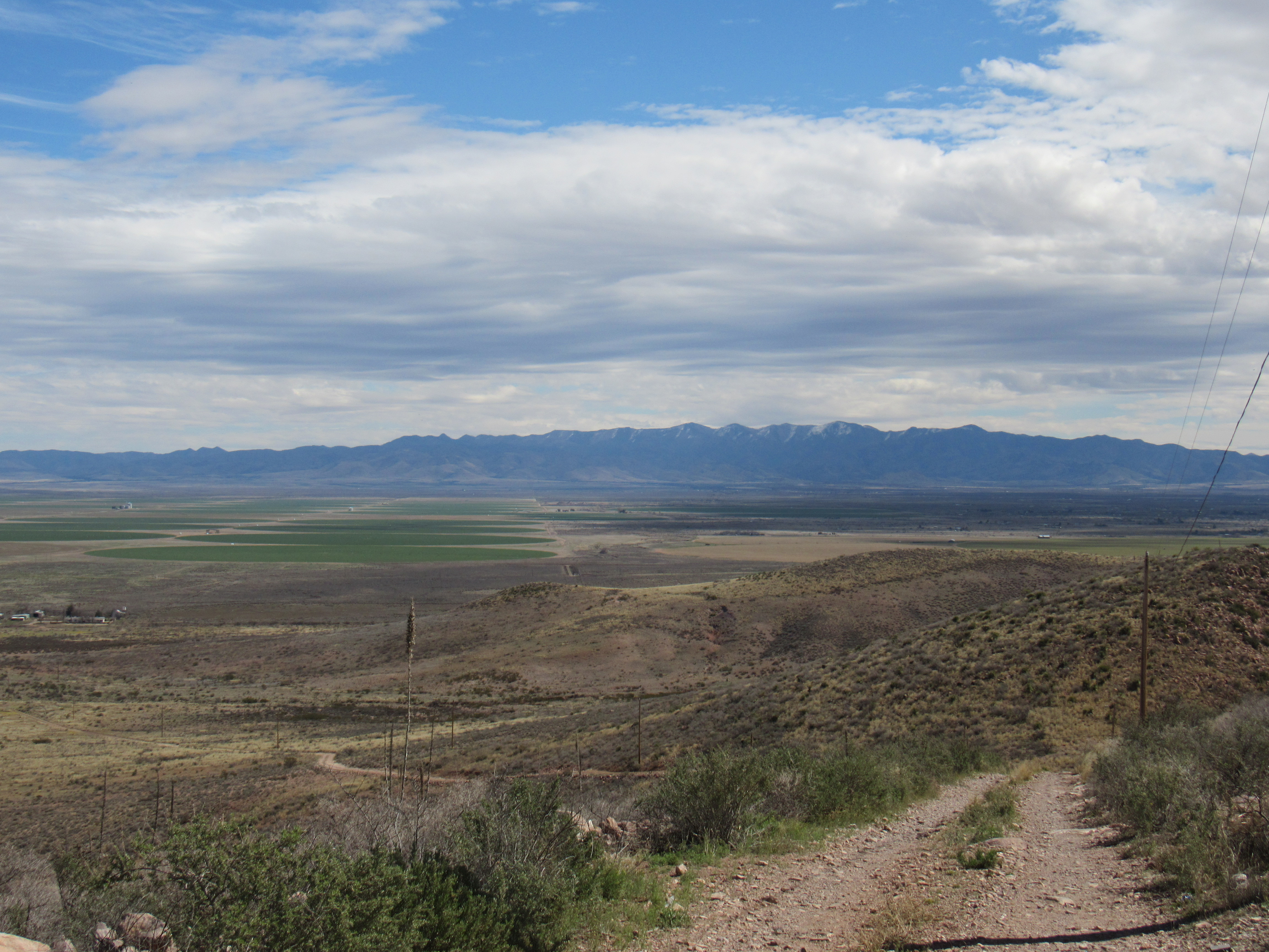
Looking west towards the summit
The road remained pretty decent for the next half-mile, but then took a turn for the worse. It became rocky in places and steepened – there was no way any car would have made it. I had the truck in 4WD and crawled slowly up the hill. The road ended abruptly at a nice flat summit. Over to the south side sat, undisturbed, a rocky outcrop which was in fact the highest point of Turkey Creek Ridge.
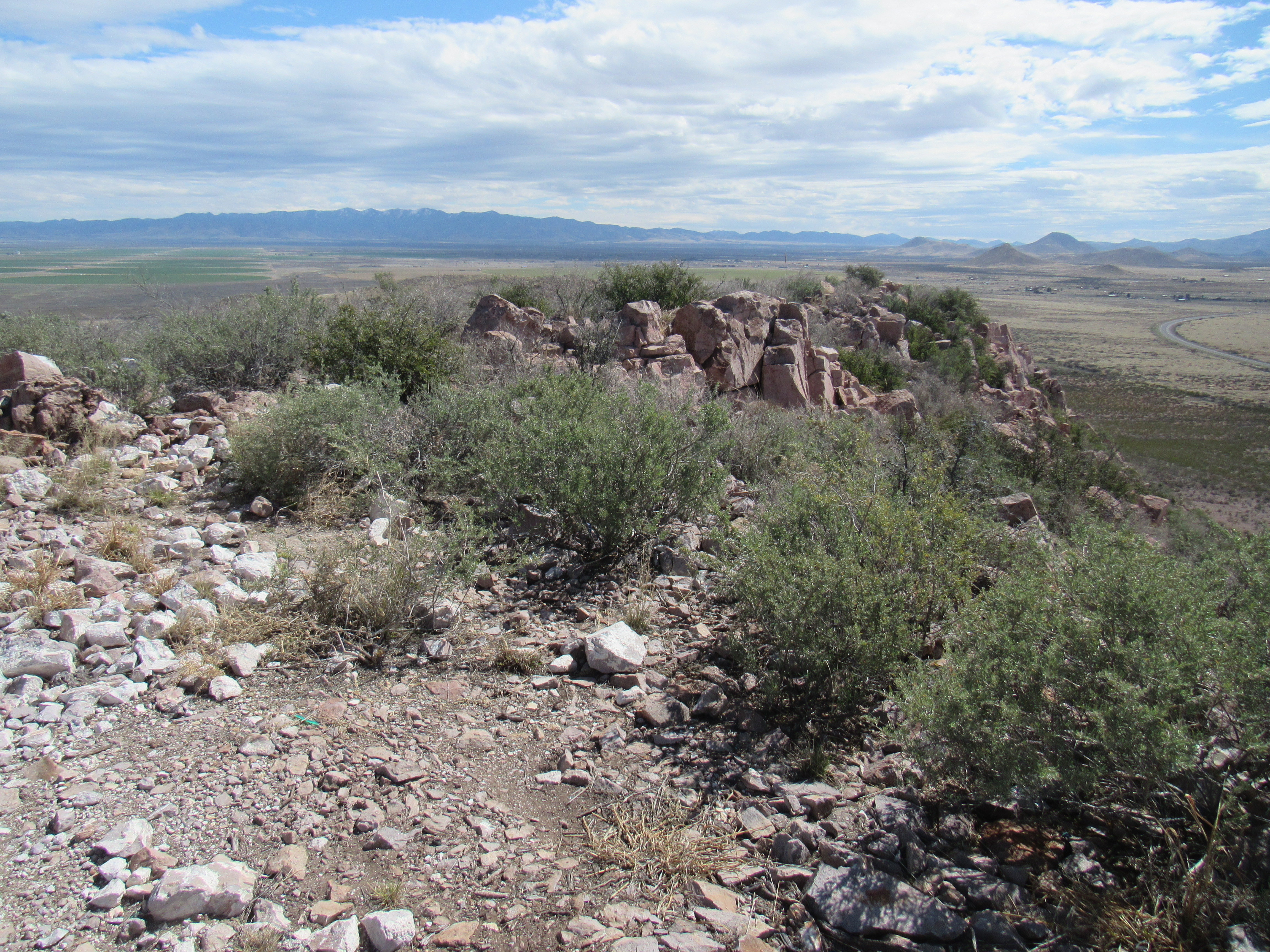
The summit
A large tower sat on the summit.
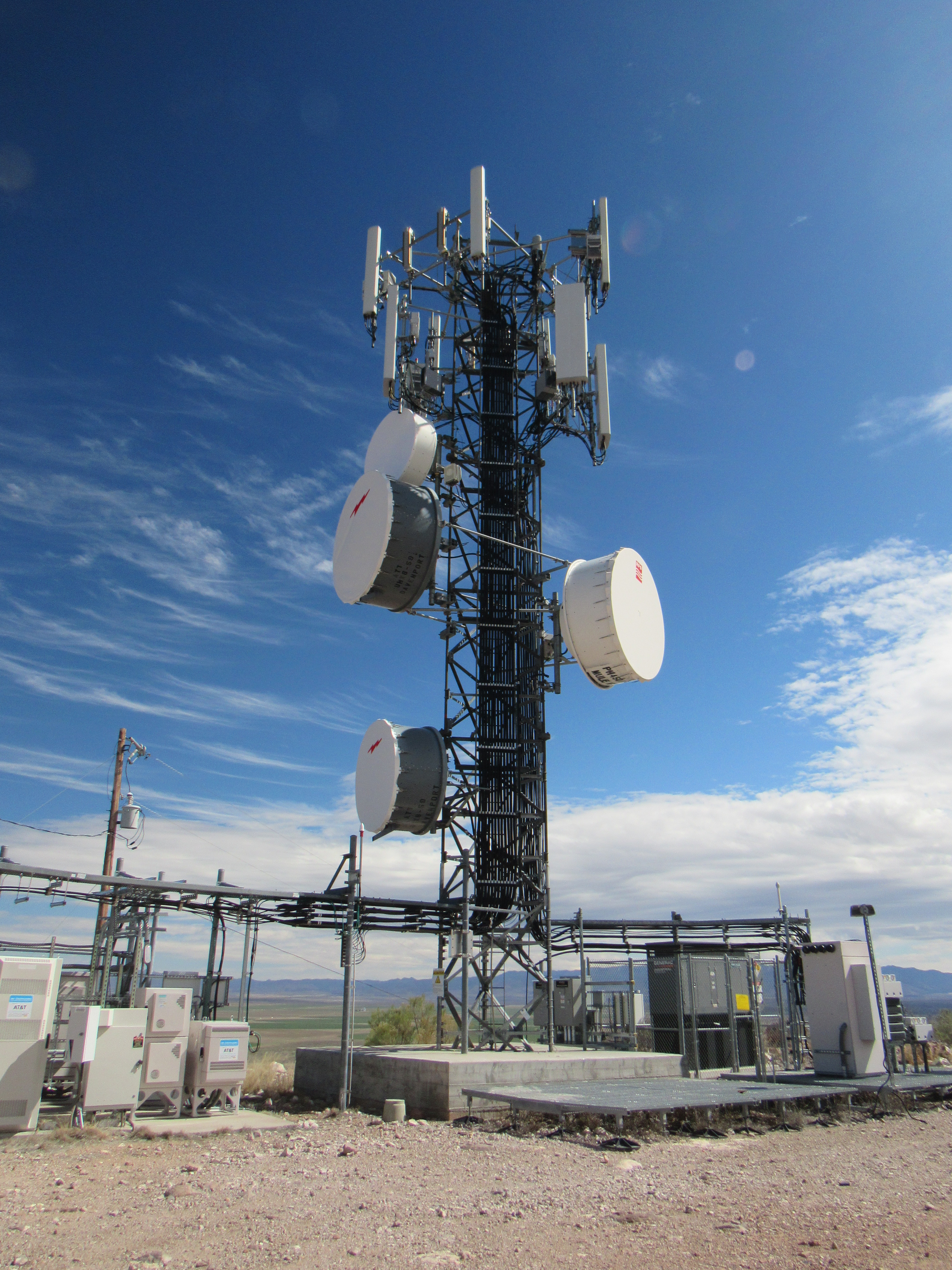
The tower
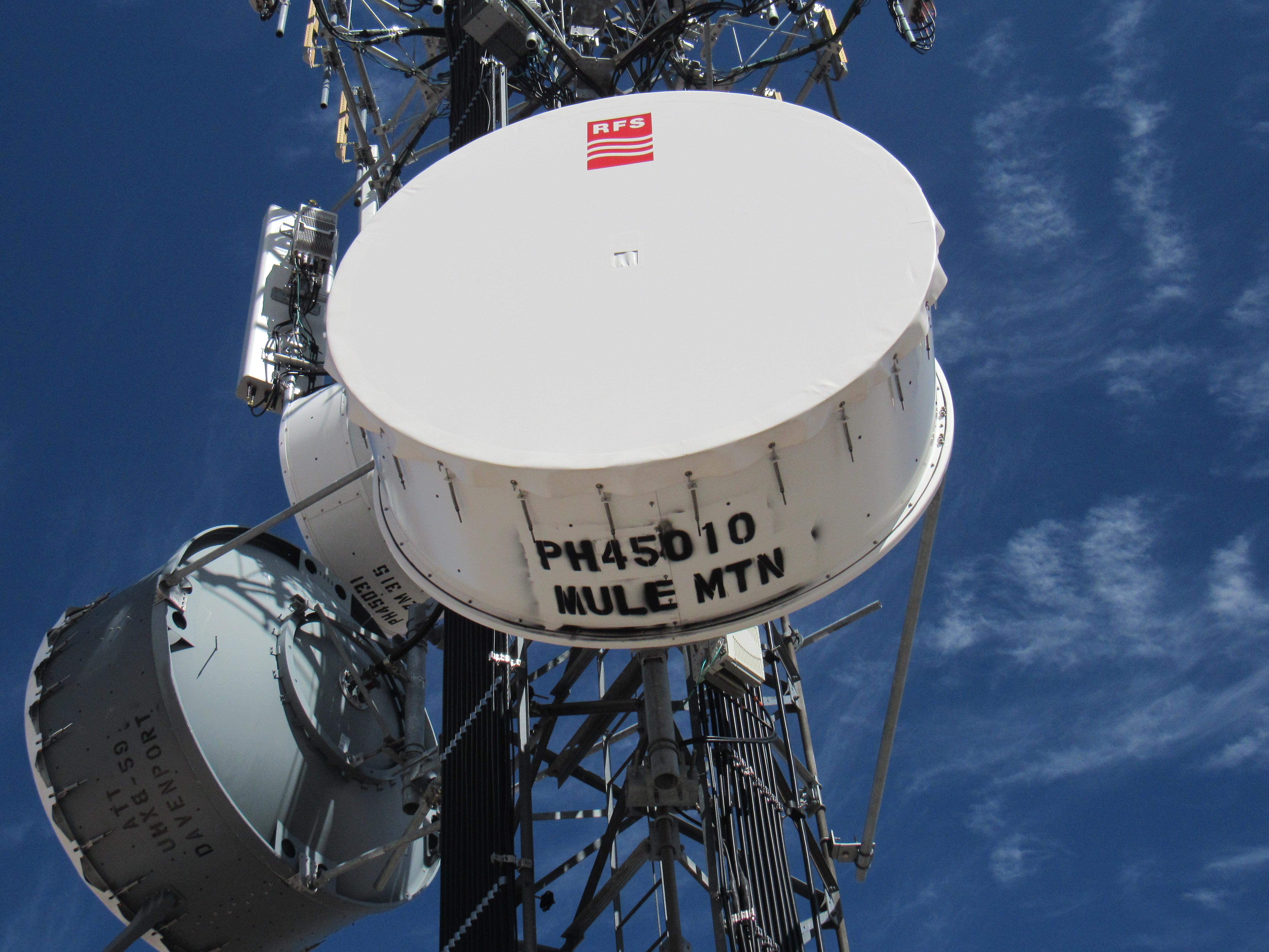
As I poked around, I saw that both AT&T and T Mobile used this tower to relay signals between the Mule Mountains and someplace called Davenport. Here are some photos supporting that.
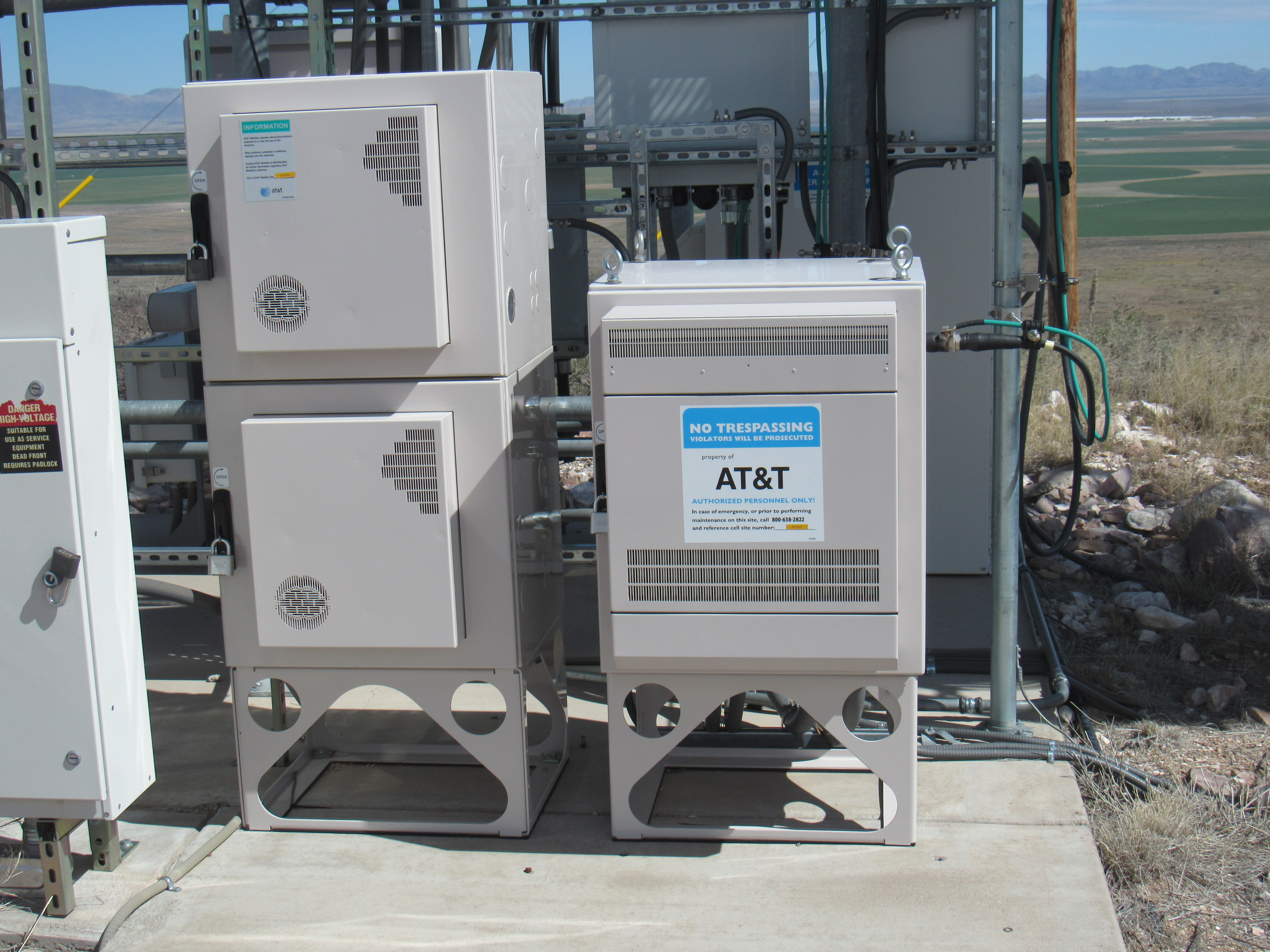
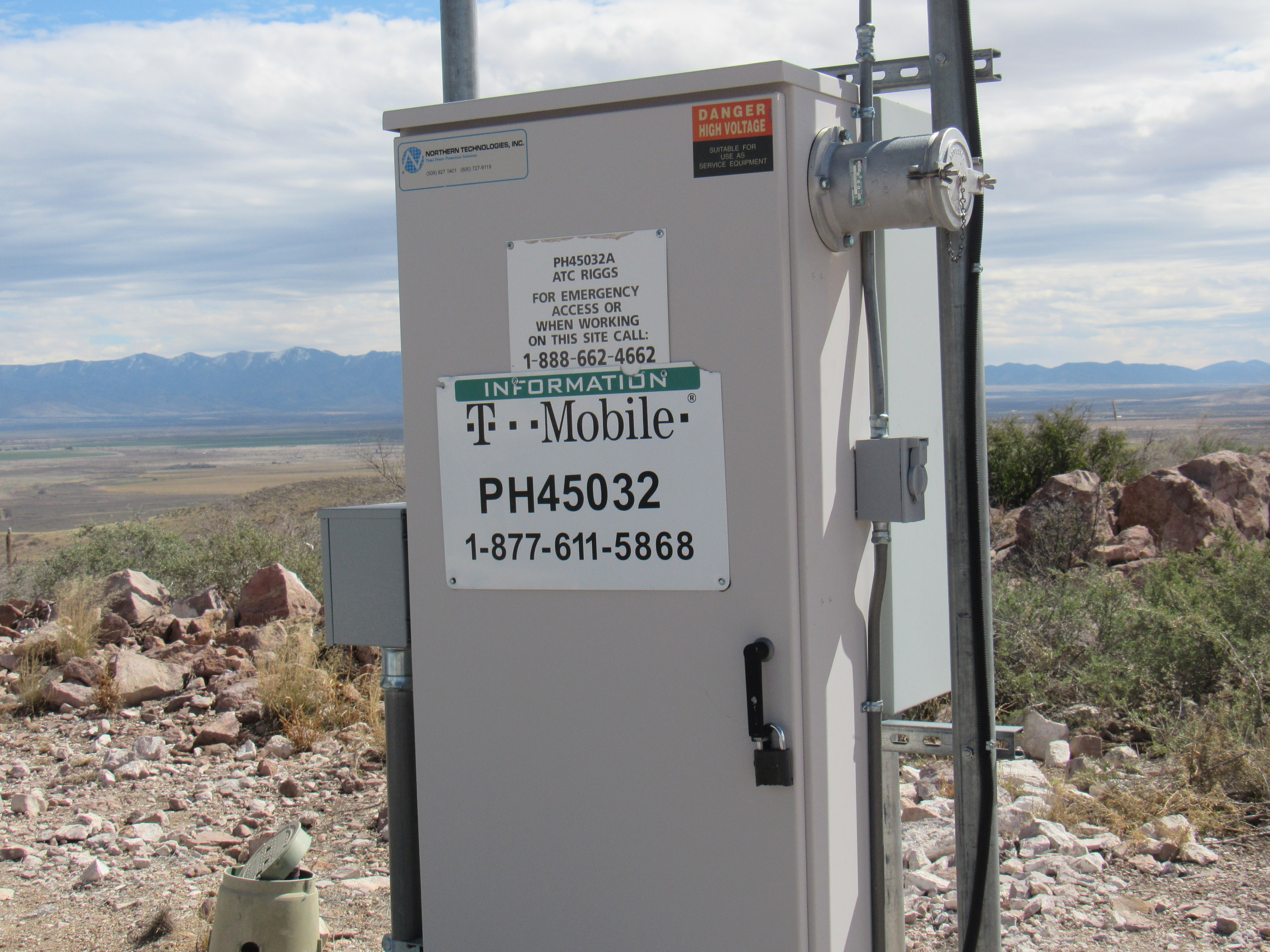
T Mobile
To the Mule Mountains
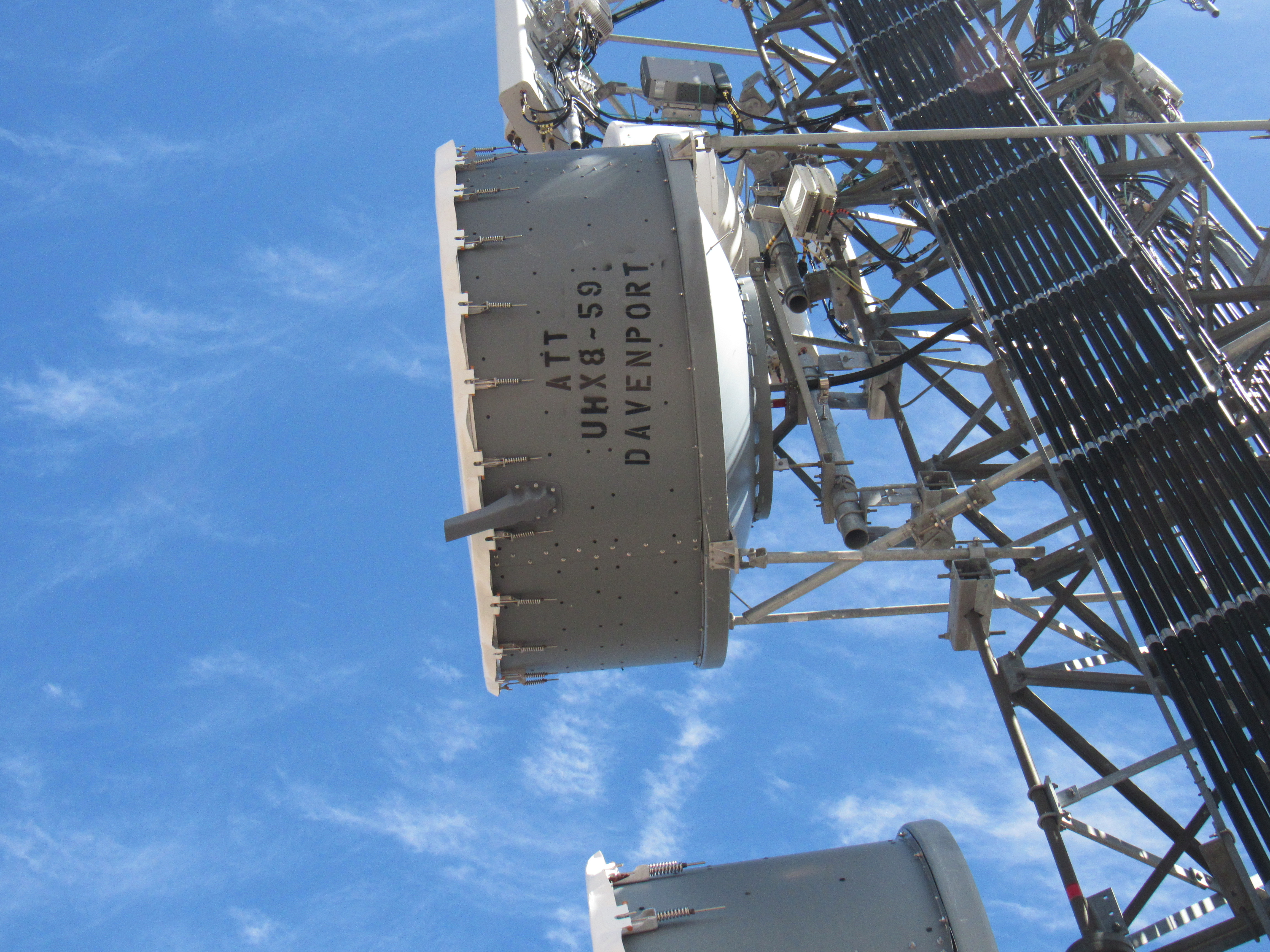
To Davenport
Here’s a view to the Mule Mountains – the tower there is 33 miles away.
The distant Mule Mountains
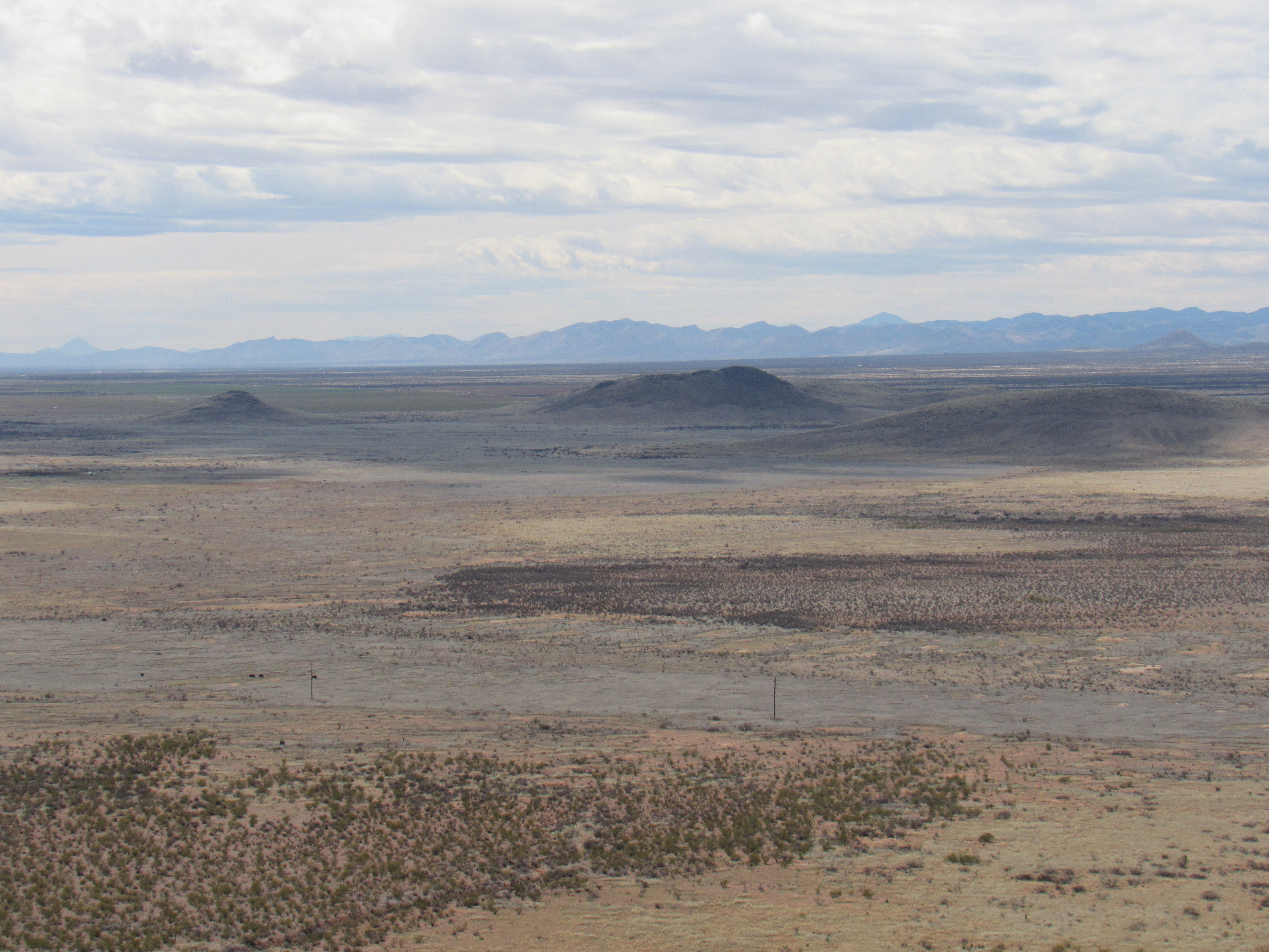
Turkey Creek originates in the Chiricahua Mountains, seen here with snow on the northern slopes. It flows west until it dies in the irrigated farmland seen at the base of our peak.
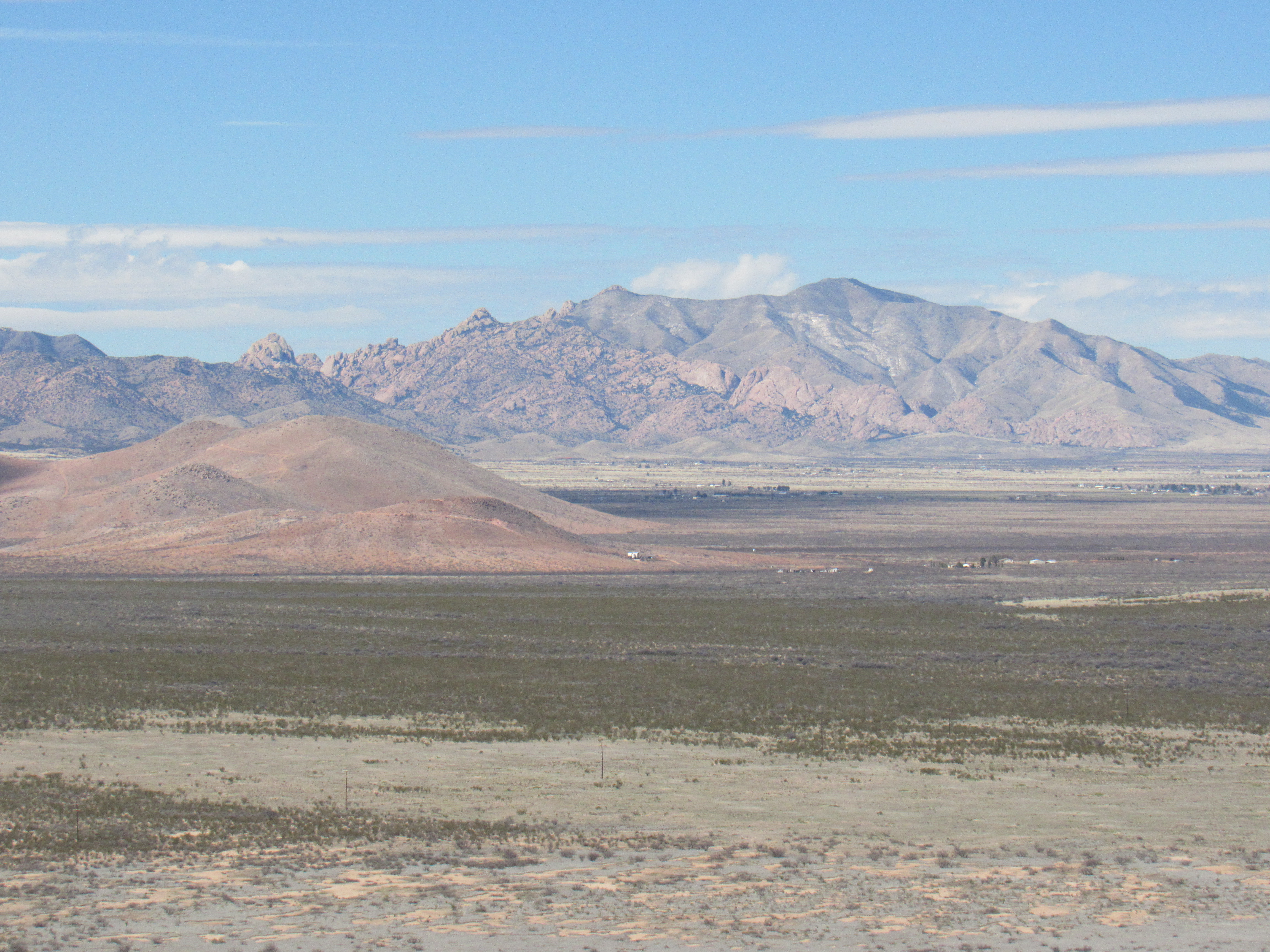
The Chiricahua Mountains, rising to 9,759 feet
To the north can be seen the Pinaleño Mountains, culminating in snow-covered Mount Graham, 56 miles away and rising to 10,720 feet. That’s the south slope we are looking at – there’s a lot more snow on the hidden north slope.
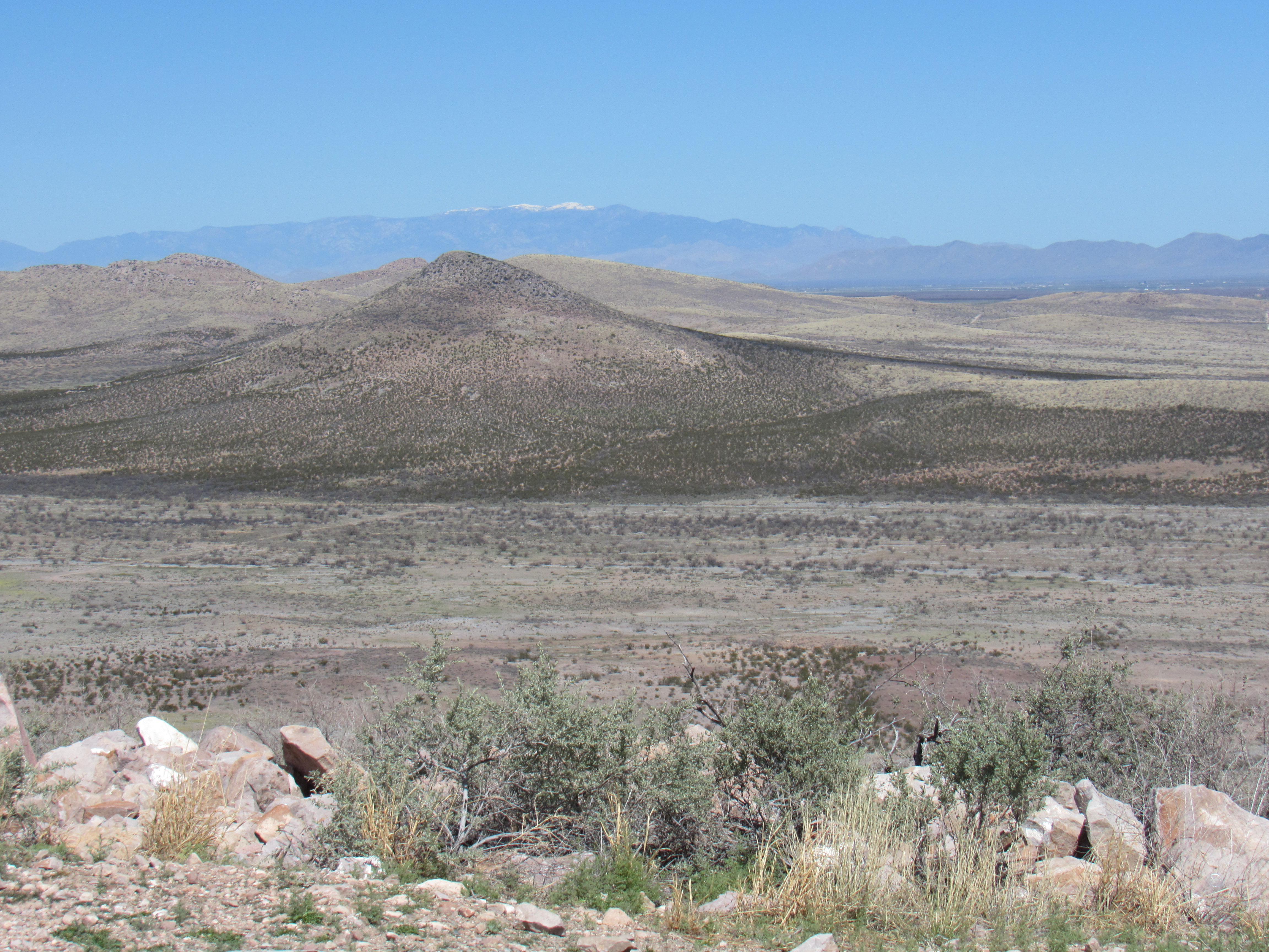
Mount Graham
Seventeen miles to the west lie the Dragoon Mountains, site of the famous Cochise Stronghold.
The Dragoons
Once I figured I’d seen all I could see from up there, I drove back down to pavement. Feeling somewhat peckish, I stopped at a nearby restaurant and had a meal that couldn’t be beat. Their chocolate pecan pie made a perfect dessert.
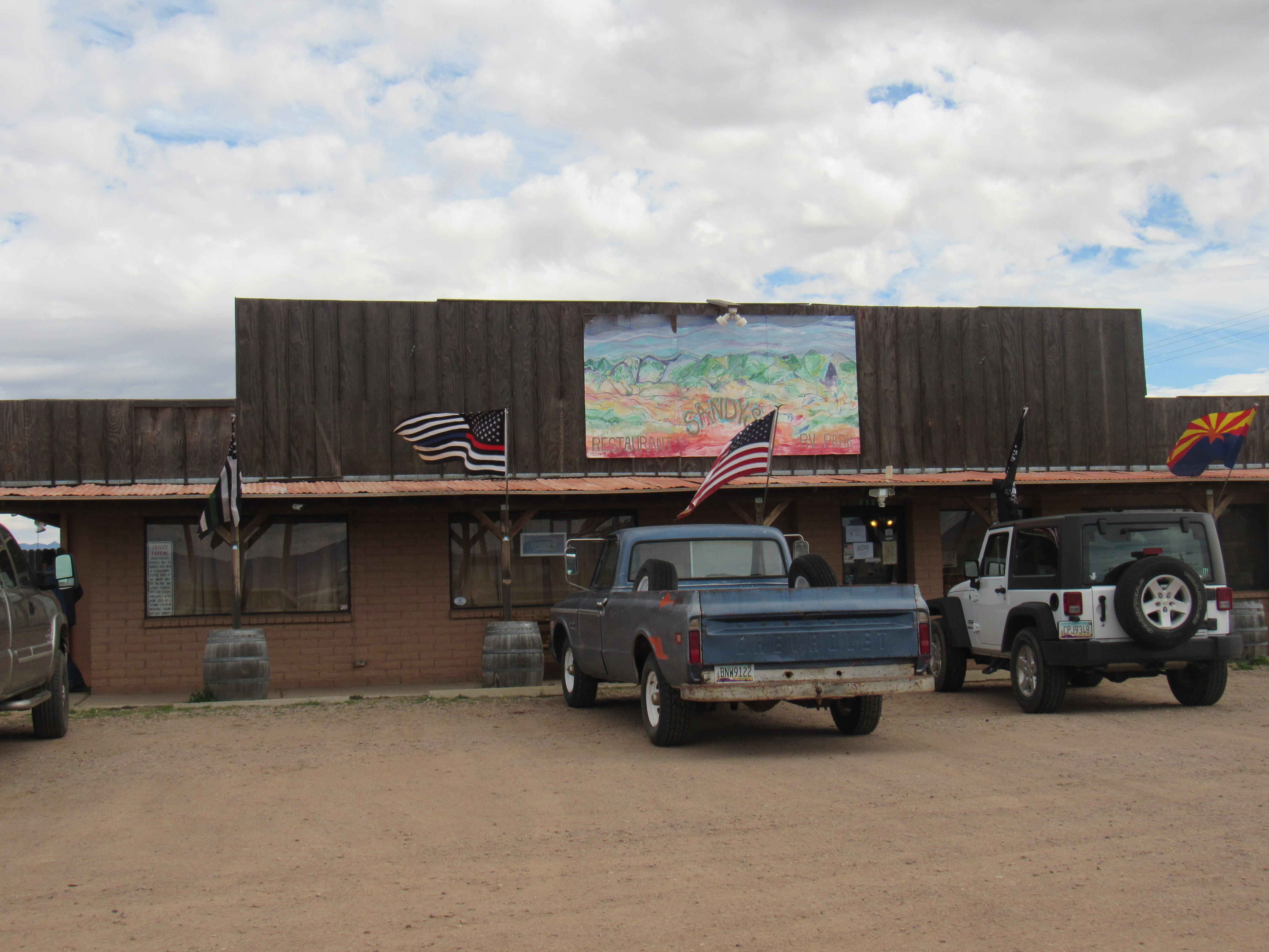
Sandy’s Restaurant
This sign in their window caught my eye.
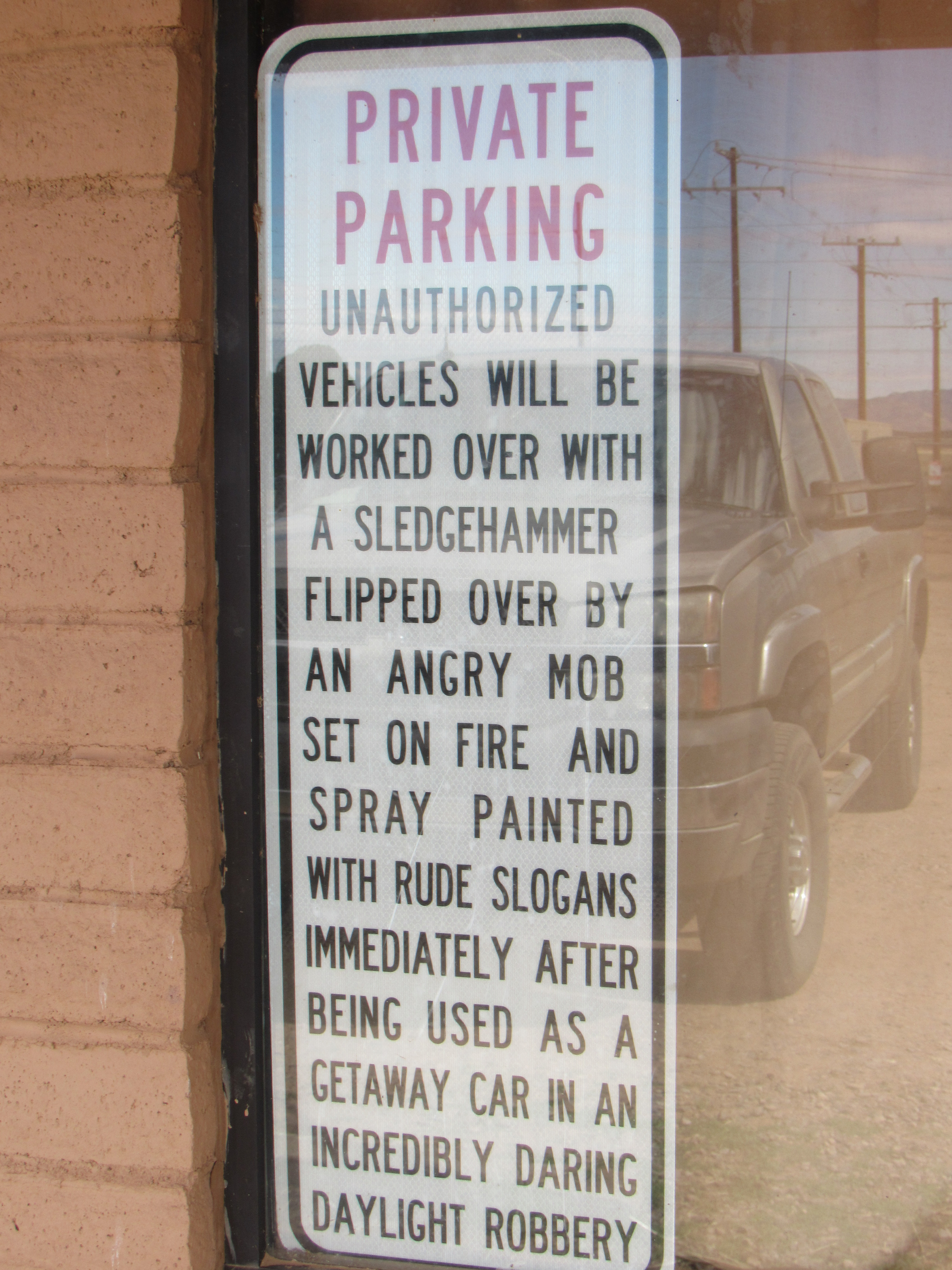
The sign.
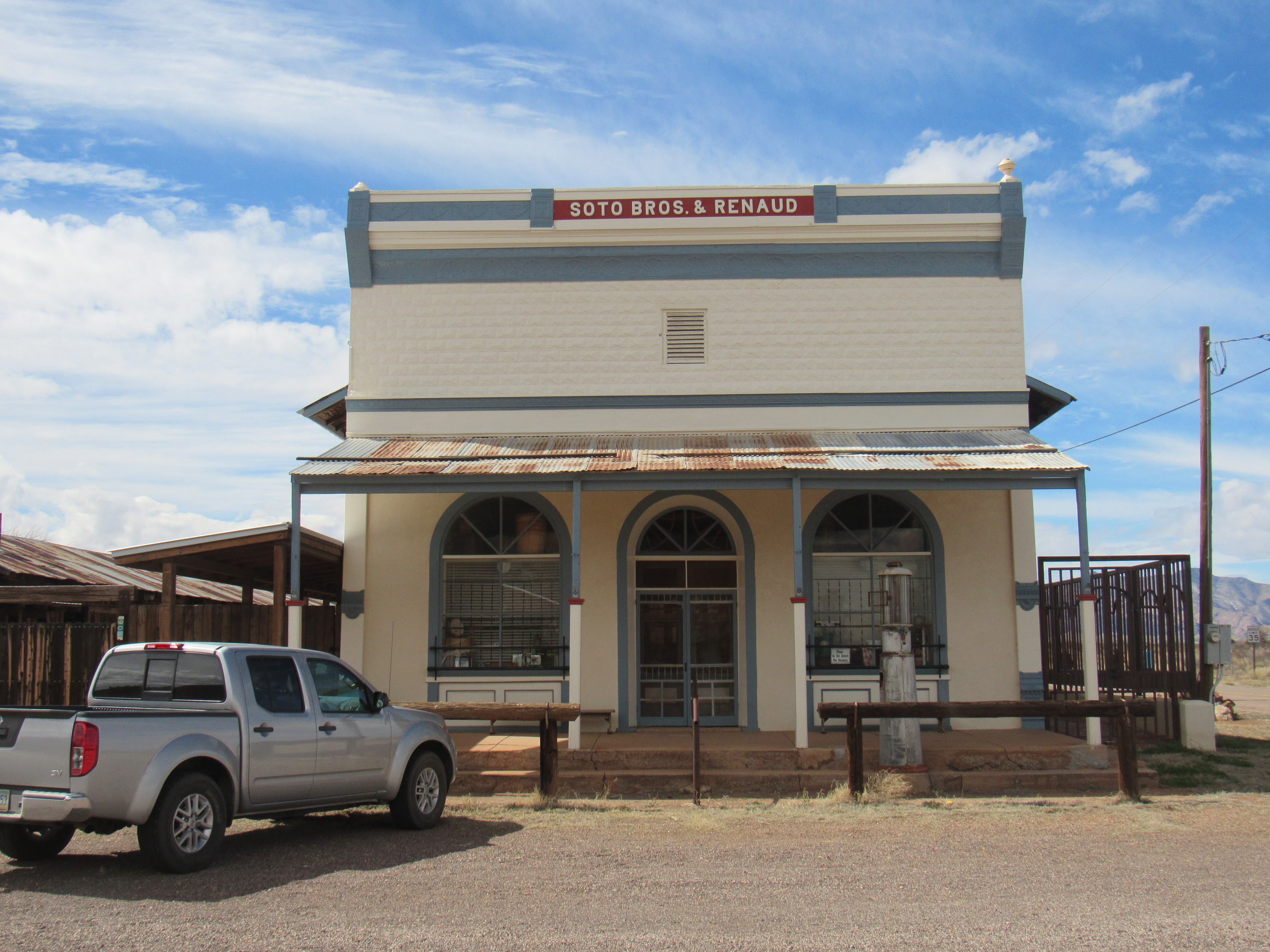
Well-sated, I started the drive home. There was one more stop I wanted to make, though, as it was right along the way. Pearce, Arizona is a historic ghost town which certainly has an interesting past. This link may serve to enlighten. I poked around there for a while, playing tourist and enjoying the place.
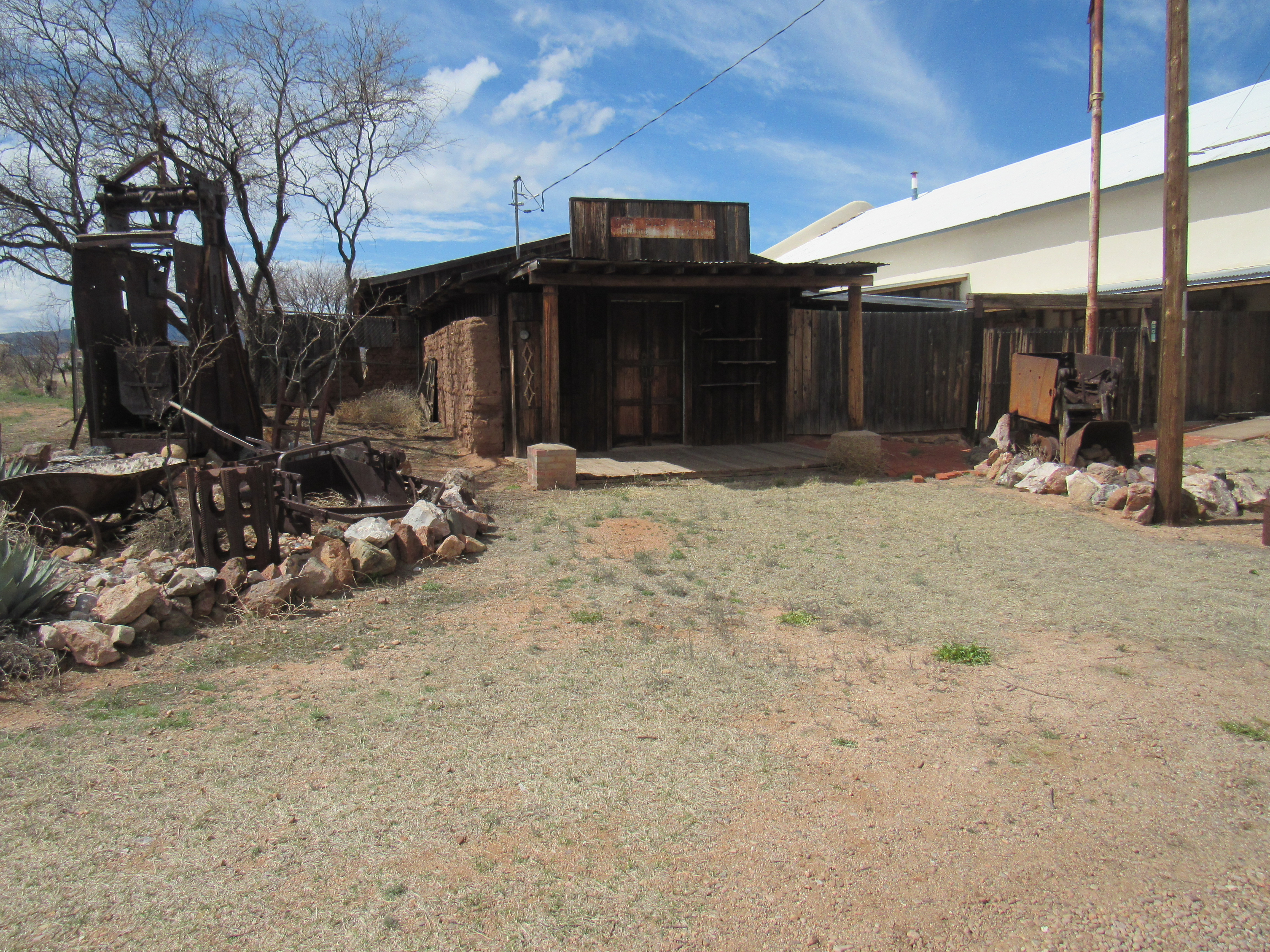
The Old Store
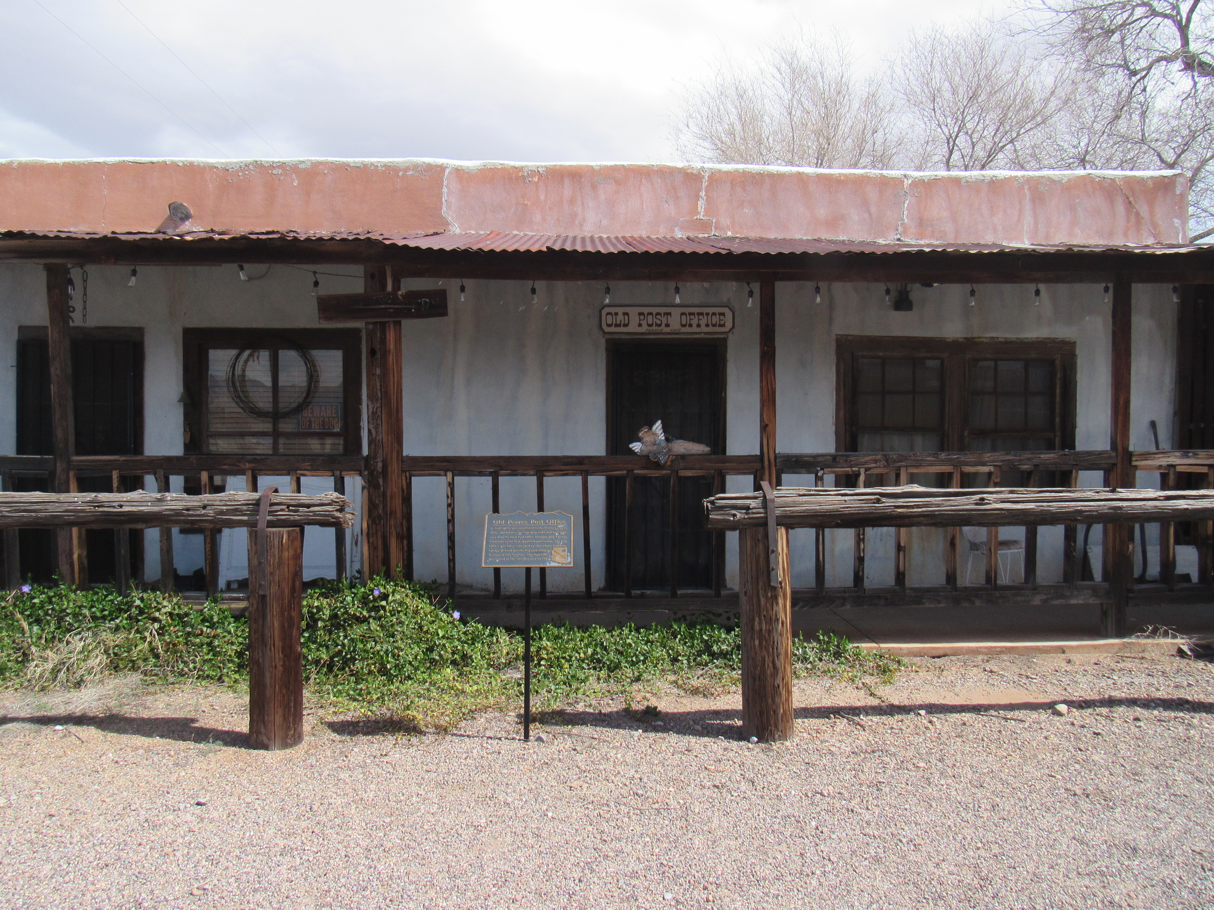
The old post office.
Another old store
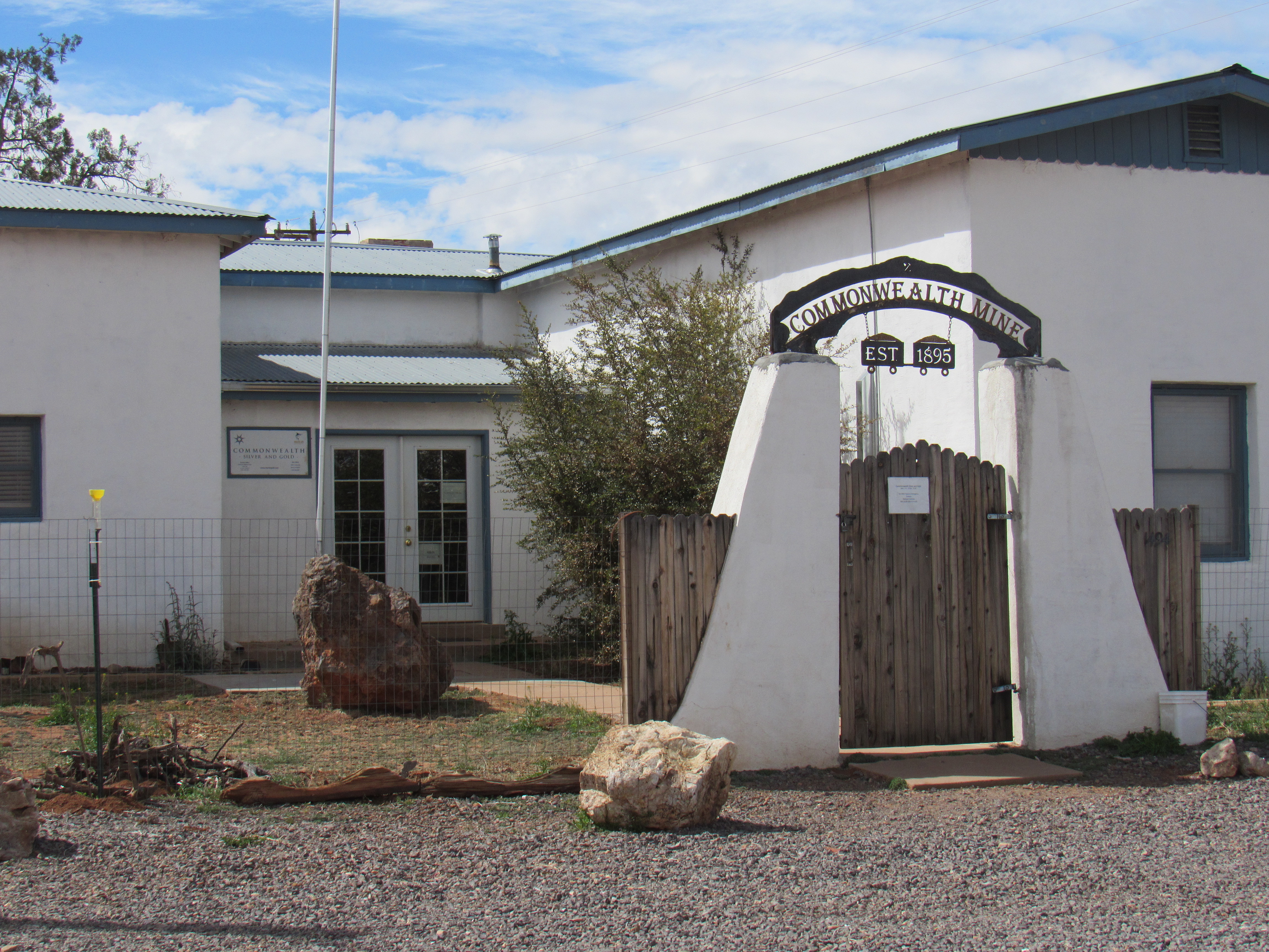
The mine office
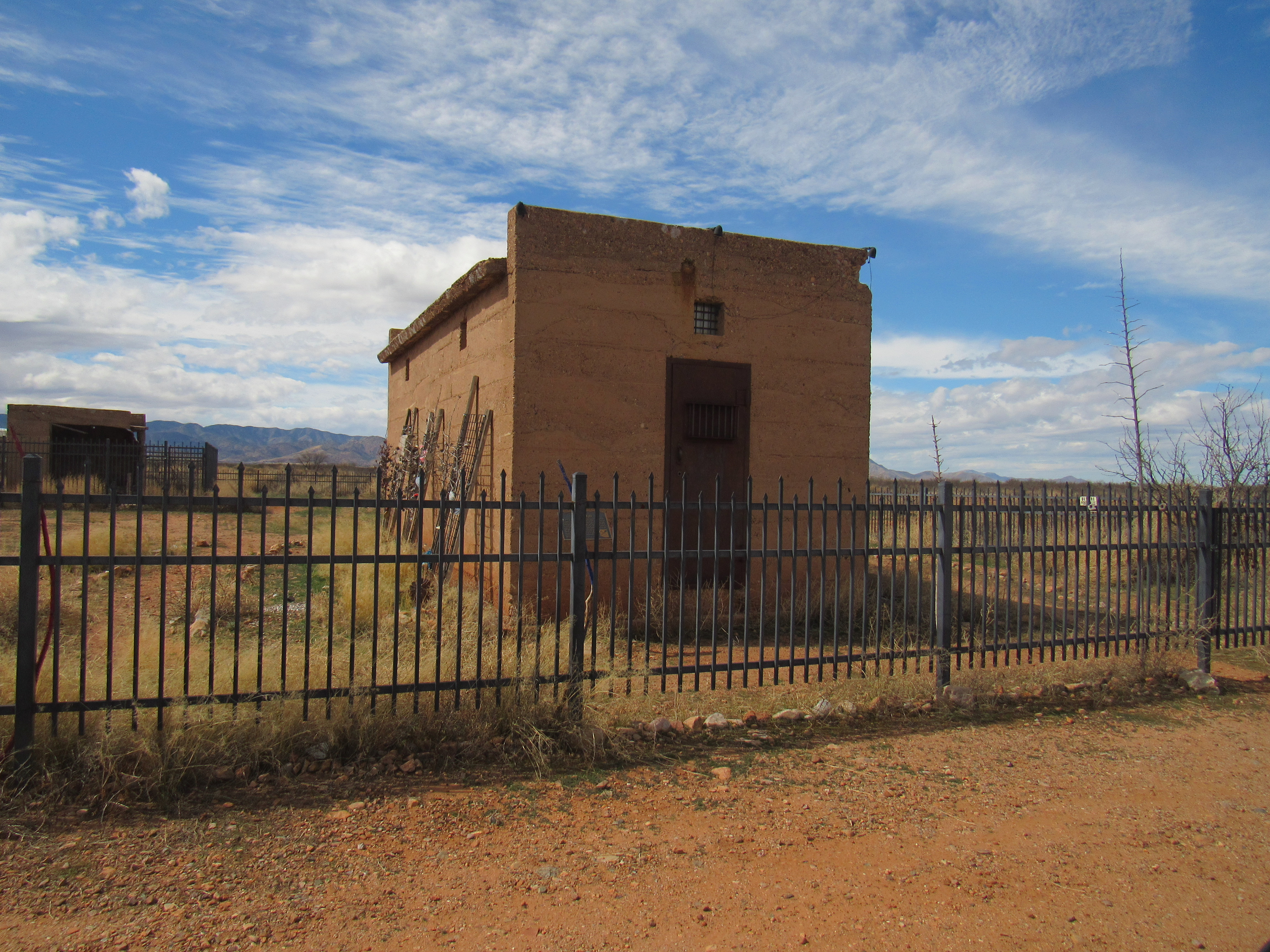
The old jail
An interesting place, certainly worth a future visit. Arizona is filled with fascinating history like this.
Okay, so what peak did you climb on Leap Day? I hope you had fun.