
The first time I ever saw the name on the map, it piqued my interest. You surely don’t name a feature “Cemetery Ridge” unless there’s some interesting history behind it. My Arizona Place Names by Will C. Barnes once again came to the rescue, and here’s everything it has to say about the name.
It mentions that “the feature lies in Yuma County, Arizona and first shows up on the United States Geological Survey Map of 1923.” It goes on to say that “it is southwest of the Eagletail Mountains, near longitude 113 degrees 30 minutes, about 6 miles west of the Maricopa County line.” That’s all true enough, and it goes on to say that a letter from Fred Notbusch stated that “According to local reports, several prospectors were killed here in the Seventies and their bodies buried on the hill or ridge.” That would of course mean the 1870s.
As interesting as that all is, we still have no real idea of what happened to those prospectors. Killed, how? Buried, where? As we will go on to see, the ridge is a long, winding feature and there is not a single spot shown on the topographic map named “cemetery”. Those maps are pretty good about showing graves, but I can’t find even a single one anywhere along the entire ridge itself or in the area. The prospectors part makes sense, though, as a great deal of prior mining activity occurred here.
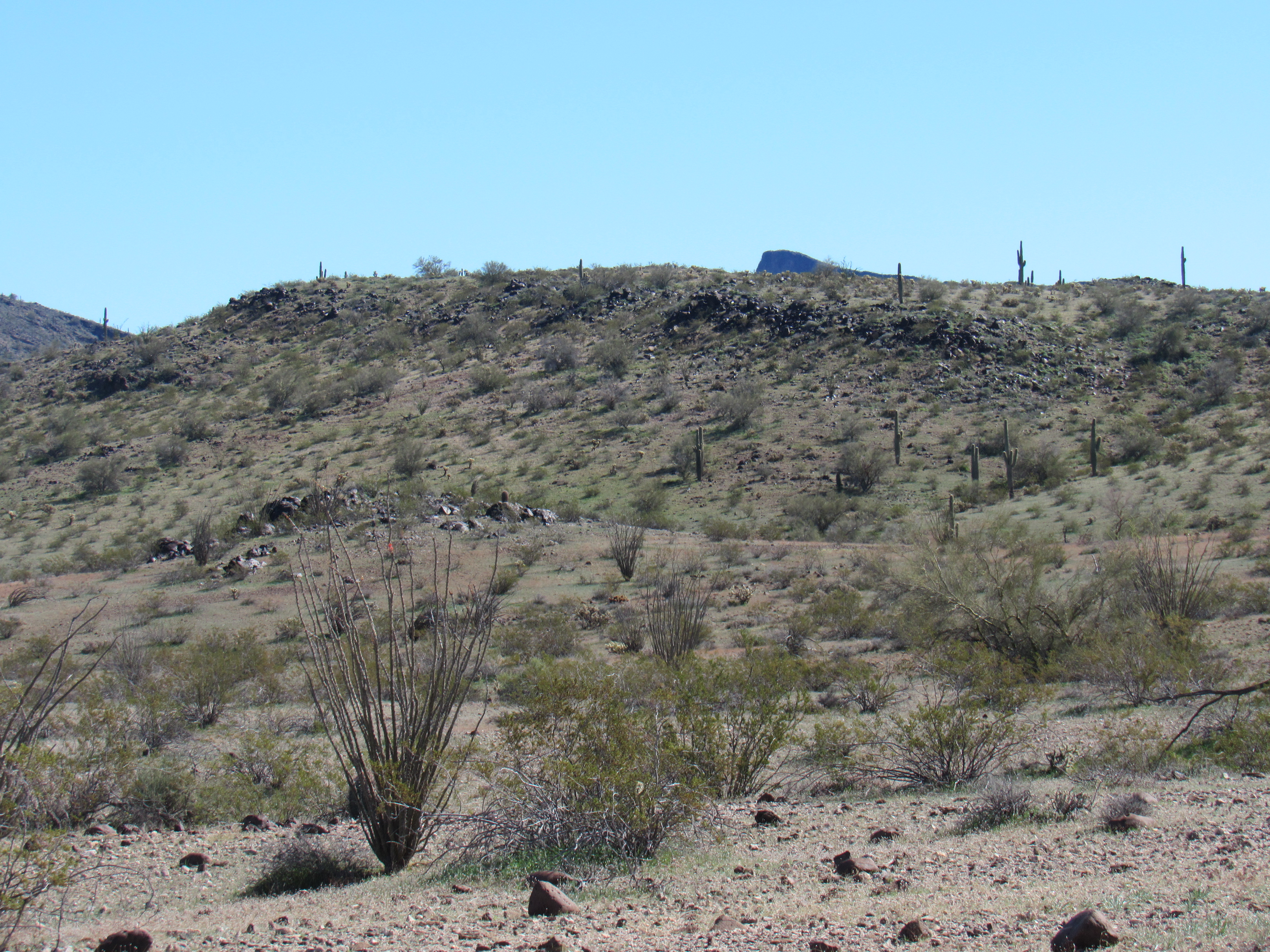
In the past, I had had only the briefest taste of Cemetery Ridge, and I really wanted to go back and explore it more fully. I’d been hoping to go in with a friend, but that turned out to not be in the cards, so I headed in alone one fine day. Although it was winter, our finest season here in the desert, it was unseasonably cold, and windy to boot. It took me a full 3 1/2 hours of freeway driving to reach my turnoff into the desert. Even after all of that, I found myself driving more miles of paved farm roads through the dead-flat Harquahalla Plain. An area of probably 40 square miles is irrigated here and produces lush crops. This photo shows a typical irrigation ditch.
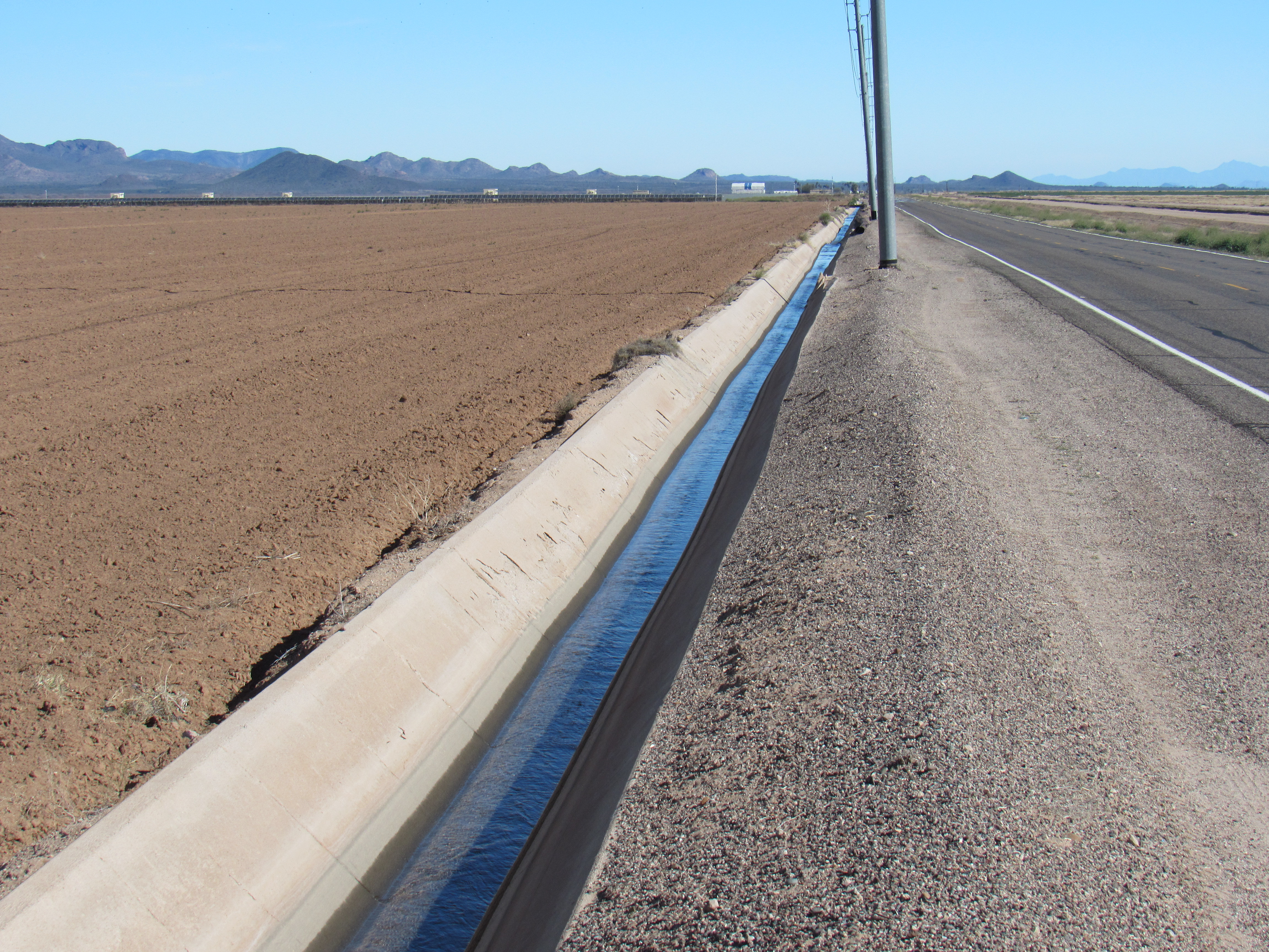
In the Harquahalla Plain
This next photo shows the striking contrast between the green irrigated farmland and raw desert beyond
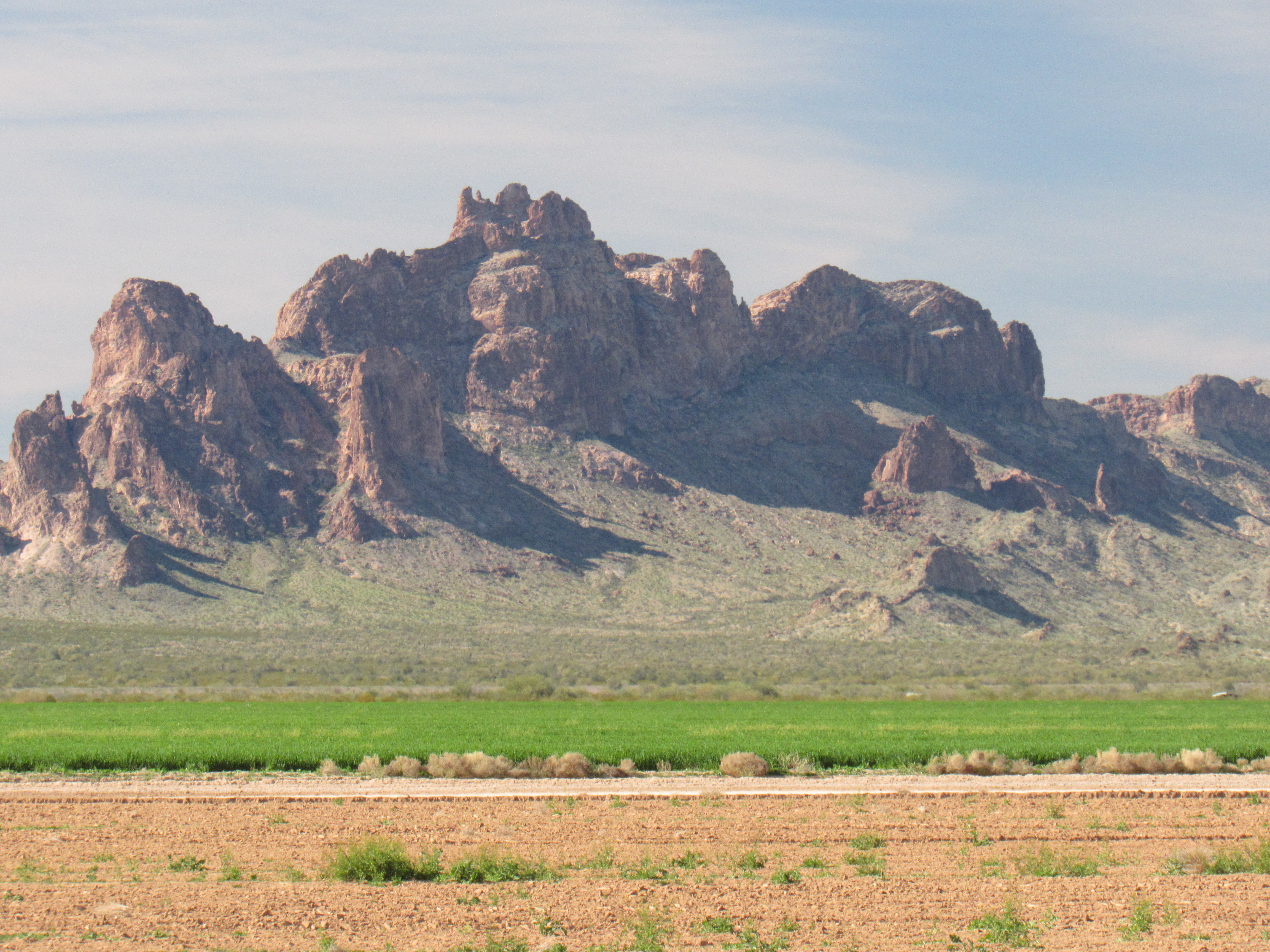
Irrigated versus non-irrigated land
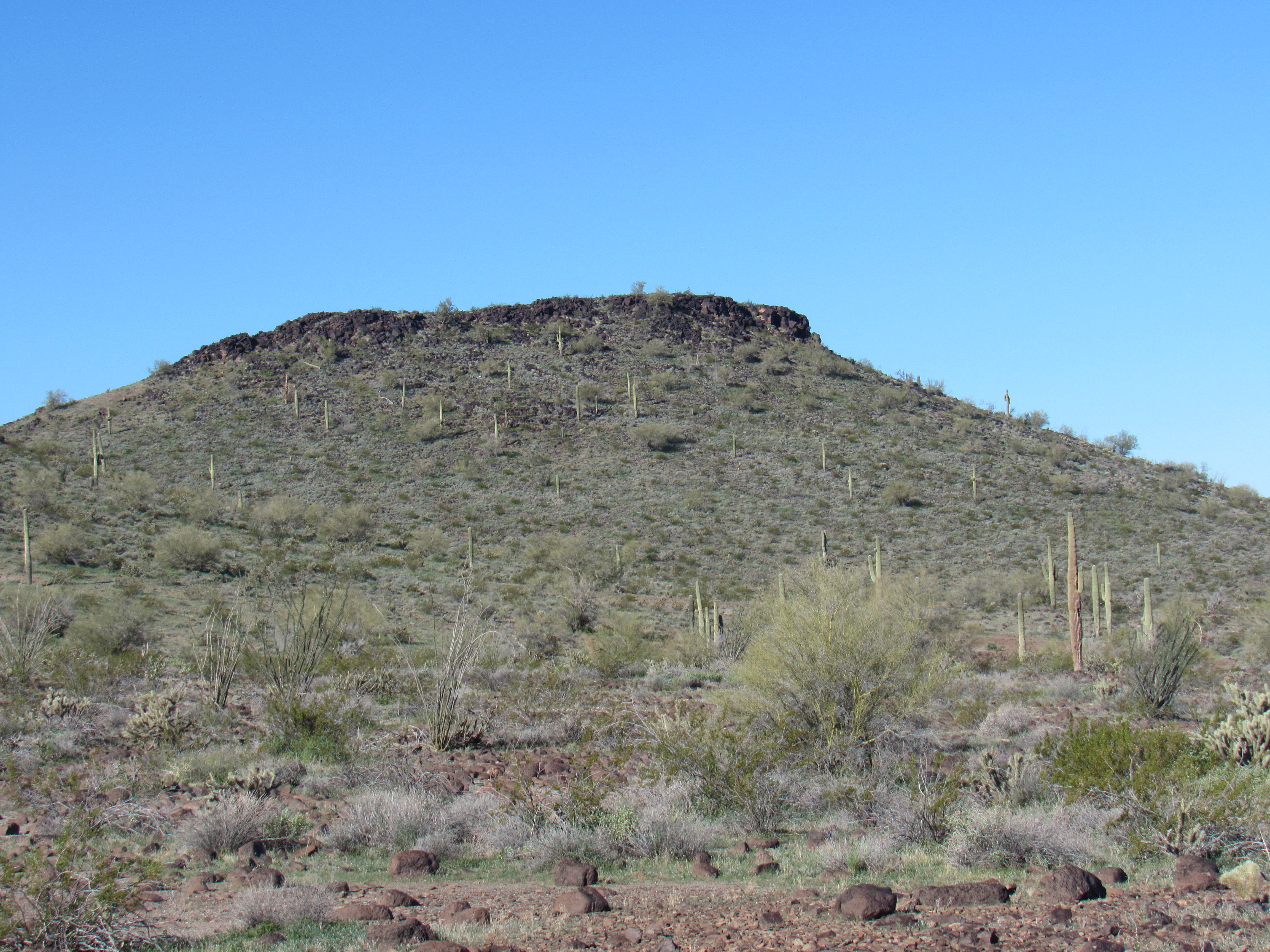
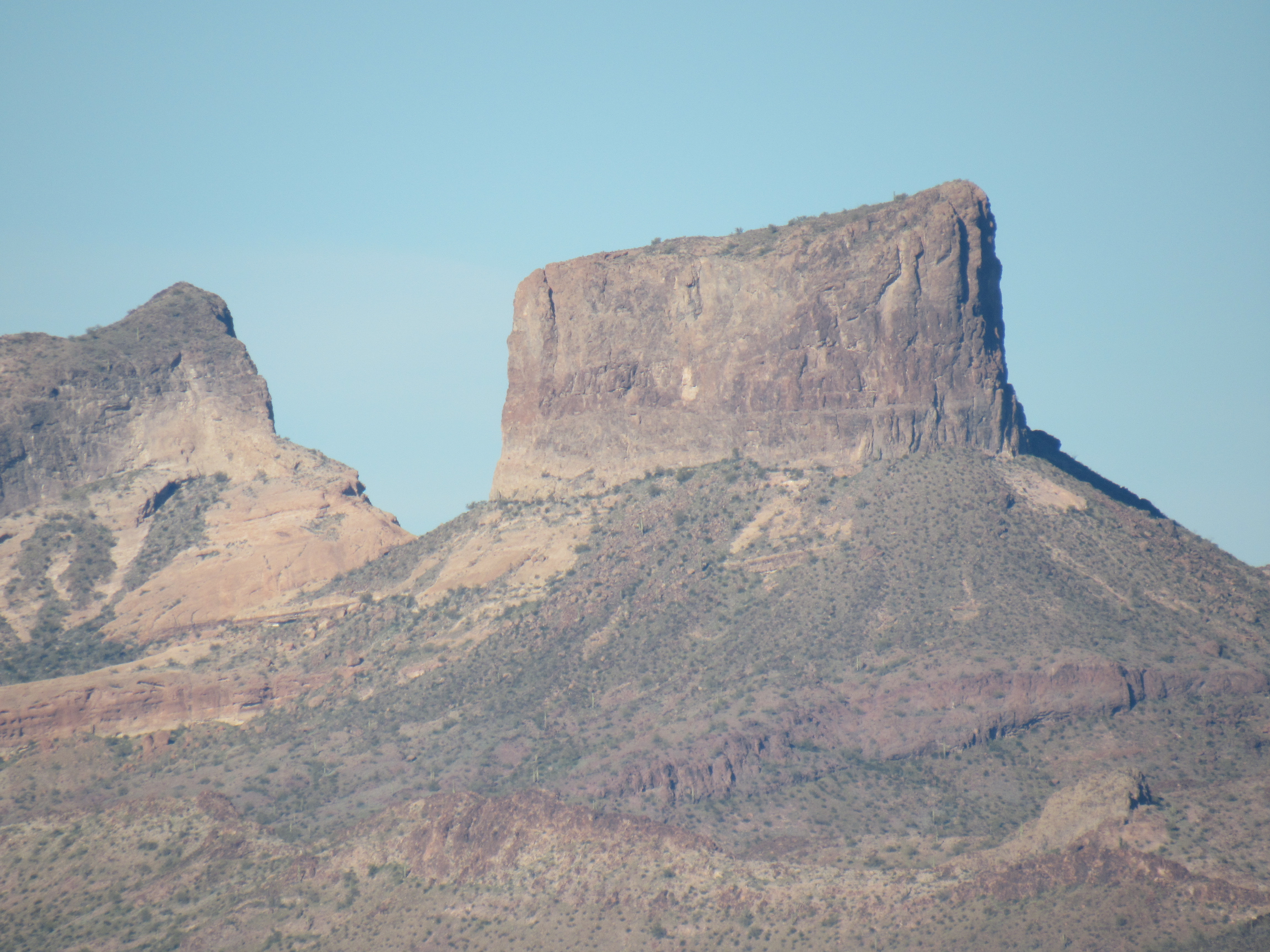
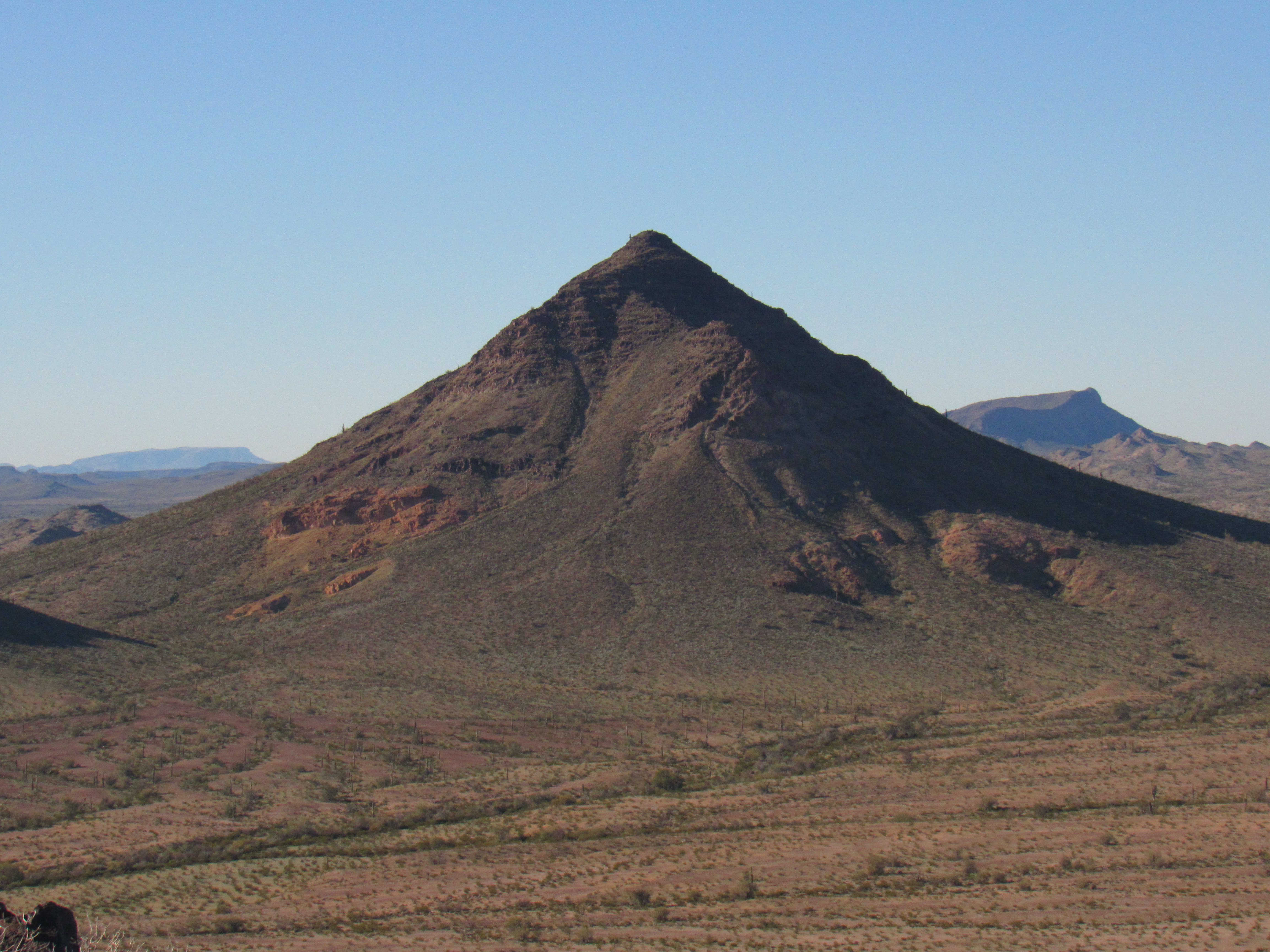
Eventually I ran out of paved roads and started down a dirt road that swung around the southeast corner of the Eagletail Mountains. It’s amazing how quickly I transitioned from lush green farmland to austere desert, following an arrow-straight road which paralleled a buried natural-gas pipeline. After some miles, I could see the very prominent Columbus Peak rising up on the south side of the road.
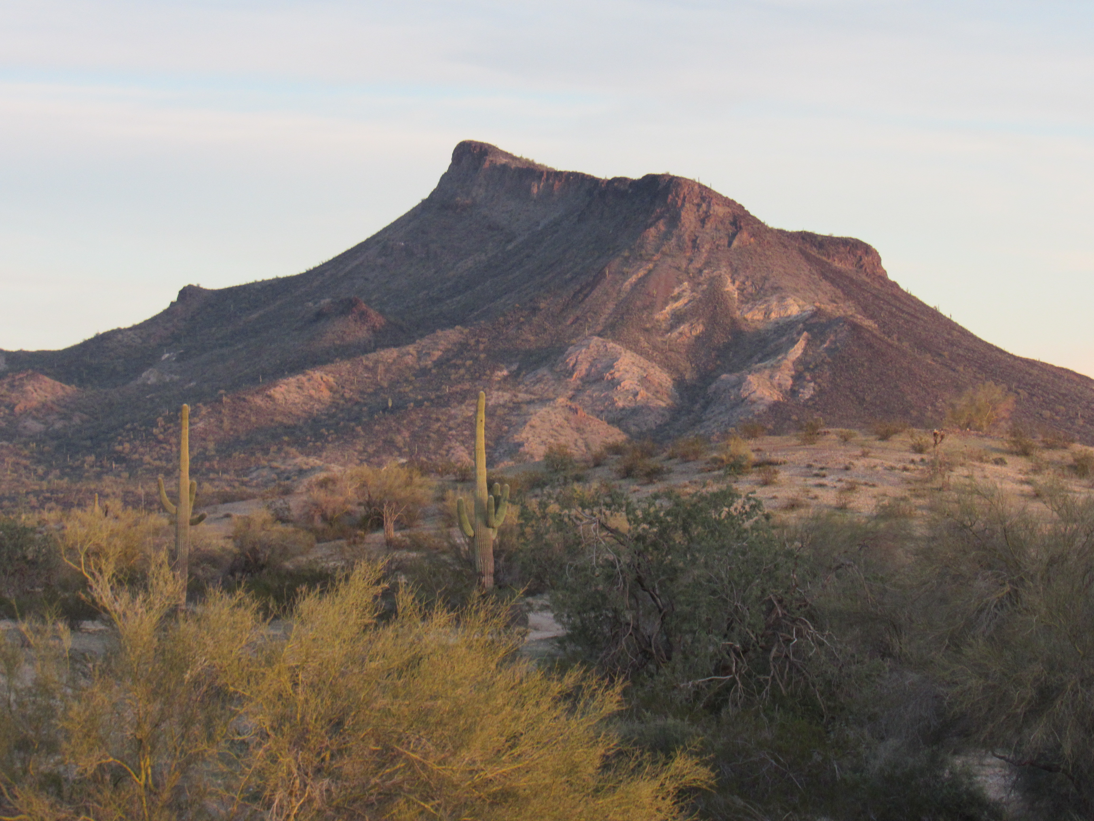
Columbus Peak, elevation 2,428 feet
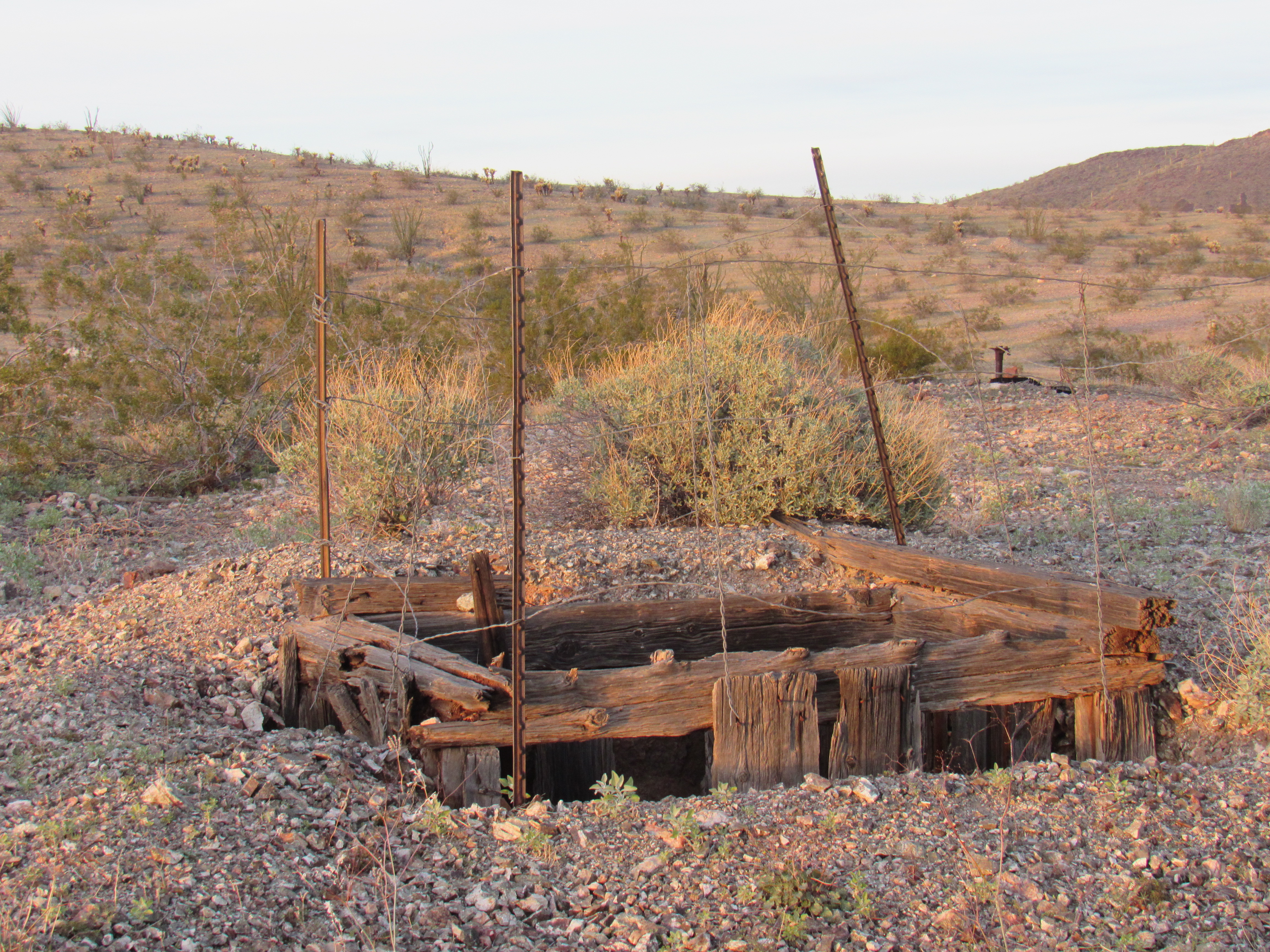
The thing about Cemetery Ridge is that its boundaries are ill-defined at its eastern end. The road I was driving seemed to pass through a low point along the north side of the Gila Bend Mountains, so if I took that as a boundary of sorts, then the Ridge must lie to the north of the road. I was entering an old mining district peppered with names like the Big M Mine and the Outlaw Mine. These old diggings have always fascinated me, and if one is along my path I will always pay a visit, time allowing. Such was the case this sunny afternoon when I stopped at the Black Silver Mine. History tells us that the Old-Timers in this area were primarily going after gold, silver and copper. Rubble had filled in much of the entrance to this sloping tunnel, but it went a long way down into the bowels of the earth. I’m not one to go down into and explore these – let’s just say that I don’t relish the idea of being buried in there by a cave-in or dying from poisonous gases.
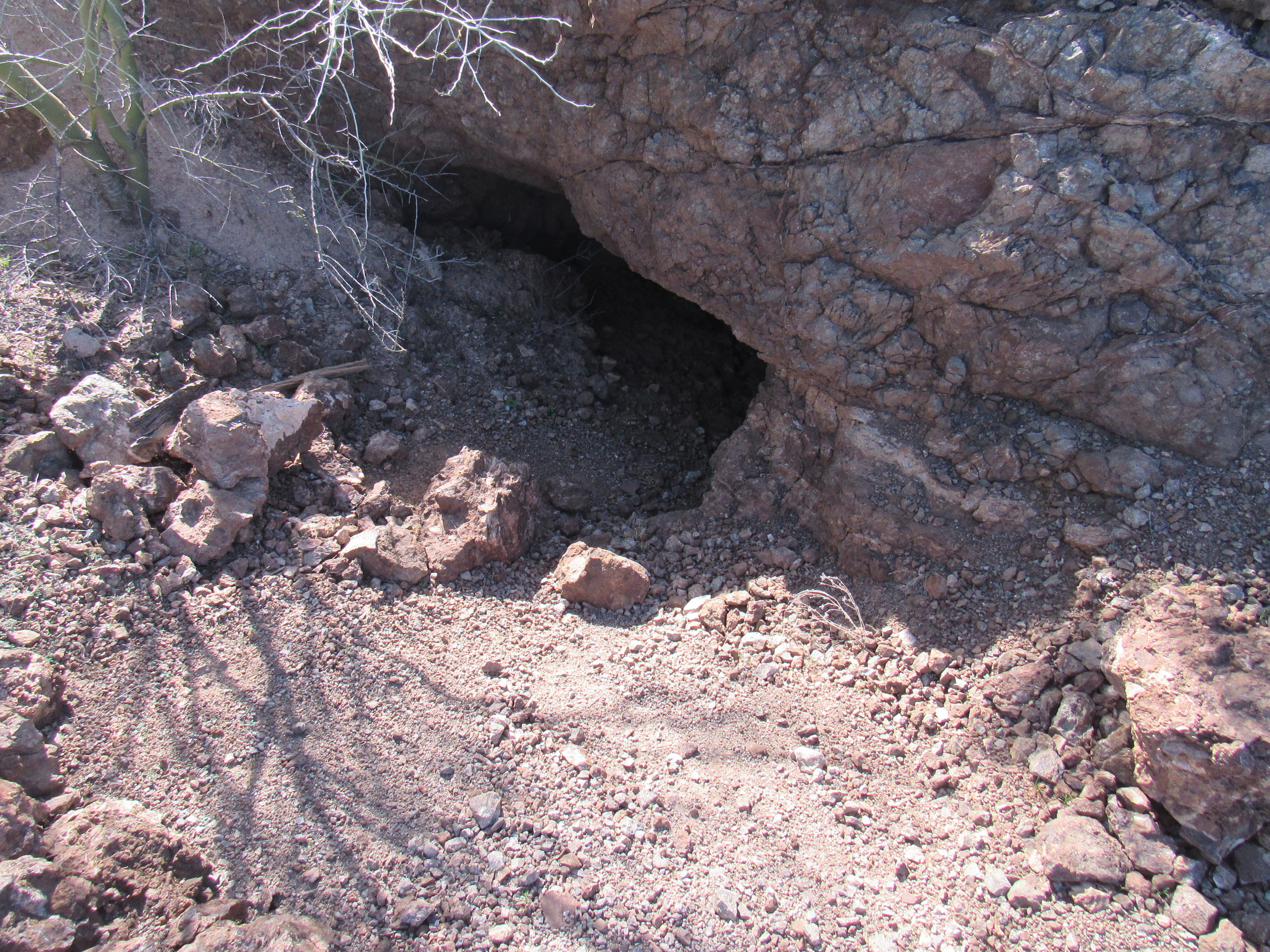
Black Silver Mine
And then there was this, a vertical shaft showing much erosion.
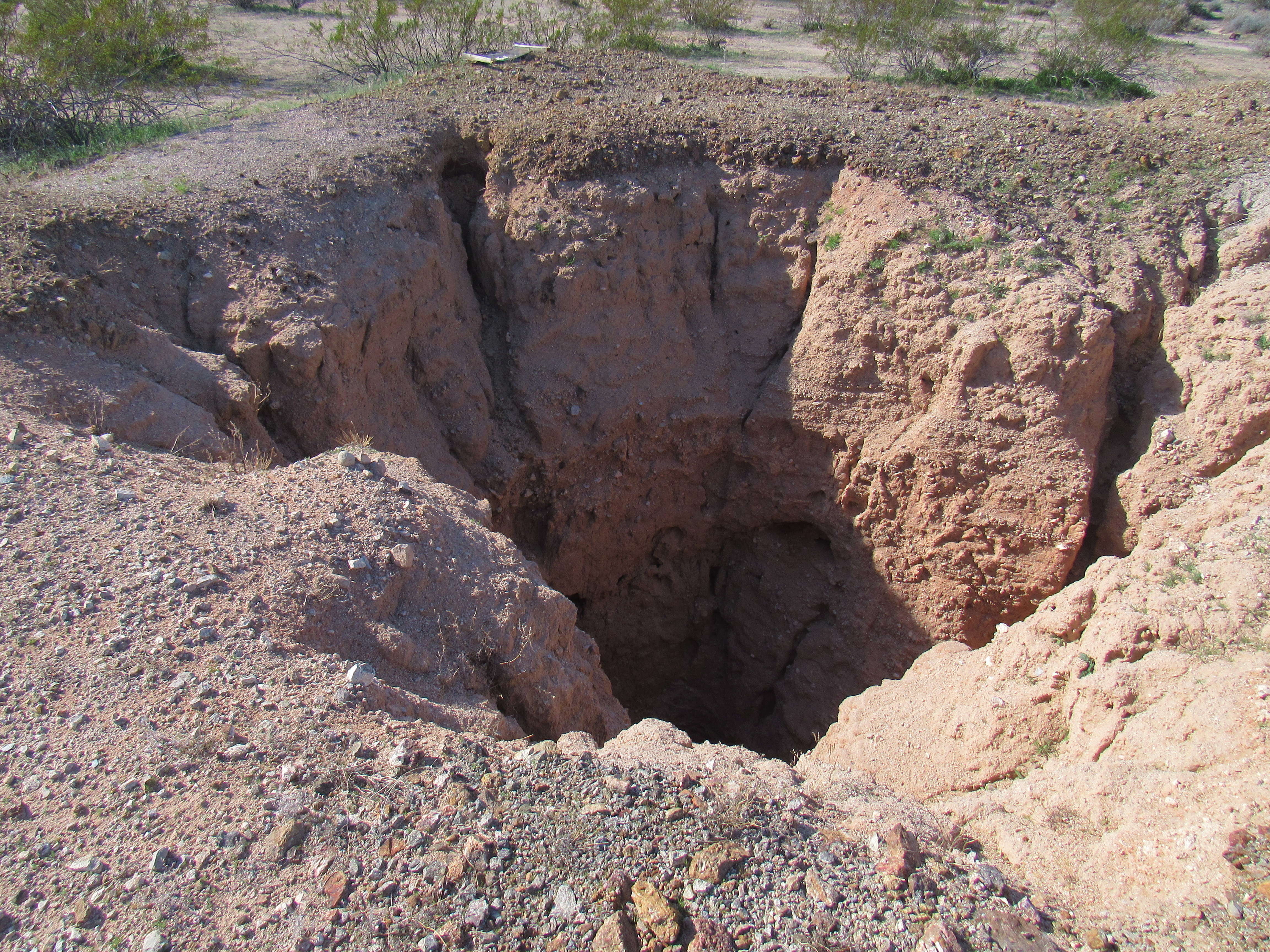
Slowly filling in
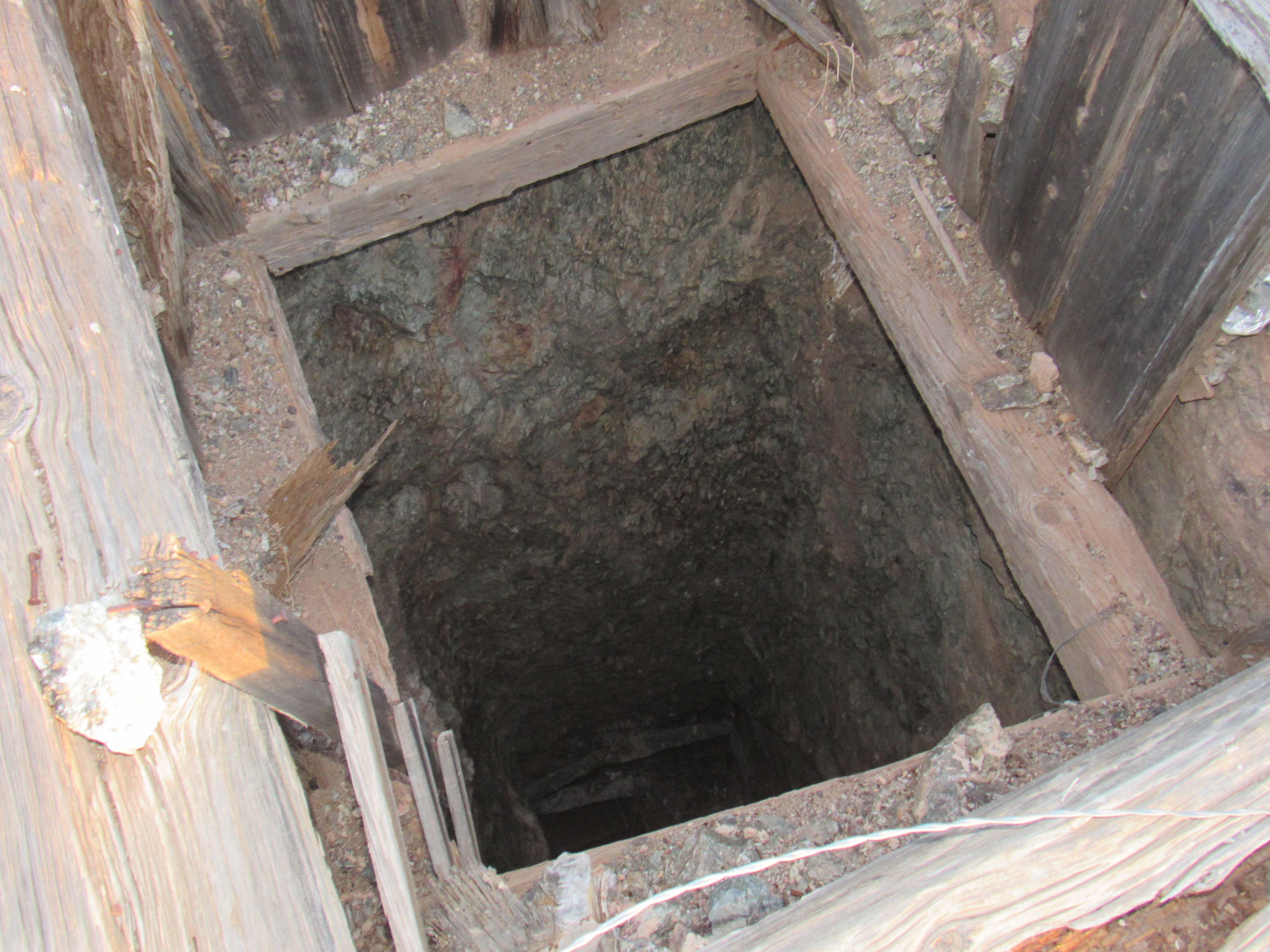
Here is a closer look, into the gaping maw. You can see timbers that have fallen in with dirt piled upon them. God help anyone who falls in!
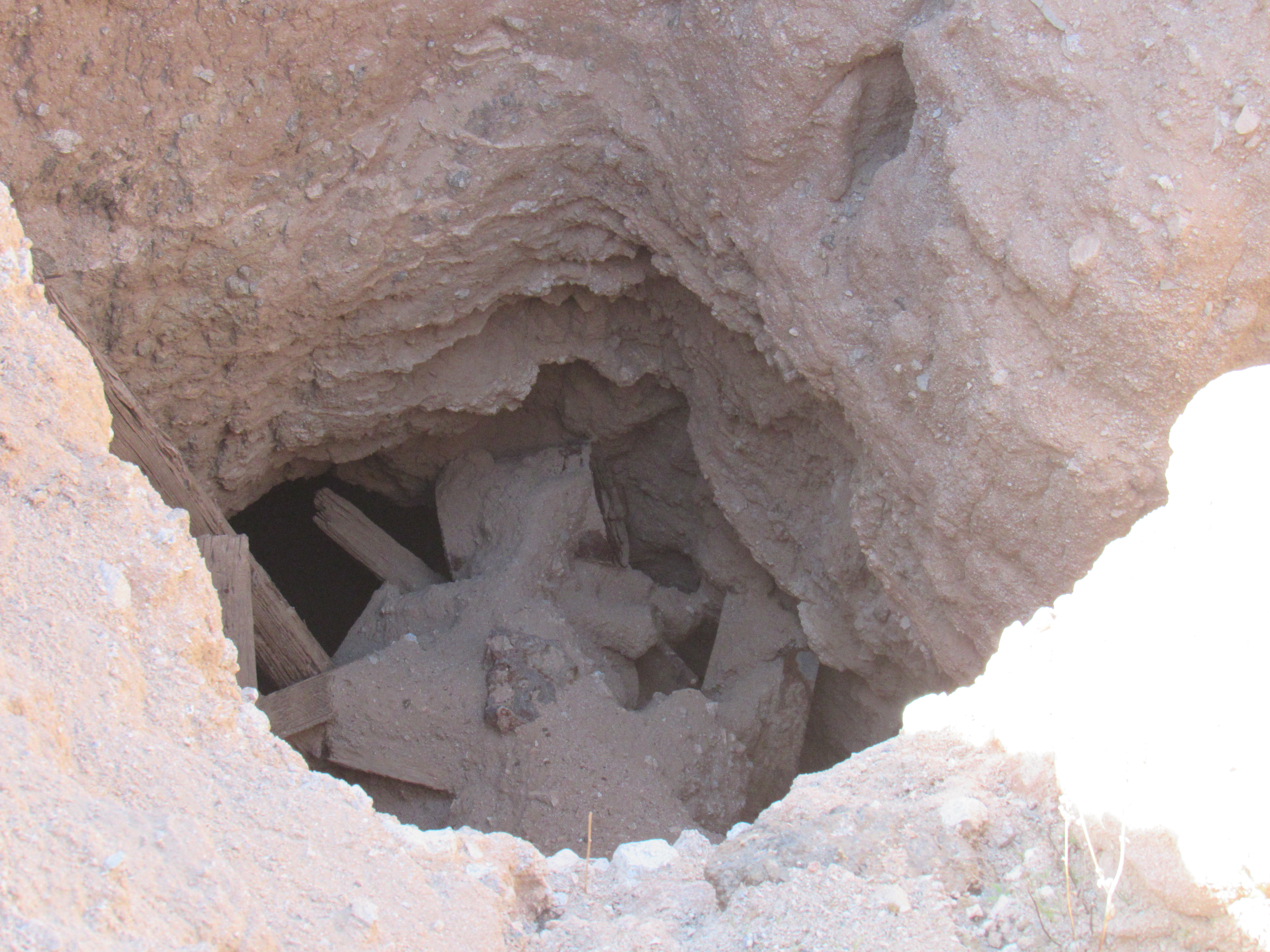
Looking down
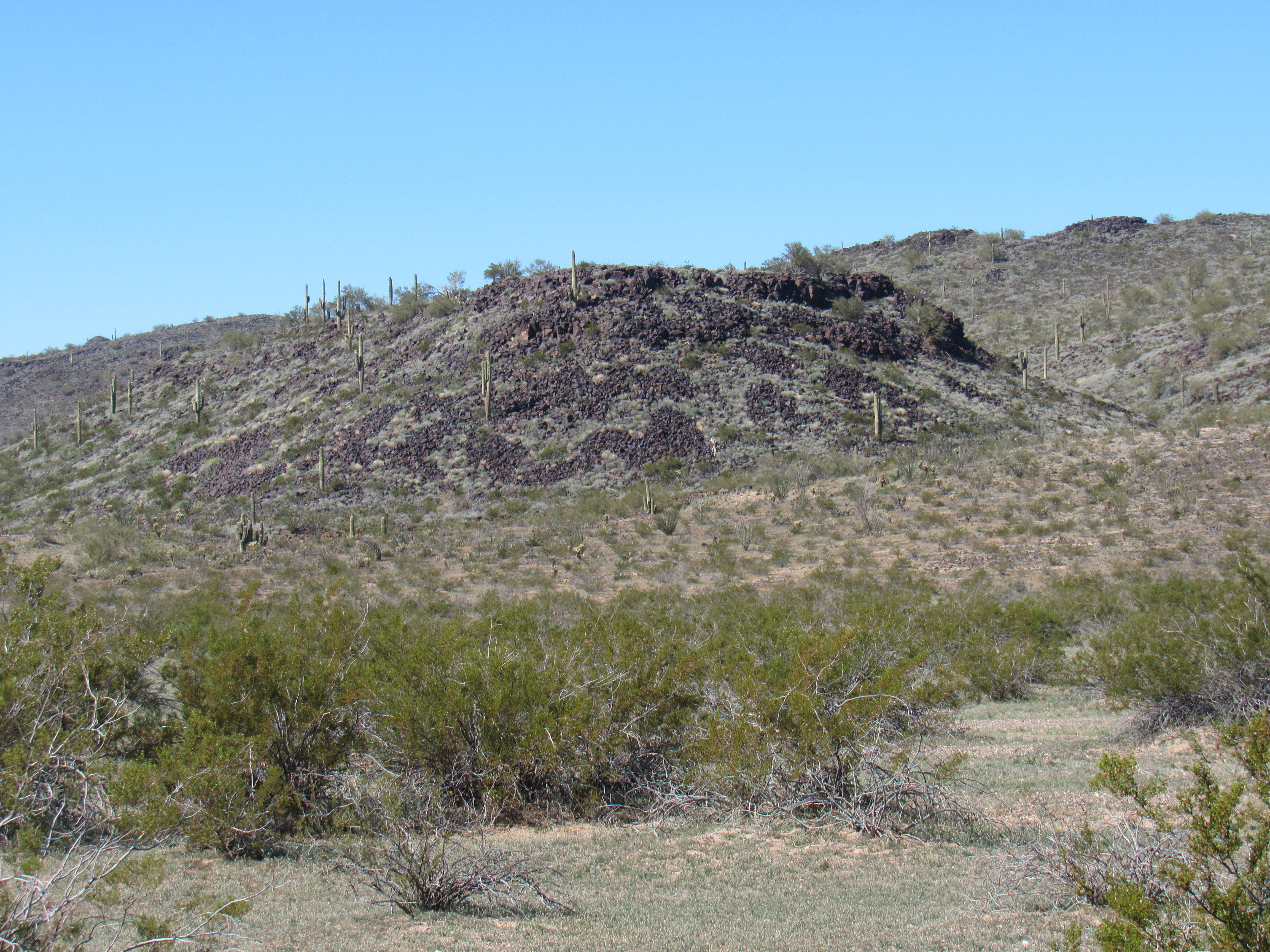
It was about 2:30 in the PM when I visited the old mine, and I soon moved on. If Cemetery Ridge lay to the north of the road, then I felt I had reached the far eastern end of it at a nice peak which I now stopped to climb. Peak 1902 was a popular spot – 14 others had signed in to the register before I ever came along, probably because it was so close to the road.
The south side of Peak 1902
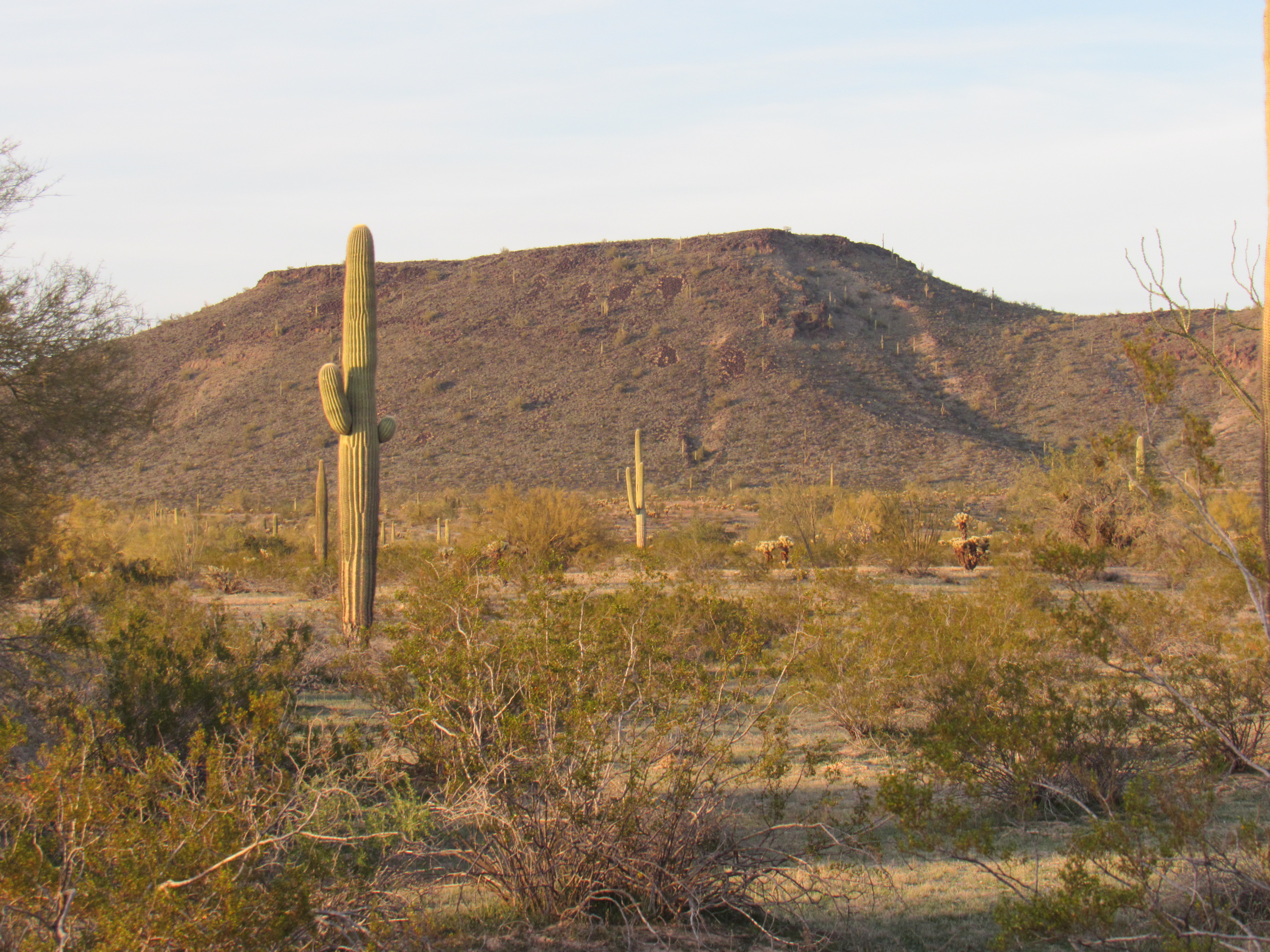
From its summit, I was surrounded by beautiful desert vegetation as I had this expansive view of Columbus Peak to the southeast.
Columbus Peak
The day was wearing on by the time I made it back to my truck, 5:20 by my watch. Continuing my drive west, in short order I arrived at this odd-looking thing, all metal and concrete.
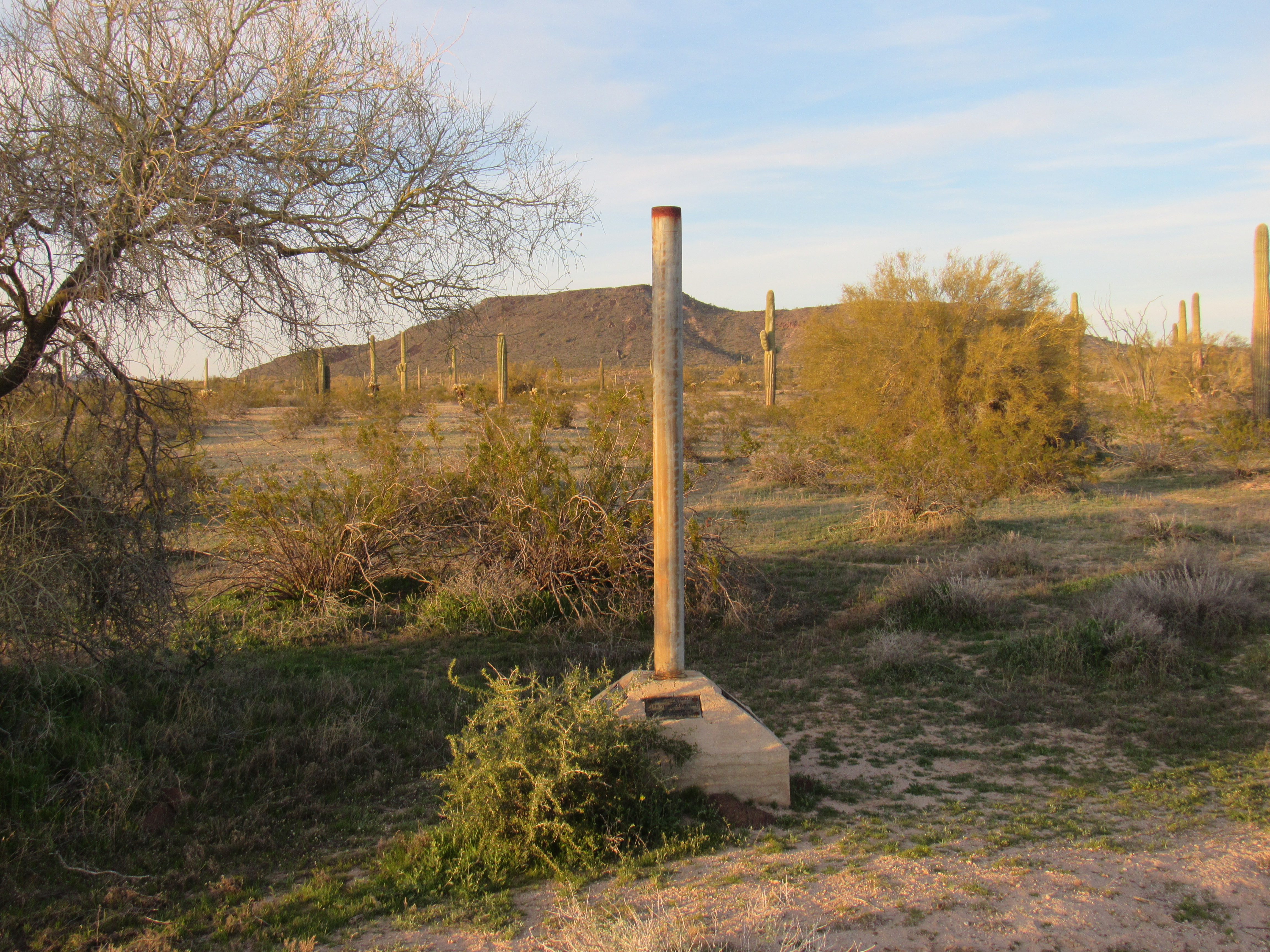
The Thing
Naturally, I stopped for a good look. Its concrete base held some plaques.
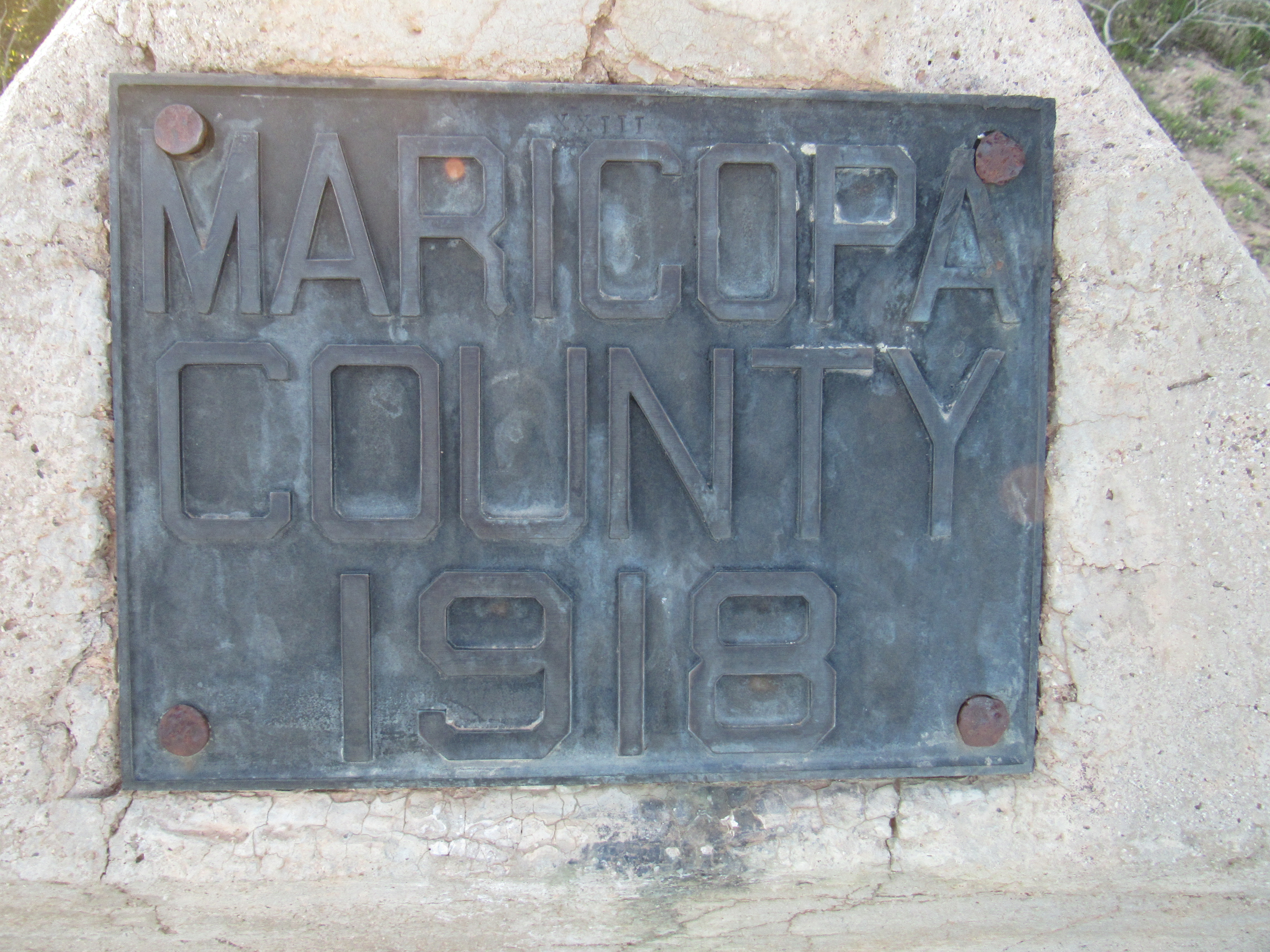
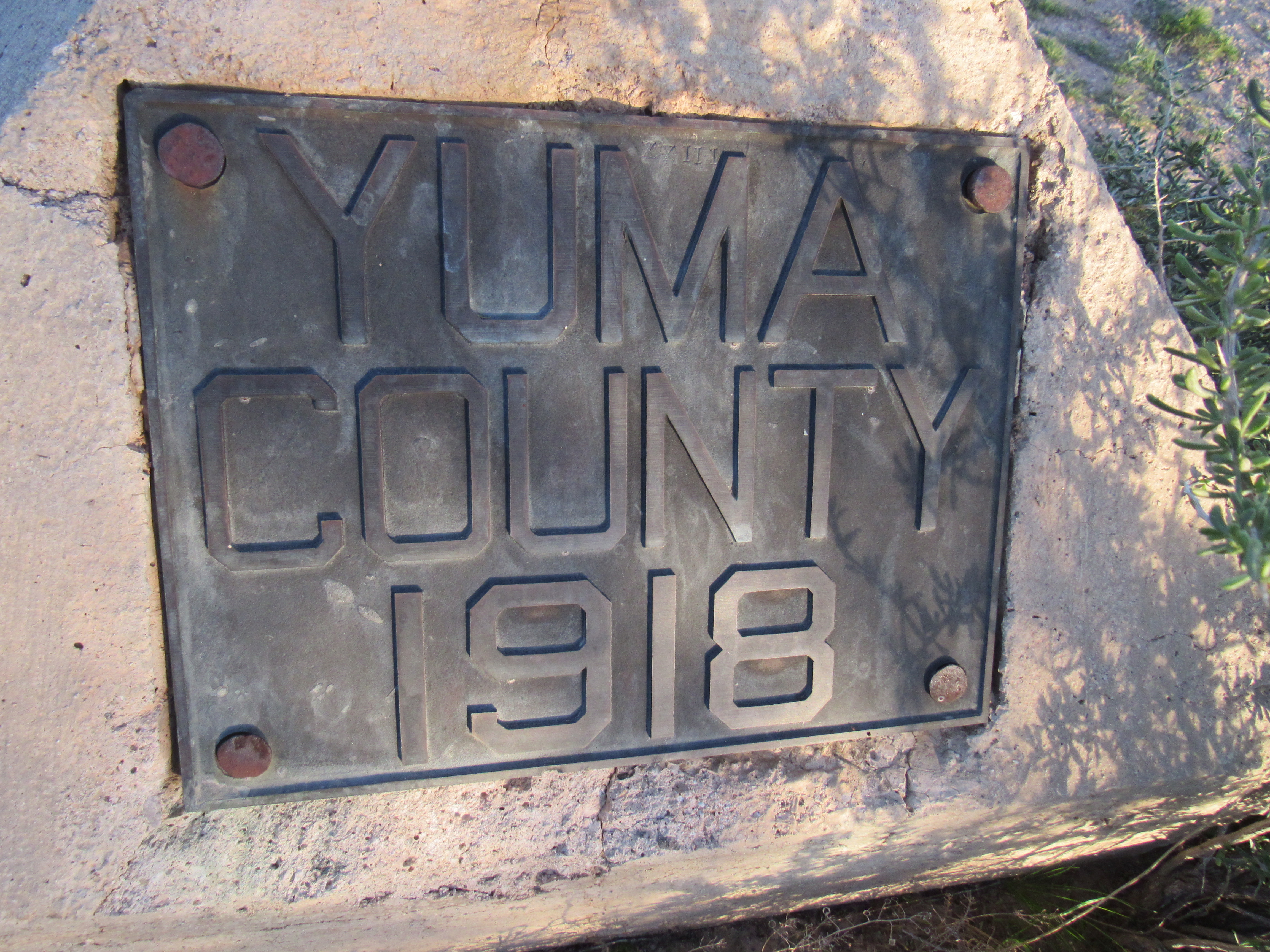
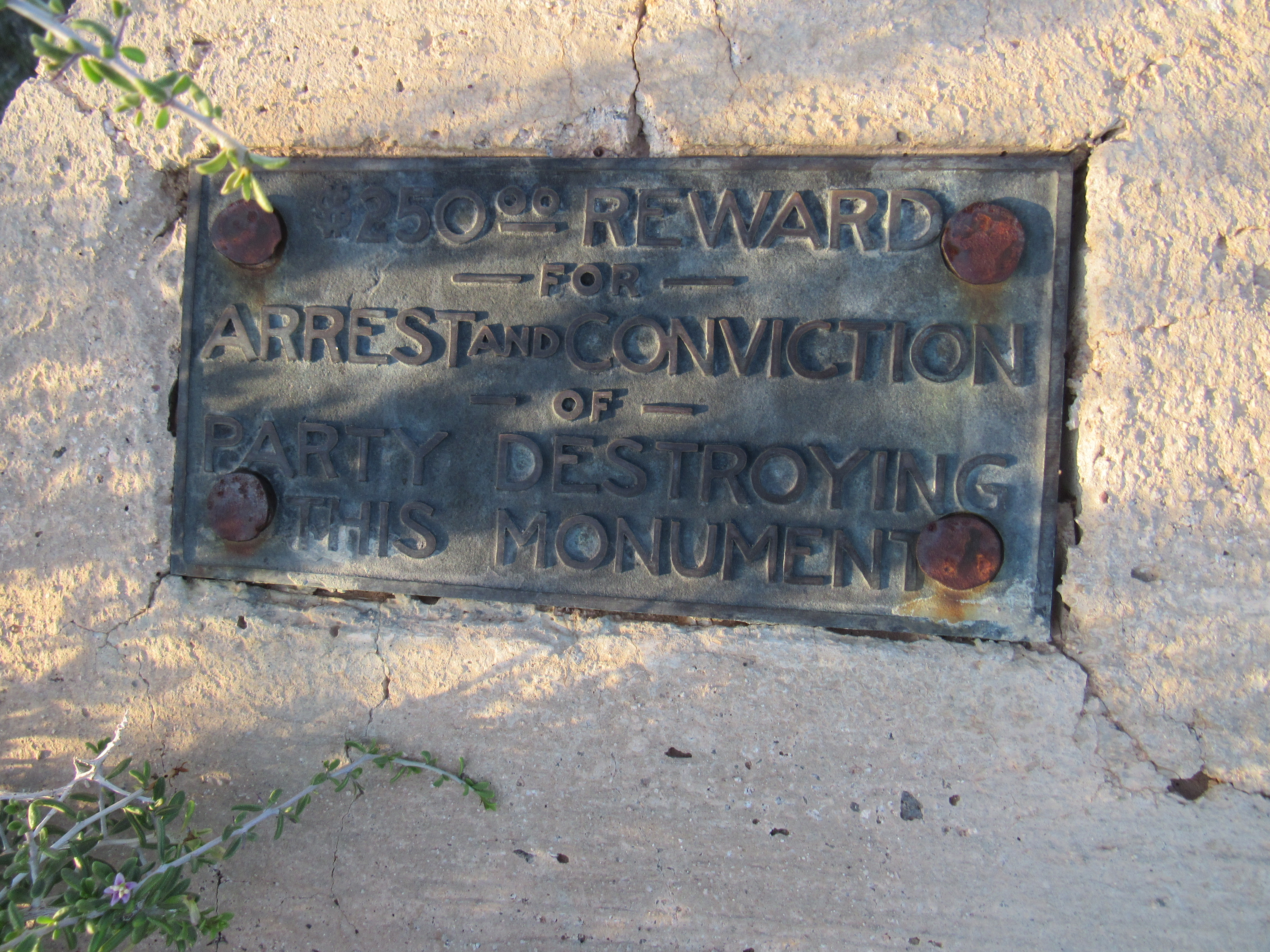
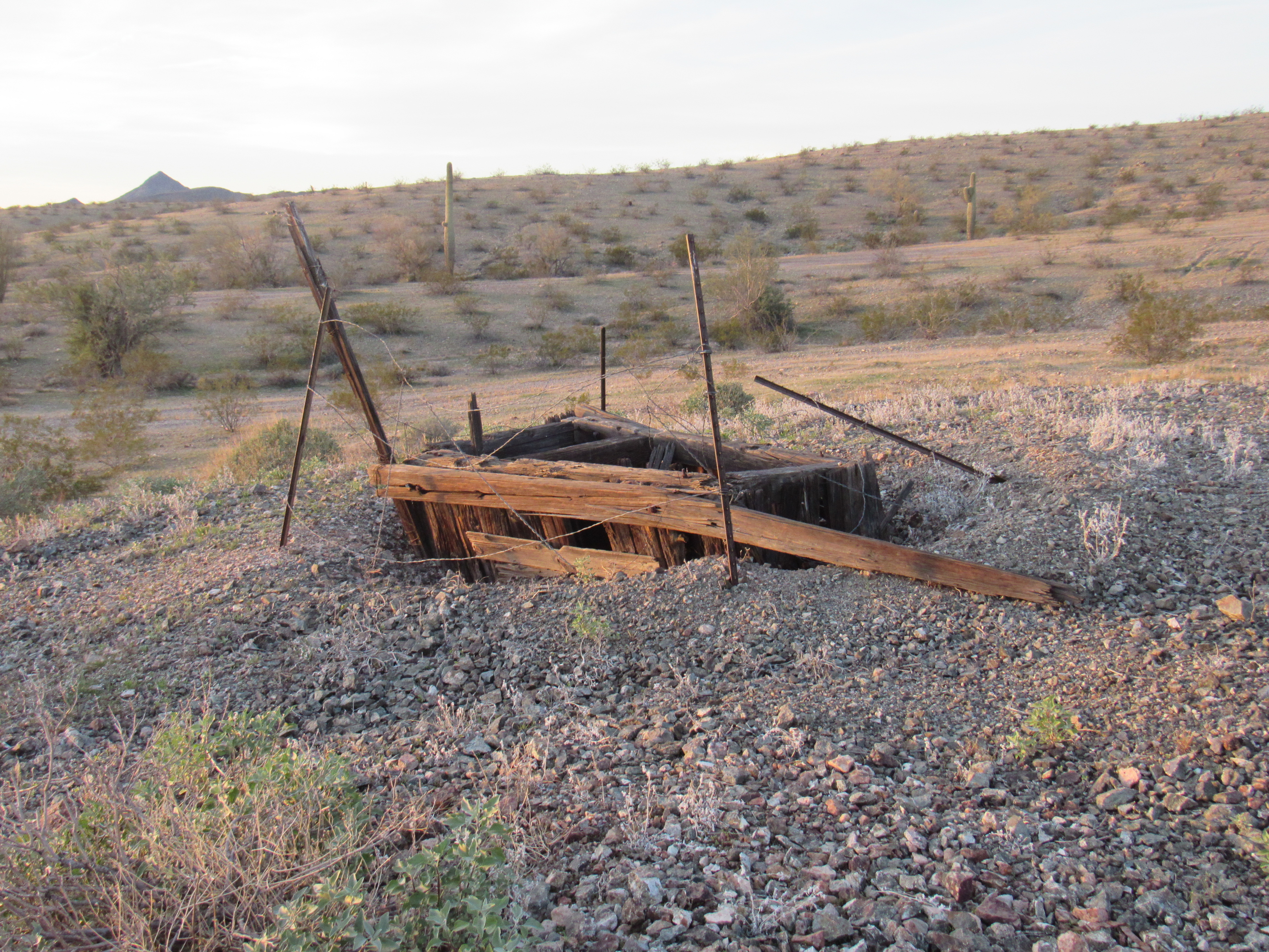
I had stumbled upon a survey marker showing the boundary between the two counties. These were all numbered, and this one was Monument 23. Worth a few minutes of inspection, for sure. Another mile brought me to the Stardust Mine – I love these names. It makes me wonder what was going through the prospector’s mind when he came up with this one. All that remained were these two shafts – at least someone had made an effort to string up a bit of barbed-wire around the openings to give a token warning to passers-by.
The Stardust Mine
And here’s a look down – yikes!! At least this shaft was faring better than the one back at the Black Silver Mine.
Leaving the mine, I went a bit farther west before turning north on a sketchy track. Fortunately, the desert here was flat and posed no problems, so I quickly reached what is known in these parts as the Arlington-Clanton Well Road, a good dirt road by any measure. In short order, it took me to a low pass in Cemetery Ridge itself, where I camped for the night at 1,357 feet. It had been a short day with the Ridge, but a good start.
Day 2
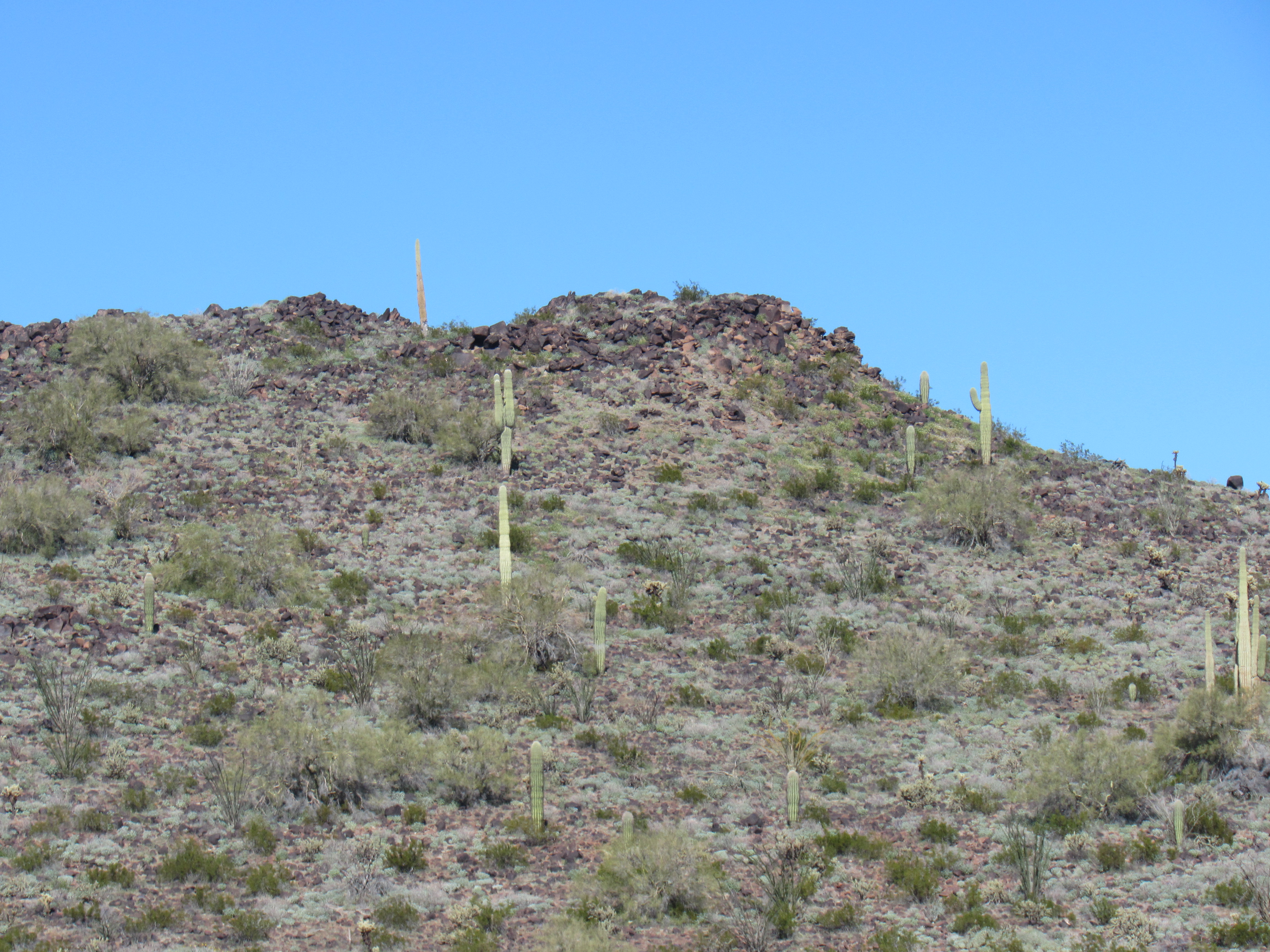
In the past, I had spent some time in the nearby Clanton Hills, documenting every bump and exploring every nook and cranny. It seemed like a fun idea to do as much as I could along those lines with Cemetery Ridge as well. There were actual summits along the Ridge that met the criteria we peakbaggers use to give them that status, and there were a great many lesser bumps which I would not climb but would try to document. Unlike most other trips, this time I’d forgotten about the alarm clock and decided that I would sleep in as late as I wished, and that’s exactly what I did this morning, lazing in my sleeping bag until long after sunrise. Before breaking camp, I took these photos of some nearby parts of the Ridge. Here’s nearby Point 1504 right next to camp.
Point 1504
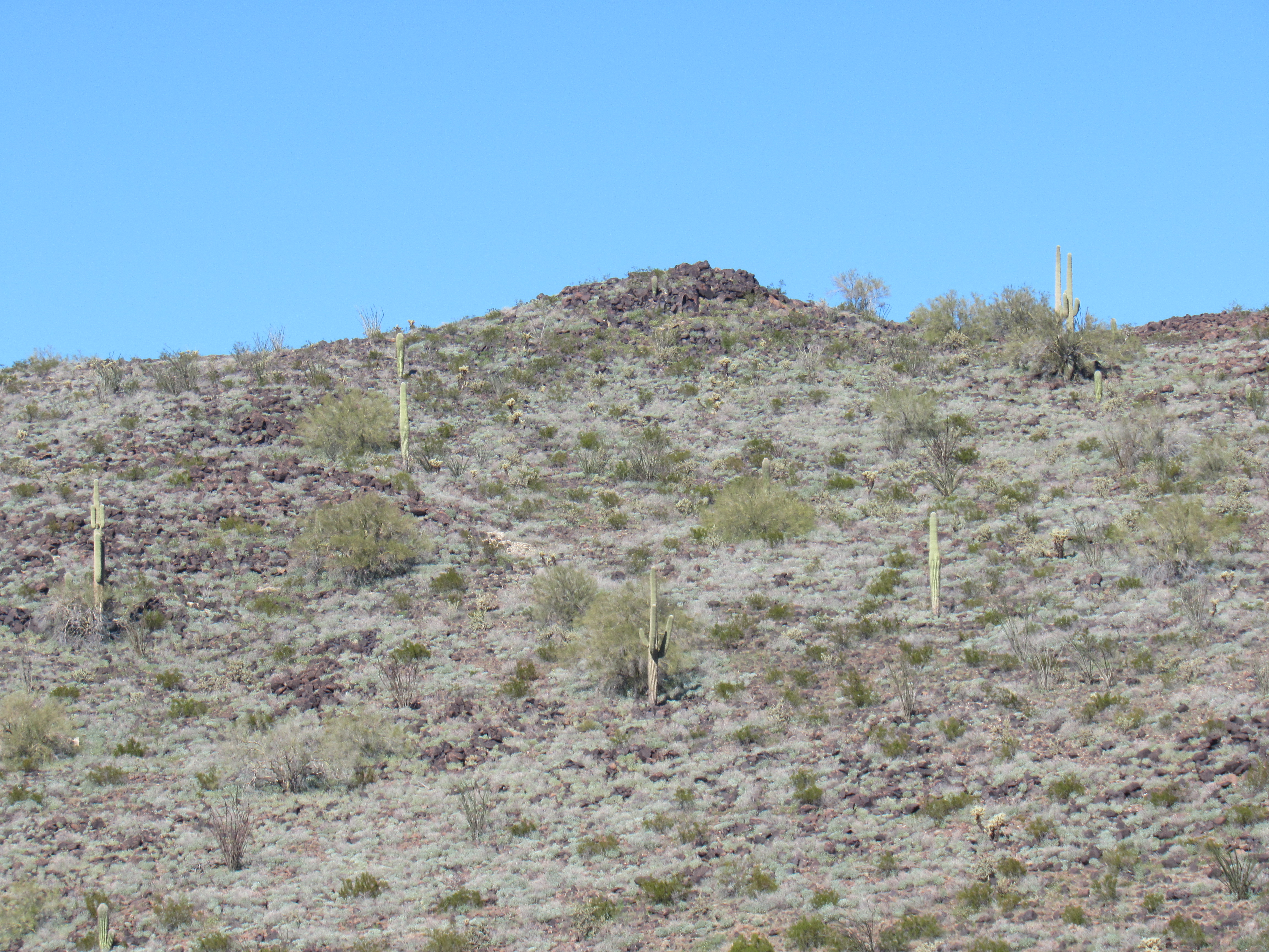
And just NW of it, Point 1597 can be found.
Point 1597
From my campsite, I could look out and see, a mile away, something called Gibson’s Roost Well. It warranted a look, so away I went. I’m not sure who Gibson was, or if in this case “roost” indicates he lived there, but here is some of what I found when I arrived.
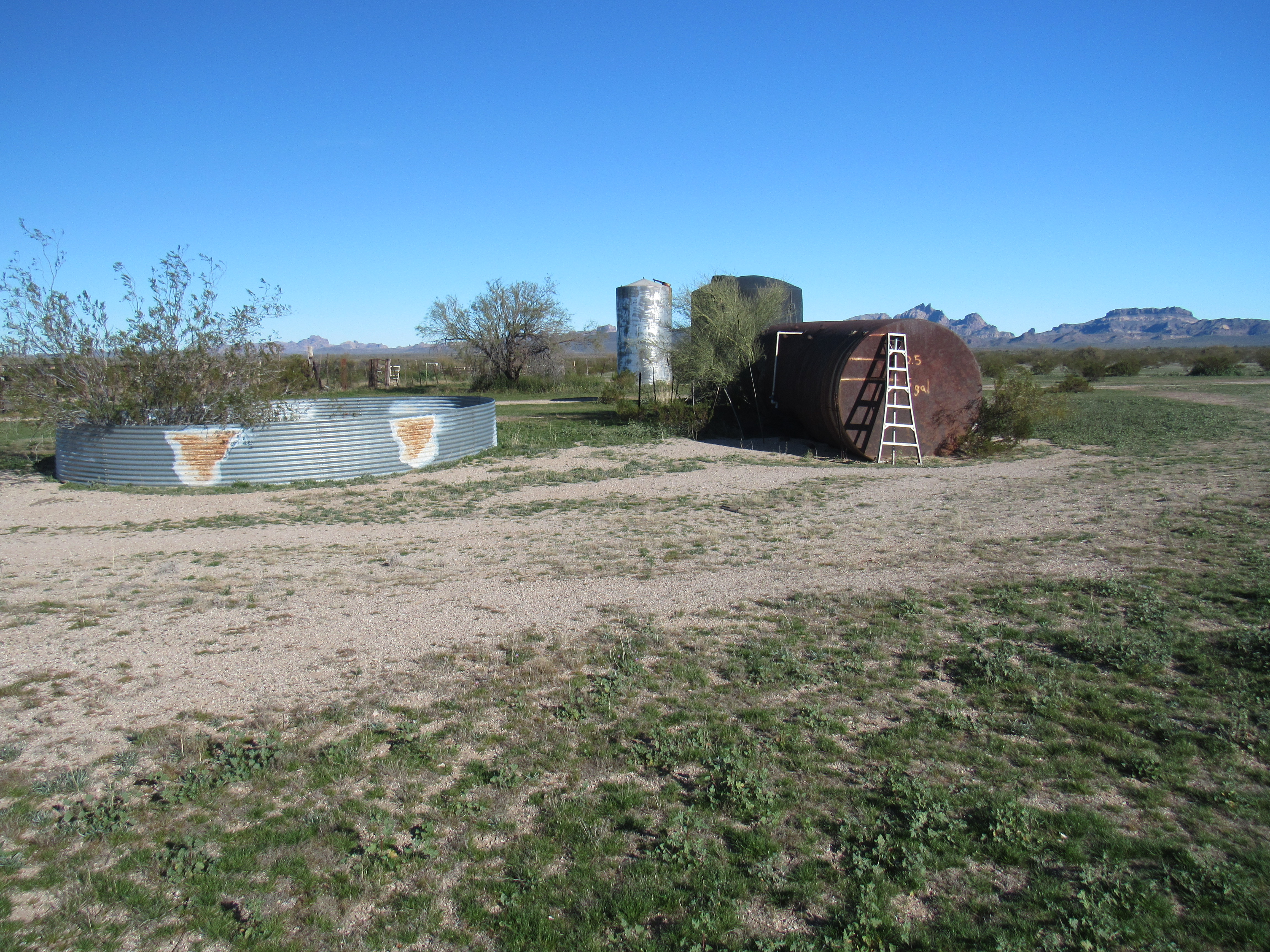
Gibson’s Roost
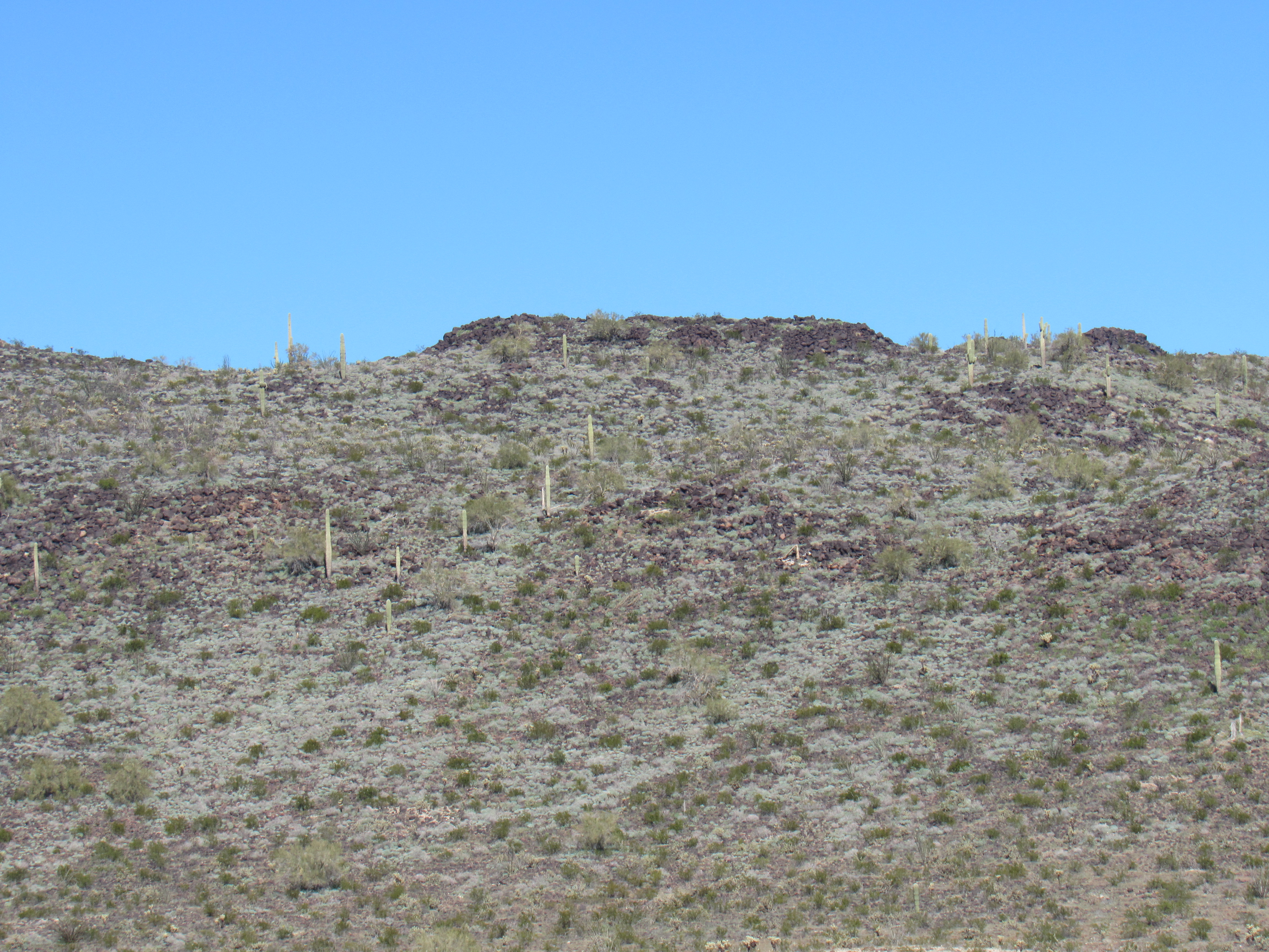
There was another peak to be climbed back near where I’d camped, so after a few minutes at the well I returned the way I’d come. By the time I’d parked and set out, it was already 10:30 in the AM – it was an easy saunter up the gentle northwest ridge of Peak 1835. The original register left back in 1999 had lost its seal, so I replaced it with a newer model and signed in. It was pushing one in the afternoon by the time I was back down at my truck. Wow, the day was wearing on and I’d done so little – I guess that’s the price you pay for sleeping in. This photo was taken late the previous afternoon from the south side – I climbed up the left skyline.
The south side of Peak 1835
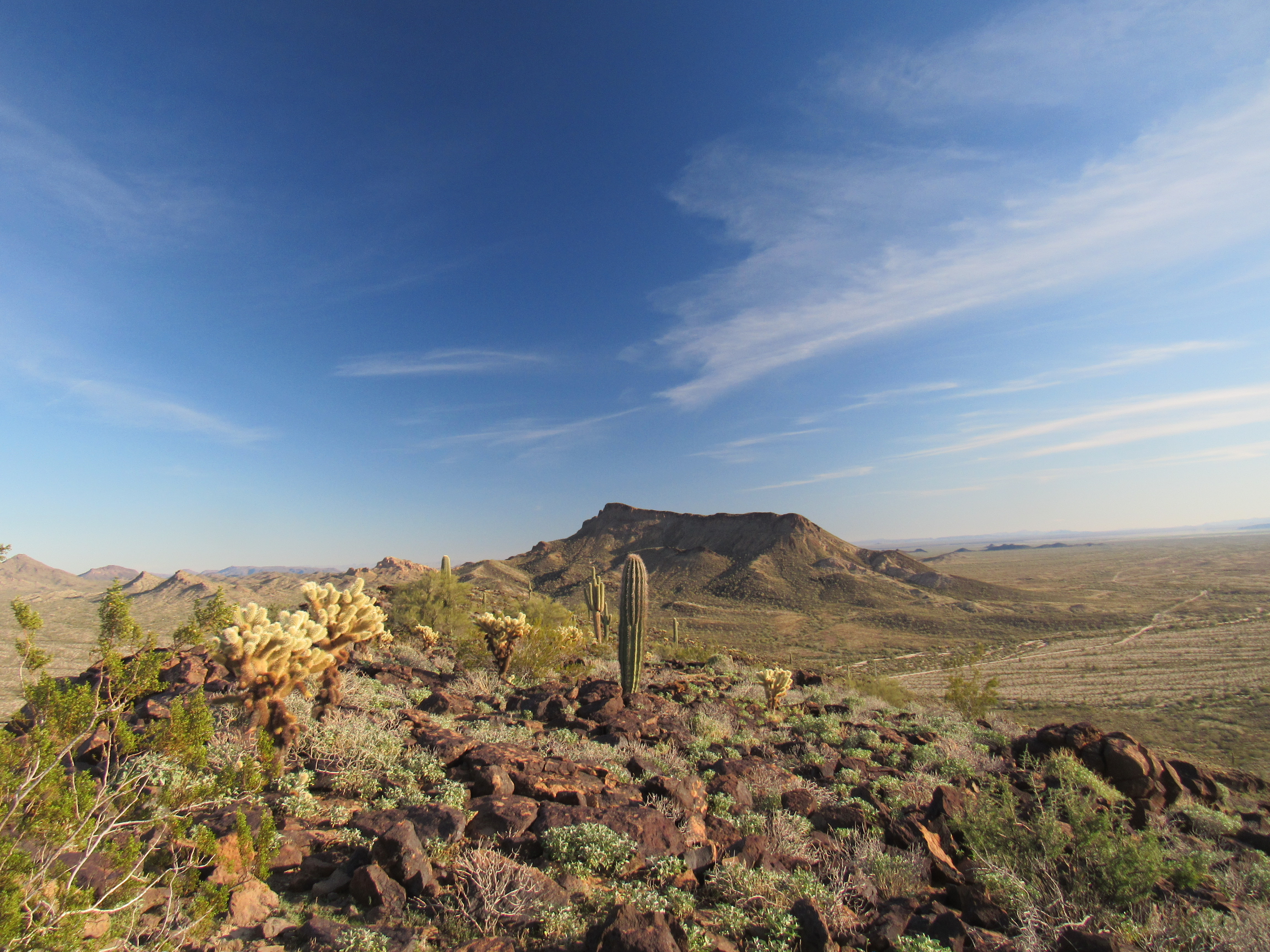
Over to the east, in the Eagletail Mountains, were some dramatic peaks I could see. Check out these beauties. The first is Eagletail Peak, the range high point, rising 1,600 vertical feet from the desert floor in all its rocky splendor.
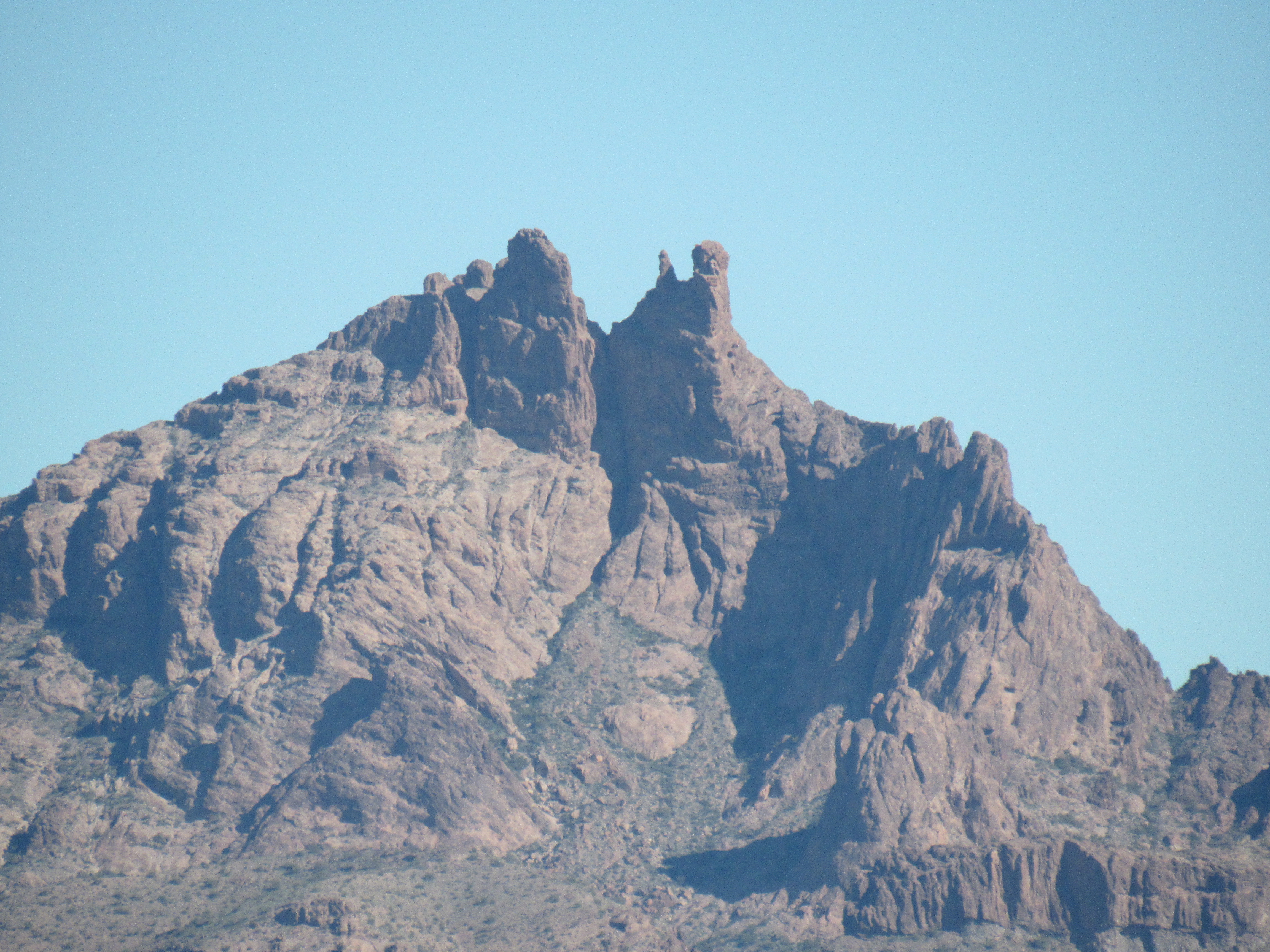
The west side of Eagletail Peak
And if it’s drama you seek, here is Anvil Mountain, unclimbed to this day.
Anvil Mountain
Okay, back to the present at Cemetery Ridge. Let’s continue our journey along its length, showing you the various bumps as we go. Here is Point 1467 in the foreground, which sits just to the west of Peak 1835.
Point 1467
Moving west along the spine of the Ridge, here’s another.
Point 1458
And the next one.
Point 1480
And the next one, Point 1408, the dark one in the foreground.
Point 1408
And one more as we work our way west along the Ridge.
Point 1578
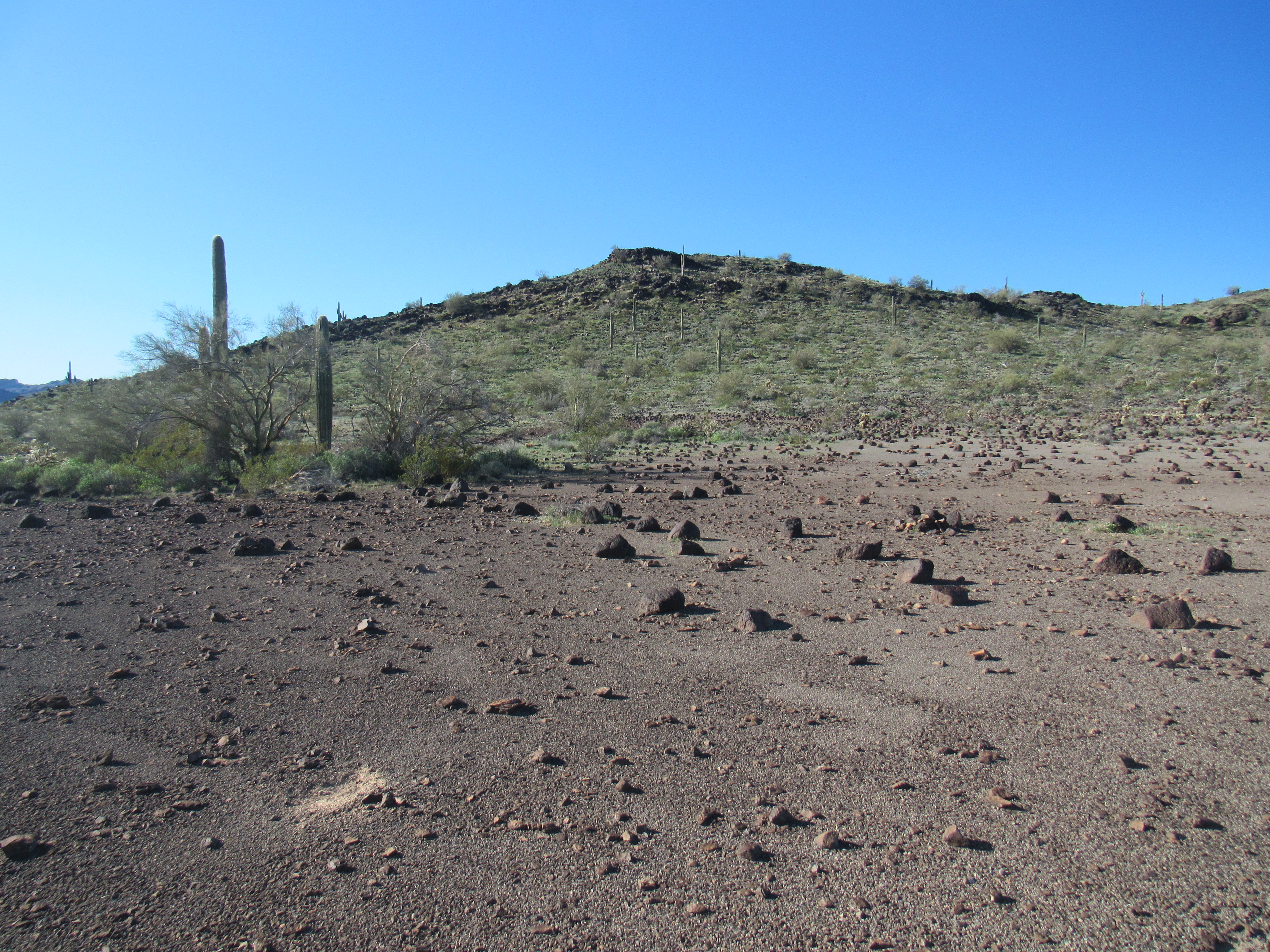
Okay, enough of little bumps – I had now reached the next actual summit. I parked, set out on foot and was on top of Peak 1668 by 3:30 in the afternoon. Here’s what greeted me – see the metal pipe sticking up in the cairn?
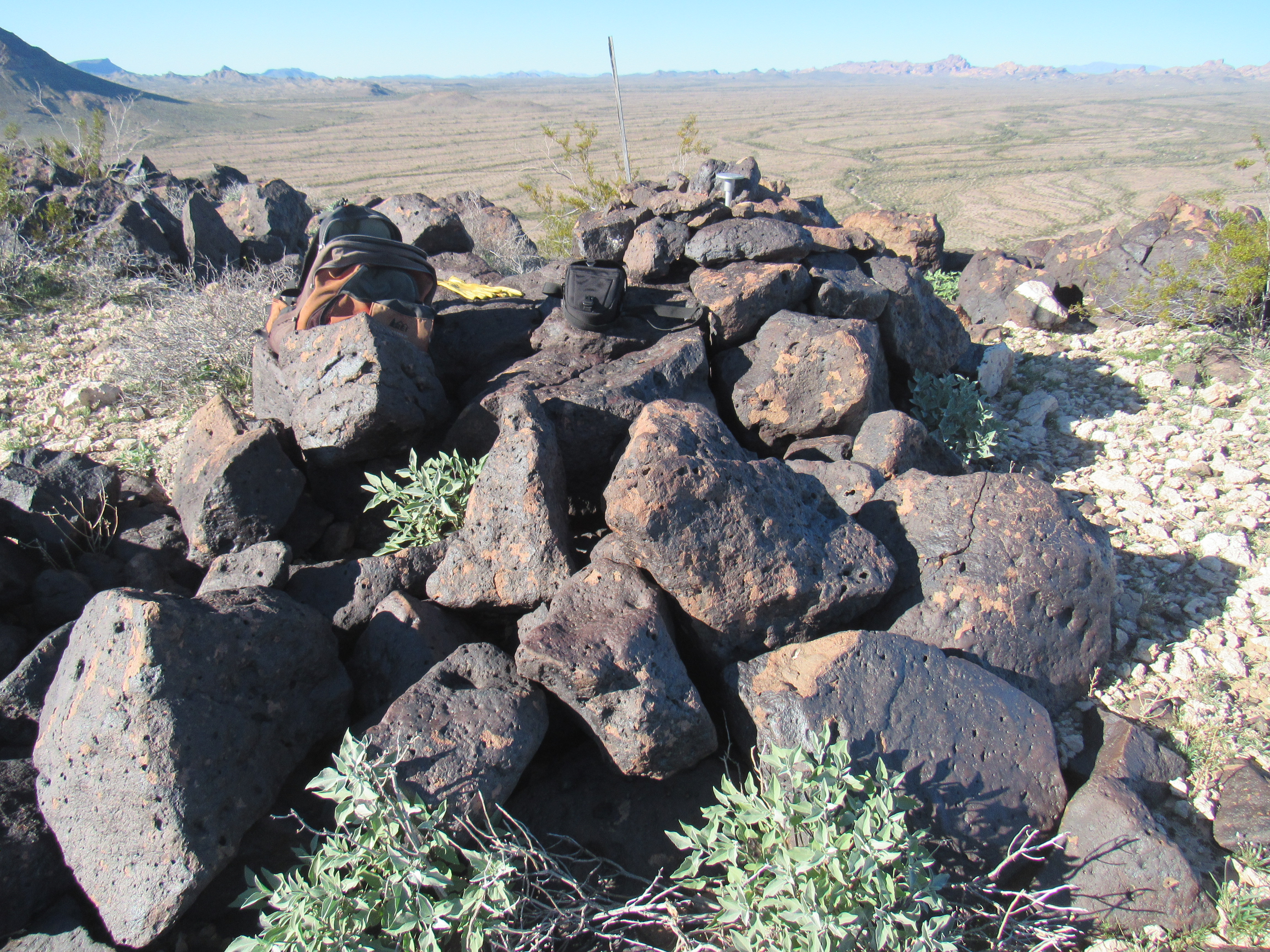
The summit of Peak 1668
Here’s a closer look. The jar is one that I left to replace another old, leaking register I found with 5 prior entries.
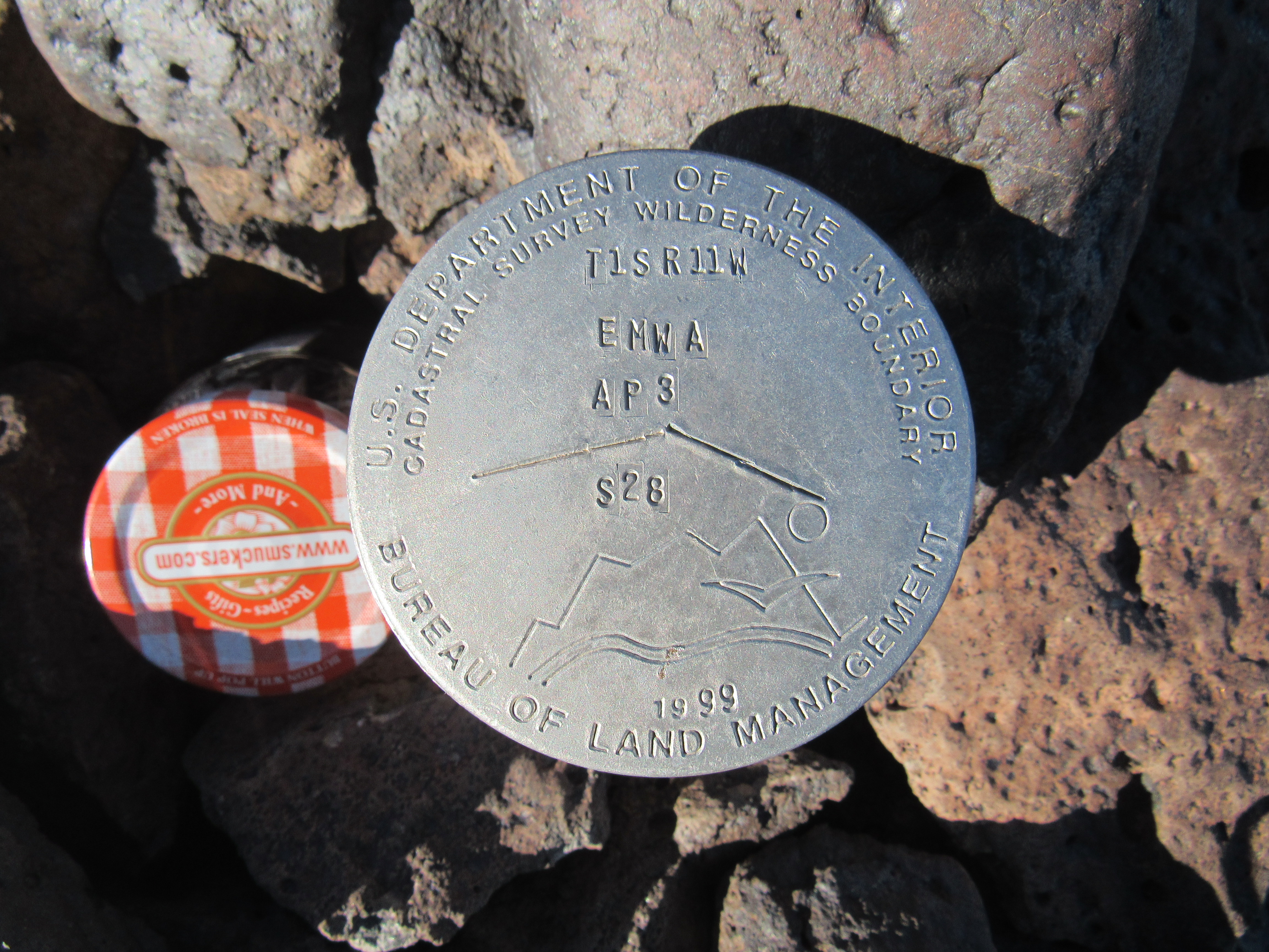
The survey marker
The survey marker tells us that this is the boundary of the EMWA, meaning the Eagletail Mountains Wilderness Area. Nice design on it.
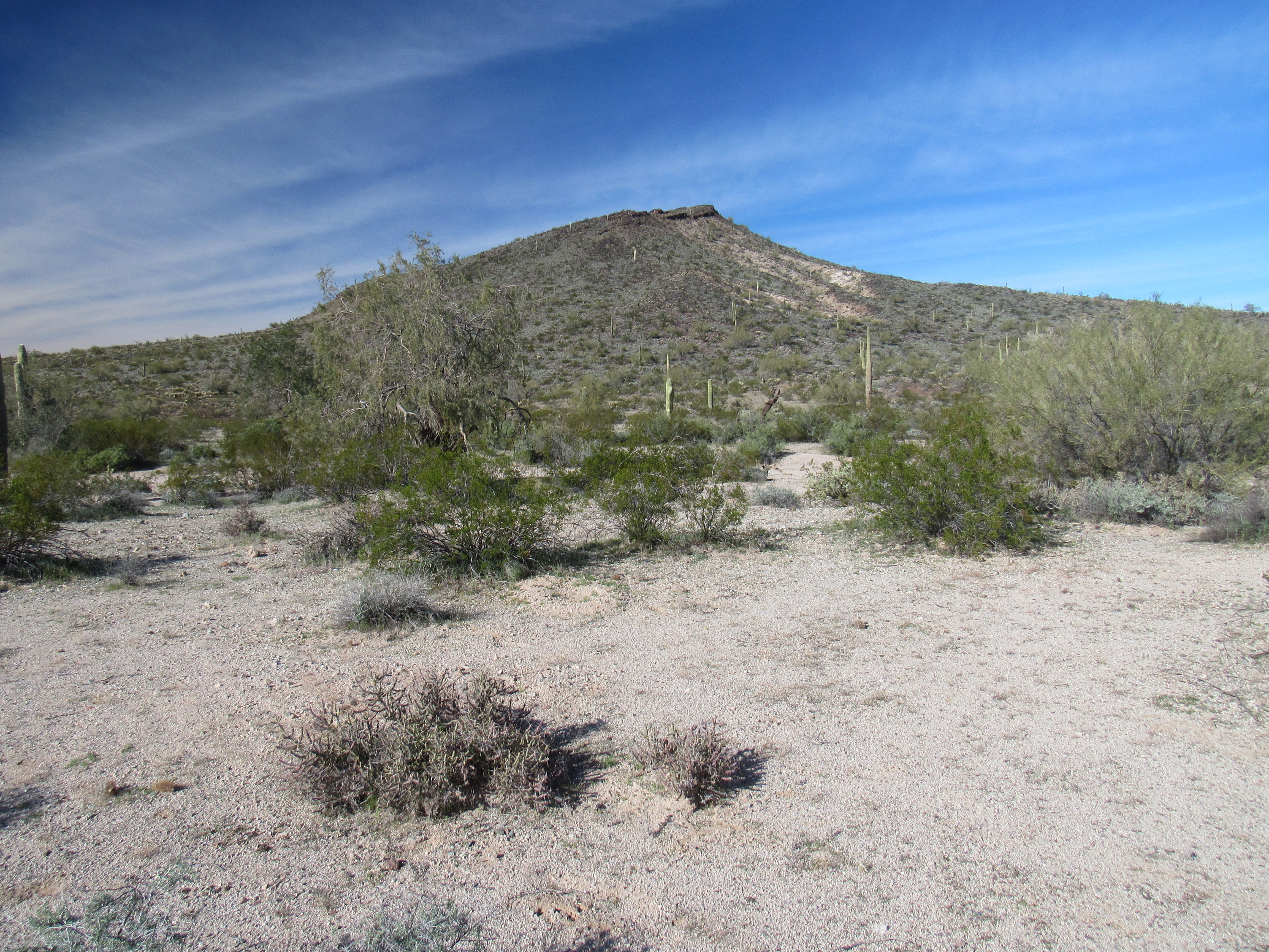
A look to the northwest showed me this afternoon view of Nottbusch Butte, on my agenda for the next day. At this point, I couldn’t tell how I would approach it but it certainly was a nice-looking peak.
Nottbusch Butte
Down I went, back to my truck. There was time to stop and inspect one more item of note. A short drive farther to the west brought me to a feature labeled on the map as “Apache Box”. It was a narrow gap in Cemetery Ridge, a spot where the mountain came right down to the desert floor. The gap was quite flat and only 600 feet wide. Did the term imply a kind of place where Apache Indians might try to box in enemies, or perhaps game they were hunting? The name seems out of place, though, because both historically and present-day, none of the various Apache tribes live(d) anywhere near here – they were all much farther to the east. It’s hard to photograph it in just one photo (I should have tried it from farther back), but here’s one that shows how the east side of the box comes steeply down to the desert floor. The other wall looks much the same. The white things are markers showing the edge of the wilderness area. I cannot find any record of who named the feature, or why.
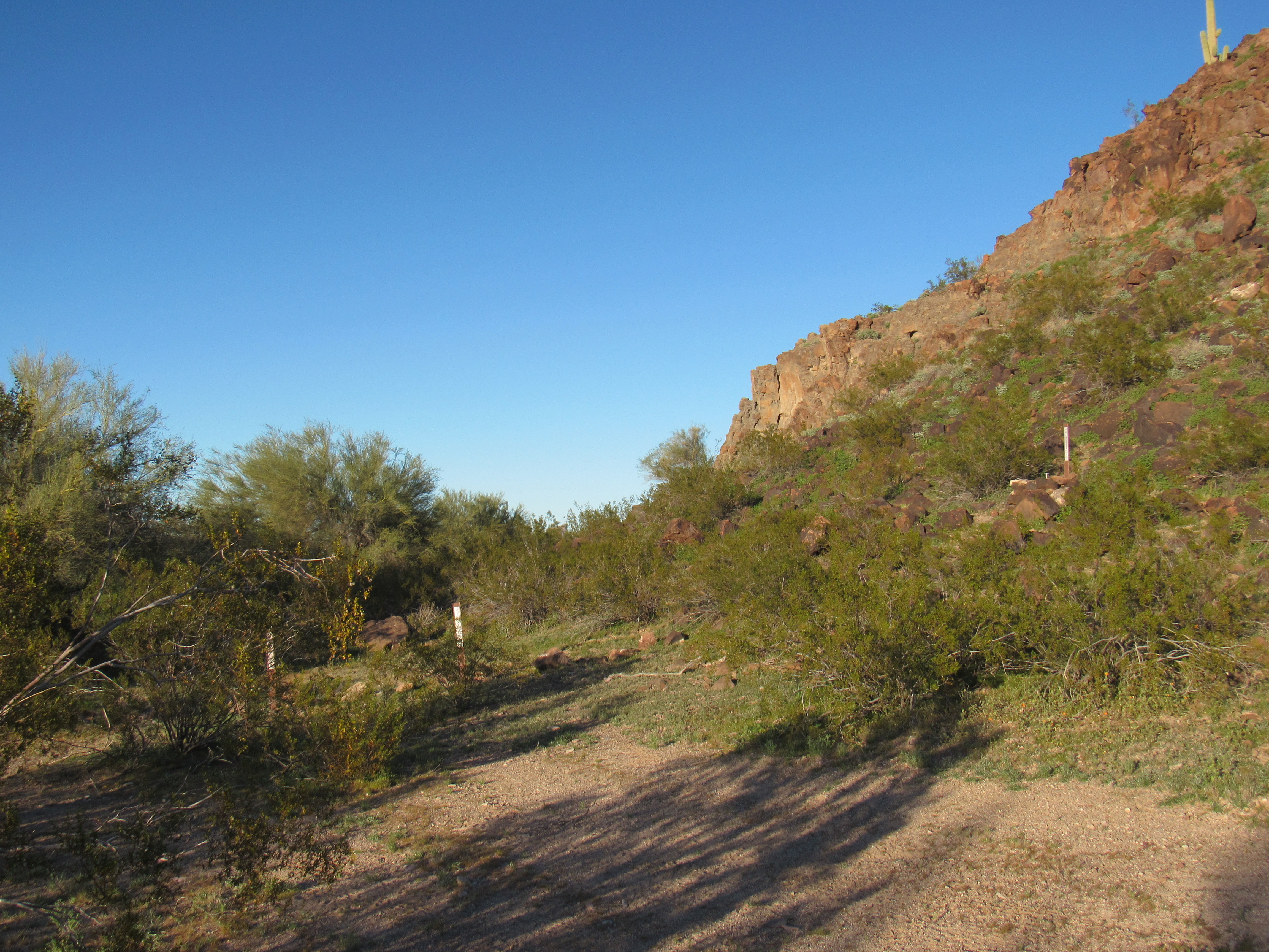
Standing in Apache Box
My hope this afternoon was to drive as close as I could to my starting point for a climb of Nottbusch, but there were a lot of miles to cover and I was losing the light. Four quick miles brought me to Clanton Well out in Nottbusch Valley, where I joined the Palomas-Harquahalla Road, a wide dirt road heading north. This is a major track in the area – it runs all the way to Interstate 10 far to the north. I would only use it for a mile today before heading off on yet another dirt road which would take me to tomorrow’s climb. I didn’t get far, though, before the sun set and I camped for the night. Two days had now been spent with Cemetery Ridge, and there was a lot more of it to explore.
Please stay tuned for the next part of the story, called “Cemetery Ridge – Part 2”.