
Please be sure to read the preceding Parts 1,2 and 3 of this story before starting this one.
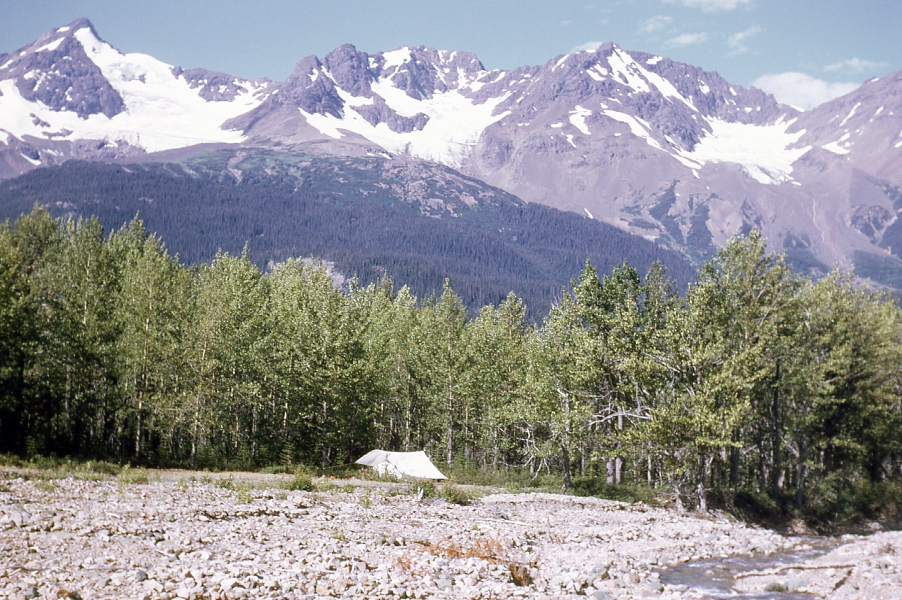
August 7th had arrived, and the bosses had decided it was time for me to head out on another fly camp, this time with Bill. He and I got along well together, so this should be a good experience. We got all our gear together and into a sling for the chopper. This time we were going to a place called More Creek. Our flight there went without incident, and once the pilot had dropped us and our gear off, we set up camp at 3,100 feet elevation. Here’s a picture of Bill at camp – he’s looking very fashionable, don’t you think, wearing my bearskin?
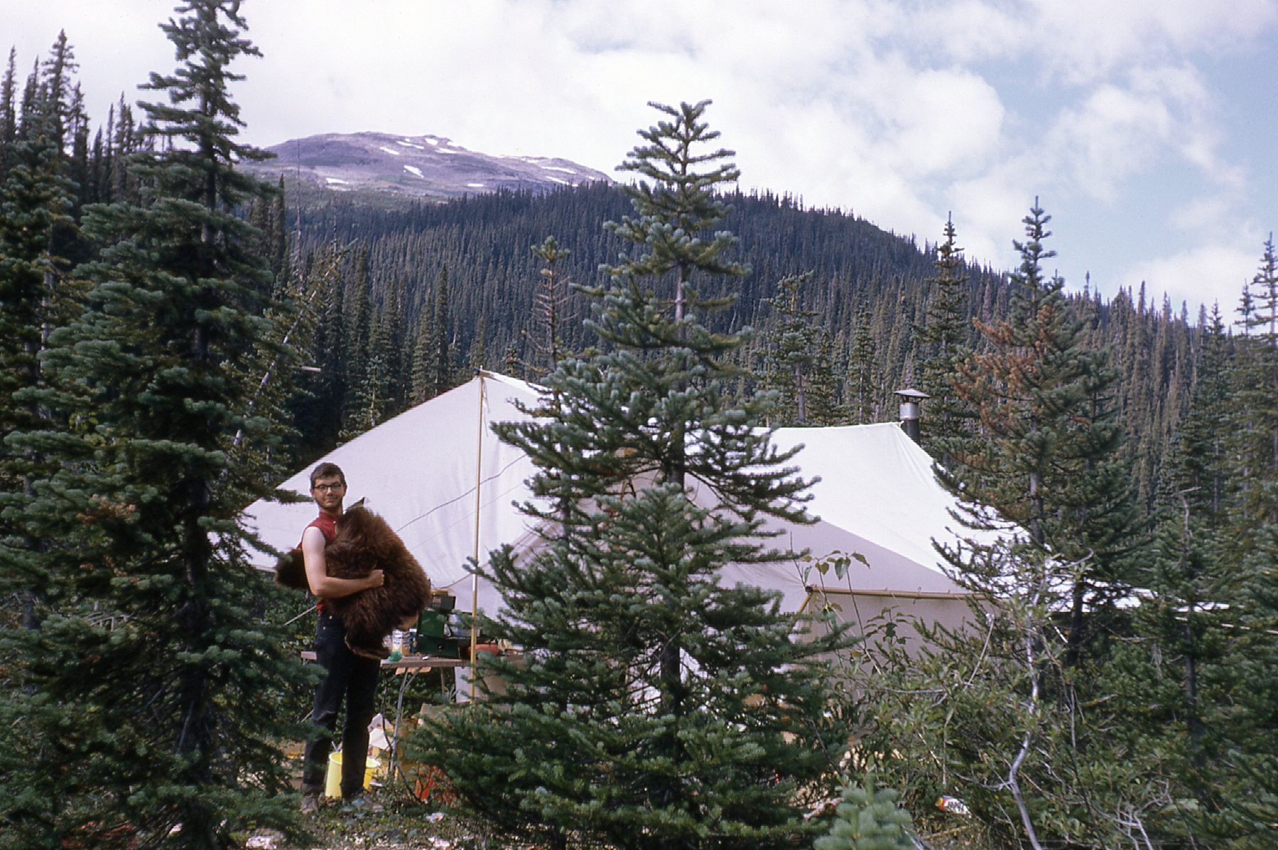
Bill at fly camp 3
See the mountaintop behind him, the part above tree-line? That’s the edge of the Arctic Lake Plateau, a beautiful place, quite other-worldly. It wasn’t far on foot, and here’s what it looked like up there.
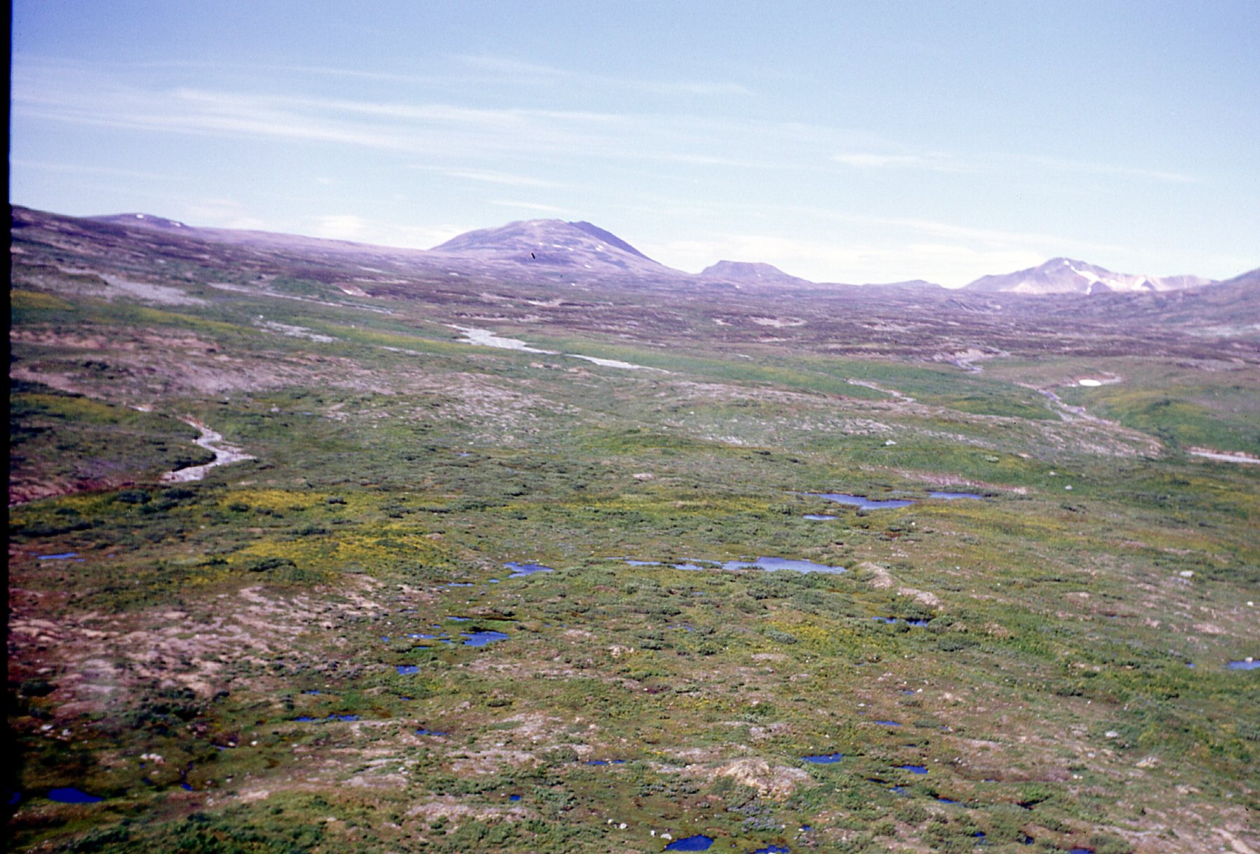
Up on the plateau, looking north.
Here’s another view we had, this time looking northeast.
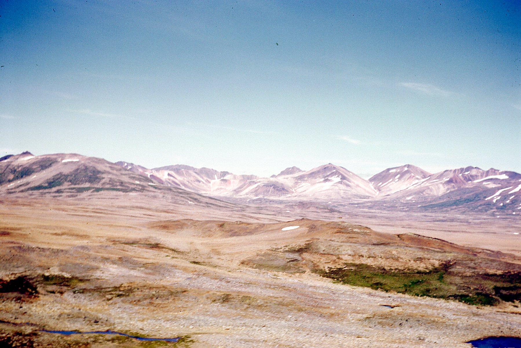
A look towards the Spectrum Range
Check this out – that’s a lake out there, that white thing. Appropriately enough, it’s called Arctic Lake. It sits at around 5,000 feet above sea level, and in this photo, taken one day as we flew by in mid-July, it was still completely frozen over.
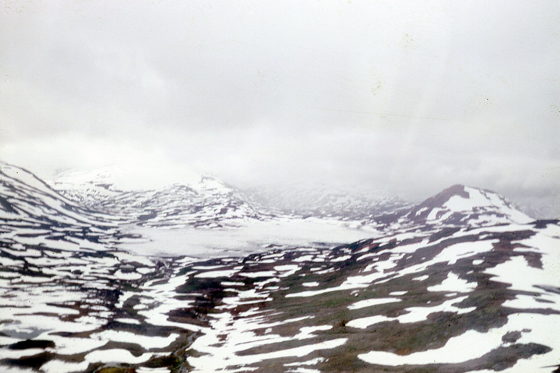
Arctic Lake
Arctic Lake was only a few miles from our fly camp, and impressive as the plateau was, it was completely overshadowed by some nearby peaks. A few miles to the east sat Hankin Peak, a real beauty, completely surrounded by glaciers. It stood 8,734 feet above sea level, with 4,240 feet of prominence. This link will show you a topographic map of the peak and all its surrounding glaciers. Hankin was only 25 miles from our base camp, meaning we could fly all the way there in an easy 17 minutes if we wanted.
Just a few miles to the west of our fly camp on More Creek stood the biggest, baddest peak of them all in our local group of peaks. This giant was even higher than Ambition Mountain (9,688′) which was right around the corner from our base camp, and it was known as Scud Peak. Earlier, a couple of chapters ago, I showed you pictures of Scud Glacier, named after the peak, but the peak itself is a real mind-blower. It stands 9,800 feet above sea level, and has a whopping 7,126 feet of prominence. This link will take you to a site that has a terrific picture of Scud Peak – it looks like an Arctic wilderness! It was so close to our base camp that we could fly there in an easy 16 minutes at cruising speed.
Bill and I spent an idyllic 7 days at that fly camp, enjoying perfect weather. Finally, on the 13th of August, our chopper arrived and flew us directly to another fly camp with no time back at base camp. This would be our 4th of the summer, and it was situated along Mess Creek, at 2,600 feet above sea level. They promised us we’d only spend a few days here, as we’d already been out a week. En route to that camp, the chopper stopped at one of our other fly camps to deliver their mail. Check out this nice setting where they were camped.
Talk about great scenery!
Once the pilot dropped us at our new site, we were pretty darn pleased. It was a beautiful park-like setting in the forest beside Mess Creek, which was more like a river than a creek. We set up camp and settled in for what we thought would be just a few days. On the 16th, during our regular evening radio call to our base camp, our boss informed us that a forest fire was burning at nearby Kinaskan Lake, only about 10 miles from our fly camp. We had been noticing smoke in the air, but hadn’t been too concerned to that point. He then went on to tell us that the BC Forest Service had conscripted our helicopter to use in fighting the fire, so we wouldn’t be returning to base camp until they were done with it and our chopper crew.
That was quite a shock to hear, and we became really concerned because we were almost out of beer. Over the next days, we noticed animals moving along our side of the creek, obviously fleeing the fire – deer, moose, a black bear. All we could do was sit tight and hope for the best. Each evening we’d talk with our boss on the radio, but still no chopper. Finally, on the 20th of August, it was released and Bill and I were the first ones to get picked up and taken back to base camp. Whew!
Bill and I had been out at fly camps in a continuous stretch from the 7th to the 20th of August, a record for our crew, and it sure felt good to settle back into a base camp routine once again. The season was wearing on, and it was starting to freeze at night. On the 24th, I had the good fortune to spend the day prospecting at a place called Deeker Creek. The native people of this region called it Lx’áas, which means “Falling Water” in their language. We spent the day on glaciers having a look around.
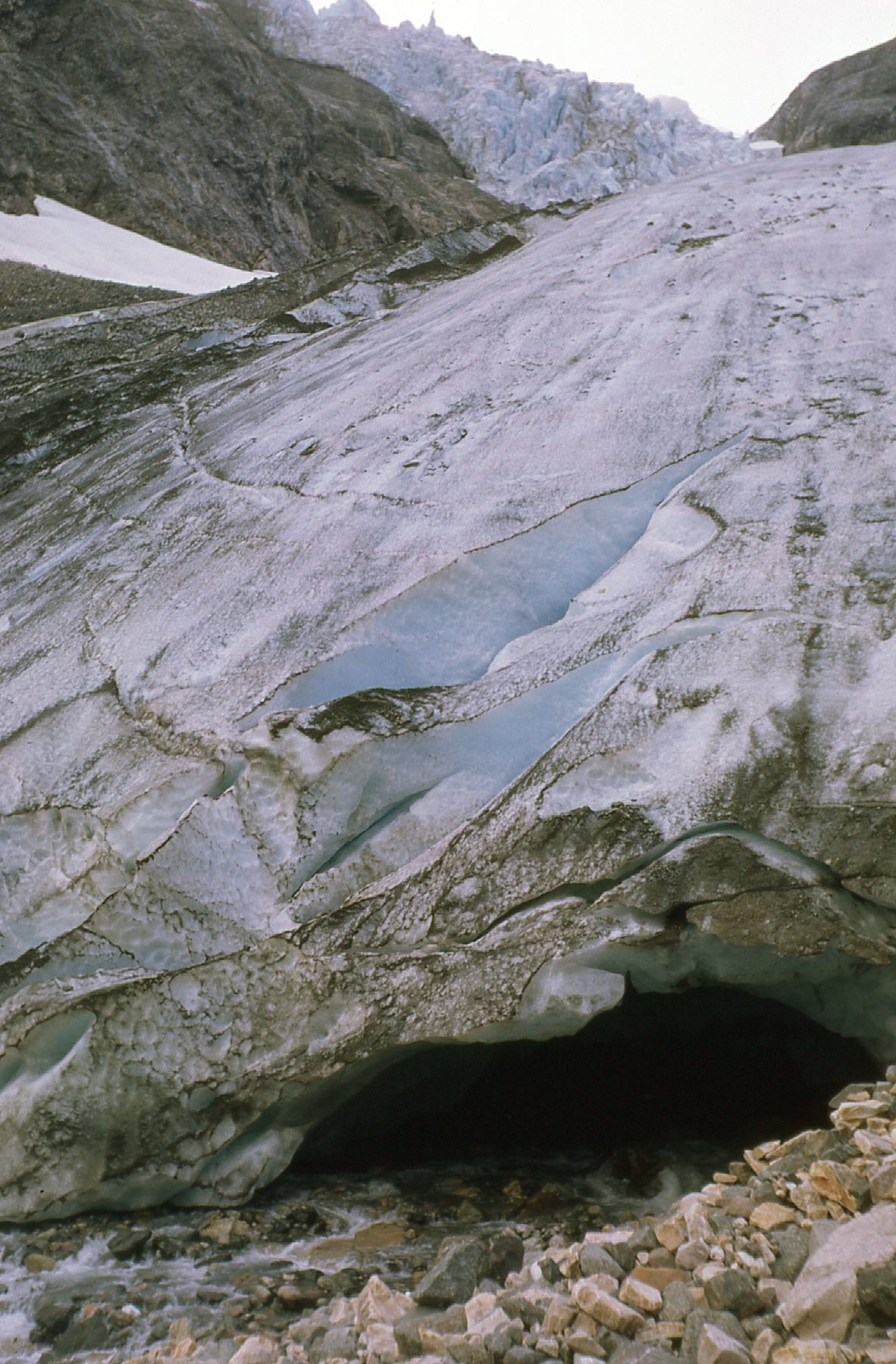
Near Deeker Creek
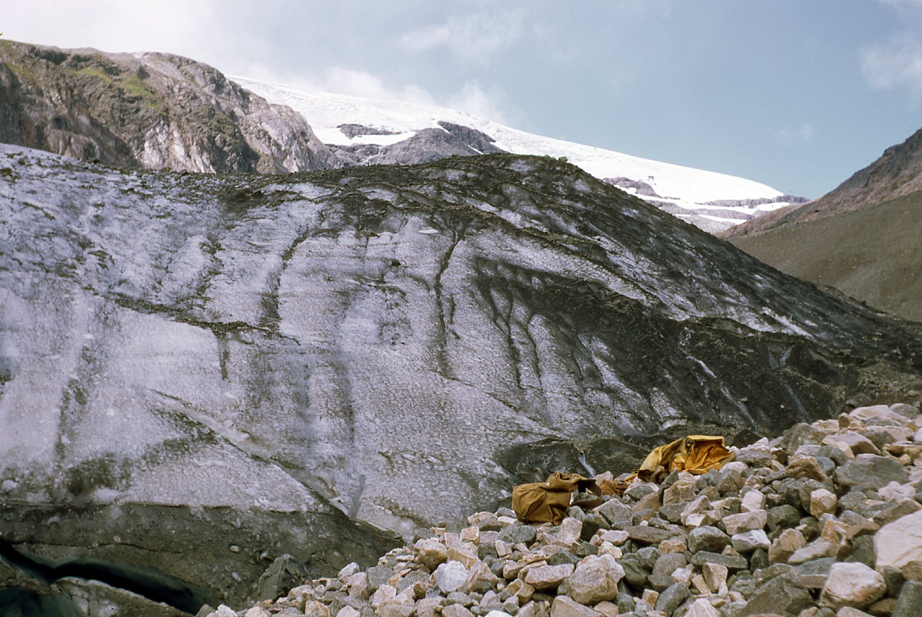
More ice
This was only 15 miles from the crest of the Boundary Ranges and the border with Alaska. There are some amazing glaciers in this area: the Mud Glacier, the Flood Glacier and the Great Glacier. These massive glaciers come all the way down to about 100 feet above sea level near the Stikine River, and if that doesn’t give you an idea of how cold this area is, then nothing will. The province of British Columbia has created Great Glacier Provincial Park in order to protect the glacier.
I’m pretty sure that I mentioned much earlier in this piece that the only human settlement along the entire length of the Stikine River is Telegraph Creek. In the language of the local Tahltan people, the village is called Tléikw Héen, which means “Berry Creek”. In the entire 3 months I spent in the Stikine, only one time did I go there.
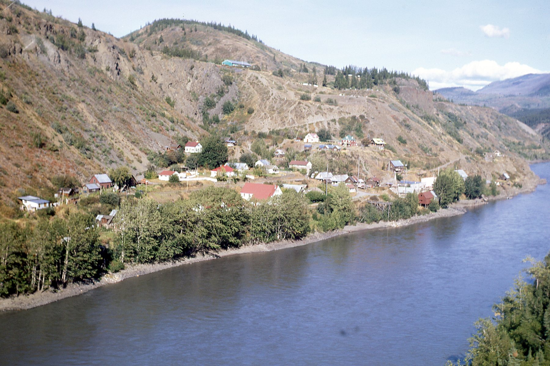
Telegraph Creek
On that day, as we flew north from base camp and were cruising along a couple of thousand feet above the bush, our pilot Don Halvourson asked me if I’d like to take the controls of the chopper for a bit. Would I? You bet! He showed me how things worked, then gave me a try. In a short while, my efforts had brought the machine to a complete halt. I couldn’t really tell, but he said that we were sitting there in space with zero forward movement, just hovering. And so ended my career as helicopter pilot.
On August 26th, my birthday, my boss, Ram, asked me if there was anything special I’d like to do. “With the chopper, you mean?” “Yes”, he said. Well, there was one place I’d been thinking of a lot, and I told him I’d like to go up the Chutine River. The Chutine is a major tributary of the Stikine – it drains a part of the Boundary Ranges right on the BC-Alaska border and flows east to enter the Stikine. The Tahltan people have a name for the Chutine, and they call it Shulhéeni which means “River on the Edge”. He said that’d be fine, as long as I promised to at least pretend to look at a few rocks during the day. From our base camp, it was only a few minutes flight (12 miles) to the mouth of the river where it enters the Stikine, but I wanted to go up the river a ways. The pilot was fine with that and flew me many miles more, not as far as Chutine Lake but to an alpine meadow before the lake. My boss allowed an exception to the rule of always going out with a partner, so today I was by myself. I spent a blissful 8 hours alone, wandering alpine meadows and lost in my thoughts. If you travel 30 miles up the river to Chutine Lake, you find yourself right beside Chutine Peak, which is 9,547 feet high and boasts a prominence of 5,791 feet, making it an ultra-prominence peak. Since the lake is only 885 feet above sea level, the peak soars a full 8,662 feet above the east shore of the lake. The peak sat 38 miles from our base camp, meaning we could have flown all the way to it in a scant 27 minutes. Chutine Peak sits on the eastern edge of the massive Boundary Peaks ice sheet, only 14 miles from Alaska and only 27 miles from the Pacific Ocean, where at this northerly latitude glaciers flow directly into tidewater.
My Chutine idyll finally ended when I heard the distinctive sound of the chopper coming up the valley for me. It had been a perfect day, and I was always grateful to Ram for giving me that. He was a terrific guy, perhaps my favorite boss ever, and I was devastated to hear of his death only 2 years later. He froze to death overnight on far northern Vancouver Island in the winter after becoming separated from his partner while studying some mining claims. Barely 30 years of age and engaged to be married, his death was tragic.
Only 25 miles due south of Chutine Peak sat the paterfamilias of the entire region, a monster known as Mount Ratz. It stands 10,137 feet above sea level and is the highest peak of the Stikine Icecap and of the Boundary Ranges. It boasts a staggering 7,972 feet of prominence and was only 36 miles from our base camp – we could have flown all the way to it in an easy 25 minutes. The peak is named after William F. Ratz, the surveyor who was the engineer-in-charge of surveying the Taku, Whiting and Stikine Rivers – he died at the very young age of 25. Here is a link to a good photo of the peak.
It would be remiss of me to not mention another major peak in our area. Mount Edziza is Canada’s largest volcano, and if you ever see it it’s a huge plateau with many individual cinder cones. We flew over it several times, and the colors of the ground are amazing. Click on the link and learn all about it. It’s so vast that it doesn’t seem very high, but it stands 9,144 feet high and has a prominence of 5,741 feet, making it another ultra-prominence peak. It is covered in miles of glaciers, and for the few who visit it each year it is a true wilderness experience. Fortunately, it is protected as a provincial park. It was only 26 miles from our base camp, meaning that we could fly there in an easy 18 minutes.
I’ve promised you that mountains would be the main focus of this piece, and I’m trying hard to deliver. I think I’ve saved the very best for last. There’s a peak in the Boundary Ranges which is surrounded by vast icefields and is known as Devils Thumb. The local Tahltan people have a name for it, and that is Taalkunaxk’u Shaa. It is known to climbers the world over as a killer. Three different climbing parties have disappeared without a trace while attempting to climb its northwest face. That sheer face soars 6,700 vertical feet above its base, and to this day it remains unclimbed, the highest in North America. The mountain, at 9,078 feet, stands lower than several others I’ve described in this piece, but not one commands more respect. I wonder if I’ll live long enough to see that face successfully climbed by some intrepid and lucky party. Oh yes, our base camp was close enough that we could fly over to it in an easy 37 minutes.
Well, back to my story. On August 28th, we made a few final improvements to our airstrip to make things easier for the Otter to take off with a load. On the 29th, we loaded about 600 pounds of gear into it as a trial run and he made it just fine. The next day the pilot was back, and we loaded a full 2,000 pounds of gear into the plane and crossed our fingers as he gunned it, building up speed on our 1,300-foot airstrip. He barely got airborne before he flew out over the lake.
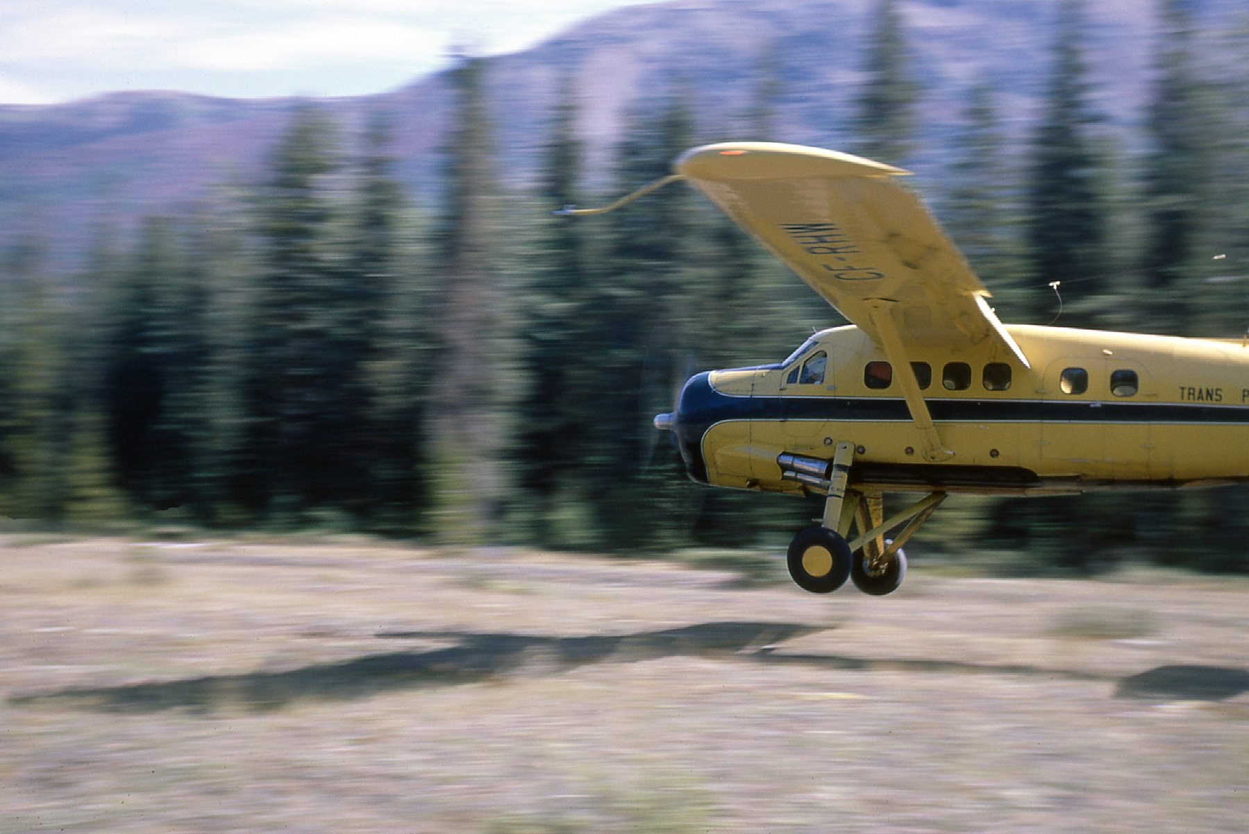
Pilot Ron Wells taking off with a 2,000-pound load.
We were holding our collective breath as his wheels lifted off the ground. The same day, our chopper with pilot and mechanic left for good. We had chartered the machine from Alpine Helicopters for the season, and it had been a good experience. I personally had been fortunate enough to log a full 23 hours and 20 minutes of flying time in that little Bell G3B and loved every moment of it.
The next day, August 31st, the Otter flew the rest of us out and back to Terrace. I spent almost 2 more weeks working with our other crew north of town up near the Nass River, and a miserable, rainy experience that was (I got stuck out in the soggy Coastal rain forest on a fly camp with a seasoned prospector twice my age who could run circles around me). By September 14th, I was back in Vancouver and settled in at my university once again.
What a summer it had been! I was a 20-year-old kid who got to spend his first field season in the midst of some of the most wild and spectacular country to be found anywhere. I hope that through my words and pictures I’ve been able to convey to you just how special an experience it was. Thanks for coming along for the ride.