
Early in the day of June 12th, the weather was threatening – plenty of clouds, spitting a bit of rain now and then, windy. We had arrived in the Valley of the Yoho to see the highest waterfall in Canada, but unless the weather cooperated we might not see much at all. It was 1966, and a Sunday. It had to be a Sunday, or a Saturday would have worked too, but the weekend in any case. That was the only time off we had, those precious two days at the end of each week, from our jobs at the sawmill in Golden, BC. Kicking Horse Forest Products was a pretty decent employer – they worked us hard, but the weekend was all we’d get and we cherished those two days off every time they rolled around.
We were students at the University of British Columbia in Vancouver, working summer jobs to pay for the next year of school. Our transportation for the summer was my BSA motorcycle – it was a shiny chrome beauty, brand-new, and it got us around okay. But because it was a bike, we paid the price if the weather turned foul, which it often does in the Canadian Rockies. Many were the days when we’d be riding far from town and we’d get soaked to the arse by rain or, even worse, snow (yes, snow in the summer – we’re talking Rockies here!).
The bike was a 350 CC B40 model. Single cylinder, or a “one-lunger” as they called it, it wasn’t as fast as the Japanese bikes that were coming out at the time. My buddy back in Vancouver had a Honda 305 CC twin which could blow the doors off of the BSA, but it got us around and never let us down. It made a glorious noise, and you could hear it coming from afar. That single cylinder had high compression, and since you had to kick-start the beast the only way you could do it was to use the compression release lever on the handlebar. If you didn’t, you could stand straight up on that starter pedal with all your weight on it and it wouldn’t even move.
It has always been my goal in publishing stories on this website to focus on mountains. Sometimes I may deal with them only tangentially, but I try to have them in every piece in one way or another. In some stories, the main focus will be mountain photos, as is the case in this one, with less text. All of the photos presented here are originals taken by me in 1966, an amazing (to me at least) 54 years ago. I think they’ve survived well, having been taken on 35MM slide film and stored away from light and in sealed containers, then digitized only recently.
Anyway, there we were, motoring our way into Yoho National Park that iffy morning. Parks Canada says the place is named for a Cree expression of awe and wonder, and it’s fitting – it really is spectacular. The park was established way back in 1886, and although it encompasses only 507 square miles, it is part of a UNESCO World Heritage Site along with contiguous Kootenay, Banff and Jasper National Parks. Its headquarters are in the village of Field alongside the Trans-Canada Highway. Field boasts a population of 200 souls on a really good day, and that’s a good starting point to see what Yoho has to offer. It’s just over 2 miles from there to the turnoff on to the Yoho Valley Road, and then you’ll find yourself following the Kicking Horse River upstream. Odd name, right? They say that back in 1858 a horse kicked explorer James Hector in the chest, and there you have it.
If you go another 2+ miles up the road, you come to a viewpoint where you can see two rivers merging. The Yoho River flows into the Kicking Horse, and even though the Yoho is much bigger in the sense of volume, the name Kicking Horse wins out and flows another 50 miles as such to enter the Columbia River at the town of Golden, BC.
The road then continues another 6 miles or so upstream along the Yoho River to end near the falls. By the way, due to so much winter in this part of the world, the road is only open from mid-June to mid-October. During the rest of the year, you’d have to ski it or hoof it. When you reach the end of the road, you can park and walk a short path over to the falls.
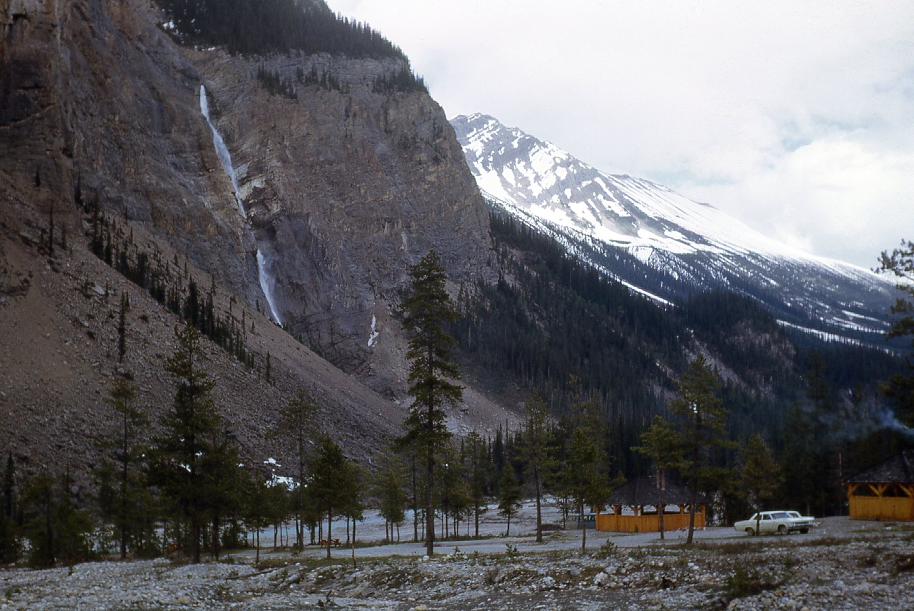
We’re talking about Takakkaw Falls. Another Cree word, which means “magnificent”, the name is apt. The moment you open your car door, you can hear the roar of the falls half a mile away. Here’s a first glimpse.
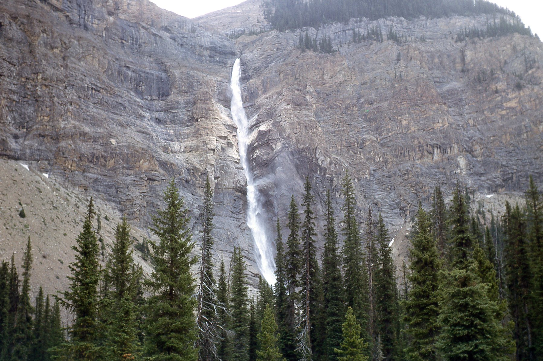
Takakkaw Falls
When we were there in 1966, this was regarded as the highest waterfall in Canada. Nowadays, they feel that a couple of others are higher, but when I started to delve into the subject of “how high is a waterfall”, I really opened up a can of worms. It turns out that there’s a whole lot of science surrounding waterfalls. There are also many different types of waterfalls – check out this fascinating link to see pictures and read definitions of them. Who knew that there would be types such as: plunge; horsetail; fan; punchbowl; block; tiered; segmented; cascade; chute; scree; slide; ribbon.
Waterfall aficionados think of them almost as living organisms, as their appearance can change with the season and with the amount of water passing through them. Takakkaw is classified as one of the horsetail type. In a cold winter, the falls can freeze, offering spectacular ice-climbing opportunities for the hardy souls who make the trek all the way in on the closed road.
Then there’s the issue of how to measure the height of a waterfall. One way of looking at it is to measure the total drop from top to bottom. Some falls have a series of drops making up their total height. Some purists tend to think of the height of the longest single drop of a falls as being its true measure. For example, the total height of Takakkaw is 1,260 feet, but the height of the greatest single drop or segment is 833 feet. Two falls in BC are usually listed as having a total drop greater than Takakkaw, namely James Bruce Falls and Della Falls, and that is factual. However, both of these falls are composed of a succession of many individual drops, and I don’t know if any single segment exceeds the 833-foot single drop of Takakkaw. In any case, it’s easy to get to Takakkaw, whereas James Bruce and Della are in extremely remote environments and only rarely visited. You can walk an easy trail over to the base of the falls and get as close as you like.
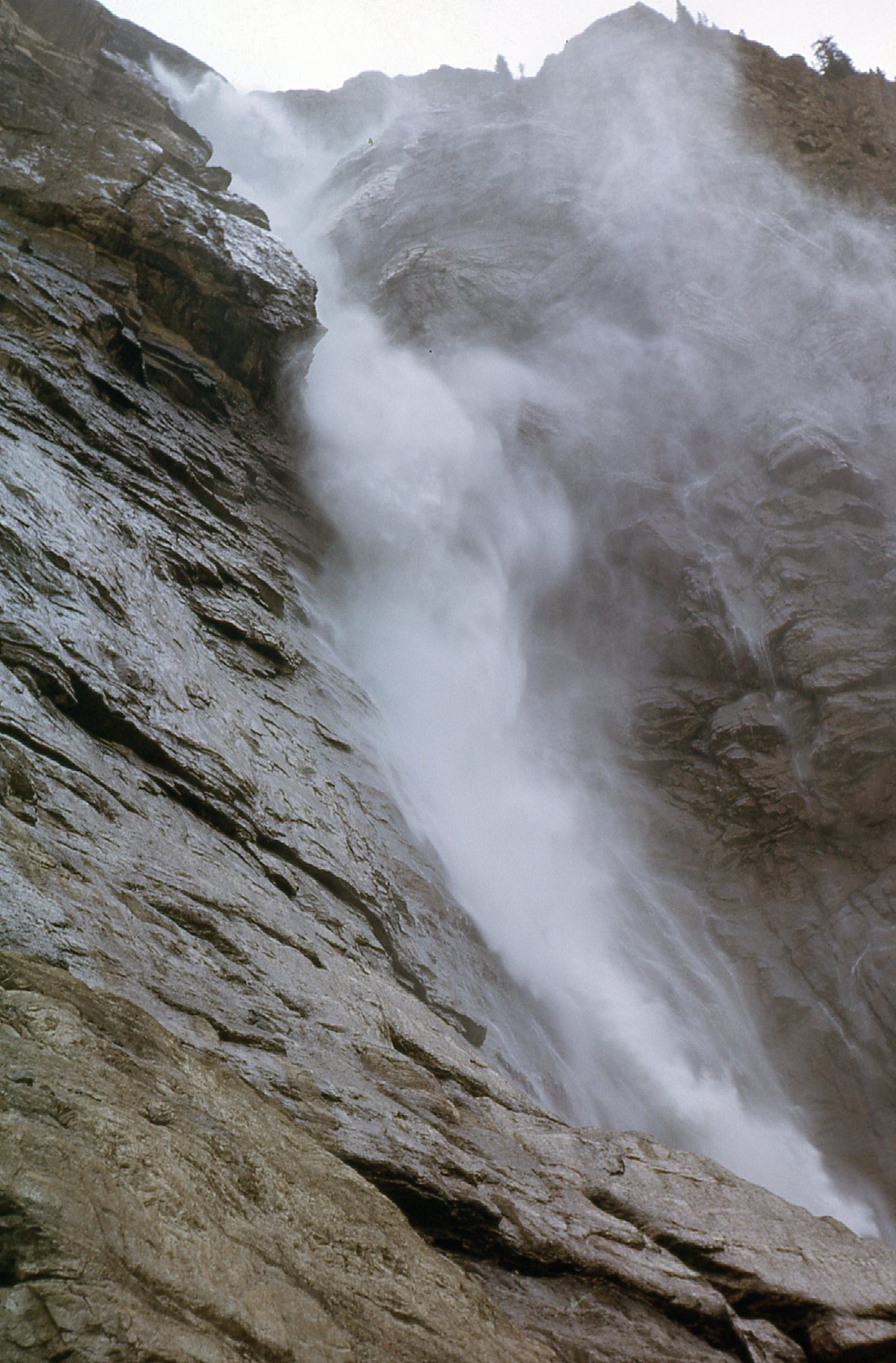
The upper part of the falls.
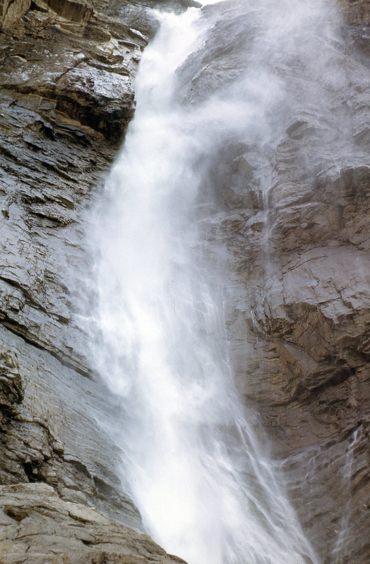
Another close-up look at the falls.
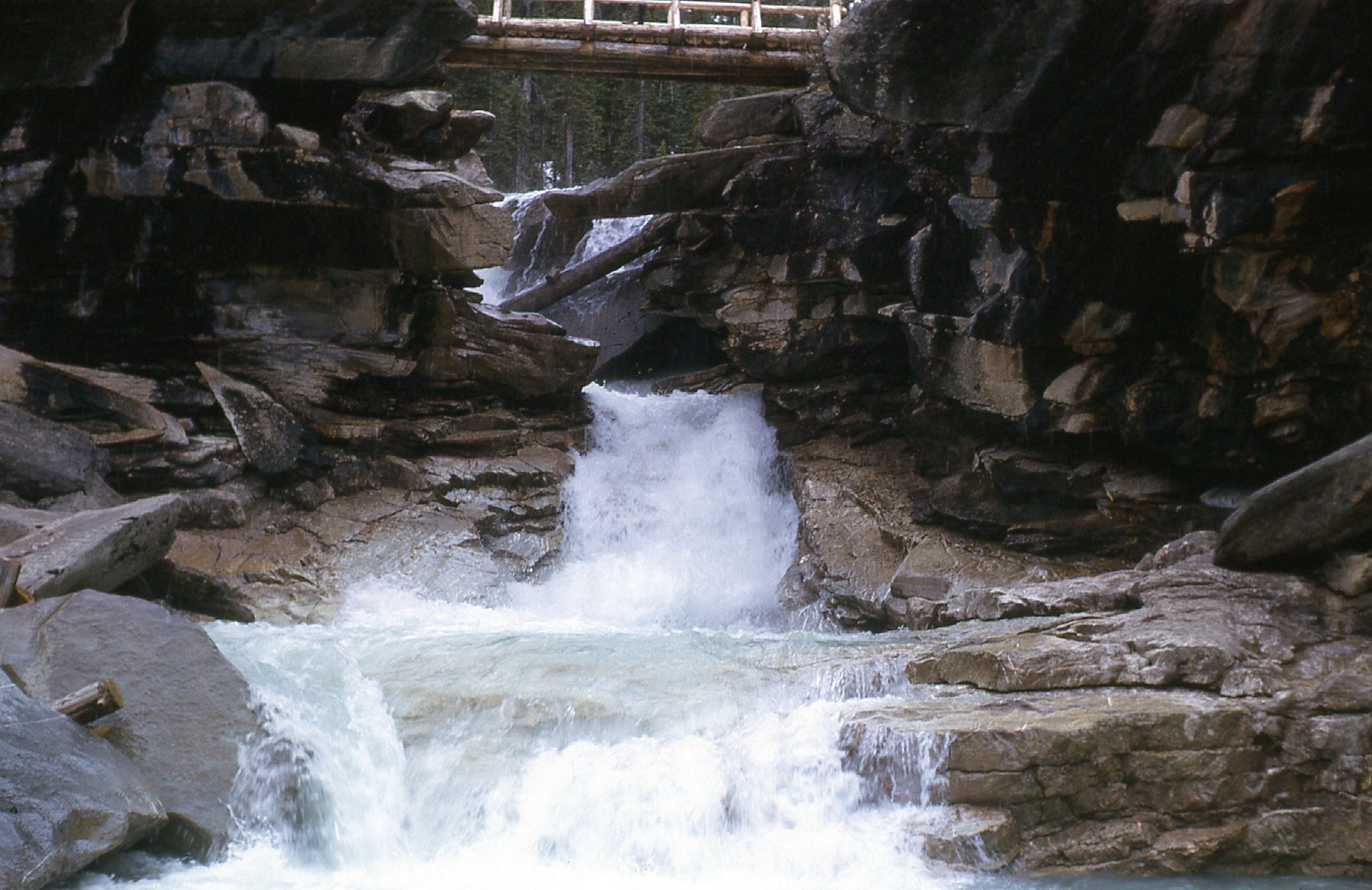
George and I decided to walk a trail north up the Yoho River to see more of the sights the valley had to offer. It was a well-maintained path and easy to follow. The first attraction we came to was Point Lace Falls. In just over a mile, there was a signed path off to the side – a short walk brought us to this.
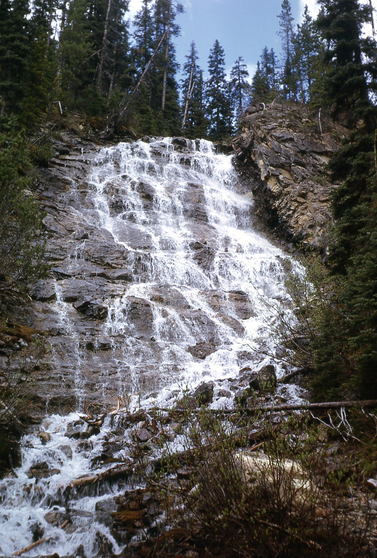
Point Lace Falls
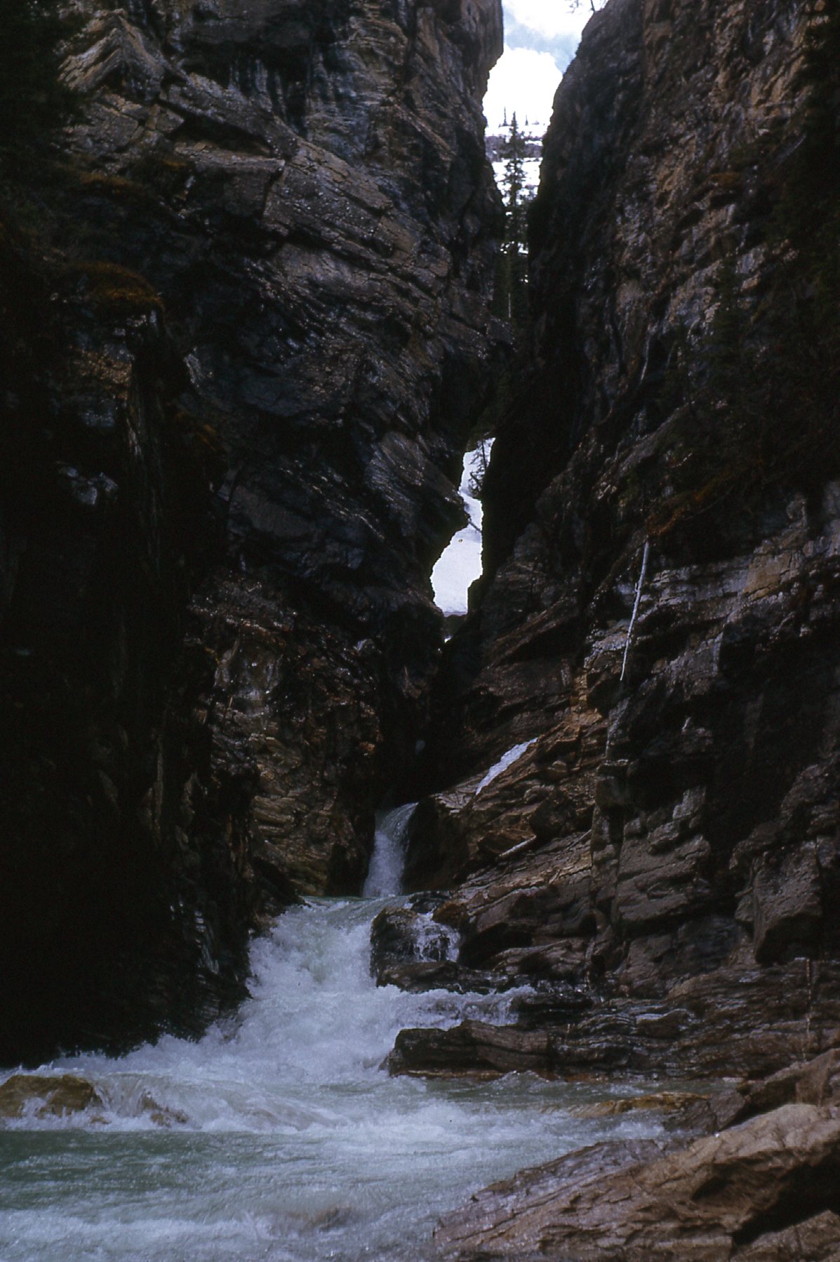
Very nice. Once back at the main path, another side path took us to the edge of the rushing Yoho River. On the other side was another falls called Angel’s Staircase.
Angel’s Staircase
Once back out at the main trail, it was a short distance to reach Lake Duchesnay. Sitting at 5,250 feet, it’s almost half a mile long
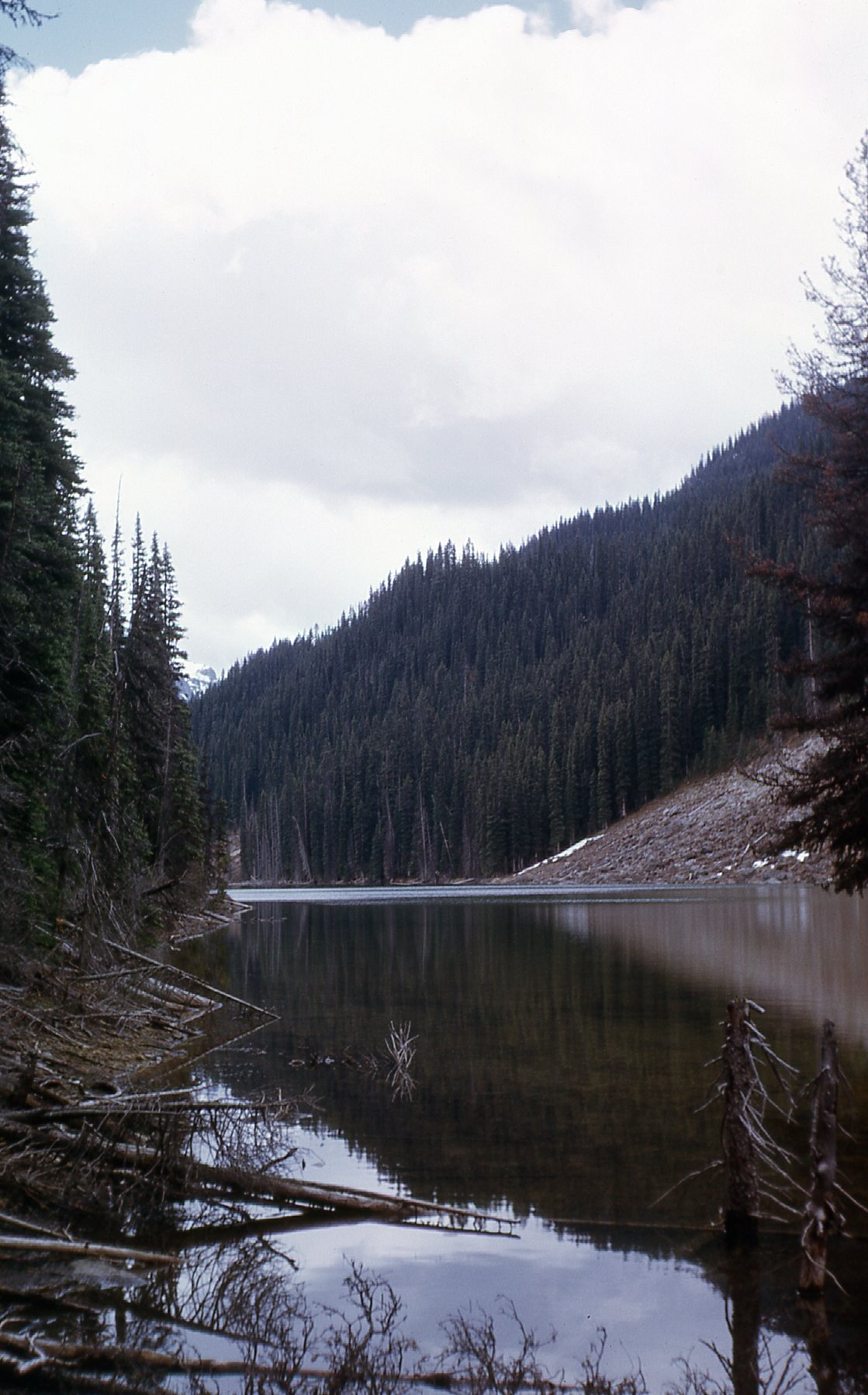
Lake Duchesnay
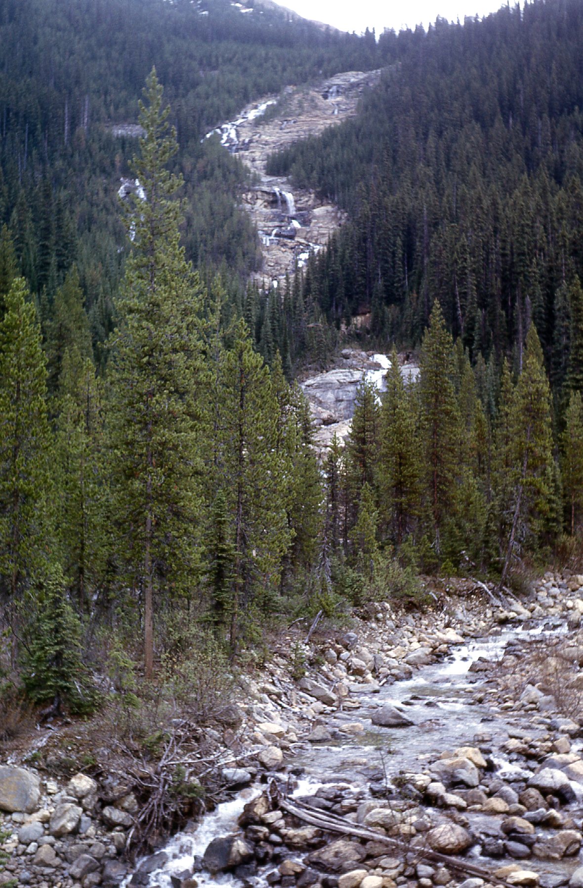
There was still more to see. At about 2.5 miles out, we came to Laughing Falls
Laughing Falls
Here’s a closer look.
Closer to Laughing
Laughing Falls is actually a spot along the Little Yoho River. Here’s an obscure factoid: the Little Yoho flows east from the highest named lake in Canada. Kiwetinok Lake is 2.7 miles upstream from the junction of the Little Yoho and the main Yoho River. So just how high is that lake, you might ask? 8,050 feet. It sits at Kiwetinok Pass, way above tree line.
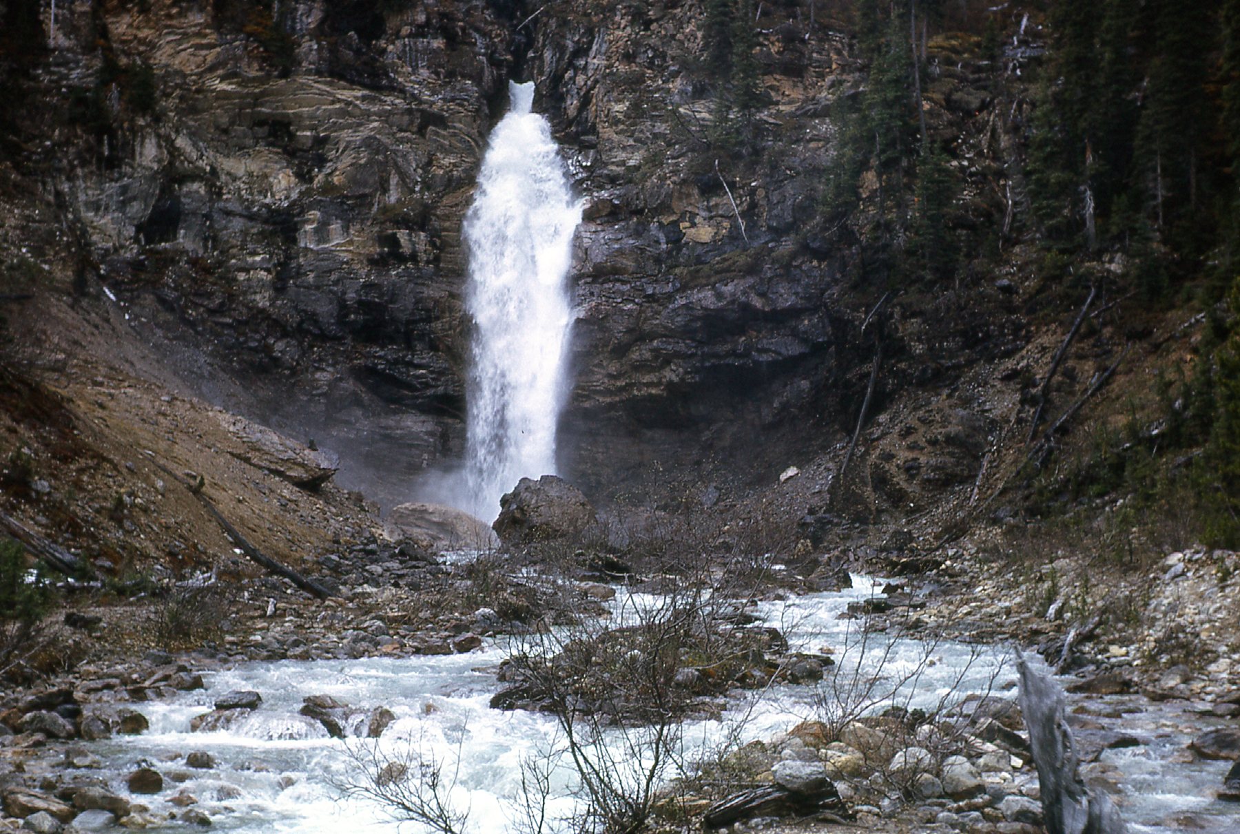
One more feature of note is Twin Falls Creek. It flows west downhill from Twin Falls.
Twin Falls Creek
From near here, you get a glimpse up to Twin Falls to the east.
A distant Twin Falls
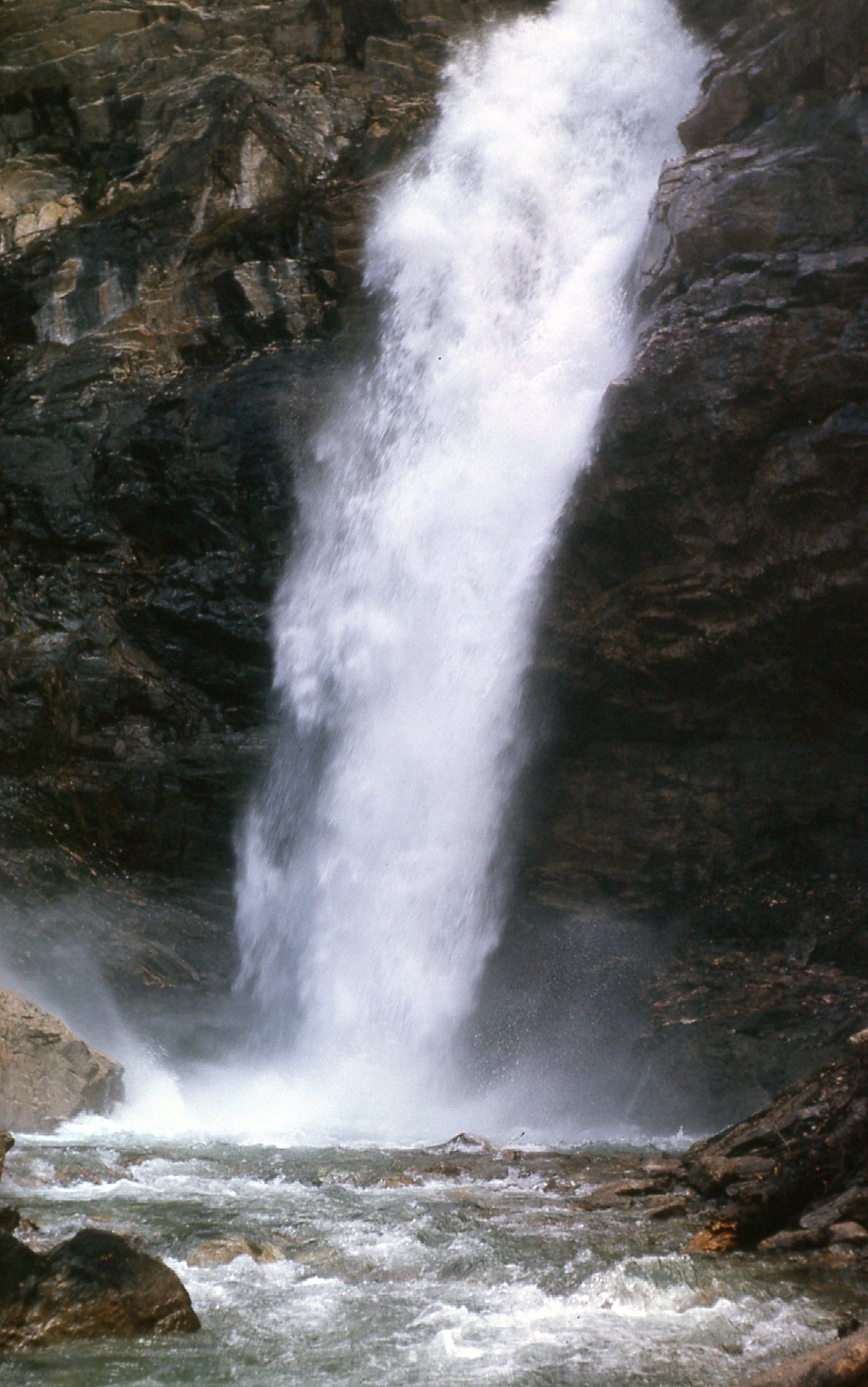
There’s a trail that goes to Twin Falls, and here’s a closer look that can be had.
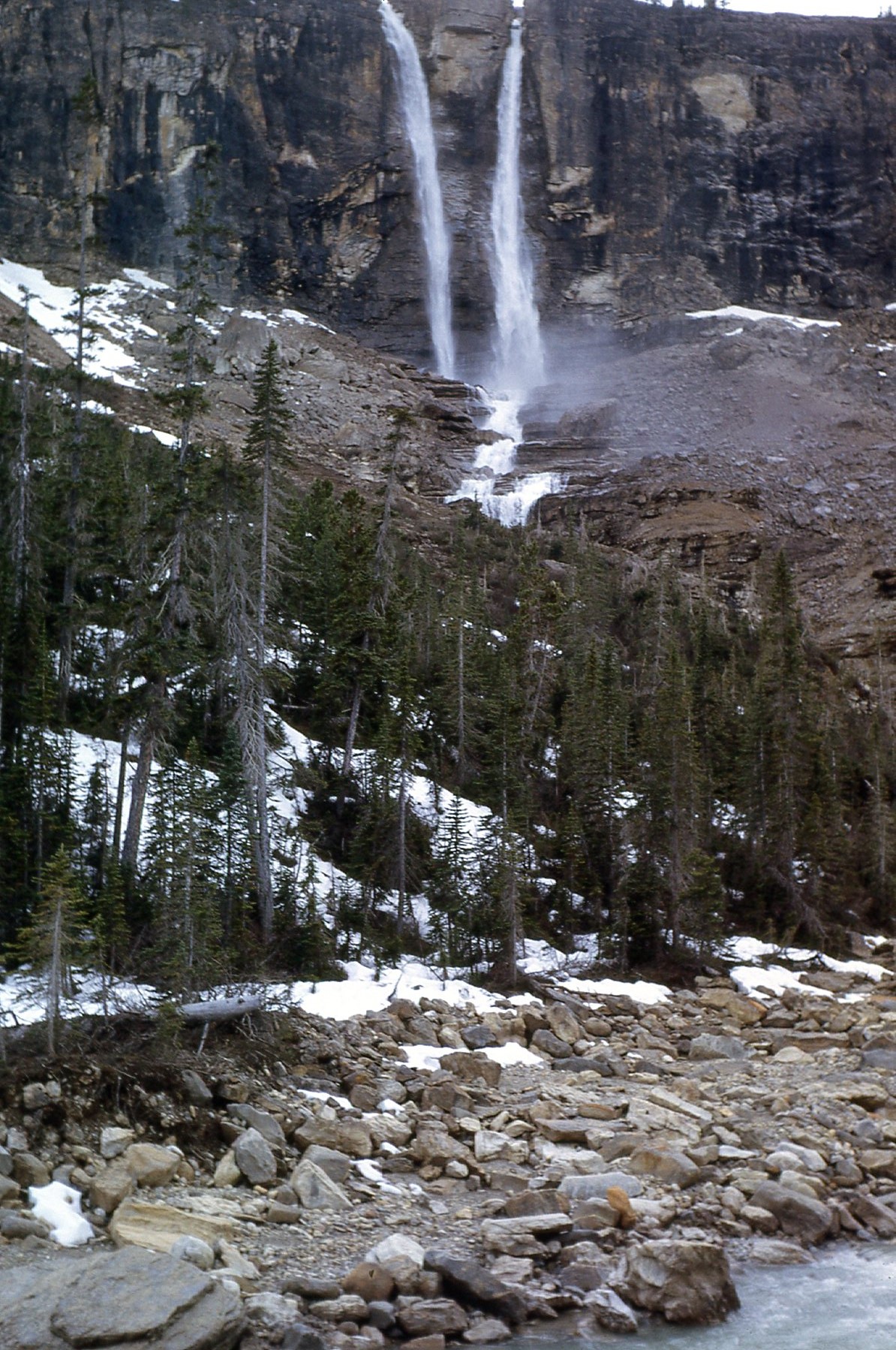
A closer look.
Twin Falls is no slouch – they drop 600 feet, and you get two for the price of one! If you make it all the way to the falls, you’ll have walked 5 miles one way from where you parked. There is a lovely chalet there which has undergone some recent controversy. Once back at the main trail, we went another mile or so to get this view of Trolltinder Mountain (on the right) and Mount Balfour (on the left).
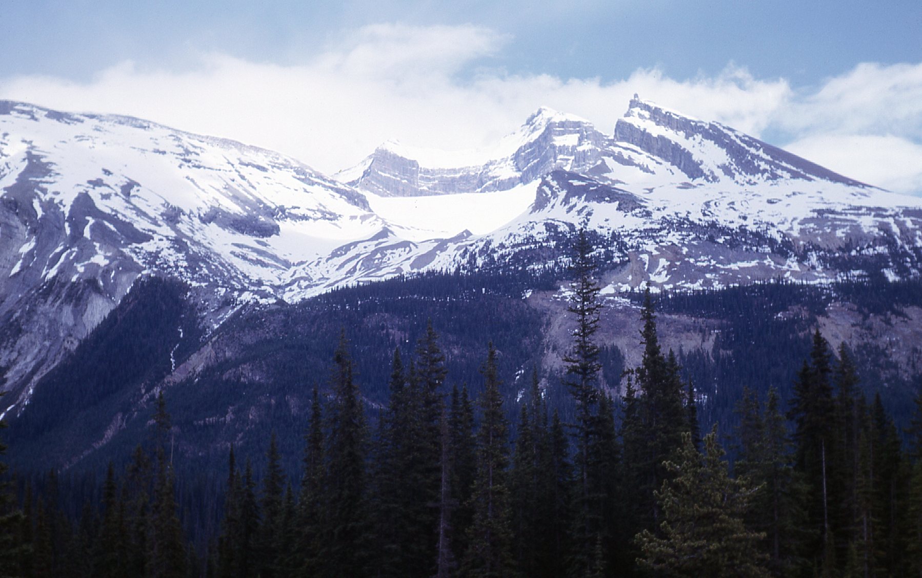
Trolltinder (9,554′) and Balfour (10,735′)
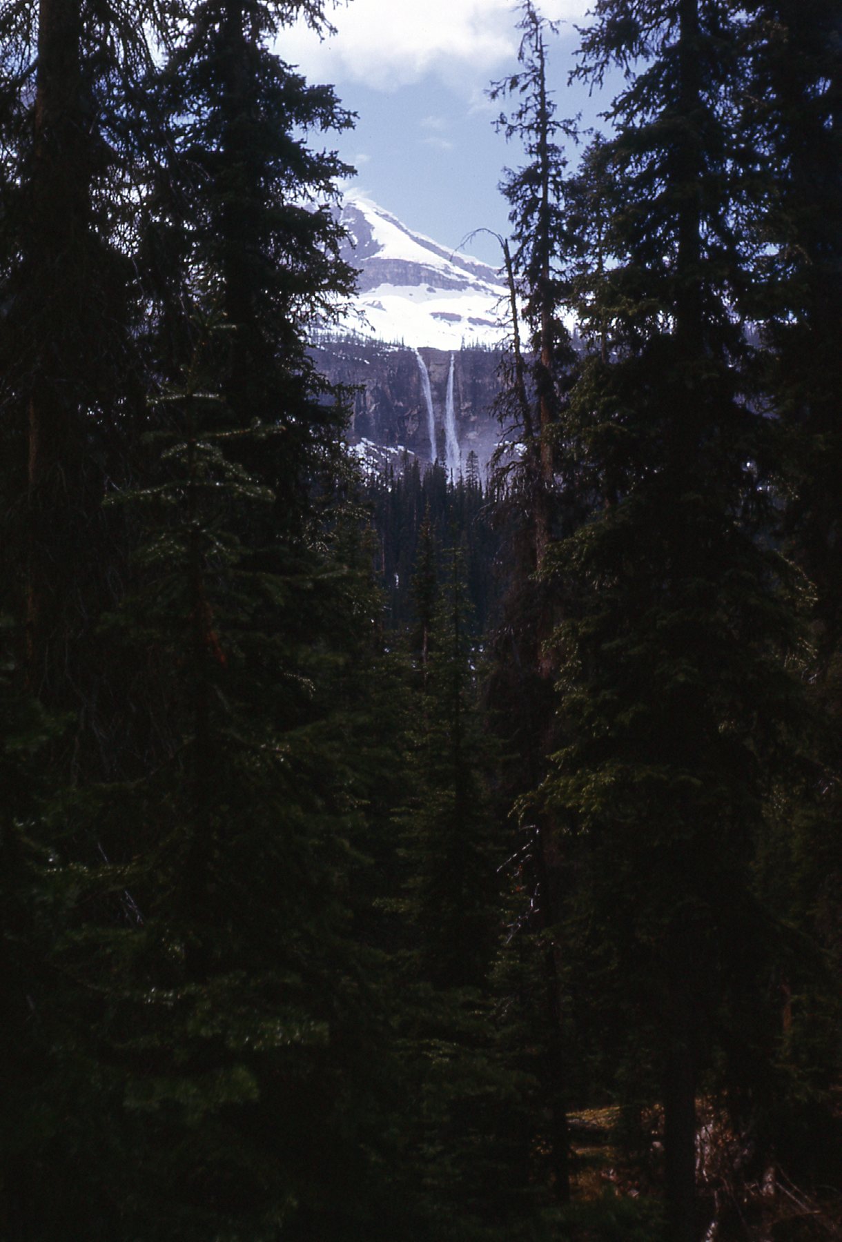
With that view in hand, we started back south on the trail. Did I mention that Yoho has 38 peaks over 3,000 meters in elevation, the highest being Mount Goodsir. At a whopping 11,703 feet, it is the 10th-highest peak in the Canadian Rockies and is a challenging climb and not for the faint-of-heart. As we neared Takakkaw Falls once again, we had this view of Peak 9000. This mountain sits north of the Daly Glacier. The falls is fed by the Daly Glacier, which is a part of the Waputik Icefield.
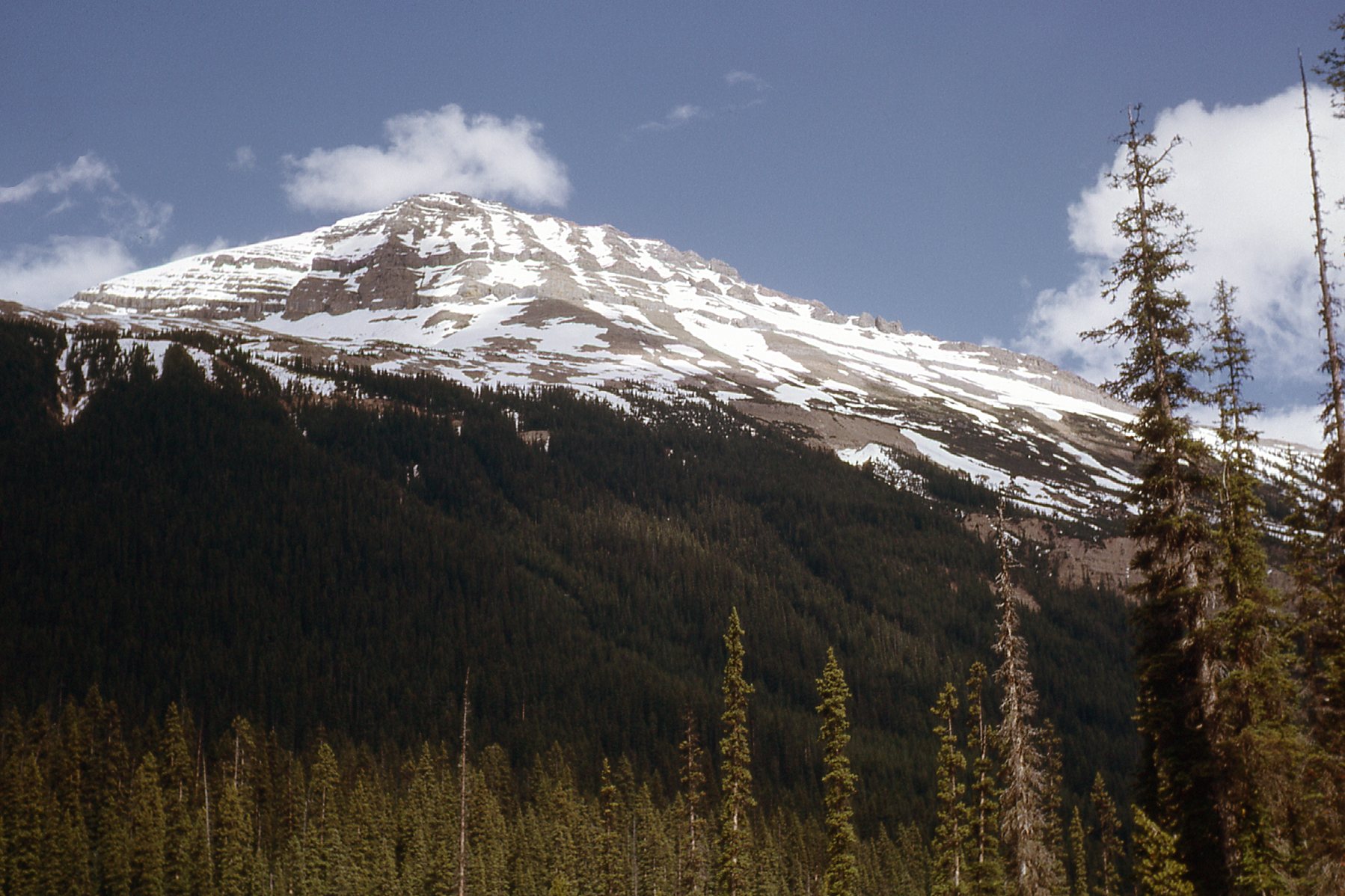
Peak 9000
As you approach Takakkaw from the north, you get this good side view.
Takakkaw Falls from the north.
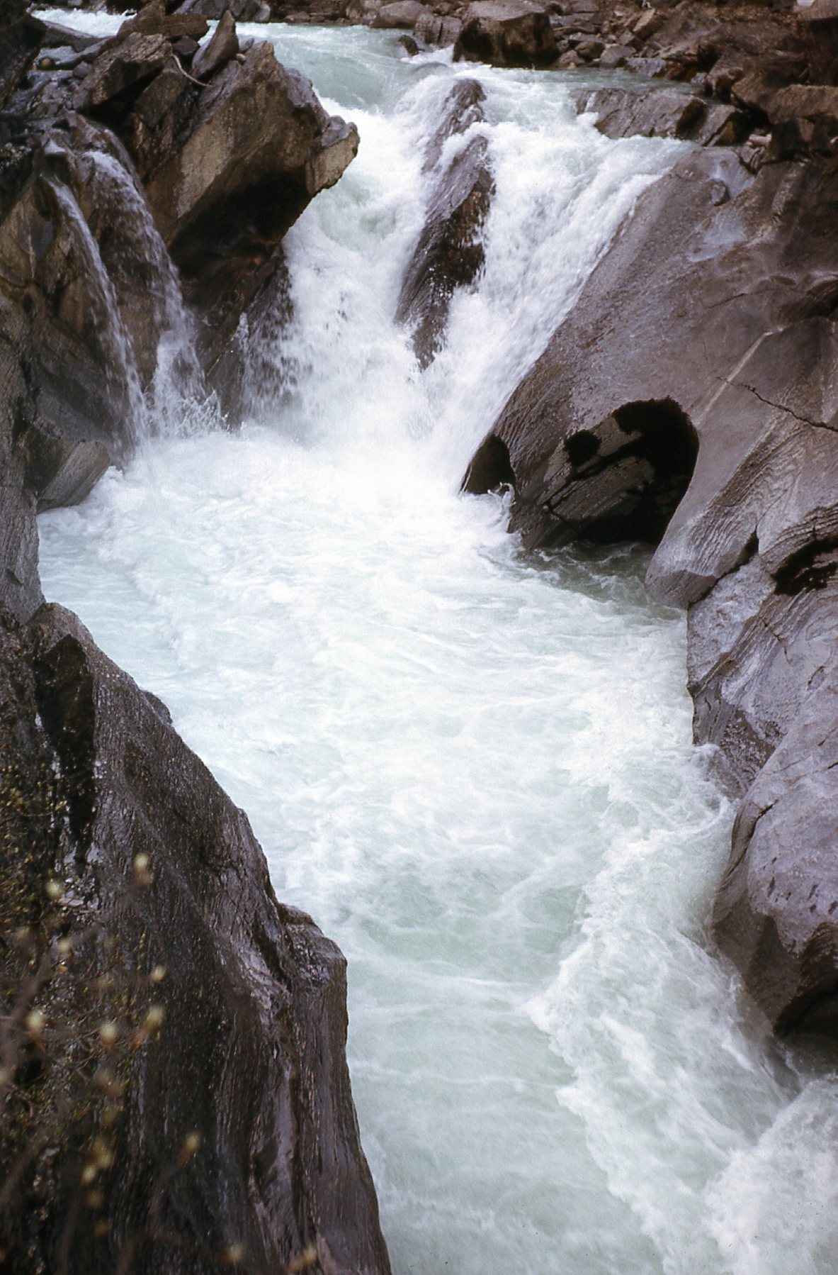
By the time we’d put in 14 miles for the day, the weather was starting to close in on us again. On the way back down the road, there are several good spots to stop and get a view of the Yoho River.
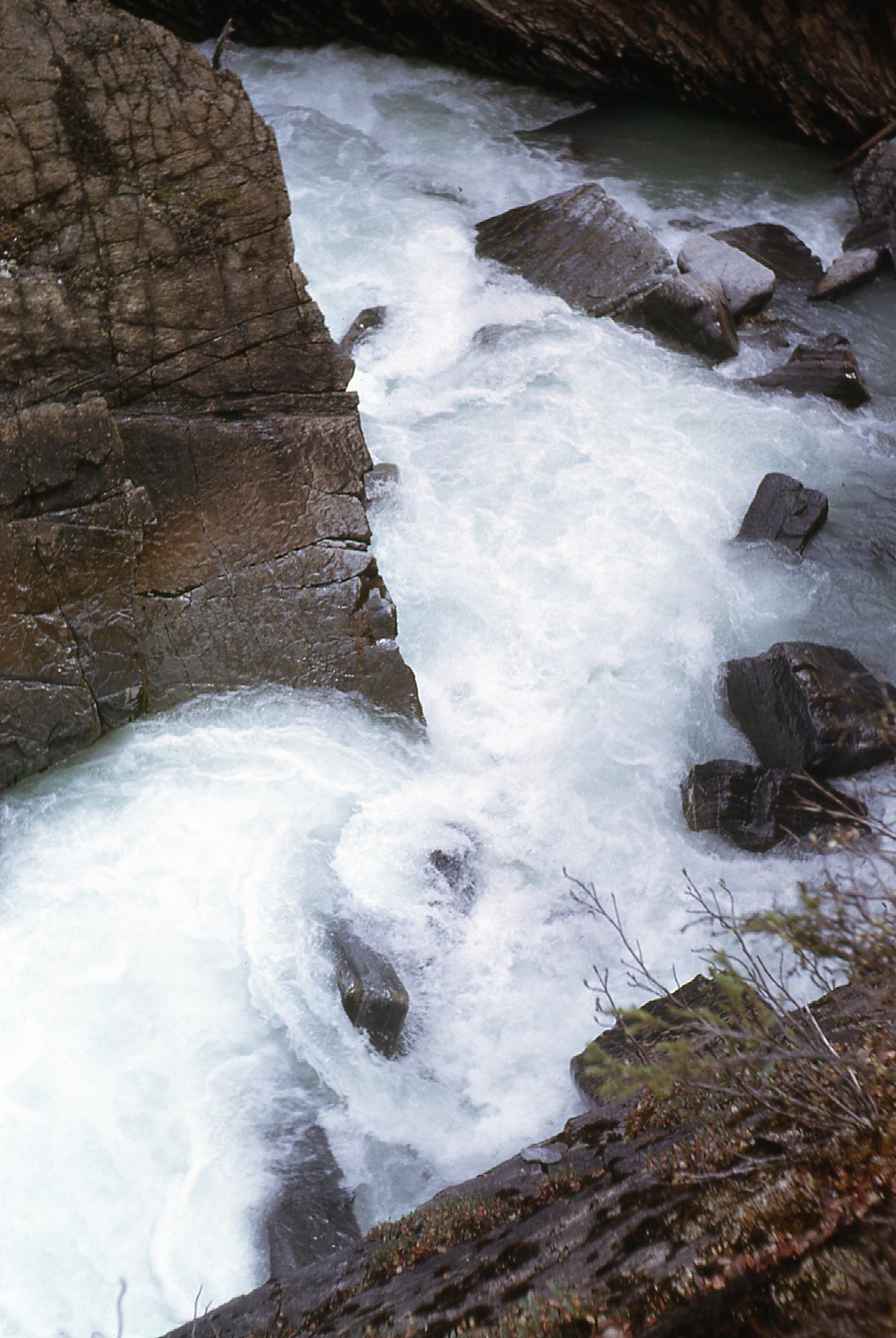
The Yoho
The Yoho
More Yoho
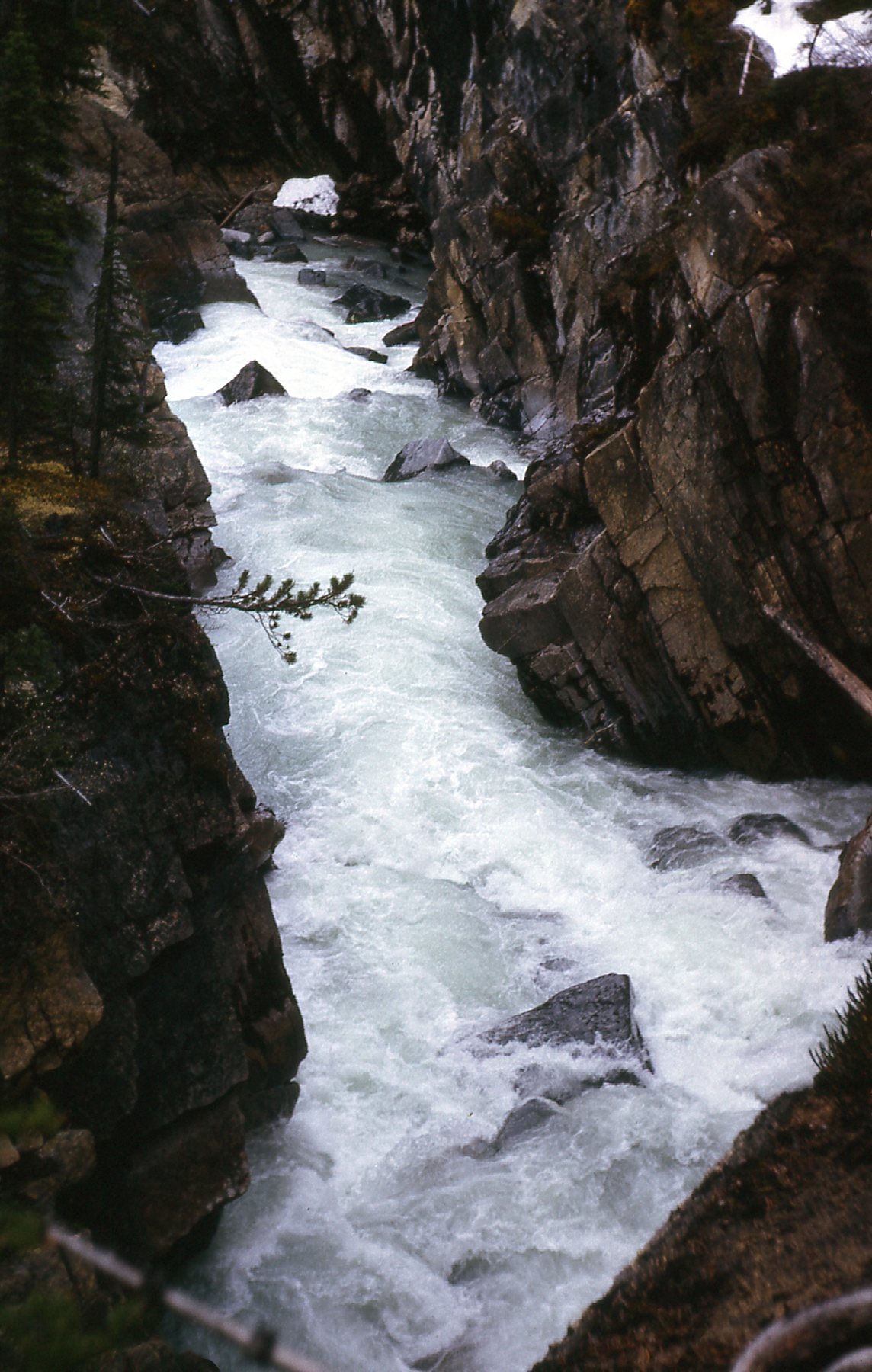
Even more Yoho.
And here’s a look south to Cathedral Crags on our way back out to the main highway.
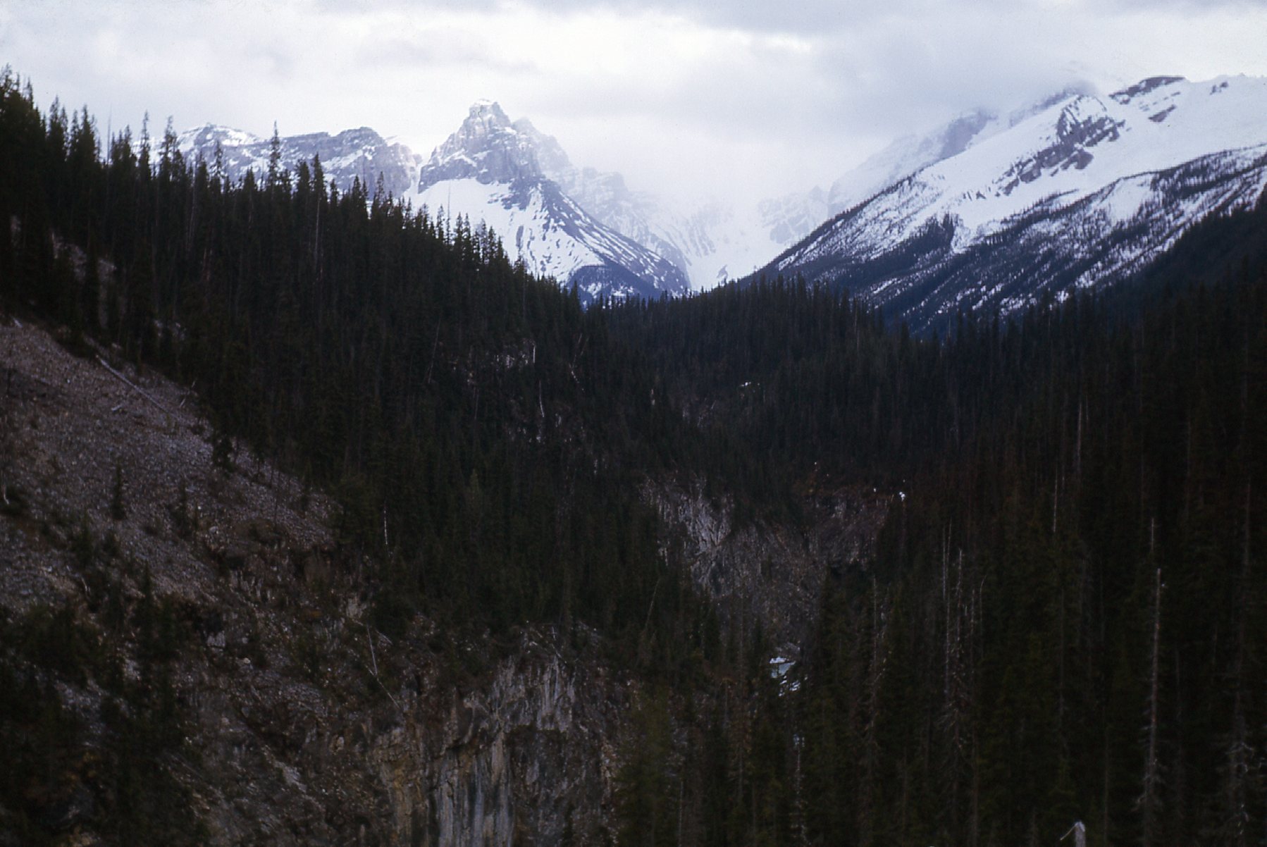
Cathedral Crags, elevation 10,112 feet.
This piece wouldn’t be complete without a photo of George and the BSA. George went on to become one of the world’s most prominent geophysicists – his name is immediately recognizable to anyone in the field.
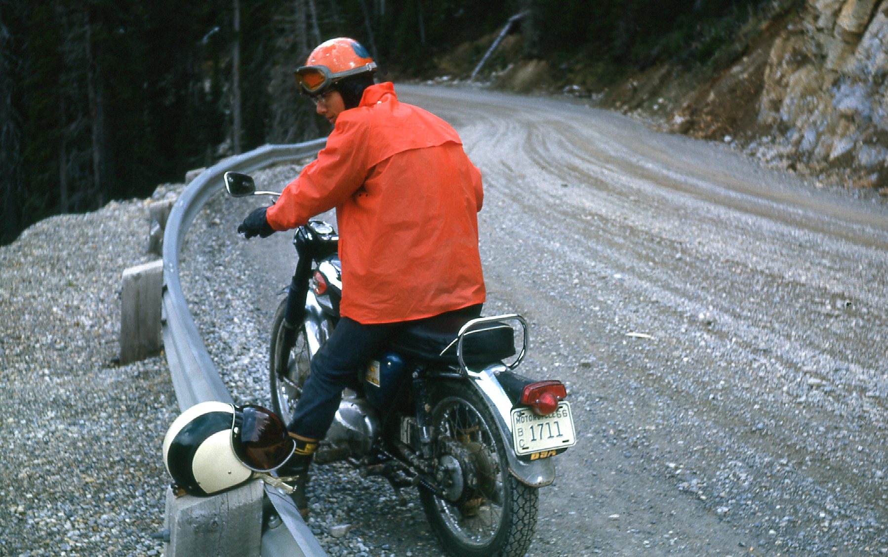
George
Well, I hope you enjoyed our visit to the Yoho Valley and some of its more famous falls. Thanks for keeping us company.