
Several days after the journey outlined in The First Part of this story, days spent in a different country, we found ourselves back in southern Mexico. We traveled from Tapachula in Chiapas all the way to the beautiful city of Oaxaca, the capital of the state of the same name. That involved an overnight, 10-hour bus ride, and then the new day greeted us. Soon we would embark on another adventure relating to the Continental Divide.
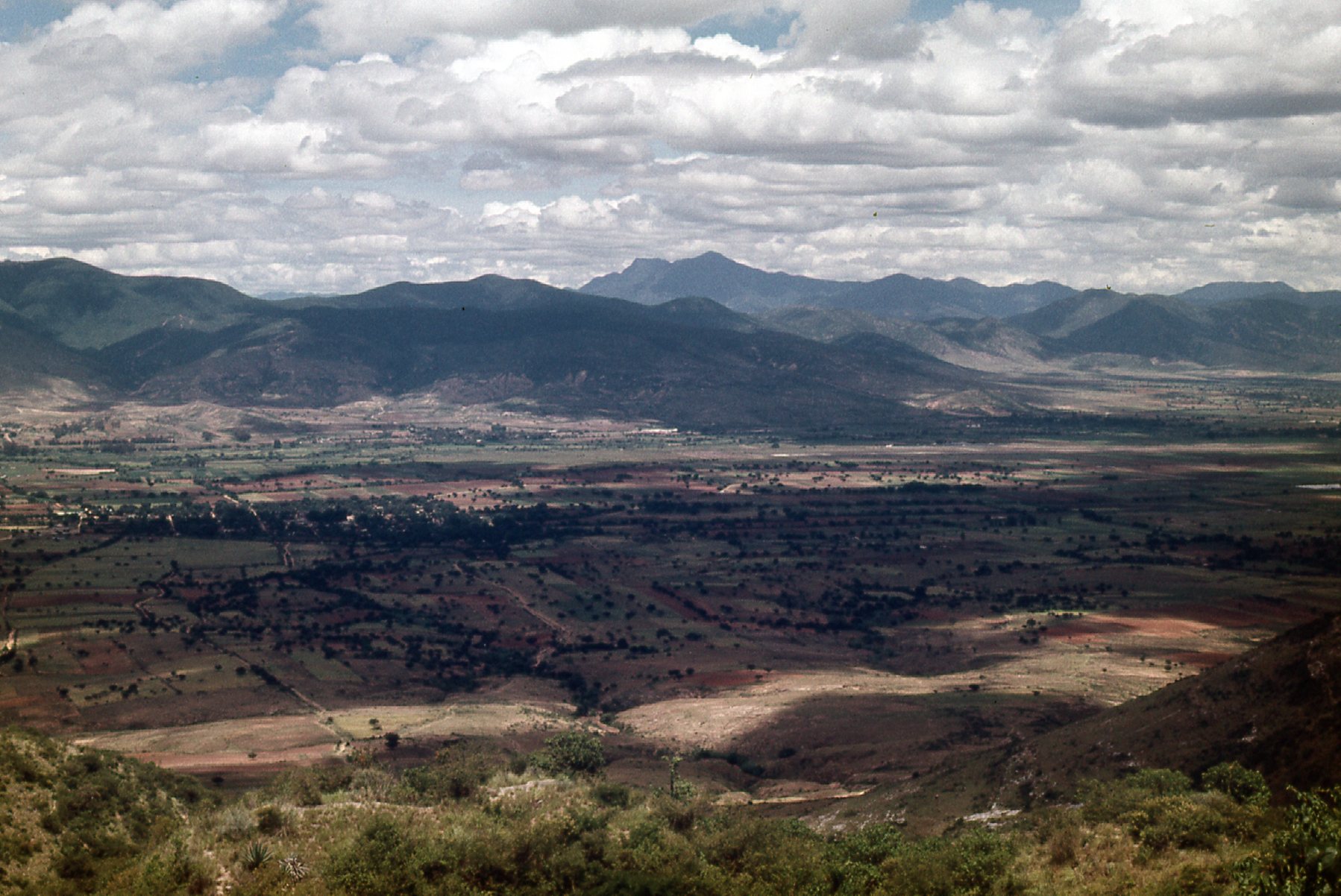
The landscape east of Oaxaca
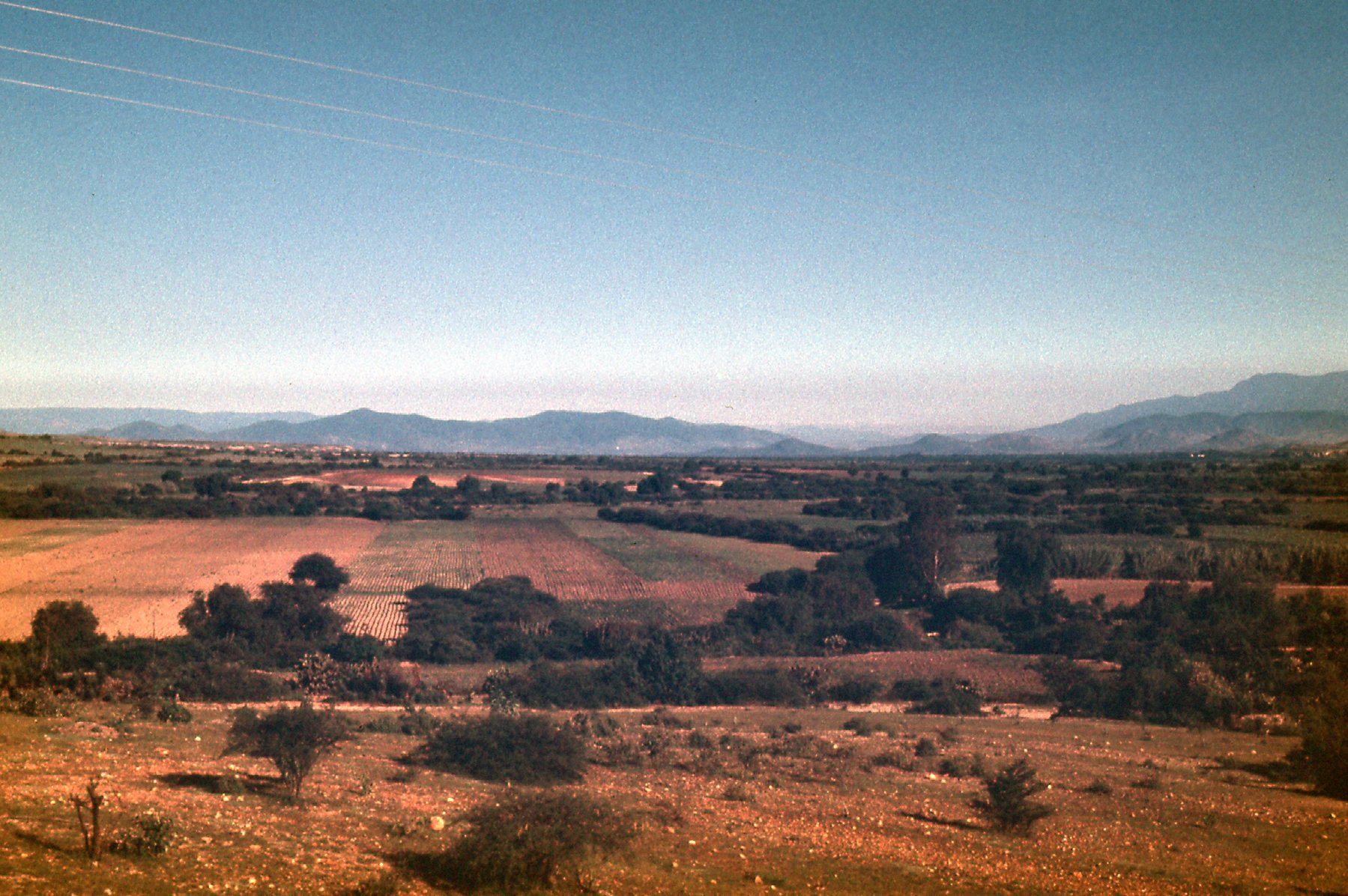
Oaxaca is a lovely city, sitting at an elevation of 5,100 feet, giving it a pleasant climate year-round. The name of both the city and the state comes from the local indigenous Nahuatl word for a tree which is found growing around the city. It is said that of all Mexico’s large cities, Oaxaca probably has the largest percentage of indigenous population. We spent 5 unhurried days there, seeing the sights and enjoying the markets. Here’s a view of the land near the city.
Near the city
One of the nearby attractions is the Tule tree, a few miles out of town. Here’s a link to some interesting information about it. It has the largest diameter trunk of any tree in the world.
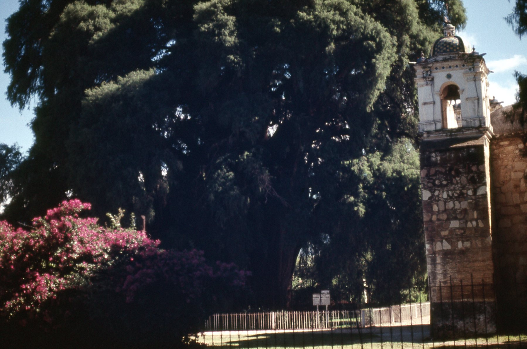
The Tule tree
By the time July 13th arrived, we felt it was time to move on. Did I mention the year? – it was 1972. I felt sad to leave, because of all the places I’d visited in Mexico (by now, I had traveled in all 32 states in the country), Oaxaca was one of my favorites. We were heading to Puerto Escondido on the Pacific Coast, and we’d travel by bus. I’m not sure how many companies there were in Oaxaca offering such a ride, but we decided to give Azoteca a try.
Bright and early the next morning, we checked out of our hotel and caught a cab to La Solteca bus station. We knew that our route would follow Highway 131 all the way from the city of Oaxaca to Puerto Escondido, a distance of 257 KM or about 160 miles, taking us to the shores of the Pacific Ocean. Our direction of travel would be south, through the mountains. We knew today that we would once again cross the Continental Divide, as we had done earlier on this trip when we traveled from the state of Tabasco to the state of Chiapas. It was the same divide, but it would be at a point hundreds of miles farther west.
I had been in this region 2 years earlier with my friend Dan. He and I had used his car to travel the country, whereas this time my friends and I were using public transportation to get around – bus, train, boat, car, plane and even hitch-hiking. Dan and I had also driven south out of the city of Oaxaca, but instead had traveled Highway 175. Had we followed it far enough, it would have taken us all the way to a remote village called Puerto Angel on the Pacific Coast. We didn’t, though, instead only going as far as a tiny place called San José del Pacífico, a distance of 138 KM out of the capital. Even this took us up to an elevation of 8,200 feet in the cloud forest.
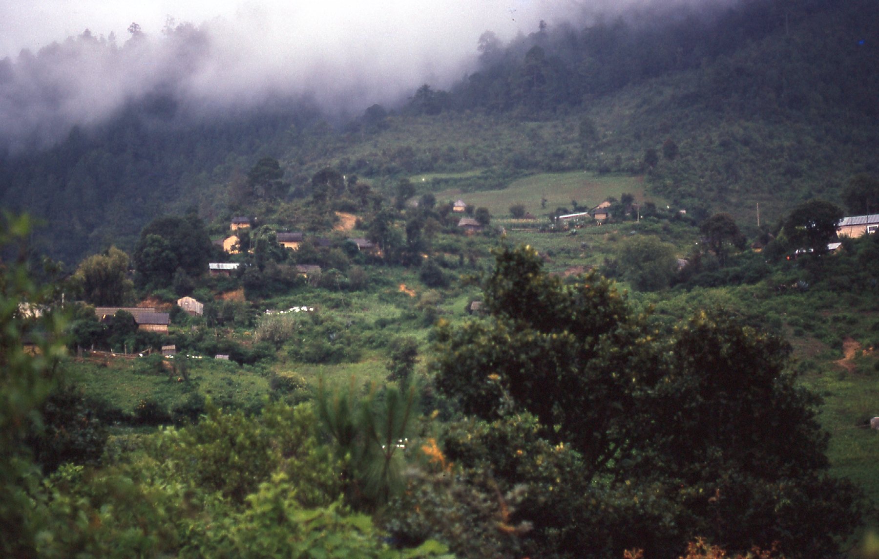
San José del Pacífico
Dan and I didn’t go all the way to the Continental Divide that day, but we were pretty close. Not many miles farther south, the highway tops out at 2,820 meters, or about 9,250 feet elevation.
Now, 2 years later, the girls and I were on a different road. Our bus pulled out of the station at 6:00 AM sharp and headed south on Highway 131. It was a scenic drive through lower country, then we started to climb up into the mountains. We were surprised to see how few people were on the bus – everyone had a seat, nobody had to stand. The hours passed – we went through an interesting area where small villages off on side roads had unusual names: Magdalena Mixtepec; San Bernardo Mixtepec; Santa Cruz Mixtepec; San Miguel Mixtepec; San Pedro Mixtepec. These names made it clear that we were in the Mixteca region, an area where about 12,000 people spoke the Mixtepec Mixtec language. Most speakers of the language refer to it as “poor peoples’ language”.
In the middle of the day, we rolled into the village of Sola de Vega, at around 1,400M elevation, or 4,600 feet. Even though we hadn’t traveled very far from the villages which spoke Mixtepec Mixtec, we were now in an area where a completely different language was spoken, namely Lachixío. Some of the nearby villages reflected that, namely Santa María Lachixío and San Vicente Lachixío. Theirs is a type of Zapotec language and is only spoken by about 3,000 people.
Sola de Vega
There are other villages in this high mountain region which have a word added to their name to denote the local language spoken there, such as Ozolotepec, Yautepec, Ocotepec, Ecatepec, Topiltepec, Ixpantepec, Temaxcaltepec, Yaitepec. This whole region is isolated and keeps to itself, each group closely guarding their traditions, language and customs.
As we continued south from Sola Vega, the road climbed higher. Here is a picture taken of the land by the KM 102 marker along the highway.
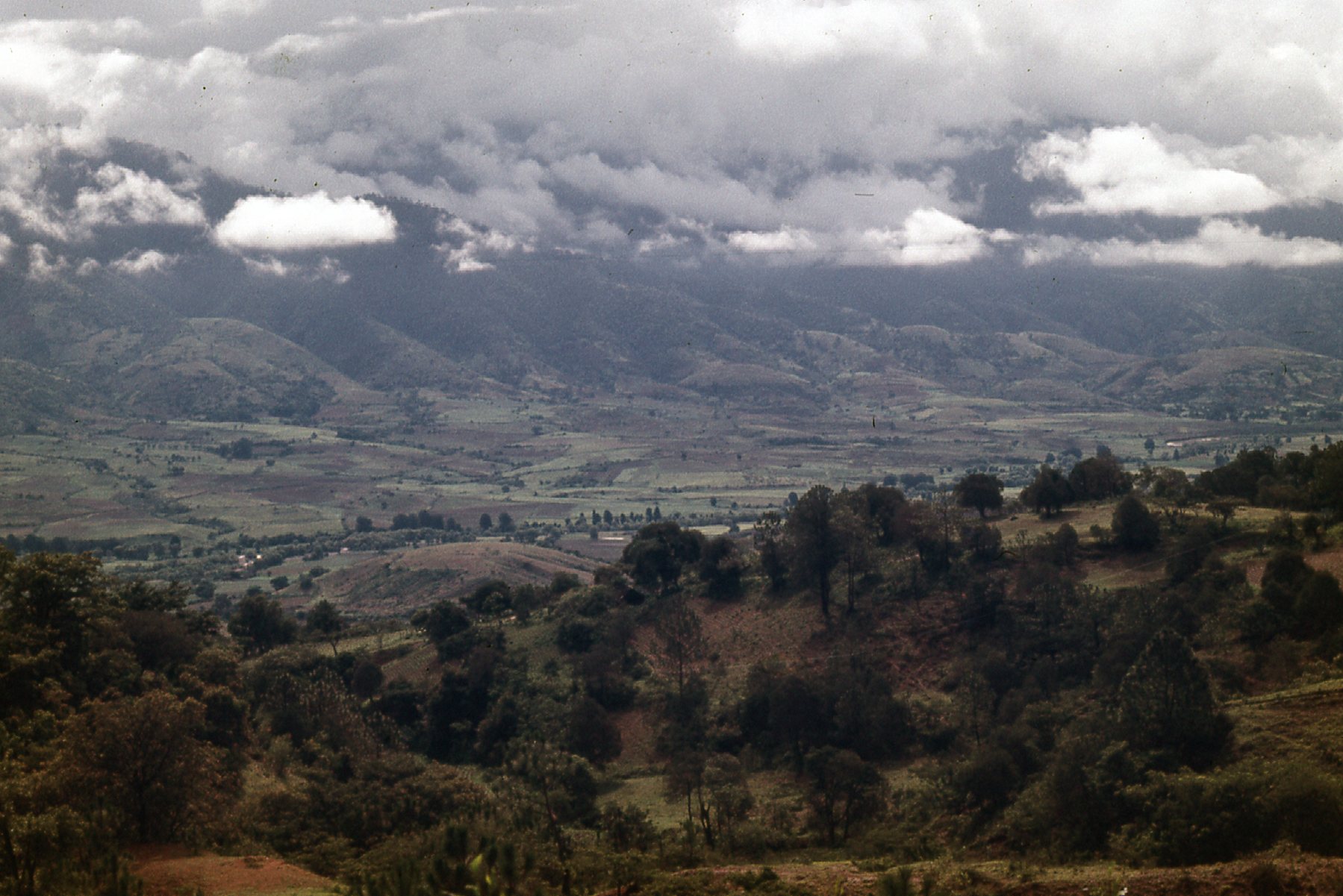
Near KM 102
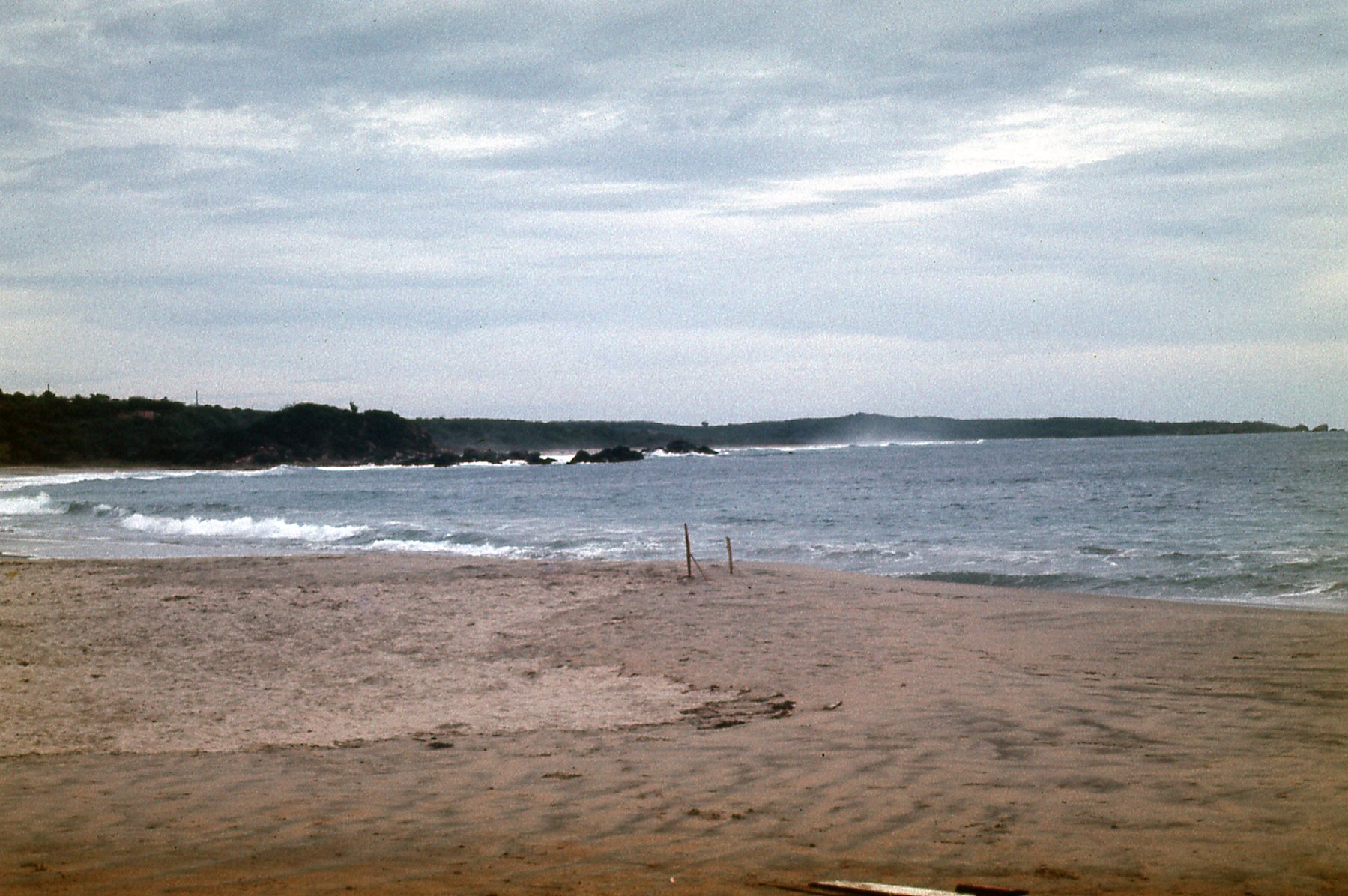
At last, we came to the Continental Divide, near the village of Lachao. The road crested at an elevation of 2,000 M, or about 6,560 feet. This was almost 3,000 vertical feet below the elevation of the divide along Highway 175 a mere 35 miles to the east, which goes to show you that it’s all about where they can put the road. Here’s a picture looking south from the divide along Highway 131 – yes, the highway is a dirt road!
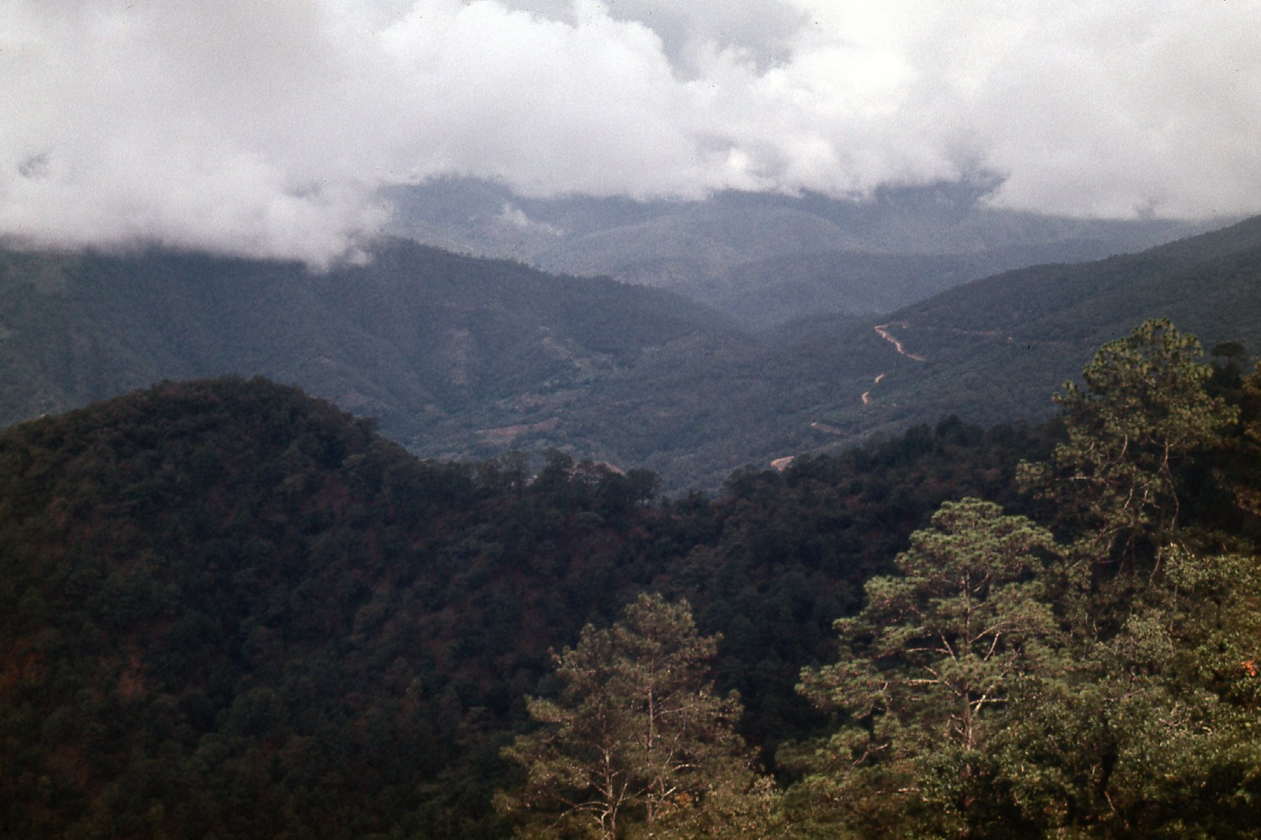
Looking south from the divide.
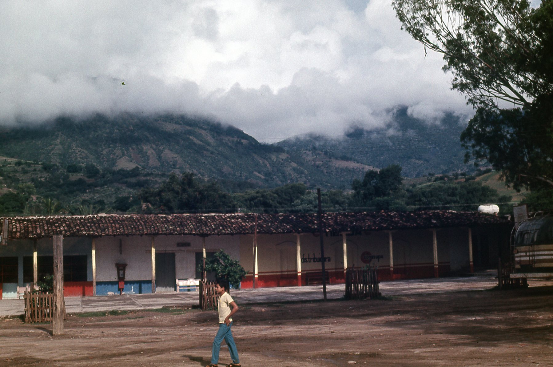
Yet another stop we made was at the village of San Gabriel Mixtepec, and here we had lost a lot of elevation, dropping all the way down to 700M or 2,300 feet. And yes, that’s our bus just down the street.
San Gabriel Mixtepec
The Pacific side of the divide was a much rougher ride and seemed to take forever to cover any distance. I wanted to mention that the mountain range that forms the divide is called the Sierra Madre del Sur and is rugged and extensive. Its highest peak is called Cerro Nube Flan which reaches an elevation of 12,205 feet, so it’s no slouch.
One of the passengers on the bus, Ramón, was a young man who was better-dressed than the others. He overheard our talking and finally spoke up, asking us where we were headed. He quickly realized that we weren’t too well-informed about travel arrangements in the region, that things weren’t quite what we expected, and offered to give us a hand. He appeared to be a businessman of sorts, and we chatted freely as we rode down to the Pacific Coast. It was 4:30 PM by the time we pulled into the seaside town of Puerto Escondido. It had taken us a full 10 1/2 hours to travel the 160 miles from Oaxaca, for a blistering average speed of 15 miles per hour.
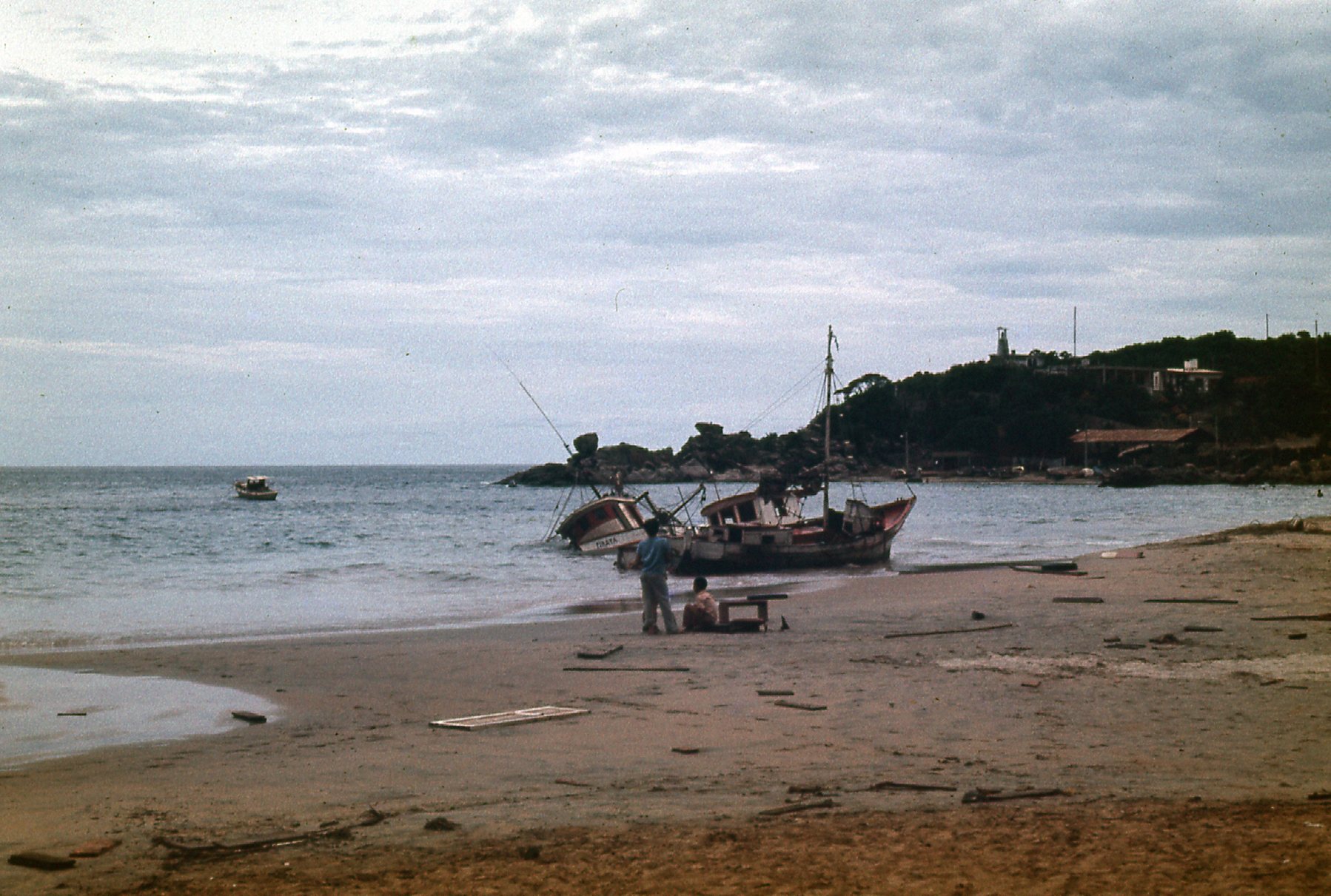
This was a quiet town, and back in 1972 it mainly depended on fishing to stay alive. Here’s a view looking one direction down the beach.
The beach
And here’s looking the other – kind of reminds me of the closing scene of The Shawshank Redemption.
The beach at Puerto Escondido
Our bus had now become a real sweat-box, as we had lost the cool air of the high mountains. On we rode along the coast, arriving at a place called Río Verde by six o’clock. There, small groups of us hopped into the back of open pick-up trucks and for 10 pesos were driven to Río Grande. Wait, it gets better. The trucks dropped us off at the edge of the river, and for 5 pesos we climbed into small open motorboats while a guy took us across to the other side. Ramón’s brand spankin’ new VW Beetle was waiting there. I don’t know how he did it, but he managed to stuff all 3 of us plus himself along with copious amounts of luggage into that little car. He then drove quickly along the coastal highway while my girl-friend was sick to her stomach a few times.
We reached a town called Pinotepa Nacional, where Ramón had a hotel room. We all rested in the air-conditioning for half an hour, then piled into his VW once again at 9:00 PM. On we drove into the night, this time for fully 3 more hours, until at midnight we arrived at Acupulco. That was Ramón’s final destination as well, so it worked out for all of us. He dropped us off at a cheap hotel, the Hotel Coral, where for 60 pesos we spent a miserable night.
What a day! We had traveled from the highlands of Oaxaca, through the mountains and over the Continental Divide for a second time, then down to the coast. That had been 257 KM. As if that weren’t punishment enough, we then traveled another 389 KM along the coast to Acapulco. From the remote back-country all the way to probably the most touristy place in all of Mexico. We had more adventures on that visit to Mexico, but our travel over the divide was a memory that still lingers all these years later.