
Please be sure to read the previous 3 chapters of the story before starting this one.
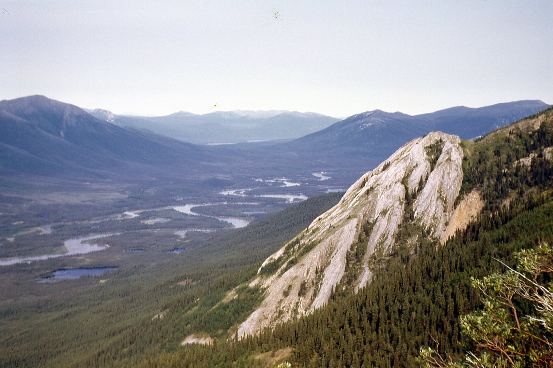
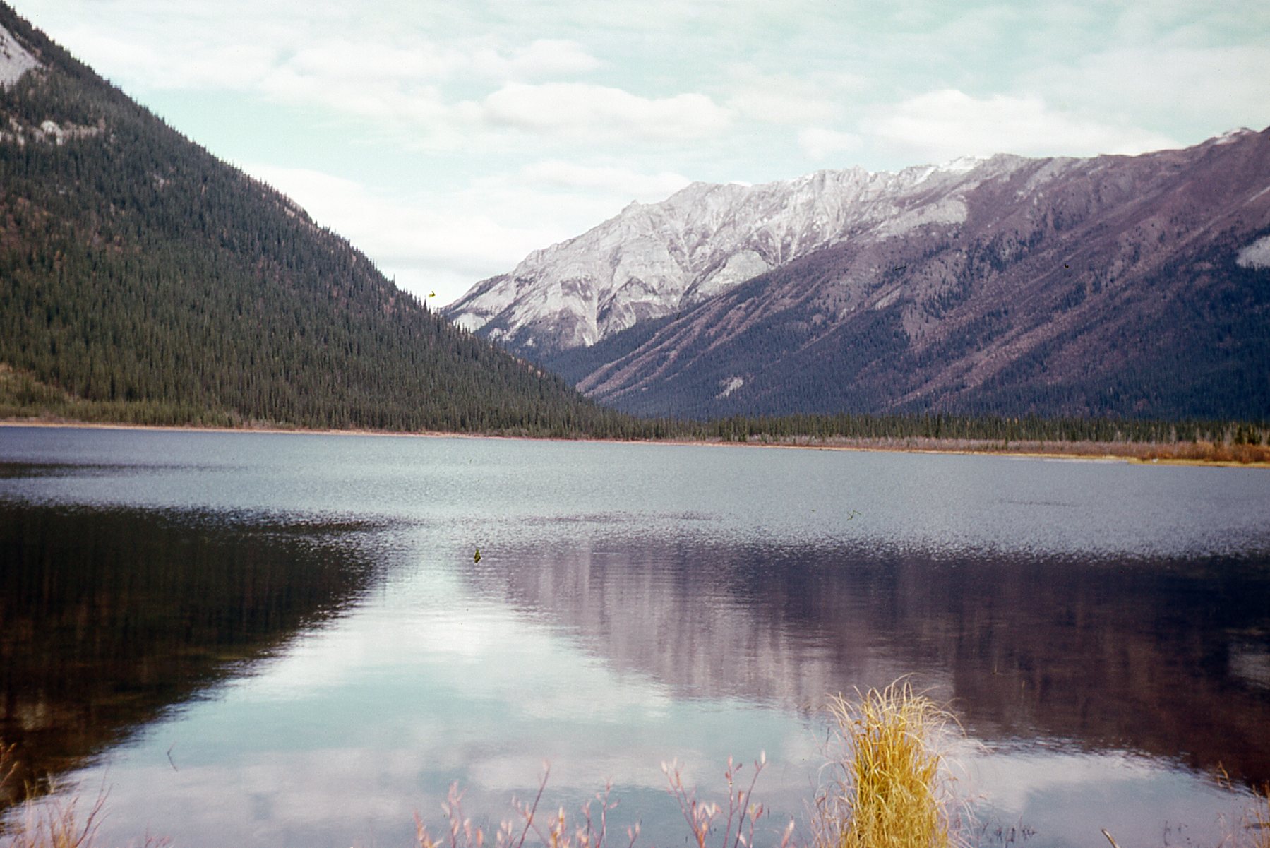
Several days of warm weather had melted off all of the recent snowfall. On August 18th, a spell of rainy weather cleared up enough for a chopper to come in. We used it to transport Bernie (our prospector) and myself to the highest corner of the property in the northwest. In addition, we had everything we needed to stay out for several days of camping and geological work. After the pilot dropped us off, he picked up our boss from camp and flew him back to Whitehorse. Bernie and I worked well together, putting in 9-hour days doing geological mapping, making our way back in the direction of camp where we arrived at the end of our 4th day out. The chopper had dropped us off pretty high up and we had these good views up and down the river.
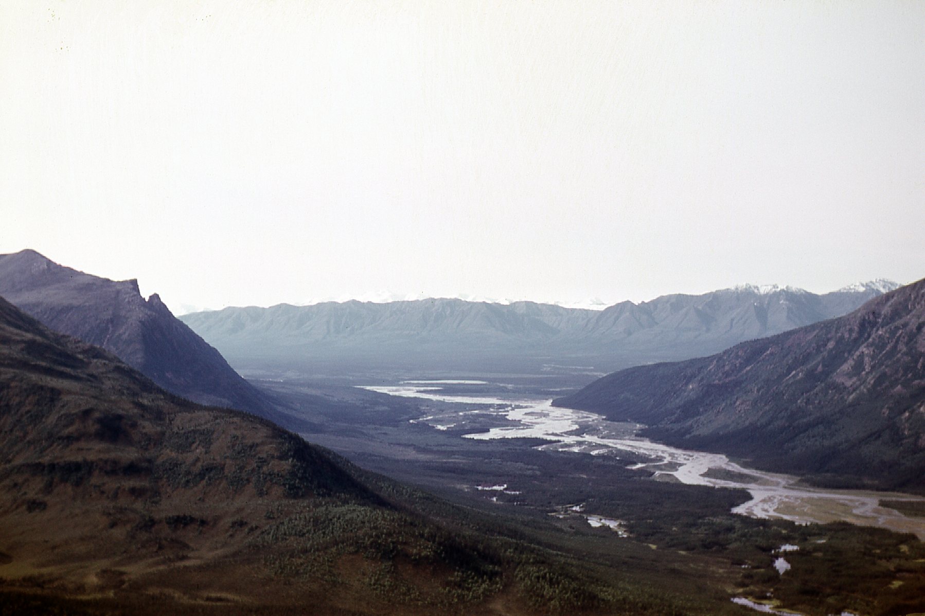
A look north down the Kluane River
Looking south up the Kluane River
I mentioned previously that we’d hired 2 young guys from Burwash Landing to help us out for a while. Besides them, we had also hired 2 older guys for a short while. The day after Bernie and I returned to camp, one of them, Thomas Joe, rode into camp on his horse. He stuck around long enough to have dinner with us and then left. To this day, I still don’t know how he reached us – he must have known of a shallow spot where he could ford the river on horseback.
On August 25th, the surveyor, his helper and our cook decided to take the day off and try to walk out to civilization. They walked down to the river, then headed upstream for 7 miles along the east bank until they reached a point where they were directly across from Mile Post 1118 on the Alaska Highway. The river was at its narrowest there, a mere 250 feet wide, but swift and too deep for crossing on foot. They could only stand there in frustration as they saw vehicles driving along the road. They knew there were pretty girls working in the lodge there, serving cold beer to travelers. Ah, so near yet so far! It was a long walk back to camp.
Our crew had been very busy all summer. Once we had put in an east-west baseline, the surveyors put in a grid of lines that ran north-south from it. Our guys cut a path for them, and they surveyed 40 miles of line at 400-foot intervals. We used this grid for all of our work: for the geological mapping; for geochemical soil sampling; for a magnetometer survey; for a dozen test pits we dug. None of this would have been possible without the surveyed grid lines. Here’s an example of the test pits we dug. These were in places near where we thought there’d be a chance of exposing more mineralization. It was hard work digging these because in some spots we’d hit permafrost (soil that was permanently frozen) and that would stop us in our tracks.
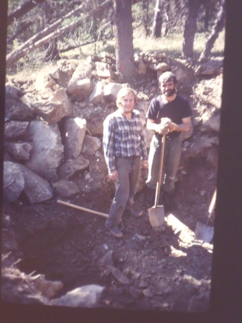
Keith and Bernie digging one of the test pits.
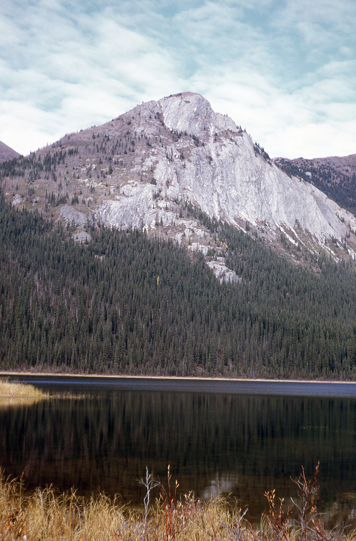
Don’s dream was to shoot a sheep. We knew that Dall sheep inhabited the area and he was determined to get one. On August 28th, the Jet Ranger came in to bring mail and supplies. I had the pilot drop me and Bernie off high on the mountains to the south, and he also dropped Don, along with a backpack and the .270 Winchester, on an adjacent mountain. The idea was that Bernie and I would prospect our way down the mountain all the way back to camp. Don was even farther from camp and higher up, and left to his own devices. I took this picture from our drop-off point, looking up to where Don was left.
Don was dropped off near Peak 6937
Here’s a good picture of Bernie, our prospector.
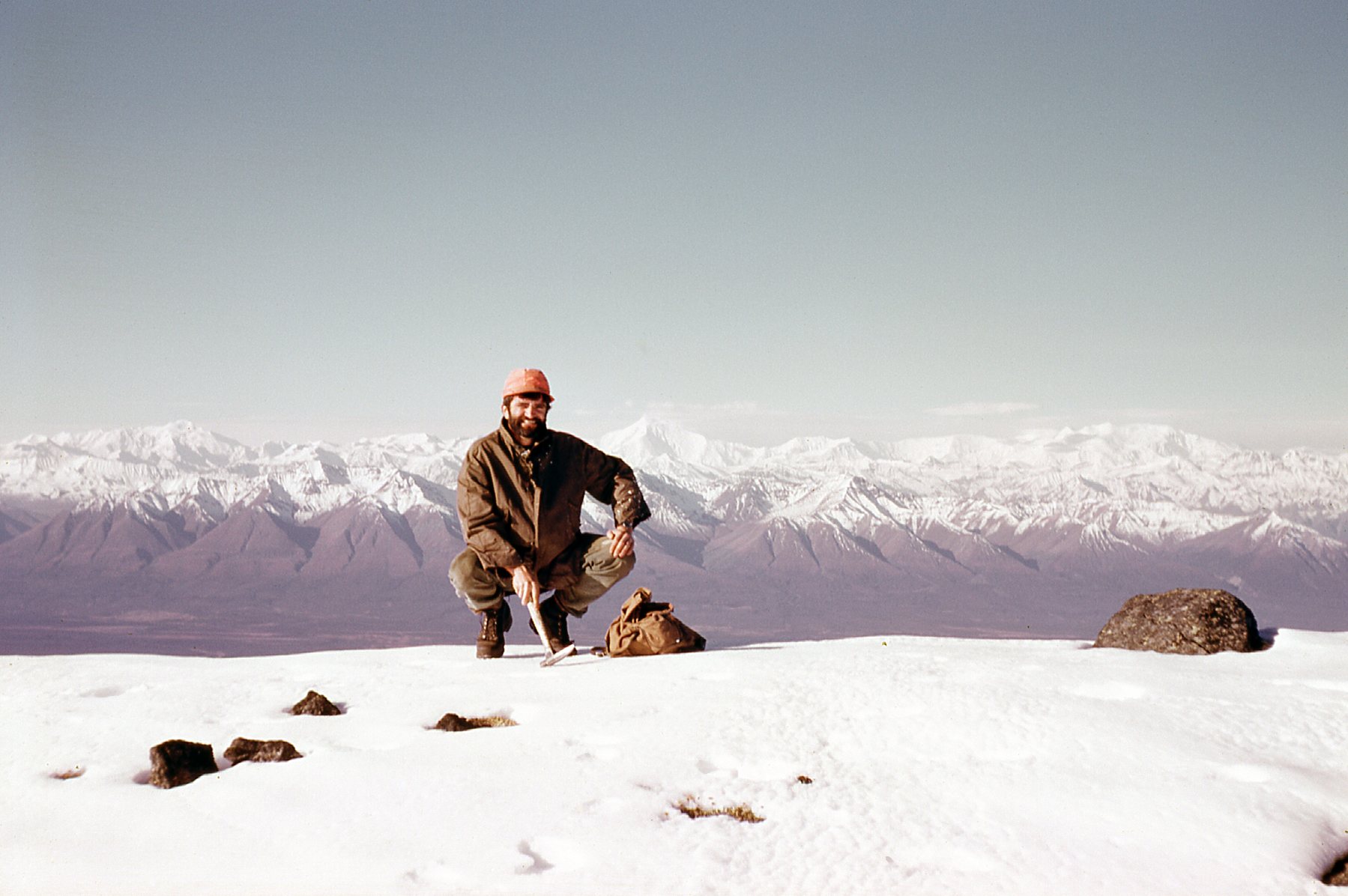
Bernie Marini
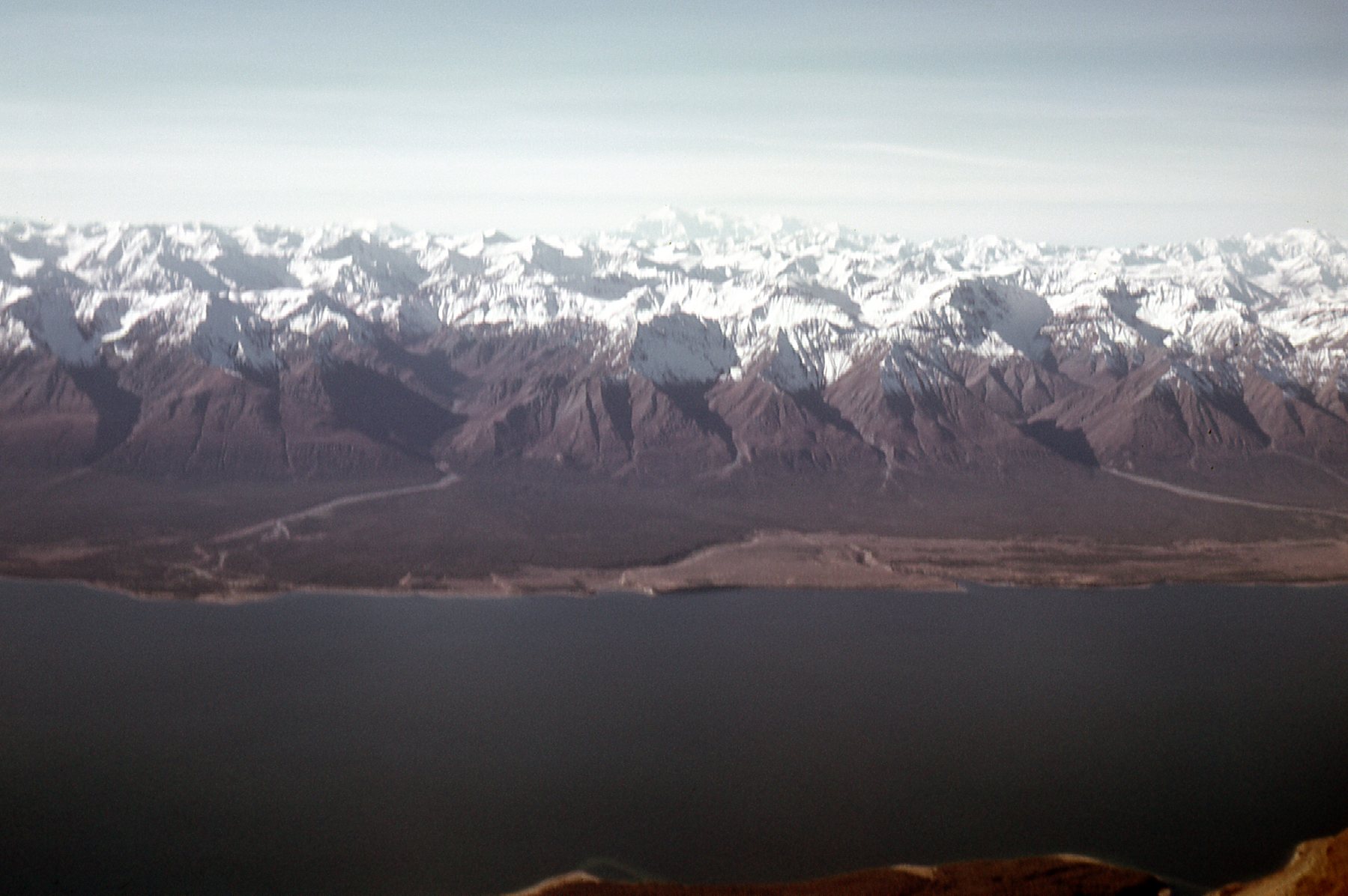
From our vantage point at 6,500 feet elevation, we had a good look over the top of the Kluane Range deep into the St. Elias Mountains. In this view to the southwest we can see what I believe is Mt. Lucania (17,257 feet) on the far right. It is 53 miles away and stands almost 11,000 vertical feet above us.
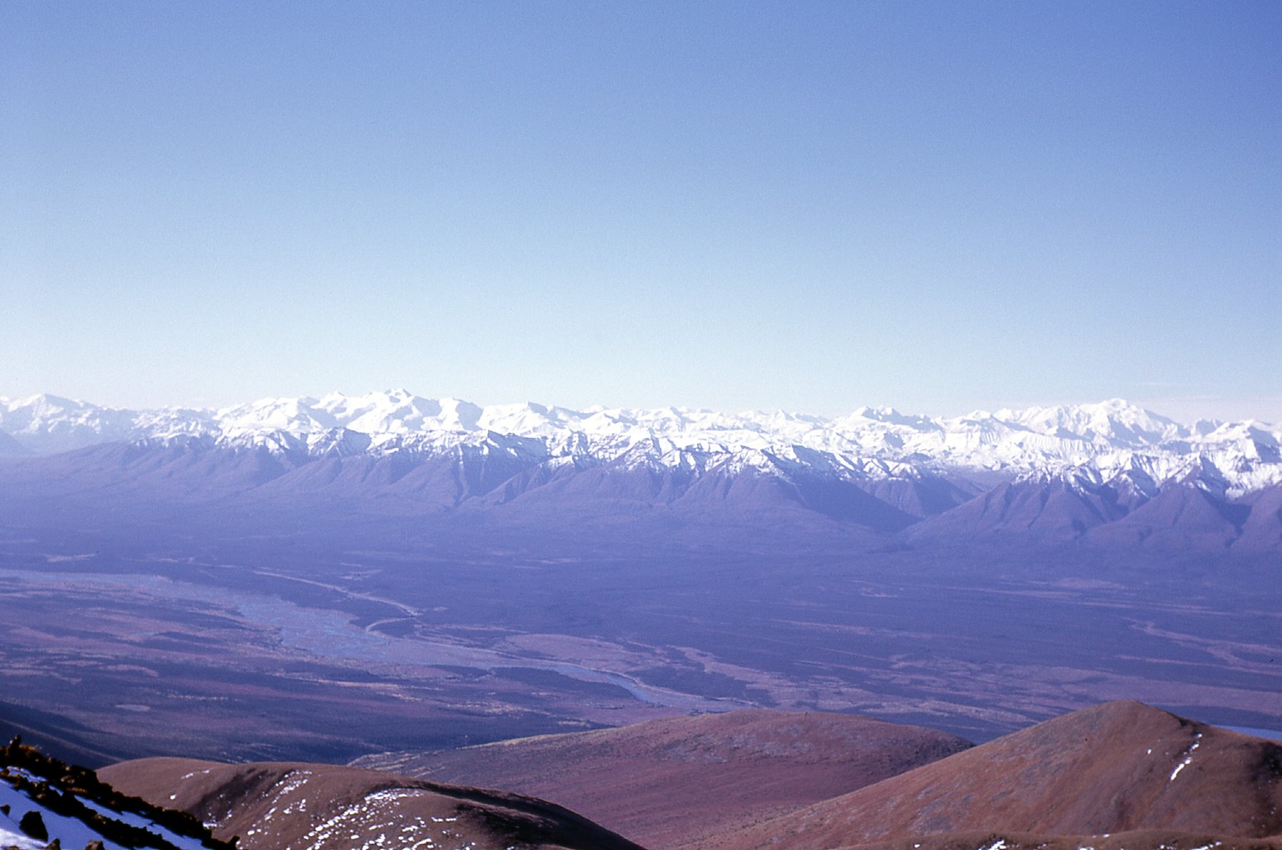
Looking southwest into the St. Elias Mountains
In this next photo, we are looking northeast to the 2 small lakes, each about half a mile long, which sat to the east of our mining property. You can also see the very southern tip of Tincup Lake above them.
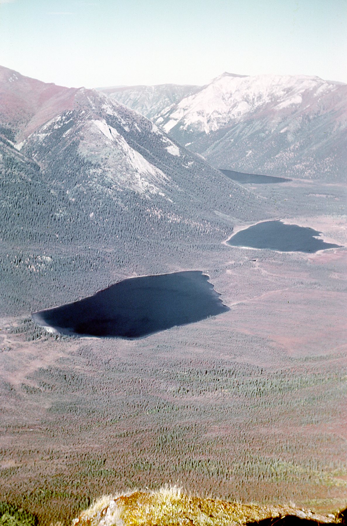
Our nearby lakes.
Bernie and I had a great day prospecting our way back down to camp, and although we got in late, it was nothing compared to Don. He staggered into camp very late and totally exhausted – we were getting worried about him. His hunt had been successful. He had shot a sheep, skinned and butchered it and then loaded every bit of meat he could carry, along with the hide, onto his pack frame. It was an extremely heavy load, but Don was one of the strongest, most muscular guys I had ever met and he pulled it off in great style. We celebrated his success with him as he regaled us with the story of his hunt.
The very next day, two of the company’s big bosses with PhDs arrived to check things out – they didn’t stick around long, only a few hours, but seemed satisfied with what we were doing. The day after their visit, Don shot another bear right in camp just before supper – it had been hanging around and was becoming a nuisance. Once they get used to people and lose their fear of us, they become dangerous. Don made several beautiful meals of the sheep meat, and we didn’t waste a speck of it. We ate bear meat, and also rabbits that strayed into camp. And grouse – don’t even get me started on them! They were constantly wandering into camp – we’d pick them off with the .22, and Don had several ways of cooking them. They were delicious, but eventually we grew tired of them and left them alone. Here’s one of my favorite pictures of Mike.
Mike preparing grouse for the cook.
One day in early September, we made an arrangement with the two older Indian fellows who had worked for us earlier in the summer. We flew them into camp and several of us walked over to the nearest lake. One of those guys shot a moose at the edge of the lake, and then we flew it back out to their village.
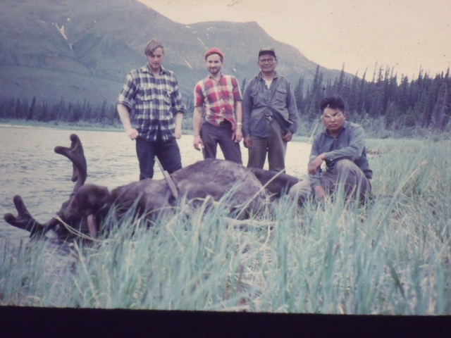
The moose
The chopper pilot said to call the boxes of meat “rock samples” because it was illegal to shoot a moose at that time of year. We were glad to do it, though, as another way of thanking them for all their help. And all that meat was a big help to the folks in their village. Don got some nice cuts of the moose meat which he cooked for us. Here are a couple of pictures of the lake where they got the moose.
Cam Lake One, looking east.
Looking northeast over Cam Lake One
Don was still turning out excellent meals – my diary says that he made a delicious fricaseed pork tenderloin on September 6th. We all kept busy. Bernie and I went all the way over to Tincup Lake and did some prospecting above the western shore. In the 3rd week of September, a technician arrived to carry out an electromagnetic survey. Keith assisted him – it was one last thing we would try, to make the best possible assessment of the mining potential of the property. Winter was coming, freezing every night and staying chilly much of the day.
After that EM survey, the end was in sight. I finished my field work for the mapping, and we started to dismantle the camp. We were down to a skeleton crew – me, Don, Keith and Mike – the same ones who had been there the entire season. One of the guys snapped this photo of me in late September. I look like I’m deep in thought – probably thinking how I wish this long field season would end, as in “I’m ready to blow this popsicle stand”.
The young Desert Mountaineer, just turned 22.
We all had time on our hands – with the real work all done, we could take it easy. One day, Don melted a bunch of chocolate and added nuts and raisins to create this one-of-a-kind treat. As you can see from the edges, we were eating as much of the “Cam bar” as we could. We had to eat up everything we could, because it wasn’t going to get flown out at the end.
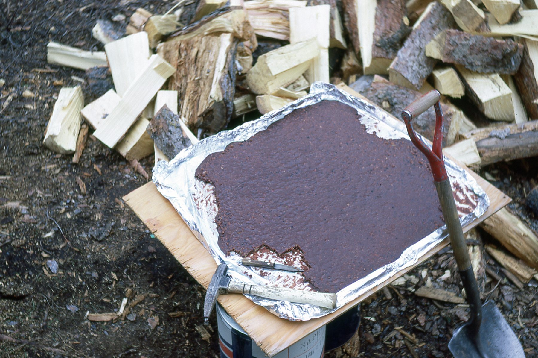
Cam bar
One day I wandered over to the second of our two “Cam” lakes and sat on the shore, realizing that even though it’d been a long, hard summer without a break, this really was a very special place and we were lucky to have spent time here.
Northeast across Cam lake #2
North across Cam lake #2
The final day, September 27th, arrived. The chopper came in and flew out with a couple of the guys and a big load of gear. Hours later, it returned for me and the rest of the gear. I asked the pilot if he wouldn’t mind flying as high as possible so I could take a few pictures. He was happy to oblige and took us up to 10,150 feet. I was curious to see if Mt. Logan, would be visible. It was, and I wish my picture had turned out better – it’s a bit blurry through the window of the chopper. Right in the center of the horizon and 80 air miles away sits a big white thing. That’s Logan, it has the largest base circumference of any non-volcanic mountain in the world and is Canada’s highest at 19,551 feet.
Looking southwest to Mt. Logan
It seemed other-worldly to land in Whitehorse, a bustling city, after 3 months and 8 days in the bush without a break. In the next day or two, all the guys had flown home. Bud and I took care of final details in town, then went on a bit of a road trip, driving the 330 miles to Dawson City. This historic place is well worth the visit, if for no other reason than to see the old buildings.
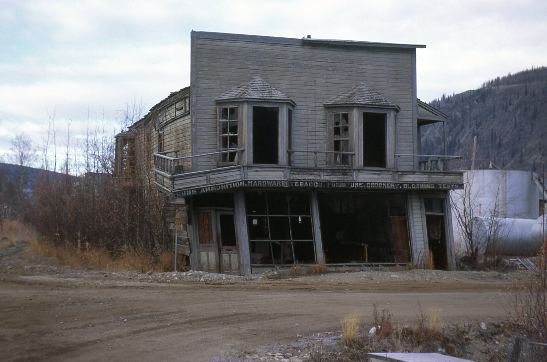
Dawson City
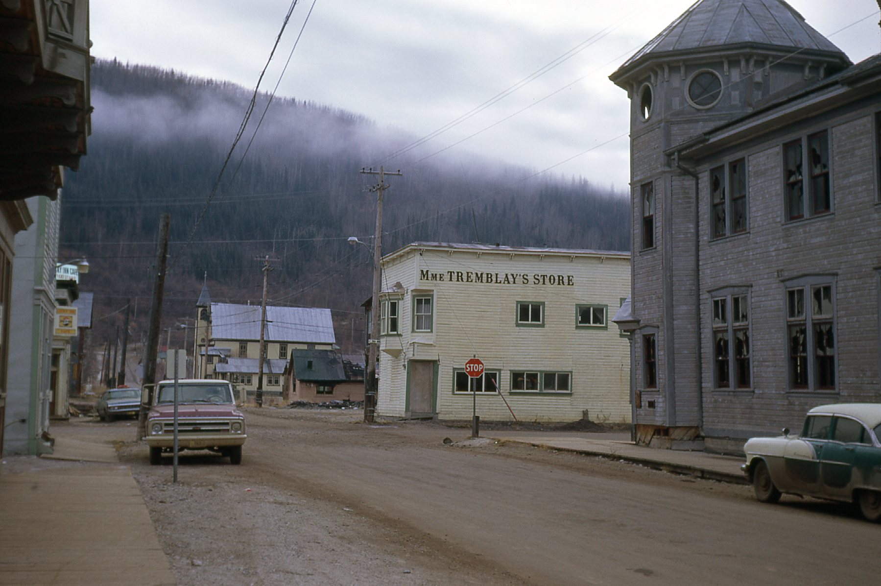
Dawson City
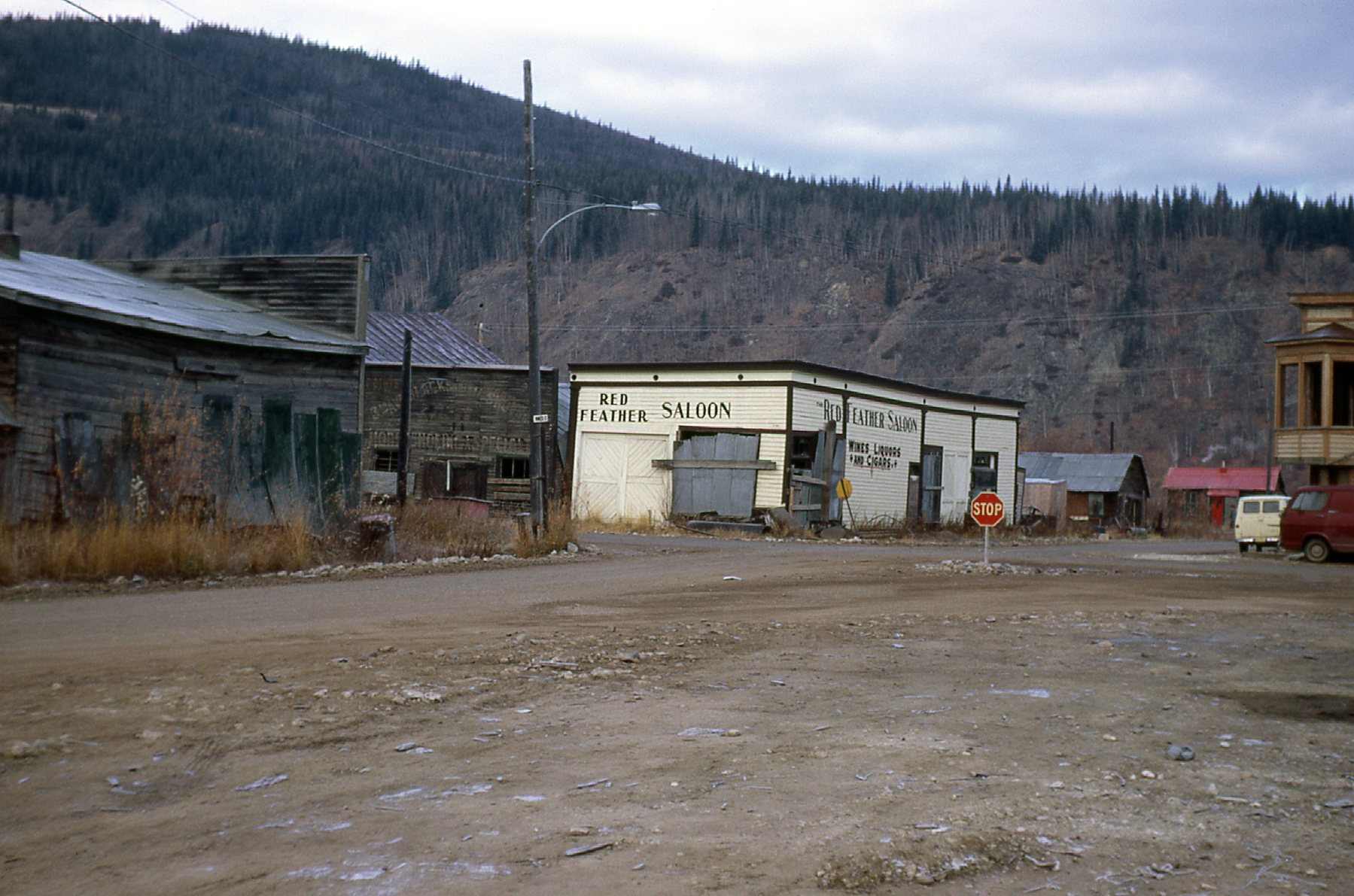
Dawson City
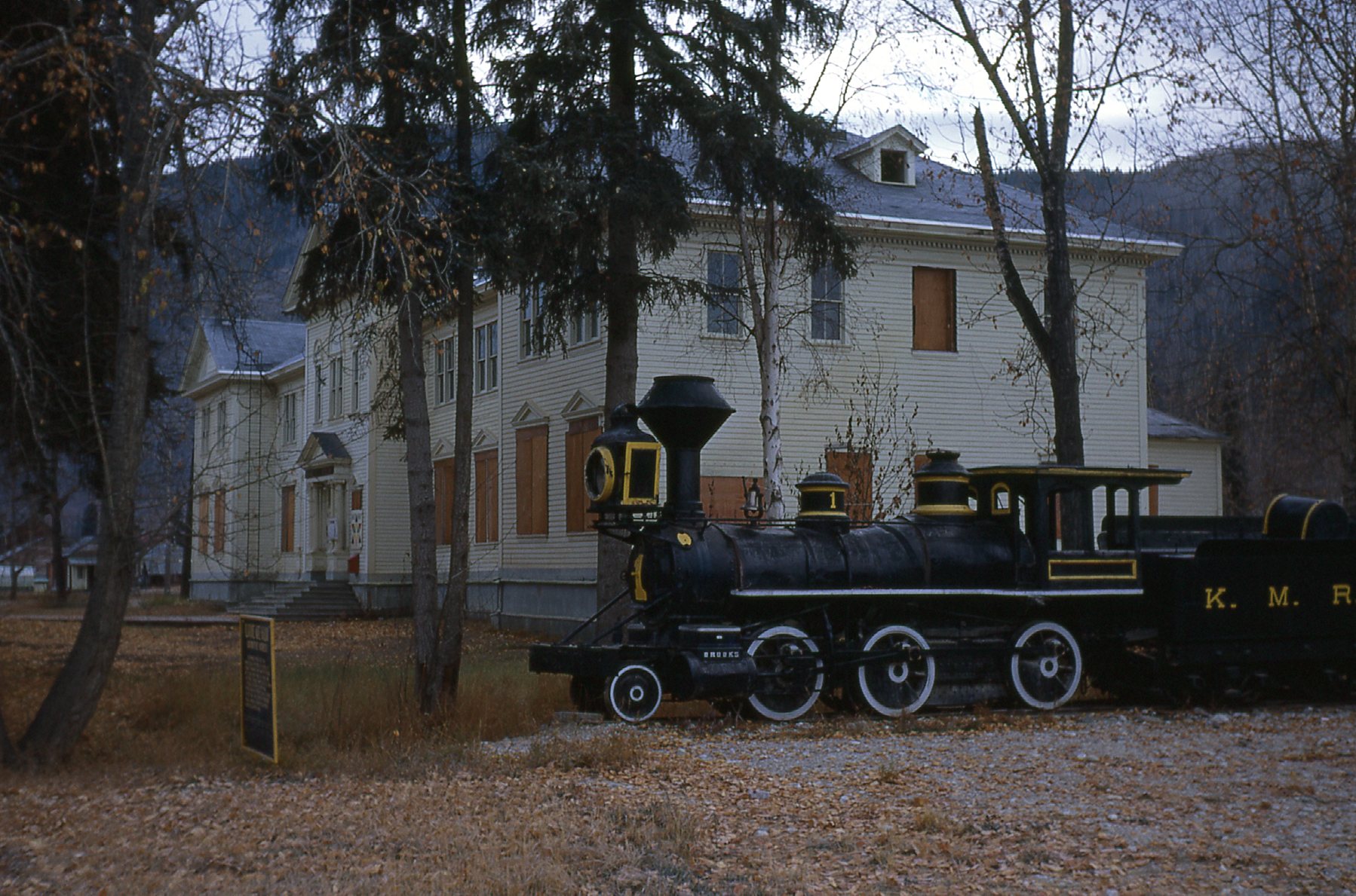
The old Territorial Government Building
Until 1953, Dawson City was the capitol of the Yukon. Today, it is the second-largest community in the territory, with about 1,400 inhabitants. We spent a couple of days there, with a side visit to the Clinton Creek mine and Alaska via the Top of the World Highway, which is closed during the winter.
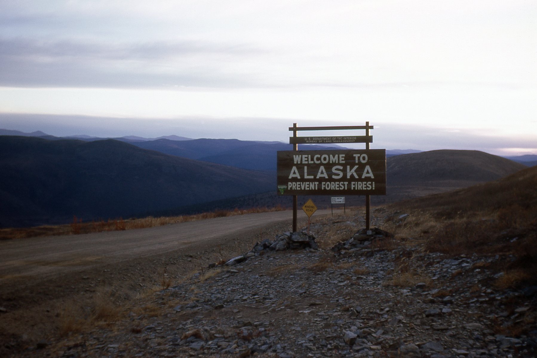
Alaska
Eventually we drove back to Whitehorse and in early October flew to Vancouver. My work then entailed making finished copies of all of the maps and completing my report. I don’t want you to think that our summer didn’t amount to much other than a bunch of guys living out in the bush, so here is the report I produced for the company. Sorry about the way it’s presented here – I’m no computer whiz, that’s for sure. If you zoom in on each page, you should be able to read them okay. I hope you’ll have a look at it, because all of the work that all of us did that summer of ’69 boiled down to these few pages.
Title page
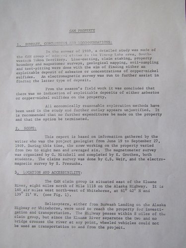
Page 1
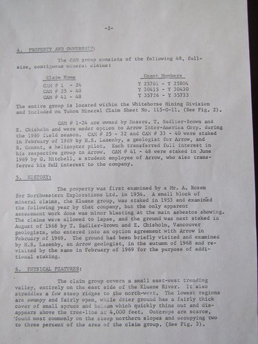
Page 2
Page 3
Page 4
Page 5
Page 6
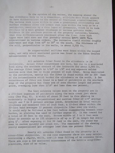
Page 7
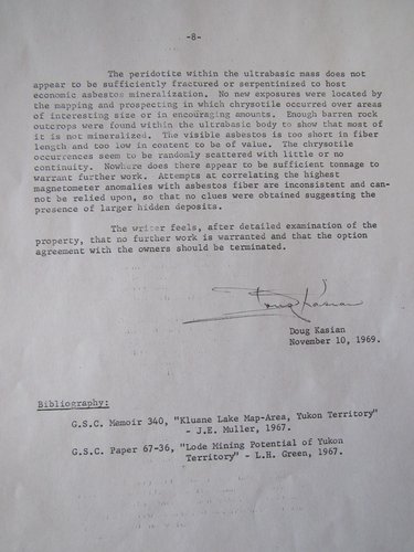
Page 8
So there you have it, my report summarizing all those months of our collective hard work. The report was only part of what we did, though. The maps were an even bigger part of the work and formed an important part of the report. There’s no way I can show them to you here, but I thought that for fun I’d list all of the ones we did. Some of them were really huge.
- Magnetometer Plan East Scale:1″ = 200 feet Map size 42″ x 65″
- Magnetometer Plan West Scale:1″ = 200 feet Map size 42″ x 65″
- Geological Plan West Scale:1″ = 200 feet Map size 33″ x 59″
- Geological Plan East Scale:1″ = 200 feet Map size 33″ x 59″
- Geological Section Scale:1″ = 200 feet Map size 15″ x 54″
- Ronka EM-16 Survey Plan Scale:1″ =200 feet Map size 18″ x 25″ each, 2 sheets
- Geochemical Assay Plan Scale:1″ = 200 feet Map size 42″ x 54″
- Vertical Section Main Showing Scale:1″ = 20 feet Map size 17″ x 22″
During the next months spent in the Vancouver office, I made a few more trips into the field. The most notable were a week spent in the snow near Peachland in the Okanagan Valley, and a bone-chilling week in Northern Manitoba in November.
The company I was working for, Arrow Inter-America Corp., was owned by W.R. Grace. They had become famous as the Grace Steamship Company. In 1969, they had mining and exploration interests all over the world, and there was talk of my going to South America to work for one of their operations there because I spoke Spanish, but that never materialized. One day in the fall, my boss came to me and asked if I’d be interested in going to Turkey to work for another of the company’s interests. “Can I think about it?” was my response. “Sure, but I need your answer by the end of the day” was his reply. Well, I decided I would do it, but a day later he said that it wouldn’t happen after all – a national election had just taken place, and the party that had won had some strong anti-American sentiments, so the project had been shelved.
My employment with them ran out at the end of the year, but I still look back on the months spent working in the Yukon as some of the best ever. To this day, early in the year 2021, I am still in touch with Keith and Mike and am glad that we have maintained our friendship 50 years on. Some years later, I believe around the mid-70s, our cook and friend Don took his own life. To this day we don’t know what troubled his soul enough to arrive at such a crossroads, but he is missed.
Thanks for staying with me and sharing the journey.