
Hello Friends. I am starting something new for this website, something I am calling The Pictorial Series. Here’s how it works. With well over 400 stories already published on the Desert Mountaineer website, I’ve covered a lot of ground. However, as I look back on some of them, I now wish there had been more or different pictures in certain stories. Most of the stories I’m talking about actually occurred long ago, in the 1970s for the most part. I now have access to a great many more photos I took from that time period, so I can present some of those stories in a fresh light. The text may also be presented differently than in the earlier story, but the new photos will be thing I’m most excited to show you. I’m going to start things off with a new look at one of my favorite peaks in the Pacific Northwest. I’m talking about Mount Shuksan, and the best summary I can give of it is a quote from Fred Becky’s Cascade Alpine Guide:
“Mt. Shuksan epitomizes the jagged alpine peak like no other massif in the North Cascades… it has no equal in the range when one considers the structural beauty of its four major faces and five ridges…There is no other sample in the American West of a peak with great icefall glaciers derived from a high plateau, and in the Pacific Northwest it is the only non-volcanic peak whose summit exceeds timberline by more than 3000 feet… Shuksan is one of the finest mountaineering objectives in the North Cascades and its reputation is certainly deserved; a wide variety of challenges can be encountered on this quite complex mountain. The climber has a choice of rock walls, moderate firnfields, steep ice, and easy scrambling. Despite a sometimes-forbidding appearance, Shuksan has yielded 14 routes, numerous variations, and impressive subsidiary climbs, including some directly up dangerous ice cliffs.” – Fred Becky (Cascade Alpine Guide : Rainy Pass to Fraser River).
Mount Shuksan is a pretty big peak. It stands 9,131 feet in elevation, and with 4,409 feet of prominence it’s no slouch. It has one problem, though – it sits in the shadow of its bigger brother, Mount Baker. A mere 11 miles separate the two summits. Baker can be seen from far and wide – as it is farther west, it’s closer to “the edge of things”. There are plenty of peaks to the west of it, but since they’re in the four-to-six-thousand-foot elevation range and so much lower, they don’t obstruct the view of Baker very much. Shuksan is a different story. Tucked in to the east of Baker as it is, it also happens to be surrounded by 6 and 7-thousanders. I grew up just north of the border, in a small town just 35 air miles from Baker. There was little to block the view, and from the vantage point of our town we could see all the way down to the 5,000-foot level on its northwestern slopes. But Shuksan – no way, no how. It was missing in action. Even though it was only 40 air miles from my town, it might as well have been 400.
I didn’t know much about either peak until I made my first attempt on Baker in the winter of 1967. That was probably the first glimpse I ever had of Shuksan, but since the attempt on Baker was so all-consuming I didn’t pay much attention to it. No pictures survive from that climb. Years passed. Once I moved to that small town I mentioned earlier, in early 1973, I started climbing peaks in the region with a passion. By the time 1976 rolled around, I couldn’t stand it any longer – I had to go and give Shuksan a try. I still didn’t know much about the mountain. Sure, I had some idea of a couple of the routes on the west side, but that was it. I’m not sure how I even found out that much, but armed with a lot of determination and a dangerously small amount of knowledge of the mountain, I headed out on October 19th. I drove a Volvo station wagon in those days, and if I folded down the seats I could sleep in it. There was a parking area beside the paved road and that was my starting point. It was 8:30 PM by the time I turned in, excited about what tomorrow would bring.
Early the next morning I set out by headlamp and covered the 4.1 miles along a good trail and soon reached Lake Ann. At around 4,700 feet elevation, this is the real start of the climb. I didn’t leave any gear there, as I was traveling fast and light, planning to do this as a day climb. I could bore you with the long version of my climb, or give you the short and sweet version – hmmm, I say let’s go with the latter. As I originally promised, we’ll focus on the pictures.
On the way in to the lake, I had this view of Mt. Baker.
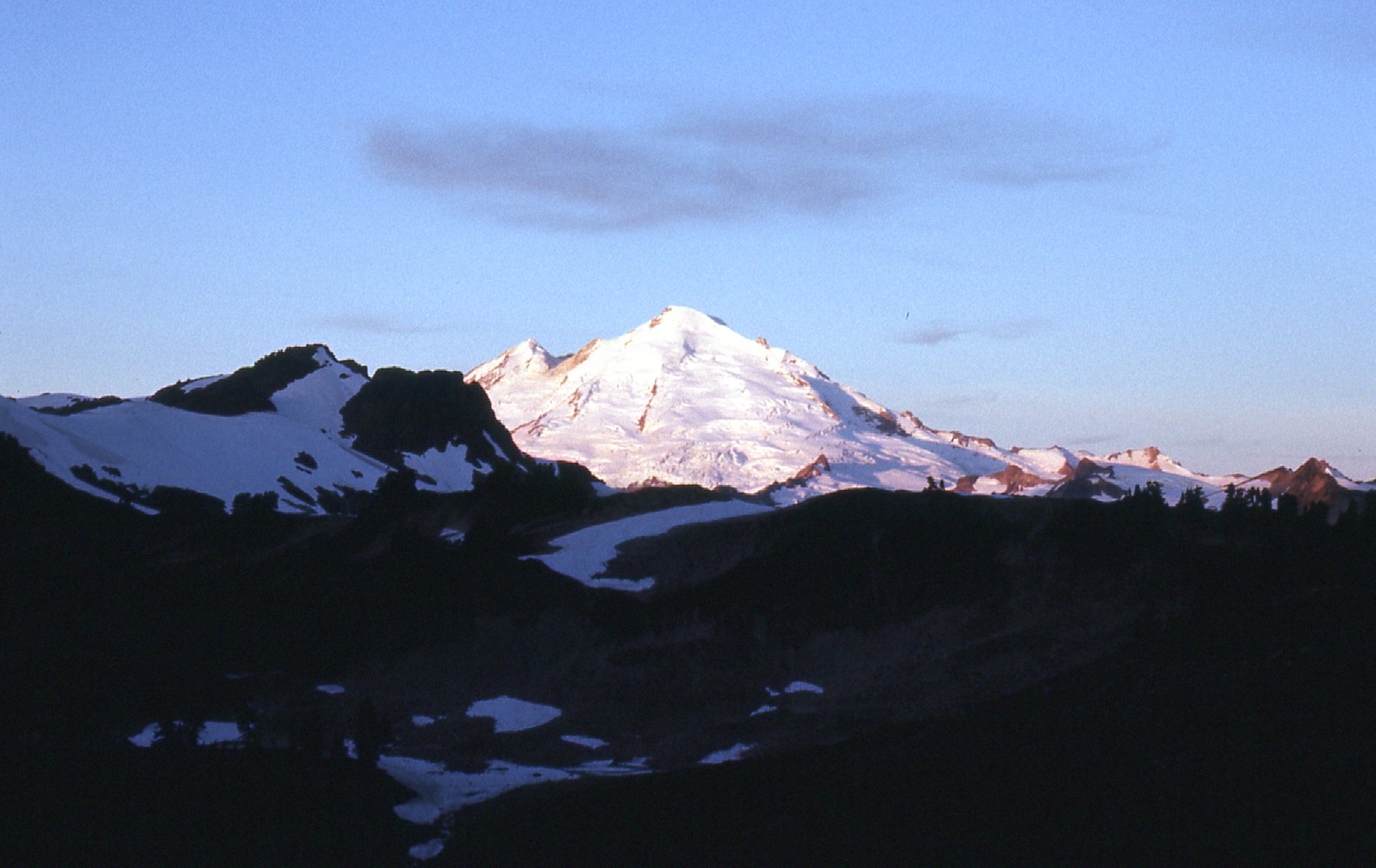
Looking west to Mt. Baker at sunrise
From the lake itself, you can see the Lower Curtis Glacier.
The Lower Curtis Glacier
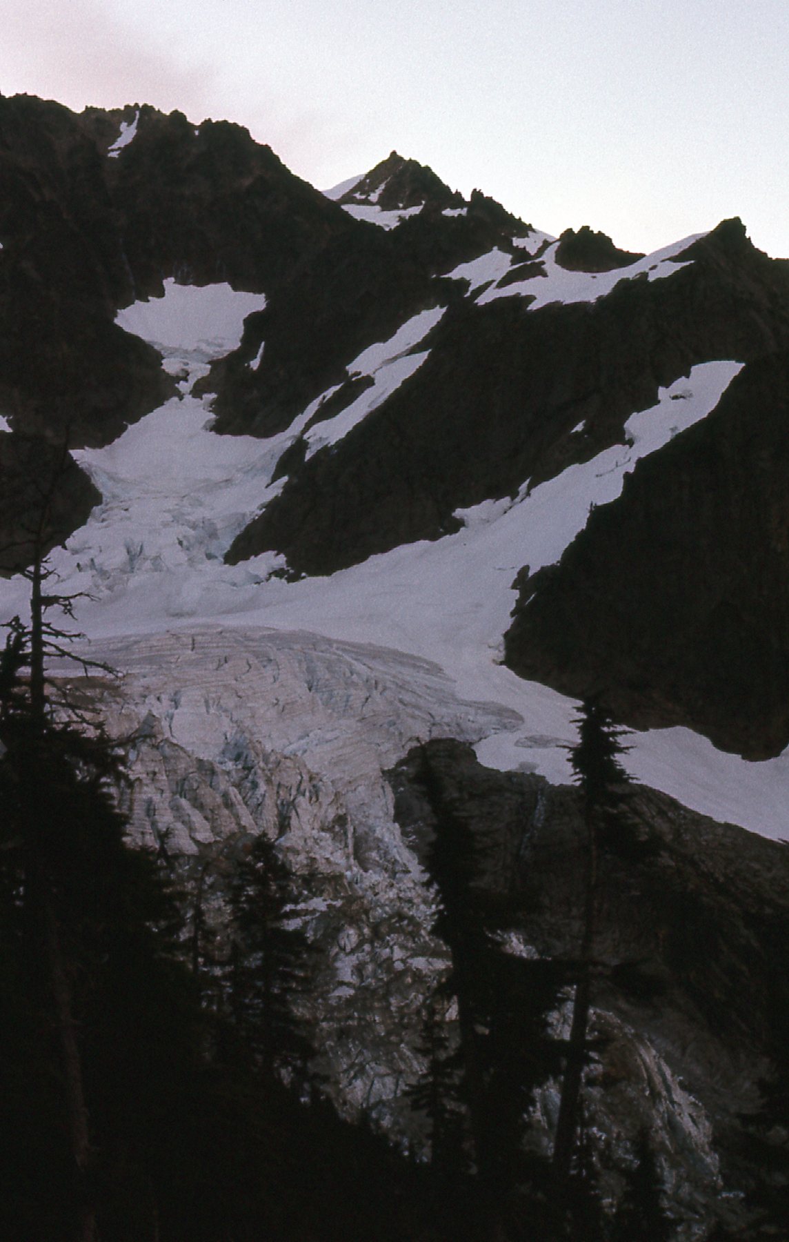
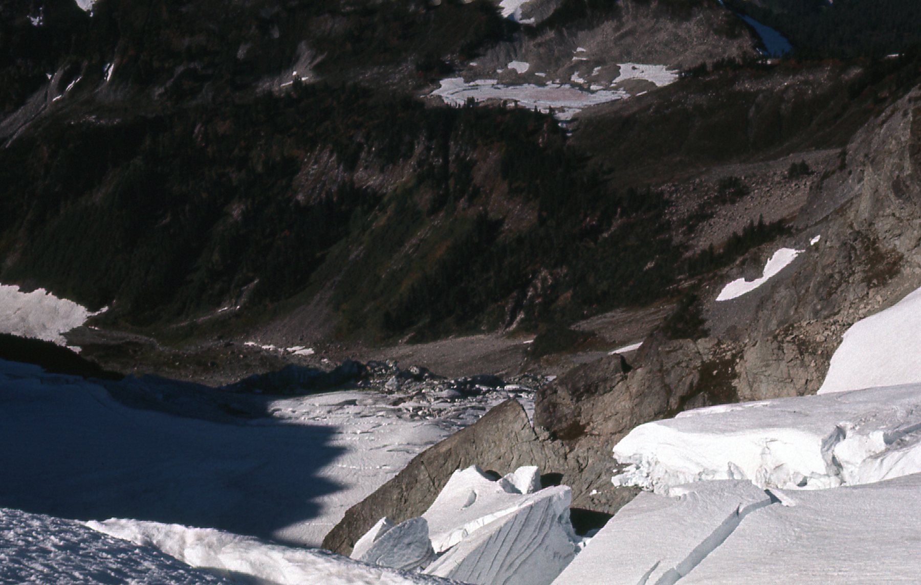
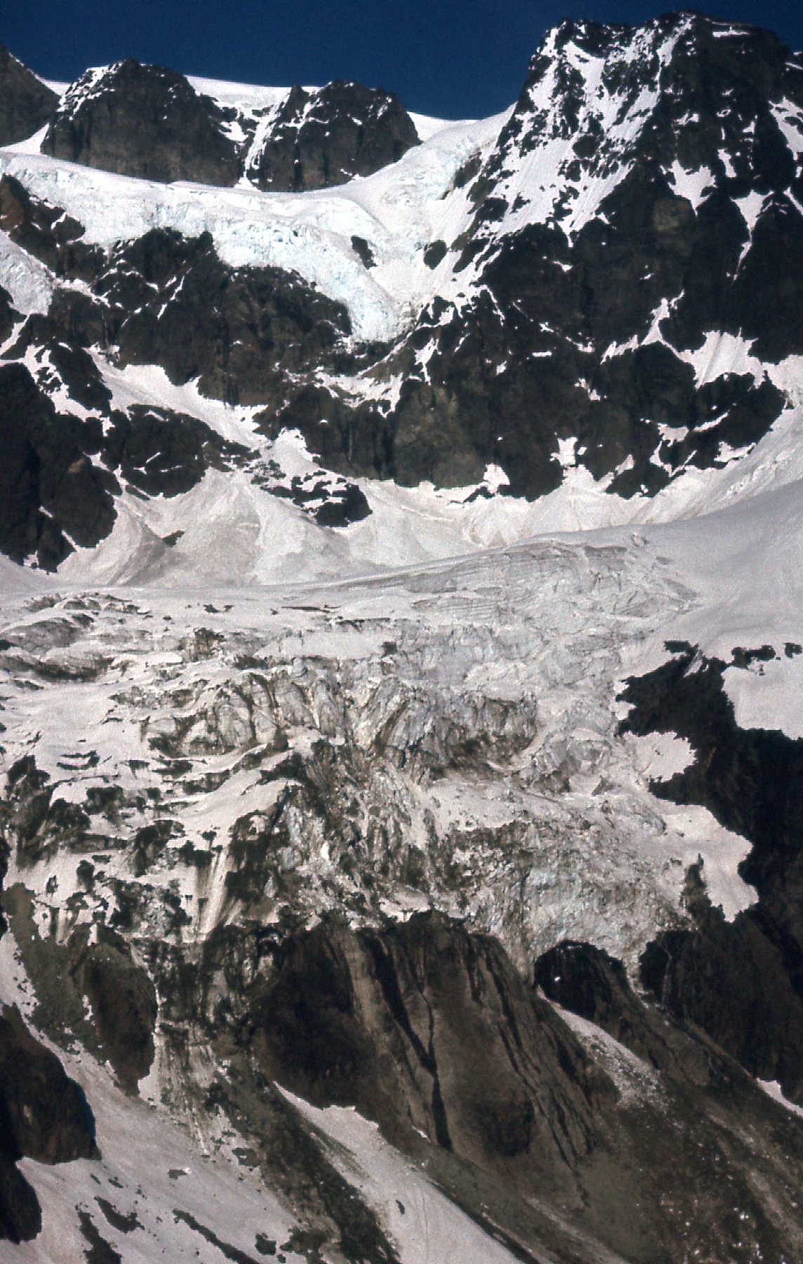
When you leave the lake, you climb up through alpine meadows to approach a feature called Fisher Chimneys. This is a wall of crumbling rock which starts at around the 5,400-foot level. There are several paths through this, but no matter which way you go, you’re going to have to deal with Class 3-4 rock, and you’d better be paying close attention, as climbers have died here. At around 6,700 feet elevation, you emerge from the chimneys to find yourself on the Upper Curtis Glacier. Here’s a look back down to the Lower Curtis Glacier from above the chimneys.
The Lower Curtis Glacier
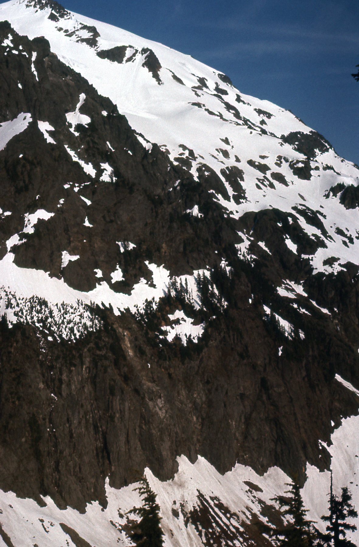
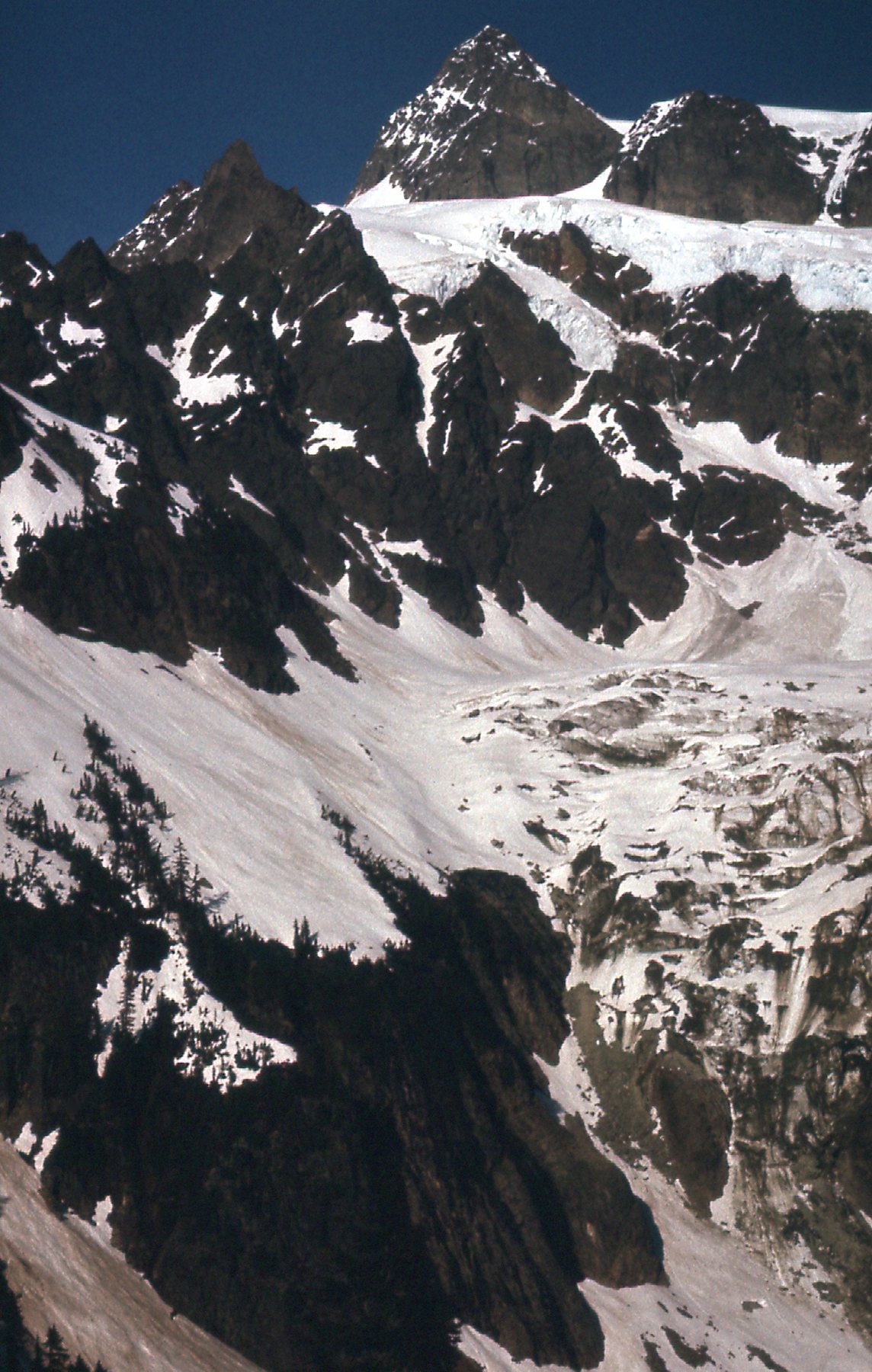
From the same area, here’s a look to the upper part of the mountain.
Looking way up.
I now had an even better look back over to Mount Baker.
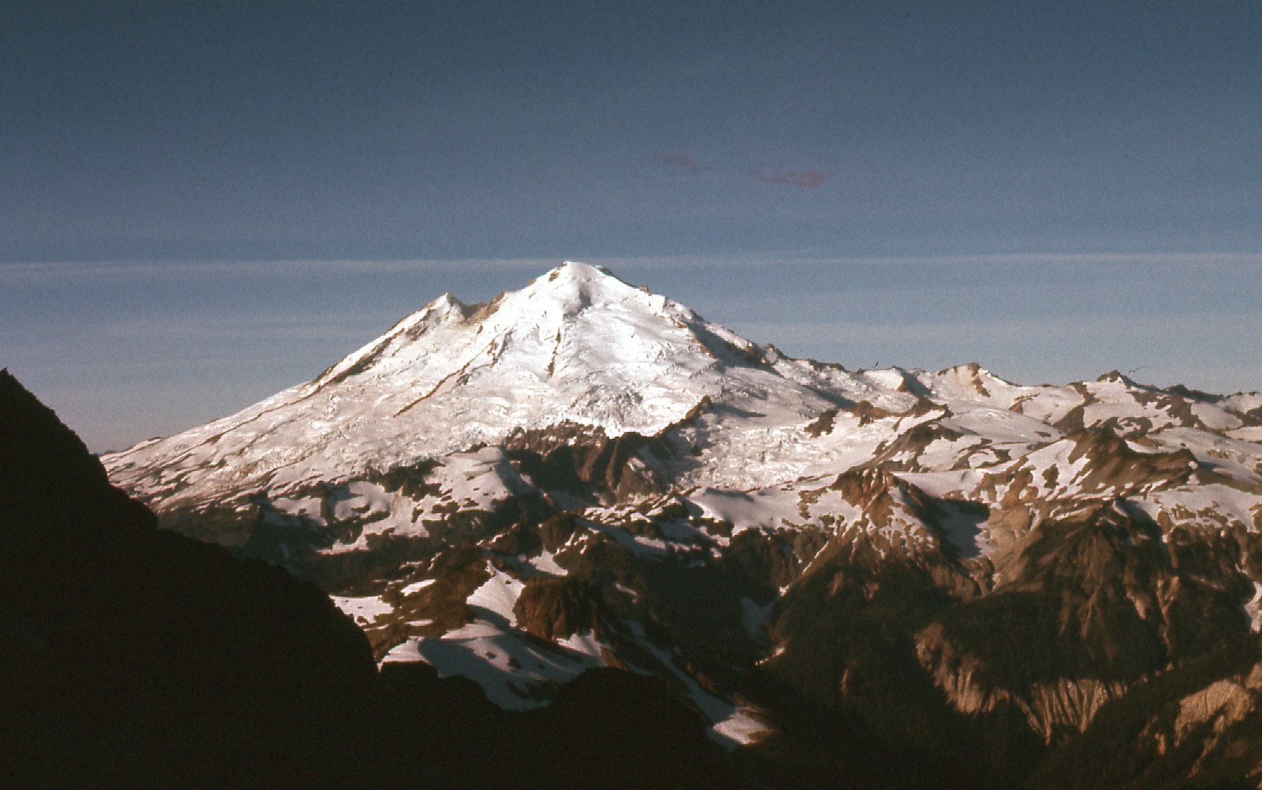
West to Mount Baker
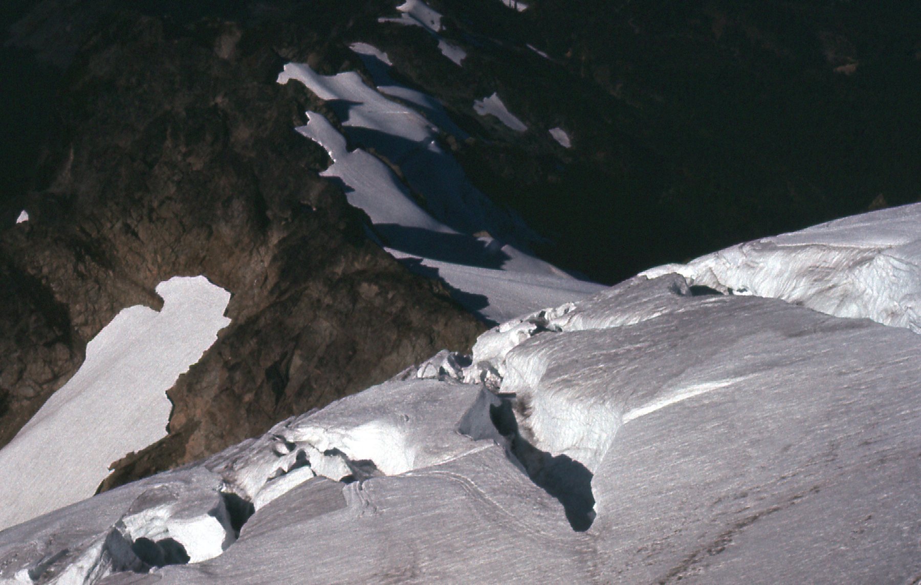
By now, I was well up on to the Upper Curtis Glacier. I was alone, unroped, with only crampons, ice axe and day pack, and I found myself on shaky ground as I tried to continue climbing. These next photos will give you a good idea of my surroundings.
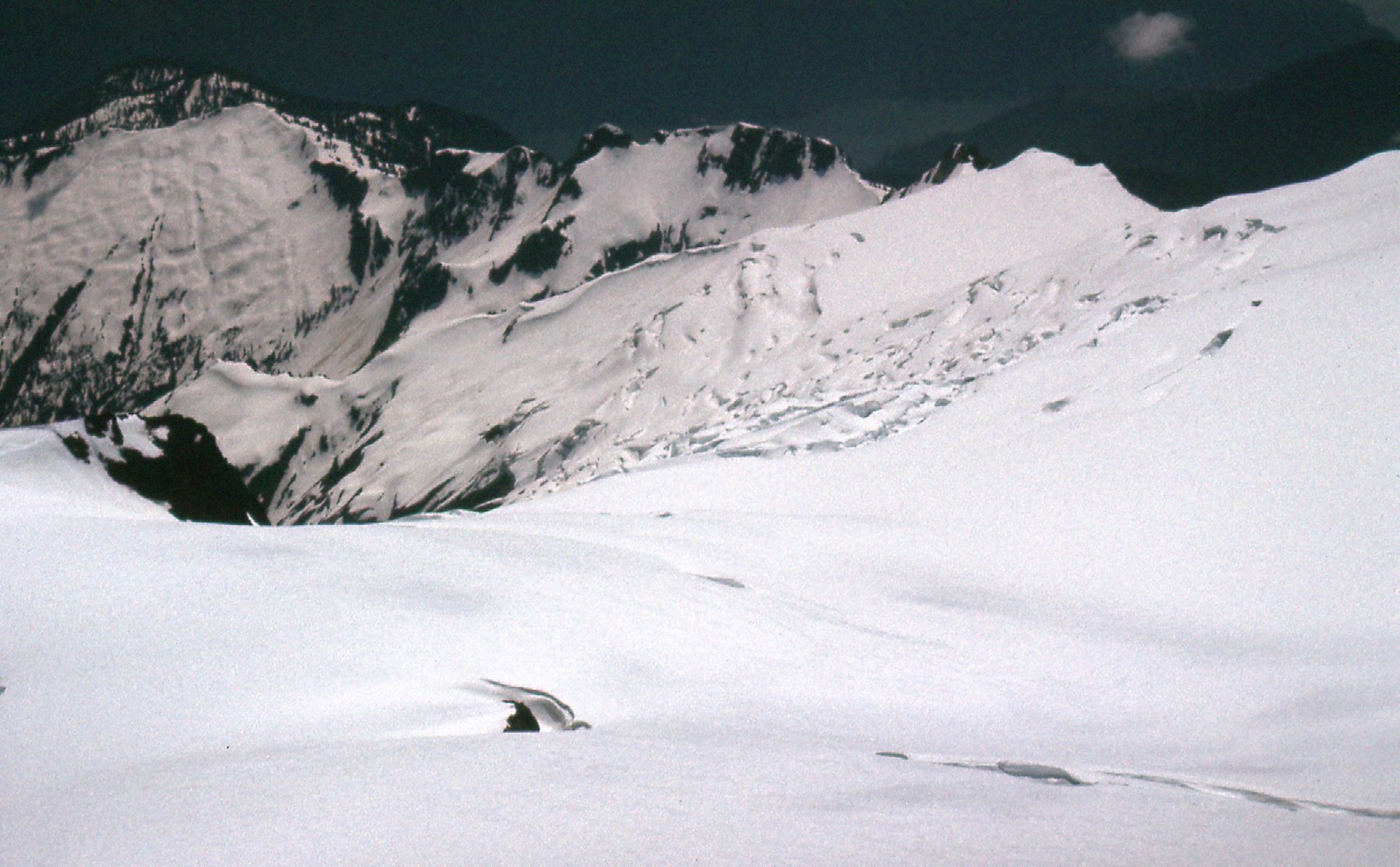
Looking southeast across the glacier.
Upper Curtis Glacier
I could see problems ahead.
At 7,200 feet.
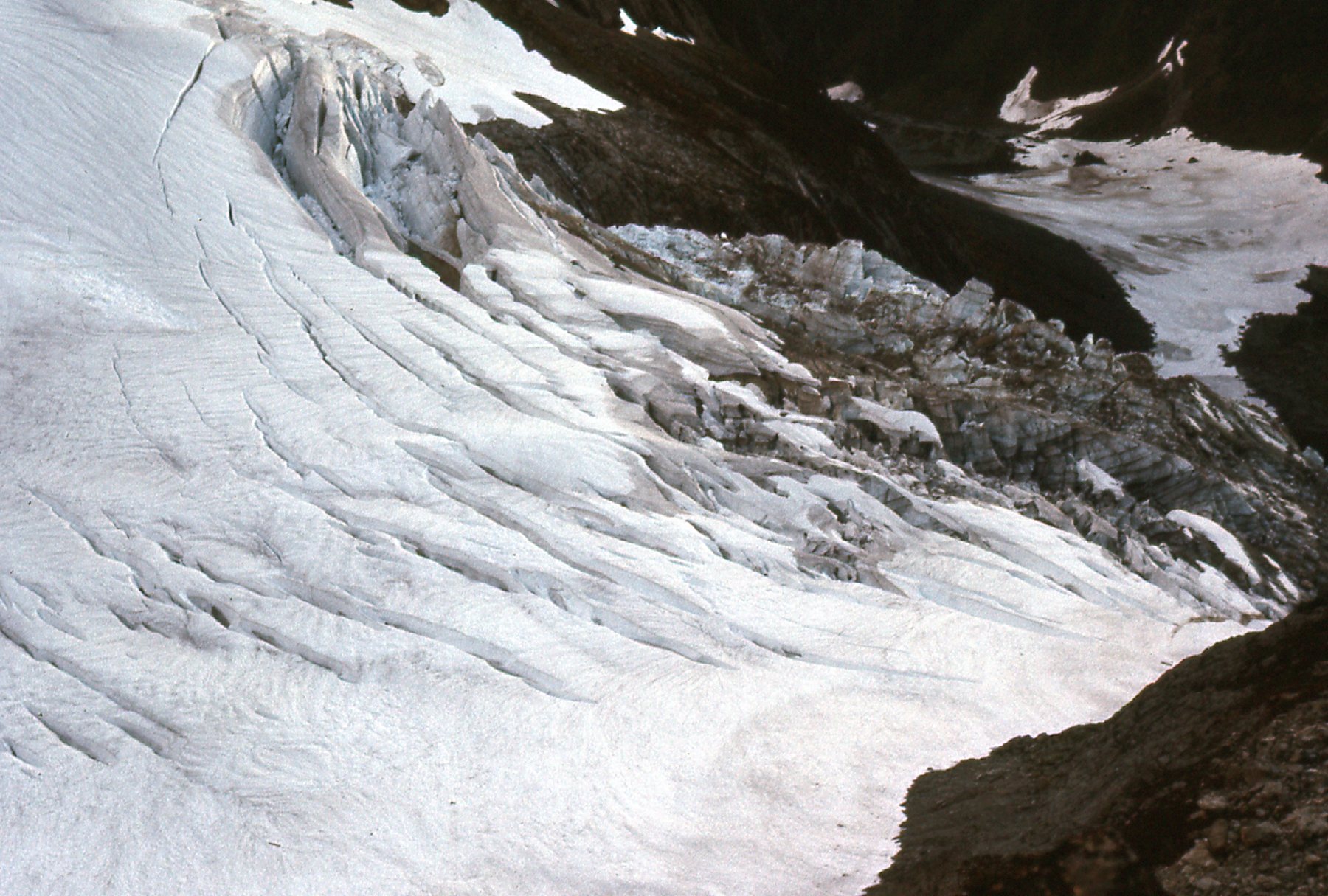
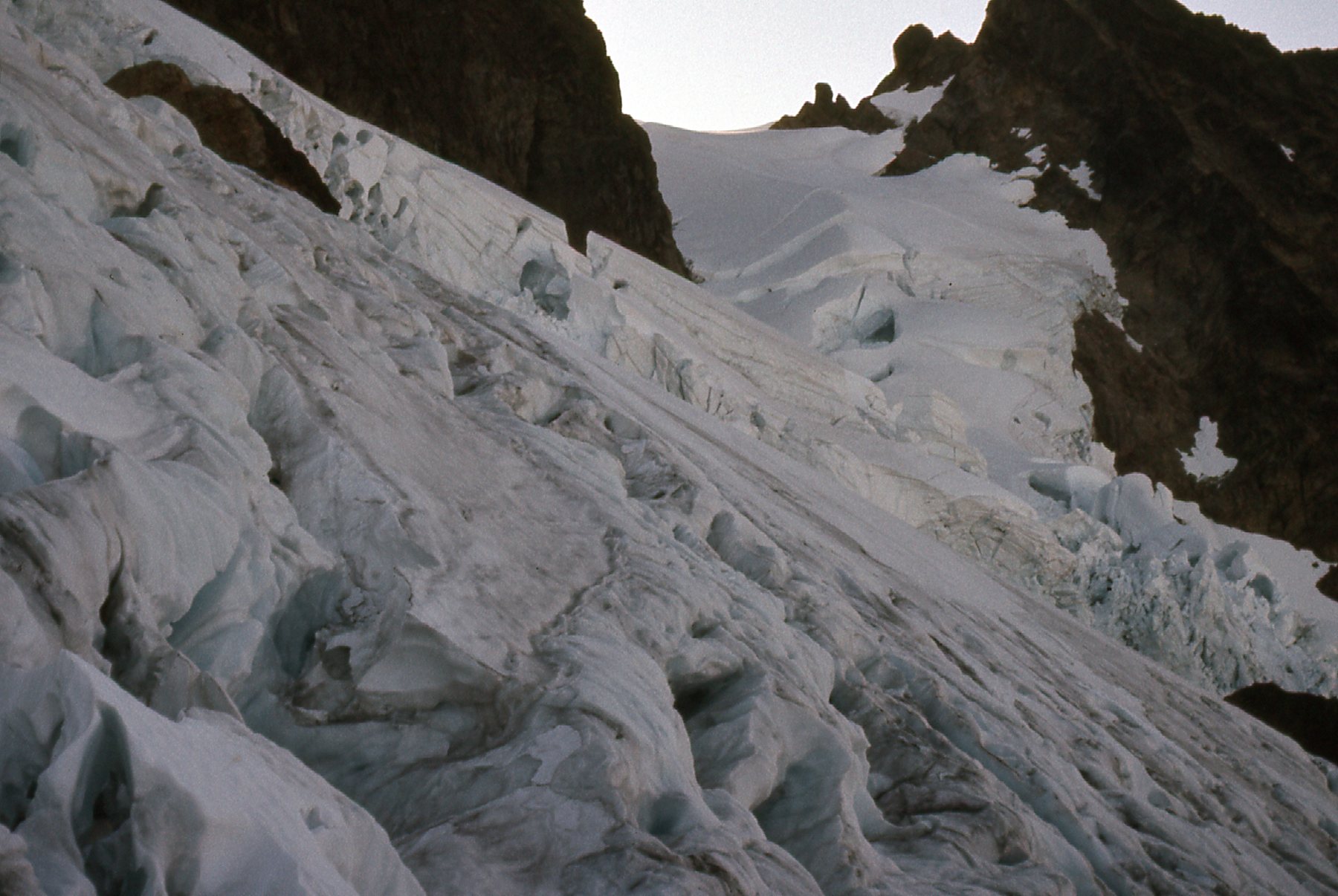
I kept climbing. There were interesting details in the ice.
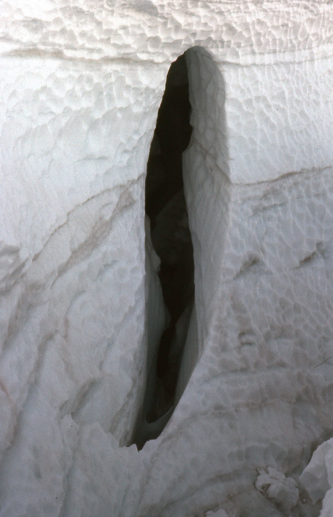
Glacier detail.
More detail.
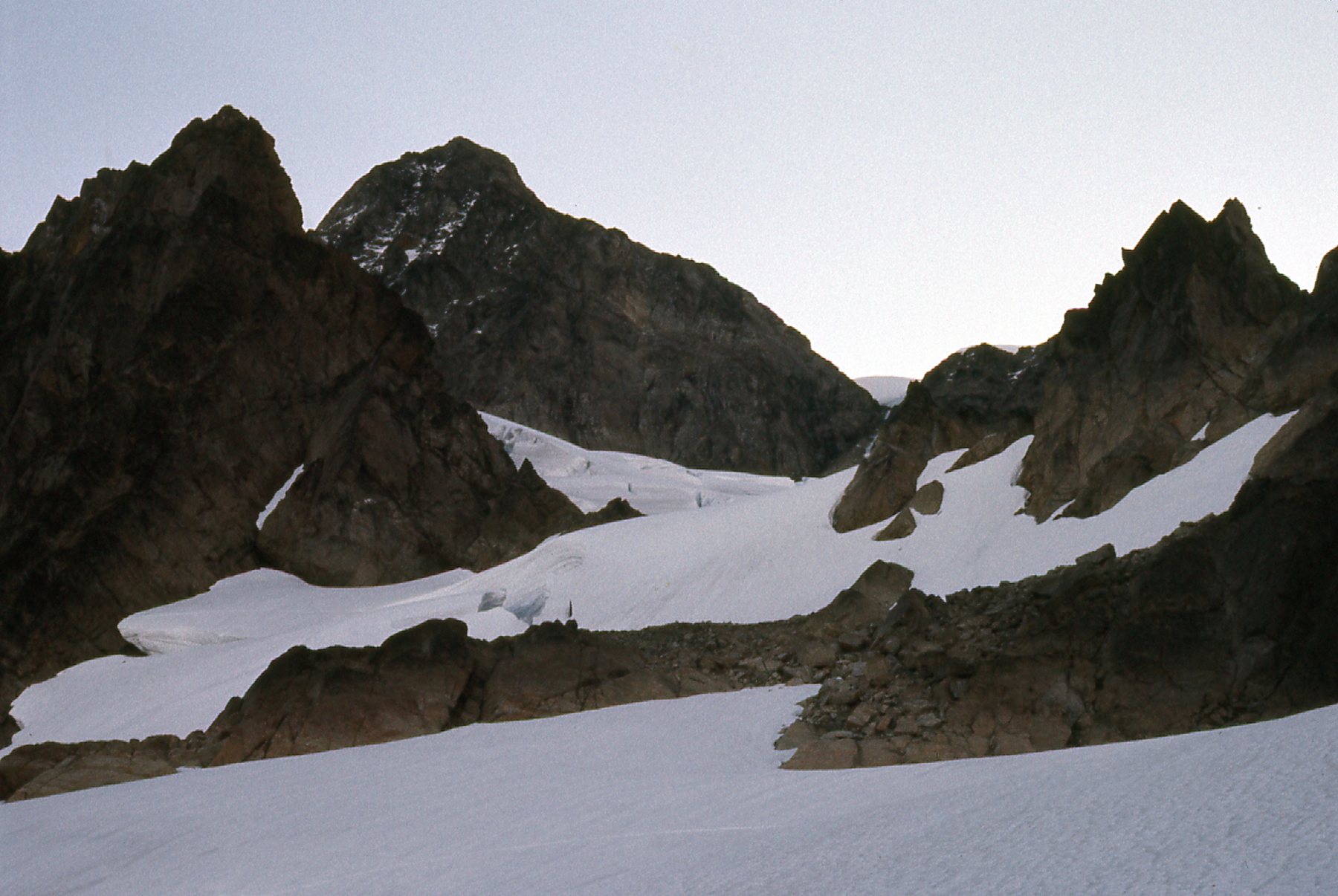
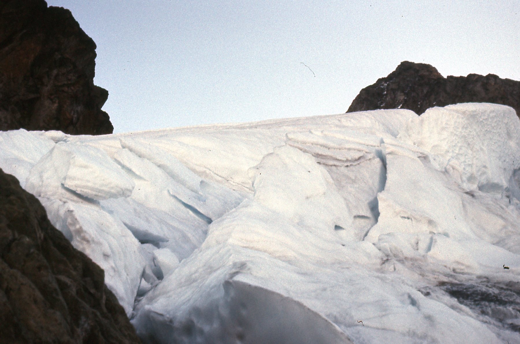
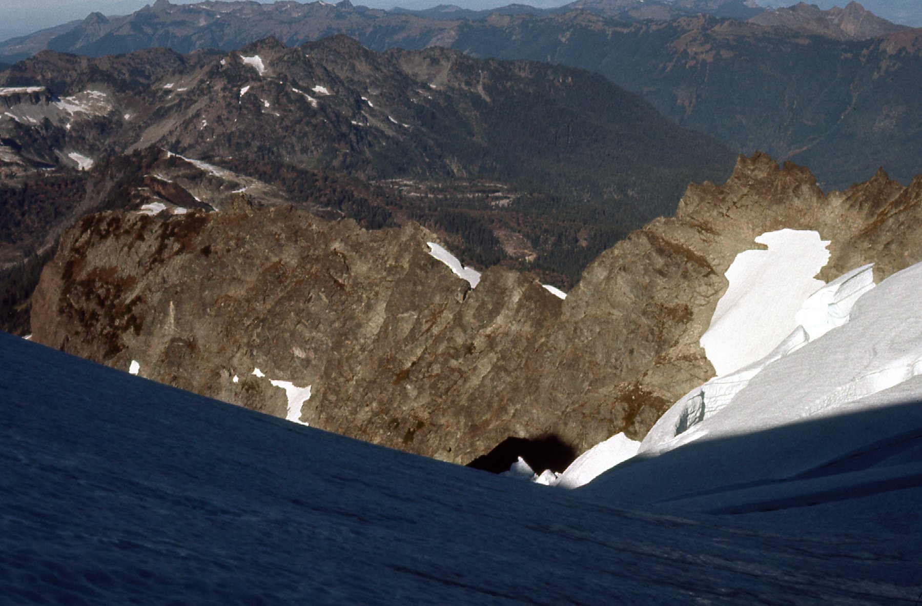
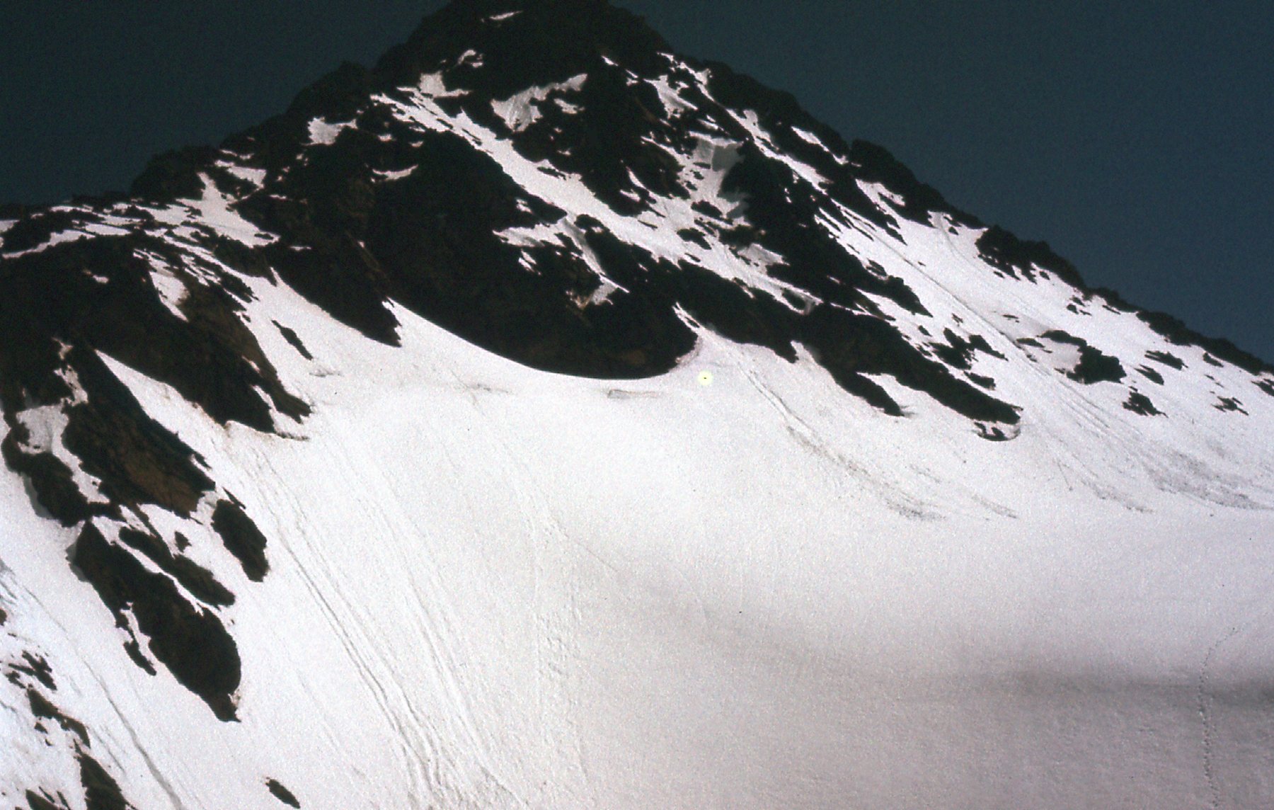
I managed to make my way up to 7,500 feet, where I chickened out. This late in the season, a lot of snow had melted off of the glacier surface, revealing many crevasses. It was all too risky for me. I took some final pictures from my high point.
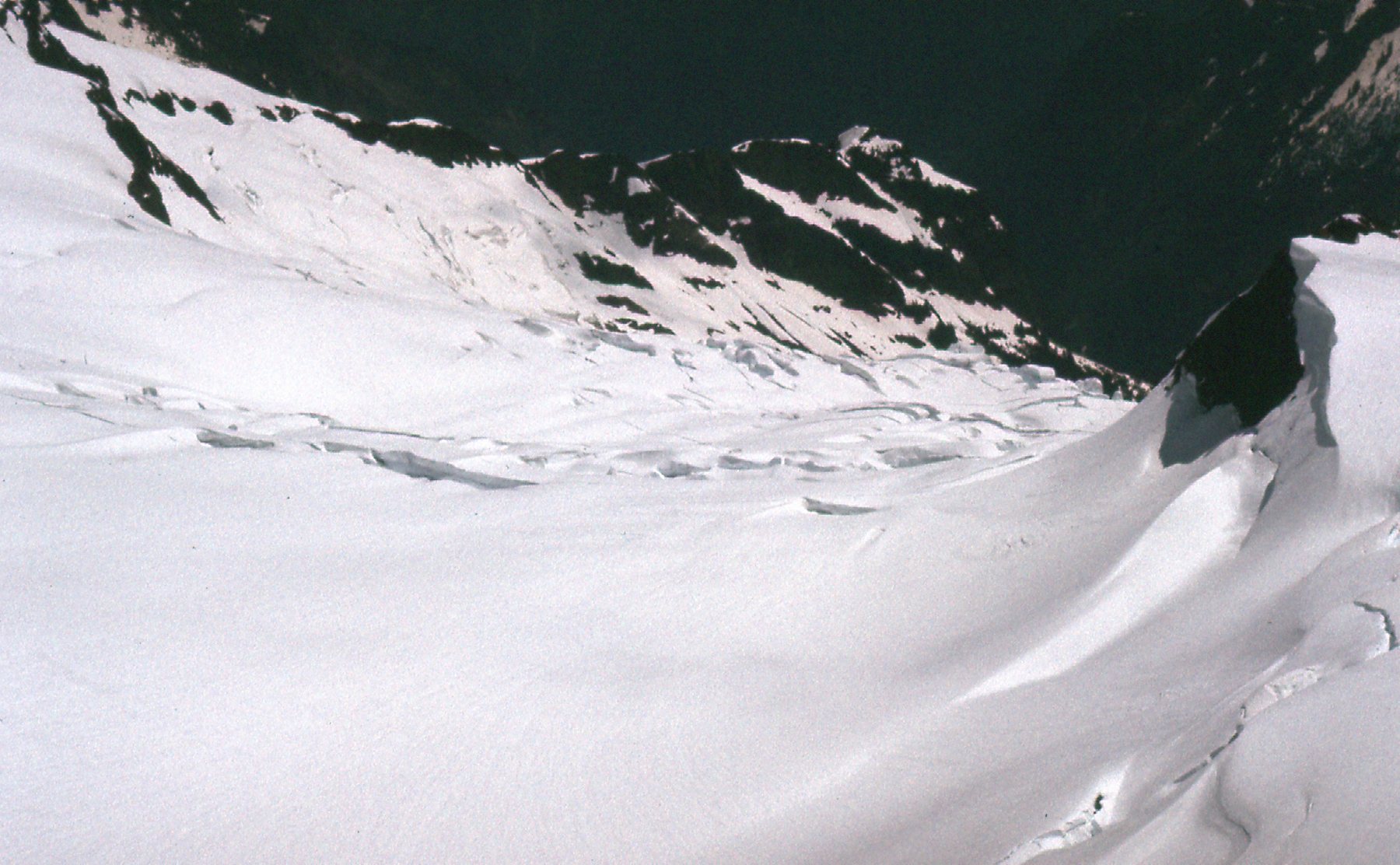
Looking northwest on the Upper Curtis Glacier.
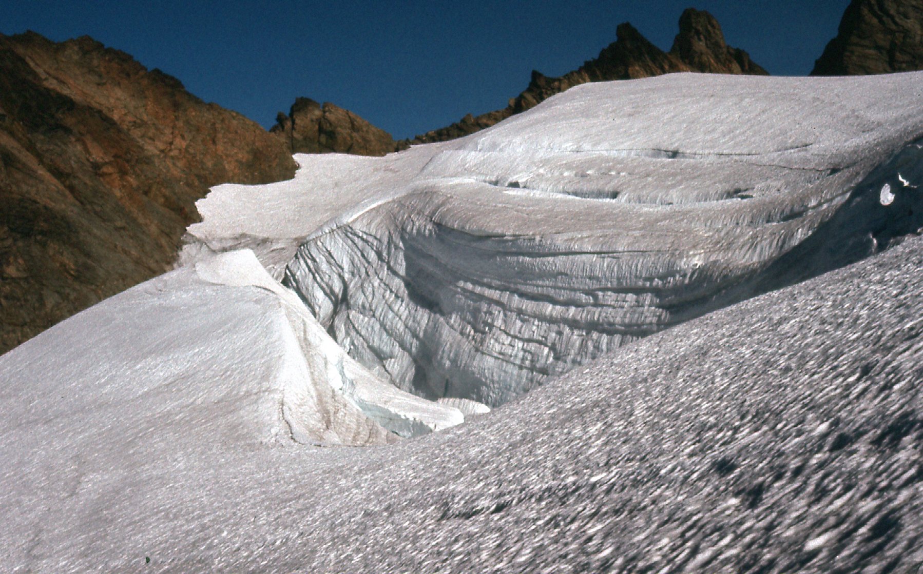
On the Upper Curtis Glacier
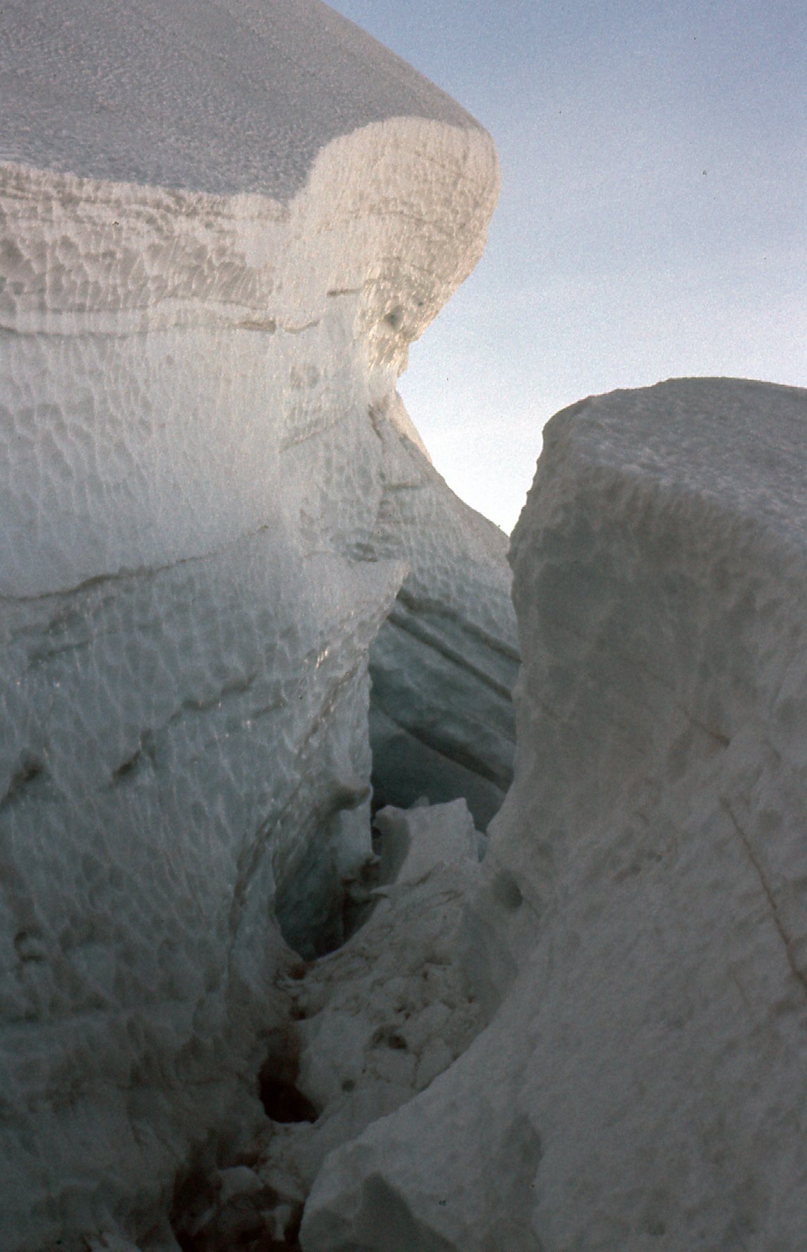
Another detail.
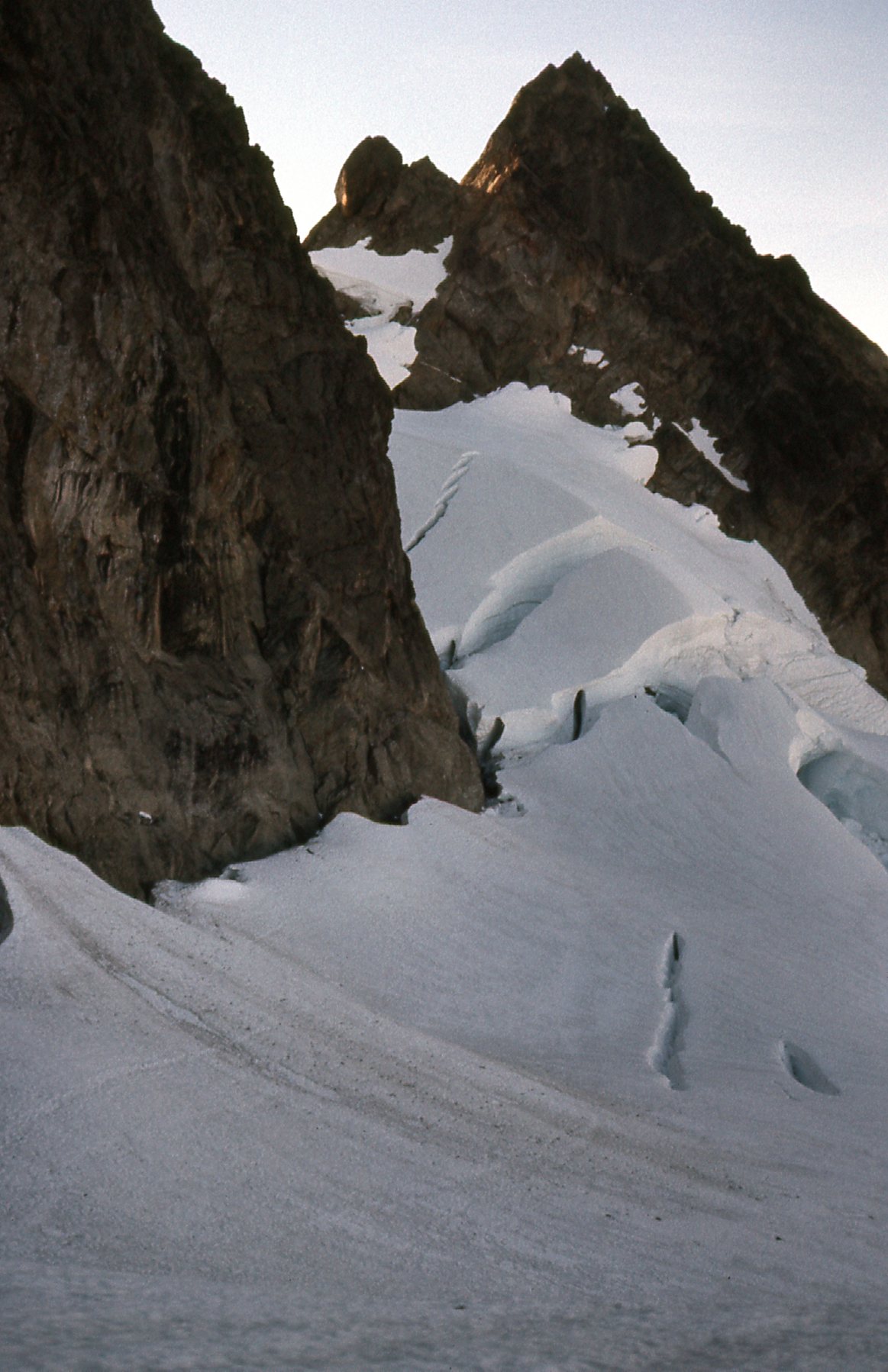
In this shot, we are looking back down 800 vertical feet to the top of Fisher Chimneys.
Looking at the top of the chimneys.
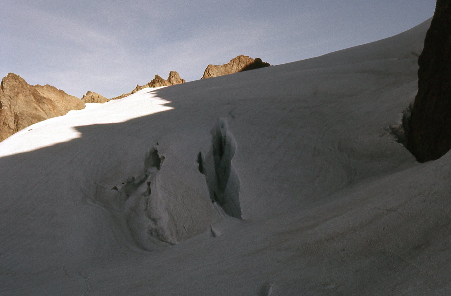
There is an important feature known as The Hourglass on the mountain. We’ll talk more about it later, but for now here’s a frozen waterfall near it.
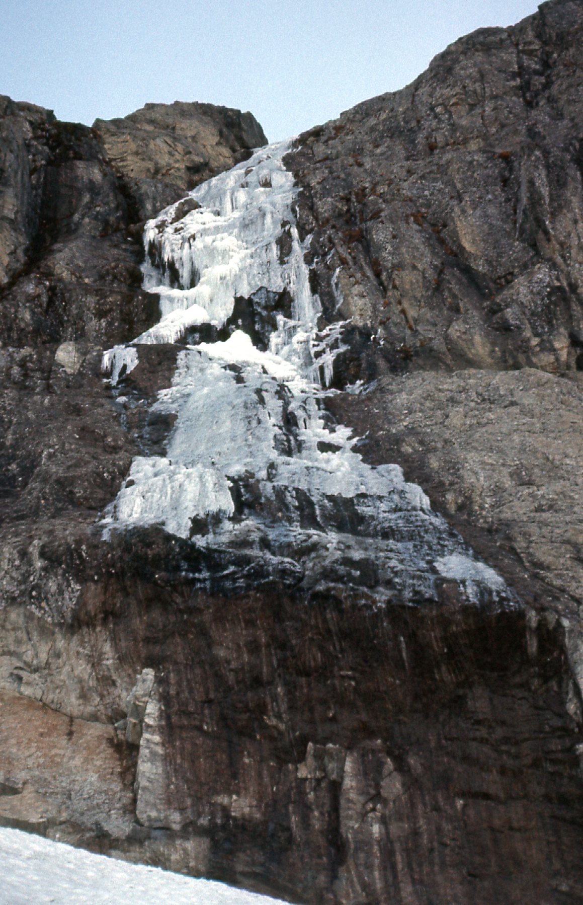
Near The Hourglass
Another look at Mount Baker from near my high point.
Mount Baker, again.
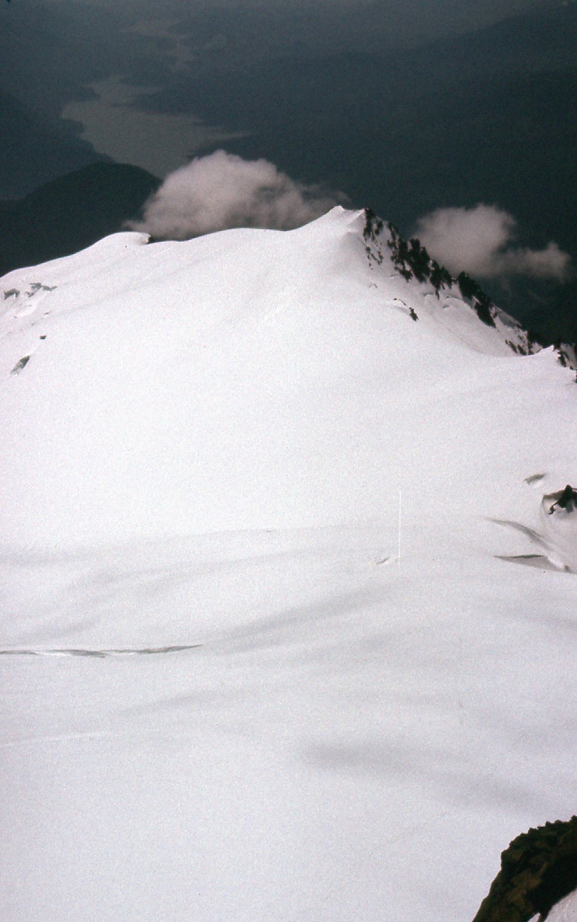
Remember Lake Ann – here’s a look back down to it from on high. It’s in the upper right of the photo, and mostly frozen over.
Lake Ann
All went well on my descent. I was back at my car by 4:30, and all the way home in the Great White North by 6:00 PM. It wasn’t worth taking chances with those crevasses. It’s hard enough to rescue someone who falls into one if there’s a team of other climbers available. If you’re alone and fall into one, chances are pretty good you’re a dead man. I resolved to come back another day with a partner, roped up, and do it right.
That time did arrive. On June 10th of 1977, Brian Rundle arrived at my place in Mission, BC. We drove in my Volvo to the same parking spot I’d used 9 months earlier. We had this view north from the parking area.
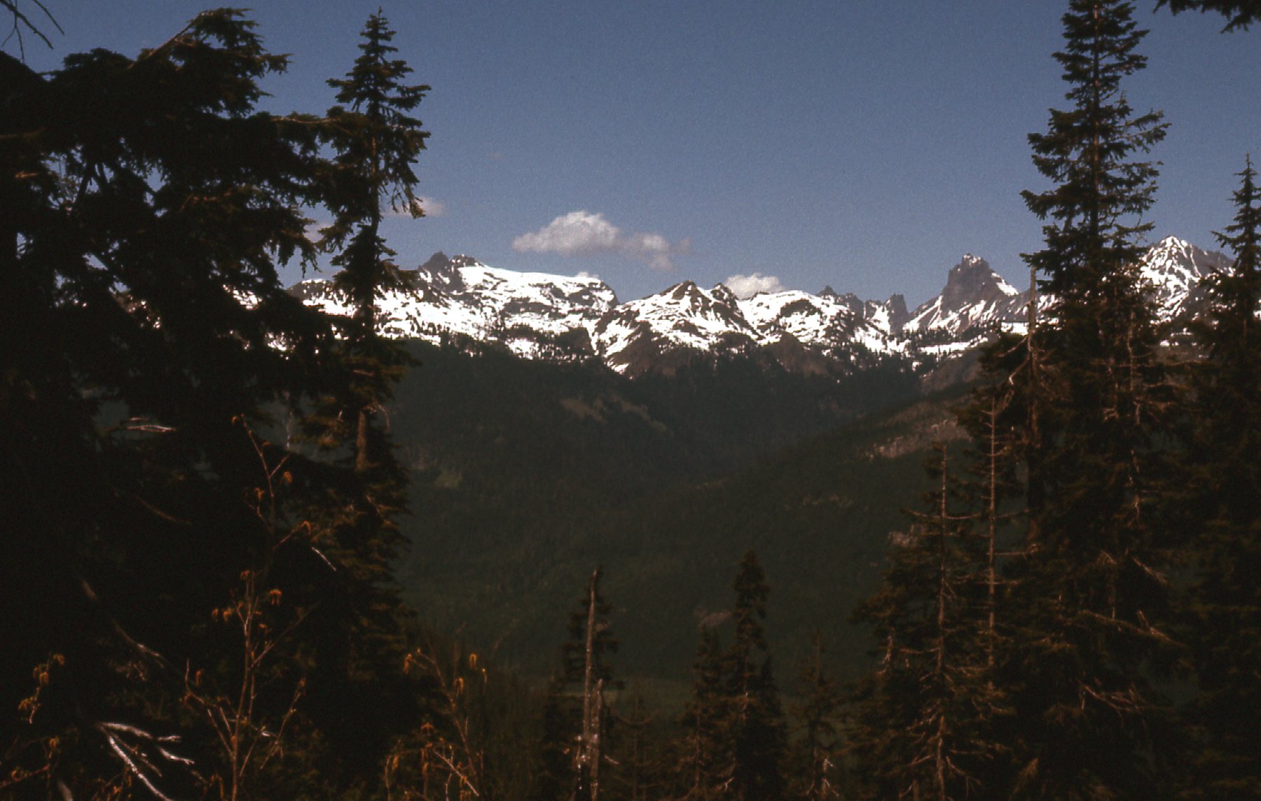
Mt. Tomyhoi on the left, with the Border Peaks on the right
By the time we’d readied our backpacks and walked the trail to Lake Ann, it was 5:45 PM. I took a few pictures from our camp by the lake. Remember that our camp was at only 4,700 feet elevation, so the summit was still 4,400 vertical feet above us. These next 4 pictures would stitch together as a panorama from right to left.
The southwest side of Shuksan
This shows the ridge to the east of the Lower Curtis Glacier
The Lower and Upper Curtis Glaciers
This shows the summit pyramid, way up there.
This last one shows a part of what is called Shuksan Arm as seen from Lake Ann.
Shuksan Arm
Brutally early the next morning, we set out across the meadow for Fisher Chimneys. This was only the third climb we had tried together. I was 29, and Brian only 19. We were determined, though. Once up through the chimneys, we roped up on the Upper Curtis Glacier. The route we had decided to try was The Hourglass. In retrospect, this was pretty bold. This route is an ice climb in a notch to the west of the summit pyramid. It turned out that there were other climbers above us, and they were knocking down pieces of ice as they climbed. Brian and I were not wearing helmets, and soon realized that if one of those pieces of ice were large enough and hit us on the head, it could be fatal.
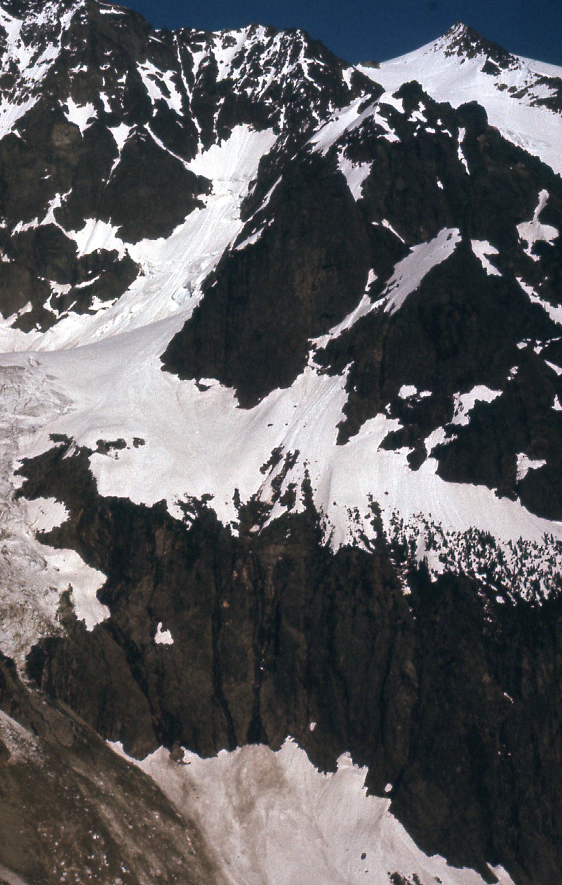
What I remember about climbing in the Hourglass was that the rock was steep, exposed, crappy and covered in verglas. We didn’t want to head back down and try another route, so we unroped and moved over to the right to be more out of the line of fire from above. It worked out okay, and we made it to the top where we exited on to the Sulphide Glacier at around 7,750 feet elevation. We roped up again at this point. Here’s what lay ahead – that’s the upper part of the glacier you’re looking at, with the rock of the summit pyramid at the top. The pyramid involves 800 vertical feet of rock up to Class 3 and even 4, depending on the exact route you chose.
Looking up to the summit pyramid.
It was a warm, clear day on the summit of Mount Shuksan. The climb had taken us 8 hours from Lake Ann to reach the top. Here’s a view looking north along the summit ridge.
On the summit.
And a few more views taken from the summit. This one shows much of the Sulphide Glacier, which would be the descent route we’d choose. That’s Baker Lake out there in the distance.
The Sulphide Glacier
This next view is looking to the south-southeast.
Looking south-southeast
This view looks southeast down the Crystal Glacier.
The Crystal Glacier
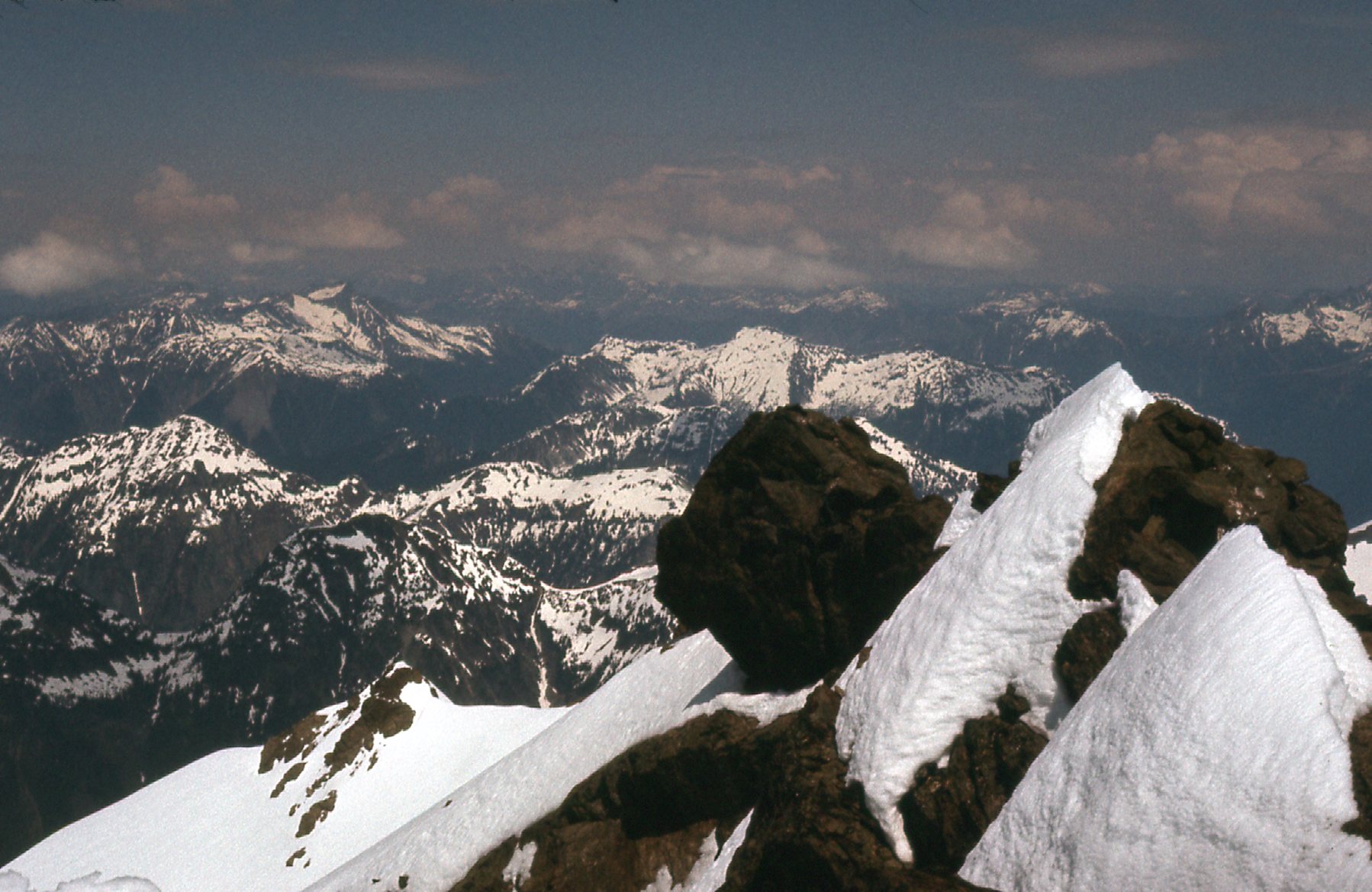
This is perhaps my favorite summit view – we are looking more or less east along what is known as Jagged Ridge, and on to the upper part of the East Nooksack Glacier.
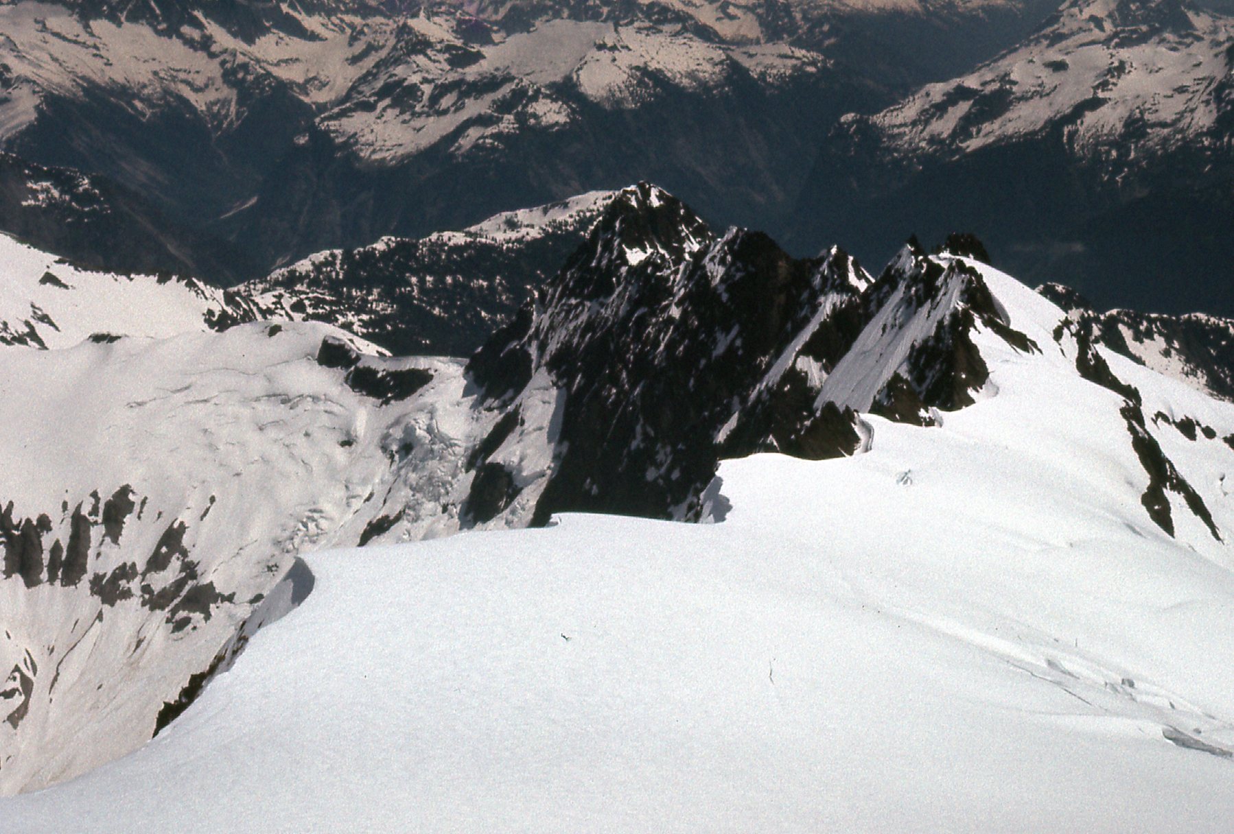
Jagged Ridge
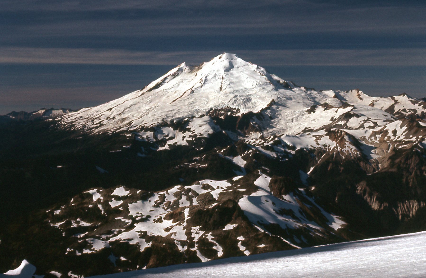
We had a great view of Mount Baker, but there was a layer of haze present high up.
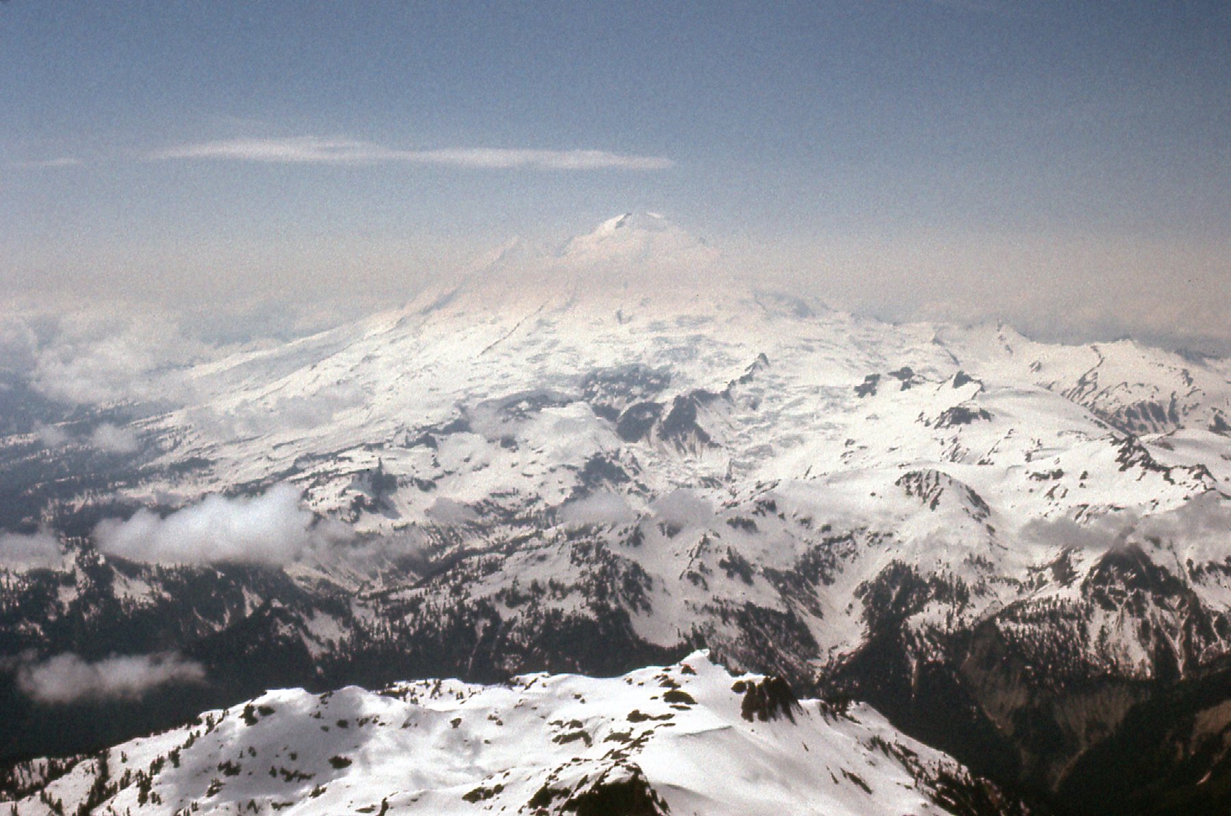
West to Mount Baker.
We didn’t stick around long on top. Once down off the summit pyramid, we slogged our way down the softening snow of the Sulphide Glacier. After a while, we exited the Sulphide and made our way on to what they call Hell’s Highway on the Upper Curtis Glacier. It was pretty free of crevasses and we made good time over to the top of Fisher Chimneys. We were careful going down through this area of poor rock, and finally arrived back at our tent at Lake Ann at 5:15 PM. Everything was as we had left it. We packed it all up and hoofed it back out to the Volvo by 8:30 that evening, arriving back home in Mission by 10:30 PM. Here’s a look back from near the parking spot, taken after that failed solo attempt from the previous year.
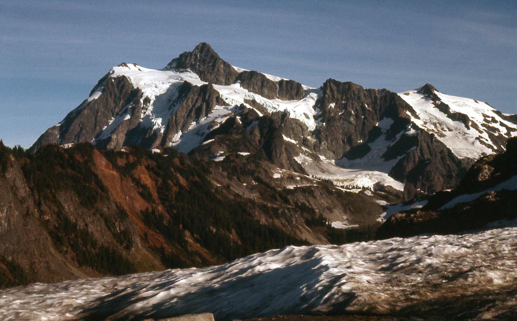
The west side of Mount Shuksan
And one final view to finish up – this is the world-famous view from Picture Lake, farther down the highway. This is probably one of the most famous mountain pictures in the world, having appeared in countless calendars and ads.
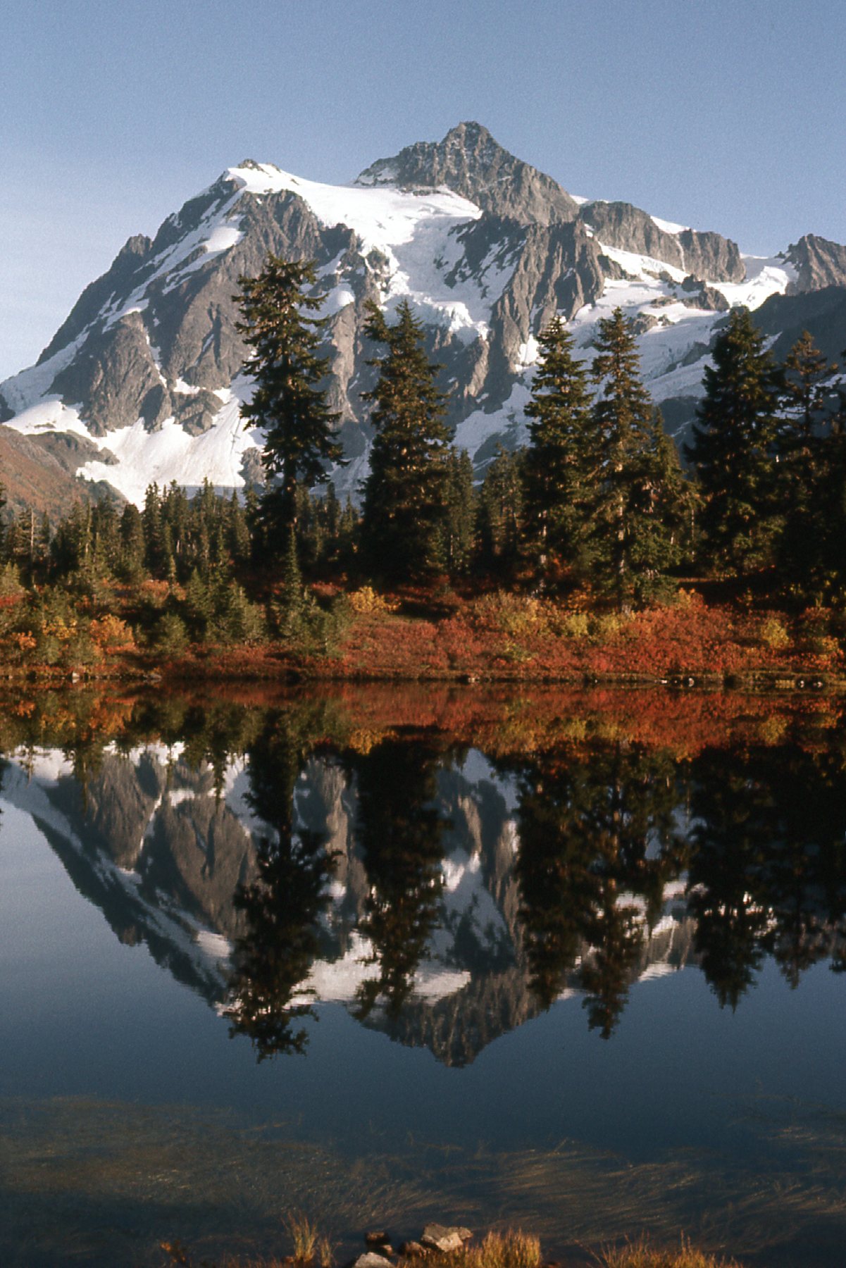
Mount Shuksan in all its glory.
So there you have it, Folks. A recap of a favorite climb, but with an emphasis on pictures rather than words – I hope you enjoyed it.