
Most Americans and, I dare say, a great many Canadians have heard of Yuma, Arizona. It’s a haven for Snowbirds, with delightful winter temperatures welcoming those from colder climes. The summer is a different story, however, when temperatures can routinely exceed 110 degrees F. Named after the Native American peoples who’ve lived there for millennia, it might surprise some to know that 100,000 people call the place home. I’ve driven through Yuma on Interstate 8 many times, but only recently stopped long enough to enjoy a few of the more unusual sights it offers.
I had read about a bridge that had been nicknamed “The Bridge To Nowhere” and I was determined to go have a look. After all, how often can you visit a bridge that goes nowhere? Well, as it turns out, there are similar bridges all over the world that do the same thing, go nowhere. So many, in fact, that some hardy soul created a Wikipedia page devoted solely to these oddities. I’ll sum up for you what that Wiki page says.
A bridge to nowhere is a bridge where one or both ends are broken, incomplete or unconnected to any roads. There are four main origins for these bridges:
- The bridge was never completed for reasons such as cost or disputed property rights.
- One or both of the bridge’s ends have collapsed or have been destroyed – e.g., by earthquake, storm, flood, or war.
- The bridge is no longer used, but was not demolished because of the cost; for example, the bridges on an abandoned railway line.
- The bridge is completed, but the streets connecting the bridge are not completed.
Further, the term “bridge to nowhere” may be used by political opponents to describe a bridge (or proposed bridge) that serves low-population areas at high cost, a symbol of pork-barrel spending.
It turns out that no less than 24 different countries have such bridges, which I found quite surprising. Here is a link to that Wikipedia page which makes for fascinating reading.
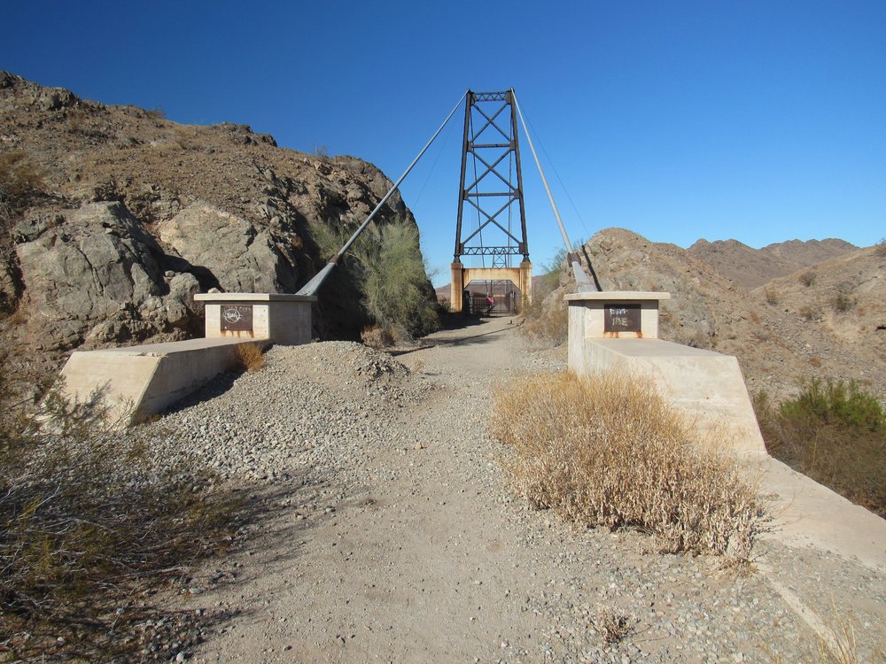
The bridge I wished to visit in Yuma is known as the McPhaul Suspension Bridge. It used to carry a section of U.S. Route 95. The bridge is listed on the National Register of Historic Places. The bridge, which was named for local Yuma resident Henry Harrison McPhaul, was built over the Gila River in 1929 and replaced in 1968 when it was deemed insufficient for modern transportation needs. A dam and replacement bridge, subsequently destroyed, were built and the river was rerouted.
The bridge is 1,184 feet (361 m) long in total. Its main span is a 798-feet (243 m) Warren-type pony truss bridge suspended by cables from rocker type towers. The span is held by two steel cables 5.75 inches (0.146 m) in diameter and 1,300.7 feet (396.5 m) long. It has two approach spans, 57 feet (17 m) and 114 feet (35 m) long, and approach roadways 140 feet (43 m) and 75 feet (23 m) long. In January 1928, the Arizona Highway Department contracted with the Levy Construction Co. of Denver to build the structure for $152,454.00 (that’s around $2.28 million in 2019 dollars). Construction began in mid-1928 and was completed in December 1929. McPhaul Bridge carried traffic on US 95 until 1968, when it was deemed unacceptable for modern, heavier cars. The bridge crosses only desert rock and sand these days, but the Arizona desert air has kept it remarkably intact – it would make a fine location for a post-Apocalyptic film. Rumor even has it that this bridge was a model for the Golden Gate Bridge in San Francisco, construction of which didn’t begin until 1933.
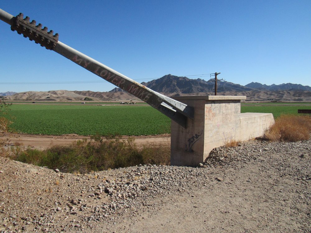
The bridge was easy to locate, just a few miles north of downtown Yuma. It was easy to see, off to the west side of the highway as I approached it. At each end it has been blocked off – you can’t drive across it and neither can you walk it. Here is the view from where I parked.
The east end of the bridge
They don’t want you trying to climb over the fence and walk on the bridge.
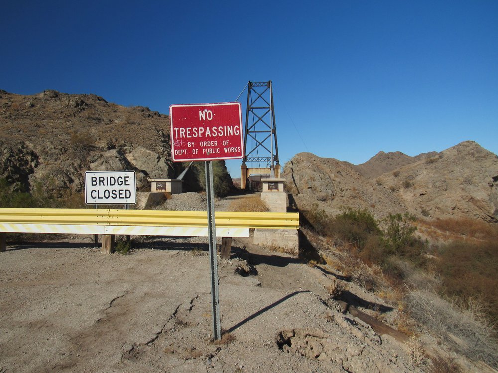
No trespassing.
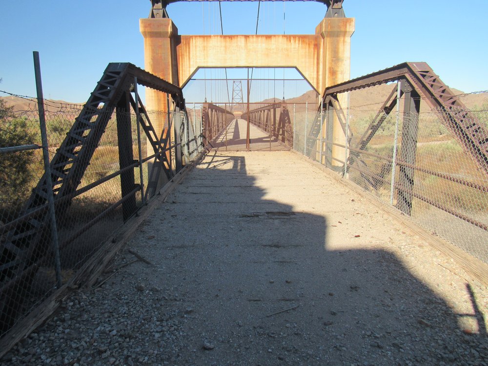
If you look through the fence, here’s what you can see. It’s well blocked-off for safety.
The bridge
You can barely read the name these days.
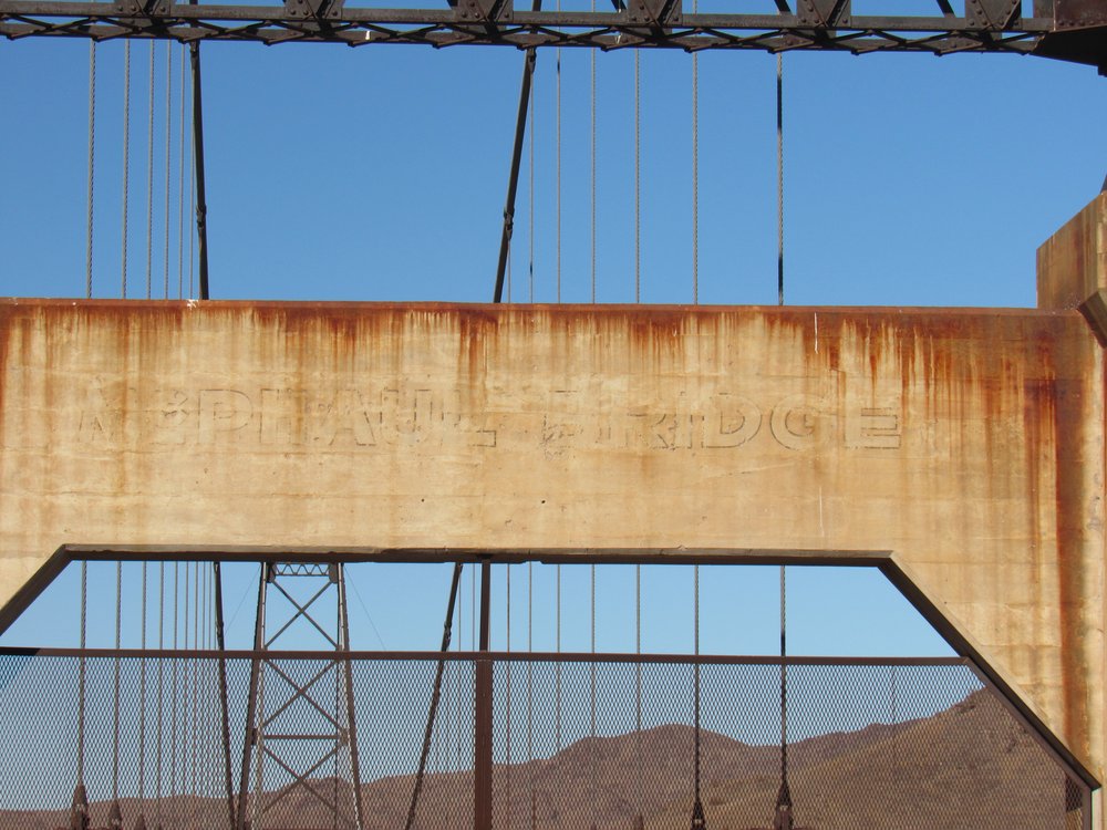
McPhaul Bridge
The cables holding it up are massive.
Where the cables are anchored.
If you wander over to the side of it, you can get a good look at how the bridge decking still seems intact.
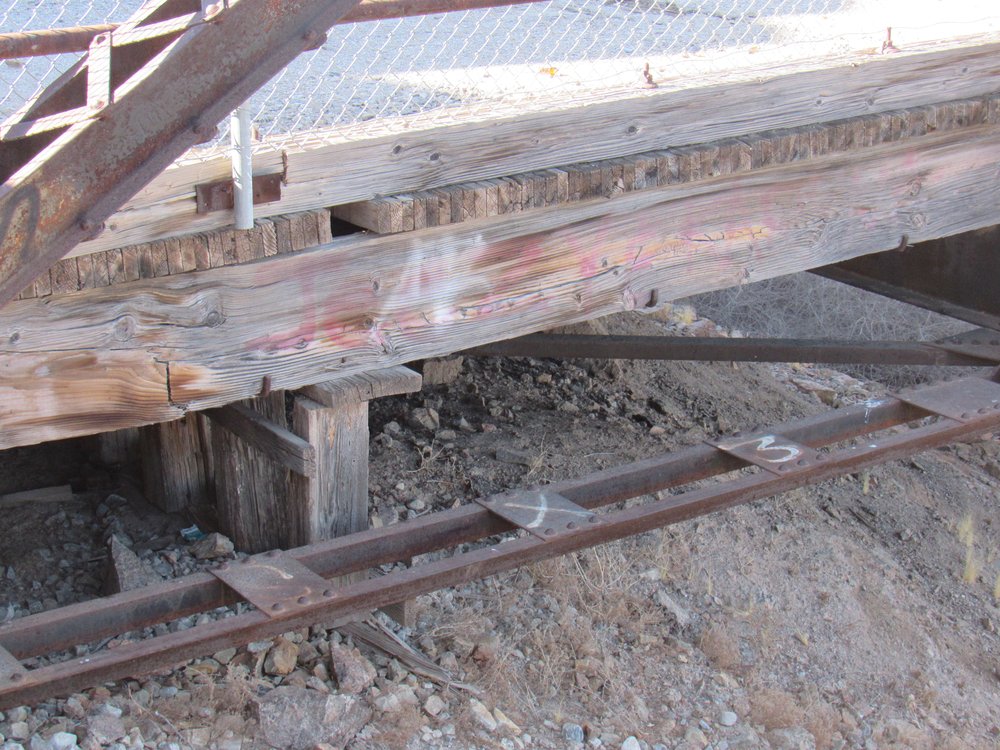
The bridge deck.
From the side, you can see what a striking bridge it is. It’s not hard to imagine why the builders of the Golden Gate Bridge used this one as a model.
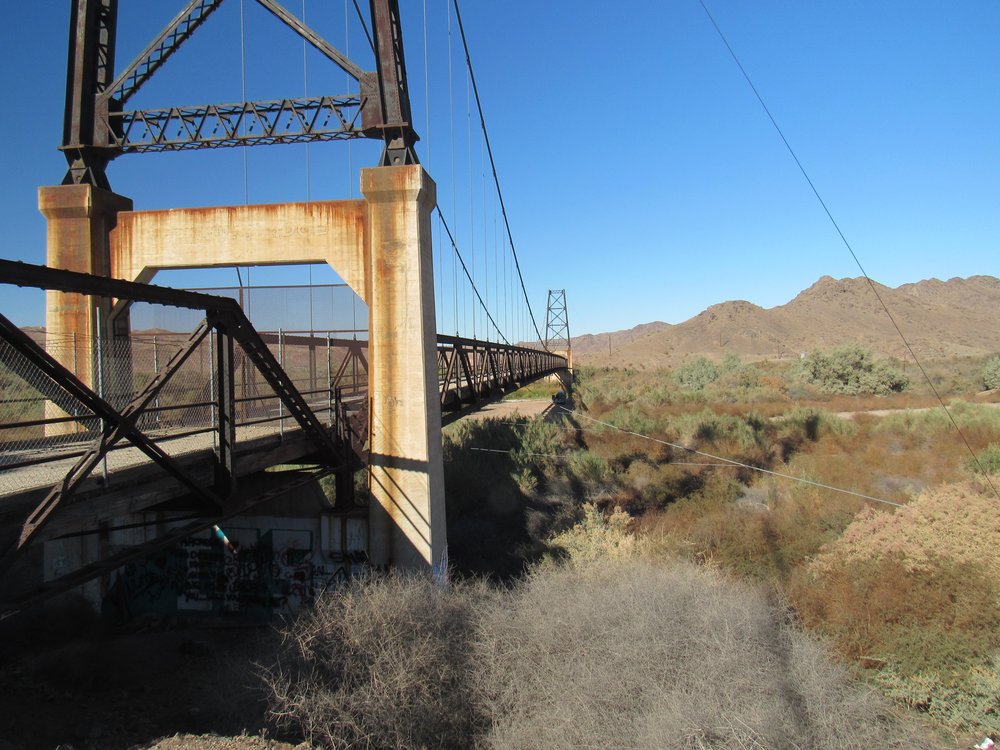
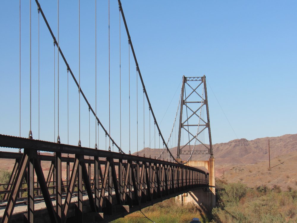
Nice bridge!
I would have loved to walk across it, but that wasn’t possible. Hey, I’d had as good a look as anyone, so I moved on.
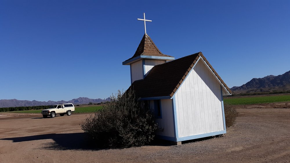
A short distance away stood another roadside attraction that I’d bypassed for years – it was time to check it out. A tiny church stood in a farmer’s field, and a dirt road led from the highway to it. This sign welcomed you.
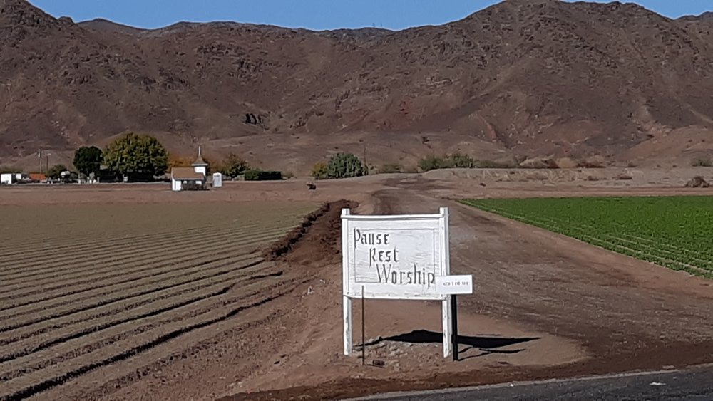
Welcome.
Loren Pratt, the farmer who owned these fields, had built the tiny chapel in honor of his deceased wife Lois back in 1995. The day I was there, his surrounding cotton fields were being worked as I visited. The chapel sits open to the public 24/7.
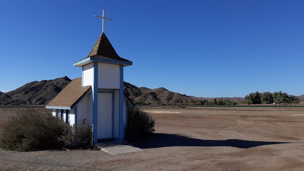
The front of the chapel.
The front door of the chapel is a standard size door, the kind you would find in any home – only 6 feet 8 inches high, so you can see how small the building is. As you enter, this is what you see.
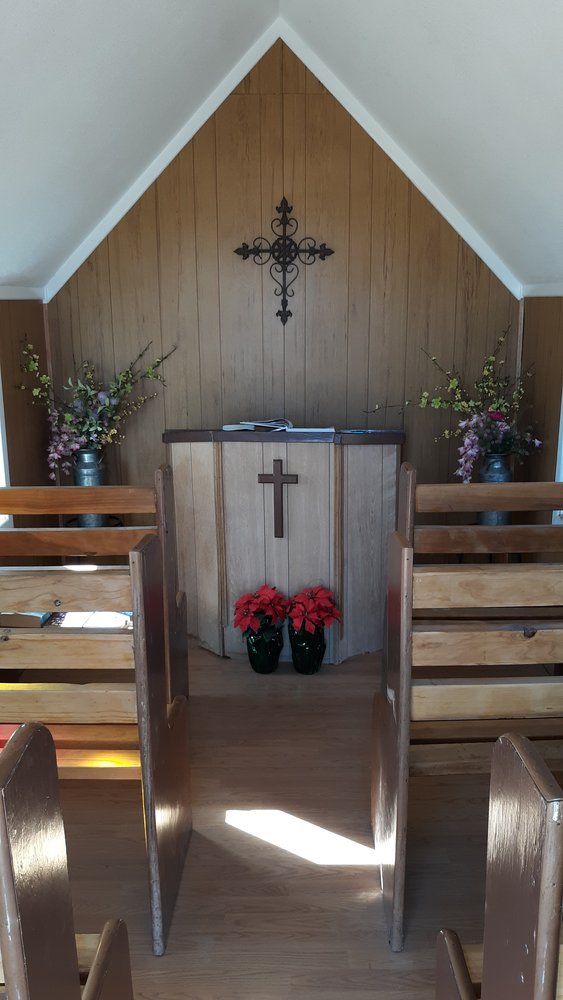
Your first look.
There are 6 tiny pews – 2 small people or one large person could sit in each one.
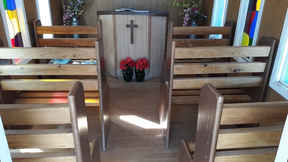
Another look.
The interior dimensions are only 8 feet by 12 feet. People have left books for others to enjoy.
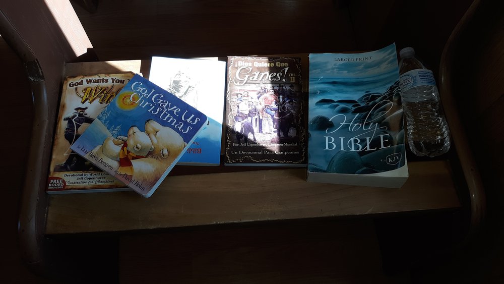
Reading material.
There is even a guest book for visitors to sign, as many have done from near and far.
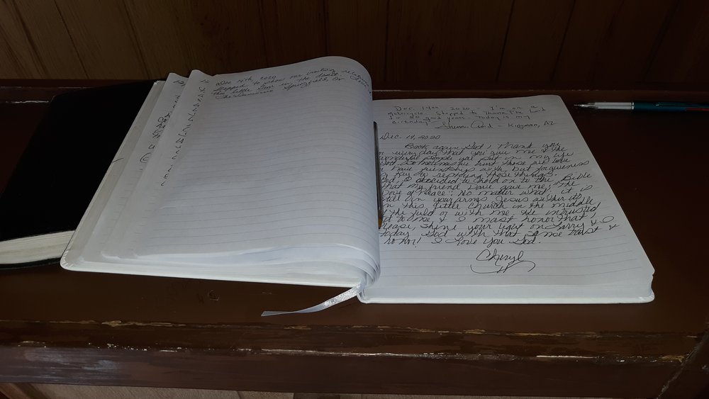
The guest book.
In 2011, a microburst picked up the chapel into the air and dropped it nearby, demolishing it in the process. The farmer, with the help of generous donations, rebuilt it and there it sits today.
It was a touching experience to visit this little church, and I was glad I finally stopped by.
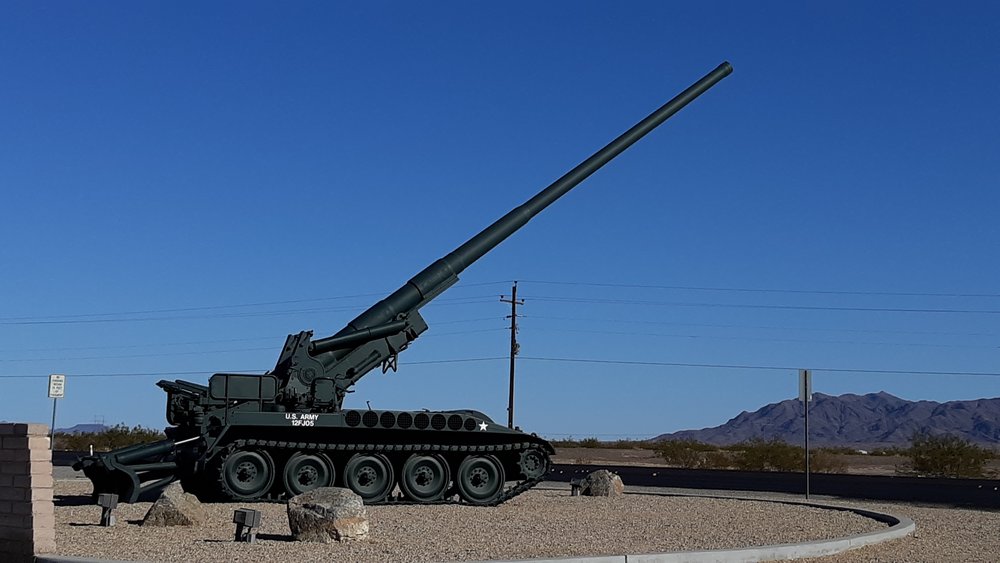
As I continued north on U.S. Highway 95, I entered the Yuma Proving Ground. There, on the side of the road, sat an atomic cannon. You have to see this thing to believe it – it is massive. Talk about the marked contrast between a tiny chapel and a huge cannon!
Picatinny Arsenal was tasked to create a nuclear capable artillery piece in 1949. Robert Schwartz, the engineer who created the preliminary designs, essentially scaled up the 240 mm shell (then the maximum in the arsenal) to 280 mm. The design was approved by the Pentagon and a three-year developmental effort followed. The project proceeded quickly enough to produce a demonstration model to participate in Dwight D. Eisenhower’s inaugural parade in January 1953. The gun was initially designated T131 and the carriage was T72.
The cannon was transported by two specially designed tractors, each of which was capable of independent steering in the manner of some extra-long fire trucks. Each of the tractors was rated at 375 horsepower (280 kW), and the somewhat awkward combination could achieve speeds of 35 miles per hour (56 km/h) and negotiate right-angle turns on 28-foot (8.5 m) wide, paved or packed roads. The artillery piece could be unlimbered in 12 minutes, then returned to traveling configuration in another 15 minutes. The gun was deployed by lowering it from the tractors onto leveled ground. The whole gun assembly was balanced on a ball and socket joint so that it could be swung around the footplate. The traverse was limited by a curved track placed under the rear of the gun.
On May 25, 1953 at 8:30 a.m., the atomic cannon was tested at the Nevada Test Site The test, code-named “Grable” resulted in the successful detonation of a 15 kiloton shell (W9 warhead) at a range of 7 miles (11 km). The cannon could actually shoot a shell a full 20 miles. This was the first and only nuclear shell to be fired from a cannon. After the successful test, at least 20 cannons were manufactured at a cost of $800,000.00 each. They were deployed overseas to Europe and Korea, and were frequently shifted around to avoid being detected and targeted by opposing forces. Due to the size of the apparatus, their limited range, the development of nuclear shells compatible with existing artillery pieces and the development of rocket- and missile-based nuclear artillery (such as the Little John and Honest John tactical nuclear missiles), the M65 was effectively obsolete soon after it was deployed. However, it remained a prestige weapon and was not retired until 1963.
When you first drive up to the cannon, it’s hard to believe your eyes, the size of the thing.
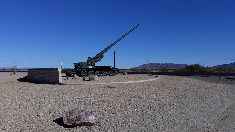
The atomic cannon.
Here’s a bit closer look.
This is one big gun.
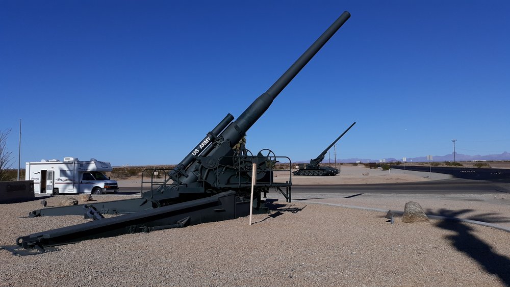
Yikes!
A sign gave some statistics on the gun.
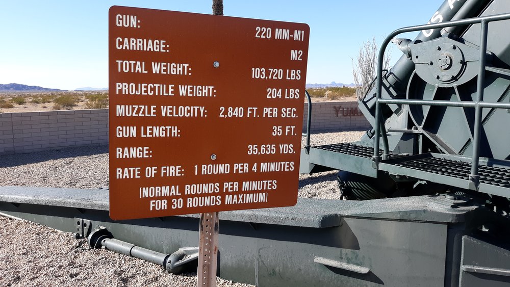
There were a total of 20 of these M65 cannon produced. Seven of them survive on display today. I’m glad there isn’t one of these in every neighborhood.
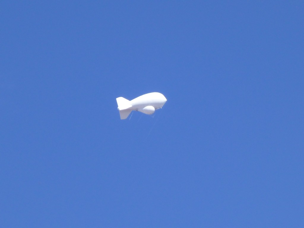
There was one more item I wanted to see while I was near Yuma. Only 13 miles beyond the atomic cannon was a Tethered Aerostat Radar System, TARS for short. An aerostat is a balloon that is permanently tethered to the ground. There are 10 of these along the U. S. southern border, and their primary function is a low-level, downward-looking radar with a range of 200 nautical miles. They are looking for small aircraft attempting to fly across the border from Mexico and carrying loads of drugs into the country.
The aerostats are large fabric envelopes filled with helium, and can rise up to an altitude of 15,000 feet (4,600 m) while tethered by a single cable. The largest lifts a 1000 kg payload to an operating altitude providing low-level, downward-looking radar coverage. The aerostat consists of four major parts or assemblies: the hull and fin, windscreen and radar platform, airborne power generator, and rigging, and tether; they are kite balloons obtaining aerodynamic lift from relative wind as well as buoyancy from being lighter than air.
The hull of the aerostat contains two parts separated by a gas-tight fabric partition. The upper chamber is filled with helium and provides the aerostat’s lifting capability. The lower chamber of the hull is a pressurized air compartment. The hull is constructed of a lightweight polyurethane-coated Tedlar fabric. An airborne engine drives the generator, supplied by a 100-gallon diesel fuel tank.
This aerostat, or blimp, as most of us prefer to call it, usually rides at 10,000 vertical feet above the landscape. Because it is white, it can be seen against our blue sky for a long distance. There’s one other in Arizona, at Fort Huachuca, a big army base in southeastern Arizona. Between the two of them, they can cover the entire border that Arizona shares with Mexico. Here’s a telephoto shot of the Yuma blimp almost 2 miles above the Yuma Proving Ground.
For those of us who climb in southwestern Arizona, it’s almost like seeing an old friend poking up above some mountain range. Here’s an example of what I mean. Look really hard (zoom way in if you need to) and you can see the blimp – it’s 17 miles away to the west at sunrise.
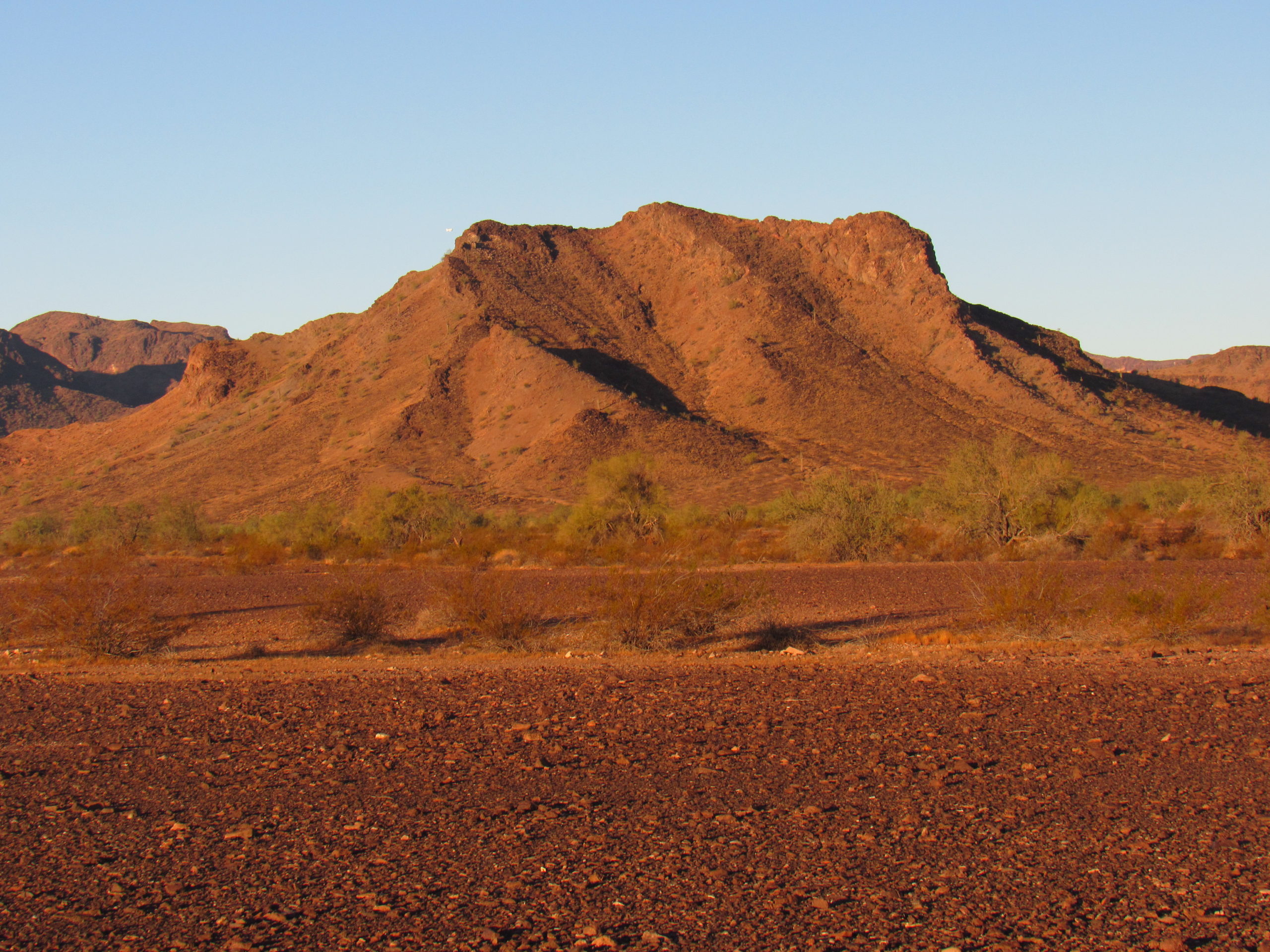
Can you see it?
So that’s it, four things of interest (to me, at least) near Yuma, Arizona. Check them out if you’re ever out that way, they’re all on line and easy to visit.