
I have a long history with this mountain range that flanks the entire north side of the city of Tucson, Arizona. I’ve been climbing there since June 7th of 1986. At that time, I was still paying my dues doing a two-year stint in Phoenix. Once I moved to Tucson, though, the high, cool range became my playground.
The high point of the range rises 6,768 feet above the city, and you can drive to within a few feet of the top. A paved road takes you to an allowable 9,100 feet, for a net driveable gain above downtown of 6,711 feet. You can’t do that at Flagstaff – the highest you can drive on Humphrey’s Peak is 9,560 feet, but that’s only a rise of 2,651 feet above the city. Rising up above the city of Safford, Arizona is Mount Graham, the highest-prominence peak in the state. You can only drive up to 9,620 feet on Graham, so that’s a rise of 6,703 feet above the city of Safford at its base. You can see why Tucsonans love this range so much as an easy escape from the summer heat.
That June climb of Mt. Lemmon in 1986 was what started my love affair with the range. When I moved to the northwest part of the city in 1987, I was well-positioned to climb some peaks near my home. Climbs of Pusch Peak and Mount Kimball soon followed. One Christmas I thought it’d be a good idea to climb three peaks in a row (Pusch Peak, Bighorn Mountain and Table Mountain). I was carrying a full backpack, planning to just keep on going after I did those three, but after they were done I talked myself out of continuing. In early 1989, I tried something more strenuous – Mount Kimball, Window Peak and Cathedral Rock on the same day. I started in the dark at the Finger Rock trailhead and staggered into the Sabino Canyon visitor center well after dark. That was a near-marathon, with 25.2 miles covered and 10,160 feet of gain.
By the way, have you guessed by now that all this talk has been about the Santa Catalina Mountains? The name translates to Saint Catherine in English.
A friend told me about another challenging outing that I should try. Start at Catalina State Park and head east up the Romero Canyon trail to Romero Pass, then northwest up a long ridge (all on a trail) to the summit of Mount Lemmon. It was a beautiful day when I did it – started off in the heat down below and finished in snow on top. Counting all of the ups and downs along the trails, that day amounted to 8,255 vertical feet of gain. When I got to the top, I hitch-hiked down the highway and then rode city buses back to my home for another long day. By now, I figured I’d fairly covered the ground through the western part of the range and hitting the major peaks. Then I got a pretty bold idea.
Why not try a traverse through the entire range? This was before we had GPS and all the fancy hi-tech tools available now, so I printed out a whole bunch of topographic map sheets and taped them all together, then drew a line which showed the route I planned to follow. It was a long, skinny map but it folded up well. I’d be able to just have the portion that I needed open at any given time so it wouldn’t be unwieldy, and I carried it in a gallon zip-loc bag to protect it.
Came the big day, April 29th of 1989. I had a friend drive me to the top of Mount Lemmon and drop me off at 5:15 AM. She would pick me up at the end of the following day at an agreed-upon spot many miles away at the other end of the range. I was carrying a full pack – no tent, but a sleeping bag and a bivy bag for the one night out, plus some food and a lot to drink. Since it was already late April, it was going to be pretty warm, not so much in the higher areas where I’d start but certainly where I’d finish, over 5,000 vertical feet lower.
I started inside the observatory compound where the benchmark sat (there’s a break in the perimeter fence that all climbers know about).
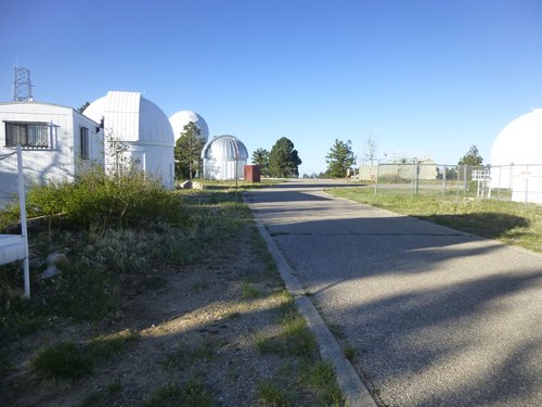
The road is the highest point on Mount Lemmon
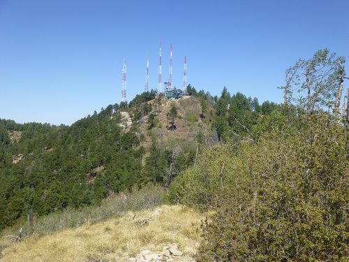
Professor J. G. Lemmon is said to have named it for his wife, the first white woman to reach its summit. Once back out, I walked over to and past the communication towers along Radio Ridge.
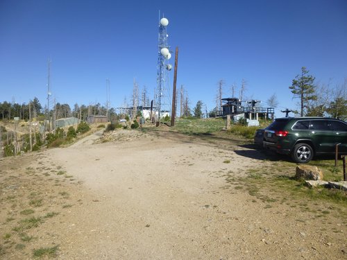
Radio Ridge
Something else that can be found along the ridge is the top of the chair lift for the ski area. It is said that this is the southernmost commercial ski area in the entire Northern Hemisphere.
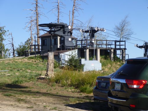
The top of the chair lift.
My goal was to stay along the true crest of the range all the way if possible, so I then headed southeast along the wilderness boundary. In so doing, I passed the spot that marked the very highest bit of the Pusch Ridge Wilderness. As I lost elevation, I passed the head of Carter Canyon and then over Points 8631 and 8456. Losing elevation quickly, I dropped all the way down to Sabino Canyon by the picnic area at 7,440 feet – it was 6:40 when I arrived. Well, that first 3 miles went quickly enough, as it was all downhill with the exception of 3 small bumps I had to cross over. On this trip, I would carefully count every bump for the sake of accuracy.
Uphill through the forest to the top of Syke Knob at 8,020 feet at 7:30 AM, I found myself right beside the highway for a stretch, then dropped all the way down to 7,700 feet. Up to and over Spencer Peak at 8,206 feet with one bump crossed to get there, Heading due east, I dropped down to the highway and actually crossed it, then climbed up to Point 8220. It was 8:30 AM. The next part of my journey would keep me close to the highway but on its north side. As you can tell from the links I’ve attached, I was traveling in a more-or-less easterly direction. I soon arrived at another observatory.
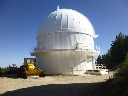
The observatory.
This one was operated by the Steward Observatory at the University of Arizona. One of its main purposes is to scan the heavens for Near-Earth Objects, things in space that might crash into Earth and wreak havoc. Beyond that, I climbed another hill with radio towers of some type, arriving on top at 9:25 AM. I had now been on the move for more than 4 hours. My path next took me down into a wooded gully, then up the other side and over two more bumps. A dirt road appeared, and I walked it a short distance to the top of Mount Bigelow.
Mount Bigelow
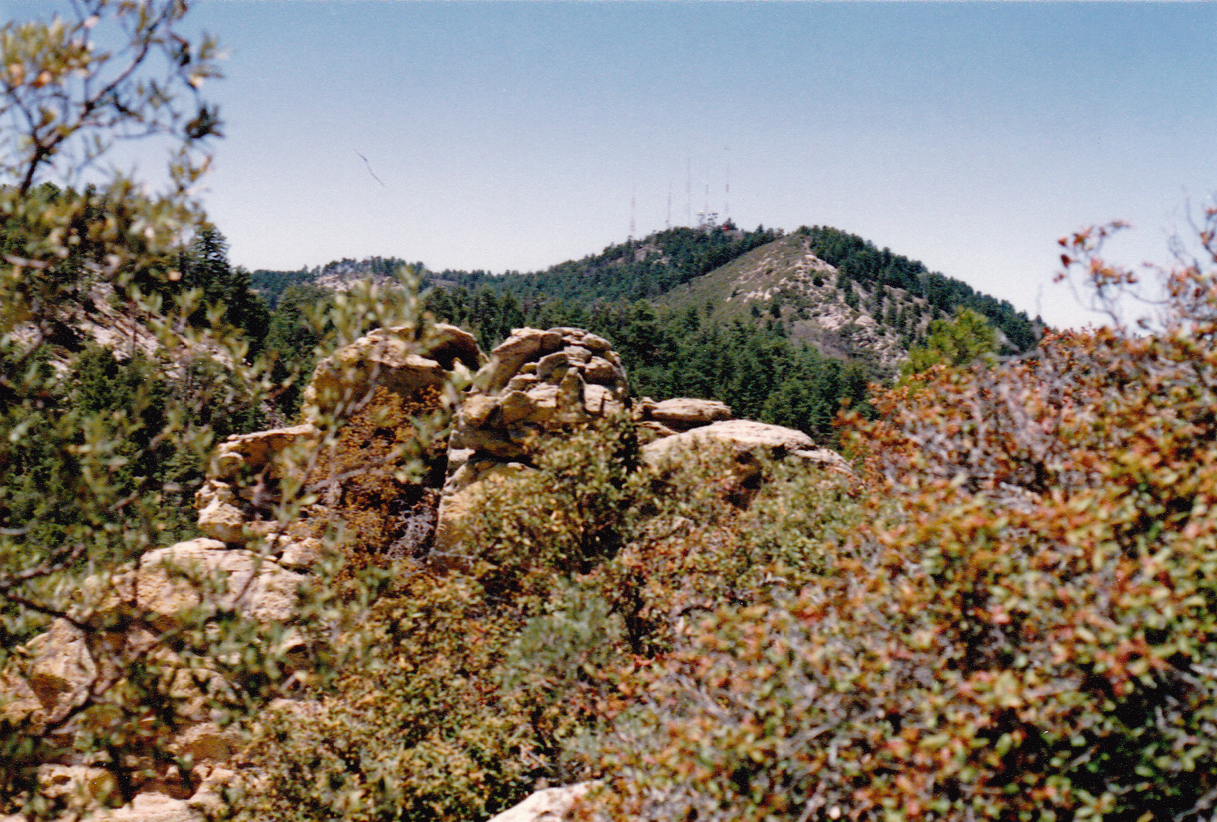
This peak was named for Lieutenant John Bigelow Jr. of the 10th U.S. Cavalry “who scouted through the Santa Rita Mountains in the early 1870s, looking for hostile Apaches.” He was the son of John Bigelow, Ambassador to France from 1864 – 1867. It can be easily seen from much of Tucson, and at night the flashing lights on its huge communication towers really stand out. Several of the city’s television stations transmit from here. From Bigelow, I had this view back to Mount Lemmon, my starting point some hours earlier.
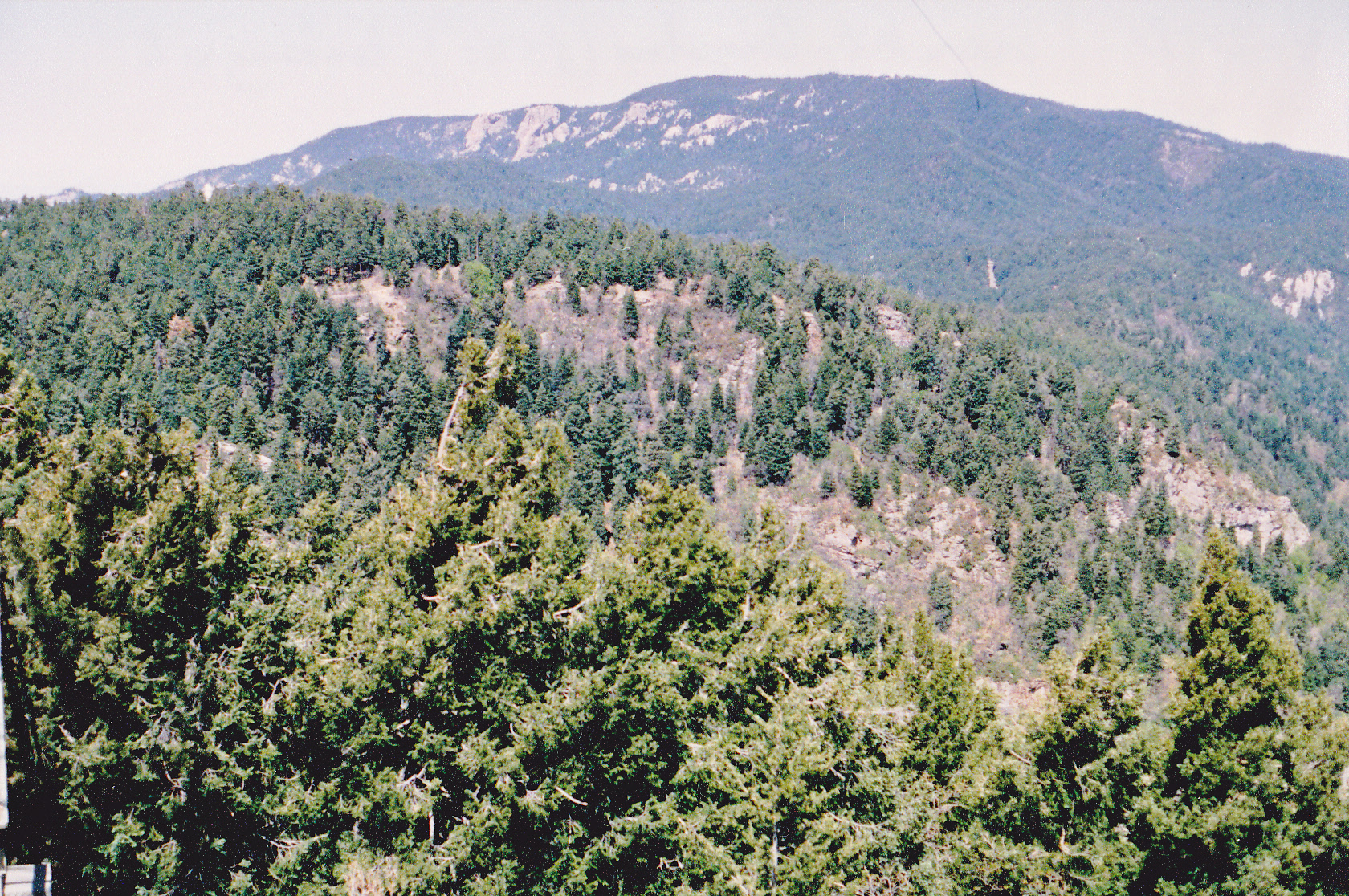
Looking west to Mount Lemmon
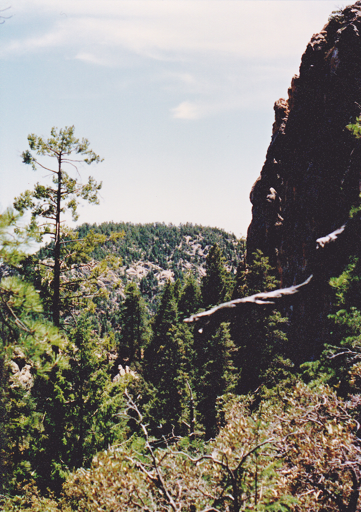
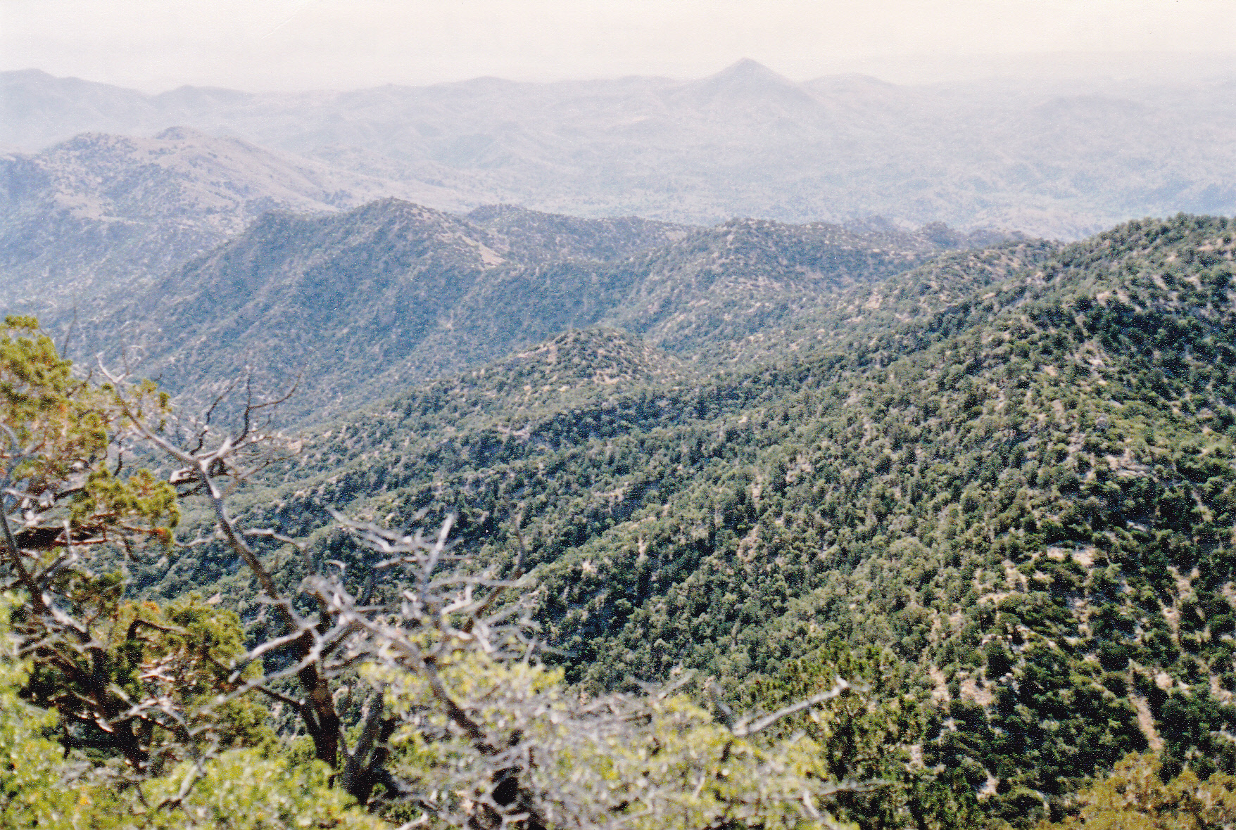
I also had a good look to the southeast over terrain I’d have to cover next.
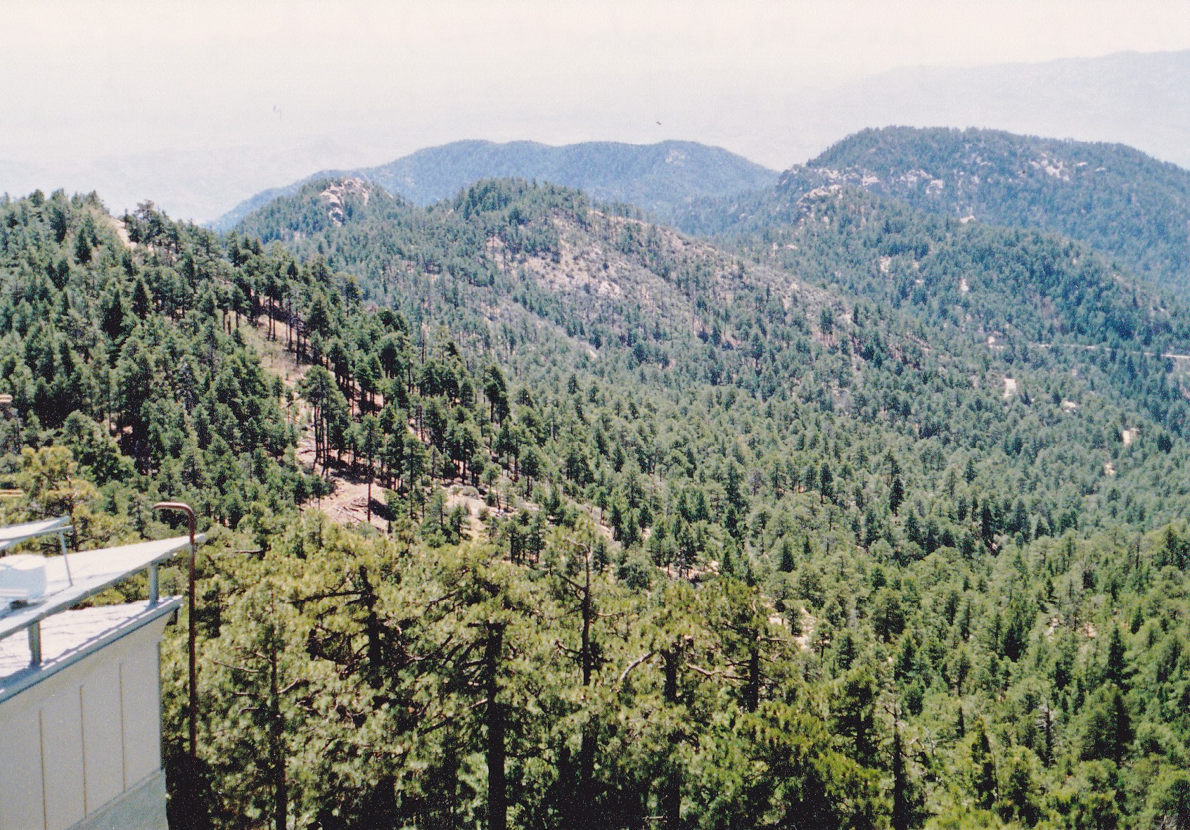
Looking southeast from Mount Bigelow.
It was 10:10 AM when I left Mount Bigelow and headed east and downhill to Kellogg Mountain. At 8,401 feet, it’s only 139 feet lower than Bigelow.
Kellogg Mountain
The next significant bump I had to cross was Point 8135. From it, I took this picture back towards Mount Bigelow.
Looking west from Point 8135.
Heading steadily downhill, I soon arrived at Leopold Point. It was here, at 8.060 feet that I stopped for lunch – it was 11:40 in the morning. Six and a half hours to this point – that seemed okay, considering I was carrying a full pack. There was a lot of daylight left, so I should be able to cover a lot more ground before I stopped for the night. When I continued, it didn’t take long to reach something called Barnum Rock.
Looking from Barnum Rock to Green Mountain
After crossing a few more bumps past Barnum Rock, I walked out of the bush into – a parking lot! This was San Pedro Vista, a popular tourist viewpoint, so-named because you had an unbroken view over miles of peaks to the San Pedro River valley, about a dozen miles away to the northeast. People were stopping here and taking pictures, and some of them gave me a strange look when they noticed the big pack. These many hours up until this point, I had been walking through the works of man – roads, paved and dirt; many buildings; radio towers; the noise of traffic, near and far. That was all about to end – from here on in, there was a pretty good chance I wouldn’t see anything but the odd fence once I was down into cattle country.
After a bit of a breather, I left the pavement at the viewpoint at 7,350 feet and soon found myself climbing south up the slope of Green Mountain. The forest was pretty co-operative with minimal bushwhacking and the summit was attained with little fanfare. With the couple of intervening bumps, it had been a climb of over 600 feet to get to this summit. I didn’t linger, instead dropping east off of the summit and over several more bumps to arrive at a place called Bear Saddle. This put me at an elevation of 6,740 feet. Before I started this trip, I figured that this would be about the half-way point. The afternoon was wearing away – it was 3:45 PM by the time I arrived at the saddle.
Things were starting to take their toll on me. From the saddle, I climbed east up to Point 7125, then headed south along a ridge over a few more bumps to arrive at Point 7134. It was here that I made a decision. Peak 7281, unofficially known as Guthrie Mountain, was something I wanted to climb, but it was not along my path of travel. So, I left my pack on top of Point 7134 and headed southeast, dropping to a saddle and then up to the top of Guthrie. By the time I got there, it was already 4:45 PM. I turned right around and made my way back to my pack atop 7134. Now I was in a position to continue along the spine of the range as was my original plan.
Crossing over more bumps along a ridge, I finally climbed up to the top of Point 7135 where I called it a day. It was now 5:30 in the evening. Here’s a picture of where I spent the night. Hanging up in the tree is my sleeping bag in the blue bag, and my red shirt and red pack. That whitish thing on the left is a bandana I wore. Looking at the photo, if those 3 bottles are all I brought to drink, that was cutting it awfully close.
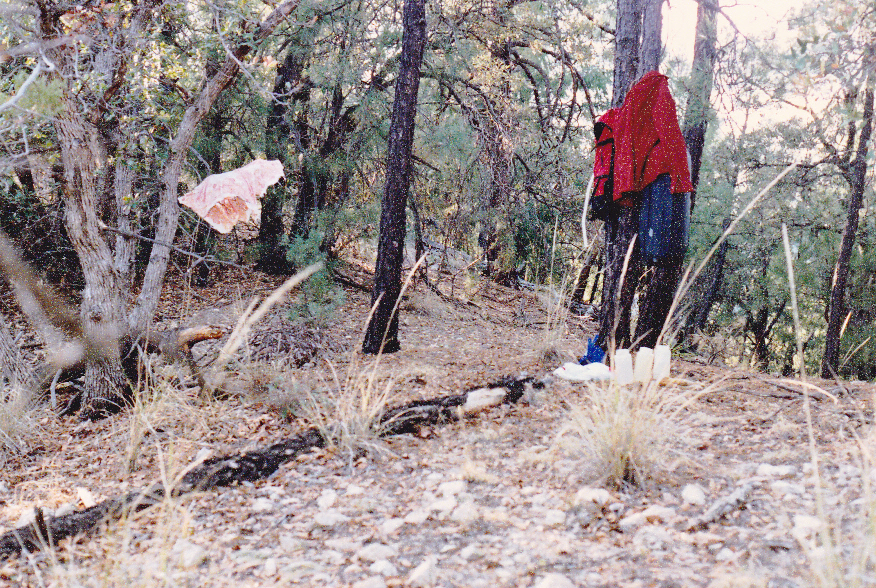
Bivy site on Point 7135.
It had been a long day – 12 hours and 15 minutes on the go; 5,460 vertical feet climbed (even though I was basically heading downhill – all those bumps really added up) and 16.7 miles of distance covered, all done with a full pack. I slept well.
Day 2
I broke camp and started on foot at 5:22 AM. The southeast ridge I followed was a nasty bushwhack, so much so that it took me until 7:30 to cross over several bumps and finally reach what is shown on the map as the official Guthrie Mountain, at 6,466 feet elevation. I was hoping that the going would improve, but the bad brush continued for a while longer. When I arrived at Point 5825, it was already 8:25 AM. I took 2 photos from there. Here’s the one that looks back the way I had come. It shows 2 peaks. The one on the far left is the official Guthrie Mtn. (6,466 feet); the light-colored one on the right side of the photo is the unofficial”Guthrie Mountain” (7,281 feet).
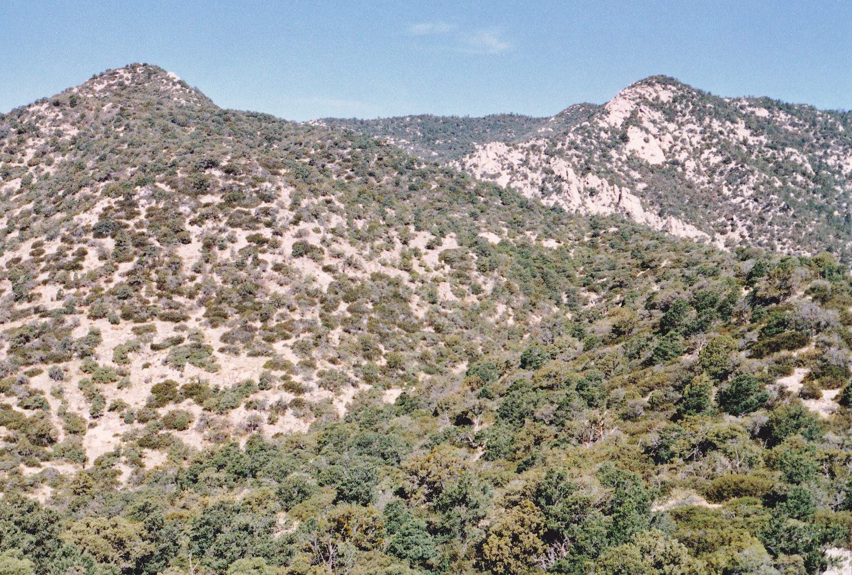
The two Guthries.
And here’s a picture taken from the same place, Point 5825, but looking the other direction, east. That’s the direction I was heading. It was a hazy day.
Looking east to where I had to go next.
The next serious bump I crossed over was Point 5483. More lesser bumps, and I found myself at a 4,800-foot saddle at 10:20 AM. The day was warming up, but that made sense – I was almost 4,000 vertical feet below my starting point on Mount Lemmon yesterday morning.
My route now took me to the northeast, climbing up to Point 4980, then down again and up once more to top out on Point 4918. It was downhill from there for half a mile where I arrived at – a road!! This was all the way down to 4,400 feet elevation. Hmmm, I was confronted with a choice. My original plan had been to continue east overland for many more miles over many more bumps to finally end my trek near Piety Hill. Or, I was now confronted with a second choice – I could follow this old four-wheel-drive track and end up at almost the same spot. The road would add several extra miles but would involve less vertical. I made my decision – I’d walk the road – it was too tempting, less thinking involved, no route-finding. It was already 11:30 AM.
Heading southeast, I made good time on the road – it was easy to follow. After a couple of miles, I had drunk the last of my water, but fortunately I came to a trough used to water cattle. The water in it was pretty disgusting, but I figured if it was good enough for the cows it was good enough for me. Remember that bandana hanging from the tree last night? It was filthy with sweat and dirt, so I rinsed it out in the trough, then used it as a filter of sorts to strain out bugs and other crap and filled 2 quart bottles. It was now one o’clock and I had entered Bullock Canyon.
The road stayed in the canyon, heading east and then northeast for a couple of miles, until it abruptly left it and headed up a side canyon to the southeast. It was 2:20 PM when I started up this canyon, but the road was still easy to follow. Almost 2 miles later, I arrived at Bull Spring – there was water there, but I didn’t need it. 3:15 PM.
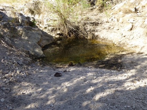
Near Bull Spring
I was on the home stretch – one more mile would take me to Redington Road, a major dirt road passing between the Santa Catalina Mountains and the Rincon Mountains. Half-way through that mile, I was walking along and in a shady stretch when I saw something big and black in the road ahead. I’m glad I was paying attention, because it was a snake. It sat there, coiled up – I gave it a wide berth, but as I walked around it, it kept looking at me. It didn’t seem a bit concerned about me, and it was obviously in charge of the situation. In later days, I described this Arizona Black Rattlesnake to a herpetologist friend of mine at the University of Arizona. He felt that I had seen a pregnant female and said that this was definitely not a snake to be messed with. Its venom is extremely toxic, twice that of the Western Diamondback Rattlesnake, and any bite is considered life-threatening.
Okay, so half a mile later I arrived at Redington Road. I continued another half-mile to the exact agreed-upon meeting spot, arriving there at 4:15 PM. My friend arrived soon afterwards and picked me up. Today’s part of the trip amounted to 14.8 miles of ground covered with 3,185 vertical feet climbed. The tally for the full 2 days was 31.5 miles and 8,625 feet of gain. I was glad to be done – it was about 85 degrees, and all I wanted to do was get home and take a nice shower.
Over the years, I had more adventures in the Saint Catherine Mountains, nibbling away at the list of 52 ranked summits and many other unranked ones. Those of us who live here in Tucson are pretty lucky to have such a high, cool playground right next door.