
Hello everyone. This is the latest in what I am calling my Pictorial Series. These are stories which I have published in the past but included few if any pictures. I am now able to present the stories again with a strong emphasis on the photography and somewhat changed text – I think you’ll find that they have quite a different feeling from what you read before.
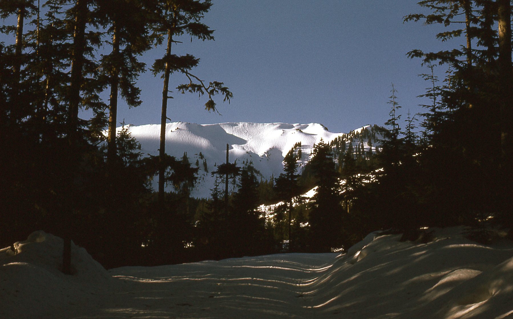
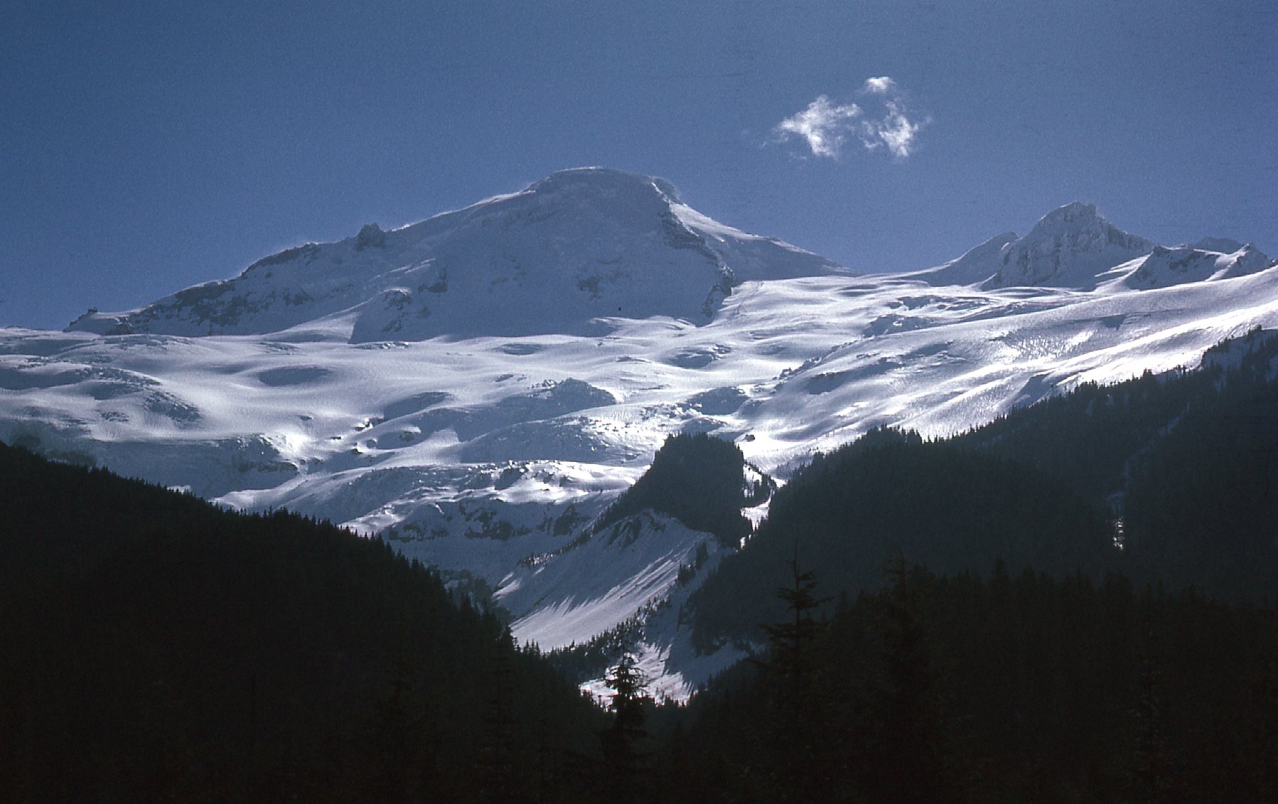
This piece is about one of my favorite mountains, as it was close to and very visible from my home of many years in Canada. Mount Baker is only 34 miles away in this mildly-telephoto shot.
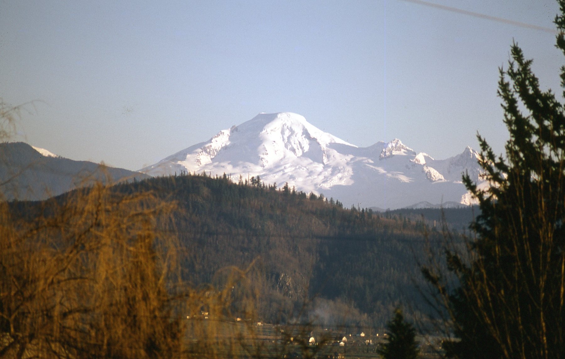
Mount Baker, as seen from Mission, British Columbia, Canada
Mount Baker is heavily glaciated. So much so that, after Mt. Rainier, it has the heaviest glacier cover of the Cascade Range volcanoes – the volume of snow and ice on Mount Baker is greater than that of all the other Cascades volcanoes (except Rainier) combined. It also happens to be one of the snowiest places in the world – in 1999, the Mount Baker Ski Area set the world record for recorded snowfall in a single season. It was a whopping 1,140 inches (29 meters, or 95 feet). The mind boggles! I bet the skiers were happy.
There are eleven named glaciers on the flanks of Baker. Some of them, like the Coleman Glacier, facing us in the above photo, come all the way down to 3,980 feet above sea level, with others almost as low. Granted, they have melted back somewhat due to climate change, but that’s still pretty impressive. By the way, in the parlance of the local Nooksack Indian people, the mountain is called Kulshan.
My first attempt at climbing Baker was in the winter of 1967. In fact, that was the first time I had ever visited the mountain, probably because I had never owned a vehicle up until that point. My room-mate George from university borrowed his father’s panel van and on December 28th, we drove Forest Service roads on the north side of the peak to about 4,300 feet elevation. We had a devil of a time finding the start of the trail, as the bush was deep in snow. Finally we did, and followed faded footprints to the Kulshan cabin at around 5,000 feet, arriving at around 1:00 PM. The place was cold as a tomb, but we soon had a fire going in the wood stove to warm the place up.
We retired early and were moving by 6:15 the next morning. By eleven, we had reached a saddle at the 9,100-foot level. The route was straightforward from there up to the summit, but for some reason that to this day I’m not quite sure of, we called it quits at around 10,000 feet. The weather was cold and windy but otherwise clear. My guess is that we thought that by the time we reached the summit and then made the descent, it’d be dark before we reached the cabin. We were young and inexperienced on big mountains, so it felt like the right thing to do. Back at the cabin by 3:00 PM and the vehicle by 4:30, we made it back out in good time. So ended my first attempt on Baker.
A couple of years later, I was living in Vancouver. I had my first car by then (1969), and one fine October day I drove out to have another look at the mountain – not to climb it, just to play tourist. I first drove all the way around to the ski area on the northeast side. There, almost 7 miles from the summit, I had this great view.
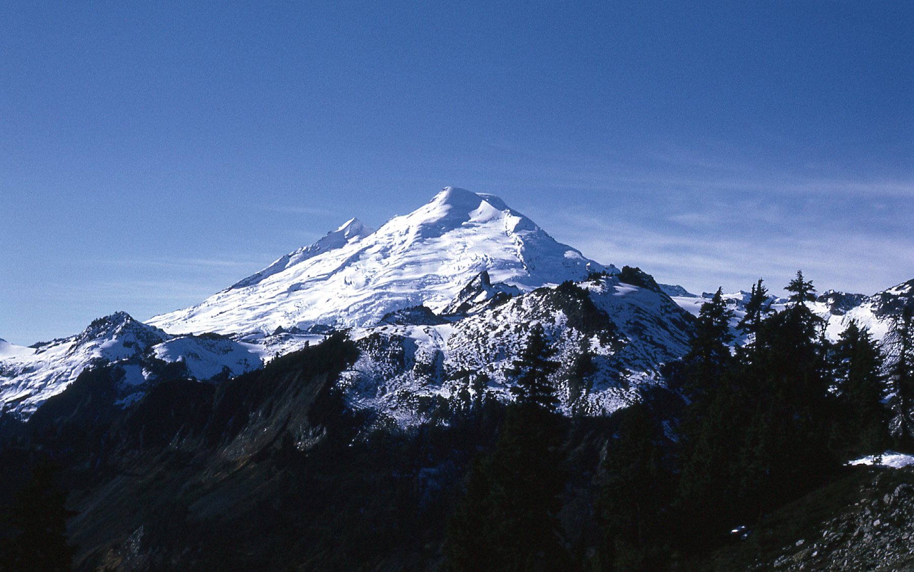
The northeast side of Mount Baker
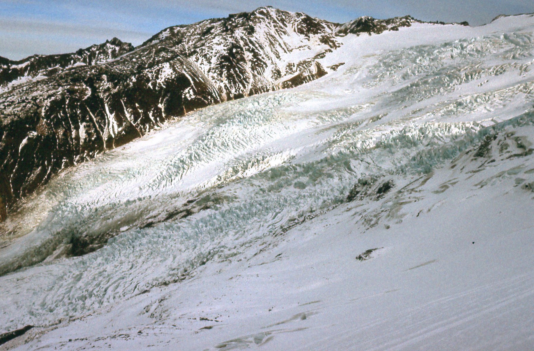
Then, back around to forestry roads on the north-northeast side, I had these views from around 3,000 feet elevation. What I like about this next photo is that it shows how low the Coleman Glacier comes. To its left and upslope is the Roosevelt Glacier, covering much of the rest of what we can see of the mountain.
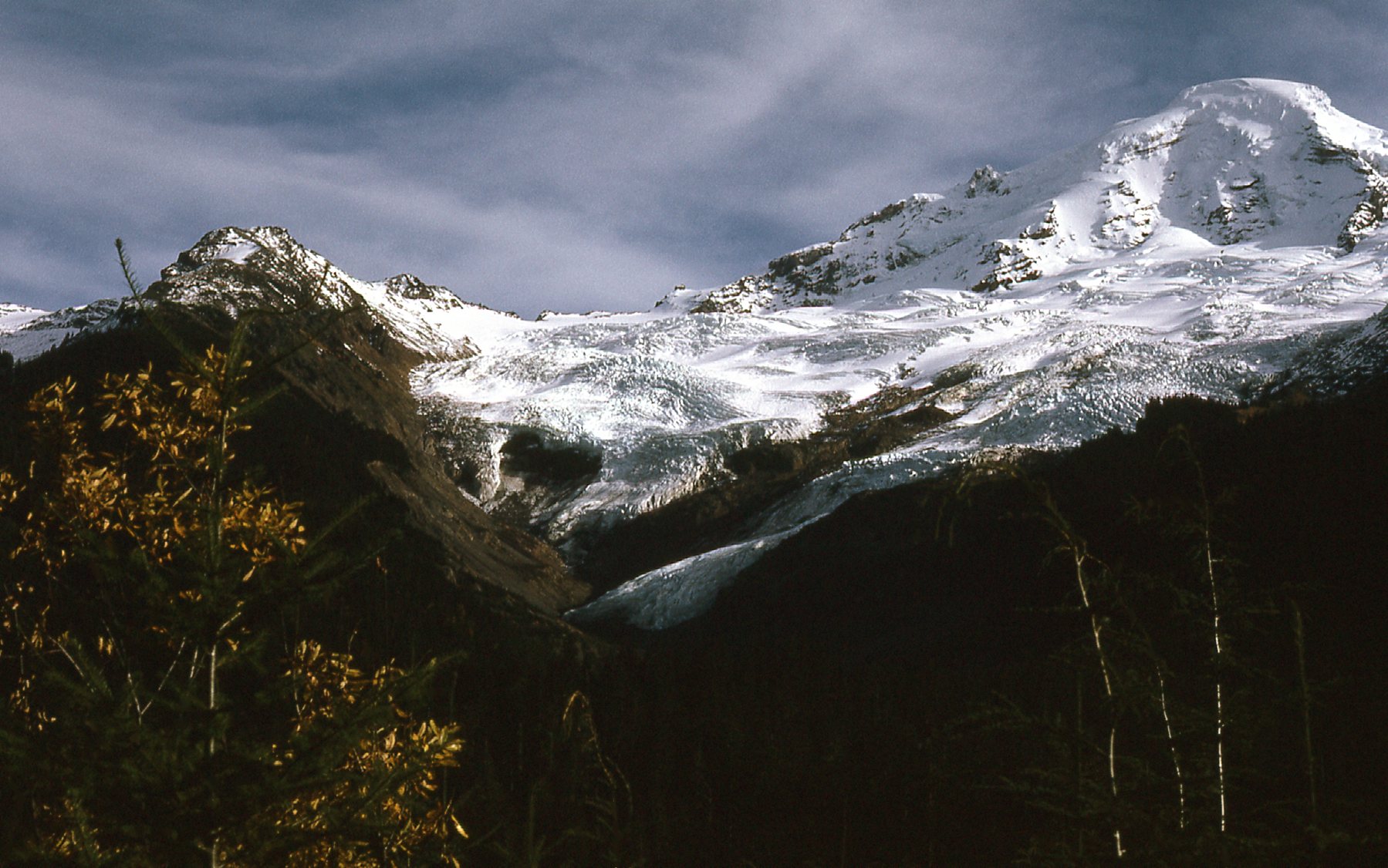
Coleman Glacier
From the same vantage point, this next photo shows the view to the right of the above photo.
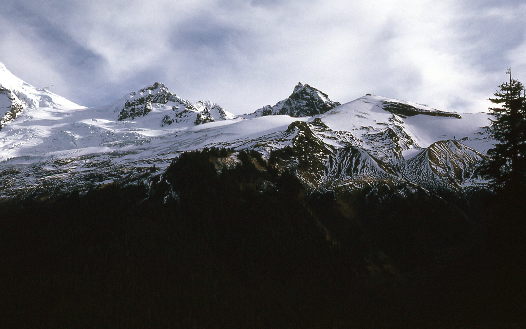
Colfax Peak on the left, and Black Buttes on the right.
It was another 5 years before I returned to Mount Baker, this time with a friend. It was March 23 of 1974. We couldn’t drive in very far on the access road, only 3 miles, before snow stopped us.
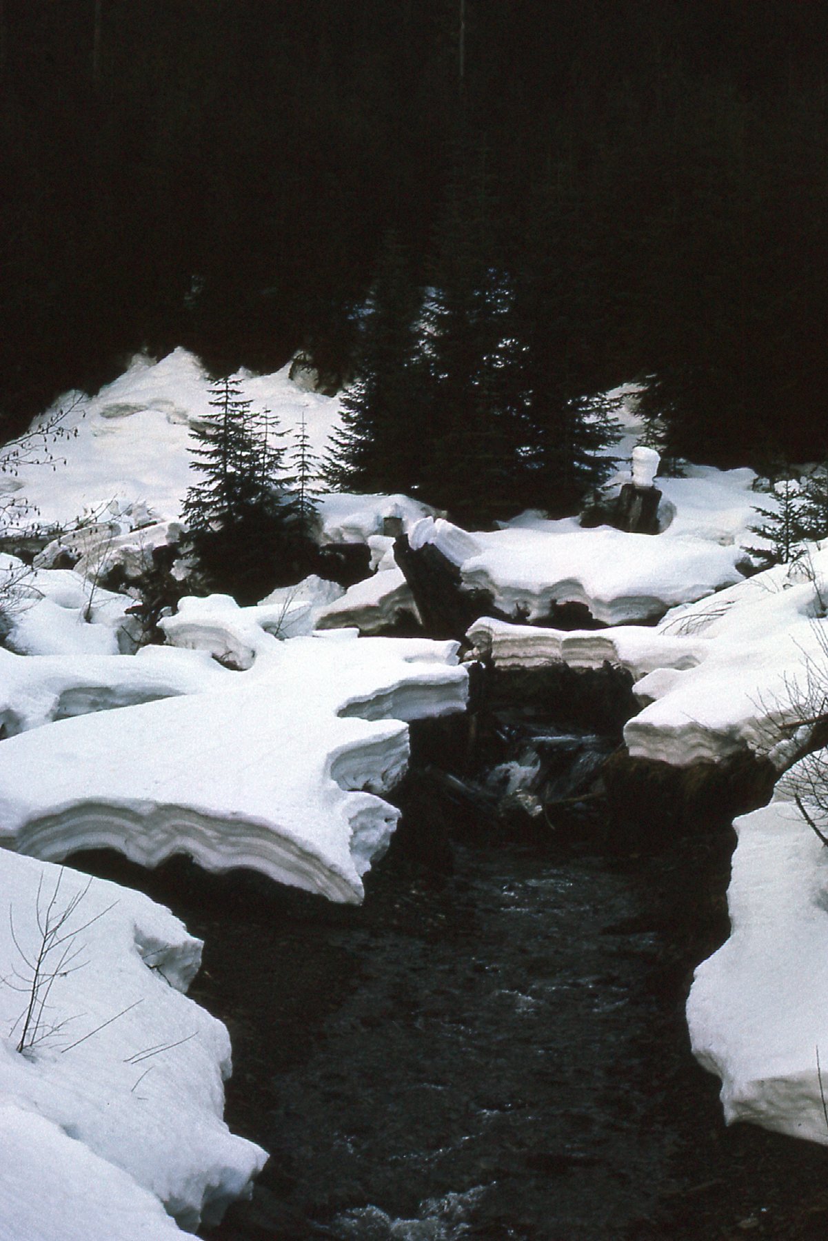
Along the road
We had no choice but to park and set out on foot with full packs. By 5:30 PM, we stopped and bivouacked on the snow under clear skies, 6 1/2 miles up the road.
Near Mount Baker
Early the next morning, we made good time to the trailhead. Another hour and a half had us at the Kulshan cabin. This was such a cool place, it had bunks to sleep up to 30 people. Sadly, it is no more. I have read several reasons for its demise: it burned down; the Forest Service dismantled it when the area became part of the Mount Baker Wilderness Area; it was destroyed in an avalanche and then what was left of it was removed. I don’t know for sure which was the actual reason, but I’m going to go with the avalanche.
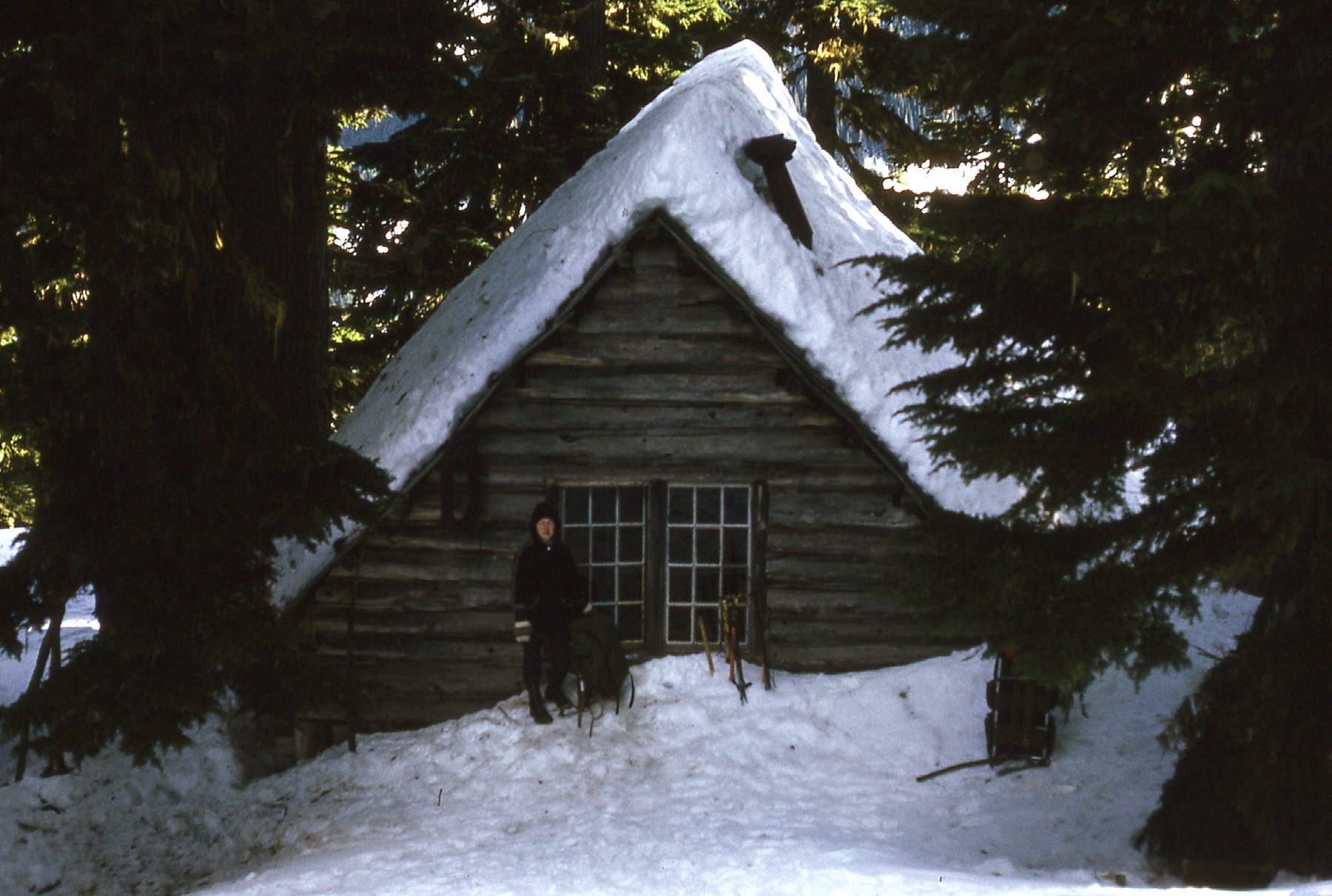
The Kulshan cabin
We arrived at the cabin by 11:00 AM, had a big lunch, then headed up the mountain above tree-line. It was never our intention to summit, but just to enjoy the day and the amazing scenery. We were not disappointed.
Above the cabin in the last of the trees.
Up in the snow
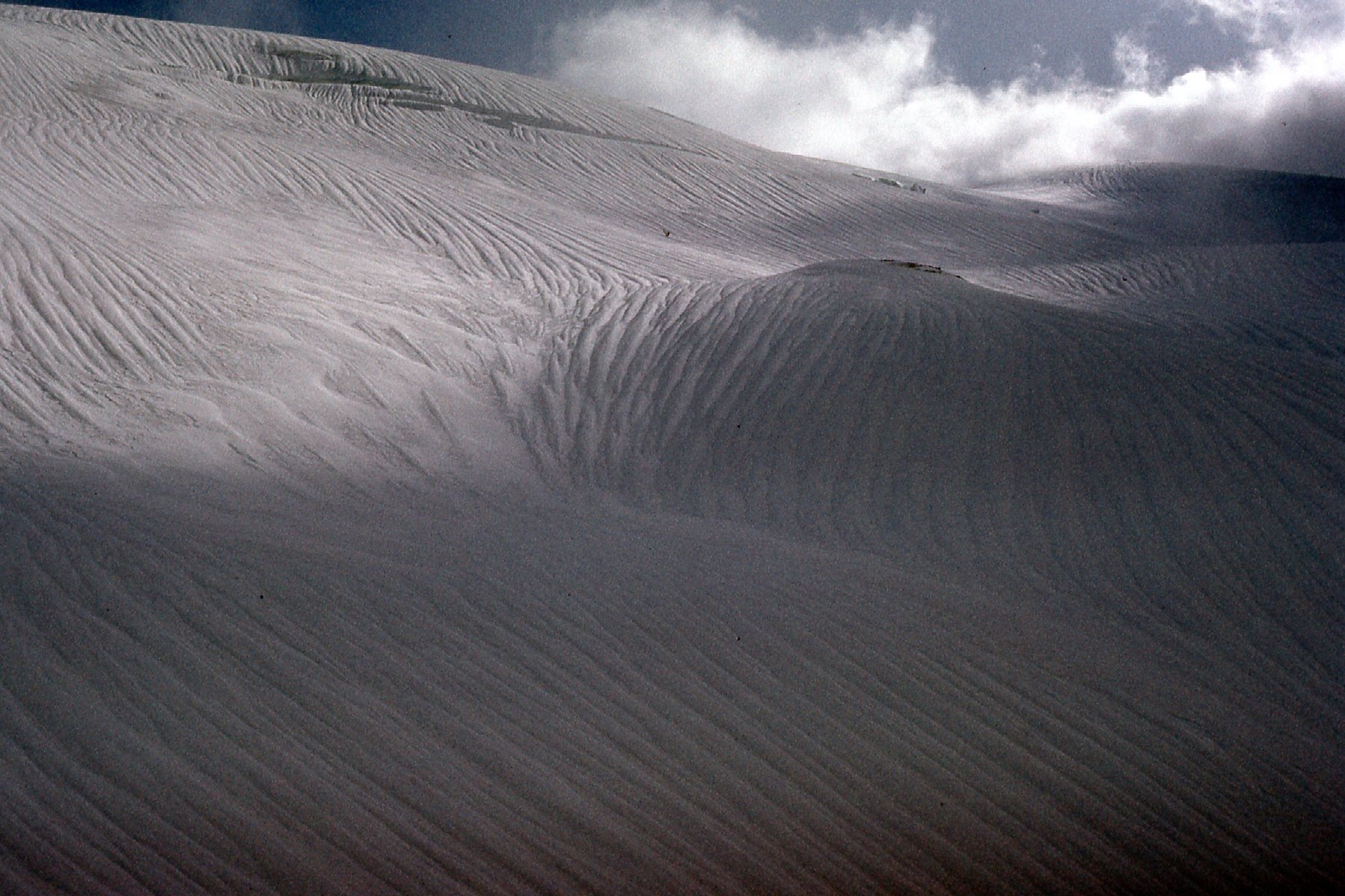
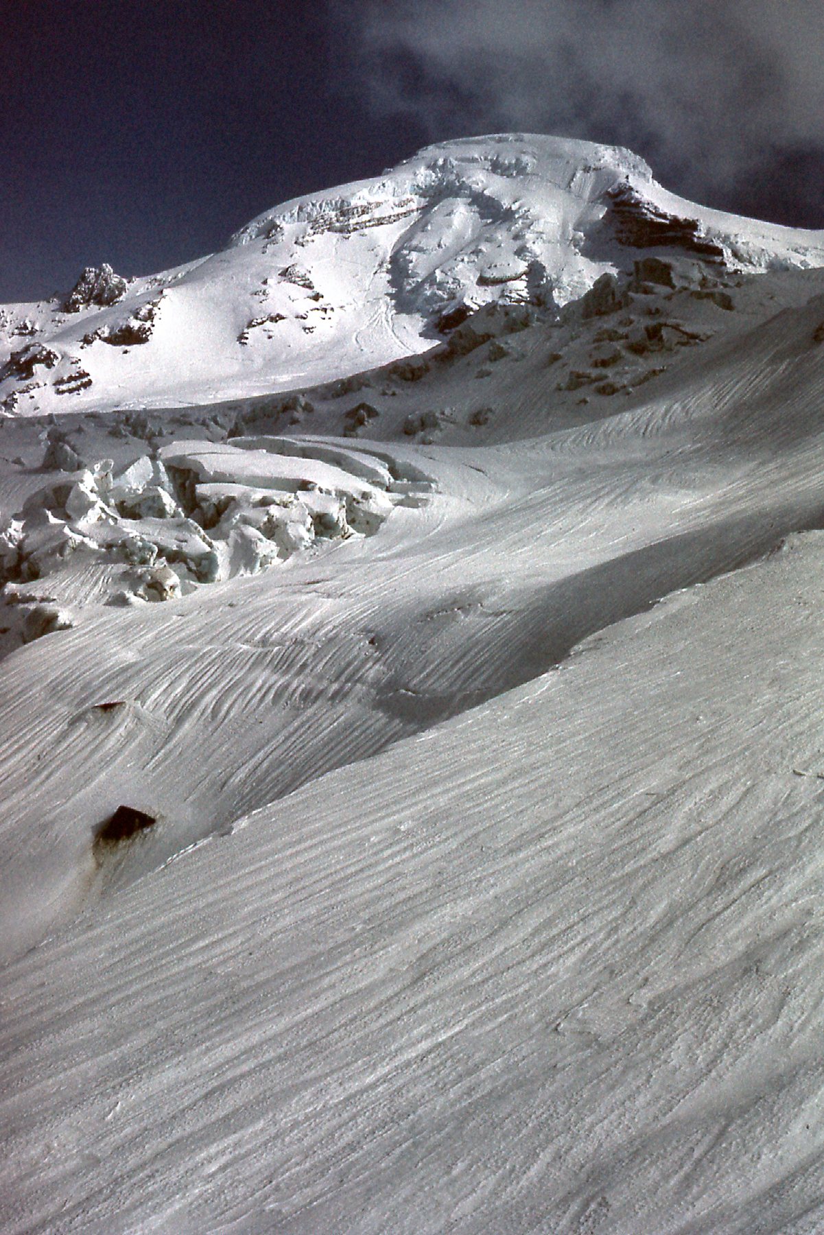
Higher up
I love how the wind has textured the snow in the previous photo.
Looking down the slope.
We spent most of the afternoon up on the snowy slopes taking in the amazing views. It was late by the time we returned to the cabin. Soon after arriving, 3 guys returned from the summit – I was jealous, I still hadn’t been there. All 5 of us spent the night in the cabin, and in the morning we headed back through the forest on the trail, deep in snow.
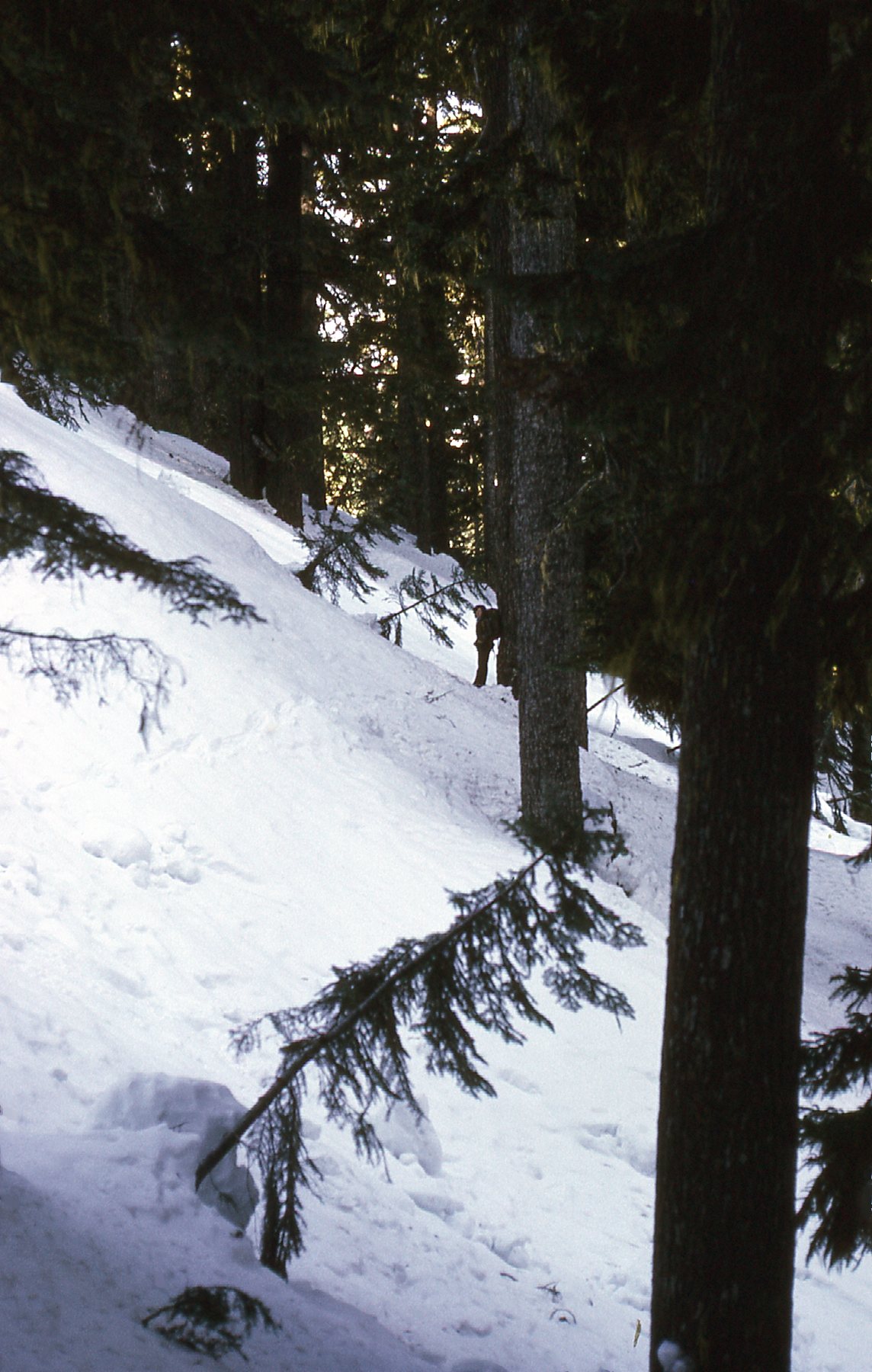
Along the trail.
Once back down to the road and walking out on it, we had this grand view back up to the peak.
A last look back
I made other trips back to the peak to do things like practice crevasse rescue. Once I went there and tried to team up with others going for the summit, but didn’t get a place on their rope. So what do you think of the pictures so far? If you liked them, wait until you see what’s coming next.
My next real opportunity to climb the peak came at the end of 1976. On December 2nd, I headed there with a climber named Doug Buis from my home town. To this day, I don’t remember anything about the guy other than we went there to climb together. We drove all the way up the road to park at the trailhead, then walked up the trail to the cabin and just kept on going. We put in 7 hours on foot and finally stopped at 8,850 feet. Here was our view from there late in the afternoon.
The end of the day.
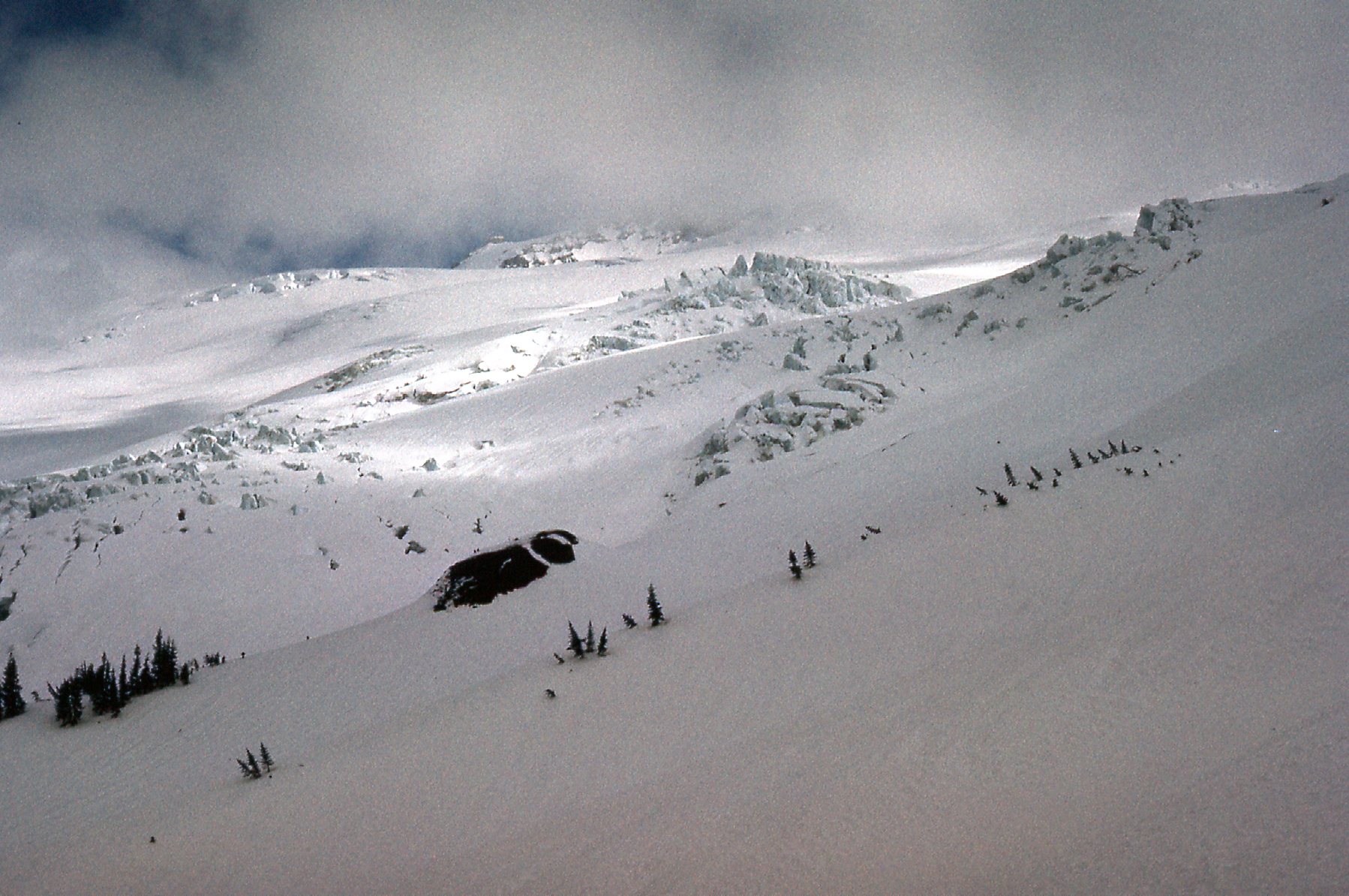
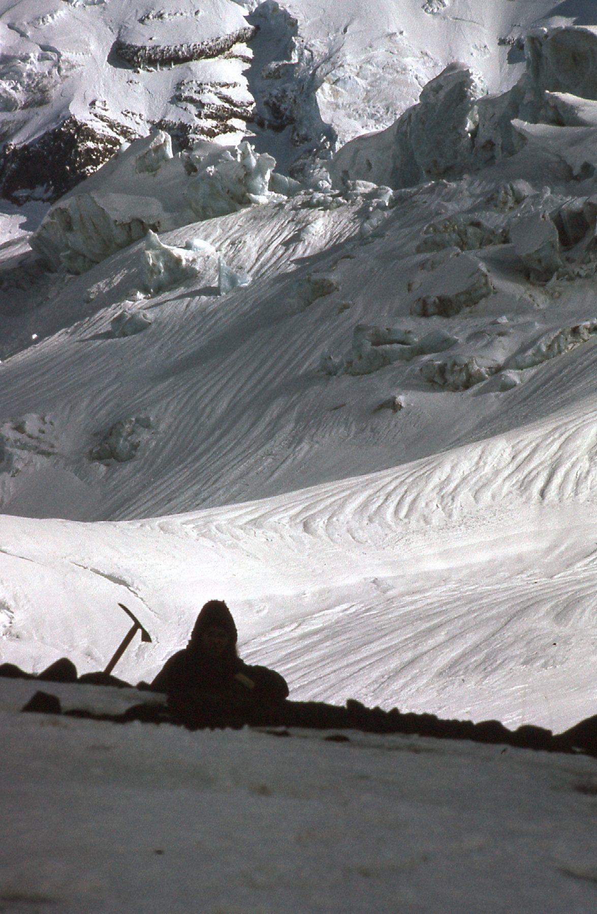
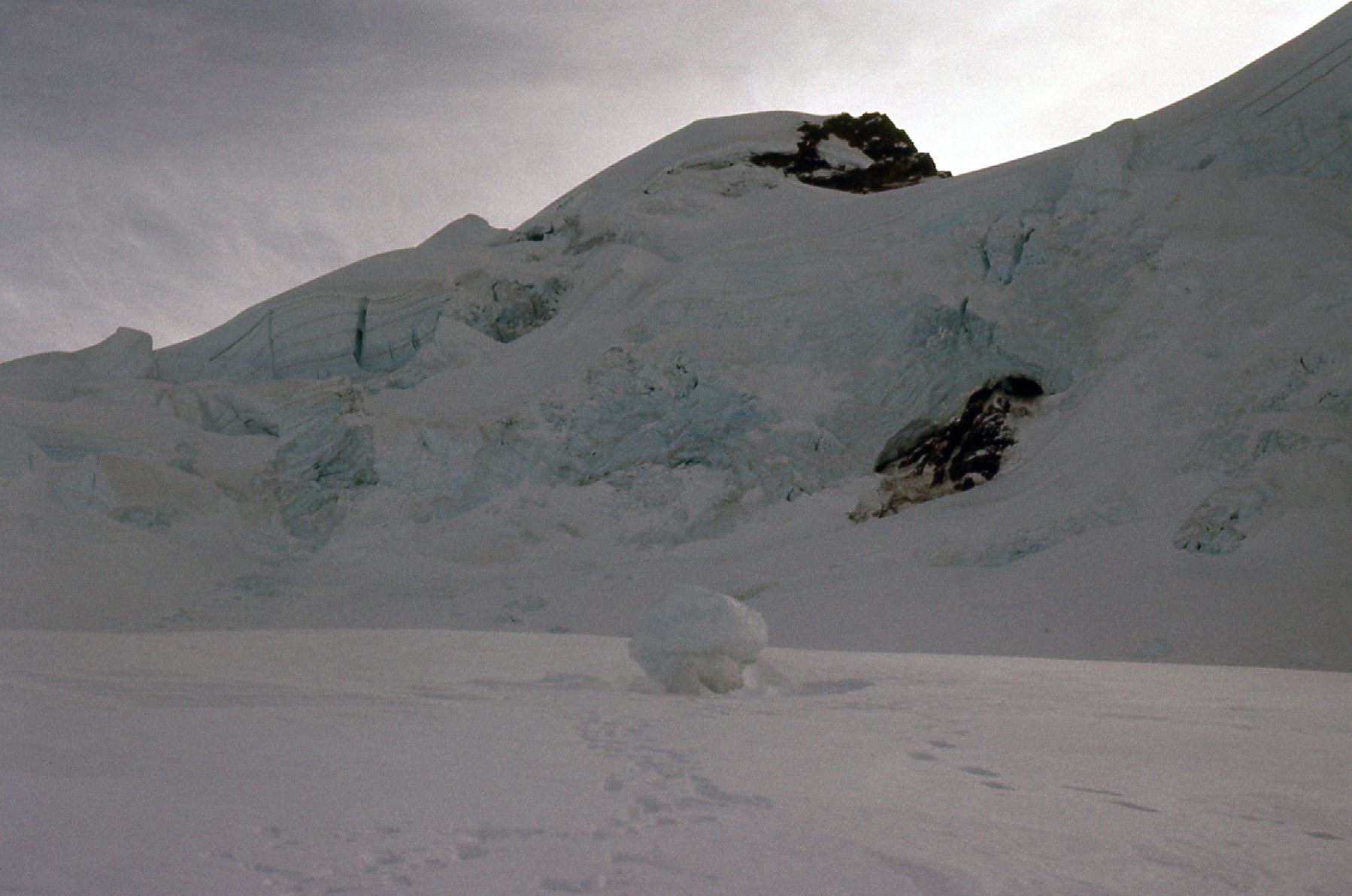
We had reached a feature on the mountain known as “the great crevasse”. This huge gash stretched far across the upper part of the Coleman Glacier, and depending on the time of year when you arrived, it could prove quite the obstacle to any forward progress. Depending on conditions, sometimes you had to travel quite a ways to outflank it. It was about half a mile long when we were there. It looked like we could cross it okay, so that wasn’t a worry this time. The wind was blowing hard. If we went much higher, we’d be in a wide-open saddle and exposed to that gale all night. As we stood there on the downhill lip of the crevasse, we decided to do the only sane thing – we’d crawl down into the crevasse and camp on what looked like a sturdy snow bridge. We managed to pitch a tent, but it made so much noise all night that we hardly slept at all. Have you ever spent the night in a tent while outrageous wind gusts blew outside? The tent would be pushed in against us, then just as quickly snap back out with a terrific noise – it was like being inside a lung breathing in and out. Our thought of being 20 feet down in the crevasse to be out of the wind was a pipe dream. It howled all night. Between the tent’s flapping and the spindrift creeping in, we hardly slept a wink. Fortunately, it didn’t get all that cold overnight, only down to 18 degrees F. In the cold light of dawn, we had a look around.
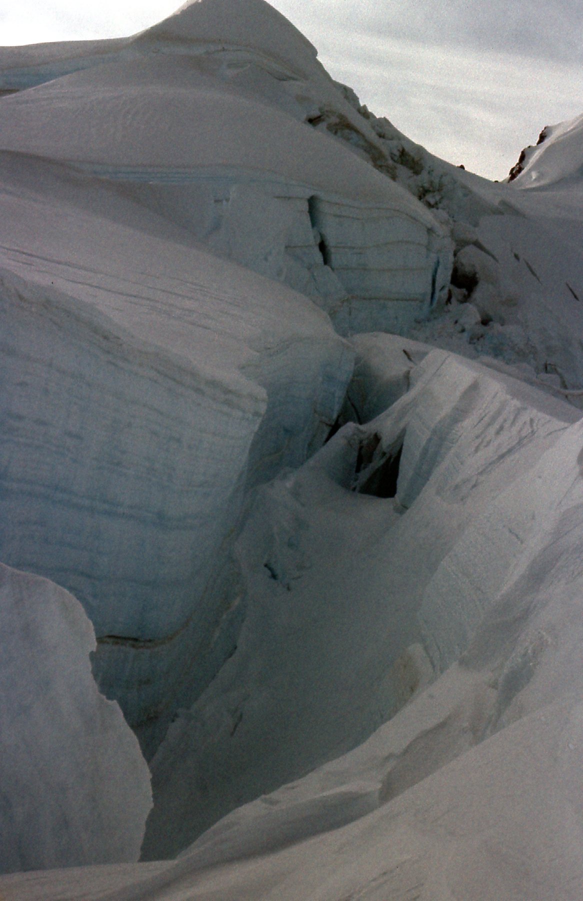
Our bivy site in the Great Crevasse
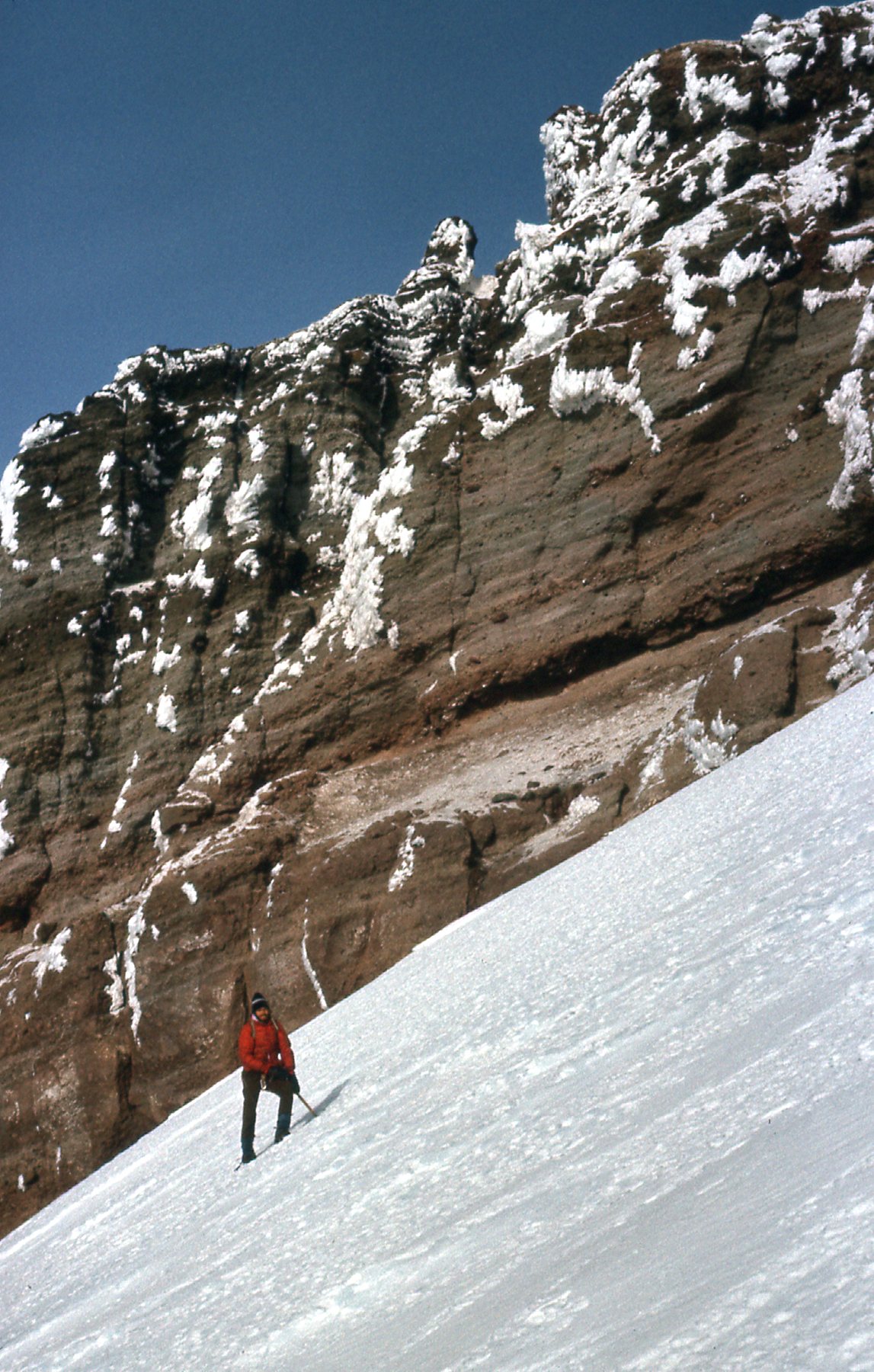
There were some fearsome openings into crevasses, but nothing that couldn’t be avoided easily.
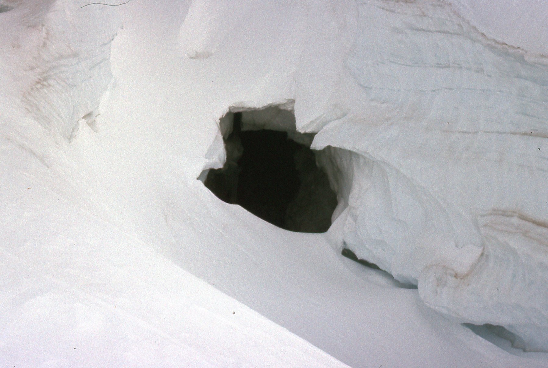
A bottomless pit.
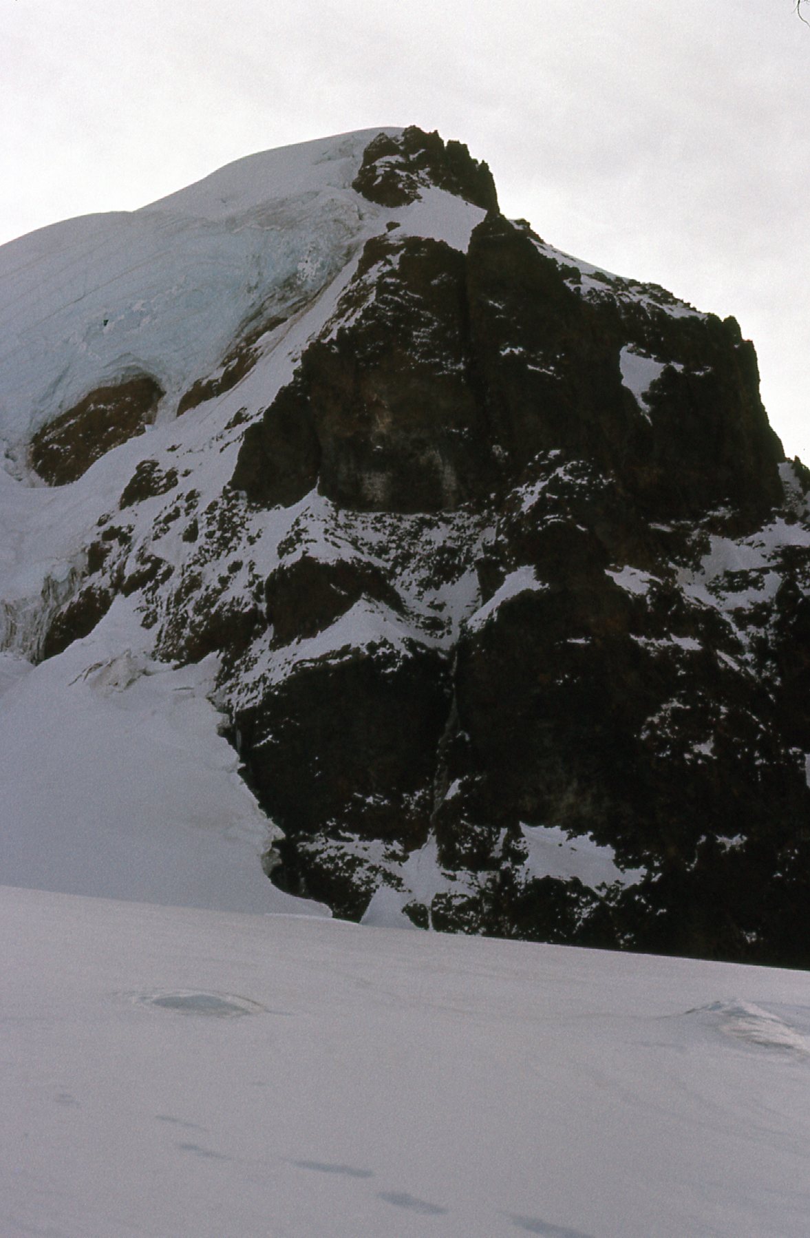
It was 8:15 AM by the time we got moving. There was a high, thin haze and feeble sunlight, but the wind was blowing hard. Nearby was a feature known as the Black Buttes.
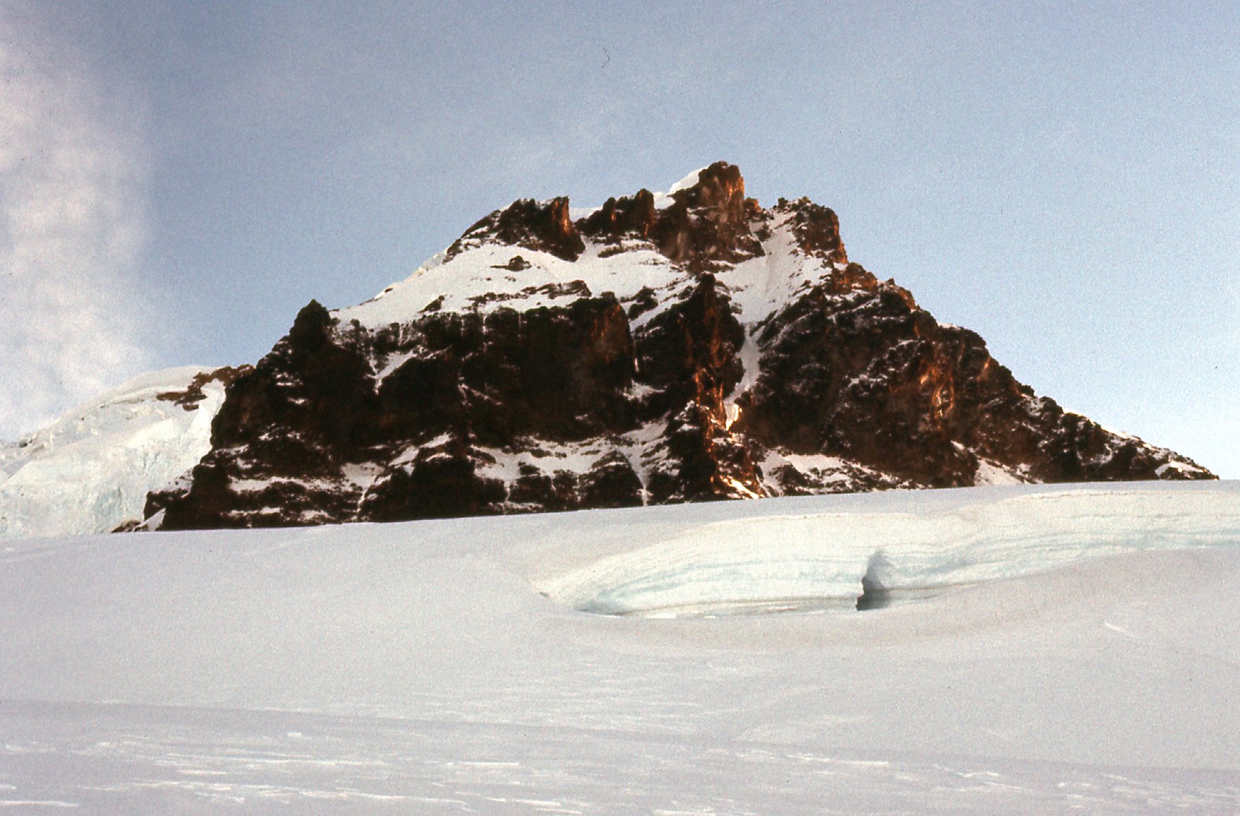
The Black Buttes
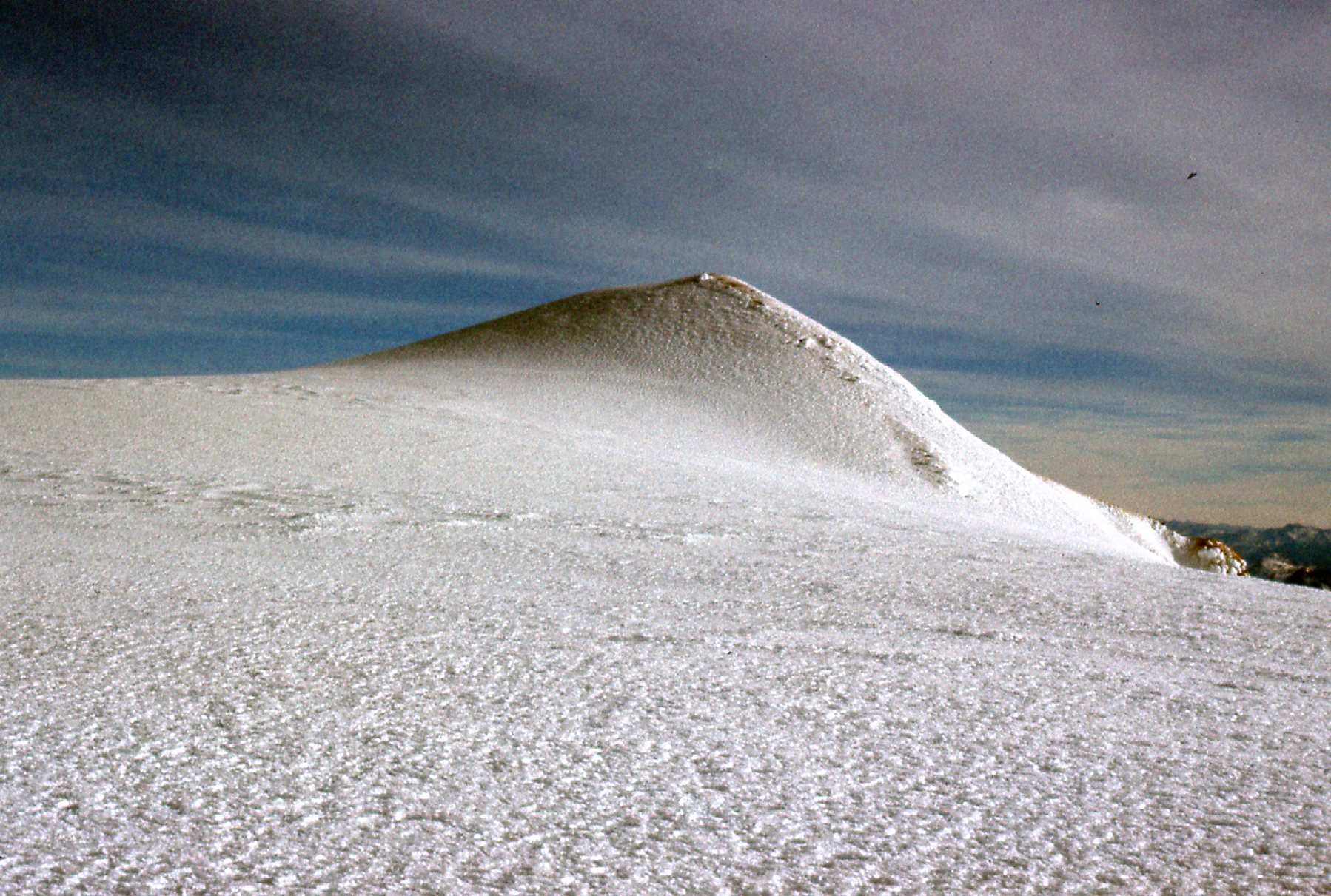
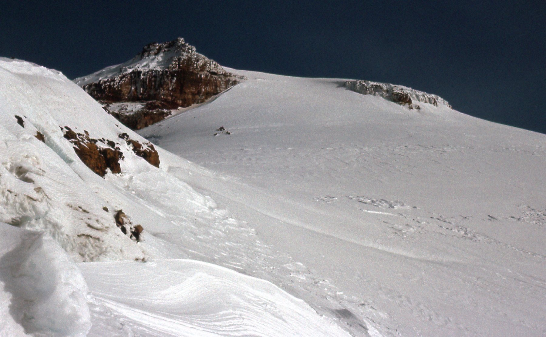
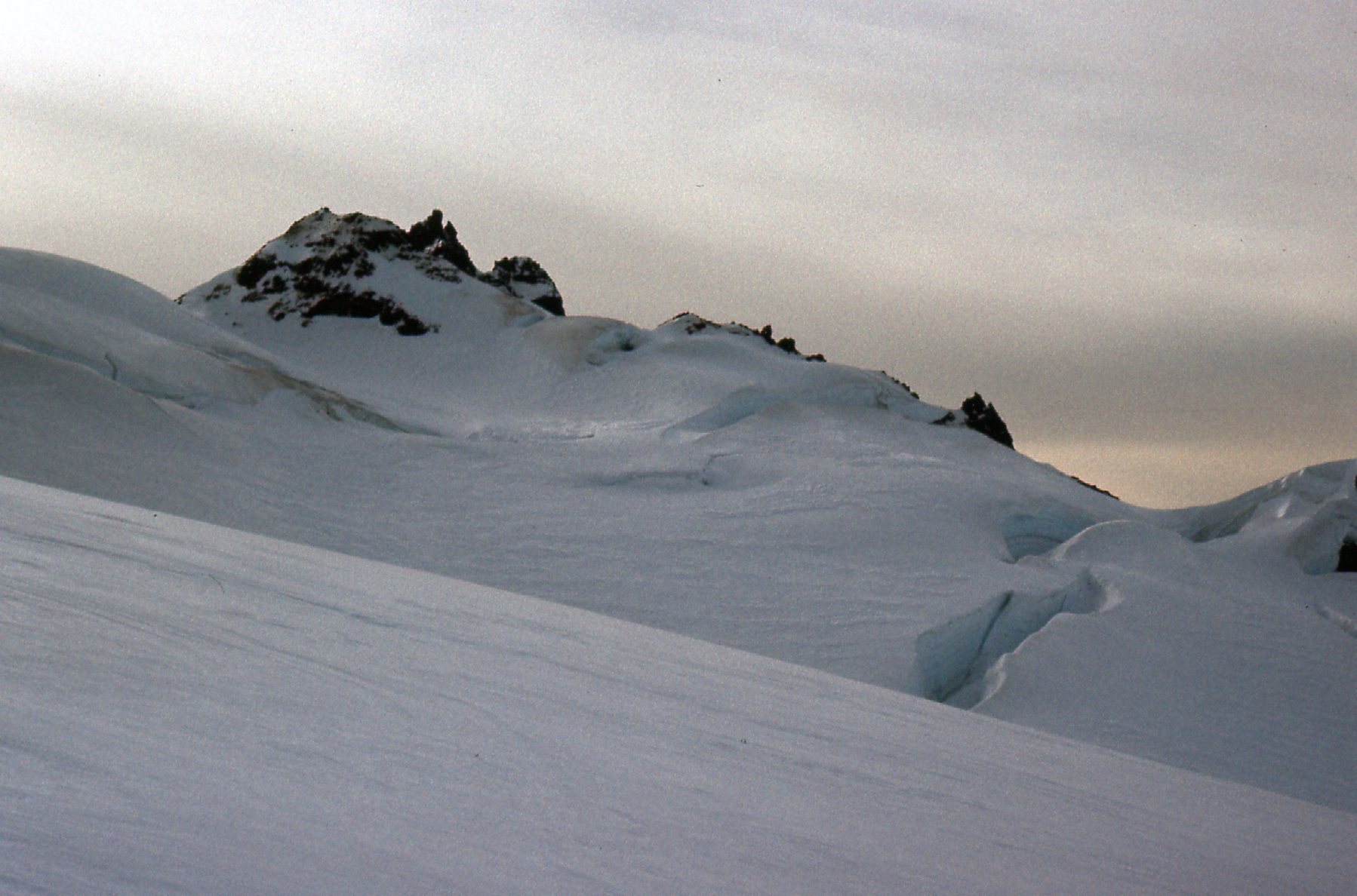
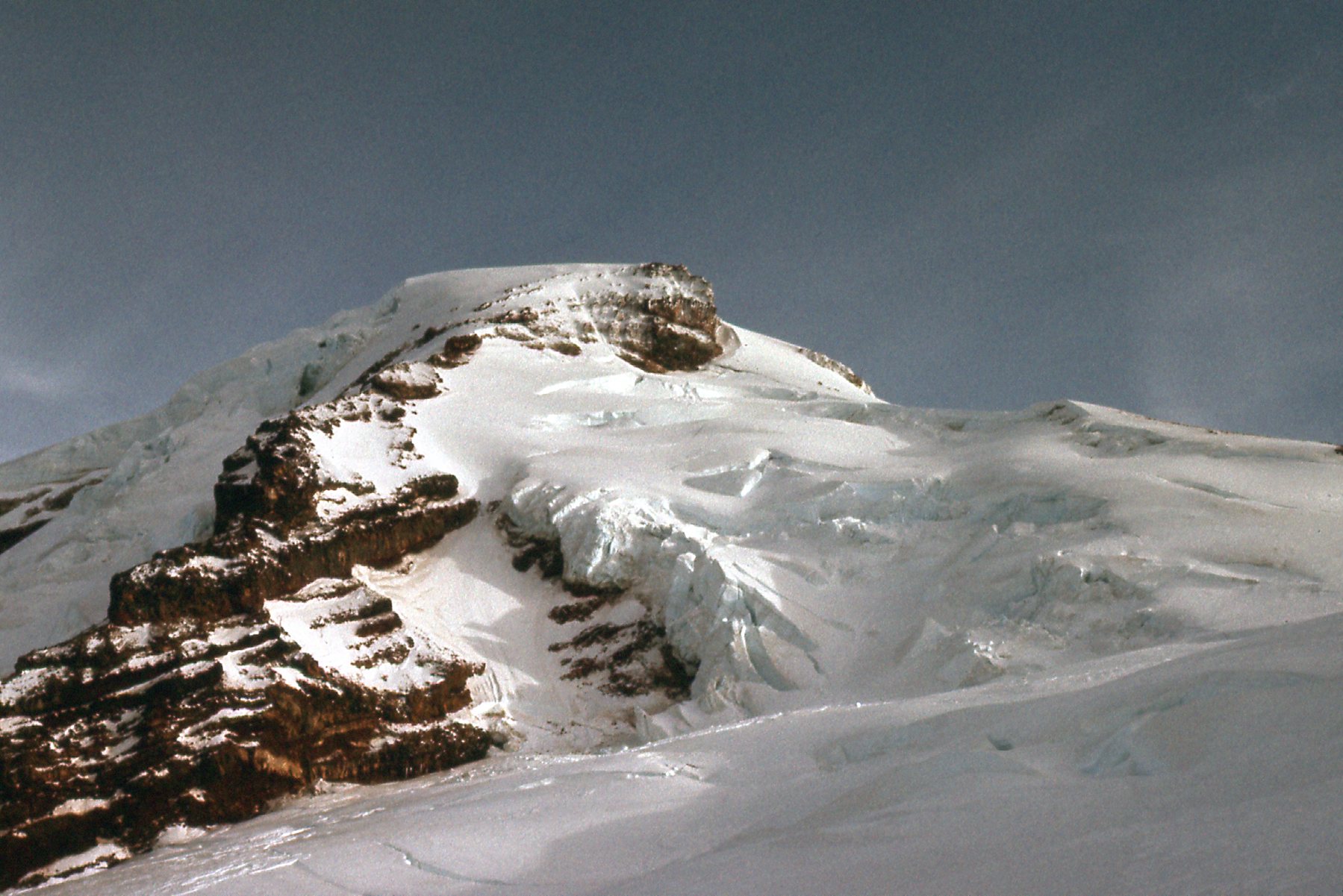
We made our way up to a distinctive saddle at 9,000 feet which put us close to a subsidiary summit known as Colfax Peak.
Sunrise on Colfax Peak, elevation 9,460 feet.
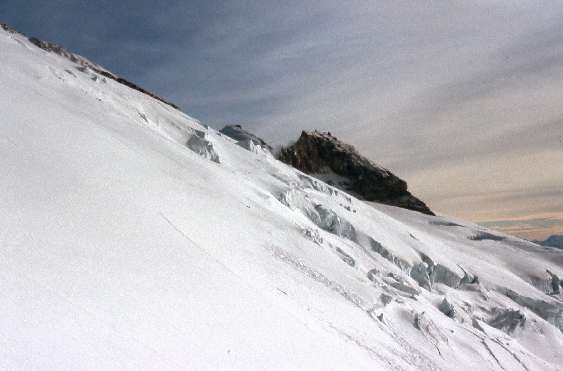
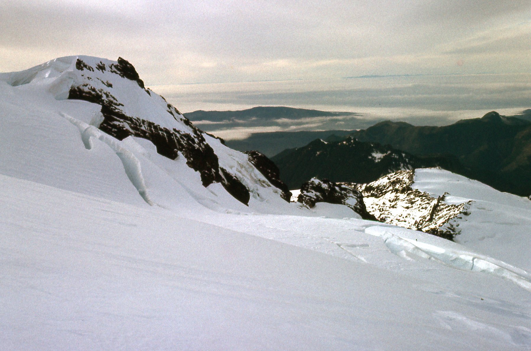
All we had to do now was climb up a very even slope for 1,700 vertical feet. Here’s a picture showing that, with the Roman Wall seen in the background.
Doug Buis and the Roman Wall
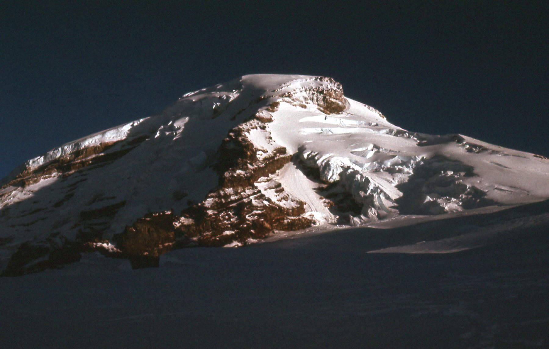
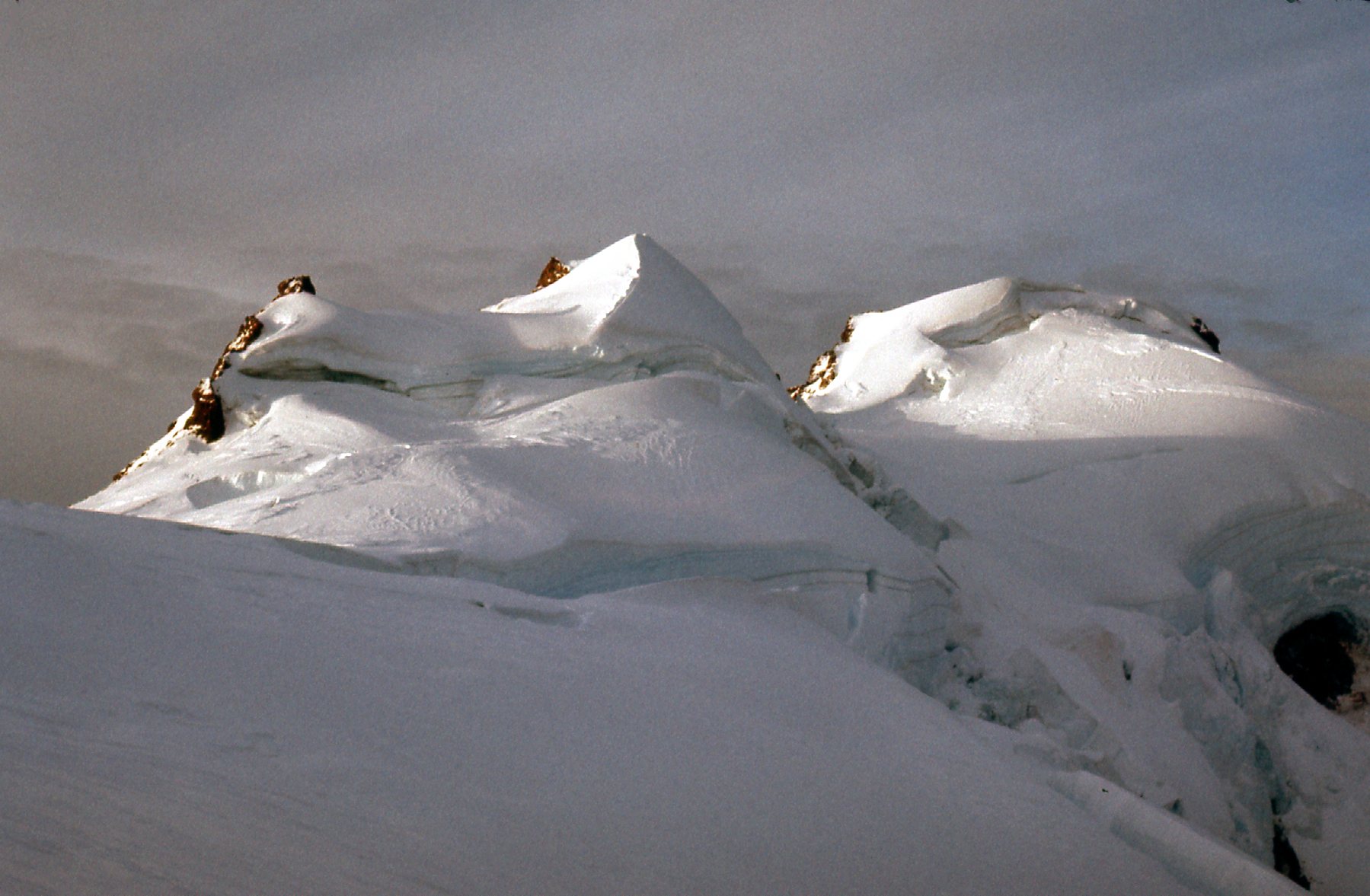
Two hours after leaving our hell-hole, we stood on the summit. The temperature was +14 degrees F and the wind was howling at 40 mph, but it surely did feel good to be there. The summit of Mount Baker is quite flat and about a quarter-mile long. It is actually a crater, filled with ice. I took photos looking both directions across it.
Looking east to the highest point of the summit.
This photo is taken on the highest point and looking west back across the summit area.
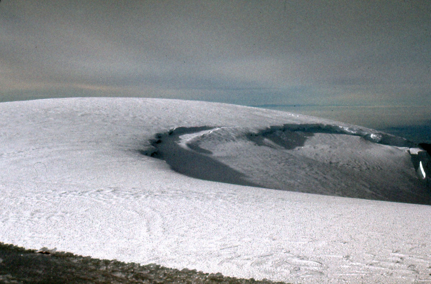
A look west back across the summit area.
The highest point of the mountain is known as Grant Peak, which is 10,781 feet. However, there is a lesser summit known as Sherman Peak, at 10,180 feet. It sits about 3,000 feet to the south of the true summit. From the highest area, we get this great view down to the smoking crater. It doesn’t smoke all the time, but was for us that day.
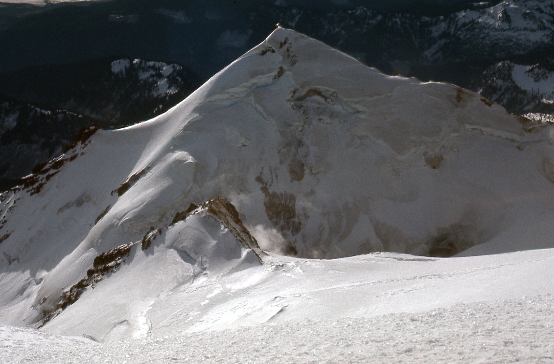
Looking south to Sherman Peak and the crater.
This next view covers the area to the right of the above photo and better shows the vapors escaping from the crater.
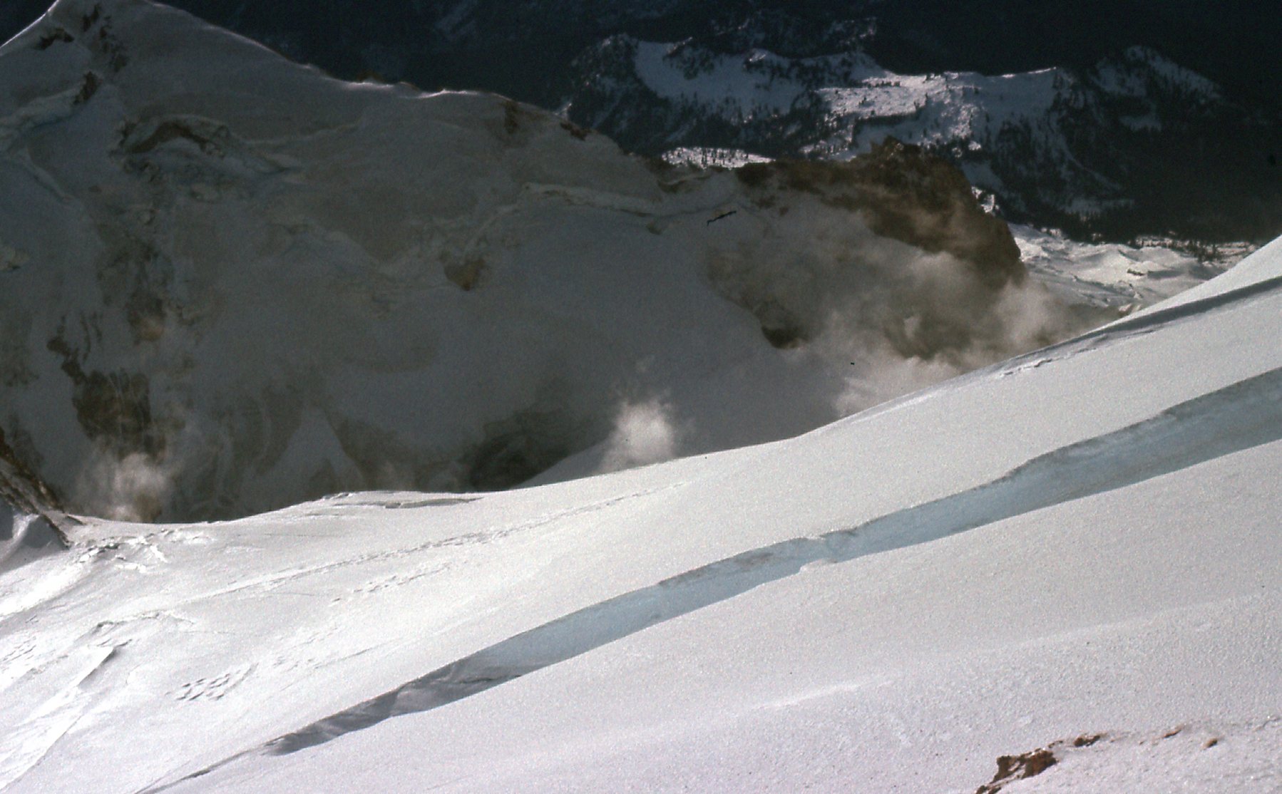
More of the crater
If you look northeast from the summit, you can see Mount Shuksan. It’s a spectacular mountain in its own right, but because it sits a full 1,650 feet below Baker, it’s almost lost amongst the surrounding peaks.
Mount Shuksan
Here’s one of me on the summit – it took 9 years of trying, but I finally made it.
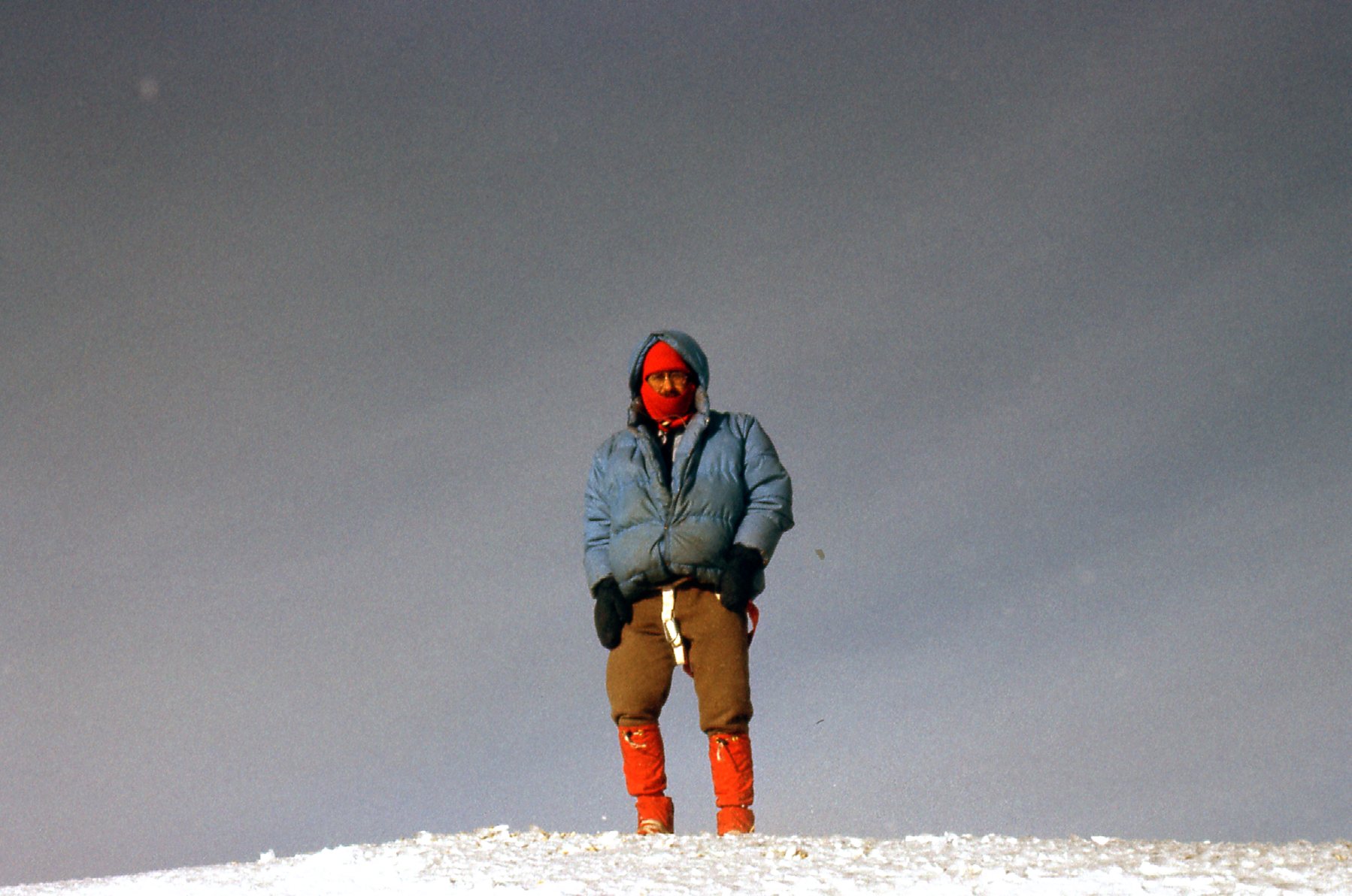
Me wearing what must be the world’s dirtiest parka.
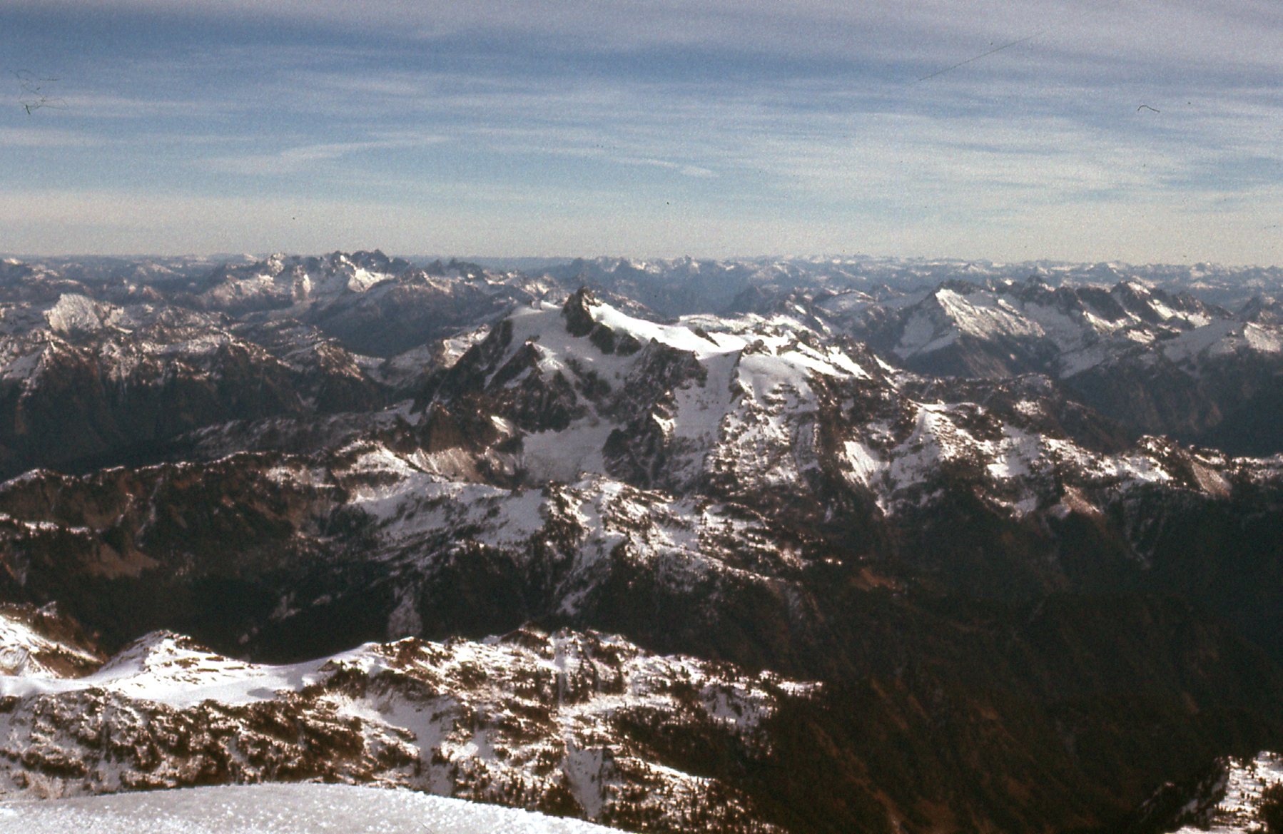
After just the right amount of time on top, we roped up and started back down. Part-way down that long steep slope where George and I had called it quits 9 years earlier, I took this telephoto shot looking southwest. In it, we are looking over top of Black Buttes to what is called Twin Sisters Mountain, 9 miles away – it’s the long ridge with all the snow on it. It’s actually comprised of 9 distinct peaks stretching for 7 miles – we only see the northern half of it here.
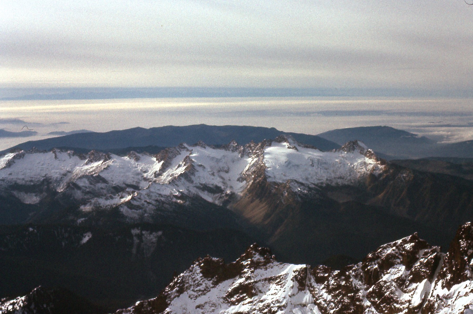
Twin Sisters Mountain
From back down at the 9,000-foot saddle, we had this clear view up that long slope to the summit. That’s the Roman Wall on the upper left. The long slope is actually the upper part of the Deming Glacier.
A look back up the final 1,700 feet to the summit plateau.
Looking across the slope, here we can just see a bit of Sherman Peak.
A bit of Sherman Peak.
From the upper part of the Coleman Glacier, here’s a view of Colfax Peak, elevation 9,460 feet.
Colfax Peak, looking south.
Bordering the Coleman Glacier along much of its length is a feature known as Heliotrope Ridge. Here are some photos which capture some of its highlights. First, the upper part.
Upper Heliotrope Ridge
Then this view lower down.
Lower down on Heliotrope Ridge
And finally an even-lower view.
The lowest part of Heliotrope ridge
Looking east to Grant Peak.
From lower down on the Coleman Glacier, we had this view of Grant Peak, the main summit. On the skyline, the dark area right in the middle is the Roman Wall.
One final view to share with you – here, we are looking northeast to the Roosevelt Glacier. That’s Bastile Ridge on the other side.
Roosevelt Glacier
It took us 5 hours to descend from the summit all the way down to the car, and I was back home in Canada by 5:45 PM. the same evening. Finally, after staring at the mountain all those years from my home town in British Columbia, I could now look at it with the satisfaction of knowing I’d stood on top. It felt pretty darn good. I now live far away from Mt. Baker, but whenever I do get back to the area on rare occasions, I still look up at it and smile, remembering that December day way back in 1976 when the effort finally paid off.