
A long time ago in a galaxy far, far away, I was a young, bold, fast climber. Those were the days, now just a distant memory! Living in southwestern British Columbia, I was surrounded by plenty of exciting mountains that were nearby and offered every sort of challenge I could ever wish for. One area that was close to home was known as “the Chehalis”, named after a lake and river of the same name. In the mid-1970s, I spent a lot of time driving the old logging roads throughout the area drained by the river. Its drainage basin isn’t large, only 148 square miles (that’s the equivalent of a square about 12 miles on a side), but an impressive array of peaks surrounds it.
Beginning in 1973, I made many forays into South Statlu Creek, Middle Statlu Creek (also known as Blacklock Creek) and North Statlu Creek (which includes the drainage of Tessaro Creek). Farther north, Skwellepil Creek flows east for quite a few miles and empties into Chehalis Lake along its western shore. All of that exploration and climbing took place in 1974 and 1975, continuing into 1976 and 1977, and all of those areas mentioned were part of the Chehalis drainage.
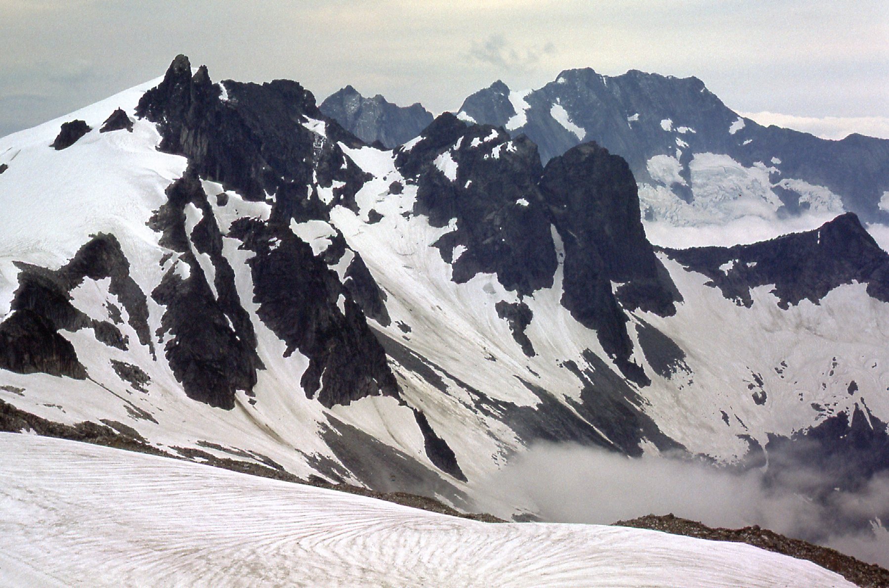
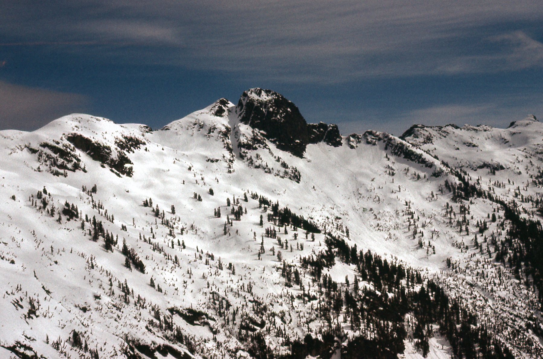
Another area I started to explore as early as 1975 was Eagle Creek, a major tributary of the Chehalis. It flows south and enters the lake at its northern end. The years 1976 and 1977 saw me putting in time up that drainage, checking out the area of Grainger Peak at the northern end of Eagle Creek. Although I wasn’t successful in summiting during any of my visits to the Grainger area, my time spent in the area gave me a good look at other climbing possibilities. In fact, it was on September 11th of 1976 that I had this view south from a point high on Grainger, and what I saw excited me. It was a rocky tower, sitting alone along the ridge. At the time, I knew nothing about it, but it looked like quite the challenge.
Looking south from Grainger Peak
From even higher up on Grainger, I had another look at the mysterious peak. This view showed more of the precipitous west face to the right of the tower.
We can see the mystery peak over on the far left.
After my unsuccessful bid to climb Grainger, time passed and I didn’t think much about going back into the area. A year and a half went by, and I was busy climbing all manner of good stuff throughout southwestern British Columbia. In early 1978, my thoughts once again turned to the peaks surrounding Eagle Creek. That rocky spire I had seen from high on the slopes of Grainger Peak came to mind and I wondered what I’d find if I went in there for a closer look.
By early April, I couldn’t stand it any more, so I decided to head back in. On the 9th, I drove the logging roads of Canadian Forest Products as far as I could up into the Chehalis. I was able to drive to a point a bit north of Chehalis Lake, where I was forced to stop because of a slide blocking the road. It was there that I spent the night sleeping in the back of my Volvo station wagon. In later years, logging roads were pushed miles farther up the Chehalis River than they were in 1978, making any peaks in the upper part of that drainage much more accessible.
I was on the move at 0500 hours the next morning, heading north on the last bit of road. It crossed over to the west side of Eagle Creek and soon ended at around 1,900 feet elevation. The snow was phenomenal. By that, I mean that I couldn’t recall ever seeing so much of it down so low this late in the year. I put on my snowshoes and kept walking, staying on the west side of the creek. I was familiar with the bush here, having made a few forays up Eagle Creek in recent years. Since this area hadn’t been logged, it was virgin forest with relatively little brush, so moving through it was pretty easy. The fact that there was plenty of snow in the forest made it even easier. I passed out of the last of the trees at around 3,600 feet in the great basin on the southeast side of Grainger Peak. That’s a really low elevation for tree-line in that part of the world, and maybe it’s because it’s all rock and snow in there, making it hard for trees to survive. Reaching the basin had taken about 3 hours.
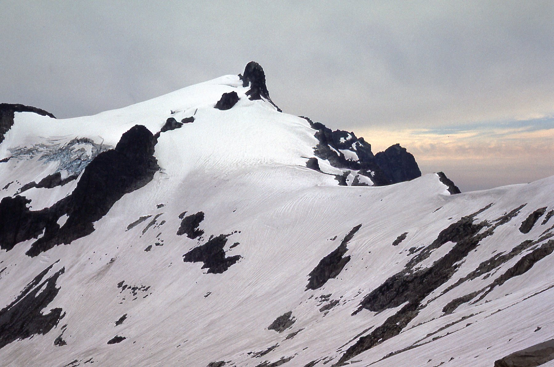
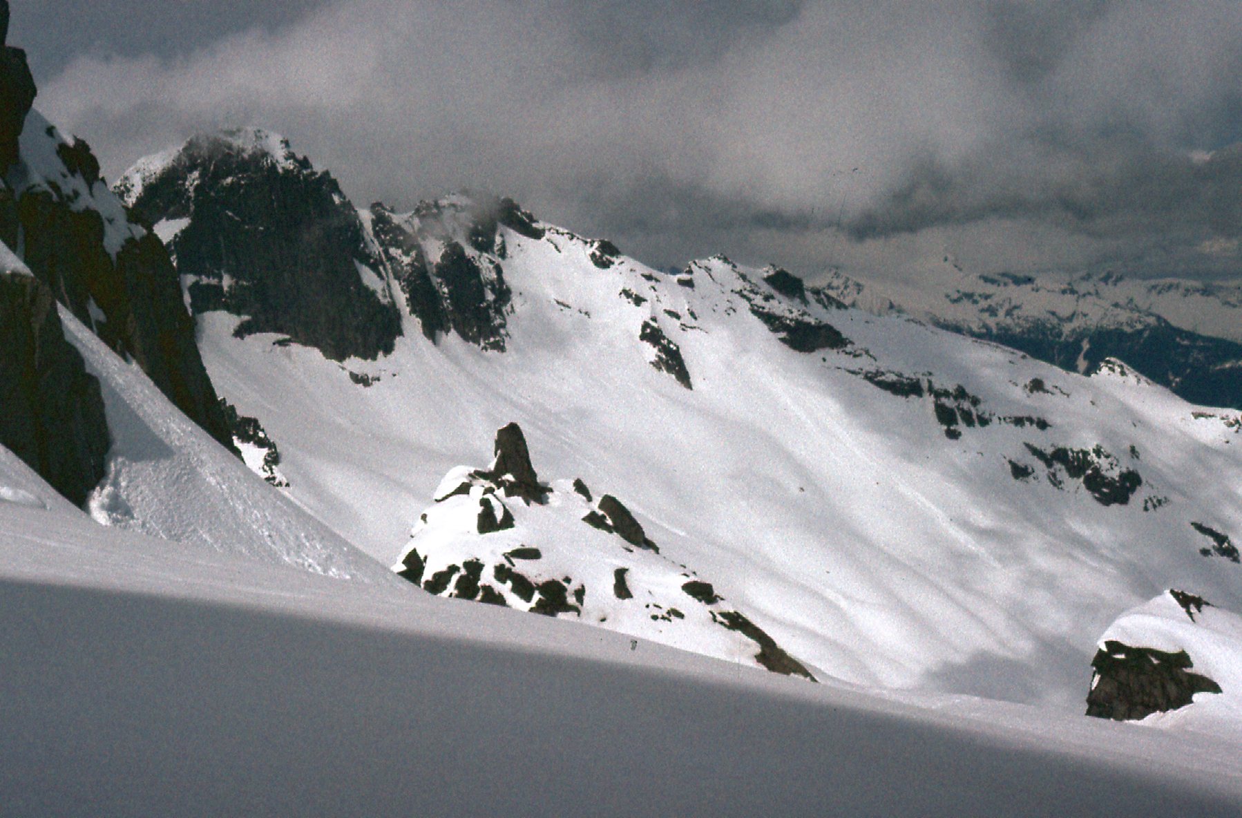
My next task was to head west up to the saddle between my peak and Grainger Peak (which sat to the north). This would normally be done over a lot of rock, but not that day. Talk about a winter wonderland! The snow was so deep everywhere that I didn’t set foot on any rock at all climbing up to that saddle at around 5,800 feet. This climb of 2,200 vertical feet up from the basin was all done on snowshoes, of course, and so it was pretty straightforward, even the steeper parts. I was using a pair of lightweight Sherpa snowshoes, a clever invention with a toothed piece below the foot which allowed for really good traction on steep slopes and even somewhat icy surfaces. As I climbed up towards the saddle, I had this look north to Grainger. So much snow, everything was buried deeply!
A look across the basin at Grainger Peak to the north.
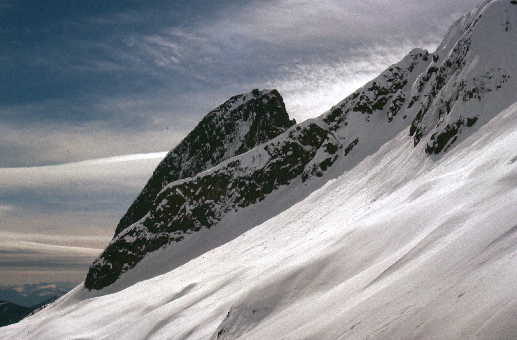
I had tried to climb Grainger a year and a half earlier, in September, but it didn’t even look like the same mountain now. Deep snow disguised it from how I remembered it before. Here’s the view I had to the south towards the peak I’d come to climb. It was hard to know what I was looking at, since I’d never been there before, but I couldn’t see any obvious or reasonable way to the summit. Hell, I didn’t even know where the summit was! Those little black marks are just bits of dust sitting on the slide that I scanned, and aren’t things sitting on the snow.
My peak.
So far, I’ve only referred to the mountain I’d come to climb in terms like “my peak” or “the peak”. It didn’t have a name, but the topographic map of the time showed 3 distinct closed contours at 6,800 feet. So that’s it then, Peak 6800 it would be.
I now headed south along the ridge, slowly gaining elevation. I don’t have a lot of photos from this trip, but everything I have, I’ll share with you from that day. I was on the north side of the peak, then found myself having to cross the glacier that sits on its east side. That day, the glacier was so deeply covered in snow that I couldn’t even tell I was on it, there was no trace of crevasses to be seen. However, here is a picture I took from way down in the valley bottom along Eagle Creek a year and a half earlier in September when I tried to climb Grainger. The glacier is clearly seen here, a full 3,000 vertical feet above where I stood near Eagle Creek.

Okay, back to the present climb in 1978. In this next photo, we are looking back down over the glacier (you can’t see it) and towards Grainger Peak in the distance on the left.
A look back to the north during the climb.
Now let’s look in the other direction. There’s a dramatic ridge which drops down to the east from the summit area. Here’s the lower part of it.
The lower part of the ridge.
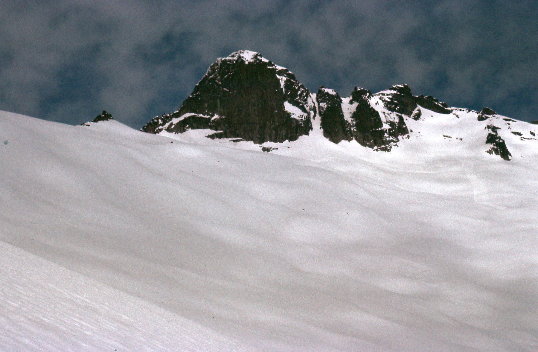
In this next view, we are looking at a higher part of the ridge.
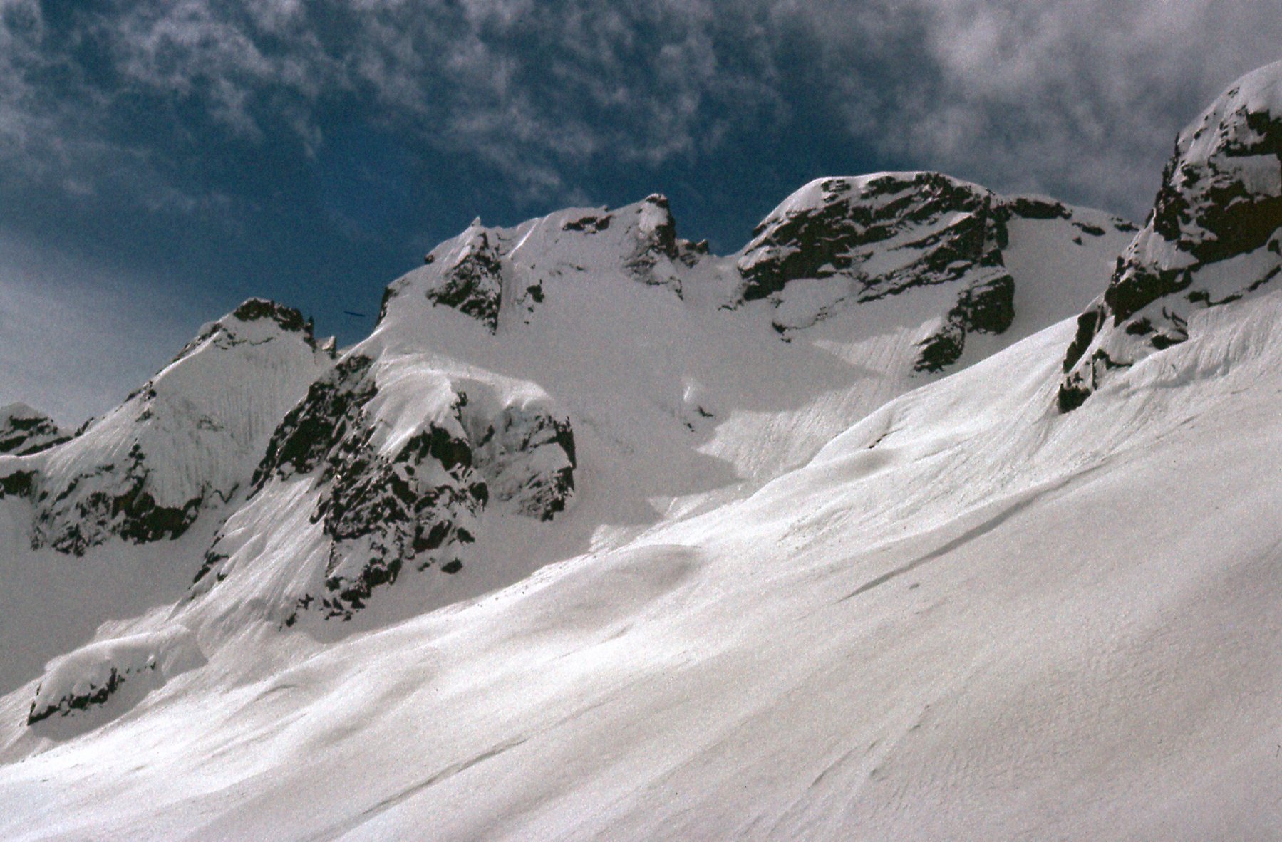
A part of the ridge, higher up.
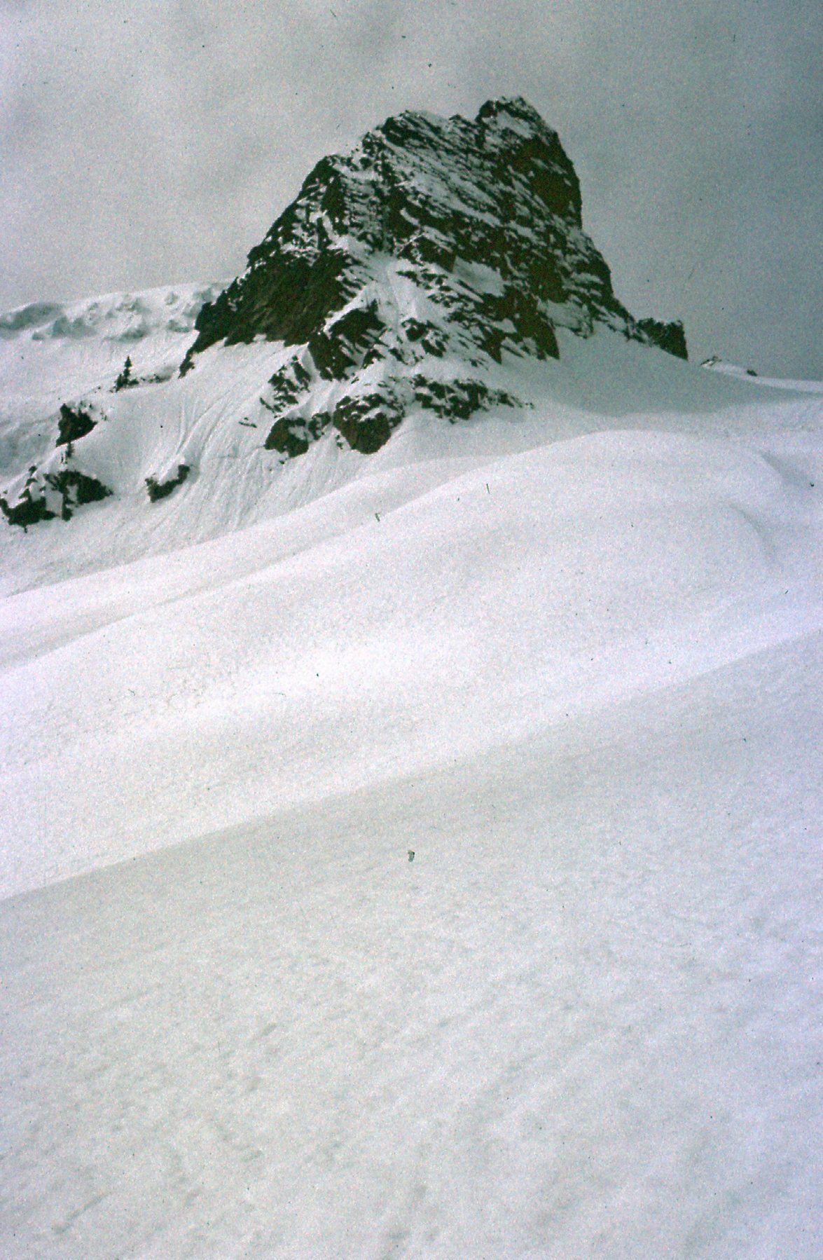
And finally this view – we are looking at the top of the ridge, at about 6,600 feet elevation.
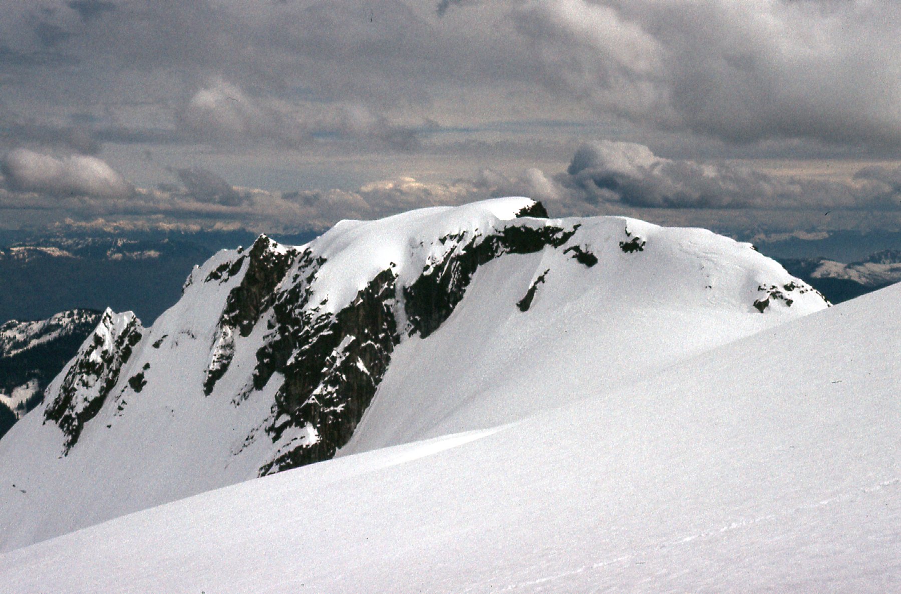
The highest part of the east ridge.
I was at this point high enough on the mountain that I could now make sense of things. Map sheet 92 G9 (1:50,000) which I was using showed three distinct closed contours at 6,800 feet. The southern two were gentle snow domes. The highest one was clearly the most northern of the three, a steep rock tower.
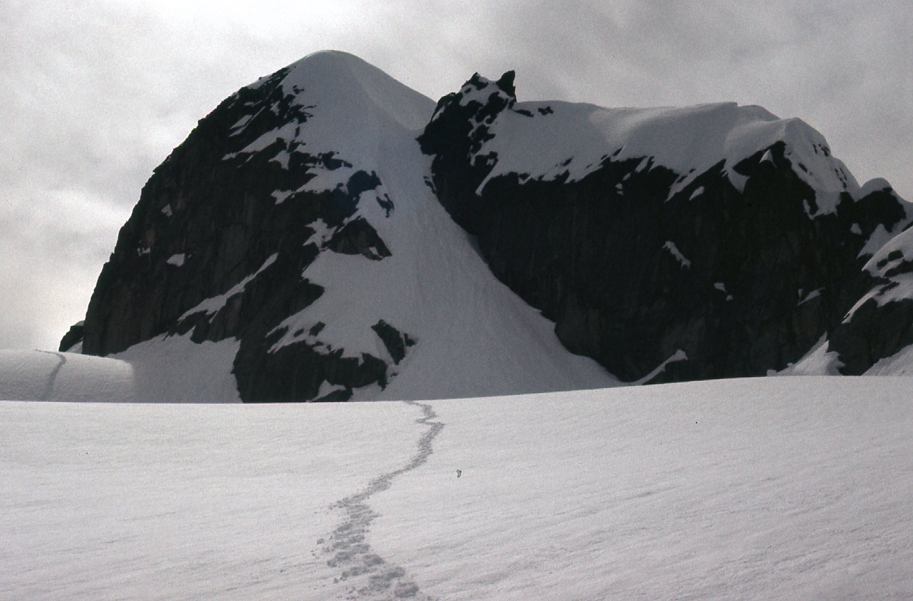
There I was, just me, standing on the snow on the east side of the rocky tower. There was so much snow on the mountain that it covered just about everything. However, as I stood on that east side of the peak, it became quickly apparent that the only chance I had of getting to the top was by using a shallow gully which was deep in snow. It looked risky. I was alone, with no partner to rope up with, so I couldn’t protect myself in any way. The gully was the only way up for me, and it was do or die (and I hoped not die). It was time to go big or go home. I walked over to the base of the gully and looked up – it appeared to go all the way to the summit of the mountain.
I left my snowshoes at the bottom and started up. If the snow had been really hard and icy, I wouldn’t have been able to do it, as I had no crampons with me – just an ice axe. I kicked deep steps and sunk the handle of the axe in all the way with every step, the strap securely tightened around my wrist. I’d be lying if I said I wasn’t scared – in fact, I was scared shitless. It was consistently steep, as much as 60 degrees, but once I was a fair way up it, I felt committed and just kept going. Although the snow was rotten in places (which didn’t exactly boost my level of confidence), I kept at it. Overall, the snow seemed consolidated enough, though, that I felt it wasn’t going to avalanche. In case you’re curious, here’s what a 60-degree slope looks like.
I don’t recall how long it took to climb all the way up the gully to reach the top, but it went okay. It was close to 250 vertical feet of climbing, or about the height of a 25-story building. By the time I reached the top, I was so glad it was over. It had been my custom for years to build a cairn and leave a register if I found none, but today there were no loose rocks lying about with which to do that, so I didn’t even try to leave one. It was 1:00 PM when I reached the summit of Peak 6800, so it had taken me a full 8 hours from my car to the summit. The ceiling was dropping quickly so I didn’t stick around to enjoy the view. Ever-so-carefully, I retraced my path down the gully, facing inwards and using my same steps as before. To this day, I wish I had taken a picture of the gully I’d climbed – alas, I have none to show you. That has been a shortcoming of my photography over all the years, that when I’m in a tense situation I forget to take pictures. Part-way down the mountain, though, I did stop briefly to take these two. The first one shows a view across the valley to a nice peak which stood about 6,000 feet in elevation – it is shown on some maps today as Grainger E3.
Peak 6000 to the east across Eagle Creek.
And then there’s this one, my favorite of the trip. You can see my snowshoe prints across the bottom, but you can also see them crossing another patch of snow in the distance over on the lower left. My path led around the rocky shoulder and out of sight, to where I’d found and climbed the gully which led me to the top.
Peak 6800
By now, the weather was threatening – I fairly flew down the slopes on my snowshoes, down to Eagle Creek. By the time I’d traveled through the forest and all the way back to my car, it was 6:00 PM. I had no sooner arrived than the heavens opened and down came the rain. I was lucky, the weather had actually held for the full 13 hours it had taken me to do the climb. Using good map-measuring tools combined with a pedometer, the tally on the day was 21 miles covered and a vertical gain of 5,200 feet, not counting any extra up and down that was incurred.
You’re probably wondering why the title of this piece is “Nursery Peak”. When I climbed it, there was no name on the map, and I had never heard the term “Nursery Peak”. I can’t find any geographical feature on the maps of southwestern British Columbia with the term “nursery” in it. It’s only natural, I think, for me to wonder where the name came from, having been the first person to climb it. If anybody out there has any ideas as to the origin of the name, please let me know.
One last point. I’ve seen, on the internet, pictures of people in recent years who have climbed this mountain. The only pictures I’ve seen show a steep, roped climb on rock. Maybe I was just very lucky the day I went there, way back in 1978, to find it buried so deeply in snow that I literally didn’t have to set foot on a single bit of rock the entire climb. I’m sure that made for an easier time of it for me. Descriptions of the climb nowadays allude to “a steep gully on its east face that is mostly fourth class with a few moves of low fifth”, and that would be the route I used that April day way back in 1978.