
Black Hills. I think it’s a pretty common name. A number of U.S. States have one or more places called the Black Hills, and so does Canada. I can’t help but think that someone way back when came up with such a name because of the dark appearance of the feature. In the past, I never gave the matter much thought, but for one reason or another, (perhaps because Covid has placed so much free time on my hands) in the past year I started to notice that we sure did have a lot of Black Hills dotting the Arizona landscape. I consulted the Guru of Arizona Hills, Dave Jurasevich, and his definitive list of all of the named hills in the state to get more information. I can’t speak with any certainty as to how many there are in other states, but Arizona certainly has its share, with no less than 12 named sets of hills that qualify. I’ve attached a link to Dave’s fascinating list, which is well worth a look even if you’re not a climber. When you see a list like Dave’s, it really gets your peakbagger heart a’pumpin. After all, lists are the meat and potatoes of a peakbagger’s life. A good list can get you started along a completely different path, one of which you may have had no previous knowledge or any desire to follow.
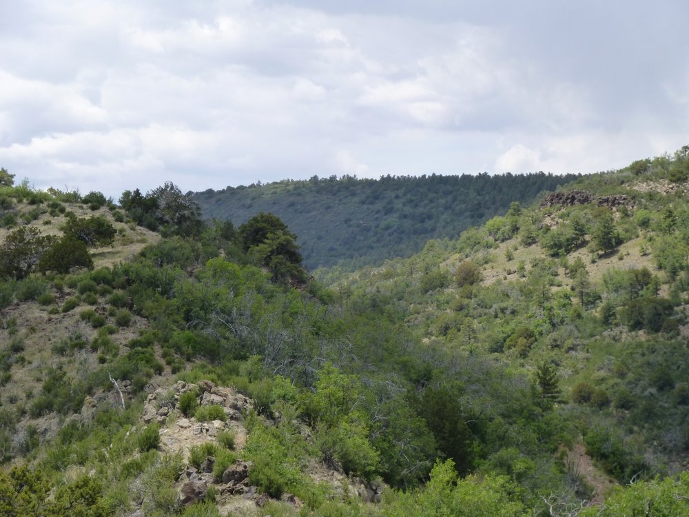
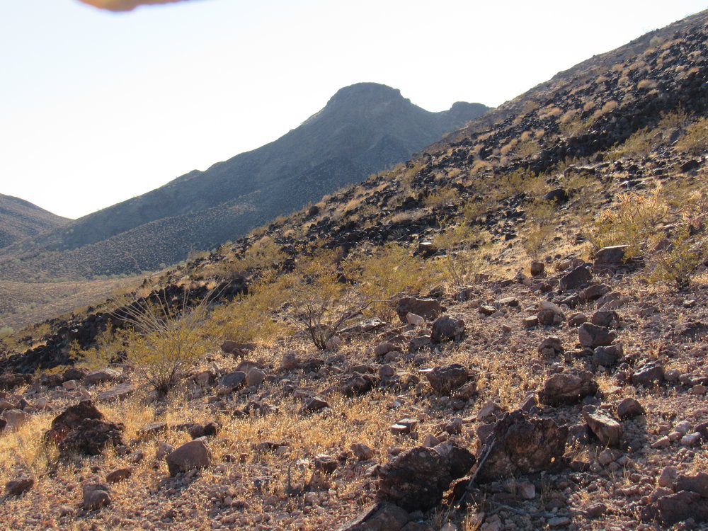
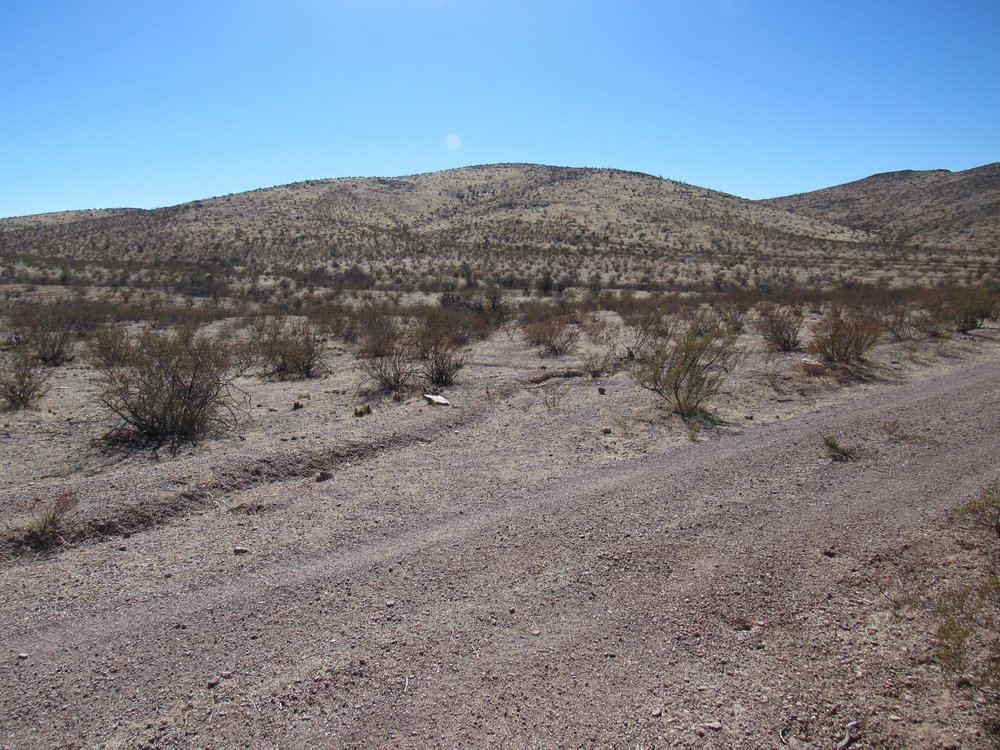
The first one of Arizona’s Black Hills I visited was back on September 7th of 1987. I went to climb something called Guthrie Peak. My reason for going there was that Guthrie happened to be the highest point in the Peloncillo Mountains, one of Arizona’s longest mountain ranges. Upon closer inspection of the maps, though, I discovered that the northern end of the range also carried the name “Black Hills”. Those hills were a sub-set of peaks that were a part of the larger Peloncillo Mountains. No problem, I’d seen such things before, so by climbing Guthrie I had climbed both the range high point and the hills high point. The area encompassed by the hills was quite extensive, about 15 miles by 15 miles, and included 20 or so peaks. By climbing Guthrie way back in 1987, I had already climbed the first of my Black Hills and didn’t even know it. Here’s a photo I took during the climb. It shows the rough road I walked to the top, with the summit in the distance.
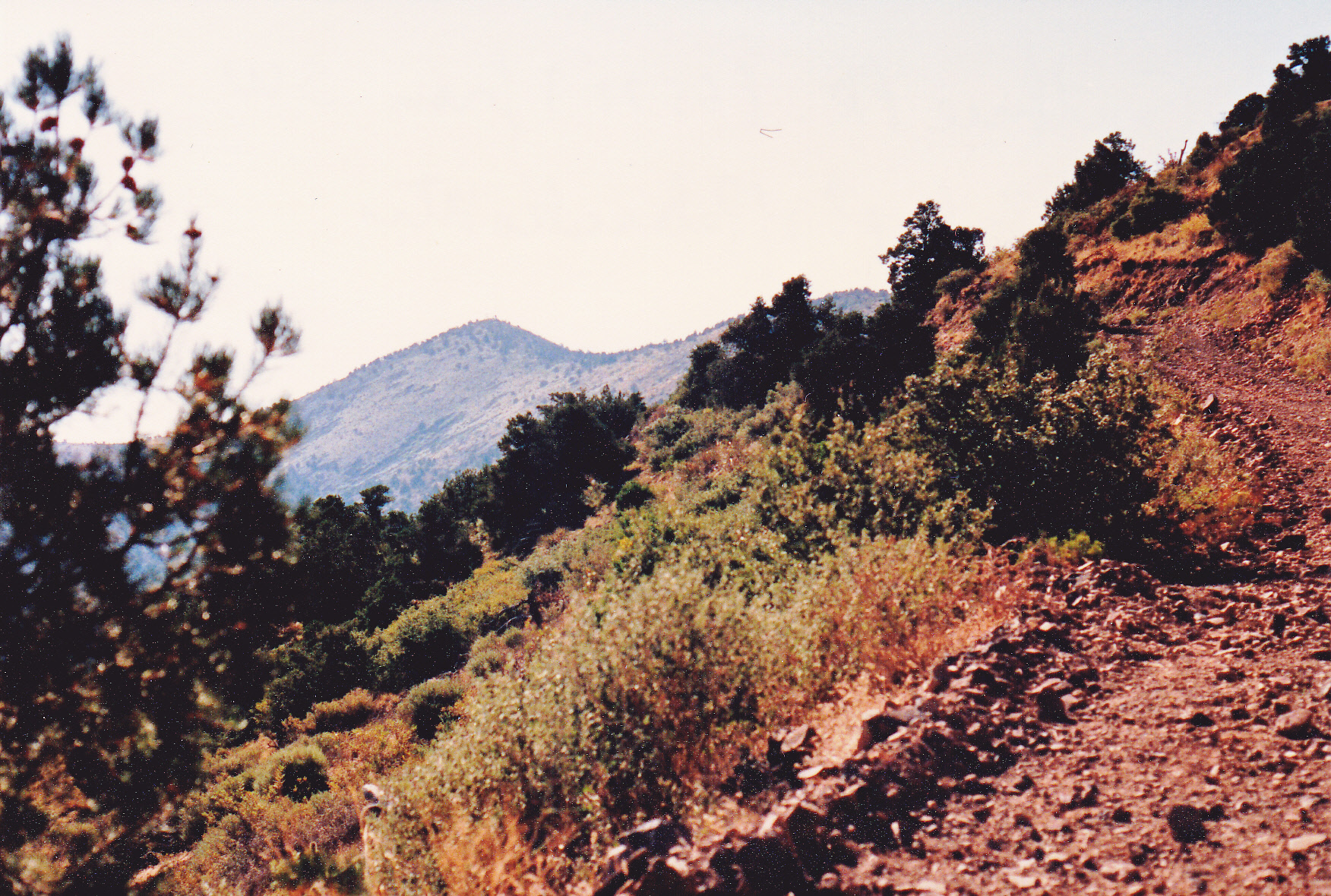
Looking northeast to Guthrie Peak
Fourteen years passed. One day in 2001, Dave Jurasevich called me and suggested that we meet and spend several days climbing some hills on the Tohono O’odham Indian Reservation. It seemed like a good idea, so we did. Aside from mechanical problems with my truck, we had a successful trip, climbing 11 peaks. Each of them represented the highest point of a set of named hills, and it turned out that of the 11, two of them were each part of a set of Black Hills. Yes, the reservation had 2 sets of Black Hills of its own.
The first one we climbed was on January 19th. This group sits to the north of Indian Highway 34, and a prettier group of peaks you’d be hard-pressed to find. There are only 4 of them, and the highest is Peak 2950. It’s a small group, stretching 4.3 miles N-S and a mere 2 miles E-W. This is a quiet place, in the western shadow of the Sheridan Mountains.
Looking east to Peak 2950, the high point.
Two days later, we were back in the same area and visited the other set of Black Hills on the reservation. These sit on the west side of the Aguirre Valley, and are dwarfed by the nearby North Comobabi Mountains. Their high point has an elevation of 2,655 feet, and stands only 260 feet above the road which passes by its foot. I need to use the word “their” somewhat loosely here, as there are a grand total of 2 bumps in this group. The other, slightly lower, is called Proctor Hill and sits 2 miles to the east of Point 2655. Once we had done this second of the Black Hills, we moved on to other climbs on the reservation.
A look north to Peak 2655
My records show that a mere 2 months later, I climbed in another of the Black Hills groups. I didn’t set out to do that on purpose, it just happened to be a nice peak that caught my eye and needed climbing. This peak was one of three in the group, and it had a name, Cerro Prieto Benchmark. Peak 4338 and Baldy Peak rounded out the trio This is a nice area, surrounded by miles of grazing land and cows-a-plenty. This set of Black Hills is about 4.3 miles by 2.4 miles in size.
The west side of Cerro Prieto
Many years passed, and it wasn’t until 2017 rolled around that I ended up in another of the Black Hills. Once again, it wasn’t the hills specifically I went to climb. Woodchute Mountain is a broad, gentle peak which happens to have a lot of prominence – I was working on the list of 2,000-foot prominence peaks in the state at the time, and it happened to be one of them. It’s almost 8,000 feet high and heavily wooded, so much so that you get no view at all from the summit. Here’s a glimpse of it as seen from a nearby trail.
That’s Woodchute, the dark one back there.
This set of Black Hills sits about in the center of the state, and whoever first named it decided that it must have been pretty important, as the name as shown on the topographic map seems to go on forever. Honestly, it is over 40 miles long north to south and about 25 miles wide. It is mostly a high uplift, and in all that area includes only about 30 widely-scattered peaks. There’s nothing else in the state like it in extent and vagueness, and about the only thing we know for sure is that its highest point is Woodchute Mountain.
In late 2020, long into the days of Covid, it dawned on me that just about the safest thing I could do was to go out and climb mountains. No germs, no people, just me and Nature. About that time, it also occurred to me that Arizona had all these sets of Black Hills and I had already climbed 5 of the 12. Why not climb the rest of them? – it’s not as if I had anything else better to do with my time. Besides, peakbaggers love nothing more than a good list to follow. There were a couple of them close to Tucson, so I thought I’d start my quest with them.
Signal Peak was one I’d known about for many years, but I’d always delayed heading in to it because I thought it’d be a difficult road to drive. It turned out to not be so bad. Thirty-five miles on pavement, followed by another 7 or 8 on dirt roads, got me in close. The back-country driving wasn’t so bad, and all of it could have been done in 2WD with high clearance. I was able to drive to within a single mile on the northeast side, which I did on November 23rd. It was a walk through pleasant, hilly country to reach the summit. There’s only the one peak in this Black Hills, and if you include all of its lower bumps, it’s almost 4 miles long and a mile and a half wide. Here’s a look at it.
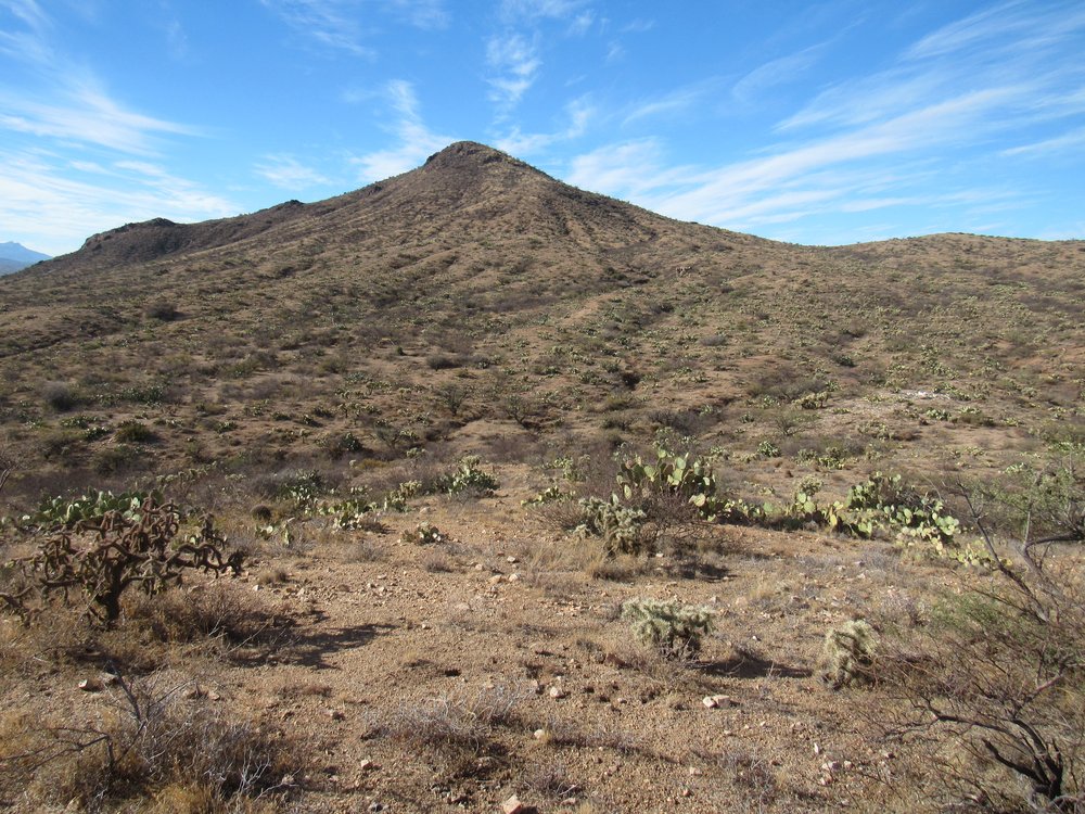
The northeast side of Signal Peak.
Five days later, on November 28th to be exact, I drove for almost 3 hours to finally arrive at the west side of the Sulphur Springs Valley north of the town of Willcox, Arizona. I parked on a quiet dirt road and made a quick climb of Peak 5130. This group consists of only 2 peaks, and if you include all the little bumps it stretches out along 5 1/2 miles. It has the slightly different name of Ash Creek Black Hills, but I included it in my project anyway. While I was parked to do the climb, the rancher who owned the land arrived and was waiting for me by my truck when I got back down. I had to apologize profusely, not knowing it was private land, but the owner was a nice guy and forgave me.
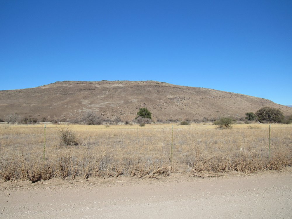
The south side of the peak.
A week later, I was back at it, this time with fellow peakbagger Andy Martin. Since Covid was still scouring the land, we did a socially-distant climb together. Dr. Fauci would have been proud! We went in separate vehicles, wore masks and kept a discrete distance between us at all times. A small ridge near the town of San Manuel bore the name “Black Hills”, although some sources refer to it as the “Little Black Hills”. It’s little alright, just over a mile long and half a mile wide. Its highest point stands at 3,442 feet and only rises about 160 feet above the surrounding desert. The picture shows its shadow as seen from the top at sunrise, with the northern end of the Santa Catalina Mountains in the distance.
Looking west
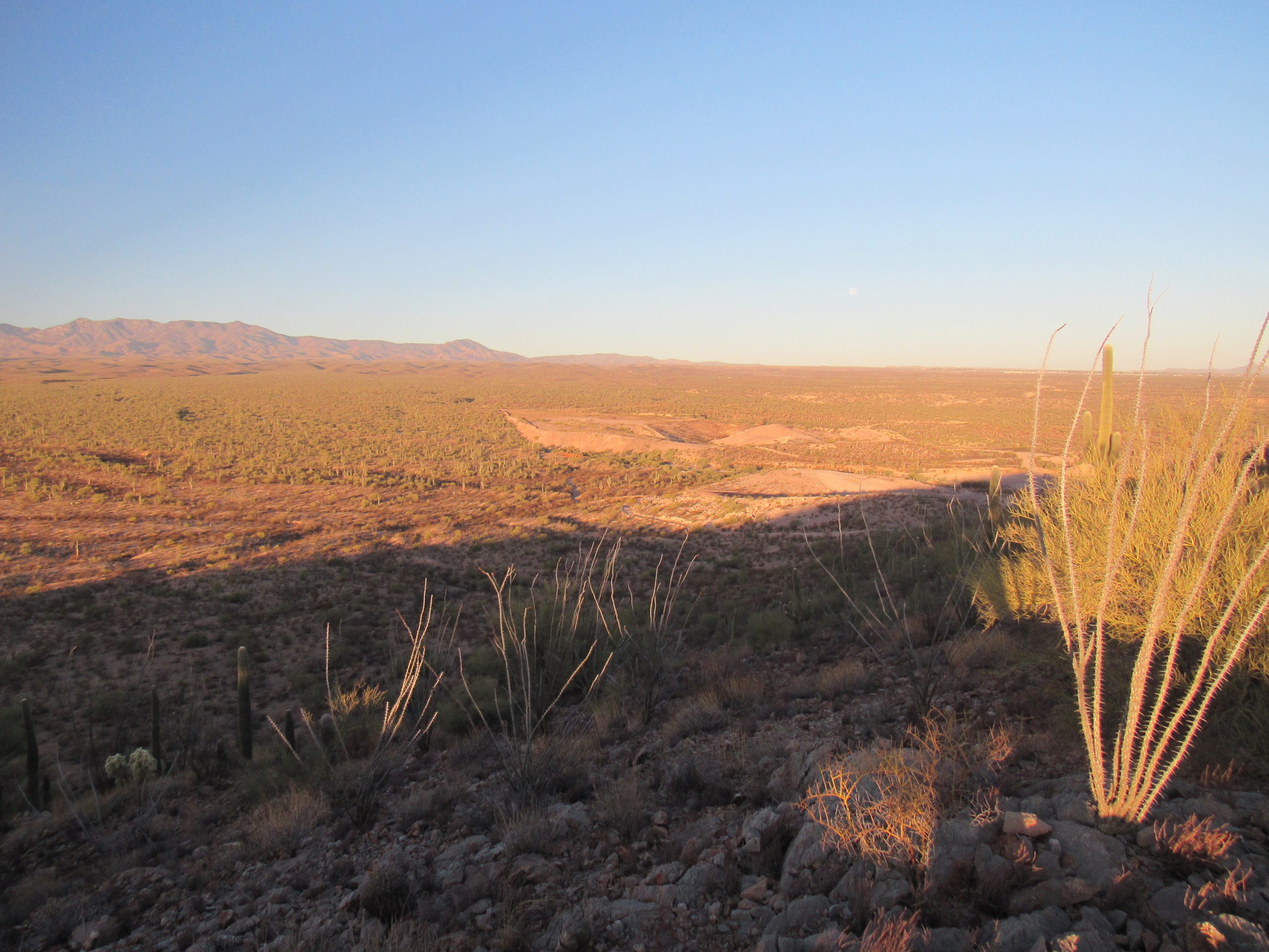
Well, that was 8 of the 12 climbed. What next? Hmmm, there was one that I’d been considering for some time, but I didn’t know if I was up for the challenge. It would be a stealth climb, going to a place where I wasn’t allowed to go. I pondered this one for a full 2 weeks before I felt I was ready to make the commitment. Packing my truck for several days of camping, I headed out with everything I needed on December 14th. It was a long drive to get to where I’d start, and by sundown I was positioned where I needed to be. It was a restless night, worrying about how things would go on the morrow.
The next day dawned clear and cool – in other words, perfect weather for a good stealth climb. I had brought a mountain bike with me on this trip, planning to use it to cover a lot of miles on military roads that were closed to the public. At the last minute, though, I had a change of heart and decided to break every rule in the book and drive those miles in my truck instead. I’ve gotta tell you that I was on pins and needles, paranoid as can be, as I drove deep into military territory, completely forbidden to the public at all times. I finally hid the truck in a remote, vegetated wash and set out on foot. The goal was a climb of Peak 1639, the highest point in another set of Black Hills. The only picture I have of the peak is this poor one.
That’s the north side of the peak, poking up behind the ridge.
Six hours on foot was spent doing this one, and I was glad to be done. There were six peaks in those Black Hills, tightly clumped together in a circle about 2.3 miles across. Climbers had visited only 3 previous times. Once back at the truck, I drove like hell to get off the military land, and breathed easier once it was all over.
On the same multi-day trip, I tagged one more of the Black Hills. This small ridge was less than a mile long, and rose to 2,700 feet. It sat about 5 air miles north of the town of Wickenburg and was comprised of a single peak. Here’s a look back to it from a nearby road.
The Black Hills north of Wickenburg – the 2 bumps just left of center.
Ten down, two to go. The next set of Black Hills I tried was again in the Sulphur Springs Valley, this time about 55 miles north and west from the town of Willcox. This one looked like a no-brainer. A good dirt road led from the Eureka Ranch and headed up almost to the top of my peak. I stopped in at the ranch on January 5th of 2021. It was a fine morning, and I soon found myself speaking to the owner. Pointing up to the nearby mountain, I told him I’d driven 3 hours from Tucson and politely asked his permission to drive 5 miles up his ranch road and climb the peak. “Nope, sorry” was his immediate reply. “I had to pay the Forest Service a fee of $50,000.00 in order to secure the sole right-of-way across my land up that road into National Forest land, and if I give you permission to cross my land, then everybody else will want to do it as well and I’ll never hear the end of it.” He then went on to tell me that there was a back way in, all of it legitimate and using Forest Service roads. It meant going a long way around, but it would get me to my peak just the same. I told him I’d give it a try and left.
All the rancher had told me was where to find the start of the Forest Service road that would get me to the peak. It bore a lot more study, as far as I was concerned, so in the comfort of my own home with a cold beer in hand, I studied satellite photos until I finally thought I could see a way in to the peak. I printed out some topo maps, marked on them what I thought would be a reasonable route, and then on January 5th I headed in. Records indicated only 2 previous climbers had been to the summit – one was deceased, the other had climbed it 30 years ago and I couldn’t reach him, so I was left to my own devices. This sign adorned the gate at the start of the drive in.
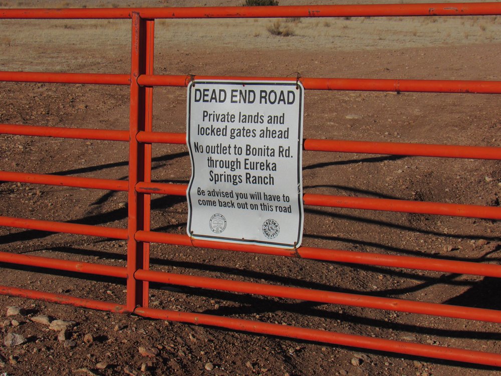
The warning.
Well, to make a long story even longer, the drive in to the peak was nothing like I expected. It was 6 miles in a straight line, but 10 miles to actually drive it. A number of times, roads I followed ended at locked gates where they crossed from the national forest back on to private ranch land. I’d have to backtrack and try another route. I almost gave up when I came to the first big hill which dropped steeply down into a canyon. As I stood there at the top of the hill looking down, I thought “This can’t be right.” I locked my hubs and put the transfer case into 4WD and down the hill I went. It was one of those hills that makes you wonder “If I go down this thing, will I be able to drive back up it again?” That was only the start of the excitement. My route crossed a series of flat mesas, with canyons before and after each one. All told, there were 12 hills that needed 4-wheel-drive, and 12 gates to pass through. With all of the route-finding, it took me a full 4 hours from where I entered the national forest until I reached the base of my peak. The climb itself was only an hour, round-trip. Here’s what I found on the top of what they call Eureka Mountain.
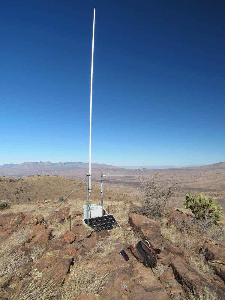
Some radio stuff
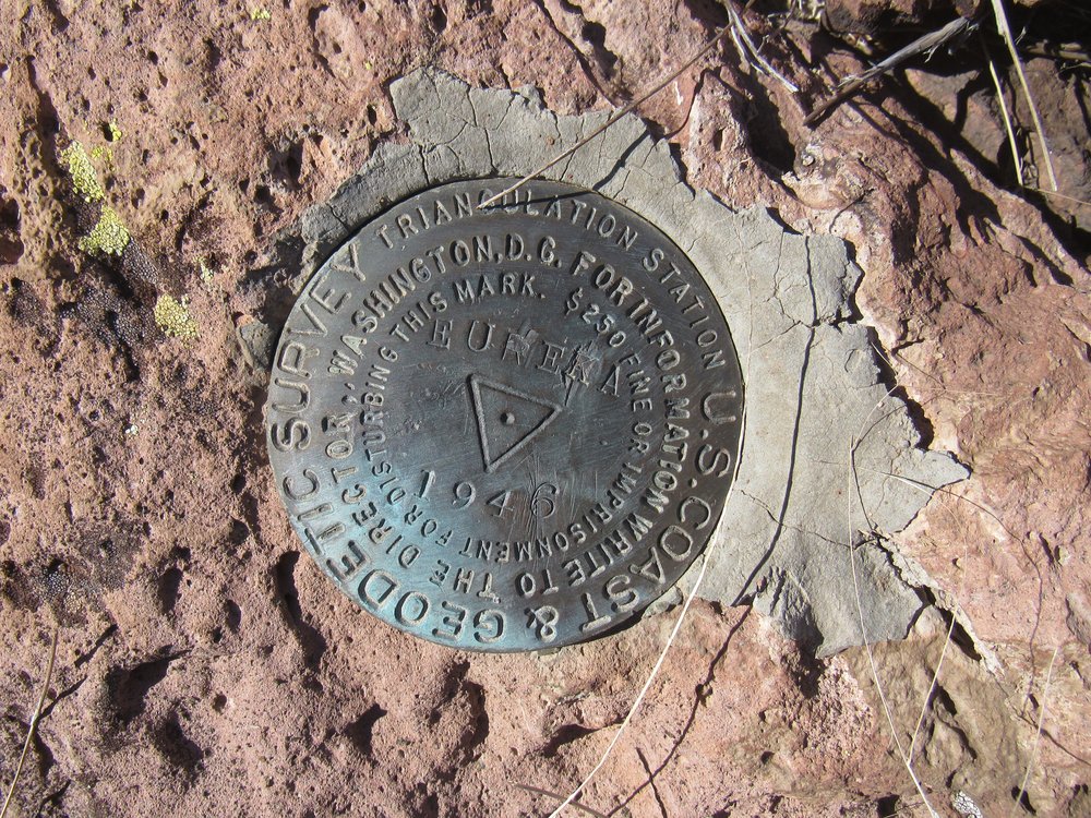
The benchmark on the summit.
I could plainly see the Eureka Springs Ranch down below, where the rancher lives who wouldn’t let me pass.
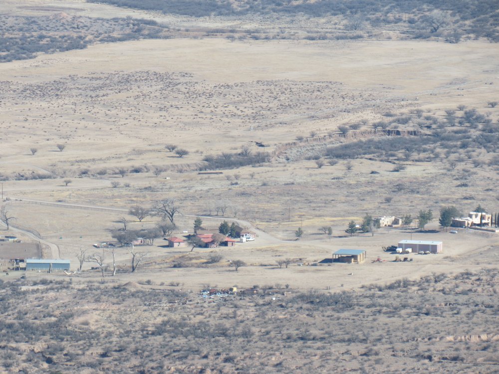
The ranch
Here’s a telephoto shot of the Large Binocular Telescope atop Hawk Peak, which was 20 miles away to the east. It’s one of the most powerful scopes in the world, and sits at an elevation of 10,627 feet above sea level.
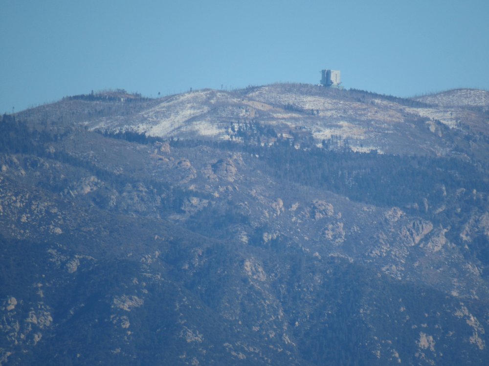
The LBT
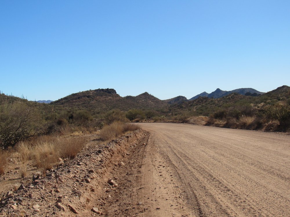
This set of Black Hills only has 2 actual peaks, along with a few lesser bumps. They are strung out over an uplift stretching just over 5 miles. Once back at my truck, it was a much easier drive out – I knew the exact route, now well-marked on my maps. There was still drama negotiating the rough hills in the canyons, but it all worked out fine. Back at the start of the drive in, I took this picture of the hills in the distance. It looks like a pretty benign drive over to them, doesn’t it? It’s nothing of the sort.
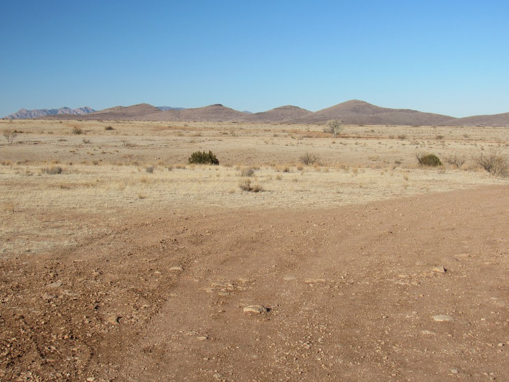
Looking north to the Black Hills
There was only one left to do to finish off the dozen. It sat just north of the village of Fort Thomas. While on a multi-day camping/climbing trip, I drove in and parked just north of the peak on February 19th of 2021. This set of hills was just a couple of gentle bumps stretched along 2 miles of desert. A quick climb of 300 vertical feet took care of things in under an hour.
The north side of Peak 3689
Peak 3689 was the last one of the dozen Black Hills high points. I know it doesn’t look like much, but it still felt good to stand on top. As I strolled down from the summit, it dawned on me that I was finished. It’s fun putting together a little project like this one. Two of the peaks were more challenging than the others, but for different reasons.
Peak 1639 was the only one that could be truly considered remote. Miles inside an off-limits military base, a decent climb in its own right, rarely-visited, a true stealth climb in every sense of the word, this one has it all. As a peakbagging prize, this is a good one, but few will have the nerve to try it.
Eureka Mountain would have to be the other one that really left an impression on me. The approach is everything on this one. It’s not remote, and the climb itself is fairly trivial, but the drive in and out will leave a clear memory with you for a long time.