
It was the summer of 1965, and I had just finished my first year of studies at the university in Vancouver, British Columbia. Fortune had smiled upon me, and I was able to land a job at a sawmill in the mountain town of Golden, BC which would allow me to pay for my next year of school. Golden would be my home from late April to early September, while the job lasted. Sadly, I had no vehicle so couldn’t really go anywhere on my weekends off unless I hitched a ride.
That was the case one weekend in August. Bud was one of the guys working at the mill and staying at the same boarding-house as was I. We had hitched a ride to Banff and spent the day enjoying the town, then started back in the afternoon. We were hitching at Castle Junction (known as Eisenhower Junction back then), about half-way between Banff and Lake Louise along the Trans-Canada Highway, when a car pulled over to pick us up. Imagine our surprise when we found ourselves in the company of three lovely nursing students from Ontario. As we rode along, they told us they were camping near Emerald Lake and how much they’d enjoy it if we were to join them for several days of bacchanalia. They had plenty of food, booze and everything else needed to show us the time of our lives. We had barely half an hour to make a decision before they reached their turnoff. Our shift at the mill would start at 1:00 AM, only hours from then. Well, we chickened out, afraid of losing our jobs if we didn’t show up. Truth be told, the real reason was probably that our 18-year-old virginal selves were simply too shy to deal with the situation like any normal red-blooded males would have. They dropped us off when they reached their turnoff and we continued hitching the last 35 miles to Golden. Yes, we made it to work on time, but secretly regretted our decision for a long time. Bottom line, I almost got to visit Emerald Lake for the first time in 1965, but I had to wait another year to actually see the place.
One year later, I was back in Golden working at the same sawmill. This time, my friend George, a student who was staying at the same men’s dorm on campus, was also working at the mill. I had a motorcycle and we used it to advantage, heading out of town every weekend and visiting all the best places in the nearby Canadian Rockies. One of the first places we went to, because it was so close, was Emerald Lake. The road to the lake had been plowed, so we were able to get to it with no problem, although May 15th was pretty early in the season. In this part of the world, snow stays around for a while, as seen in this photo. Here’s George with a pair of snowmobiles alongside the road.
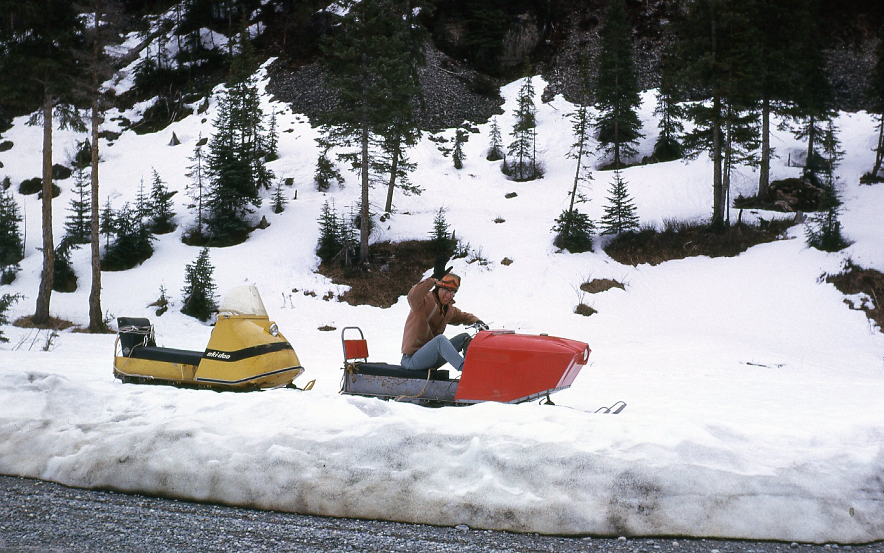
Snow
Yoho National Park was established way back in 1886 and was the second of Canada’s national parks to be created. In order to attract tourists to visit the park and stay a while, Emerald Lake Lodge was built a few years later. The transcontinental railroad made a stop in the nearby village of Field, only 8 miles away, so access to the lake was pretty easy. When we visited on May 15th, the lodge was still closed for the winter. As you can see here, there was still plenty of snow by the front door.
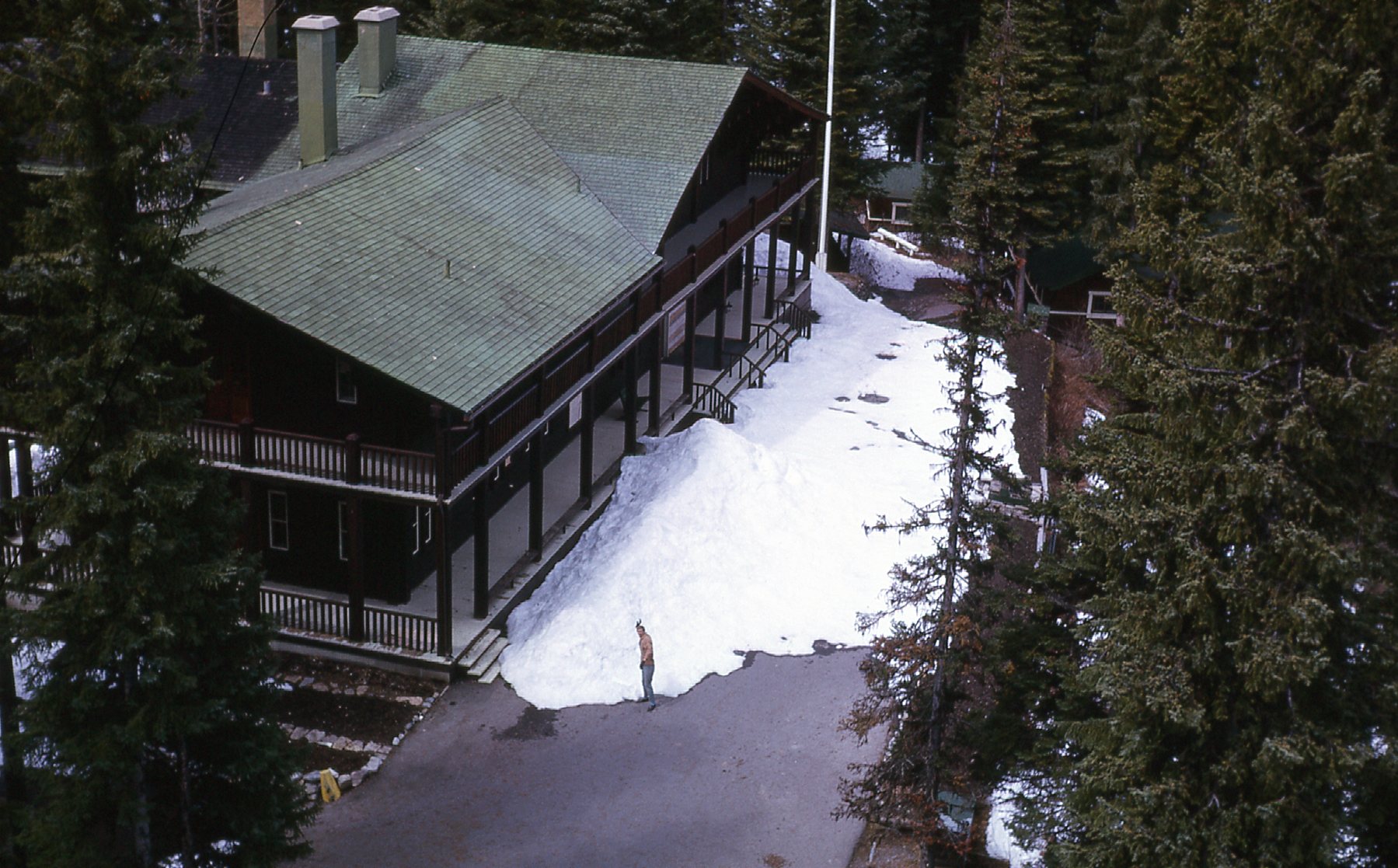
Emerald Lake Lodge
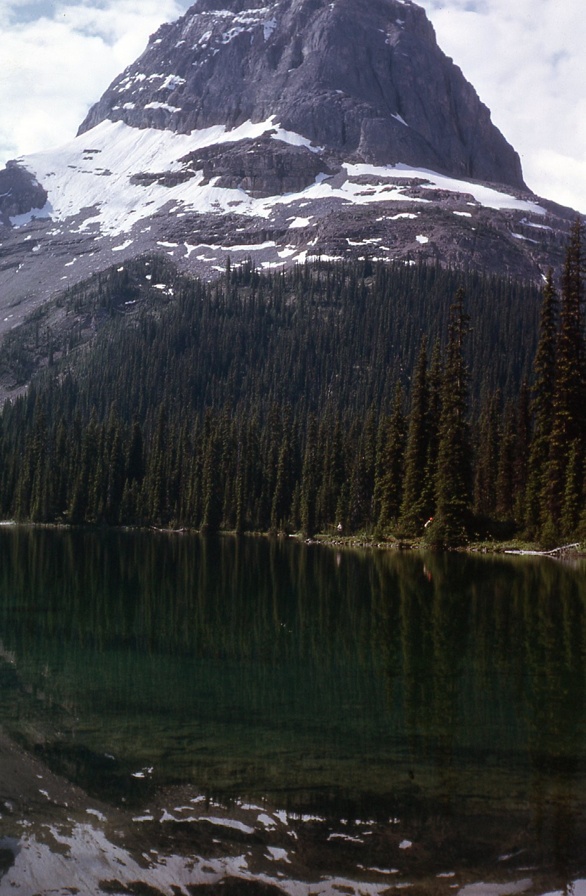
This look towards Yoho Pass shows that the lake was still frozen in mid-May.
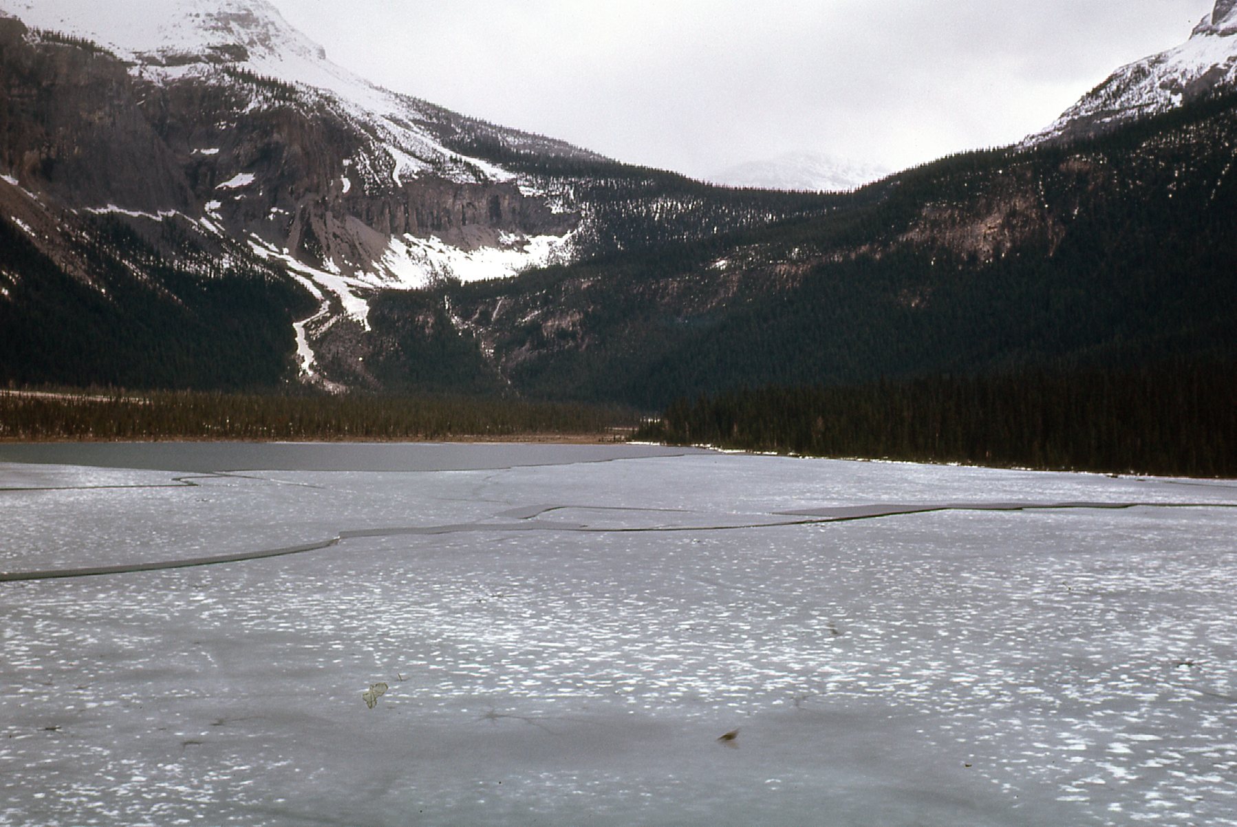
The frozen lake
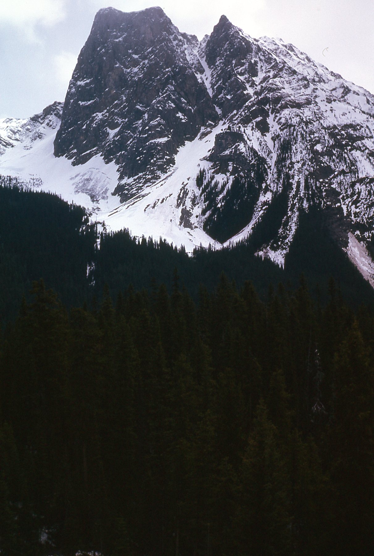
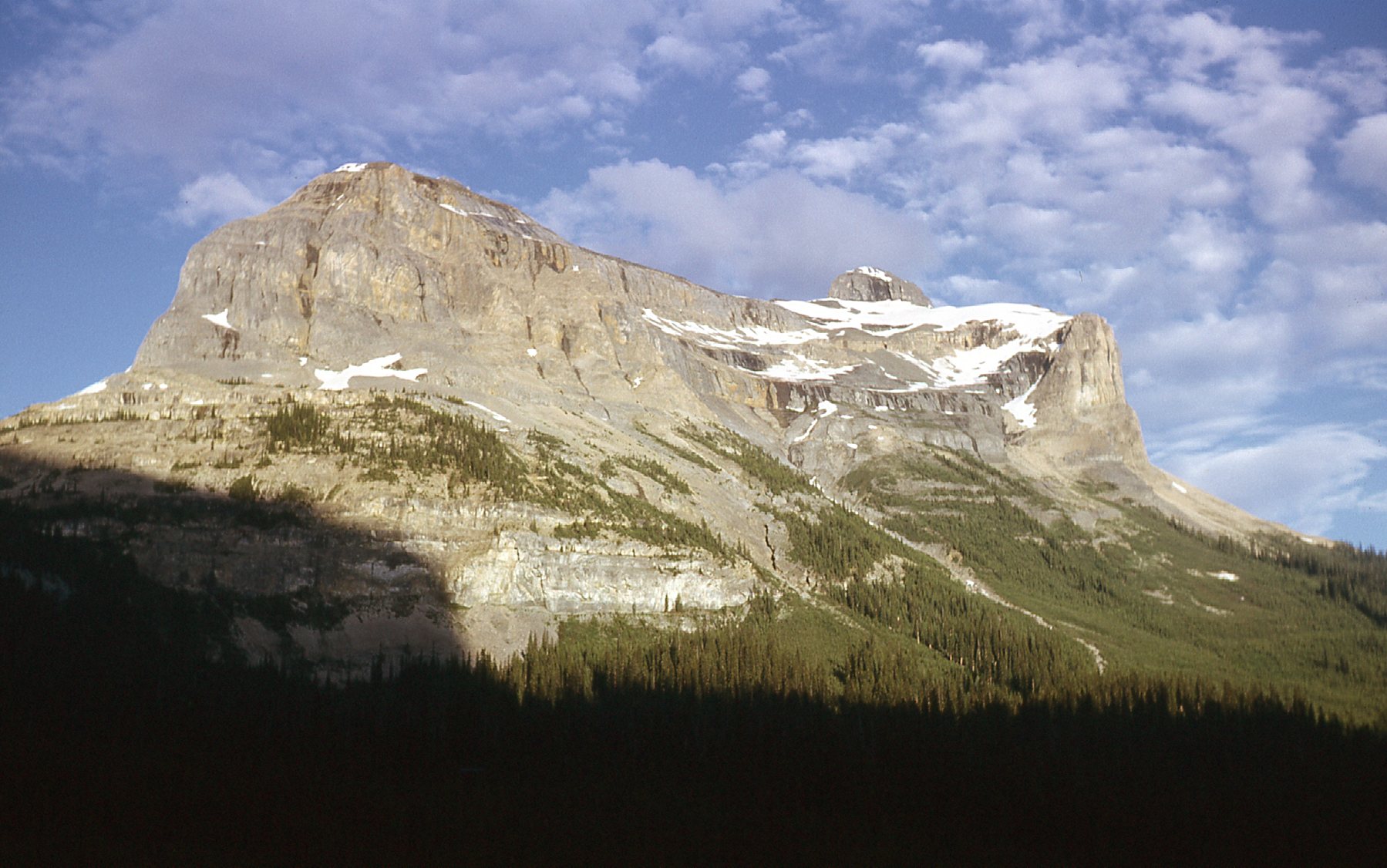
Here’s nearby Mt. Field
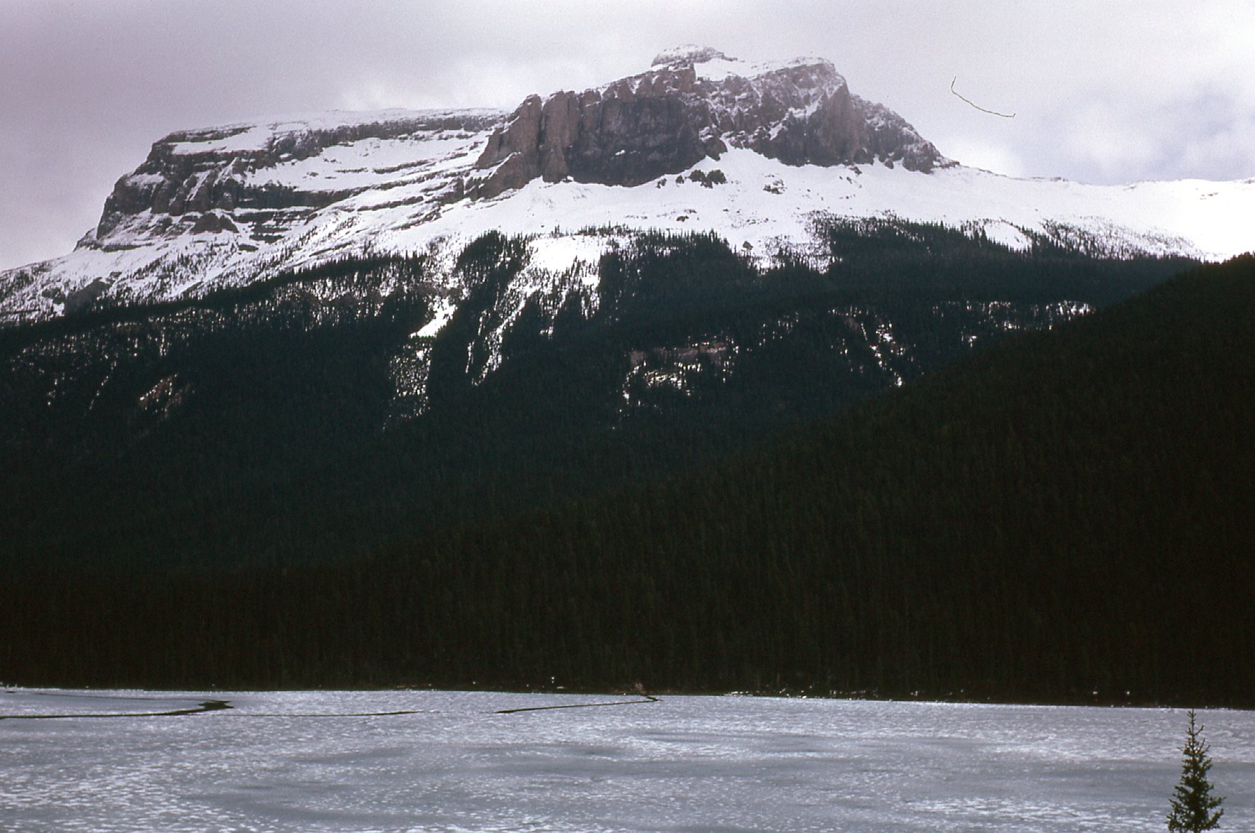
Looking east to Mt. Field, elevation 8,671 feet
I also wanted to show you this view of Mt. Burgess, and it’ll play a prominent role later in the story.
Looking southeast to Mt. Burgess, elevation 8,527 feet
We didn’t stick around too long at the lodge. It was closed, and all of the trails were still deep in snow, so we headed back out to the village of Field. Here’s a view looking over it to Mt. Dennis which looms above.
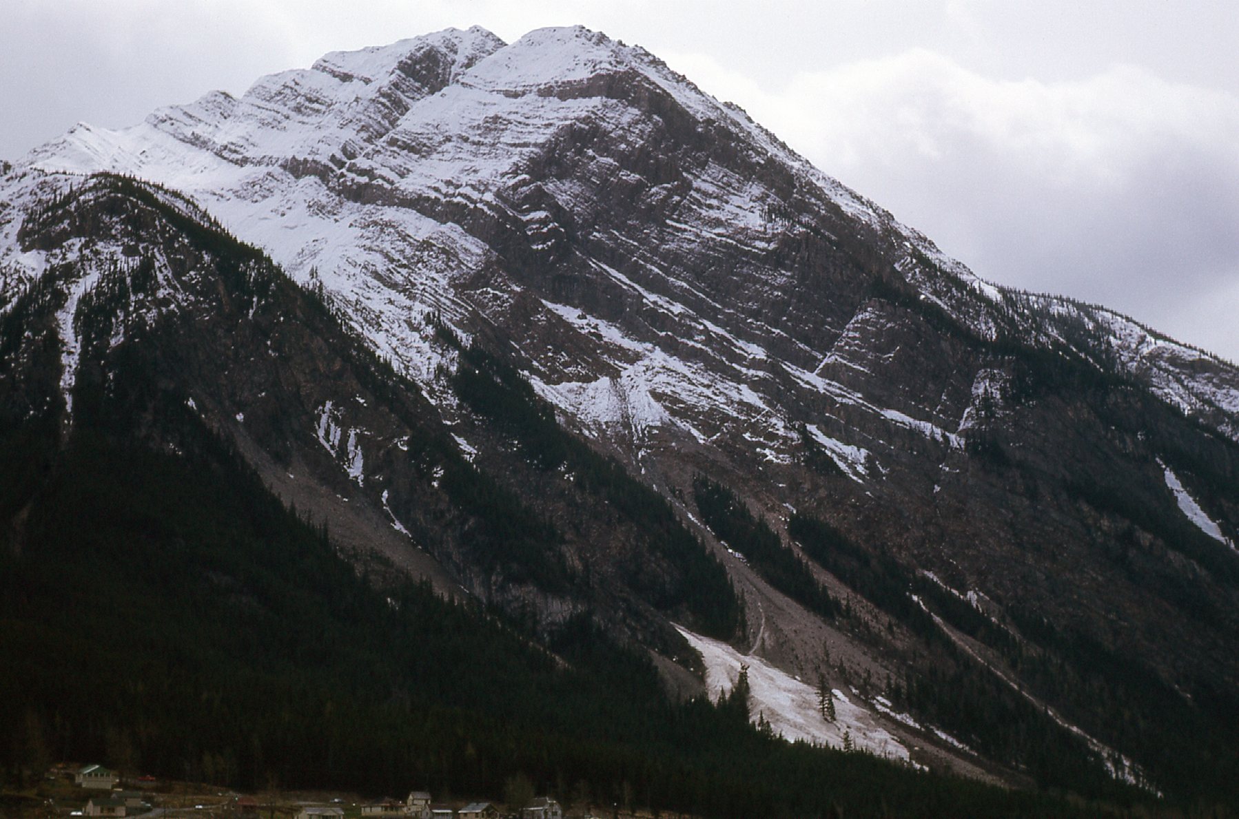
Mt. Dennis, elevation 8,363 feet.
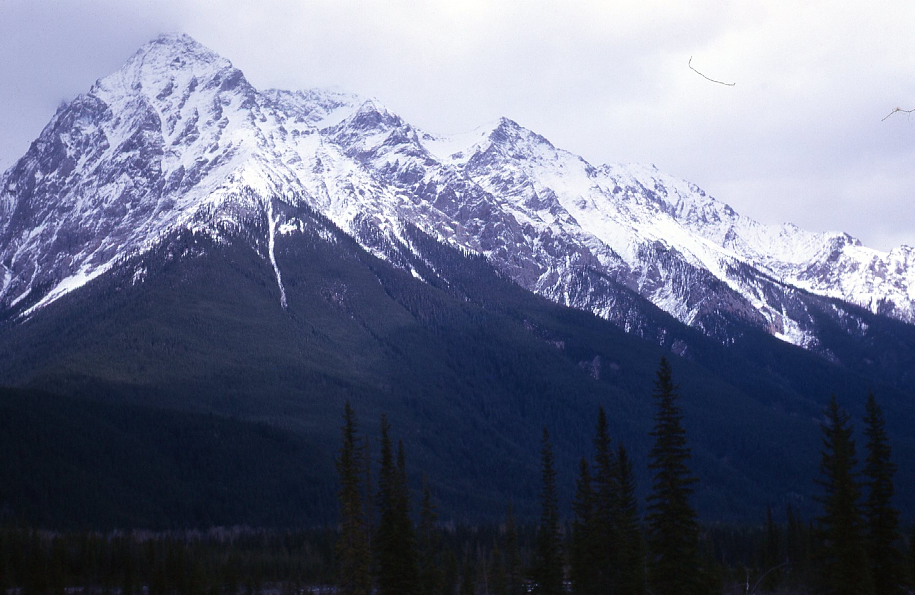
On the short ride back to Golden, we enjoyed this view of Mt. Vaux (10,860 feet elevation).
The west side of Mt. Vaux
We also had this wintry view of Chancellor Peak.
Looking southeast to Chancellor Peak, with an elevation of 10,715 feet.
George and I managed to get out and explore much of what the national parks offered during the course of the summer – Banff, Jasper, Kootenay, Glacier – they were all nearby, and the good old BSA 350 got us where we needed to go. Once July rolled around, the snow had melted off in all of the lower country, including the Emerald Lake area, so we decided to go back for a better look.
At 5:00 PM sharp on July 22nd, we got off work at the sawmill, hopped on the bike and headed straight to Emerald Lake. We left the bike in the parking lot near the lodge and headed out on the trail which followed the west shore of the lake at about 4,265 feet elevation. As we walked along, we had this beautiful view of Mt. Burgess – remember how I mentioned earlier in the piece that we’d come back to this peak? This is a familiar image to those of us of a certain age, who might remember an earlier series of Canadian currency called the Landscape Series. This was the picture on the back of the 10-dollar bill. Here’s a link which shows all of the reverse sides of those bills. When you open the link, scroll down about halfway through the article to the section entitled “Reverse”, where you can see all of the images that graced the money that I saw as a kid growing up in the Great White North. Here’s the photo I took at 7:15 PM that evening – from a slightly different vantage point than that seen on the banknote, but pretty darn close. I apologize for the light that leaked in to the film on the left side.
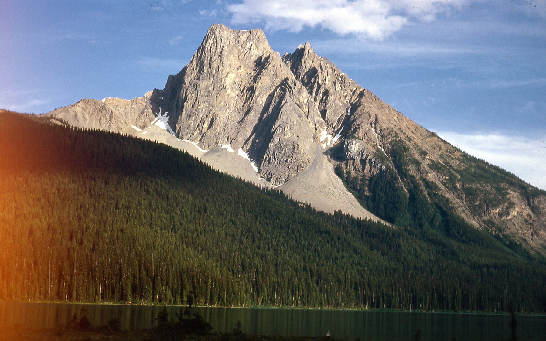
Looking southeast to Mt. Burgess.
It was a beautiful evening, and I took a few more photos as the trail climbed higher. This one was from a few hundred feet above the lake.
Looking south over Emerald Lake
This one looks east to Mt. Wapta (9,114′) at 8:00 PM.
That’s Mt. Wapta on the left and Mt. Field on the right
Here’s a view from 5,200′ looking south over the lake.
Looking south on a fine evening.
After a climb of about 1,700 feet on the trail, we arrived at Yoho Lake in about 2 hours time. It was also known as Summit Lake back then, and sat at just under 6,000 feet elevation. There was a log cabin there in Yoho Pass, sitting on the shore near the north end of the lake, available to anyone to use at no charge. It had bunks and a wood stove, and was roomy and comfortable. We spent a comfortable Friday night there. The only disruption was a porcupine gnawing on the cabin at 4:00 AM.
The next morning, we made ready for a long day’s outing. Here’s a picture I took from the cabin, looking south across the lake to Wapta Mountain. If you look carefully and zoom in along the shore, you can see a fisherman in white with his pole, and someone else over to his right.
Yoho Lake
The trail headed down the west side of the lake, and once we reached its south end I took this photo looking back. It shows the cabin where we stayed, and as I write this a full 55 years after George and I were there, the Yoho National Park administrators tell me that this may be the only surviving photo of the cabin. Michael Peak is 8,862 feet and rears up behind on the right. Another fisherman can be seen in front of the cabin.
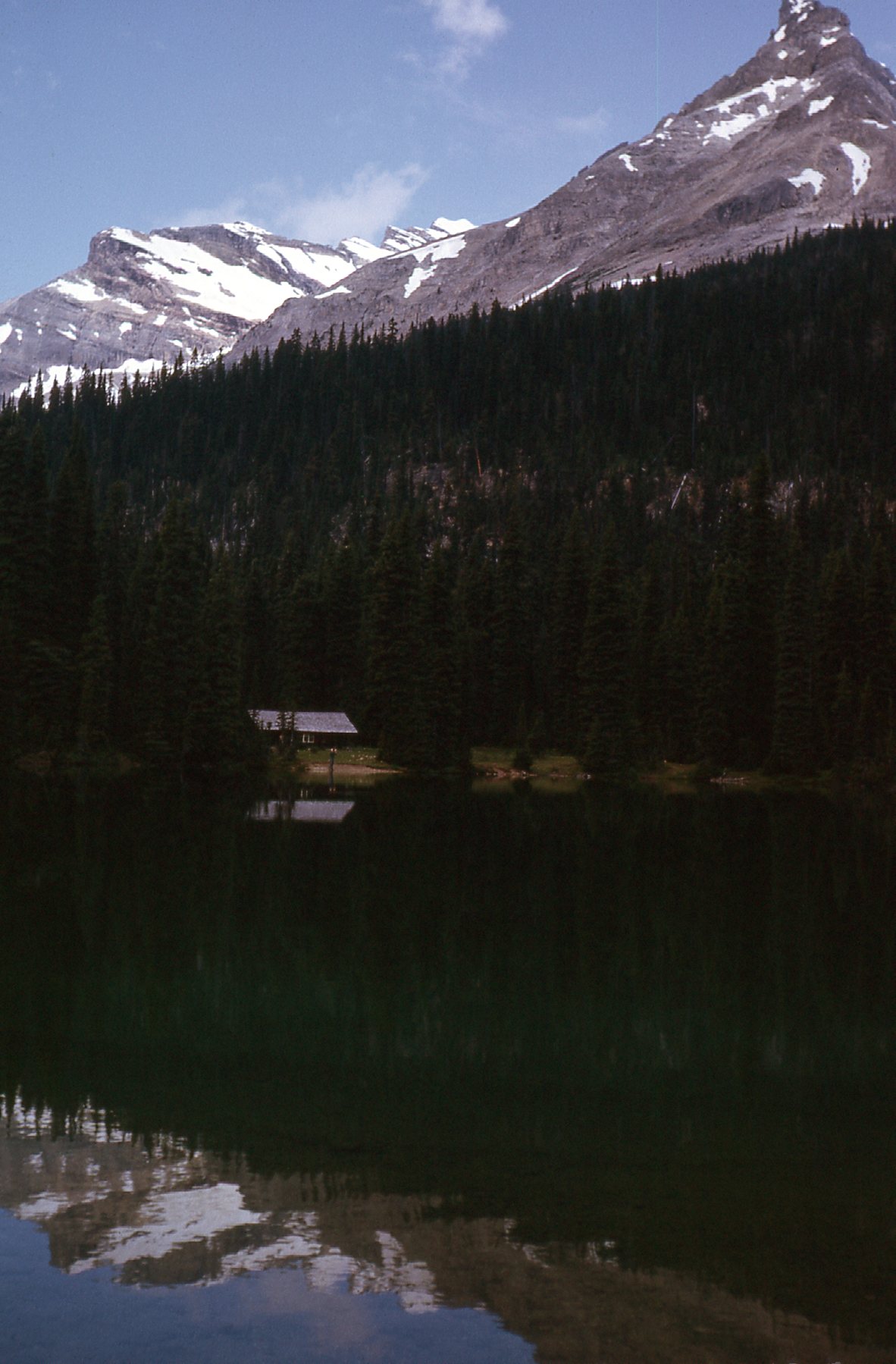
The cabin at Summit Lake, with Michael Peak in the background.
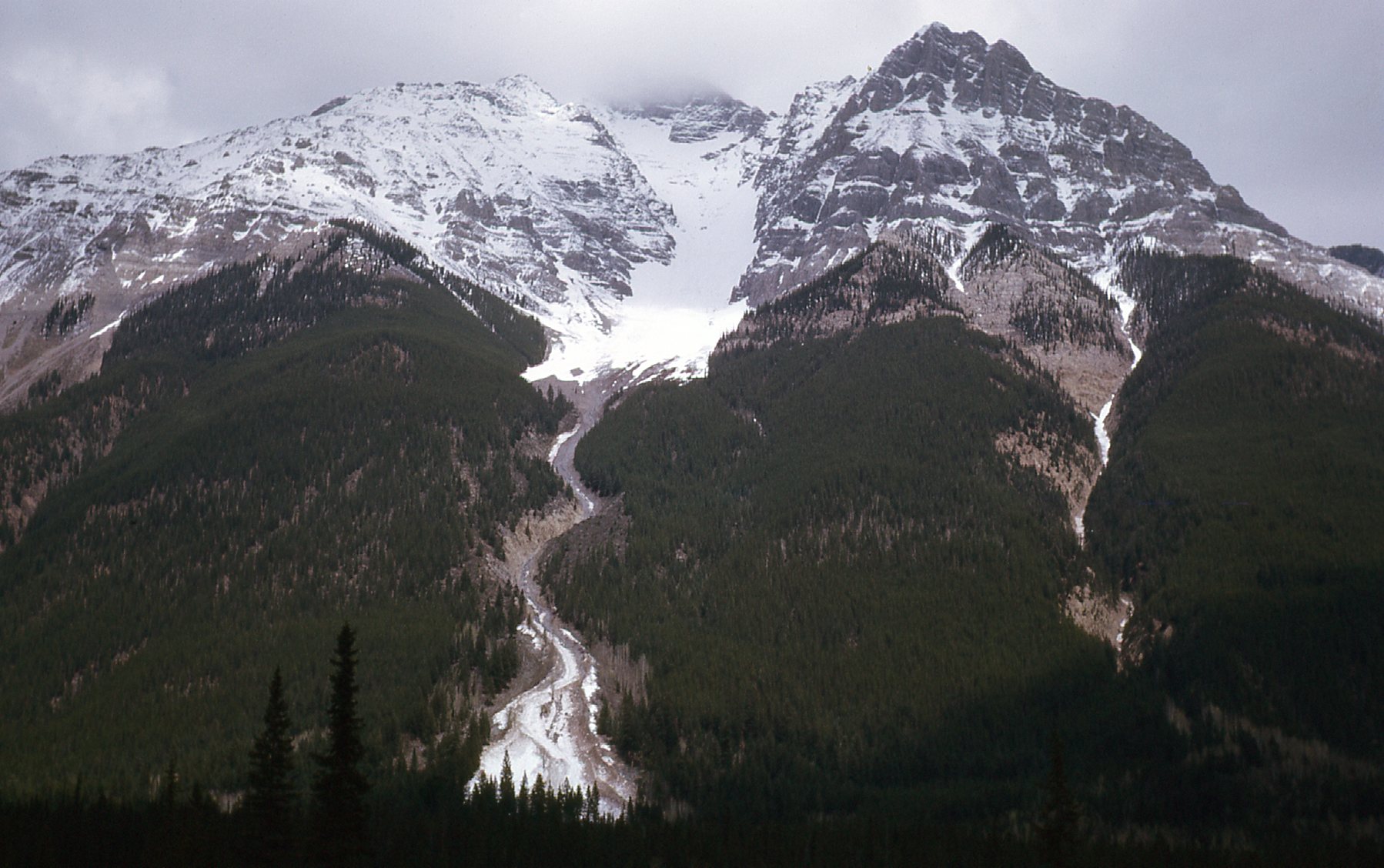
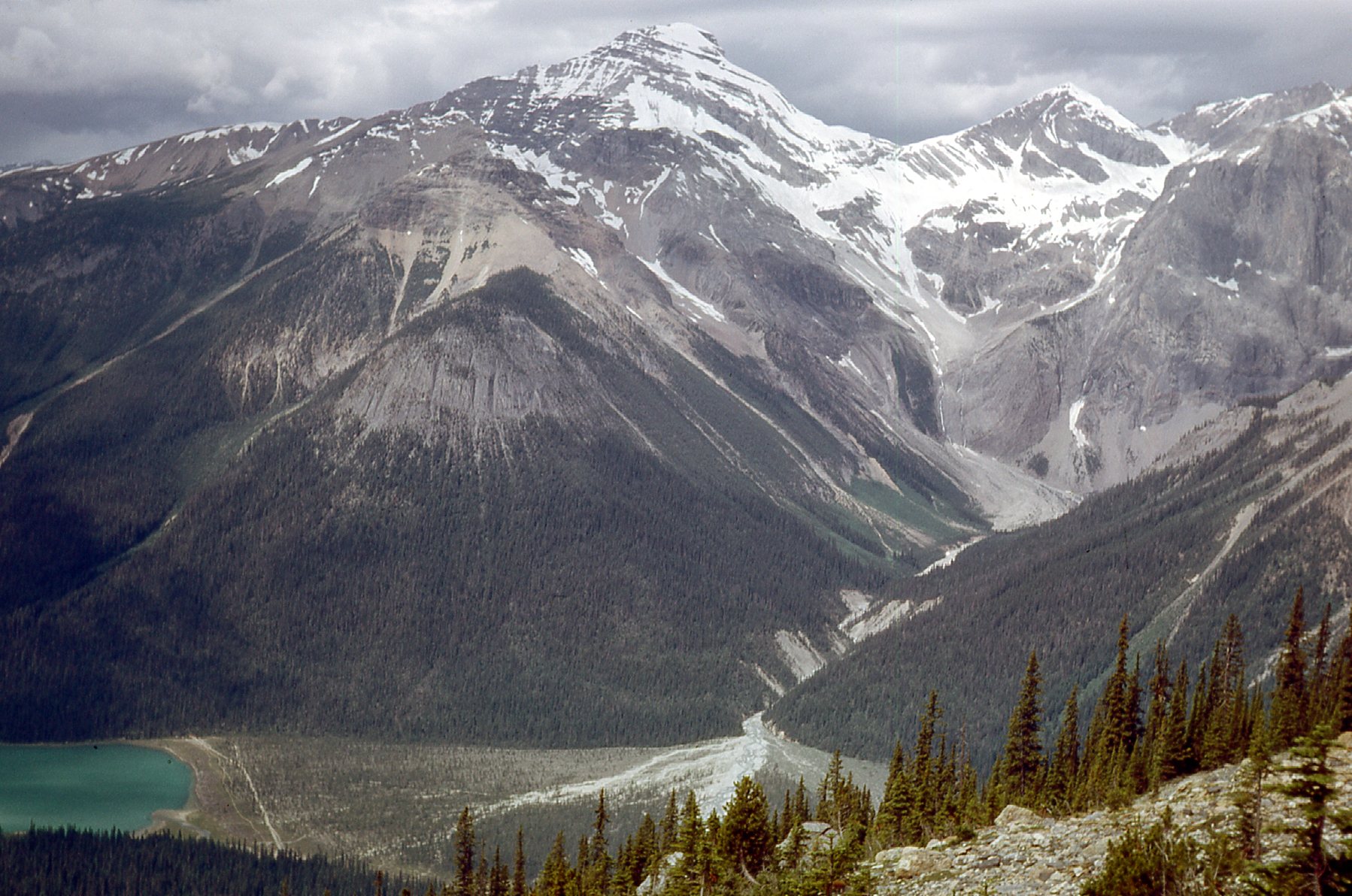
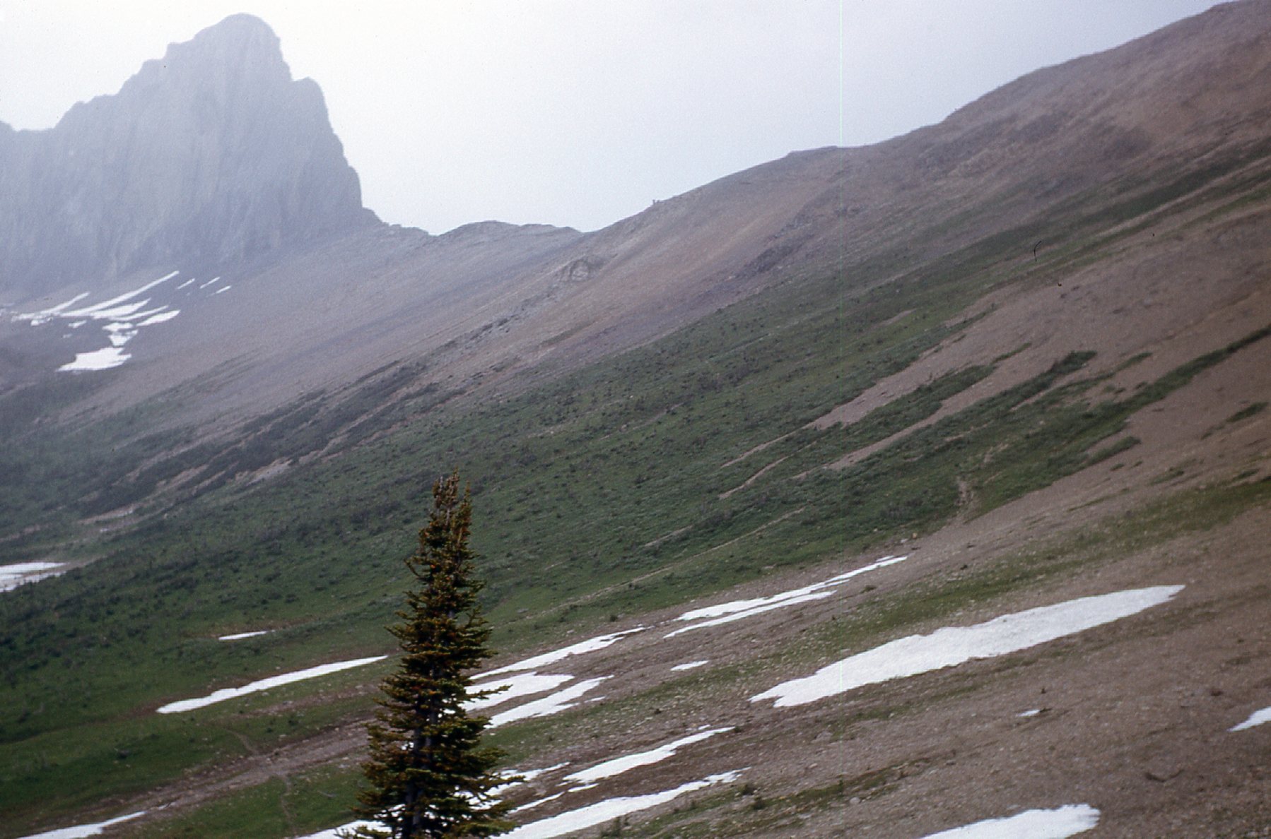
Today, we were going to travel along what was called the High-Line Trail. This was something we were really looking forward to. Eventually I became a geologist and George, a geological engineer, and you’ll see why traveling along this trail meant a lot to us both. It was around 10:30 AM when I took this next photo. That thin ribbon of a waterfall drops over 3,300 feet from the toe of the glacier down to the trail below in the lower left corner.
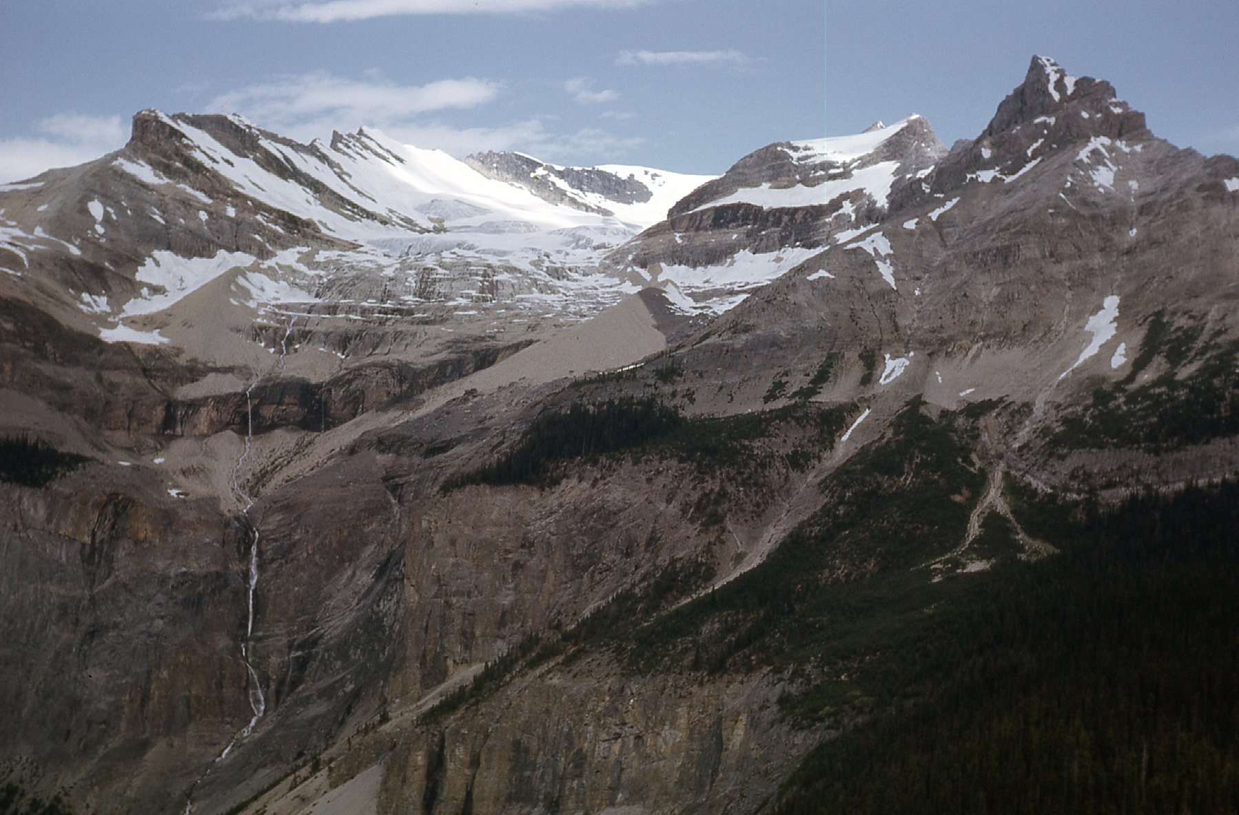
Looking up at Michael Peak on the right, the President Range on the left and center, and what was known as the Emerald Glacier.
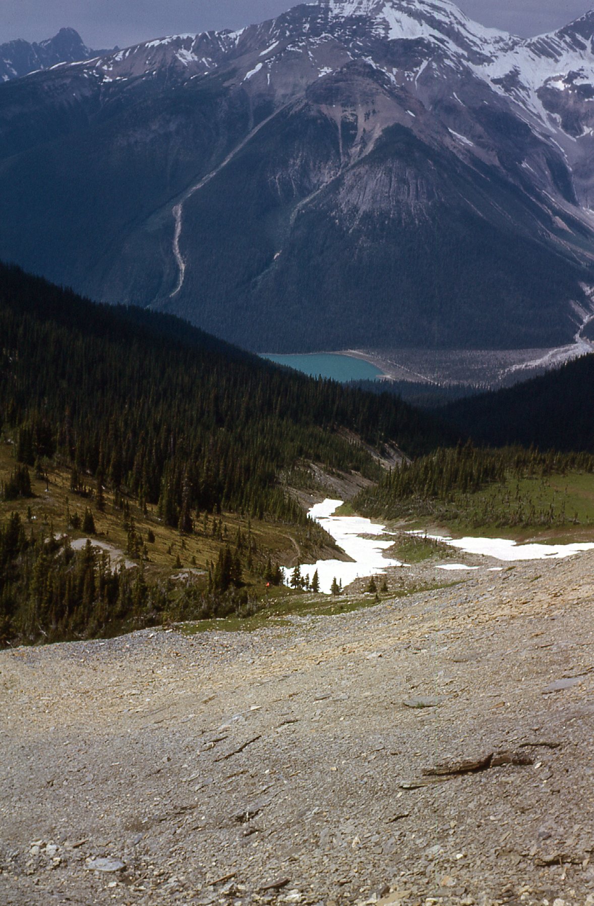
The weather looked somewhat iffy as we continued. Only half an hour later, here was our view from 6,700′ looking down on to Emerald Lake.
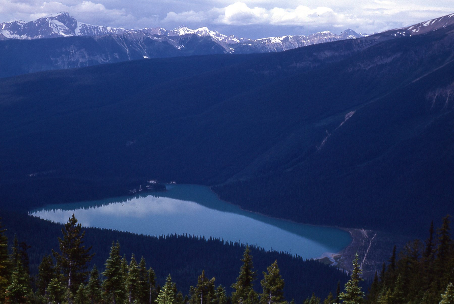
Emerald Lake
We passed below a line of huge cliffs.
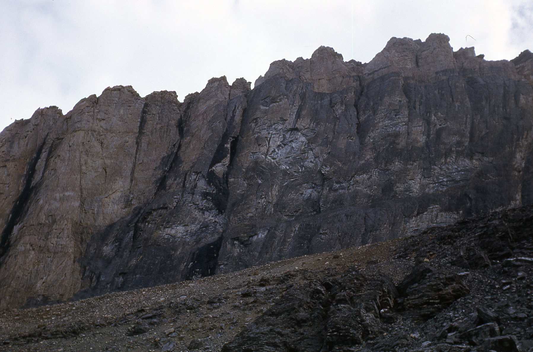
Along the High Line Trail
A little over a mile from the cabin, the trail curved to the southeast and we had this look at Mt. Burgess from around 7,000′.
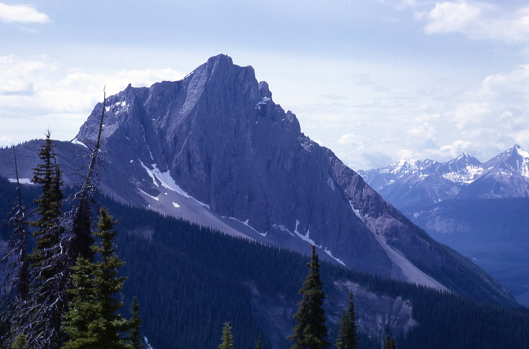
Looking south to Mt. Burgess
The views were open and expansive from the trail, like this one looking west across the valley. That’s Emerald Peak (8,862′) in the center, and Mt. Carnarvon (9,994′) over on the right.
Looking west from the trail.
Here’s another glimpse of some interesting geology, taken at noon from 7,000′ on the trail as it crossed Wapta Mountain.
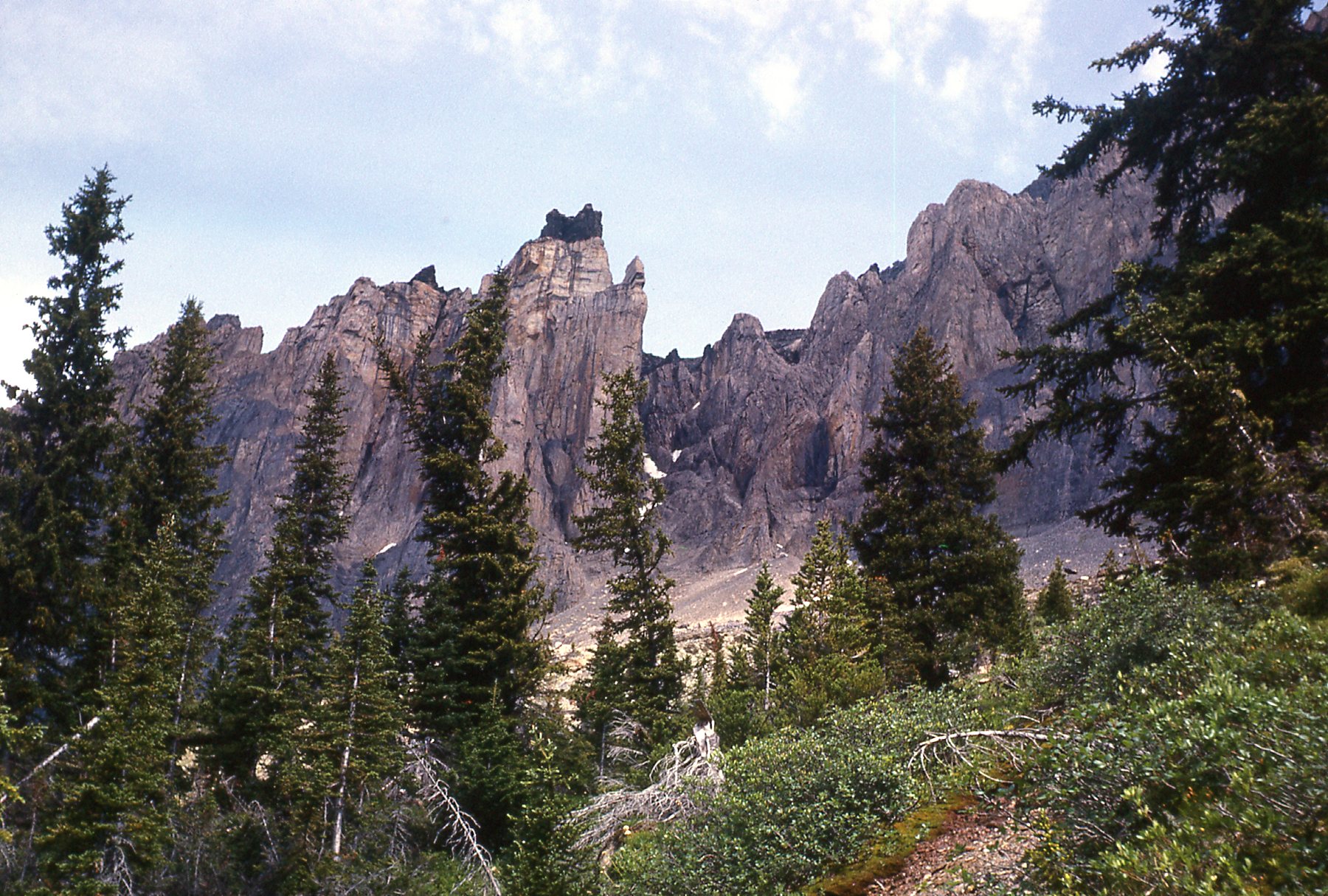
And speaking of geology, from near the same spot, at around 7,000 feet, here’s something else we saw.
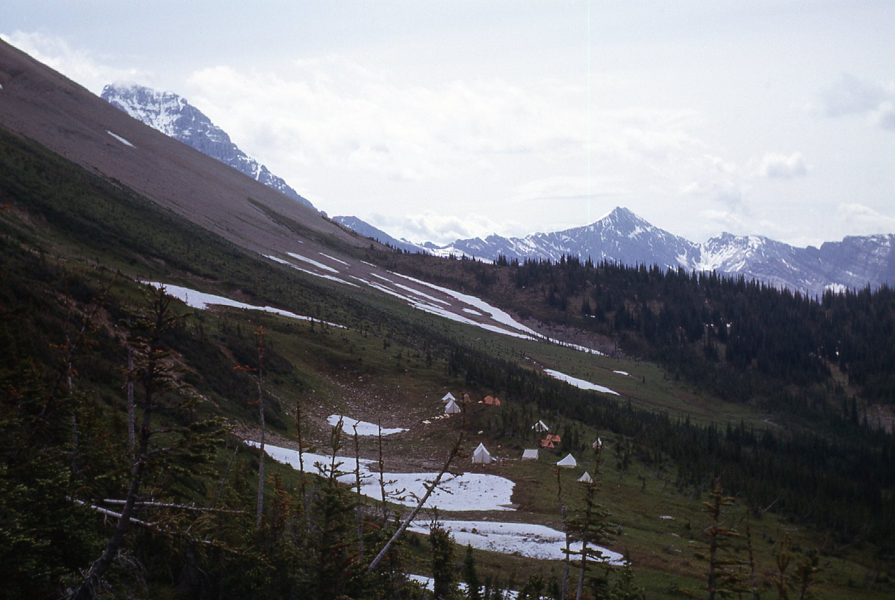
The geologists’ camp
It turns out it was a camp of geologists from the federal government who were there to study. “Study what?”, you may ask. Look again at the previous photo – there are a couple of important things I’d like to point out. On the far right, there’s a bit of a dip in the forested ridge – that’s Burgess Pass. Sloping steeply up to the sky on the left is a field of broken shale on the slope of Wapta Mountain. And that, Folks, is part of the Burgess Shale formation.
The Burgess Shale fossils were discovered in 1909. Paleontologists have worked there on and off for many years – they’re still coming back today. The shale beds are unique in all the world for their incredibly-well-preserved fossils of soft-bodied creatures from Cambrian times a half-billion years ago. Don’t take my word for it – instead, check out this site which describes in detail, with amazing pictures, the fossils found there. The place is so one-of-a-kind on all of Planet Earth that in 1980 it was declared a UNESCO world heritage site. That, coupled with the fact that it lies within a national park, should protect it forever.
From a bit further along, we had this view looking down on the camp, the lake and Emerald Peak and Mt. Carnarvon, again from around 7,100′. It was now 12:30 PM, and the weather was becoming more unsettled.
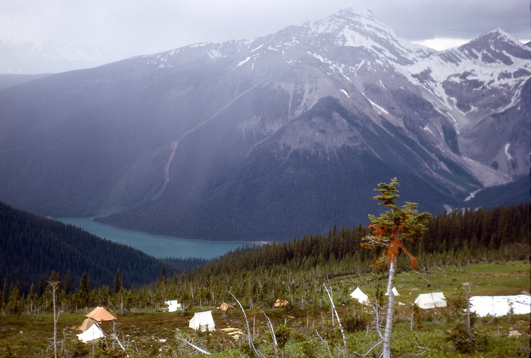
Looking west
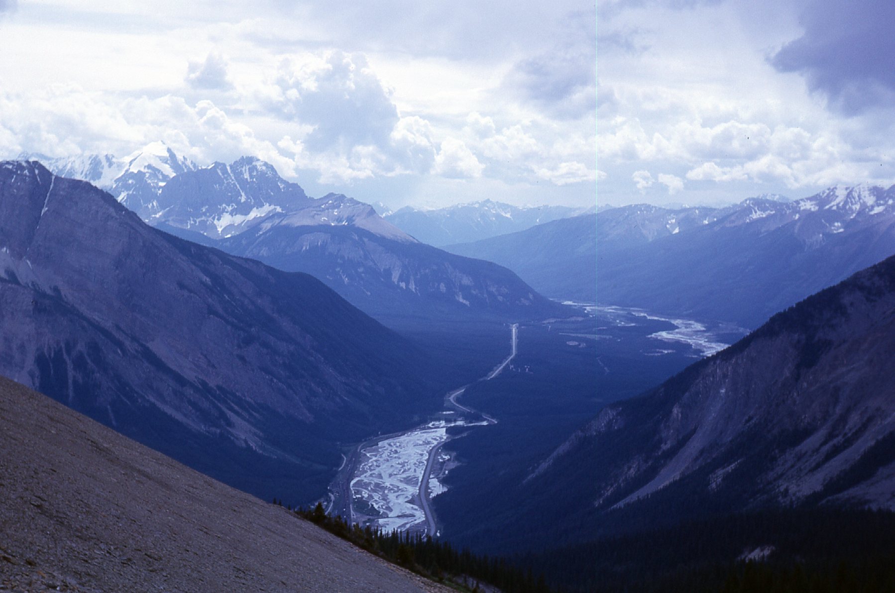
Since we were so close, we went the last of the way to Burgess Pass. Sitting at 7,200 feet, it afforded us this view to the south-southwest. We had walked 3.7 miles from the cabin to this point. Here, the trail forked. To the left, it descended 3,100 vertical feet to the village of Field. In the valley bottom can be found the Trans-Canada Highway, the Kicking Horse River and the Canadian Pacific Railway. Taking the right fork would take you back down to the Emerald Lake Lodge.
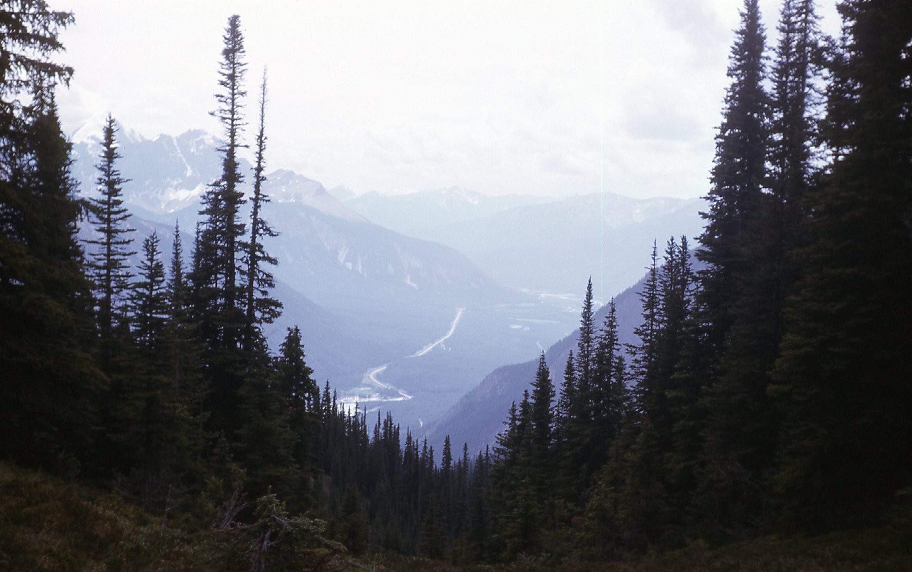
A view to the low country.
From near the pass, we had this view looking over to the impressive north face of Mt. Burgess.
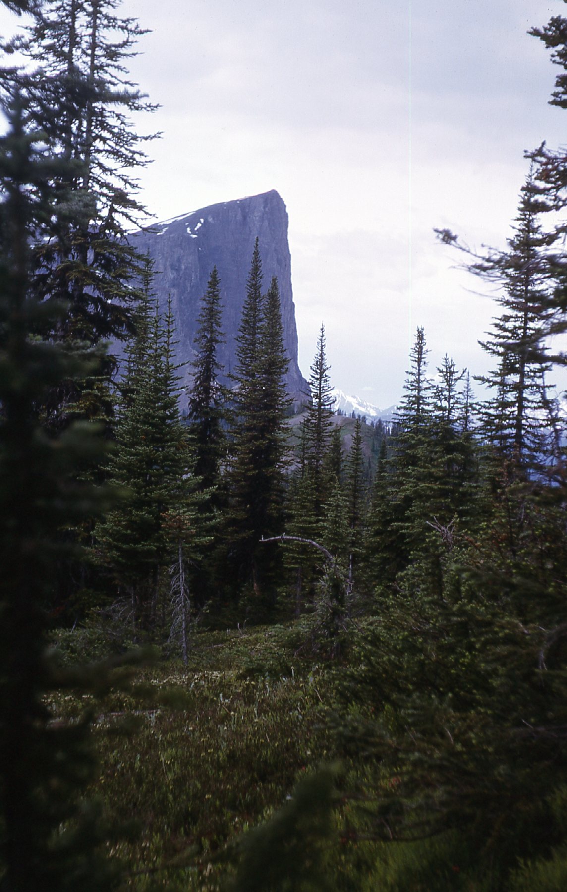
Now that’s what I call vertical.
We left the pass and started back north over to Wapta Mountain. Here’s a sweeping view of the shale beds. The scientists were working up near the ridge on the skyline, about a thousand feet above their camp.
The shale beds
There weren’t any signs saying we couldn’t, so we angled up across the slope towards them. It didn’t take much poking around in the countless pieces of loose shale to see that there were fossils everywhere. It was incredibly exciting to see perfect trilobites all around us – the more we looked, the more we saw, thousands of them. We sorted through them and kept some real beauties for ourselves. Into our day-packs they went, nobody the wiser. Nowadays, the area is festooned with signs warning you of dire consequences if you even stray off of the trail, let alone consider swiping any fossils. We spent more than an hour there, reaching a point hundreds of feet above the trail. From around 7,500 feet, I took these last photos for the day.
Looking west down the slope across the shale.
And this one, a better look to the west. On the left side of the photo can be seen Mt. Dennis (near) and Chancellor Peak and Mt. Vaux covered in snow farther away.
A better look, from hundreds of feet above the pass.
It was mid-afternoon by the time we descended back to the trail and later yet by the time we returned to the hut at Summit Lake. Several people on horseback passed by late in the day. A couple of fishermen gave us 7 fish they’d caught in the lake. We cooked them up in the cabin and they made a fine supper indeed. It rained hard during the night, but we slept well.
It wasn’t until ten o’clock the next morning, July 24th, that we left the cabin, covering 4 miles and dropping 1,700 feet to get back down to the lodge. It poured rain much of the way and we looked and felt like a couple of drowned rats. At around noon, I took this picture of that big no-name waterfall that cascaded down from the Emerald Glacier – talk about gloomy weather!
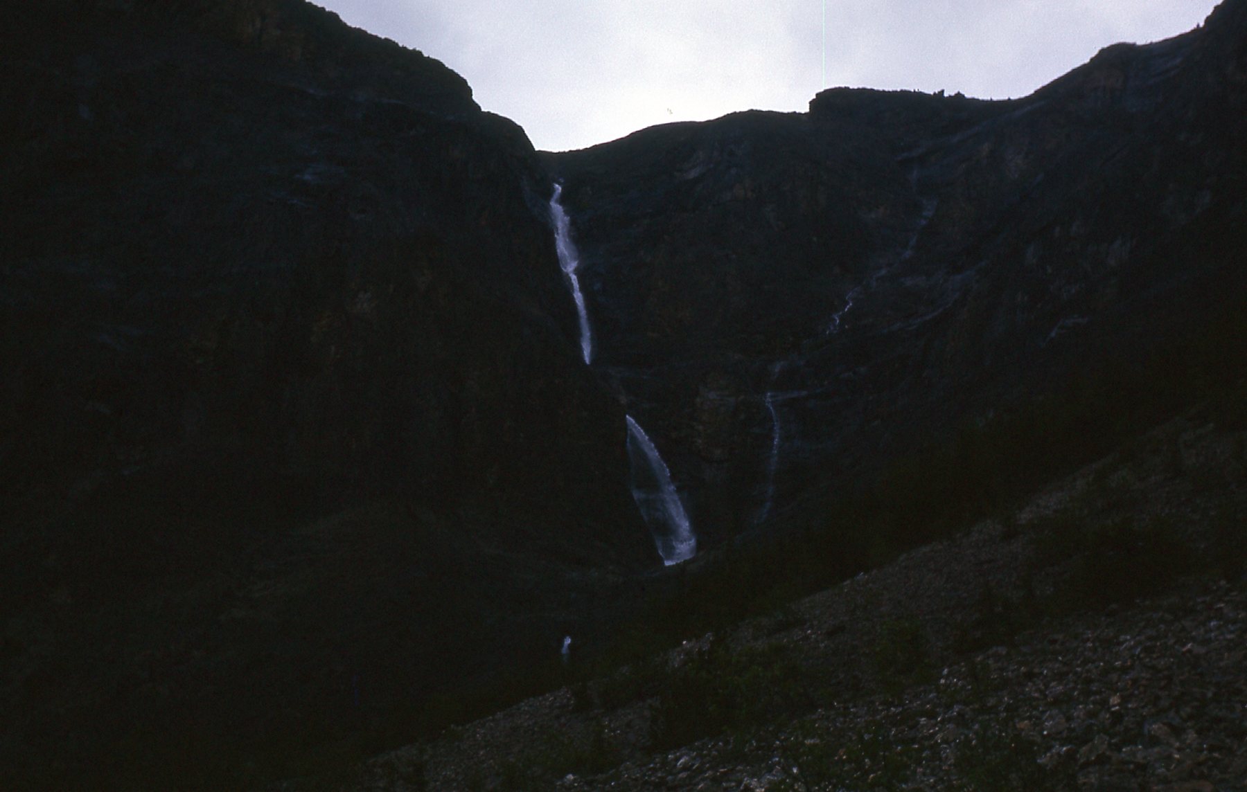
The waterfall, which drops a total of 3,300 feet.
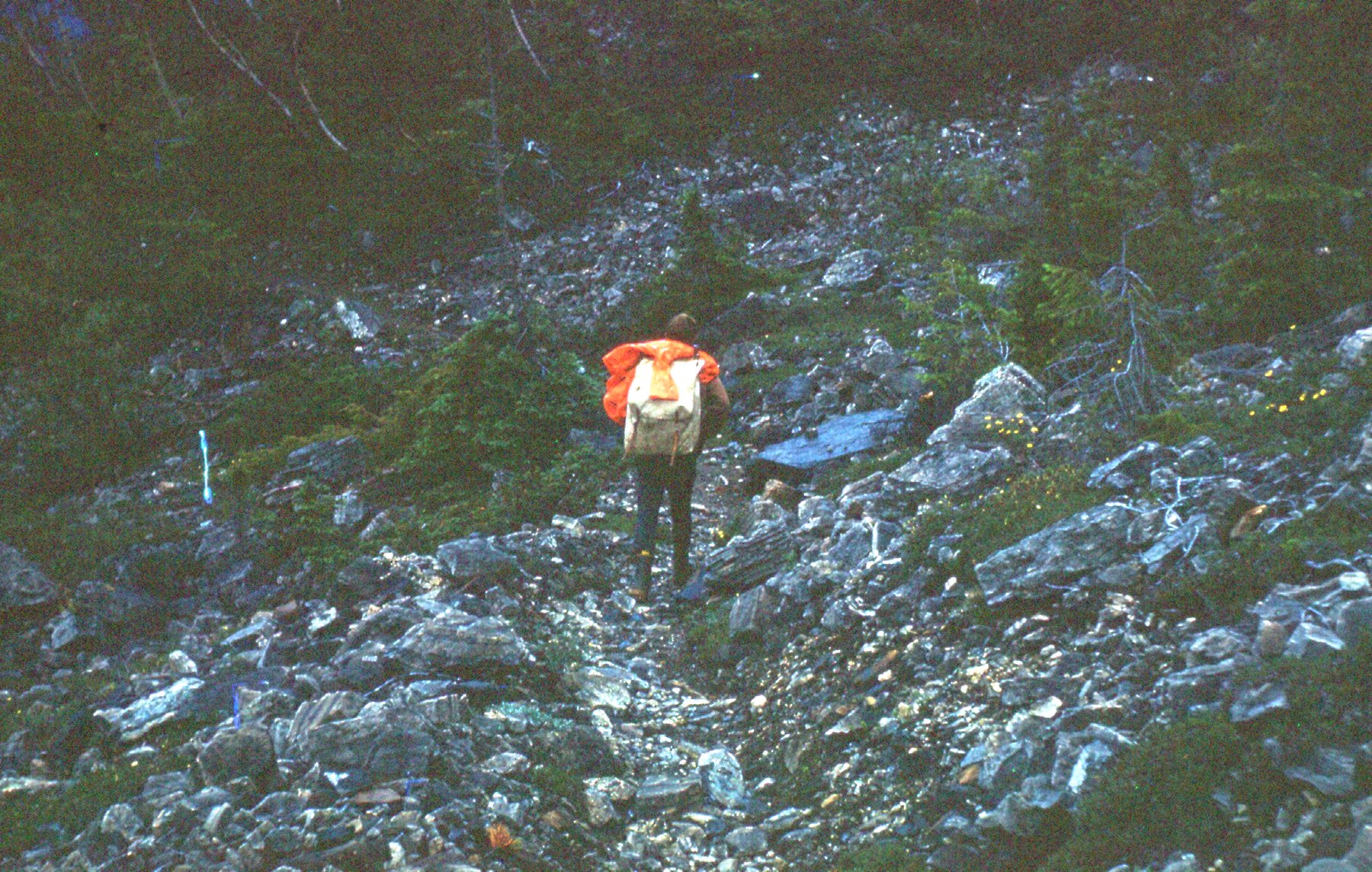
One last photo – this is George, soaked and disgusted with the weather, at around 5,200′ along the trail. By the time we made it back to the motorcycle, the weather had improved enough that we had a pleasant ride home.
So that’s my experience with Emerald Lake. It was a wonderful weekend, all in all. Oh yes, in case you’re wondering about the fossils – we donated them all to the Geology Department at the University of British Columbia in Vancouver, the school we were attending. We may have been somewhat vague as to the location we found them, however.