
I heard Paul shout; then, a moment later, a thump as he hit the ground. I turned around and saw him lying flat on his back with his leg bent awkwardly beneath him. I helped him up and asked him if he was hurt. He took a few steps and winced as he limped along on the leg he had twisted. He said it was okay, but soon admitted that it was going to slow us down.
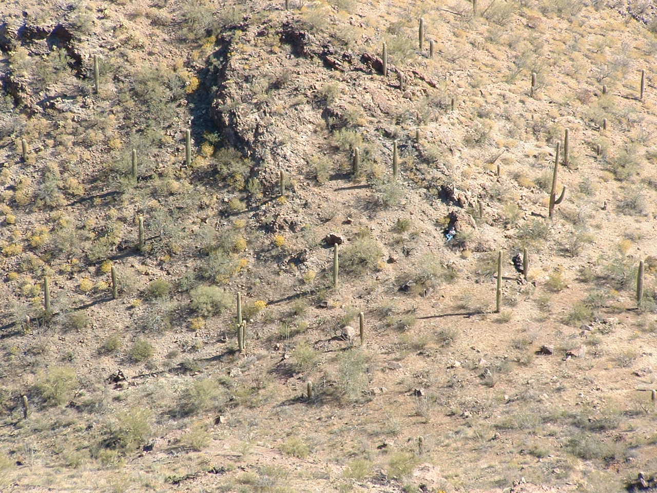
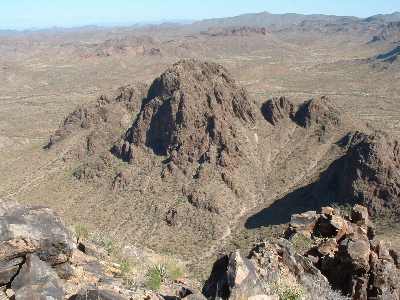
We had left our camp before 6:00 AM, at first light. Now, it was about 7:30 on a late March day. We had camped the night before on a pass overlooking the Barry M. Goldwater Air Force Bombing Range in the Sand Tank Mountains in southern Arizona. In previous years, I had climbed other peaks within a few miles of this very spot. I had heard explosions so large that you could feel the concussion hit you in the chest, like some malevolent force, taking your breath away, followed by an actual mushroom cloud rising into the sky. Today, we knew we were in a place we should not be – there would be hell to pay if we were caught. Here’s a view we saw early in the day as we started out.
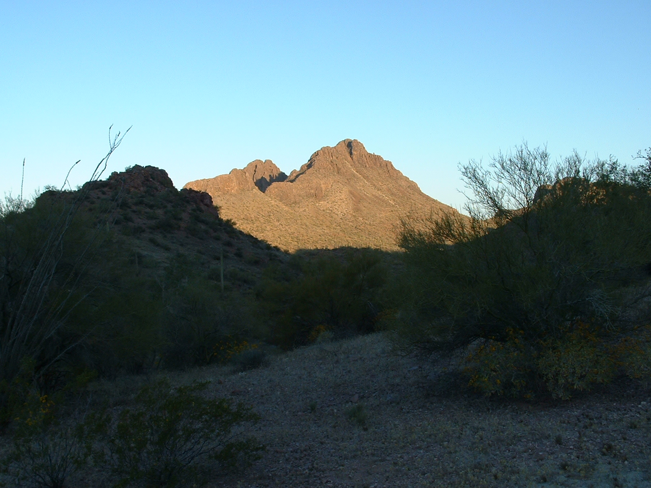
Looking west
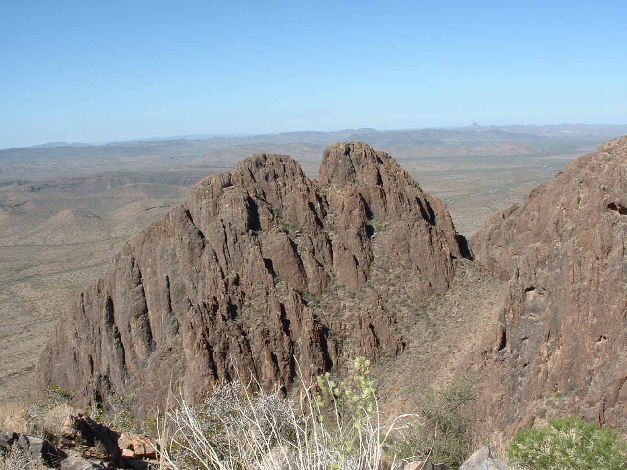
Here’s the same shot, but a telephoto view. This is what you are seeing: the big peak filling up the entire right half of the photo isn’t really a peak at all, it’s just an eastern outlier of what you can see through the notch. I’ll need to refer to it again, so let’s just call it “the outlier”. The peak in the back, visible through the notch, is Dragon’s Tooth East Peak.
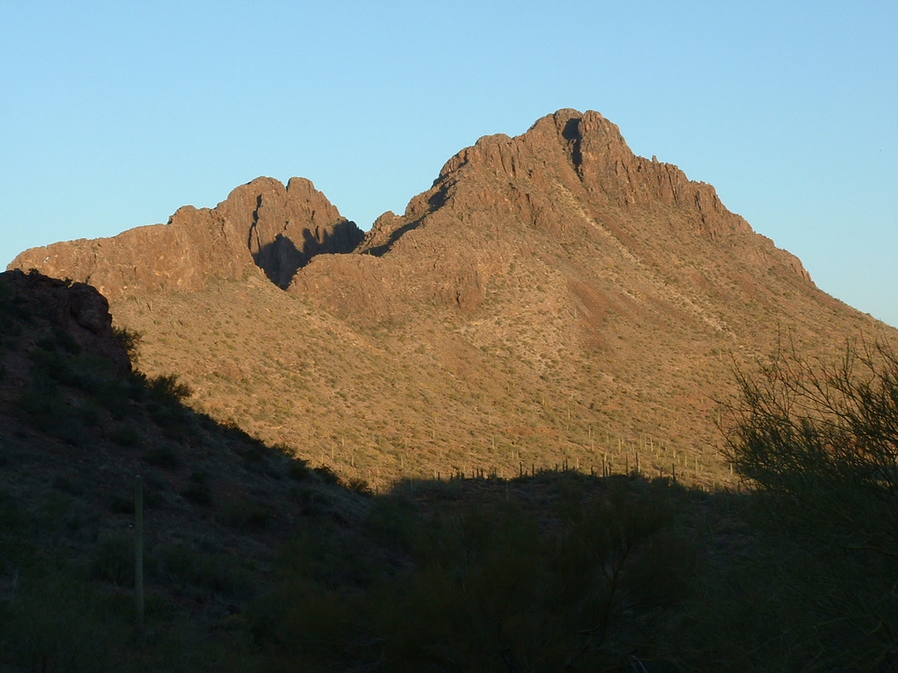
A closer look
Once Paul felt that he could continue, we slowly started moving once again. We were below a sharp ridge that soared above us.
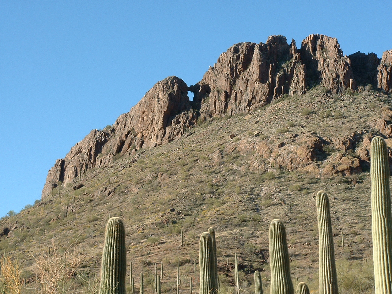
The ridge
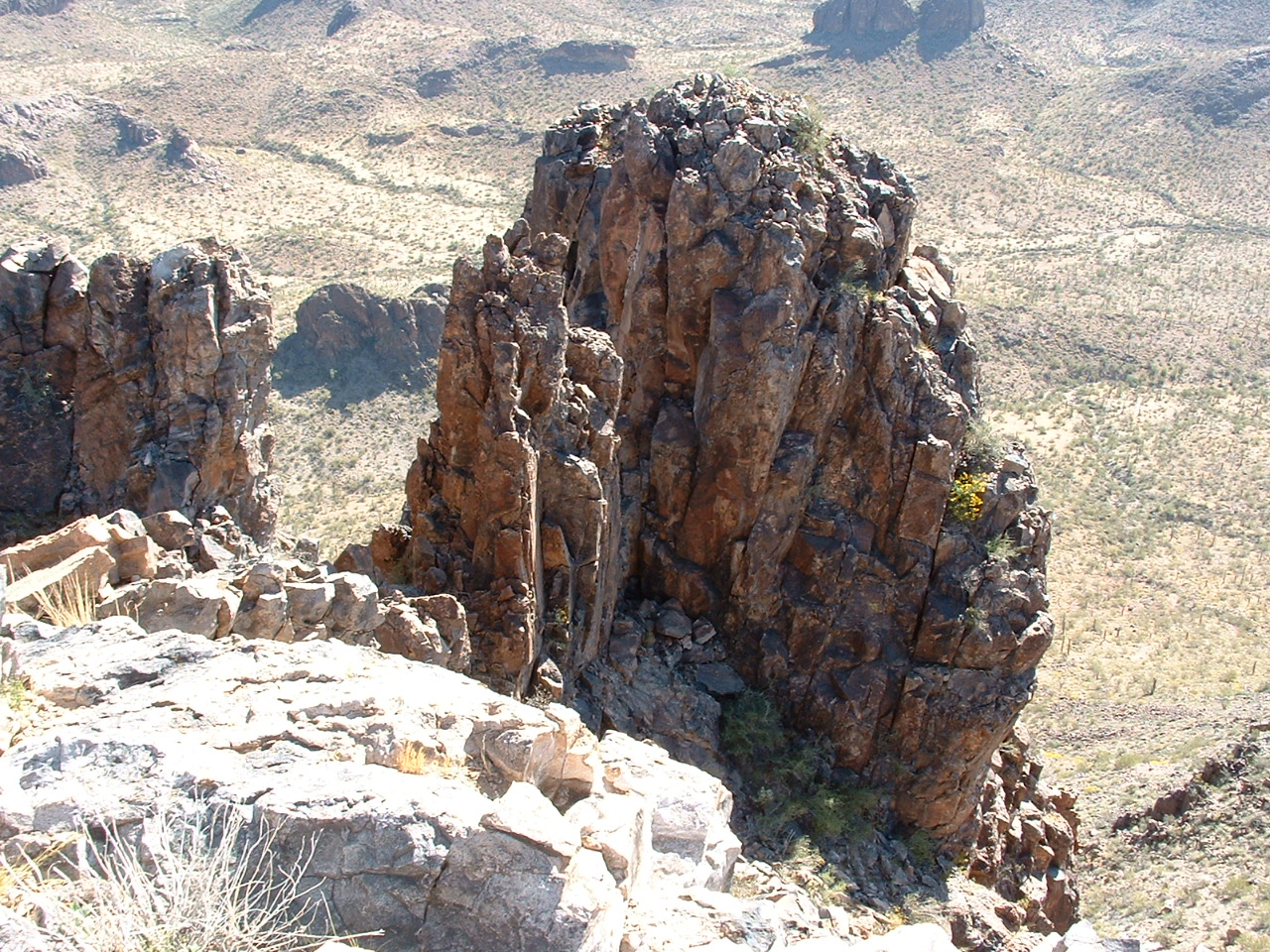
One part of the ridge was a series of pinnacles.
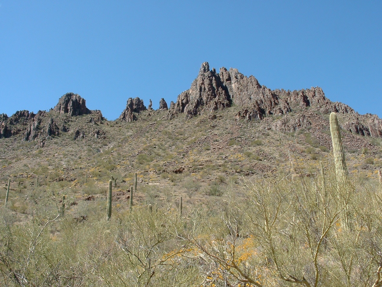
The pinnacles
We walked on up the valley, slower than before, until we reached a 2,800-foot pass northeast of our objective. Paul was game to continue, but after contouring across a hillside for a hundred yards, I could tell that he was hurting. If he tried to climb to the summit with me, a steep 750 feet higher, I felt his knee injury could be aggravated to the point of dangerously slowing our return to camp. I urged him to wait in a safe spot nearby and he said he was okay with that. We had two-way radios and agreed to talk every 15 minutes. Here’s a telephoto shot I took, looking steeply down on Paul in his resting place.
Paul
I started up, using a prominent talus slope to cover half of the distance, and soon topped out. Nothing worse than class 2. It had been 3 1/2 hours since we left camp. I fired up the GPS and found I had 12 strong satellite readings. I let it settle, and over a 30-minute period it gave me a steady reading of 3,532′ elevation, which agreed with the contours on the map. I was sitting atop that eastern outlier I mentioned earlier. A thousand feet away to the west rose a cluster of vertical pinnacles. I used my 5-power hand level and, try as I might, I could only conclude that the highest of them was at least the same elevation as my position, and probably a bit higher. This mountain had two true summits – a west summit and an east summit. Those vertical pinnacles I was staring at were a nightmarish mess. Just south of the pinnacles, there is a saddle which can be easily reached. The next photo shows the easy path up to the saddle, the light-colored swath angling up in the lower right corner of the photo. The double bump that fills up most of the photo is a nameless southern outlier of Dragons Tooth East Peak.
The path up to the saddle, and the south outlier
I couldn’t see the route from the saddle to the top of the pinnacles, so it’s anyone’s guess how that would go. I suspect it would be a steep roped climb. From where I sat, I had this view over to the East Peak.
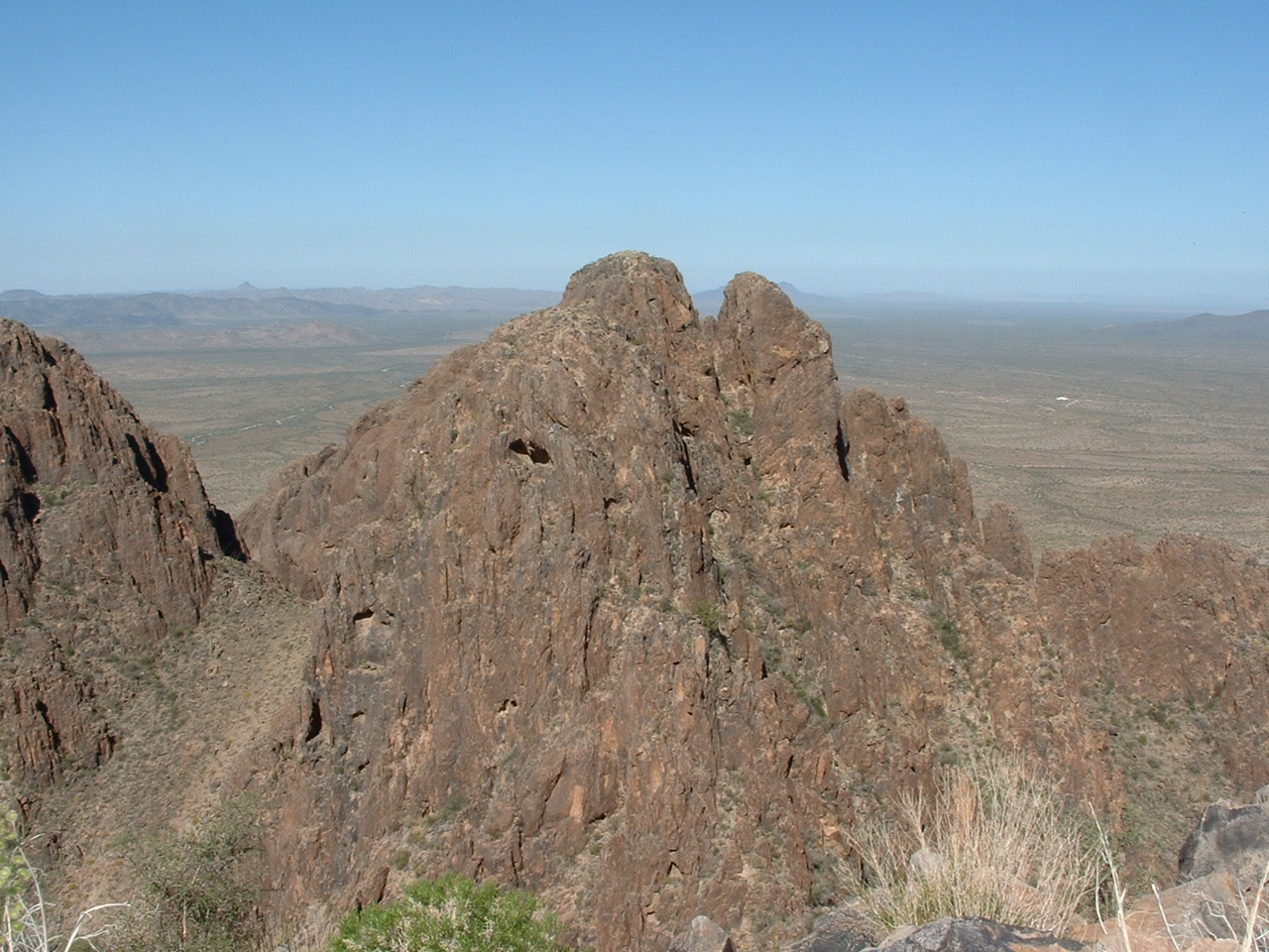
Dragons Tooth East Peak
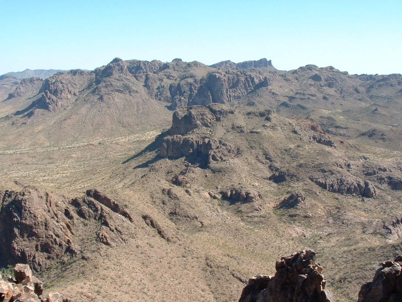
And here’s the same thing, but zoomed in closer. Don’t be fooled by this photo, it is very misleading. As you look at the left side of the photo, it looks like an easy stroll over to the right and up to the top of the high bump on the left. It is anything but! The whole lower left part of the picture is Point 3483 in the foreground. Directly behind it, but not visible, is a steep 250-foot drop separating it from the high bump. The steep crag on the right is just a lower part of the East Peak. We are looking west in this photo.
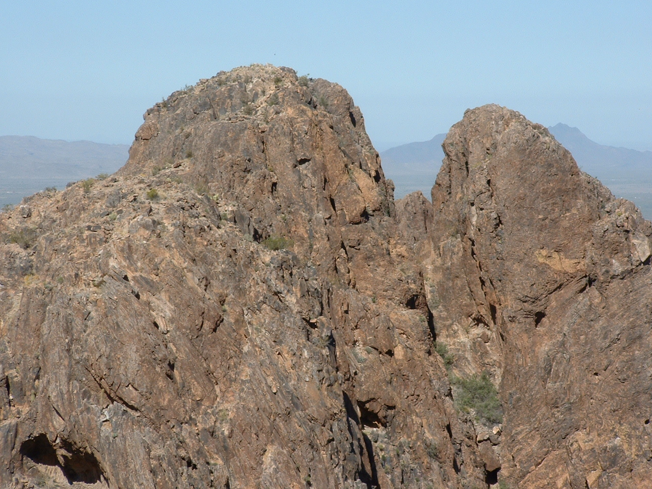
This is it, the real deal!
Then, there is the west summit, which was altogether hidden from me. If the map contours are to be trusted, it is guarded on all sides by even steeper walls than the east summit I’ve been jabbering about. If you look at the 7 1/2′ USGS topo map (Kaka NW) and study Dragon’s Tooth, the spot I had reached is just north of the first “o” of the word “Tooth” shown on the map. To the west is point 3483, and just west of that is a pair of closed 3,520′ contours. The highest part of the pinnacles which make up the east summit is the southern of the two contours and is shown in green. The slightly lower west peak has its summit between the letters “D” and “r” and was not visible from where I sat – it is also shown in green on the map. I had mixed emotions. I had been fantasizing about Dragon’s Tooth for years. Now, here I was, enjoying some small degree of success, but disappointed that to really bag the thing, so much more would still need to be done.
While I sat up there, I took more pictures of the amazing views which I’d like to share with you here. This steep tower was just below me to the south.
Tower to the south
Four miles to the south sat the broad Peak 3667.
A telephoto shot south to Peak 3667, four air miles away.
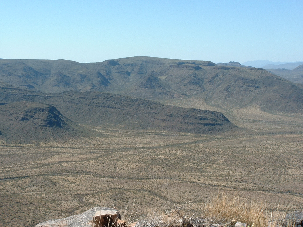
Then there was this unparalleled view to the north, to the high country of the Sand Tank Mountains.
The high country of the Sand Tank Mountains
And here’s one more. Just half a mile north of Dragons Tooth sits unclimbed Peak 3300.
Peak 3300
Anyway, after I took the requisite photos, I called Paul on the radio and headed down. In half an hour, I was back to where he had waited for me. He had fashioned a walking stick from a saguaro rib, and we slowly walked down the valley. It was all downhill until just past Burro Spring, where Paul had hurt his leg. From there, we headed east over a saddle and into another drainage. We crossed that and traveled southeast over another saddle, and down into a large sandy wash. We followed that upstream for the better part of a mile, then walked up another wash for a mile to our camp. Paul did pretty well, and found he could travel uphill less painfully than going downhill. We were back at camp 8 1/2 hours after we had left. We spent another night there, enjoying our beer, tequila and an eclectic mix of tunes on the old CD player.
The next morning, we drove back out, on a road not shown on any map, to Paradise Well. I came up with the bright idea that, since we had the whole day ahead of us, maybe we should drive out on some untried roads. We could have an adventure on these new roads, seeing some country we hadn’t traveled before. It looked like we could drive east and exit the Sand Tanks into the Vekol Valley, then head south to hit the gas pipeline road somewhere west of Bitter BM on the Tohono O’odham Indian Reservation. Paul was game, so away we went.
We passed quite a few abandoned pick-up trucks on the roadside. Most of them were Ford 150s, and seemed to have nothing wrong with them worse than flat tires. They were fairly intact, and still had their spare tires, stereos, 5-gallon gas cans and a lot of other stuff that it was tempting to take with us. We just kept going, following what was obviously the road most traveled, ignoring fainter side roads. We needed to head east for a few miles, but our road was heading southeast, then finally straight south. I told Paul I was concerned because we were definitely NOT going the direction we should have been to reach the Vekol Valley. In fact, we were still well inside the Sand Tank Mountains, in the most southeasterly part of the range, and going through some very rough country, crossing endless gullies and ridges. The road we were on was very well-used, but not on any map. We had with us a Delorme road atlas, and we took a couple of GPS readings as we travelled, confirming the fact that this road we were on was now heading southwest, directly away from the Vekol Valley, and in a direction opposite from where we wanted to go. I was torn: the sure thing would have been to turn around and go back north all the way out to Interstate 8, approximately 1.6 billion miles away from where we were right now, or to keep going to wherever, and maybe run out of gas. The road was so well-traveled, it seemed like it must go somewhere useful, so we just kept on going, following it as if we were on rails – there was nothing else out here, no side roads, so it wasn’t like we could get any more lost than we already were, right?
We saw a vehicle approaching us, moving quickly, raising a rooster-tail of dust in its wake. Paul’s keen eyes recognized the distinctive green-and-while markings of the US Border Patrol. Excellent! We pulled over, got out, approached them and identified ourselves as climbers from Tucson. We showed them our ID. They seemed relieved that we weren’t Bad Guys.
They said they knew we were coming, so they had come out to greet us! We had probably been detected from the air, or had tripped some sensor along the road. I asked them if they were from the station at Why, Arizona – they said yes, and it turned out that I even knew a few of their fellow officers stationed there. They told us that we would soon reach the pipeline road, so we thanked them and drove on. Within another 15 minutes, we arrived at the village of Kaka, along the pipeline road, and pavement – beautiful, sweet pavement. We had driven about 15 1/2 miles from Paradise Well to Kaka, but it seemed like a lot more. The rest of the drive home to Tucson was uneventful.
Dragon’s Tooth will bug me until I can return. What a stealth! There are several buildings and roads only 2 miles from the peak. Active bombing is a regular occurrence there. The Air Force is pretty serious about doing things their way. From the summit, I had a clear line-of-sight to the town of Gila Bend, 27 miles to the northwest. I had a strong cell-phone signal, but when I tried to call my wife, a message kept coming up on my screen which said “call not allowed”. AT&T verified for me that the Air Force was using some technology to jam all signals but their own. What a coup it would be to go back there and fool around on Dragon’s Tooth again, right under their noses!