
Some of the climbing trips I went on back in the 1970s were into really remote spots, or at least I thought they were remote. The fact that I didn’t have any pictures to “back them up” didn’t make them any less of an adventure, but I have to say that when I would write those stories and publish them without pictures, well ….. I always felt they’d have been even better if I’d been able to include photos.
This story is about one of those trips. For more than 40 years, the photos were lost to me. Then, in the year 2019, when, through a minor miracle, I regained a treasure trove of thousands of lost photos, it changed a lot of things for my story-telling. So here, I’ll present one of those adventures with an emphasis on the photos which were absent from the first iteration.
Early in 1976, I started to wonder what it would be like to travel up a drainage known as Sloquet Creek to its head and then down the Stave River to where it emptied into Stave Lake. It would definitely be an adventure. When I contacted the BC Forest Service in Agassiz, they told me that the valley of the Sloquet had been logged years before – the road hadn’t been maintained and was no doubt quite overgrown, that it might be quite hard to follow in places. That was okay by me, it’d be a backpacking trip anyway. The first part would be on the old road up the Sloquet, the second part would be down the Stave River on a modern logging road.
It seemed like a good idea to have a partner for this adventure. I lived in a small town called Mission, as did my close friend Mike Ryan. We were both self-employed, so could arrange our own schedules. It was harder for Mike, as he had a family to support – I, on the other hand, had nobody depending on me. The day for our departure arrived – June 4, 1976. Mike’s wife drove us the 40 miles to the dock at Harrison Hot Springs and dropped us there.
Eighty-five miles east of Vancouver sits the town of Harrison Hot Springs, which in turn sits at the southern end of Harrison Lake. Even that far inland, the lake is only 33 feet above sea level. For me back in the 1970s, it was a gateway to many climbing adventures. I could either drive up the logging roads on the west or east sides of the lake, or, and this always made it feel more exciting, I could pay a small fee and take the water taxi north up the lake and get dropped off. This boat delivered men and supplies to the docks of the logging camps that dotted the shore, but it would also drop you anywhere else it could safely get close enough for you to hop off.
That’s where Mike and I were that morning. We boarded the boat with our backpacks and settled in for the ride. Heading up the lake was always an adventure. 37 miles long and only about 2 miles wide in its upper reaches, peaks rise up steeply from its shore, in places almost 8,000 vertical feet. The spectacular scenery never lets up the entire way. We stopped at several camps, but finally, 5 hours after setting out, the captain pulled up to the old dock at Spring Creek. We disembarked, telling him we wouldn’t be back, to not bother looking for us on any of his runs during the next week. He wished us well. As the boat pulled away, we soon lost the sight and sound of it. The silence was immense as we stood there on the dock – just us, our packs and excited thoughts. It was 12:30 PM.
We set out northwest along the lake on a good dirt road for about 4 miles. Our road then took a sharp turn to the west along the north side of the valley that contains Sloquet Creek. We continued another 4 miles on a pretty good road, easy to follow. The old topographic map that we were using showed a hot spring along the way, and we kept a lookout for it. There was a bit of navigating involved, and at one point we dropped our packs and started looking for it. Back in the 1970s, the hot spring was little-known, so we were left pretty much to our own devices. We found it after a short search.
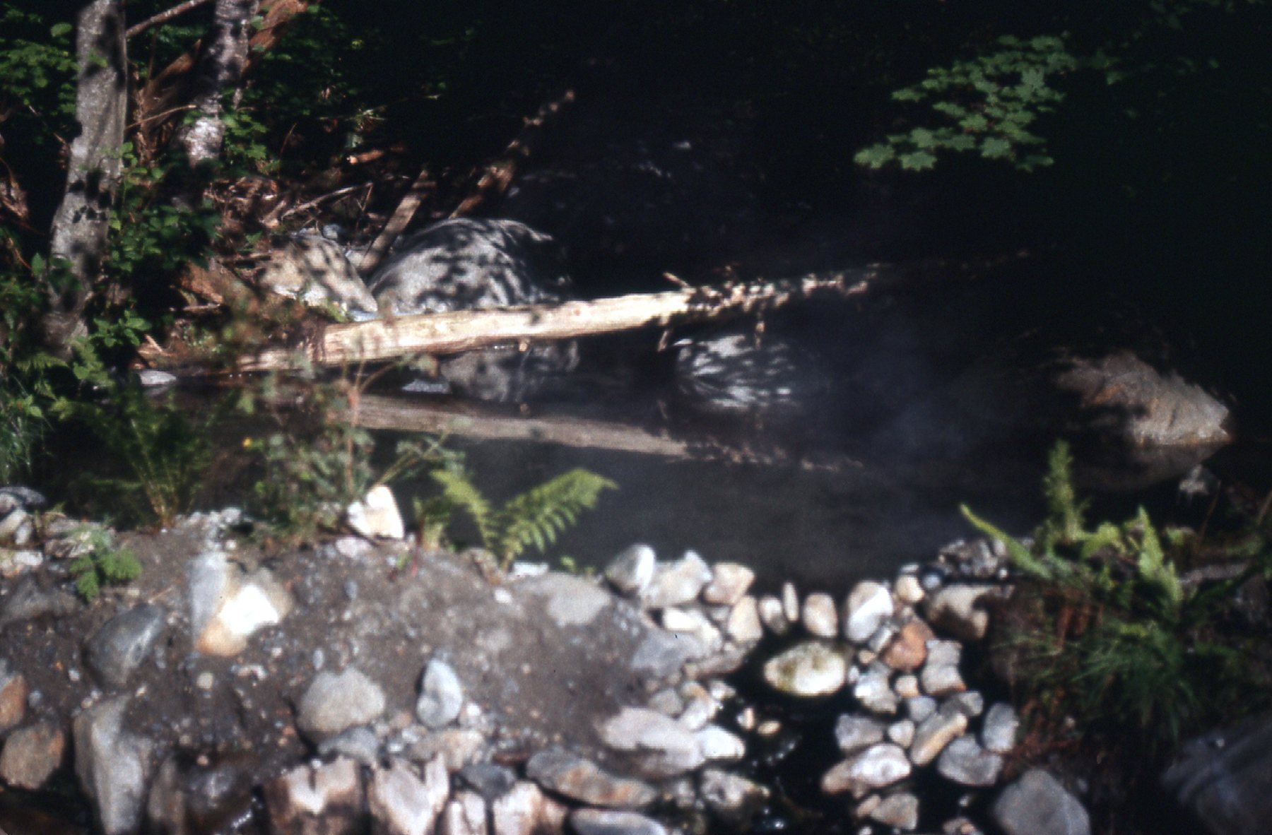
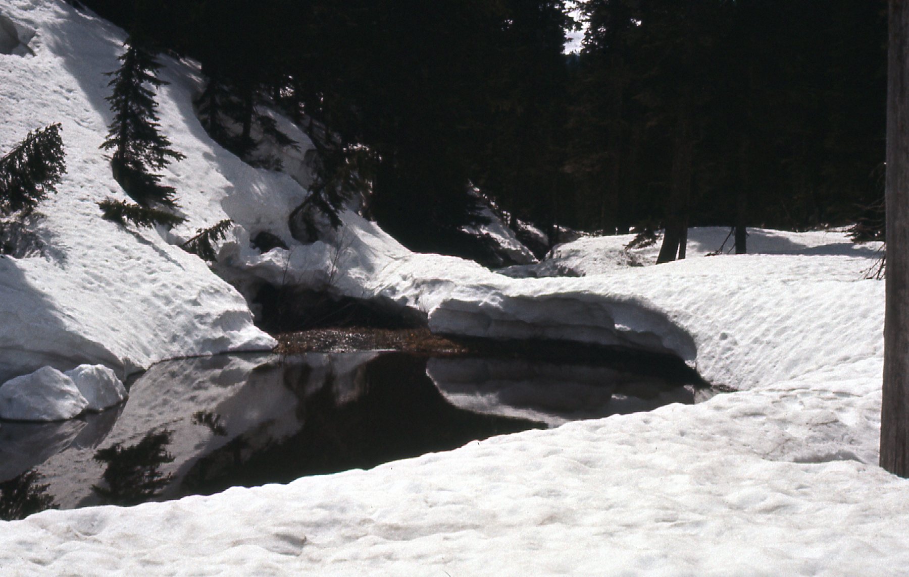
The pool
A small waterfall issues from the steep rocky bank of Sloquet Creek itself, and it is scalding hot. As I recall, it then flowed into 2 small man-made pools, which were way too hot for your body. The spring water then flows a ways and into another pool, bigger, also man-made. The water in that pool was very warm but perfect for a good soak. Wow, what a sight for sore eyes! Someone had built a rock wall to impound the water, and it was deep enough in which to recline. We were soaked in sweat from the day’s efforts, and in moments had stripped to the buff and slid into the pool. The water was delicious, and as we sat there submerged to our necks, we felt the day’s aches melt away. Only a few feet away, the creek roared past, its rolling white waters making quite a din. We were in bliss – even the mosquitoes couldn’t ruin our day at this point. A soak of an hour made everything as right as rain, and we so liked the area that we camped there for the night. The day had been hot and cloudy, but blue skies arrived later on. Our first day had gone well, covering 8 miles with full packs, and we were pleased.
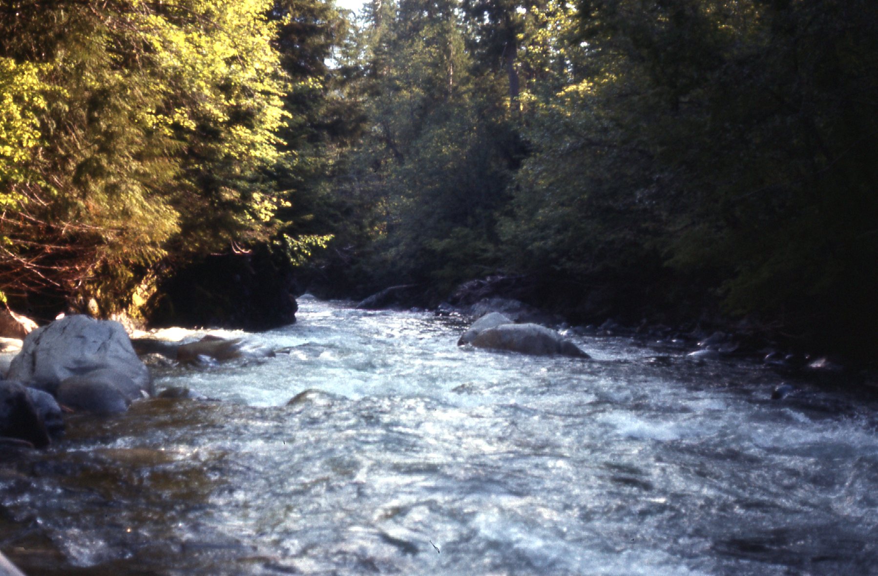
Looking downstream along Sloquet Creek by the hot springs.
The next day, Saturday, was a very different experience from our first day. We had camped near the hot spring overnight and hated to leave. Once back on the old road, our progress was hindered by brush – it was slower and more difficult than the day before. There were times when we couldn’t tell if we were still on the road, yet at other times the road was clear and obvious.
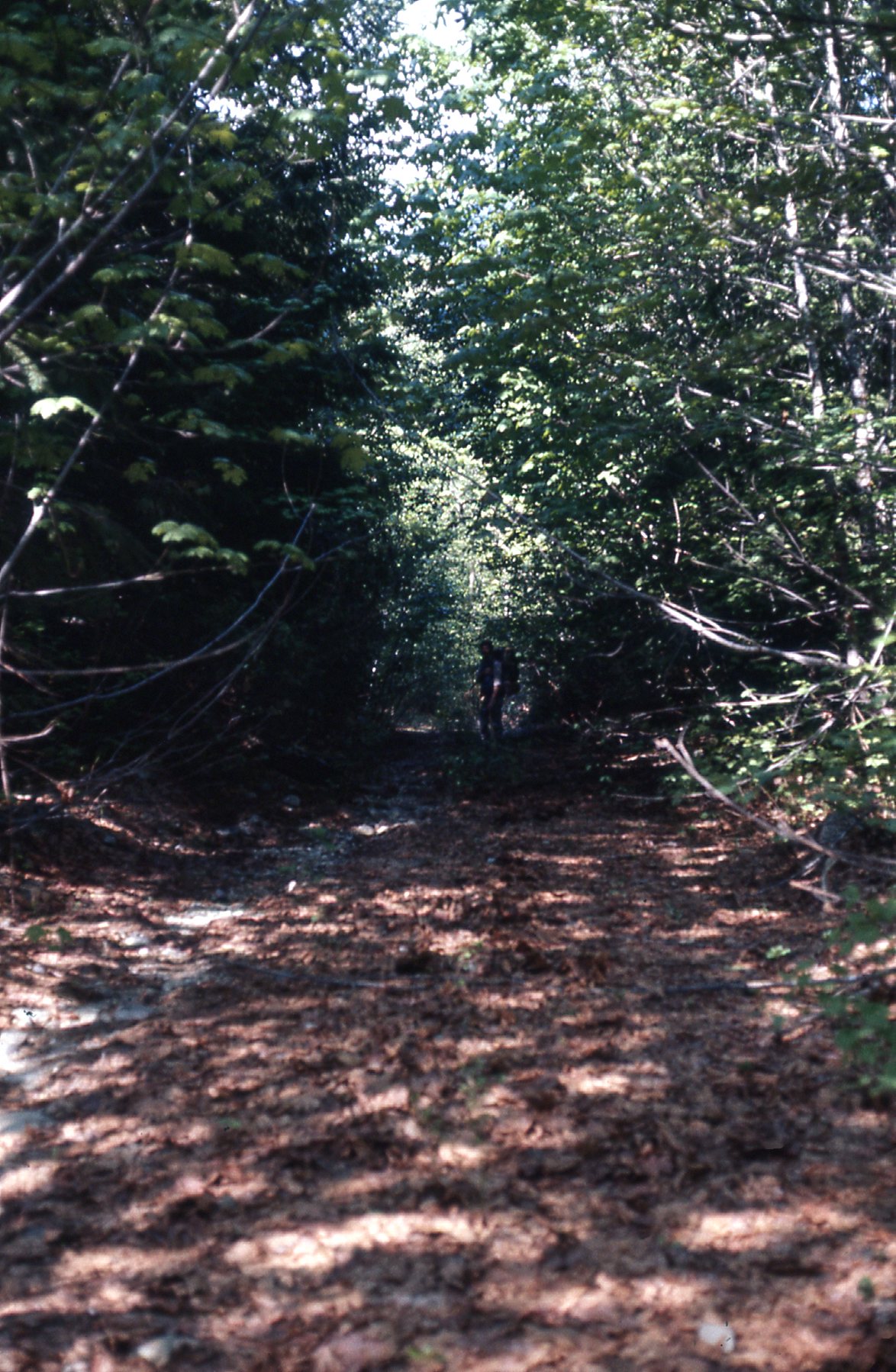
Mike, up ahead in the shadows
At around the 10-mile mark along Sloquet Creek, we came across this old logging truck, a relic of the bygone days when they had logged out the valley.
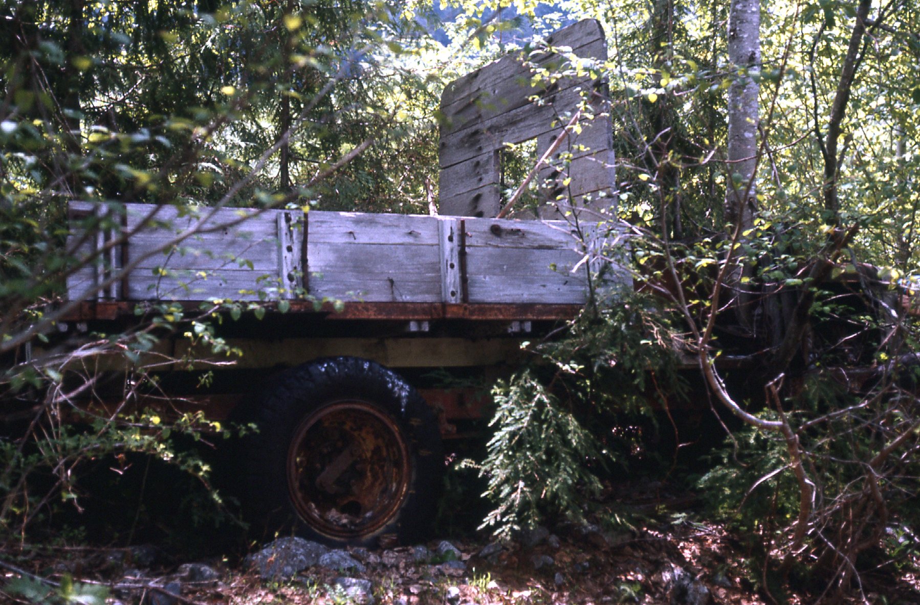
The old truck.
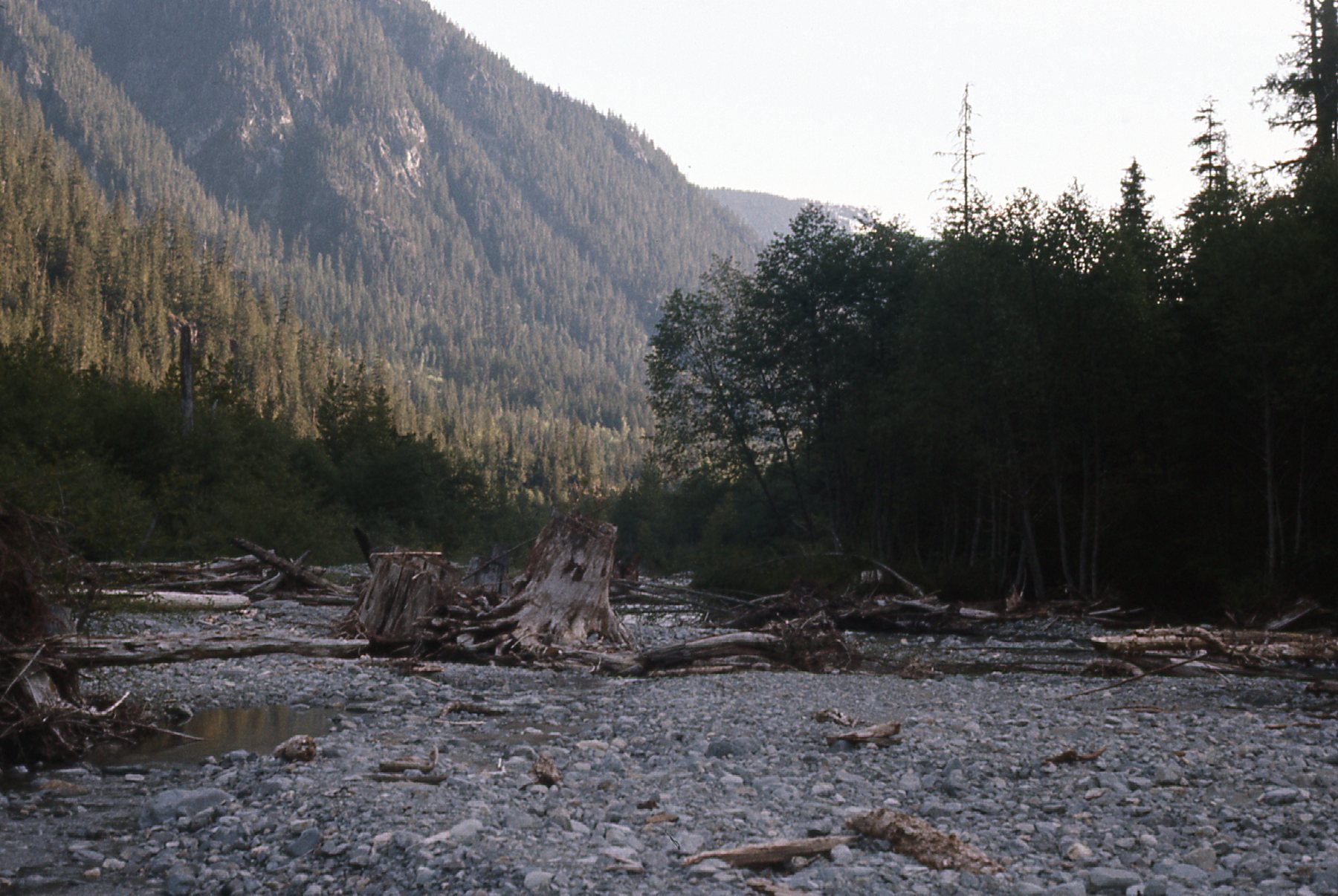
By noon, after having walked for several hours, we were forcing our way through brush and having a hard time even following the road. At noon, we became discouraged because we had lost the road completely. We wondered if it had crossed over to the other side. Since we had nothing to lose at this point, we forded the creek. It was mid-thigh deep, but we made it across okay. Once on the other side, we spent a full 6 hours moving upstream – the bushwhacking was terrible.
At one point, we were walking along through a thicket of young saplings, with poor visibility. Nearby, we saw a black bear – unlike most, it didn’t run off, instead lurking around for a while. In BC, we were used to seeing bears, but this one didn’t fit the usual model, seeming bolder. It worried us some, so we crossed Sloquet again, and voilà!, there was the old road, or what was left of it. Even so, we decided to move back out to the middle of the Sloquet and camp on a gravel bar for the night. Here’s where we had camped overnight, in the roomy REI McKinley 4-person tent. It was heavy, but the only one I had at the time.
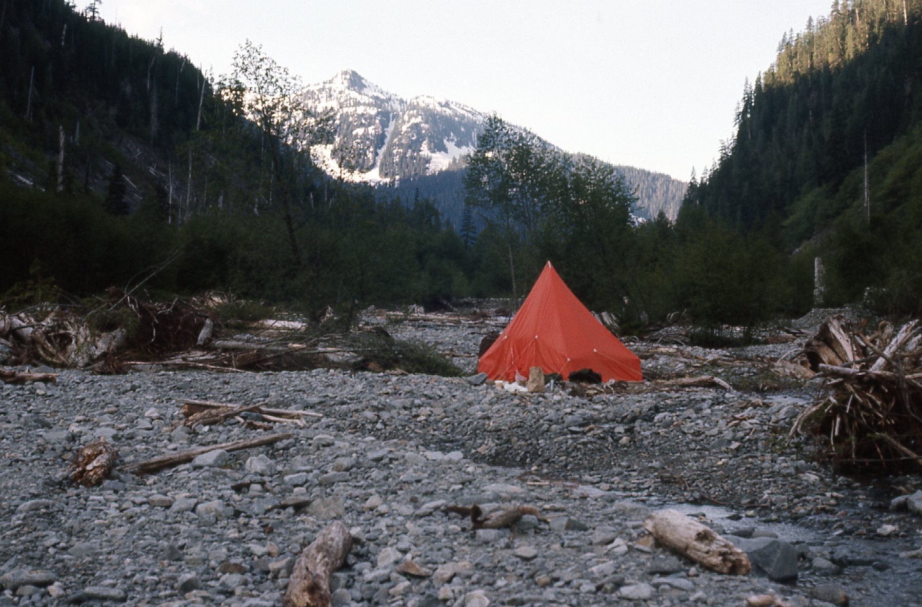
Along Sloquet Creek and looking upstream
A look downstream
Early the next morning, we were moving once again. At around the 15-mile mark we came to this old bridge, the only one we found still standing, a hold-over from the former logging days.
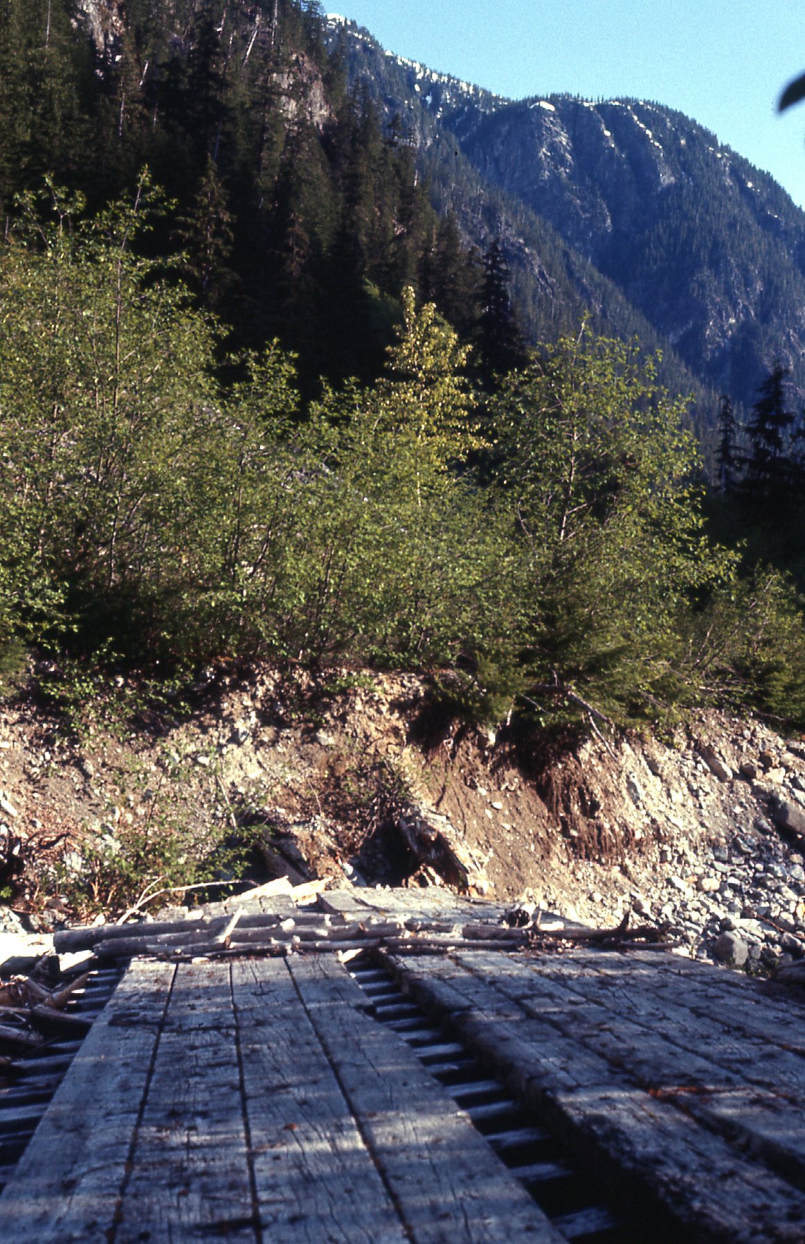
The old bridge
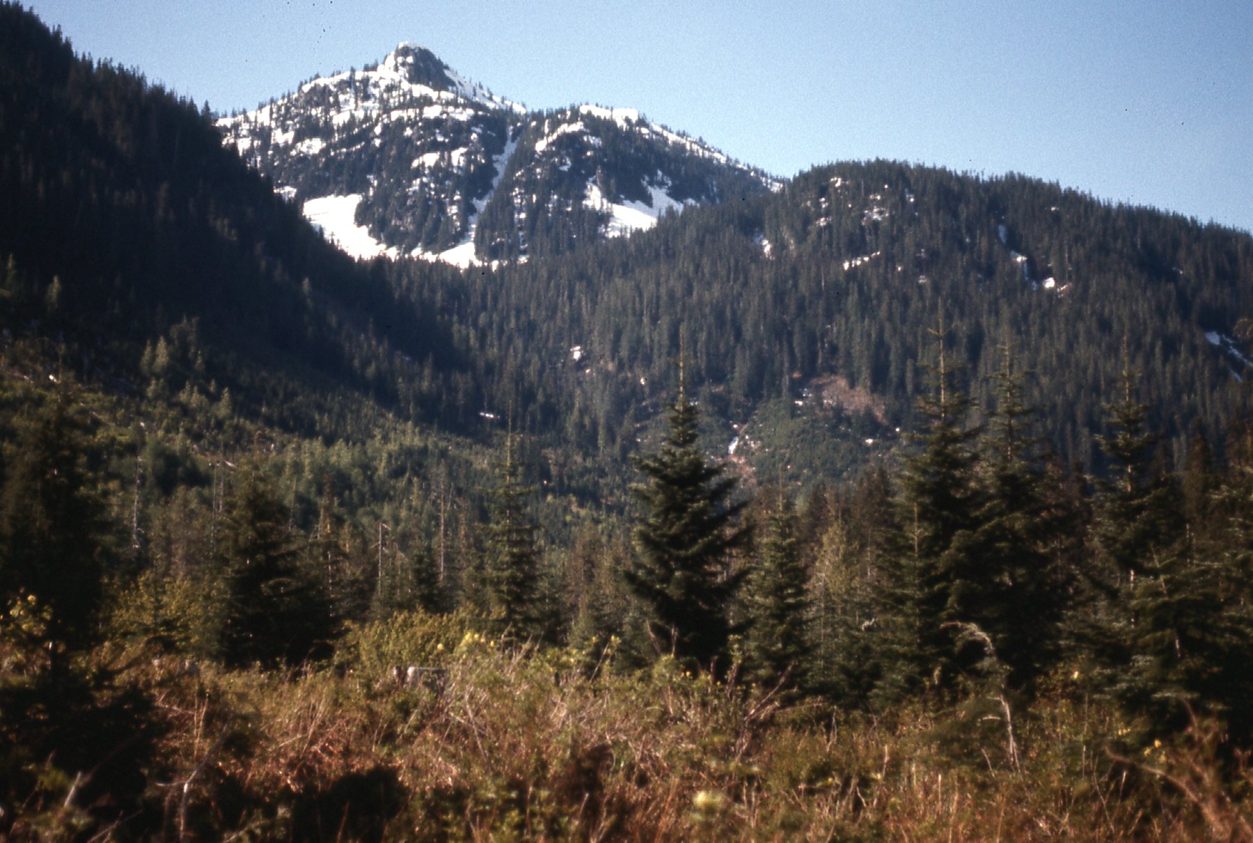
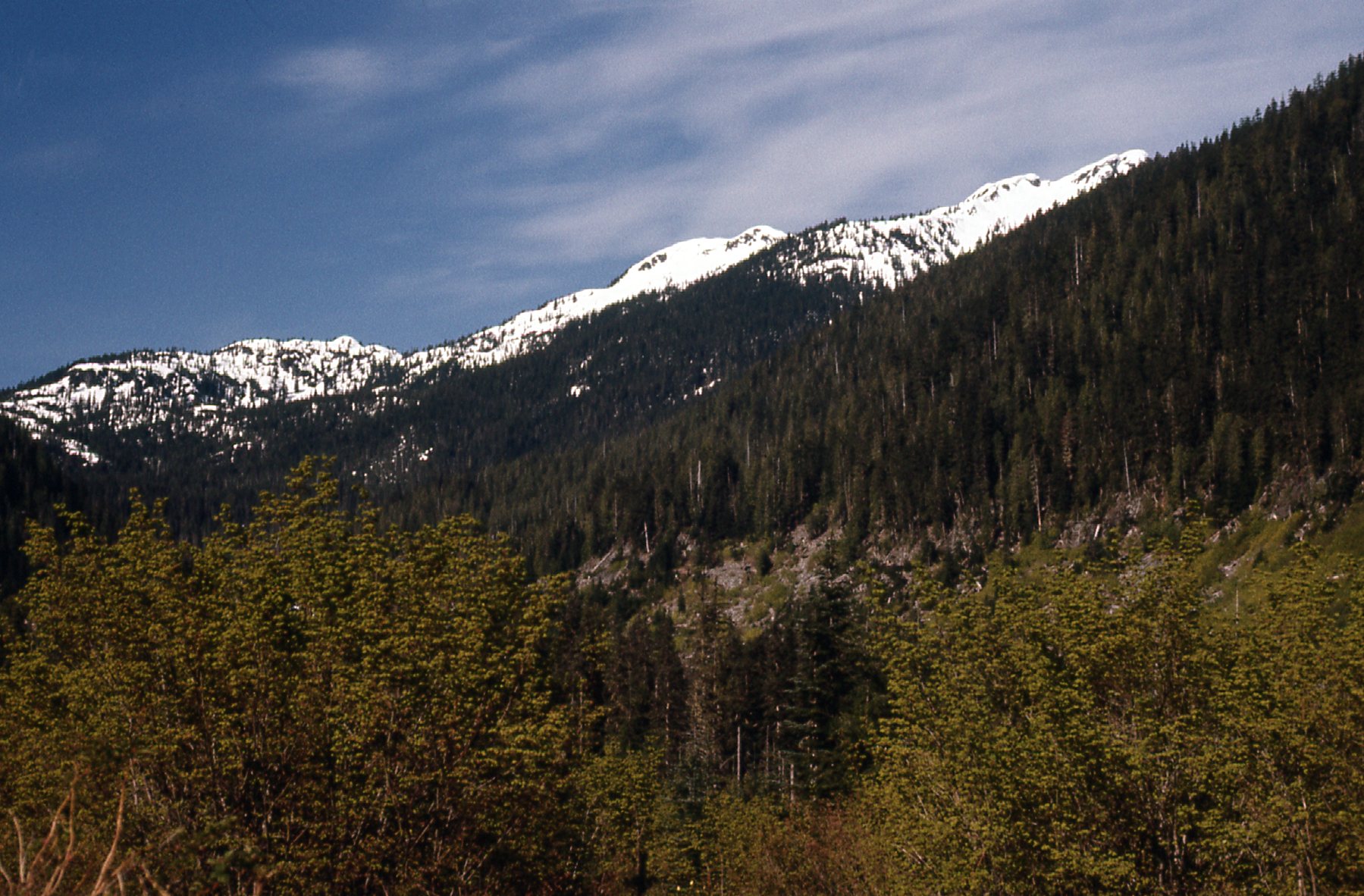
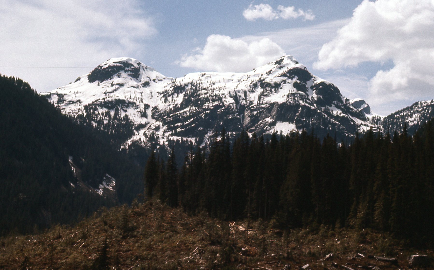
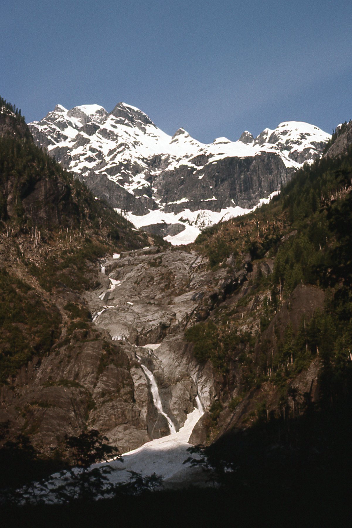
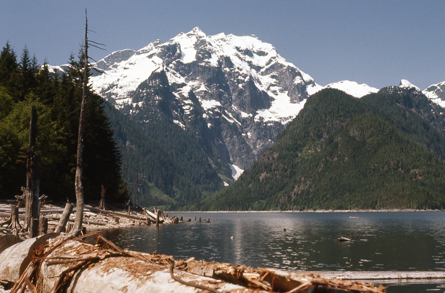
Sloquet Creek was smaller as we neared its headwaters – we forded it once more, then forded something called Ironstone Creek. We were just west of a prominent peak called Mt. Lamont, and only a mile from Kinnear Lake which drained into the Sloquet. This was a big day for us, our third. Today we would enjoy a major change of scenery, leaving behind the valley of the Sloquet and crossing over into the Stave River. Here are 3 views of the mountains that surrounded the head of Sloquet Creek.
The south part of the headwaters of Sloquet Creek.
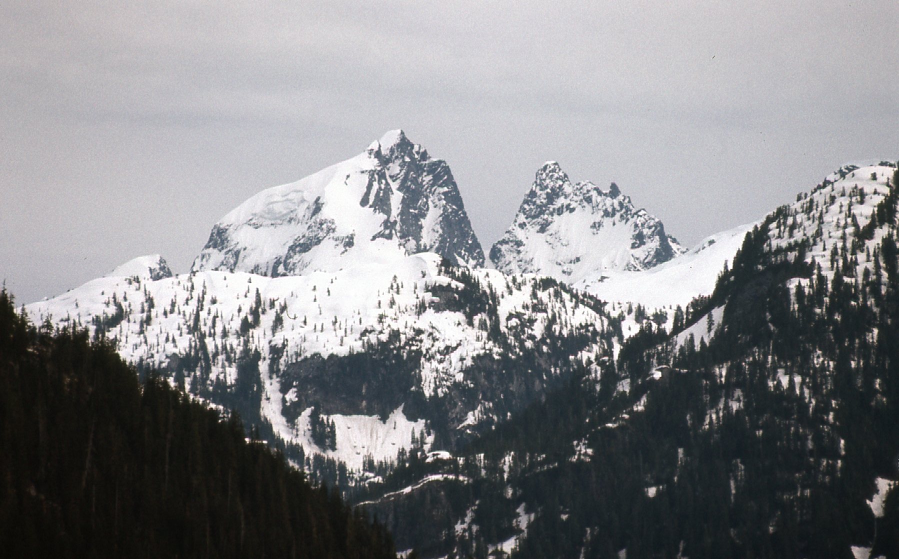
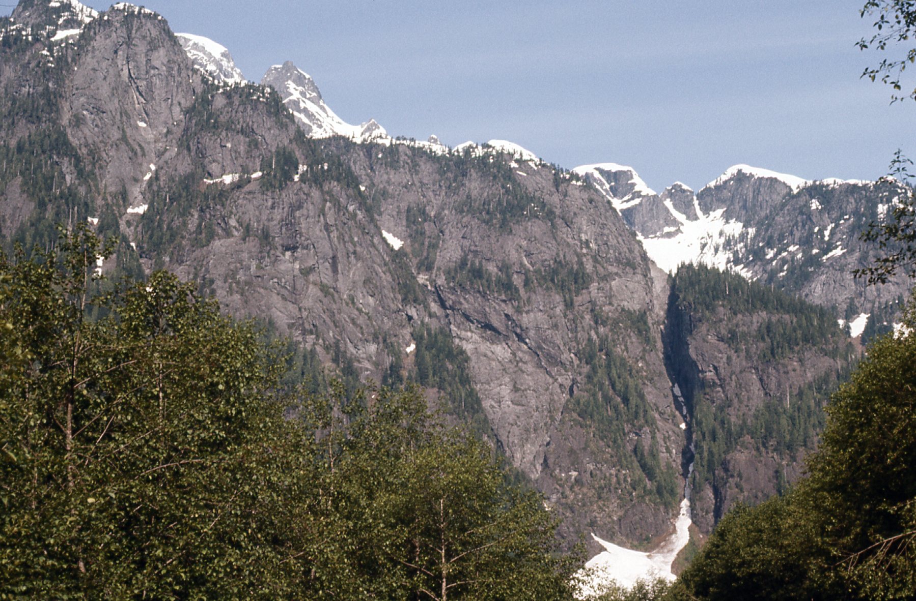
Here are the mountains that formed the western headwaters.
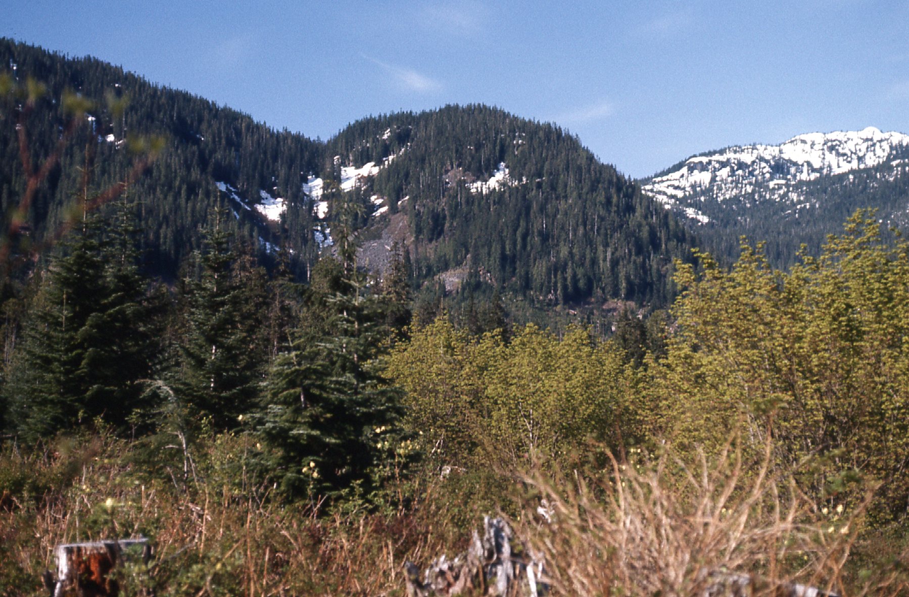
The western headwaters.
And one more look at the headwaters, here seeing the northern part of the uppermost drainage.
The northern headwaters.
As we continued west, climbing steadily, we approached a pass at 2,900 feet elevation – it was noon when we arrived. Before we got to the pass, though, I took this last photo looking down into Sloquet Creek, the way we’d come. We had started way down the valley and around the corner to the right days earlier.
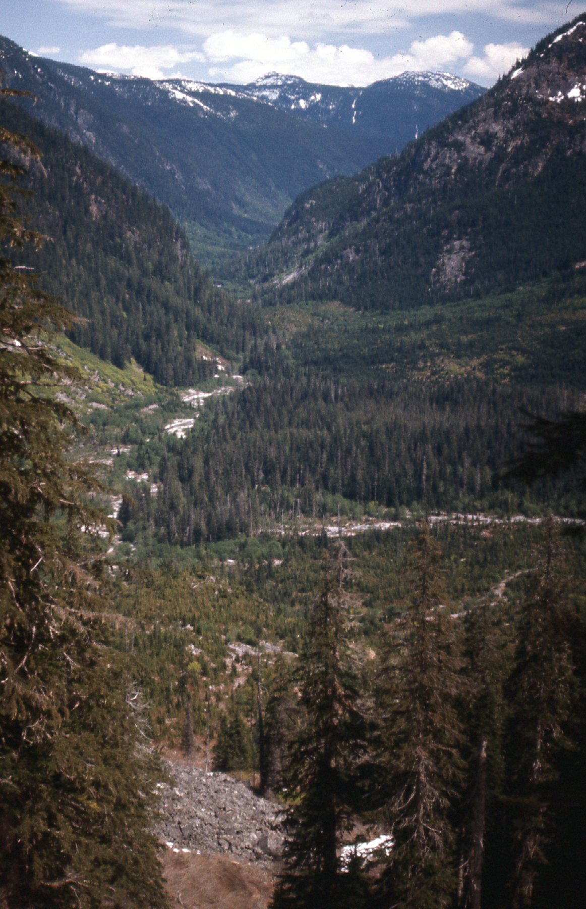
A last look east down Sloquet Creek
This was an exciting moment, one we’d spent days working towards. We were done with Sloquet Creek, and now could see down into the next drainage. This would be the start of the next big part of the trip. Even though the pass was at an elevation of only 2,900 feet and already it was June, there was a lot of snow there. As we started through, here is what we saw.
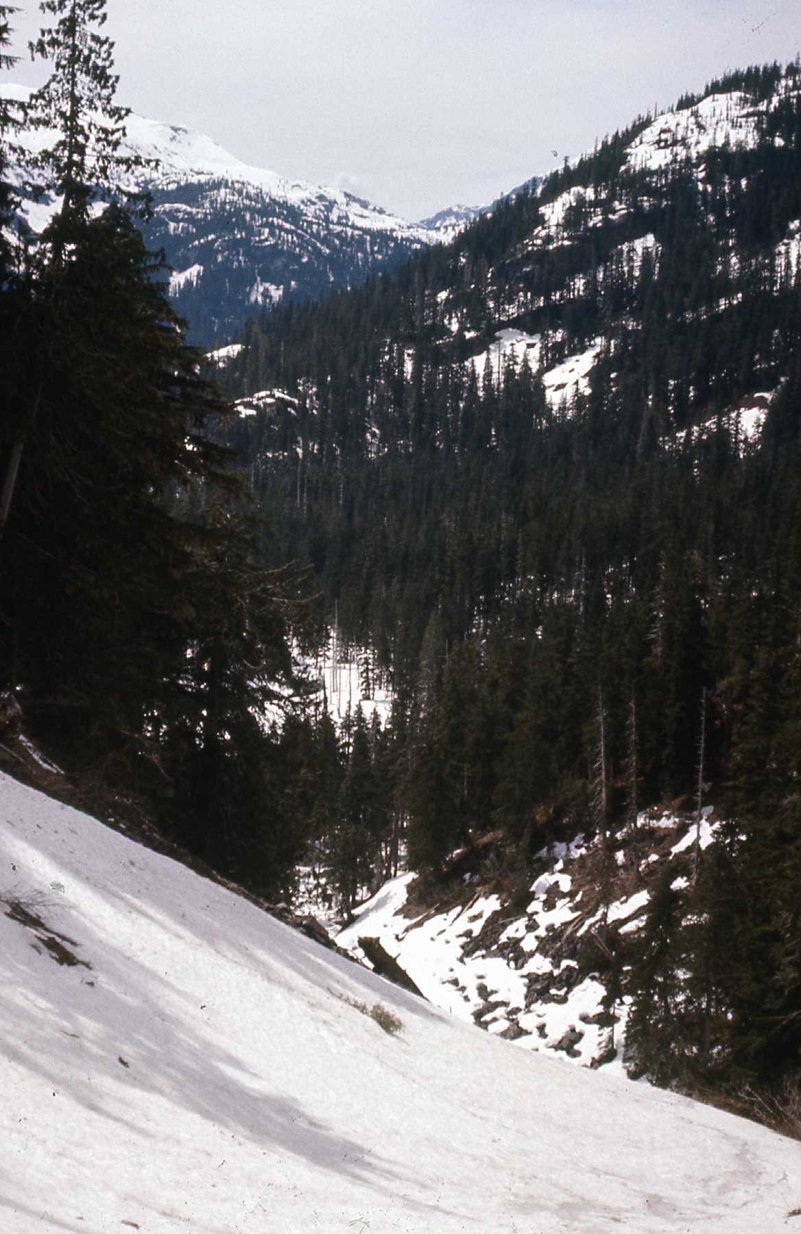
Working our way through the pass.
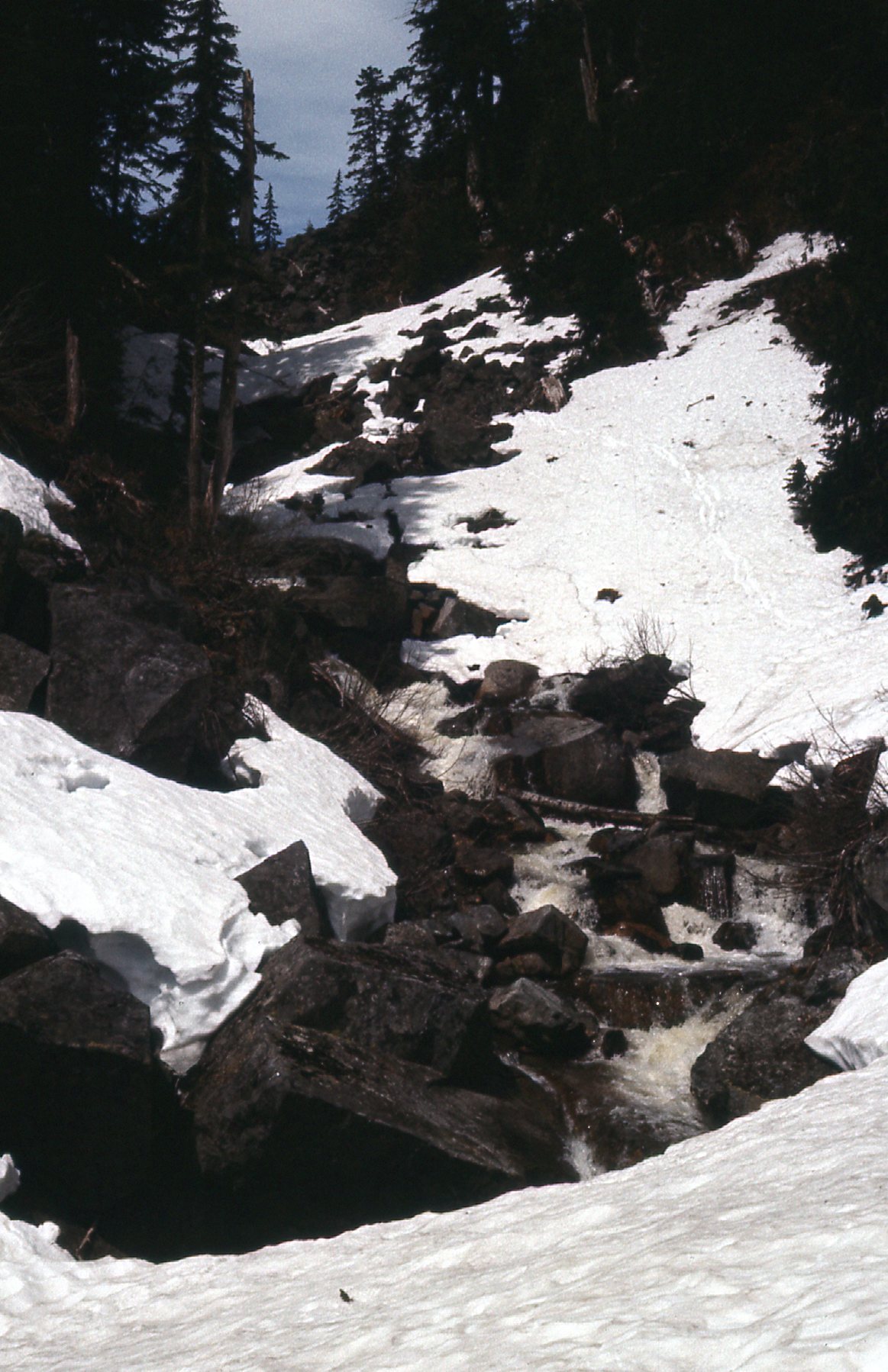
At around 2,500 feet, we came across this pond. The snow was still deep.
The pond
It was noon by the time we reached the pass itself, an exciting time as we had our first glimpse down into the Stave drainage. We followed this creek down for a while from the pass.
Starting down.
We passed by these bluffs a bit lower down.
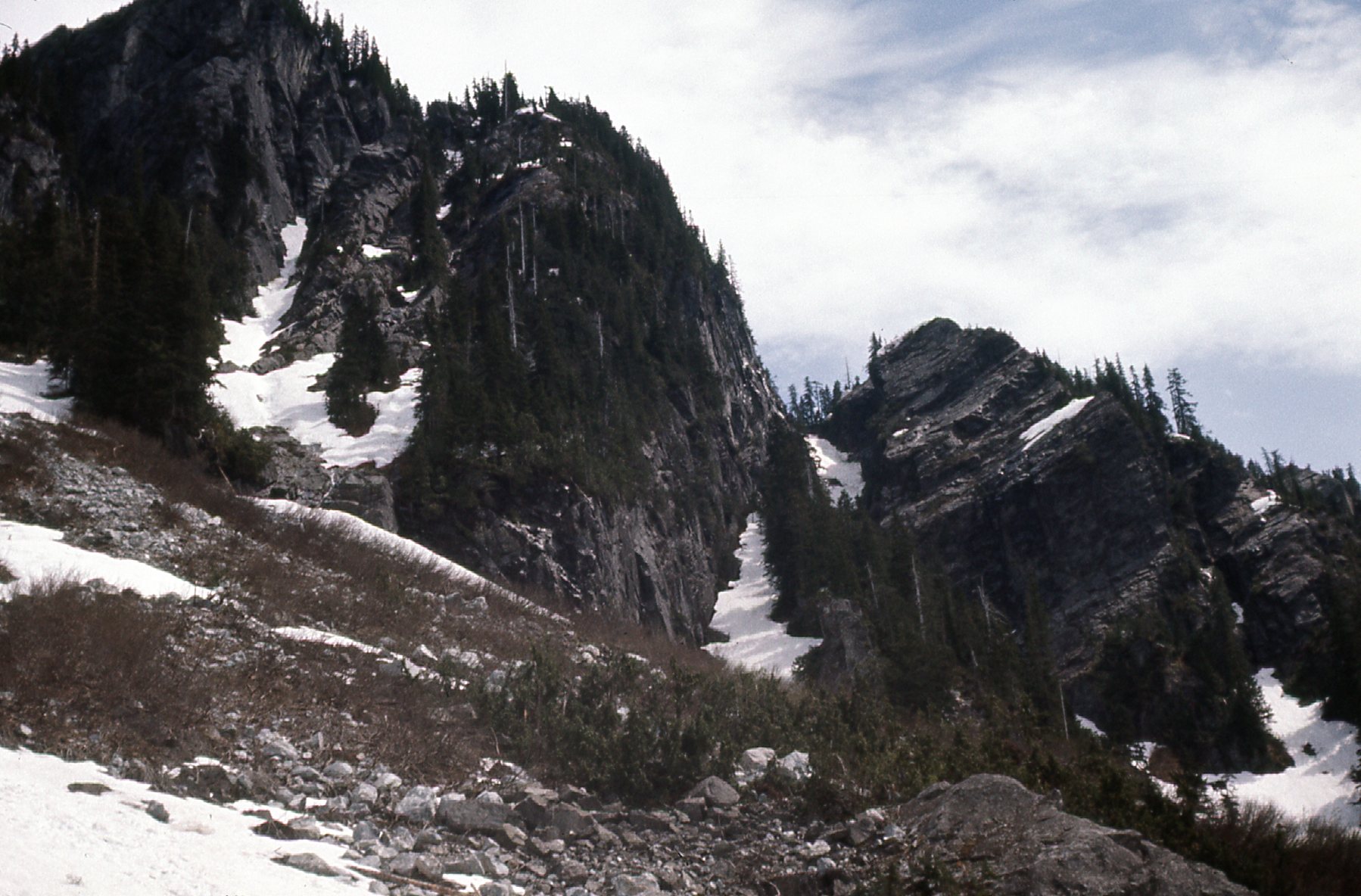
Some bluffs
Once out of the pass itself, we had this look to the terrain which awaited us down below. We’d have to pass through this logging slash to continue down.
Looking down.
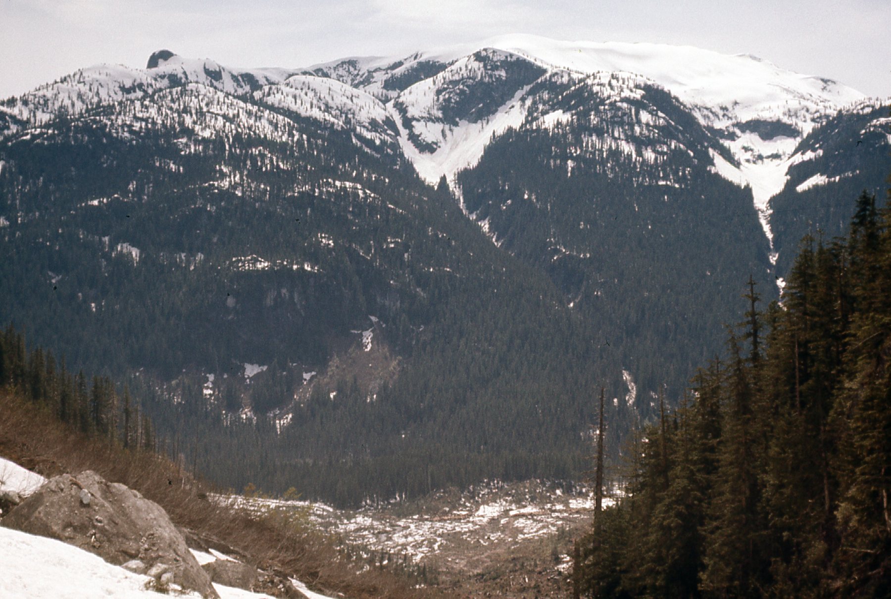
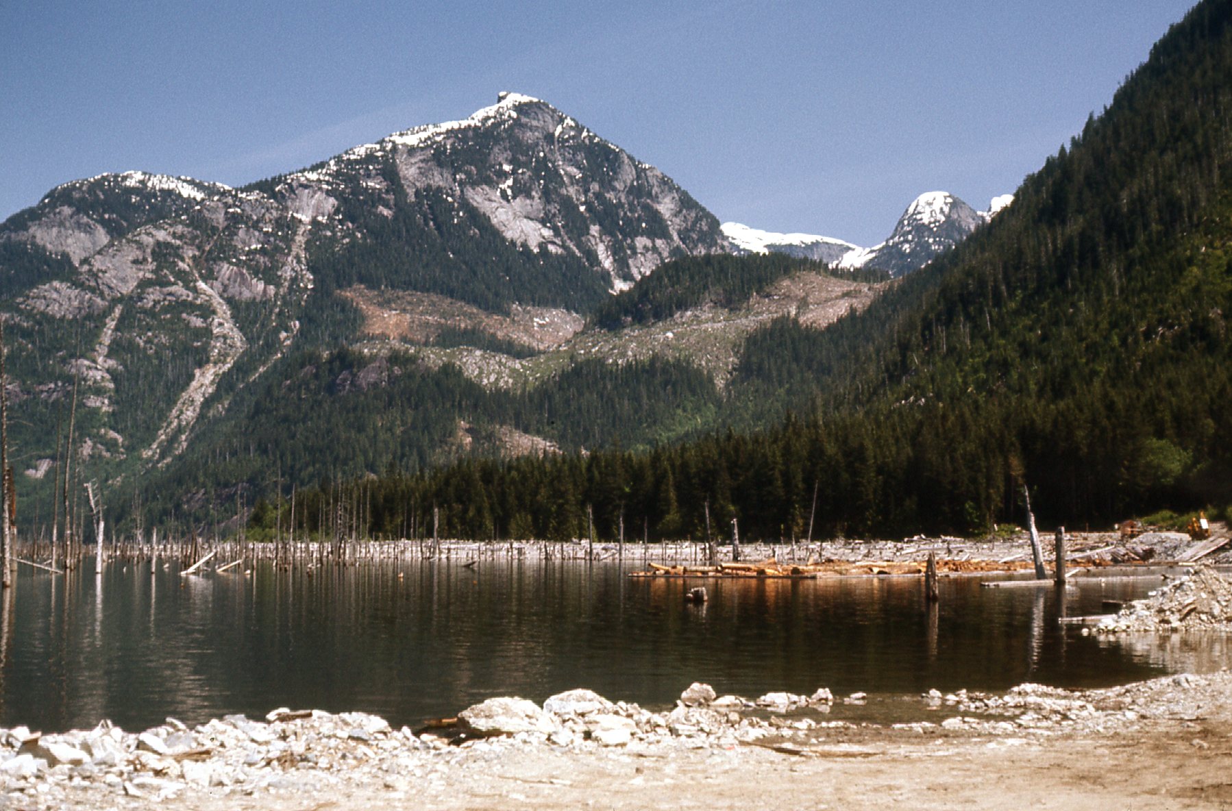
A full 3 hours later, we had walked down old spur roads to the main logging road by the Stave River, losing 1,300 feet in the process. As we descended, we enjoyed this view to the north.
Peaks to the north.
We would meet the Stave River at around 20 miles north of where it would eventually flow into the lake. The logging road was excellent, well-maintained and so much easier than bushwhacking. There’s a lot of daylight each day that far north, so we kept on going. With my telephoto lens, I snapped this shot of Mount Judge Howay from about 15 miles north of it that afternoon. More on this peak later.
The north side of Mount Judge Howay.
We managed to put in another 10 miles that day on the main logging road – man, our feet were sore. We camped in the shadow of Judge Howay which towered 7,000 vertical above us, and the bugs were horrific. I took this photo of the river at the 12-mile mark along the road – twelve miles, that is, north of the logging camp which sat at the mouth of the Stave River.
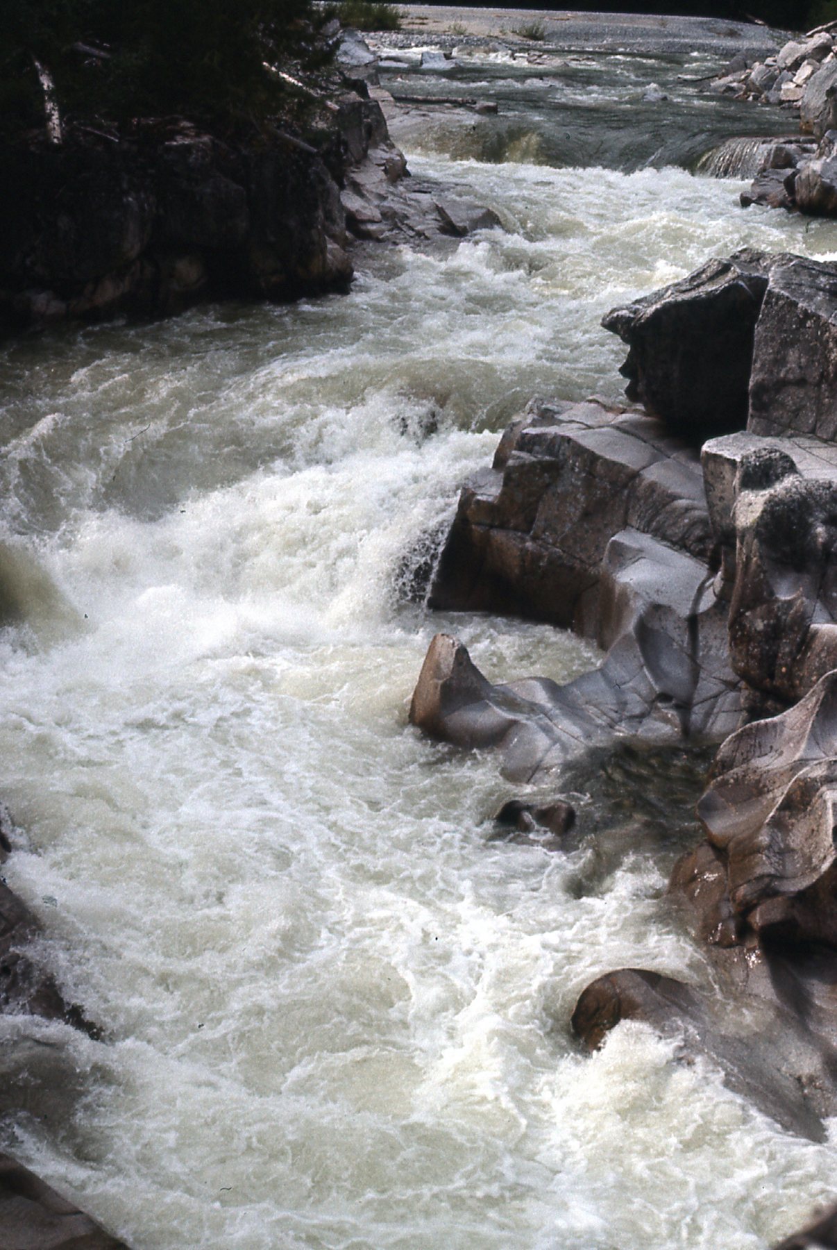
The rushing Stave River near 12-mile.
An aside – the Judge had a hold on me. In 1976, I knew 2 guys who had climbed it. The east side was a steep, Class 4 route, but the trick wasn’t so much the climbing; rather, it was the start. You had to ford the Stave River, chest deep here, in order to get over to the start of the climb. I gazed at it longingly, but didn’t have the nerve. Still, being so close, it ate away at me. I actually did return on my own a year later, intent on fording the river and doing the climb. Standing on the bank, I tried to get a feeling for how hard it would be to get across. There were big rollers, and white water, and it scared the shit out of me. I couldn’t get past the thought of me out there in that chest-deep water, pack over my head, getting swept away to my death. I chickened out and never went back.
Next morning, we set out again, heading south along the road. As we came around a corner, we confronted another black bear. This one acted like most of them did – terrified, it ran up a steep dirt bank, pissing itself as it went and disappeared into the thick brush. Here’s the view we had of the country just northeast of the the Judge.
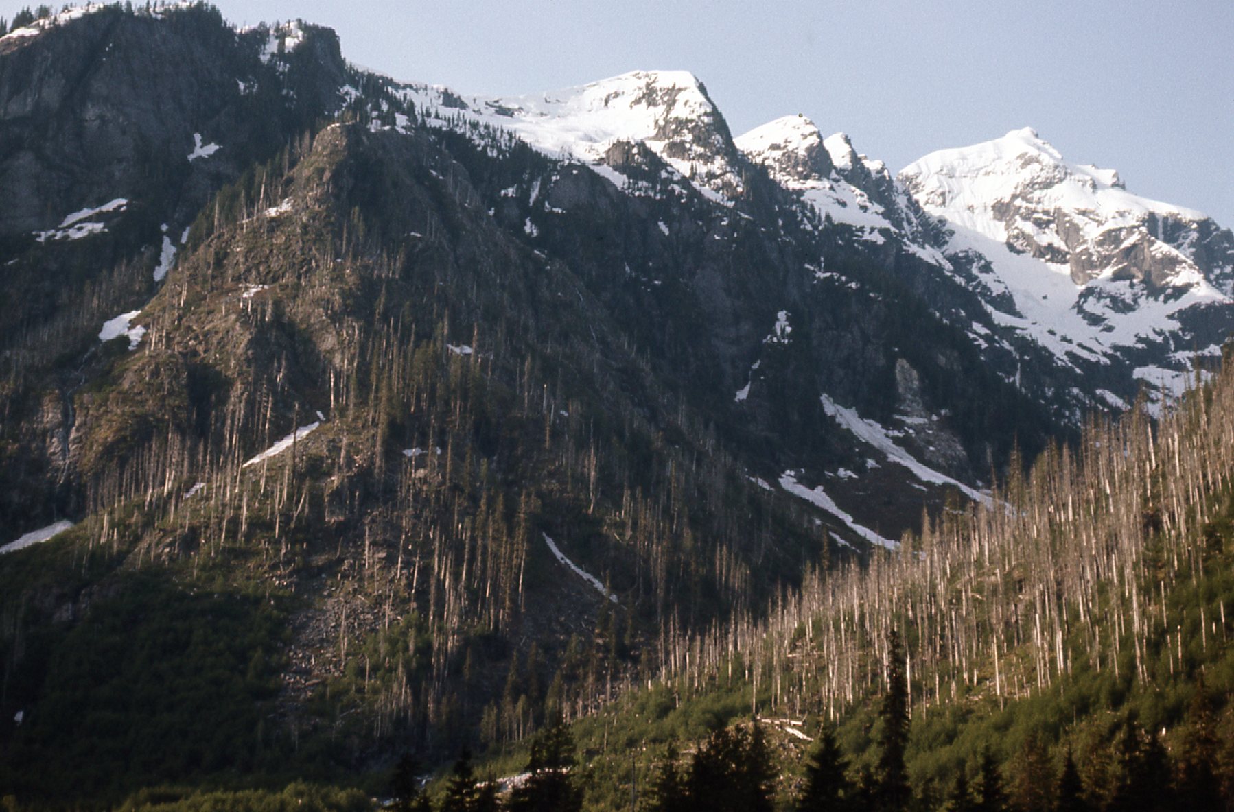
The northeast side of the Judge.
Another view, this time the east side of the Judge.
The east side.
Here’s one more, taken on the southeast side of Judge Howay – so much steep country around there.
Southeast of the Judge.
It took us another 3 1/2 hours of brisk walking to reach the camp. You should have seen the looks on their faces when we came walking in, like they’d seen a ghost. Here’s the thing – the only way you could get to their camp was by boat or plane from the south. None of them, not in a million years, would expect anyone to come walking in from the north – where in the hell would they ever have come from? – it was all remote wilderness up there. Oh, I almost forgot to mention that when we were still about 7 miles from the camp, a logging truck came by and offered us a ride the rest of the way. Maybe we were just gluttons for punishment, but we politely declined – we’d done all of it on our own steam up to here, and another 7 miles wasn’t going to kill us.
The hard part was all done – on this, our fourth day out, we had reached the big logging camp at the head of Stave Lake. We were back in civilization, so to speak. These were the first people we had seen in 4 days, and they treated us kindly, ushering us into their mess hall for some home-made pie.
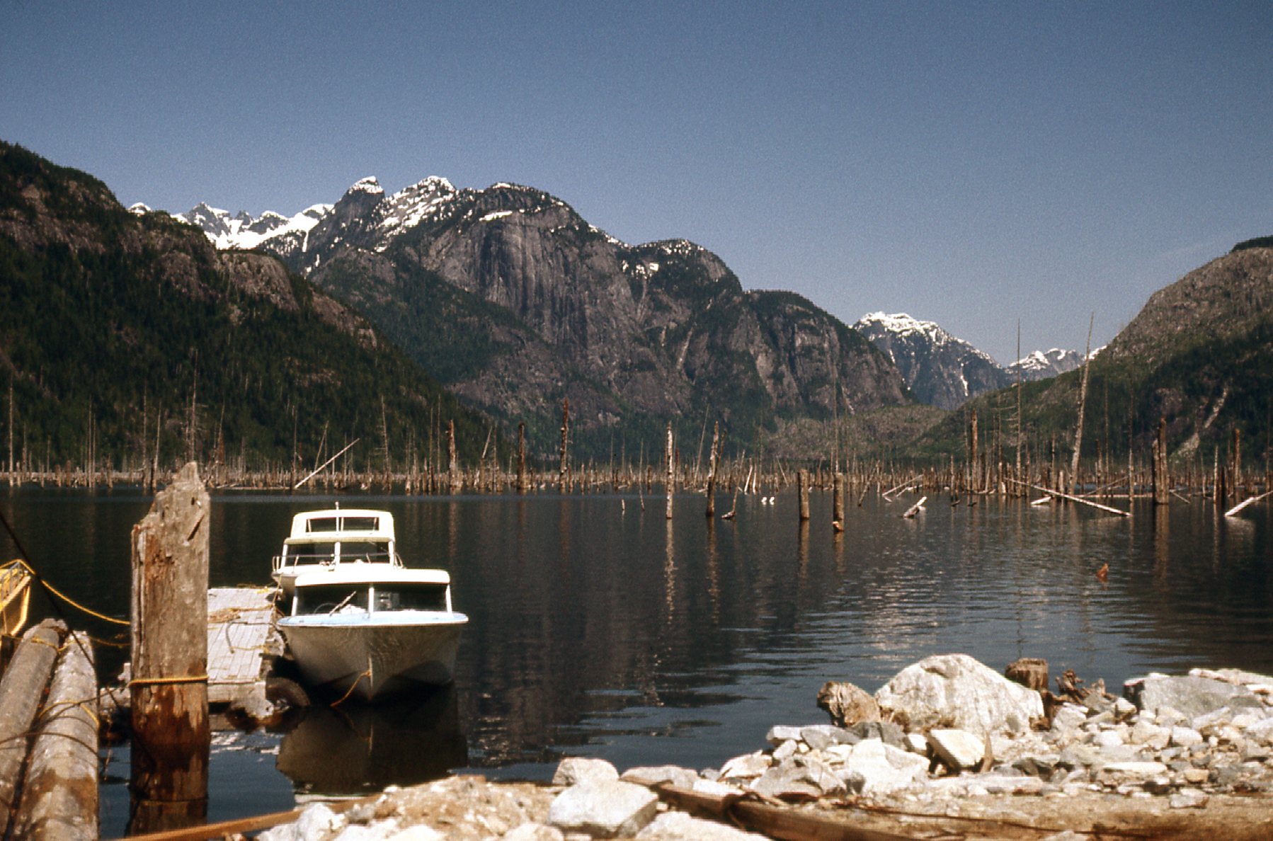
Our journey of adventure was over, or so we thought. Boats regularly plied the waters of Stave Lake, making the 18-mile run between the village of Stave Falls at the southern end of the lake and the camp at the northern end, where we now found ourselves. There was no way to drive out, so all traffic was via boat or plane. Our plan had been to catch a ride out on one of the boats. It turned out that a barge had left earlier that day, so we were stranded, for a while at least. Luckily for us, though, the Forest Service had a boat at the dock, and their man told us we could catch a ride with him down the lake the next day, and that suited us just fine. The rest of the day was spent on the boat dock, swatting flies and waiting for night to fall. From near the dock, we could see east up Roaring Creek, an active logging area.
Up the valley of Roaring Creek
We could also see back north up the valley that held the Stave River – it’s off to the right side of the picture.
A look back north.
And off to the west, across the lake, sat the striking Mount Robie Reid which Mike and I would climb together the following month.
The east side of Mount Robie Reid.
It was kind of an anticlimax to such a grand adventure. The forestry guy did let us sleep on the boat that night, though, and that helped. The next morning, away we went and were back home by mid-day.
The trip had been a success. It lasted 5 days, we had traveled 55 miles by boat, 50 miles on paved roads and close to 50 miles on foot. We didn’t know of anyone else who had done what we did, so we felt pretty good about our little adventure. Somehow, word of our trip got out, because a year or two later, I received a phone call from a man I’d never met. He said he was the son of the man for whom either Mt. Lamont or Kinnear Lake had been named – so many years later, I can’t remember which. He himself was elderly, and wanted to go in and visit the area to honor his father’s memory. He must have been a man of means, as he was willing to pay for a helicopter to take him and me to it. He just wanted to stand atop the mountain and see the area for himself. I guess he felt I was the resident expert on the peak, as I had recently been close to it. I had to turn him down, as I was about to leave on another climbing trip. Never did hear from him again – I hope he made it.
I hope you enjoyed seeing these long-lost photos as much as I did – I’m glad I could present them to you here.