
This is a story about an event that could have turned out to be a tragedy. Fortunately it didn’t, but even so it put the fear of God into me, a close call that could have cost me my life. It all started on a fine, sunny morning in September of 1974. I had been married for a year to a girl from Vancouver, and we decided to head out on a road trip. But let me back up for a moment. The trip wouldn’t have been possible if we hadn’t bought a car from a friend. She’s the one in this photo, the tall girl on the right next to the fellow in the red shirt. She sold us her car for a song, a Volkswagen Beetle, as kind of a wedding present. I’m surprised she did, as it was her pride and joy. It was a 1960 model, and we paid her $400.00 for it.
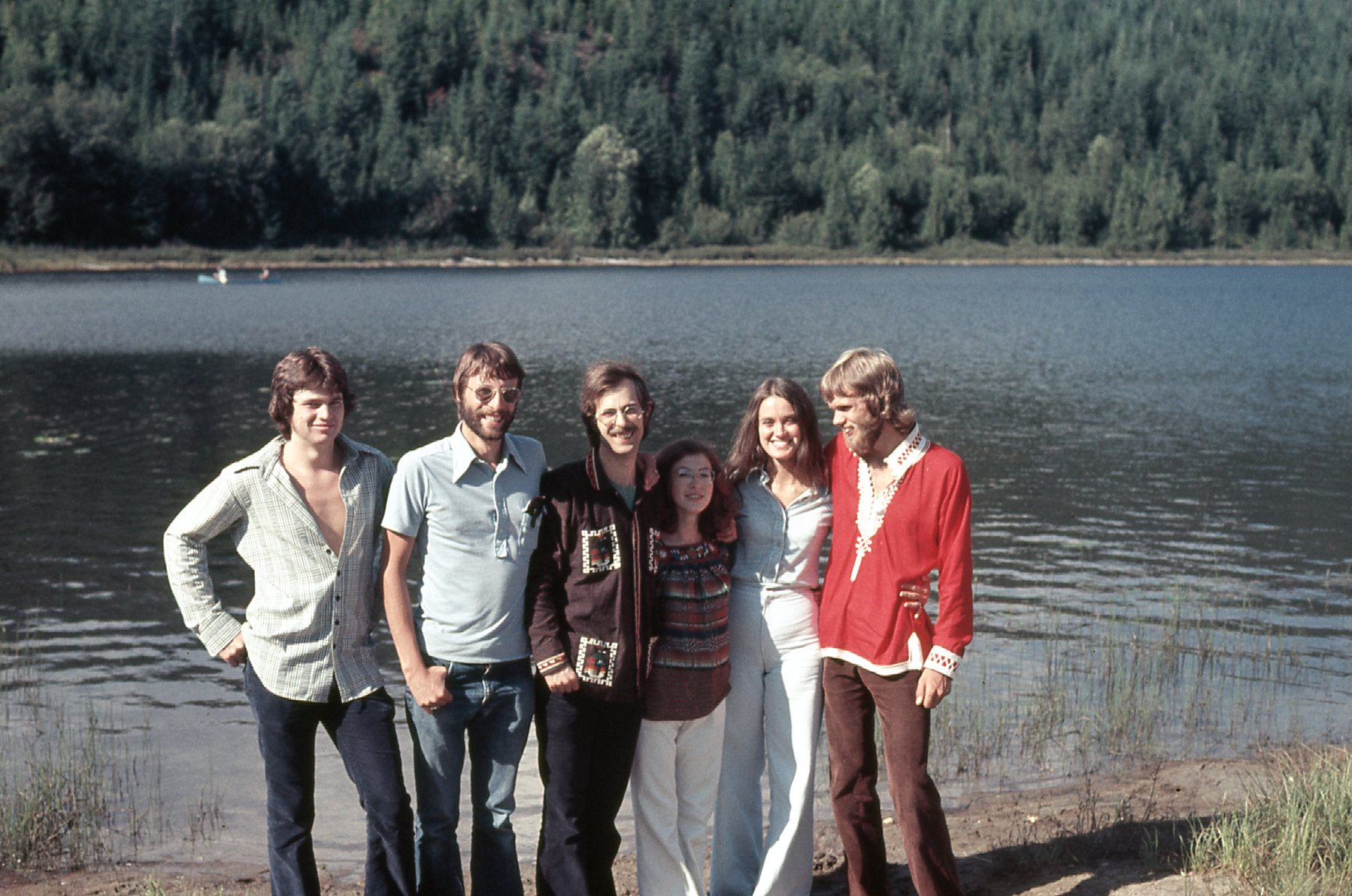
The seller of the car.
A striking feature of the car was its two-tone root beer paint job – she was really proud of it, and so were we as its new owners. We took good care of it, always kept it nice and shiny. So back to my story. Our goal was to head down to the States for a bit, then cross back into Canada and see the sights in the Interior of BC.
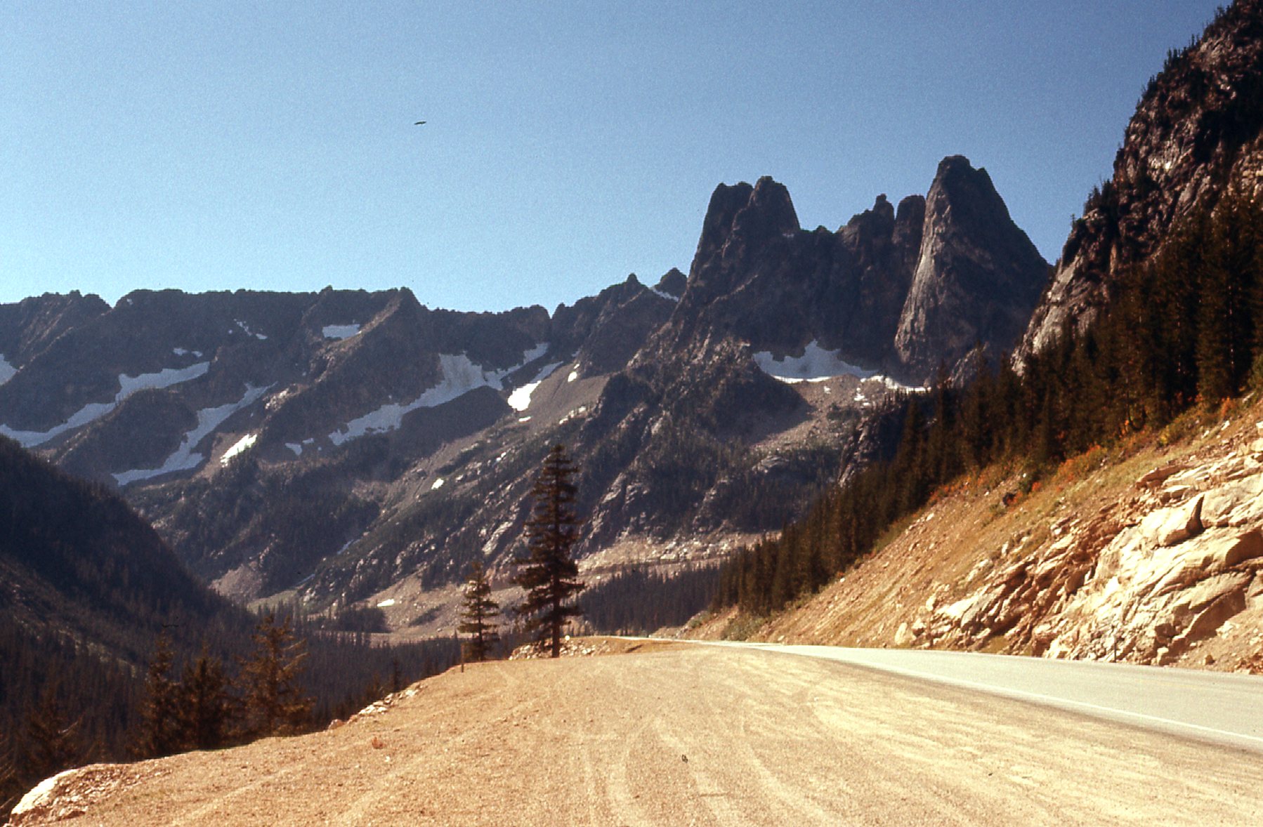
We left Mission by 8:00 in the morning and crossed into Washington at Sumas, then drove State Highway 9 down to Sedro-Woolley. It was a nice, scenic drive and only took us an hour to drive the 40 miles. A sign at the edge of town proclaims it “Gateway to the North Cascades”, and in fact State Highway 20 heads east from there and through North Cascades National Park. I was pretty excited, as I’d known about Highway 20 for a long time but had never driven it. Apparently it gave access to a lot of significant peaks in the North Cascades, and although we had no plans to climb anything this fine September day, at least we’d get a good look at things. Here follows a road diary of sorts of our drive that day.
Heading east out of town, we found ourselves heading up the valley occupied by the Skagit River. Not many rivers start in Canada and flow south into the United States but this was one of them. It’s about 150 miles long, with its headwaters in Manning Park in British Columbia. It flows from its source northwest along Highway 3, then southwest past Silvertip Mountain and into the Skagit Valley. Another ten miles or so heading south sees it crossing the border into the US and becoming Ross Lake. The only reason the lake exists is because it’s impounded behind the Ross Dam. Below the dam sits Diablo Lake, which owes its existence to the Diablo Dam. One more hurdle, the Gorge Dam, impounds Gorge Lake below the Diablo Dam. These 3 dams generate hydroelectric power, and the Upper Skagit Indian Tribe wishes they weren’t there because of the impact they’ve had on their historical lands. Just over 60 miles from Sedro-Woolley puts you beside the Diablo Dam. This far east, the valley of the Skagit had narrowed and we found ourselves surrounded by mountains. One of the first striking peaks we could see from the highway was Mount Blum, named for John Blum, a Forest Service fire patrol pilot killed in a crash in 1931. Mount Blum isn’t exceptionally tall, only 7,685 feet, but boasts a whopping 3,281 feet of prominence. It sits about 14 miles north of the highway, and is located east of Mt. Shuksan and west of the Pickets.
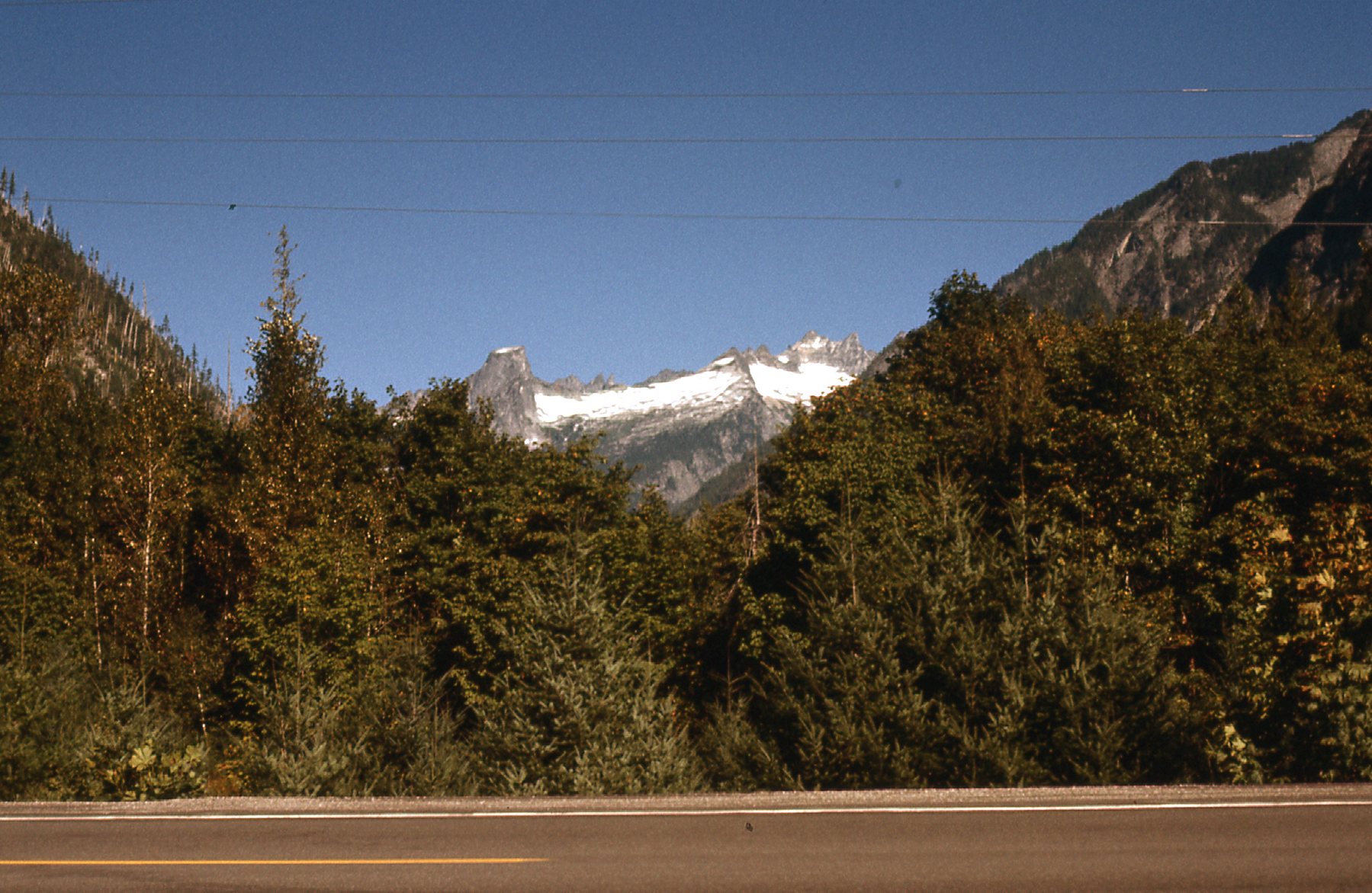
Looking northwest to Mount Blum.
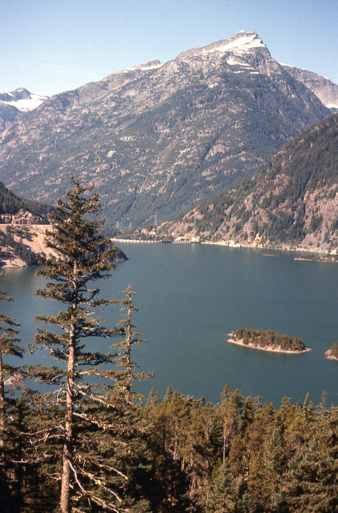
Here’s a view we had of Diablo Lake.
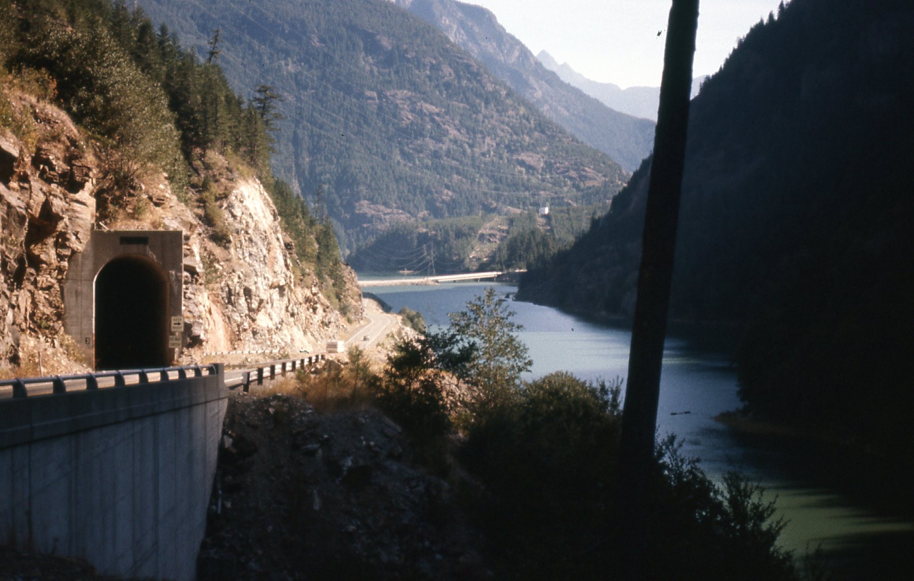
Diablo Lake
Once beside Diablo Lake, we had a good look at Colonial Peak. It sits barely 2 miles from the highway, and at 7,772 feet is about the same height as Mount Blum.
Colonial Peak on the left.
Here’s another view of Diablo Lake – you can see the dam at the other end.
Diablo Lake, looking west.
To take advantage of the scenery, the highway had numerous pullouts for motorists to safely park off to the side. There were signs pointing to all of the best peaks. You could stop and take pictures to your heart’s content without being a hazard to other vehicles. Actually, back in the day there were signs telling you to pull over and let others by if there were 3 or more vehicles behind you. Here’s another of those spots, from which I took this telephoto shot of Goode Mountain. At 9,350 feet, it is the highest peak in the North Cascades between the Skagit River and Lake Chelan, and was named for topographer Richard Goode of the USGS. It has 3,809 feet of prominence.
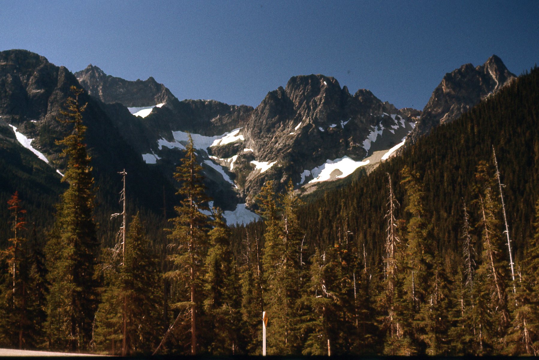
Goode Mountain, the point on the far left in the back. We are looking southwest.
Here’s another peak only a mile east of Rainy Pass (4,875′) along the highway. Whistler Mountain, at 7,790 feet, is part of the Okanagan Range, which is a sub-range of the North Cascades.
A look east to Whistler Mountain.
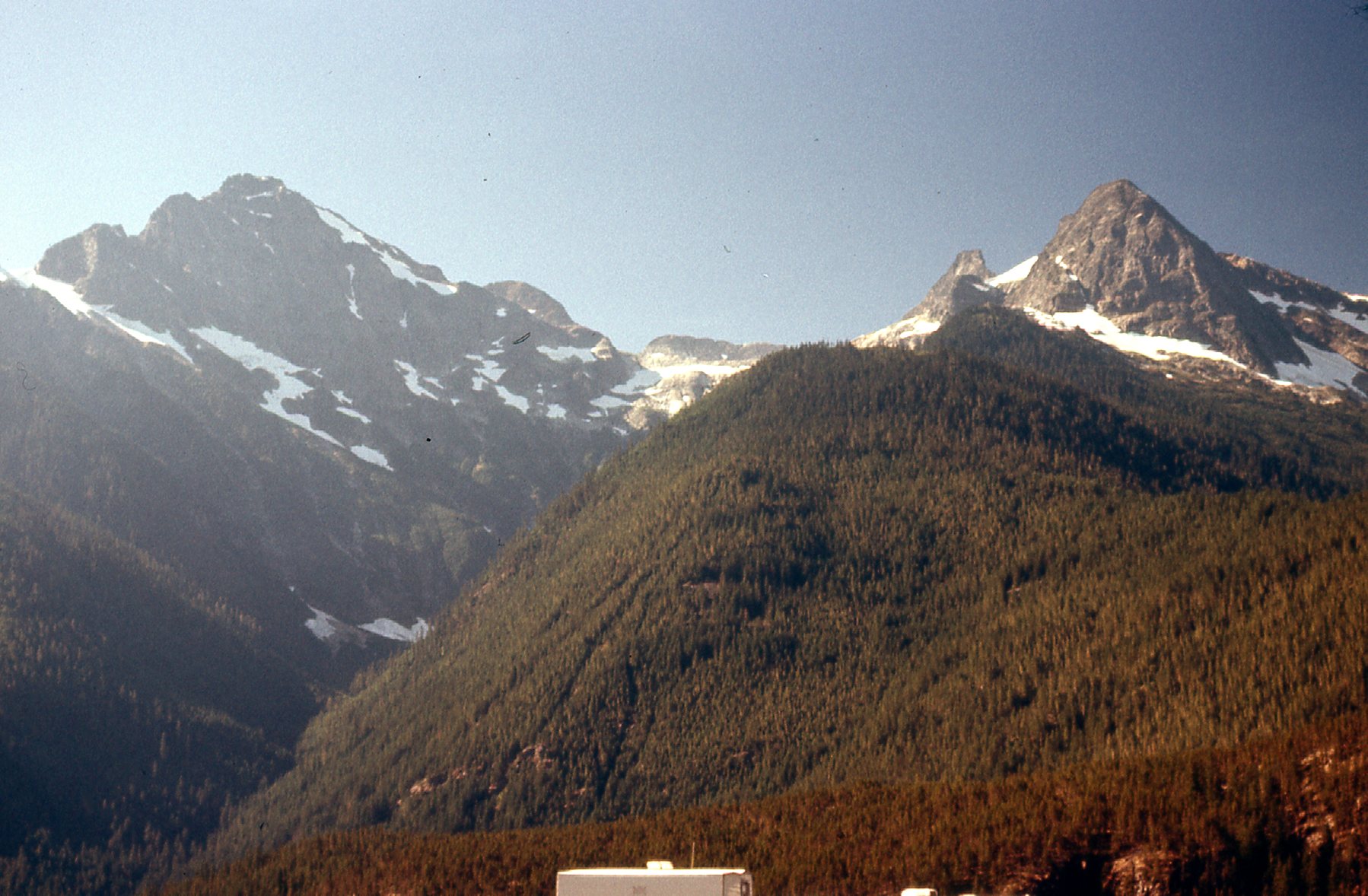
Soon after, we reached Washington Pass. At 5,477 feet, it is the highest spot along Highway 20. At this point, we had driven a hundred miles east from Sedro-Woolley. We had this look at Silver Star Mountain from the pass – it is only 4 miles away to the northeast. At 8,876 feet, it’s not the highest peak in the area, but it’s plenty rugged and has several technical routes to its summit. It also has 2,436 feet of prominence.
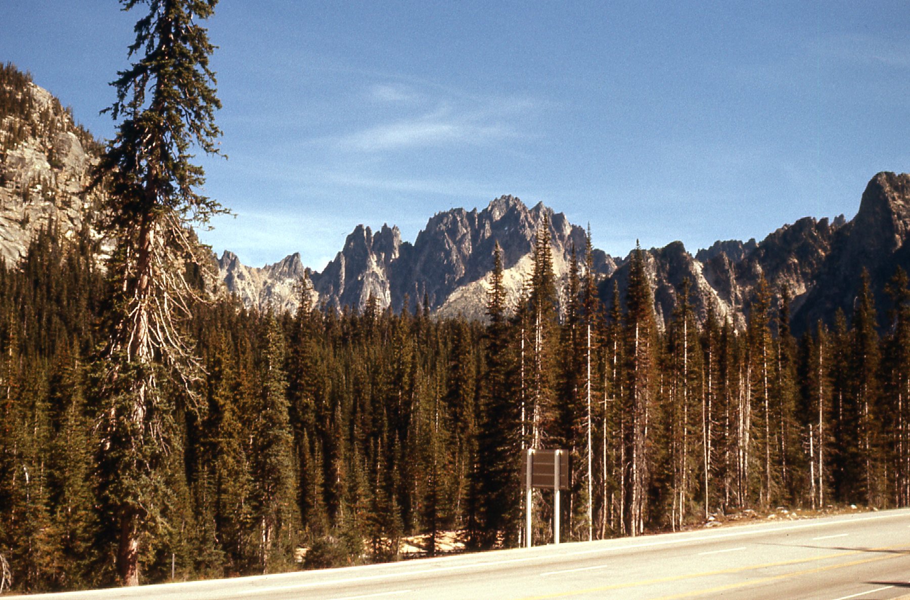
Silver Star Mountain
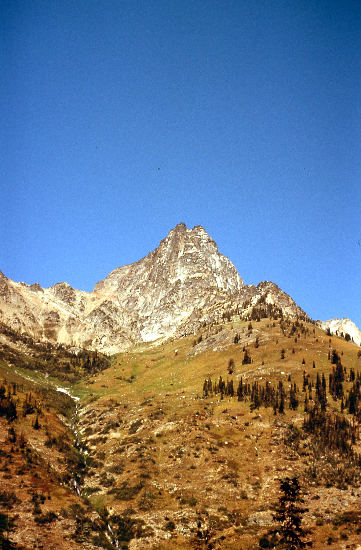
Also visible from the pass is this beauty, the iconic peak known as Liberty Bell Mountain. At 7,720 feet, it’s not the tallest thing around, but what it lacks in height it makes up for in difficulty. The first ascent was done in 1946 by none other than Fred Becky and friends. When they did it, though, the highway hadn’t yet been built so they had a 17-mile approach. Nowadays, it’s an easy mile on a nice trail. Becky’s route is rated at Class 5.6 and is the easiest route to the top. There are plenty of other, harder routes on its many faces. One of them, the Liberty Crack, is listed in the book “The 50 Classic Climbs of North America”, and is rated 5.10d with aid involved. Most people take 2 days to make the climb.
Liberty Bell
From the high country of Washington Pass, the highway headed downhill, following Early Winters Creek and then the Methow River. We passed through Mazama, Winthrop and Twisp, all the way down to 2,500 feet before climbing once again up to the Loup Loup ski area at 4,000 feet. The highway didn’t stay high for long, soon descending steadily and arriving at the town of Okanogan, Washington all the way down at 840 feet above sea level. We had traveled another 71 miles from Washington Pass.
Now that we were done with Highway 20, it was time to start back north. We followed US Highway 97 which stayed near the Okanogan River. I said earlier that not many rivers seemed to flow south from Canada into the States, but this one made a liar out of me. The name is spelled differently north of the border, where they say Okanagan. Same pronunciation, though. We passed through the towns of Omak, Tonasket and Oroville until, 52 miles north of the town of Okanogan, we crossed the border back into Canada and arrived at the town of Osoyoos.
So far, so good. No incidents to report, the little VW was running well and we had thoroughly enjoyed the drive through the North Cascades. Now we were ready for the next phase of our adventure, a long and scenic drive through the Interior of British Columbia. We were almost done for the day. Another 30 miles east on BC Highway brought us to the village of Rock Creek, and just north of it we found the Kettle River Campground. It was 4:30 PM when we arrived, and we settled in after our 300-mile drive for a relaxing evening. Little did we know the drama the next day would bring.
I had done nearly all the driving the previous day, and my wife said she’d like to take the wheel the next morning. That was fine by me, I’d like a break. We left the campground and headed north on paved Highway 33, arriving a few miles later at the village of Westbridge. This was a tiny place with a few scattered homes and a general store and gas pump. It was here that we left the paved highway and started north on a gravel road known as the Christian Valley Road. This was the start of an adventure, something we had planned for some time. This road would more or less follow the Kettle River through forested land for a long way until eventually it would reach another paved highway.
As we rolled along, there was a time or two I asked her to slow down as we approached a curve in the road. After all, it was a gravel surface and it would have been easy to lose control. I was becoming alarmed because I felt she was driving too fast. Then it happened. We approached a fairly sharp turn, and she was doing at least 30 miles per hour. It was too fast, and the car went into a 4-wheel skid. She tried to turn the steering wheel to correct for the skid but we drifted to the left and off the road. Not only did we skid off the road but the car overturned on to its right side. In that split-second, I thought “This is it, we’re gonna die!”. It was all over in a moment, the car came to rest on its right side. Thankfully we were each wearing a lap belt, which probably helped somewhat.
I was lying against the passenger door, and she was hung up in her seat belt and partly lying on top of me. Once the shock of what had happened passed, somewhat dazed, we took stock of the situation. Neither of us seemed hurt, so that was good. The car had a sunroof, which I was able to open and we crawled out through that. The ground where we came to a stop had some rocks as well as dirt, and we weren’t sure what would be the condition of the car on the side that was hidden on the ground. The car hadn’t burst into flames, so that was a good thing. The first thing that occurred to us was to wonder if we might be able to get the car upright again. It was pretty light and was sitting in a way that it looked like we might be able to do it. Well, it was nothing short of a miracle, but we actually did it. With a mighty thump, the car landed upright. Only then did we see the damage. The entire right side was badly scraped, with several big dents. In this next photo, you can see the main road we had been driving on across the bottom of the photo.
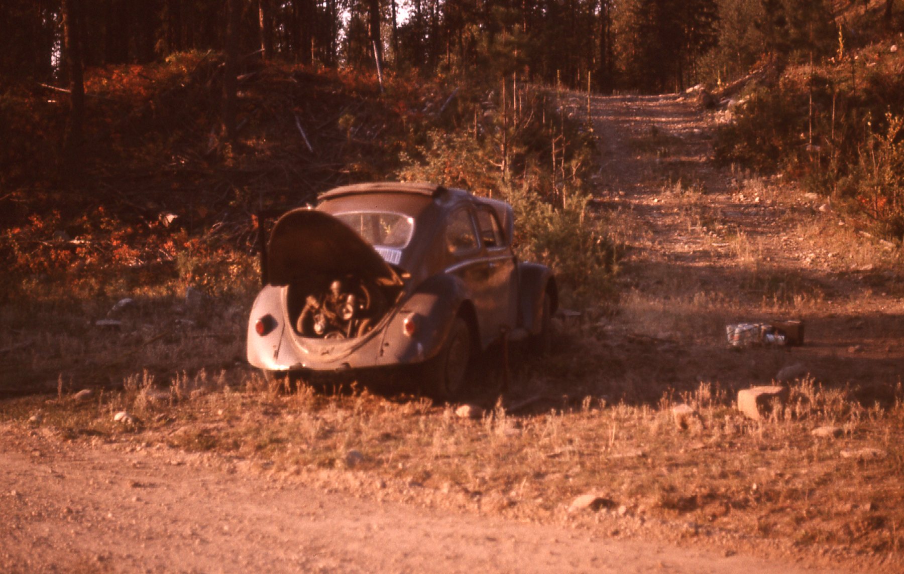
This is where the car came to rest.
As well as the body damage, we noticed right away that the 2 tires on the right side were flat. I managed to jack up the car and replace one of the flats with the spare we had. That still left us with one more flat tire. I jacked up that part of the car and removed the wheel. It was decided that she would remain with the car and our stuff, while I would start back south with the wheel and try to get it fixed. We recalled seeing a repair shop of sorts at Westbridge and hoped they’d be able to fix the flat. It took a while before a pickup came along and gave me a ride the 14 miles back to the village. There, I found a guy at the shop who had a look at the tire and pronounced it repairable and took care of it for me. By the time all was said and done and I had hitched a ride back north to the waiting VW and got the tire back on the car, a full 4 hours had passed. Here’s a photo of that side of the car, taken a day later, showing how it was scraped up. See the dented roof? The door would barely close.
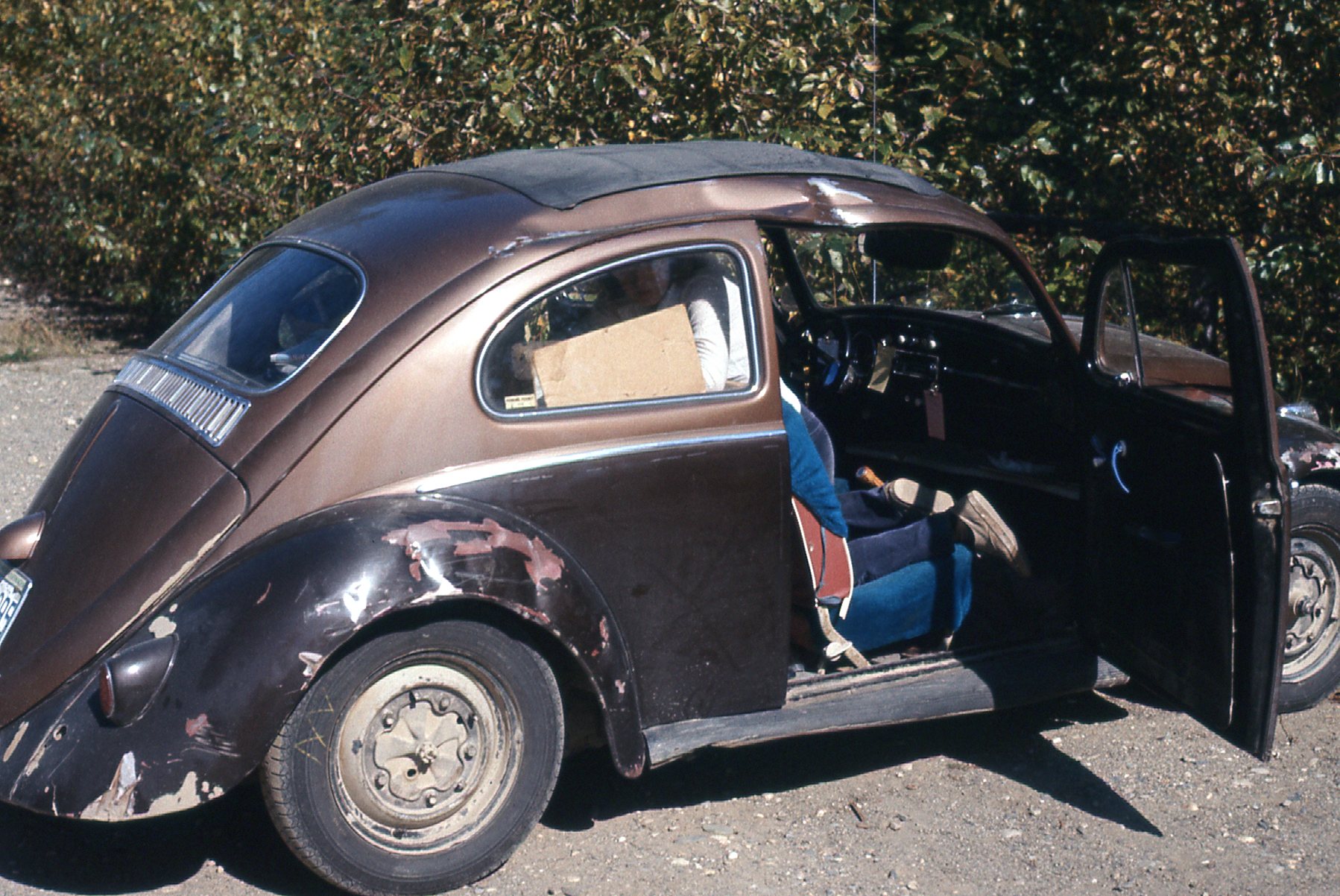
Not so pretty anymore.
The car seemed to drive okay, as normally as before the accident, so we decided to continue with our holiday. It was just over a hundred miles from Westbridge north to where we emerged at BC Highway 6, and the day was getting on by the time we finally arrived at the village of Edgewood. We had planned to drive south from there, another 100 miles or so on gravel roads, through the wilderness to reach the town of Grand Forks. However, the close call with the accident had left us both somewhat shaken and we weren’t quite ready for another adventure, deciding instead to stick with paved roads for a while. All in all, we were pretty lucky to have escaped injury. The car’s damage was never fixed, and its appearance went steadily downhill from there.