
I was really looking forward to this trip because it was into an area I’d never visited before. It’d be a bit of a drive to get there, but I always enjoyed a road trip anyway. The only vehicle I had was a 1960 Volkswagen Beetle – it was plenty beat up but still seemed reliable enough for a lengthy drive. There was a repair shop in my small town and they did a good business with customers like me who owned these old Beetles. When your engine started to under-perform, you’d take it in and they’d swap it out for a rebuilt one and away you’d go – nothing that a couple of hundred bucks didn’t take care of.
From my town of Mission, I drove the 50 miles west into Vancouver, then north past Squamish and Whistler to arrive at Pemberton. That leg of the trip was another hundred miles past oceanside vistas and beautiful mountain scenery. Pemberton was a pretty small place back then, I’d wager not much over a thousand souls. The real adventure would begin there.
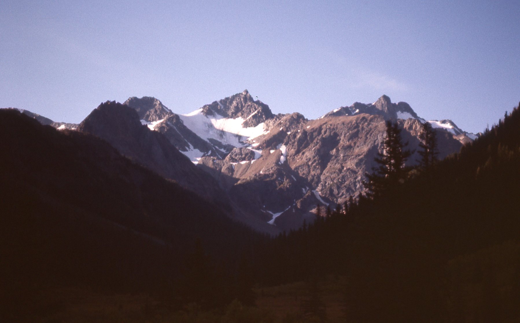
I drove northwest along the Lillooet River through an agricultural area for about 20 miles, passing by a spot known as Pemberton Meadows. Once past the farmland, it was just good old BC forest, logged of course. Here’s a view I had looking farther up the valley – the river’s source was another 30 miles upstream in the Lillooet Crown Icecap.
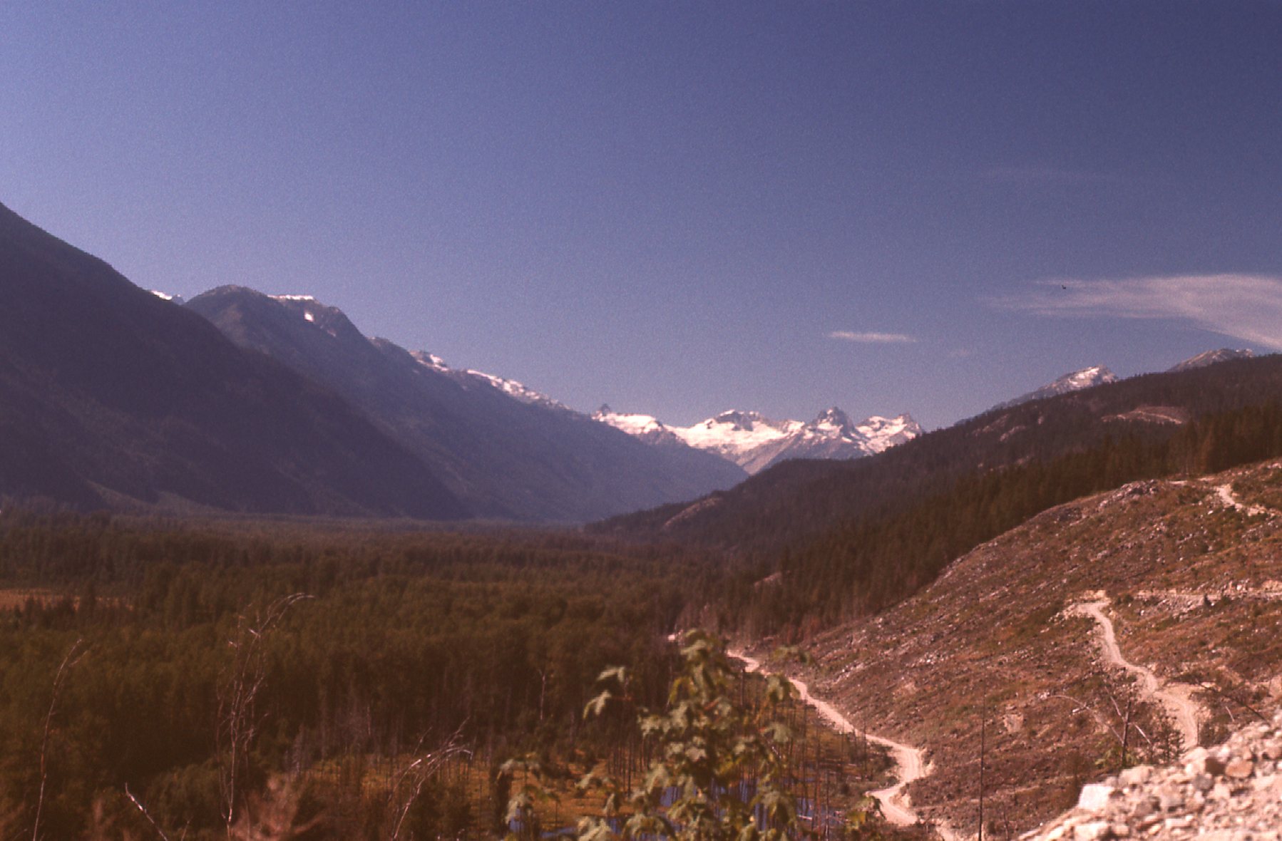
Looking west up the Lillooet River
The Lillooet Icecap is one of the larger icefields in the Coast Range. Ring Pass on the edge of that area was once considered as a possible route for the Canadian Pacific Railway. The survey party led by Stanley Smith was lost in that area and never found. As a consolation prize, the Stanley Smith Glacier was named for him.
The road I needed to drive climbed steeply north out of the Lillooet River Valley, up into the drainage of Railroad Creek. After a quick initial gain of about 1,700 vertical feet, the gradient eased quite a bit but did continue to climb, finally reaching Railroad Pass at 4,544 feet. The forest was beautiful as I drove along. One thing that still stands out in my mind today is this. On the AM radio in the Beetle, I could pick up the CBC radio signal being broadcast from Pemberton. The Metropolitan Opera was on the air that Saturday afternoon and it kept me company for those many miles. Once beyond the pass, the road went steadily downhill, following the drainage of the Hurley River. It was a rough road back then, and apparently it still is today, websites saying it requires a 4WD vehicle and bringing a spare tire. They say it’s only open from June to September most years. Someplace along the way, I took this picture of a cabin I saw. That’s the old Beetle there.
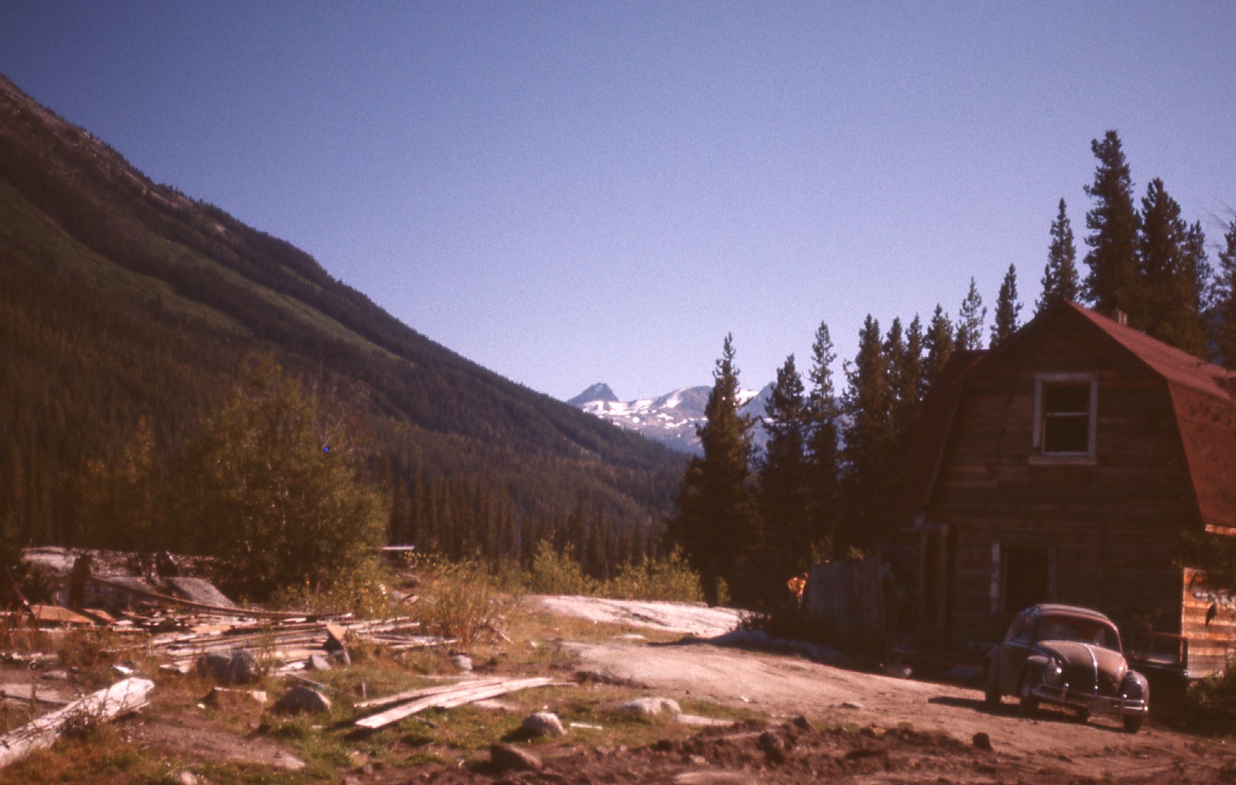
The cabin.
It’s only 46 miles to drive from the Lillooet River Valley to finally reach the town of Bralorne, but it took hours and I loved every minute of it. Before I reached Bralorne, I took a brief side trip to the Lajoie Dam on Downton Lake.
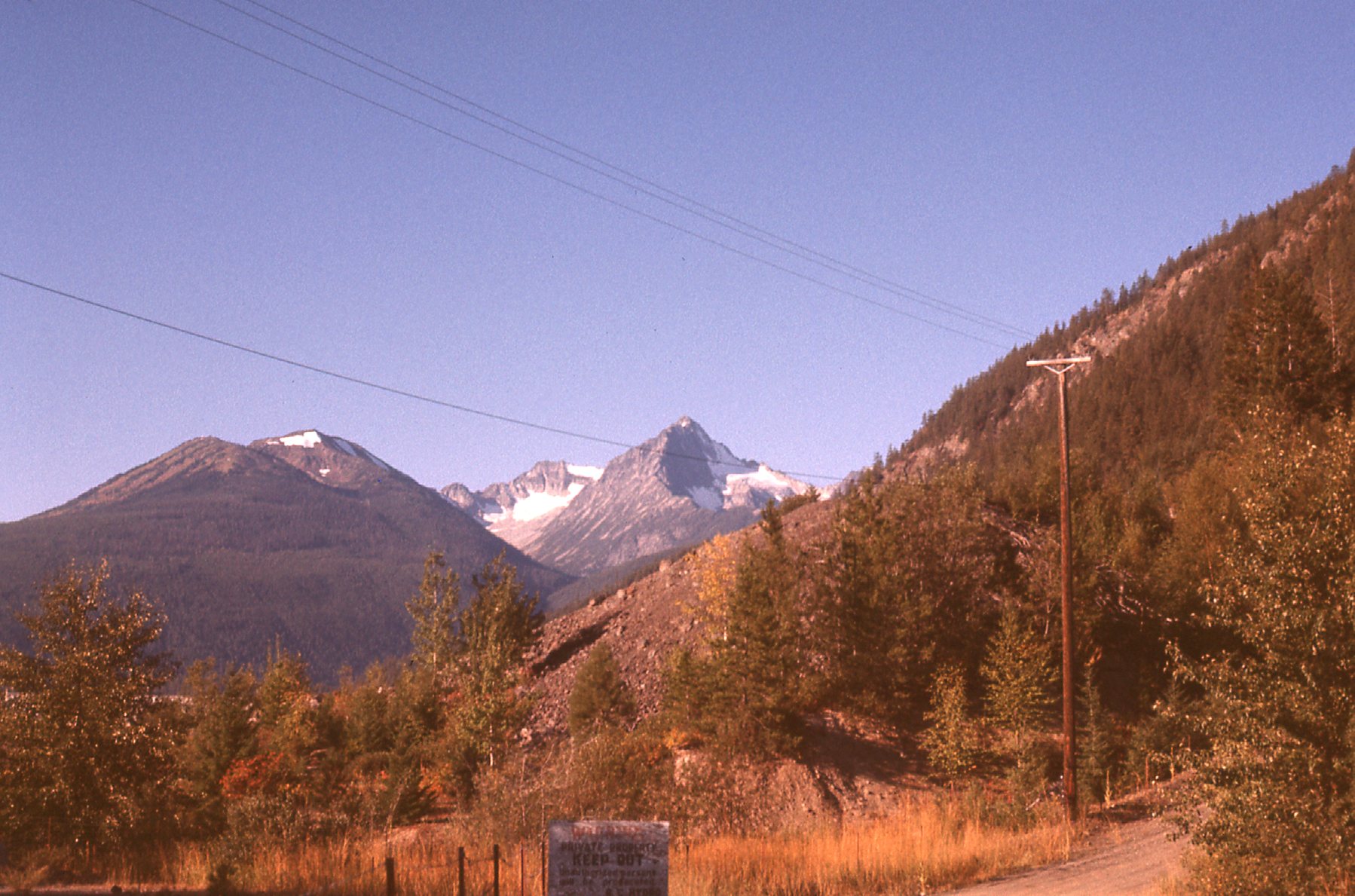
Near Downton Lake
Seeing all of this beautiful country was great, but I’ll bet you can guess the real reason I’d come all this way – to do some climbing, of course. Eight miles past Bralorne, I came to the community of Gold Bridge, a tiny place, but the jumping-off point to my real destination. Gold Bridge sits above the west end of Carpenter Lake, a man-made reservoir 31 miles long impounded by the Terzaghi Dam. I drove a few miles more to Gun Lake where I camped for the night.
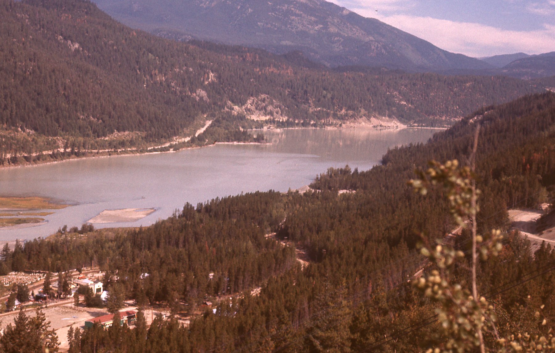
Carpenter Lake – looking east.
Early the next morning, I drove back to Gold Bridge, where I then followed the dirt road along the south shore of the lake for about 7 miles. That brought me to what was known as the Truax Creek road. As I drove up that dirt road, I climbed steeply, gaining almost 2,000 vertical feet in the first few miles, then drove south for several more miles to reach its end at about 6,500 feet. This was no logging road – it had been made by miners. I found this old grader, long-abandoned, along the way.
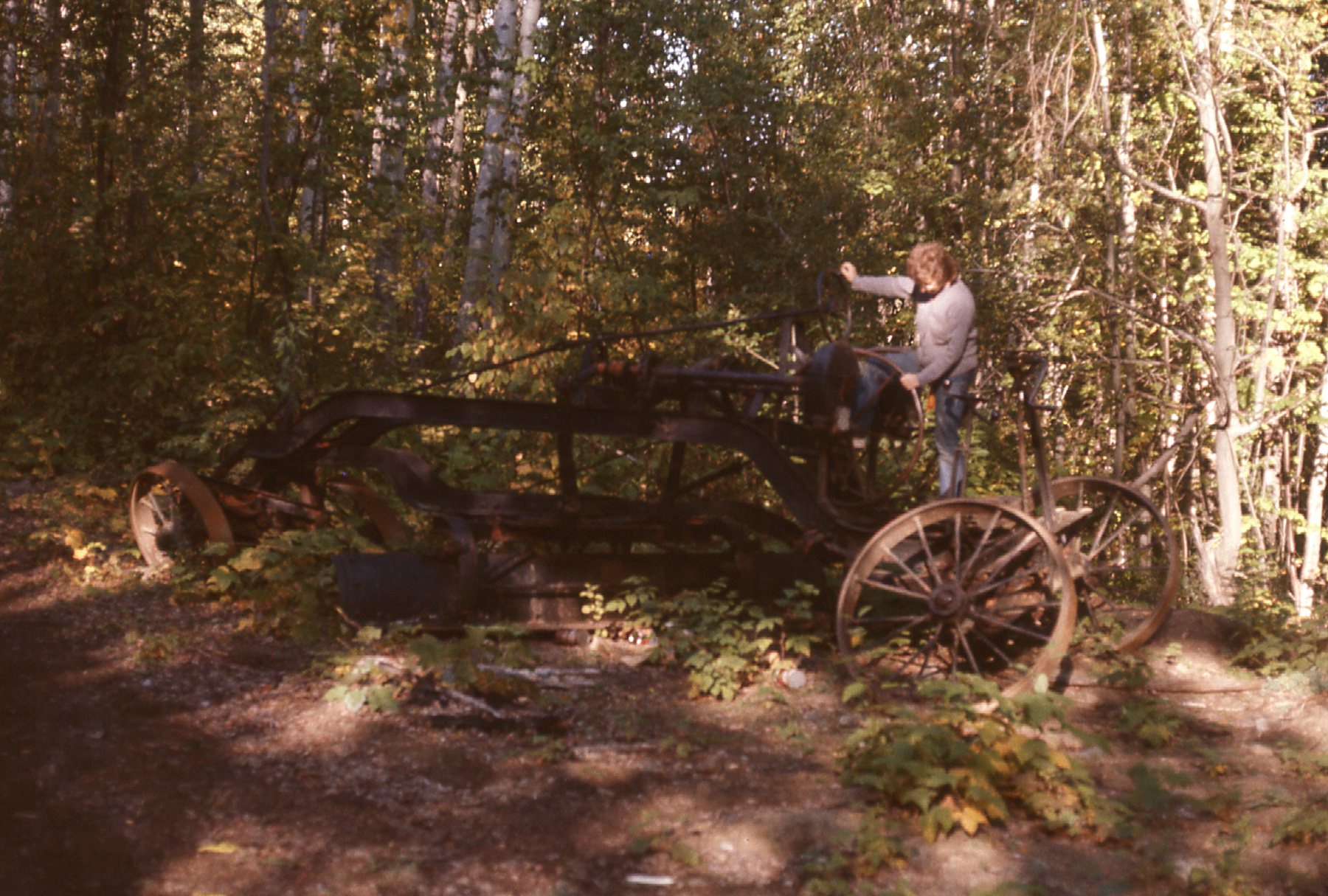
The old grader.
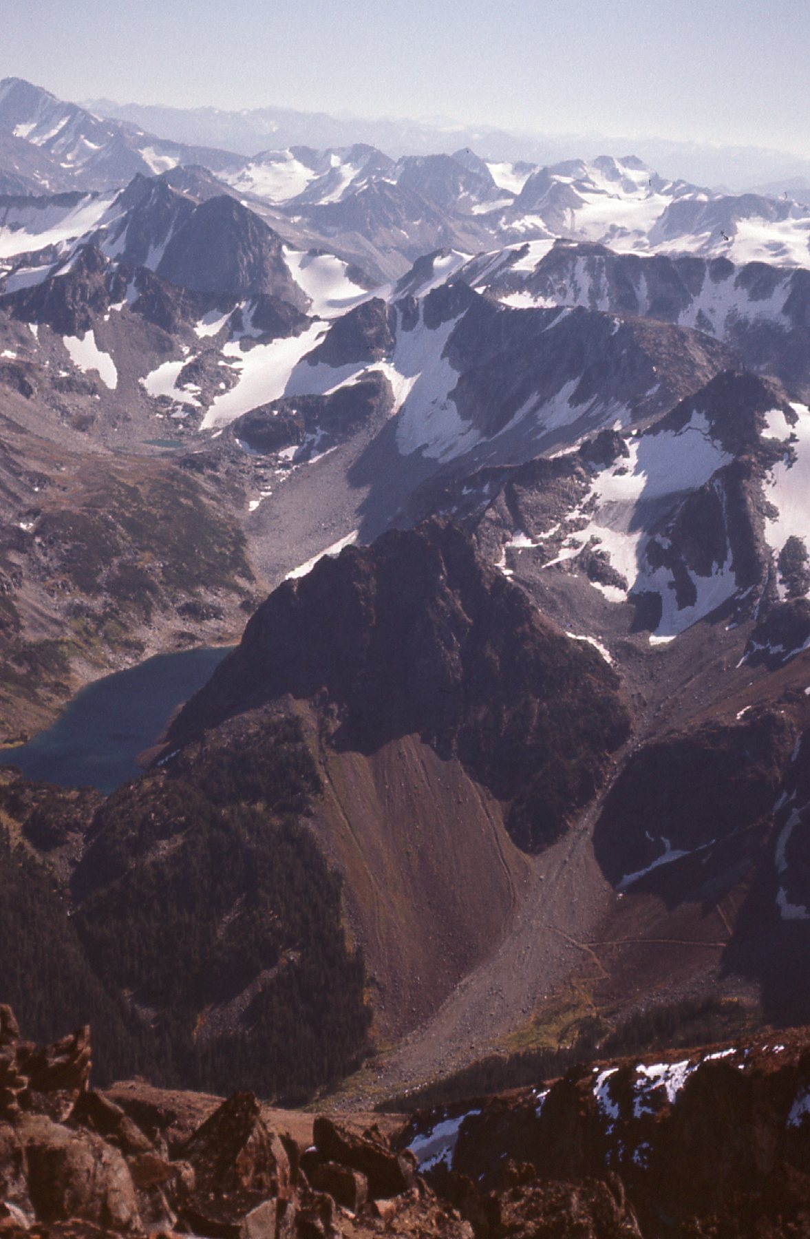
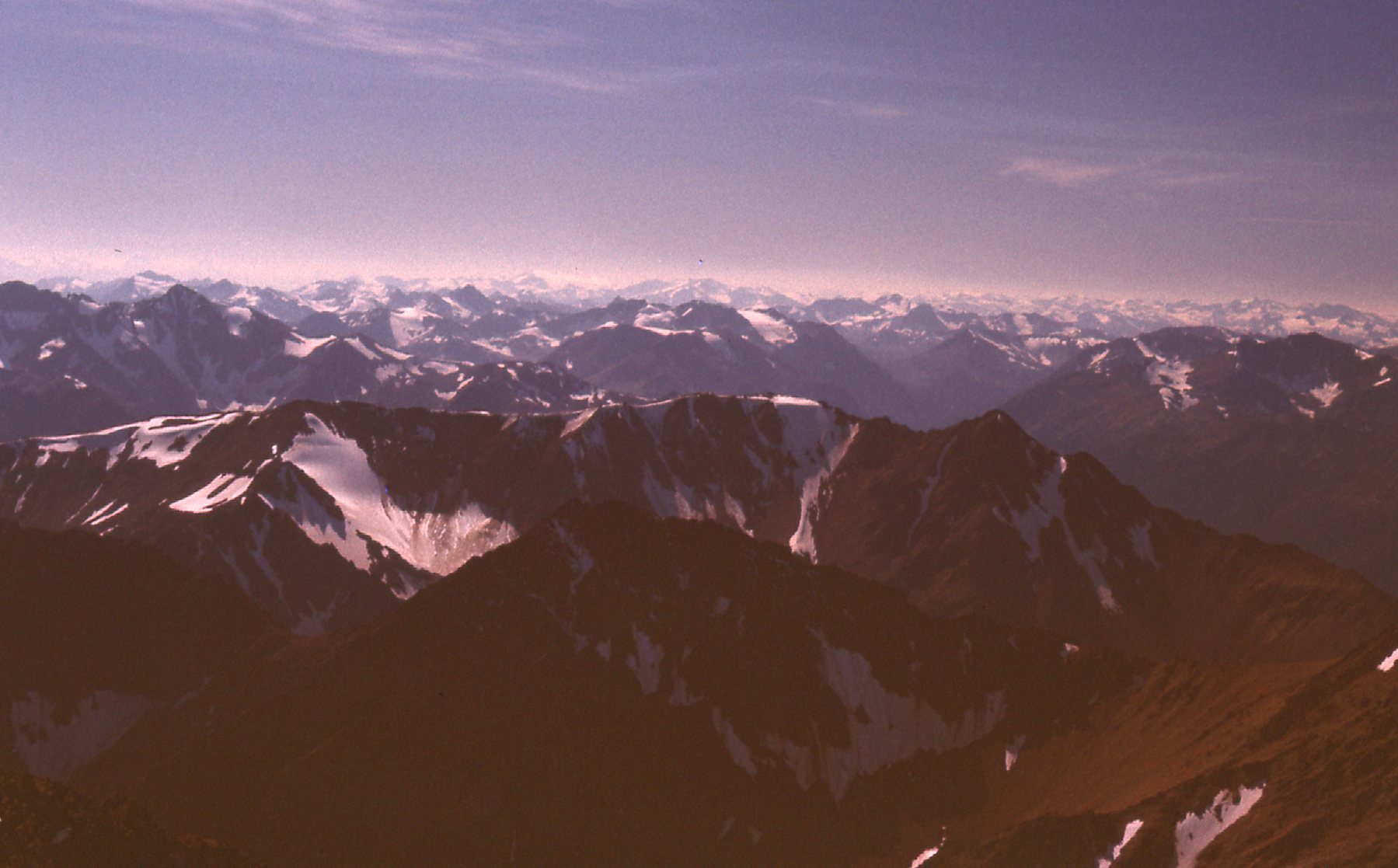
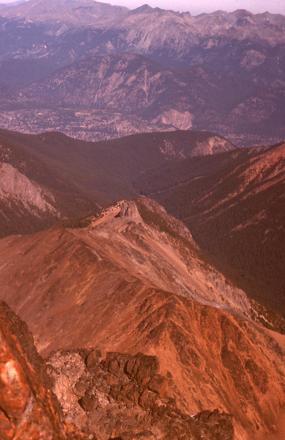
It was still early in the day, so I made the best use of the time. With just a day pack, I set out, heading west up a valley. In this part of the province, 6,500 feet put me pretty much at tree-line, so there wasn’t any bushwhacking to speak of. I bypassed a small lake along its north shore, then contoured around to the north up an easy valley. It was all open country here, not a tree in sight. I followed the southwest slope of Mount Truax and before long found myself on its summit at 9,450 feet. The weather was perfect and I had unlimited visibility in every direction. These were 4 views I had from the top.
Looking east across the Bendor Range. That’s Truax Lake way down below.
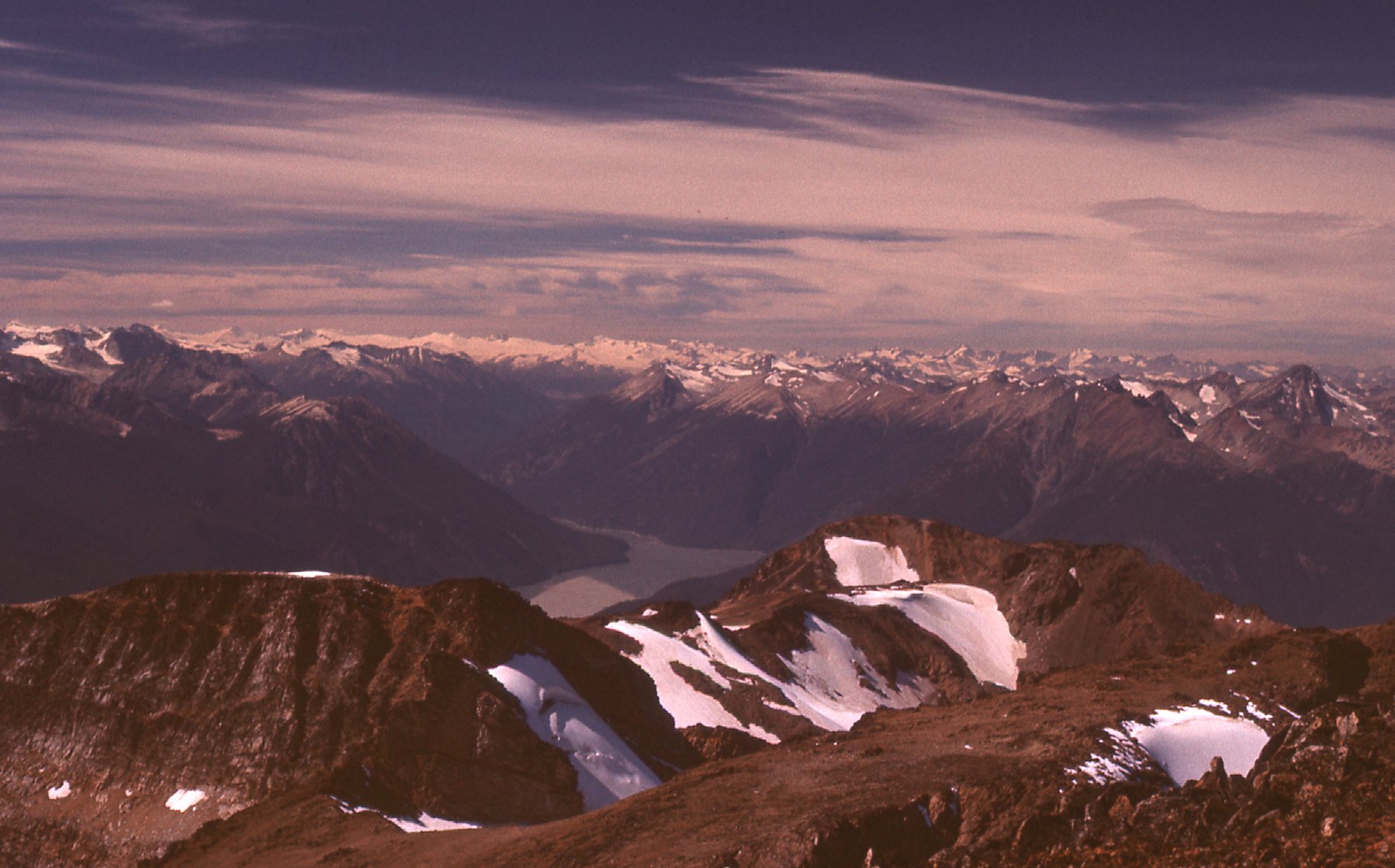
Looking west – that’s Downton Lake out there.
Looking south from the summit.
Here. we are looking north, down the valley of Truax Creek, the way I’d driven in.
Mount Truax happened to be the highest peak of the Bendor Range, so the views were outstanding. I didn’t linger, but soon headed down. It was easy going all the way back to the car. The old Gray Rock Mine was close at hand, so I paid a visit before I lost the light. This mine, now abandoned, had produced zinc, antimony, mercury and arsenic from the minerals sphalerite, stibnite, cinnibar and realgar. Quite a toxic mix.
At the Greyrock Mine.
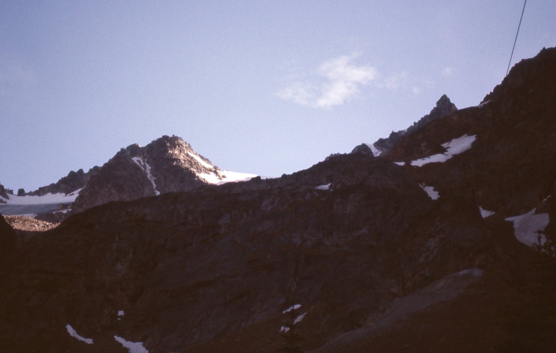
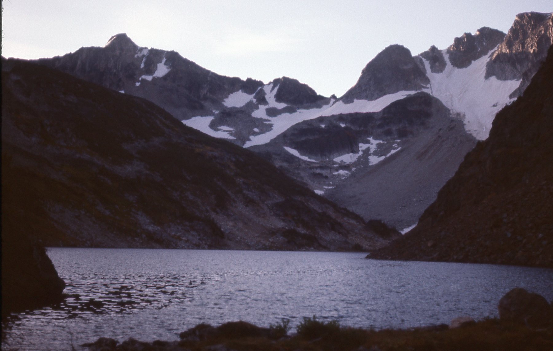
After camping there for the night, I went back up to a lovely alpine lake at around 6,900 feet early the next morning. The views didn’t disappoint.
Alpine splendor
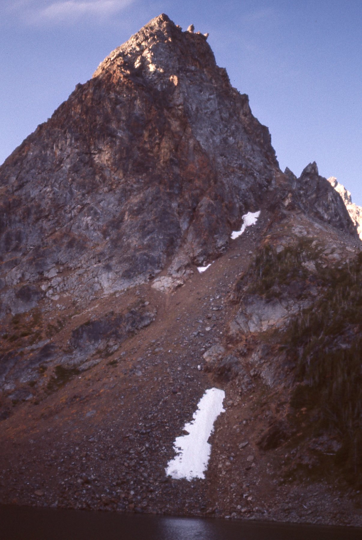
Here’s the sun rising on Mt. Truax.
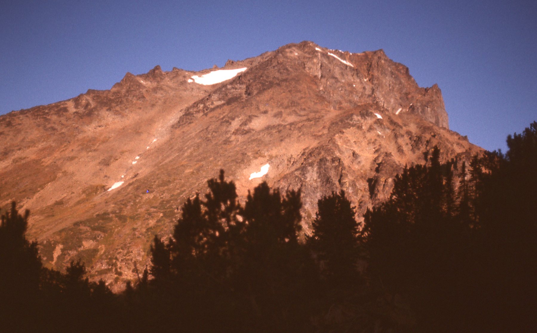
Mt. Truax, the east side.
The sun was just hitting some of the mountaintops.
Another peak.
Here are some views around that lake.
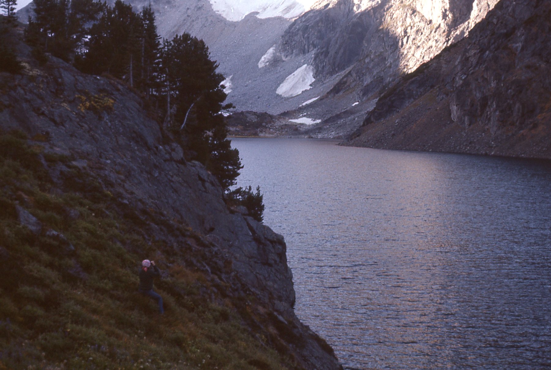
The no-name lake.
The shore was steep in places.
Another view.
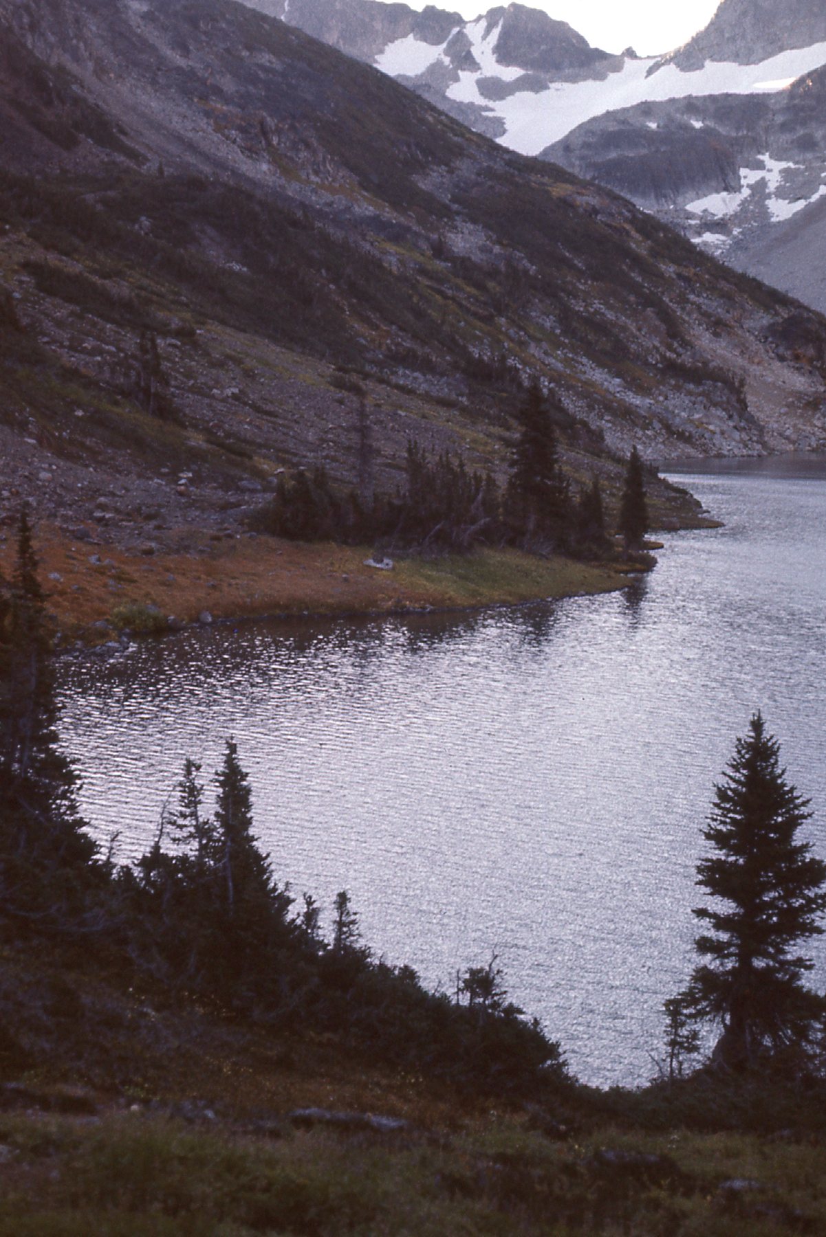
Yet another view.
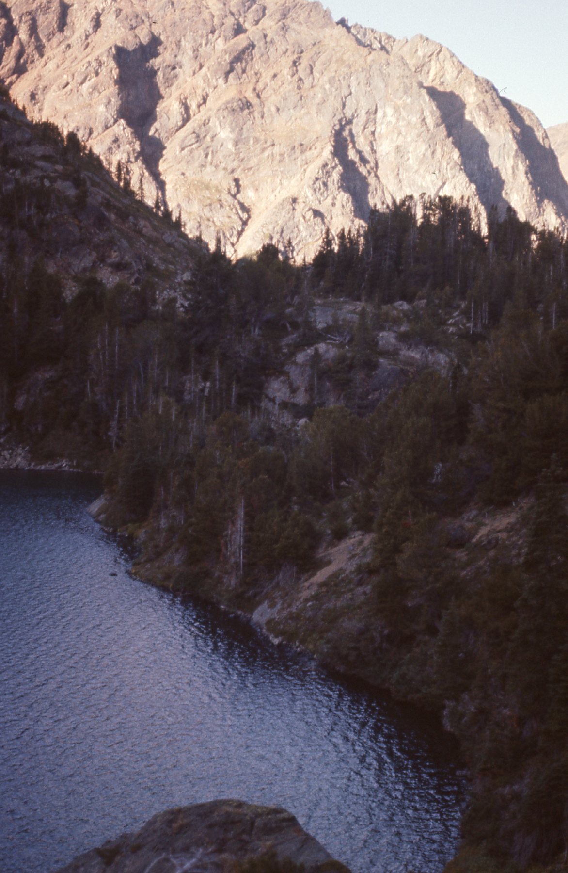
After visiting this lake, I went back down to the car. From there, it was a short walk to what was known as Truax Lake – it was lower, at about 6,365 feet. It was also bigger than the no-name lake, about 3,000 feet long compared to 1,300 feet for the higher. Here’s a view from Truax Lake.
By Truax Lake
I drove north back down the road along Truax Creek to Carpenter Lake, then west back to the village of Gold Bridge. A short drive south from there took me to the town of Bralorne. There’s plenty to be said about this place, and I’d like to share with you what I’ve learned.
Way back in the 1890s, prospectors had found placer gold in mountain streams in this area. Then they began to search for the underground source of that gold. In 1897, three men hiked in from Lillooet and staked some claims. Those claims changed hands a few times and were worked on and off into the 1920s. When the Depression arrived, world markets collapsed but the price of gold remained strong. Men and investment ramped up production. In fact, the district was one of the few bright lights in the BC economy during the Depression. In a seven-year period in the 1930s, the mines of the Bridge River, as they were collectively known, produced a staggering $370,000,000 in gold. The real turnaround happened in 1931 when Austin C. Taylor acquired the property and financed construction of a 100-ton mill. The Pioneer Mine at Bralorne operated from March of 1932 until 1971. In that time, 3 million ounces of gold were refined from its adits – that’s almost 94 tons of gold. At today’s prices, that’s worth over 5 billion 400 million dollars. From that wealth grew an entire town, with churches, schools, post office, banks, bakeries and ball teams. The mines themselves needed all manner of support buildings: power houses, boiler houses, blacksmith shops, concentrator buildings, machine shops and so on. Over 100 miles of tunnels were dug in the forty or so years of operation.
The Bridge River mining area provided a sanctuary from the economic woes of the world, as all around North America plants were idled and people starved. Bralorne provided a ray of hope. Hundreds of men were on the payroll for the mines – this propped up an otherwise-failing region. Without the business from the mines, the Pacific Great Eastern Railway, Cariboo ranchers, truckers and even the town of Lillooet probably would have failed. Bralorne’s population reached over 1,500 in its heyday.
One thing I haven’t yet mentioned was the time of my visit. It was September 15th of 1975 when I took this picture of the once-illustrious Pioneer Mine, about 4 years after it had closed.
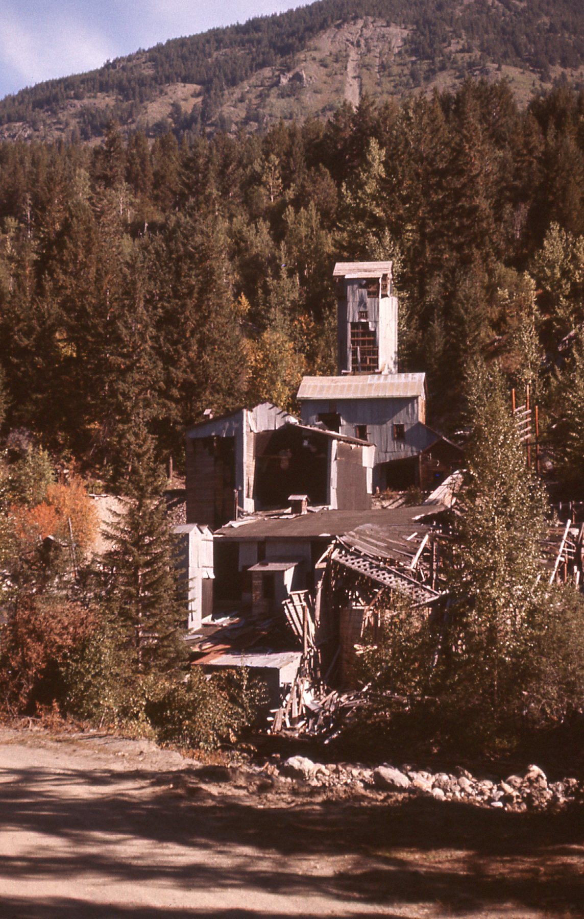
The Pioneer Mine at Bralorne
Bralorne had become a ghost town, abandoned and forgotten. Its buildings were empty, open to anyone who wanted to strip them for lumber or anything else of value. It was eerily quiet as I drove through the streets, and kind of sad. Just a few short years earlier, this had been a vibrant community.
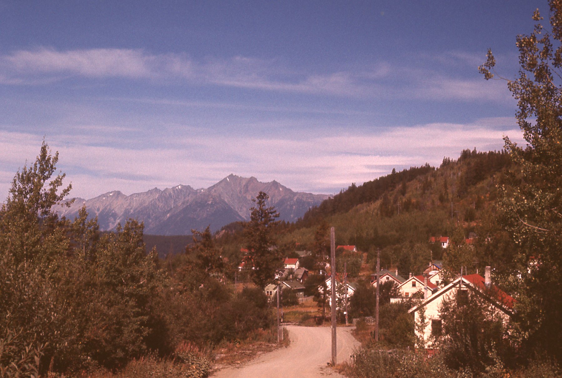
Bralorne
Bralorne
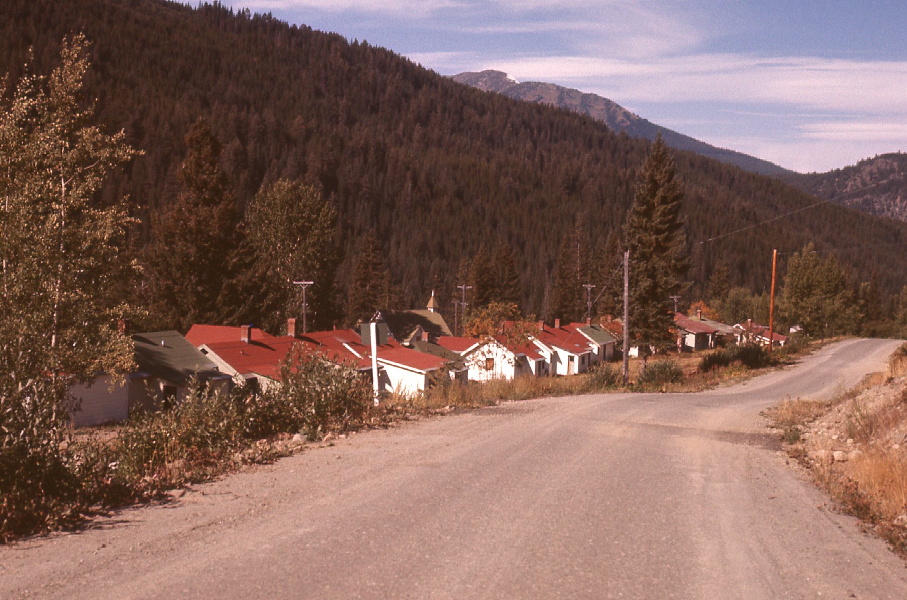
Here’s a view along the deserted Main Street.
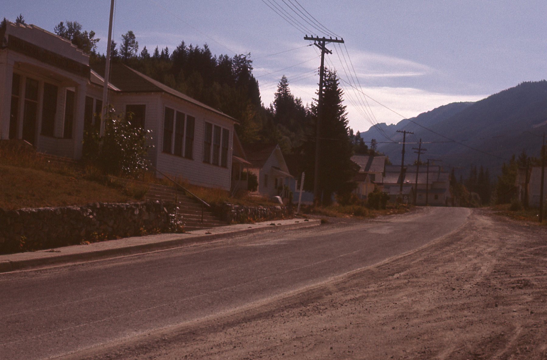
The main street of Bralorne, BC
It was time to leave. 72 miles of dirt roads took me to the town of Lillooet, and another 166 miles on paved highways saw me all the way back to my home in Mission. Even today, 46 years later, I still fondly remember my visit to the area. I understand that with the high prices gold fetches these days, exploration has once again picked up. It’d be nice to think that there could be a resurgence of interest in this beautiful area. The only school in the region is in Gold Bridge, and it’s barely hanging on with only 5 students.