
This story is of historical significance because it deals with a lot of climbing activity that was somewhat pioneering in nature, and it also, through the pictures presented, documents the logging activity that was going on in the 1970s in the region known as the Statlu.
There seem to be a great many indigenous place names on our maps, and rightly so. Those peoples were here first and it’s only fair that their names should be given to features that were meaningful in their lives. Those would be Native American names in the USA or First Nations names in Canada. I run across them all the time, and always try to determine the origin or meaning of each one. Usually I can come up with something, but once in a while I draw a blank. The name “Statlu” is one of those whose origin has completely evaded me. The name appears on maps of southwestern British Columbia as far back as the early 1900s but other than that, I’m still clueless as to its meaning. I and others I’ve consulted think, though, that it sounds First Nations. I can find a total of four times the name is used on various maps. Statlu Creek and Statlu Lake appear to be official names, while “Statlu Falls” and “Statlu Peak” seem to be unofficial. Why all this fuss about Statlu anyway? The reason is that it played an important part in my early climbing, and here’s how.
During much of the 1970s I lived in a small town called Mission, about 40 miles east of Vancouver. I was looking for peaks to climb that weren’t too far from my home, and as I studied the topographic maps I became intrigued by a region that seemed to fill the bill. Imagine if you will an area bounded by Stave Lake on the west and by Chehalis Lake and the Chehalis River on the east. Then make the Fraser River its southern boundary, and you pretty much have it. I’m calling the whole area the Statlu, as it contains the 4 named features I mentioned earlier. It also contains several named lakes: Statlu Lake, Brotherhood Lake, Olive Lake, Wilson Lake, Blinch Lake, Kenyon Lake, Salsbury Lake, Twin Lakes, Dickson Lake, Sonny Lake, Davis Lake and Thurston Lake. But the dozens of peaks are what really attracted me. The whole area was very mountainous, and I figured I’d have my work cut out for me trying to figure out how to get at them all. By the mid-70s, the area had been heavily logged and I knew logging roads penetrated deeply into many of the valleys. The 1:50,000-scale topo maps weren’t of much help with the roads though, as they were already terribly out-of-date. Also, I knew that the 100-foot contour intervals would leave a lot to my imagination, but that was all we had at the time. I purchased the maps that covered the area and started making my plans.
Please keep in mind that roads I was able to drive way back then may no longer be driveable, and for all intents and purposes some may no longer exist, having been reclaimed by the coastal rain forest. In some cases, major washouts may have occurred or bridges may no longer be usable. Those of you who know the roads in the Statlu today may find it interesting to see how far I was able to drive back in the day. There will be instances where nowadays you can drive farther than I could when I went in in the 1970s.
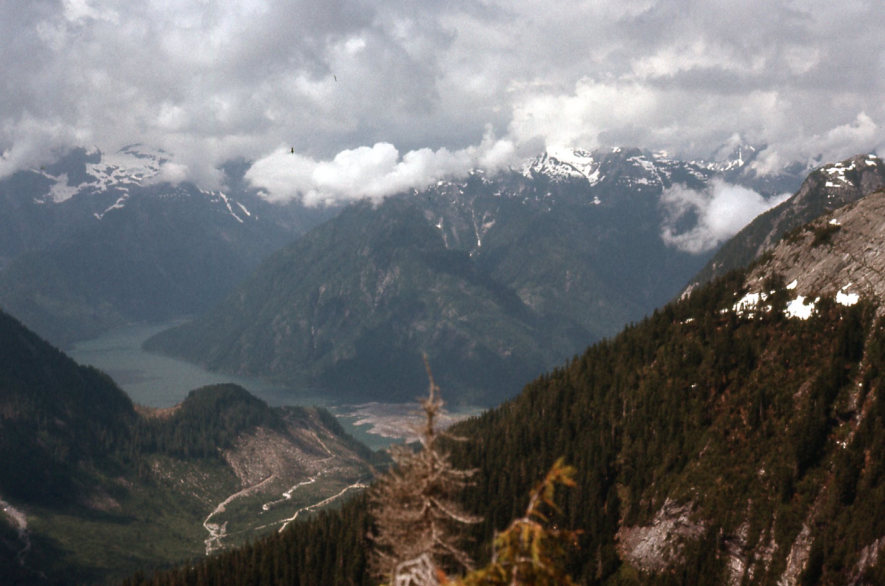
I had driven into the Statlu as early as 1973, but those first trips were merely for exploration, to see where the roads led. It wasn’t until the year 1975 when I headed in to do more than just drive. On July 20th, I drove the 21 miles east from Mission along Highway 7 to near the Sasquatch Inn. There, I turned north on what is now called the Chehalis Forest Service Road. When I told you this was close to home, I wasn’t kidding. This was the start of the route for many of my Statlu climbs. Ten miles north from the highway brought me to an important junction, where I headed west up Statlu Creek for just over 4 miles. Another junction led me north for about 5 miles up North Statlu Creek, where a lesser road headed north up Tessaro Creek. This road petered out after half a mile, putting me at 2,100 feet elevation on the west bank of Tessaro Creek. It was pretty amazing to see that I had penetrated deep into the heart of the Statlu by driving a mere 20 miles of good dirt logging roads from the highway.
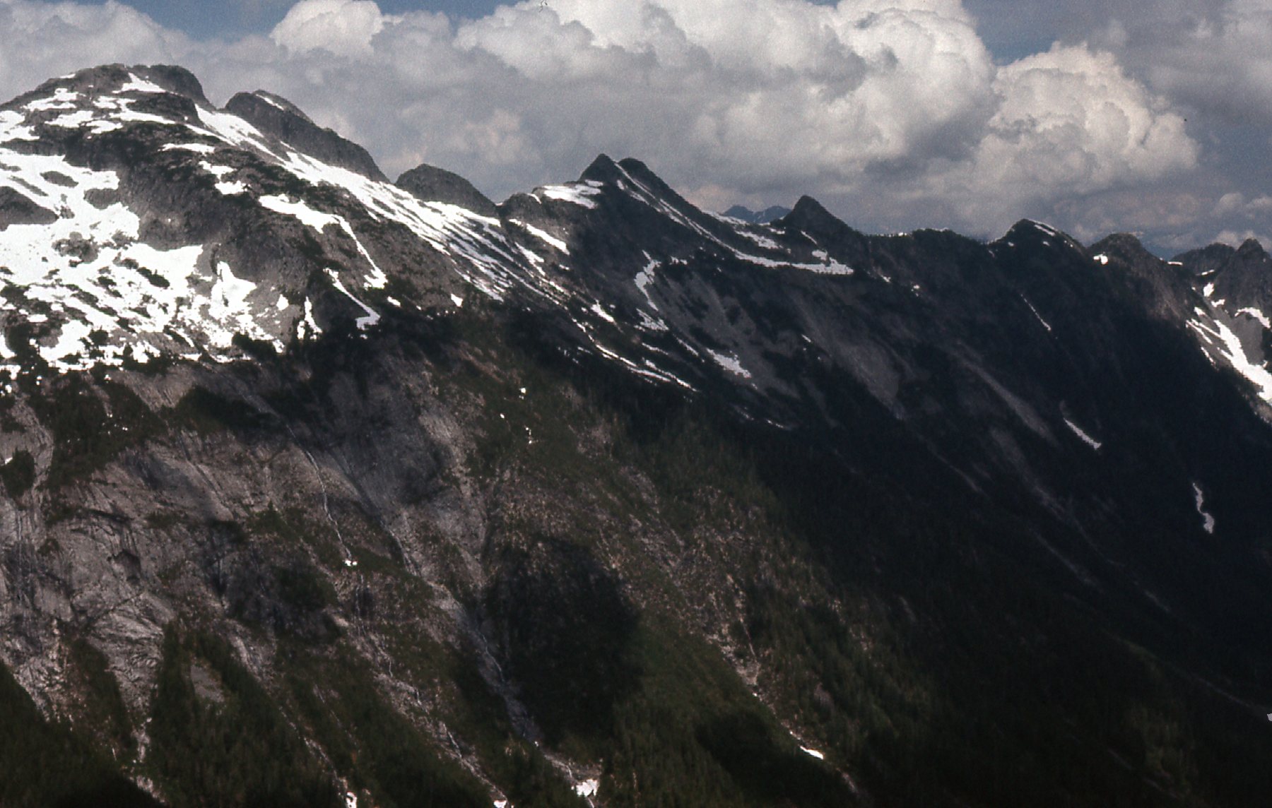
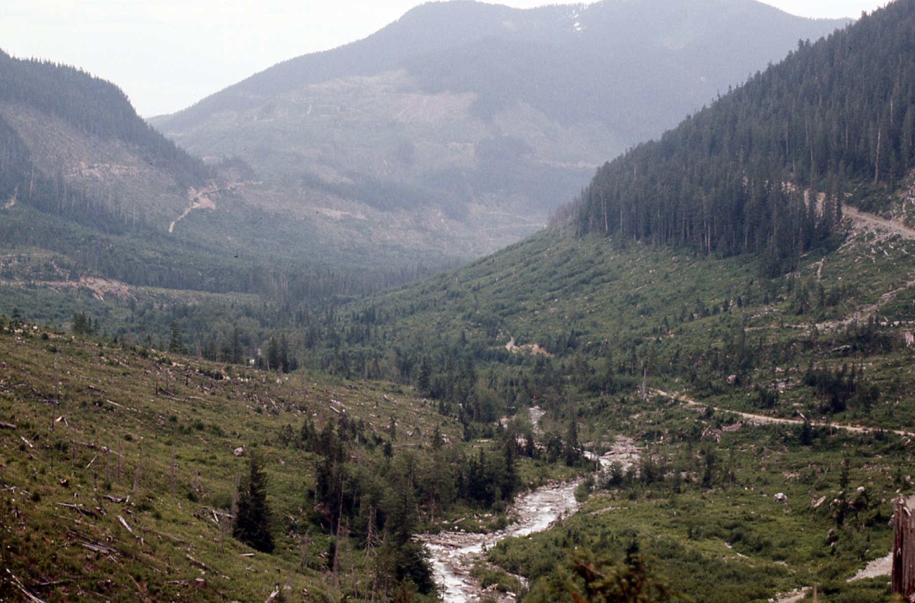
This was an important day, my first good look into an area that would become very important to me over the next few years. I wanted to get a good look around, to see what mountaineering opportunities lay close at hand, so I started climbing north from where I’d parked. There was a ridge that formed the western boundary of the valley occupied by Tessaro Creek, and I figured that if I angled up it I’d get some good views. I wasn’t disappointed. Here is the look I had up to the head of North Statlu Creek. Recent logging is plain to see.
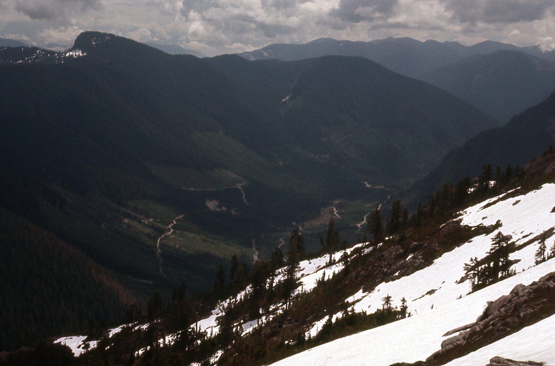
Here, we are looking a bit west of south up to the head of North Statlu Creek
I was getting a glimpse over to Olive Lake, which is at the head of Tessaro Creek. See it?
Northeast to Olive Lake
The ridge was still above me when I took this photo.
Once I gained the ridge itself, I had more good views. I could see Blinch Lake to the southwest, surrounded by some nice-looking peaks.
Blinch Lake
I could also see due west to the top end of Stave Lake, less than 5 miles away.
Stave Lake
From the same ridge, I had this tantalizing view to the country at the very head of Skwellepil Creek.
A look to the northwest.
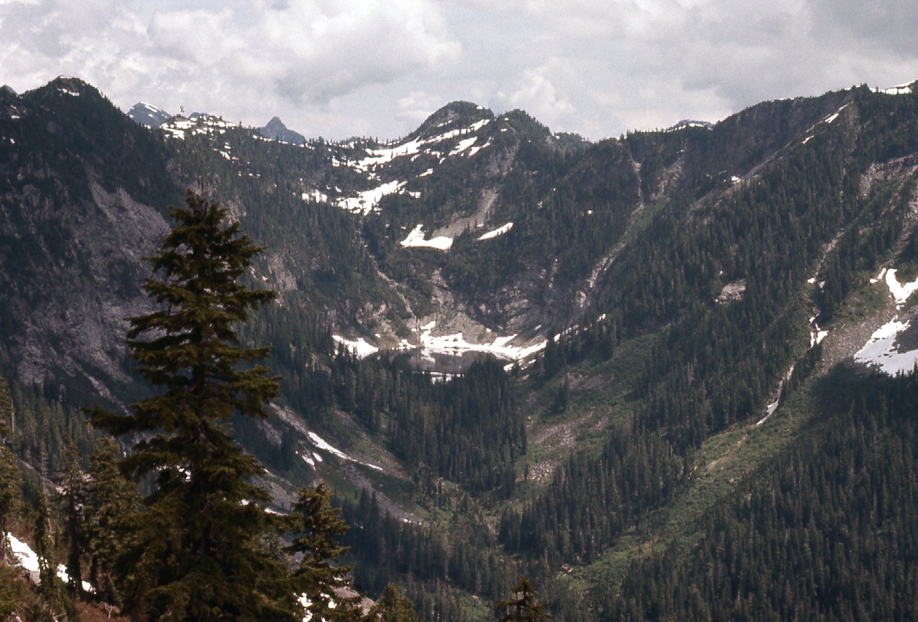
As I contoured up the hillside, I finally reached a summit along the ridge. I’ll give its elevation in meters, as Canada was switching over to metric at the time. The maps I was using were in feet, so converting interpolated measurements in feet over to metric gives some odd amounts – please bear with me. Peak 1554 meters was due west of Olive Lake, and as I stood on its summit my mind was being blown by what I saw. First of all was this view steeply down to the lake.
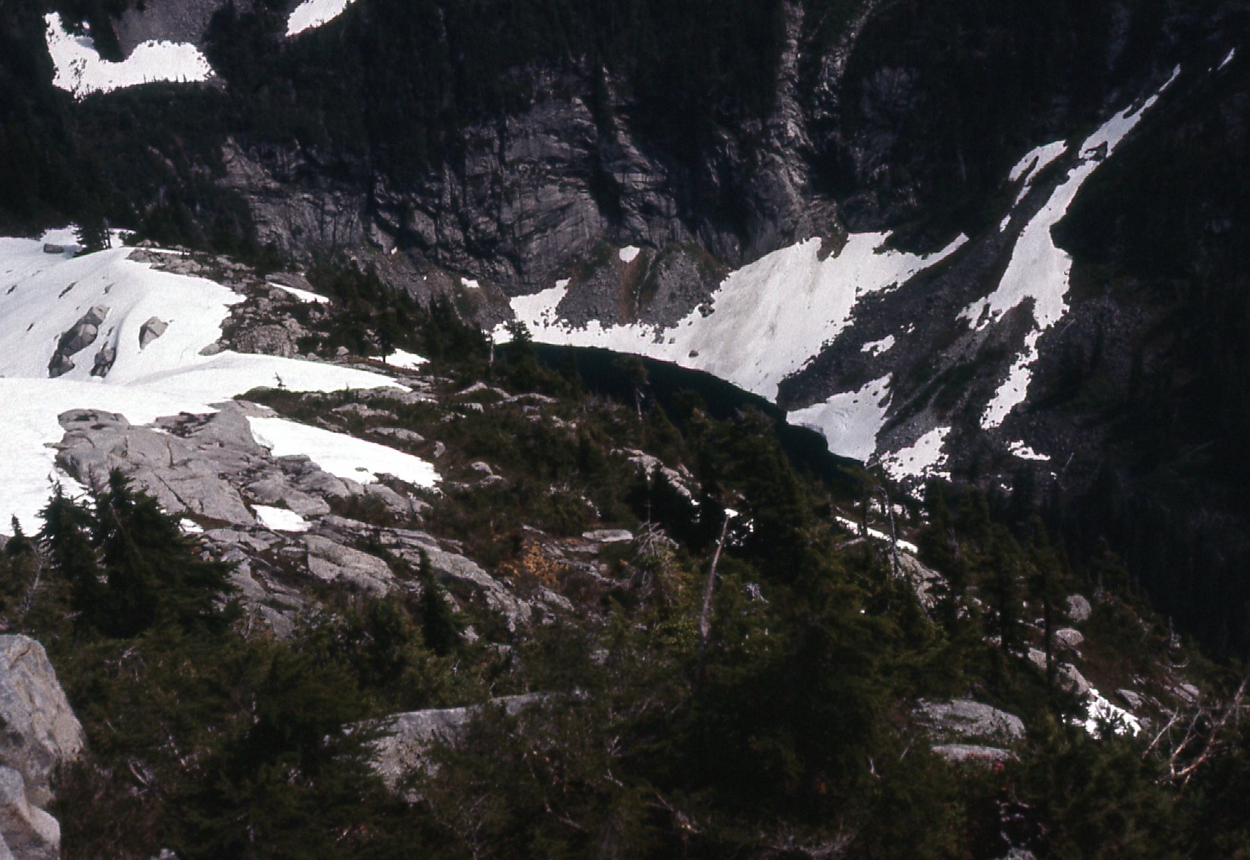
Looking east down to Olive Lake, 545 meters below me.
Check out these views over Skwellepil Creek, which is the valley on the north side of Olive Lake. They are in sequence, from right to left. This first one is looking way down the creek – the big dark peak over to the right is Mt. Orrock, 5 miles away.
Looking a bit north of east
This next photo sits to the left of the one above.
Northeast from Peak 1554 meters, over Skwellepil Creek.
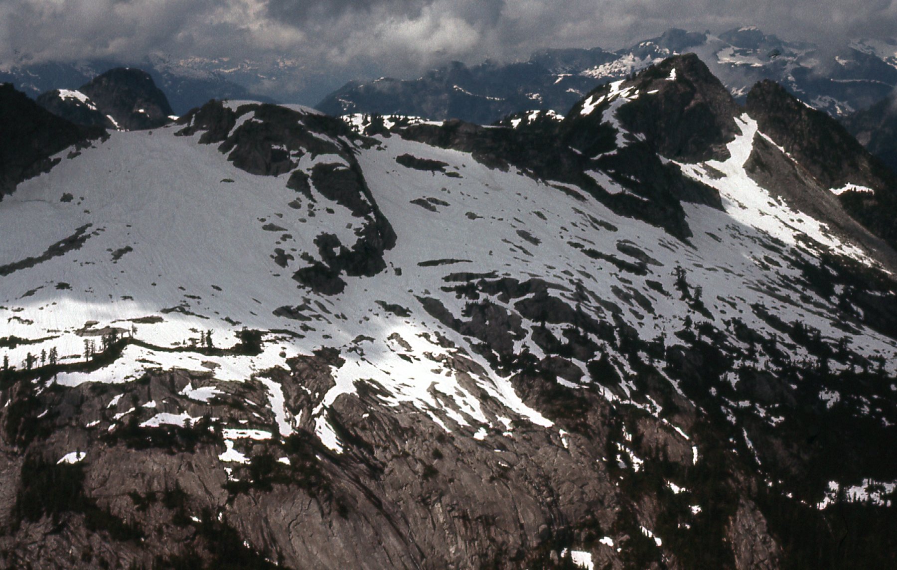
And then there was this one – good Lord, I almost soiled myself. This was the best front-row seat imaginable for the Ratney group of peaks. We are looking north. Back when I took this picture, we used the name “East Ratney” instead of “Mt. Bardean”.

From left to right: Stonerabbit Peak (1,830 meters, or 6,000 feet elevation); Mt. Ratney, just right of center (1,960 meters, or 6,434 feet); “Mt. Bardean”, near the right edge (1,930 meters, or 6,300 feet)
After getting those amazing views from the top of Peak 1554M, I contoured my way down the slopes on the west side of Tessaro Creek and back to my car. I was pretty excited to have seen what I did that day, and vowed to come back and do some serious climbing.
True to my word, I was back a mere 4 days later. This time, my visit was more to explore than anything else. Instead of heading up the Statlu Creek roads, I continued north along the Chehalis River and up the west side of Chehalis Lake. Back in 1975, you could drive decent logging roads farther north of the lake – in fact, you could drive a bit of the way up Eagle Creek. The road didn’t go far up the creek, not far beyond where it entered the Chehalis River, and pretty much the whole drainage of Eagle Creek hadn’t been logged, so it was all virgin forest. From the Eagle Creek road, I had this tantalizing view north up that valley.
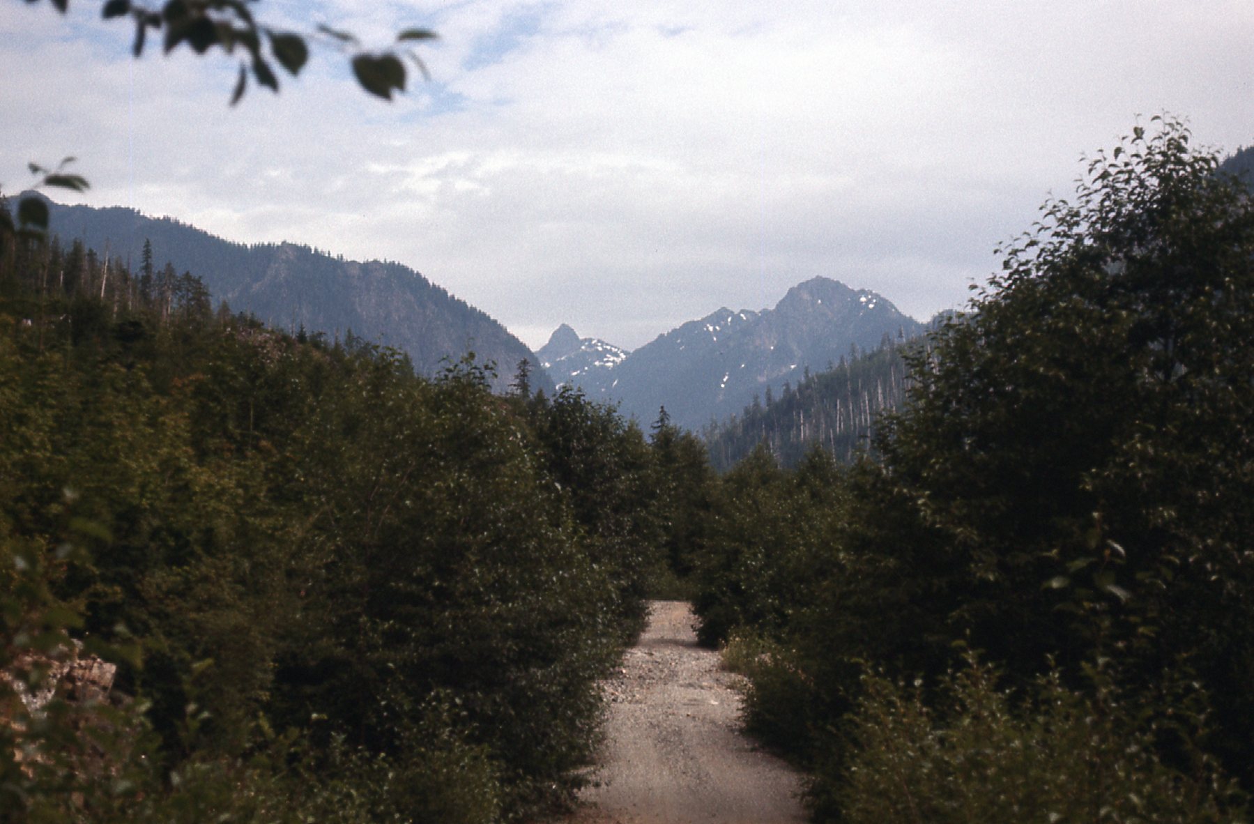
Looking north up Eagle Creek.
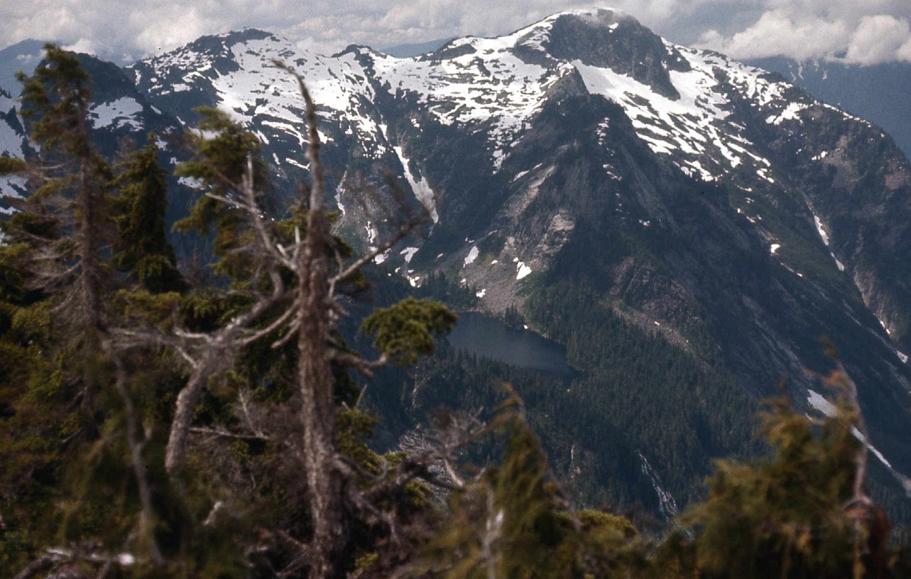
There was a rough trail up to Statlu Lake, so I thought I’d check it out. From lower down, I had this view to the northwest up to Mt. Clarke.
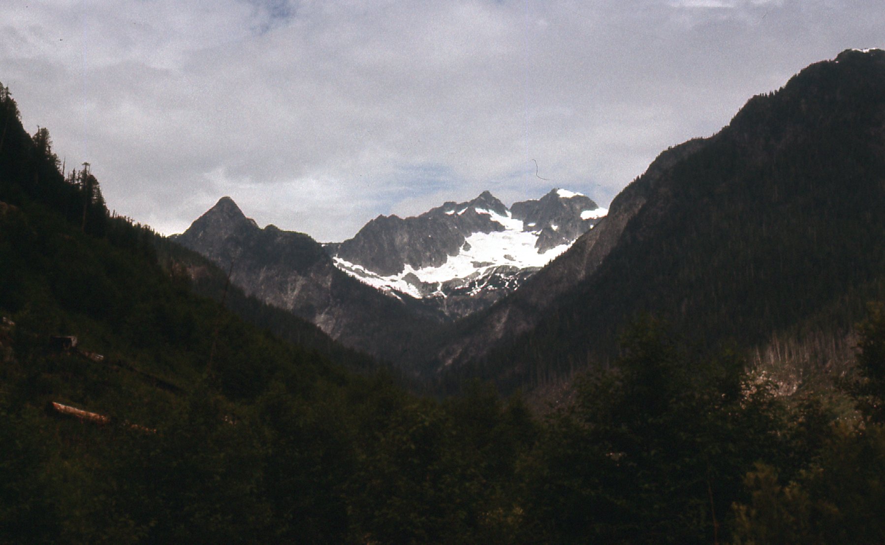
Mt. Clarke
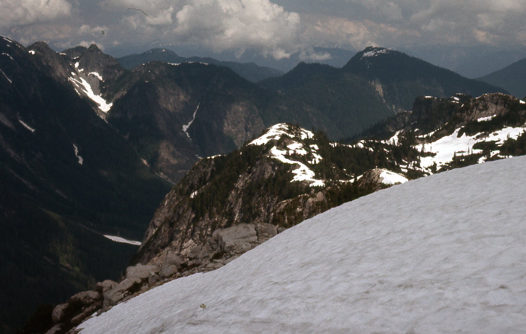
As I climbed up the trail, I passed by a lot of steep terrain – what you see here was to the south of the trail.
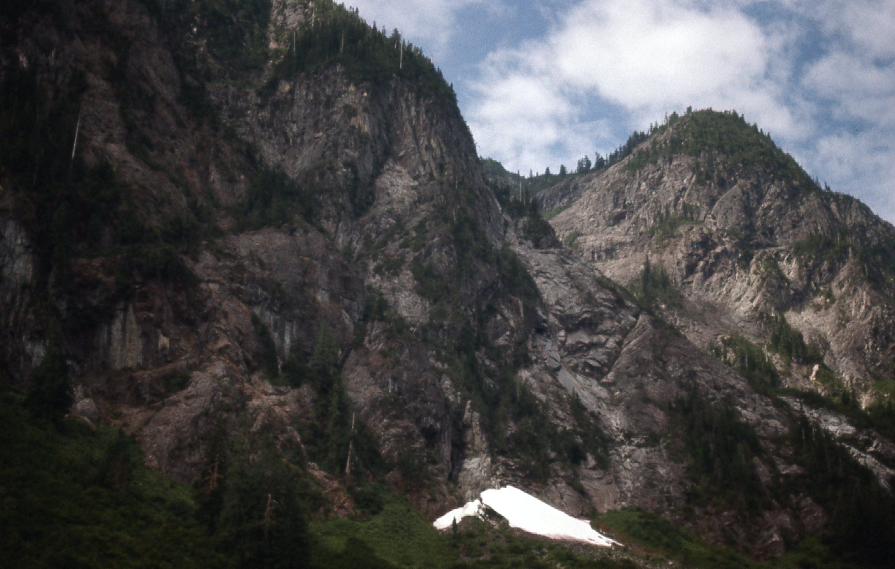
Cliffy country.
It didn’t take long to reach Statlu Lake, situated at an elevation of 600 meters. Here was what I saw. That’s Mt. Clarke again, in the back on the right. Its summit sits at 2,171 meters, or about 5,200 feet above the lake.
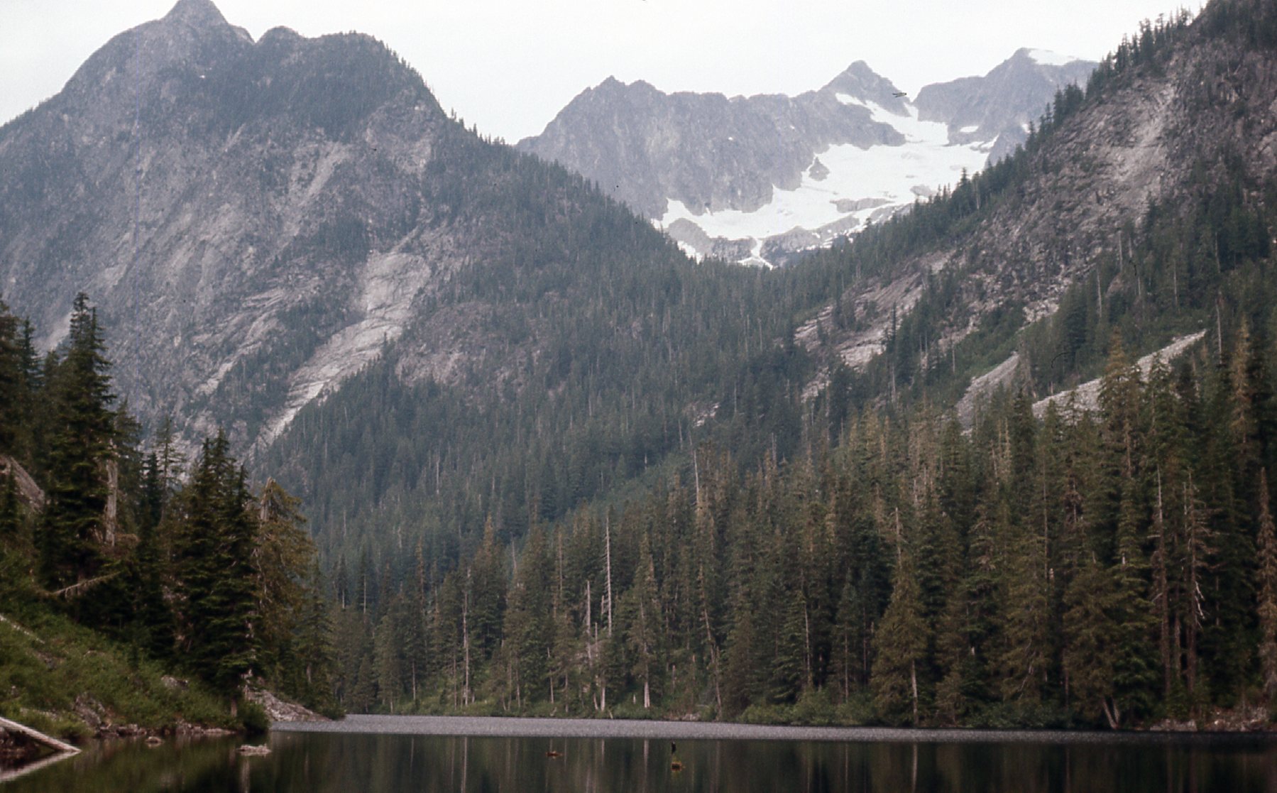
Mt. Clarke
The outlet of the lake is at its east end, and this is where the Chehalis River begins its steep descent to the valley below.
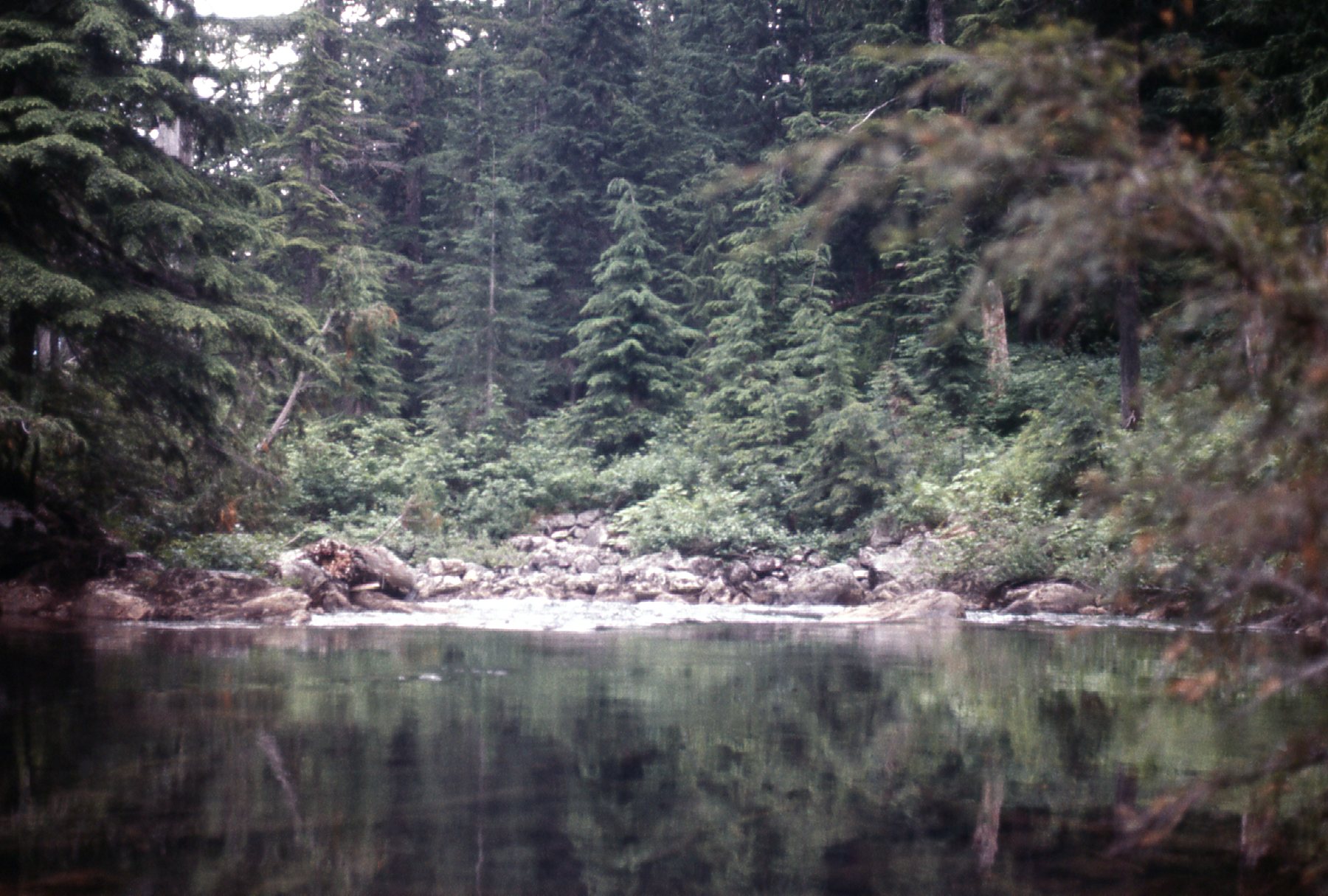
The outlet of Statlu Lake
As you descend the trail from the lake, you can hear the roar of Statlu Falls. The rocks are wet and slippery if you try to approach it. Very dangerous, people have slipped and fallen to their deaths there – I know of at least 5, but I’m sure the number is higher. I went over to have as close a look as I dared, and got this photo.
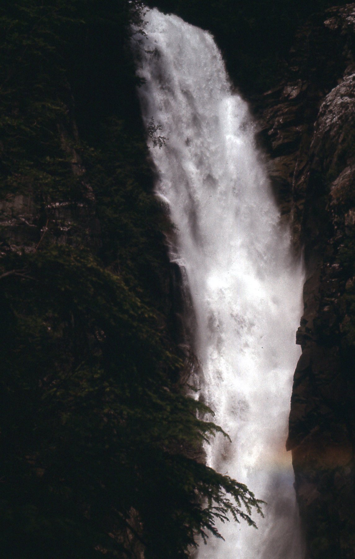
Statlu Falls
As I continued down the trail, I met a man who was frantic. He came running up to me and said that he had been near the top of the falls with his dog, and the dog had gone into the stream and had been swept over the falls. He asked me if I had seen any sign of the dog, and sadly, I told him I hadn’t. It didn’t seem likely that the poor creature could have survived such a plunge. I took this picture looking down to where his red Jeep was parked. I felt really badly for him, but there wasn’t anything either of us could do. The bottom of the falls is a foaming cauldron of hell that nothing, man or beast, could possibly survive. I’m just glad he didn’t go in after his dog and try to get him.
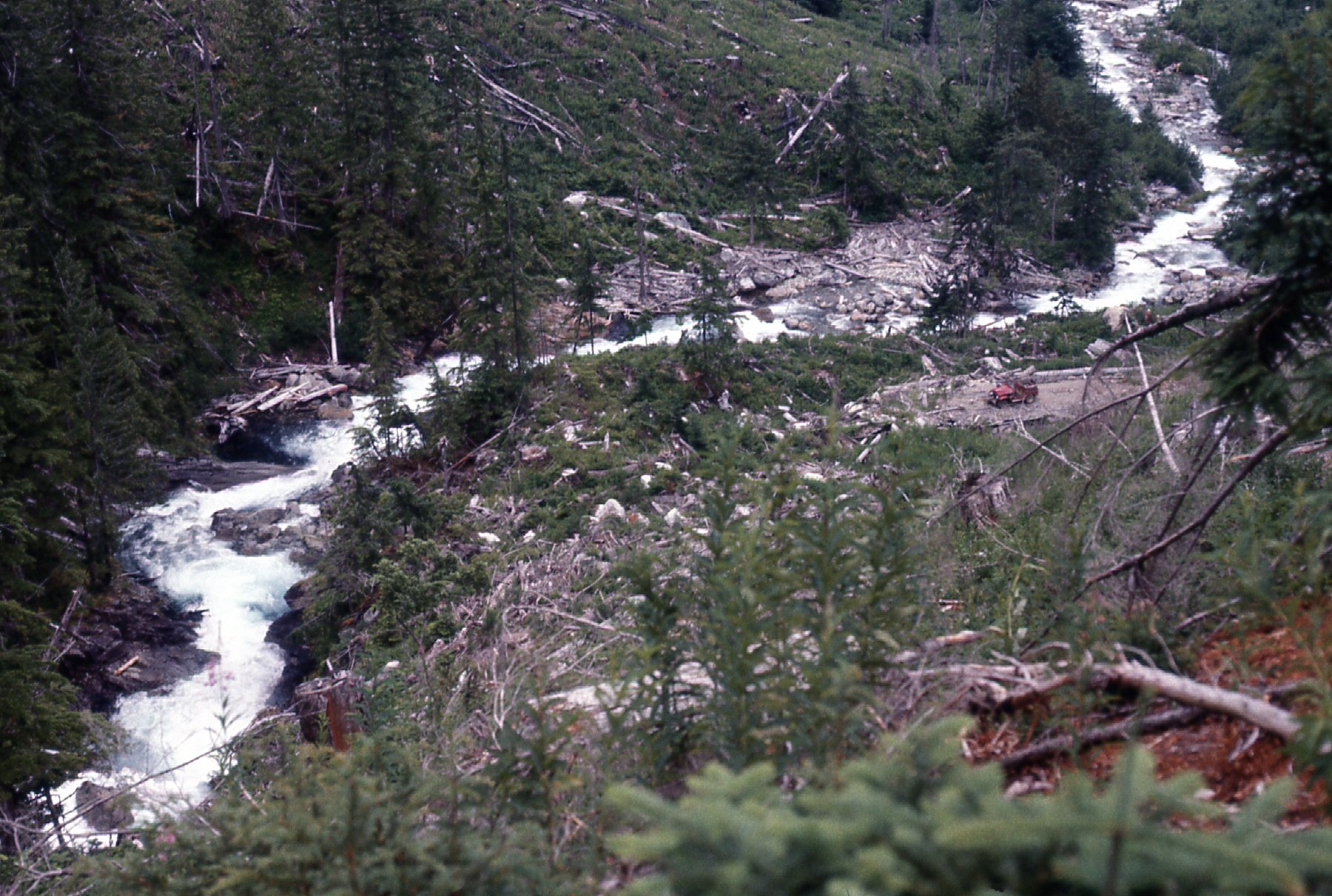
The Jeep parked by the river.
In the valley below the falls, you can see that the area had been heavily-logged by the time I was there in 1975.
Looking east towards Mystery Creek.
There was one more thing I wanted to do before the day was out. I drove down the west side of Chehalis Lake, then drove west up Skwellipel Creek as far as the roads went at the time – I just wanted to check out that valley to get an idea how access would be for some future climbs I had planned. Once back out, I drove south as far as Statlu Creek. One last bit of exploration I thought I could do on the way home was to drive west up Statlu Creek, then head along South Statlu Creek to Dickson Lake. From there, I drove south along Norrish Creek and made it all the way back out to Highway 7 only a few miles east of Mission. Quite the day, with 85 miles driven on back roads, but I had learned a lot and set the stage for some climbing to come.
Stay tuned for the continuation of this story, Statlu – Part 2.