
Please be sure to read the previous installment entitled “Statlu – Part 1” before starting this one.
In July of 1975, I had driven many miles of roads in the Statlu and had done some exploring, but I had only climbed a solitary peak near Olive Lake. I was eager to head back in to the area and start climbing the dozens of peaks that awaited. It’d be exciting stuff, as I knew of nobody else who had ever been in there and climbed any of them. I had absolutely no information, so all of the route-finding would be my own. Time got away on me, though, and between climbs elsewhere and some time spent in the States, it wasn’t until October of 1976 before I could really turn my attention once again to the Statlu.
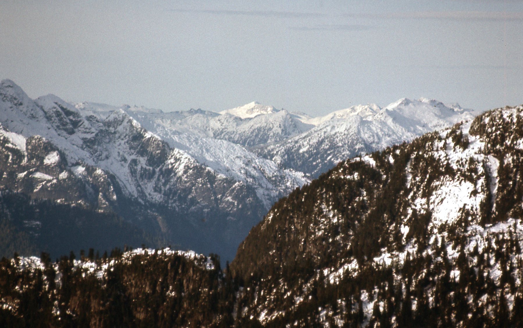
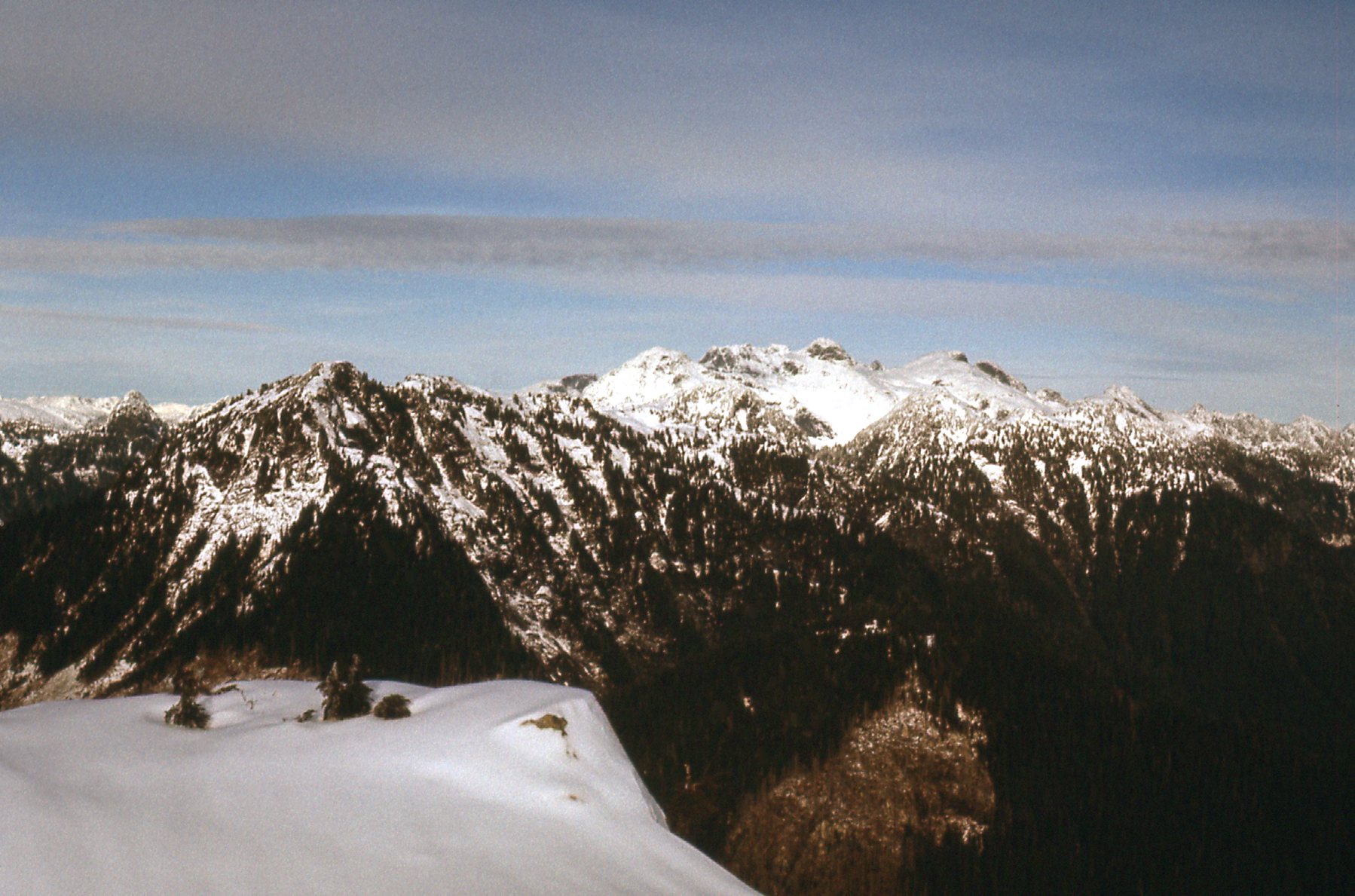
On Saturday, the 16th, I drove back in, this time to Skwellepil Creek. Logging roads went in as far as the big bend in the valley, maybe a bit past that, and I parked on the north side of the creek. I was here today to climb Mt. Ratney – the name was unofficial, but it was well-known among climbers. I parked near a small lake at 575 meters elevation. As I was driving up the valley, I had this view west to the high country.
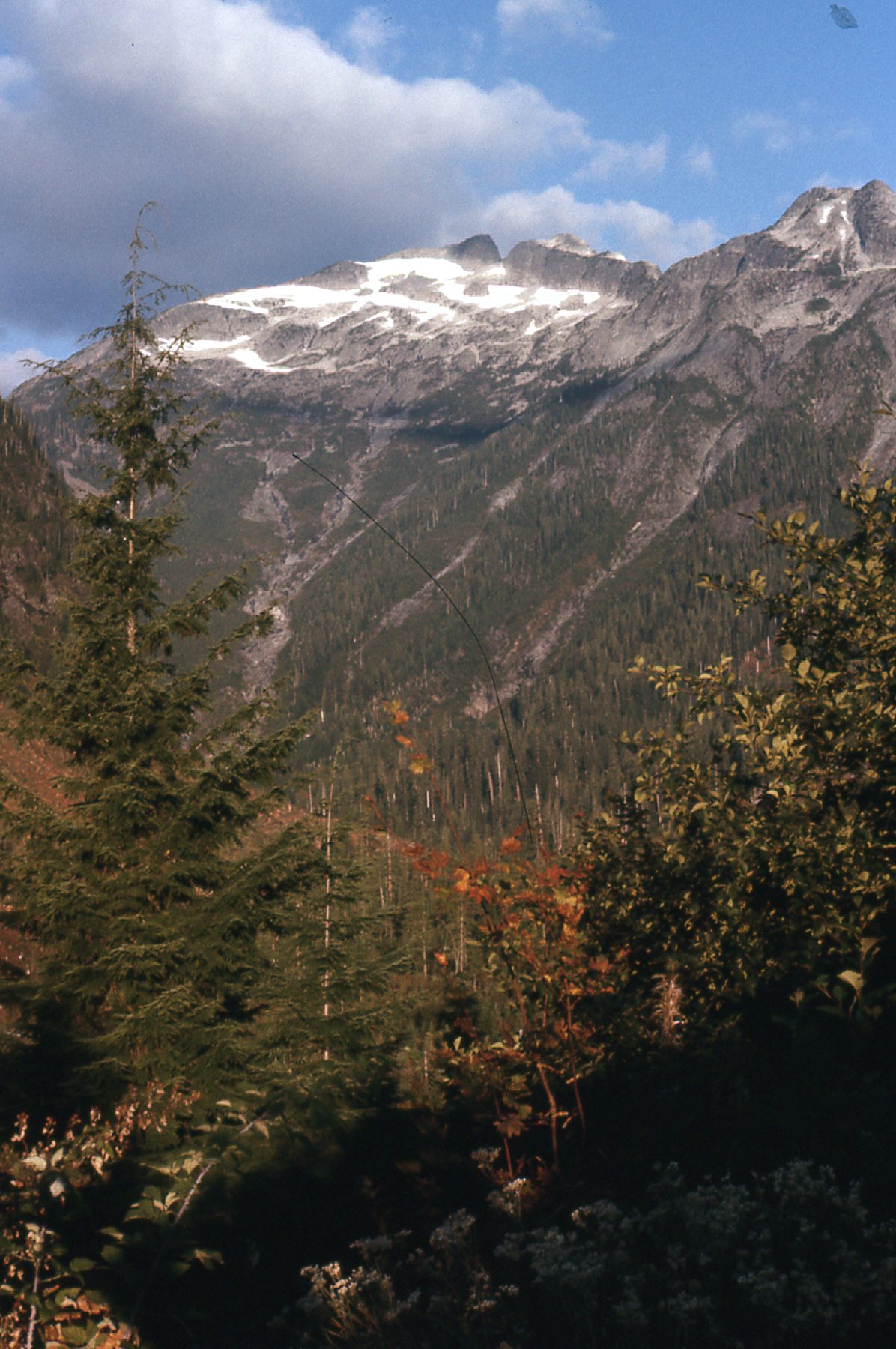
A look west up Skwellepil Creek
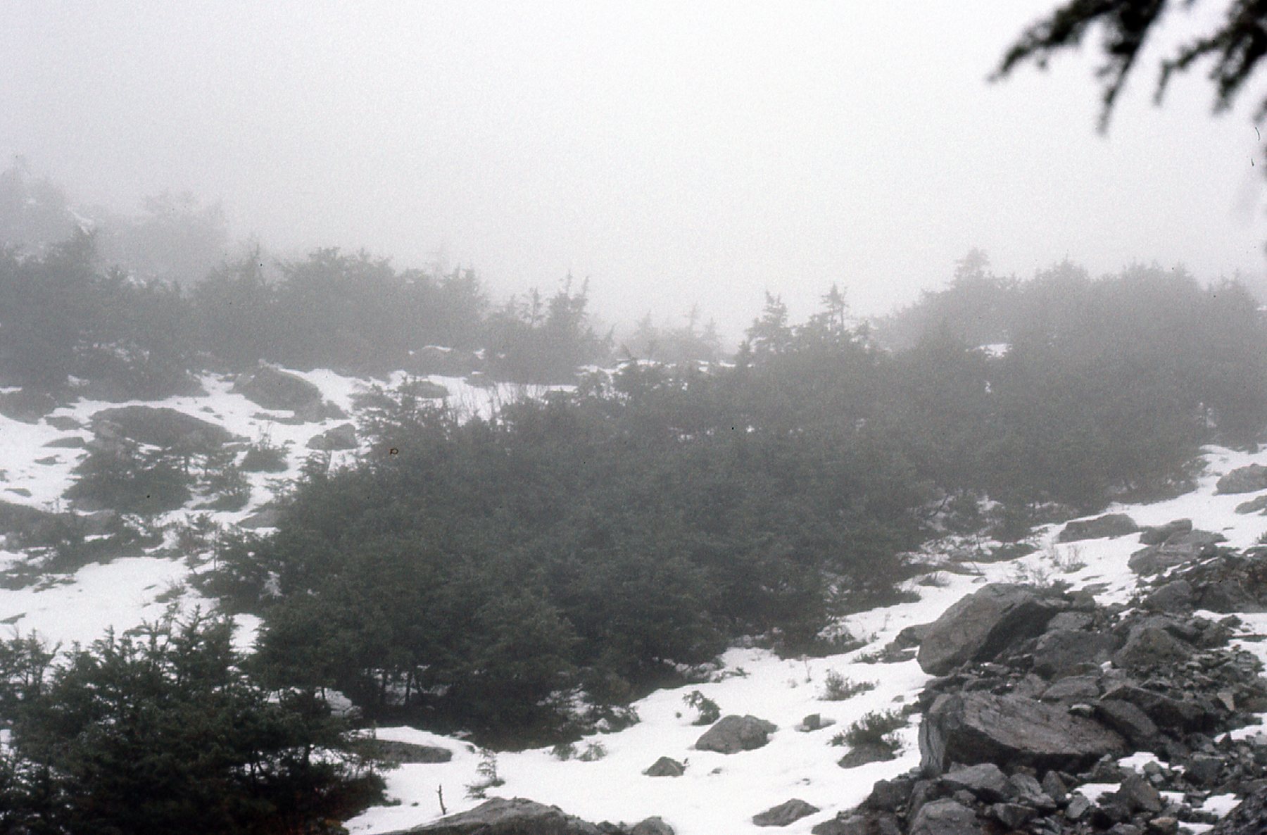
From where I parked, I contoured up and to the west, then used one of the many avalanche fans that came down the south side of the ridge. As you can see from the next photo, avalanches had scoured the mountain clean down to the bedrock.
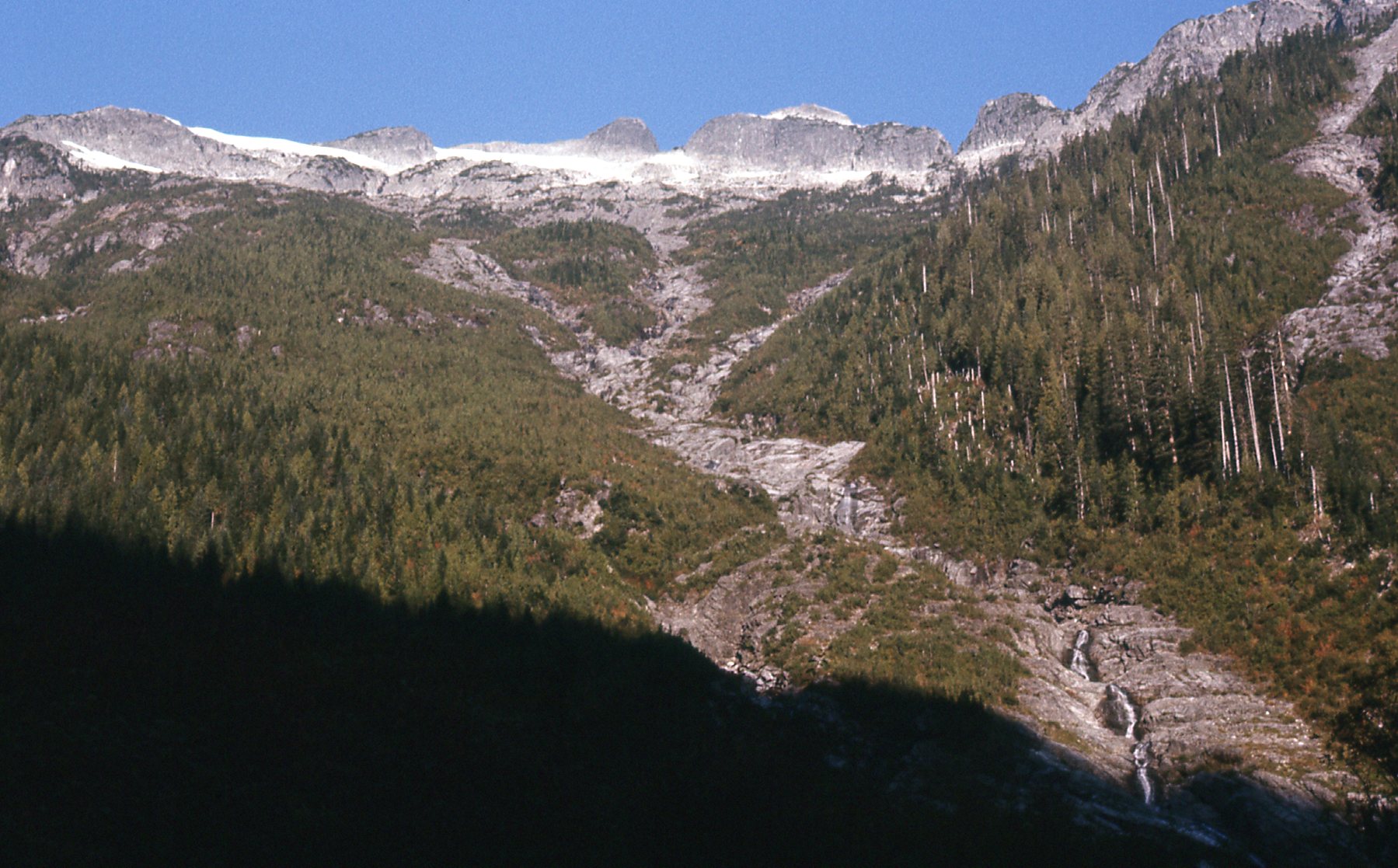
The southeast side of the peak.
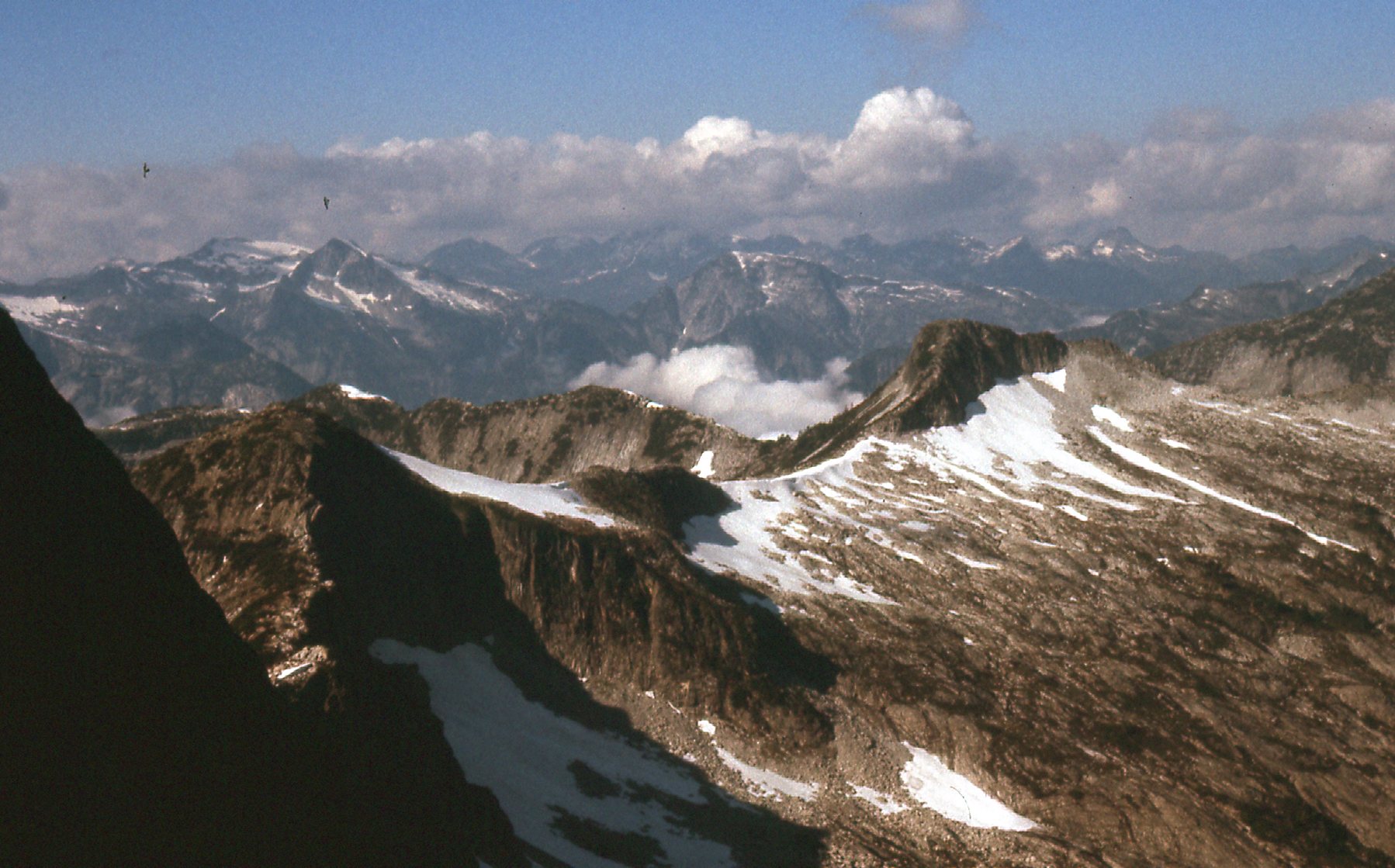
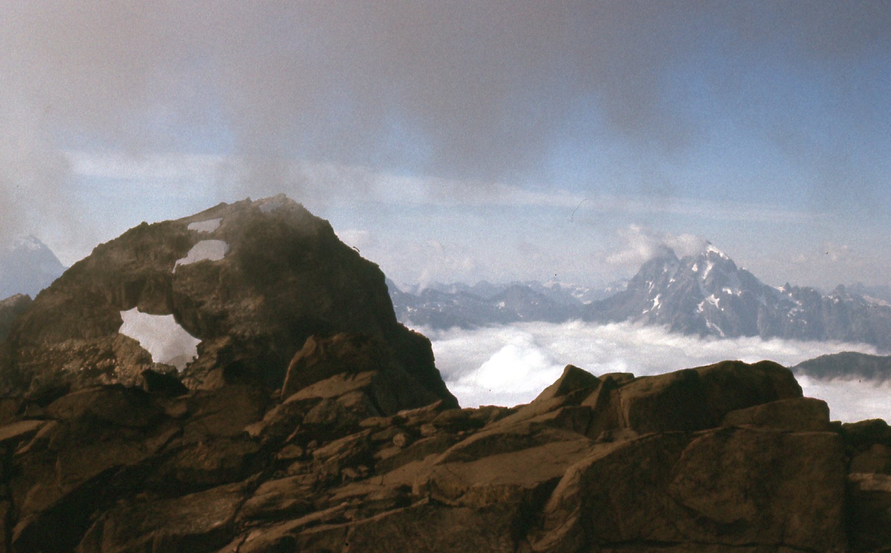
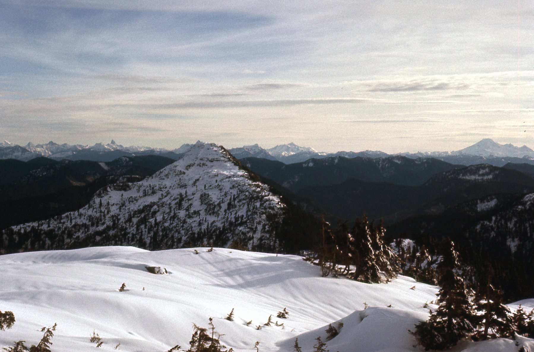
I was shooting for the saddle on the east side of the peak, the one between Ratney and its neighbor to the east which we loosely called “East Ratney” back in the day. (Nowadays, they’ve dropped the name “Mt. Bardean” on it.) It was pretty easy going up to the ridge, which was above treeline. This photo shows some of the terrain on the east side of Ratney.
The east side of Ratney.
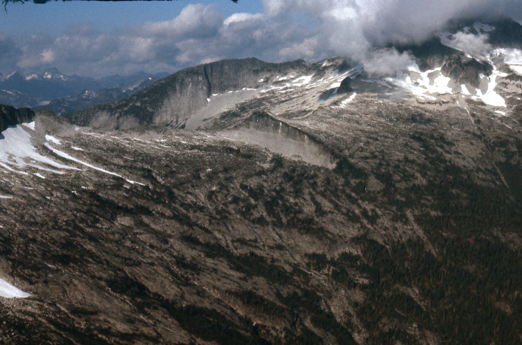
Here’s another view from higher up.
More of the east side of Ratney.
There was a lot of nice rock scrambling. Before I knew it, I stood on the summit of Mt. Ratney, elevation 1,960 meters (6,434 feet). The climb from the valley floor had been 1,385 meters, or 4,545 feet. What really got my attention was the terrain between Ratney and its much higher neighbor to the north, Mt. Clarke. Have a look at these photos I took from the summit. This first one shows the northwest ridge of Ratney. Getting on to it was not difficult from the Ratney-Bardean saddle.
The northwest ridge of Ratney.
This next photo is a continuation of the ridge, as it swings from northwest to north, then starts northeast.
The ridge continuing north.
One more. This one shows how the ridge makes a curve from the northeast and up on to the summit ridge of Mt. Clarke, hidden in the clouds.
Looking north to Mt. Clarke
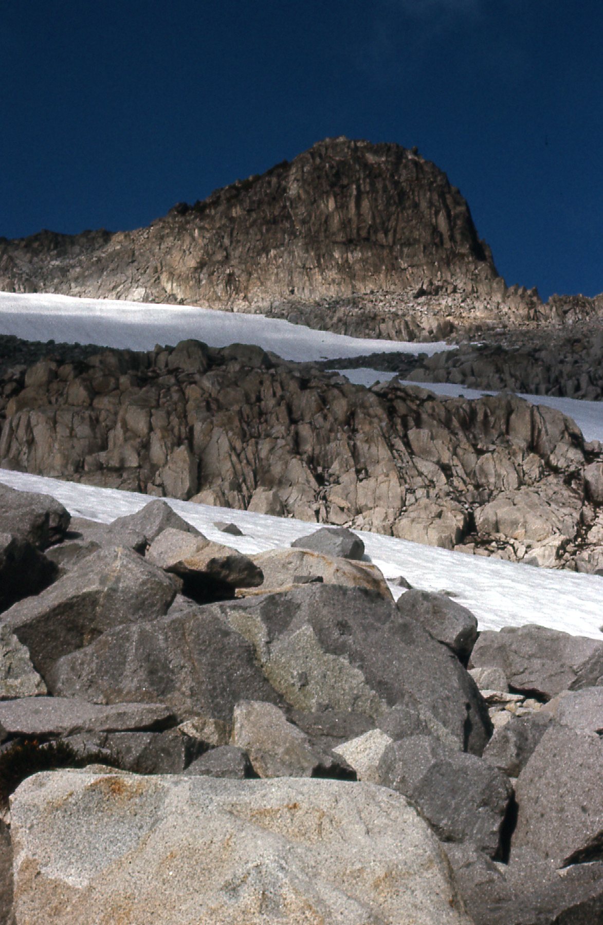
That was exciting country, and an interesting way to approach Mt. Clarke as a backpack. I found a register on the summit of Ratney, and only 2 parties had signed in to it before me. After a short while, I dropped down to the Ratney-Bardean saddle. From there, I had this view to a small glacier on the north side of Ratney.
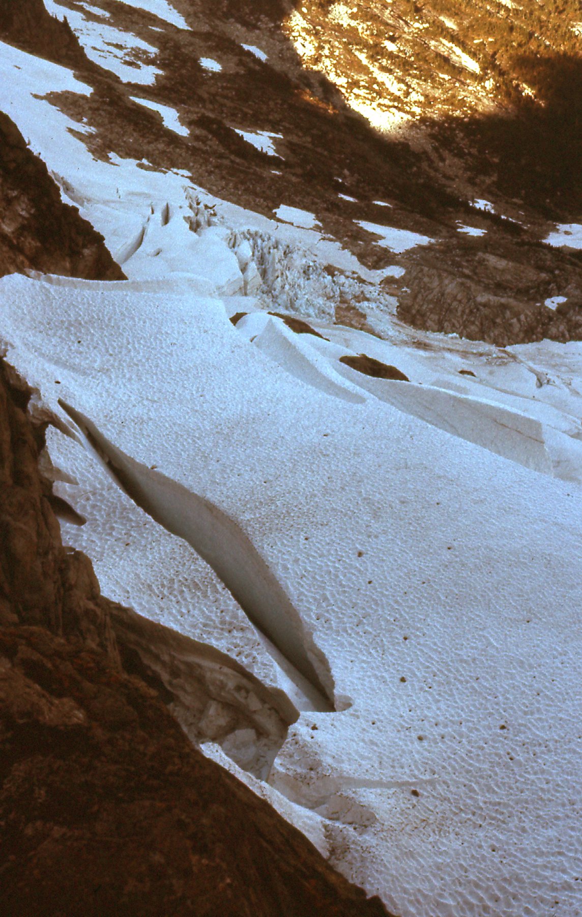
Glacier
It was easy ground to continue over to East Ratney (Mt. Bardean), as the whole south side of the ridge was friendly terrain. It didn’t take me long to reach its summit, at 1,930 meters (6,300 feet). I had this look back to Ratney. That’s Mt. Judge Howay over to the right, 10 miles due west.
Looking west back to Ratney.
After a short stay on East Ratney, I headed down its southeast side on easy slopes. I stopped for a moment to take this picture of Peak 1767 meters (5,800 feet) on the ridge east of East Ratney.
Peak 1,767 meters, the dark peak on the right.
I passed this waterfall on the way down.
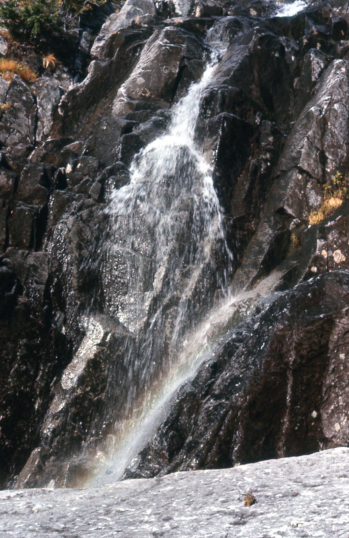
Waterfall
From lower down, I had this view to the east down Skwellipel Creek – you can see all the recent logging.
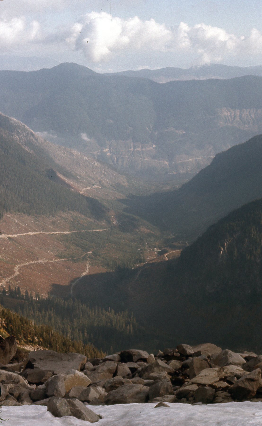
Looking east.
It had been a great day. The weather had cooperated, and I hadn’t run into any difficulties. Even the roads had worked out, getting me in close for perfect access to the peaks. I think when I went in there in 1976, Ratney wasn’t on the radar of too many climbers yet.
A couple of months passed. Just before Christmas, on December 23rd, Paul Berntsen and I left Mission of a foggy morning and drove to the Statlu, to the very end of the logging road in North Statlu Creek. The area had been recently logged, and the road was open. We were able to park on the east side of the creek at about 690 meters. The weather was threatening and even snowing lightly as we set out, climbing up a prominent gully on the west side of Mt. Jasper. The higher we went, the worse the weather was. I took this picture at around 1,127 meters.
At 3,700 feet, or 1,127 meters.
Visibility came and went, but when we reached the high point at 1,432 meters things cleared momentarily, enough that we could see we were on top. There was a secondary summit nearby which we also visited, at around 1,402 meters. Here’s Paul posing on top. Note the typical climbing duds which we all wore at the time: knickers, knicker socks, heavy mountaineering boots and of course a tuque – after all, we were in Canada, eh.
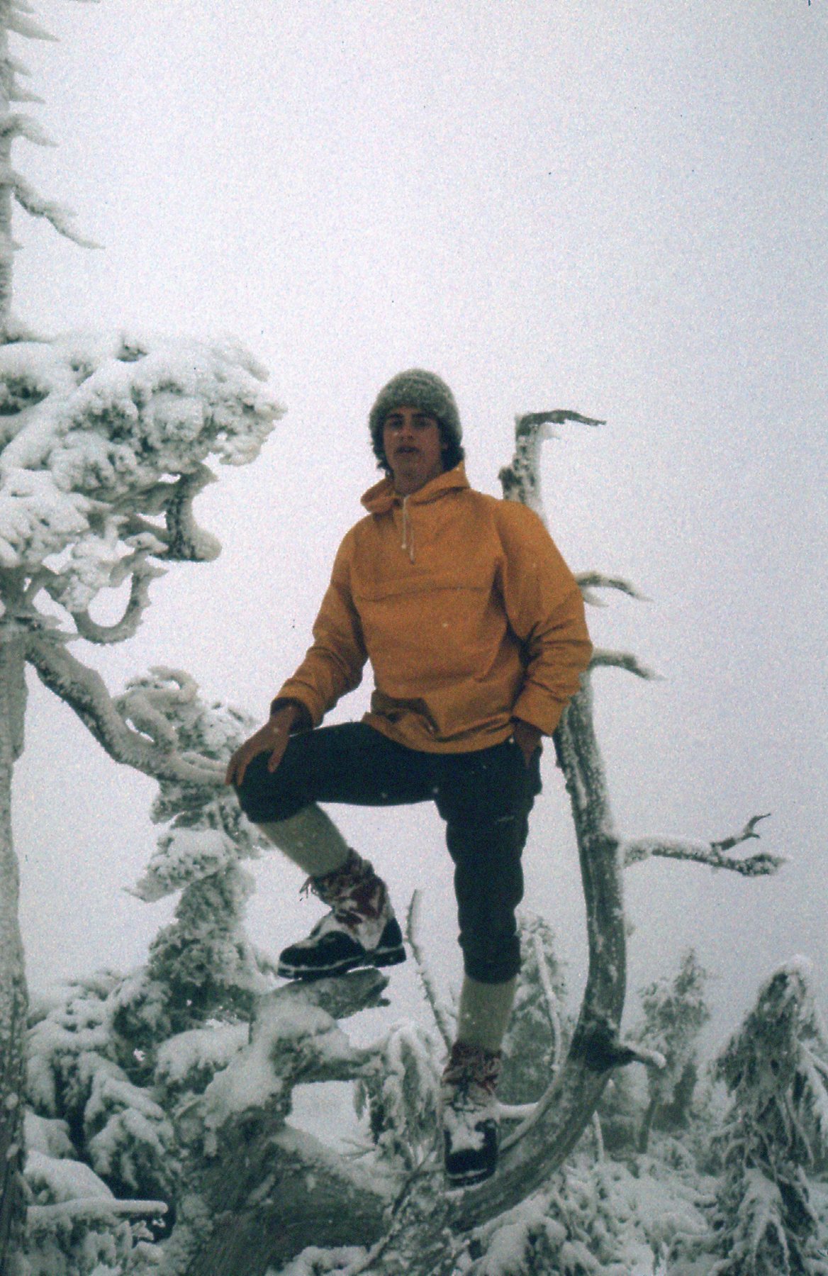
Paul on the top of Mt. Jasper
This was about a 2,500-foot climb from the west side. The weather deteriorated and it snowed heavily on our way back down. Mt. Jasper is pretty massive and is guarded by steep cliffs, all along its North Statlu side and also the side facing Middle Statlu Creek, also known as Blacklock Creek. It has several summits, but we climbed the highest two that day. The guidebook credits us with the first recorded ascent, and I guess that because it was 2 days after the winter solstice, you’d have to give us credit for the first recorded winter ascent too.
I must have enjoyed the experience on Mt. Jasper, because only 5 days later, on the 28th, I returned to the area – this time the weather was better. My car was in the shop for repairs, so a friend drove me in their car as far as they could up the Lost Creek road. I then used my mountain bike to cover more miles, and finally ditched it in the bush. From there, it was all on foot. I picked up a broad ridge at 600 meters and followed it up and to the northeast until I was near a bump at 1,280 meters. I had a look to the southeast to a mountain I called Peak 1402 meters (more on that later).
Looking southeast to Peak 1402 meters.
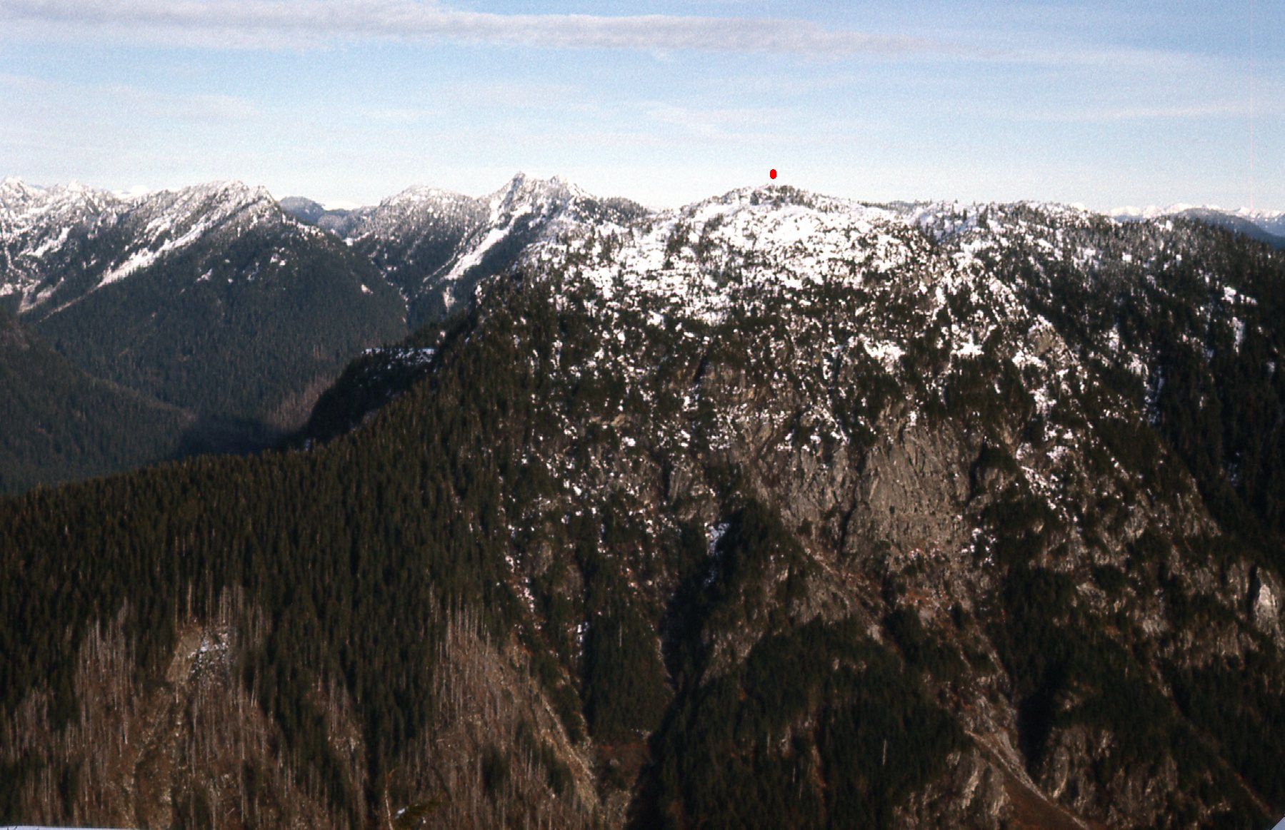
Over the top of the 1280-meter bump, then a turn to the west-northwest for the home stretch. Straight ahead of me was the rocky south side of Mt. Kettley
The south side of Mt. Kettley
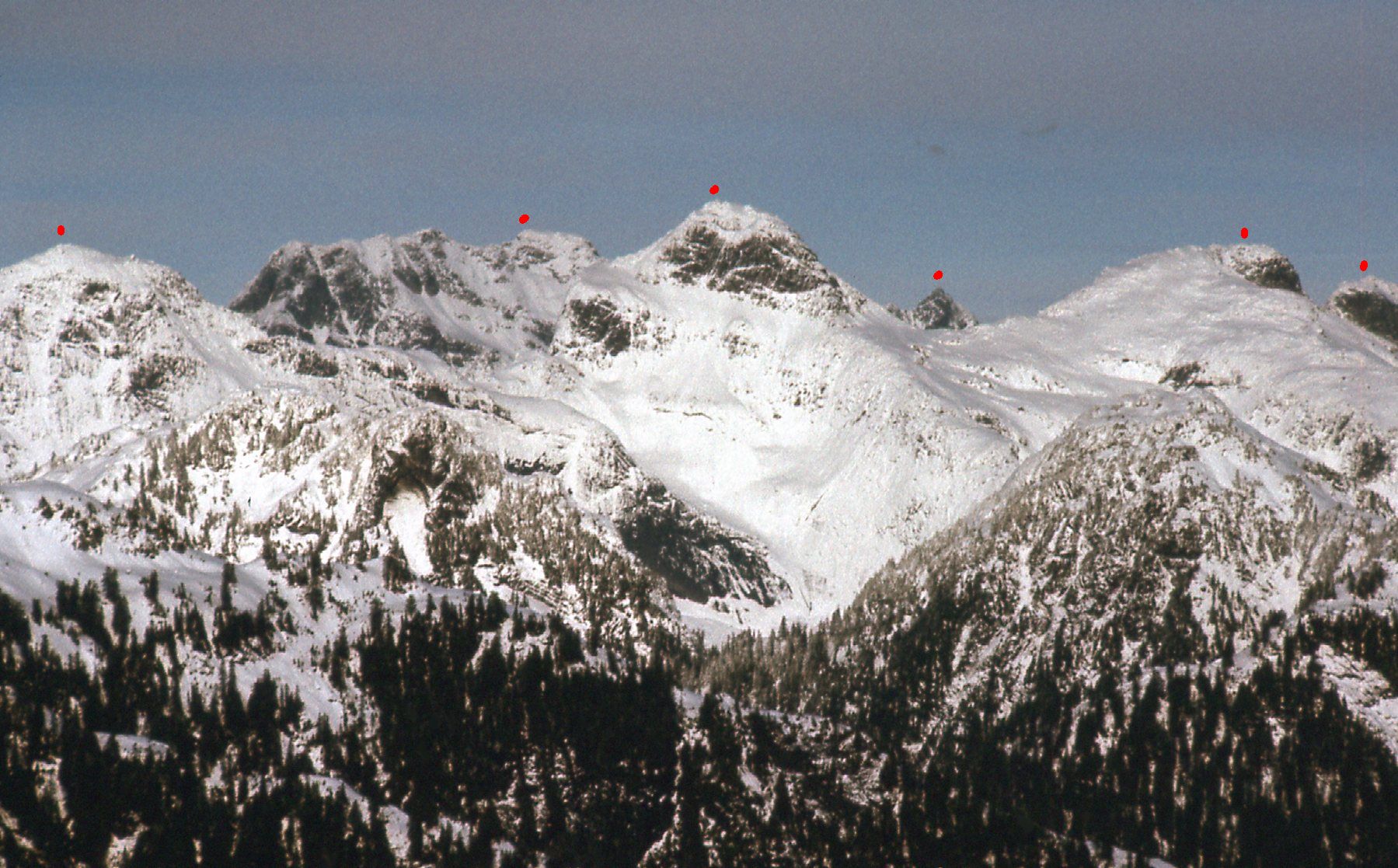
There were a lot of cliffs on that side of Kettley, and I had to weave my way up through them. Fortunately the snow was deep and I think that actually made it easier. My diary says it took me 5 hours from when I left the car until I reached the summit of Kettley, at 1,390 meters. I took a lot of pictures from the summit which show the surroundings really well, and I’d like to share them with you here. This first one shows a lot that is significant. See the 5 red dots? They mark the positions of several peaks which I’ll guide you through.
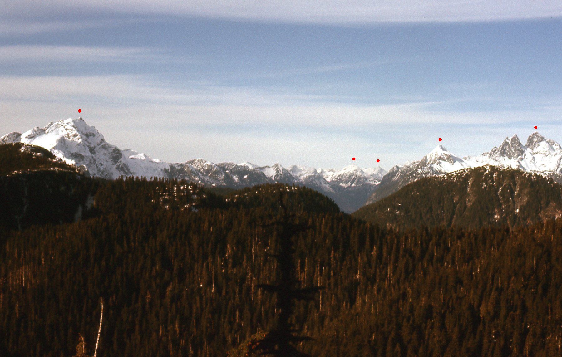
Five red dots
The big peak on the left with the dot is Mt. Robie Reid, about 11 miles away. Here’s a telephoto of it.
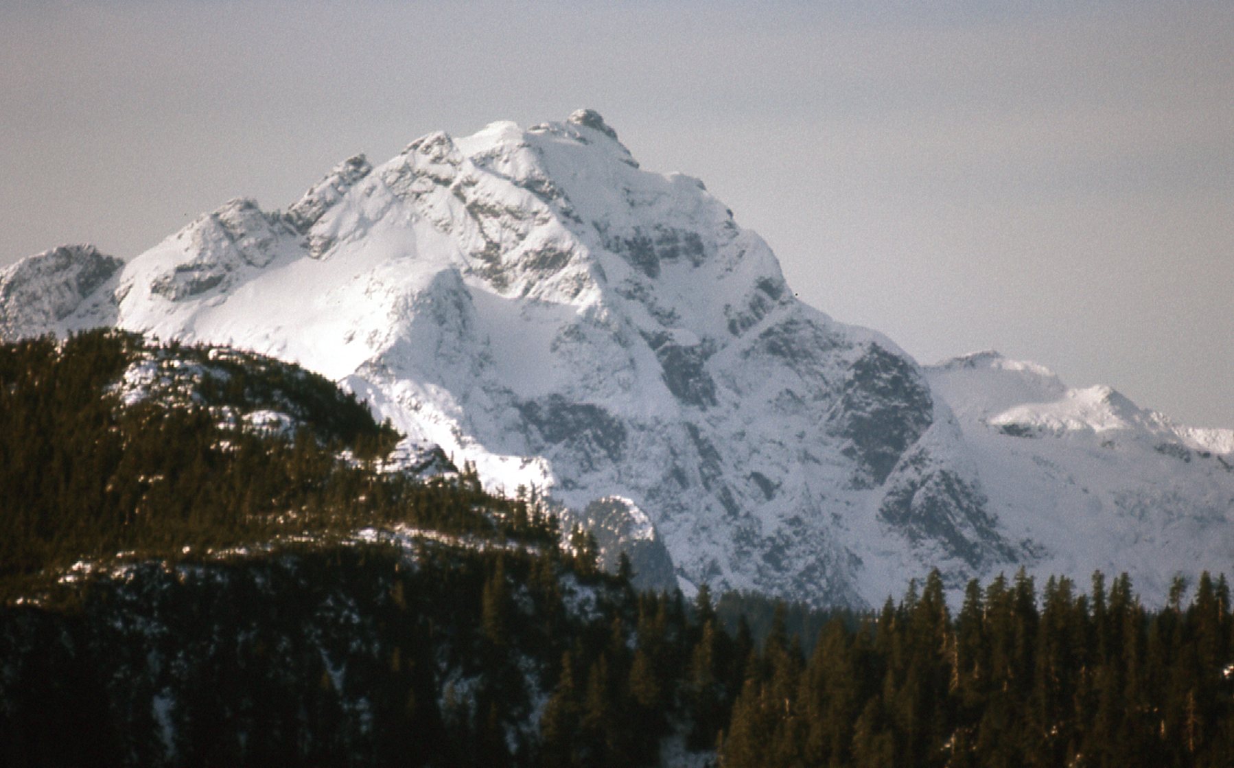
Looking west-northwest to Robie Reid, elevation 6,847 feet.
The next one in from the left with a dot is Osprey Mountain, elevation 5,495 feet. Just to the right of it is Tingle Peak – back in the day, it was simply Peak 5712 with no name. They are both way up at the head of Tingle Creek, the major valley that runs between Robie Reid and Judge Howay. This is a telephoto shot.
Looking northwest up Tingle Creek. Those 2 peaks are about 16 air miles away.
In the previous picture, the big peak at the right edge of the photo is Mt. Kranrod, elevation 5,961 feet – it is one of the red dots. Finally, the dot farthest right is Mt. Judge Howay, seen here in a telephoto shot.
The southeast side of the Judge, almost 11 miles away to the north-northwest.
This next shot sits a bit to the right of the previous one. It too is a telephoto, and we are looking up to the area of Mount Lamont and Mount Glendinning, about 20 miles distant.
Looking north-northwest to the Glendinning-Lamont area.
Closer in, I had this up-close view of Mount Jasper. It is, of course, the previous climb discussed in this piece. It sat only a mile and a half to the northeast, across the valley of Blacklock Creek. I put a red dot above the actual summit. You can see the wall of cliffs that guard that side of Jasper.
The southwest side of Mount Jasper.
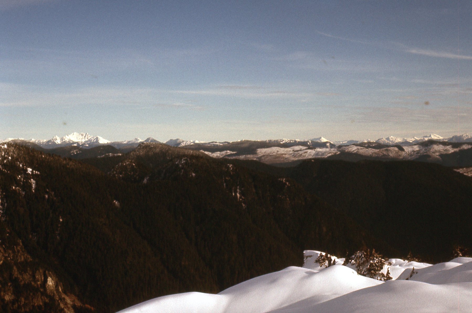
Here’s what I could see if I looked north.
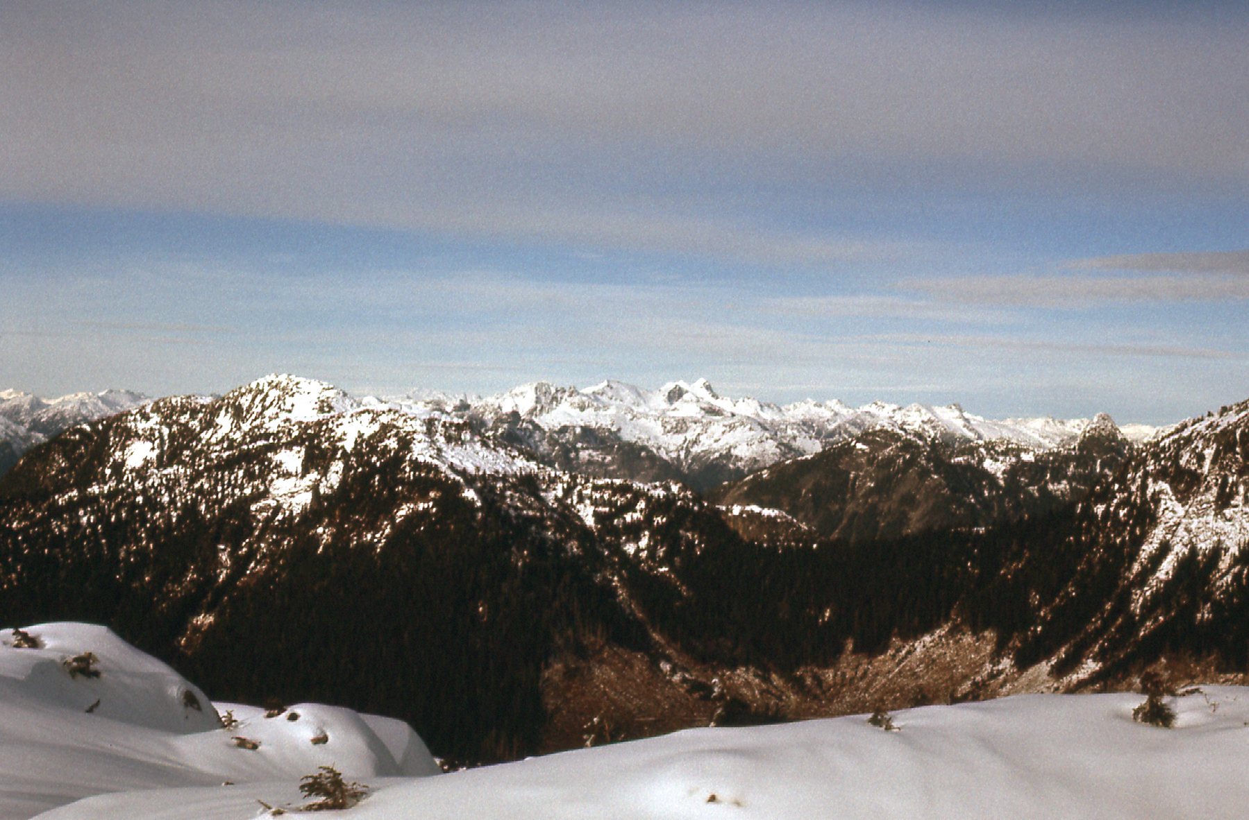
Looking north.
Then I took the same photo but with a telephoto lens. I’ve put some red dots on it for you. The dot on the left marks Winslow Peak, elevation 6,565 feet. Over to its right sit the west and east summits of Robertson Peak, elevation 7,400 feet, which are just over 18 miles distant.
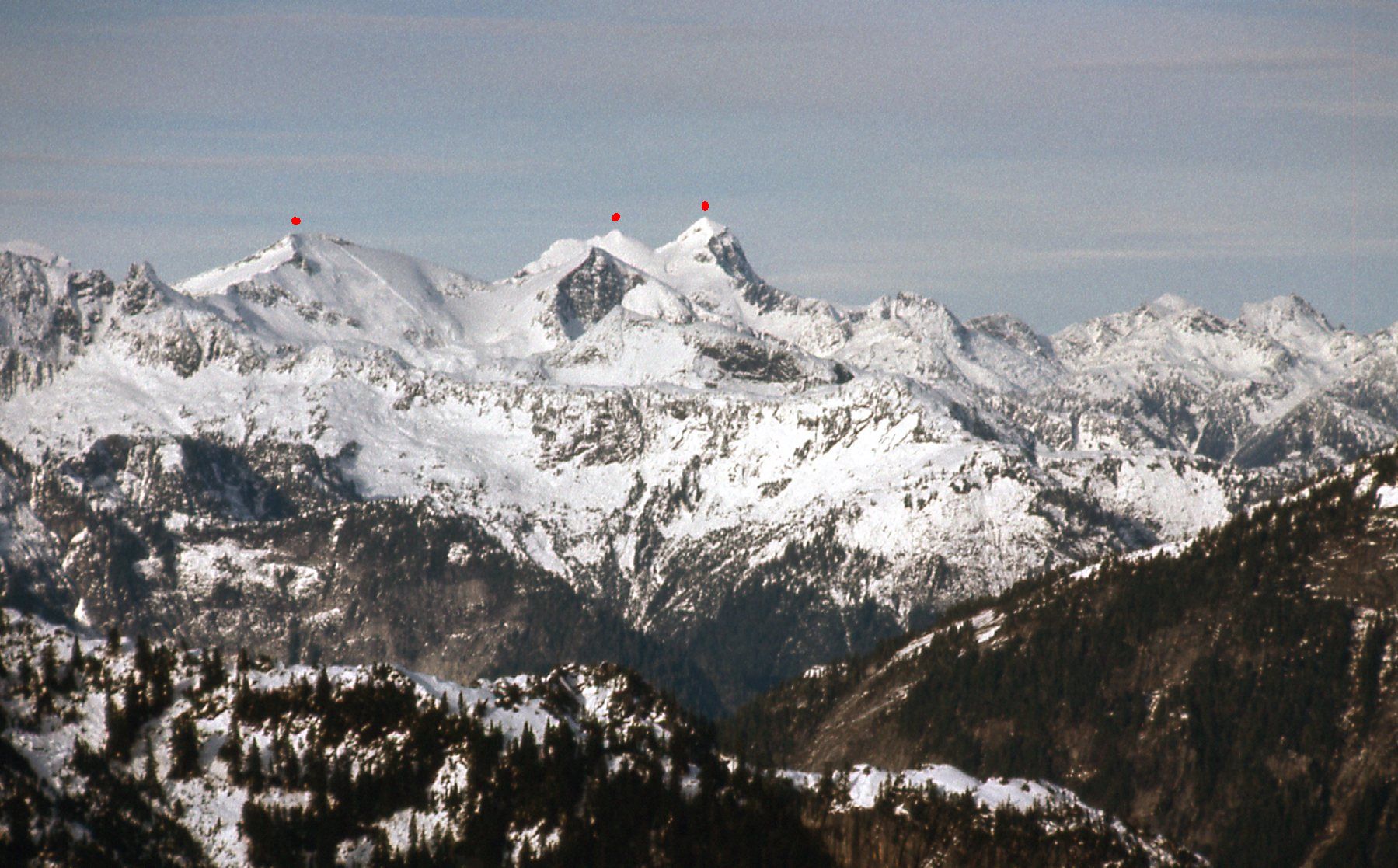
The Robertson Peak area.
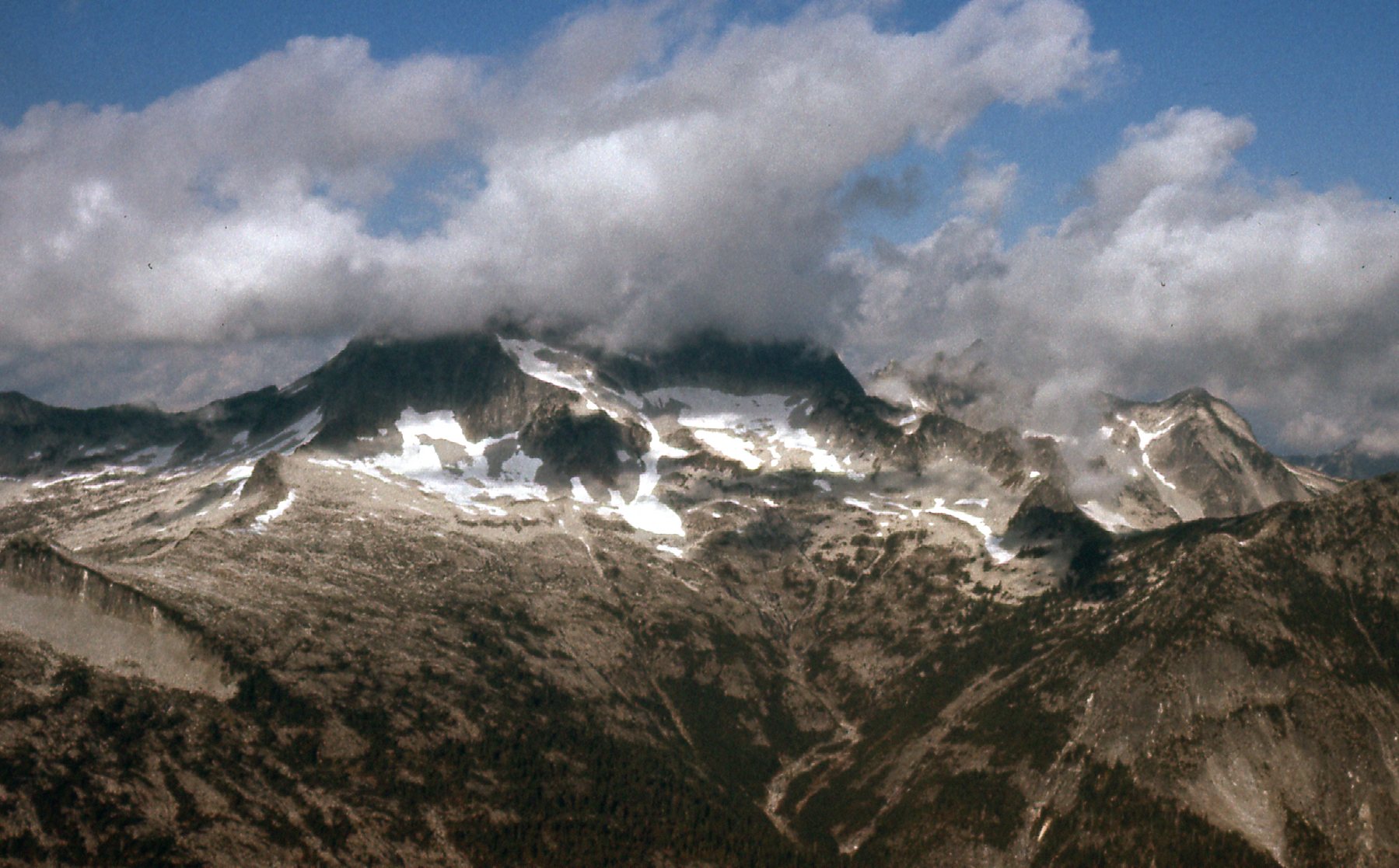
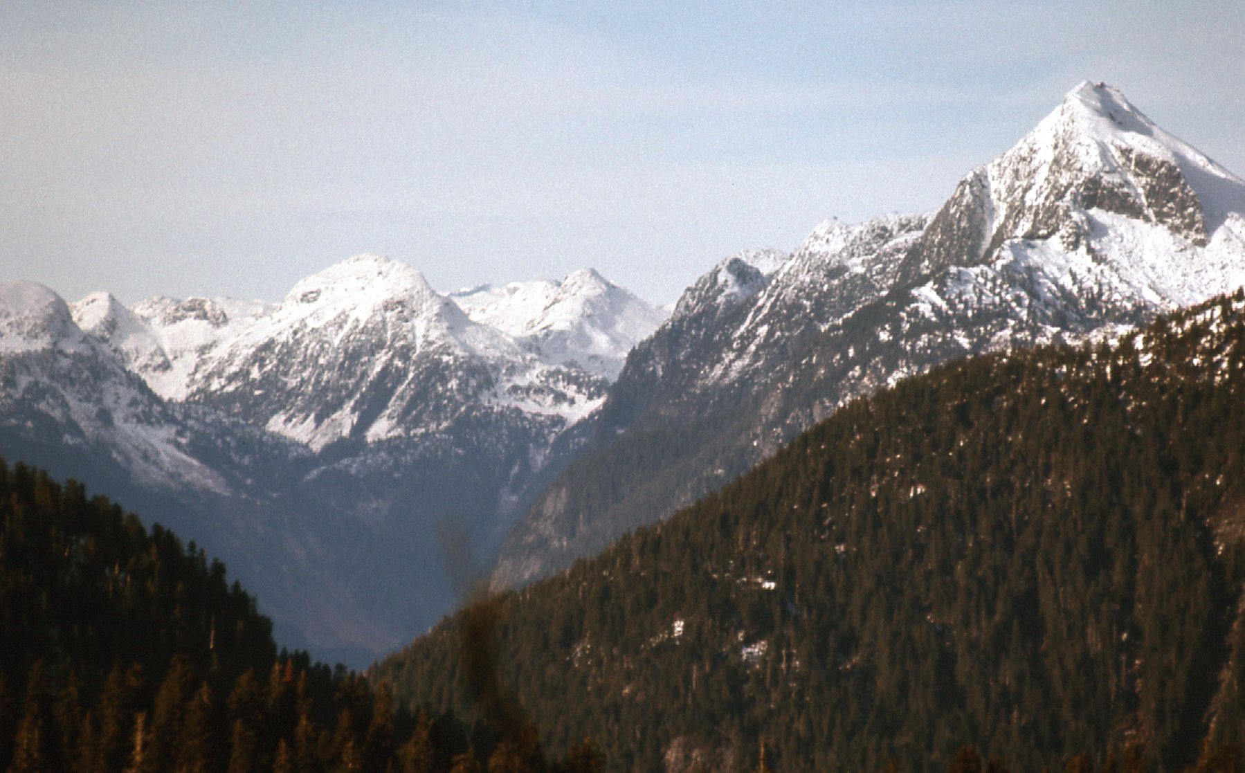
Looking north-northeast from where I stood on Kettley was this view of some favorite peaks.
Mt. Clarke and the Ratneys
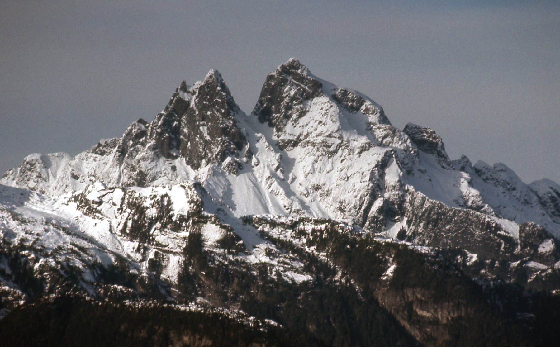
I marked some peaks on the telephoto I took looking in the same direction. Here’s what you’re looking at in the next photo, with the 6 red dots. Over to the left is Stonerabbit Peak. Farther right is the summit of Mt. Clarke in behind. Right in the center of the photo is the summit of Mt. Ratney. Down in the hollow we can see the dark top of Grainger Peak. To its right, at the top of the long snow slope is East Ratney, also called Mt. Bardean nowadays. Finally, at the far right edge of the photo sits Peak 5800.
The Ratneys, mostly.
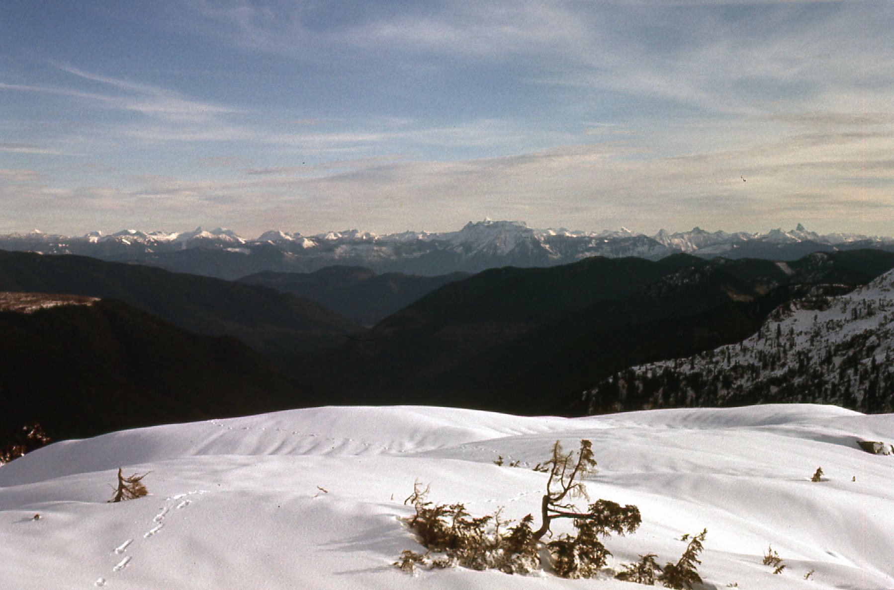
Okay, I’m almost done. Here’s another, this time looking east where we can see The Old Settler on the horizon.
That’s The Old Settler on the left, the white one.
Here’s one looking southeast. I think the pointed one over to the far right is Slesse Mountain, and the big lump on the horizon just to the right of center is the Cheam Range. If you look carefully, you can see my snowshoe tracks coming across the snow.
Looking southeast.
One more, and this one is important. See the snow-covered peak out there, only a mile and a half away? It was simply known as Peak 1402 meters. Well, the maps improved, and nowadays it is 1430 meters. And what’s more, now it has a name, Statlu Peak.
Peak 1402 meters.
Well, a little over a month later, on February 2nd (it was now 1977), I went back in to climb Statlu Peak. On that day, I drove the roads up into South Statlu Creek, then up a spur logging road up to 925 meters elevation on the east shoulder of the peak, offering an enjoyable route to the summit. A few comments on Kettley and Statlu Peaks are in order.
When I did Kettley, it turned out to be a long day by the time I made my way back out to where my friend was waiting in her car to drive me back to Mission. I felt that a better route up Kettley would have been via its north ridge which could have been approached by roads up Blacklock Creek. Even more aesthetically pleasing would be to combine the 2 peaks into one day, by doing Statlu first, then walking the ridge northwest over the intervening bump at 1280 meters and then to the top of Kettley. Both peaks have rock faces on their east sides which could offer interesting challenges.
I told you earlier that it felt like I was doing some pioneering work with these peaks in the Statlu, and the guidebook seems to agree. It gives me credit for the first recorded ascents of these 2 peaks, and once again (as for Mt. Jasper), in for a penny, in for a pound – you might as well give me credit for the first recorded winter ascents while you’re at it. My appetite had been whetted, and I couldn’t wait to see what the rest of 1977 had in store.
Stay tuned for Part 3 of this story.