
So what kind of a name is Maselpanik? I’ve searched every database I can find, and still I come up with no meaning. It sounds indigenous, perhaps it’s a First Nations word. The name only appears on any map in conjunction with Maselpanik Creek, a small drainage which originates high up on Custer Ridge just south of the international border in Washington state. It then flows north into British Columbia for about 10 miles until it joins the Klesilkwa River. The first time I ever visited the area was in October of 1976, when I climbed Whitworth Peak on an overnight trip with 2 friends. We used logging roads that went south up the valley to gain access to the peak.
Almost a year passed. Like every other climber in southwestern BC, Dick Culbert’s alpine guide had become my Bible. I referred to it constantly, and one area that had really caught my eye was just south of the border in the U.S. High peaks abounded, things like Mt. Redoubt and Mt. Spickard, almost 9,000 feet. These peaks sat in the States and were normally climbed by using Canadian approaches up Depot Creek from Chilliwack Lake. However, Maselpanik Creek could also be used as an approach to some of them, and my attention went there. In all honesty, though, I cannot recall how far up it one was allowed to drive at the time. Culbert’s book refers to something called the Maselpanik Trail, and I can’t remember using that either. The valley of the Maselpanik was being actively logged at the time, and roads went south to within one mile of the border. That meant that, in a perfect world, if the logging company would allow it, one could drive almost to the head of the valley, giving terrific access to some of those peaks.
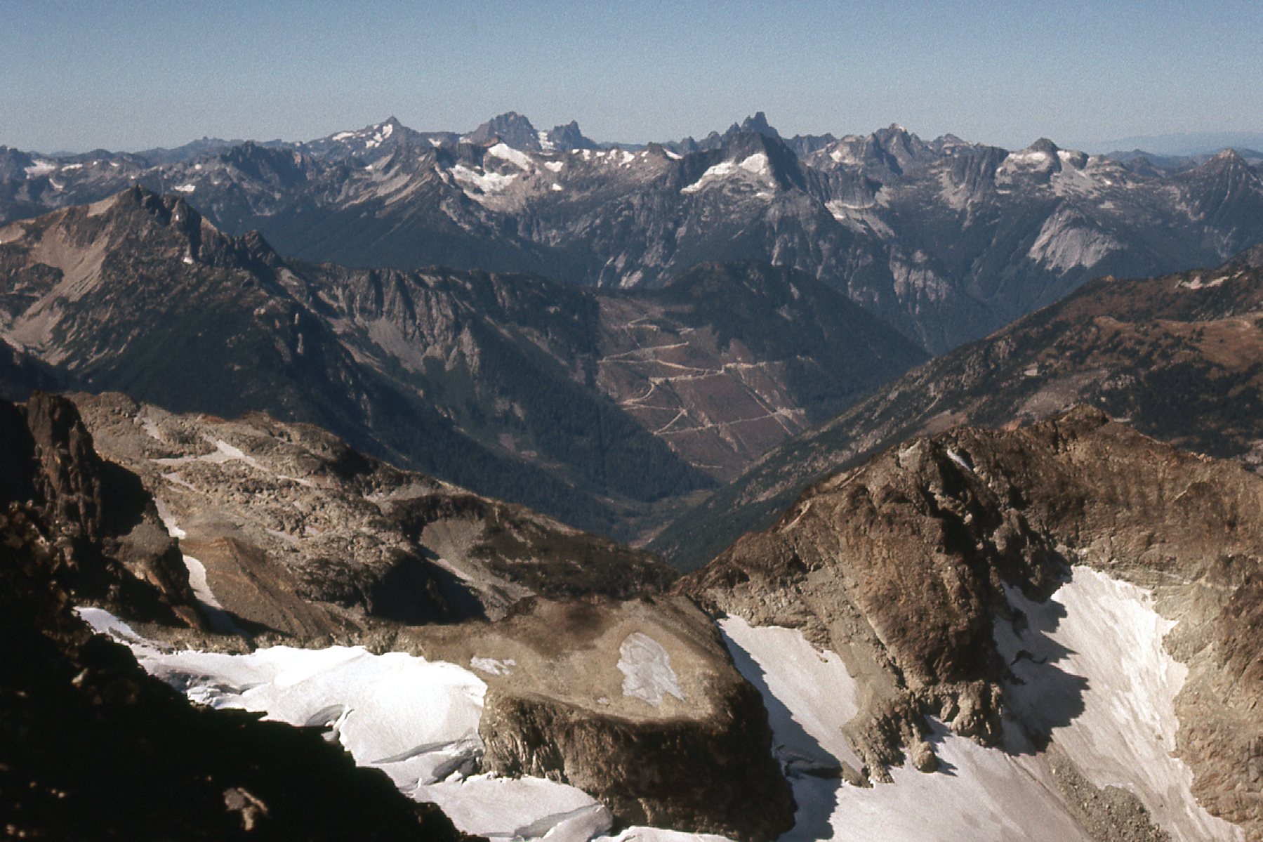
On September 12th, I drove from my home in Mission the 55 miles to the start of the Silver-Skagit Road, then another 22 miles to arrive at the start of the road up Maselpanik Creek. Now, as I write this, it has been fully 44 years since I drove there that fine day, so I must be forgiven for not remembering the next detail. Was the road gated somewhere up the creek, or was it open to anyone to simply drive as far up it as they wished? My diary doesn’t say, but my guess is that I was able to drive pretty far up the valley. Although this photo doesn’t help solve that mystery, it does show that the valley was being (or had recently been) actively logged way up towards its head.
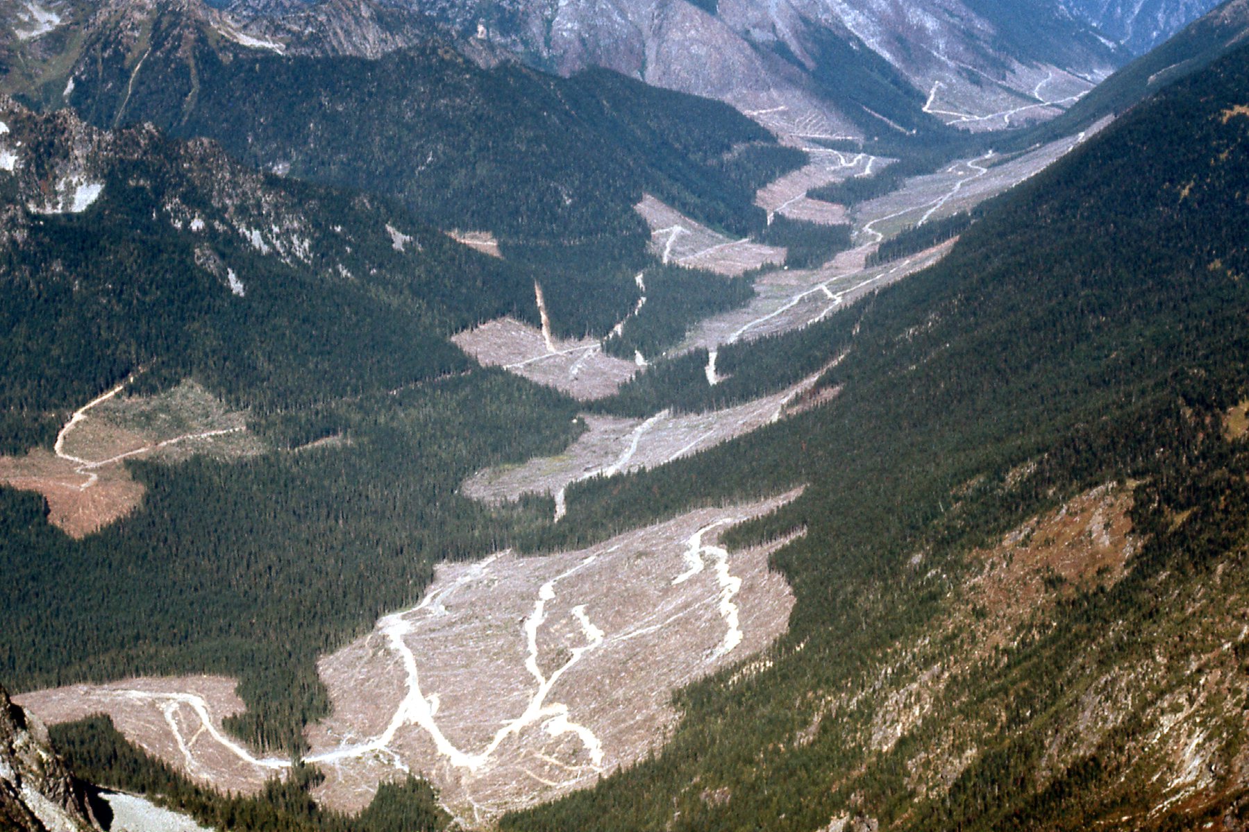
Looking north down Maselpanik Creek. In the far upper right corner, you can see where the valley ends and joins the Silver-Skagit Road.
So why was I here? Well, a mountain known as International Peak sat at the head of the valley and it appeared that I could easily approach it from these roads. Here’s a photo taken from some point along the road at an open spot. We are looking up to an area to the west of my peak.
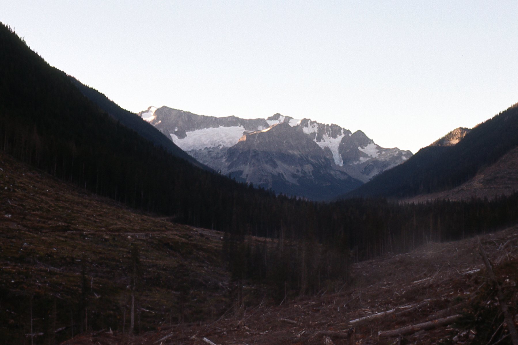
High country west of International Peak.
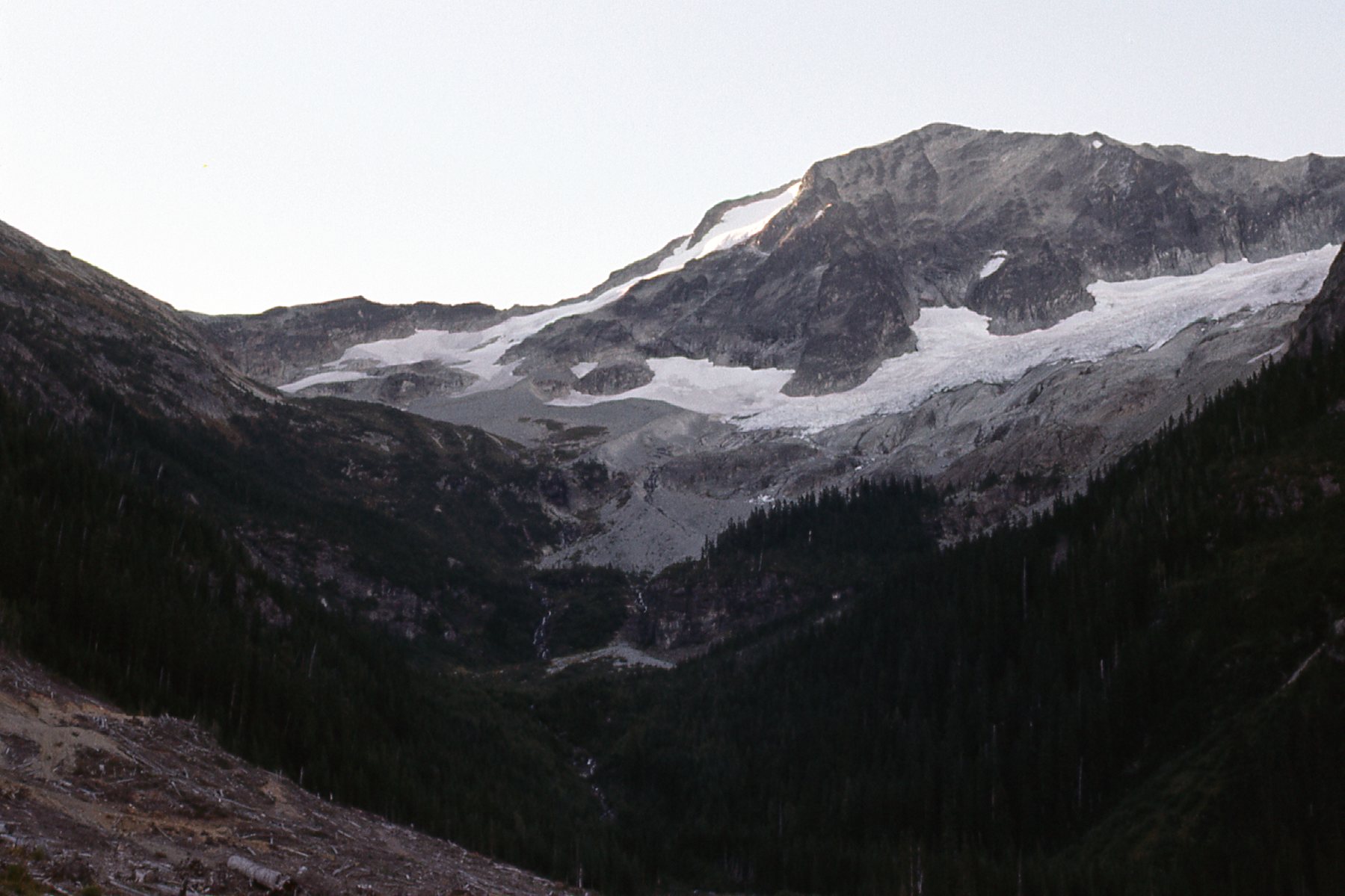
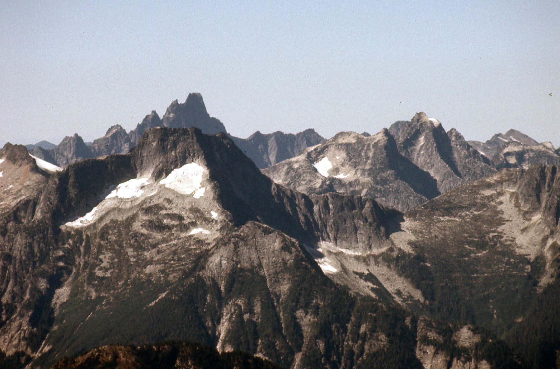
Here’s a photo taken from higher up the valley. We now get our first real look at the peak. See the glacier running from the summit and down to the left? Our route will be near that.
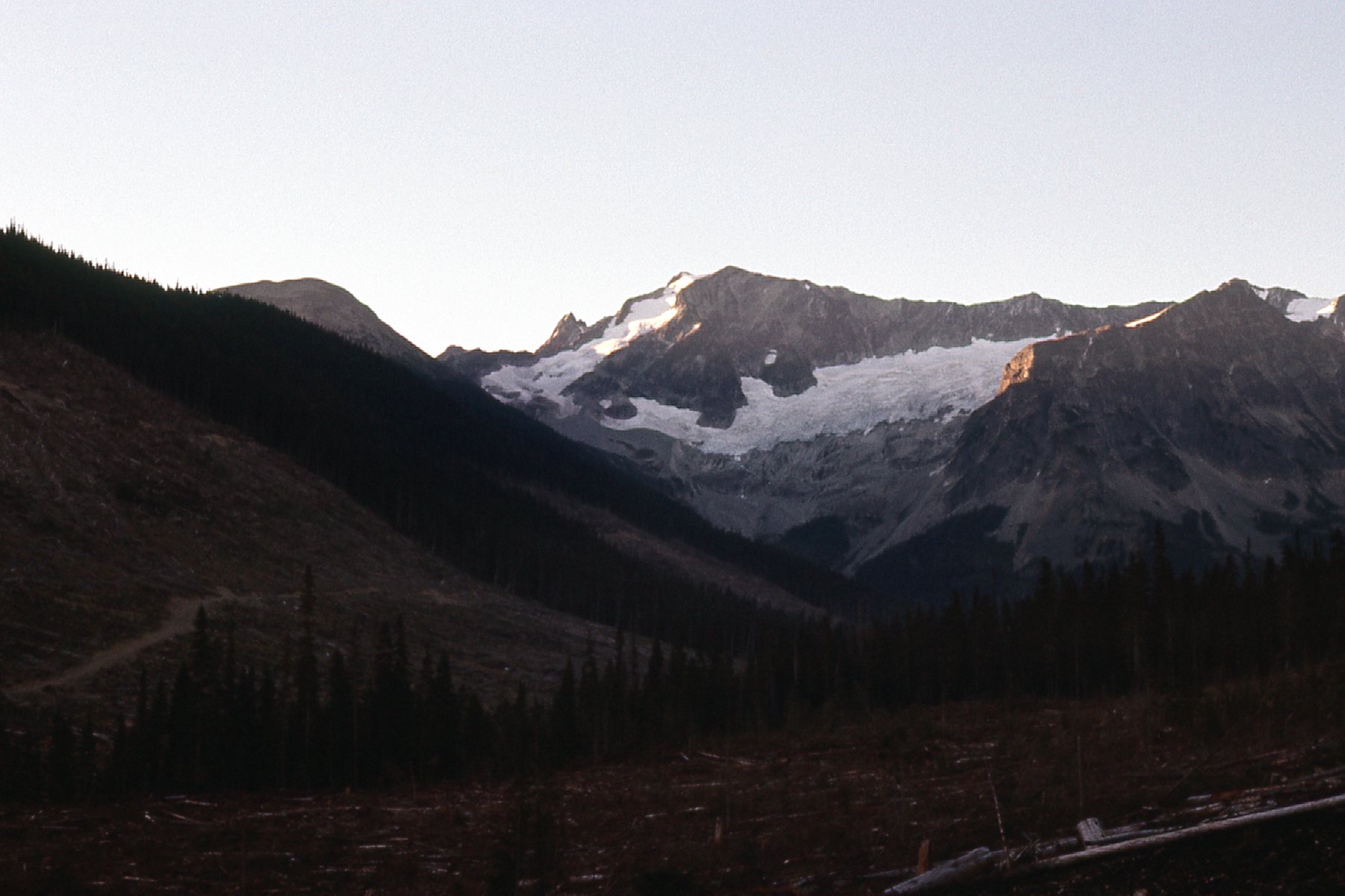
International Peak from the north.
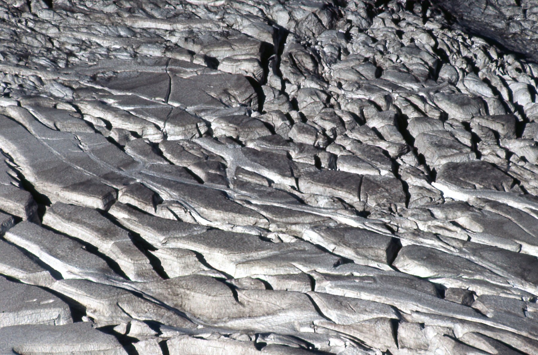
As I climbed higher, I approached this glacier, which I wanted to avoid.
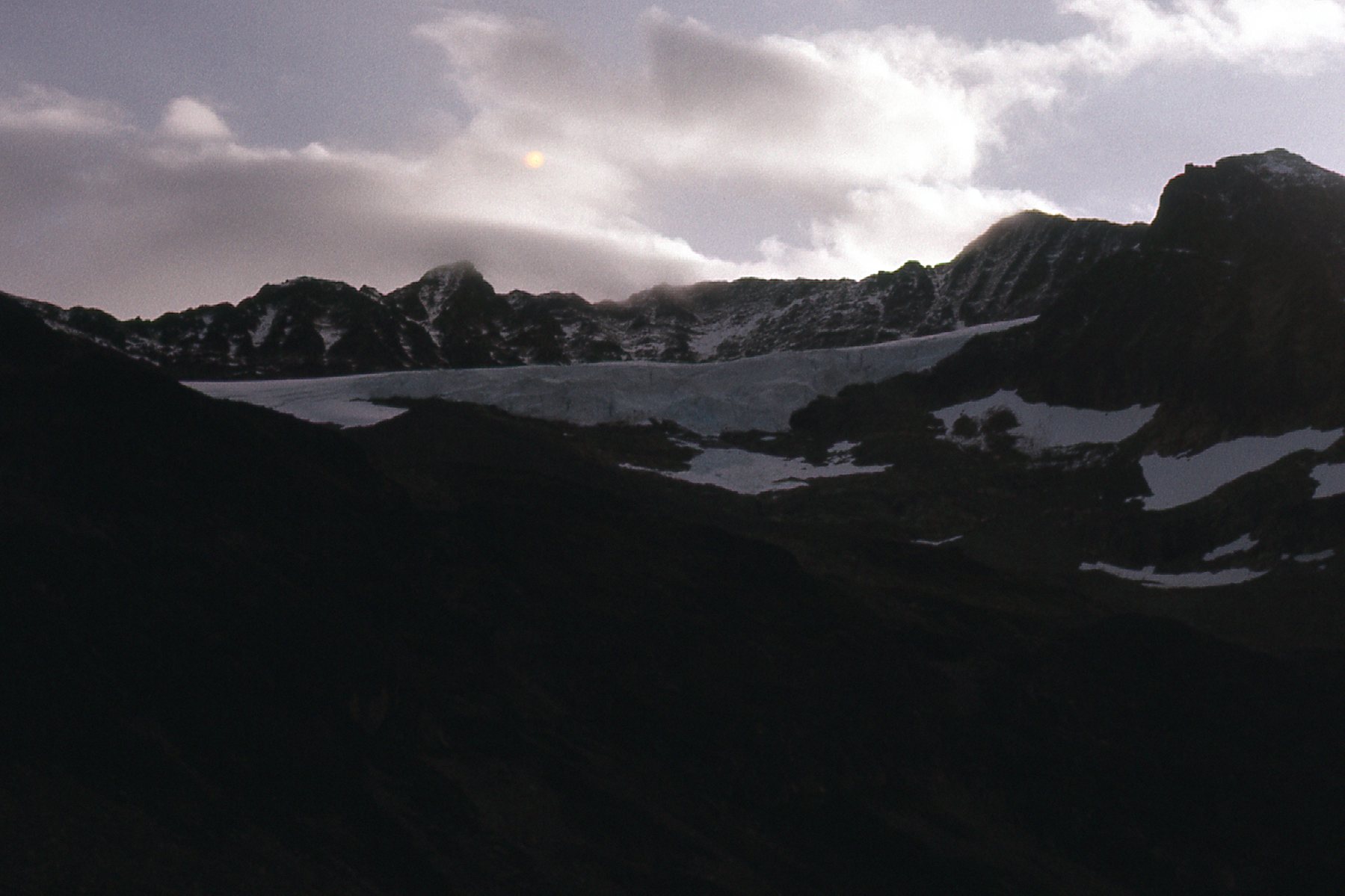
A glacier.
I managed to use the logging roads to get all the way up to 4,000′ elevation, where this next picture was taken. We are looking at the east cirque at the head of Maselpanik Creek. This was the first good view I had of my route up the mountain. See the glacier dropping from the upper center part of the photo and down to the left? Well, just behind and above it is a long rocky rib which starts on the left skyline and goes up and to the right all the way to the highest point we see. That rib is the north ridge of the peak. I would now make my way across the cirque, avoiding waterfalls and other difficulties, and climb up on to that ridge. The summit is still 4,500 vertical feet above me.
The cirque
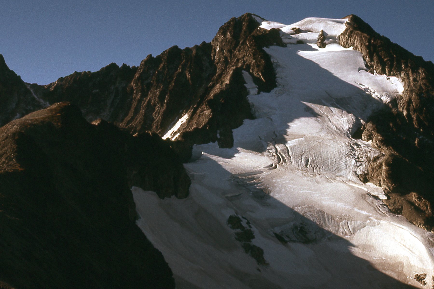
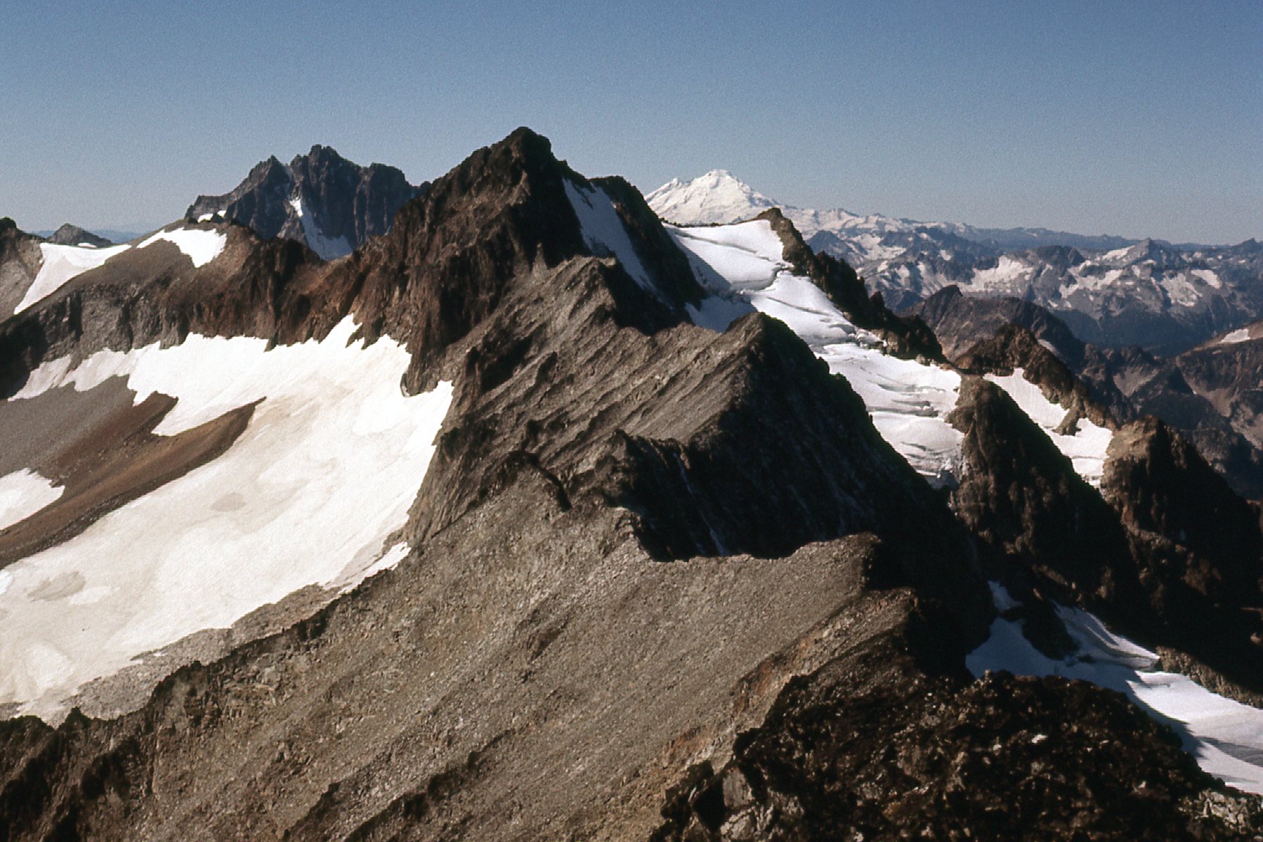
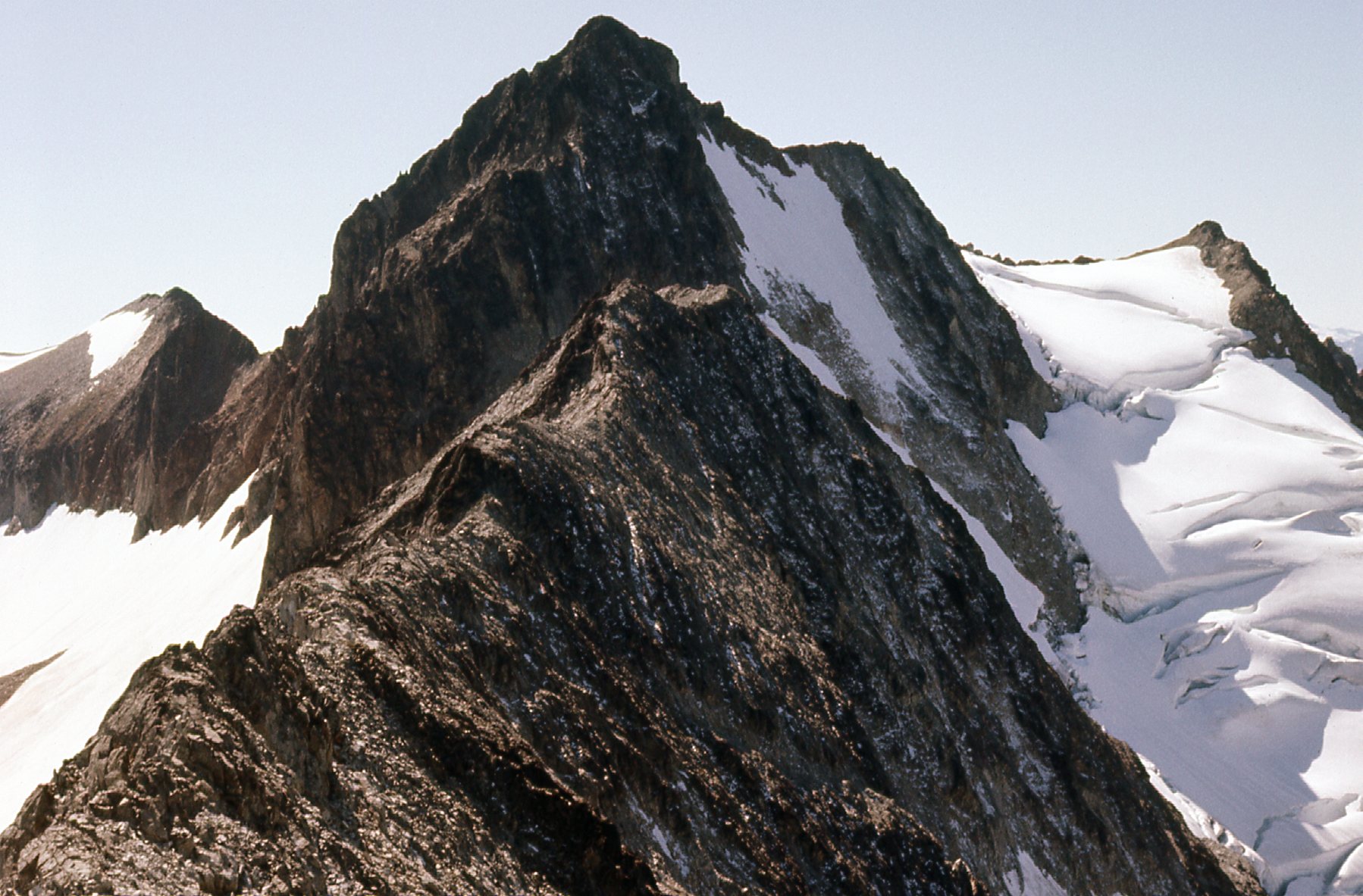
Higher up in the cirque, I passed the last of the trees and had this even better view of the north ridge. I’m not there yet, but am getting closer, and it is becoming more defined as I approach it. The sharp spike lower down on the skyline with the dusting of fresh snow on the side facing us is known as Peak 8200, and it is actually on the east ridge of International Peak. It is well behind the north ridge and more distant.
Getting closer to the north ridge.
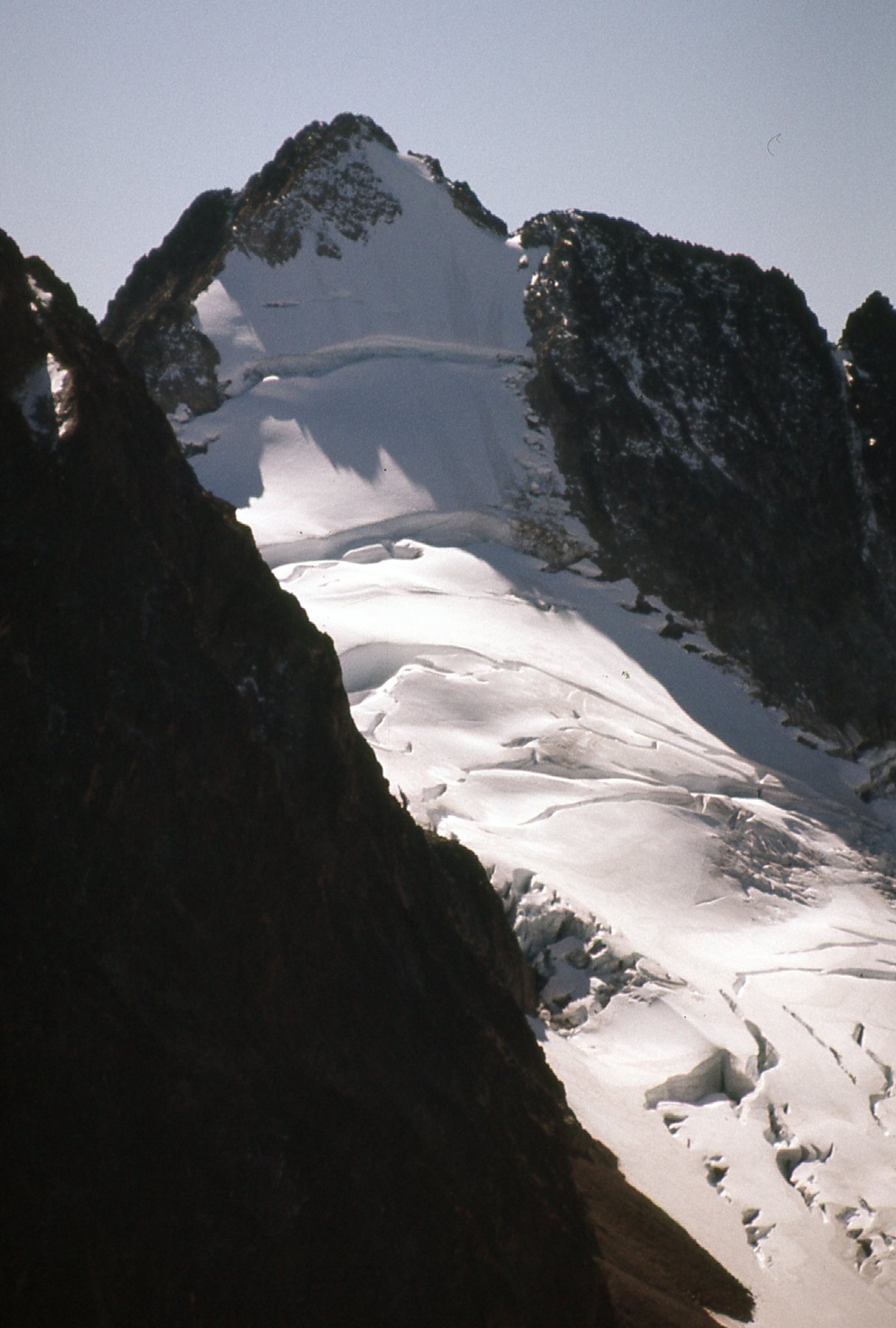
Here’s a nice glacier sitting to the west of my summit. We can also see the west ridge of International Peak on the skyline to the right, also known as Custer Ridge.
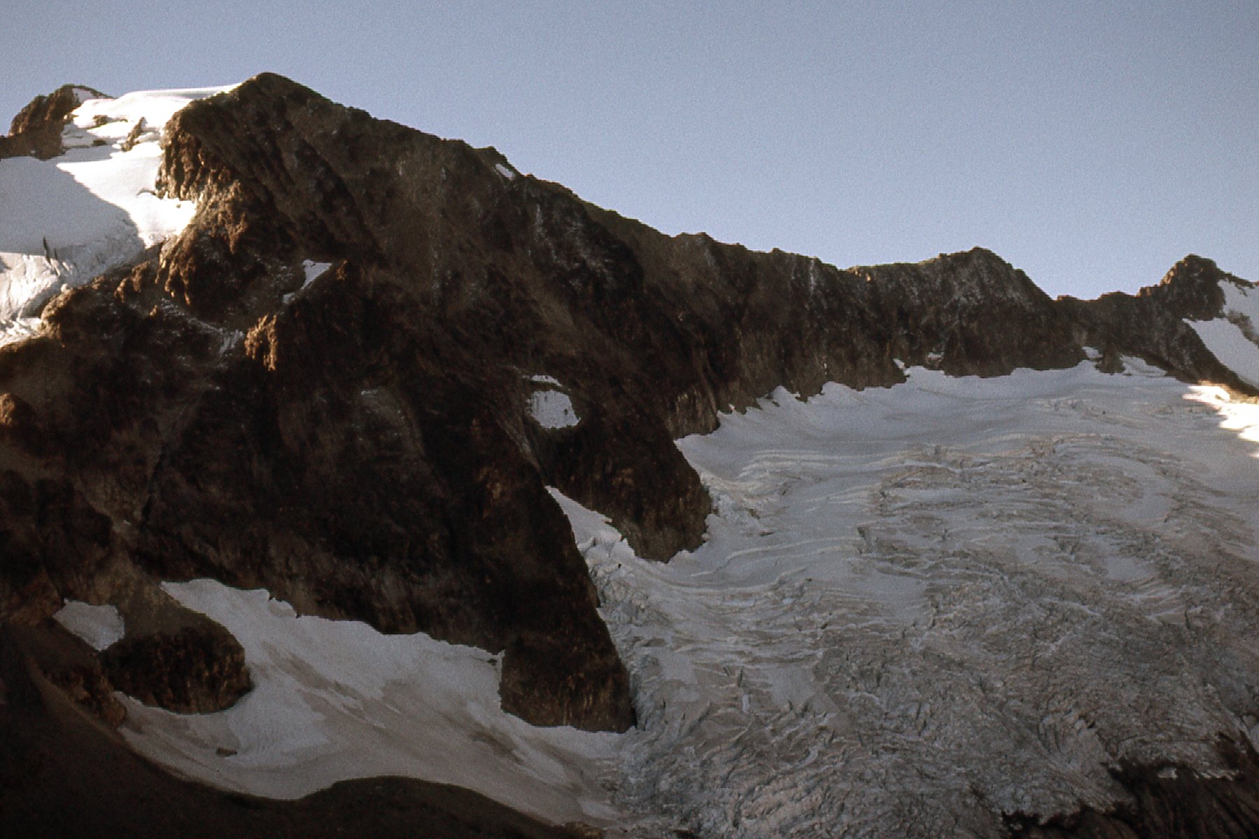
The glacier
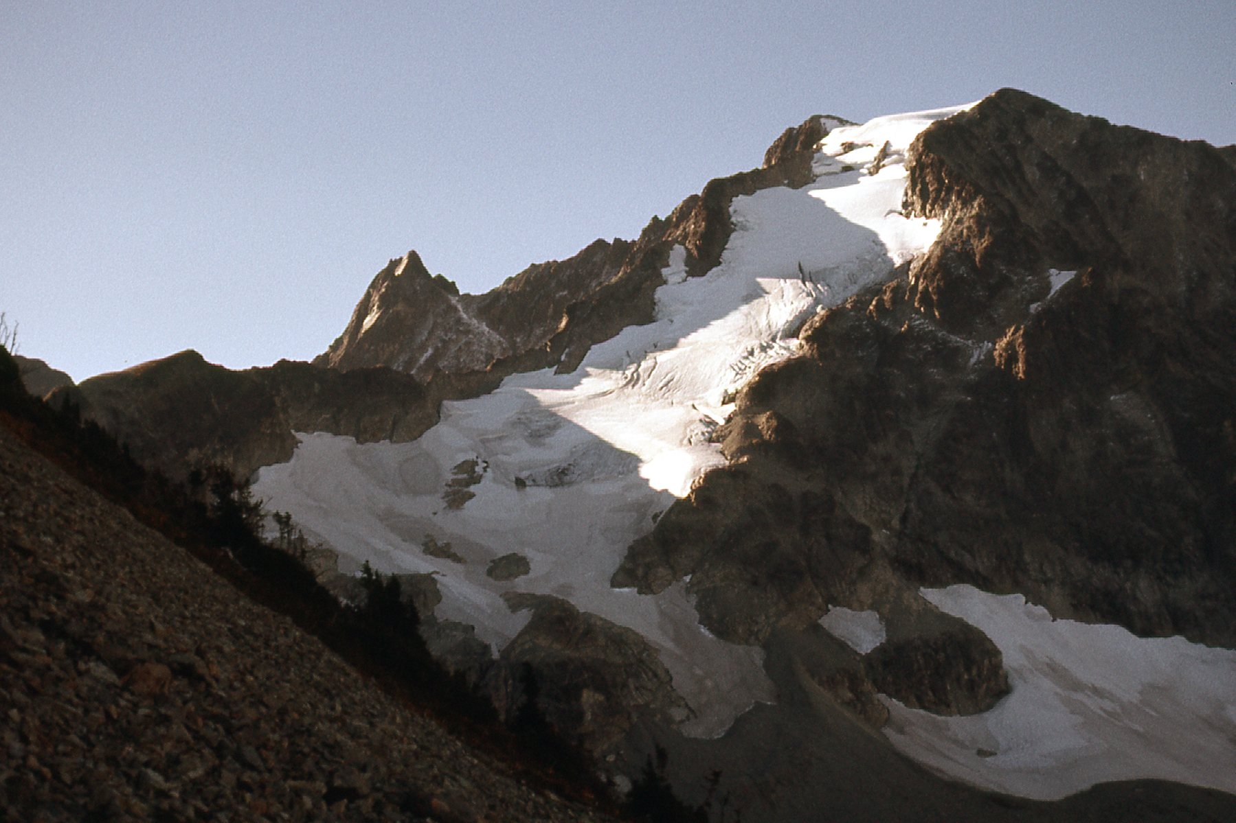
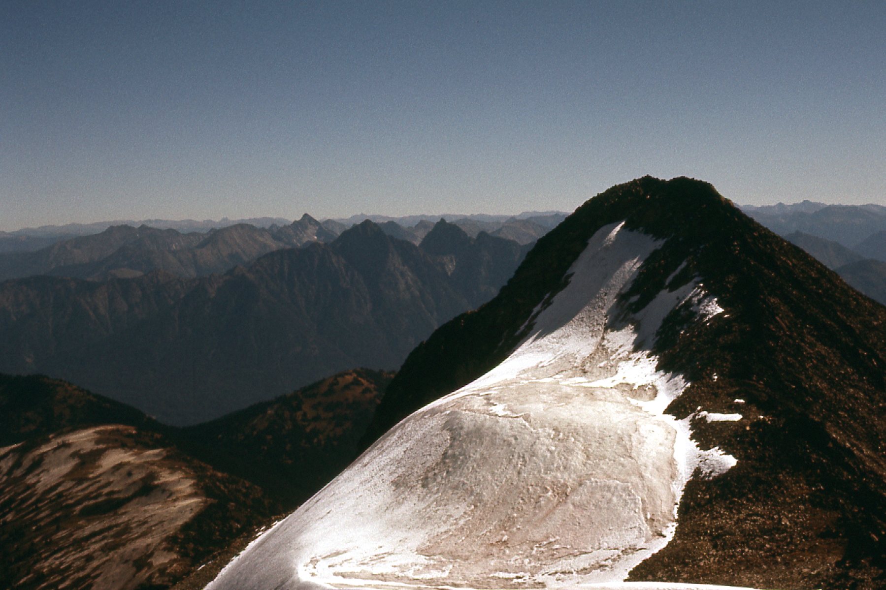
This next photo is one of my favorite pictures I took that day. In it, I have finally reached the north ridge and am standing on it at around 7,000 feet. The ridge starts on the far left center of the photo in the sunshine, then heads right, following the dividing line between sunshine on the left (east) and shadow on the right (west). Culbert’s book describes the ridge as Class 3, but Bruce Fairley’s guidebook from 1986 describes it as follows: Rock on the ridge itself may be Class 4 and poor quality. I’m not trying to blow my own horn, but I have to agree with Fairley. I had been climbing for 15 years by that time and had done my share of Class 3 and Class 4, and there was no doubt in my mind that the trickiest bits were Class 4, encountered high up near the top of the ridge. I remember sweating bullets as I pulled up and over the worst spots, deciding then and there to try to find an easier and safer way down. About 2,000 feet out in front of me was the border, where I crossed from Canada into the U.S. at an elevation of about 7,500 feet.
The north ridge.
I don’t recall what the hour was when I walked the last feet to the summit, but it was around mid-day. International Peak is known nowadays as Mount Rahm, and has an elevation of 8,500 feet.
Heading east up the last steps to the summit of International Peak.
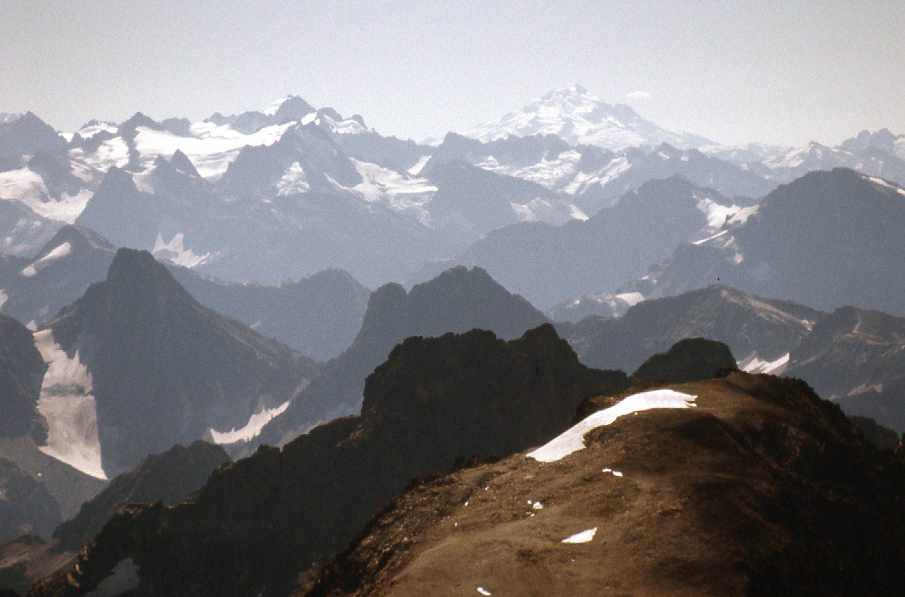
The few clouds that had been around at the start of the day had burned off, and I now had a perfect blue-sky day in which to enjoy the amazing views from the summit. My shutter was working overtime to capture these photos I share with you now. In this next one, we are looking north, the way I had come in to and up the mountain. Over on the left side, we see the north end of the Maselpanik logging roads. In the extreme lower right corner, the light brown area is where the north ridge starts. In the distance, I have placed 6 red dots to help identify peaks for you. The farthest one to the left on the skyline is Mt. Payne – that is its present name, but back in the day we called it Un-named 8150. The next one to the right is Sumallo Peak, which we used to call Un-named 7700, before it had a proper name. The third one in is Mt. Rideout (8,029′). Then it’s a longer distance over to the fourth one, which is Silvertip Mountain. At 8,500 feet, it is the same elevation as the peak I was standing on, but it is an ultra-prominence peak. The farthest dot to the right on the skyline is Mount Outram – it is 19 air miles distant, and has an elevation of 8,000 feet. There’s one more dot, just below and to the left of Outram. That shows Whitworth Peak, mentioned at the beginning of this story. One of the things I most like about this photo is that it clearly shows the relationship between the Rideout-Silvertip group of peaks.
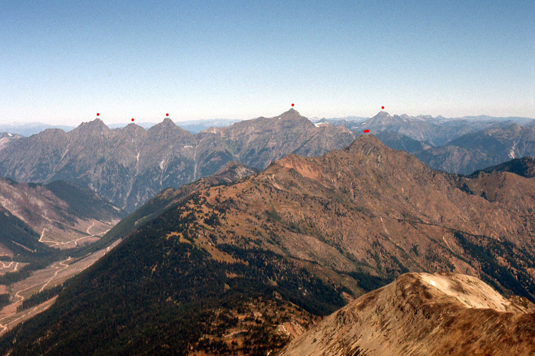
Peaks to the north.
When I looked down the east ridge of my peak, this is what I saw, a peak that contoured at 8,200 feet and is known as “McNaught Peak”. Actually, it’s in the foreground and nearer to us. Beyond it, rearing up behind is the top of “Devil’s Tongue”. Click on the name to see a very dramatic picture of it. And way down in the valley bottom, that’s Ross Lake that we can see, sitting 7,000 vertical feet below us.
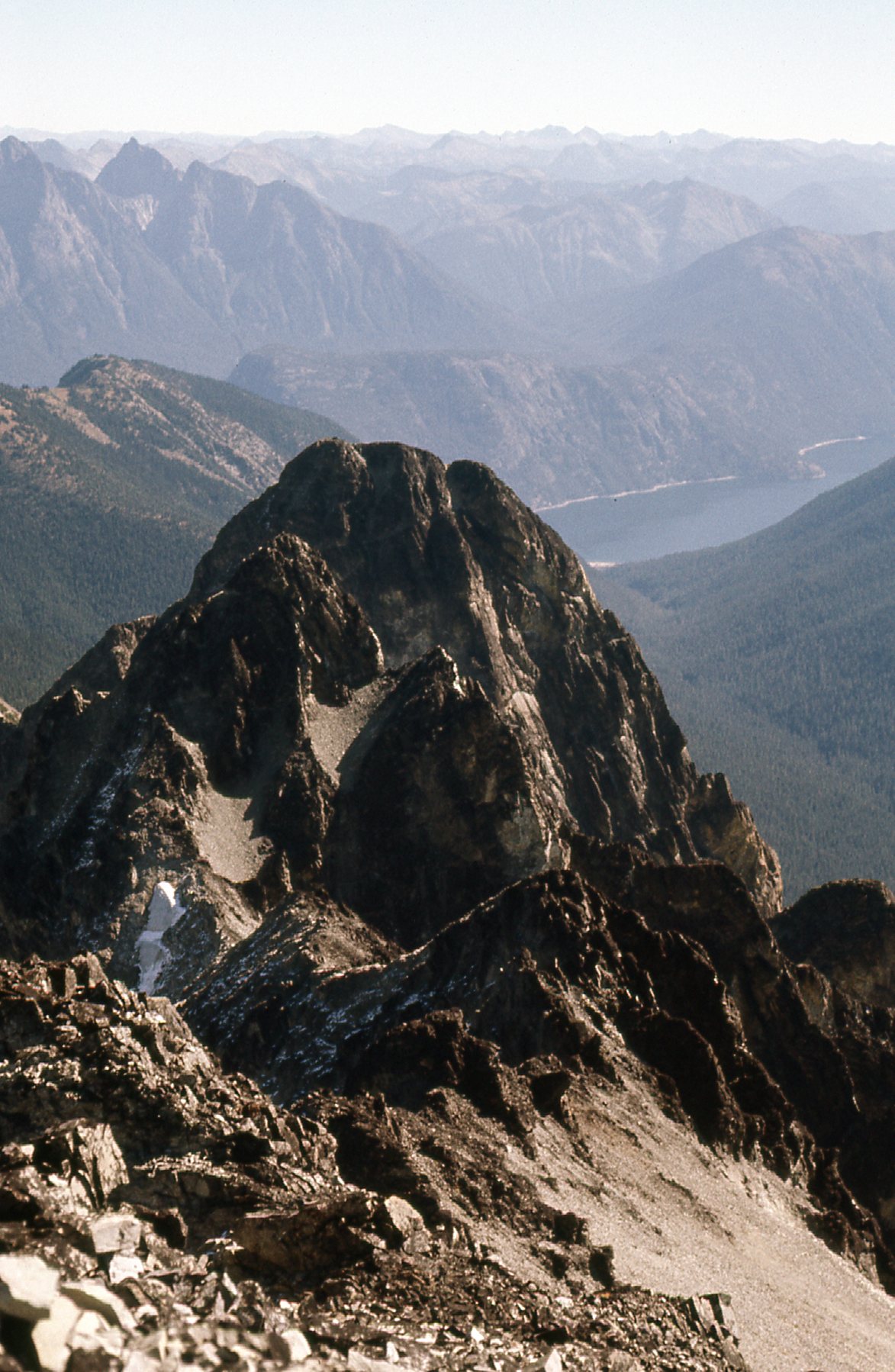
McNaught Peak, the west side.
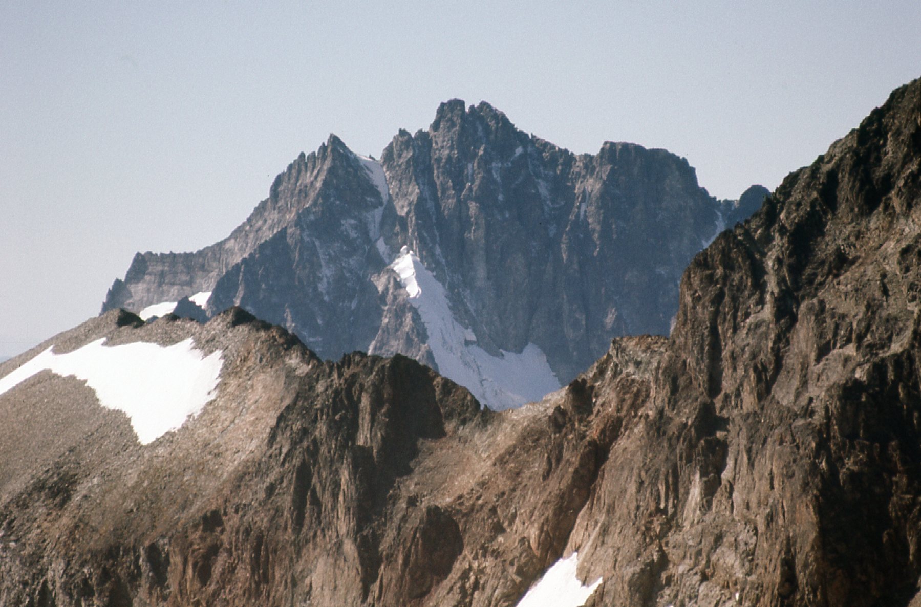
Next, here’s what I saw as I looked west along the border. If you look in the middle distance, you can see a logged area with a logging road zigzagging up through it. That’s the valley of Depot Creek, which is the normal access to Mts. Spickard and Redoubt. Okay, look to the very top of the logged area. Directly above it on the distant skyline you can see a low spot. Immediately to the left of that low spot, there are 3 distinct peaks. The first one to the left is Canadian Border Peak. To the left of it and higher is American Border Peak, and to the left of ABP and a bit farther away is Mt. Larrabee. They are all significant peaks by the border in that area.
Looking west
There’s one more photo I have that looks out in that direction but takes in an area a bit to the right of those 3 peaks in the above photo. It is a telephoto shot, unlike the above photo, but you’ll be able to place this one if you look back at the previous photo. See the tall, dark peak over on the left? That’s Slesse Mountain, a challenging rock climb. It is famous for the fact that, in 1956, a commercial airliner crashed into its highest part and killed all 62 people aboard. It was Canada’s worst air disaster at the time. Directly in front of it and much closer sits Mount Lindeman, the one with the snow patch facing us. Farther over to the right is another peak on the skyline, the one with the bit of snow on its right shoulder – that’s Mount Rexford. All 3 are challenging climbs.
Three more fine peaks.
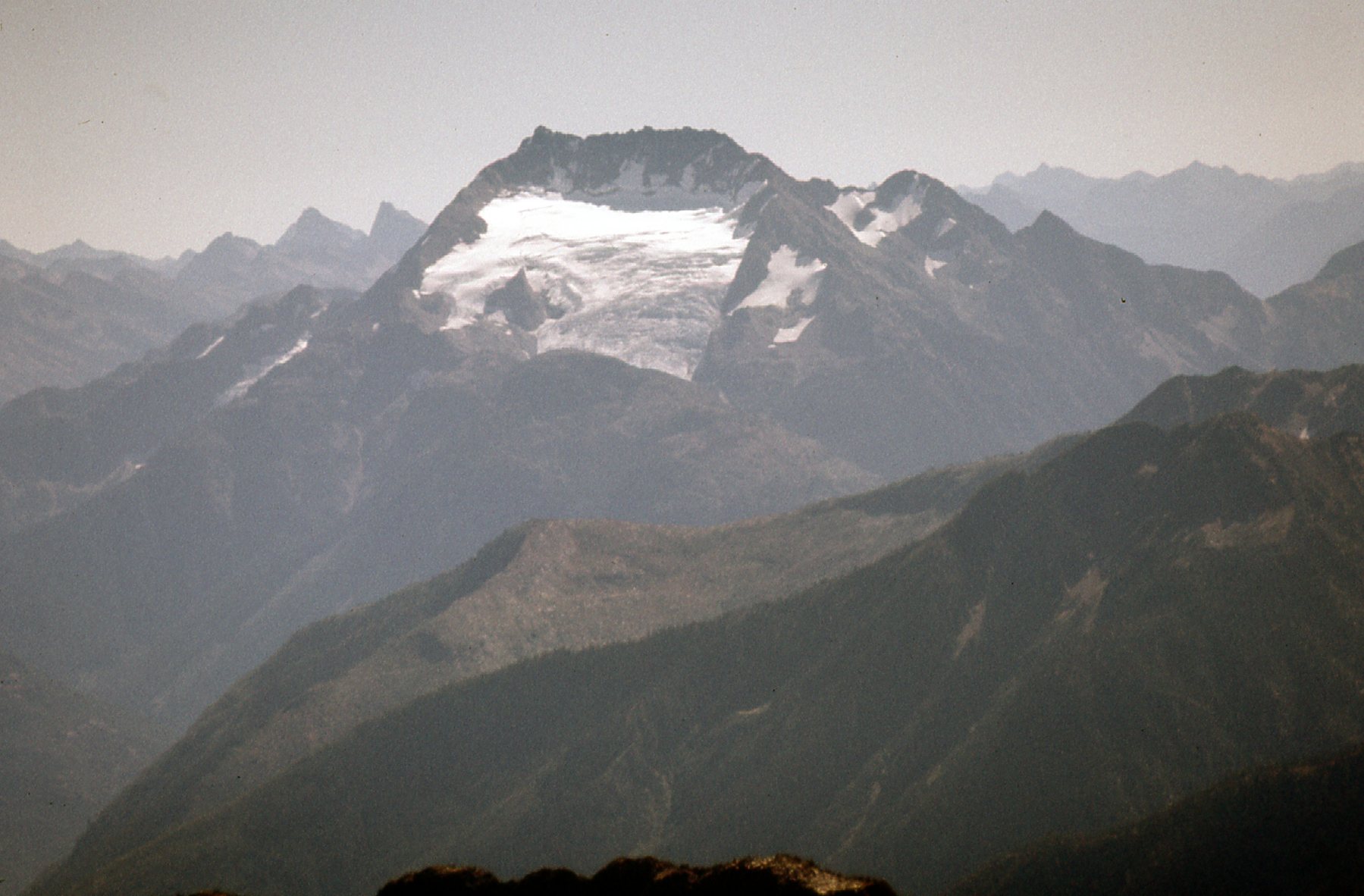
Okay, enough of that – let’s get back to stuff that was close at hand. From my vantage point atop International Peak, I could see the north face of Mt. Spickard. At 8,879 feet, it’s the highest peak in the group around me.
Mt. Spickard.
Here’s a broader view of the same peak. We’re looking at the south end of Silver Lake – slopes rise up from its shore to Depot Pass, right in the center of the photo.
Depot Pass
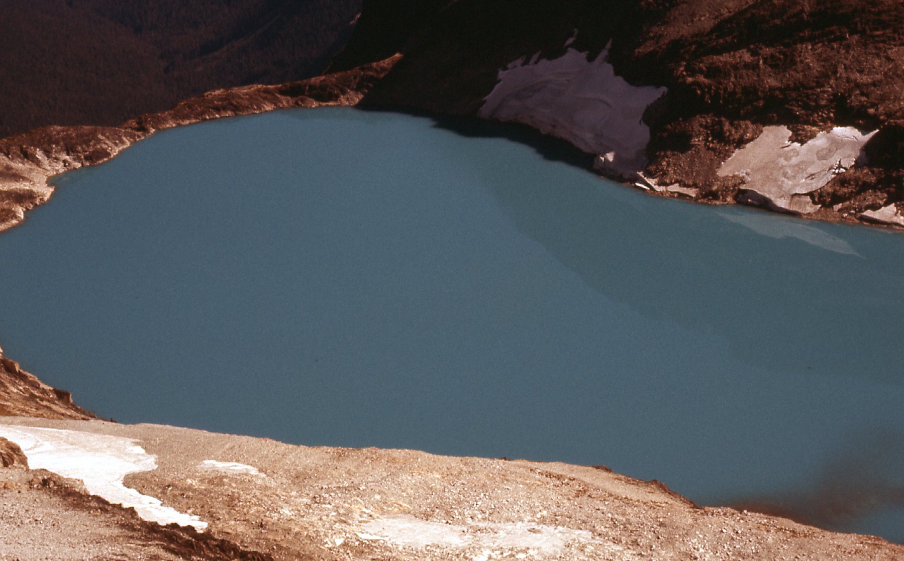
Here’s a look steeply down to Silver Lake, sitting at 6,763 feet – that’s about 1,700 vertical feet below.
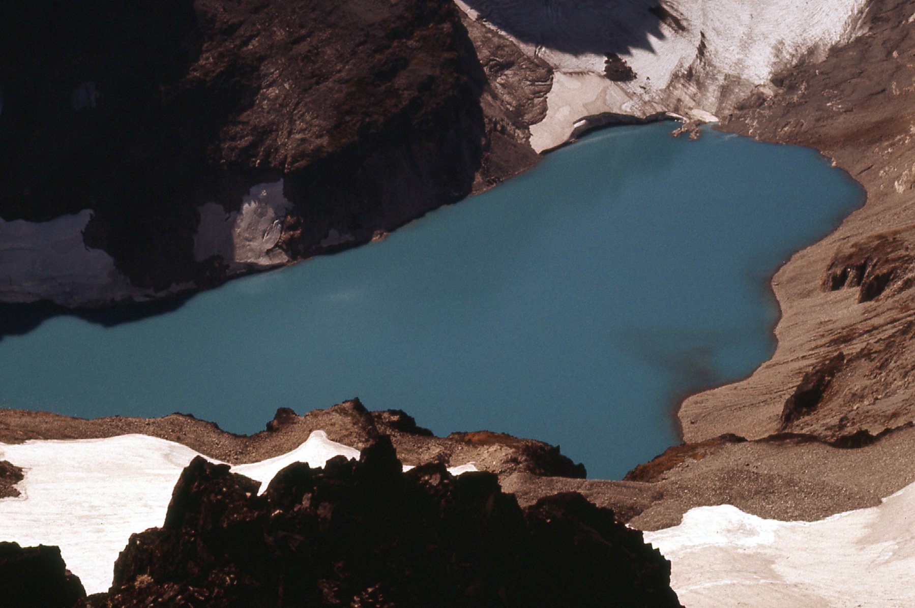
Silver Lake
That was the south end of the lake – here’s the north end.
The north end.
From my peak, something called Custer Ridge led southwest. It’s the rugged brown ridge twisting away from us in the next photo. Out there about a mile away it culminates in a dark peak just a bit left of center on the horizon. Back in the day, we used to call it “Matsaac Peak”, but that was an unofficial name. These days, it seems to go by the name “Mt. Custer”, but that too is an unofficial name. To the right of it in the distance sits Mount Baker, all snowy-white; to its left sits the dark, rugged Mt. Redoubt.
“Matsaac Peak”
Here’s a telephoto I took from the same spot, this time focusing on Mt. Redoubt (8,956′). It is, of course, the dark peak we see in the background. Nowadays, the most popular route up it is on the northeast face, which is staring right at us. That line goes up the ice tongue, then up steep snow leading to a couloir which arrives at the notch on the summit ridge, then up rock to the right and to the summit. Probably the same year I took this photo, 2 climber friends from Mission did this route. Near the top, one of them took a fall – fortunately they were roped up. He dislocated his shoulder and couldn’t go up or down. His partner descended solo the way they’d come up, made it all the way back out to Chilliwack Lake in Canada and was able to summon help. I don’t know what kind of strings they had to pull, but a helicopter was arranged – it flew across the border to the peak, a full 3 miles into the States and plucked the stranded climber from high on the mountain. It was a military chopper, with a seasoned crew able to pull off such a rescue.
The north face of Mt. Redoubt.
Here’s one of my favorite shots taken from my summit. In the distance on the left half of the skyline we see the Mt. Challenger group of peaks. Over on the right skyline sits Bacon Peak.
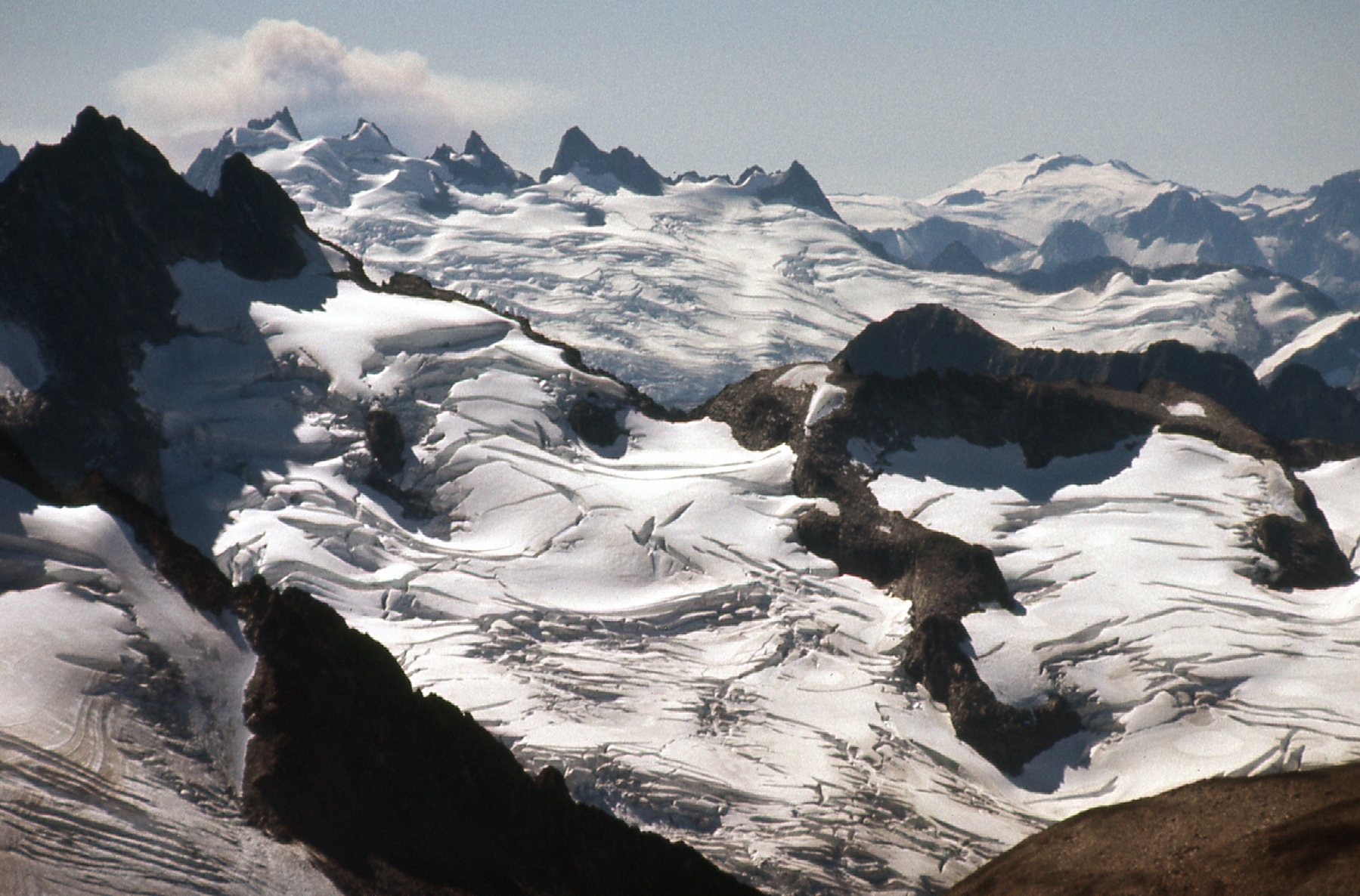
Looking south to the Pickets
Now, for your viewing enjoyment, here are a couple of telephoto shots. This one shows Glacier Peak, 77 air miles to the south, and 10,541 feet in height.
Glacier Peak
Much closer, only 21 air miles away, I could see Jack Mountain (9,066 feet). It sits by itself to the east of Ross Lake, and is one of the ten non-volcanic peaks in Washington State over 9,000 feet.
Jack Mountain
Okay, now that I’ve shown you what was all around me, it was time to think about getting down off of International Peak in one piece. I knew for sure that heading back down the north ridge, the way I’d come up, still didn’t appeal – too steep and loose. There had to be another way. The problem with trying to go down a different way is this – if you haven’t covered all of that ground before, you don’t know what you’re going to run into. You could be making real progress, then you arrive at the top of a set of cliffs which you simply can’t descend (or a stream or river you can’t cross, or a glacier too crevassed and dangerous). You might have to do a lot of back-tracking to find another way, costing you precious daylight. Hell, you might even discover that, when all is said and done, the only way back down off of your mountain is the way you came up it, much to your chagrin.
Okay, enough chatter. It seemed to me that I might find a way if I started down the southwest ridge (Custer Ridge on the map). I really hoped so, as there didn’t seem to be any other options that were obvious. The going wasn’t difficult, and I soon lost a couple of hundred feet. Here’s a look back up the ridge.
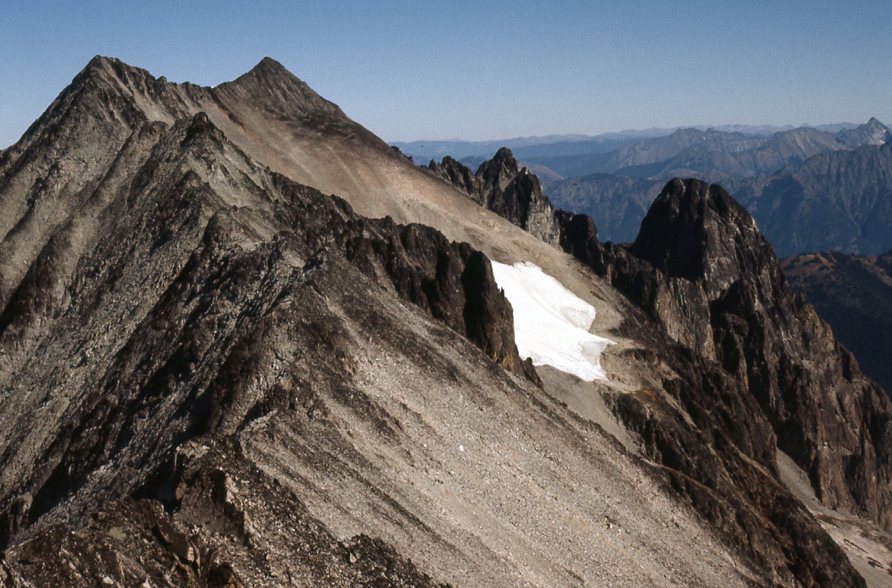
Looking back up the southwest ridge of International Peak.
From further down the ridge, I had this good view of Silver Lake. In the upper left of the photo, you can clearly see the barrier that impounds the lake.
Silver Lake
The farther down the ridge I went, the closer I was to “Matsaac Peak”.
“Matsaac Peak”, elevation 8,630 feet, also known as “Mt. Custer”.
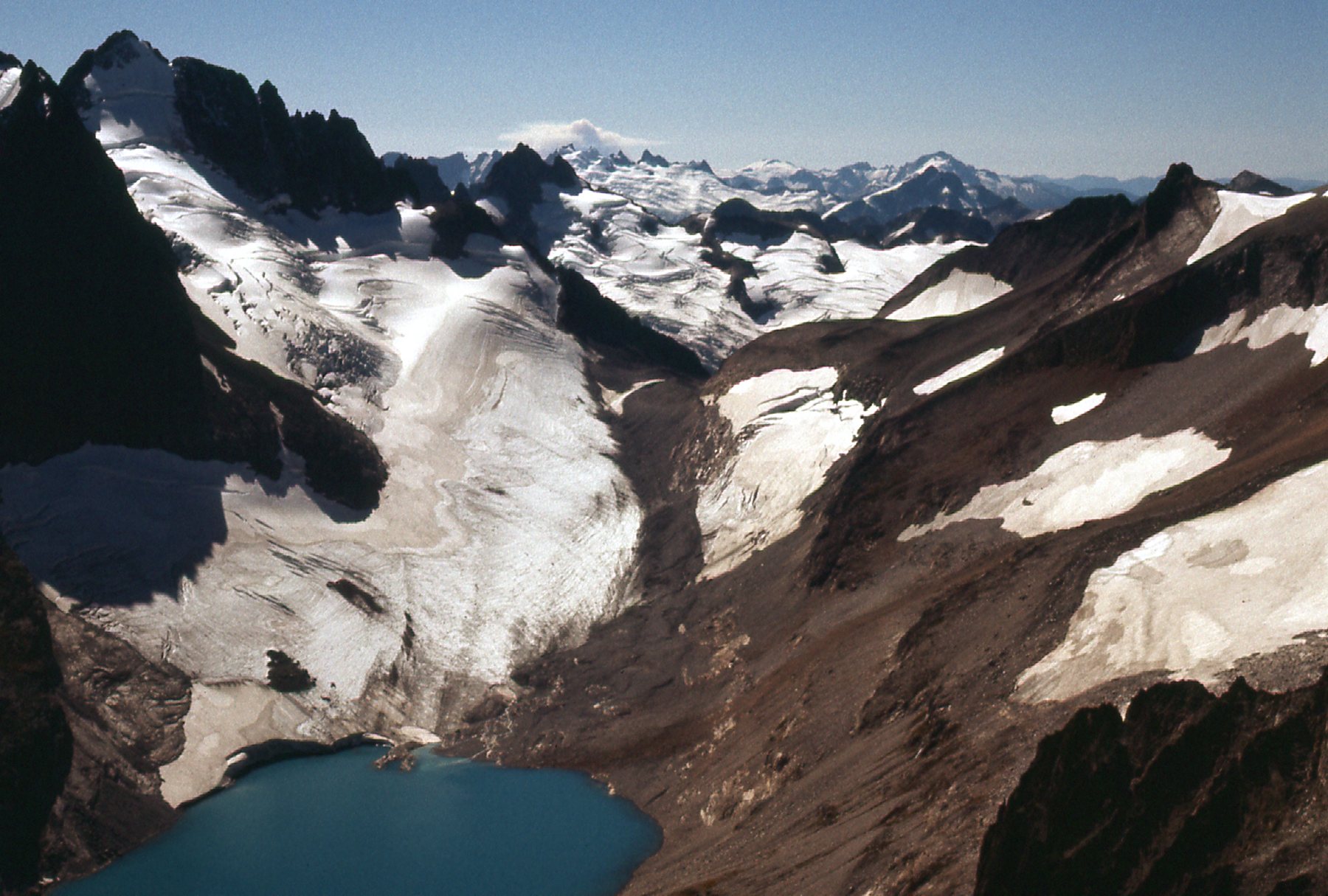
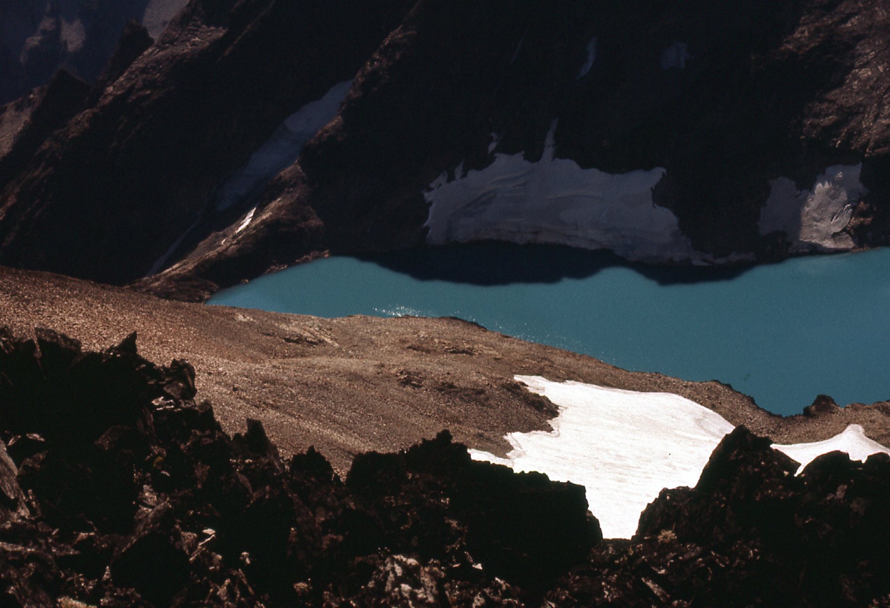
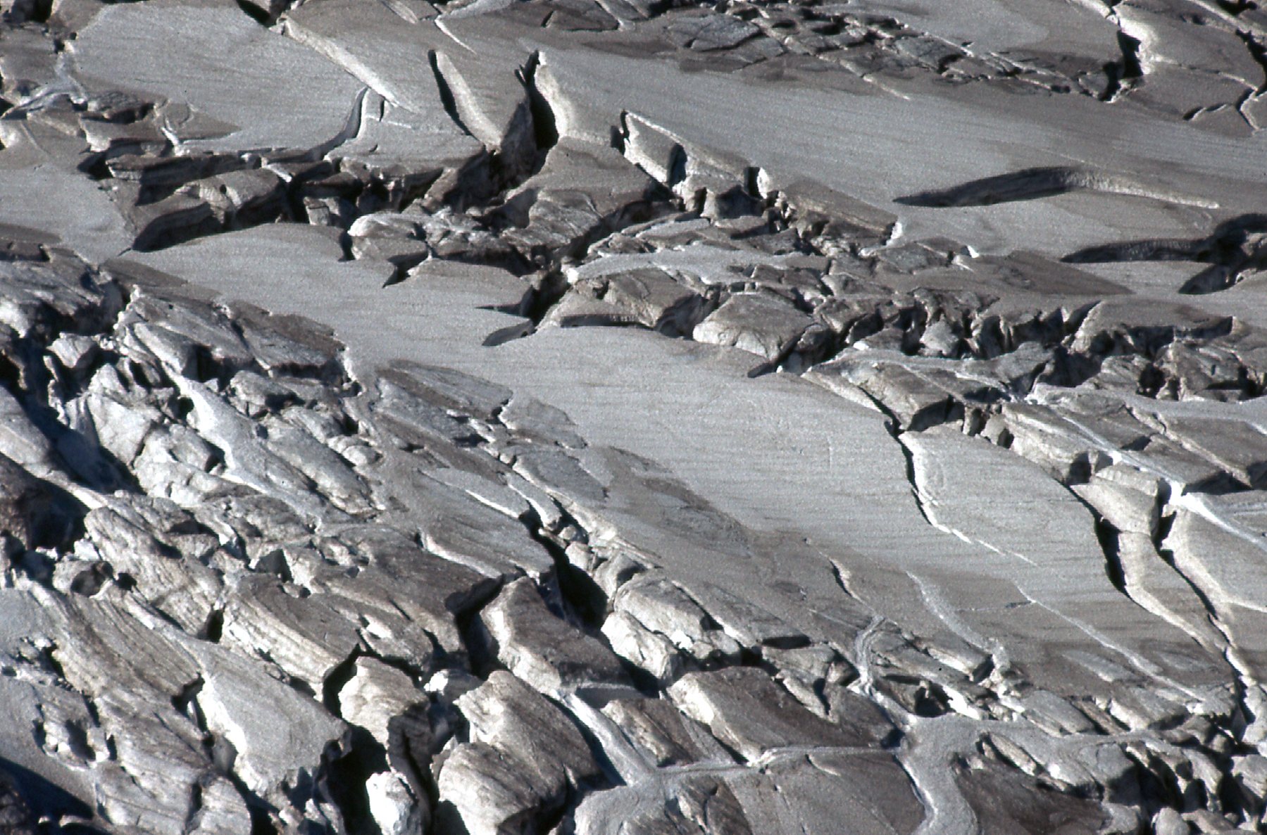
I reached a low point on the ridge at around 8,200 feet. There, it seemed like I could follow a narrow ridge that headed off to the north and dropped quickly down to about 7,400 feet. What a place! The ridge descended between the “Maselpanik Glacier” and the “Custer Glacier”, and the scenery was amazing. The great thing about the ridge was that I could avoid having to cross the glaciers, heavily crevassed this late in the season. Here’s what I was trying to avoid.
A detail on the glacier.
Rough country
It worked! The ridge was not too difficult, and it allowed me to lose elevation quickly. Below 7,400 feet, the ridge broadened and it was easy going. Here’s a picture I took on my way up, early in the day. I dropped down from the dark ridge seen in the upper left, then went right along the light brown ridge in the sunshine on snow and rock, then dropping down and off the picture to the right.
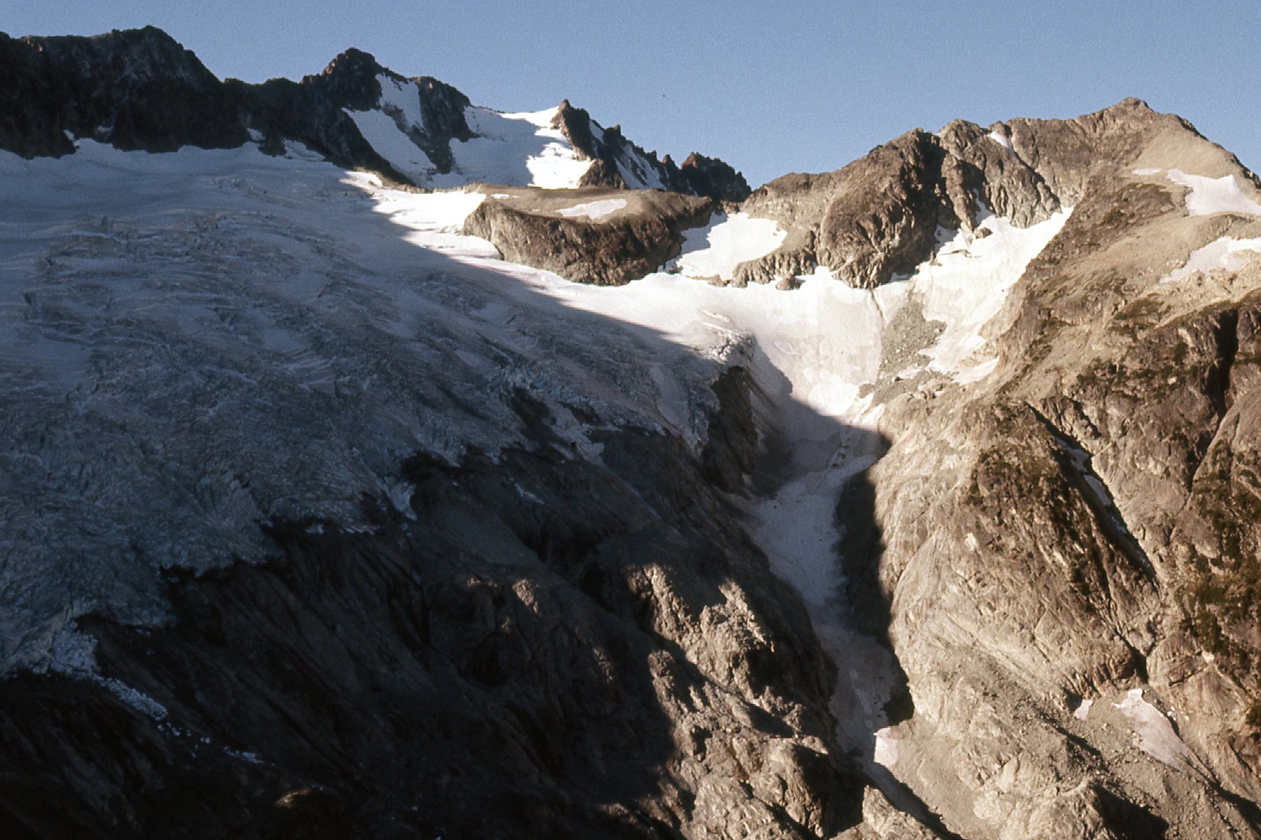
Part of the route down. That’s “Camp Peak” in the upper right corner.
It all went without a hitch. There were no serious difficulties to speak of, and before long I crossed the border back into Canada, where I reached one of the highest logging roads, then followed it down the valley until I reached my car. The only statistic I entered into my diary for the day was that the entire round trip, vehicle to summit to vehicle, was 10 1/2 hours.
This was a memorable climb, not just because it challenged me with some difficulties but also because there was some enjoyable route-finding involved. I had just turned 30, and it was a time when I felt I was doing my best climbing. The location of International Peak was definitely in an area of unsurpassed beauty and spectacular peaks.