
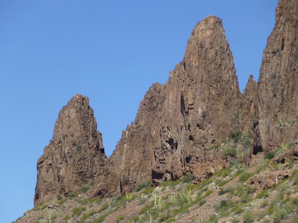
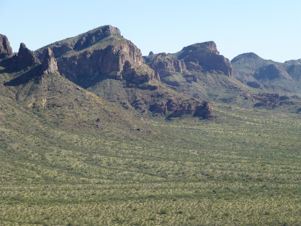
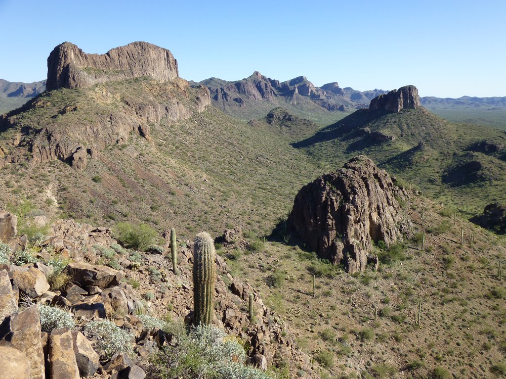
There’s a place in the Sonoran Desert where I could take you to see as pretty a bunch of peaks as you’d ever hope to find, a place where they rise straight out of the desert floor and reach for the heavens, looking like nothing the hand of man could ever create. I mean, take a gander at these and tell me I’m wrong.
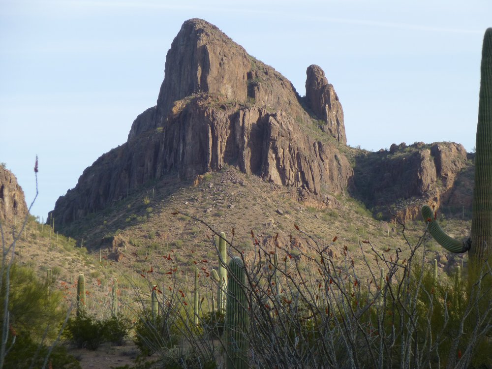
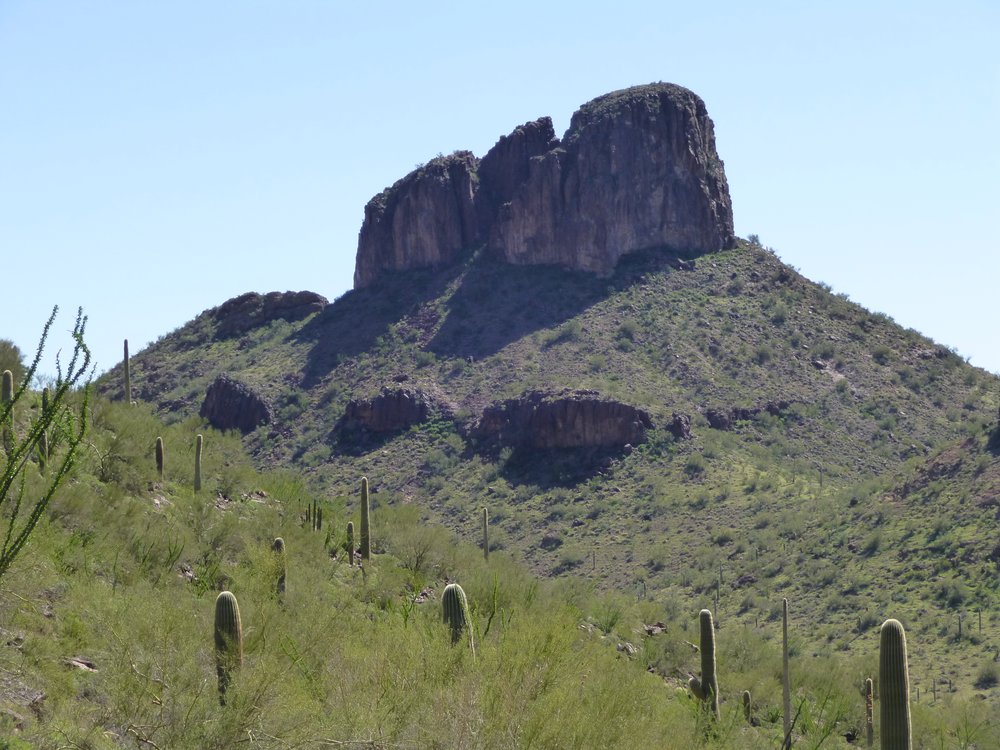
Everything I just showed you would fit inside a circle on the map not more than a mile across. It’s an area I love revisiting, so one day in 2014 I thought I’d head back there and climb some more of the nearby peaks. Three of them sitting in a tight group caught my eye. I thought I’d do the biggest one first. It had good access and allowed me to park right at its base. Here’s how it looked from there.
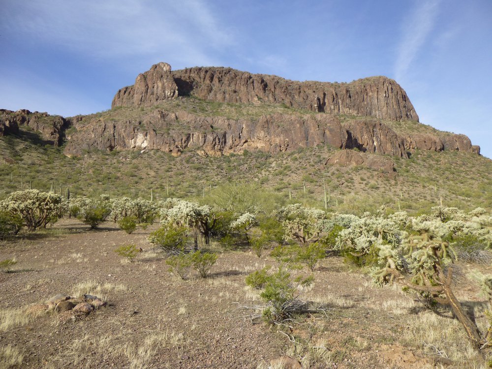
Looking at the east side of the peak from its base.
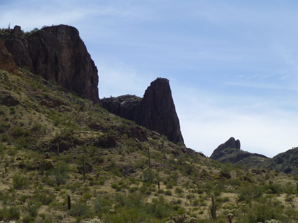
I couldn’t help but notice that there sure were a lot of cliffs guarding that whole side. Maybe if I went up higher, a path to the top would become more apparent. Perhaps something closer to this end.
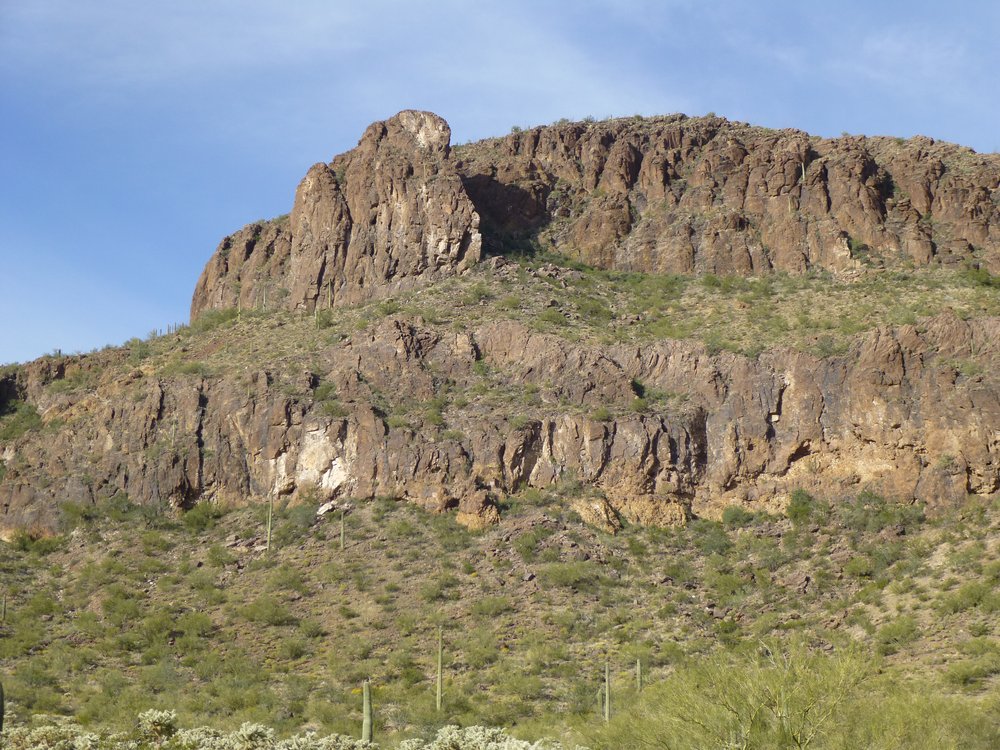
Could there be a path I wasn’t seeing yet?
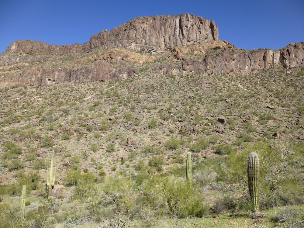
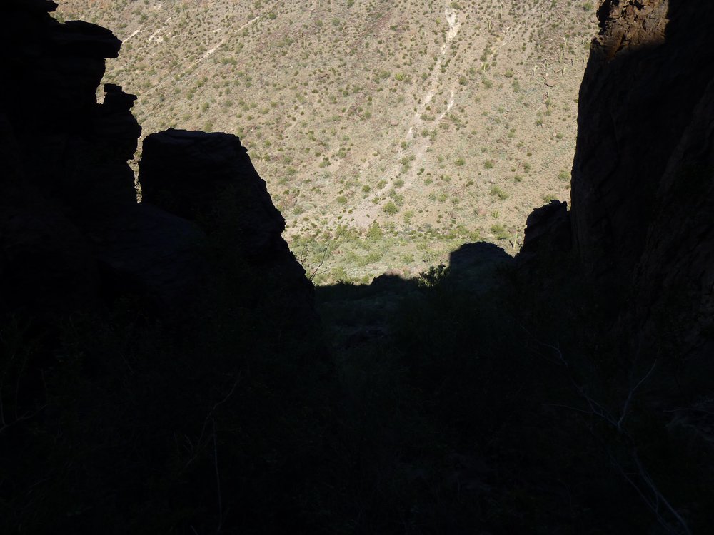
After climbing up to that huge outcrop standing out on the left side up high in the picture above, it looked like there could be a way. Have a look at the next picture – see the part in shadow between the 2 parts of the mountain? What if I went in there, maybe an easier path would come to light?
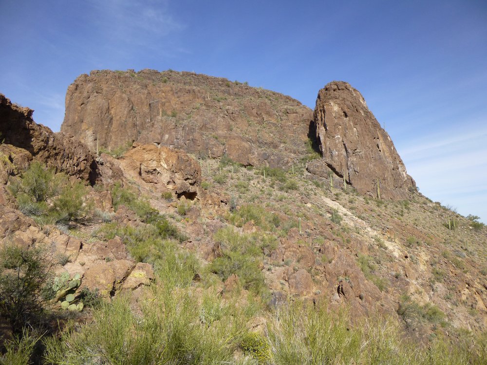
Maybe a way?
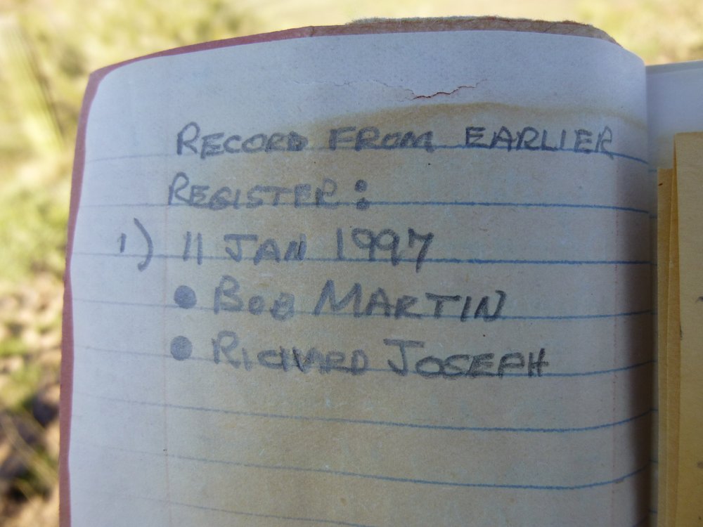
Well, that’s what I did and it worked – I found a route that wasn’t quite so cliffy, and there I was on the summit in just under an hour. It was just under 800 feet of climbing to the top of Peak 3066. The register showed me that 3 old friends had been up there the better part of 20 years earlier, plus 4 others I didn’t know. Here’s the summit.
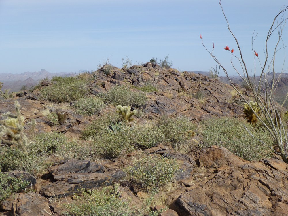
The top of Peak 3066.
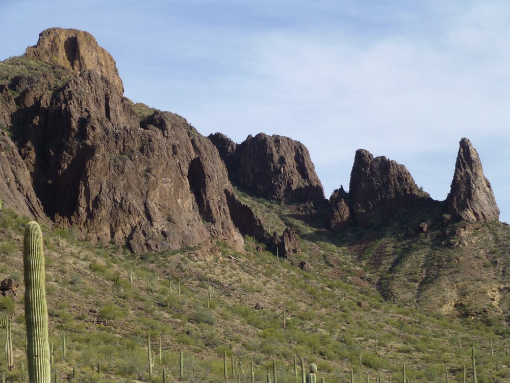
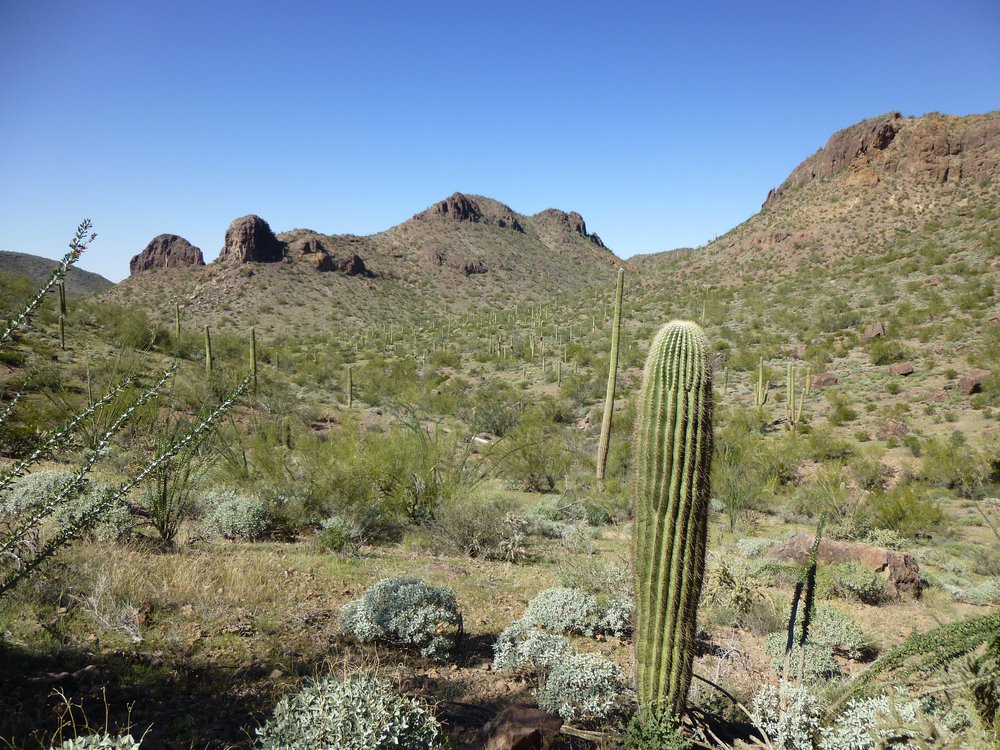
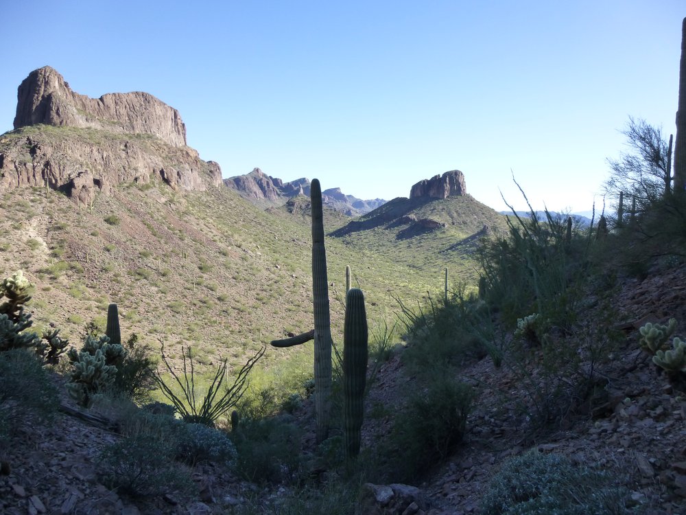
Here’s what really caught my eye – it was the next one on my agenda. Only a third of a mile away and 300 vertical feet lower, it looked tricky from here.
This one would be next.
I didn’t stick around long on top, and because I knew the way, it was a quick return to my truck. Down where I was parked grew a virtual forest of cholla cactus.
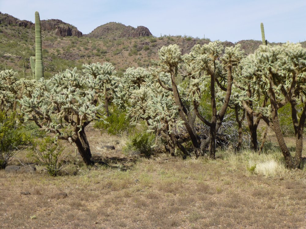
Cholla forest.
A quick drive of half a mile had me parked for the next climbs. It was an easy walk and a gain of a hundred feet to arrive at a saddle between 2 peaks, where I had this first glimpse of my next objective.
The next mountain to climb.
Hmmm, from a distance I can’t say that I liked what I saw. It was a steep son of a gun, that much was for sure. It didn’t take me long to get closer, and it still looked plenty steep.
Still steep.
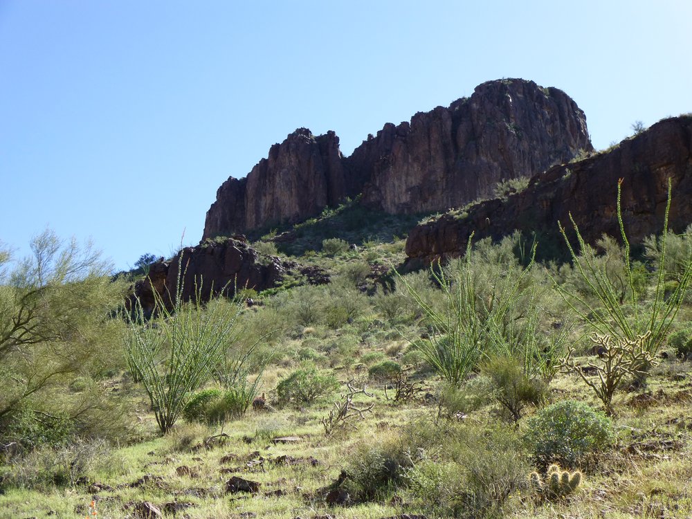
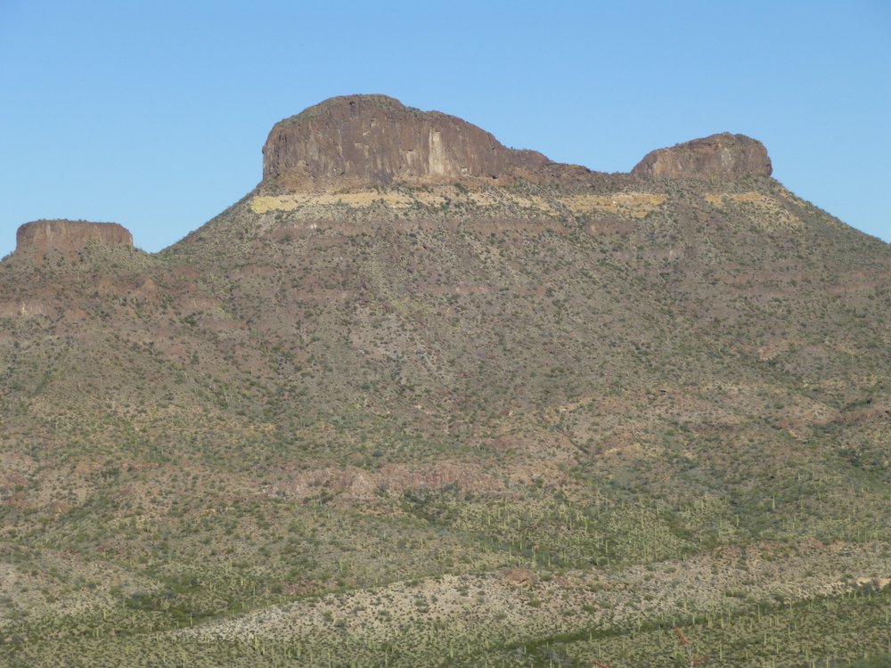
As I approached the peak, I was passing below the first one I’d done earlier, Peak 3066, but I was on the opposite side from where I’d climbed it.
The west side of Peak 3066.
By now I was climbing up to the base of my peak, and I still couldn’t see my way up. Others who had climbed it in the past hadn’t reported any difficulties, so I knew there had to be a route lurking ahead but still out of sight.
Starting up the slope.
Looking back over my shoulder, I could see the saddle through which I’d passed to get this far – it’s the low point to the right of center of this next photo.
That’s where I was.
The moon had risen over the imposing walls that guarded nearby Peak 3066.
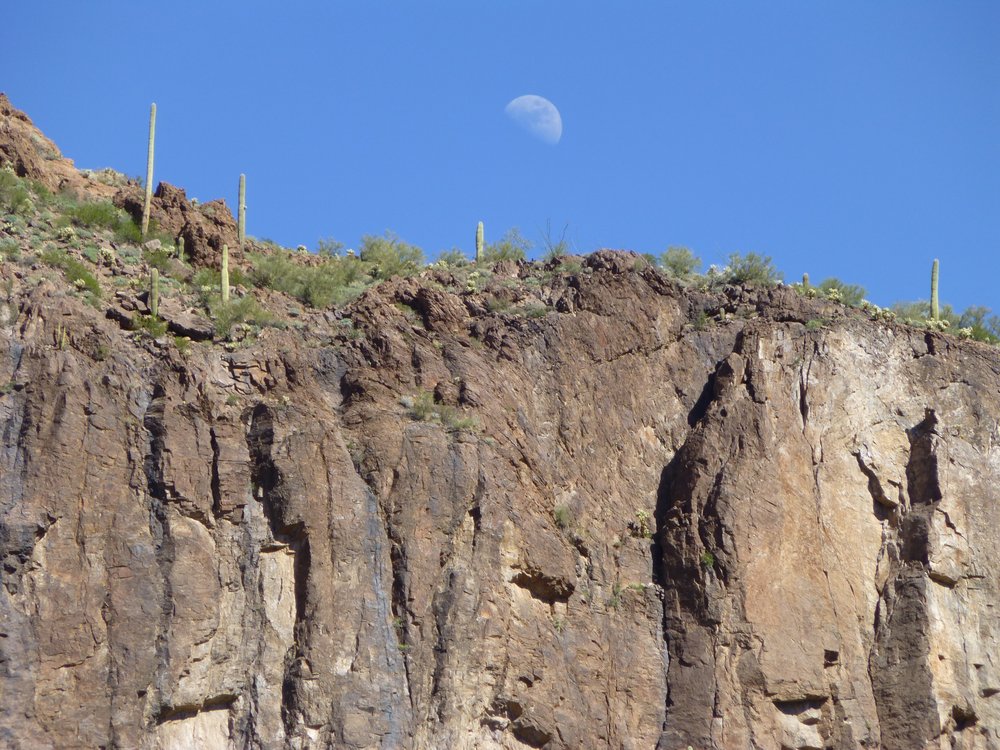
Moonrise.
Finally, when I was right at the base of my peak, I found this notch. It would keep me moving upward, so I took it.
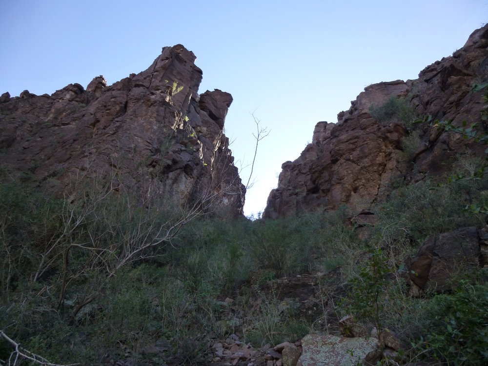
Let’s keep on going.
At the top of the notch, a steep but easy rocky scramble over to the right soon had me on top of Peak 2750.
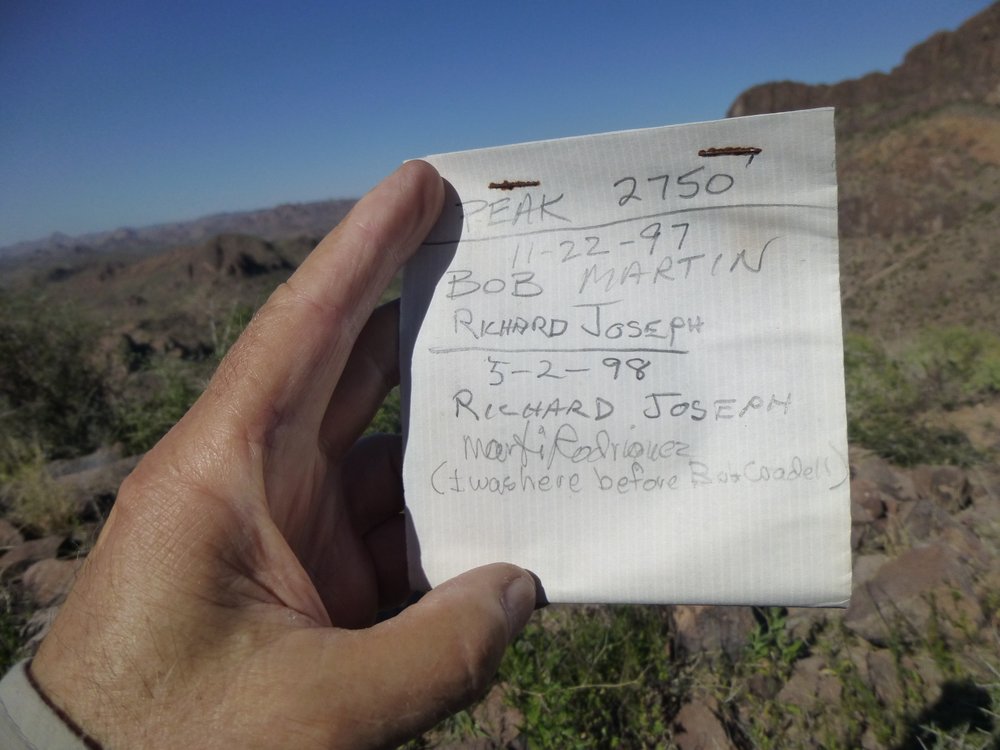
The register.
The entire climb from the truck had taken just under an hour. This may have been just a little shrimp of a peak, rising just a few hundreds of feet above the desert floor, but the views were first-class. Check these out. Only 1.3 miles to the northwest was Peak 2590.
Peak 2590
To the northeast sat Peak 3066, the first one of the day.
Peak 3066
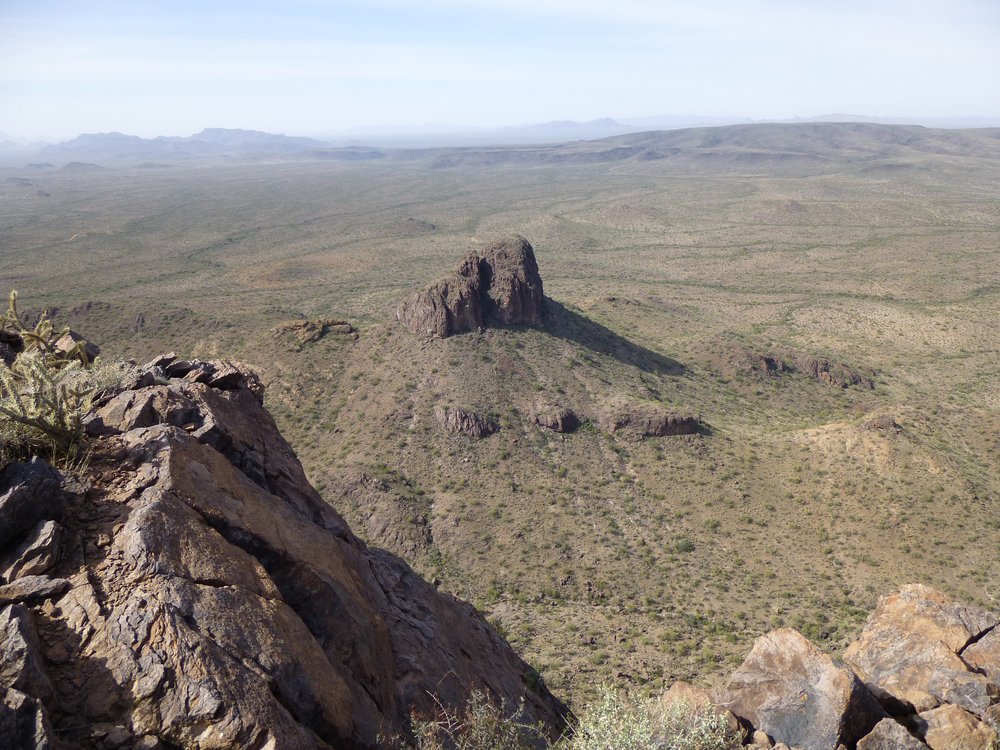
To the east, 3.2 miles distant, sat Sauceda Benchmark, the highest of all the 100-odd peaks in the entire Sauceda Mountains.
Sauceda Benchmark, elevation 4,118 feet
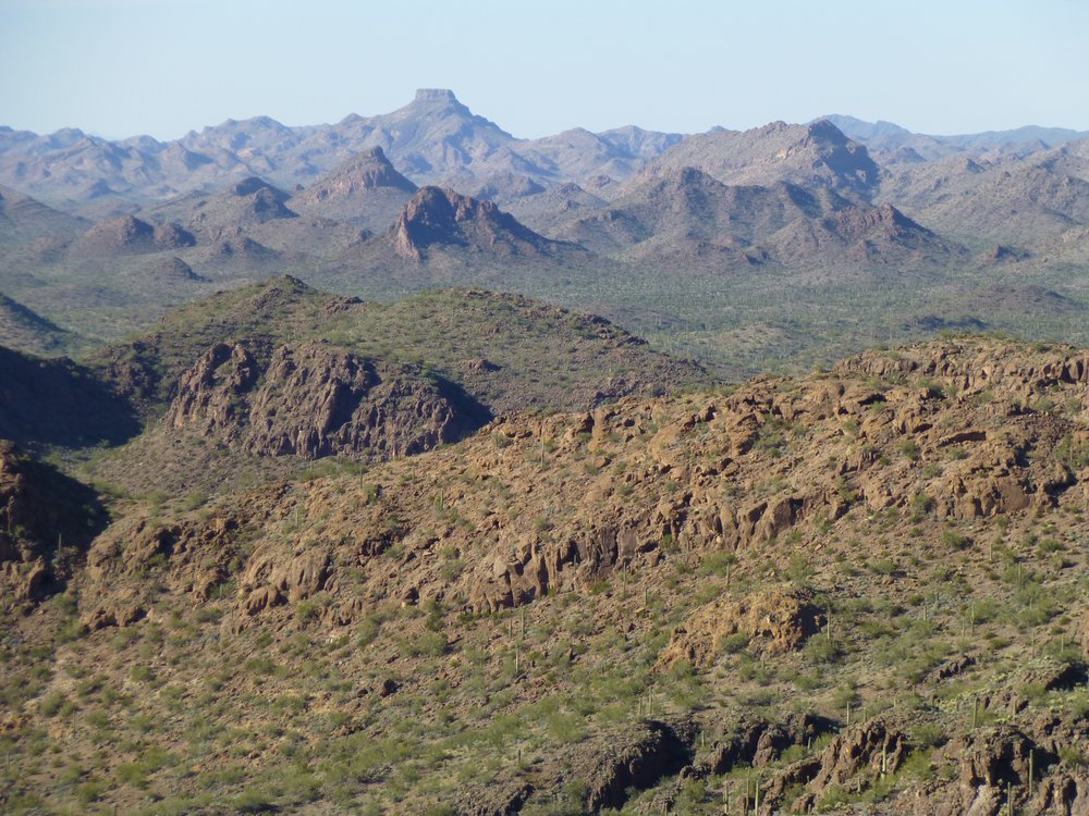
Moving to the right of the previous photo, this is what we see. The high peak on the right skyline is Peak 4030 which is the second-highest in the range. It is 3.6 miles to the southeast. 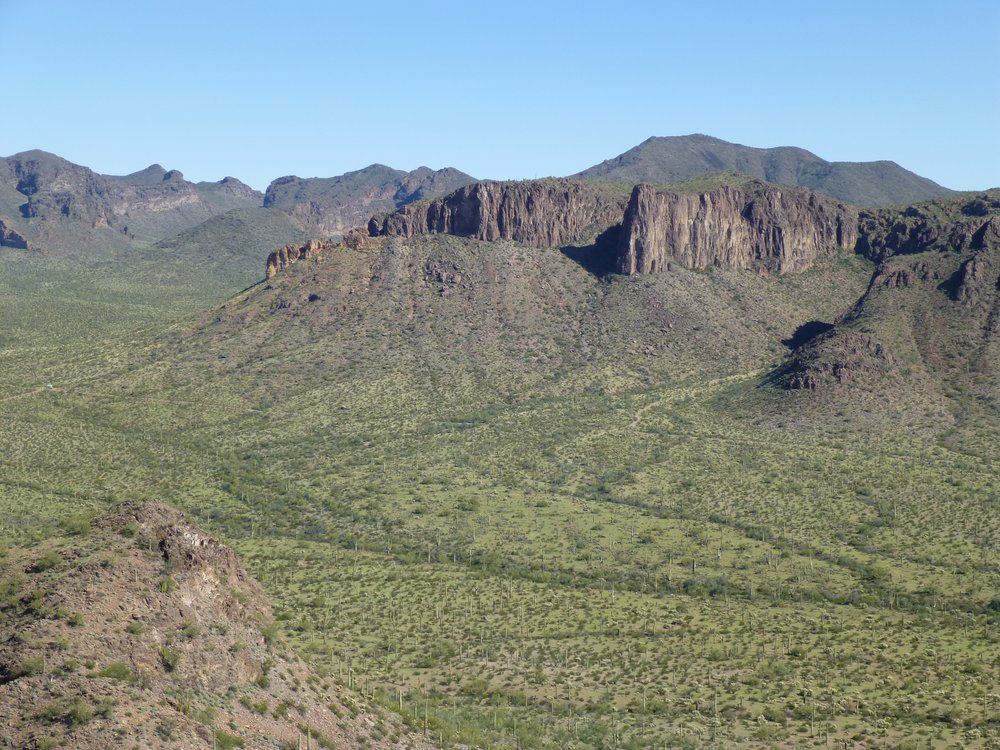
Moving to the right of the above photo is this next one, zoomed in closer. The one on the left is Peak 3310 and the one on the right is Peak 3370.
In the Sikort Chuapo Mountains, we see here Peaks 3310 and 3370.
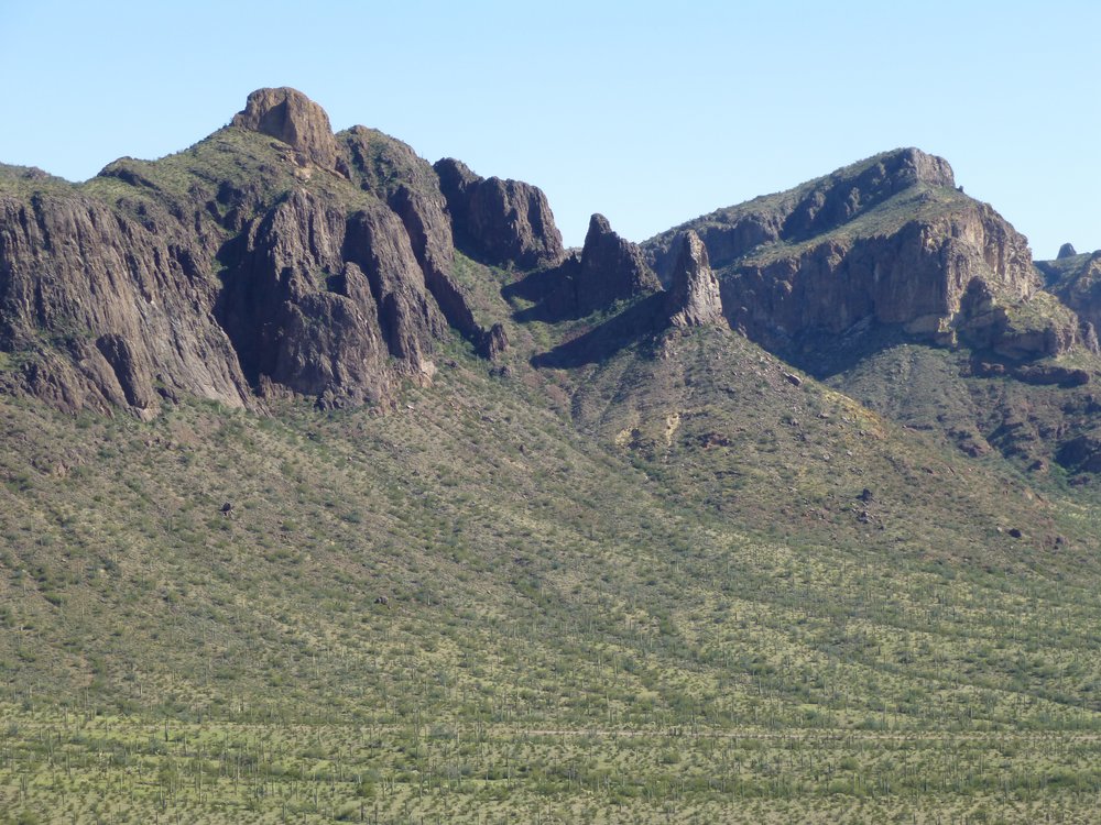
Let’s move one more photo over to the right, where we now see Peak 3370 again, on the left, and Peak 3325 to the right of center.
Peak 3370 on the left and Peak 3325 on the right.
After a short stay on top, I headed back down the rock and into the gully.
Looking down the gully.
Once down, I headed north back towards that pass I had traveled earlier. Upon arriving there, it was a straightforward climb up the east side of the peak. Shadows were lengthening, as you can see from this shot taken part-way up.
Some shade.
It was four in the afternoon by the time I made the summit of Peak 2663. It was short work to find the cairn and the register buried inside it.
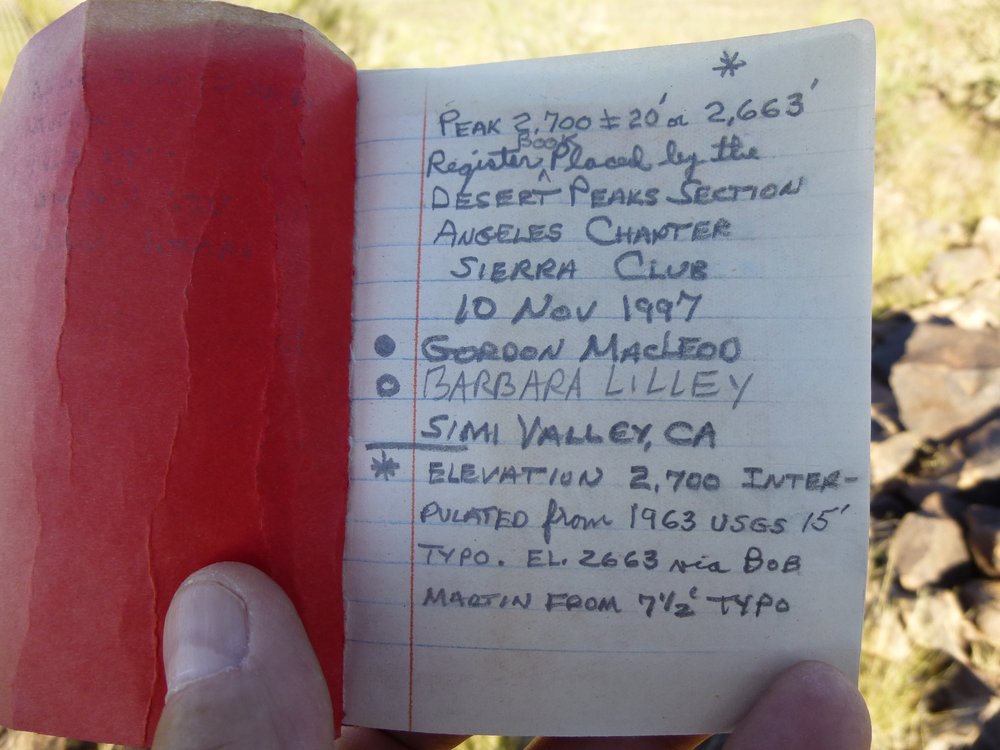
The register.
Sometimes climbers will replace an old, poor or damaged register with a newer one. That was the case here, and Barbara and Gordon always practiced good climbing etiquette by acknowledging any earlier entries they found.
Giving credit where credit is due.
I love the play of light in the mountains early in the day and again late in the day. Look at this next picture, for example, taken from the summit. In the upper right is the last mountain I’d climbed, Peak 2750, the one with the long shadow on its left side. And the one towering in the upper left all sunlit is the first one of the day, Peak 3066.
Late afternoon.
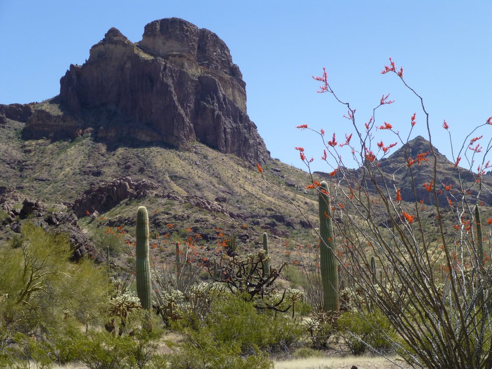
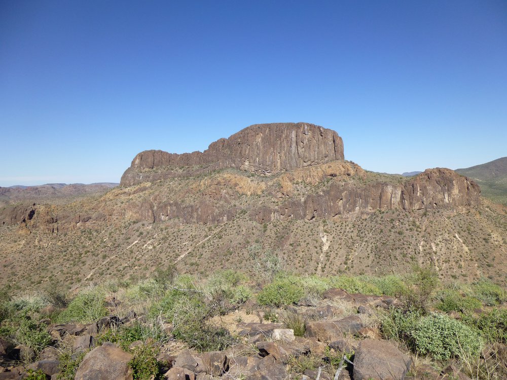
Here’s a nice shot, a telephoto, of Peak 3066. Those are some cliffs, huh?
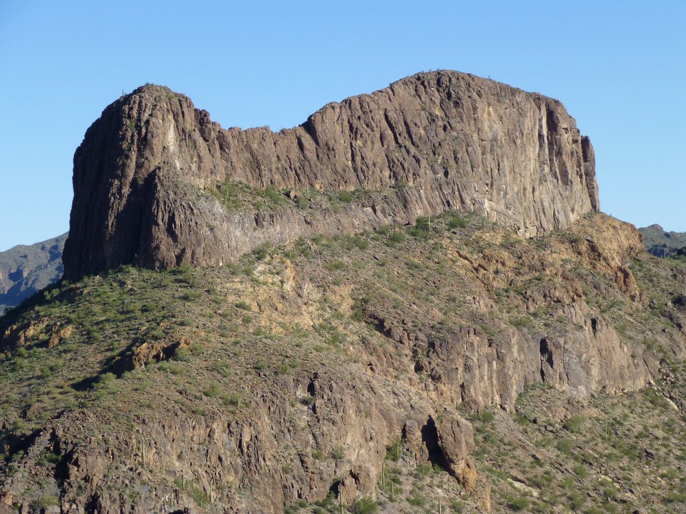
The west side of Peak 3066.
And just to the north of the above peak is another nearby beauty, Coffeepot Mountain, which is a prominent landmark in this area. It’s only 1.7 miles to the northeast in this photo.
The west side of Coffeepot Mountain.
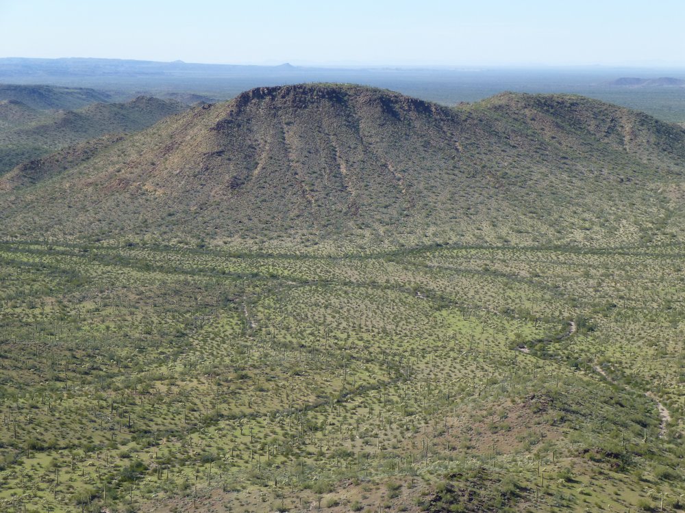
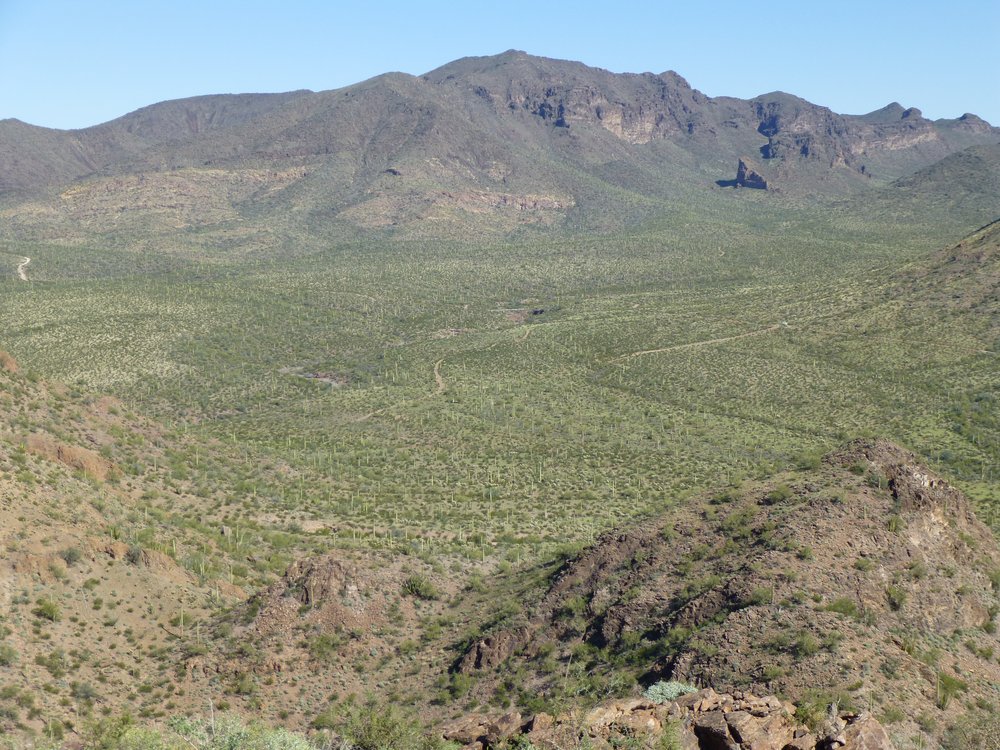
Another one I like is this one, a view north into another part of the Sauceda Mountains. So many peaks to climb!
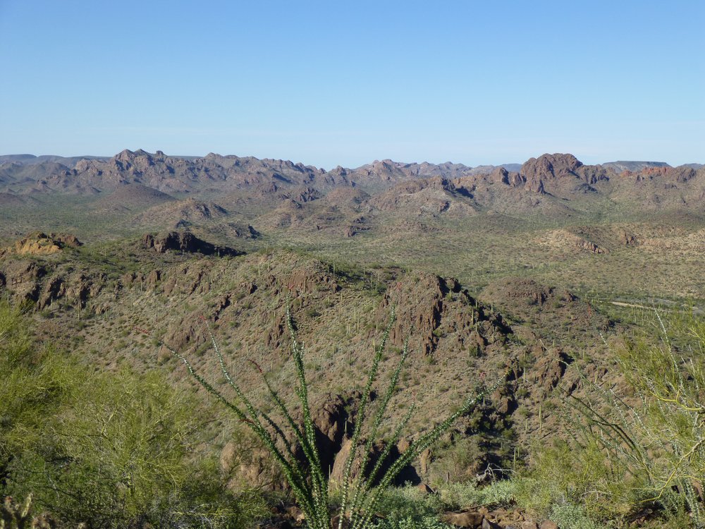
They go on and on.
Another view to the north gives us this one – that’s Hat Mountain out there, the one with the flat top. It’s 12.5 air miles to the north-northwest.
Hat Mountain.
If we look to the northeast, here’s what we see. What’s that curious thing sticking up just left of center?
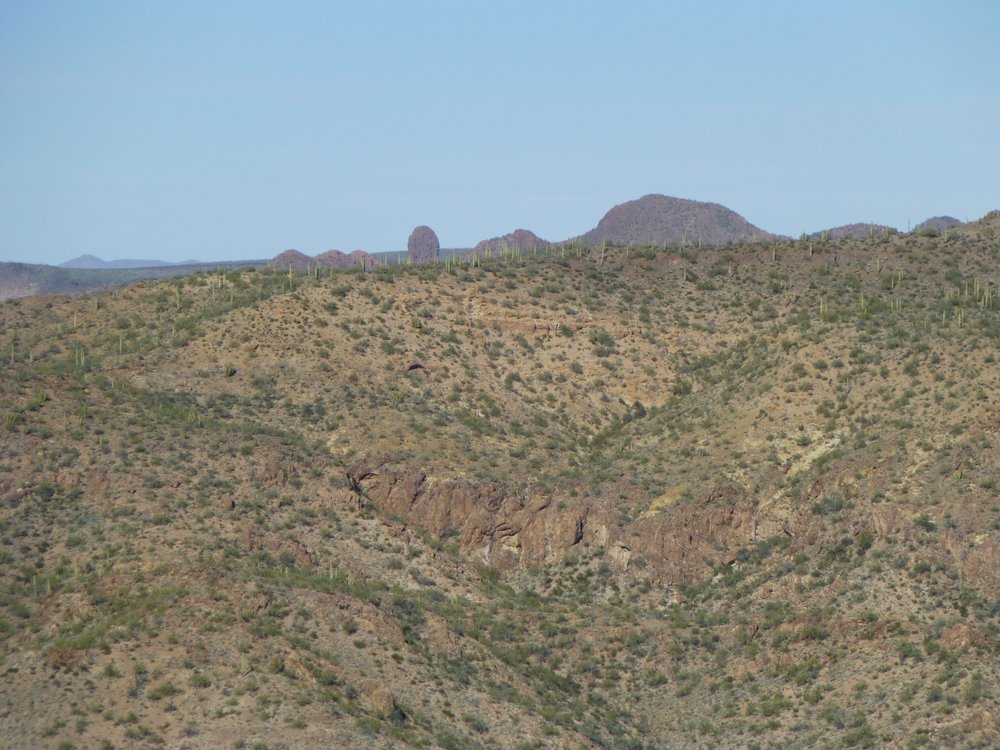
What’s that?
I zoomed in a bit more, and this one shows it better.
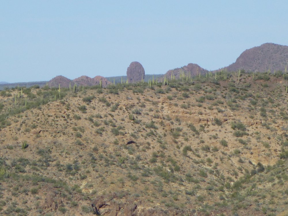
It’s Tom Thumb.
What you’re seeing, Folks, is the elusive Tom Thumb. It’s hard to spot, as other peaks hide it from almost every angle. Don’t let the name fool you, though – it may not be very tall, but it is easily the toughest climb in the entire range. It has shaken off some clever attempts. I highly recommend reading this account of a climb that was done on it, which also has some really good photos.
Tom Thumb is only 5.6 air miles away in the above photo. The peak which rises steeply up to the right of Tom on the right edge of the photo is Peak 3180. I never get tired of the Sauceda Mountains. There are so many different peaks in the range, (105 in all) each with its own challenges, that you can climb there for months or even years and never get tired of what there is to offer. Dozens of them are in a part of the Air Force Bombing Range which periodically has restricted access, and for the truly brave of heart, 16 of them are in an area where nobody can enter, ever! Perfect fodder for the stealth climbers in the crowd.
Late afternoon is my favorite time of day, so I hated to leave the summit. This third and last peak of the day was so close to my truck, though, that it only took me half an hour to get back to it. Once there, a short drive brought me to a nice level camp spot. There was plenty of time to cook a meal and enjoy another stunning desert sunset. Today’s Sauceda threesome had gone without a hitch and I looked forward to many more.
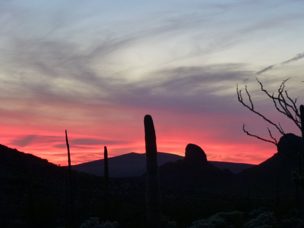
Sonoran Desert sunset.