
I used to live in the province of British Columbia in Canada. A town there which is still dear to my heart is called Mission, formerly Mission City. The lowest part of town is down on “The Flats” adjacent to the Fraser River, which is only 30 or 40 feet above sea level. The town rises quickly to the north with steep residential streets. As a high-school kid, I can remember watching television on our black-and-white 13-inch set in the early 1960s. With rabbit ears, there were exactly 3 channels we could receive: CBUT, channel 2, in Vancouver; CHEK, channel 6, in Victoria; KVOS, channel 12, in Bellingham. Channel 12 was the closest, only 25 air miles away. The Vancouver channel was 37 air miles away. The Victoria channel was 63 air miles distant, and it was the weakest of the 3 for us in Mission. It wasn’t until the mid-1970s that Vancouver got a second station, channel 8, on a rival network.
I was envious of kids I knew whose families lived “up the hill”, only a few hundred feet in elevation higher than down on the flats. They were poised to have perfect line-of-sight reception to a whole new world of television that we couldn’t get down below. Namely, they could get the Seattle stations, even though they were 100 air miles distant, and there were 5 of them – channels 4, 5, 7, 9 and 13. Those stations represented the 3 major American broadcast networks (ABC, NBC and CBS), as well as a PBS station and an independent station. To receive those Seattle stations, they needed a large antenna, usually with a rotor (a motor which could point the antenna in any direction). The rotor was controlled by a box inside next to the TV, so it was effortless to aim it for the best reception on any channel. How I envied my friends whose families had that kind of set-up!
Mission was only 8 air miles to the nearest border crossing into the US, so it was just a short drive down to Washington state and all that it had to offer. One of the biggest draws for me was the REI store in Seattle, a magical place offering every type of climbing equipment you could imagine. Back in 1969 there was nothing comparable in BC. Seattle had the one and only REI store back then (now, they have grown to a total of 168, spread all over the country). It was a funky old store, occupying a few buildings connected by hallways, and I still remember the squeaky wooden floors. Visiting the store was like entering a climber’s wonderland, and I went there every chance I could get. You can be sure that every time I was near Seattle, a visit to REI was de rigeur.
One particular trip stands out in my mind, even today. My friend and climbing buddy Mike, who also lived in Mission, and I drove down to Seattle and spent a glorious 3 hours in REI. Mike also needed some tools for his work, so we spent some time taking care of that. Now it was time for dinner, so we went to our favorite Indian restaurant. As I recall, it was in the University District, and was called the Maharishi Restaurant (probably long-gone by now). The owner was a very likable guy, and he explained to us that in order to satisfy all possible tastes, you could specify which of 8 degrees of hotness you wanted your food to be. Each degree of hotness had a name. The owner, born and raised in India and habituated to very hot food, said that the hottest he could tolerate was number 6. I liked my Indian food pretty hot, but not so much as to ruin my meal, so I ordered a hotness of 3, whereas Mike, feeling pretty bold, ordered his meal with a 5 hotness. Mine was delicious and just right at 3. Mike, however, soon started sweating profusely and it was all he could do to finish his meal. He had me taste his food, and it was much too hot for me!
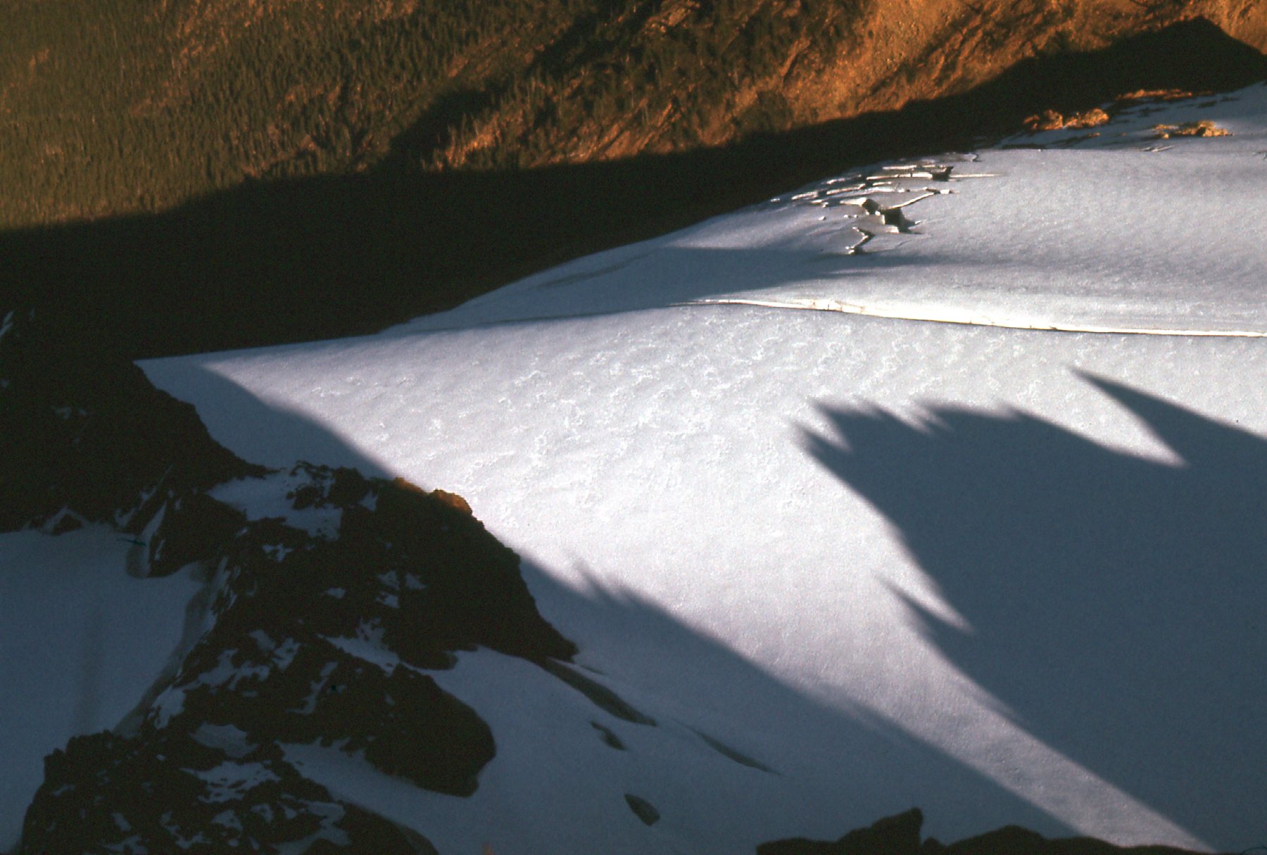
Our meal concluded, we got back into my Volvo station wagon and motored north. Why make all that effort to head down into Washington state and not try to climb something? There was a peak we wanted to try, up pretty close to the Canadian border. In fact, it was only 34 air miles from Mission and therefore only 26 miles from Canada. We drove to the village of Acme and then east into the mountains as far as we could. It was really late by the time we stopped, and we both slept in the back of the Volvo that night. I wanted to show you this picture I took a couple of years earlier in April, when deep snow lay on the peaks. Here’s what we’re seeing. We are looking east. On the left side can be seen the rounded white summit of Mount Baker in the background. To the right of it is a peak known as the North Twin, and farther to the right, exactly in the center of the photo is a higher-looking peak called the South Twin – that was our goal.
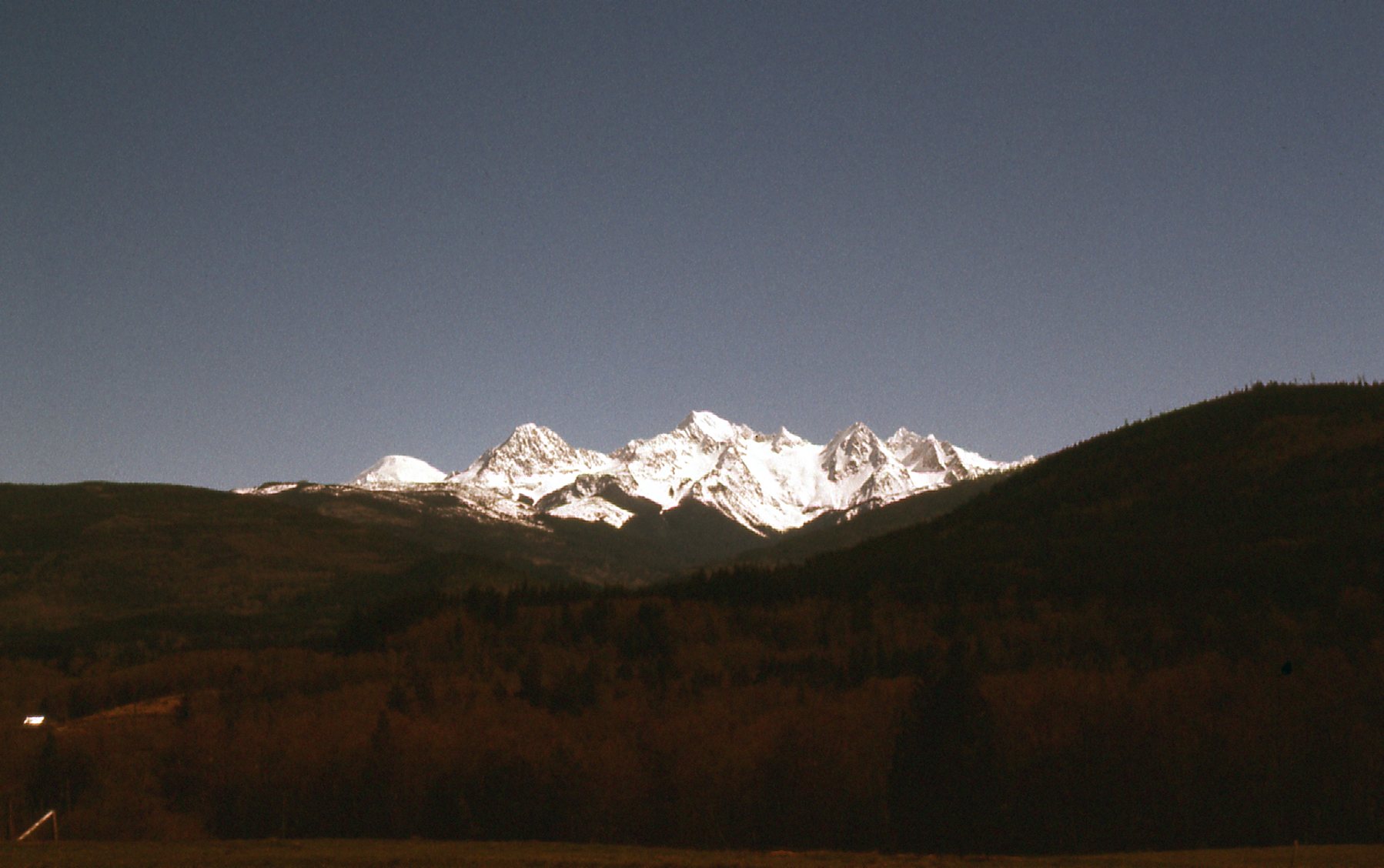
Twin Sisters Mountain
We set out early the next morning on foot from the car and walked up old logging roads until we reached about 4,000 feet elevation. This was the real start of things – as we started up the west ridge, we still had 3,000 vertical feet to climb
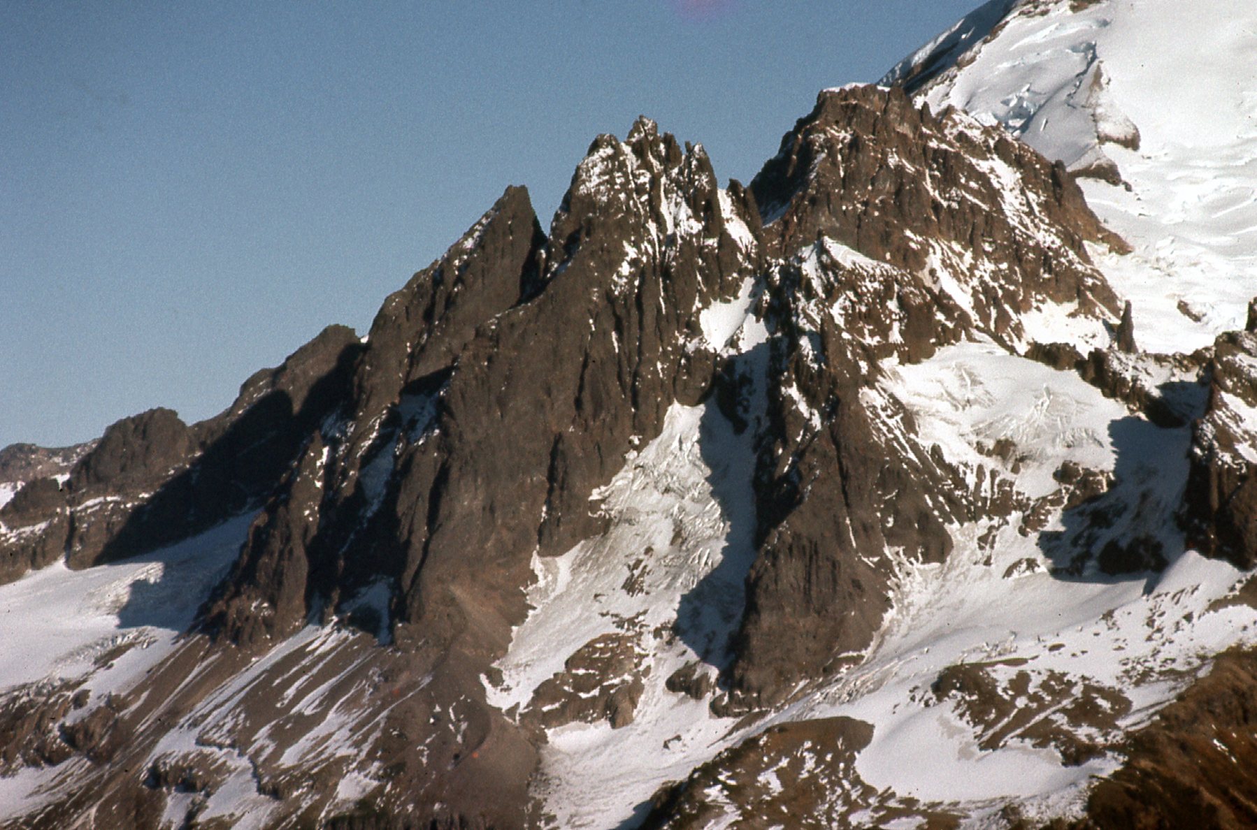
Here’s a good quote I found: “The orange-yellow rock in the Twin Sisters range is primarily composed of olivine and is extremely solid. Good holds are frequent and everywhere you place your hands it feels like 50-grit sandpaper.”
Looking west to Twin Sisters Mountain
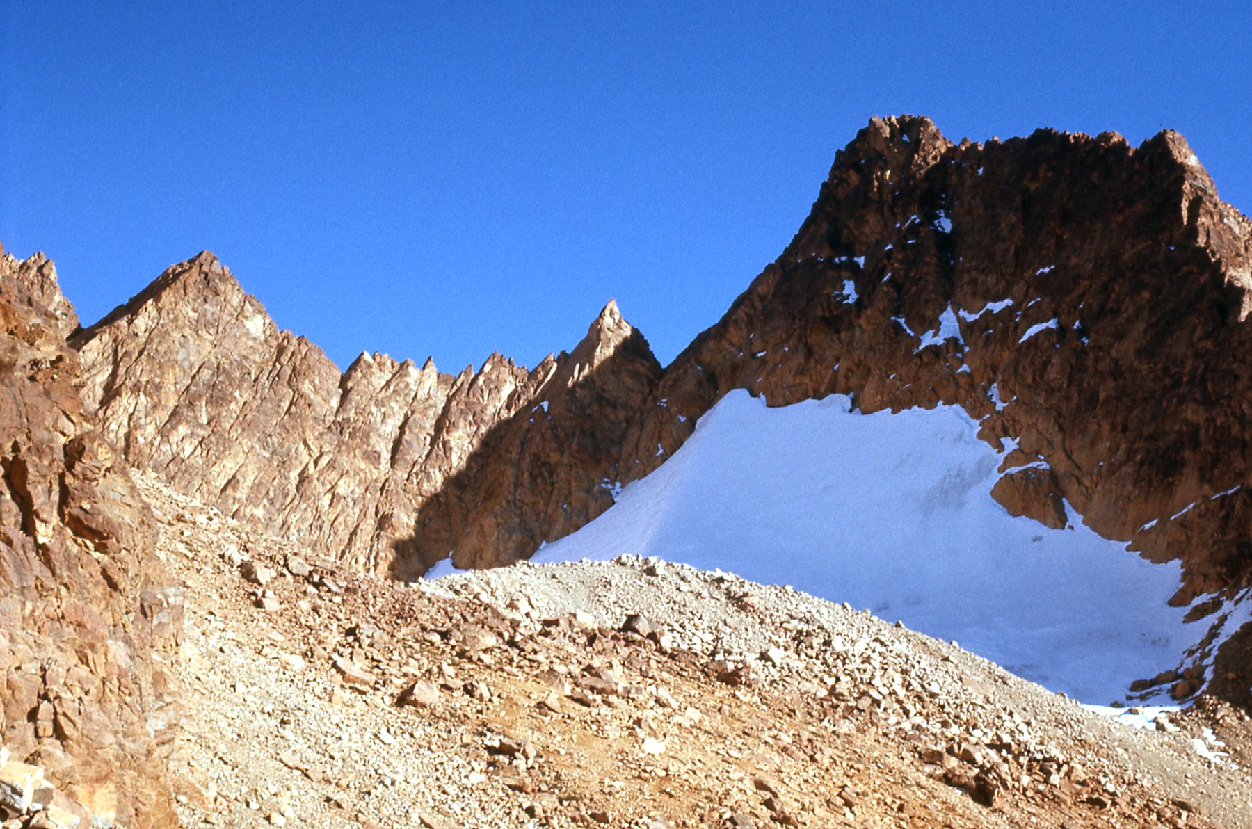
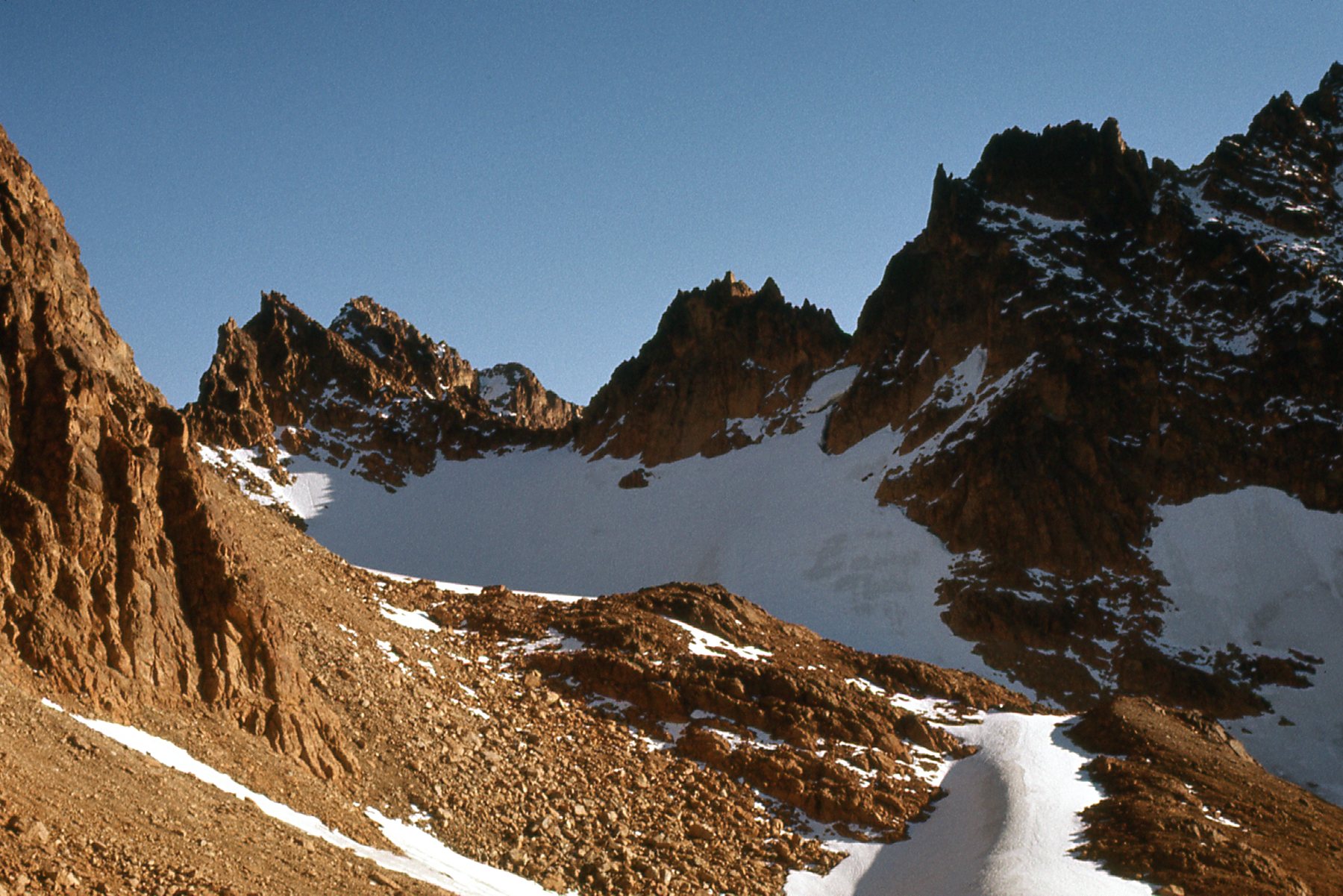
The easiest route to the summit of the South Twin is the west ridge, and the time of year and snow conditions will have a lot to do with what type of climb you end up having. When Mike and I went, it was mid-November and had been a dry, snow-free season so far. Some climbers choose to enter the basin on the west side of the range, between the North Twin and the South Twin, then climb steep snow as a means to get on to the west ridge itself. Or, you could choose to stay on the west ridge itself the whole way, which is what we did. If you like rock scrambling, it is said that this route offers some of the finest scrambling to be found anywhere in the state of Washington, which is high praise indeed.
We met 2 other climbers on the ridge and climbed with them, all un-roped. In retrospect, we didn’t encounter anything that we considered a real problem, although there was plenty of steep rock and exposure in places. It was definitely the type of climb that would not appeal to someone who didn’t like lots of rock scrambling and who was concerned about exposure.
At 6,200 feet, there is a 15-foot step which has to be down-climbed, and is Class 4. We all did this un-roped. From around 6,600 feet to the summit is the steepest and most exposed part of the climb, some reports putting it at Class 5. Many reports advise using a rope for this section, but we didn’t use no stinking rope and we had no problem. We didn’t have crampons or ice axes with us either. I have a theory I’d like to share with you. Back when we were climbing in the 60s and 70s, I think that a lot of the climbs we did were under-rated. Or maybe another way of thinking about them is this. We went out and boldly did climbs that we didn’t think were all that hard, yet nowadays young climbers who do the same climbs seem to think that they are more difficult than we thought they were. Were we just tougher back then, and took more climbing challenges in our stride? It does make me wonder, when modern write-ups talk about this difficulty or that problem on a climb, why we old-timers didn’t feel they were as difficult. Here’s the only photo I took on the way up the ridge. The bump on the right is close to me, while the rest of the ridge continues on up in the middle of the photo on the right skyline.
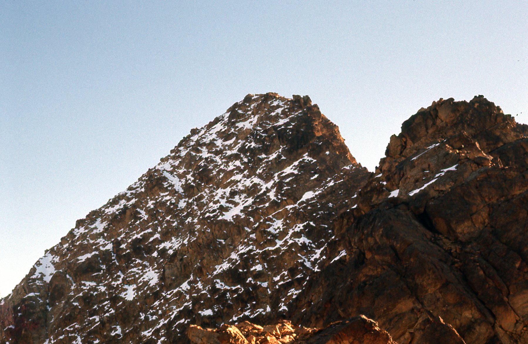
Looking up the west ridge.
Here we are on the summit of South Twin, at 7,020 feet.. My buddy Mike is the one on the right. From the looks of us, you’d think that we were out for a stroll, rather than just having climbed a peak with some challenges. Back when we made the summit, on November 12 of 1976, topographic maps showed a lower elevation of only 6,932 feet.
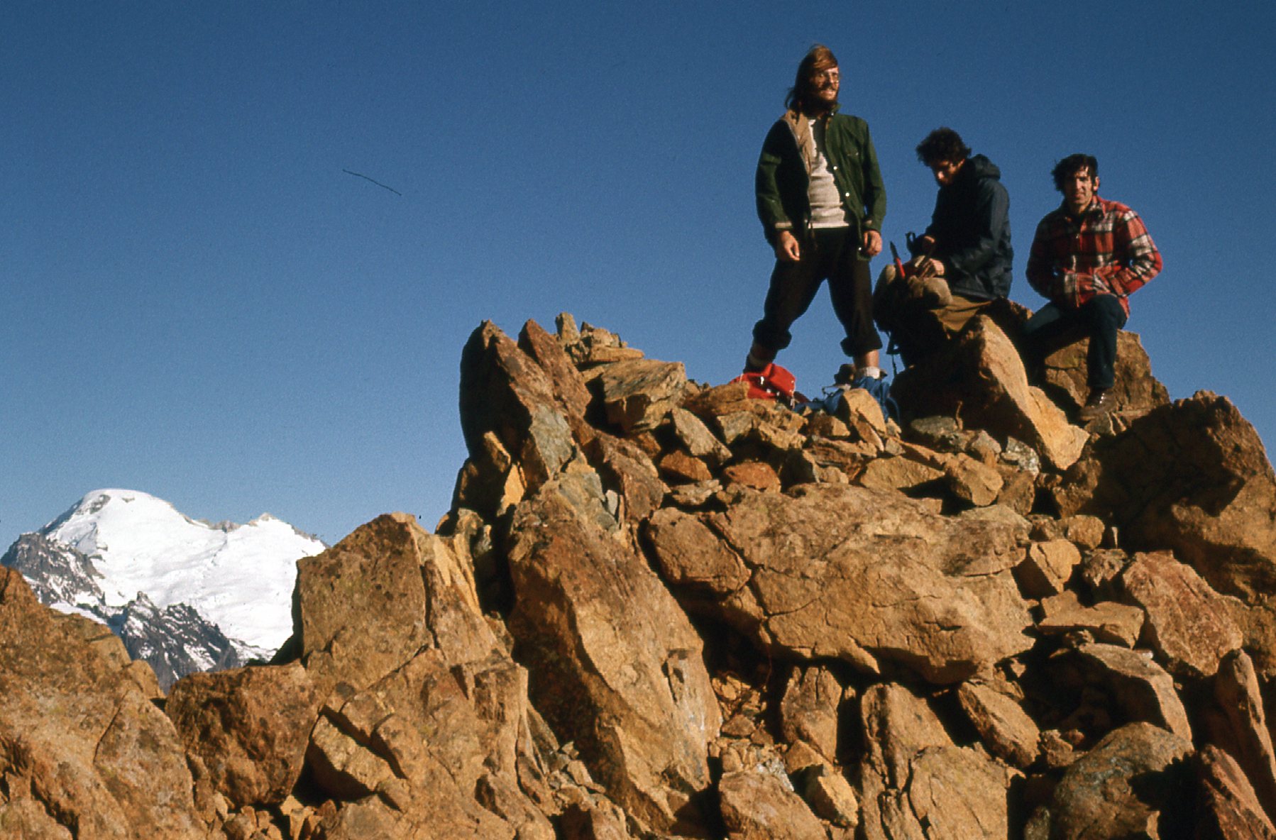
On the summit.
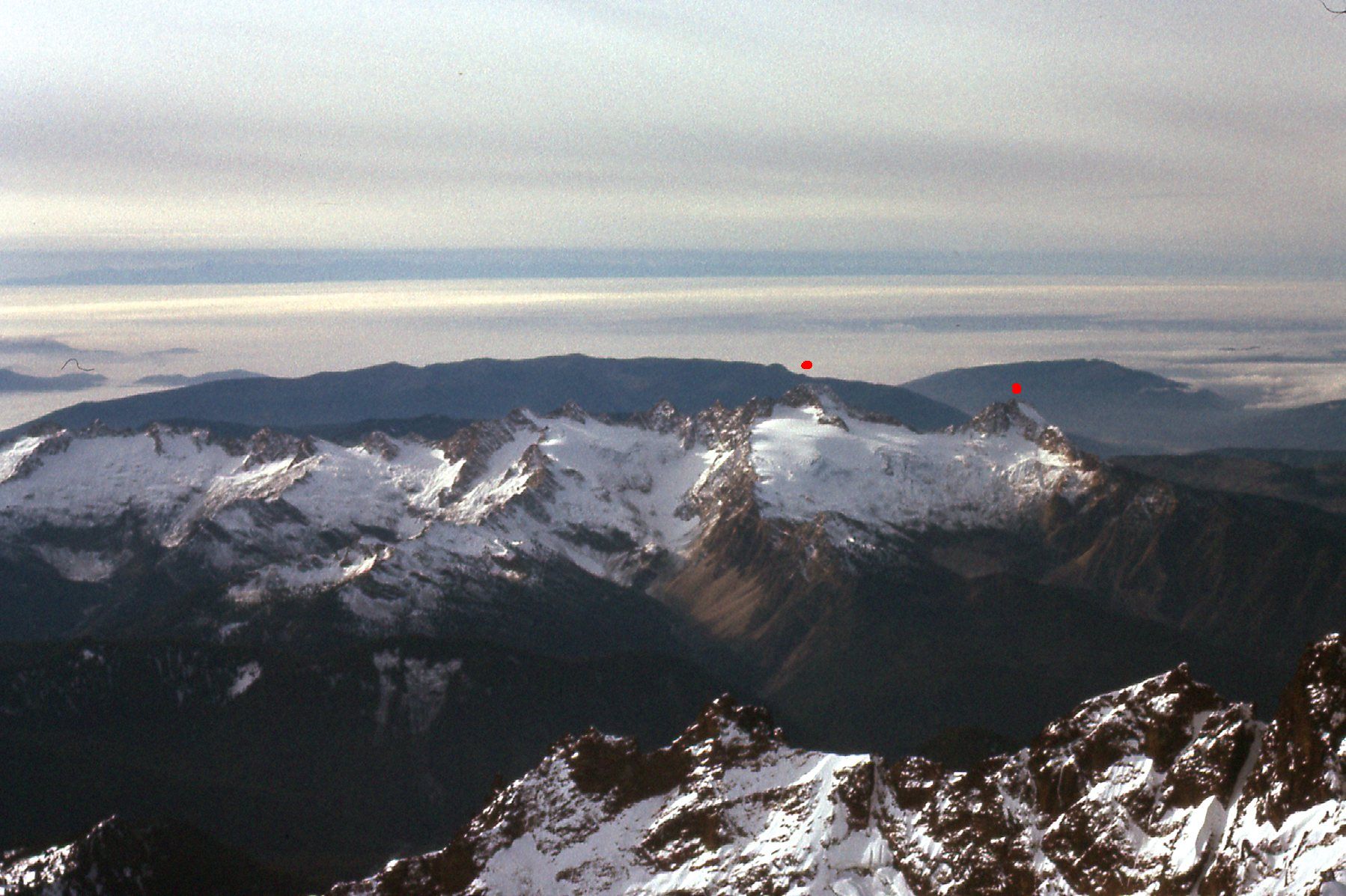
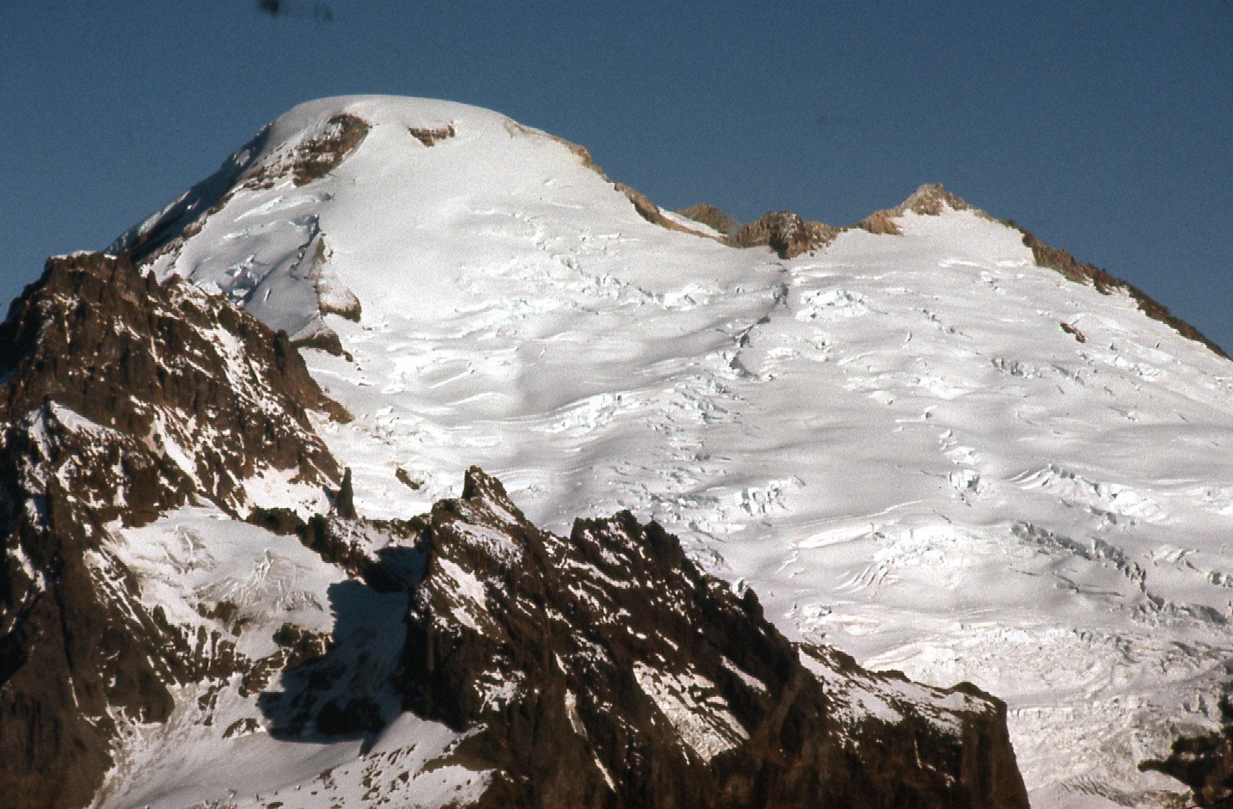
The climb was worth the effort, if not for the 3,560 feet of prominence, then for the outrageous views we had on the summit. How about these for starters. Here’s a telephoto of the Black Buttes and Colfax Peak, features on the southwest ridge of mighty Mount Baker, only 9 miles away.
Part of Mount Baker.
Here’s one showing the south side of Mount Baker, featuring the Deming and Easton Glaciers.
More of Mount Baker
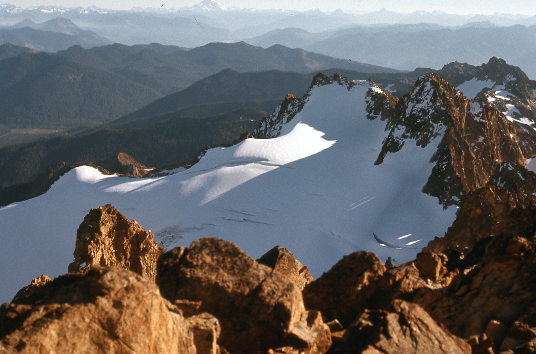
If we looked northeast, beyond the south shoulder of Mount Baker, we could clearly see the Southern Pickets, about 40 miles away to the northeast. Luna Peak, at 8,310 feet, is the group’s highest.
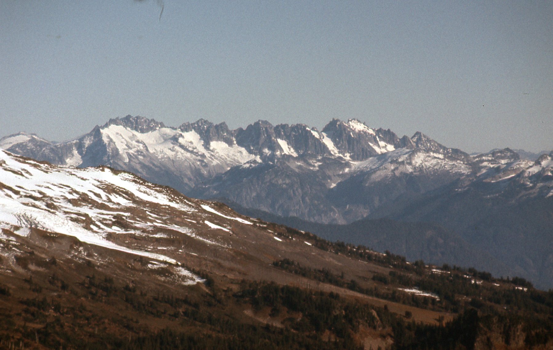
A telephoto shot of the Southern Pickets
This shot of the North Twin shows it to be well over 300 feet lower.
A look north to the North Twin
I love this one, a steep look northeast down on to the Sisters Glacier, the largest in the group.
The Sisters Glacier
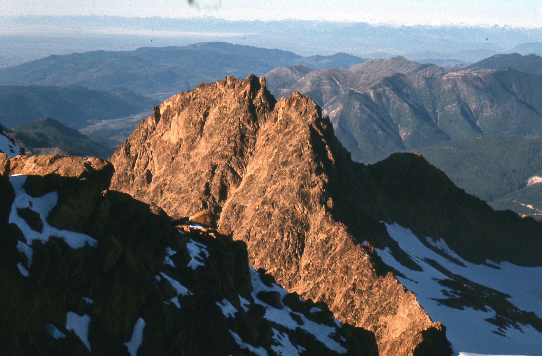
If we looked south-southeast along the spine of Twin Sisters Mountain, we could see how rugged the ridge is. Looking very closely in this next photo, you can also see, about a third of the way in from the left, on the distant horizon, the bulk of Glacier Peak, 57 air miles away.
Looking down towards Glacier Peak.
After a short while on the summit, all of us headed back down, carefully and slowly on the tricky bits. These last 2 photos show some of the steep, rugged country on Twin Sisters Mountain.
A look back.
One rugged ridge.
By the time we made it back down 3,000 vertical feet to the end of the road, then walked a lot more to the car, we were all shagged out. It was so late that we chose to sleep in the car another night. By 9:00 AM the next morning, we drove across the border at Sumas, Washington and back into Canada. It had been a great climb on a peak that could actually be seen from my home town of Mission, and every time I’m back there and look to the south and see it, it puts a smile on my face.