
A few years ago, I published on this website one of the stories dearest to my heart of all of the 500 or so already offered to you. It was a 3-part story of some significant climbing in a remote group of mountains called the Lillooet Range. Sadly, I didn’t have any pictures to go with the story. Well, I am about to make amends for that today. I have located the photos that were taken 45 years ago, and am excited to present them to you here along with a shortened version of the text of the original story.
Day 1: Tuesday, July 26th, 1977
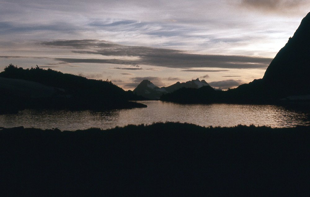
Although this was the day our trip started, much work had already happened in the days and weeks leading up to now. For example, we had made food drops from a small airplane into the remotest part of the range so that we could re-supply later. A friend gave us a ride to the docks at Harrison Hot Springs, where we boarded a boat which dropped us off at the old Stokke Creek landing near the north end of Harrison Lake at one in the afternoon.
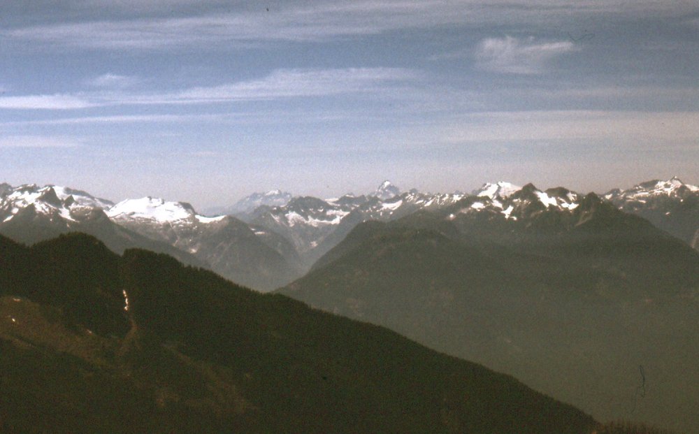
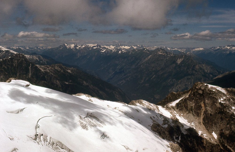
Our packs were heavy, probably 60 pounds, as we were carrying everything necessary for 10 days to reach our first food drop, including camping gear, gear for glacier travel and much else. The day was hot, almost 80 degrees, as we slogged up an overgrown logging road. Here was our first glimpse into the country we hoped to visit in the coming days, still thousands of feet above us.

Looking north up Stokke Creek
By the time we called it quits, we had covered 5 miles and gained 3,000 vertical feet, finally turning in at 9:00 PM.
Day 2: Wednesday, July 27, 1977
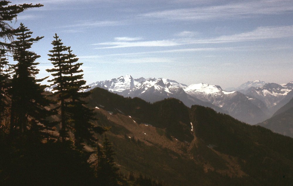
Our logging road had ended, and today we had a full-blown West Coast bushwhack up a rocky, burnt ridge which we followed to about the 5,000-foot level. At around 6,000 feet, we stopped for some lunch in a heather meadow by a waterfall. Here are some of the views from that point.
Looking southwest to distant Robie Reid and Judge Howay
Looking south-southwest to the Grainger Peak area
A hazy look west across Harrison Lake and up the valley of Tretheway Creek, with Robertson Peak dominating the skyline.
Finally, we left all vegetation behind, and by 2:30 PM we reached the edge of the Breakenridge Icefield at 7,050 feet elevation. It felt so good to drop those packs right there, a good campsite. About an hour later, we set out to climb a couple of nearby peaks. Heading south along the icefield, we arrived at a peak which we traversed, up its north flank and down the south. Brian built a cairn on its summit, and it was around 7,385′. It didn’t have a name, but in the years since our ascent, it has become known as Breakenridge SW2. Here was how it looked from its south side.
The south side of Breakenridge SW2. We climbed up the other side and descended this side.
The reason we continued right over it was that there was another peak we wanted to climb farther southwest. In a saddle between the two peaks sat a small lake, about 300 feet across, which actually shows up on the map. The lake was at around 6,900′ elevation.
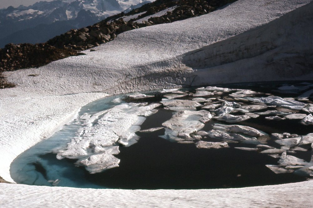
The small lake.
We went up the north side of that other peak, elevation around 7,120 feet. It had some nice moves on upturned granitic blocks, and we build a cairn there too. Here’s a photo taken from north of the two peaks, which shows them both well.
Peak 7385 (Breakenridge SW2) is on the left; in the center and farther away is Peak 7120. The lake is hidden, down low and between the two.
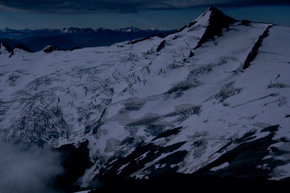
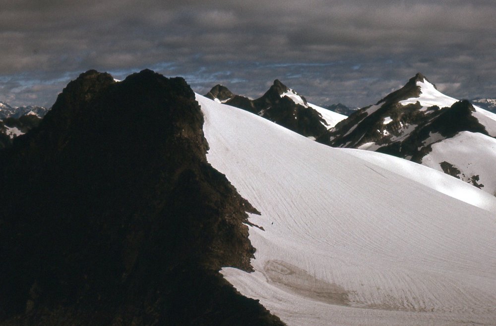
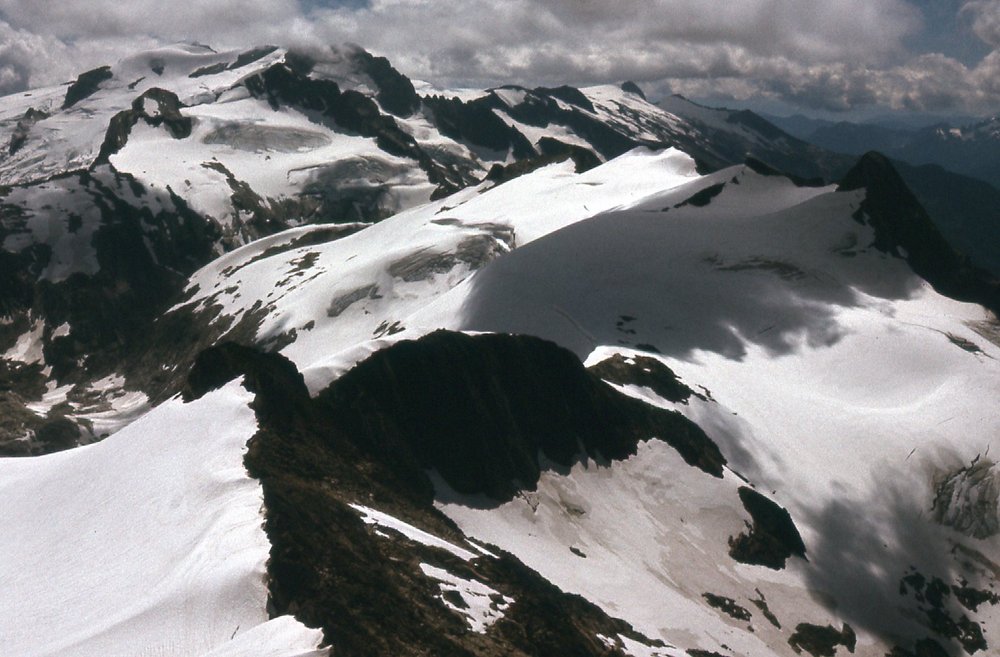
As we moved across the icefield, we had these other views. This one shows the southwest side of Mt. Breakenridge.
The southwest side of Mt. Breakenridge, elevation 7,858 feet.
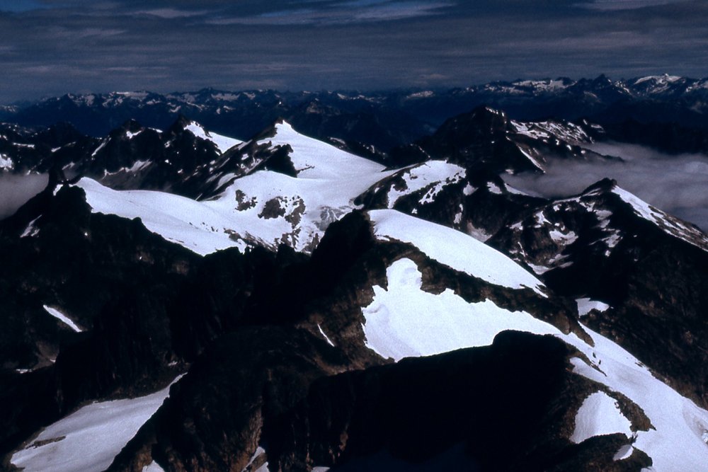
Here, we look to the terrain north of Breakenridge.
Peaks north of Breakenridge.
By 6:30 PM, we made it back to our campsite and, dead tired, decided to call it a day. We set up the tent, an REI McKinley, plenty roomy for 2 guys. After a meager supper, clouds started to move in, and by 9:30 were in our sleeping bags. It had been a long, hard day – we had climbed 5,250 vertical feet, most of it with heavy packs, and had covered 6 miles. It had been grueling work so far, but now that we were above tree line, we felt that the going should be easier.
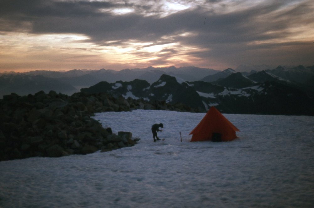
Our camp at 7,050 feet.
Day 3: Thursday, July 28, 1977
When we awoke at 5:30 AM, it was pouring rain. After some breakfast, we sat in the tent and waited to see what would happen with the weather. Hours passed, and it improved enough to pack up camp. By 8:00 AM, we left and headed north along the edge of the icefield, then dropped our packs and climbed up to the top of Peak 7420. We built a cairn there at 9:00 AM as the clouds rolled in once again. We hurried down to our packs and continued north out into the middle of the icefield. Once again, the clouds rolled in and socked us in – it was a complete white-out, and we couldn’t see a thing. We sat down on the snow and waited, for 4 hours. It was frustrating, and we decided we had to do something – we couldn’t just sit there forever. Some distance back, we had passed a big, open, fairly-flat piece of rock. It seemed like we could find it, and eventually we did.
We found the most level spot and pitched our tent. The wind blew hard, non-stop. We kept hoping against hope that it’d let up and maybe we could move on later in the day, but by 6:00 PM we were still socked in. At 7:00, we tightened up our tent cords and it was snowing! Obviously we weren’t going anywhere anytime soon, so bedtime came at 7:30. This weather was a major concern – our expedition was up in the air and things could unravel quickly. Tomorrow would surely be a better day.
Day 4: Friday, July 29, 1977
I’m going to sum up this day in just a few words – it was shitty. It blew hard, and rained almost non-stop, with a fairly steady 36 degrees – it was socked in all day. The altimeter showed a steady rise in pressure all day, which got our hopes up. By 8:00 PM, we noticed that it hadn’t rained for a while. By 10:00, it had cleared and the moon was shining. Please, God, let it hold! Here is a picture of where we camped those 2 days and 2 nights.
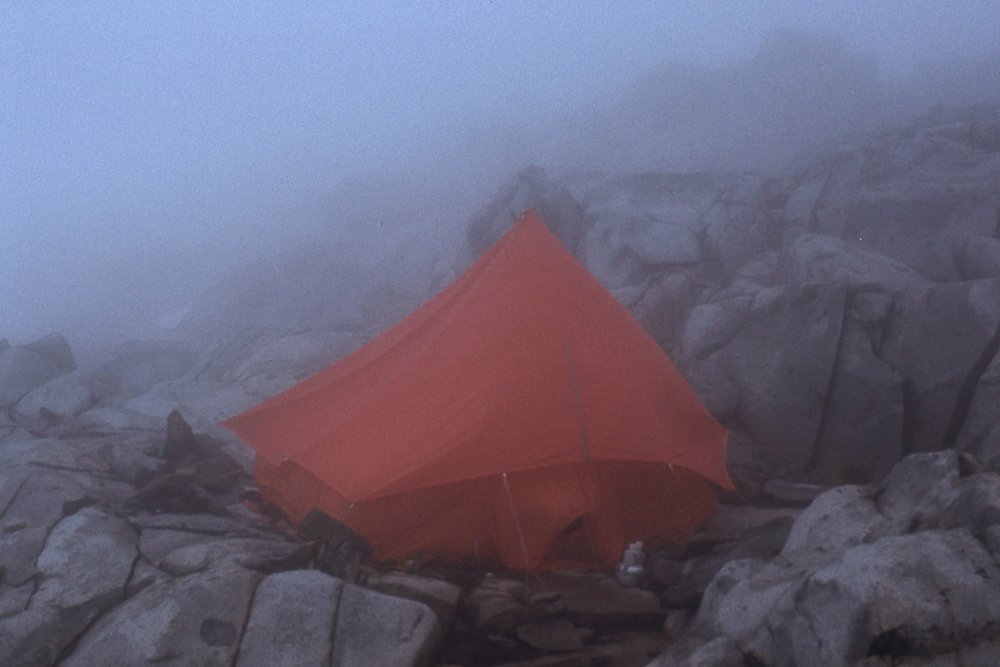
Our home.
Day 5: Saturday, July 30, 1977
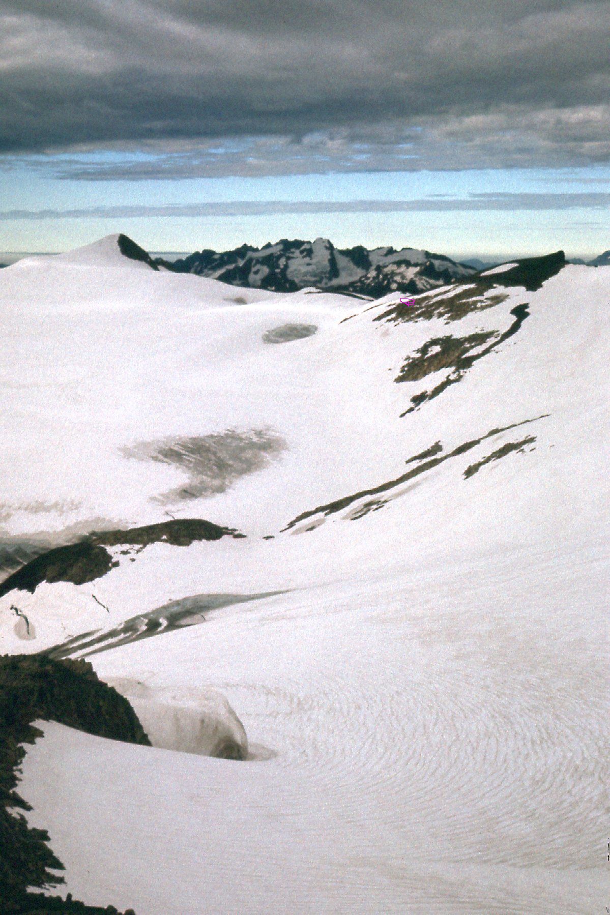
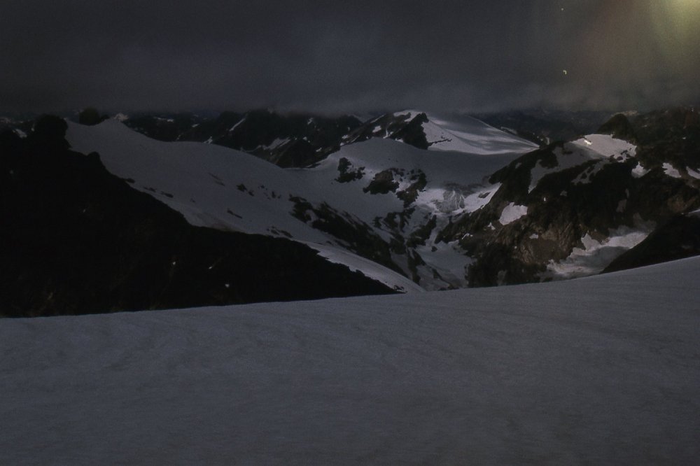
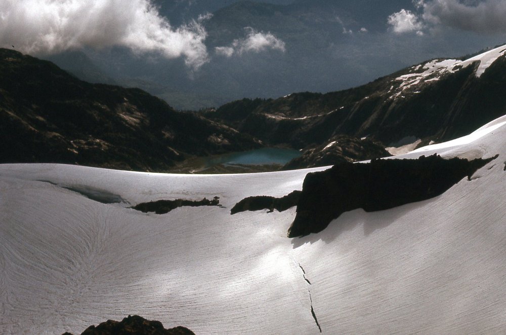
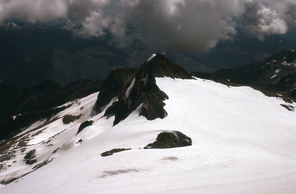
There were still some clouds hanging around by the time we set out once again by 6:40 AM, but it was gradually getting clearer all the time. Continuing across the icefield, we made it to the summit of what we called Peak 7900 two hours later. From there, we could see all the way back to where we had spent the last 2 days in storm. I’ve put a pink dot on this photo so you can see where that was.
A look back across the icefield to camp.
Our next goal was about half a mile to the west-northwest – it was bigger, around 8,000 feet. It would turn out to be the biggest one we would climb in the entire trip. In all the years since we did the first ascent, people have christened it “Traverse Peak”, perhaps as a nod to the fact that we traversed it from south to north over its humps, or perhaps that we crossed over it as we continued on our path north through the range. I’m not sure if the name is official, but guidebooks and the internet all use the name now. It has been climbed by a few others in all those intervening years, and the name is in common usage. Here is a look from Pk 8000 back to the southeast to Pk 7900, our first stop of the day.
Looking back to Peak 7900
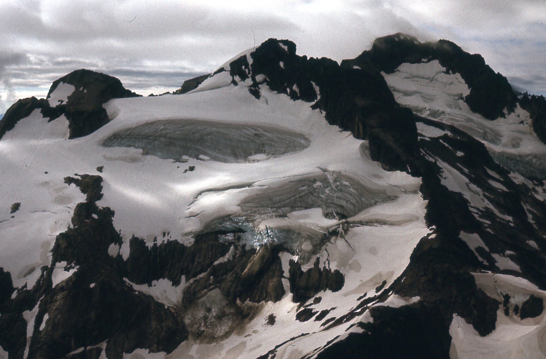
From atop Peak 8000, we had this view back to the terrain on the north side of Mt. Breakenridge. The photo is underexposed, but it certainly shows the texture of the glacier well.
The north side of Breakenridge.
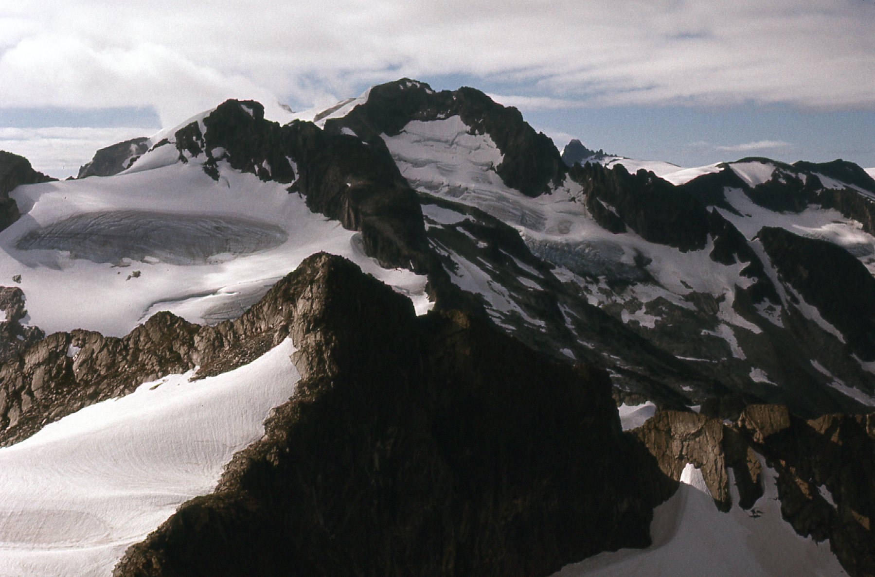
Also from the top of Peak 8000 was this view to the north – it shows the country that awaited us in the coming days.
Looking north at things to come.
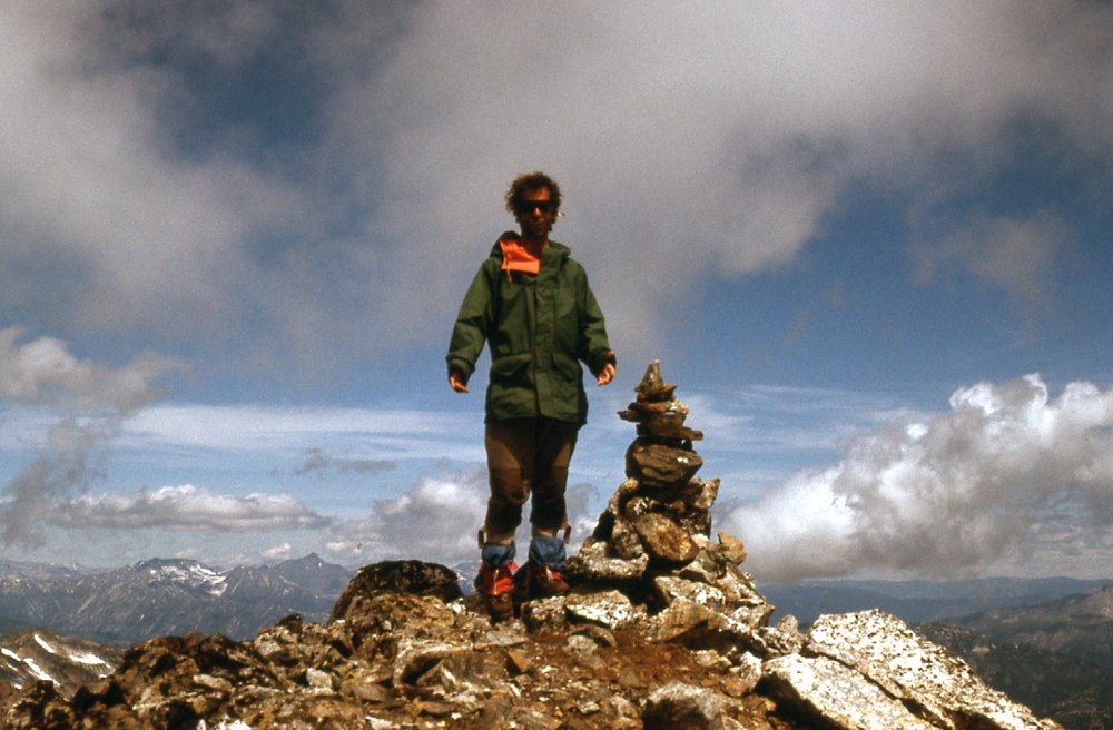
Here’s Brian Rundle, my partner on the trip. He had just turned 20 a few days earlier.
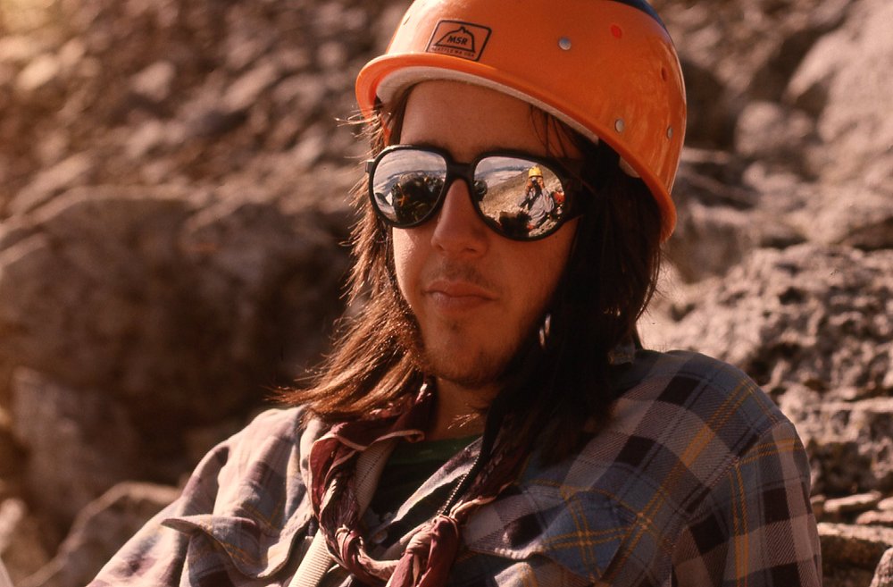
Brian
The skies were clearing, and we were excited to push on – we had a full day of climbing ahead of us. A large, crevassed icefield lay in our path, and we weren’t looking forward to crossing it. We roped up, and armed with ice axe and crampons, in an hour’s travel we made it across and stood in a notch between 2 peaks. Here’s a look back across part of that icefield.
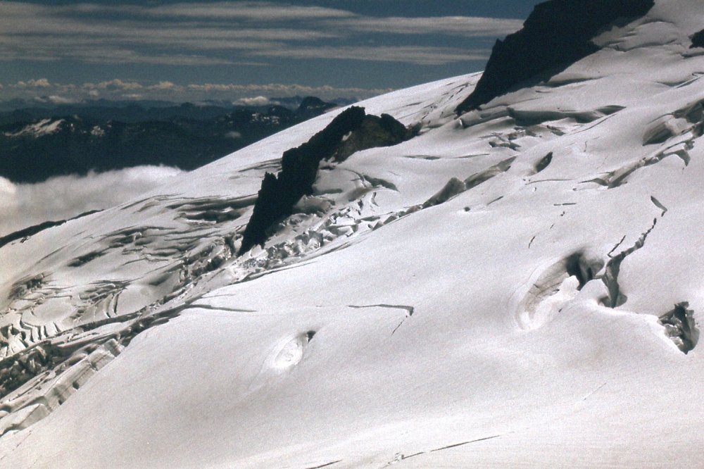
The icefield on the north side of Pk 7900 and Pk 8000
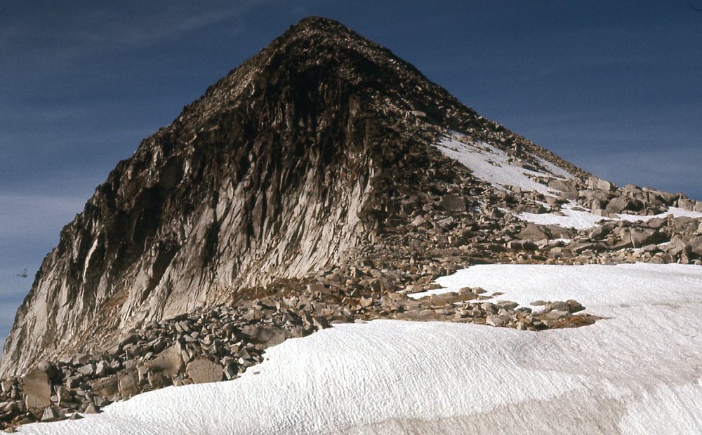
At the notch, we dropped our packs, dropped down a bit, then climbed up 320 feet of slabs on the north side of Peak 7300. We built a cairn on its summit and stayed a while to soak up the view. Back down in the notch, we had this view – our route went up the left side.
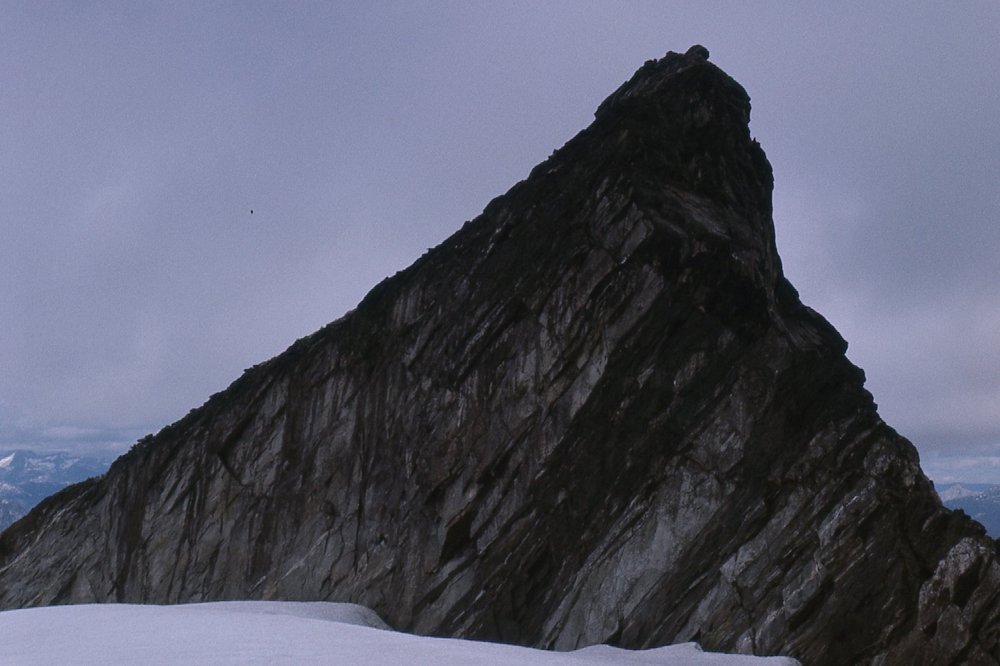
Peak 7300
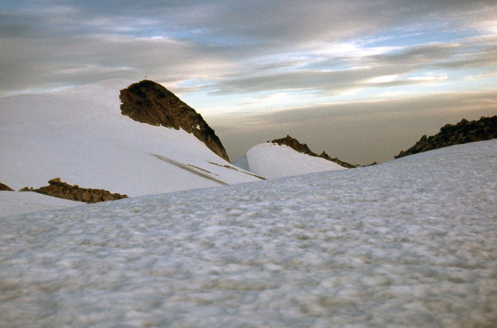
We also had this view to the north from the notch. Sorry, it too is underexposed, but it looks up towards Cairn Needle.
Looking north
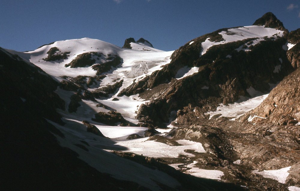
The next part of our journey involved dropping north from the notch into a basin which was filled with a crevassed glacier, half a mile wide and as long. The map showed nothing of that, which really surprised us. Some mapmaker wasn’t paying much attention that day. We negotiated it just fine, and ended up on a lightly-wooded ridge. The smell of the vegetation really struck us, to smell living things again. We dropped all the way down to a small lake, losing about 1,300 feet in the process, and decided to stop there for the day.. Our campsite was exceptional. We washed some clothes and ourselves, then spent hours lazing in the sun. It was a good chance to dry out all of our gear. Brian had a cold, and it was getting worse. It was decision-time, and given the distance to our food-drop and the time we had lost in the storm, we realized that it was unlikely we’d make it there in time. We could put in one more solid day of climbing before packing it in.
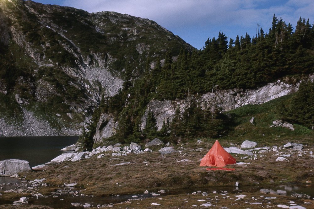
Our camp by the lake.
It was a shock to realize that our big plans were over, almost before they had begun. A big factor was our food. I had pushed hard for minimizing the weight, and as a result our food was inadequate. We were always hungry, losing weight and slowly starving ourselves.
From camp, we had this view of the first peak on our agenda for the next day.
North from camp to Peak 7000.
As our 5th day came to a close, we felt good about our decision and enjoyed the sunset.
Sunset from 5,800 feet.
Day 6: Sunday, July 31, 1977
The weather boded well for this, our last full day of climbing. There were clouds around, but no apparent threat of rain. By 6:30 AM, we set out with day packs, as well as a 9MM rope for glacier travel and ice axes and crampons. This was back in the day of knickers, knicker socks, Kendal mint cake and clown white. Our first peak was 7,030 feet by the altimeter. Climbed by Class 3 slabs on its north side, we were building a cairn on the summit by 8:10 AM. This was the first peak to the north of our camp by the lake. The lousy 100-foot-contour maps were all we had in those days, and they were missing so much detail, but we managed. And no GPS, of course – those wouldn’t come until light-years later. We had an important view from atop this first peak, and here it is. The dark peak on the left skyline is Peak 7300, climbed mid-day yesterday. Filling the center part of the photo is that half-mile glacier omitted on the map. Our route of travel took us from the saddle to the right of 7300, then down and to the right, crossing the glacier and reaching the dark ridge to the right. We followed the arc of the ridge to get us down close to the lake where we were camped. Just below the photo’s center is some light blue ice – those are seracs getting ready to fall over the cliff below.
Looking south to part of yesterday.
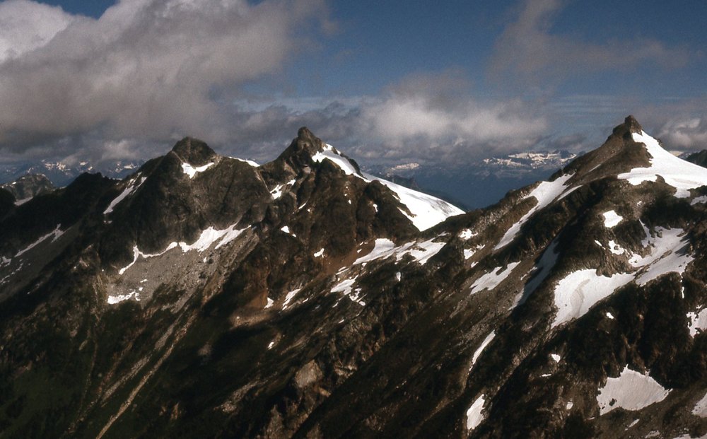
When we were done with Peak 7030, we descended its north side, the same side we’d used to climb it. Moving farther north, we reached a triple summit – we crossed all 3 bumps, south to north, and built a cairn on the north end at what the altimeter said was 7,120 feet. This triple summit afforded a good view back to the south, which I share with you here. In the middle of the photo, just left of center, is Peak 7030, our first of the day (with the sun on its left side, and the icefield trying to climb up its east side). But check out the big dark peak in the back, the highest on the skyline. That, friends, is Peak 8000 (Traverse Peak), the one we did yesterday morning, and this is the only place you’ll see such a view of its north face.
Another look south.
Here’s another view we had from the triple summit. The lake sits at about 5,100 feet.
A look east from the triple summit.
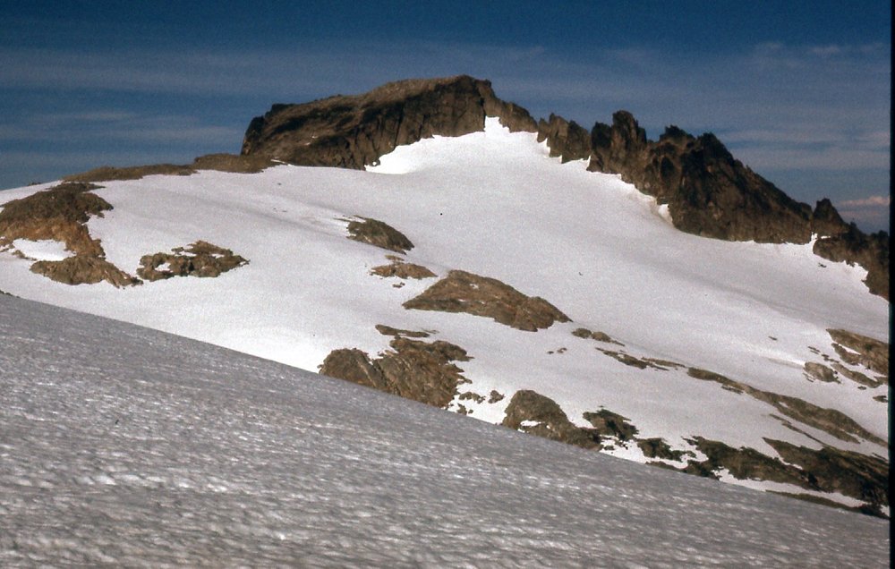
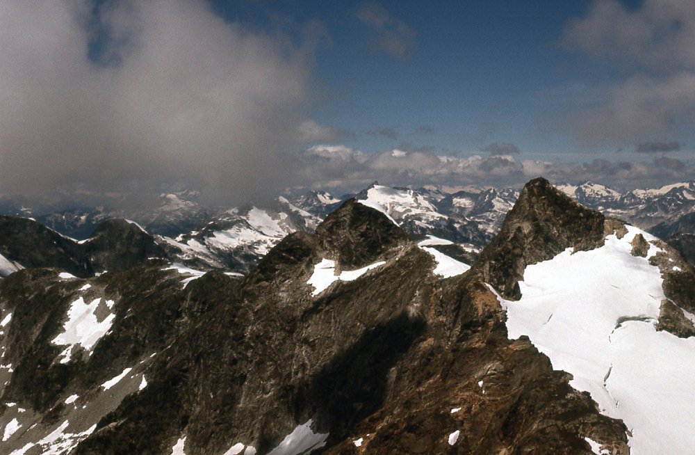
When we left the triple summit, we headed north to a small peak which we determined was 7,200 feet. Again, we built a cairn, then descended to the north on some very steep snow. Our next objective looked a bit intimidating – we had been eyeballing it warily for some time. Here is how it appeared from the triple summit. It’s the dark one on the left, which is clearly higher than the 7,200-foot peak we were on.
That’s “Vista Peak” ahead on the left side.
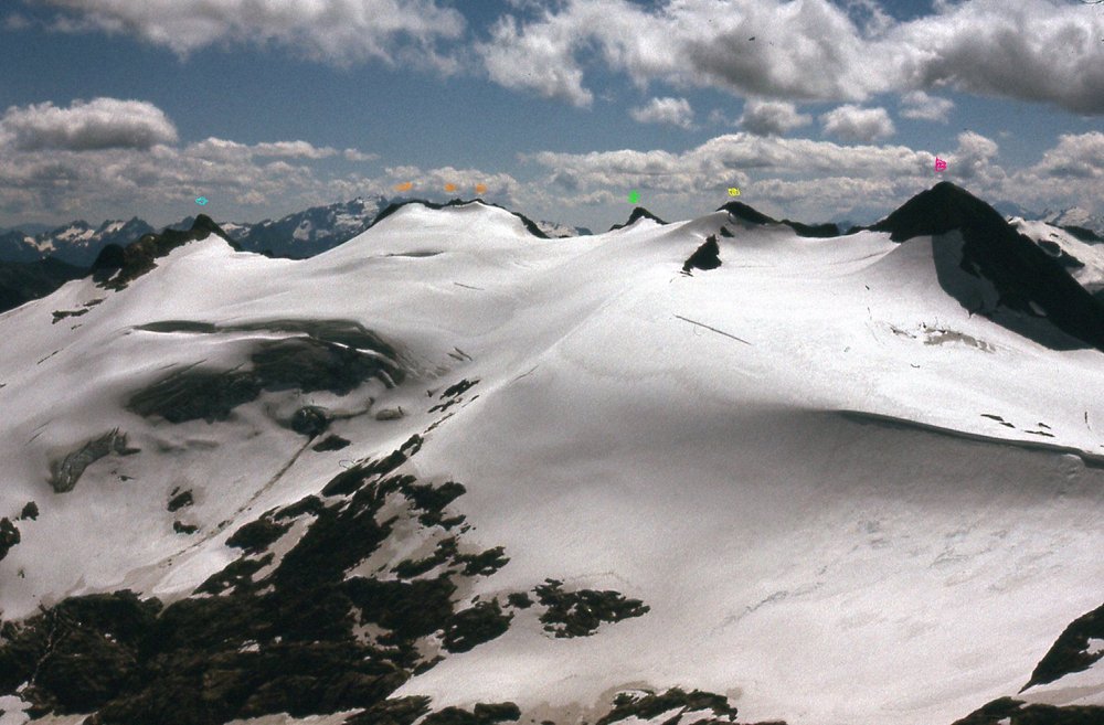
It was a Class 3-4 rocky tower on its south ridge, which we managed just fine, then we headed further north on to its summit. The views were outstanding. We called this one Peak 7200, but there appears to be some error in its height. Perhaps the fault was with our altimeter, but this peak was clearly higher than the Peak 7200 we had just climbed to the south. Let me show you what I mean. In this next photo, which we took hours later from another peak, we have a good look back on the morning’s peaks. I’ve taken the liberty of putting colored dots above each of the peaks for easy identification (zoom in to see them better). Let me review them for you. Over on the left, the one with the light blue dot, was the first of the day, Peak 7030. Moving over to the right were the triple summits at 7,120 feet shown with orange dots. Next right is a green dot (not mentioned, but we climbed it anyway). The next one has a yellow dot, and we called it Peak 7200. All of which brings me to the last peak on the right side, with the pink dot. We also called this one Peak 7200, but the photo shows it clearly higher than the yellow dot 7200 peak. Bruce Fairley’s excellent A Guide to Climbing and Hiking in Southwestern British Columbia makes the comment “7,200 feet possibly higher”. His guidebook calls our pink-dot peak “Vista Peak”, as do the Internet and Google Maps. Way back in the day, when we climbed it, it had no name.
Looking southwest to the morning’s peaks.
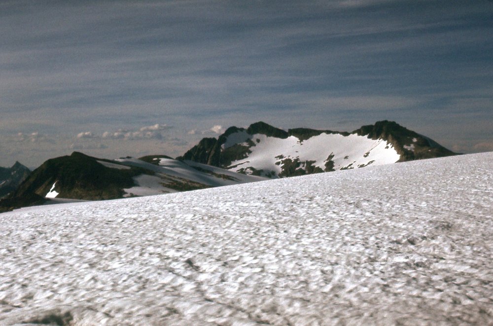
From the top of Vista Peak, we had this excellent view north to our next peak. It’s the one on the right edge of the photo, and is another one which, when we climbed it, was totally unknown. Sometime during all the years since we were there, people have started calling it “Surprise Summit”, and the name now appears in all the usual places.
Looking north from “Vista Peak”
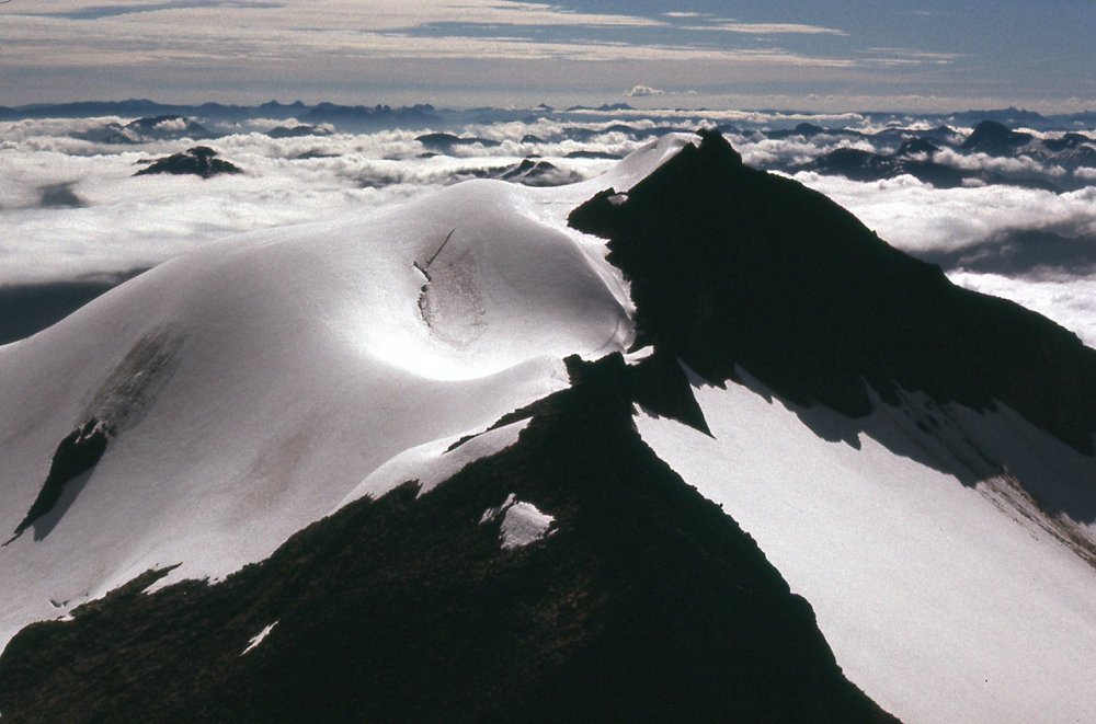
Our first food drop lay only a dozen air miles to the north, but it might as well have been a thousand – we just weren’t gonna get there. As it was, we were almost out of food. We dropped down to a big icefield and crossed it, then gained the summit by its south ridge, facing us in the photo. We figured it was about 7,500 feet, close to the height of Cairn Needle, the peak just to the left of center. It was 12:15 by the time we stood on top. It was such a beautiful spot, we didn’t want to leave. We had lunch and built a big cairn. I’m excited to share with you some of the views we had from the top of “Surprise Summit”. In this next photo, all those snowy peaks way out there in the middle of the photo are ones we would have reached had we been able to continue.
That’s Cairn Needle on the right – it’s barely over half a mile from us.
In this one, we are looking north.
Looking north up the valley of the Nahatlatch.
Brian snapped this one of me.
Me on top of Peak 7500 (Surprise Summit)
We could see far down into the northeast fork of Stokke Creek.
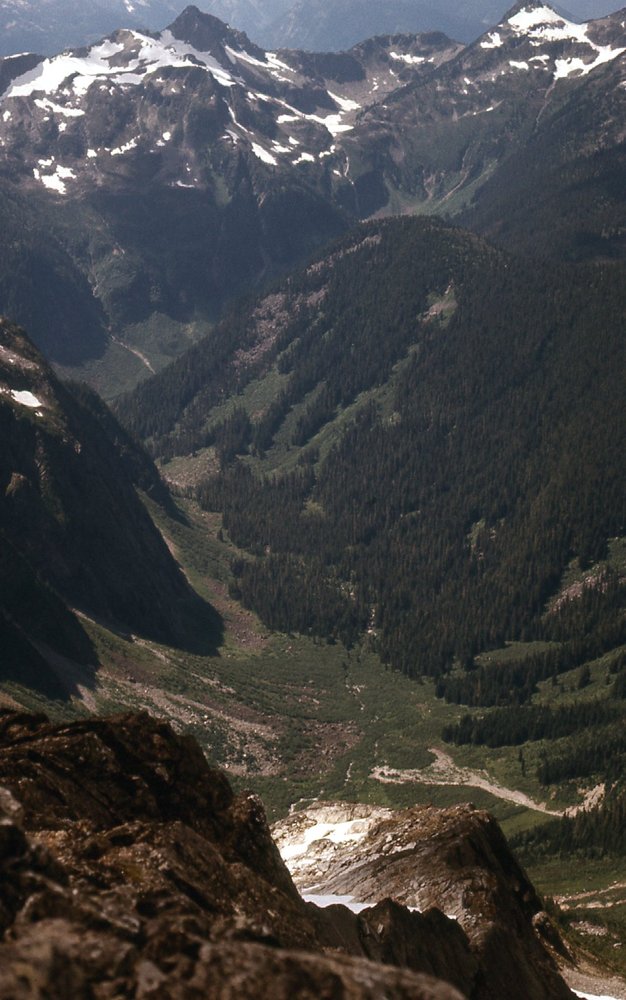
The northeast fork of Stokke Creek.
If we looked back to the south, we could see the ground we had to cover to get here from “Vista Peak”, which is the black peak in shadow near the upper right corner of the photo – a lot of terrain to cover to get here.
Looking south
Okay, one more – here, we are looking southeast to what would be our last peak of the day. It too had an elevation which we estimated to be 7,200 feet.
Peak 7200 in the center distance.
We left “Surprise Peak” and dropped down to the icefield, then crossed it until we finally arrived at our last peak, 7,200′. It was 2:20 PM when we arrived. In no hurry, we used the countless pieces of shale on the summit to construct the mother of all cairns, over 6 feet tall. It was visible for miles in every direction. In all the years since we climbed it, I hope someone else has visited. We spent an entire hour on top, eventually forcing ourselves to leave. Down we went into an achingly-beautiful valley where we counted almost 20 small lakes, in the process losing 2,000 feet of elevation. We crossed endless slabs of smooth, glacier-scoured rock and walked through fields of heather. It was so green! There wasn’t a bad moment in the entire afternoon, a blue-sky day which made us feel like we were in paradise. In 60 years of climbing, I still look back on that day as one of the finest I’ve ever spent in the mountains, anywhere in the world. In this last picture, you can see back up to our last summit, Peak 7200 in the far upper right corner; in addition, in the center skyline we see dark “Vista Peak”, and on its left side we see that rocky tower we had to climb
Looking 2,000 feet up to both our last peak (7200) and “Vista Peak”
Eventually, we had to head west up a different valley – at its head, we crossed over a ridge and then down to our camp. Twelve hours had passed, and every minute of it had been sheer climbing bliss – 6 summits, 12 miles and just over 5,000 vertical feet of climbing. Once back at camp, I too was starting to feel like crap – Brian’s “Lillooet-Range flu” had caught up to me as well. Given how poorly Brian was feeling, it’s a credit to his stamina how much we were able to do on this final day.
Day 7: Monday, August 1, 1977
After a good night’s sleep, we packed up and were ready to move by 8 o’clock. It was a bit sad to leave our campsite by the lake, home for 2 nights. What we now had to do was get back to civilization by a different route than any we had planned. Our camp was sitting above the Stokke Creek drainage, so all we had to do was drop down into it and head towards the lake – simple enough, right?
Down the steep mountainside we started, and before we knew it we were in the middle of some world-class bushwhacking. Much of the valley had been logged years before, and the re-growth, coupled with the usual trash that loggers leave behind, turned our descent into a real nightmare. Down and down we went, losing about 3,000 vertical feet on the very steep slope until we finally hit an old spur road. By then, it felt like we’d already had the snot kicked out of us, but the fun was just beginning. Although we now had an old logging road to follow, it was about as much good as having no road at all, it was so overgrown. Even though it was all downhill, it was a frickin’ misery. And hot – it turned out to be the hottest day of the year so far. Somewhere in that valley, we came across this waterfall, a bit of a bright spot in all of the tangle.
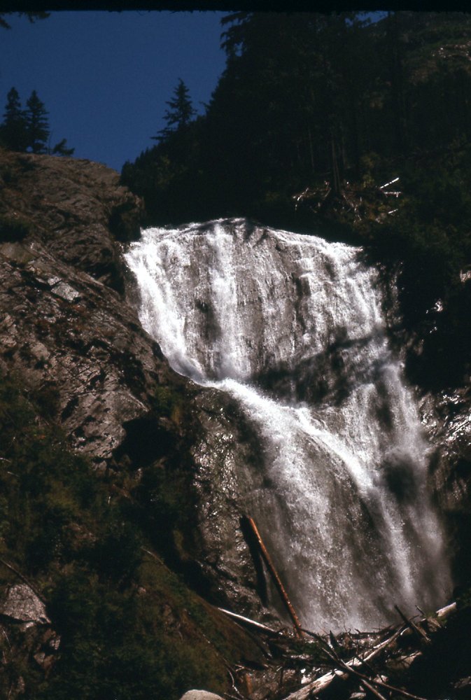
The waterfall
We literally bushwhacked our way down the old road, swatting the clouds of insects that plagued us. I don’t have any recollection of even stopping for lunch – hell, I don’t know if we even had anything left to eat! Something else that added to the misery was the endless series of deeply-eroded washouts across the road – it had not been maintained forever, and the high rainfall had just eaten it up. It was one long, hot death march down the valley of Stokke Creek. By the time we came to the end of the valley, down at the lake, it had taken us 7 1/2 hours to lose 6,000 vertical feet.
Feeling like a couple of whipped curs, we dropped our packs on to the wooden dock at the lakeshore. God help us, the soul-tormenting thrash that was Stokke Creek was finally over. At this point, I’d like to take a page from Brian’s book – in fact, I am blatantly plagiarizing his description by sharing with you, Fair Readers, word for word, his excellent description of what happened next. More on where to find this in a bit, but, for now, enjoy.
I dropped my pack, stripped naked and jumped into the lake, man was that refreshing. Mmmm what’s this? All of a sudden there appear three or four teenage girls on the dock. They were very surprised to see us to say the least. Me being naked in the water and all, I was a bit surprised as well. They really didn’t know what to make of us, so they skedaddled out of there to get someone in charge. This gave me the opportunity to get out of the water and dressed. In short order they returned with more girls and two guys. These men were really nervous and concerned about how we got there, who we were, what our intentions were etc. They really didn’t believe that we walked right through their camp over a week ago and again today and no one noticed. It turns out that this is a juvenile detention camp. Only access is by boat or chopper, although there is an abandoned airstrip. The inmates are all here for a thirty day stretch, then it’s back to city detention or release depending upon their situation. These girls pretty much all looked like hard cases; it was kind of sad to some extent. The two guys are councilors-wardens-guards or something like that. Security is solely based on the remote access. There is nowhere to go. The guys were suspicious that we might be trying to break out one or more of the detainees. It was kind of weird. I mean really, look at the state of us. Eventually we were able to assuage their fears, and they realized that we were probably mostly harmless. In fact they went so far as to let us share their dinner with them. The girls had to run a lap of the airfield before getting fed; we were excused this duty. They also let us use their radiophone and we were able to make arrangements for the water taxi to stop by on his next trip, which by luck was tomorrow. Additionally they let us stay in one of the old logging camp bunkhouses; that was pretty far removed from where the girls slept. The bunkhouse was nice in that it kept the voracious mossies’ at bay, but the downside was that there were ants everywhere. A very uncomfortable night and it was hot as hell. I am sure that the guards must have taken turns at watch that night, just to ensure there was no funny business. Which of course there wasn’t.
Day 8 – Tuesday, August 2
They fed us breakfast, and in turn we answered all kinds of questions about climbing in general and specifically what it was like up those old roads. We assured the girls that no matter what they thought of their current situation, that it was like a Club Med luxury resort compared to what they would find if they ventured away from their camp. Before long we heard the unmistakable racket of the boat, and headed down to the dock with our entourage to see us off. I remember there being a family on the boat going for an outing or picnic perhaps. The little boy looked awestruck at the DM and me in all our gnarliness with all of our gear dangling off our packs, I can still see him asking his dad if he can give us a couple of cans of pop from their cooler. A can of cold sprite never tasted so good.
Folks, you can read more of Brian’s engaging and well-written material at his website: www.pangranitichighway.com
Anyway, some final thoughts. As grueling as our escape from the Lillooet Range had been, we were already planning our next adventures before the boat had docked.
In a few days, both of us had recovered from our colds, and, as luck would have it, that part of BC embarked upon a record-breaking spell of flawless weather that lasted over a month. When I think back on our 8-day adventure, one of the most powerful memories I have is that of hunger – we were slowly starving ourselves to death. Each of us started the trip weighing 140 pounds, and I’ll bet when it was over we clocked in somewhere between 125 and 130. And speaking of food – as long as I live, I will never stop wondering about our food drops. Did they burst open on impact? We had some luxury items in them, such as canned fish and nice chocolate, stuff we could gorge on when we got there. Maybe ravens found them and pecked the boxes apart. Not many animals would be up that high on a big icefield, but a bear could be, and if he did, he’d make short work of it. If some such thing happened, we might have arrived and found little of it usable. Then, we’d be in a fix, starving and even farther to go to reach civilization. Oh well, I guess we’ll never know. The Lillooet Range still lives on as one of those great adventures that we all need more of in our lives.
I hope you enjoyed the re-write of this adventure, and especially the pictures, which have never been seen before by anyone – they were the main reason I brought this one back for you.
Oh yes, one final thought – this expedition was written up in the Canadian Alpine Journal, Volume 61, 1978, in case you’re interested.