
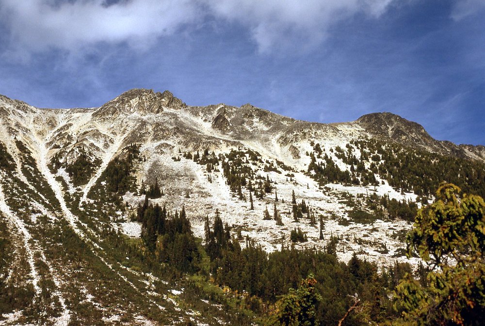
Devil’s Lake was a means to an end, namely a means to get at Stein Mountain. So I need to tell you why I had this fixation with Stein Mountain. Well, for one thing, it was big. Any peak that reached 9,000 feet in southwestern British Columbia was big, and Stein stood 9,010 feet. But it was different – it was right beside Lytton, one of the hottest, driest places in BC or all of Canada for that matter. So I’ll get back to Devil’s Lake in a while, but I’ve got to work my way back to it in my own roundabout way. I had my first experience with Stein back in the summer of 1968 when I spent a few days way up the Stein River doing some prospecting with a crew of fellow misfits. The mountain loomed large above us during those days and started to work its way into my system even then, more than I realized. It wasn’t until July of 1976 that I returned with my brother-in-law for a backpacking trip up the river for a few days that I had another look at the peak. Then again in August, where not much happened beyond some wishful thinking in the vicinity of Lytton, gazing up at the mountain and its environs and trying to figure out the best way to get at it.
Okay, now I’ve come full circle and am back at Devil’s Lake. After doing a lot of studying of the maps from the comfort of my armchair, I came up with the hairbrained idea of trying to approach Stein Mountain from the backside, from the area of this thing called Devil’s Lake. I knew nothing about it, other than I had heard rumors of a trail that left the Fraser River and headed in to the lake which sat at around 5,600 feet. A trail was something at least, something substantial that could be used to avoid bushwhacking for part of the way. I figured it was worth a shot – if nothing else, I’d get to have a look at some new country.
At a ridiculously-early hour, I hopped into my Volvo station wagon and drove the 120 miles to Lytton where I promptly got a flat tire. I changed into my spare and left the flat at a service station to be repaired, then drove about 2 miles north of town and took the reaction ferry across the Fraser River to the west shore. If you’ve never been on a reaction ferry, Google it – they do not use a motor, very cool concept.
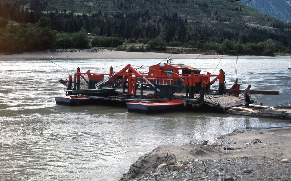
The Lytton reaction ferry
So I now found myself on a well-traveled dirt road which ran up the west side of the mighty Fraser River. Steep mountainsides reared up on both sides of the river, and bits of ranch land were squeezed in wherever they could fit along the bottom. Never having been up this side of the river before, I only had a rough idea how far I had to go. Fortunately, I met a fellow on horseback who gave me some good advice, telling me that the trail I sought was about 16 miles up-river from the ferry. He told me what to look for, and sure enough, I found the spot and parked.
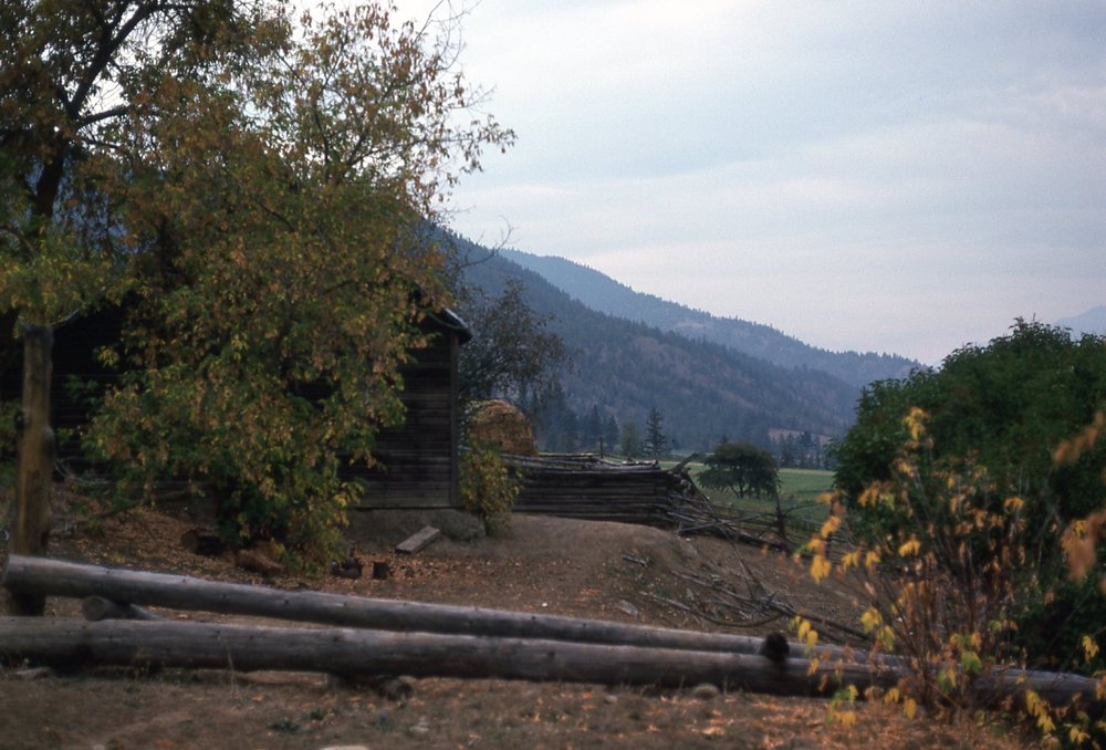
Near the start of the trail.
At the bottom end of the trail, I came upon this flume. It was pretty cool, actually. Made of wooden boards and supported off the ground, someone had engineered it quite carefully to carry water from a point farther up the valley of Siwhe Creek, which I would follow up to the lake. Water was running in it, being taken to some parched spot lower down. It may look rough, but it was effectively doing its job.
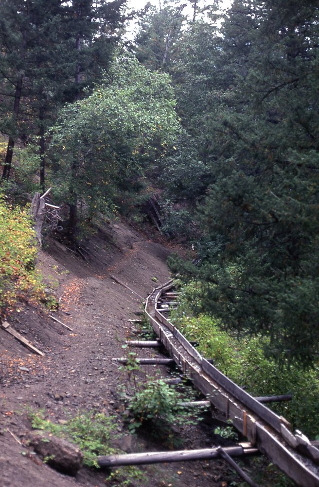
The wooden flume
The fellow I had met earlier had told me that folks on horseback traveled up to the lake fairly often. The trail was easy to follow – I left my car at 9:00 AM and arrived at the lake 6 hours later, traveling west the whole time. The entire way was through the forest, and I decided to call it a day when I first reached the lake at its eastern end, at 5,650 feet elevation. I don’t recall the length of the trail, but it was at least 12 miles. Since I only had 4 hours of sleep the night before, I was pretty wasted by the time I got there – it had been a climb of 5,000 vertical feet in those 12 miles. I dropped my pack and had a look around.
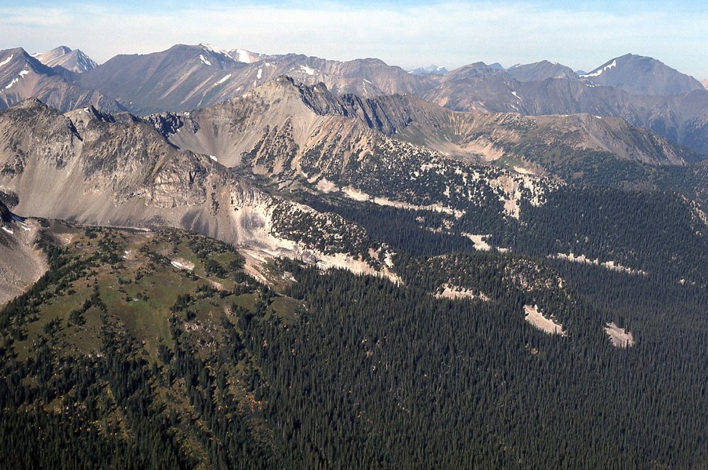
My map showed that the elusive Stein Mountain was off to the southeast, far enough away that intervening mountains blocked my view of it completely from the shore of the lake. In fact, Devil’s Lake lay in a valley which trended east-west, and on both the north and south sides of the valley sat some pretty substantial mountains. Here’s what I saw on the south side of the lake. In the middle of the photo, there’s a flat bit of mountain in behind some closer peaks – that is the top of Peak 8600. It is 3,000 vertical feet above where I’m standing on the shore of the lake. Stay tuned for pictures yet to come in tomorrow’s climbing which will show you where Stein Mountain is in relation to Peak 8600.
The top of Peak 8600.
And here’s what I saw on the north side of the lake. Somehow, mountains always seem friendlier when the sun is shining on them, don’t they? These peaks are lower, only 8,100 feet, but were close at hand and easy of access, so I thought I’d have a go at them after a good night’s sleep. What you see here is a rise of 2,500 feet from where I’m standing.
8,100′ peaks to the NE of Devil’s Lake
With no tent, I was just doing a simple bivouac, sleeping under the stars, hoping it wouldn’t rain. The odds were in my favor, as this part of the province saw very little precipitation. Here is what I saw as I lay in my sleeping bag.
Nighty night
After a good night’s rest, I headed up the south slope of what I called Peak 8100. It was a bright, sunny day with just a few stragglers of clouds, and even they looked to be dissipating quickly. The climb was worth the effort, because I was rewarded with some terrific views. Allow me to share them with you here. First of all, a look to the north, to something called Intlpam Peak, only about a mile and a half away. It’s higher, about 8,700 feet.
Intlpam Peak over on the right edge of the photo
This next shot is looking northwest down Skimath Creek to Texas Creek.
Looking northwest
In this one, we look west.
Looking west.
Swinging around a bit farther, now we are looking a bit south of west – all of these are taken from the summit of Peak 8100.
Looking south of west
The next one shows the view to the southwest.
A look to the southwest
And here we’ve moved all the way to the south-southwest.
Looking south-southwest
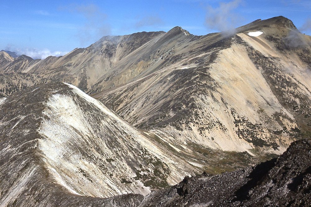
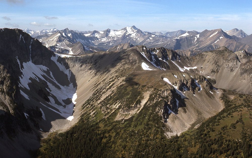
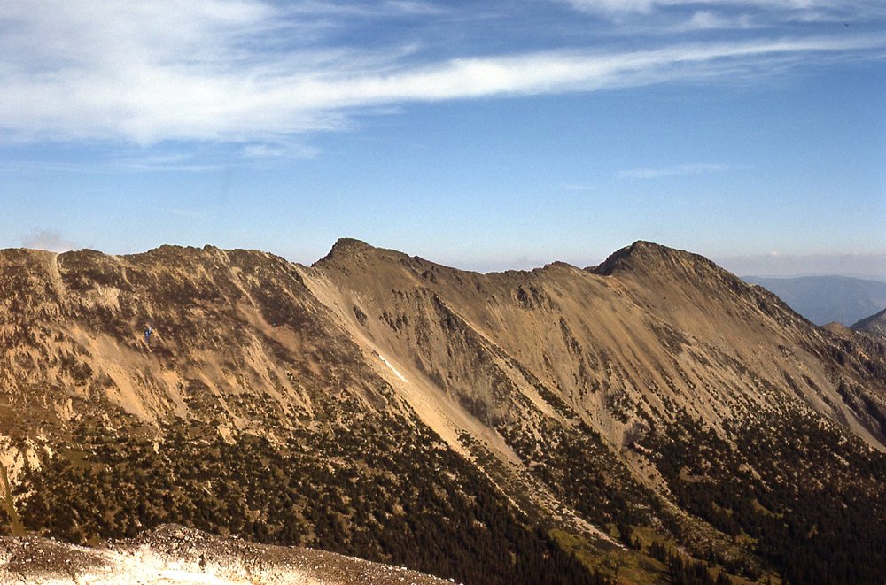
This next one had me excited – I called it Peak 8600 – I loved the look of it, and I really wanted to come back and climb it. It was due south of where I stood, and only 3 miles away.
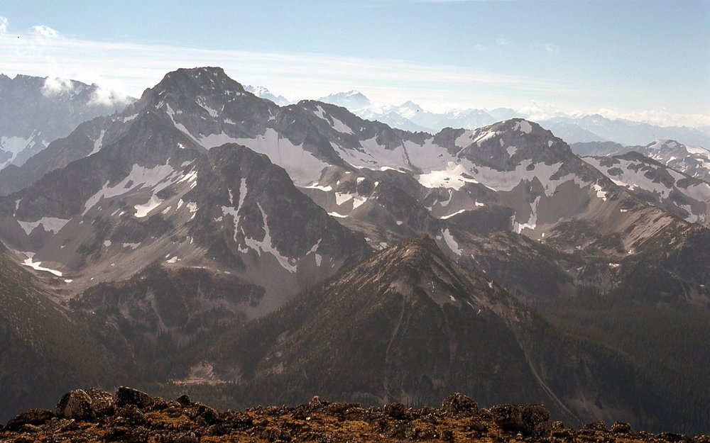
South to Peak 8600
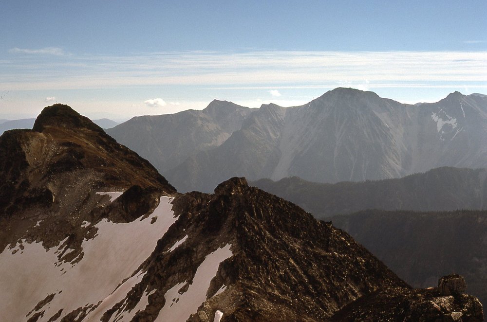
Okay, I’ve made you wait until now for the best pictures of all. Remember Stein Mountain, where all of this discussion started? Well, I could actually see it from where I stood. Let me show it to you. In this next photo, if you look really hard, it’s the little peak just to the left of center on the horizon, the one with the cloud below it. Yes, I know what you’re thinking – “What was he thinking, it’s so far away, it doesn’t make any sense to try to approach it from this side.” Yep, you’re absolutely right, what must I have been smoking to have ever even considered trying it from the north?
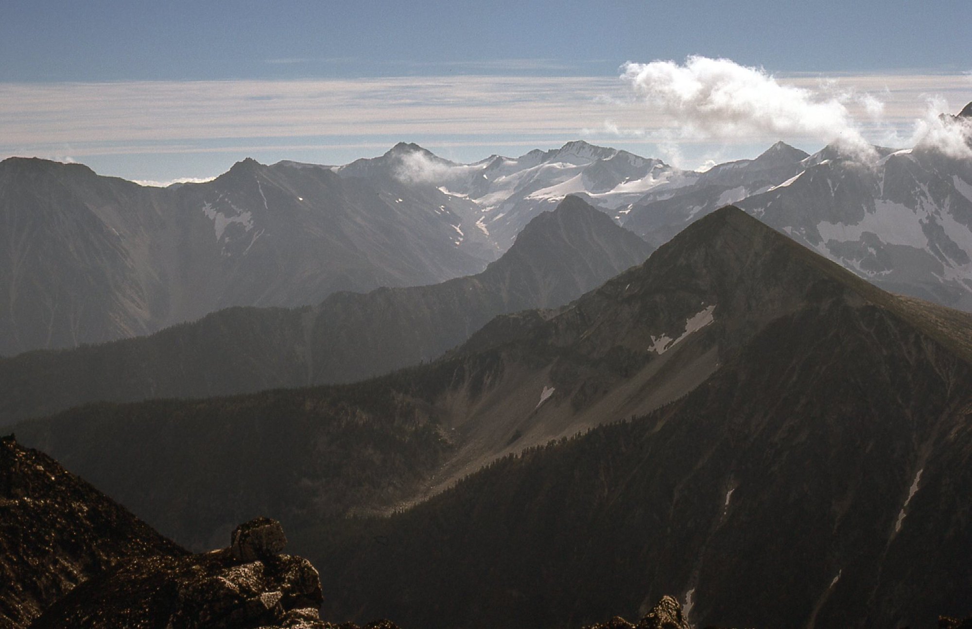
A look to Stein Mountain.
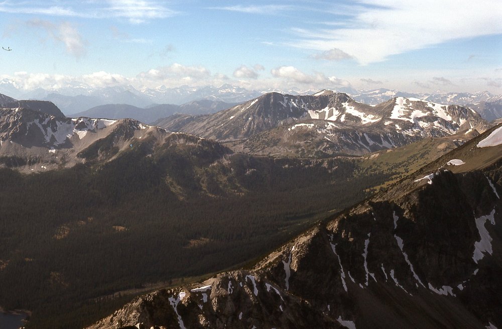
Here’s one I really like – the biggest peak in the area is Siwhe Mountain, at 9,366 feet. It’s the pointy one right in the middle of the next photo. When I took these photos in 1976, Siwhe was one very mysterious peak – nobody knew anything about it, or if it had ever been climbed. It was hard to get at, and a complete unknown. If I had stayed in that part of the world a few more years, a climb of Siwhe would have moved to the top of my list. That’s Peak 8600 again over on the right side.
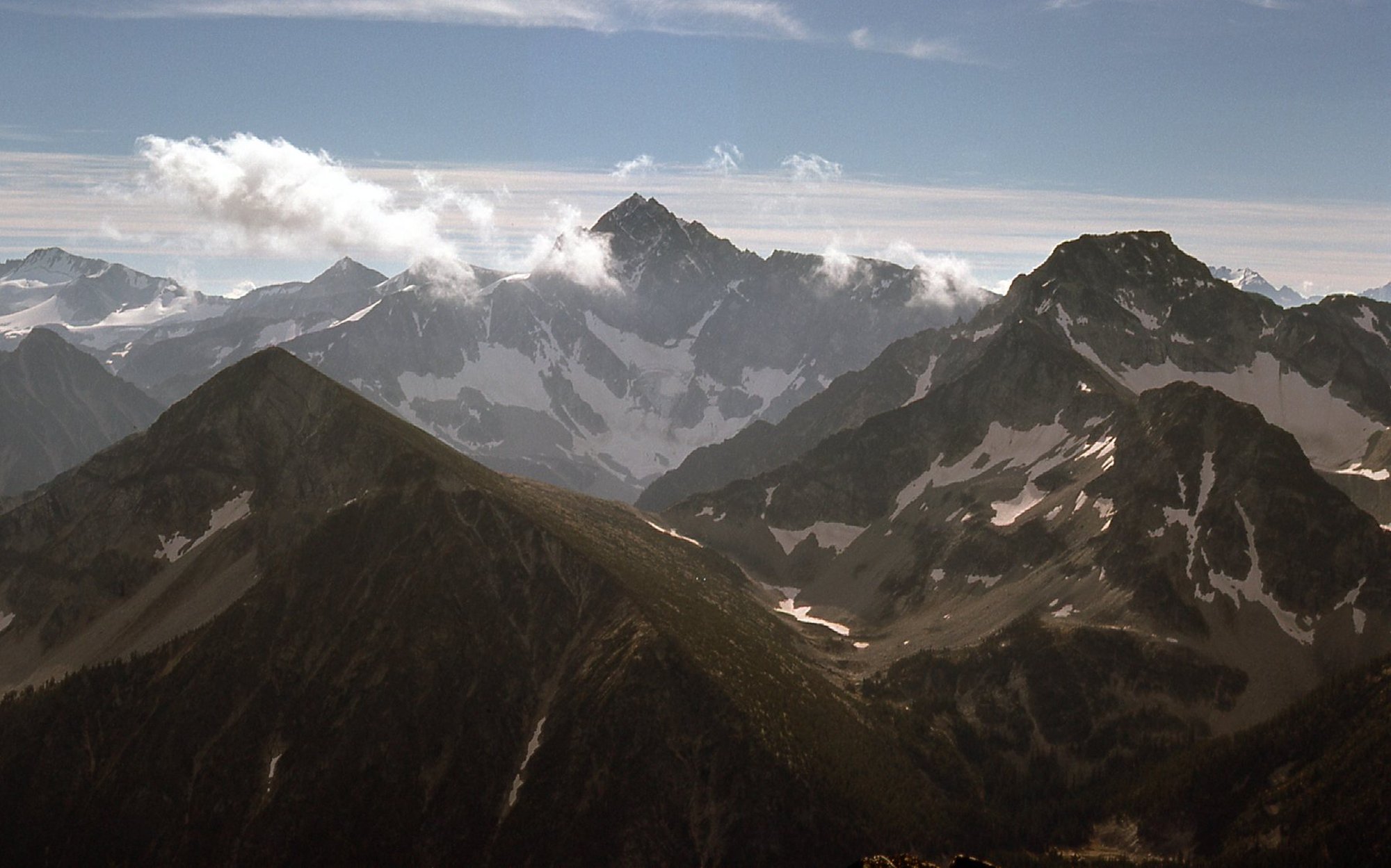
Siwhe Mountain
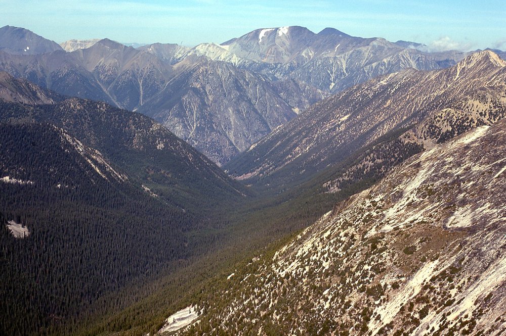
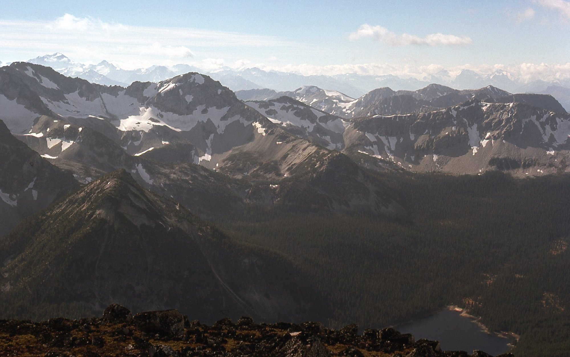
And then there’s this one, Folks, my favorite one of them all. This shows the panorama stretching all the way from Stein Mountain on the left side to Siwhe Mountain on the right side – actually, they are separated by only 3.7 air miles.
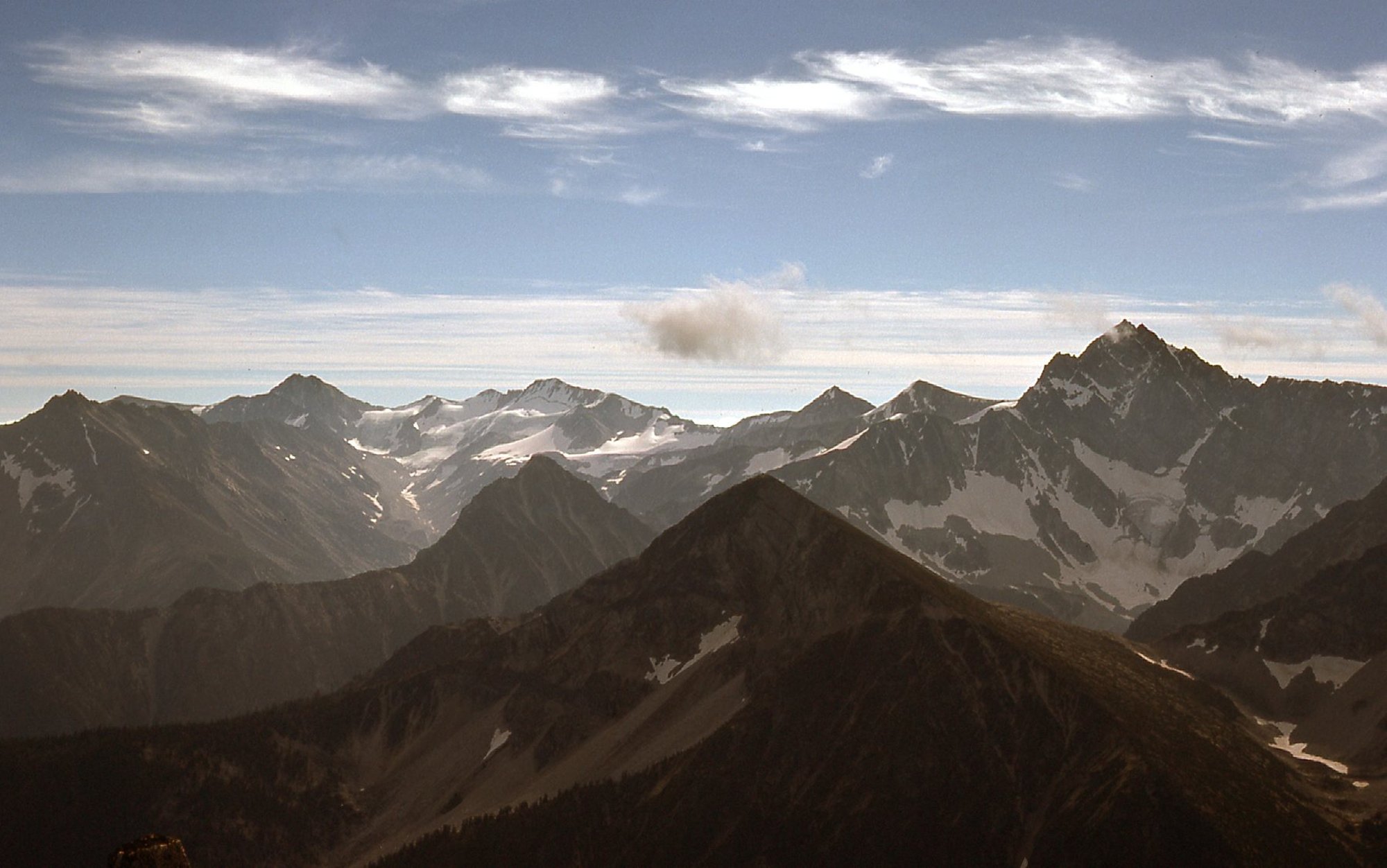
From Stein to Siwhe
I have a few more to show you that were taken from on high. Here’s a view to another nearby peak that contoured at 8,100 feet near me.
Another Peak 8100, to the east
There was a nice-looking ridge over to the northeast that was about 8,000 feet.
Looking northeast.
In this shot, we are looking east down what would be the south branch of Intlpam Creek.
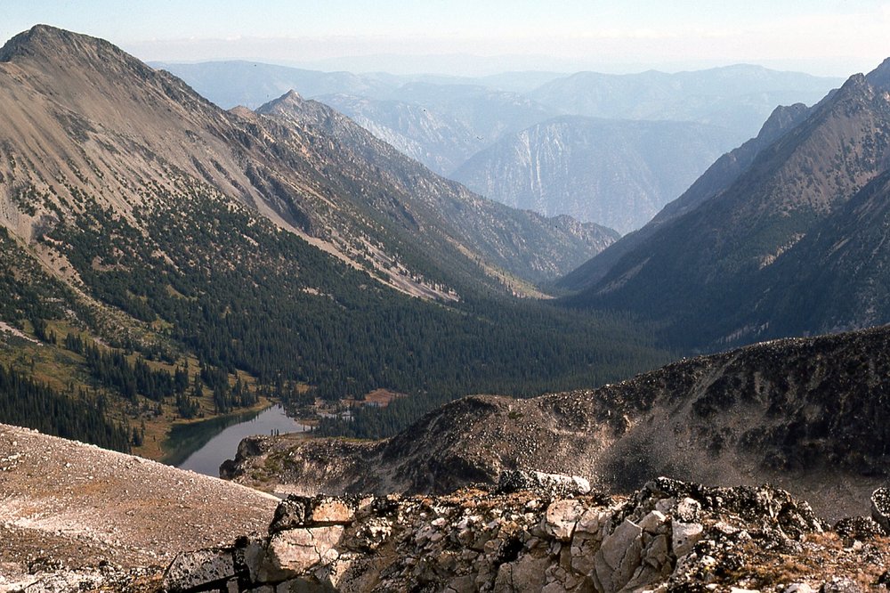
The south branch of Intlpam Creek
I had this view down to a rather glacial lake sitting at 7,300 feet.
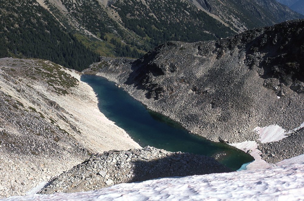
This lake was 1/4 mile long.
This was the only picture I took of Devil’s Lake, taken from the summit of Peak 8100, so it is 2,500 feet below. We are looking southwest. The outlet of the lake is at the end nearest us.
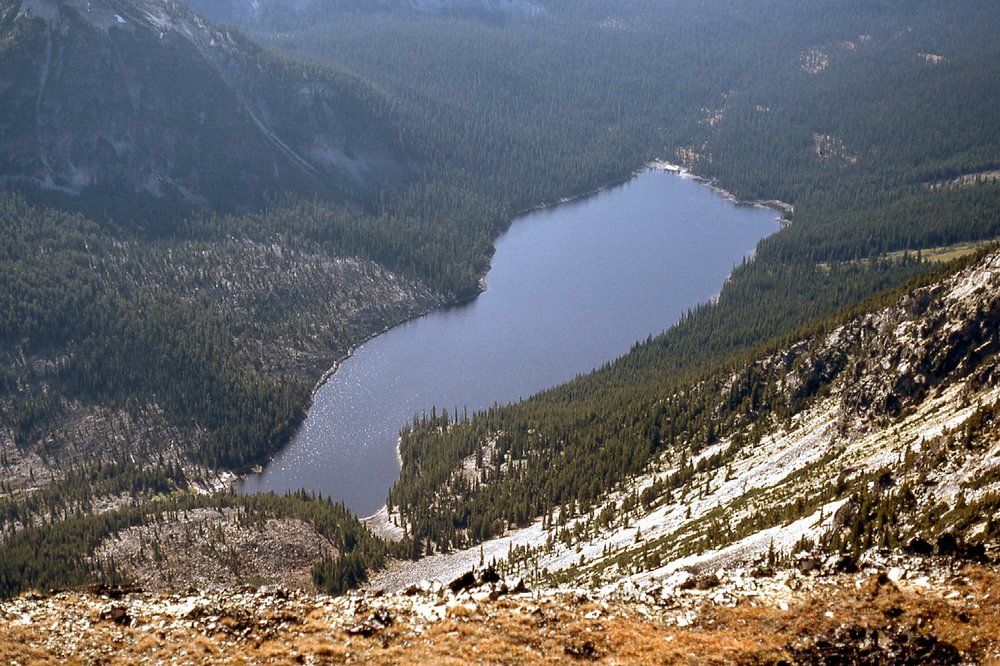
Devil’s Lake
Photography done, I started back down. At around 7,900 feet, I stopped for this selfie in a meadow.
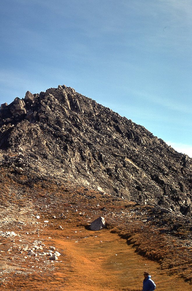
Self-portrait
Back at the lake shore at my bivi site, I packed up my stuff and hit the trail. I fairly flew down the trail, covering the entire distance to my car in 3 hours and 20 minutes – I practically ran much of the way. I stopped in Lytton to pick up the flat tire which had been repaired and made it back home to Mission by 10:30 PM. Two things I want to tell you to end this tale.
The year after my visit to Devil’s Lake, I made an attempt on Stein Mountain. I wrote a story about that climb, which you can read here:
In the summer of 2021, during an incredible heat wave when the village of Lytton reached a temperature of 121.3 degrees F., setting a new, all-time high-temperature record for the country of Canada, a fire broke out and swept through the village and burnt virtually all of it to the ground. It was a tragic loss of life and property.