
This is the latest in a series of stories previously posted on this website which lacked the photos I would have liked to use. I am happy to say that photos from this climb have now been found, and I would like to present this climb in a new light. There will be changes from the previous text to go along with the photos, and I hope that overall the result is an improvement on my previous offering.
Living in British Columbia in the 1970s, Mexico seemed awfully far away. Nevertheless, many of us climbers living in the Great White North turned our thoughts to the big volcanos down south sooner or later, and a goodly number of us eventually made the pilgrimage. The fact that Mexico boasted the 3rd, 5th and 8th-highest peaks in North America was one helluva draw, and pretty hard to resist. Those peaks represented a pretty easy and inexpensive way to get some experience climbing up high, at least a lot higher than anything outside of the Yukon or Alaska. I had kept up a pretty furious pace of peakbagging for several years, and by the time 1976 rolled around – well, I figured it was time to go give those volcanos a try. I didn’t know anyone else who wanted to go, so I just up and decided to head down there by myself.
In March, I flew via Canadian Pacific Airlines from Vancouver to Mexico City. I joked with the ticket agent in Canada that they’d better not lose my baggage, as everything I needed to climb was in that large backpack – sleeping bag, ice axe, crampons, and everything else I’d need – and if it went astray I’d really be in a fix. Well, you guessed it – by the time I got off the plane late in the evening in Mexico City, my backpack was nowhere to be found. Man, was I pissed off! They told me it would come in on a later flight and I could pick it up in the morning. Easy for them to say. I ended up spending the night in my rental car in the airport parking lot, and very early the next morning I found my backpack, which had arrived mysteriously in the middle of the night. I hot-footed it out of the capital and made a bee-line for my first peak.
My adventures while climbing Popocatépetl have been well-documented in another story already published on this website – you can use the search bar at the top of the page to pull it up under that name and read all about it. To say that I stumbled badly on that climb would be an understatement. Yes, I did reach the summit, but slowly and painfully, dealing with acute mountain sickness the entire time on the mountain. I was lucky to summit at all. Once down off the mountain, my symptoms disappeared completely. I stopped at a restaurant in Amecameca, a town at the base of the peak, and ate a huge meal to celebrate. There, at 8,140 feet, with all that extra oxygen, I felt like Superman. It was a drive of 355 KM from Amecameca to my next destination of Tlachichuca, in the state of Puebla. I arrived several hours later, at 3:30 that afternoon, ready to tackle my next peak.
The 3rd-highest peak in North America is commonly known as Pico de Orizaba, but many would argue its proper name is Citlaltépetl, from the Nahuatl words meaning Star Mountain. Mexico’s highest peak, it is only exceeded in height in North America by Mt. Denali in Alaska, now thought by many to be 20,310 feet, and Mt. Logan in Canada’s Yukon, at 19,551 feet. Nevertheless, at 18,491 feet, Orizaba is no slouch. It’s easy to get to and inexpensive to climb, so it attracts mountaineers the world over wanting to climb high quickly with a minimum of hassle. It doesn’t hurt that it’s the 7th-most-prominent peak in the world.
All the way back in Canada, I had heard through the grapevine that if you wanted to climb Orizaba you should look up one Señor Reyes upon arrival in Tlachichuca. When I rolled into town in my rented VW Beetle, he wasn’t around, but I did speak to his wife about hiring a Jeep and driver to take me up to the climber’s shelter high up on the mountain’s flank. Soon after that, a group of 7 Americans showed up. They had driven down from the States and wanted to try to drive the road in their own vehicle (I no longer remember what kind it was). I went with them, but we didn’t fare well – either we got off track, or they feared the road was too rough for them to drive. In any case, once back in town, I arranged with Sr. Reyes a truck large enough for all 8 of us plus our gear for the following morning. We arranged rooms in a place called La Casa Roja, and had dinner there too.
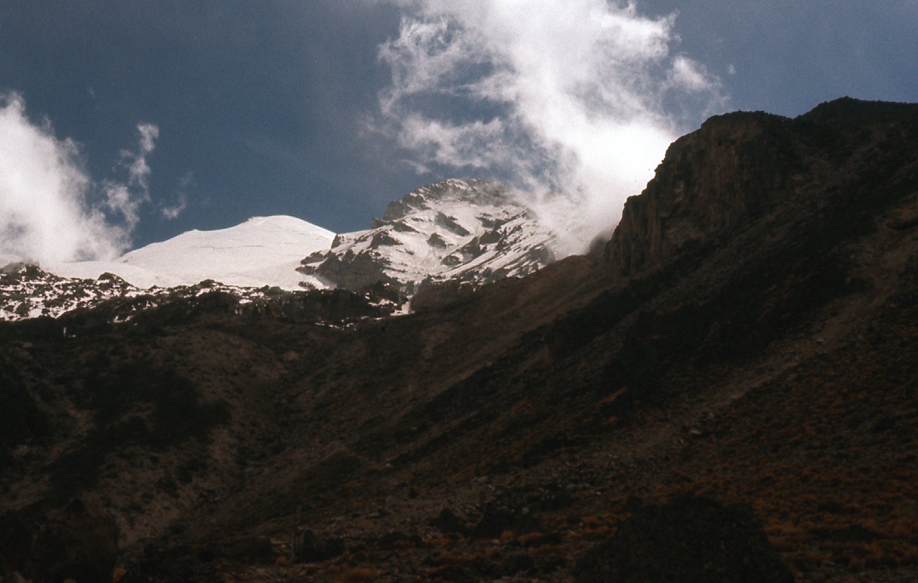
Early the next morning, the old beater truck arrived. We all piled into the open bed (it was a pretty big truck, bigger than a pickup), and two sat up front. It was a long, slow ride, the truck grinding its way up the ever-worsening dirt road filled with potholes and rocks. Here is a photo I took from the back of the truck soon after starting out.
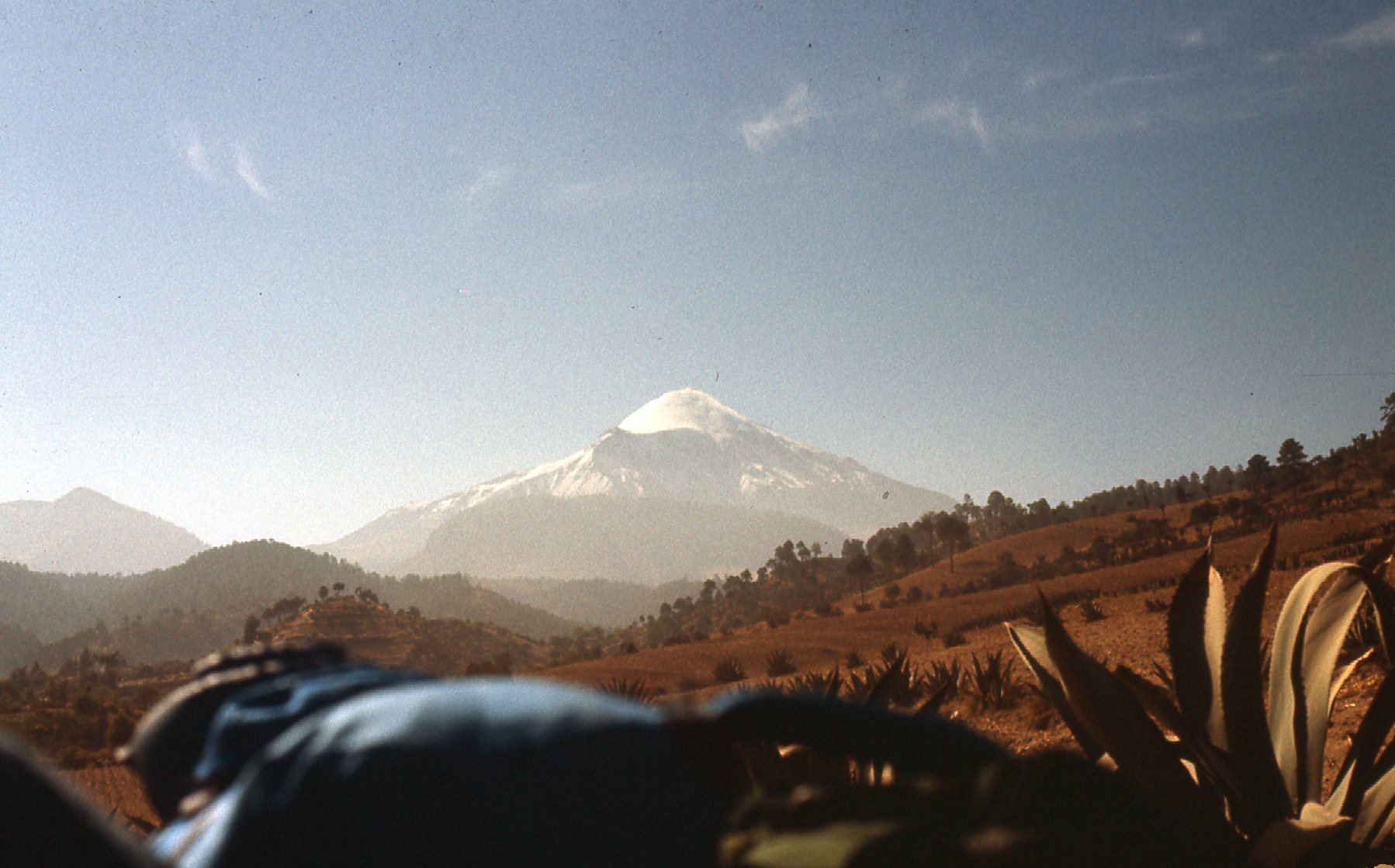
A distant look at Orizaba.
We stopped for a while at the village of Hidalgo at 11,150 feet elevation – there, our driver left us for a while and ducked into a house by the road for a meal – it may have been his home. After way too long, he returned and we continued.
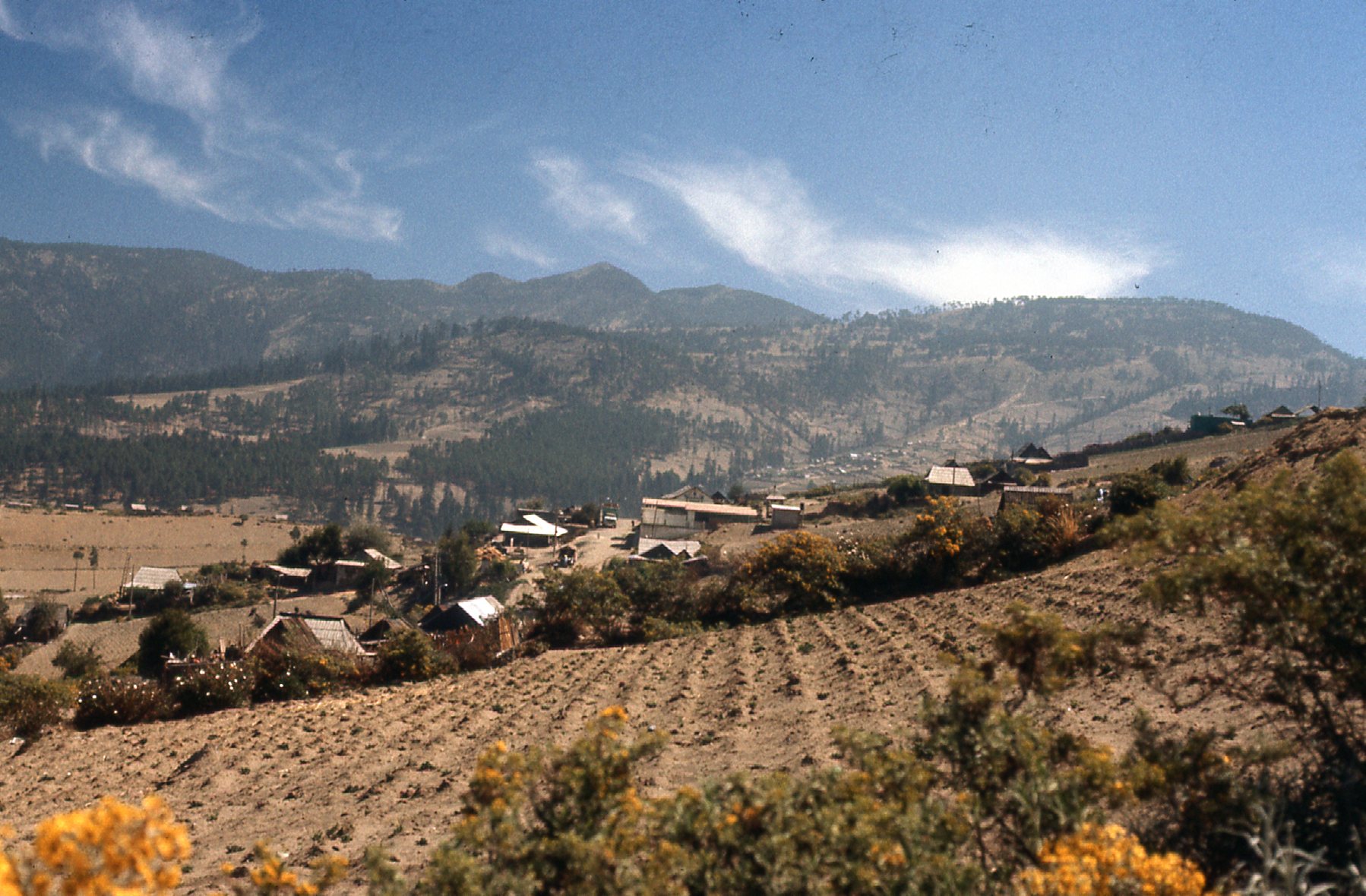
Near the village of Hidalgo.
A brief stop, getting closer to the mountain.
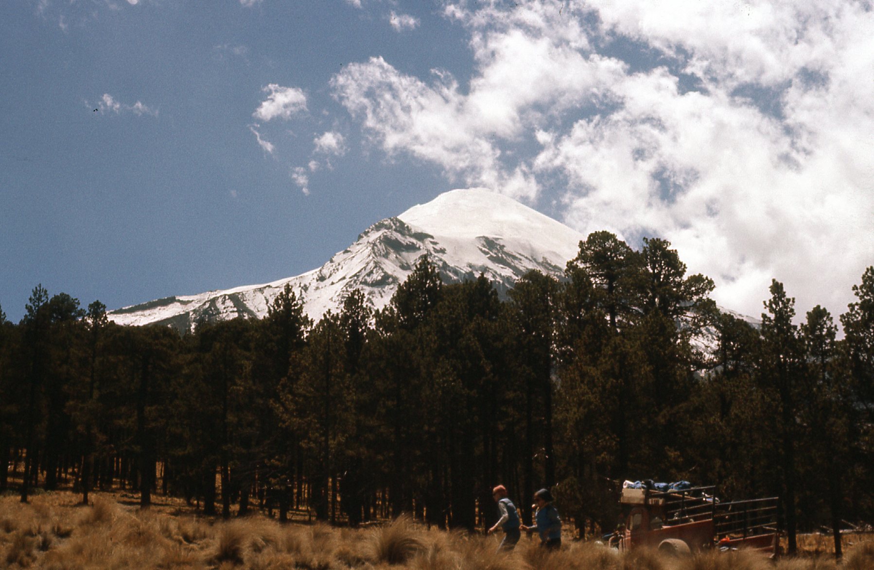
The road got even worse. It was a 25-KM drive from Tlachichuca to reach the Piedra Grande hut at around 14,000 feet. We quickly unloaded our stuff and our driver didn’t waste a moment starting back down, after agreeing to pick us up late the next day.
There aren’t a whole lot of big mountains you can climb by first driving up to 14,000 feet, so this was a pretty unusual start. Two huts were there: a small one that could sleep 10 people, and a big one that could sleep as many as 80.
The small hut, at 14,104 feet elevation.
This is the larger of the huts.
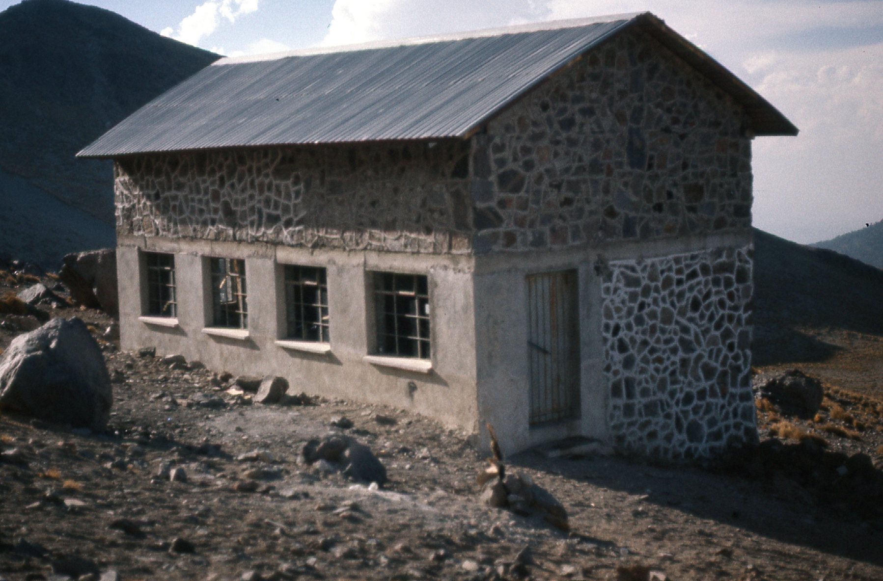
The newer hut could sleep 80 people, but if pressed you could squeeze in 100.
They were cold and stark – shelter from the storm, but that’s all. There were no facilities at all – no water, no electricity, no nuthin’, unlike the glamorous huts in the Alps and other places. Just a place to lay out your sleeping bag, that’s it. You need to bring everything you’ll need on the mountain with you up to the hut. But hey, you couldn’t argue with the price – they were free for anyone to use.
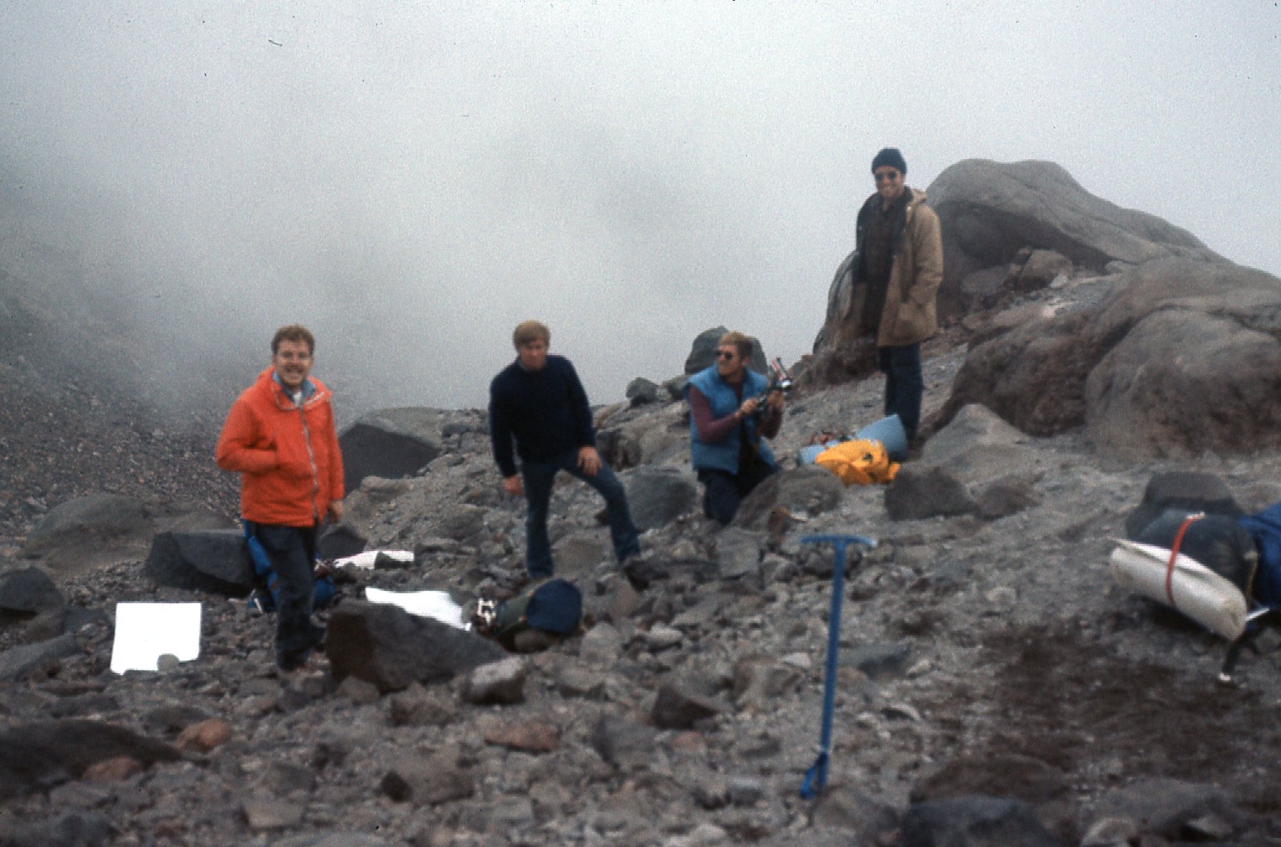
To put a bit of perspective on things as they stood at that point – here the 8 of us were, at 14,000 feet. I had just come directly from several days and nights on Popo, up high – up to 17,800 feet – and I felt great. These guys had just driven in directly from the USA, with no time at all up high to acclimatize. Even at the hut, they felt like crap. In their team, there were 4 men and 3 women, and the women felt even worse – I don’t know if they had any climbing background at all, but they quickly decided that they wouldn’t go for the summit – they’d wait at the hut until our return and keep each other company. There were no other climbers on the mountain at the time, so it seemed safe enough.
In the course of discussing the climb with the men, I strongly urged that we move higher to sleep. It would give us a better chance to summit on our one and only day on the mountain. They weren’t too excited about the idea of going even higher right away, as they too felt pretty crappy. I, on the other hand, felt up for anything. Maybe in their brain-addled state my reasoning made sense, because they agreed.
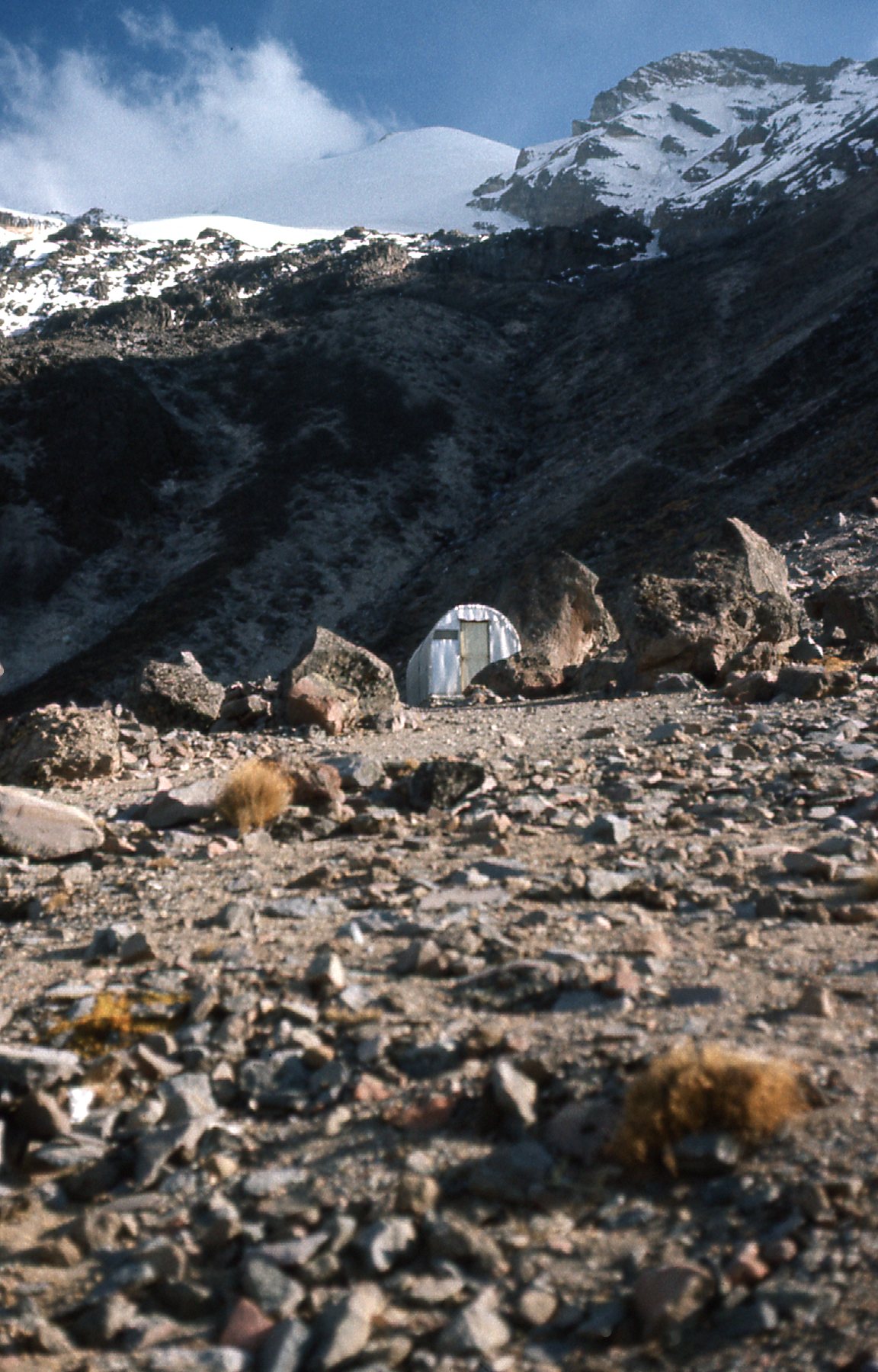
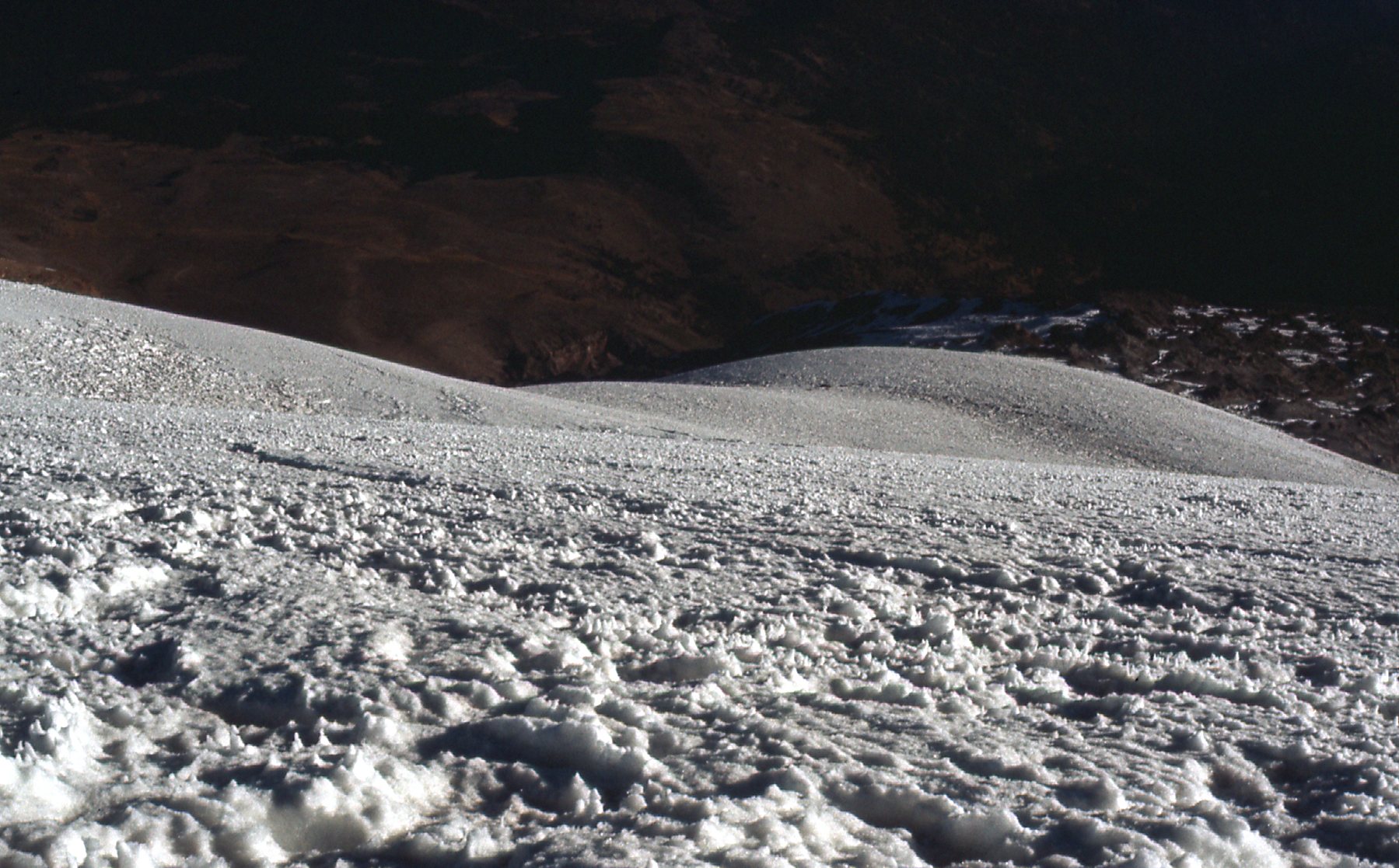
We set out for a higher camp – I’d heard that if we climbed up to the foot of the glacier, there were flattish bivi sites there, and also a source of water, flowing from beneath the toe. In 2 hours, we got there, and found a good spot to camp at 15,450 feet. All of the guys felt even more awful by then – nauseous, vomiting, pounding headaches – the classic symptoms of mountain sickness, just like I’d recently experienced on Popo. I, in turn, was feeling like a million bucks, as if I were at sea level – I had a good appetite (“are you going to eat that?”) We were camped in a tumbled area of rocky rubble at the toe of the glacier.
This is where we stopped for the night.
This is looking down to where I would bivouac, at 15,450 feet elevation.
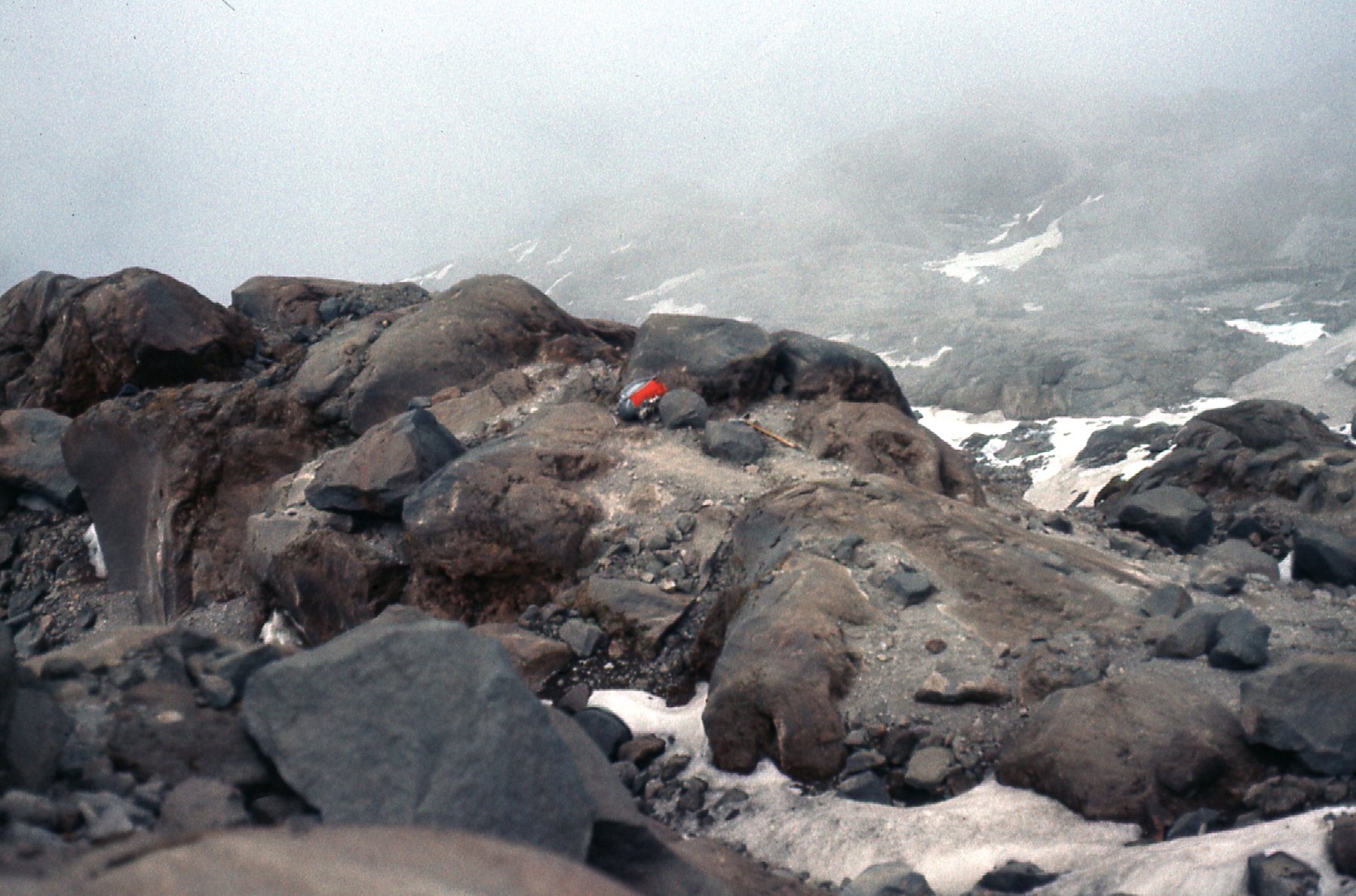
My bivi site.
Here are other views we had from where we camped.
A lower part of the northeast ridge.
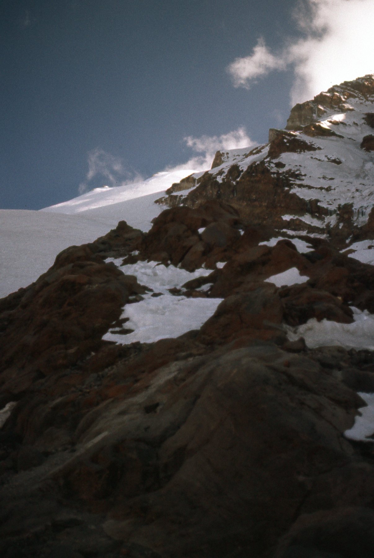
The north side of the peak in the evening.
A look out to the northeast in the evening.
As I lay in my sleeping bag, all warm and belly full, I stared up at the night sky, awash in satellites and meteorites, and overflowing with intensely bright stars. Overnight, it only dropped to +23 degrees F.
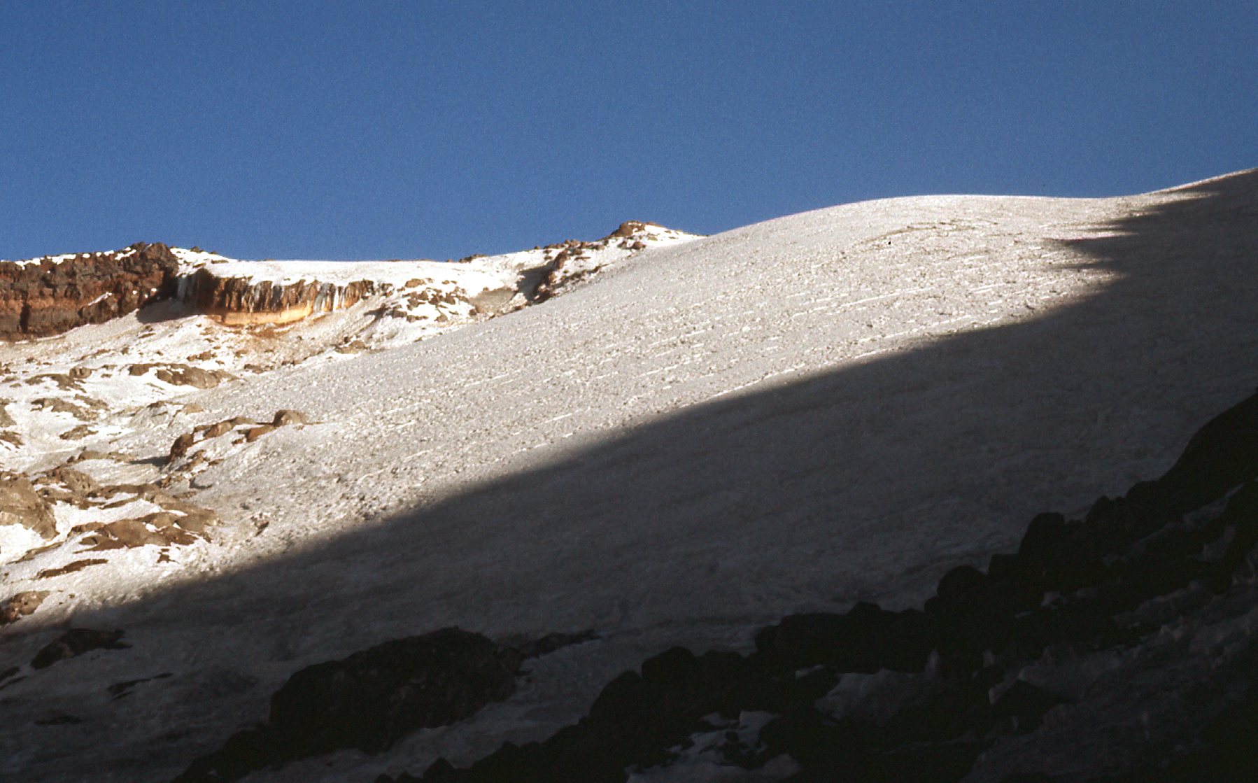
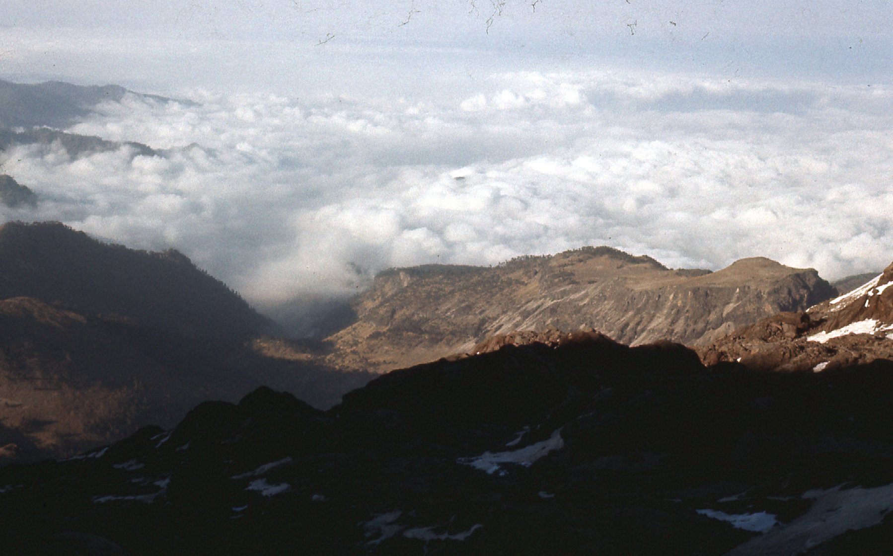
I slept well; the others, poorly. We arose super-early, and were finally climbing by 4:20 AM. Comet West was nothing short of spectacular in the early-morning sky. We moved well, and by sunrise at 6:20 we were at a col at almost 17,000 feet. Before the sun came up, the winds were fierce, making it feel much colder. When the sun rose, the air didn’t feel as cold, but at 17,500 feet my feet were freezing. Here is a view we had down to a saddle.
Looking down to a saddle on the north slope.
Here, we were still together.
Still together at this point.
Here is a look down the slope.
Here is the view down from the same spot.
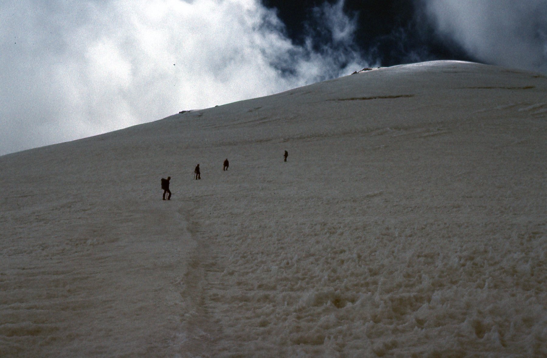
After that, we all moved up more slowly and became strung out over hundreds of yards up and down the mountain.
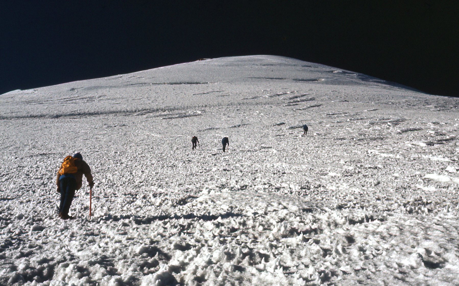
On the north side of the peak.
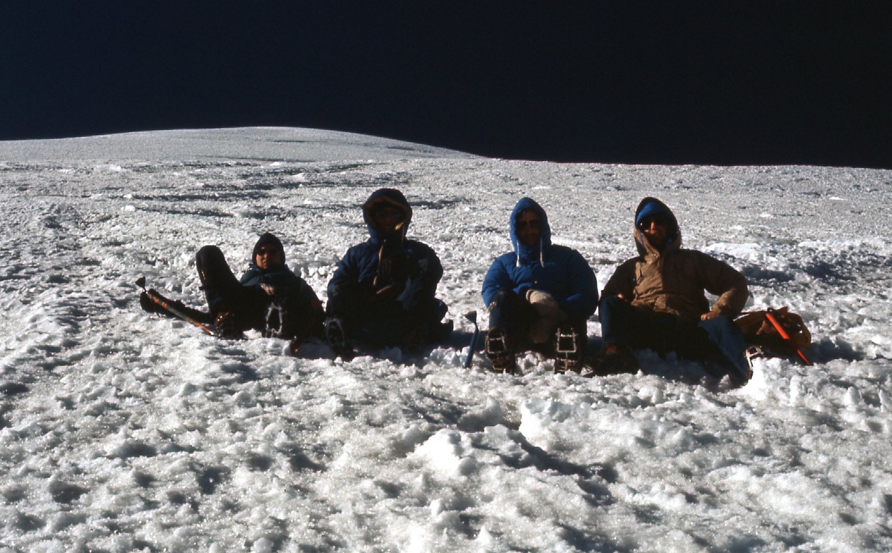
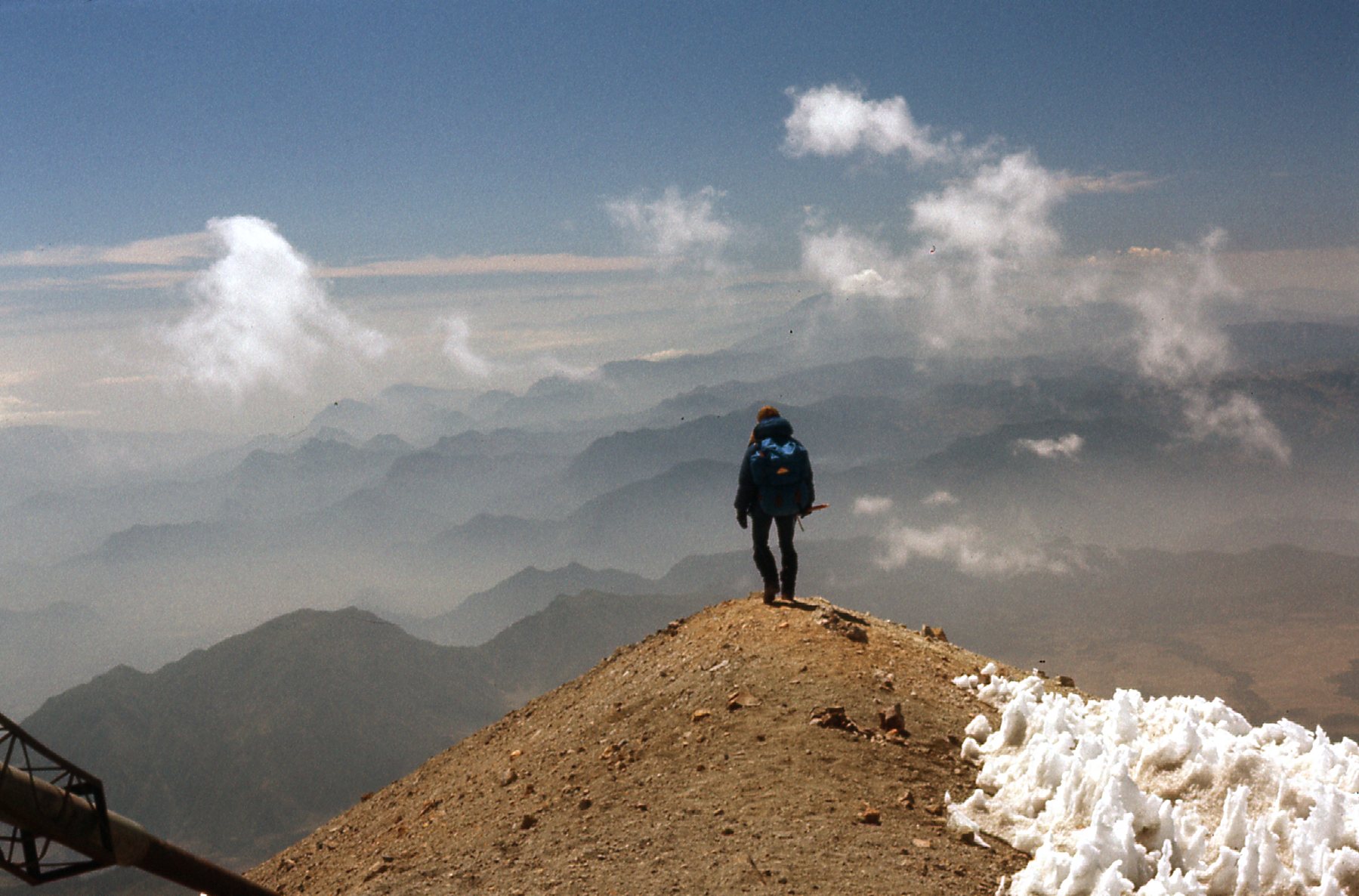
By 10:20 AM all 5 of us stood on the summit. Three of the Americans were vomiting, and all 4 of them had fierce headaches – I, on the other hand, still felt fine, thanks to my time spent on Popo. The crater rim at the summit was steeply inclined, and its walls steep and rotten; the crater was very deep, and God help anyone who should fall in. A blissful half-hour was spent on top – the views were outrageous, and our camera shutters clicked non-stop the whole time. Here are my summit photos.
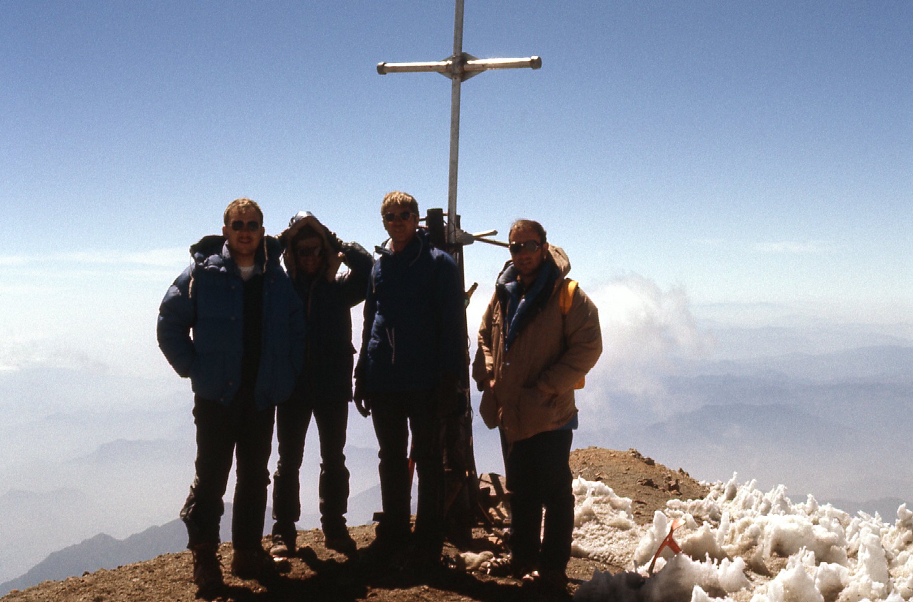
On the summit, at 18,491 feet.
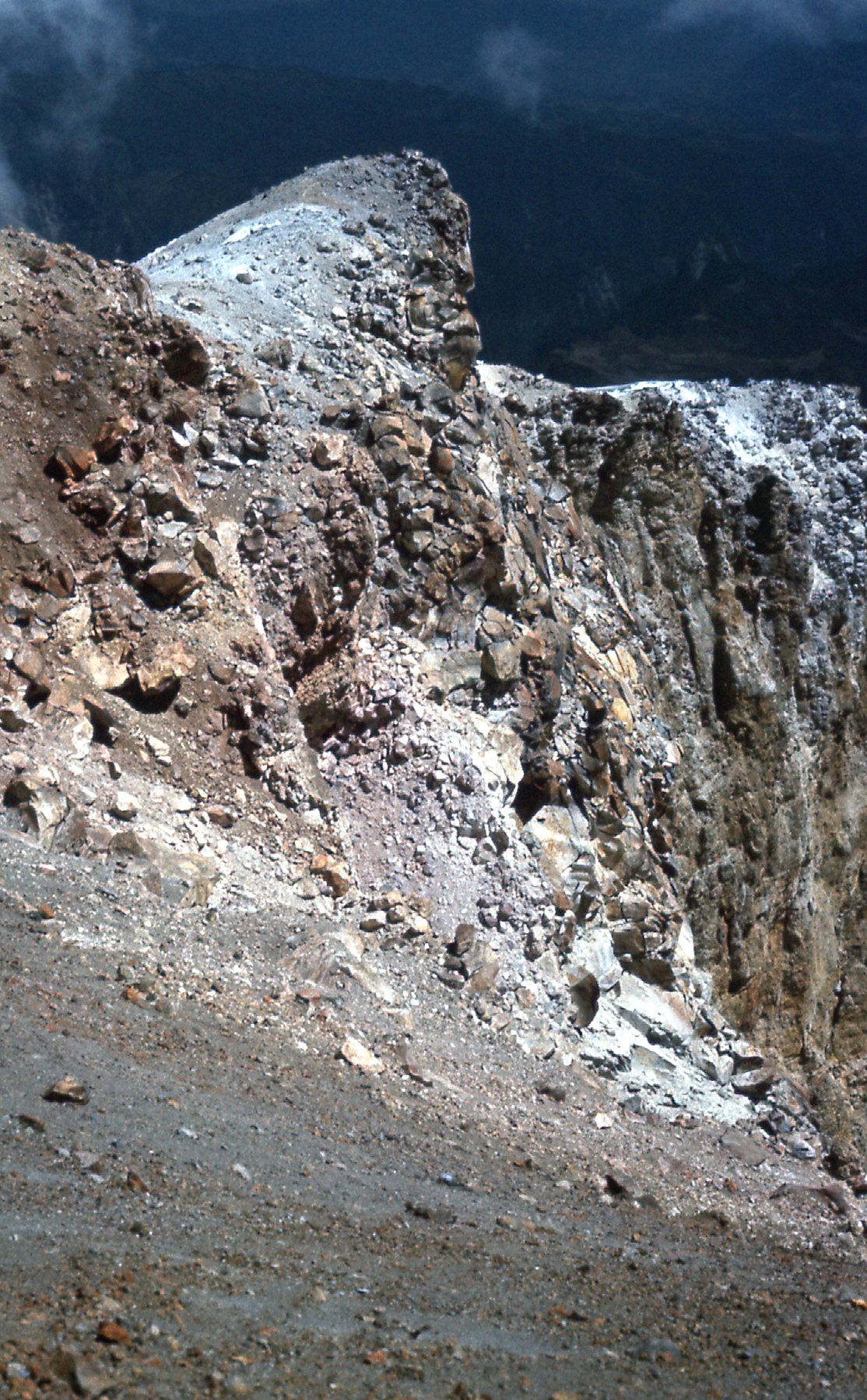
The northeast wall of the crater.
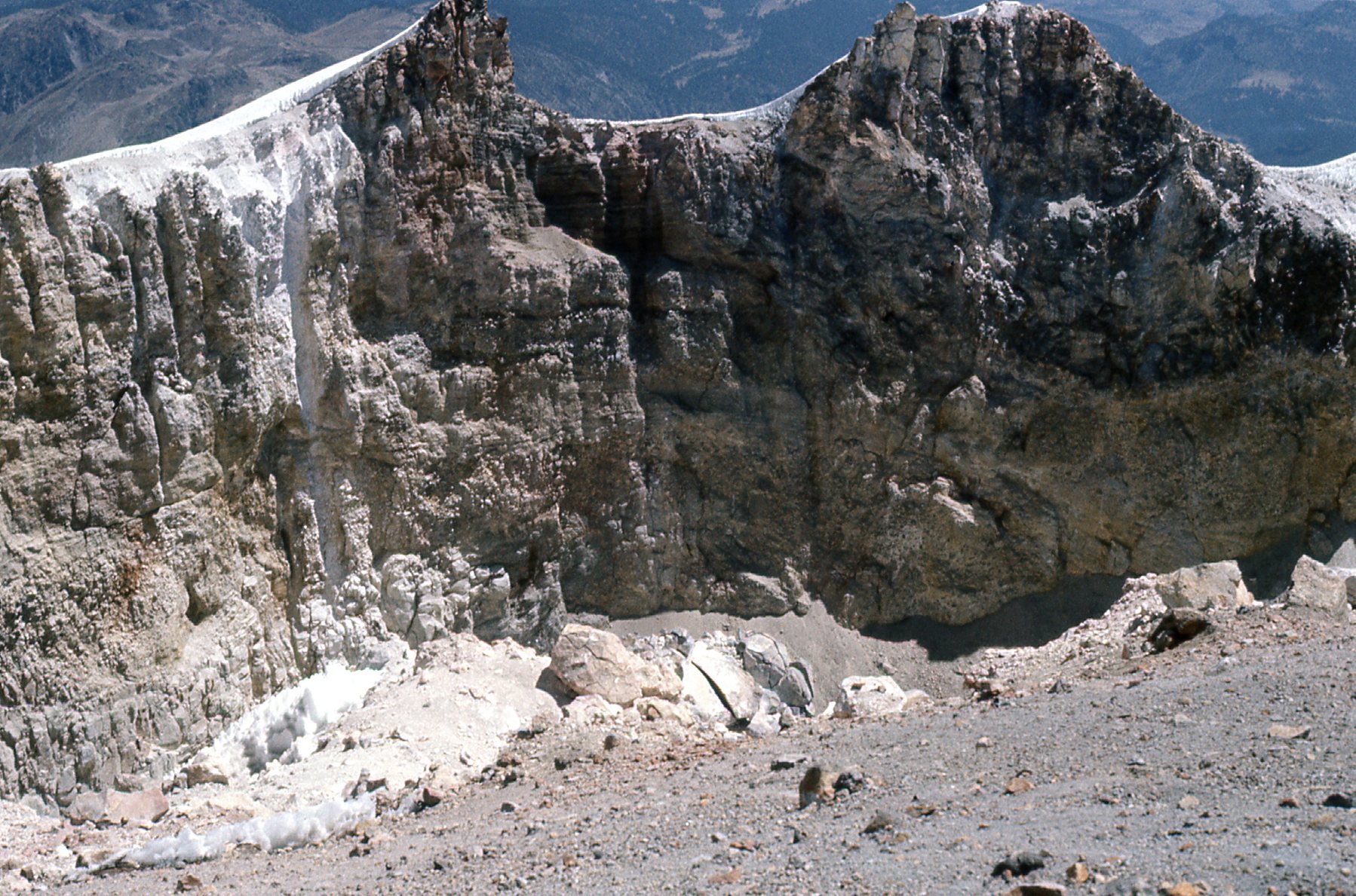
The east wall of the crater.
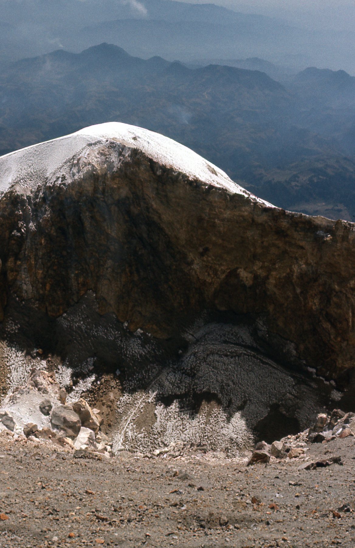
The southeast wall of the crater.
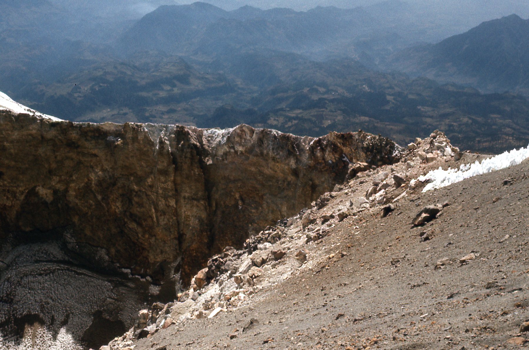
The south wall of the crater.
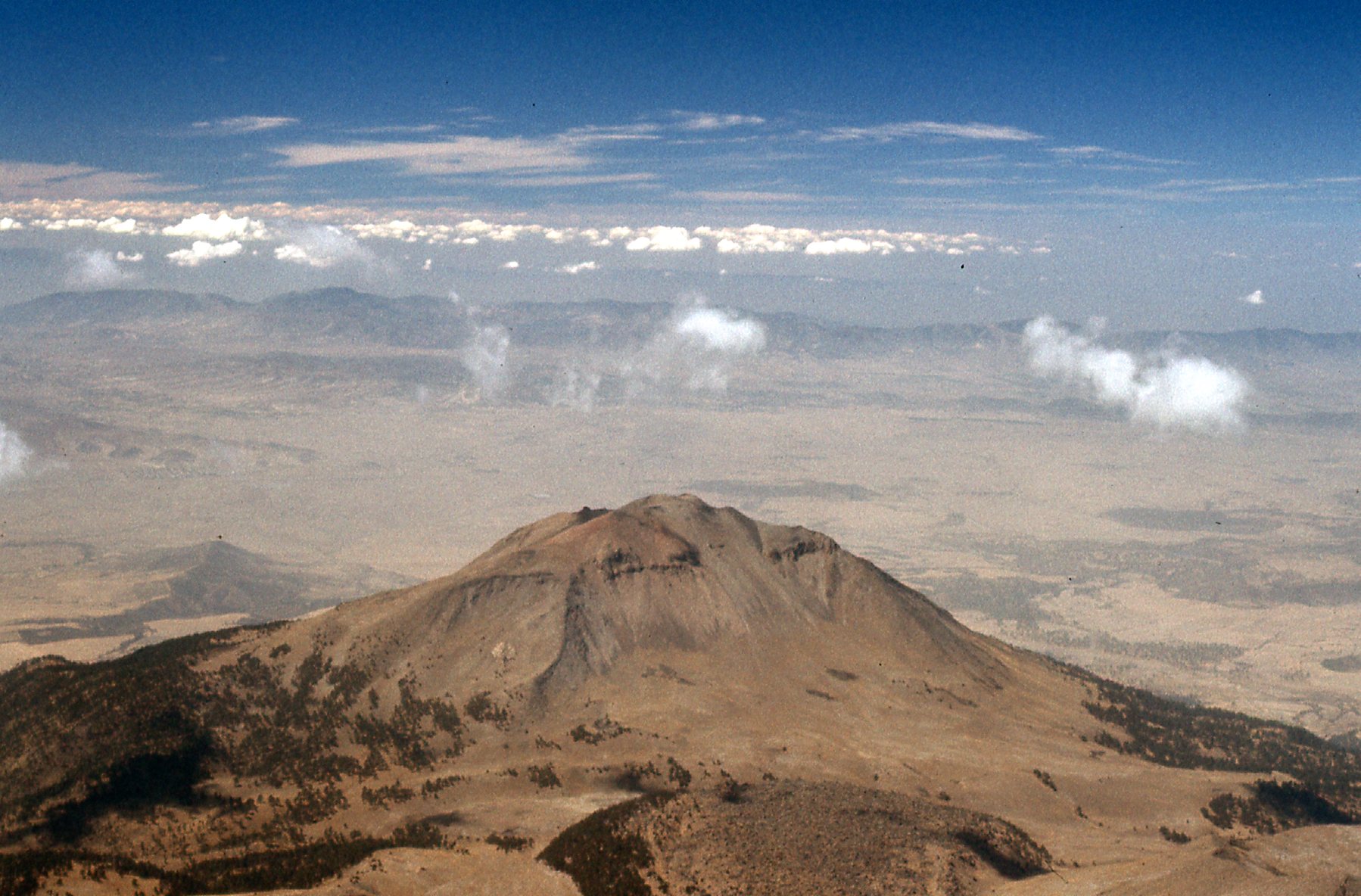
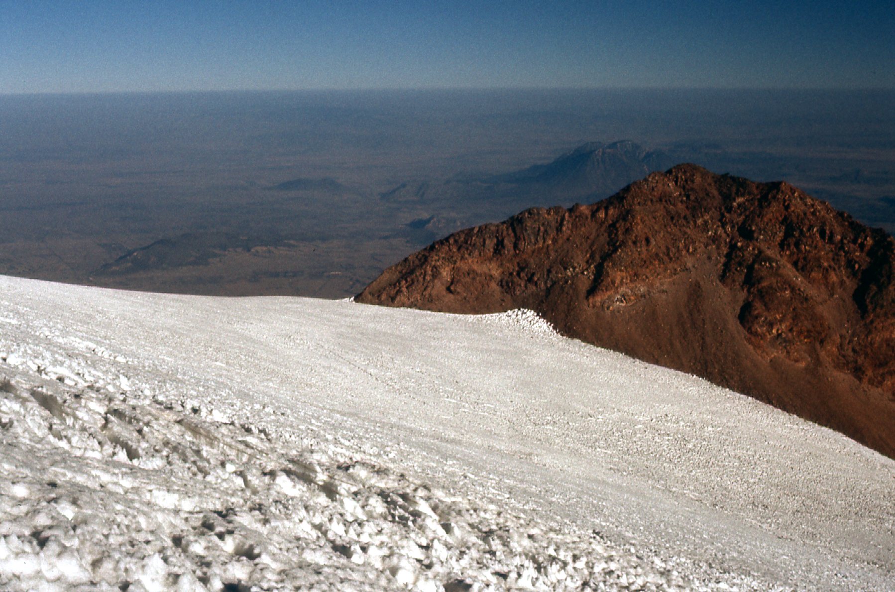
Looking west from the summit.
Looking south from the summit.
There was quite a collection of nieves penitentes at the summit.
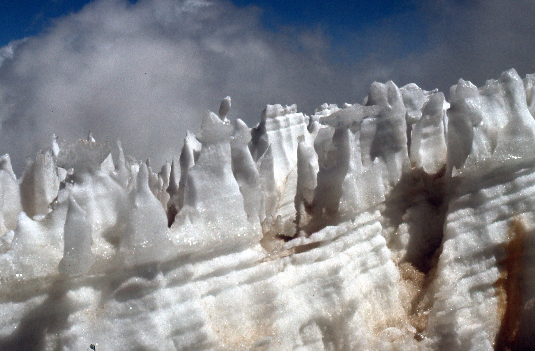
Nieves penitentes
Our descent was slow, due to the poor state of the others.
All strung out coming down.
Here is a view we had while descending, a look down the northeast slope.
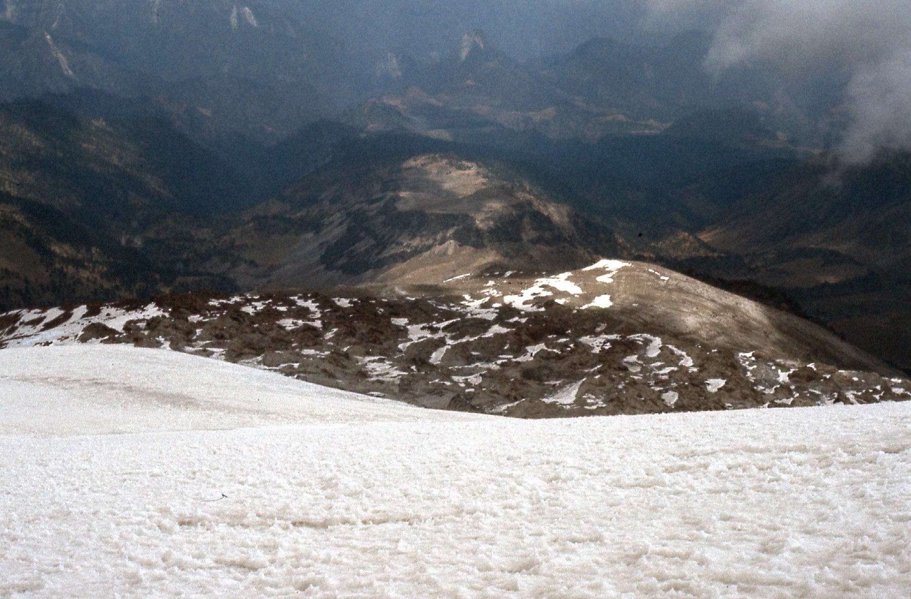
The lower part of the northeast slope.
And once back at the hut, here was a view looking back up the north side of the peak.
Looking back.
I arrived back at the hut first, at 2:30 PM. The 3 women had fared no better, and were all feeling tremendously sick from the altitude. It snowed a bit during the afternoon while we all waited for our ride down the mountain, which arrived at 6:00 PM. The trip down was much quicker than the ride up, putting us back in Tlachichuca in only 2 1/4 hours. I spent another night in town, in a flop-house so seedy that the bed-sheets were black with filth, as if they’d never been laundered (I used my sleeping bag). The Señora who ran the place did manage to rustle up a plate of black beans and rice for my supper, and I considered myself lucky at that.
I spent a few days as a tourist after that, in Puebla, Toluca and finally in Mexico City. Two odd memories remain of those final days. The first was the result of not wearing sunscreen on the climb. All of the skin on my forehead came off one evening in my hotel room – crispy and hard, like a big potato chip, with bright pink skin weeping underneath. Sorry if that was TMI.
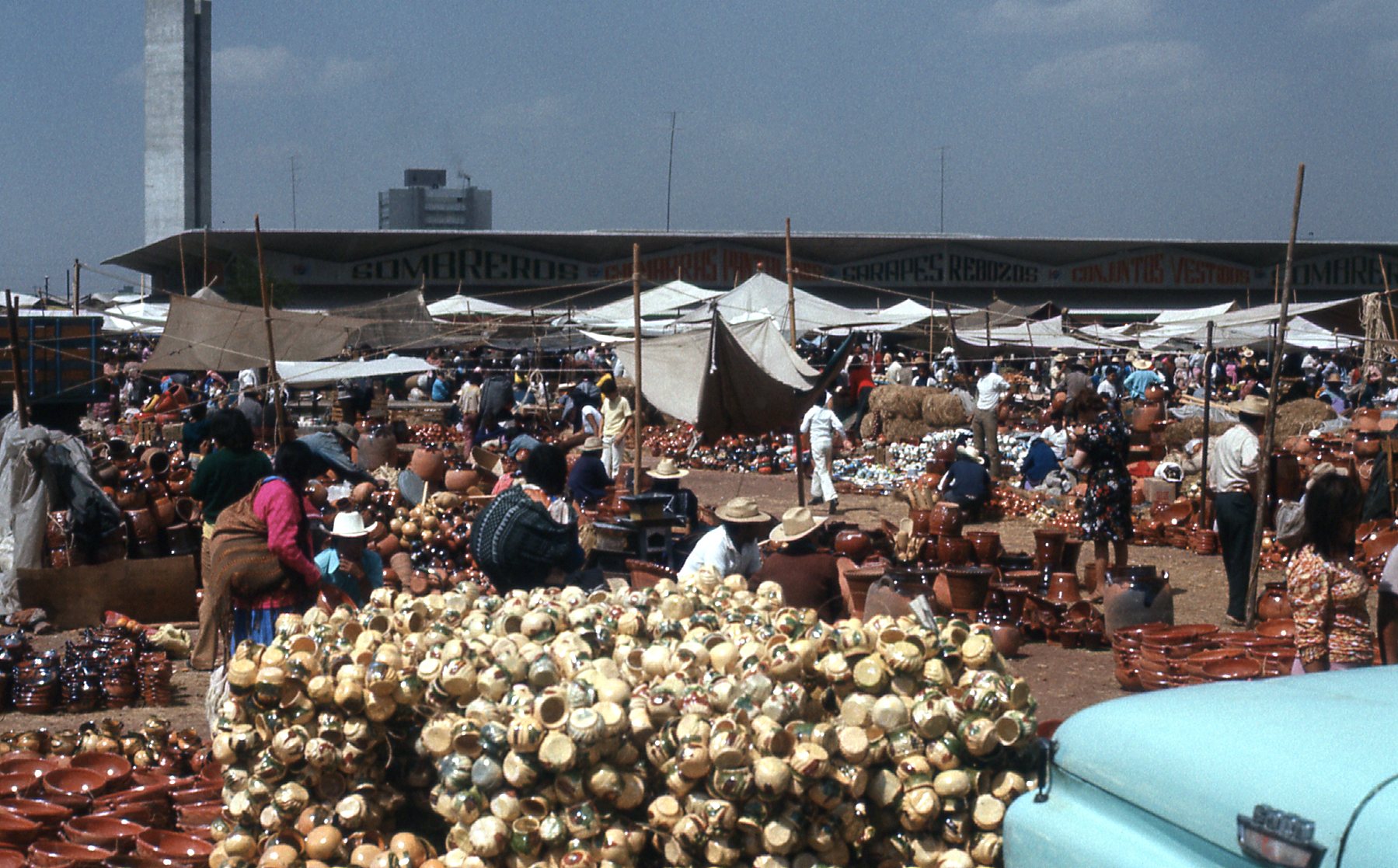
A Toluca marketplace
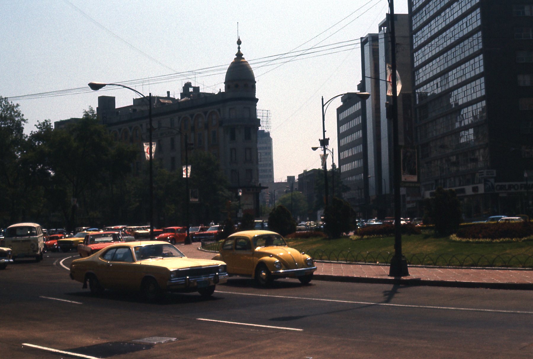
Paseo de la Reforma in Mexico City
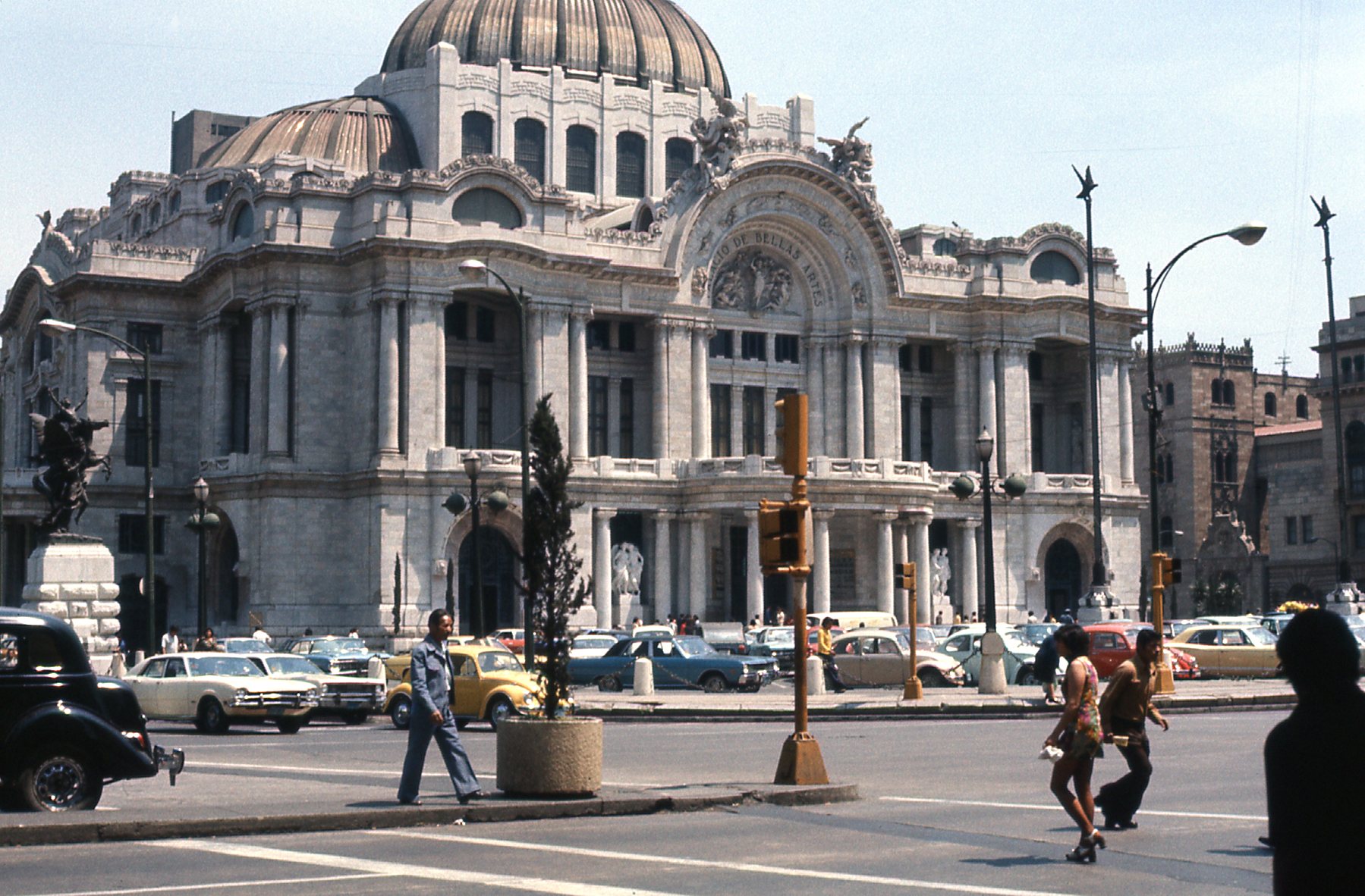
Palacio de Bellas Artes
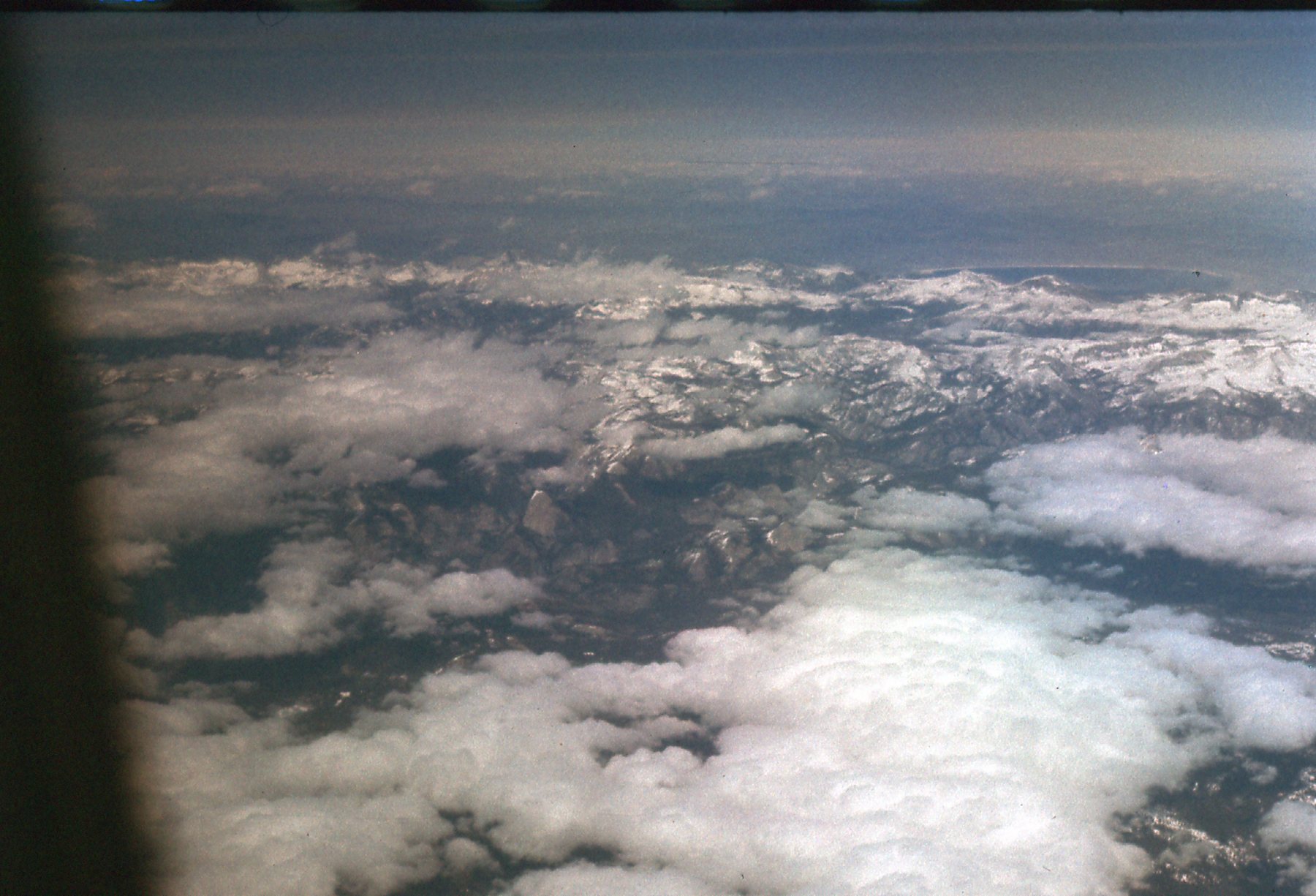
On the flight home, passing by Yosemite.
The second was more interesting. One afternoon, while driving my rented, shiny, new VW Beetle in Mexico City, I was pulled over by a traffic cop who was on foot. He told me that I had committed una infracción. It was obvious he wanted a bribe. I told him I didn’t need any hassles, as I was flying out in the morning for Canada. To this day, I remember his response: “Señor, I would like to help you, but who will help me?” Okay, hopefully I could make this go away, so I opened my wallet right in front of him, and showed him that I had a traveler’s check for fifty dollars US, and also the equivalent of five dollars in pesos. He was really pissed off, having hoped for a much bigger payday. The check was of no use to him, and the pesos were insignificant. Remember the Americans with whom I’d climbed on Orizaba? They had run into an identical traffic stop, and had been separated from 100 of their US dollars. He begrudgingly took the pesos and let me go, keeping a sharp eye out for his next mark.
Footnote: in the 47 years since I climbed Orizaba, the toe of the glacier on this route has receded all the way back to 16,100 feet due to climate change. Also, when I climbed, it was believed that the elevation of the mountain was 18,696 feet – compare that with the present, more accurate elevation of 18,491 feet.