
You’d think that with a valley almost 40 miles long, there’d be somebody living there. At least a few somebodies, right? Well, there are, but not many. The main reason is that it’s on the Tohono O’odham Indian Reservation, which has been losing population for many years. I’m talking about the Aguirre Valley, which occupies the northeastern corner of the reservation. The name “Aguirre”, which is Spanish, comes from the Basque word “Agirre”, which means prominent, or an exposed place. I couldn’t find the source of the name Aguirre for this valley. The only thing that came even close was this reference in Arizona Place Names:
Epifanio Aguirre was a well-known government freighter and contractor of early days, who came west and settled in Chihuahua. On January 16, 1870, he and a party were attacked and killed by Apaches near Sasabe, Arizona. In 1874, his wife (née Mary Bernard) moved to Tucson and taught school there for many years.
I know it’s a bit of a stretch to think that maybe he (or she) might be the source of the name for the valley, but it’s all I’ve been able to come up with for now.
The entire extent of the valley lies within the Schuk Toak District, or S-chuk Tho’ag Chekshani as it is called in the O’odham language, which means “Black Mountain District”. There are 11 districts within the reservation, and the Schuk Toak District is the 7th-most populated of those 11, with a whopping 867 inhabitants as of late 2016. That’s out of a total of 13,055 living on the reservation that year. We’re talking about a huge reservation, the size of Connecticut – 4,341 square miles, to be exact. That means about 3 people per square mile living on the res (even Wyoming has twice as many per square mile). The Schuk Toak District covers roughly 650 square miles, so we come up with a density of only about 1.3 persons per square mile, well below the average for the reservation as a whole. Most of those people live within the rough bounds of the Aguirre Valley, though.
The valley is so broad that when you’re there, you don’t get such a feeling of being in a valley but rather one of being on a wide plain. If you study a topographic map of the area, you see that the boundaries of the valley are fairly well-defined in a series of mountain ranges.
The south end is the most dramatic and obvious if we’re talking about the limits of the valley. Arizona State Highway 86 runs east-west, and if we drive it, we can see the valley stretching into the distance to the north for around 40 miles. Also, the mountain ranges with the highest peaks surrounding the valley sit there, a steep wall rising above the highway on its south side. The Coyote Mountains culminate in Peak 6529, which towers almost 3,500 vertical feet above the highway and sweeps up to that summit in a mere 2 1/4 miles. Next door to the west can be found the Quinlan Mountains, their highest point being Kitt Peak, the site of a world-famous observatory. There is a paved road which whisks you up the mountain, to within a hundred feet of the summit. Kitt Peak lies only 4 miles south of the highway. By the way, if you’re looking for a bit of a challenge, instead of driving up to Kitt Peak, you can walk up the steep haul road which was built to move all of the materials up to the mountaintop to build the first telescopes. It isn’t used any more, but if you walk it, you’ll climb up about 3,200 vertical feet for a good work-out.
Nestled against the western foot of Peak 6529 is the tiny community of Pan Tak, more correctly known as Ban Thak in the O’odham language, which means “Coyote Sitting”. Only 10 people resided there back in 2010, but I’ll bet the number is fewer now. Their cemetery counts 80 graves, so we know it’s been there a long time. A more dramatic setting for a village it’d be hard to imagine. The west face of Peak 6529 towers a full 3,100 vertical feet above it in a spectacular series of cliffs and pinnacles.
Just to the northwest of the Quinlan Mountains sits the community of Haivana Nakya, more properly known as Hawani Naggiak, which translates to “Crow Hanging”. This is a sizeable place as far as the reservation is concerned, with about 150 souls. I mention it because it almost lies within the Aguirre Valley, but not quite, and here’s why. Watercourses like Pavo Kug Wash and Sells Wash sweep down from the Quinlan Mountains, heading northwest, but as they approach Haivana Nakya and sweep around it, they then turn south into the Baboquivari Valley. So, by the narrowest of margins, the village misses being in the Aguirre Valley. Close, but no cigar. Less than a mile north of the village, drainage changes and any runoff flows to the north into the Aguirre Valley.
One place that I think we can safely say lies within our Aguirre Valley is the hamlet of San Pedro. It’s O’odham name is Wiwpul, which translates as “Wild Tobacco”. With about 75 inhabitants, it sits at 2,700 feet elevation, and looks north down a gentle slope directly into the valley. It is tucked into a corner between Dobbs Buttes and Bell Mountain. Viopuli Wash comes down from the north side of the Coyote Mountains and right past the community, then continues north. It flows in its own channel for almost 17 miles, where it then unceremoniously merges with Aguirre Wash and loses its identity. San Pedro sits at the southeast corner of the Aguirre Valley.
Let’s journey north together through the valley, losing elevation as we go, and see what we find. If we examine the edges of the valley, we see that it is bounded by various mountain ranges. There are those that sit on the west side of the valley, and those that are to the east. But first, we need to mention Aguirre Wash. We could safely say that it rises near Aguirre Pass at around 2,730 feet elevation, then flows northwest, passing La Tortuga Butte to then enter Aguirre Valley proper. From there, it continues northwest through the full length of the valley for a full 42 miles until it dies an inglorious death at the hand of some levees near the western edge of the Ironwood Forest National Monument. But more on that untimely end later.
Looking at the mountain ranges along the east side of the Aguirre Valley, we need to start in the south with the Roskruge Mountains. Named for George J. Roskruge, the U.S. Surveyor General of Arizona from 1896-1897, this range forms a 13-mile long edge of the valley. Part of the range lies within the reservation, the rest of it outside to the east. Moving farther to the north, the Waterman Mountains make an edge for another 5 miles. This range was named for a mine which was named after Governor Waterman of California. His wife Abbie was the first white woman to climb the range high point, Waterman Peak.
A bit farther north, the Silver Bell Mountains form a further edge for the valley, running almost 5 miles in length. This range contains the rich Silver Bell Mine, a strong producer of copper since the 1800s. It’s highest point is Silver Bell Peak. Beyond this range, we find the more extensive West Silver Bell Mountains, which create a 9-mile edge of the Aguirre Valley. This is the last of the ranges that form any real boundary for the valley on its east side.
Now let’s examine what forms the valley boundary on its west side. Starting once again from the south, the first real range we find is the North Comobabi Mountains, presided over by Mount Devine. This peak was named after John J. Devine, who around 1890 had several silver mines nearby. That was before the vast majority of the reservation was formed, which didn’t happen until 1916.
Once beyond the North Comobabis, we see that a bit of the Sil Nakya Hills protrude into the valley, forming a boundary for about 3 miles. Spelled Sihl Naggia in the O’odham language, the name means “Hanging Saddle”. North of these hills we encounter another group called the Vaca Hills. Meaning “cow” in Spanish, these hills form another 4.3 miles of the western boundary of the Aguirre Valley.
Continuing north, we next encounter the Santa Rosa Mountains, which form a full 10 miles of the boundary. The high point of this range is the mighty Gu Achi Peak whose proper name in the O’odham language is Ge Aji Tho’ag, which translates as “Big Narrow Mountain.”
The last 7 miles of the western boundary of our valley is formed by the Slate Mountains, whose high point is Prieta Peak, elevation 3,332 feet. By this point, we have run out of Aguirre Valley, mainly because of how Aguirre Wash disappears. The Tat Momoli Valley now takes over and continues to the north. Aguirre Wash runs for 33 miles inside the reservation, and vanishes completely after 42 miles. Our Aguirre Valley is wider in the south, up to 15 miles; it has narrowed to about 6 miles in the north near Tooth Benchmark. Aside from Aguirre Wash running the full length of the valley, the only other feature, albeit man-made, that runs that full length, is a high-voltage power line and its accompanying rough access road.
Aside from the small communities already mentioned, the only others sitting out in the valley are two, as follows:
Santa Rosa Ranch, more properly known as S-chuchk, meaning “Black Hills”. Around 45 people live here, and it is known for having a school which serves children living in the northern part of the valley. Another 65 people live at Queen’s Well, 11 miles farther north at the end of paved Highway 35. Long ago, a rancher named Quinlan ran cattle here, and the place was known as Quinlan Well. Somehow, the name got changed to Quinn’s Well, then Queen’s Well. The O’odham have historically known this location as Gohk Sha’alk, meaning “Two Clefts”.
One last feature of the Aguirre Valley that must certainly be considered are its mountains. I’ve already mentioned all of the ranges that surround the valley, and it’s not them I wish to consider here. Rather, it’s the free-standing mountains that are out in the valley and not part of any range. There are only a few of these.
The Black Hills are comprised of 2 small bumps, Peak 2655 and Proctor Hill. If it weren’t for the fact that Highway 85 runs right past them, nobody would even know they were there. Four miles to the northwest sits Peak 2647. Some might argue for its inclusion in the Sil Nakya Hills. but I don’t think so – it’s too isolated from them.
Point 2315 sits three miles ESE of Queen’s Well. It doesn’t qualify as a peak in its own right, but it is pretty noticeable.
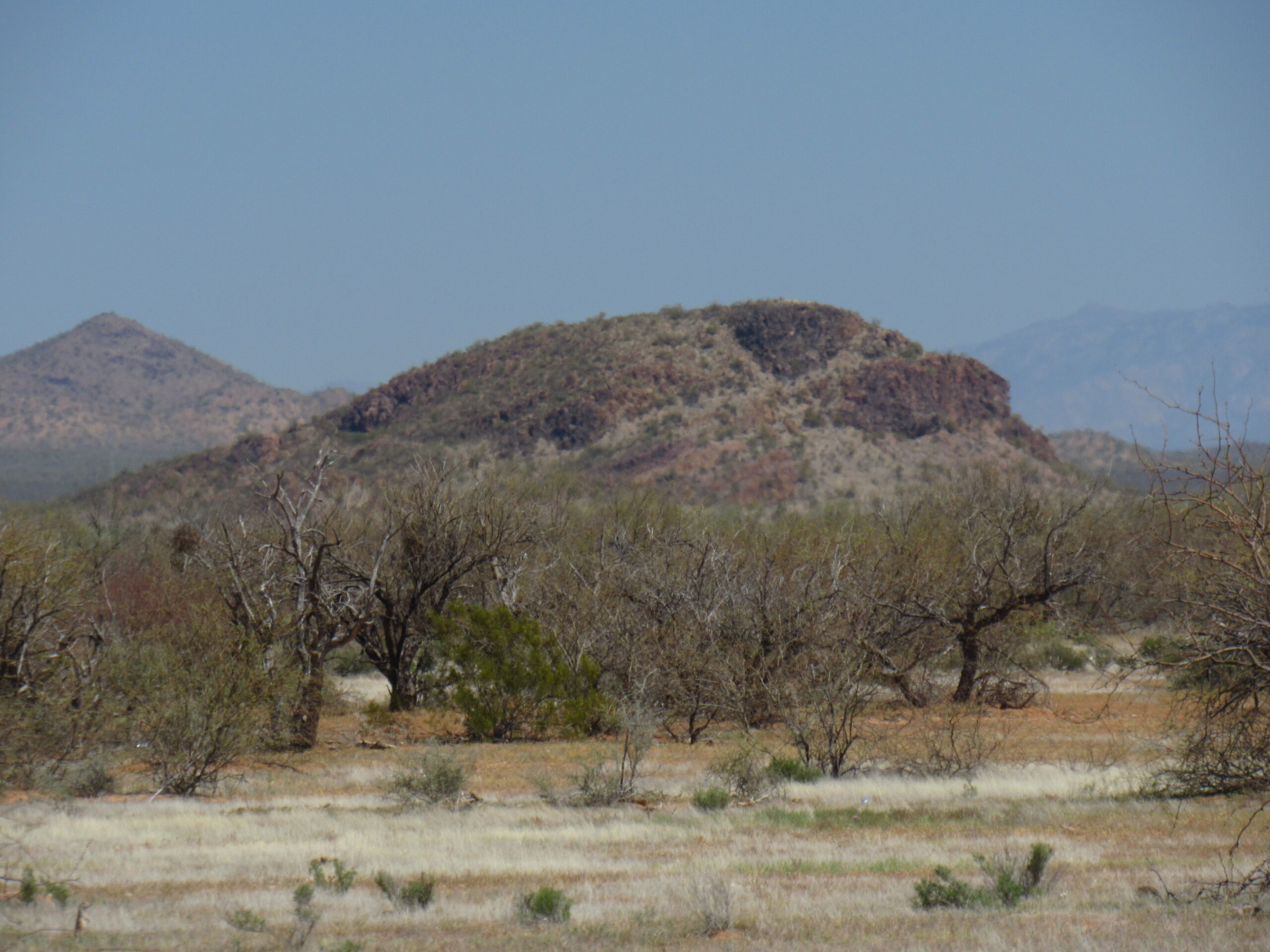
The west side of Point 2315, the dark one in the middle of the photo.
Another sizeable bump that doesn’t quite make it as a peak is Point 2478 to the west of the Roskruge Mountains. Here is a link that will show it to you:
https://listsofjohn.com/mapf?lat=32.30388&lon=-111.55145&z=16&t=c&d=y
There is a prominent double summit located a mere 2 miles northeast of Qheen’s Well, known as Twin Peaks. And only a mile north of that sits Cerro Negro. There are 2 more to mention, and they sit 6 to 7 miles north of Queen’s Well. They are the lower Ka Kohl Hill, with Slate Benchmark nearby to the northwest. Its larger neighbor 3 miles to the east is known as Koht Kohl Hill, which is easily the biggest of the peaks in the Aguirre Valley.
Back in 2002, I had the good fortune to visit some of these peaks. It was a blue-sky day in late January, and I started my journey from the Silver Bell Mine. Since Peak 2900 was so handy, I climbed it first from its north side. I then followed a series of seldom-used dirt roads heading southwest, then north, then west and finally south to arrive at Koht Kohl Hill. This was climbed via its northeast side. From there, I drove south to join the power-line road, which then led me northwest for about 2 1/2 more miles. I parked, headed southwest to the top of Ka Kohl Hill, then continued northwest to Slate Benchmark. From there, I finished the loop and ended up back at my truck.
It was a drive of 4 miles back southeast along the power line, where I reached another road which took me southwest for 2 miles towards Queen’s Well. I parked and did a quick climb of Cerro Negro, then walked south for a mile to Twin Peaks. A hive of wild bees put the fear of God into me on the upper part of the west summit, and I remember giving them a wide berth. I finished the day with a climb of Proctor Hill.
There’s one more thing worth mentioning about the Aguirre Valley, and it’s not something positive. Undocumented immigrants streaming up from Mexico have used the valley as a conduit for many years. Assuming you could walk in a straight line from the border to, let’s say, San Pedro on the southern end of the valley, you would have already crossed 45 miles of unforgiving desert. You could be hurt, out of food and water, and unsure of where you are and how far you still need to go. There is a website that tracks immigrant deaths here in Arizona, and I went on to it and counted those in the Aguirre Valley. It shows that they have found the remains of 258 people there, and that’s just the ones that are known. Sometimes a body will lie there for years before it is found, and I cannot begin to imagine how many are never found – I’m sure the number must be large. Someone I know found remains there, and it is sobering, to put it mildly. I remember a news report on a local TV channel, maybe 20 years ago, saying that a woman was found wandering in the northern part of the valley, stark naked but still alive. She was one of the lucky ones – at least she survived.