
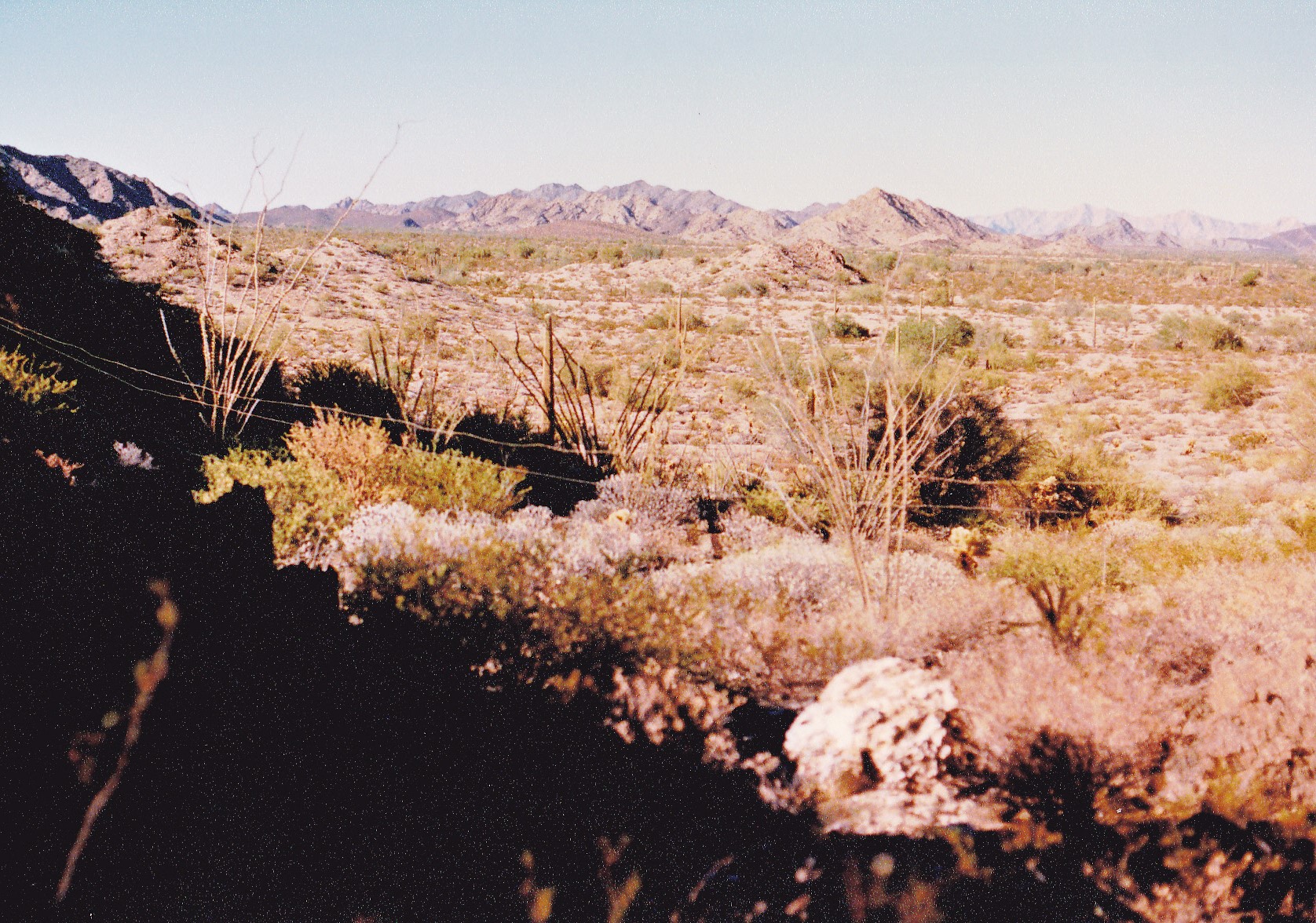
Okay, first of all I’d better explain what is meant by the BMGR. The initials stand for the Barry M. Goldwater Range, also often referred to as the Barry M. Goldwater Air Force Range. Years ago, its former name was the Luke Air Force Range. Those of us climbers who have anything to do with the place often casually just refer to it as the BMG. It is a vast swath of land in extreme southwestern Arizona, covering 1.9 million acres and spanning a distance of 132 miles from one end to the other. The BMGR includes part of the Yuma Desert and Gila Mountains, almost all of the Tinajas Altas Mountains and the Lechuguilla Desert, all of the Copper Mountains, much of the Mohawk Valley, part of the Mohawk Mountains, San Cristobal Valley and Granite Mountains, most of the Childs Valley, and part of the Growler Valley. The range was established in 1941 and is primarily used for air-to-ground bombing practice by United States Air Force pilots flying A-10s from Davis-Monthan Air Force Base in Tucson, F-16s and F-35 Lightning IIs from Luke Air Force Base in Phoenix and Tucson Air National Guard Base, and United States Marine Corps pilots and naval flight officers in F/A-18 Hornets, AV-8B Harriers and F-35Bs flying from Marine Corps Air Station Yuma. It is also used by other U.S. and NATO/Allied/Coalition flight crews while deployed to any of those bases for training.
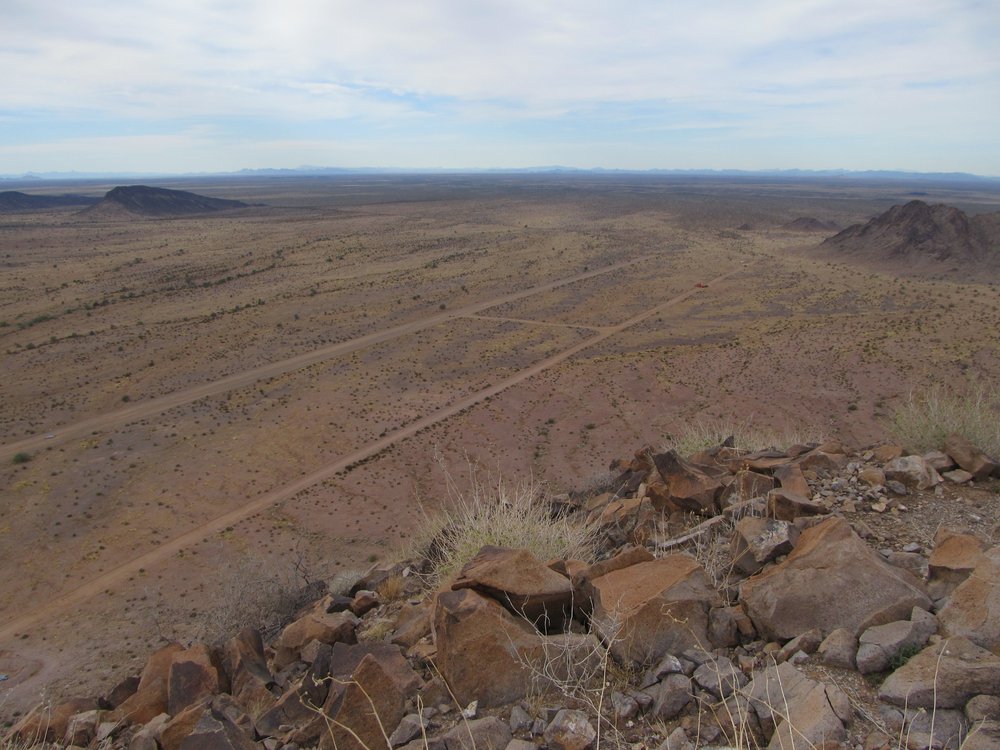
So now that you know where the range is and who uses it, I want to talk to you about it from a climber’s point of view. As you might imagine, any place so large includes hundreds of peaks, making it very attractive as a mountaineering objective. The problem is that you can’t just head out there and go anywhere you want and climb to your heart’s content. Certain areas, yes, but many others parts, no, because of restrictions that are in place. In any case, you need to get a permit, which is free. Without a permit, you can’t head out on to any part of the range at all at any time. Once you have your permit, you need to check in ahead of time before entering the range and then check out again upon leaving. Then you need to pay careful attention to which areas you are allowed to visit. Much of the range is considered to be the public use area, where you can visit any time with your valid permit. Then there is something called the Hazard Area, which is closed to the public when there is military activity. Often on weekends the public is allowed to visit the Hazard Areas. Finally, there are the Tactical Areas. These are special, because they are closed to the public at all times – 24/7/365, period, with no exceptions. You cannot ever get permission to go into the Tactical Areas, no matter who you are or who you know. And that, Folks, is what makes those areas so special – they are the Arizona equivalent of Area 51. They contain all of the most delicious peaks – peaks that climbers ponder on the maps and wonder what it would be like to go out there and climb, peaks that keep you up at night, peaks that disturb your sleep. There is a rare breed of mountaineer known as the Stealth Climber, some of whom have made the effort to trespass into the Tactical Areas. They have tasted of the forbidden fruit and lived to tell of it.
There are large areas of the BMGR that fall into that category of Tactical Area, or Manned Range, which you cannot visit. Mountain ranges that fall under such a designation are as follows: all of the Butler Mountains; parts of the Mohawk Mountains; all of the Aguila Mountains; all of the Crater Range; the north end of the Growler Mountains; the northern tip of Childs Mountain; the north end of the Granite Mountains; parts of the Sauceda Mountains; parts of the Sand Tank Mountains. All of the aforementioned are the forbidden fruit, the peaks that are not allowed to be climbed, the ones that are permanently off-limits. There is no possibility of accidentally straying into those areas, because along every road that leads to those places, there are really obvious signs that can’t be missed. I’m going to show you some examples here.
Some of the roads lead into areas that are so seldom-used that even the military doesn’t use them as access any more, so those signs are very old and faded, like this one. As you can see, the sign is also written in Spanish, for the benefit of undocumented border-crossers who might stray into the area.
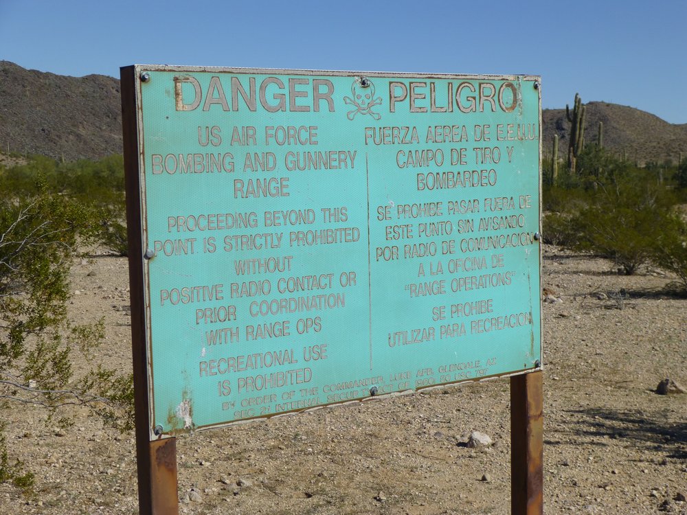
One of the old ones.
Here’s a more modern sign.
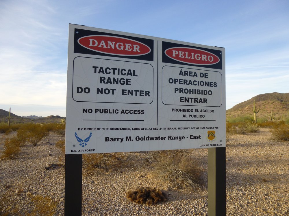
Tactical Range sign
You might run into one of these.
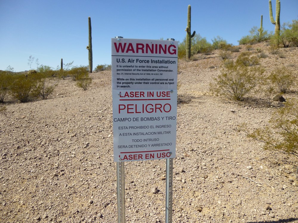
One of the newer ones.
Or one of these.
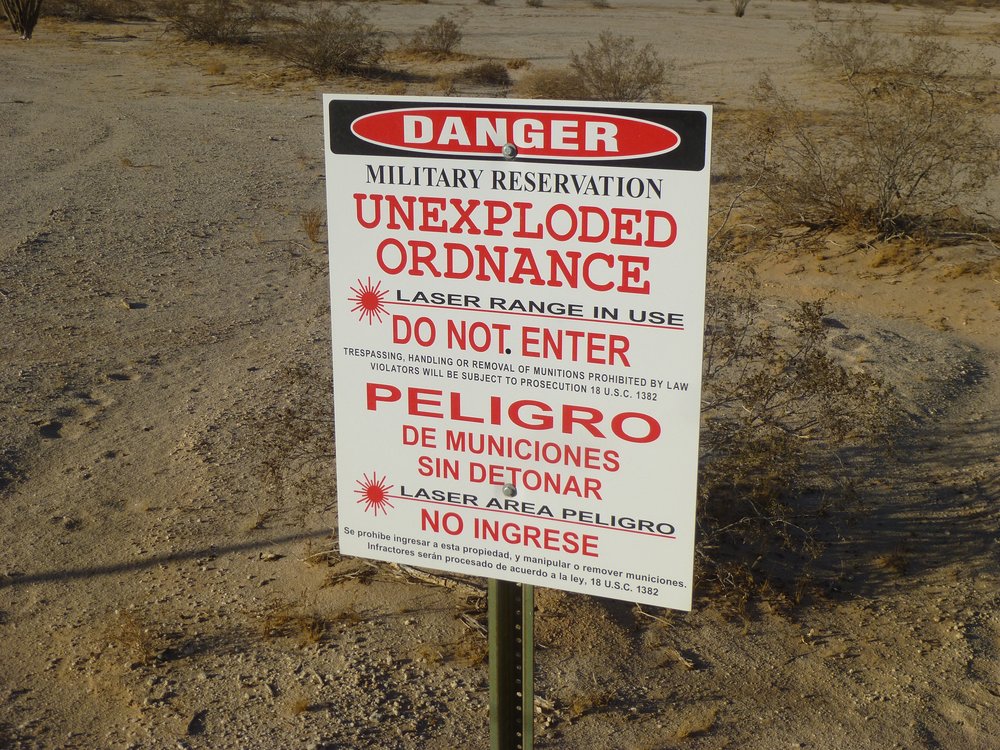
No entry, period.
And a sign like this says that your permit is not valid beyond this point.
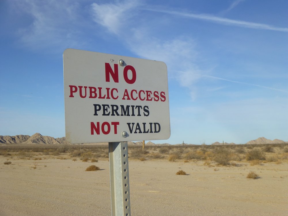
Thou shalt not pass.
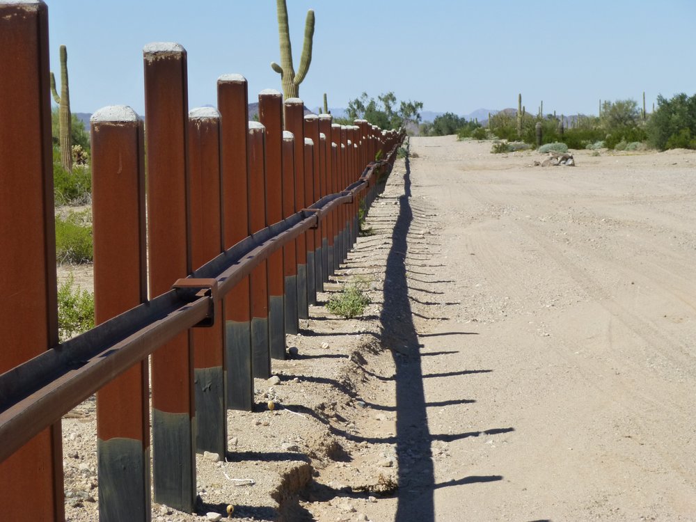
There are locked gates that bar access into the range, even for the areas that you are allowed to visit. Your permit gives you the code to the locks on those gates, and the code is changed each year. In order to get a permit, you have to watch a video on line each year which talks about the hazards of unexploded munitions and undocumented border-crossers and drug-runners. You sign away your rights to sue the military – in other words, you hold them harmless. Your permit gives you access to only certain areas of the range, while some of the most delicious areas, from a mountaineering point of view, are off-limits, and that is where the best stuff is to be seen. That’s going to be my focus in this piece, with the aid of pictures.
Some of the roads are so old and faded that they are not driven any more and may look like this.
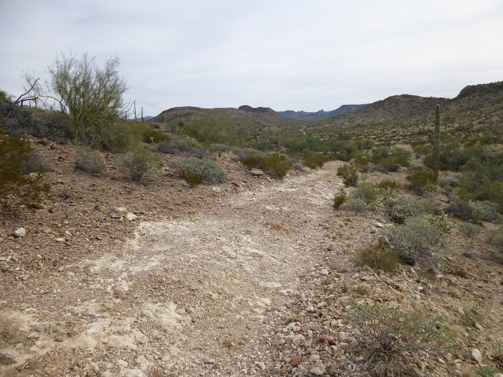
A tired old road.
Yet others are so well-maintained and well-engineered that the military regularly moves heavy equipment along them, like this one, which is closed to the public.
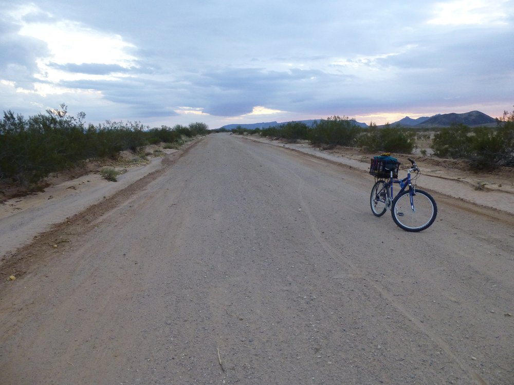
The super-road
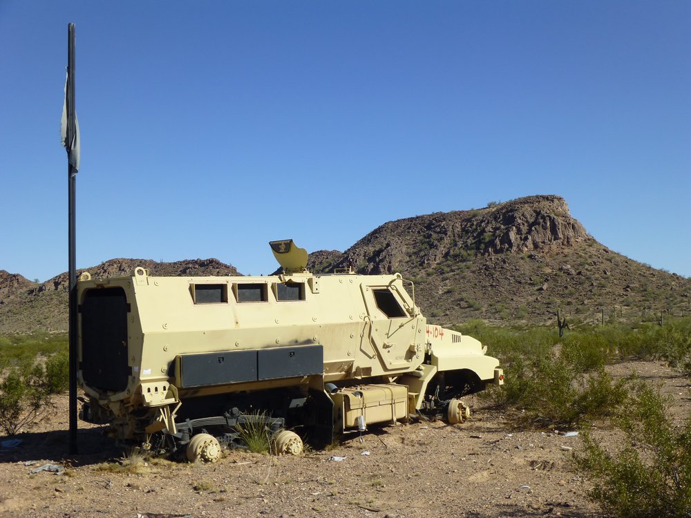
There are a number of places on the range where old vehicles have been set along a road and are used as targets – aircraft will shoot at them as they swoop down. Some of these vehicles have been in place for many years and are no longer used as targets.
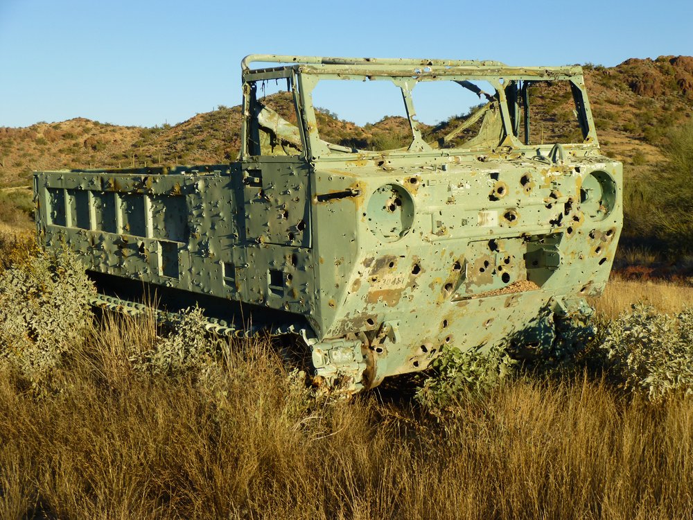
An old target vehicle
Others are of more modern vintage and are still shot at today. These are often a bright blue color.
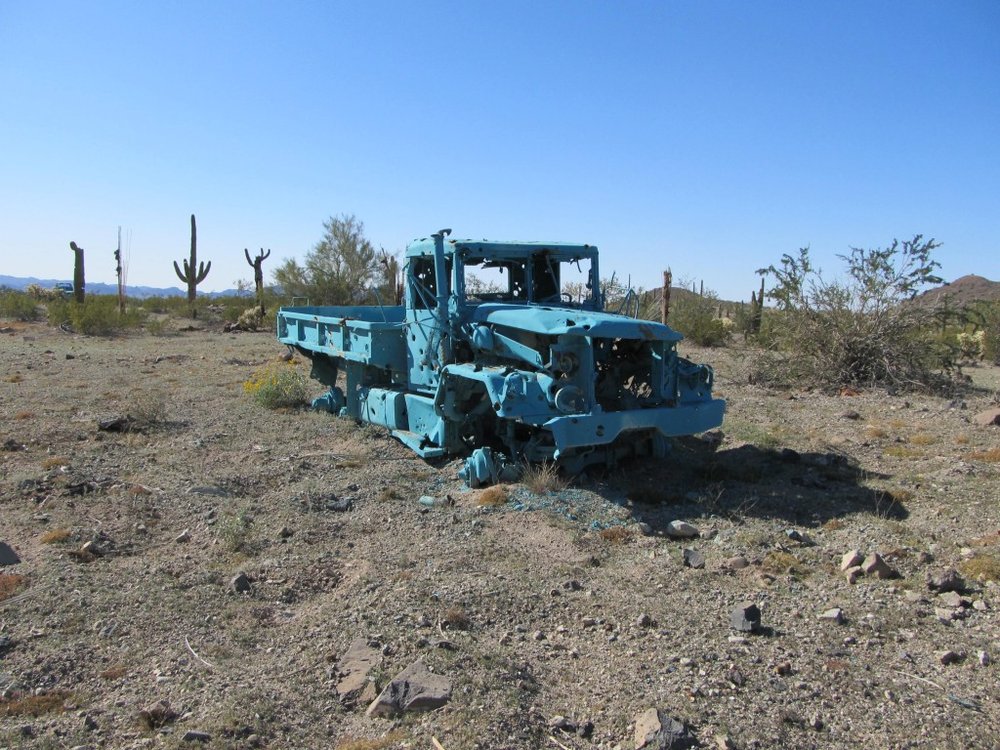
Newer target
I don’t often come across old artillery pieces, but when I do they are exciting to see.
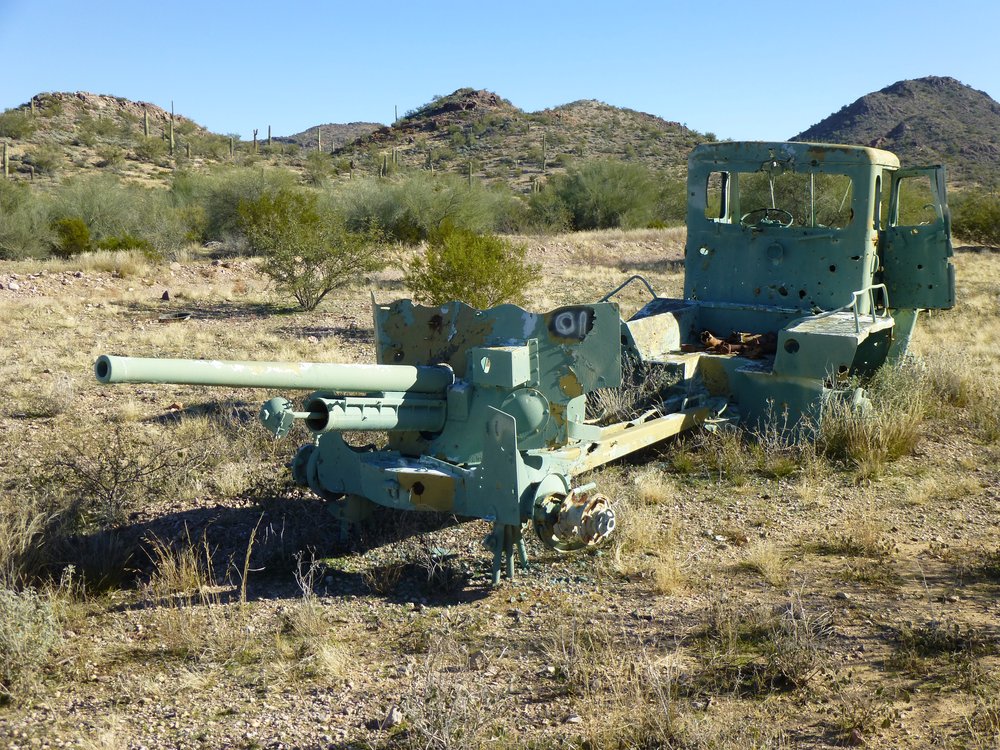
Artillery
Here’s another oldie but goodie.
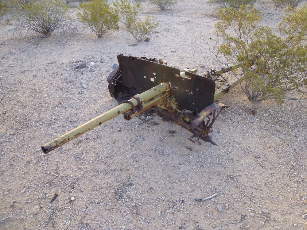
This one looks really old.
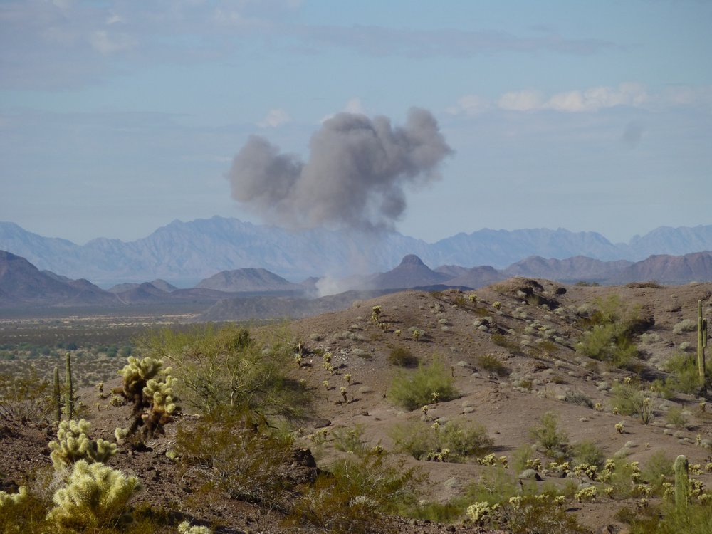
How well I remember the first time I heard the sound of bombs exploding – I was on the edge of the range and didn’t know that I was a full 10 miles away from them, yet somehow they sounded close. In later years, I was fortunate enough to sneak in much closer. For this one, I was sitting in a steep gully eating my lunch on a cold winter’s day watching the show.
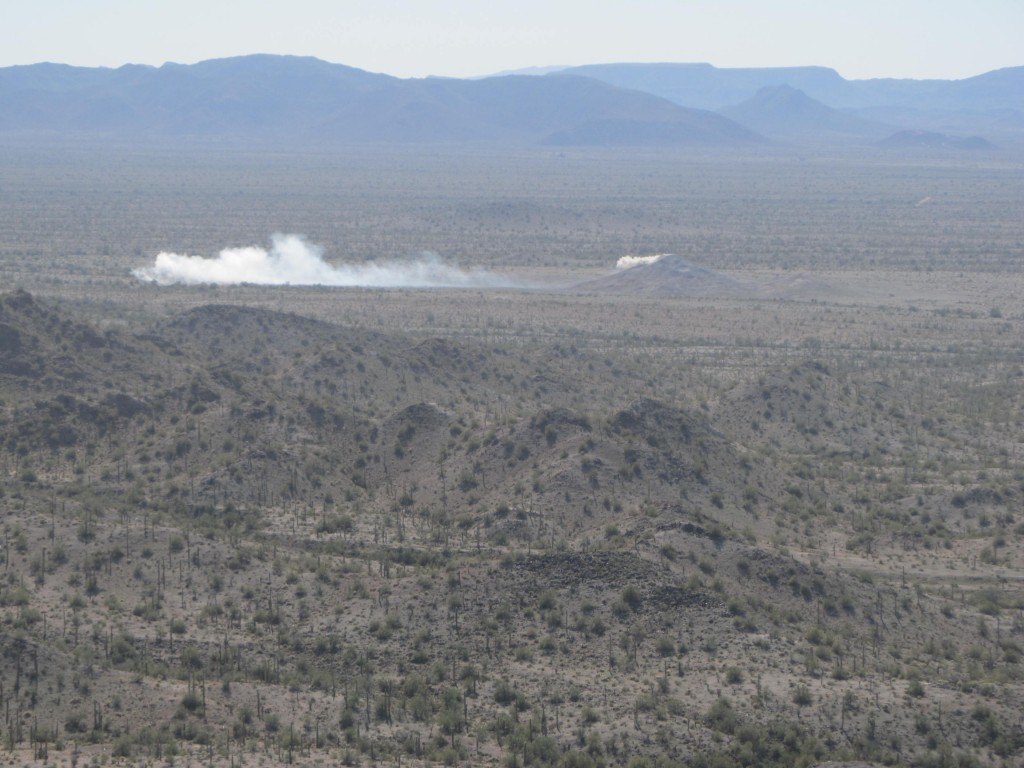
Explosions
Sometimes I was lucky enough to capture the moment of the explosion and not just the aftermath.
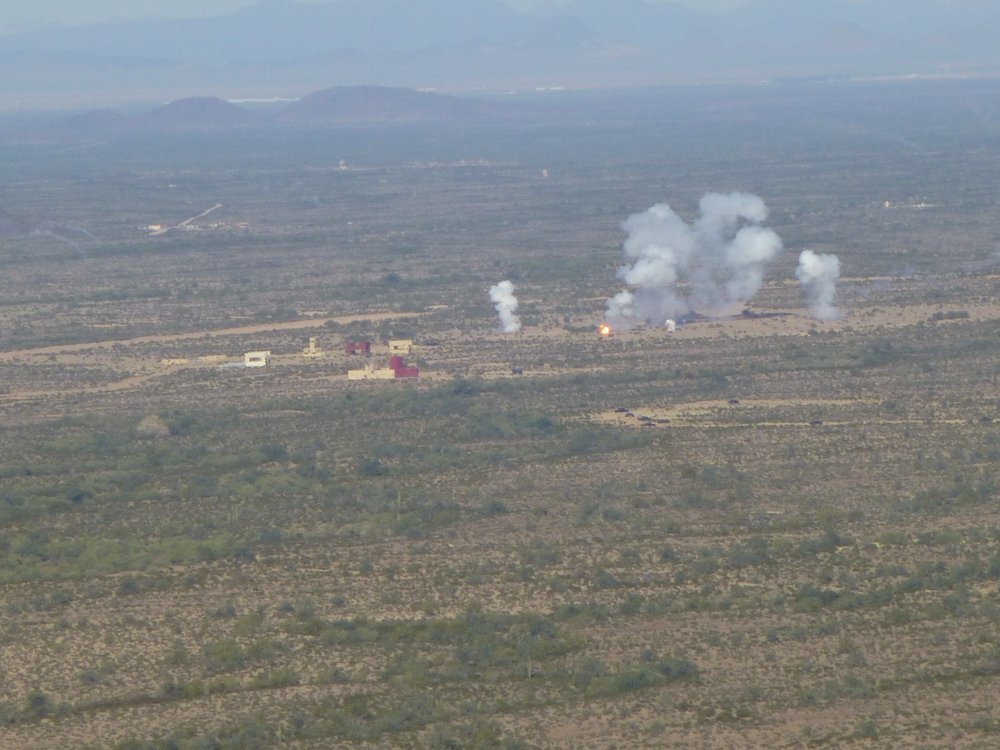
Here’s a good one.
And once in a while, you get really lucky and get in close enough to get the shit scared out of you.
A big one.
There are lots of places where the military has used shipping containers to create mock villages. They must use them for training.

It takes a village
In other places, they shoot at the containers. Some of them have been so riddled with bullets that they have collapsed.
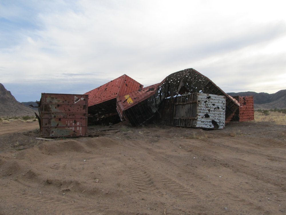
Shot back to the stone age
One time I was climbing some peaks deep in the heart of the range when I came upon some activity that I wasn’t expecting. Workers were down on the desert below me, using heavy equipment to move targets from one place to another. A double airstrip, each runway a full mile long, sat there, not shown on any map. These were quite flat, sloping less than a hundred feet in that mile.
The runways
I saw from above a different type of target, one I hadn’t seen before.
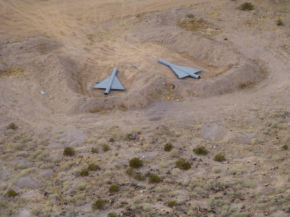
A new target
I waited until the workers left, then went down for a closer look. Here’s what one of those targets looked like – it was a mock airplane.
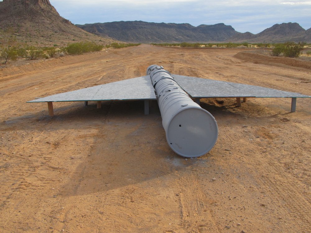
The fake plane
It was pretty exciting stuff, being in a place like that – it felt like being in the belly of the beast. I had almost been caught earlier in the day, but wasn’t, almost being the operative word.
Of the hundreds of targets I’ve seen in the range, perhaps my favorite is this old tank. It sat out in such a remote spot, all by itself, forgotten – it looked so old.
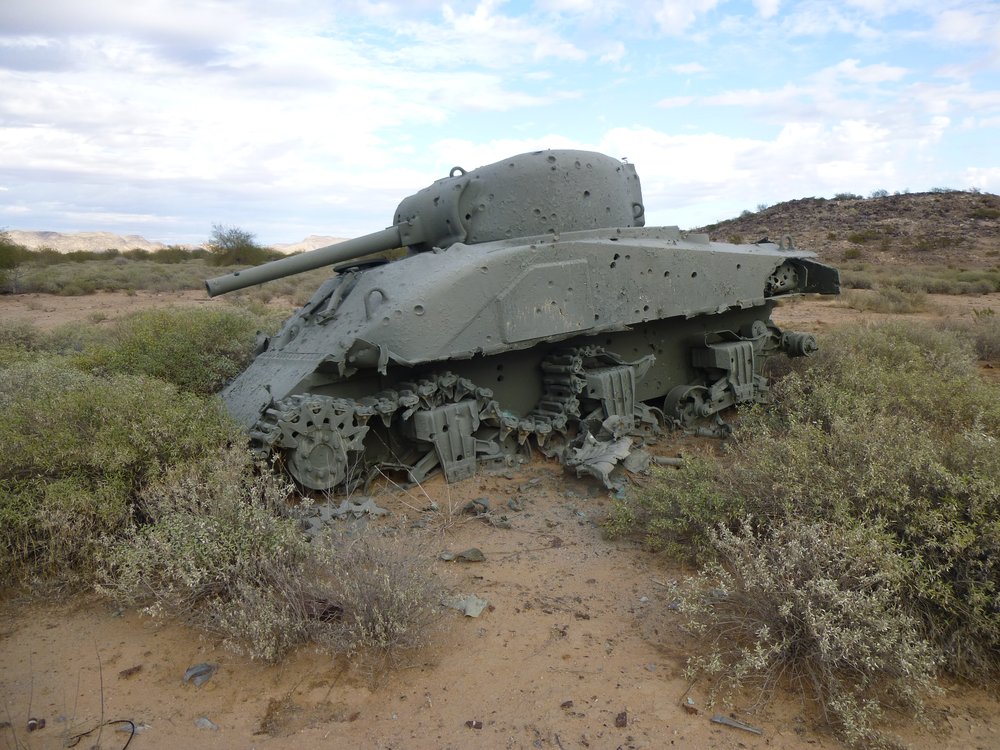
The tank
There are many observation towers throughout the range. I’m sure they’re strategically placed, probably to observe and guide aircraft movements, but I’m just guessing. Here’s one shimmering in the heat in the distance.
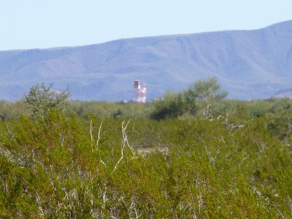
I see you, but do you see me?
Something that has changed in parts of the range over many years is what we see where it meets the border with Mexico. Back in the 1980s, parts of the border looked like this. Believe it or not, a few strands of sagging barbed wire was all that marked the international boundary. I took this picture in the Tule Mountains. I was standing in Mexico and looking north into the States.
The border fence
As the years passed, a vehicle barrier was built along parts of the border.
The vehicle barrier
I’m not even going to dignify Trump’s border wall with a photo, as it appears to be failing structurally, environmentally and on every other level. It does, however, occupy quite a few miles of the BMG’s border with Mexico.
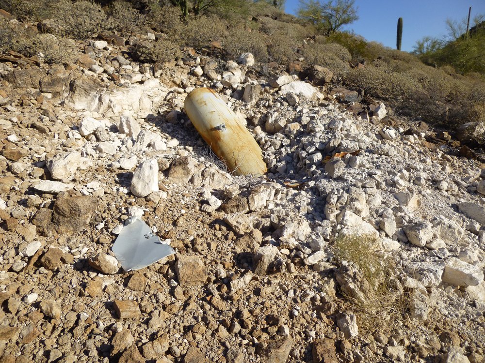
Finding munitions out on the range, both exploded and unexploded, is one of the most exciting things about being out there. Unless you have a death wish, though, you always want to give that stuff a wide berth, but it is fun to look at. Here are some pictures that give you an idea of the wild stuff that’s lying around everywhere. This one was curious – thousands of spent shell casings.
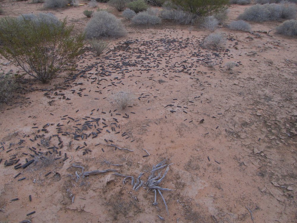
Why so many in one spot?
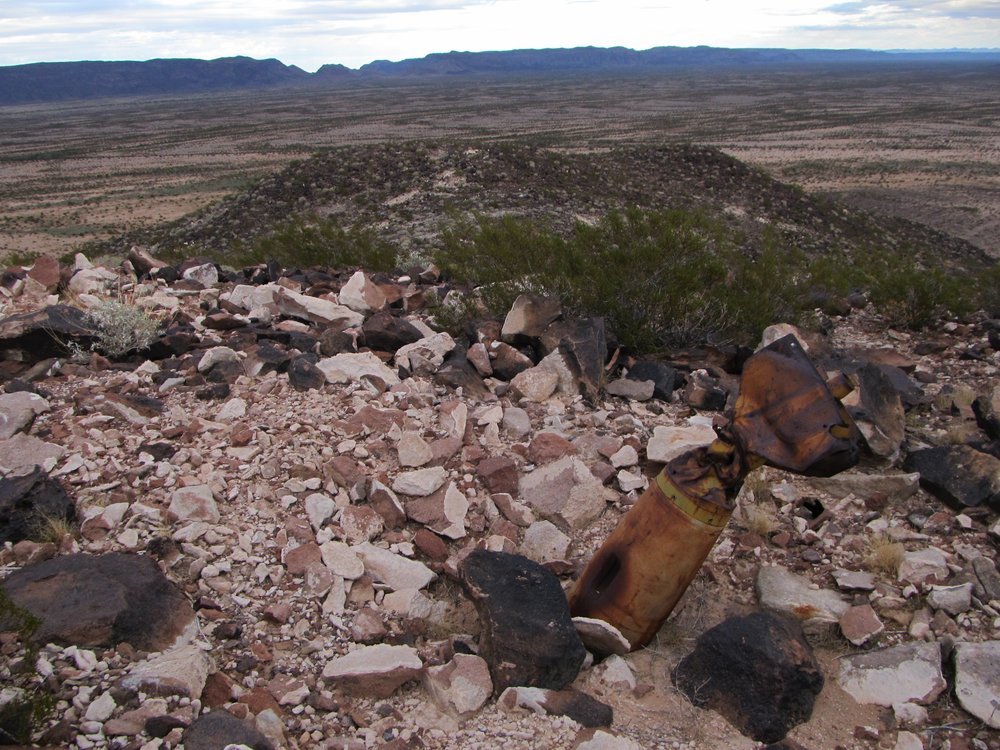
When you come across a large bomb which had exploded and you could see the steel which was 2 inches thick and peeled back like a banana, it made you realize the power of the bomb.
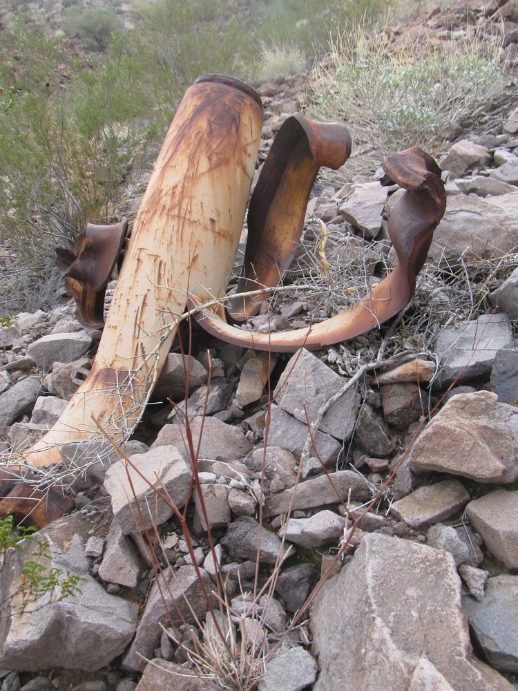
Good grief!
Small ones like this were quite common.
Just a baby.
There were plenty of others that seemed intact and were just lying on the ground.
Hands off!
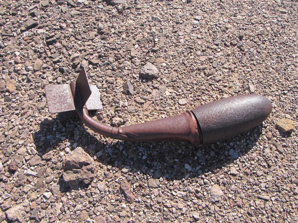
Some things appeared to have fallen from the sky with such force that they had embedded themselves in solid rock and yet had not detonated.
Hit really hard.
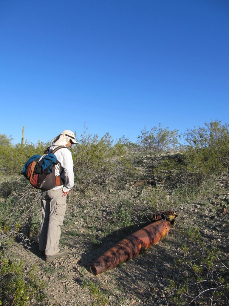
Here’s another one, on a rocky mountaintop.
Never went off.
It was a never-ending source of entertainment to watch jet aircraft flying around, sometimes so high you could barely see them, sometimes leaving vapor trails that showed you where they were. At other times, there were deafening sonic booms. If you were lucky enough to be in the right place, say on just the right mountaintop, you could watch a jet swoop steeply down and release a bomb, then climb steeply away before the bomb exploded. Few things are more exciting than watching an A-10 move in on a target with its cannons blazing – they don’t call them tank-killers for nothing.
Sometimes I would come across groups of vehicles like this. I went down for a closer look and found that they were no longer operational, but couldn’t figure out why they were arranged like that. None of these had been shot full of holes.
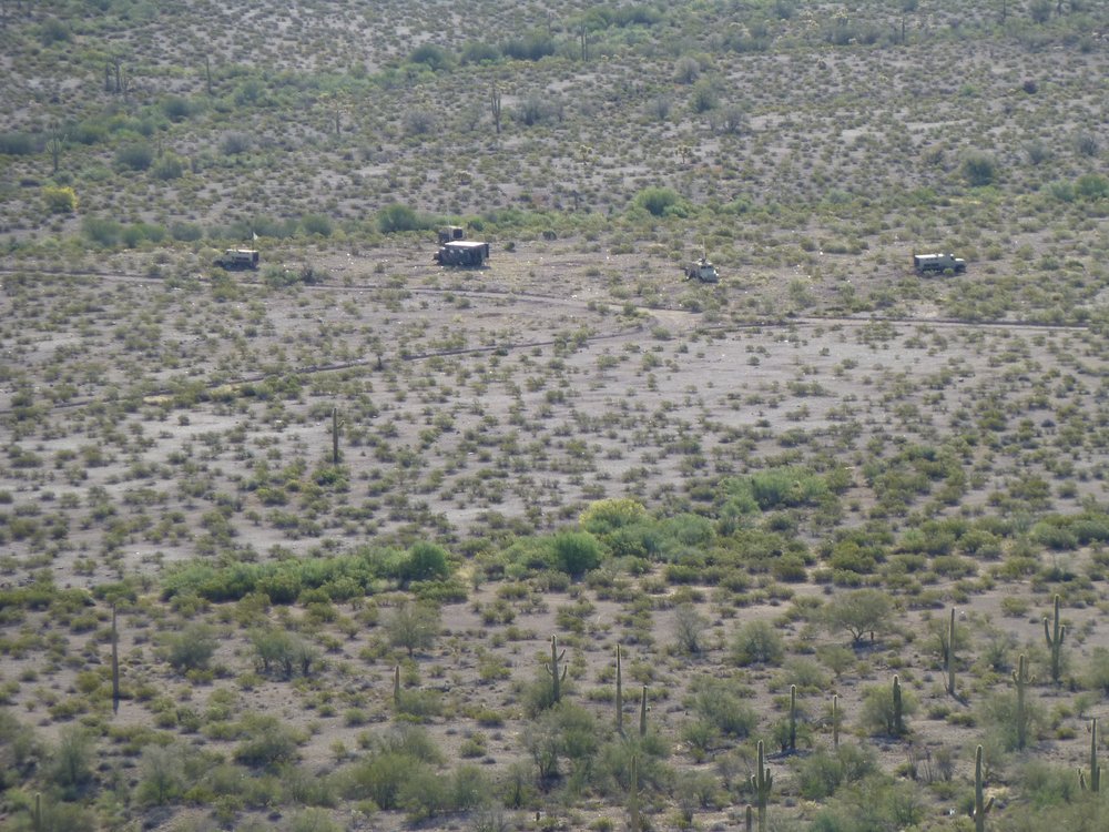
A collection of vehicles
Here’s a closer view of one of them.
A close-up
Here’s a fun fact I’ve never revealed to anyone before now. Several years ago, while climbing with a partner in the deepest heart of the bombing range, an area so off-limits that words cannot adequately describe it, we were leaving registers on top of every peak. As a precaution, we did not leave our names in those registers, but we did give each peak a nick-name. One afternoon, feeling in a crazy mood, we dropped the name “Allahu Akbar Peak” on our last one of the day. We knew darn well that no Air Force guy would ever make the effort to climb that peak and find our register. That evening, back in camp around our campfire, we laughed ourselves silly trying to imagine the look on some military guy’s face if one of them ever did find and open that register and read the name we had given the peak.
All told, I have spent several months of my life out on the BMG over a period of many years, and I consider myself fortunate to have been able to do so. Those were amazing days, filled with wonder and excitement