
Ruins – what does the term mean? A good definition I found was this one:
The term refers to formerly intact structures that have fallen into a state of partial or total disrepair over time due to a variety of factors, such as lack of maintenance, deliberate destruction by humans, or uncontrollable destruction by natural phenomena.
In 1970, I read a book called “Chariots of the Gods”, written by a Swiss guy named Erich von Däniken. I didn’t buy into his aliens from outer space ideas, but I was quite captivated by his photos of archeological ruins in Mexico and Central America. Later the same year, I found myself in the company of friend Dan Murray, driving from Canada down to Mexico for what would become an epic 43-day grand tour (20 days of it spent within Mexico) where we were to visit some of the archeological sites featured in the book. By July 30th, we had arrived in the city of Oaxaca in the far south of Mexico.
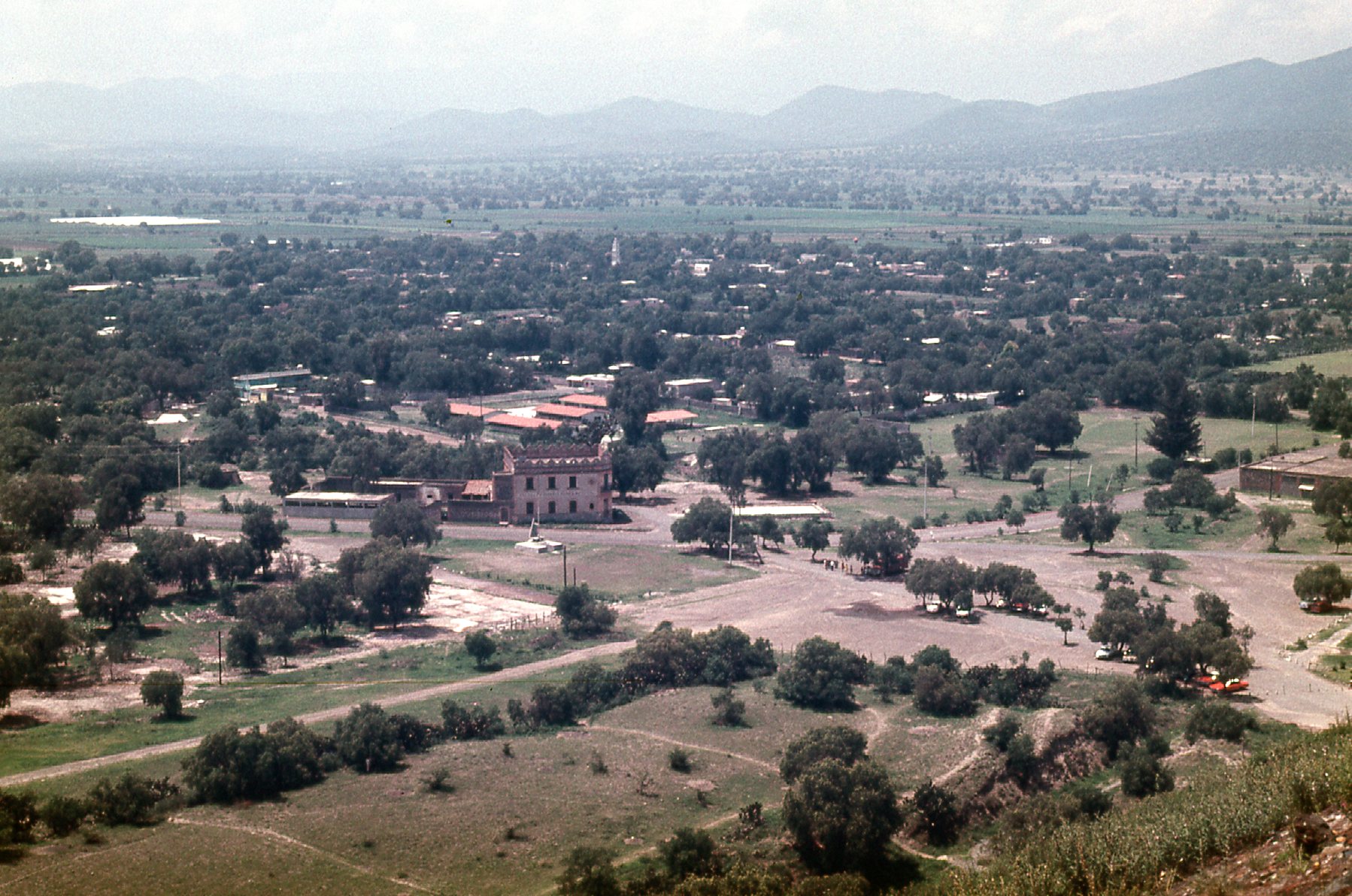
The city is beautiful, and sitting at just over 5,000 feet elevation, it enjoys a spring-like climate year-round. On the last day of July, we drove up to the ruins of Monte Albán. This mountain has a fairly flat summit which sits 1,300 feet above the west side of the city. Here is a photo of the city from the mountain.
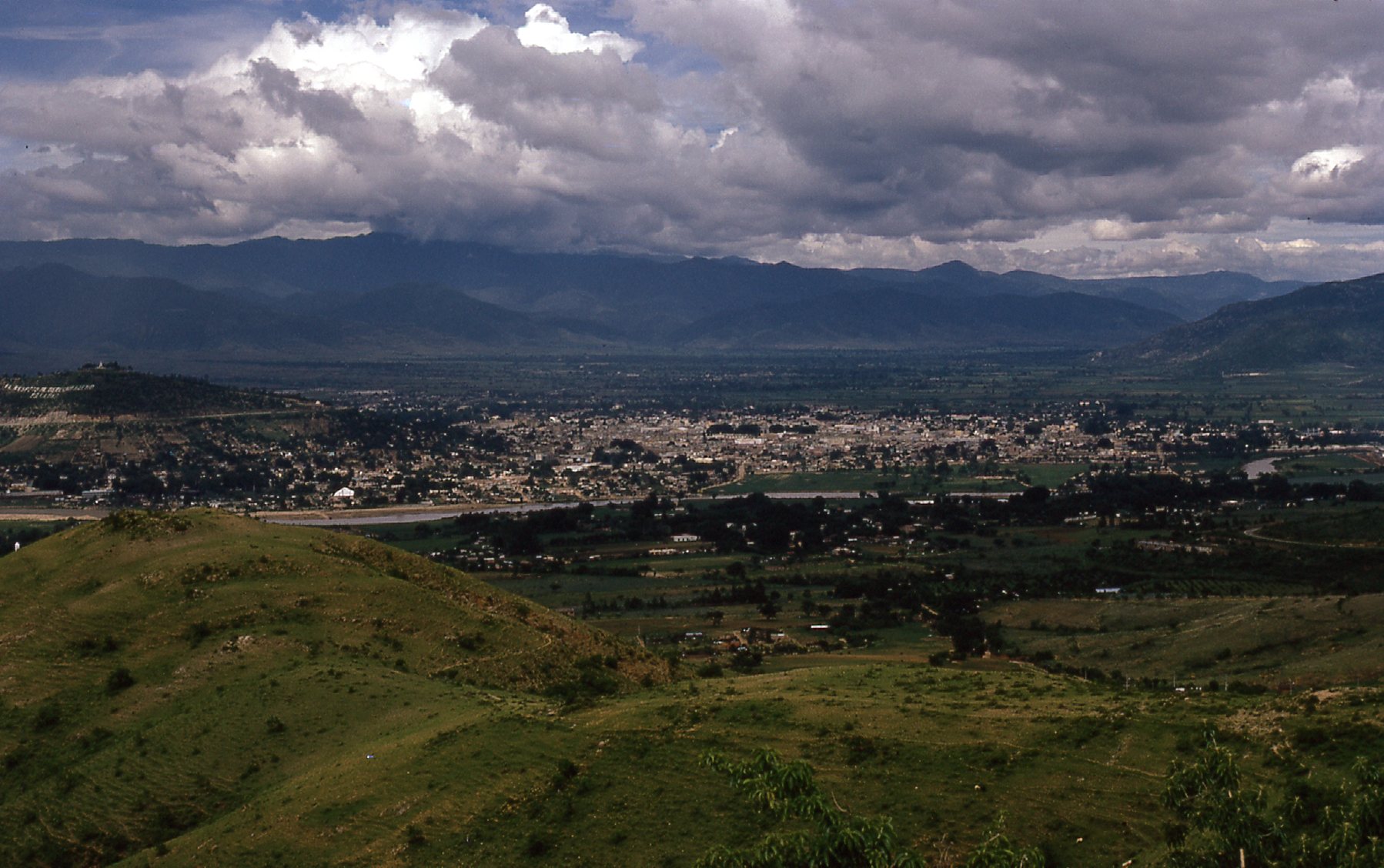
Looking down on the city.
Monte Albán was one of the earliest cities of Mesoamerica, founded around 500 BC. It was an important center of the Zapotec culture, and at one time had a population of 17,000. It was an overcast, gloomy day when we visited, so these pictures are a bit dark.
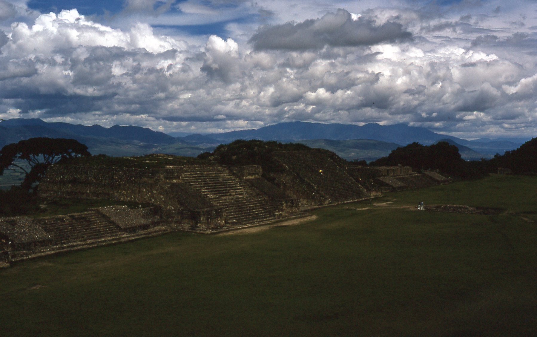
At Monte Alban
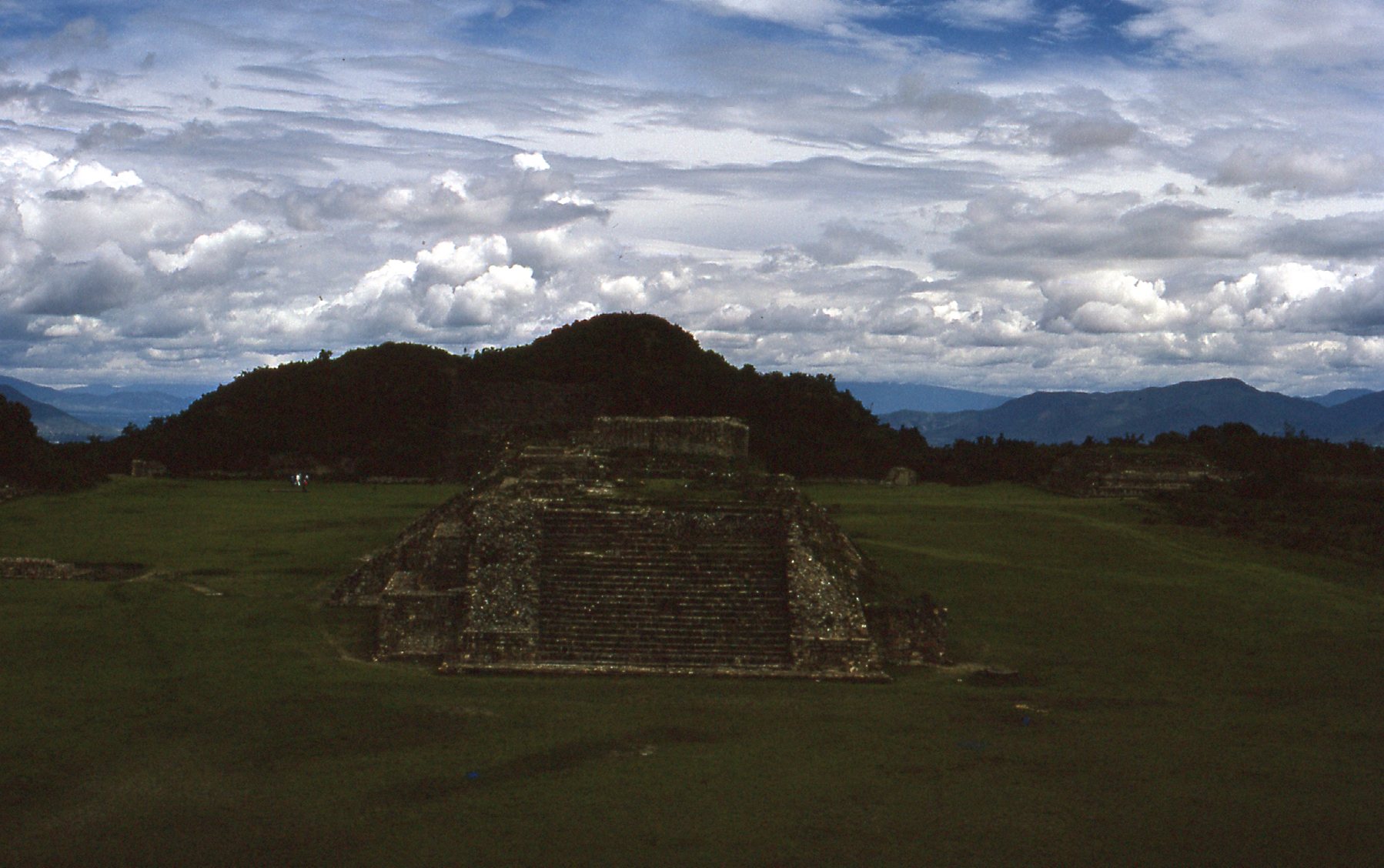
Monte Alban
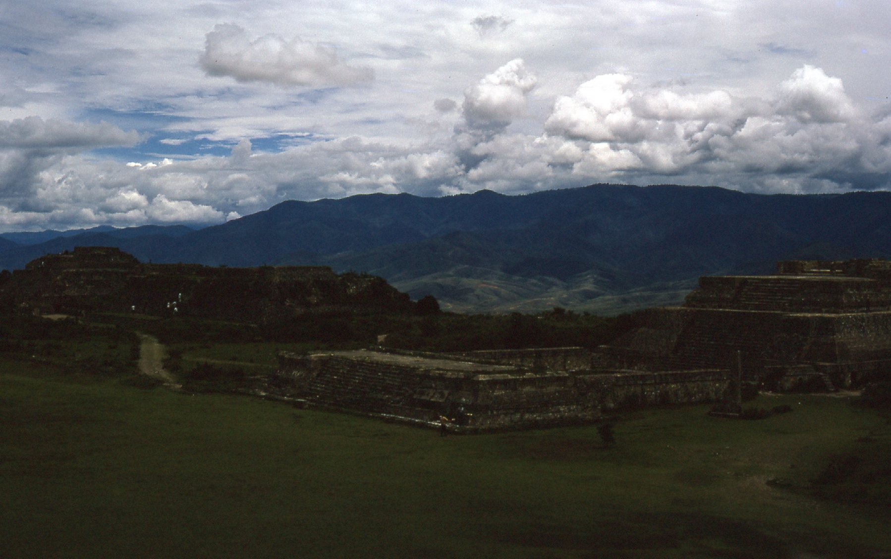
Monte Alban ruins
This was the first time I had visited any sort of archeological ruins, and I found it quite impressive. But so you don’t have to put up with my few poor photos, here’s a link to a good Wikipedia site that will tell you everything you’d want to know about Monte Albán.
Three days later, Dan and I had driven all the way to the Yucatán Peninsula. We stopped at the ruins of Kabah, but only briefly. I took this photo the day we were there, but 2 years later I returned and spent more time and had a much better look around. I’ll show you that second visit later in this story and tell you much more about the site then.
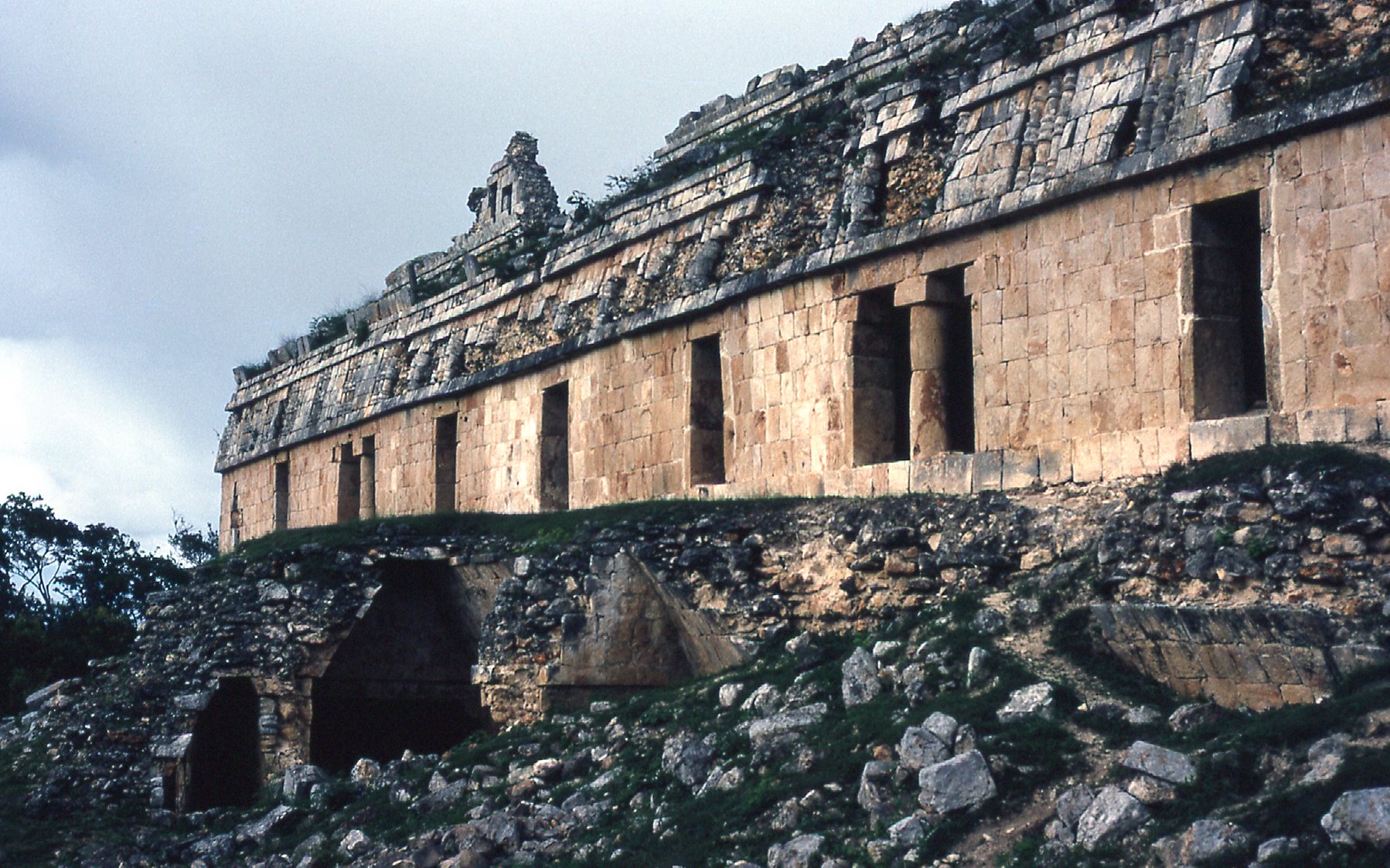
At Kabah
On that 1970 trip, we never spent much time in one place. Constantly on the move, we were all the way back to Mexico City only 3 days later. Having heard about the ruins at Teotihuacán, we stopped, but briefly. Here’s a photo from that day, August 5th. I’ll discuss this important place in greater detail later in this piece.
One of the views at Teotihuacan.
Although on this trip in 1970 we had the great flexibility of traveling in a car, we spent very little time at any of the archeological ruins – we always seemed in a hurry to move on. Two years later, I returned to Mexico and traveled extensively, this time using public transport. You could get pretty much anywhere you wanted that way – buses traveled even the back roads, going to many remote communities, and I took full advantage of that. With a whopping 47 days spent within Mexico, I wasn’t in a hurry, and took whatever time I needed to see whatever I wanted.
So fast-forward to 1972. I flew from Vancouver to Mexico City and began my exploration. This time, I’d spend more time visiting ruins and was excited to do so. In order to get a feel as to what I might expect in my travels, I paid a visit to the Museo Nacional de Antropología. What an amazing place! Check out their excellent website here. I took some pictures that day, June 20th, when I was there.
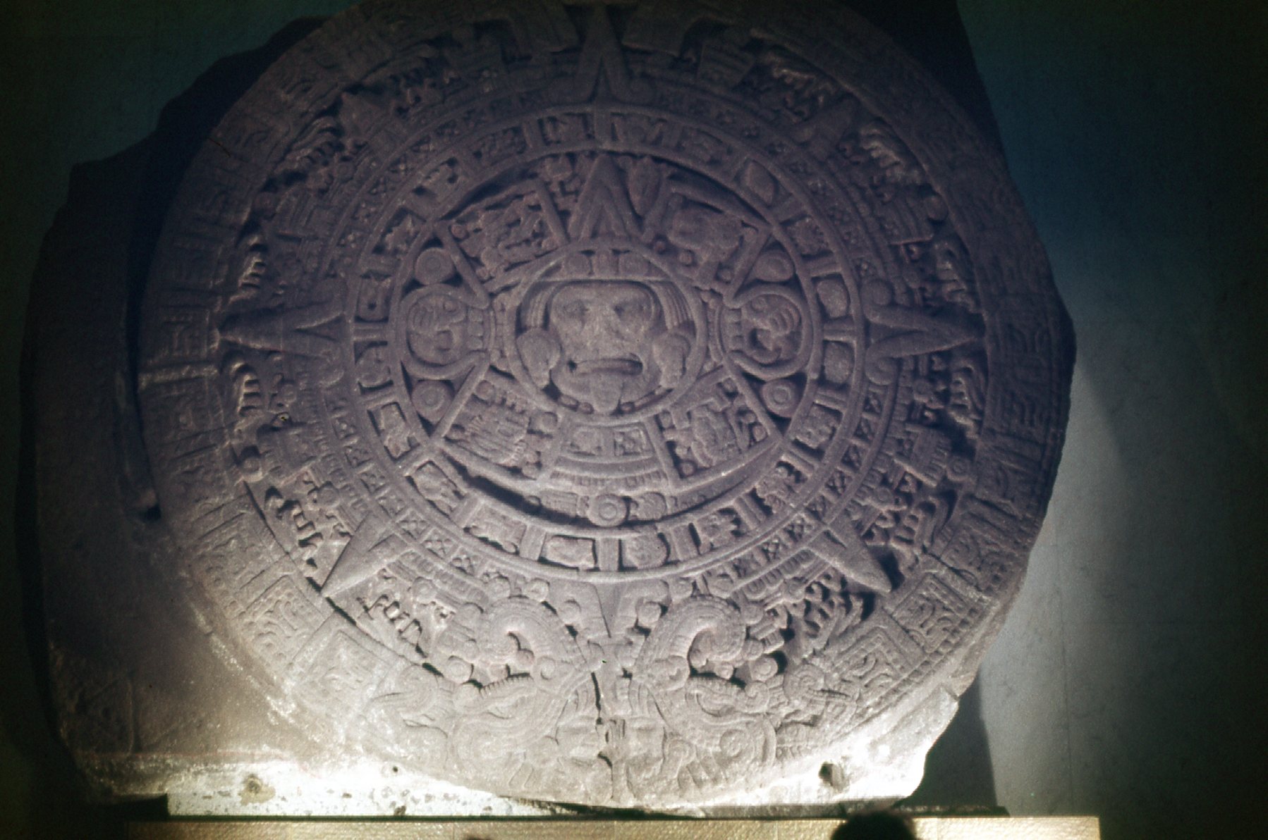
The Aztec calendar
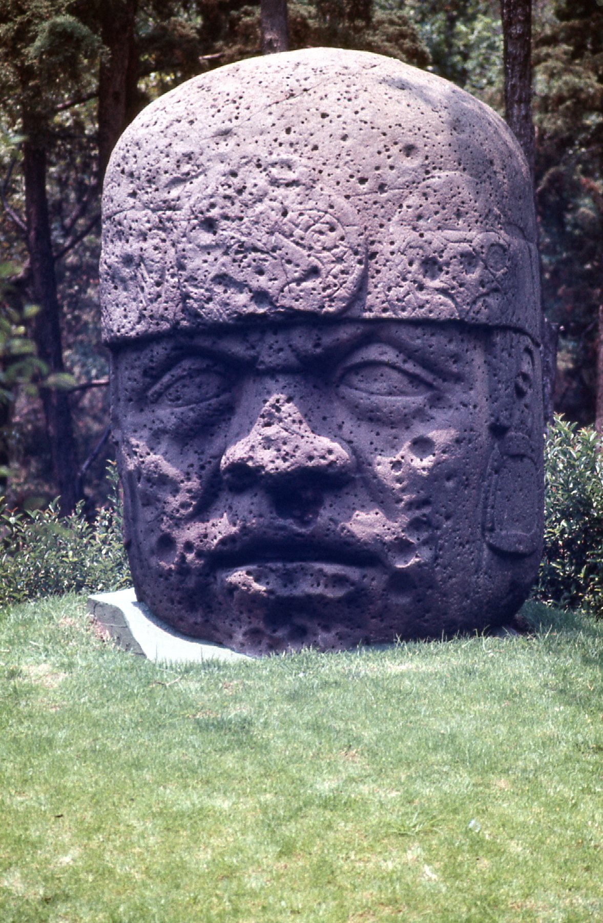
The Olmec head.
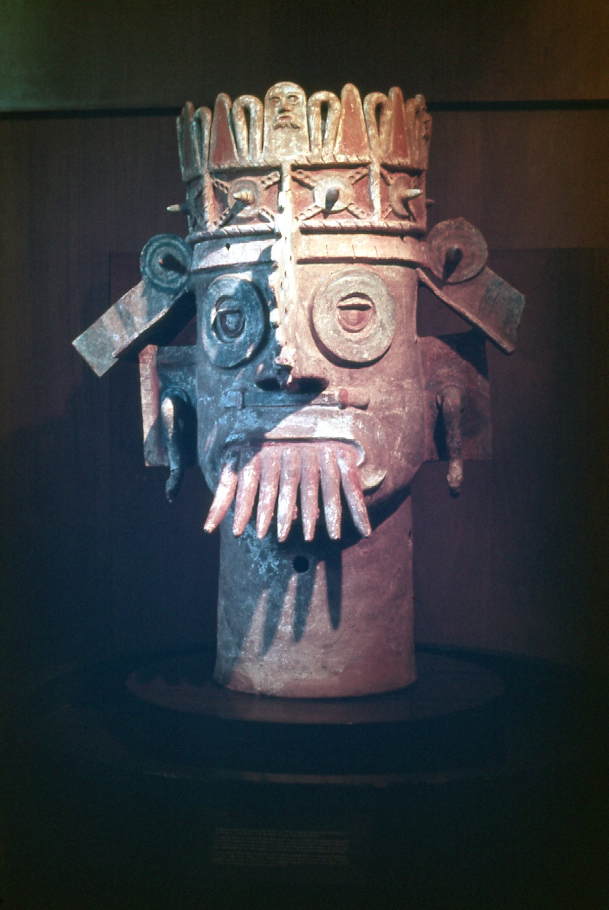
A Tlaloc rain god, from the state of Veracruz
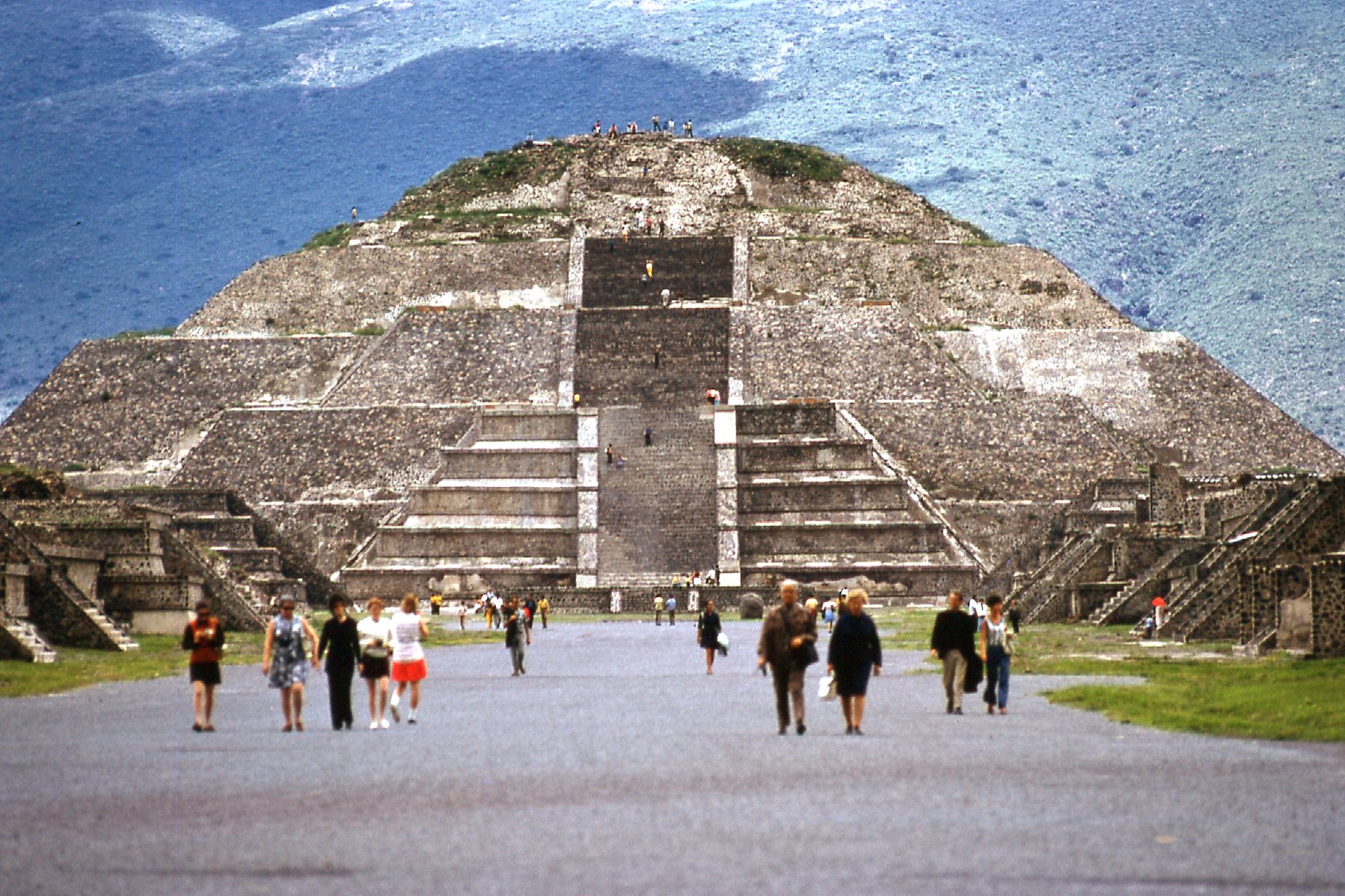
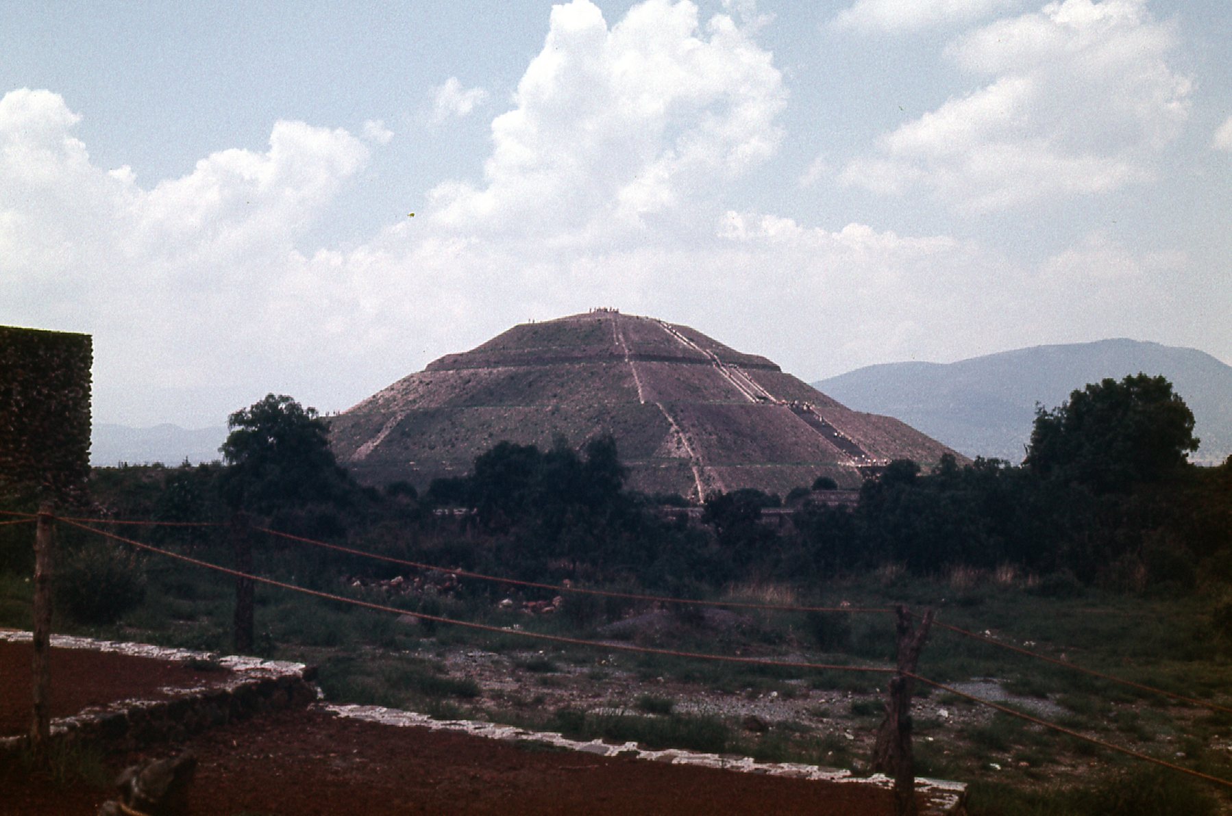
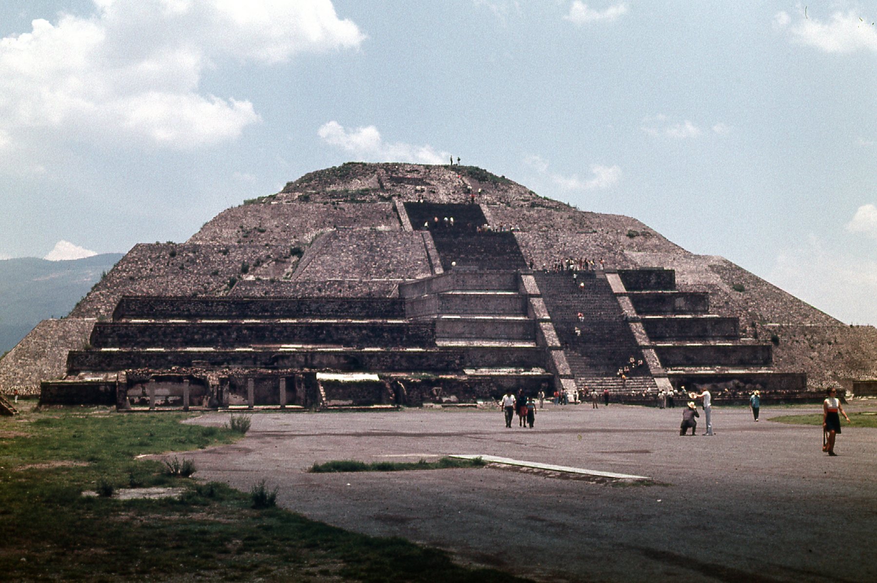
Visiting this museum got me excited. Since I was already in the capital, the logical first place to visit would be the ruins at Teotihuacán, only a few miles to the northeast of the city. On the 22nd, I spent the day there. Even at an elevation of 7,550 feet, it seemed very hot and muggy – it was, after all, the height of the monsoon season. Oh well, there was nothing to be done about that. I took a bus out to the ruins and starting walking around. My photos have survived pretty well and I’ll share them with you here. The first thing I saw was this, the Pyramid of the Sun, from a distance. My God, it looked huge!
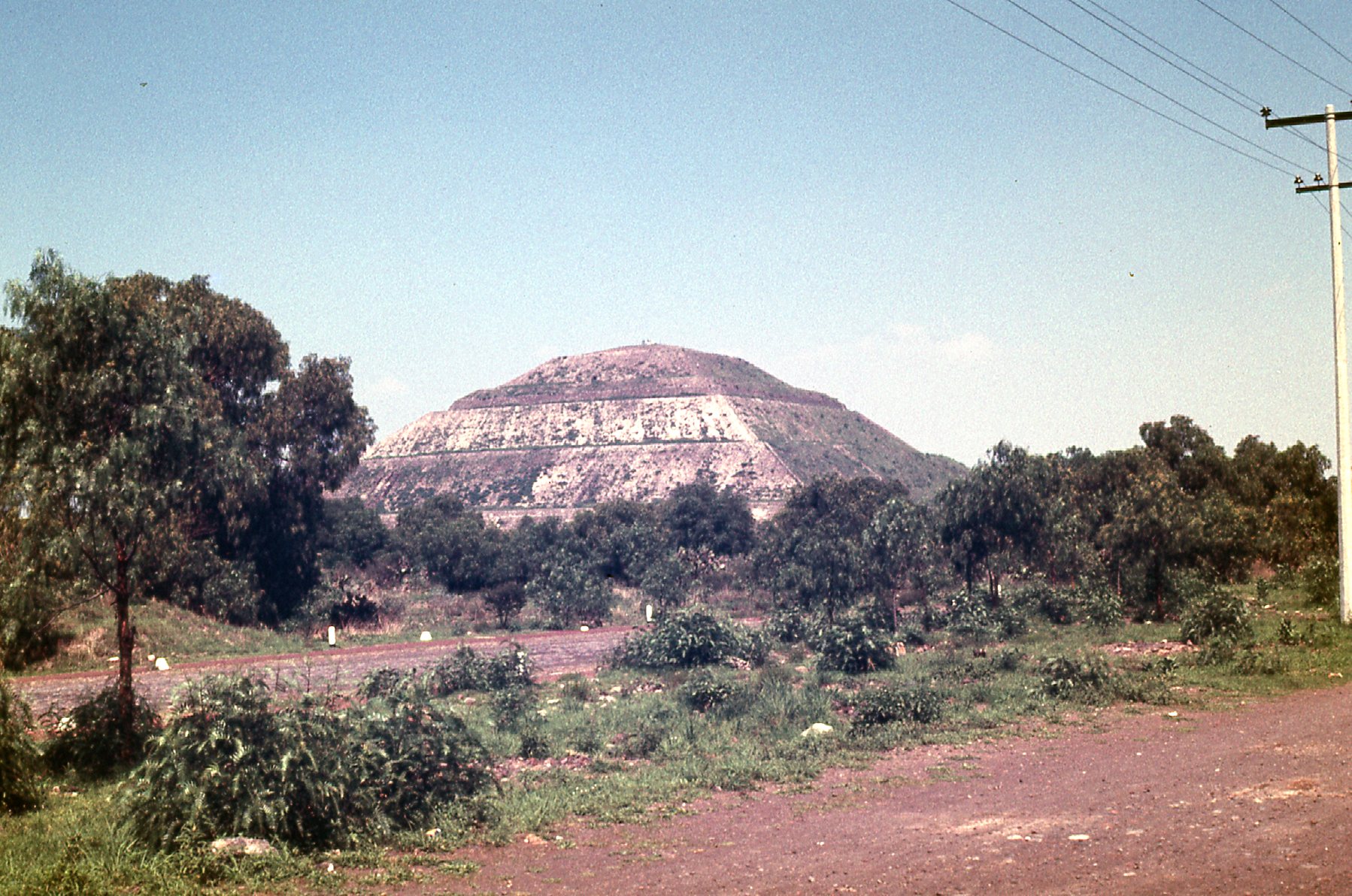
The Pyramid of the Sun
As I got closer, here is what I saw.
The southwest side of the Pyramid of the Sun.
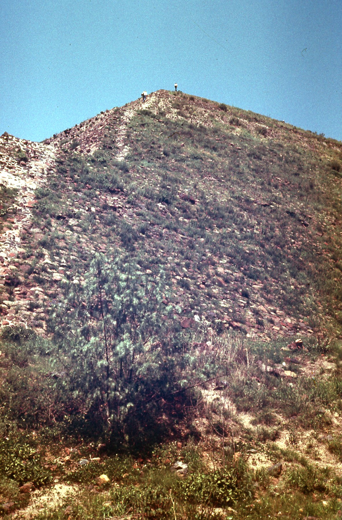
There were actual steps you could climb (just not on this side) to the top. The pyramid is 245 feet tall and measures 738 feet along each side, making it the 3rd-largest pyramid in the world (the 1st and 2nd are in Egypt). Once I had climbed to the top, I had these views of the surrounding area.
Looking south from atop the pyramid.
Looking southwest from the top.
You can zoom in on any of the pictures to see more details. In some of the photos, you can see people at various stages of climbing the pyramid.
Looking west
Looking northwest from the summit.
Here, we are looking down on to the adjacent town of San Martín de los Pirámides.
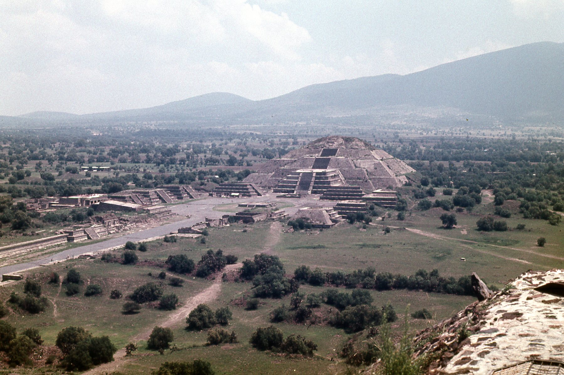
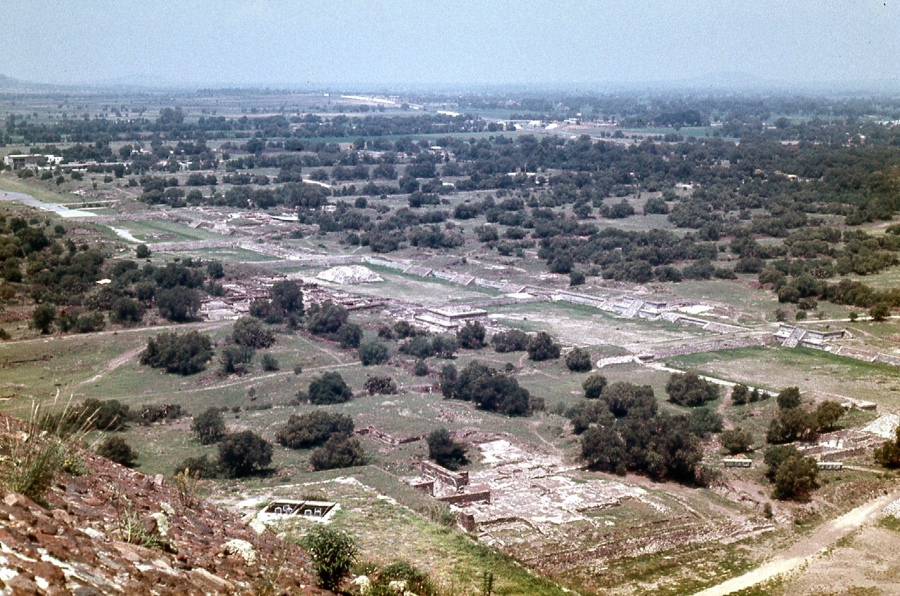
Looking north
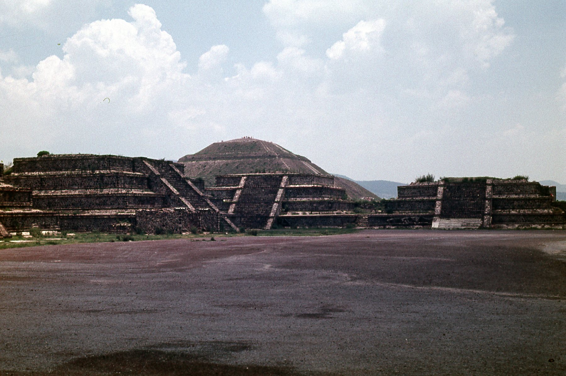
The above photo is looking north from the Pyramid of the Sun, and in it we see the Pyramid of the Moon. Although not as large, this pyramid is 141 feet tall and measures 482 feet along its side.
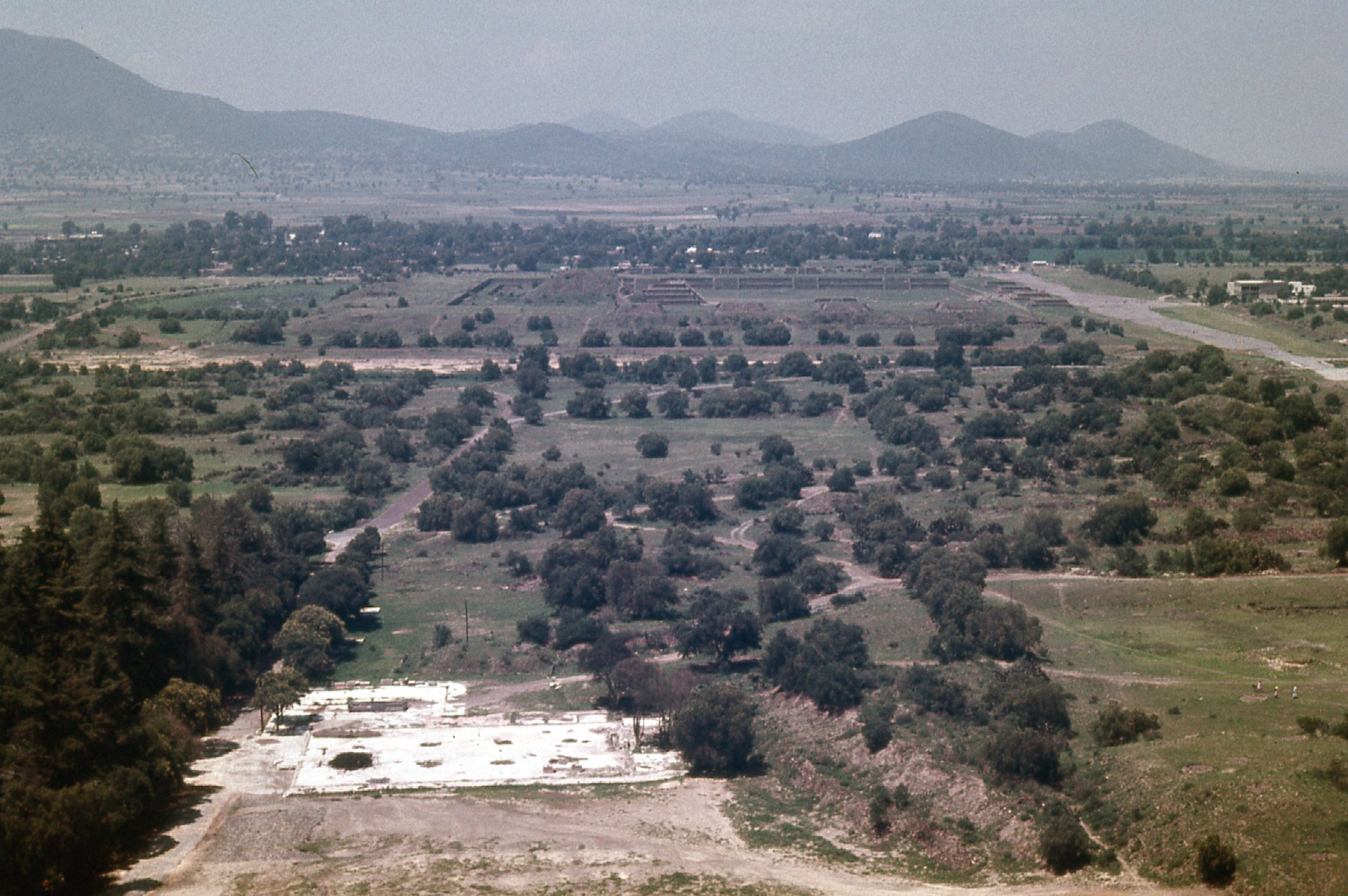
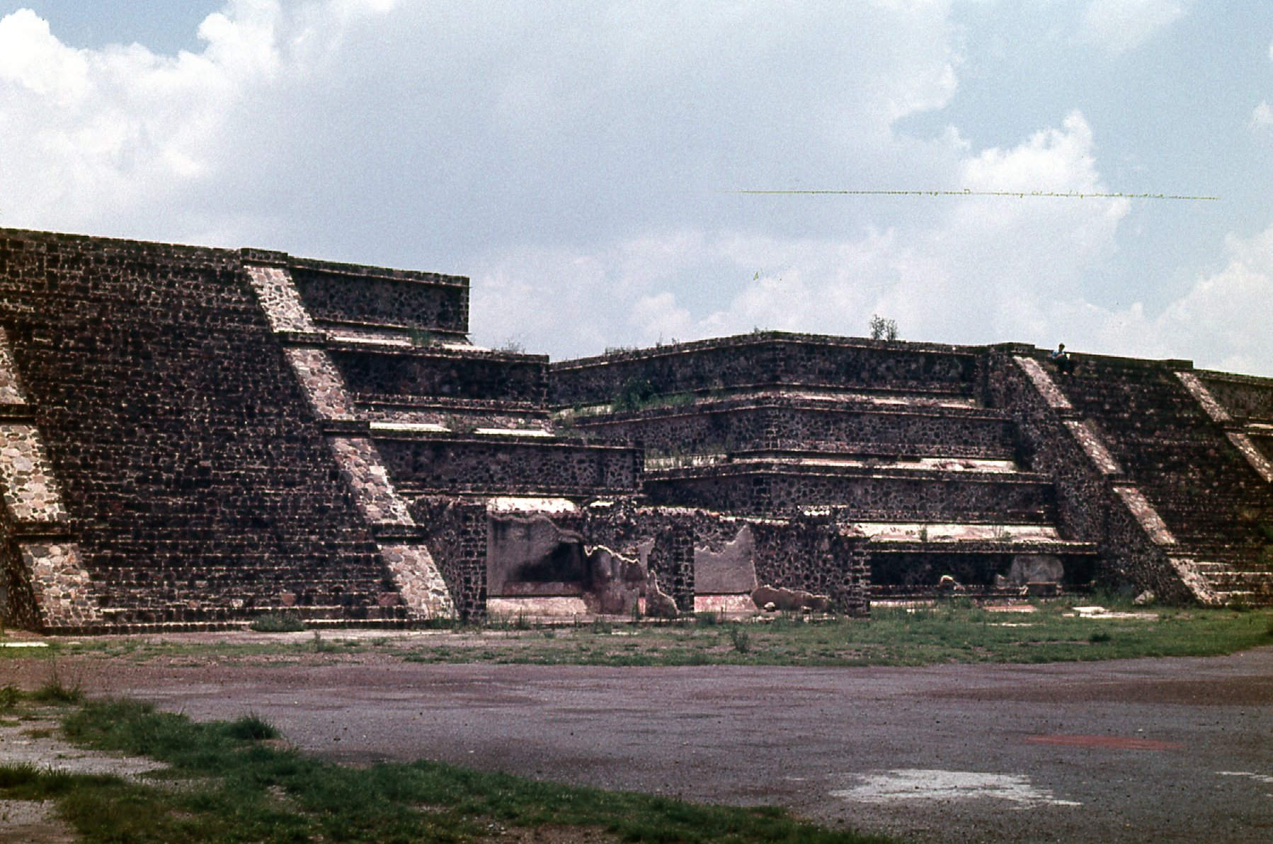
The Teotihuacán ruins are vast. Mostly built and occupied from 150 BC to 500 AD, they covered over 8 square miles, and fully 125,000 people lived here, making it the 6th-most-populated city in the world at that time. The public was allowed to walk pretty much everywhere, and I certainly did – there was wonderful detail to be seen everywhere I went.
One small detail
The 3rd-largest pyramid at Teotihuacán is the Temple of Quetzalcoatl, also known as the Temple of the Feathered Serpent. This next photo is taken from the Internet.
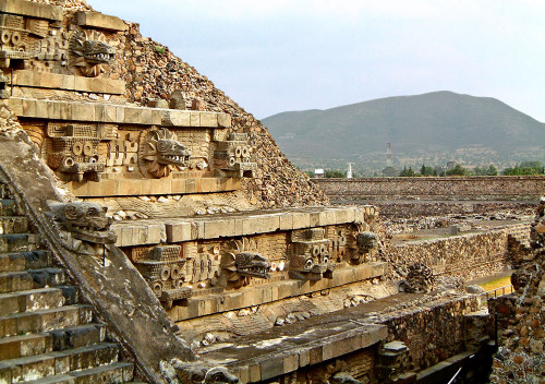
It is covered with exquisitely-carved heads. As you can see from the earlier photos, I climbed to the top of the Pyramid of the Sun. I then climbed to the top of the Pyramid of the Moon. From its summit, I had these views.
From atop the Pyramid of the Moon
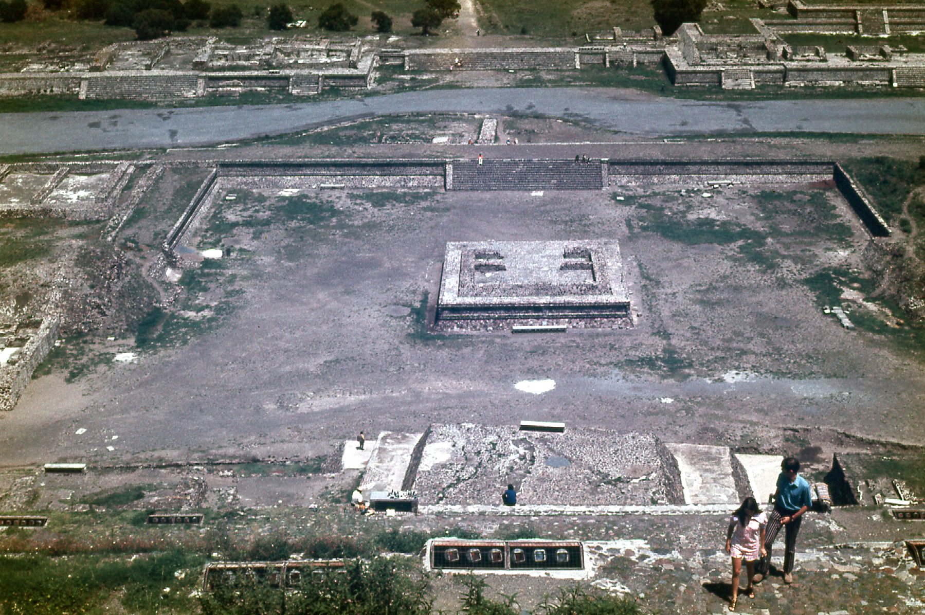
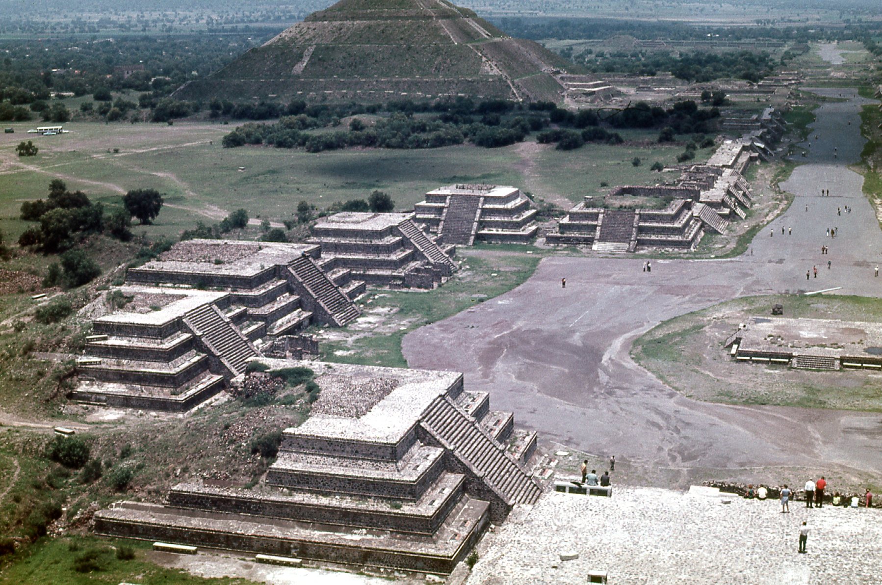
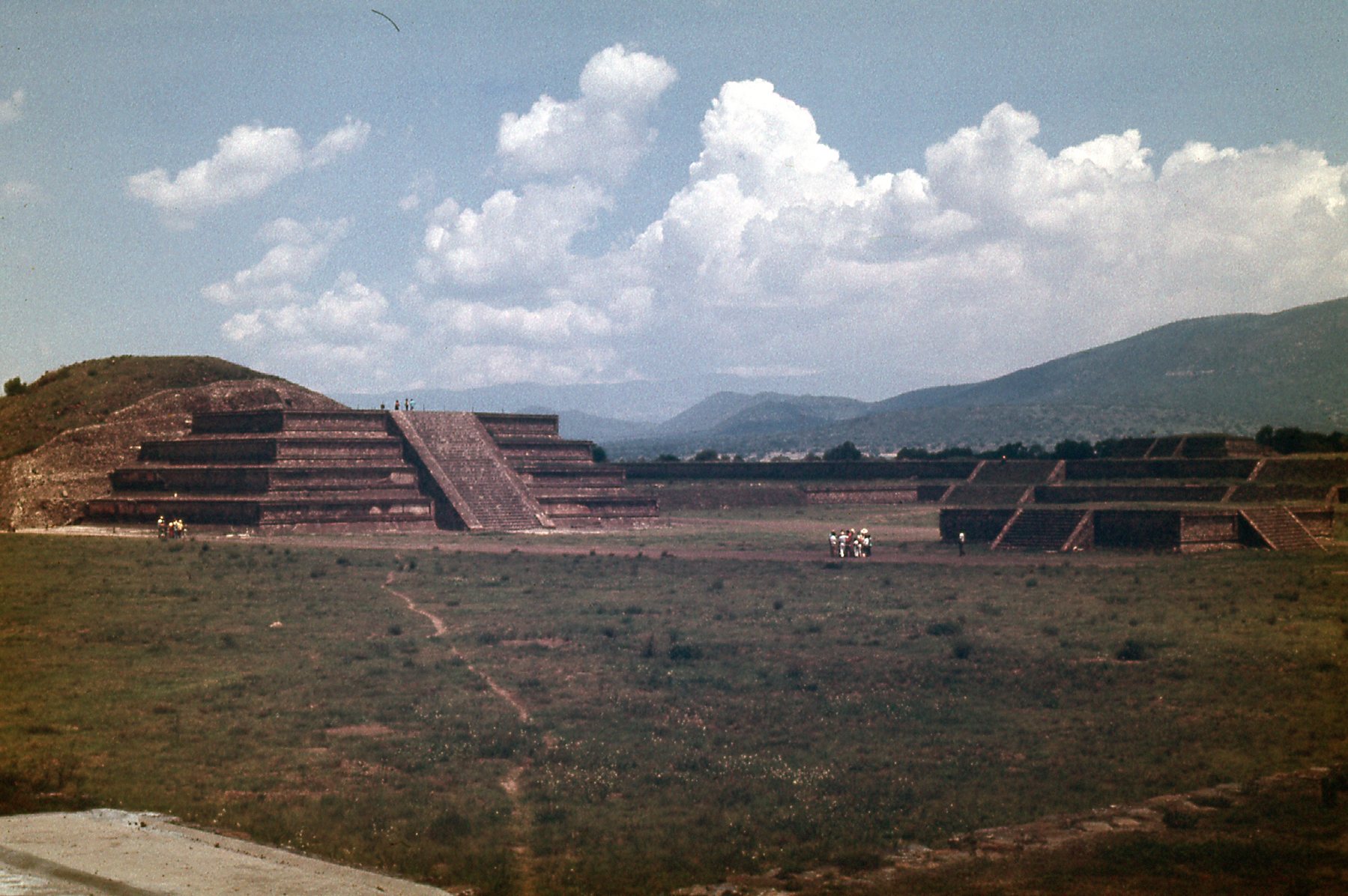
Please pardon my poor photography in the above photo, because I chopped off the top of the Pyramid of the Sun. However, the photo does show, along its right edge, the Avenue of the Dead. The main thoroughfare at Teotihuacán, it runs for just over a mile and a half along the north-south axis of the city. The above photo, along with this next one (also taken from up on the Pyramid of the Moon), both show a number of stepped pyramids that are part of the complex.
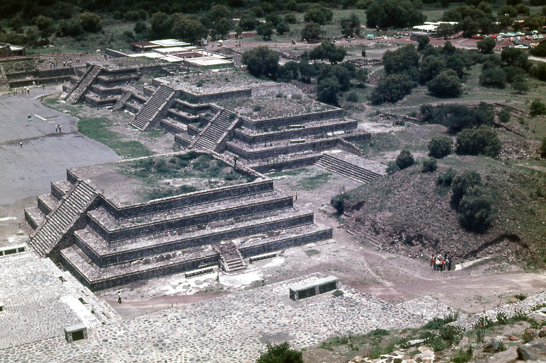
A view from above
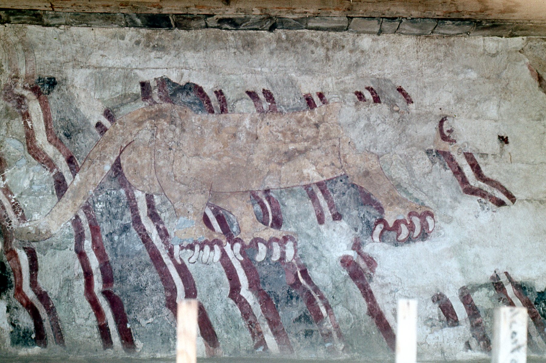
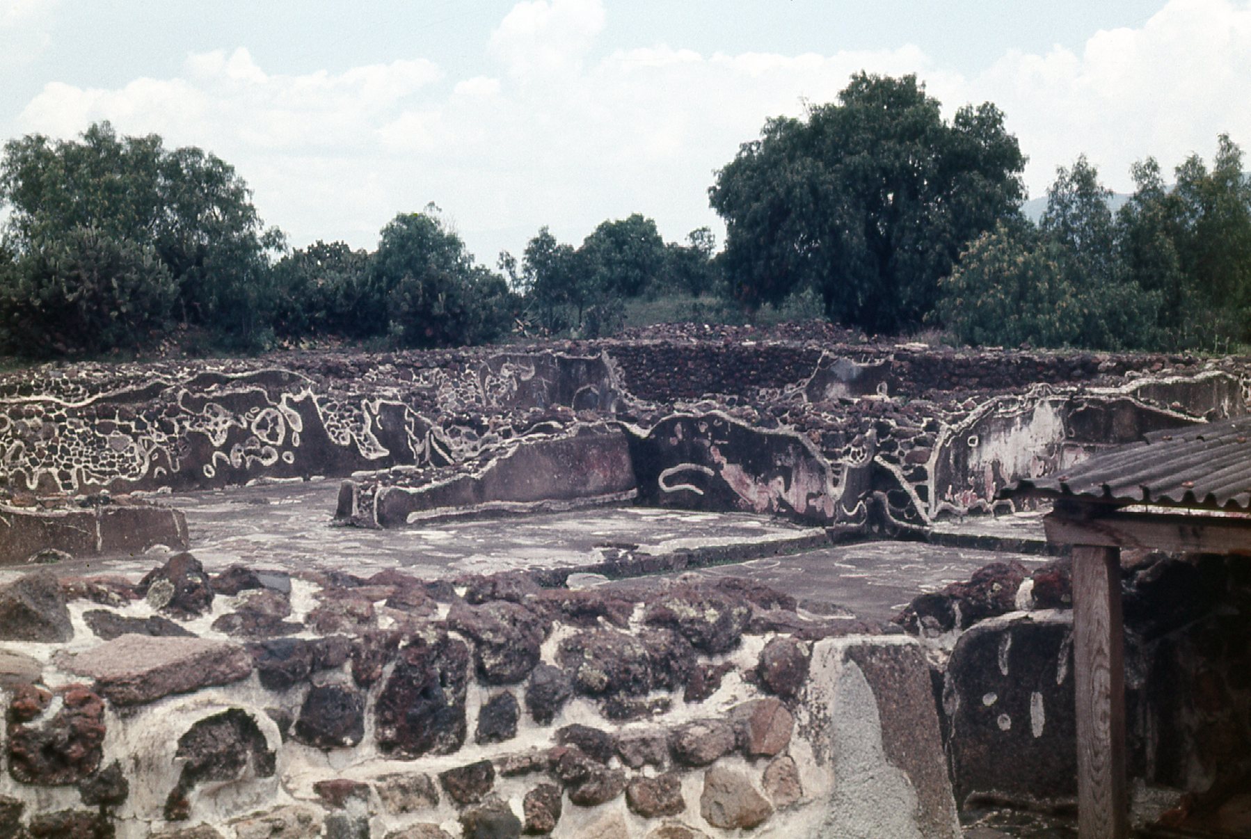
These shots show a bit of detail from the Temple of Quetzalcoatl.
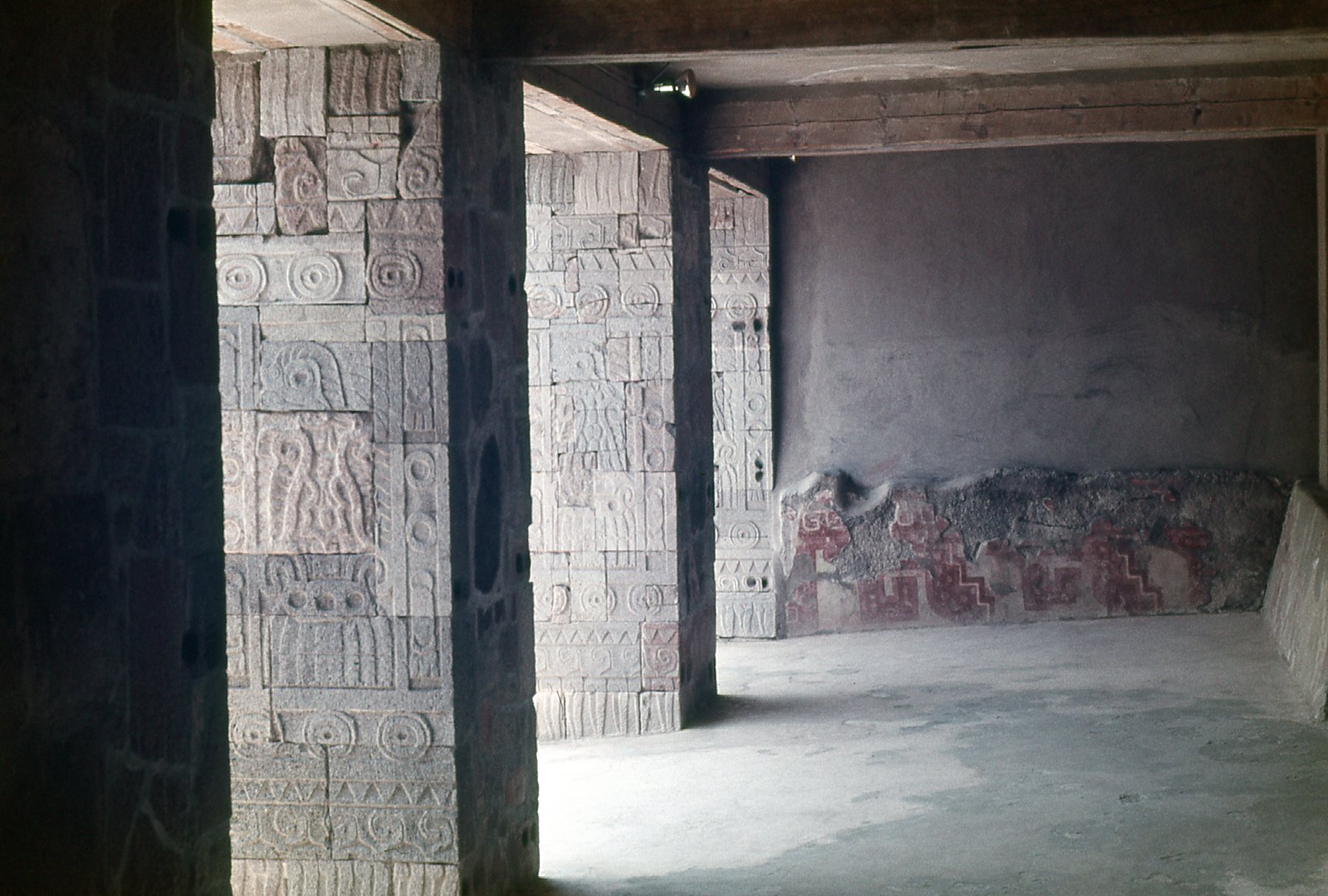
In the temple
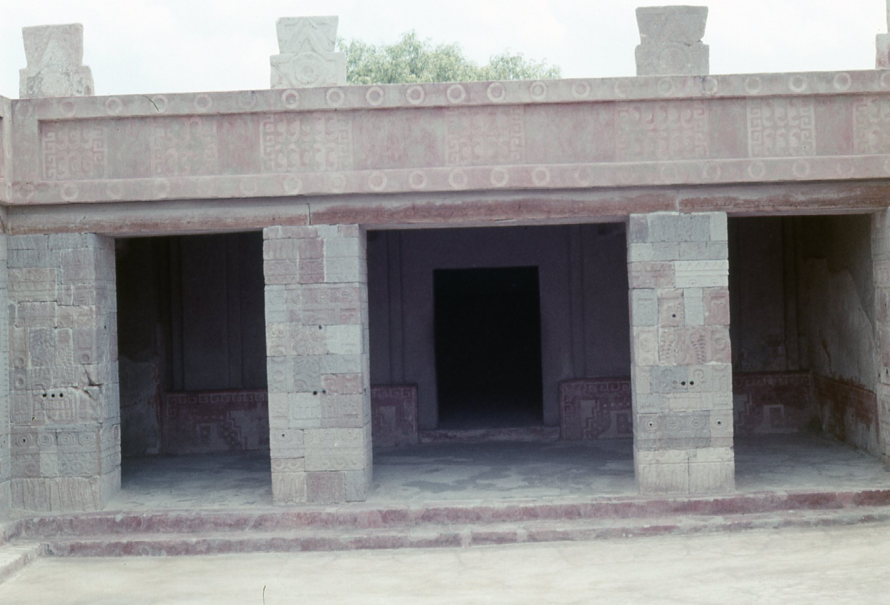
Another detail in the temple of Quetzalcoatl.
From the temple, I could see the Pyramid of the Sun in the distance. You can see the stairs by which people climb the pyramid, on its right side. Also, if you zoom in, you can see quite a few people on the top.
Looking towards the Pyramid of the Sun
Here is a shot of the Pyramid of the Moon, as seen from the temple. For scale, you can see people climbing the stairs and also on the top.
The stairs are plainly visible, which lead to the top of the pyramid.
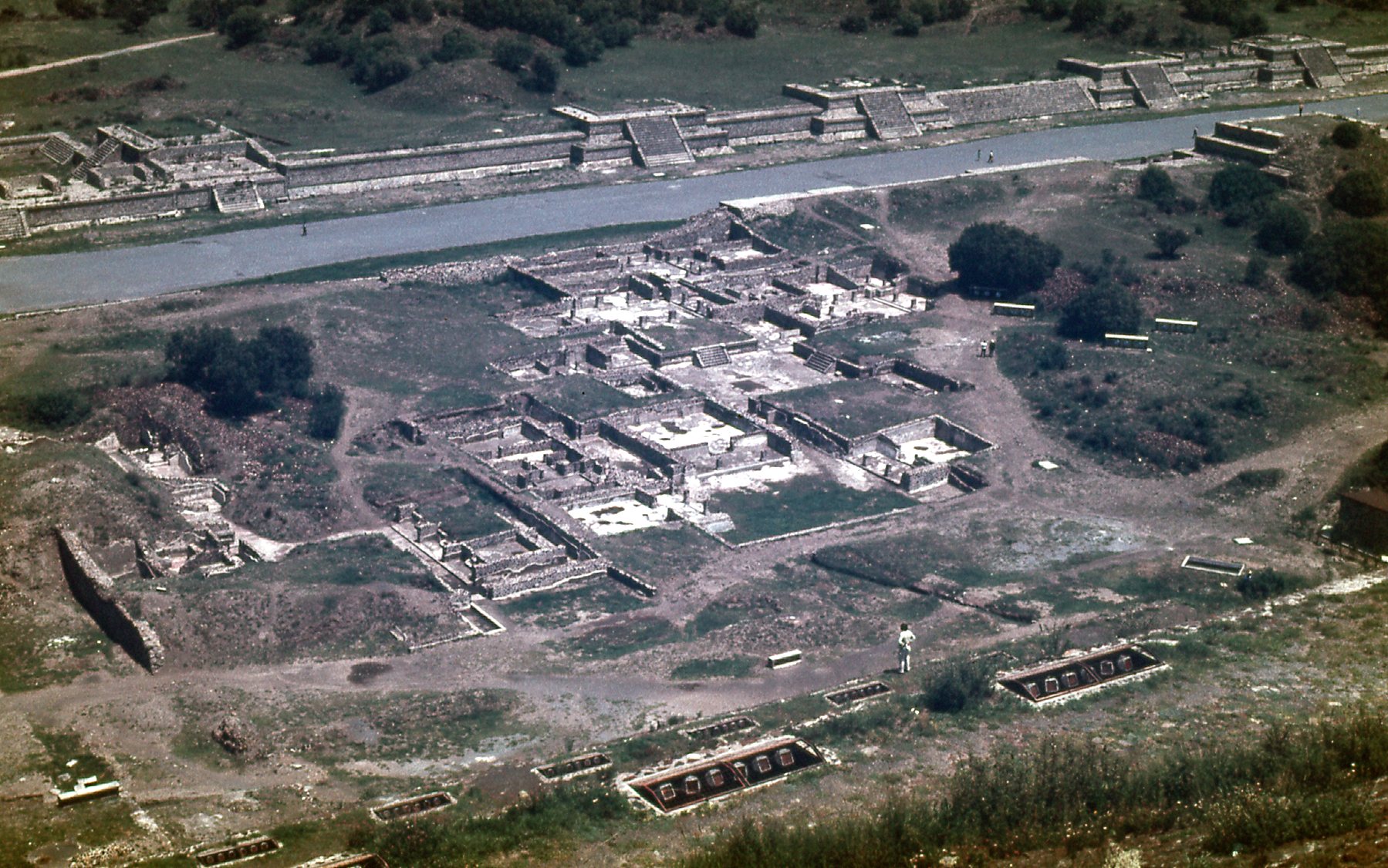
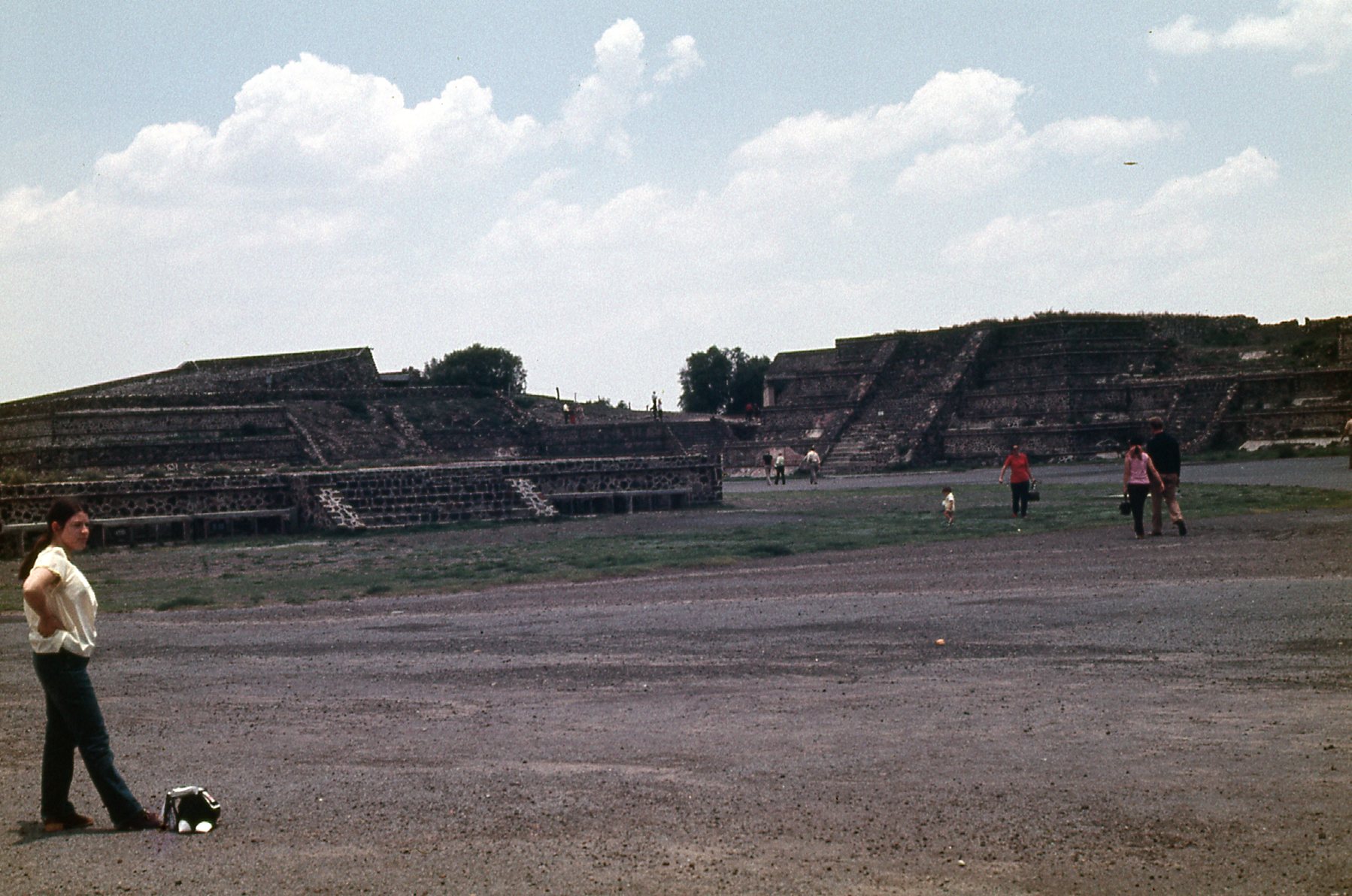
There is an area they call the courtyard, and here is how it looked from the Pyramid of the Moon.
The east side of the courtyard.
Here’s another view of the courtyard from the east side of the Pyramid of the Moon.
The east side of the courtyard.
Here’s another view from the east side of the Pyramid of the Moon.
There were some mica beds on the site of the ruins. Mica was used inside some of the passageways inside the pyramids.
The south end of the mica beds.
Here’s one last photo I took that day, a view of the arena at the south end of the ruins.
The arena.
It was a tiring day I spent at these ruins, walking miles in the heat. Because the monsoon season was in full swing, it felt oppressively hot and muggy. If it hadn’t been over 7,500 feet in elevation, it would have been a lot worse. There are excellent websites that document Teotihuacán in great detail, and are well worth checking out. Even today, they’re uncovering new and exciting finds. For example, remains of sacrificial victims have been found in at least 8 sites. I got a good sunburn from the day’s wandering. To slake my thirst, I bought grape soda from vendors, 7 bottles altogether. Once I had seen all I could manage, I caught a bus for a one-hour ride back to my hotel in Mexico City.
The following day, I took a bus to the city of Toluca – just for the day. Seventeen miles southwest of the city sits Nevado de Toluca, at 15,354 feet, one of the bigger volcanos in Mexico. How I wished I could have climbed it, but I had neither the time nor even a pair of boots with me.
On June 24th, I took a bus to Puebla, Mexico’s 4th-largest city. During my couple of days spent there, I visited the cathedral and talked a caretaker into letting me climb the staircase to the roof so I could take pictures of 2 of the biggest peaks in the country. Here are the telephotos I managed.
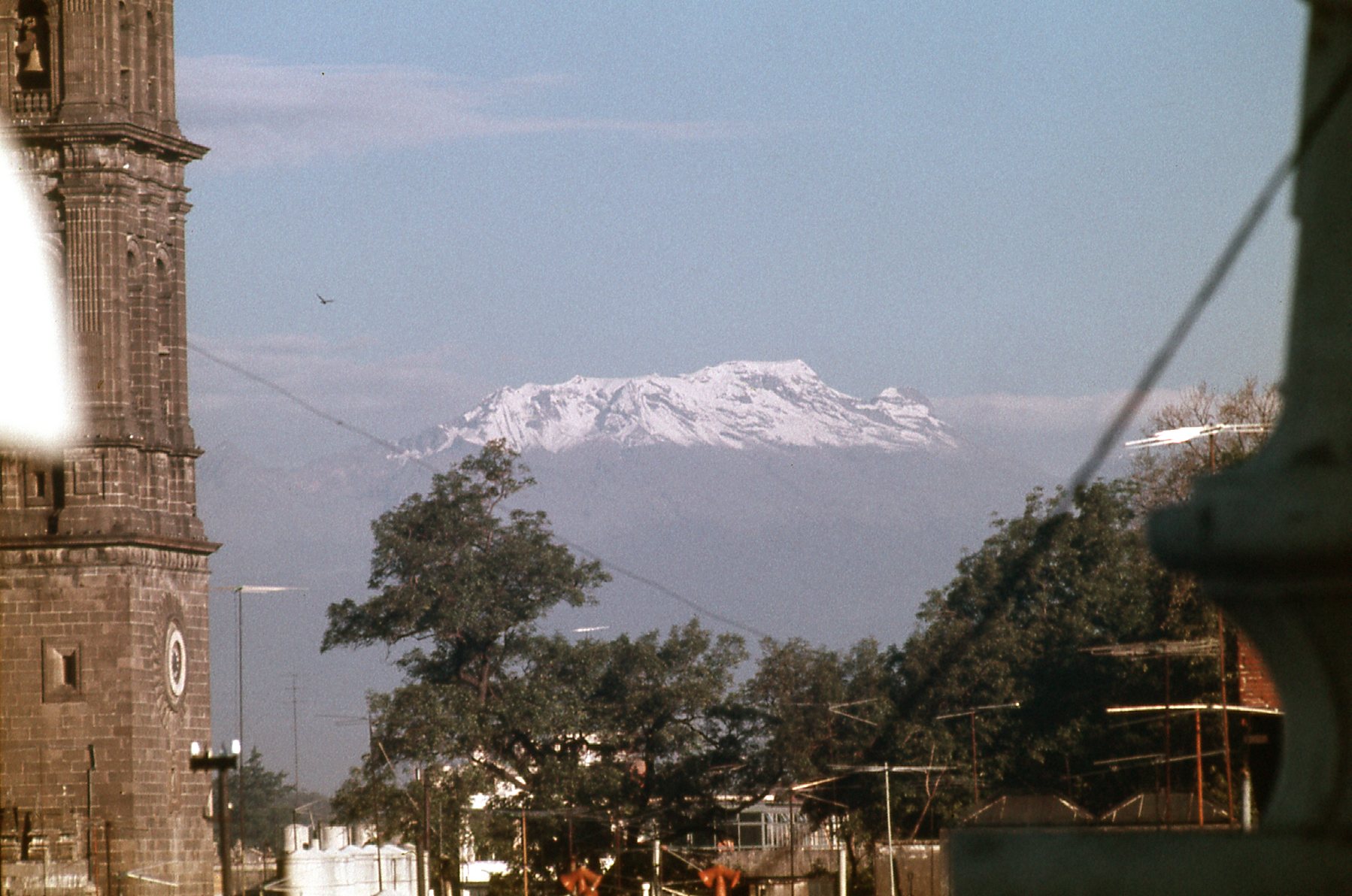
Iztacchuatl – at 17,160 feet, it is Mexico’s 3rd-largest peak and the 8th-highest peak in North America. It was 30 miles away.
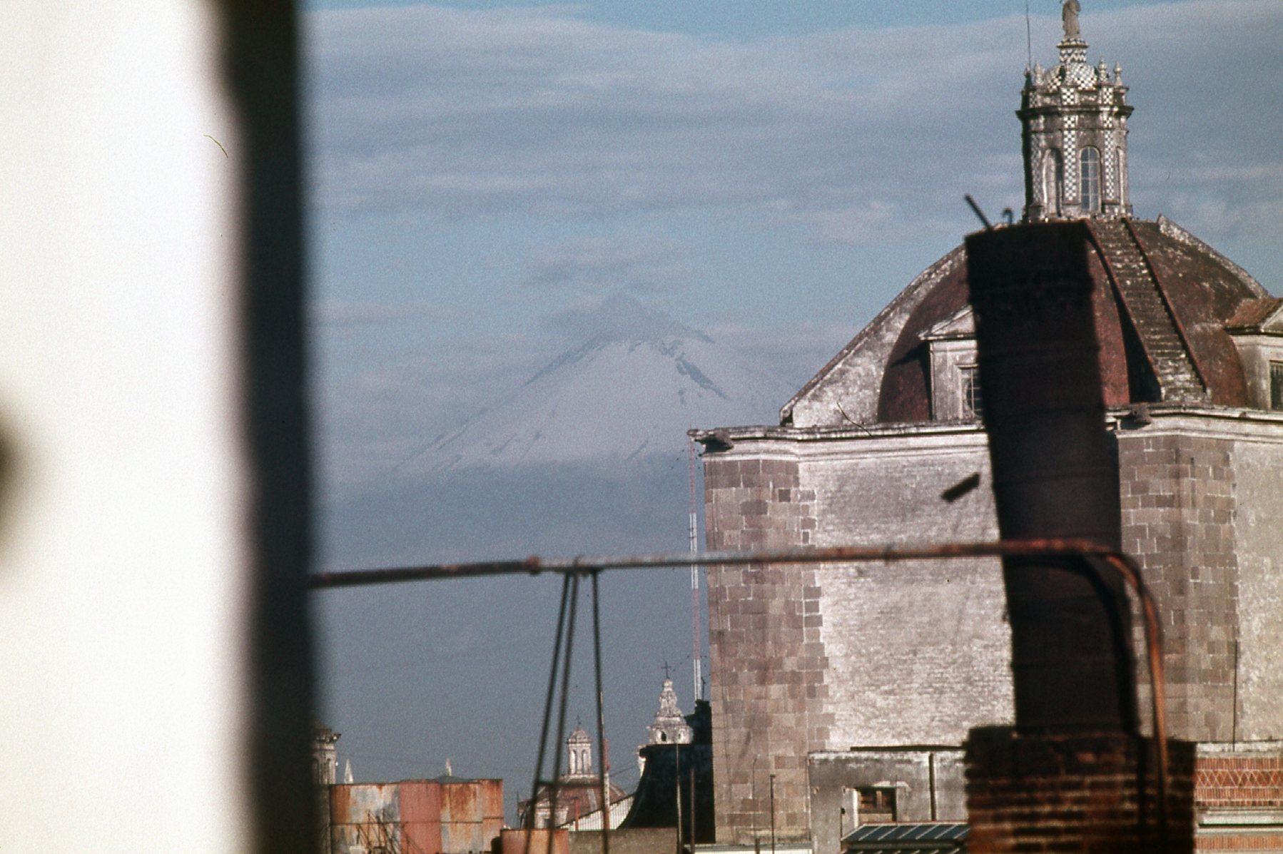
Popocatepetl – see it faintly in the back? At 17,749 feet, it is Mexico’s second-highest peak, and is also the 5th-highest peak in North America
On June 25th, I took a bus from Puebla to Veracruz, via the cities of Orizaba and Córdoba. En route, I saw Matlalcueitl, a peak also known as La Malinche. It has an elevation of 14,501 feet, and is the 6th-highest peak in Mexico.
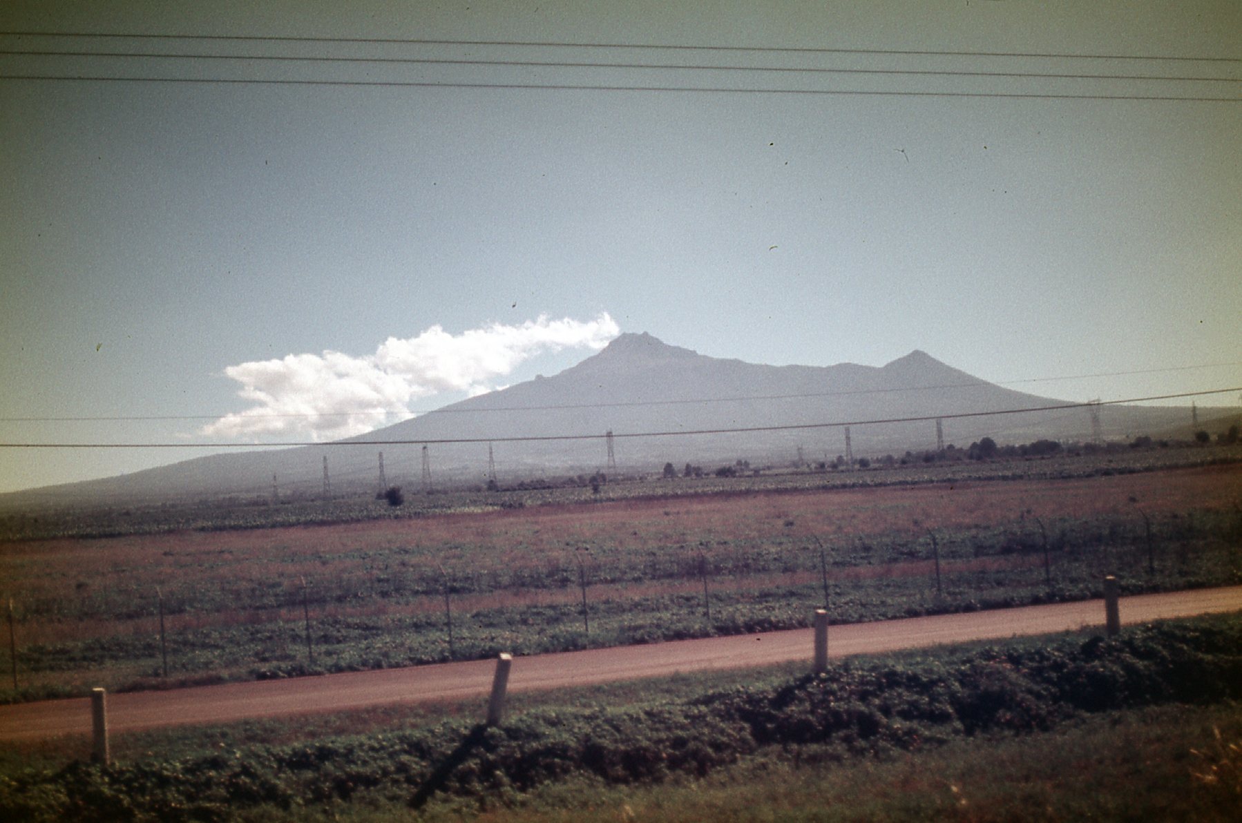
La Malinche, elevation 14,501 feet.
I also had this view of Pico de Orizaba, also known as Citlaltépetl. At 18,491 feet, it is the highest peak in Mexico and the 3rd-highest peak in North America.
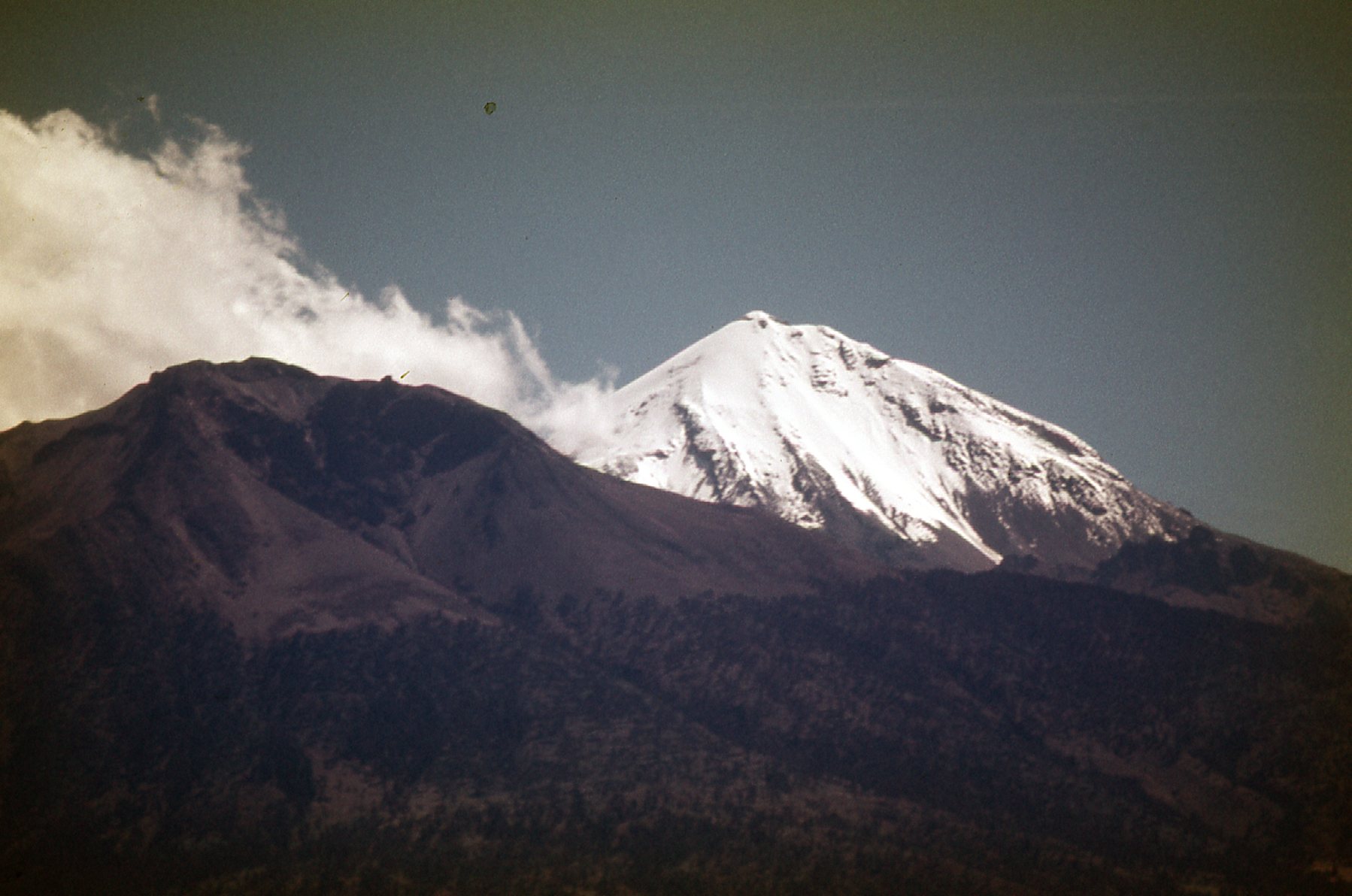
Pico de Orizaba
The 4-hour bus ride took me to Veracruz, a city on the Gulf of Mexico. It was June 25th, and I found the heat and humidity to be oppressive. The 2 days I was there were spent taking cold showers and swimming in the ocean, trying to cool off. On the evening of the 26th, I rode buses for 16 hours overnight to arrive at the city of Mérida, the capital of the state of Yucatán. My goal was to visit the major archeological ruins of the Yucatán, or at least as many as I could. So please stick with me for the next part of my journey.