
Before reading this piece, please be sure to read the previous post entitled “Ruined – Part 1”.
I had finally arrived at the city of Mérida in the Yucatán Peninsula. It was June 27th, 1972. Now 10 days in the country, here I was at the height of the monsoon season. Most days it rained, especially here so far south and in the tropics – hot and humid were the orders of the day. At least my hotel room was air-conditioned. I settled in and got organized for my visit to some ruins the next day.
On Wednesday, the 28th, I boarded a bus full of English-speaking tourists. A 2-hour ride took us south to the ruins of Kabah. This is a Mayan archeological site located in the Puuc region of western Yucatán. The highway runs right through the ruins, some of which were still overgrown with vegetation. Much of it had a very rustic look, as if a lot of work still remained to be done. Kabah was inhabited from the mid-3rd century BC, and much of what you see when you are there was built from the 7th to the 11th century AD. Some of the ruins were inscribed with specific dates: one building carried a date of 879 AD (around the time of the city’s apex). Another carried a date of 987 AD. Once arrived, I sought out the caretaker. When Dan and I were here 2 years earlier, we had made his acquaintance, and I was pleased to find that he still remembered me. Here are some of the photos I took on this second visit.
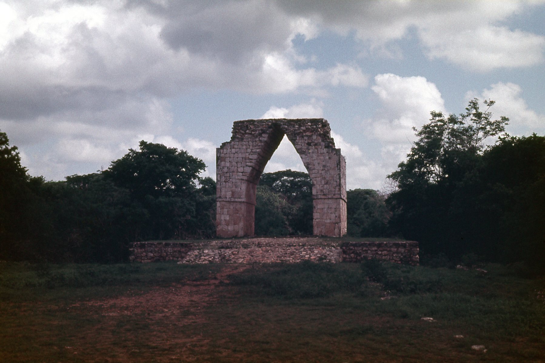
This is known as the Arch of Kabah, and it is located in the middle section of the ruins.
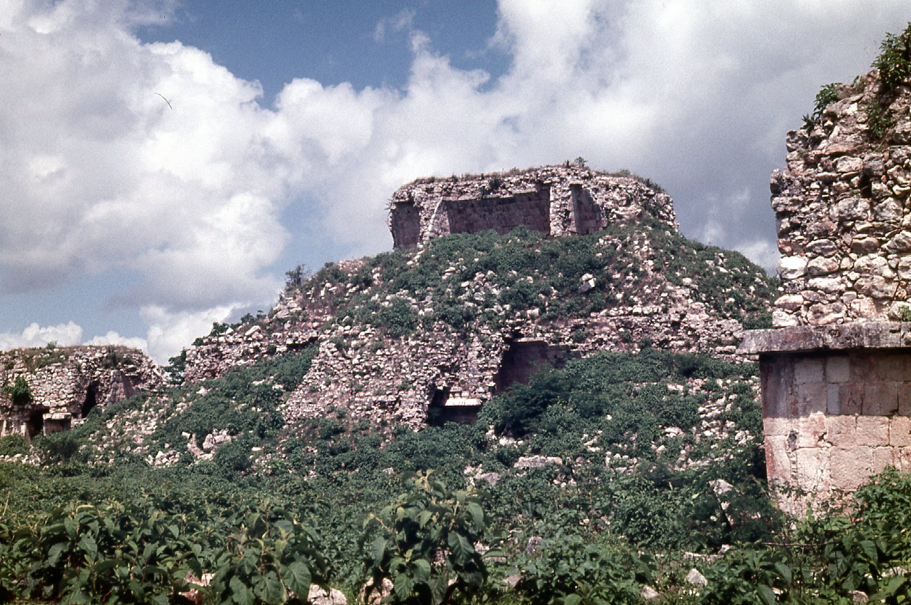
This is a view in the older part of the ruins.
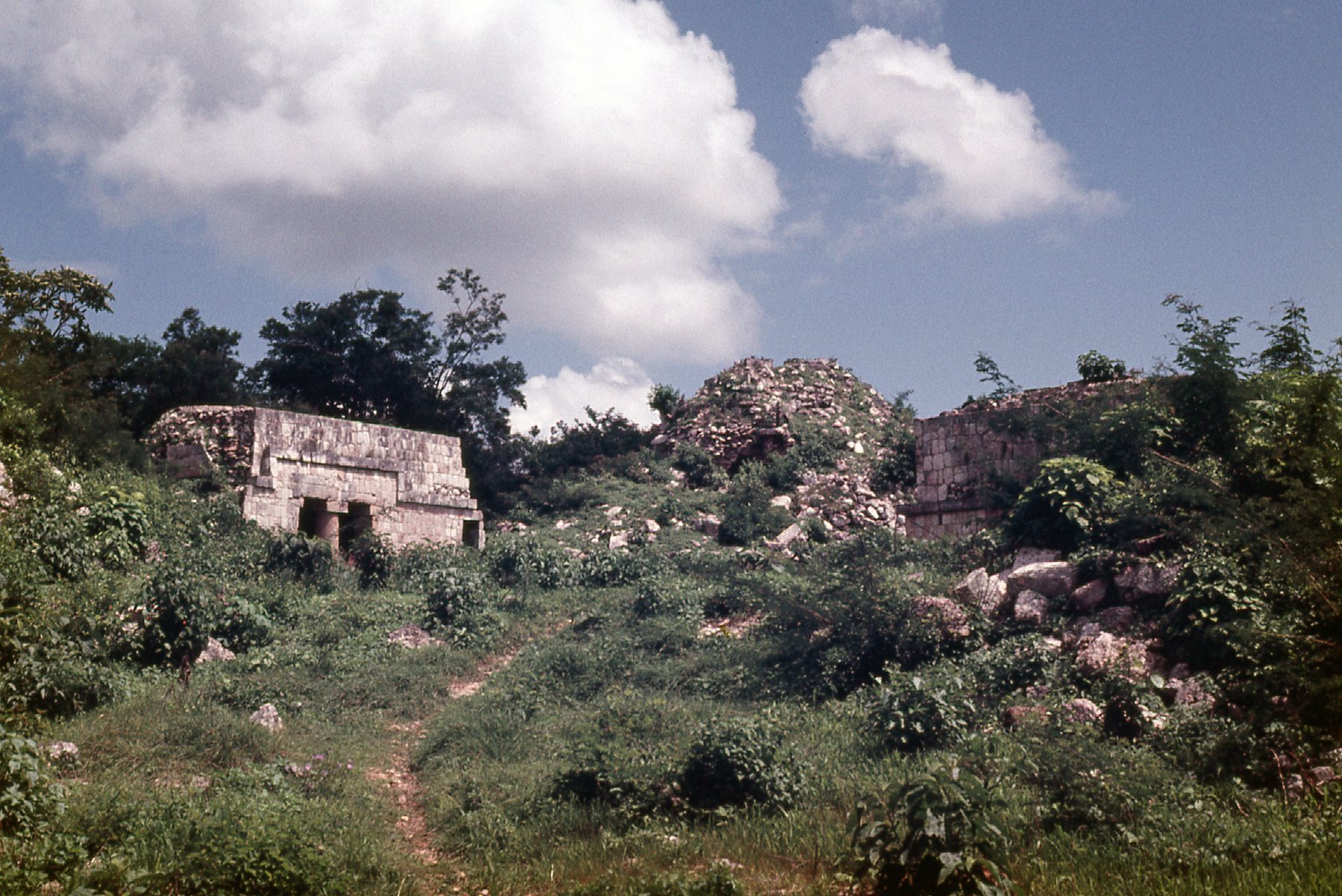
This is between the Arch and the older area.
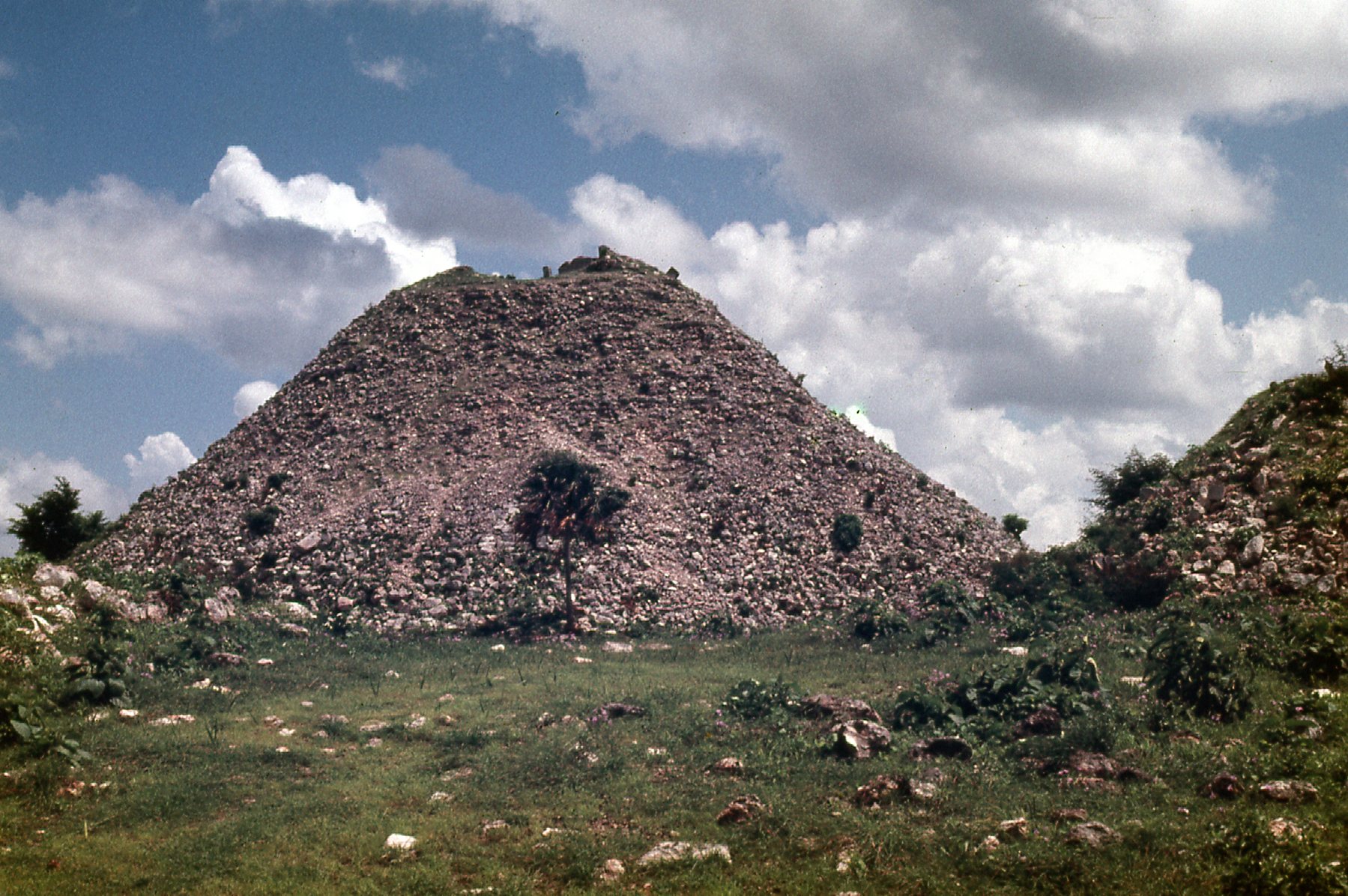
This was on the west side of the road.
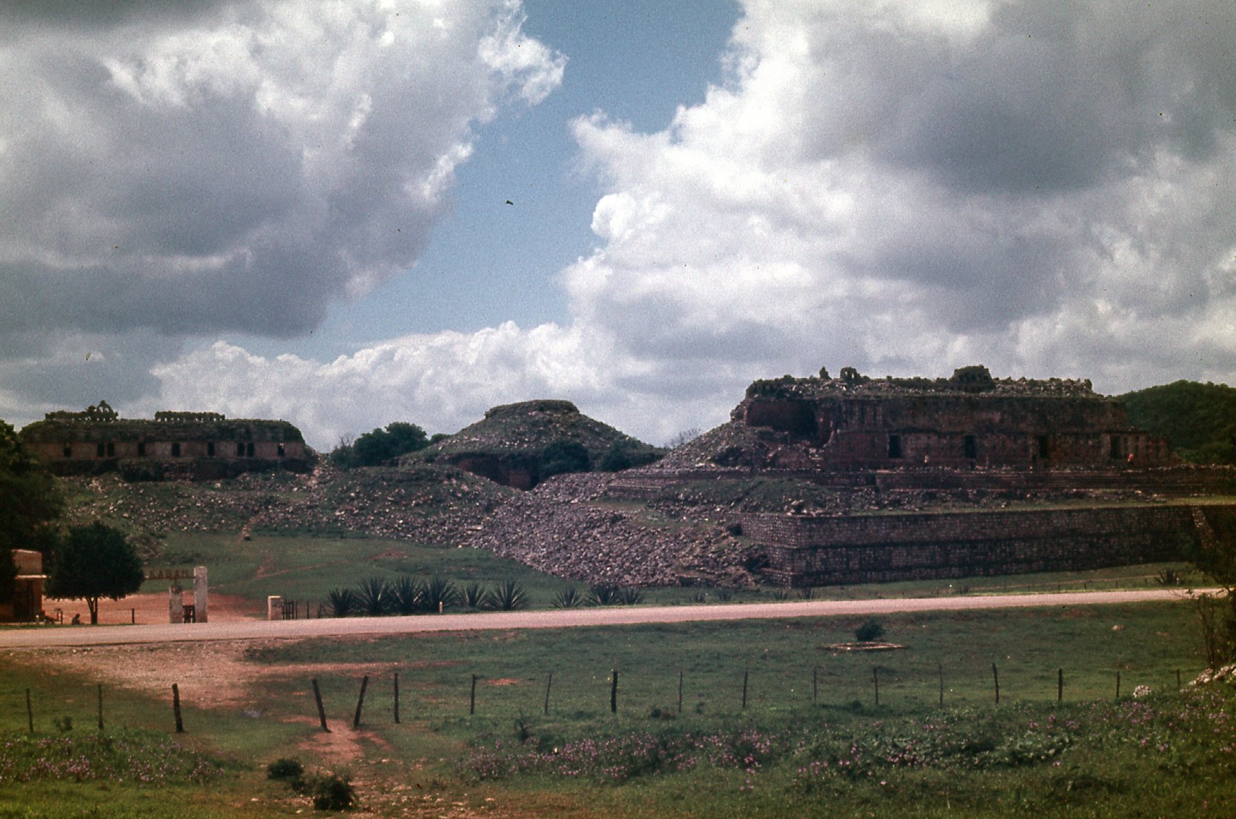
This is in the east part of the ruins. The structure on the right is known as The Palace.
If you compare the ruins at Kabah to those at Teotihuacán, at least the year I was there, it seems like Kabah was still very much a work in progress. And yet, there are real gems to be found. The Codz Poop palace is 170 feet long, and its western façade contains over 250 masks of the long-nosed rain god Chaac. Each of the masks is composed of 30 carefully-carved mosaic stones. The picture below is from the Internet and shows some of the amazing detail to be found there.
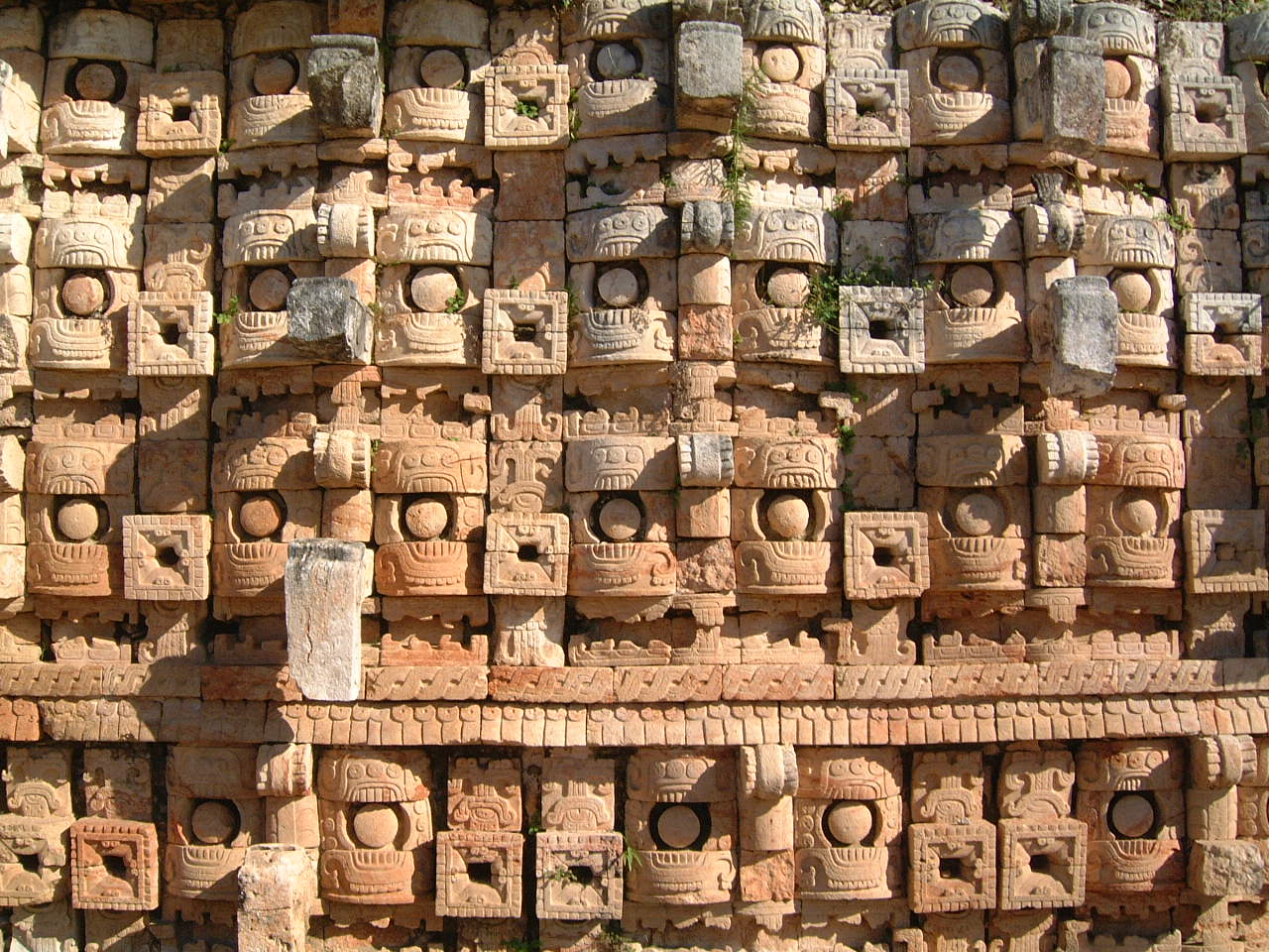
A detail from the Palace of Masks – By Hermann Luyken – Self-photographed, CC BY-SA 3.0, https://commons.wikimedia.org/w/index.php?curid=1328140
The tour I was on only allowed one hour at Kabah, so I really didn’t see much of it. If you could spend a full day, I’m sure you’d discover more treasures.
Our bus moved on, and a short half-hour ride brought us to the major ruins at Uxmal, at least more major than Kabah. Uxmal is a UNESCO World Heritage Site, and it was the capital of a Late Classic Maya state from about 850 to 925 AD. The city appears to have been founded around 500 AD. Its architecture is outstanding and is matched only by that at the ruins of Palenque for elegance and beauty. Our tour allowed us a total time of 3 hours at Uxmal, so I walked around and saw as much as I could. I took pictures while I was there, and I present them to you here.
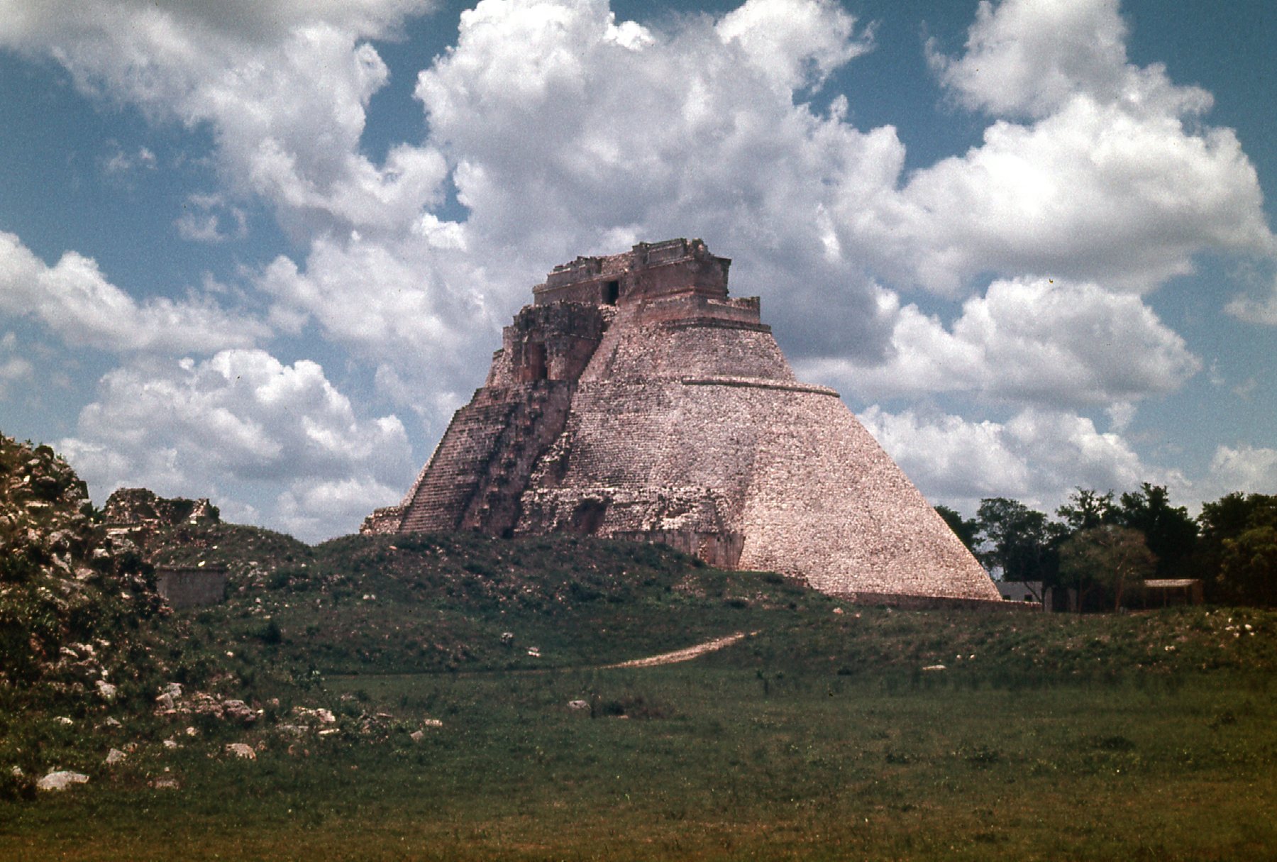
This is the Pyramid of the Magician – it is over 100 feet tall, and contains 5 different temples built in succession. We are looking at its southwest side.
Looking west-southwest from the pyramid.
Looking west.
Looking northwest from the pyramid.
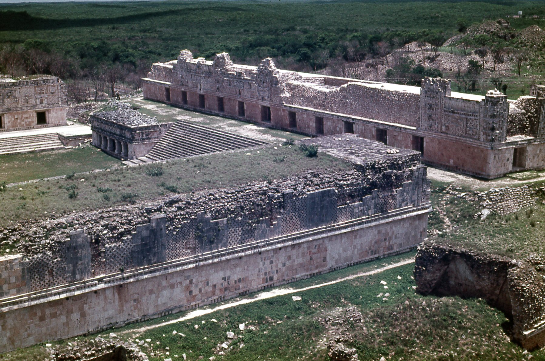
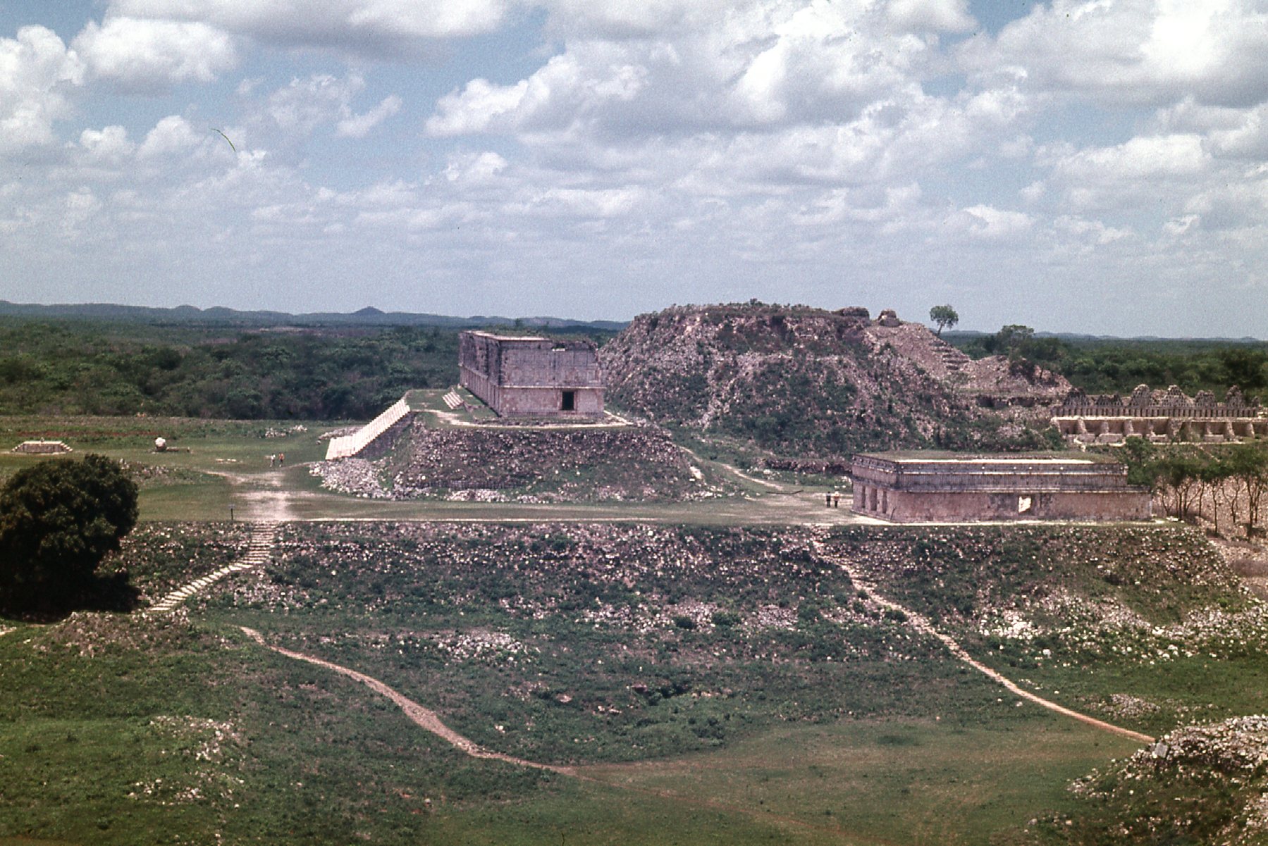
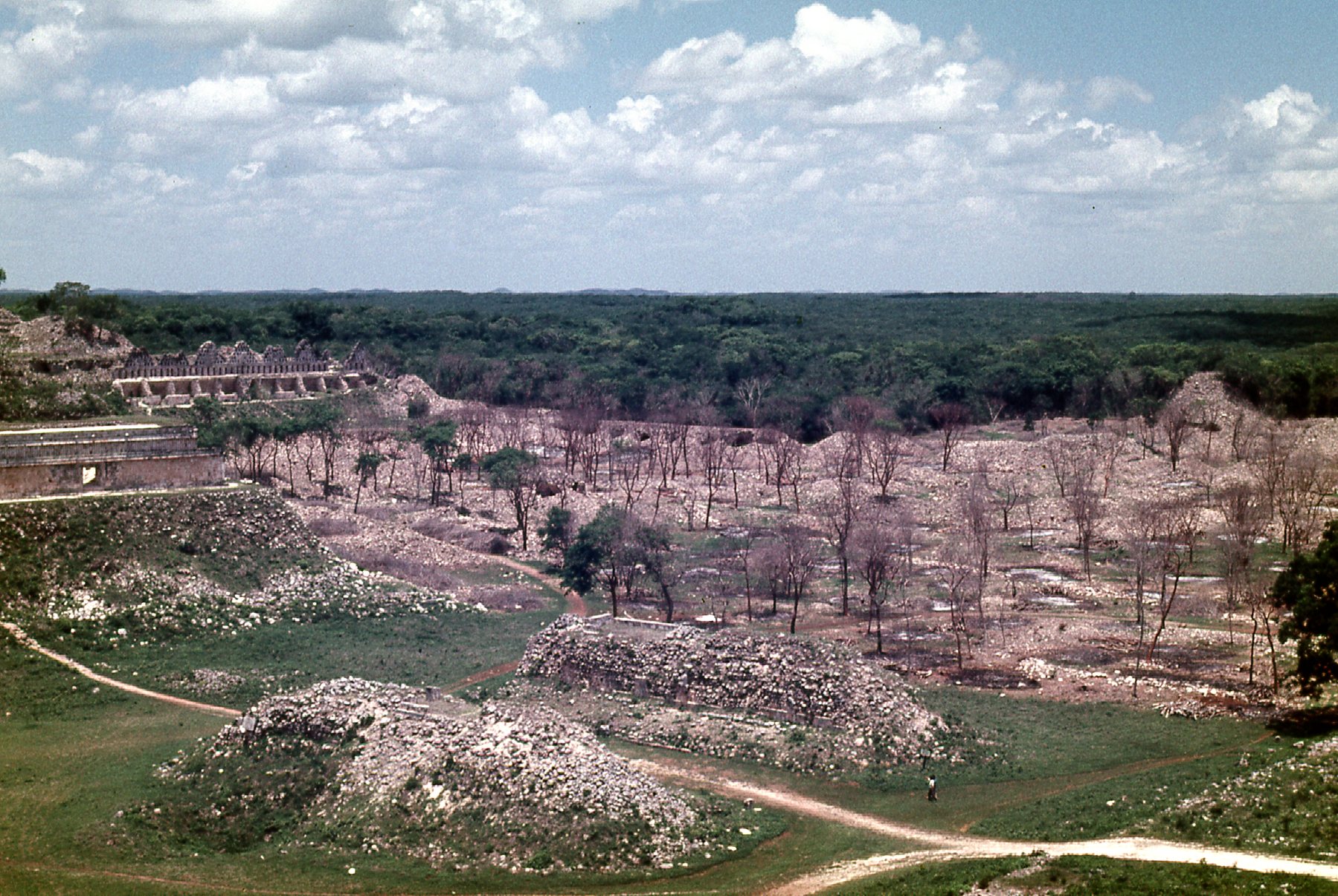
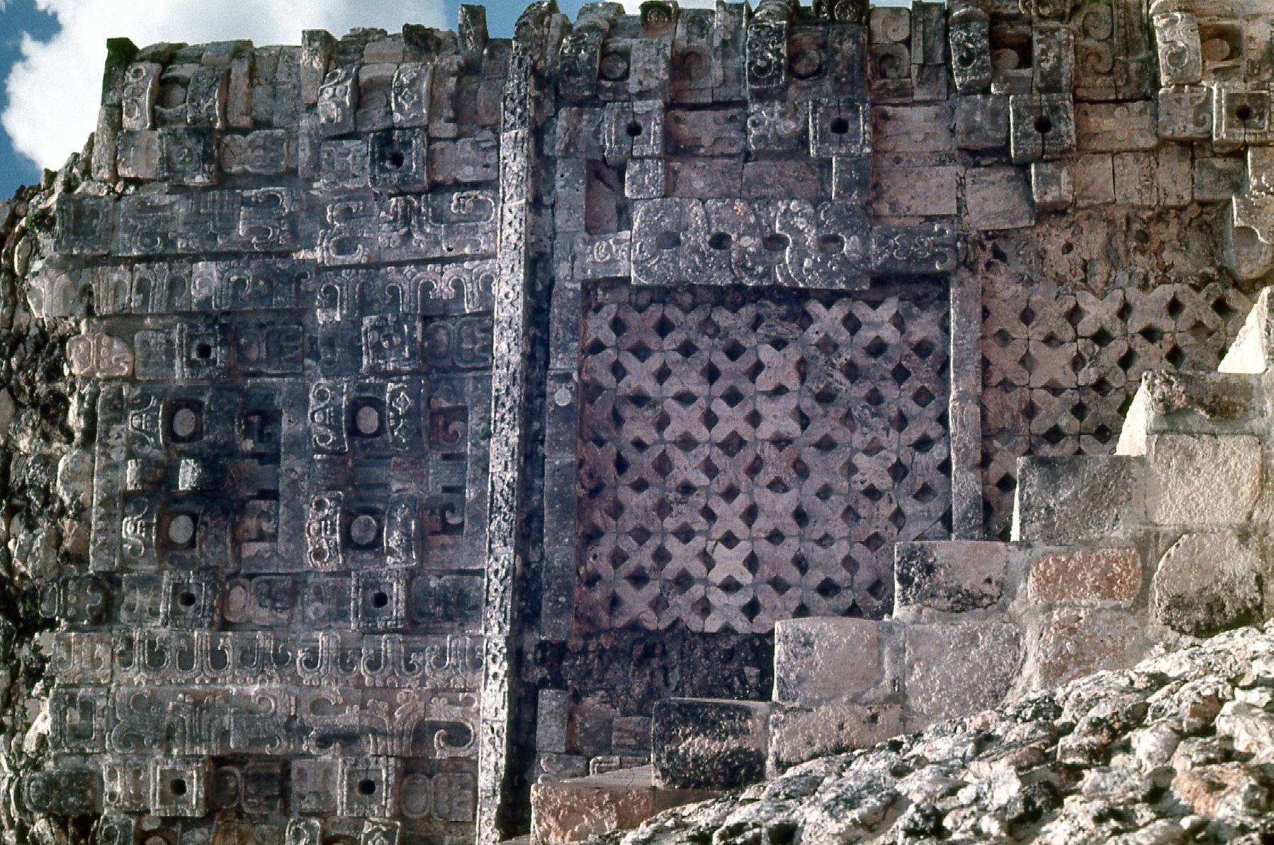
Looking north into the Quadrangle of the Nuns
Here is a view of the Casa de las Palomas.
Casa de las Palomas (House of the Doves)
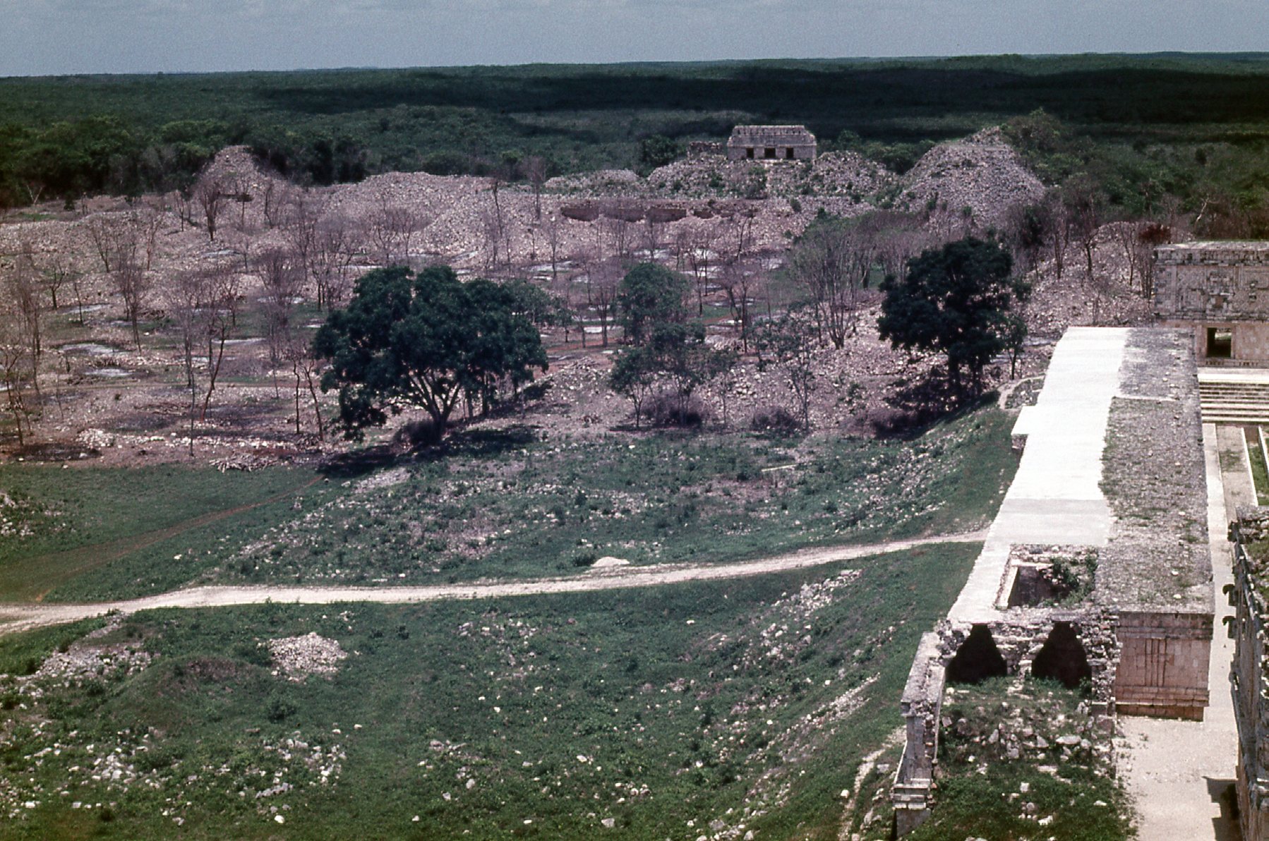
Here is a detail from inside the courtyard.
Along the north side of the courtyard.
Here’s another detail in the courtyard.
Along the west side of the courtyard.
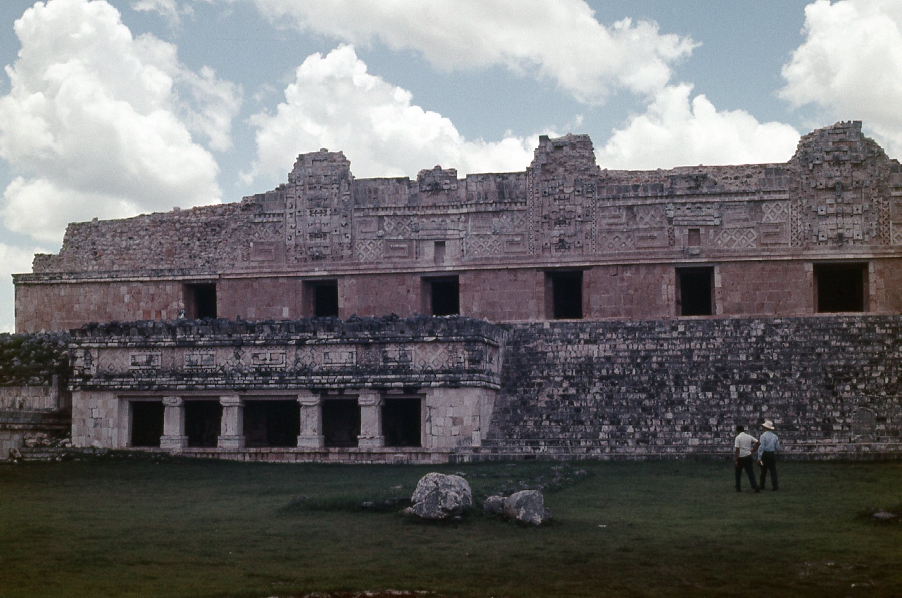
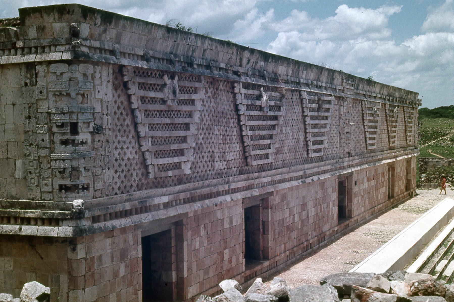
This is the Governmental Palace.
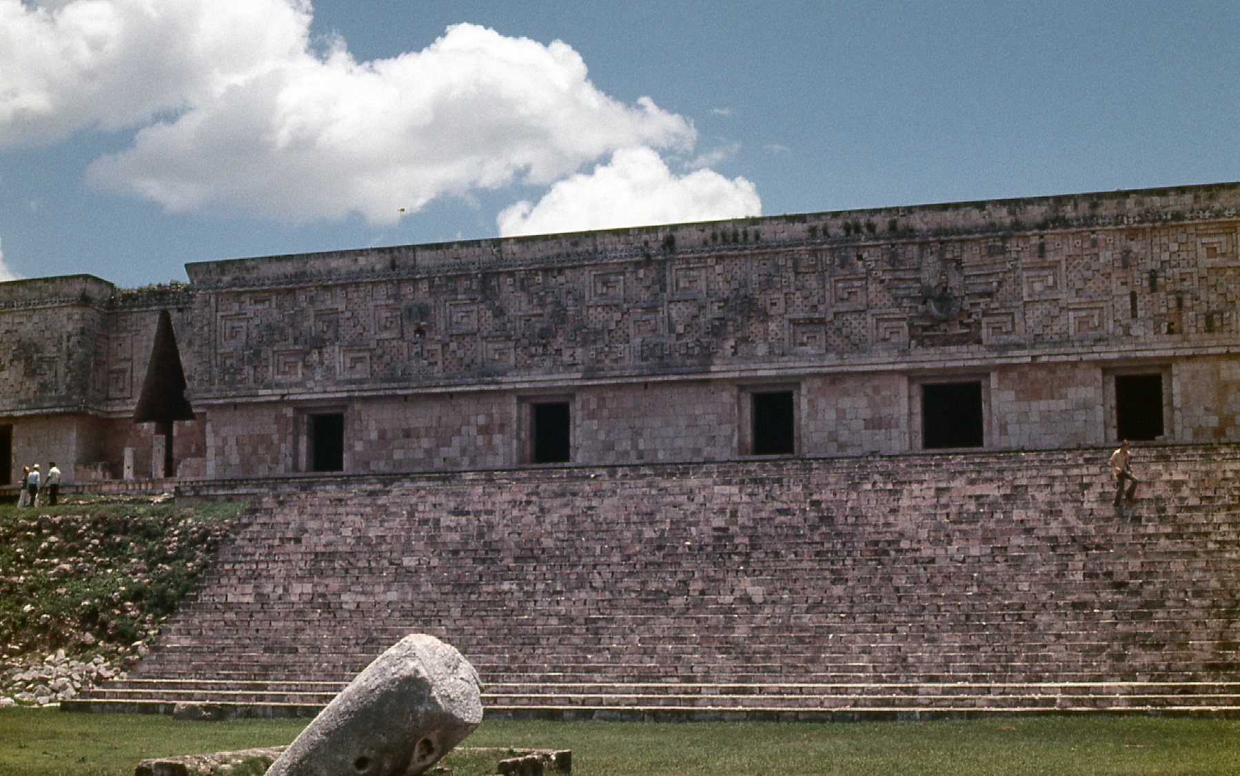
The Governmental Palace. It is large, covering more than 1,200 square meters, or 13,000 square feet..
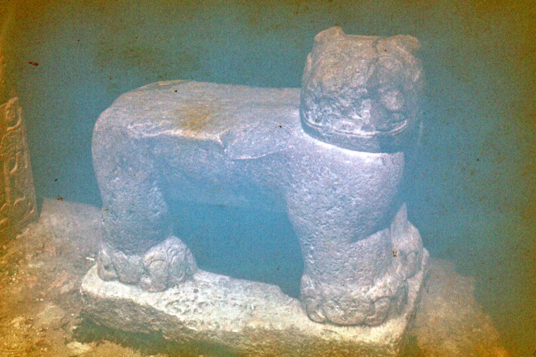
One more – this is the two-headed Jaguar Throne, which sits in front of the Governmental Palace. It represents both male and female jaguars.
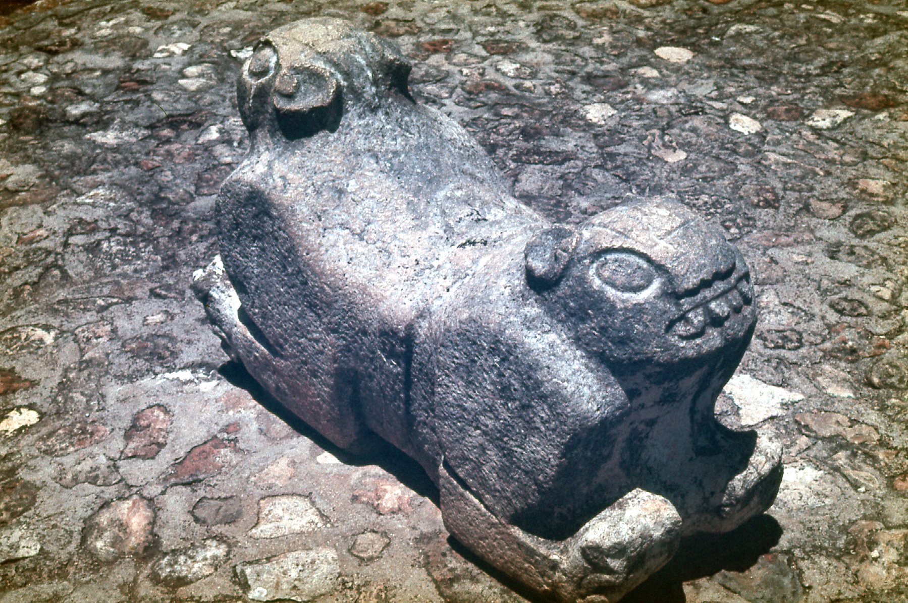
The Jaguar Throne.
Those are all of the pictures I have from that day. Here is a website that contains more, and also has a lot of really good information on Uxmal. It’s worth checking out.
One more thing. When I visited in 1972, there were no tourist facilities at Uxmal. The place had an exciting, rustic feel to it. Today, there are hotels, restaurants, a museum and tour operators which are all close by the entrance to the ruins. Okay, I know I was there over 50 years ago, and I guess that’s progress for you, but perhaps something of the feeling of the place has been lost. On the other hand, I suppose that being able to sleep and eat there would allow more people to have a much-more-detailed look than I was able to all those years ago.
The tour bus took us back to Mérida, where I spent another night. The next morning, the 29th of June, I walked to the bus depot and boarded one heading east. After riding for 2 hours, I disembarked at the ruins of Chichen Itza, one of the largest Mayan cities. It too is a UNESCO World Heritage Site, and is a major tourist draw, attracting well over 2 million visitors per year. The city rose to regional prominence around 600 AD, and the 10th century saw its rise to a regional capital controlling a large part of the Yucatán Peninsula. The core of the city covered an area of around 2 square miles, and remnants of small-scale architecture extends for quite a distance beyond this. Much has been written about Chichen Itza, and a good overview can be found at this site. The day of my visit saw me spending several hours walking around and seeing as much as I could. Here are some pictures I took that day.
Jaguar sculpture
The jaguar sculpture in the above photo is located at the Temple of the Jaguar. Here is a detail from one of the temple walls.
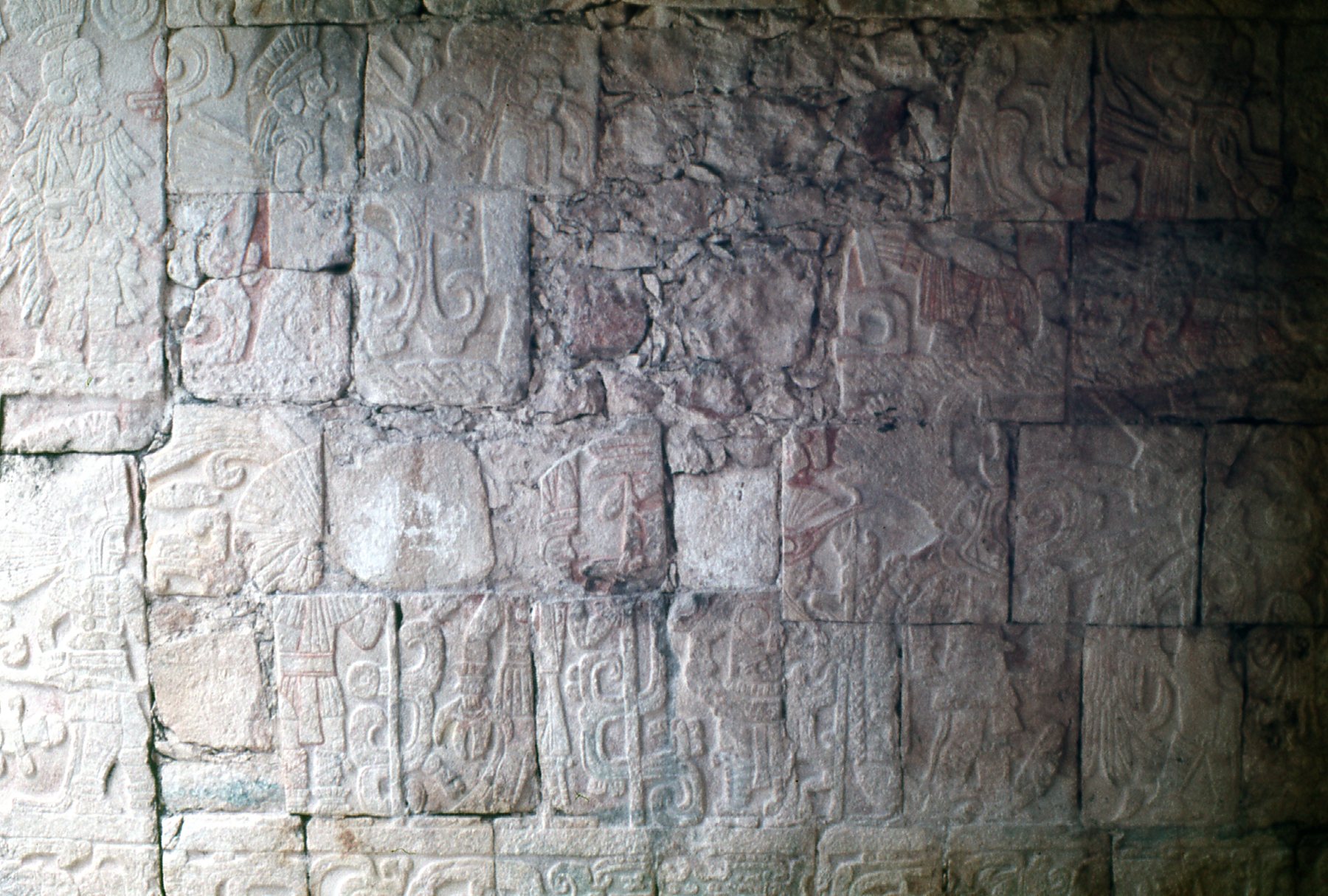
A wall detail at the Temple of the Jaguars.
Perhaps the biggest structure at these ruins is the Handball Court. This is a game that the Mayans took very seriously, stories telling of how the losers were sacrificed! There were no less than 13 different handball courts at Chichén Itzá, and these pictures were taken at the largest one, which measures 551 feet long by 230 feet wide.
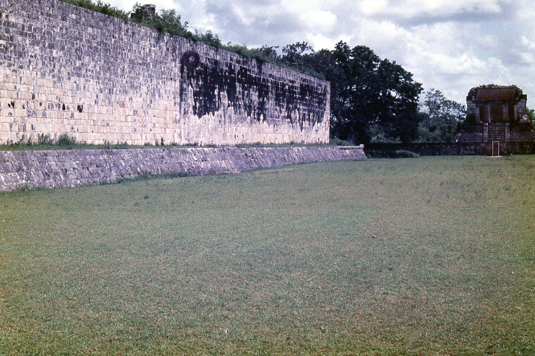
This is the west wall of the Handball Court. Visible down at the far end is the Templo del Hombre Barbado (Temple of the Bearded Man)
The east wall of the Handball Court.
Notice the small lawn mower in the above photo. I pity the poor guy who has to mow the entire Handball Court with that – it’s almost 3 acres! And in that tropical climate, it’d be a non-stop job to keep it looking nice.
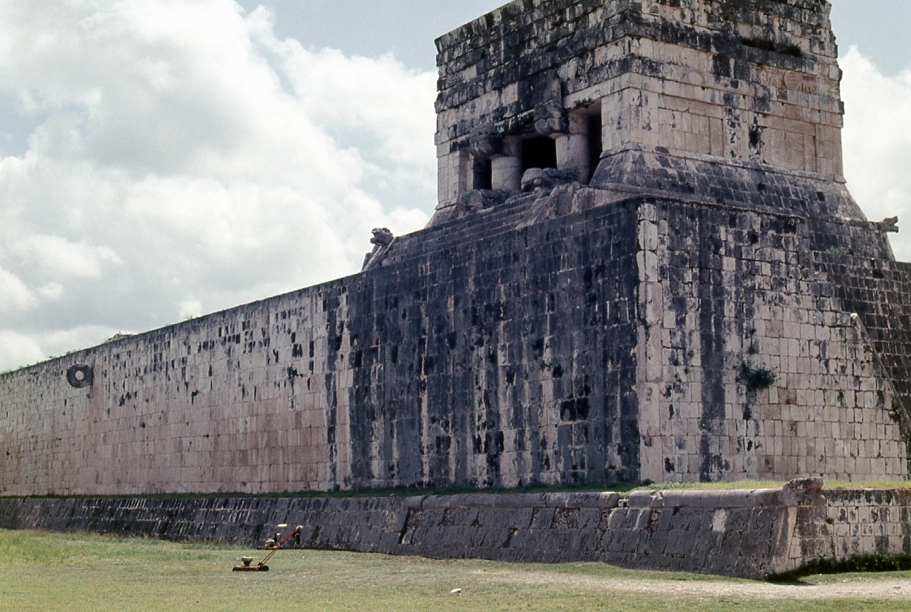
At the north end of the Handball Court sits the Templo del Hombre Barbado, and here’s a close-up of it.
Templo del Hombre Barbado (Temple of the Bearded Man)
The Handball Court has some beautiful carvings, and this is one of them. I got lucky, because there was a real iguana perched atop the stone image the moment I took the picture.
Iguana
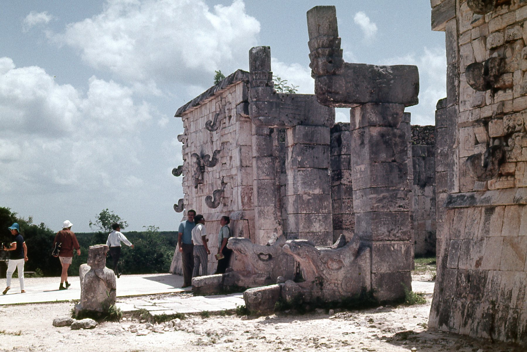
Here’s another beautiful structure I visited – it’s called The Eagles and Jaguars Platform.
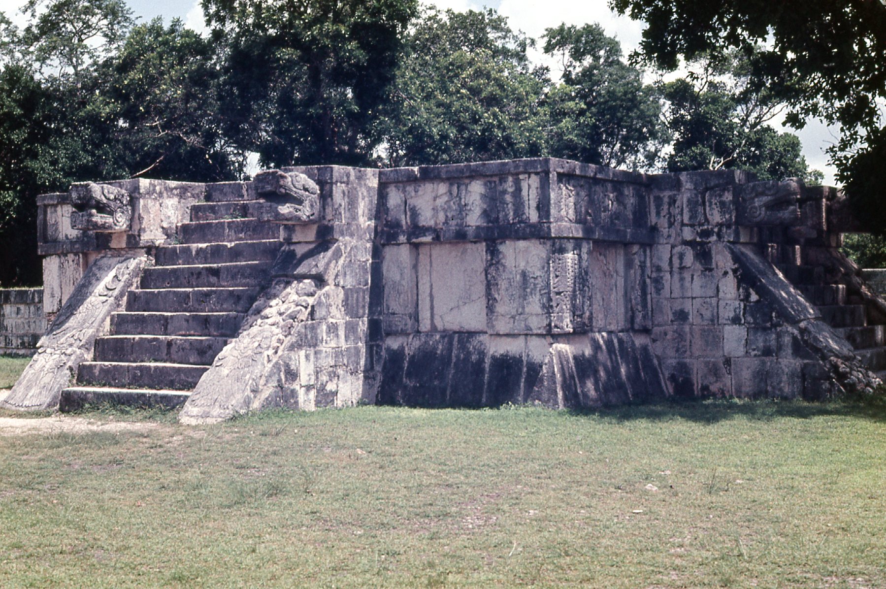
The Eagles and Jaguars Platform
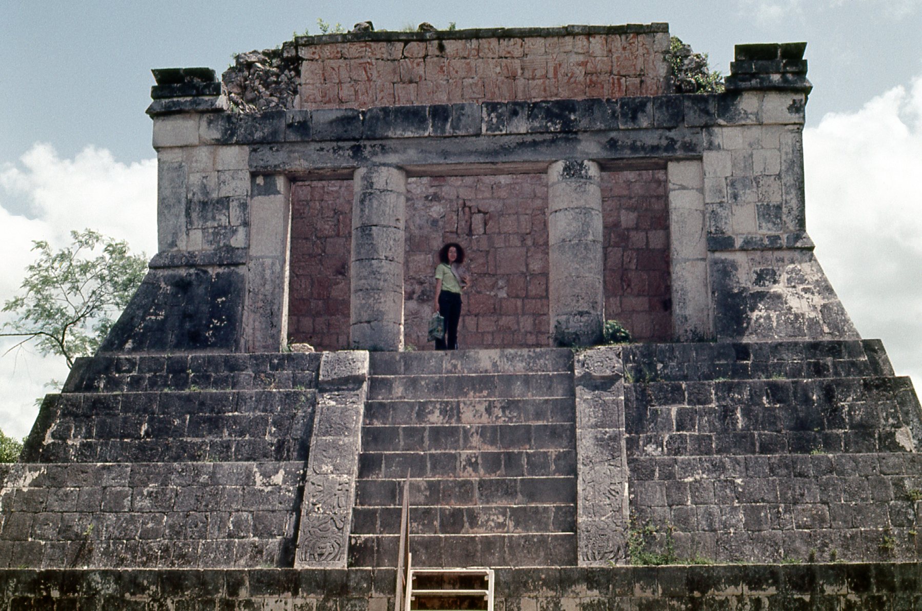
Okay, this just keeps getting better, there was so much to see at Chichén Itzá. It was hard to know where to go next in the limited time I had there. How about this – a structure called El Templo de los Guerreros. Here’s a view of it from farther back.
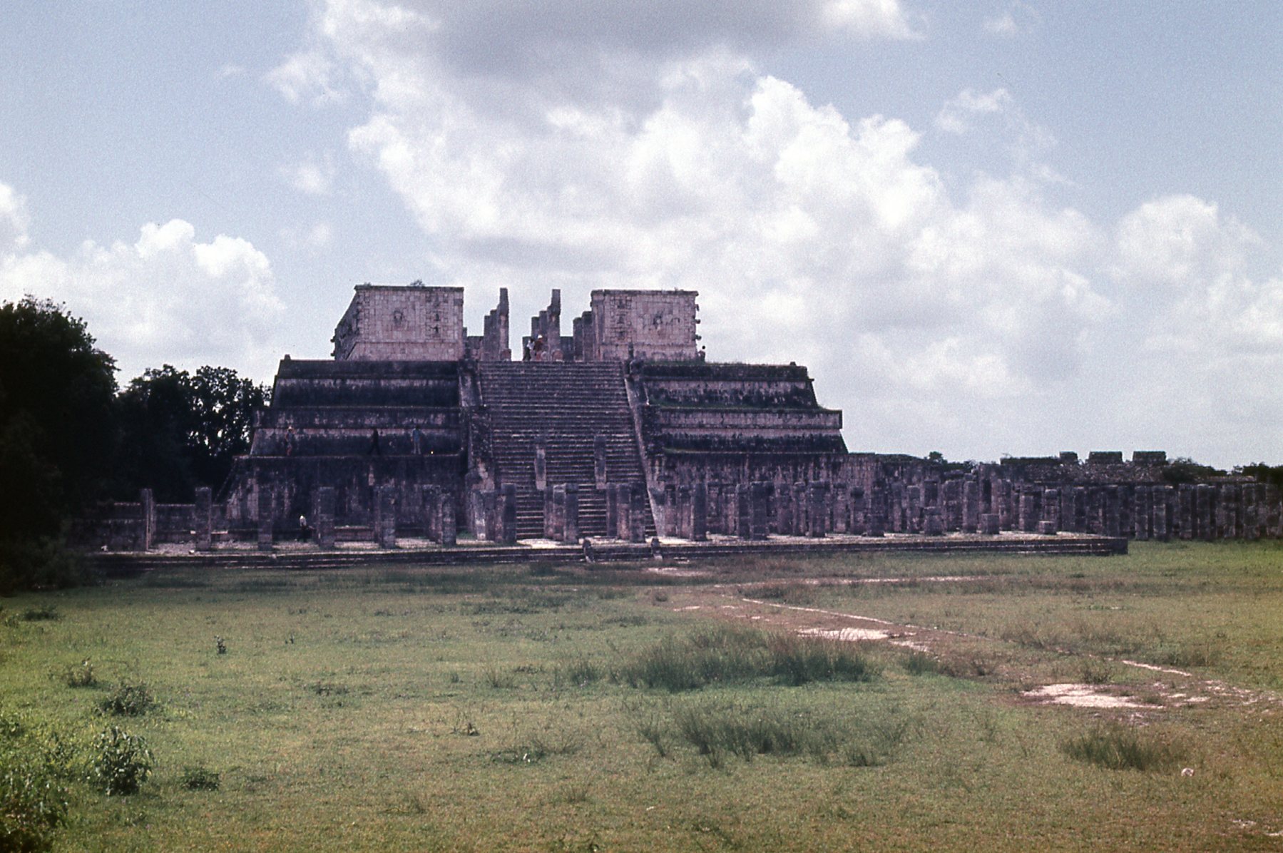
The Temple of the Warriors.
Notice the broad staircase going up the front of the temple. The next picture, I took at the top of those stairs. See the man in the red shirt and white hat? Just to the right of him and closer in is a stone figure on the ground. That is a Chac Mool.
At the top of the stairs.
Here’s a close-up of the Chac Mool, a picture from the internet. And here’s a link to explain what the figure symbolizes.
:max_bytes(150000):strip_icc()/GettyImages-469499083-5c4cf32bc9e77c0001d7ba27.jpg)
If you climb the stairs up The Temple of the Warriors and have a look around at the land below, you will see this:
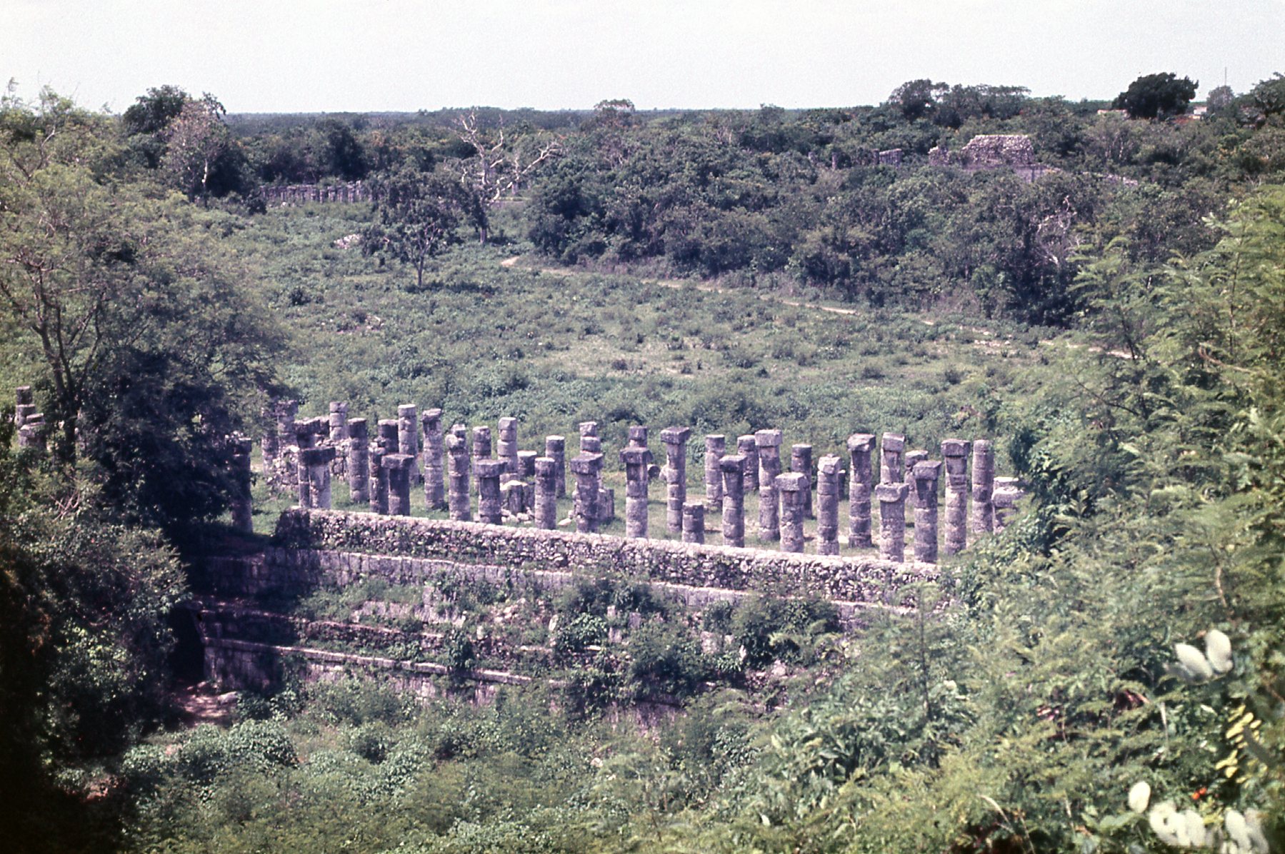
The columns
Along the south wall of the temple is a series of exposed columns, as seen in the above photo. Centuries ago, when the city was inhabited, the columns would have supported an extensive roof system. The system of columns is called the Group of a Thousand Columns, and it is found in 3 areas of Chichén Itzá. If you look closely at the above photo, in the upper left corner you can see more of them, peeking out from among the trees. Some of the columns have carvings of soldiers in bas-relief; others bear carvings of people or gods, and others bear carvings of animals or serpents.
Here is a photo taken at the Temple of the Tables. It shows an altar that is supported by small carved figures of men with upraised arms, called atlantes.
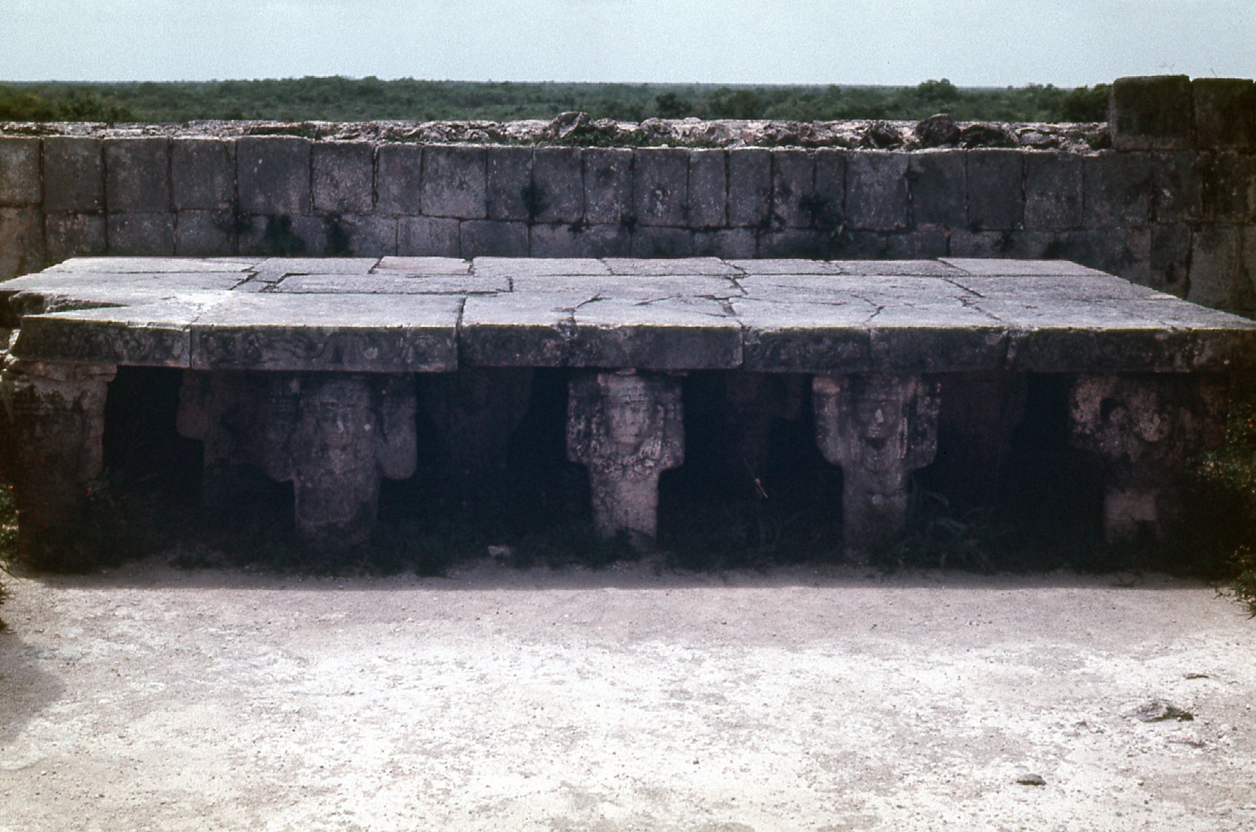
At the Temple of the Tables
Perhaps the most spectacular thing at these ruins is El Castillo, otherwise known as the Temple of Kukulcán, who was a Maya feathered serpent deity, similar to the Aztec Quetzalcoatl. The first Spaniards to see it named it El Castillo (The Castle).
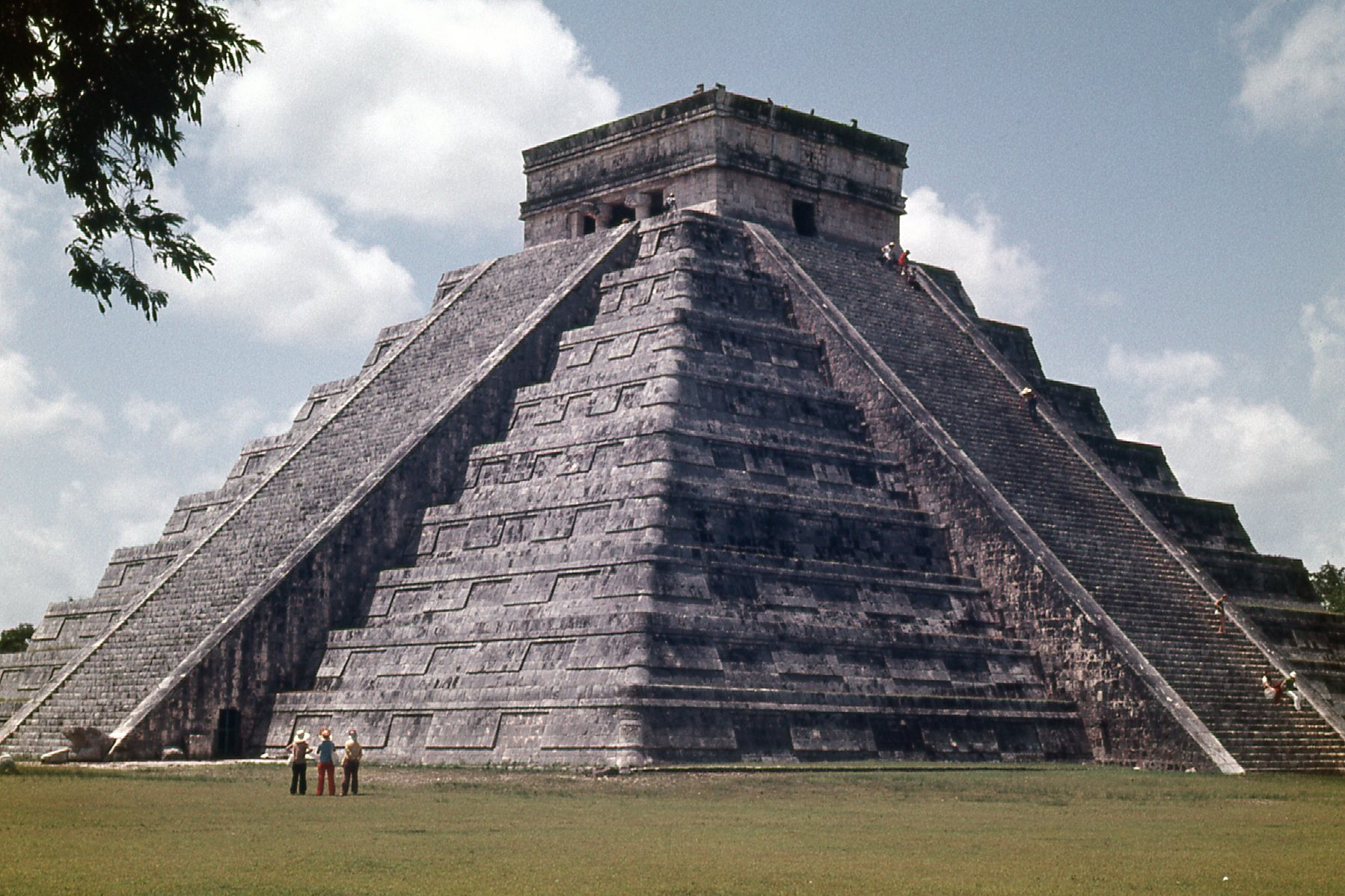
The Temple of Kukulcan.
It is a four-sided pyramid, and has to be seen to be believed. It is huge, rising to the height of a modern ten-story building. Each of the four sides is 181 feet long at the base, and a staircase rises up each side. The sides of the pyramid rise at an angle of 53 degrees. The staircases are not quite as steep as the sides, but even so they rise at an angle of 45 degrees. If you have never climbed stairs at an angle of 45 degrees, let me tell you that that is steep! When I was there in 1972, you were allowed to wander freely, and could climb the stairs if you pleased. My photo above clearly shows several people on the stairs. I remember its being nerve-wracking, especially coming back down. In fact, my palms are sweaty as I type this, thinking back on the experience. That all changed in the year 2006, when a woman from San Diego fell down the stairs and died. Since then, the public is not allowed to climb the stairs.
Look closely at the previous photo – on the left lower corner, at the bottom of the balustrades of the northeastern staircase, sit large carved figures of serpents. I took a photo of them, seen here in this next photo. In the upper right corner of the photo, you can see the stairs. These are of a size that are quite unlike stairs in any of our modern buildings – they are steep and rough, and it’s easy to see how you could mis-step on them and break your neck.
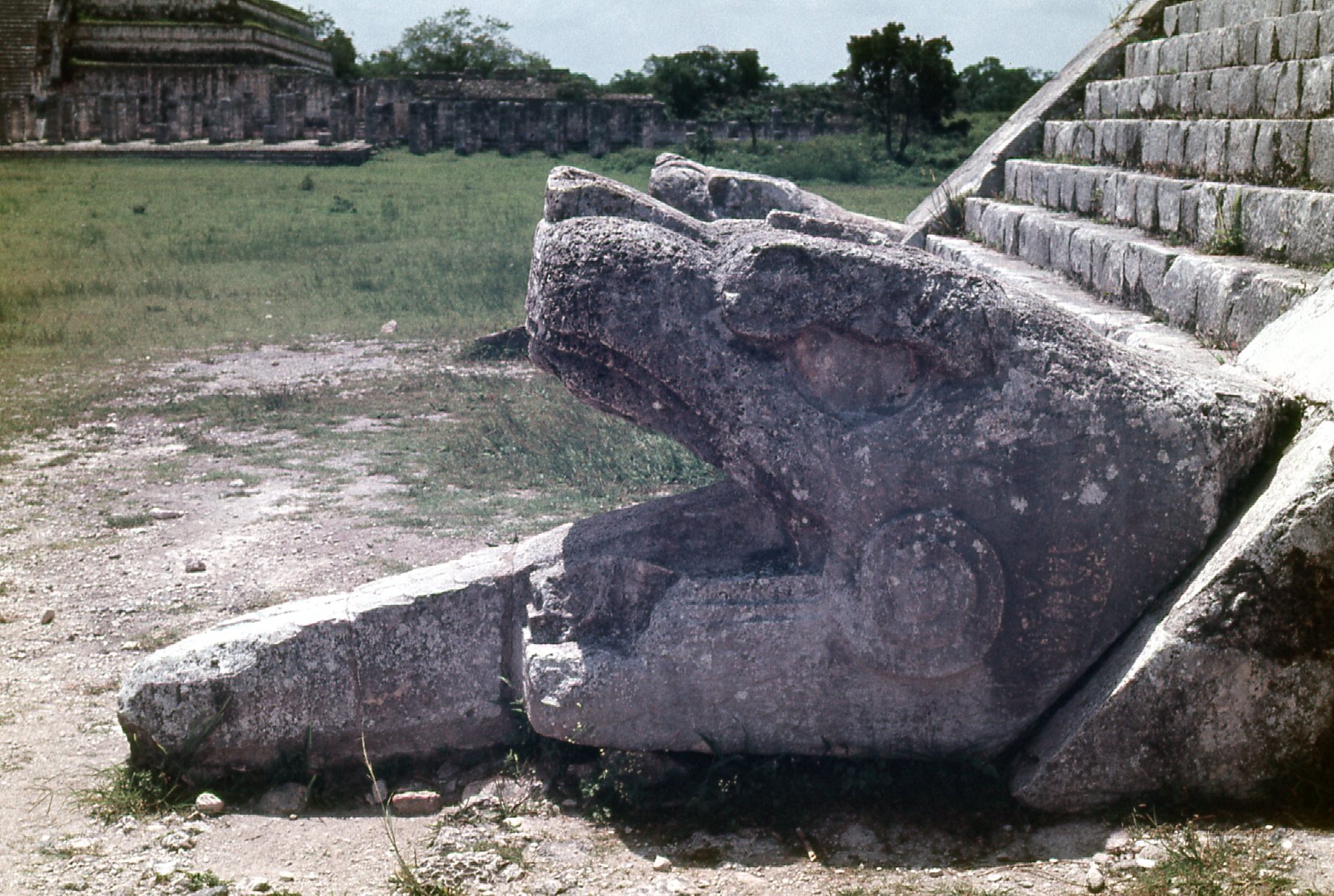
A detail at the foot of the stairs.
If you go back to the link that I supplied at the start of my discussion of Chichén Itzá, you can see some nice pictures that are better than ones I took. For example, here is my photo of one of the structures at the Las Monjas complex. Mine is underexposed, but you can see a better one on the other website.
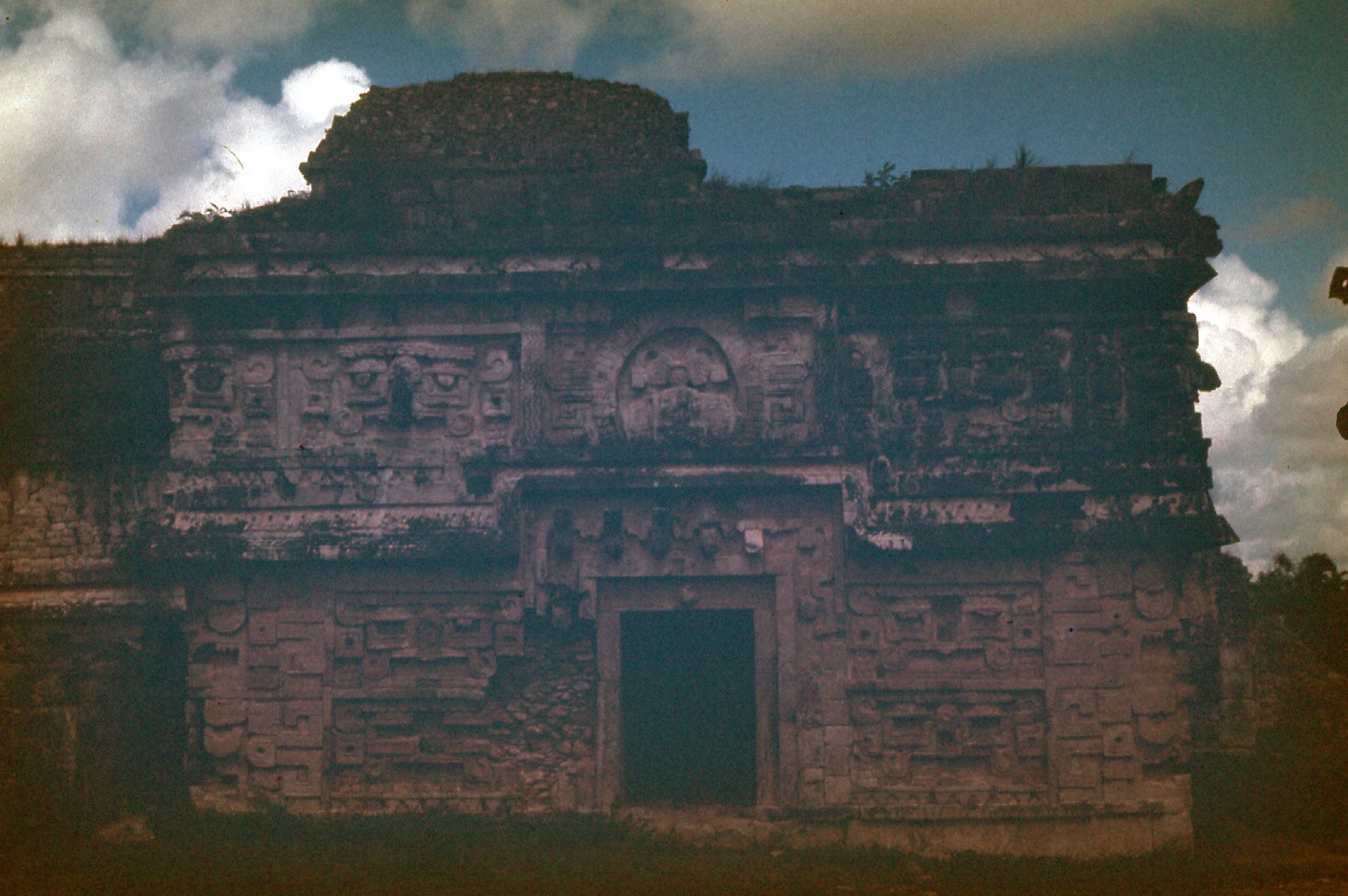
At Las Monjas
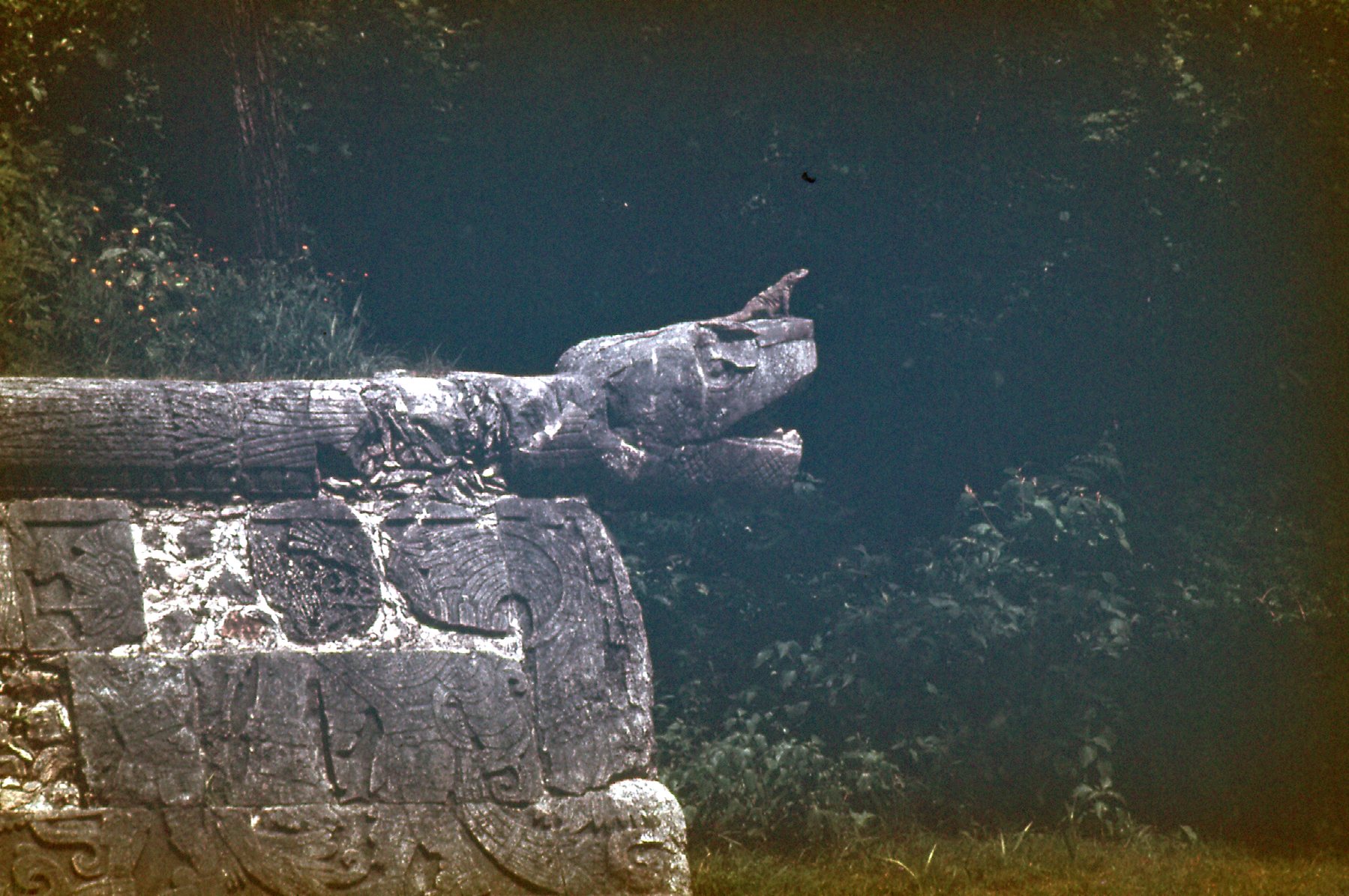
There is a building at these ruins that is perhaps even more famous than El Castillo, and it is called El Caracol. It became world-famous when the book “Chariots of the Gods” was published, partly because the author von Däniken went on at great length about how the Mayans used El Caracol as an observatory of sorts. Here is a link that will tell you a lot about El Caracol. The photo I took that day is very dark – it serves only to show the shape of the building, nothing more. It was exciting to climb the spiral stairs inside the structure so soon after having read the book, though.
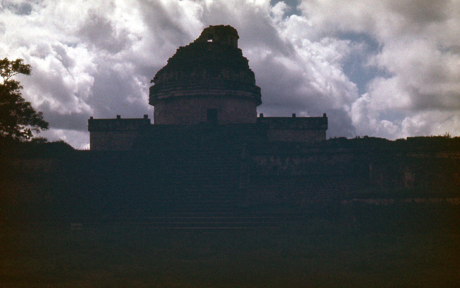
El Caracol
Well, you’ve now seen what I saw in my four hours spent at Chichén Itzá. It was definitely not enough time. In the 50 years since I was there, they’ve cleaned up the ruins a lot, and it is definitely a world-class show place. Of the 4 ruins I had visited in Mexico up to that time (Teotihuacán, Kabah, Uxmal and Chichén Itzá), this last one was definitely the most exciting. But stay tuned, there is more good stuff yet to come.