
Please be sure to read Part 1 and Part 2 of “Ruined”, which have been previously published on this site, to get the most out of this story.
Where we had left off was at the Mayan ruins of Chichén Itzá in the Yucatán Peninsula of Mexico. That was on June 29th of 1972, and an exciting day it was. I traveled directly from those ruins to the territory of Quintana Roo, where I spent a few days on the then-still-rustic Isla Mujeres. That was before the city of Cancún existed. (Quintana Roo didn’t become a state until 1974). When I left the area, I boarded a train which took me back through the states of Yucatán, Campeche, Tabasco and into Chiapas. Although I passed right by it, I didn’t stop to visit the ruins at Palenque (too bad, as they are supposed to be quite outstanding). I continued south to the city of San Cristobal de las Casas, where I spent a few enjoyable days before heading farther south to Guatemala. After a night in the gloriously-cool highlands in Quetzaltenango, I made my way to the city of Antigua Guatemala on the 7th of July. This was a place I had dreamed of visiting.
Now, it’s important to realize that Antigua was not a site of ancient Mayan ruins like Kabah, Uxmal and Chichén Itzá. Rather, it was a city founded by the Spaniards much more recently, only about 400 years ago. However, it still qualifies as a ruins if we use the definition that I gave back at the beginning in Part 1 of this series, as follows:
The term refers to formerly intact structures that have fallen into a state of partial or total disrepair over time due to a variety of factors, such as lack of maintenance, deliberate destruction by humans, or uncontrollable destruction by natural phenomena.
In the case of Antigua, the factor that made it a ruin were the many terremotos, the earthquakes that plagued the area. The city was founded way back in 1543 by the Spanish – it sits in a valley of agricultural richness, at an elevation of 5,069 feet above sea level. However, it didn’t take long before it was hit by a major quake, in 1565. That wasn’t the end of it, though – quakes also struck in 1575, 1577, 1585, 1717, 1751, 1773, 1917, 1918 and as recently as 1976. Every time the inhabitants would rebuild things, it seemed like it was only a matter of time before disaster struck again. In spite of all that, Antigua served as the capital of all of Central America and Chiapas for more than 200 years. In 1979, Antigua was made a UNESCO World Heritage Site. Back in the 1770s, the city had a population of 65,000. It dropped well below that in later years, all the way down to 9,000 in the year 1850, and even today has only climbed back up to about 46,000.
Soon after arriving, I secured a room for the night, then headed over to the tourist bureau. They offered excellent suggestions and a city map, then I spent a couple of hours on a walking tour of the ruins. Here are some of the pictures I took that afternoon.
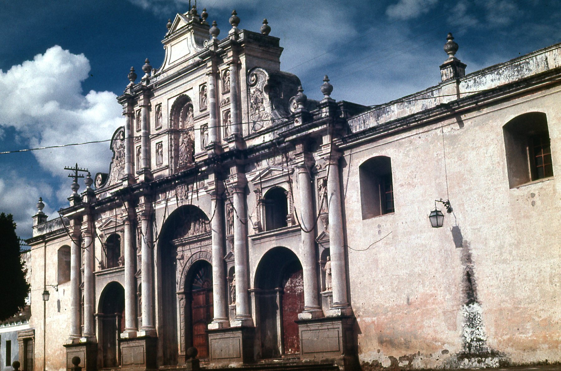
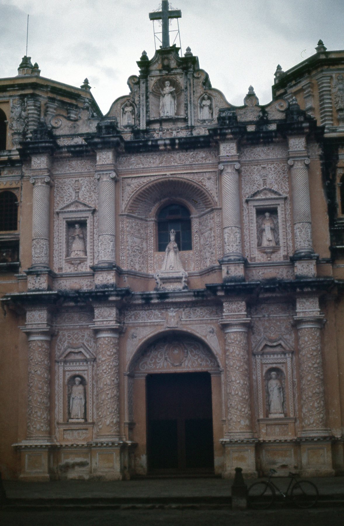
Cathedral of San Francisco
Construction on the Cathedral of San Francisco was begun in 1579. Earthquakes kept happening, so it wasn’t completed until 1702.
Another view of the cathedral.
Here is the museum, built in 1832.
The museum.
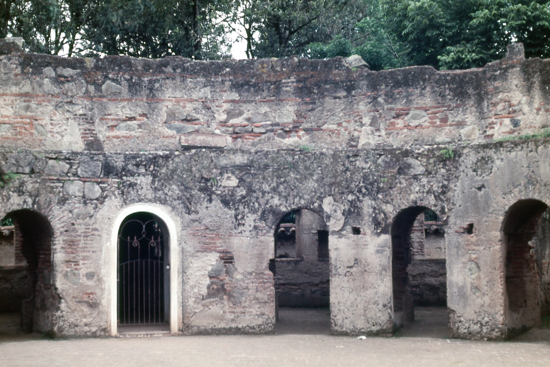
This is the Convent of Santa Clara, built in 1699. Once completed, it stood for only 2 years before an earthquake destroyed it. It was rebuilt in 1734, but destroyed once again in the quake of 1773.
The Convent of Santa Clara
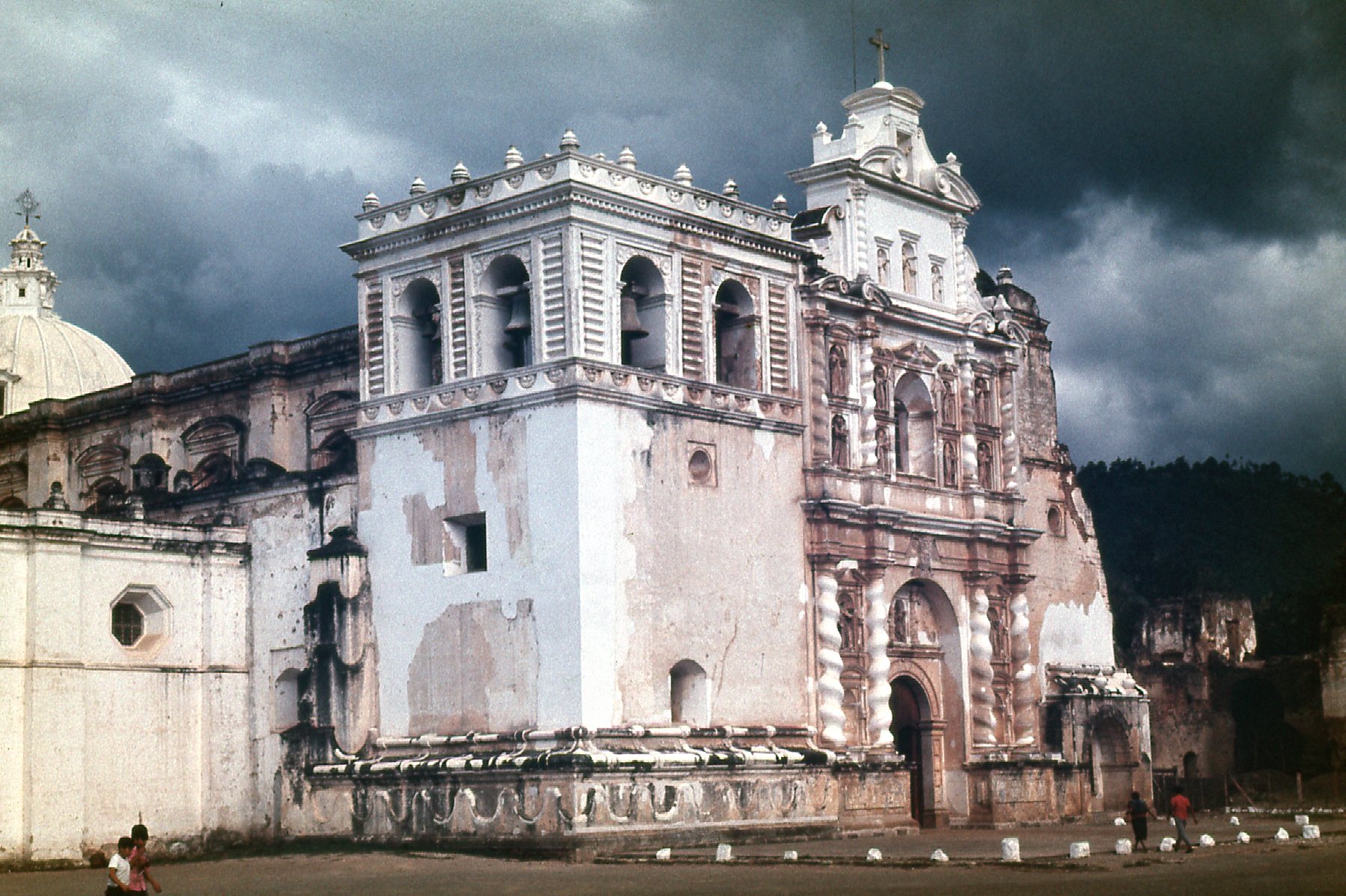
Here are the ruins of the Capuchin Convent. Construction on it began in 1731, and it was consecrated in 1736. However, the earthquakes of 1751 and 1773 destroyed it.
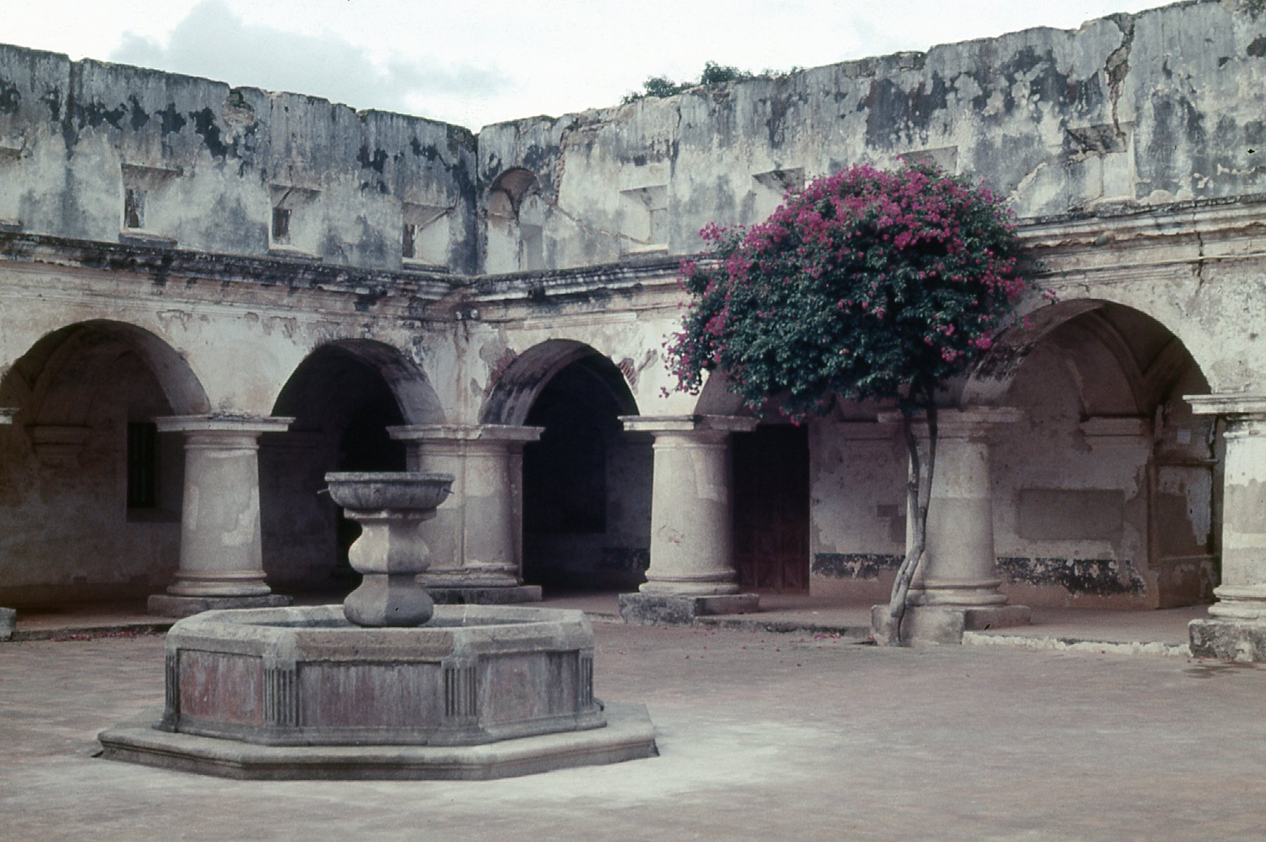
The Capuchin convent.
Here is a picture of the cells that were used by each of the nuns.
The cells of the nuns.
Here is a picture of La Merced church. It dates from 1548, was destroyed twice by earthquakes, and rebuilt in the 1700s to withstand the quakes.
La Merced church
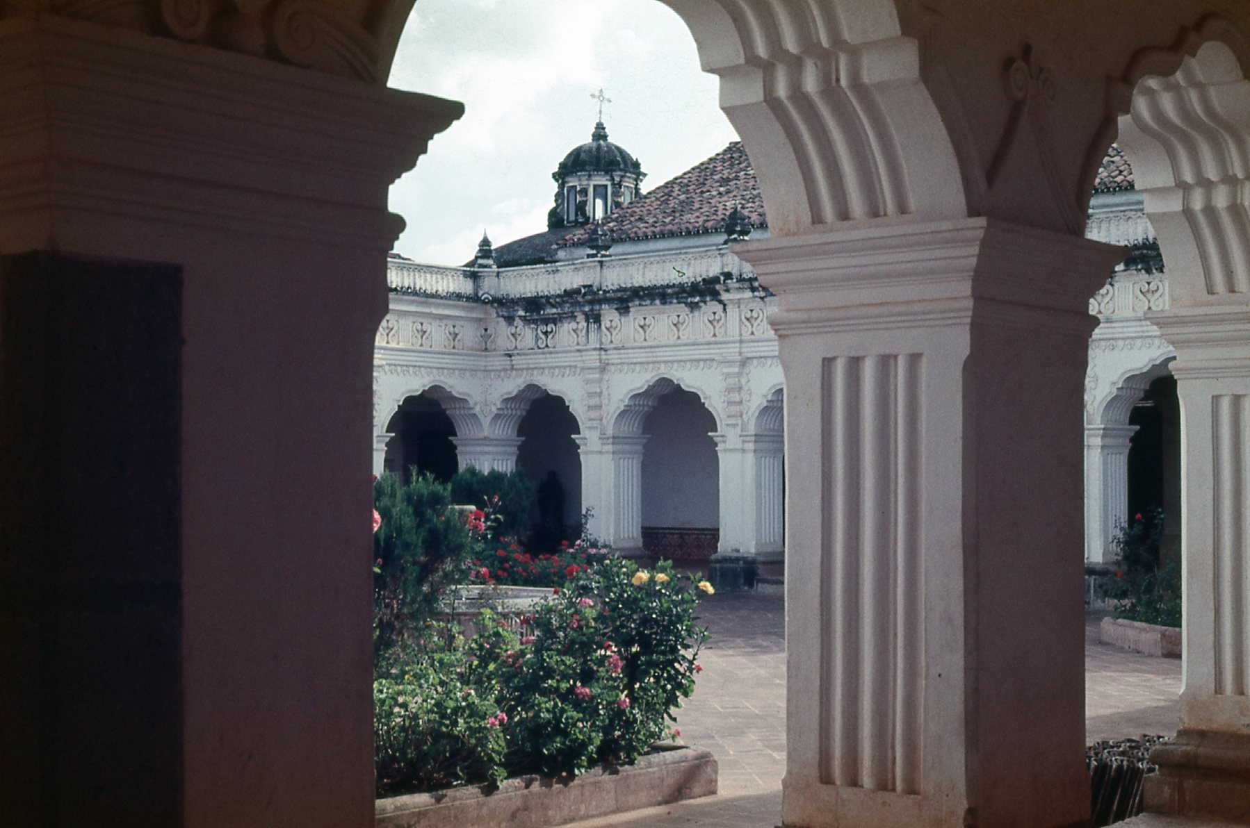
Here is a view of what was the courtyard of the Merced church and convent. In the front of the photo sits the Fountain of Los Pescados – at 27 meters in diameter, it is probably the largest colonial fountain in Latin America.
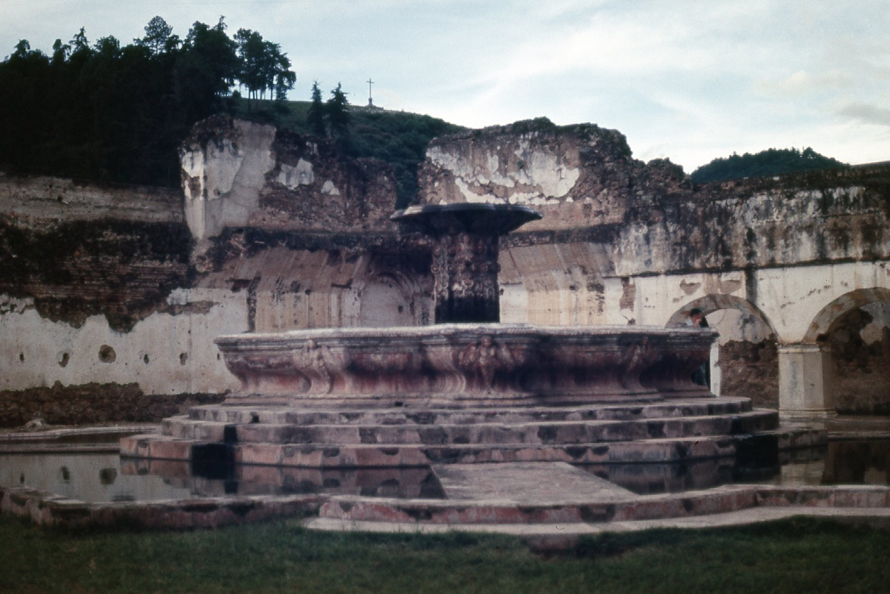
The ruins of the courtyard.
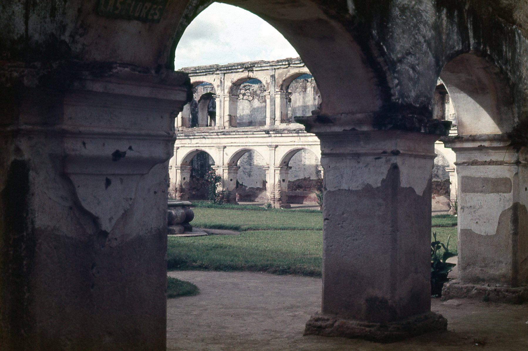
Next is a photo of the ruins of the church and monastery of La Recolección. The church was completed and inaugurated on May 23, 1717. Only months later, the 1717 earthquake struck. Repairs were made, and by 1740 the monastery housed 40 monks. The complex suffered in the 1751 quake, and the devastating 1773 earthquake finished it off for good.
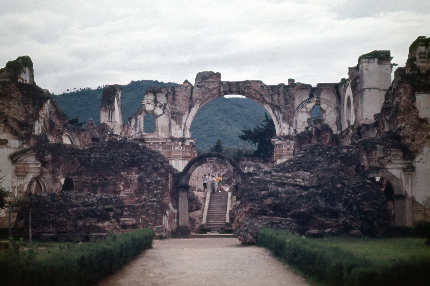
Ruins of the Church of La Recoleccion
My pictures give a bit of a glimpse into the amazing ruins to be found today at Antigua, but there are excellent sites such as this one that show more, and in fact each of the ruins can be googled in turn to learn even more. It was a fascinating place to visit, and it certainly showed the awesome power of nature over mankind’s puny works.
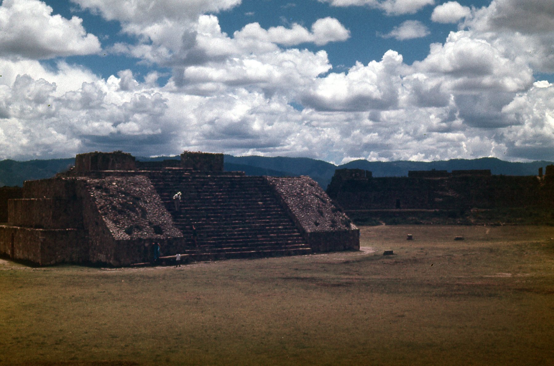
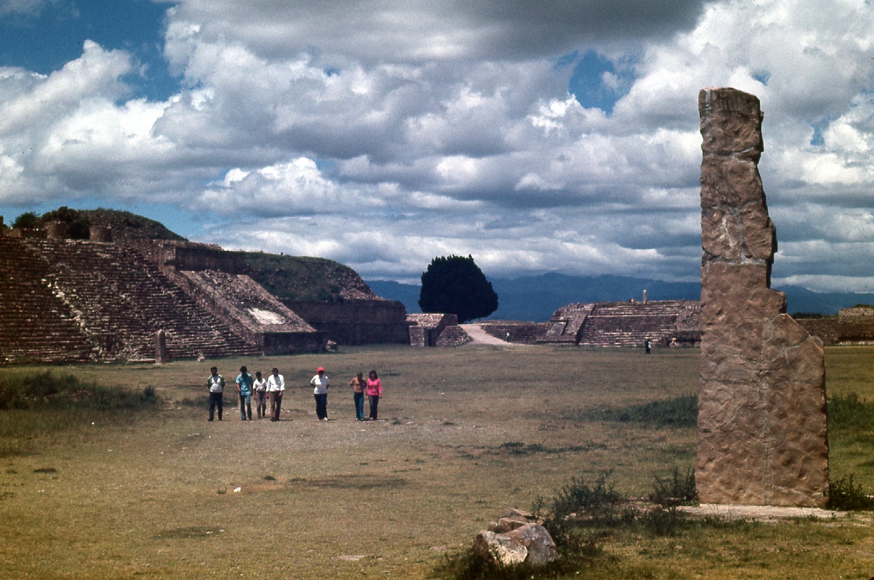
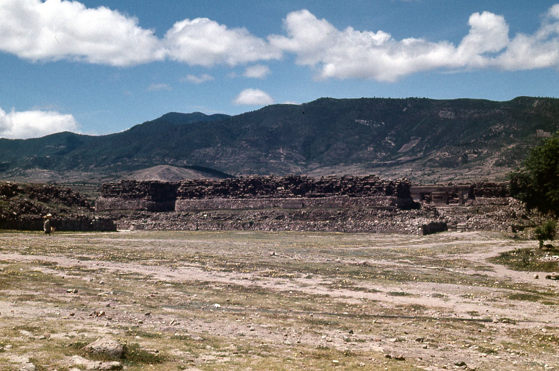
Three days after my visit to Antigua found me back in Mexico, once again in the state of Oaxaca. It was worth the time to visit the ruins of Monte Albán again, as I had spent little time there in my previous visit 2 years earlier. Here is an excellent link to a site that tells all about these impressive ruins, and here are a few pictures I took during that second visit.
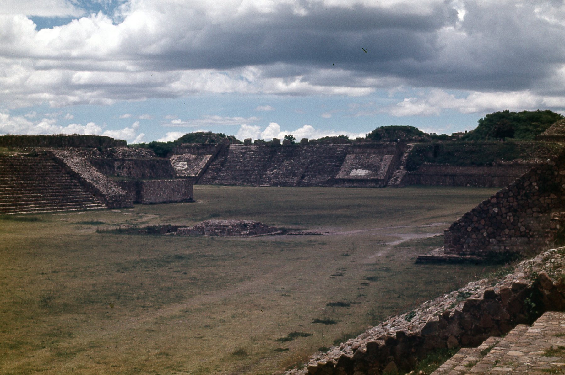
The west side of the ruins.
These ruins were made a UNESCO World Heritage Site in 1987.
The south side of the ruins.
The north side of the ruins.
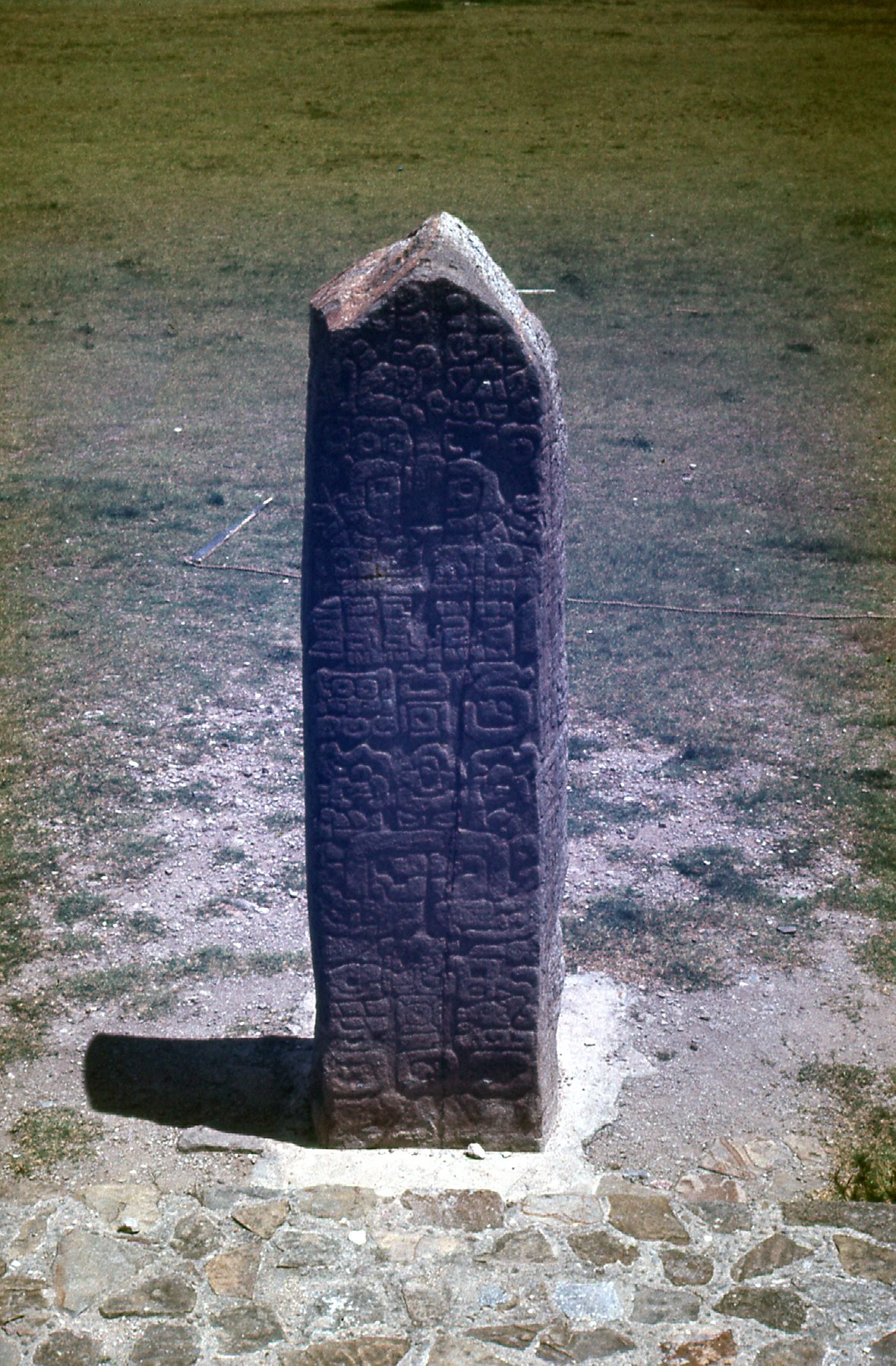
This stands in front of the West Pyramid
The link I gave you earlier has some excellent photos, so be sure to check it out. One day after I visited Monte Albán, I journeyed an hour east to visit another ruin, this one being Mitla. When I was there, on July 11th of 1972, Mitla was considered a quiet little backwater of a place, completely overshadowed by its more famous neighbor Monte Albán only 24 miles away. However, Mitla was the most important religious center of the Zapotec culture, and it was designated a UNESCO World Heritage Site in the year 2010. This site gives a lot of detailed information about Mitla and is worth checking out to learn more. Here are the few photos I took the day I visited.
The north side of the tombs.
This shows a detail of the mosaic work to be found here. Mitla is unique among Mesoamerican sites because of its elaborate and intricate mosaic fretwork and geometric designs that cover tombs, panels, friezes and even entire walls of the complex. These mosaics are made with small, finely cut and polished stone pieces that have been fitted together without the use of mortar. No other site in Mexico has this decorative work.
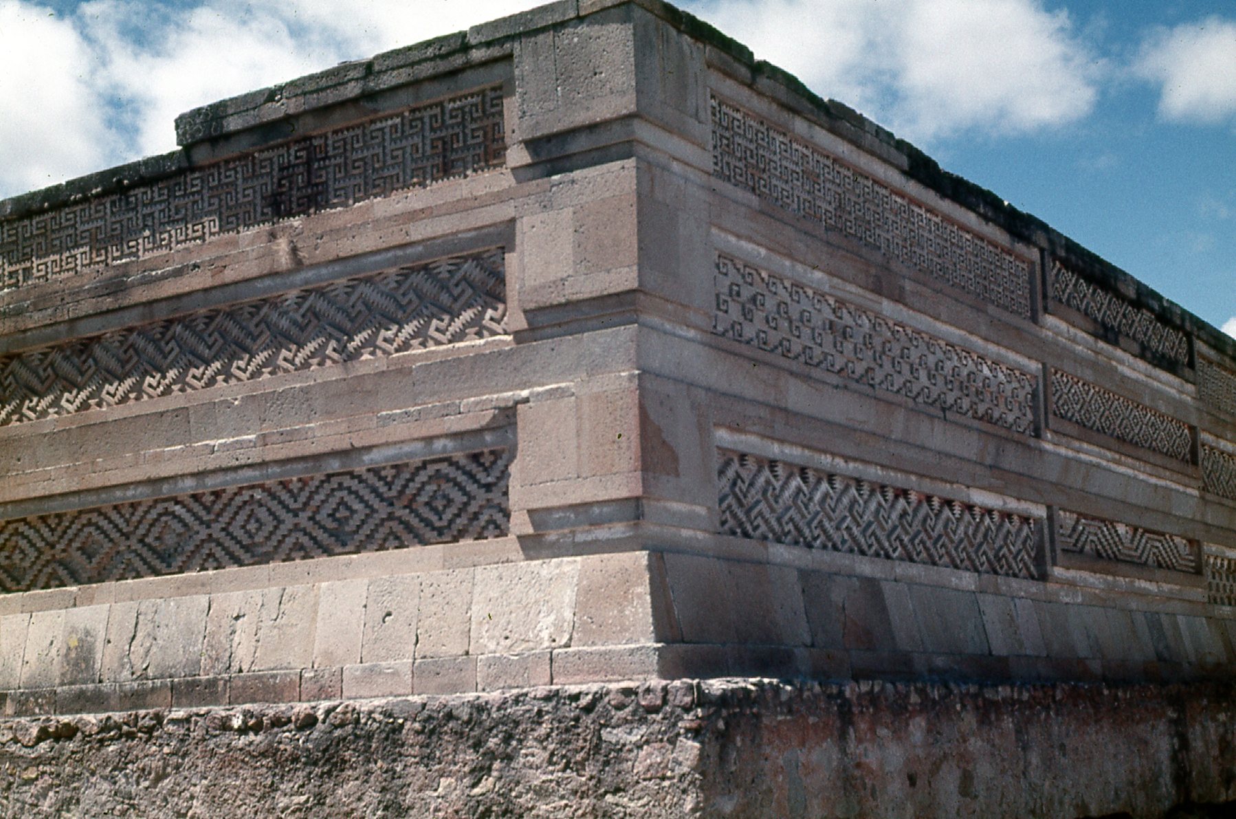
A detail of the beautiful mosaic work
This is a church that was built by the Spanish on top of a pyramid. That happened a lot, where the Spanish were trying to show the people that their religion was better than that of the native peoples who had lived there for millennia.
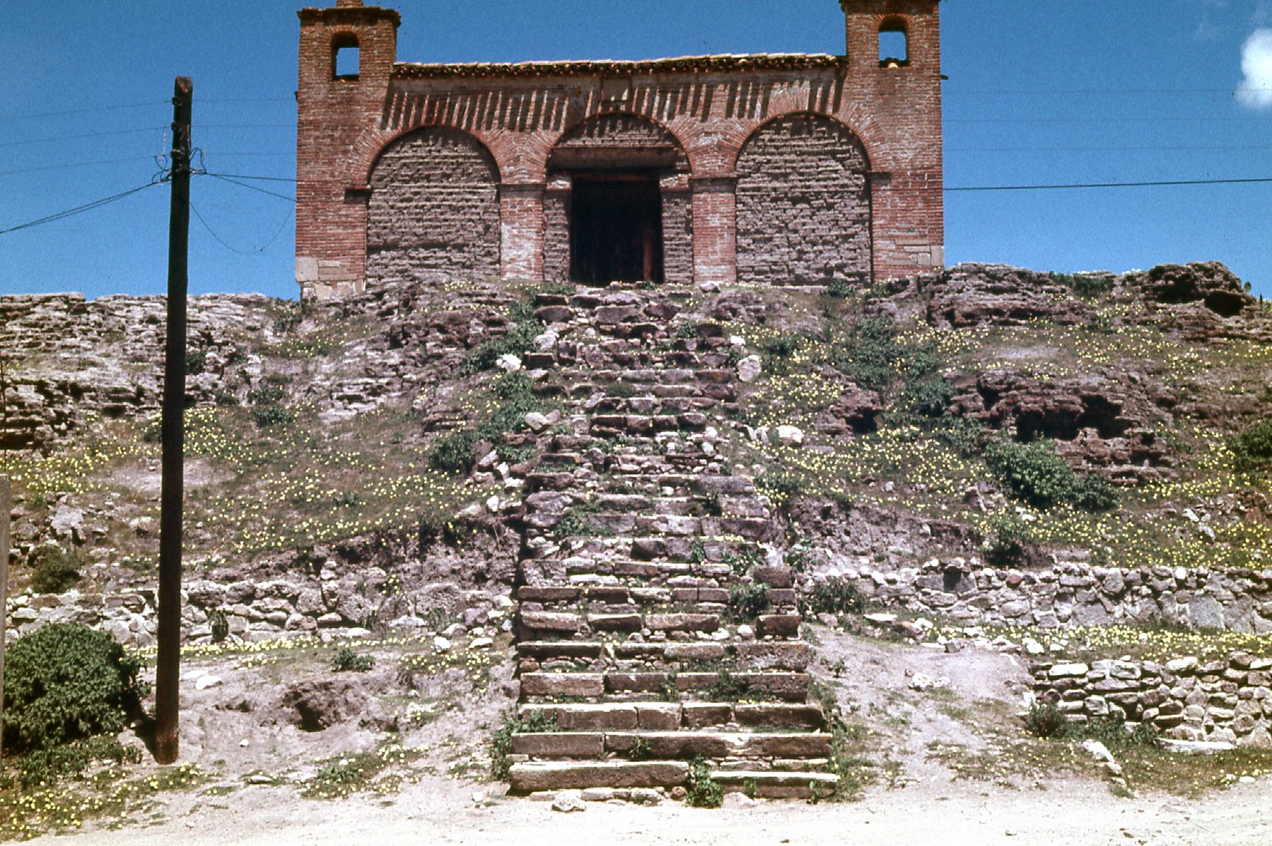
Church atop a pyramid.
My visit to Mitla was all-too-brief. It’s an important destination in its own right though. This, my second trip to Mexico, was very rewarding for having seen so many ruins, and I consider myself fortunate to have seen as much as I did in the limited time I had there. Later the same year, I traveled to Spain where I spent 5 months in the southwest corner of the country.. While I was there, I had a chance to briefly visit the ruins at Niebla. These are my only photos taken there.
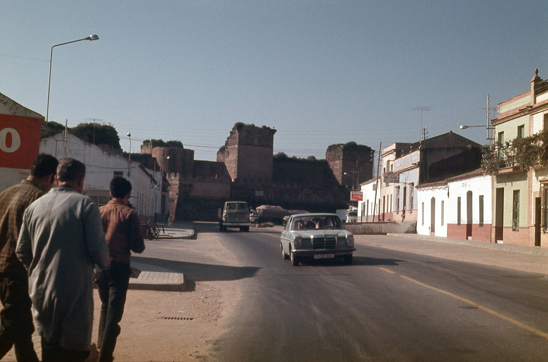
The walls
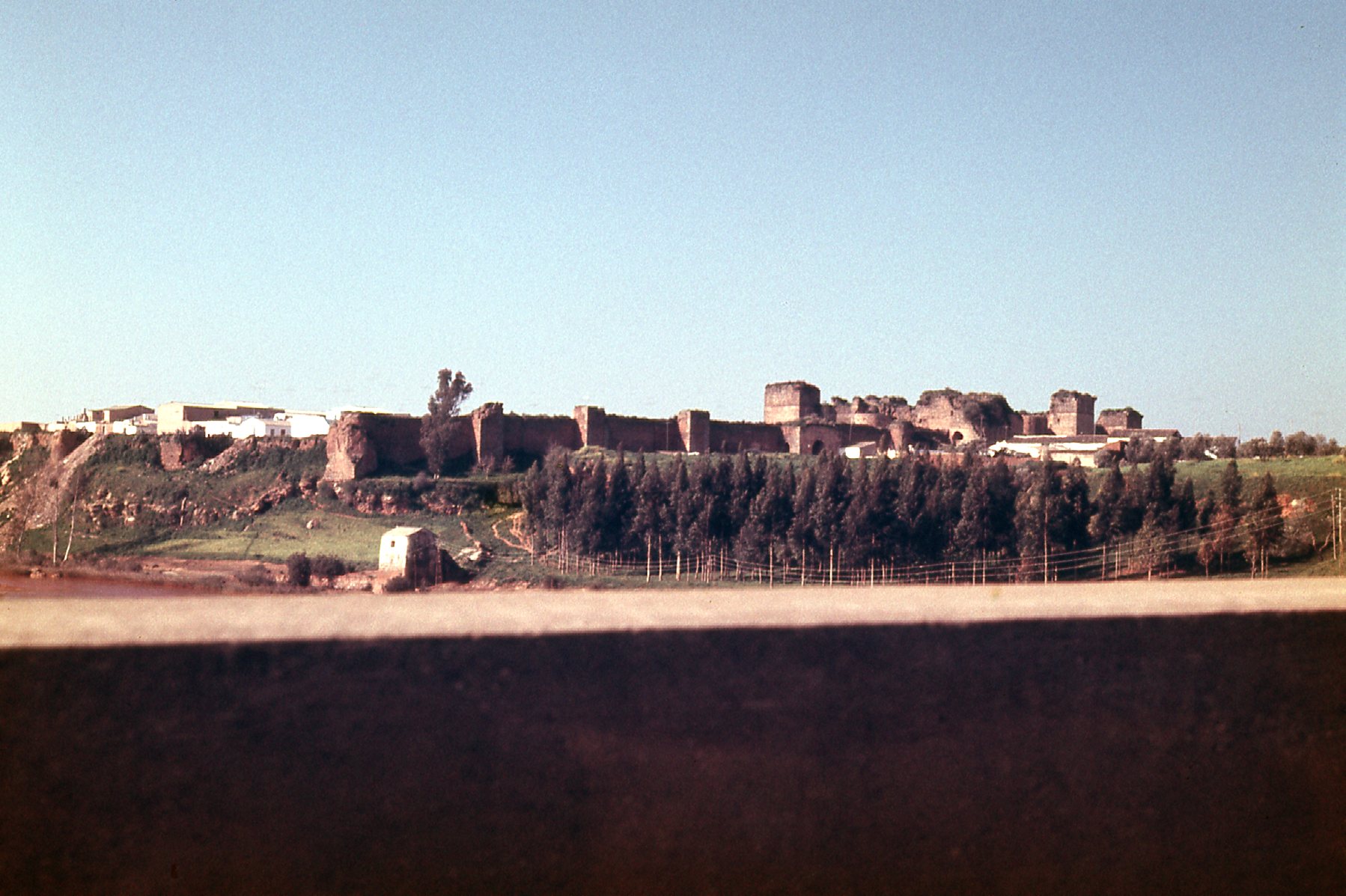
Niebla
Remains of at least two pre-Roman enclosures have been found there, which could date back as far as the 9th-5th centuries BC. The Romans and Moors also left their mark on this structure. The walls have undergone various changes and modifications throughout successive conquests and periods of history. They have 46 square towers, two octagonal ones and various access gates. This site gives a bit more information.
The next chance I had to visit any ruins was at the end of December in 1989. After spending a few days at El Cañon del Cobre in Mexico, I was driving north through the state of Chihuahua and stopped for the night at the town of Nuevas Casas Grandes. I knew that the ruins of Paquimé were located there and I wanted to have a look around. After camping nearby, I headed over to the ruins when they opened to the public the next morning. The site was quite extensive, and I won’t insult you with any of the poor photos I took that day, but will direct you to this site which explains the ruins quite well and also has some nice photos. Unlike the Aztec and Mayan ruins I had visited in southern Mexico, the Paquimé ruins were attributed to the Mogollon culture. The site was occupied from about 1130 AD until it was abandoned by 1450 AD. There were about 2,500 people living at the site, with another 10,000 in the nearby surroundings. The pottery they created is quite beautiful. Wouldn’t you know it, Paquimé was also designated a UNESCO World Heritage Site, in this case in 1998.
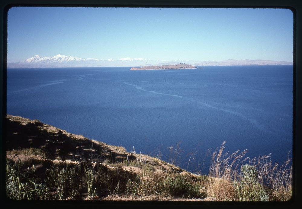
Some years later, in July of 1996, at the end of a climbing trip to Bolivia, Brian Rundle and I visited Isla del Sol in Lake Titicaca. The island was dotted with ancient Inca ruins, over 80 sites. Most of them date to around the 15th century, but archeologists have learned that people lived on the island as far back as the third millennium BC. The island, sitting at an elevation of 12,507 feet, is spectacular. Have a look at this view of the lake – that’s Isla de la Luna out there, and on the far shore we see the snow-covered peak of Ancohuma, at 21,087 feet the 3rd-highest peak of Bolivia – it is only 43 miles away.
Looking east
We stopped at one of the ruins that day. I’m not sure of its name or age, but here it what it looked like.
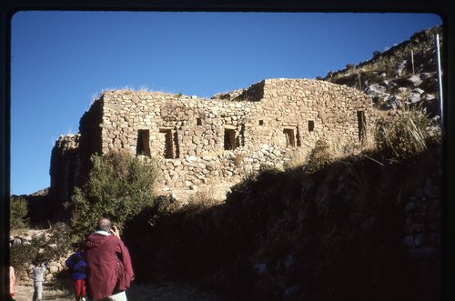
The Inca ruin
Here’s a close-up.
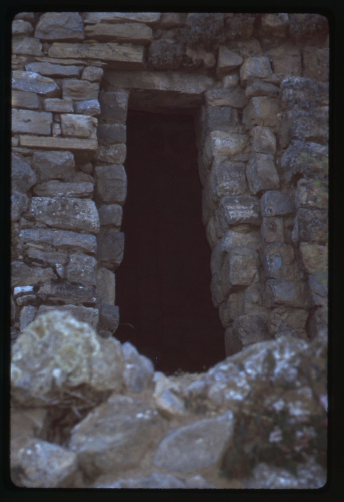
A door opening
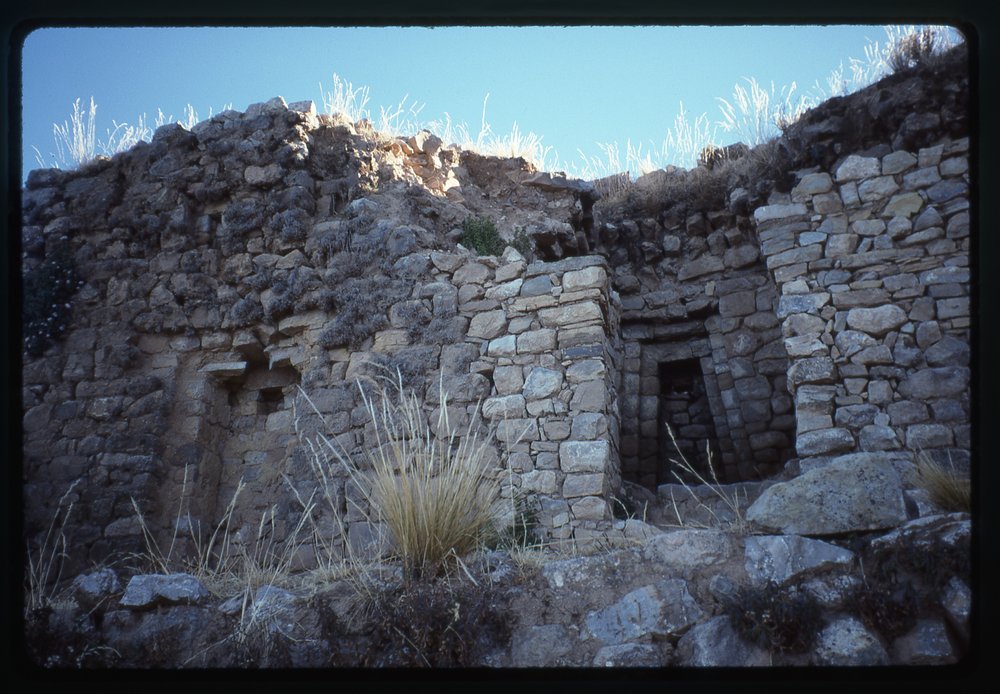
A different view
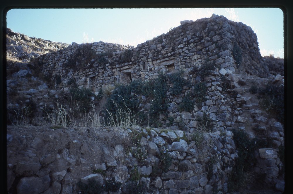
Around the other side
All of the stones used in these Inca ruins were hand-fitted, with no mortar used. It’s a testament to their workmanship that they are still standing today, 600 years later. I have a hard time imagining any building that we would build today still standing 600 years from now without any attention. Bolivia has many impressive Inca structures that are worth visiting, and I wish we’d had more time when we were there in 1996.
Which brings me to the last item on my list of ruins, the one closest to home. I’m referring to the state of Arizona where I live. Native American peoples have inhabited this area for millennia, and as a result of that, there are hundreds of ancient ruins throughout the state. Many of them are in very obscure spots, but there are quite a few that are very accessible. Among the ones I have personally visited are these, and I have prepared a link to each of them: Canyon de Chelly; Casa Grande; Montezuma Castle; Walnut Canyon; Wupatki; Tuzigoot.
Some of the other major ruins are these: Tusayan; Tonto National Monument; Navajo National Monument.
There are many more, some of which are in more of a wilderness setting and require a bit of a hike to reach. This site alone lists 42 different ones. I’m really fortunate to live in a state which has so many exciting ruins, and they are all fascinating places to visit. If you have never visited an archaeological ruin, I strongly encourage you to do so.
Thanks for accompanying me on this tour of ruins – it all turned out to be more than I thought it would, but I’m glad you were there along with me.