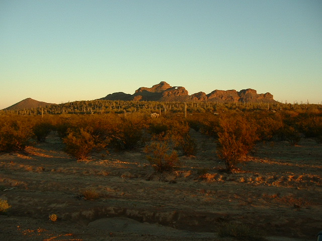
You can see it from Wahak Hotrontk, if you know where to look. From that village, it’s 14 miles to the northeast, across a slice of the Quijotoa Valley and part of the Window Valley. One more clue – it sits on a southern peak in the Castle Mountains. I’d always had fun trying to spot it across the desert without running off the road as I was driving. It can also be seen from Indian Highway 34, but few outsiders venture to that part of the Tohono O’odham Reservation. And, shy a permit from the Hickiwan District, you’re not allowed to be wandering around out there anyway.
So, assuming you have such a permit, you can head in from the west, from Vaya Chin, where sits the Hickiwan District Headquarters. Vaya Chin is the anglicized version of the proper O’Odham name, Wawhia Chini, which translates as “Well Mouth”. The road is hard to pick up there. A better bet is to come in from the northeast, from near the Black Hills by Anegam Wash. In any case, you’ll end up on a lonely dirt road south of the beautiful Castle Mountains. A good place to park is at the southernmost bend in the road, a mere four-tenths of a mile north of the site of what used to be the settlement of Oit Ihuk (which translates roughly as “field of devil’s claw“).
I went there one chilly winter’s day in December, ten years ago. Parking at around 2,100′, I readied my pack. After posting my permit in the truck window, I set out across the desert at dawn. Here was my first view of the arch – It was 1.7 miles away, and I was excited. I had known about the arch for many years, and had even read an article about it in a geological journal from the 1930s. Even so, it was one of the best-kept secrets in southern Arizona.
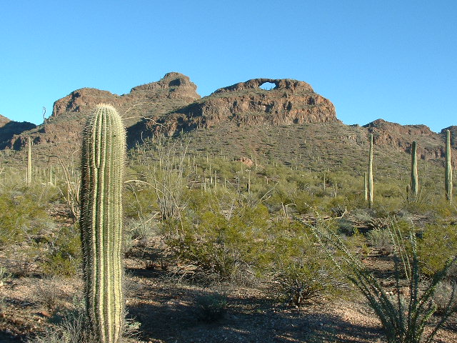
It took a mile and a half to gain a mere 200′ of elevation, but every step across the desert was pure bliss. As I got closer to the arch, it loomed larger and became even more impressive.
There were some small cliffs of rotten volcanic rock to negotiate, but nothing too serious.
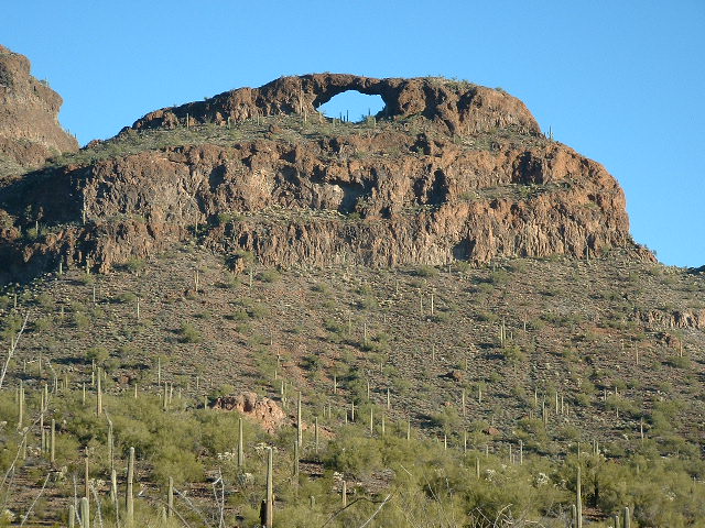
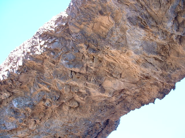
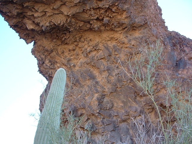
Another 400 feet of climbing brought me right up to the arch. This thing was huge! Mature saguaro cacti grew under the arch, yet were dwarfed by it.
When I stood beneath the arch, it actually scared me. So much rock overhead – what if it were to collapse?
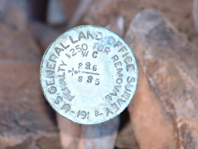
I knew the odds were in my favor, that the arch may have already stood for hundreds or even thousands of years. Nevertheless, I did not have a peaceful, easy feeling while there. There was a survey marker pounded into the ground under the arch.
I took more pictures while there.
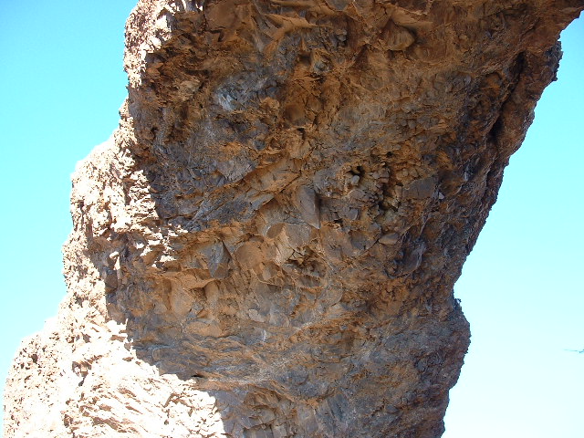
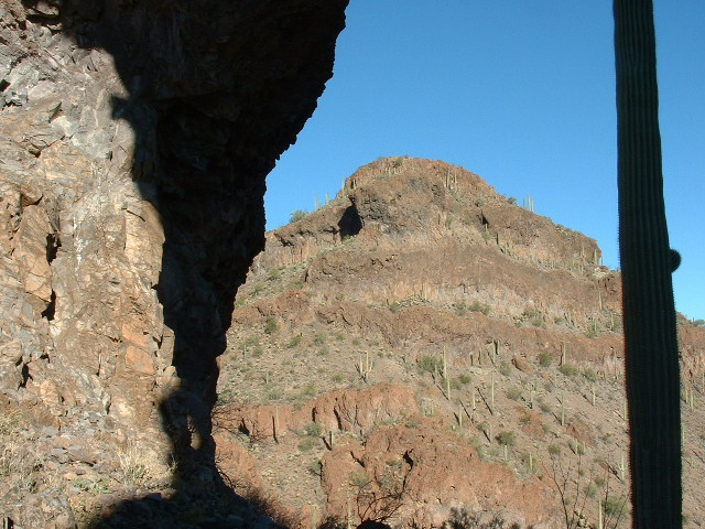
I didn’t stay too long, because I still had a lot of ground to cover. Before leaving the area, though, I climbed up and on to the top of it. Even then, it gave me the creeps – what if the damn thing collapsed? Here is a view from under the arch, looking up to Window Benchmark. I like the play of light and shadow, plus the saguaro cactus.
Although visiting this arch was really special, it was only a stop on the way. I’m a climber, and I was out here to climb. Two hundred feet above stood the summit of Window Benchmark, at 2,959′. While climbing up to it, I passed a couple of rock walls, known as trincheras.
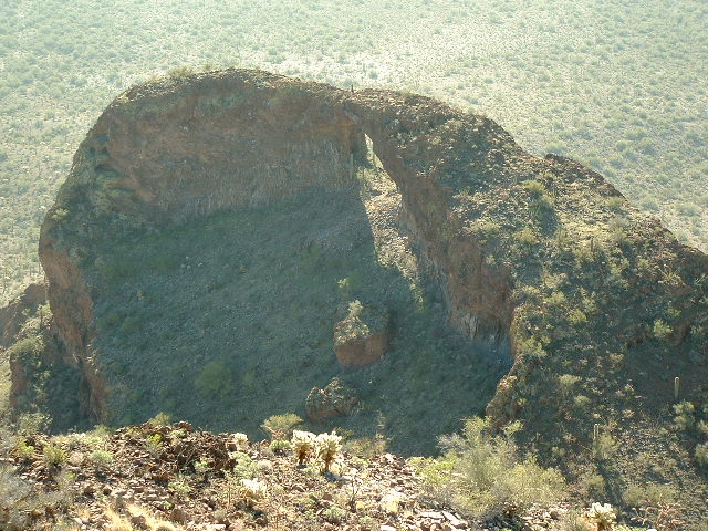
Once at the benchmark, you have this interesting perspective looking down on to the arch.
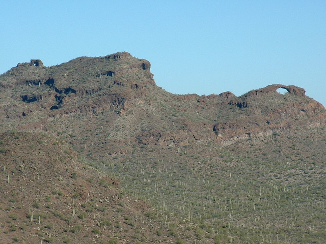
Here is a picture I took many hours later – I give it to you now because it shows the arch on the lower right, along with the summit ridge of Window Benchmark on the upper left, where there’s another, smaller arch.
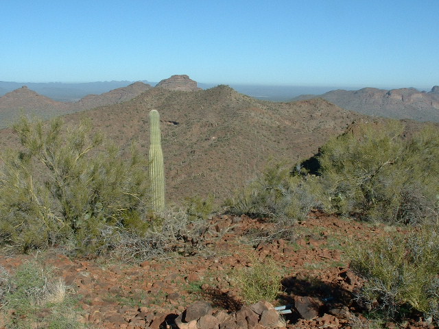
Another view from Window Benchmark looking north over Wind Benchmark shows the Castle Mountains range highpoint on the skyline just to the left of center.
After signing in to the summit register, I moved on, following the north ridge, then dropping down to a saddle 400 feet below. What I needed to do next was climb up to another benchmark called “Wind” at 2961′. Both it and Window Benchmark were parts of a larger mountain mass called Window Mountain, as you can see from the map on the link. My California peakbagger friends had visited Wind before and told of a large, unfriendly hive of wild bees near the summit, warning to give them a wide berth. Fortunately, I saw no sign of them, and signed in to the register.
Since I had made the effort to come all this way, my plan was to pick up a couple more peaks. Dropping down the west ridge and quickly losing 700 vertical feet, I went south through the desert, then up to the summit of Peak 2694. It appeared untouched, so I left my own register.
Looking ahead, there were two nice bumps in my path, neither with the minimum 300′ of prominence that we peakbaggers seek, but attractive nonetheless. The first was Point 2485 – up and over it (left a cairn), then over to Point 2688, which also appeared to have never been visited. After building a cairn on it, I dropped southwest down to the desert floor.
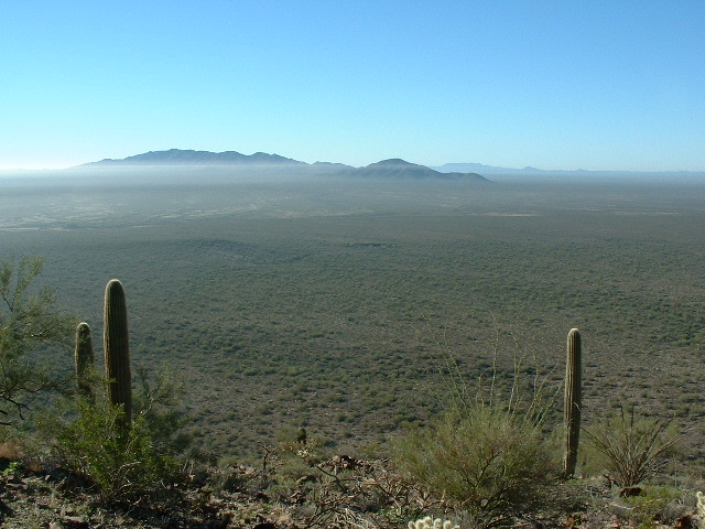
Before long, I stood on my last summit of the day, Peak 2606. It offered commanding views: south to the Sierra Blanca and northwest to the Cimarron Peak area – in fact, in every direction from the heart of the Tohono O’odham Nation.
As I left another register, it struck me how much natural beauty this unspoiled desert contained. As is the norm, it was a perfect blue-sky day. Seventy degrees, a slight breeze – it was as if I’d died and gone to heaven. I didn’t want to leave, but eventually I had to. An easy drop of 500 feet to the desert floor, a half-mile walk to a road, two miles east along that and, Bob’s your uncle, there I was back at my truck.
Please visit our Facebook page at: https://www.facebook.com/pages/Desert-Mountaineer/192730747542690

