
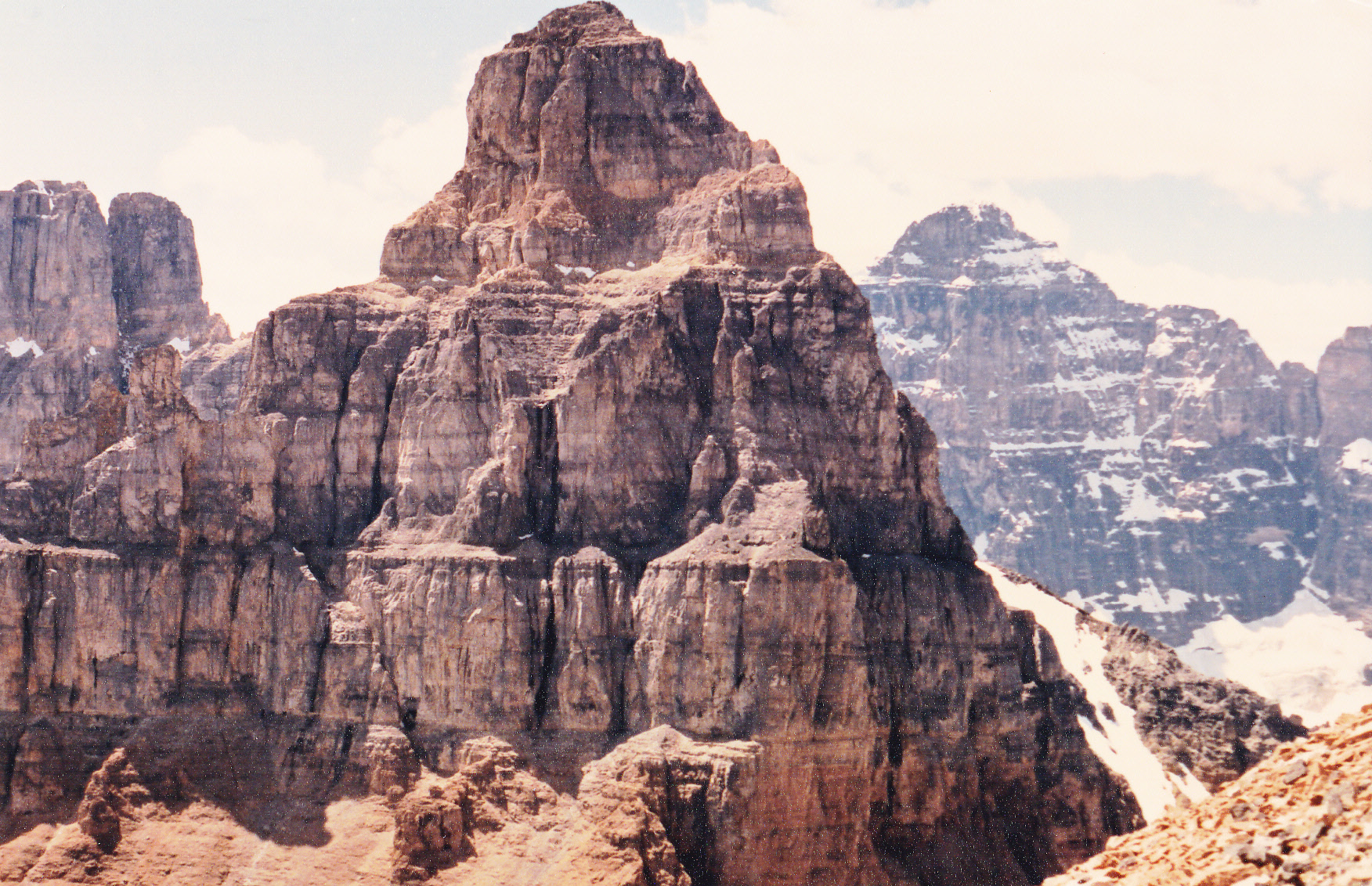
At 11,627 feet, Mount Temple is the 11th-highest peak in the Canadian Rockies. If you’ve ever driven the Trans-Canada Highway in the Lake Louise area, you can’t miss it, as it dominates the skyline on the south side of the highway. The Rocky Mountains in the U.S. have plenty of peaks that are higher than any of those in the Canadian Rockies, but many of the 51 peaks that exceed 11,000 feet in the range north of the border are difficult, dangerous and very challenging. Being that much farther north, the Canadian peaks are heavily glaciated, and are snow-covered more of the time. Mount Temple definitely doesn’t fall into the category of the most difficult, but it is one of the better-known “eleveners”.
I have an odd history with Mount Temple, going all the way back to 1966. That summer, my room-mate George and I were working at a big sawmill in Golden, BC. On Friday, August 12th after we’d finished work, we drove out to Moraine Lake and camped for the night. Early the next morning, we set out along a trail which quickly climbed above the lake and treeline while the weather worsened. On the standard southwest ridge route, we gained elevation quickly enough, reaching 9,700 feet, but the ceiling had lowered, it started raining and we were clueless as to how to proceed. We didn’t know the route and couldn’t see any higher up the mountain, so we did the only sensible thing and called it quits. Back down we went and drove home.
It must have really stuck in my craw, because one week later, I was burning to try it again. George had other plans for the weekend, so early on Saturday morning I headed over to the highway at the edge of town and started hitchhiking. It didn’t take long to get a ride, but it only took me about half-way to Lake Louise and dropped me off. There I stood on the side of the Trans-Canada Highway trying to catch my next ride. I waited, and waited, and had no luck. After a couple of hours, realizing that too much time had passed, I gave up, walked across the highway and started hitching a ride back to Golden. Well, my luck changed and I caught a ride pretty quickly. As I explained to the two fellows in the car what I’d been trying to do, they became very interested. Why couldn’t we head to Mount Temple right then and there and give it a try together? I told them I thought it was a good idea, so they turned the car around and headed east. Less than an hour later, we parked at the trail-head at Moraine Lake and set out on foot.
One of the two guys worked for the parks department at Rogers Pass and the other was an engineering student at my school, the University of British Columbia in Vancouver. In the week since I had been there with George, it had snowed, and down fairly low at that. The three of us didn’t even climb as high as the week before, and had to give up because the fresh snow was too deep. Thus ended my second attempt on Mount Temple. As a consolation prize, we instead made our way over to Eiffel Lake and enjoyed the rest of the day. It was very late by the time they dropped me off in Golden.
Years passed, and eventually I moved from Canada to the USA – Mount Temple was about the farthest thing from my mind. However, I ended up back in Lake Louise in the summer of 1987. On July 13th, I set out to climb the peak. I’d try the normal route, the southwest ridge, which was the choice of probably 99% of all those who went to Mount Temple.
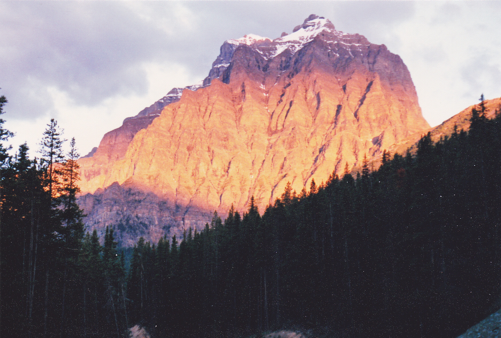
Sunrise on Mount Temple – the summit is 6,600 vertical feet above
Of the 51 peaks over 11,000 feet, Mount Temple was the first one climbed, way back in 1894. Attesting to its popularity, on a fine summer day there can be dozens of people on the mountain at the same time, and that would be the case on the day I was there. I set out from the parking lot by the Moraine Lake Lodge, at around 6,200 feet elevation, and walked for half an hour along a trail to a junction. I took the branch marked “Larch Valley” and climbed a series of switchbacks through a forest which gained me almost 1,200 feet. At another junction (one trail went to Eiffel Lake) I took the one that directed me to Sentinel Pass.
The walk through Larch Valley was fairly gentle and very picturesque. I passed near what were known as the Minnestimma Lakes, and by then was above treeline. Here’s a view of the lakes as seen from higher in the climb. You can plainly see the well-worn path I took.
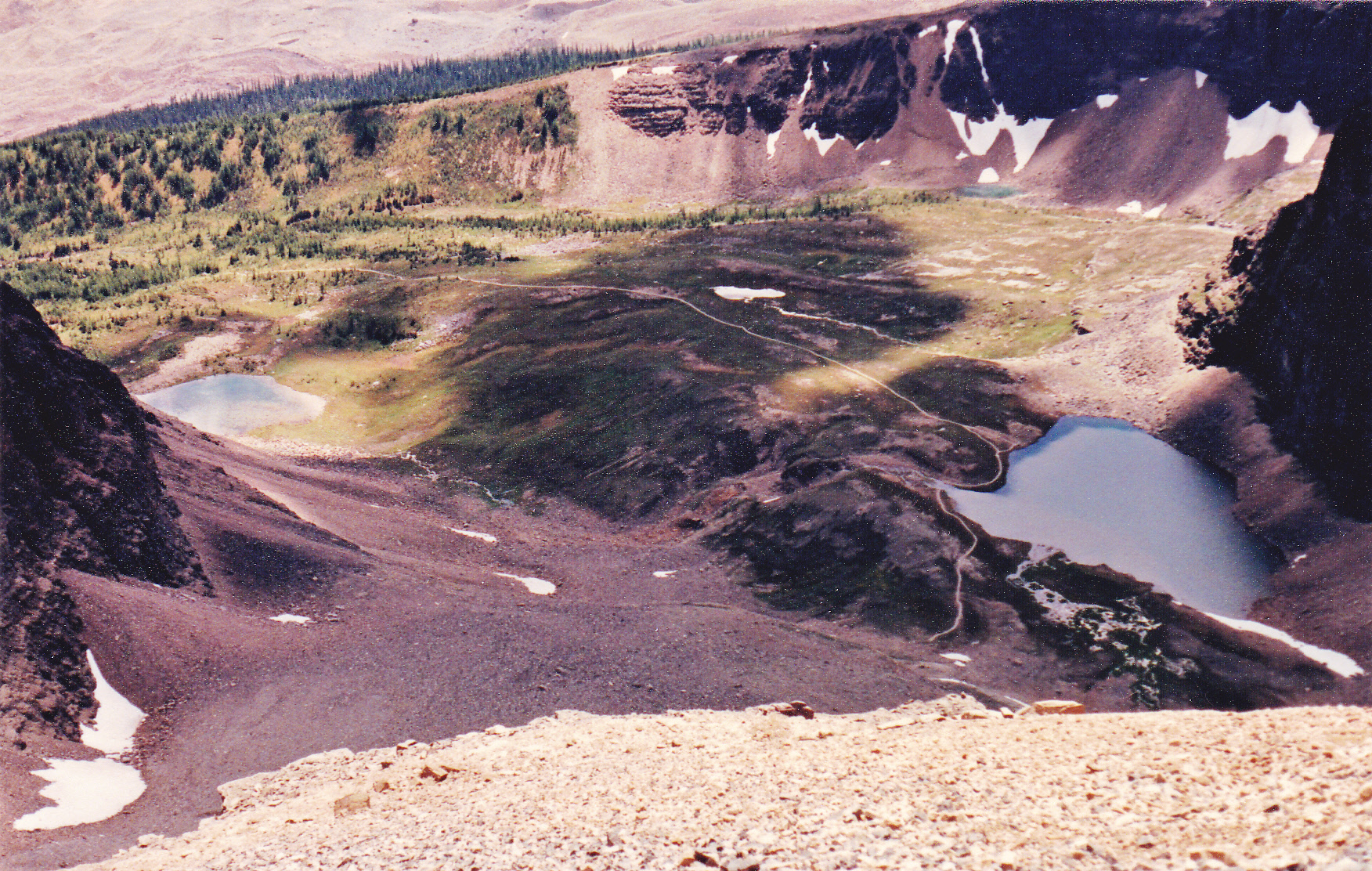
Minnestimma Lakes in Larch Valley
While in Larch Valley, I had this view of Mt. Fay.
Looking southeast to Mt. Fay (10,614′) on the Continental Divide (the border between BC and Alberta)
As I approached the head of the valley, I could plainly see the switchbacks climbing up to Sentinel Pass, at 8,565 feet.
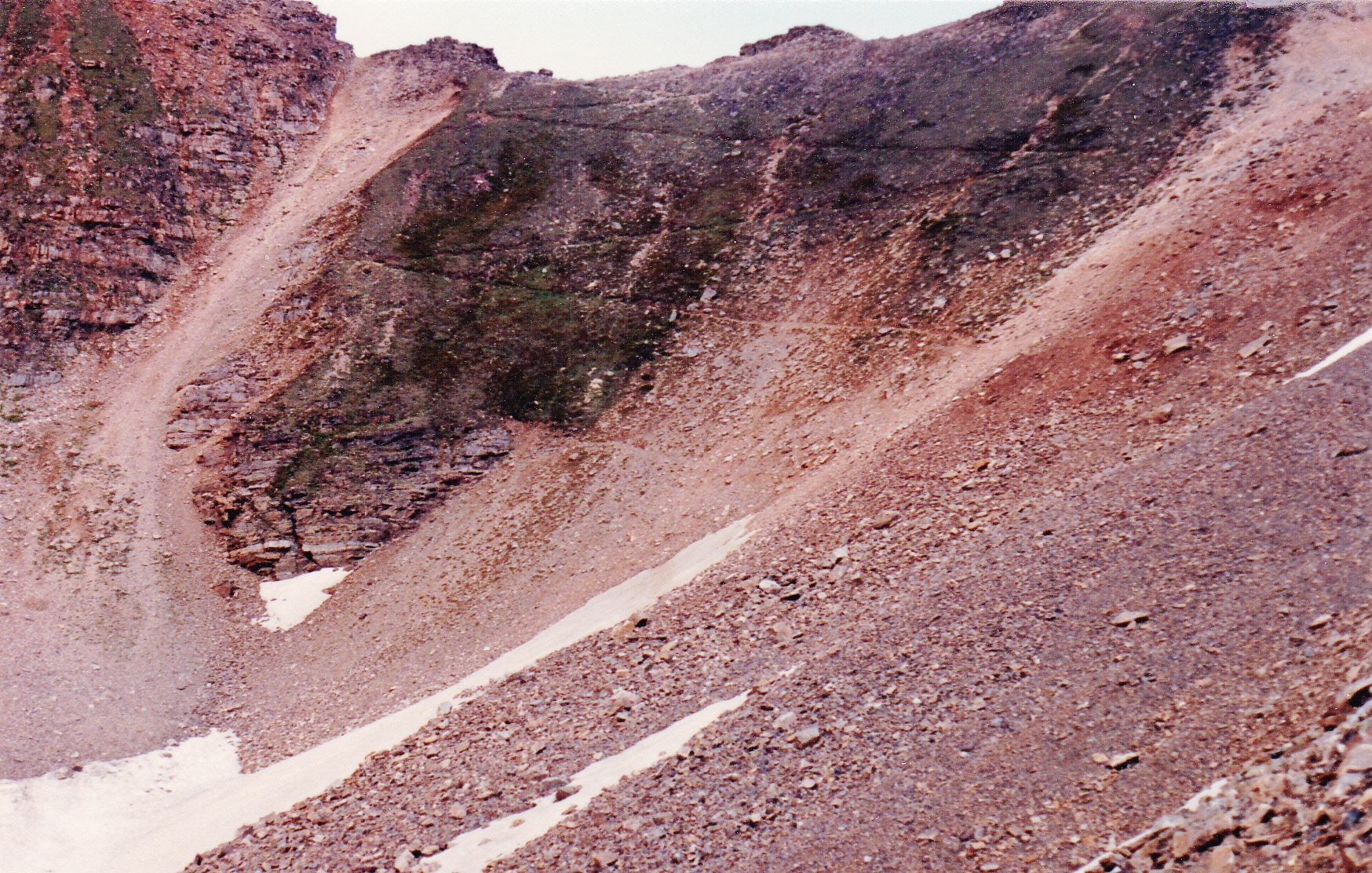
Switchbacks climbing up to Sentinel Pass at 8,565 feet.
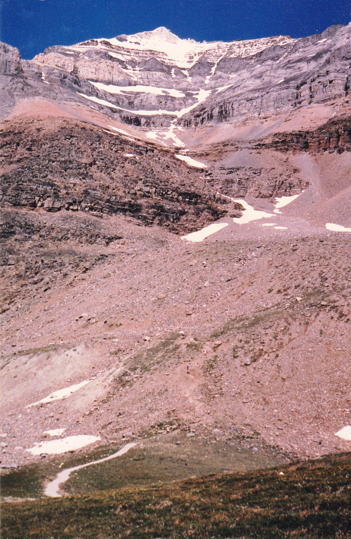
Up those I went, climbing another thousand feet to arrive at the pass. As you can see from the photo, the route was free of snow up to that point. It was a good start, but I still had another 3,000 vertical feet to go to reach the summit. Above the pass, I climbed up a long scree slope, staying to the right of the ridge itself. I was now definitely on the southwest ridge route.
There were climbers all over the route, both above and below me, and I had to keep a sharp eye out for rocks rolling down on me. Some people actually put on helmets for the climb from here to the summit so they don’t get brained by such missiles. I had to choose my route carefully to stay on firmer rock and off of much of the loose rubble. For quite a while, I did a long ascending traverse up and to the right until I reached the first rock band. This wasn’t hard, and there were even cairns showing a path up this first grey band – just some nice scrambling. A short distance above that first rock band I came to a second grey band – this is considered the crux of the climb. There are 2 steep steps here, like big blocks, with decent exposure. The rock is quite smooth in places. Some people will even want to rope up here for some extra piece of mind, but I sailed on through.
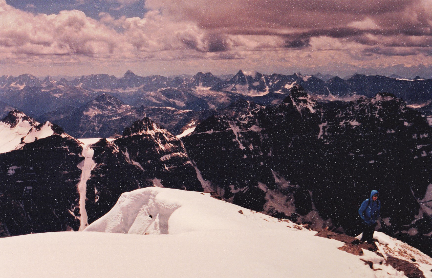
I was now well above the highest point I had reached back in 1966. Once past the second grey band, I climbed up rock slabs covered with loose gravel – slippery footing. The views were amazing, though, like this one looking back over top of Sentinel Pass.
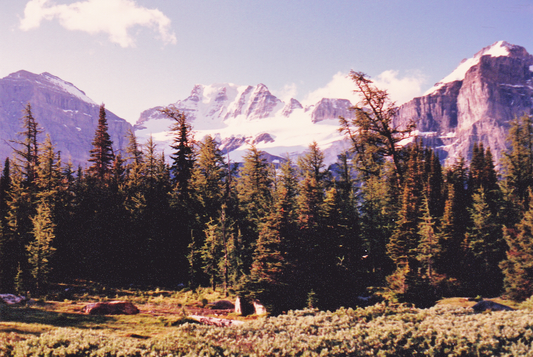
Looking west: left to right – Eiffel Peak (10,118′) in the rear; Pinnacle Mtn. (10,062′) in front; Yukness Mtn. (9,340′) in the rear
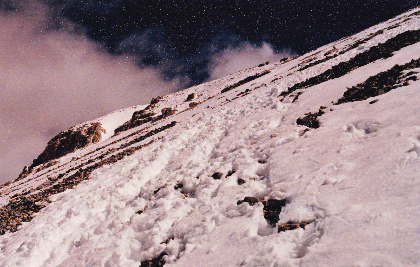
Before long, I reached the final bit of rock on the climb, a light-colored band. This was easily passed through, putting me on the long final stretch. Up until now I had always been on the right-hand side of the ridge, but now moved over to the left. There was snow the rest of the way, trodden by many others before me.
At 11,000 feet on the southwest ridge
The rest of the climb was nothing more than a steep trudge. The views from the top were outstanding, and here are several I’d like to share with you.
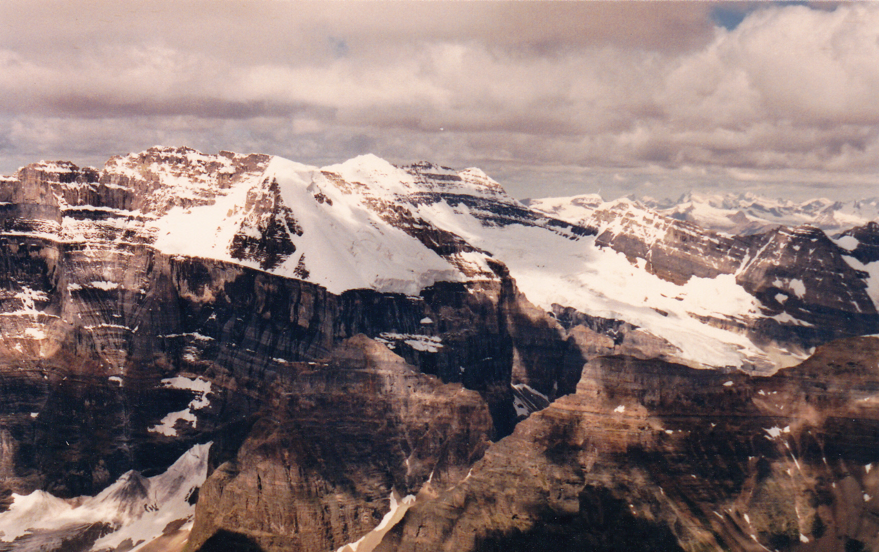
Looking north of west: Mt. Lefroy (11,230′) on the left; Mt. Victoria (11,364′) is dark, center, rear; The Mitre (9,468′) is down low just left of center.
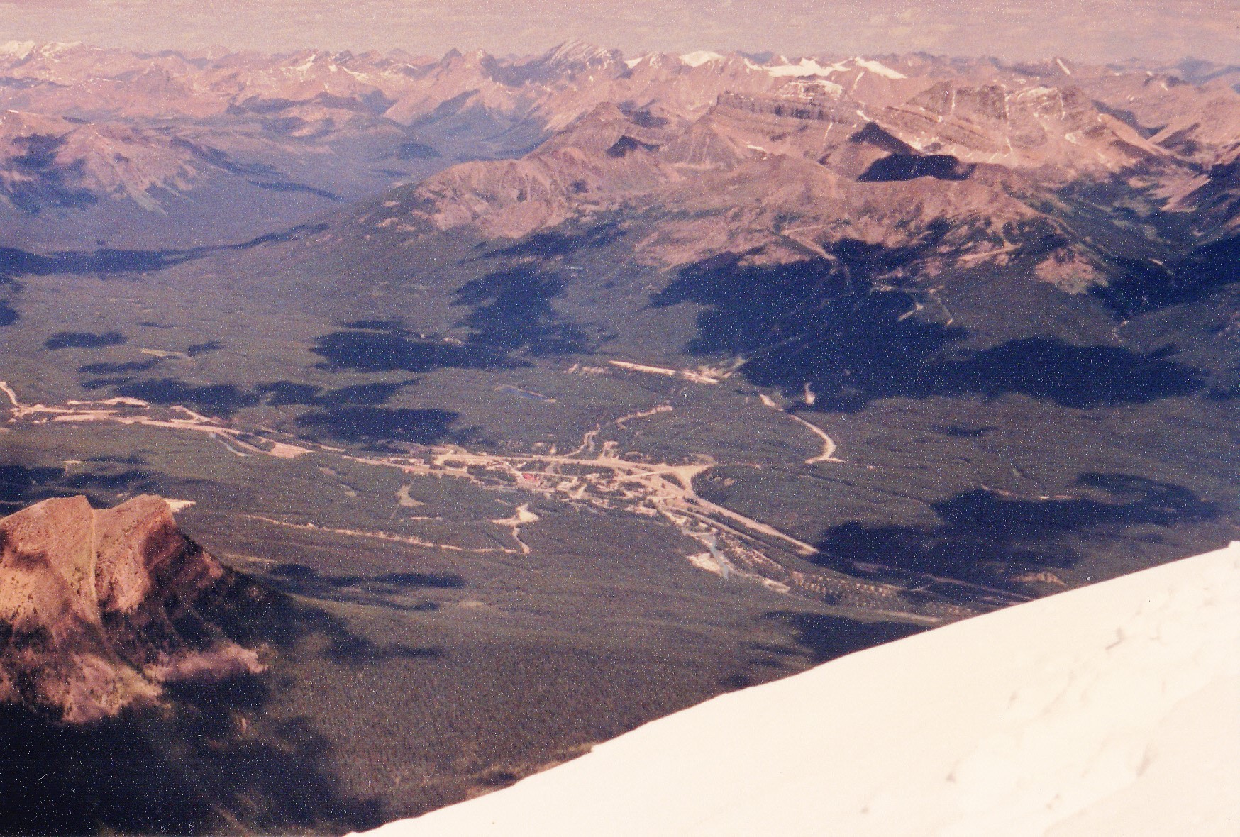
Looking north to Lake Louise village
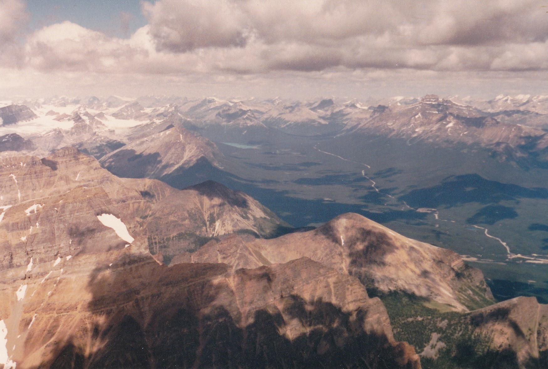
Looking northwest towards Jasper and Bow Lake
On the summit, 11,627′, looking south to the Ten Peaks
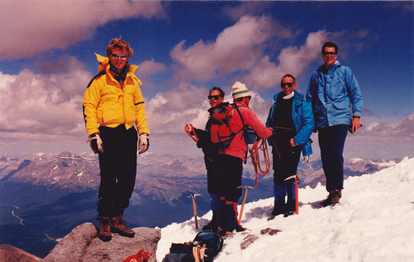
Folks on the summit
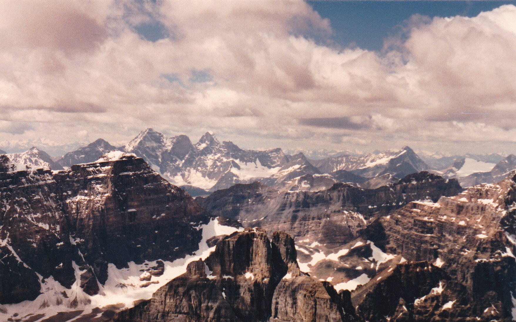
Looking west to Mt. Goodsir (11,686′), the dark summits left of center in the distance
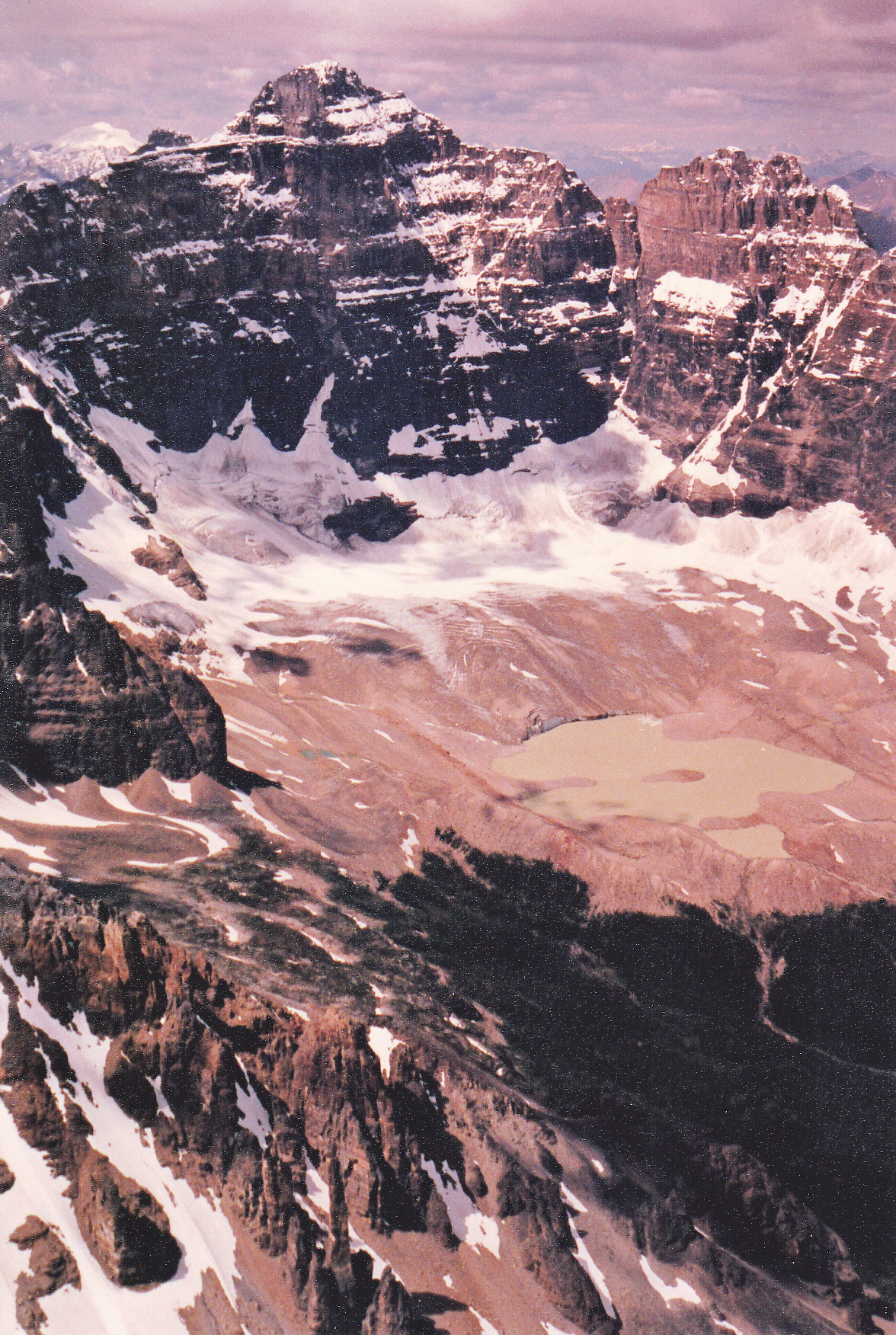
Looking west to Yukness Mtn., Horseshoe Glacier and Horseshoe Lake
I didn’t stick around long on the summit. Look at this next photo – I followed the left skyline down to the pink rock band, through it and then the dark bands below it. Then, I made my way to the center trough and straight down the middle of it towards the camera.
Descent route
Going down that center trough probably wasn’t the smartest choice I could have made, as it subjected me to rockfall from above – however, I made it through unscathed. The rest of the trip back down to the car was uneventful. The climb was 5,700 vertical feet over 11 miles, and took me the whole day. Here I am when it was over.
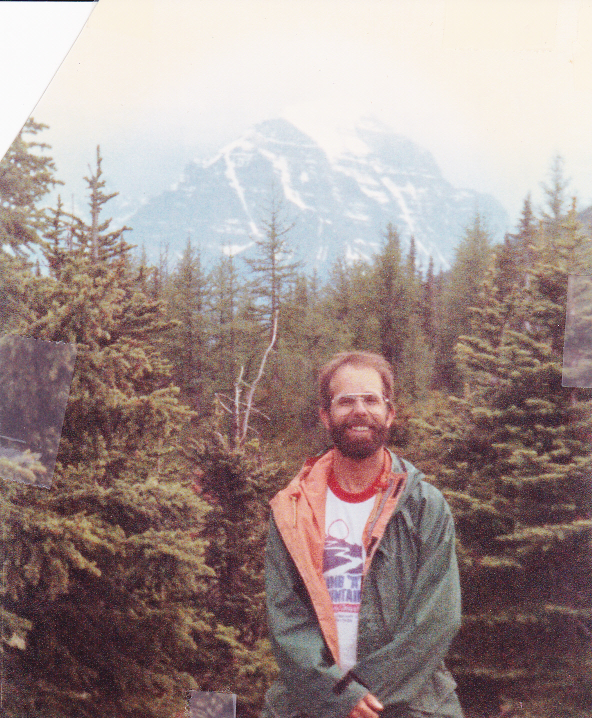
When it was done
So, 21 years after first trying it, I had stood on top of Mt. Temple. It’s a popular peak, one of the easiest 11,000-foot peaks in the Canadian Rockies, and sees a lot of action. The mountain has seen its share of tragedy, though. On July 11, 1955, in one of Canada’s most tragic mountaineering accidents, seven American male teenagers were killed on the southwest ridge route. A warm summer day had caused several nearby avalanches. They finally decided to turn back and during the descent, an avalanche swept 10 members of the party 650 feet down the snowfield through a bottleneck of rocks. Unfortunately, the entire party only had one ice axe among them and were not well prepared for the seriousness of the route. The party had also gone up the route without either of their two group leaders. And in late September of 2015, a woman from Calgary fell to her death while on the peak.
Postscript: four years later, Brian Rundle and I were in the Lake Louise area for a week, climbing our brains out between storms. On August 9th of 1991, the two of us climbed Mount Temple together and successfully made the summit. Actually, “together” is too kind a word – Brian was much stronger than I, and I was slowing him down the entire way. For the last thousand vertical feet, he left me far in his wake – I found him waiting patiently on the summit. We spent a short while on top, then made the descent together.