
In present-day mountaineering, the concept of prominence is all the rage. Here’s how prominence is calculated. Nearly every peak has a neighboring peak that is higher. That neighbor could be nearby or many miles away. So once you know what that higher neighbor is, you look at the ridge that connects your peak to that higher neighbor. Once you’ve found the ridge, you then look at the lowest point, or saddle, along that ridge. Almost done. The drop in elevation from the top of your peak down to that saddle is the prominence of the peak.
Here in the USA, we look for a minimum prominence of 300′, actual or interpolated. Many peakbaggers focus their attention on peaks with 1,000 feet of prominence, or 2,000 feet – it just depends on what your goals are. For many, the greatest prize is a peak with 5,000 feet, or 1,500 meters, or more, of prominence – these have earned the name of ultra-prominence peaks, or ultras for short. Prominence is a fairly recent concept, having come into its own only in the last decade or so. Forty years ago, climbers didn’t even know the word.
If you look at all of the ultras in the 48 contiguous states of the USA, you will find a total of 57 – pretty impressive, right? I’d now like to direct your attention to the province of British Columbia on Canada’s west coast – I’ll bet you can’t guess how many are there. Well, BC alone has 101 ultras, almost twice as many as all of the lower 48 states combined. Those 101 are scattered all over BC, and can be found in the Coast Range, the Rockies, the Saint Elias Range, Vancouver Island and the Columbia Mountains. Many of them are legendary for their difficulty – Mt. Robson, Mt. Fairweather, Mt. Waddington, Mt. Alberta, just to name a few. There are peaks on that list of 101 that have never seen their first ascent – access can be nightmarish, weather and other difficulties numerous. It has been said that the list of 101 may possibly be the hardest list of peaks anywhere in the world to complete. In fact, many world-class climbers have said that it is a list that is virtually impossible for any one climber to complete in a lifetime. Personally, I think the list is so daunting that climbers don’t even set out to try to complete it – the highest number of peaks on the list completed by one person that I’ve been able to discover is – get this – fifteen!! One peakbagger has said “Climbers in Washington state are justifiably proud of the North Cascades and its reputation as the most rugged and precipitous range in the US outside Alaska. But compared to the stuff north of the 49th parallel, they are just foothills of little note.” Strong words, but I would have to agree in principle. It’s important to understand that BC is a big place. Most Americans think that Texas is a huge state, but with an area of 364,000 square miles, BC is 35% bigger than Texas – that’s more than enough space in which to put all those ultras! By the way, guess how many ultras Texas has? – zero!
Okay, enough of my rambling on about statistics. The real aim of this piece was to tell you about a couple of BC ultras that I visited long before I’d ever heard the term. The first is called Silvertip Mountain. Of all the ultras in the province, Silvertip has a few interesting distinctions. It is the closest to the USA, only 11 miles north of the border, making it the southernmost of all of Canada’s ultras. The peak’s elevation is 8,517 feet and it has a clean prominence of 6,089 feet. Even with all of its prominence, Silvertip is still only the 35th-most-prominent of BC’s ultras. If the international boundary were 11 miles farther north, Silvertip would become the 25th-most prominent peak in the lower 48 states! Most climbers don’t think that the Cascade Mountains extend into Canada, but they do, if only a little bit. Silvertip is very near the northern tip of the range, but is still a part of it. And that makes Silvertip the most prominent of all non-volcanic peaks in the Cascades.
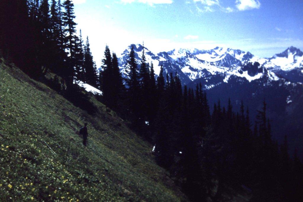
In 1974, a climber named Dick Culbert opened my young eyes and those of many others by publishing his ground-breaking Alpine Guide to Southwestern British Columbia. It revealed a world of possibilities, and gave us a push into the hinterlands to make new discoveries of our own. Dick’s book is what first made me aware of Silvertip, and based on his route descriptions I chose the southwest ridge, as it seemed the most straightforward. Getting to the peak was easy, in fact probably one of the easiest of all of BC’s ultras. From my home, I drove on paved highways for about 65 miles, then another 22 miles on an excellent dirt road called the Silver-Skagit Road. I found a quiet spot to park, at 1,900 feet elevation, in a clearing about a quarter-mile from the main road and got my pack ready. I was traveling light, just a day pack, map and compass, no ice axe or crampons. It was October 12, 1976, and I was ready to start just after first light.
When I went to do the climb in ’76, I simply started up through the bush, which was somewhat of a thrash but not terrible, (the bush became easier the higher I went) and followed the easy ridge. It took a while to climb 4,000 vertical feet, and at around 6,000 feet elevation I started to emerge from the forest. I had a pretty good view of the peak, still a long way above me, but motored on, making pretty good time.
I side-hilled for a while and entered a meadow to the southwest of the summit (there was even a small glacier there), then climbed up to the west ridge. This was wider than the narrow ridge I’d climbed up from the road.
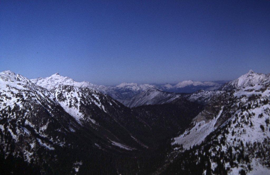
In the meadow at around 6,000 feet.
Up ahead was a false summit – I’d had my eye on it as I climbed, and wondered how it’d be. It was right along my path, and there was no avoiding it. I stayed on the right side of its crest, and it wasn’t bad at all – a bit of exposure, a bit of class 3, but quickly bypassed.
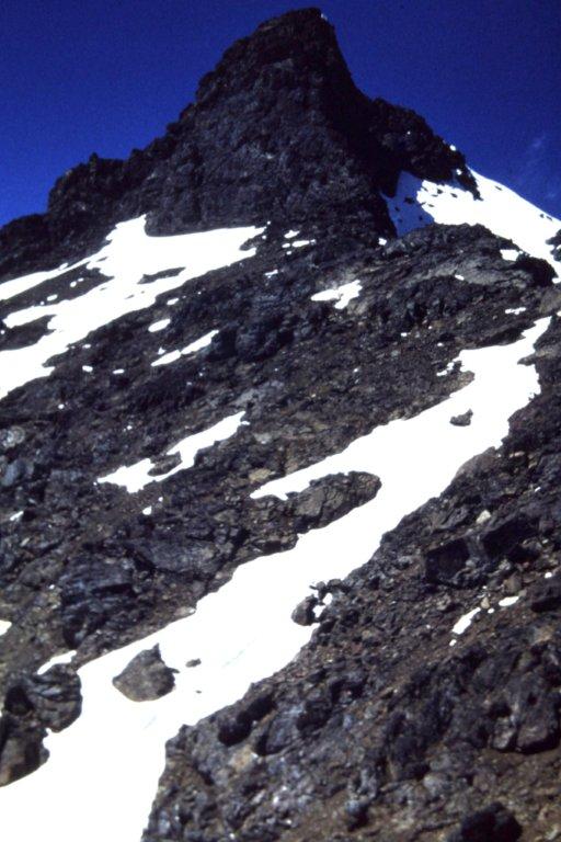
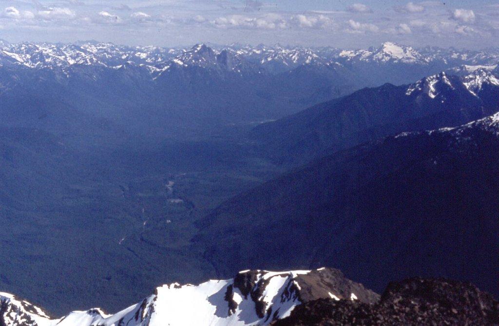
The home stretch, approaching the true summit.
Another 600 vertical feet and there I was on the summit. The weather was perfect, sunny and cool. After a brief spell on top, I headed back down exactly the way I’d gone up, without any incident. Considering the total vertical of just over 7,000 feet, counting all of the extra ups and downs, it had been a full day, but I still finished well before dark. This was very enjoyable, and a pretty big peak for the effort involved.
There are 2 other big peaks close to Silvertip: one is called Mt. Rideout, whose summit is only 2 miles west of Silvertip – I never climbed it. However, an even bigger peak simply known as Unnamed 8150 sits a mile northwest of Rideout. On September 27, 1977 I went back and climbed it as a day climb from the Silver-Skagit Road via its southwest ridge. This one felt like more of an adventure than Silvertip – the ridge was steep and narrow, and made for a pretty long day. When I climbed this peak, it was simply known as Peak 8150. However, I see that it is now called Mt. Payne, named after a climber who was killed on Edge Peak in October of 1978.
Here are some other photos of and from these peaks.
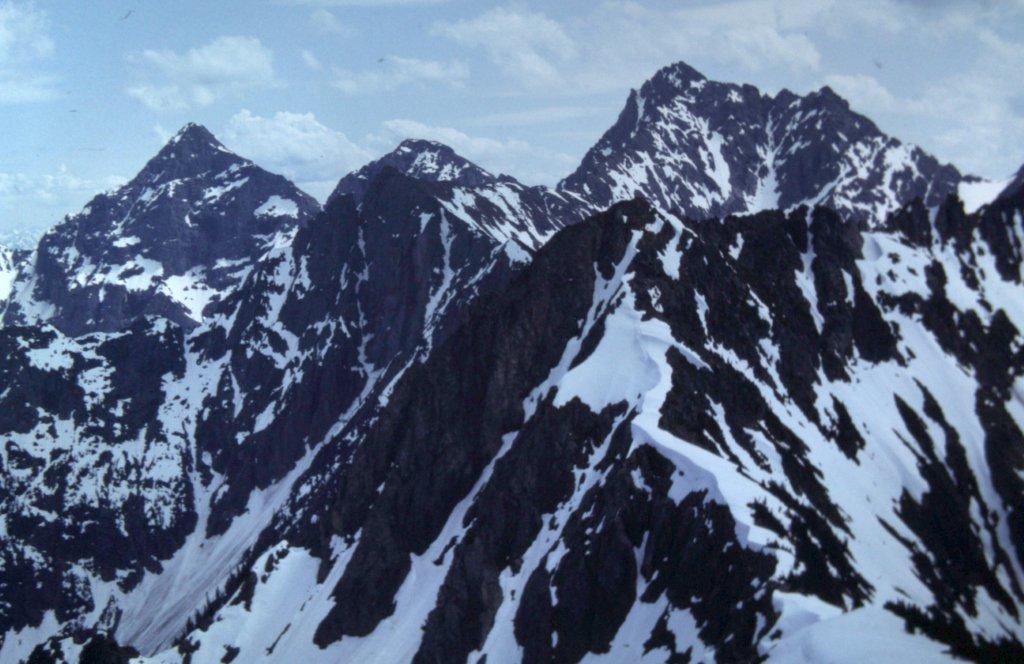
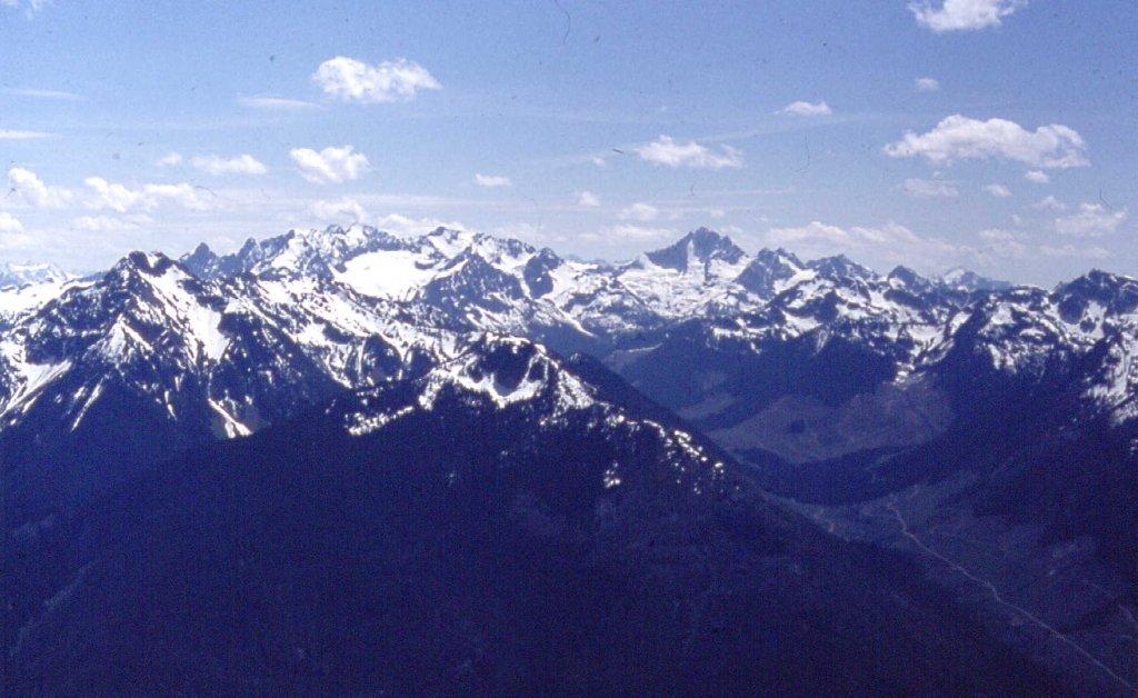
Looking southeast from Mt. Forddred. Silvertip is on the far left, about 2 miles away. Peak 8150 is the big one on the right. Mt. Rideout is lower down on the skyline between the two.
Looking west from Silvertip. Mt. Rideout is on the left, Pk. 8150 is on the right.
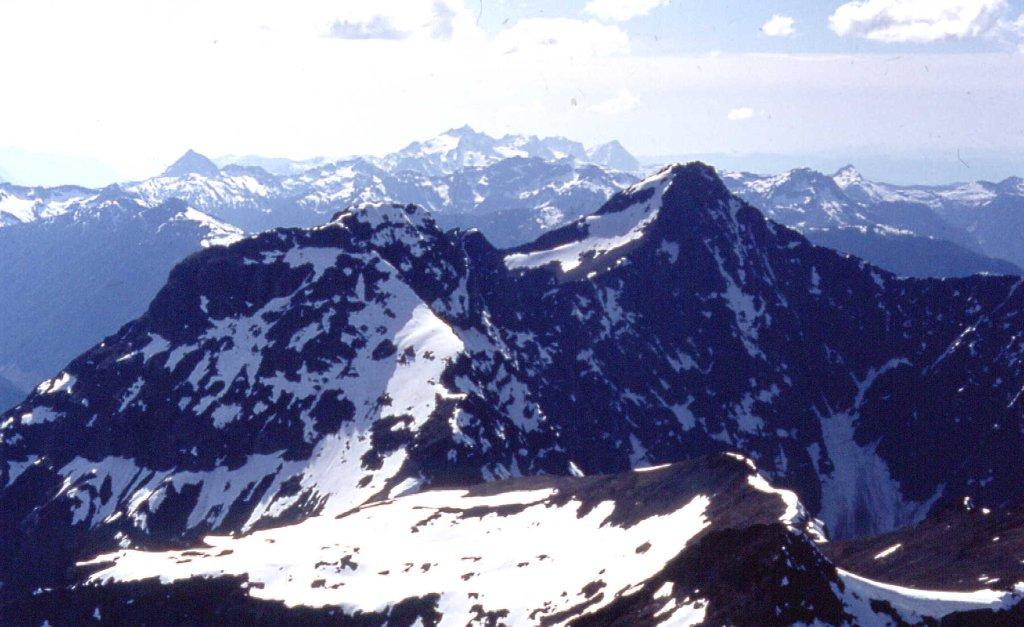
From 10 miles away, looking northeast. Silvertip is the white one towards the left side; Whitworth Peak is the one on the far right
Looking down the Skagit River Valley, south from Silvertip’s summit – Mt. Hozameen is the dark one just left of center; Jack Mtn. is the big white one over to the right
Looking west of south down the Maselpanik Valley to the Silver Lake group of peaks
Any photos I had of Silvertip are long gone, but climber friend Ross Lillie kindly let me use his for this piece.
Before I ever climbed Silvertip and Peak 8150, I went and paid a visit to another ultra – this one was 70 air miles farther north. At 9,738 feet, Skihist Mountain was the highest peak in southwest BC, so that was a definite lure. It has at least 8,032 feet of prominence, which is the 38th-highest prominence of all North American peaks. This one was in a more remote area than Silvertip.
On September 7th, 1975 I set out from my home at the leisurely hour of 7:15 AM, and 125 miles later I arrived at the small town of Lytton, population 225. This place has the distinction of having hit 112 degrees F, about as hot as you can get in Canada. I drove my old Volkswagen Beetle on to the ferry and got a free ride across the mighty Fraser River. Back in the day, you could drive up the west side of the river, then west up Kwoiek Creek to the end of the logging road, a total of 14 miles from the ferry crossing. I parked my old beater (no worries about anyone stealing it) and set out on foot at noon.
The elevation where I parked was 3,700 feet. There were rumors of an old trail in the area but I couldn’t find it. Five hours later, some of it with bushwhacking, took me to what was called Blue Lake at around 6,150 feet. I believe it is now called Antimony Lake. This was right at tree line, and a more beautiful alpine setting would be hard to find. Those 5 hours had really tired me out and I crawled into my sleeping bag early. This was one of those lightweight climbs – no tent, just sleeping under the stars. The temperature dropped below freezing overnight, with frost on the bag by morning.
I was moving by 6:30 AM. The weather was clear, not a cloud in the sky, and I moved quickly, heading northwest from the lake up to a pass at 8,250 feet to the north of Antimony Peak. By the time I got that far it was 8:30. To continue, I dropped down over a thousand vertical feet into a basin which was the head of Nesbitt Creek, then climbed another 2,500 vertical feet, much of it on scree slopes. It was straightforward, I was moving quickly, and by 10:30 I was on the summit. After a quick turnaround, I left and retraced my steps, reaching my campsite back at the lake by 12:45 PM. On the way back out to my car, I actually was able to find and follow the trail for some of the distance, passing through beautiful alpine meadows. At 4:30 PM I was done. It was an easy drive back out to the Fraser River, but instead of taking the ferry across the Fraser River back to Lytton, I drove along the west bank of the river for 30 miles. There, I used the aerial ferry across the river from North Bend to Boston Bar. This was a cage, big enough to hold one vehicle, which crossed high above the raging river below on a cable – quite the little adventure in itself. The rest of the drive home was on pavement, and I was all done by 9:15 that night. None of my pictures from that climb long ago have survived, but here is a link to a site that has a LOT of excellent ones of the area and of Skihist Mountain itself.
http://forums.clubtread.com/27-british-columbia/35370-skihist-mountain-sep-4-6-2010-a.html
So anyway, those are a few nice memories I have of climbing ultras long before anybody had ever heard the word.