
It seems like an unusual name for a mountain range, as if it could be a person’s name. So, I looked in my “Arizona Place Names” and found this: Named after George J. Roskruge of Tucson, U.S. Surveyor General of Arizona, 1896-97. Pioneer, champion sharp-shooter, civil engineer and father of Masonry in Arizona. Came to Prescott from England, 1872. Was cook, packer and chainman for surveying party that established Fifth Standard North. One of Arizona’s outstanding citizens. Died July 27, 1928.
Okay, now I know where the name came from. I was curious because this range sits close to Tucson, only 16 air miles at its nearest approach to my home. Twenty years ago, as cooler weather approached, I got the bright idea that it would make a nice winter project to climb all of its peaks. Why not? – they were nice and close, and there was probably some nice unspoiled desert out there to be enjoyed. I made copies of all of the maps that covered the area and taped them all together to form one big one, large enough to cover a dining-room table.
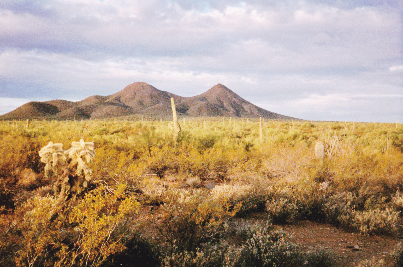
The range is bounded on the south by Arizona Highway 86 near the town of Three Points. To its north sits Waterman Pass, separating it from the Waterman Mountains beyond. All along the west is the Tohono O’odham Indian Reservation, and Avra Valley is to the east. This is not a large group of mountains – measuring along what could be called the spine, one only travels 27 air miles. With the luxury of time, I examined all parts of the range and identified 44 objectives I thought I’d like to climb. Ten of them had official names, three were named benchmarks, several had spot elevations and many were simply un-named. A few of the named peaks didn’t have a full 300 feet of prominence, but they seemed like worthwhile objectives anyway. I didn’t have a four-wheel-drive vehicle at the time, only a low-clearance 2WD pickup, so I hoped access wouldn’t be too big an issue. Just in case, I planned to have my mountain bike with me.
Three or four months seemed like a reasonable amount of time to knock off the entire project – not one big push, of course, but rather a whole bunch of day trips from home. I was excited to make a start, so on November 7th, 1997 that’s exactly what I did. From Sandario Road, the major north-south conduit through Avra Valley, I headed west for almost 8 miles to reach the entrance to the Agua Blanca Ranch. Another 5 miles to the southwest I found the AB ranch-house where the road was blocked, so I headed north a mile and a half to another gate marked “Agua Dulce Ranch”. My map guided me another 3.5 miles west to reach a tank near the end of the road, where I parked.
There I stood – to the northwest sat Peak 2821, only a mile away and inside the reservation boundary. An easy walk brought me to the first mountain of my project, which also turned out to be the northernmost of the entire range. Smaller hills were strung out another 5 miles to the west – I found this area very attractive, and had I time to spare I’d have gone farther. Today was meant to be more exploratory than climbing, but turned out well in any case – it was sunny and in the low 80s, just about perfect.
Two days later, I was back, this time with my wife Dottie in tow. There is a band of low hills all the way across the northern end of the Roskruge Mountains, stretching 10 miles from end to end, all just south of Waterman Pass. The western terminus was discussed with Peak 2821 earlier; the eastern is where we were today, a little thing called El Cerrito de Represso. There’s an earthen dam at its base, and thus its name. Actually, the name on the topo map is mis-spelled – it should be Represo, not Represso. “Cerrito” means “little peak”, and “represo” is the word for “dam”. We parked nearby, climbed the higher northern bit, then went over to the lower bump and descended a faint road down the east slope. There, we found something strange indeed. A large bird, or what was left of it, lay on the hillside. It was a brown pelican, no doubt blown a hundred miles away from its normal habitat (probably the Gulf of California down in Mexico) in a bad storm we’d recently experienced. The poor thing didn’t have a chance, as our desert was all out of fish.
We drove 2 miles southwest and parked, then walked across flat desert to our next one. It was an easy climb up the southwest slope of Cerrito de Gallinas. There were no pelicans on this one, but the name was rather bird-like (“the hill of hens”). So, two days done, and no bad roads yet.
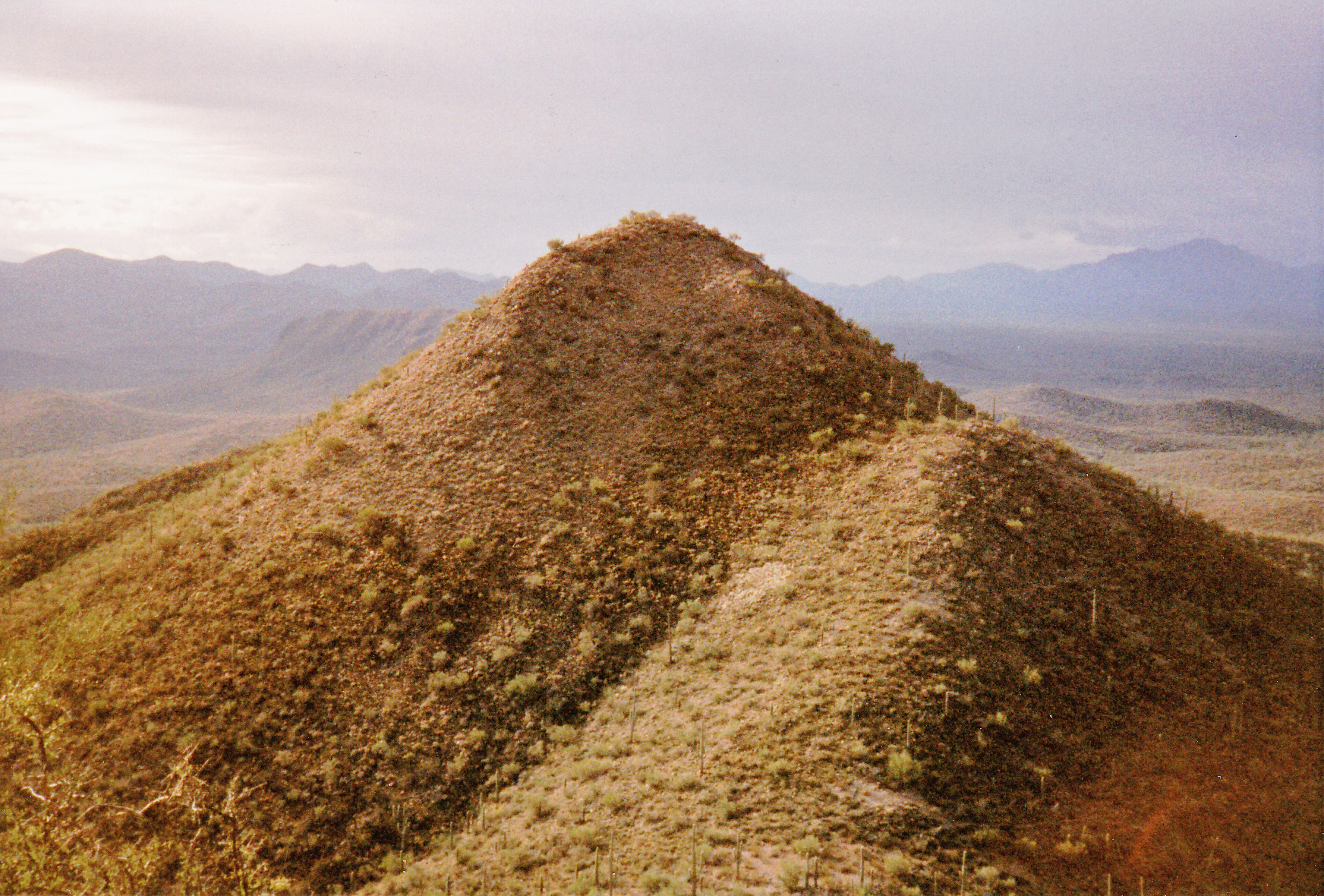
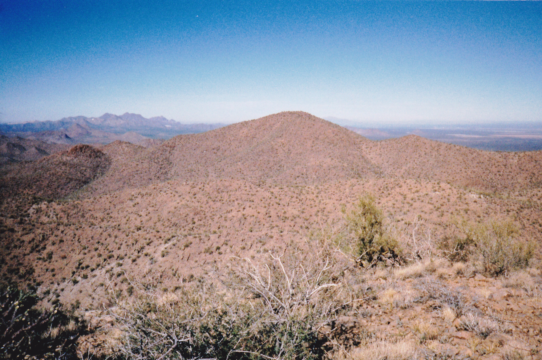
Three days later, on Wednesday the 12th, I headed back out to the range, this time by driving west on Manville Road, then lesser roads, to arrive at a spot to the northwest of something called Dos Titos.
Looking west to Dos Titos
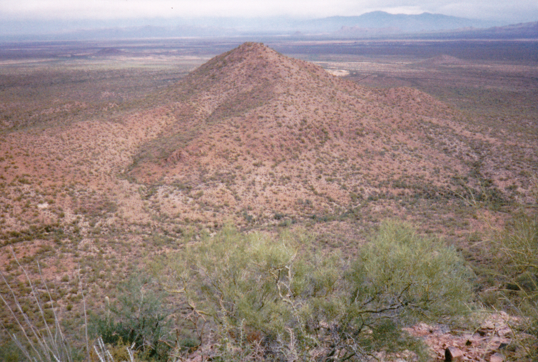
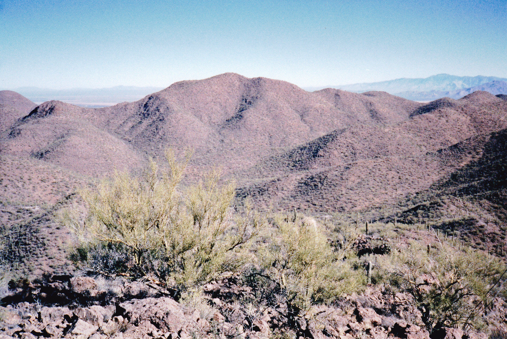
My goal was to climb both of the Titos, which were in fact two separate peaks. This proved to be a good starting point, as I could gradually climb straight up the bajada – this gave me fewer washes to negotiate. This put me on the east shoulder of the North Tito, and from there it was straightforward to reach the top. There was no register, so I left one. From there, I descended to the saddle between the two, then south to climb to the summit of the South Tito, which appeared to be about 40 feet higher.
Looking south to the south peak of Dos Titos
I knew it had been climbed before, and even though I found no register, I didn’t bother to leave one. Back down to the saddle, and an easy return to the truck.
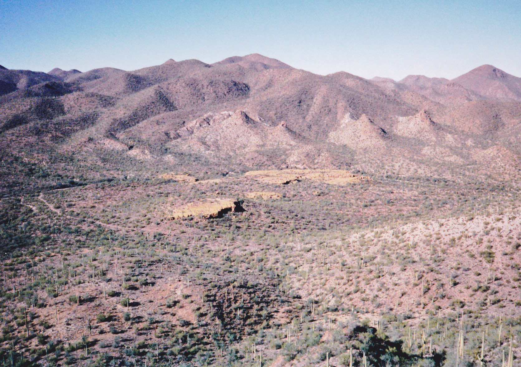
The weather looked threatening, and although a few drops of rain fell, I thought I’d try to get away with some more climbing. Heading south to a spot near the Agua Blanca ranch-house, I parked and pulled my beater of a bicycle out of the back of my truck. Before I could ride it, though, I humped it through a stretch of brush, a wash and over a few fences. This brought me to a point south of the house, where I could finally get on the bike and ride. After a mile and a half, I found myself at the end of a side road. It was now sunnier and warmer. I ditched the bike, and left a trail of flagging as I made my way to a little valley between two peaks. The first was Peak 2975 to the northeast, which went easily – I left a register, then dropped down to the valley bottom and ascended Peak 3047 to the southwest. No register there either, so I left one and dropped back down to the valley between the peaks.
Looking northeast to Peak 2975
Looking southwest to Peak 3047
Because I’m an idiot, I had brought no water with me (hey, it’s winter, so why should I need any?). Making my way back to the bike, the weather was threatening as I skulked around the west side of the ranch-house to regain my truck. Just as I got there, it started to rain and worsened all the way back to Tucson – talk about perfect timing! Those last two peaks required just over 1,650 feet of gain and 6.6 miles, and took about three hours time.
It took me almost a week to get back to the Roskruge. This time, I’d try for a peak on the far west side of the range and inside the reservation. By the time I got near my peak, I’d driven 20 lonely miles from pavement and parked in a remote area. A thousand feet of climbing brought me to the summit of Peak 3313, the highest so far in my project. No sign of anybody before me, so I left another register. This was a nice climb on a perfect day, cool and sunny, but it was so far out it took me three hours to drove to it from my home.
Hmmm, maybe enough time for one more on the way out. All the way east to a point just past the Cocoraque ranch-house, I found a poor road along a fence which took me right to the northeast base of my next peak called Cocoraque Butte, which was quick and easy. It seemed logical that someone had been there before me, but I left a register anyway. My front left tire kept losing air ever since the trip a week ago – I’d better get it checked, and soon. Nine summits done so far – this was turning out to be a really enjoyable range, and so close to home.
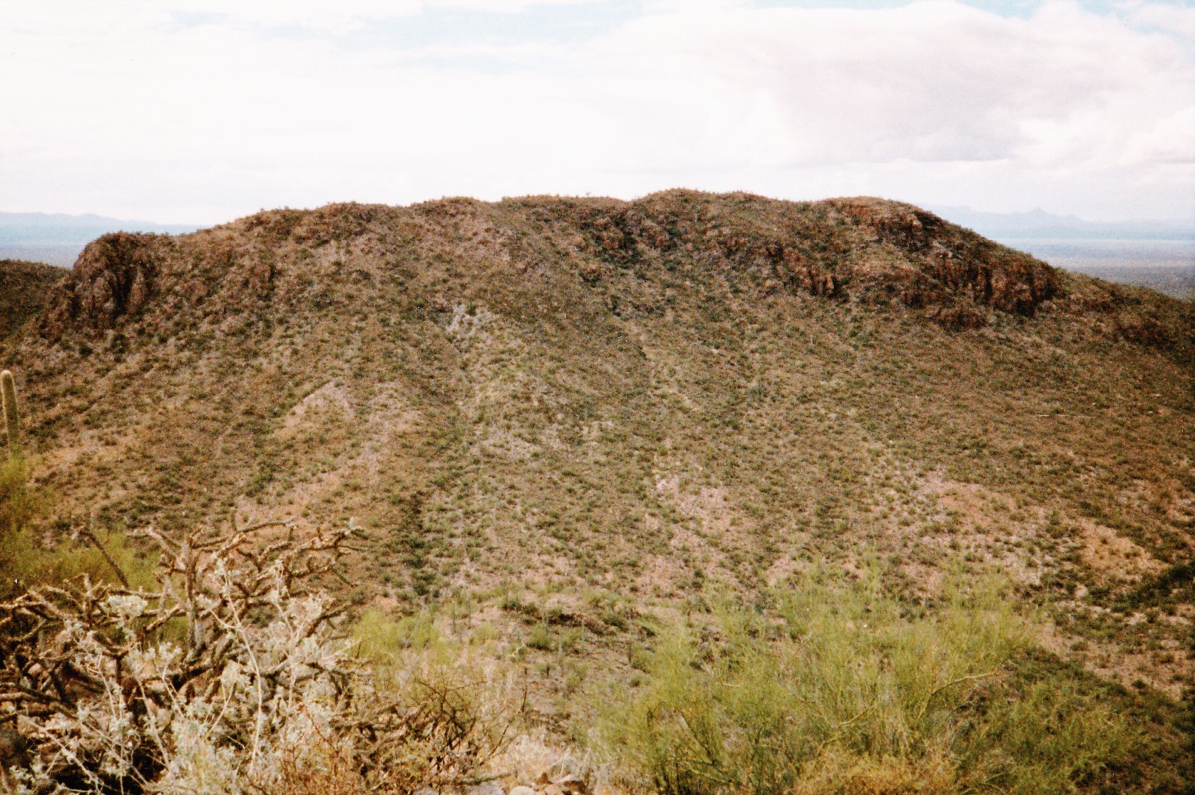
Three days later, on November 21st, I was back out in the Roskruge Mountains – this would be my fifth day of climbing there, cool and clear – a perfect day for a good workout. I parked at the end of a side road two miles west of the Cocoraque ranch-house by a wildlife guzzler. It was already 8:00 AM by the time I headed out on foot. Eleven hundred feet of climbing later, I made it to the top of Peak 3510. Once there, I realized I was so close to Pescadero Mountain that I just had to do it too. Before leaving, though, I left the customary register. When I dropped down the south side of 3510, I found myself in a saddle from which I climbed up the north slope of Pescadero. This seemed a lonely, isolated place – there was no register there, so I left one. It seems an odd name to give a peak in the desert – “pescadero” means “fishmonger”. Here are three views of Pescadero from different angles, all taken 20 years ago during my rambling through the range.
Looking north to Pescadero
Looking northeast to Pescadero Mtn.
Looking west to Pescadero Mtn.
I headed back down to the saddle. My map showed something called a pack trail there which I hoped to find – man, it took some careful looking, but there it was, oh-so-faint. It headed east and so did I – it was very hard to follow in places, but lower down it became what was shown as a 4WD road. It reached a valley bottom, and after 2.5 miles I reached Tunnel Well. Roads headed southeast from there, and I climbed the easy slope of Peak 2921. While on top and leaving – you guessed it – another register, I ate a well-deserved lunch. Something I was thinking about – there was one more peak I could do on the way back to the truck, and it was directly on my way.
A couple of miles later, I reached its south ridge and started up. There, I discovered something quite remarkable – I’ll only say it was archaeological in nature, but it blew me away. I’d had no prior knowledge of it, but I’m certain that it must have been known to scientists. It was hard to tear myself away from it, but I finally did. To the northwest along the summit ridge stood a rocky pinnacle, visible to me almost all day – I’d been worried I might not be able to climb it. Let’s say I got lucky – I tried the east side and made it to the top, and it turned out to be the highest part of the mountain by a few feet. It’s now known as Peak 2855.
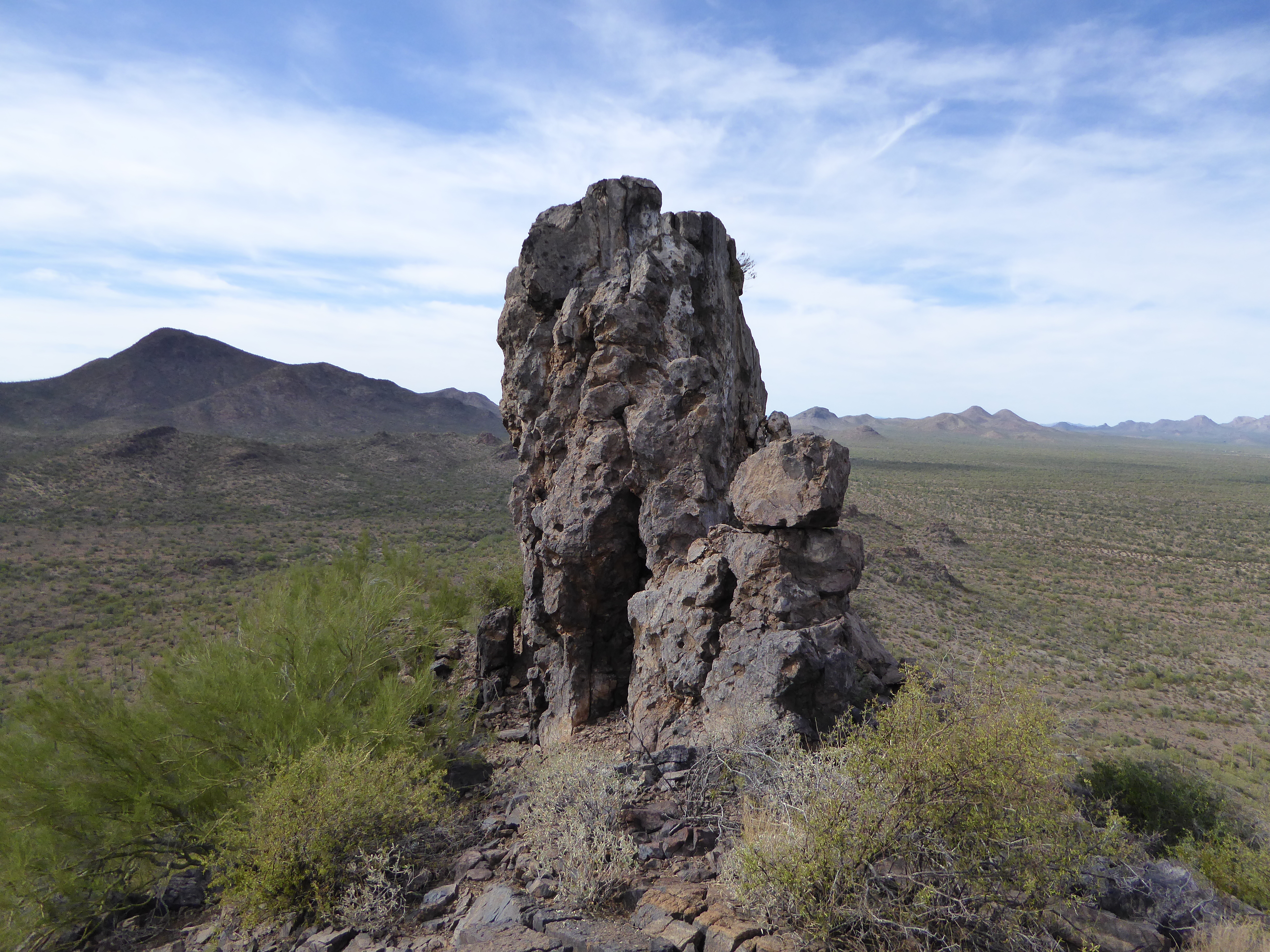
The east side of the summit pillar of Peak 2855 – thanks to peakbagger Andy Martin for the use of his photo.
Once safely off the pillar, I dropped down the easy southwest slope and ended up in a wash which I followed for a mile and a half, taking me right back to the truck. This day, my fifth, had turned out to be the most exciting of the project so far. The 4 peaks had required 11.5 miles, almost 7 hours and 3,350 vertical feet of climbing. Even though I had now climbed 13 of the peaks in the range, I was just getting started.
Please stay tuned for the next installment, which will be called The Roskruge Mountains – Part 2.